cloud masking and cloud products modis operational algorithm mod35 paul menzel, steve ackerman,...
TRANSCRIPT
Cloud Masking and Cloud Products
MODIS Operational Algorithm MOD35
Paul Menzel, Steve Ackerman, Richard Frey,Kathy Strabala, Chris Moeller, Liam Gumley, Bryan Baum
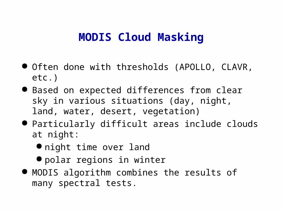
MODIS Cloud Masking
Often done with thresholds (APOLLO, CLAVR, etc.) Based on expected differences from clear sky in various
situations (day, night, land, water, desert, vegetation) Particularly difficult areas include clouds at night:
night time over land polar regions in winter
MODIS algorithm combines the results of many spectral tests.
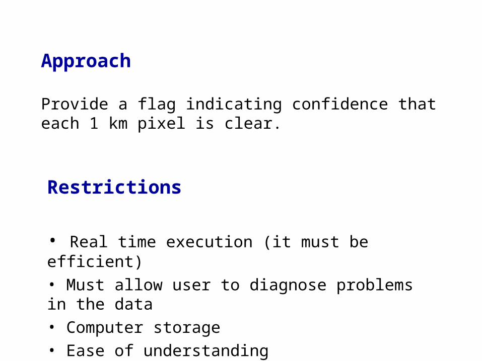
Approach
Provide a flag indicating confidence that each 1 km pixel is clear.
Restrictions
• Real time execution (it must be efficient)
• Must allow user to diagnose problems in the data
• Computer storage
• Ease of understanding
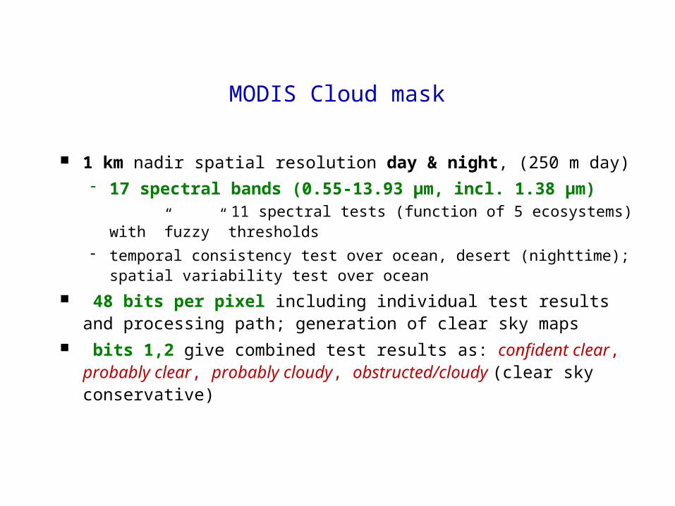
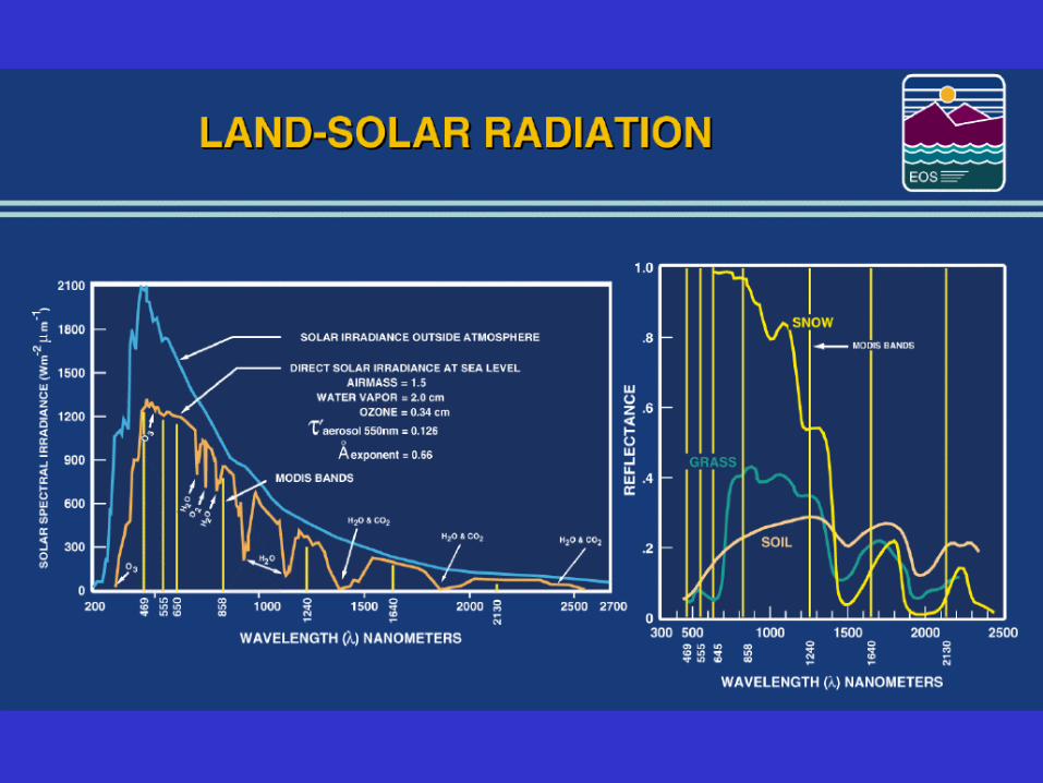
1 km nadir spatial resolution day & night, (250 m day) 17 spectral bands (0.55-13.93 µm, incl. 1.38 µm)
11 spectral tests (function of 5 ecosystems) with ”fuzzy” thresholds
temporal consistency test over ocean, desert (nighttime); spatial variability test over ocean
48 bits per pixel including individual test results and processing path; generation of clear sky maps
bits 1,2 give combined test results as: confident clear, probably clear, probably cloudy, obstructed/cloudy (clear sky conservative)
MODIS Cloud mask
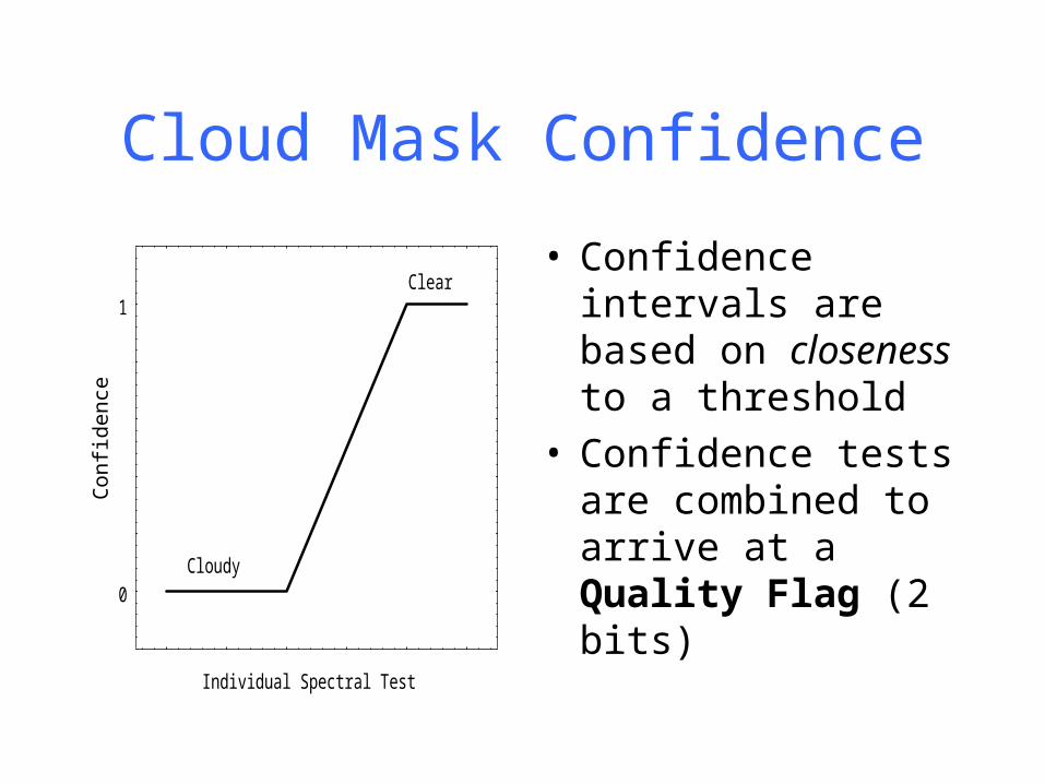
Cloud Mask Confidence
Individual Spectral Test
Con
fiden
ce
0
1Clear
Cloudy
• Confidence intervals are based on closeness to a threshold
• Confidence tests are combined to arrive at a Quality Flag (2 bits)
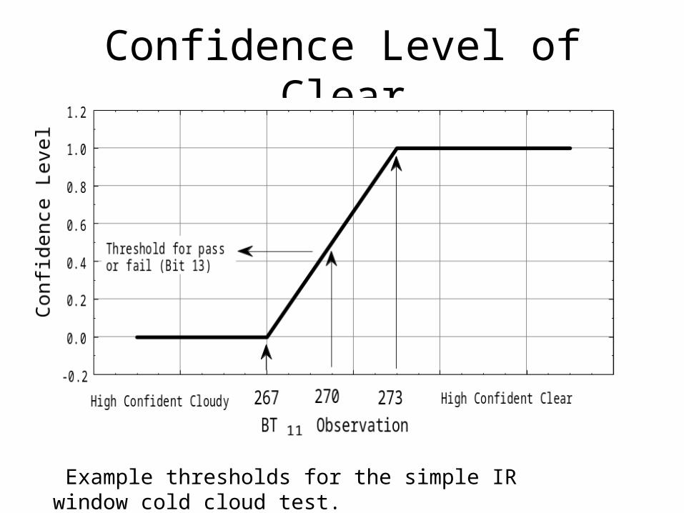
Confidence Level of Clear
Example thresholds for the simple IR window cold cloud test.

Combining tests
Each of the tests above returns a confidence level ranging from 1 (high confidence that the pixel is clear) to 0 (high confidence that the pixel is cloudy). The individual confidence levels must be combined to determine a final decision on clear or cloudy. We shall denote the confidence level of an individual test as F i and the final quality flag as Q.
N
Ni
i 1
Q F
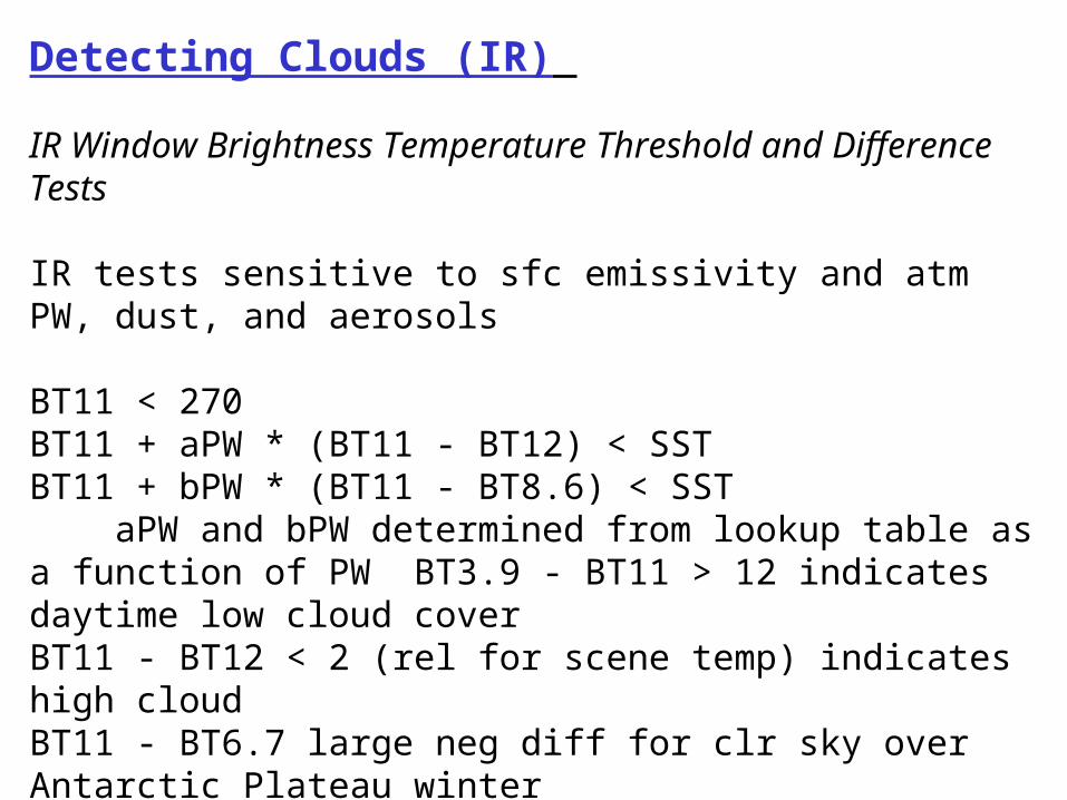
Detecting Clouds (IR)
IR Window Brightness Temperature Threshold and Difference Tests
IR tests sensitive to sfc emissivity and atm PW, dust, and aerosols
BT11 < 270BT11 + aPW * (BT11 - BT12) < SSTBT11 + bPW * (BT11 - BT8.6) < SST aPW and bPW determined from lookup table as a function of PW BT3.9 - BT11 > 12 indicates daytime low cloud coverBT11 - BT12 < 2 (rel for scene temp) indicates high cloudBT11 - BT6.7 large neg diff for clr sky over Antarctic Plateau winter
CO2 Channel Test for High Clouds
BT13.9 < threshold (problems at high scan angle or high terrain)
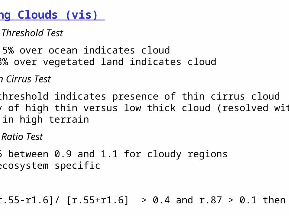
Detecting Clouds (vis)
Reflectance Threshold Test
r.87 > 5.5% over ocean indicates cloudr.66 > 18% over vegetated land indicates cloud
Near IR Thin Cirrus Test
r1.38 > threshold indicates presence of thin cirrus cloudambiguity of high thin versus low thick cloud (resolved with BT13.9)problems in high terrain
Reflectance Ratio Test
r.87/r.66 between 0.9 and 1.1 for cloudy regionsmust be ecosystem specific
Snow Test
NDSI = [r.55-r1.6]/ [r.55+r1.6] > 0.4 and r.87 > 0.1 then snow
aa
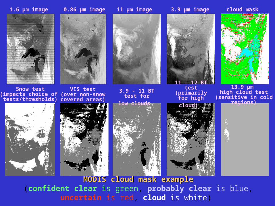
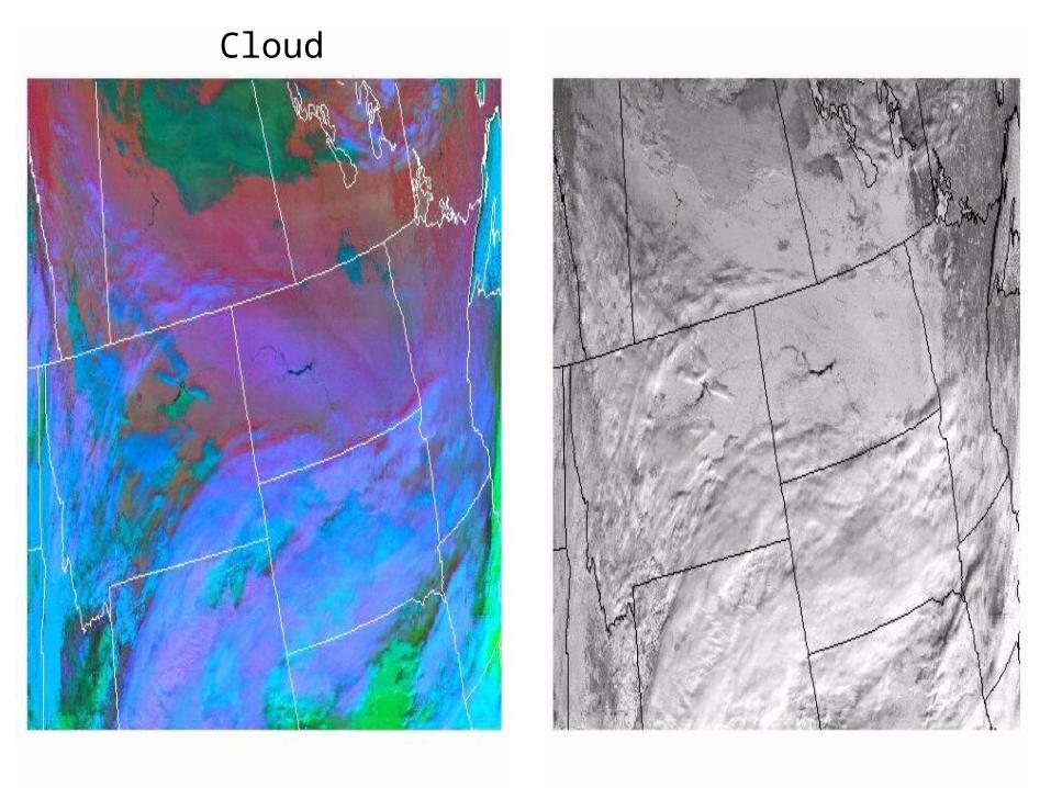
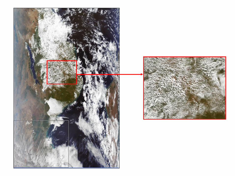
MODIS cloud mask exampleMODIS cloud mask example(confident clear is green, probably clear is blue, uncertain is red, cloud is white)
1.6 µm image 0.86 µm image 11 µm image 3.9 µm image cloud mask
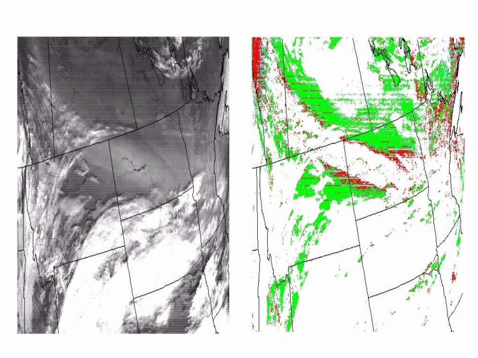
Snow test(impacts choice of tests/thresholds)
VIS test(over non-snowcovered areas)
3.9 - 11 BT test
for low clouds
11 - 12 BT test (primarily for
high cloud) 13.9 µm
high cloud test(sensitive in cold regions)

Cloud

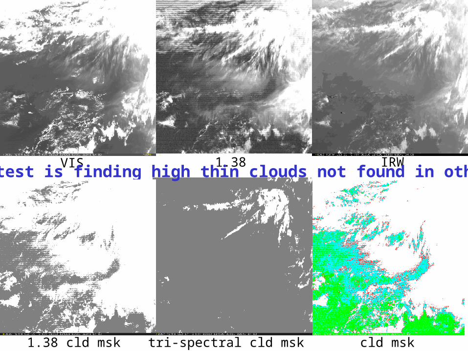
VIS 1.38 IRW
1.38 cld msk tri-spectral cld msk cld msk
1.38 um test is finding high thin clouds not found in other tests
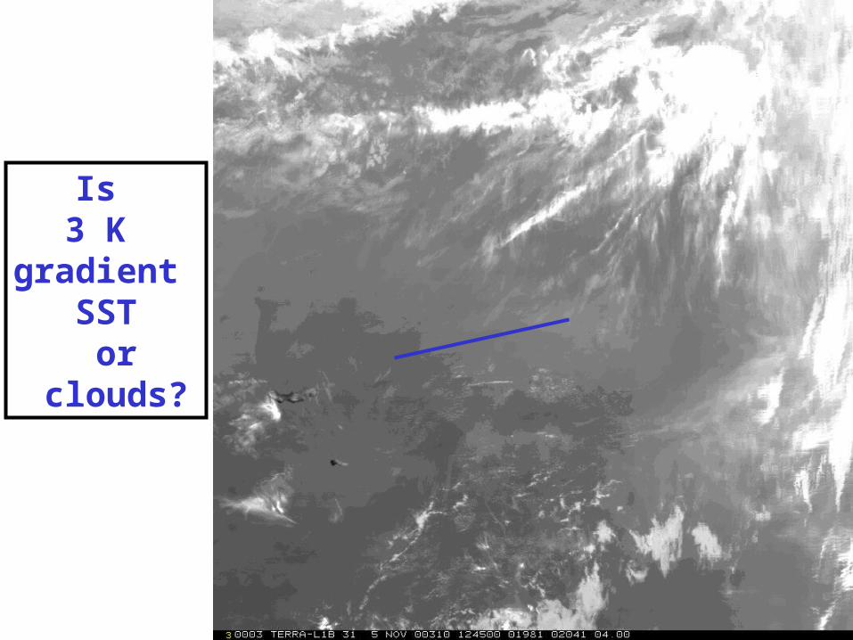
Is 3 K
gradient SST or
clouds?
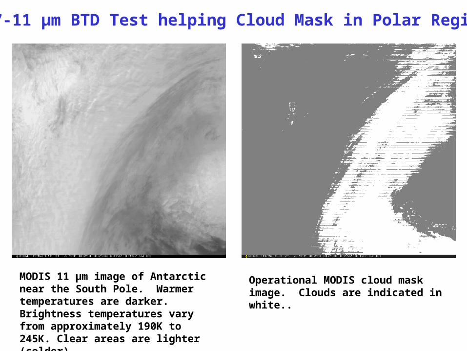
6.7-11 µm BTD Test helping Cloud Mask in Polar Regions
MODIS 11 µm image of Antarctic near the South Pole. Warmer temperatures are darker. Brightness temperatures vary from approximately 190K to 245K. Clear areas are lighter (colder).
Operational MODIS cloud mask image. Clouds are indicated in white..
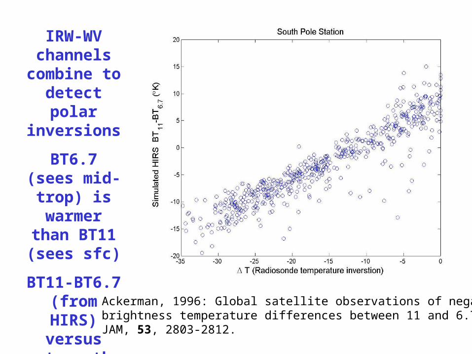
IRW-WV channels
combine to detect polar inversions
BT6.7 (sees mid-trop) is warmer than
BT11 (sees sfc)
BT11-BT6.7 (from HIRS)
versus strength of temperature
inversion (from raobs)
Ackerman, 1996: Global satellite observations of negative brightness temperature differences between 11 and 6.7 um. JAM, 53, 2803-2812.
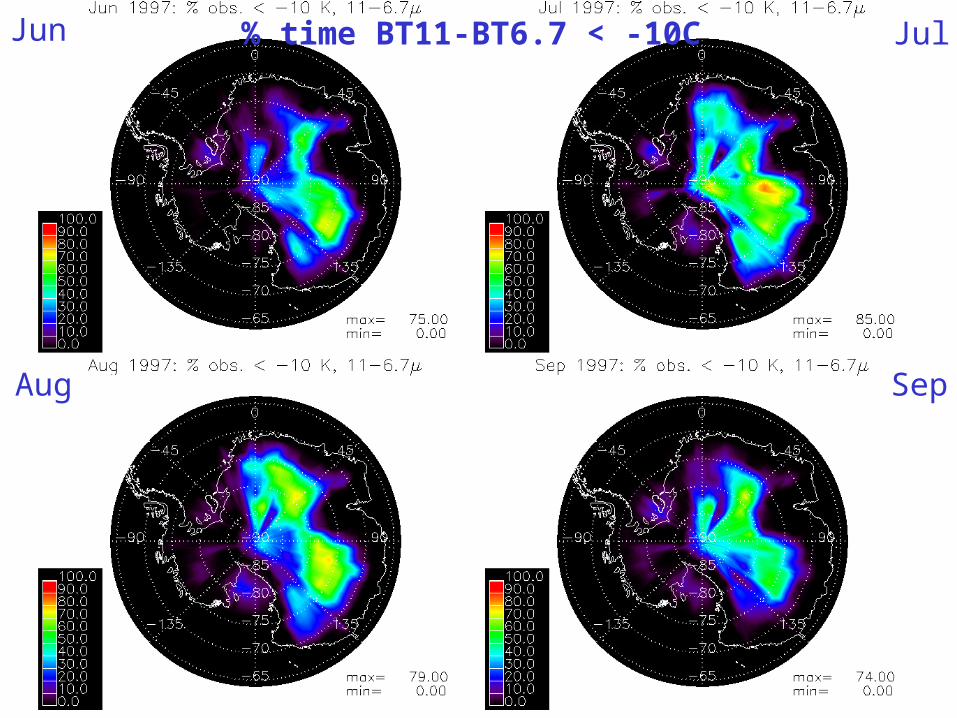
% time BT11-BT6.7 < -10C Jun Jul
Aug Sep
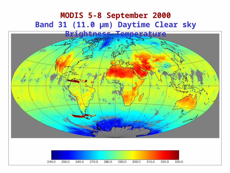
MODIS 5-8 September 2000Band 31 (11.0 µm) Daytime Clear sky Brightness Temperature
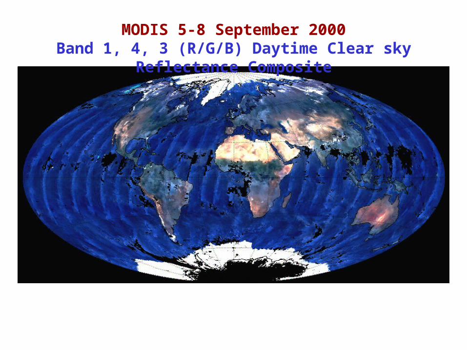
MODIS 5-8 September 2000Band 1, 4, 3 (R/G/B) Daytime Clear sky Reflectance Composite
Cloud Shadow Detection
Bryan Baum , Denis Grlujsich, Paul Menzel,Steve Ackerman
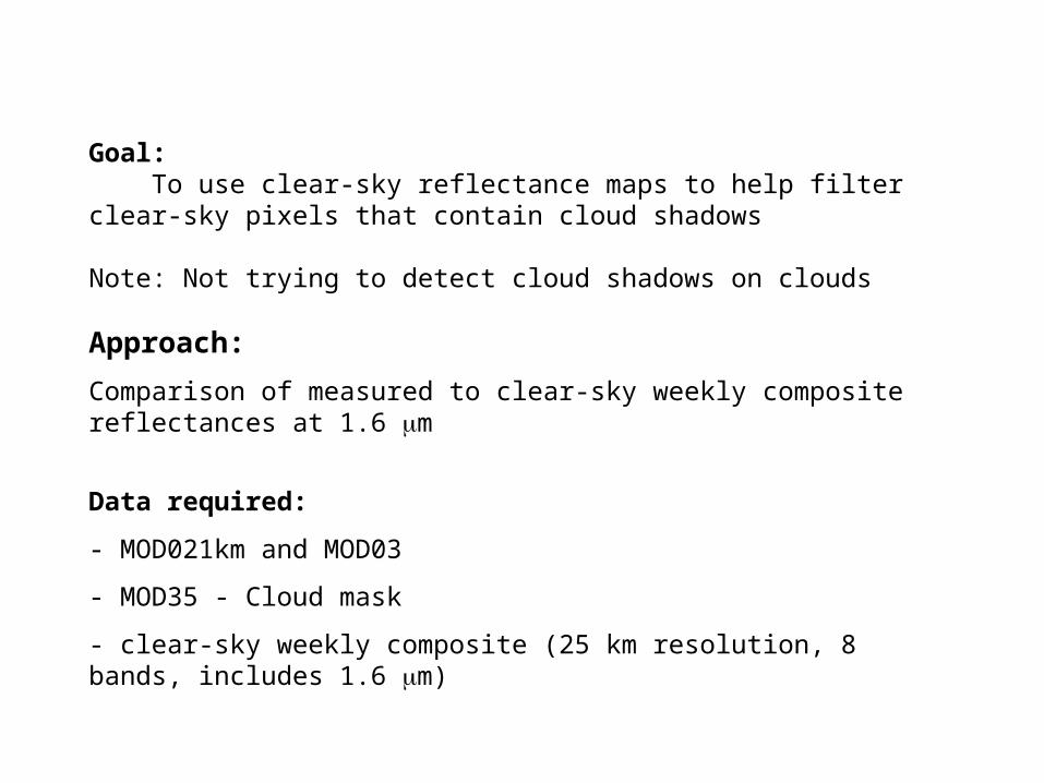
Goal: To use clear-sky reflectance maps to help filter clear-sky pixels that contain cloud shadows
Note: Not trying to detect cloud shadows on clouds
Approach:
Comparison of measured to clear-sky weekly composite reflectances at 1.6 m
Data required:
- MOD021km and MOD03
- MOD35 - Cloud mask
- clear-sky weekly composite (25 km resolution, 8 bands, includes 1.6 m)
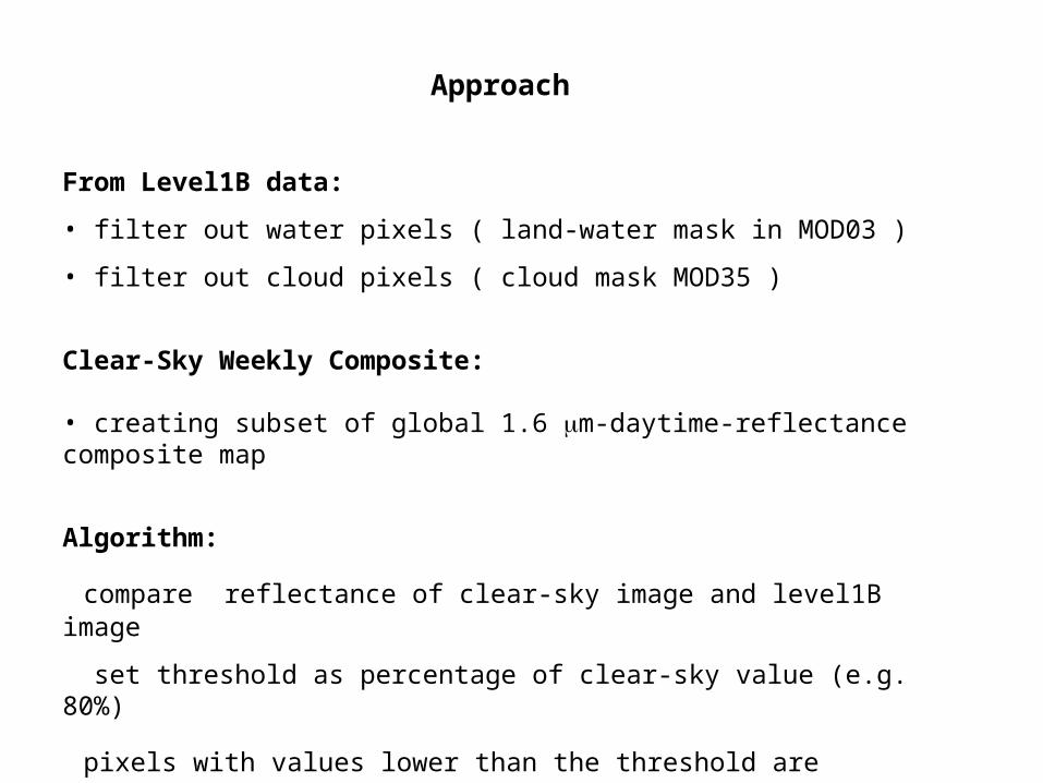
Approach
From Level1B data:
• filter out water pixels ( land-water mask in MOD03 )
• filter out cloud pixels ( cloud mask MOD35 )
Clear-Sky Weekly Composite:
• creating subset of global 1.6 m-daytime-reflectance composite map
Algorithm:
compare reflectance of clear-sky image and level1B image
set threshold as percentage of clear-sky value (e.g. 80%)
pixels with values lower than the threshold are flagged as shadow pixels

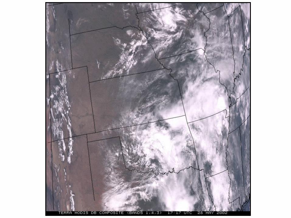
MODIS-RGB-Composite of Eastern Africa (29 June2002, 07:45 UTC)
1.6-m reflectance with water pixels filtered out of image
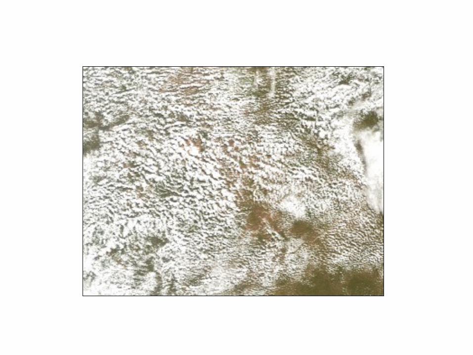
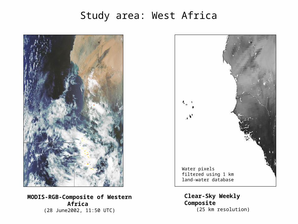
MODIS-RGB-Composite of Western Africa (28 June2002, 11:50 UTC)
Clear-Sky Weekly Composite(25 km resolution)
Water pixels filtered using 1 km land-water database
Study area: West Africa
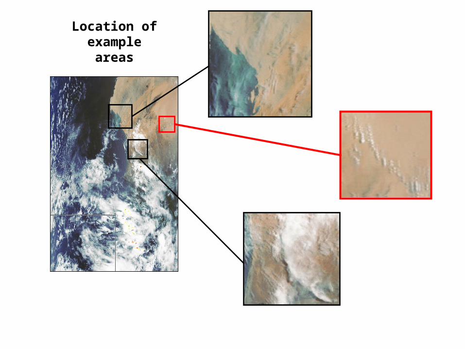
Location of example areas

RGB-composite of area 1
• Mauritania
• water clouds over desert
• surface has a very high reflectance
• little if any vegetation
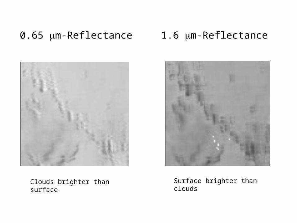
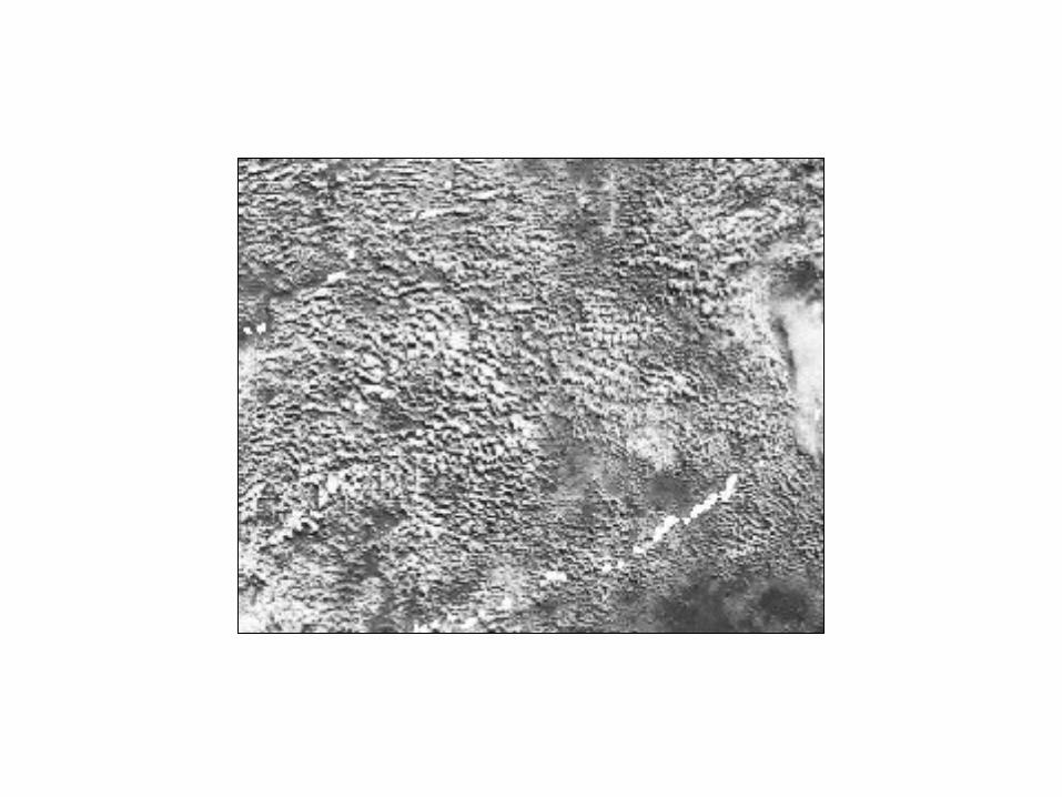
1.6 m-Reflectance0.65 m-Reflectance
Clouds brighter than surface Surface brighter than clouds
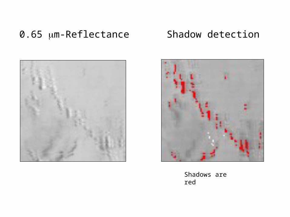
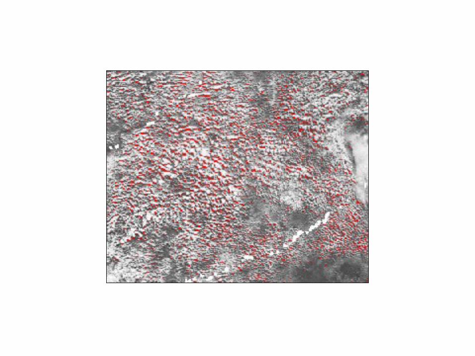
Shadow detection
Shadows are red
0.65 m-Reflectance
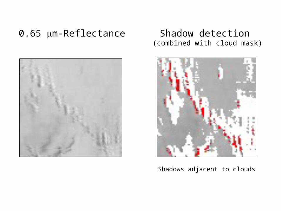
Shadows adjacent to clouds
Shadow detection (combined with cloud mask)
0.65 m-Reflectance
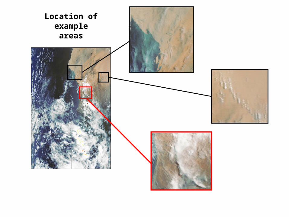
Location of example areas
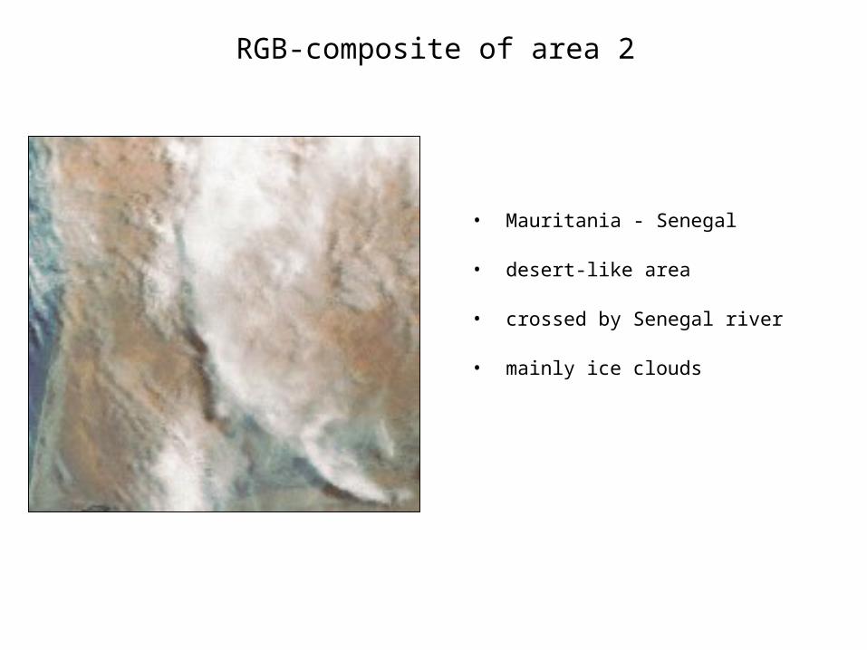
RGB-composite of area 2
• Mauritania - Senegal
• desert-like area
• crossed by Senegal river
• mainly ice clouds

• shadows on eastern edge• Senegal river not well detected by land-water mask
1.6 m-ReflectanceRGB - Composite
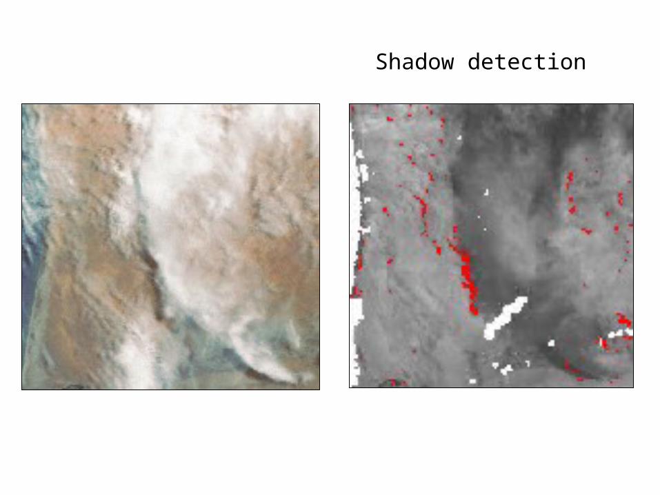
Shadow detection
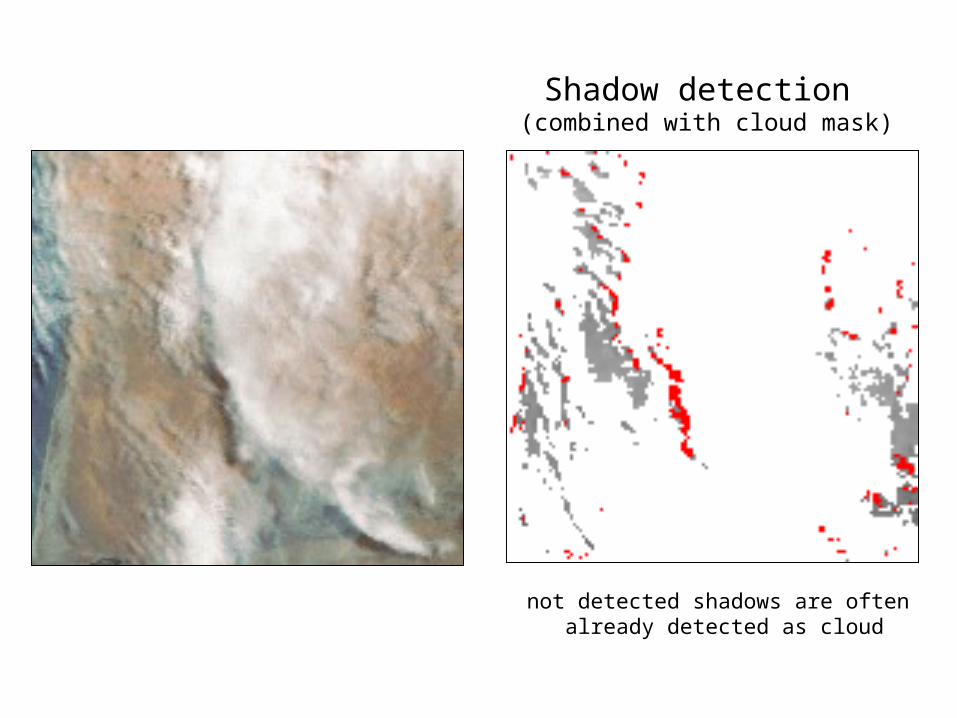
not detected shadows are often already detected as cloud
Shadow detection (combined with cloud mask)
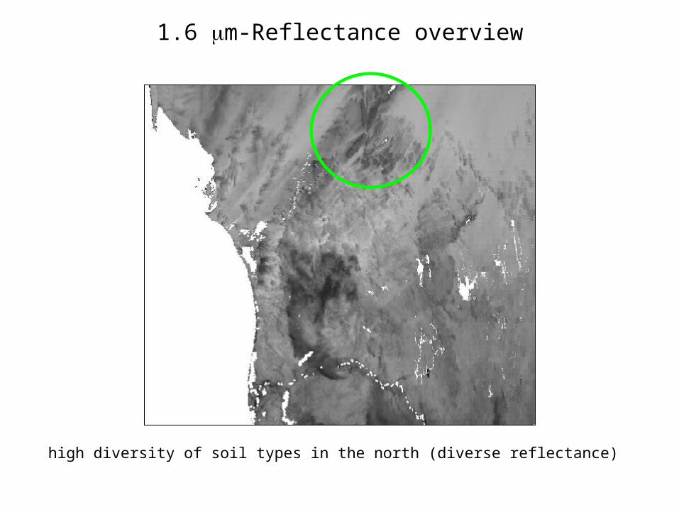
1.6 m-Reflectance overview
high diversity of soil types in the north (diverse reflectance)
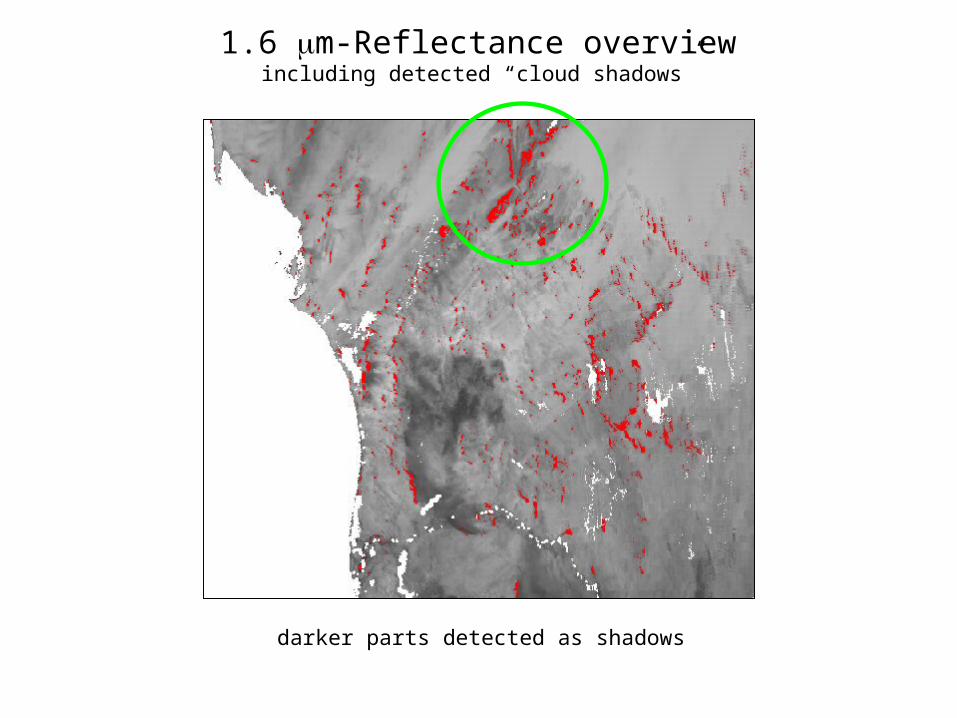
1.6 m-Reflectance overviewincluding detected “cloud shadows”
darker parts detected as shadows
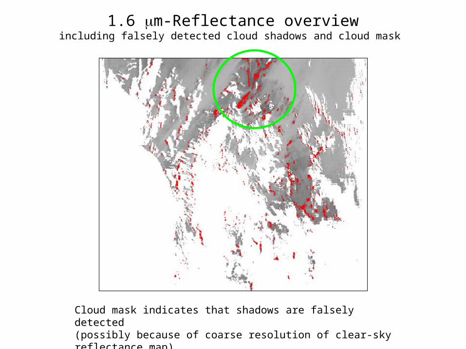
1.6 m-Reflectance overviewincluding falsely detected cloud shadows and cloud mask
Cloud mask indicates that shadows are falsely detected (possibly because of coarse resolution of clear-sky reflectance map)
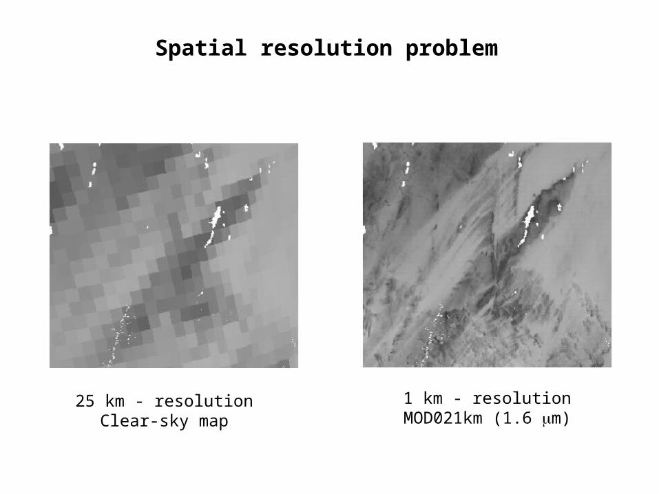
Spatial resolution problem
25 km - resolutionClear-sky map
1 km - resolutionMOD021km (1.6 m)

Land-water mask
Senegal river
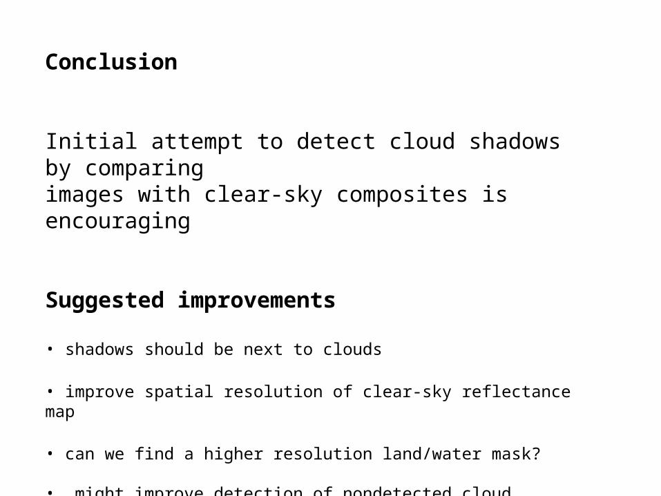
Conclusion
Initial attempt to detect cloud shadows by comparingimages with clear-sky composites is encouraging
Suggested improvements
• shadows should be next to clouds
• improve spatial resolution of clear-sky reflectance map
• can we find a higher resolution land/water mask?
• might improve detection of nondetected cloud shadows by checking nearest-neighbor pixels and relaxing threshold criteria
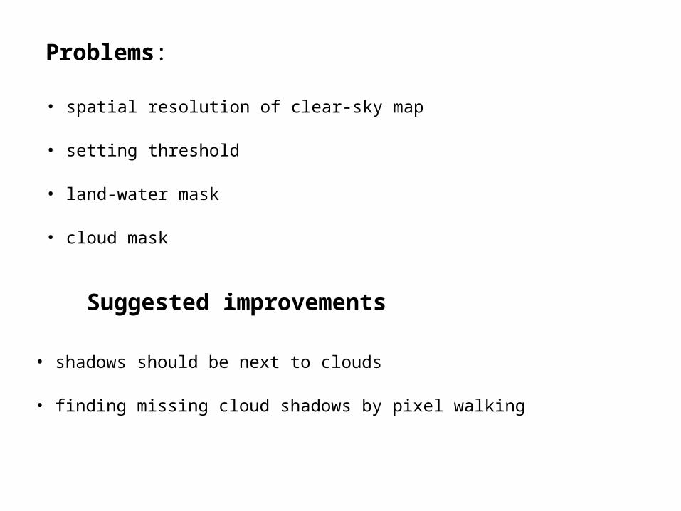
Suggested improvements
• shadows should be next to clouds
• finding missing cloud shadows by pixel walking
Problems:
• spatial resolution of clear-sky map
• setting threshold
• land-water mask
• cloud mask

Preliminary indications
• seems that threshold could be set by use of histograms
• in this example it could be set higher than 0.8
• but... the share of false shadows might be higher
• would help to have a clear-sky map with higher spatial resolution