cloud based automatic accident …data.conferenceworld.in/icstm2/p341-352.pdfcloud based automatic...
TRANSCRIPT
341 | P a g e
CLOUD BASED AUTOMATIC ACCIDENT
DETECTION AND VEHICLE MANAGEMENT
SYSTEM
Rahul Gautam1, Shubham Choudhary
2, Surbhi
3,
Inderjeet Kaur4, Mamta Bhusry
5
1Dept of ECE,
2 Dept of EN,
3,4,5Dept of CSE, AKG Engineering College Ghaziabad, (India)
ABSTRACT
With the advancement in technology and increasing traffic, road accidents and traffic hazard have increased,
causing more chances of loss of life due to lack of timely help facilities. This paper is an attempt towards
solutions for timely accident notification, vehicle theft control and vehicle pollution alerts.
The proposed paper records the parameters of vehicle at regular intervals of time, through a “smart device”
installed in the vehicle and sends these values onto the cloud, vehicle owner or a third party. Based on the
information, appropriate algorithms are implemented to send alerts and initiate action. The system will
facilitate the users in a number of ways such as notification for immediate aid in case of accident, tracking the
vehicle in cases of theft and disabling the vehicle remotely and last but not the least, monitoring the sensor
values in order to send alerts for air pollution caused by the vehicles.
The system is developed using the .Net framework, MS Access and Microsoft Azzure cloud services and related
services. The hardware components include the “smart device” installed in the vehicle and a mobile phone for
user interaction. The “smart device” installed in the vehicle does not interfere with the normal functioning of
the vehicle or cause overheads.
Keywords: GPS, GSM, REVERSE GEOLOCATION API, TWILIO MESSAGE API, Accident
Monitoring, GPS, Accident Detection, Google Docs API, MEMS.
I. INTRODUCTION
In today’s scenario, owning multiple vehicles is considered a social status in the society and consequently the
number of vehicles on the roads has increased immensely in the past decade. On one hand, this may be seen as
an improvement in the standards of living of people, subsequently, it cannot be denied that there is a stark
increase of road accidents, air pollution caused by the vehicles and crimes related to the vehicles like theft
etc.[10]. The proposed work seeks to develop a system which facilitates accident notification to the appropriate
agencies and in tracing the vehicle in case of theft and controlling the air pollution. There has not been much
work in this area using cloud services. The proposed system applies cloud services in finding solution to the
mentioned scenarios. The main objectives of the proposed project system are:1) To enable accident notification
to appropriate agencies. 2) To provide a system for controlling the functionality of vehicle in case of theft. 3)
To alert against pollution levels caused by the vehicle.
342 | P a g e
The paper is structured as follows: section 2 discusses the related work done for the new technological shifting
towards VANET. Section 3 offers an overview of all hardware and software devices used for our proposed
approach. Section 4 proposes an approach for: (1) Controlling incidence of death due to accidents through
timely notification of accidents. (2) Tracking and disabling the vehicle in case of theft and (3) Controlling
pollution by monitoring the sensor values regularly. Section 5 discusses the flow diagram and working of
proposed approach. Finally, section 6, 7 and 8 concludes with limitations and future directions for the proposed
work.
II. RELATED WORK
Intelligent Transportation Systems [4,14,24] have been proposed and built to leverage computing and
communication technology for various purposes: traffic management, vehicles safety, emergency services, etc.
The concept of leveraging wireless communication in vehicles has fascinated researchers since the 1990s
[27,28,29]. In the last few years, smarter vehicles, safer and less stressful driving experiences have been realized
by using the concepts of vehicular communication. Several factors such as the wide adoption, large traffic
events cost, less worker productivity, more fuel consumption (and subsequent drop in cost) have led to this
development, basically using IEEE 802.11 technologies [44].
A recent study by Abid et al.[1] found that in 2009 there were 33,000 causalities and 2.2 million different
injuries due to motor vehicle crashes in the United States. These crashes impact the society economically and
incur an annual estimate cost of $230 billion dollars. For every single person in the USA, $750 dollars is spent.
Moreover, the highway congestion costs $78 billion annually. Olariu and Eltoweissy et.al. [34] proposed an
innovative and effective idea of involving Mobile Ad-hoc Networks (MANET) for street and highway
communications using cutting edge technological advancements known as Vehicle Ad-hoc Networks (VANET).
VANET employs a combination of Vehicle-to-Vehicle (V2V) and Vehicle-to-Infrastructure (V2I)
communications, to give drivers advance notification of traffic events. In V2V systems, each vehicle is
responsible for inferring the presence of an incident based on reports from other vehicles. This system can lead
to well-organized security attacks by marking incorrect inferences, which produce more congestion and a
greater possibility of severe hazards. Thus far, to solve this security problem, much of work had been concluded
by Aijaz et al.[2], Lochert et al.[30], Lochert et al.[31], Yan et al.[10] and Yan et al.[11].
S. Bilal et al.[44] concluded the basic application areas in which VANETs were emphasized for emergency
alerts, cooperative driving, traffic status reports, collision avoidance and other applications. The recent rapid
convergence of Intelligent Transportation System (ITS) and VANET leading to the advent of Intelligent
Vehicular Networks can ultimately transform our driving by building a secure, safe, healthy, and ubiquitous
computing environment [7].
Olariu et al.[35] defined Vehicular Cloud Computing as “A group of largely autonomous vehicles whose
corporate computing, sensing, communication and physical resources can be coordinated and dynamically
allocated to authorized users.” The Vehicular Cloud (VC) concept is a further step to assemble the
computational and situational consciousness of drivers in public and the greater portion of the population. The
ultimate focus of the VC is to offer on demand solutions for unpredictable events in a proactive fashion [41].
343 | P a g e
Haisong Chen et al.[12] discussed an ARM and GPS based accident alarm system. The proposed system
transmits and receives vehicles state and other required user information upon occurrence of accident to the
nearest treatment centers. The system focuses to reach the scene of accident in the first time, and gain more
treatment time for the accident injured, thus lowering the accident mortality, and also reducing incidents
impacting time on the traffic.
Prashanath Mohan et al.[36] proposed A Nericell, a system that performs rich sensing by piggybacking on smart
phones that users carry with them. The sensing component uses the accelerometer, microphone, GSM radio,
and/or GPS sensors to detect potholes, bumps, braking and honking. The paper also addresses several challenges
such as arbitrary orientation, honk detection and localization in an energy efficient manner. Sangita N Gujar et
al.[43] proposed an alert service system to monitor speed of a vehicle and detect accident using GPS receiver.
Through microcontroller system, it monitors speed of a vehicle, compares with the previous speed every second
and assumes occurrence of accident if vehicle speed is below the specified speed. Accident location is acquired
from GPS along with time and thus timely help to valuable human life can be given.
III. PRELIMINARIES
3.1 Hardware Devices
3.1.1 Vibration Sensors
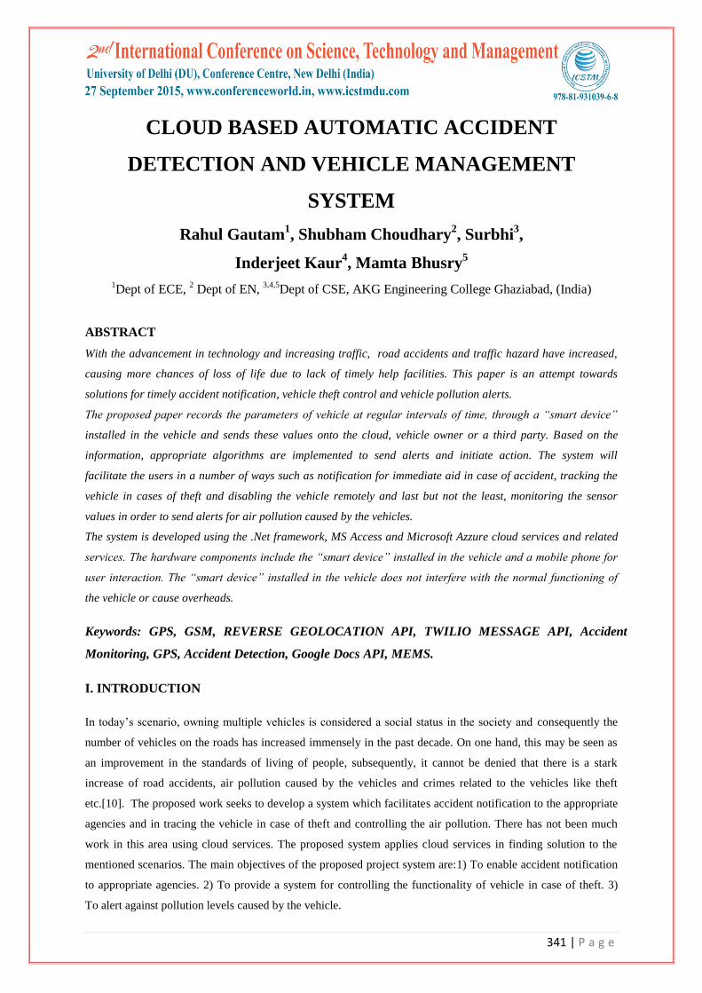
A piezoelectric sensor is a device that uses the piezoelectric effect, to measure changes in pressure, acceleration,
temperature, strain or force by converting them to an electrical charge as shown in Figure 1. The prefix piezo is
Greek for 'press' or 'squeeze' [15].
An accelerometer is a device that measures proper acceleration ("g-force"). Accelerometers are used to detect
and monitor vibration in rotating machinery. Pairs of accelerometers extended over a region of space can be
used to detect differences (gradients) in the proper accelerations of frames of references associated with those
points. These devices are called gravity gradiometers, as they measure gradients in the gravitational field. Such
pairs of accelerometers in theory may also be able to detect gravitational waves [18,39].
Figure 1: Piezoelectric Sensor
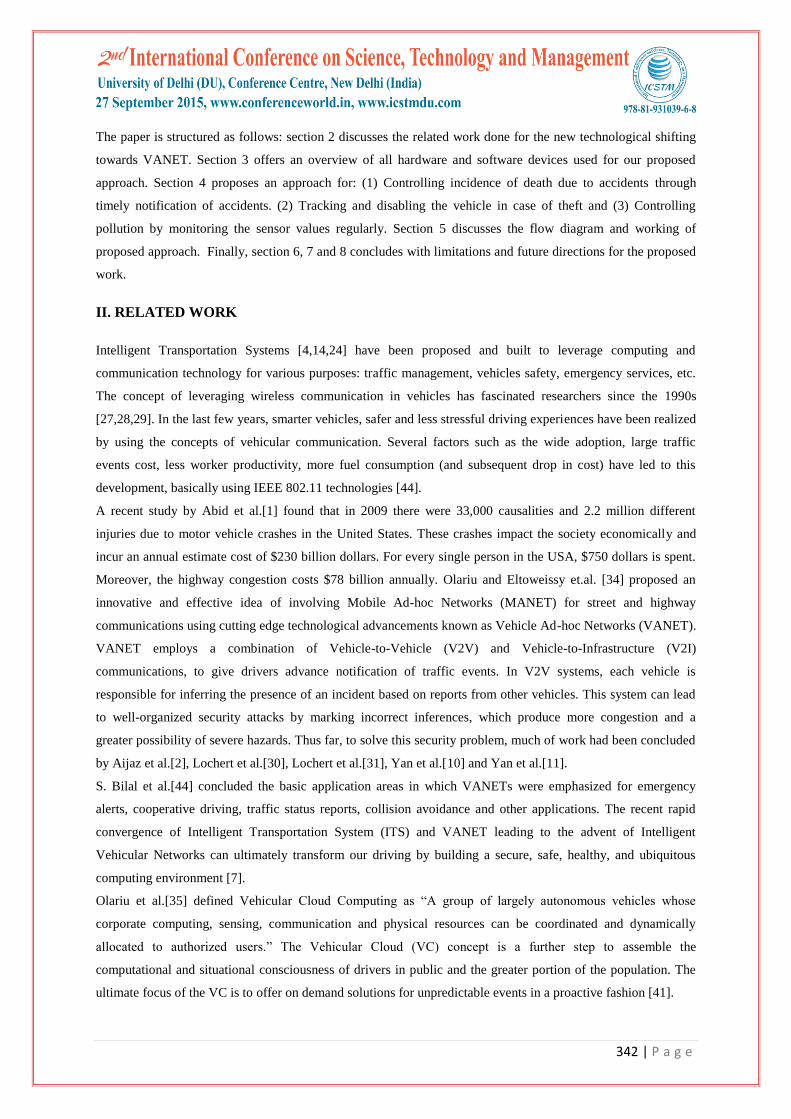
3.1.2 Global Positioning System (GPS)
The Global Positioning System (GPS) as shown in Figure 2 is a space-based satellite navigation system that
provides location and time information in all weather conditions, anywhere on or near the Earth where there is
an unobstructed line of sight to four or more GPS satellites [3,23].
344 | P a g e
Figure 2: GPS
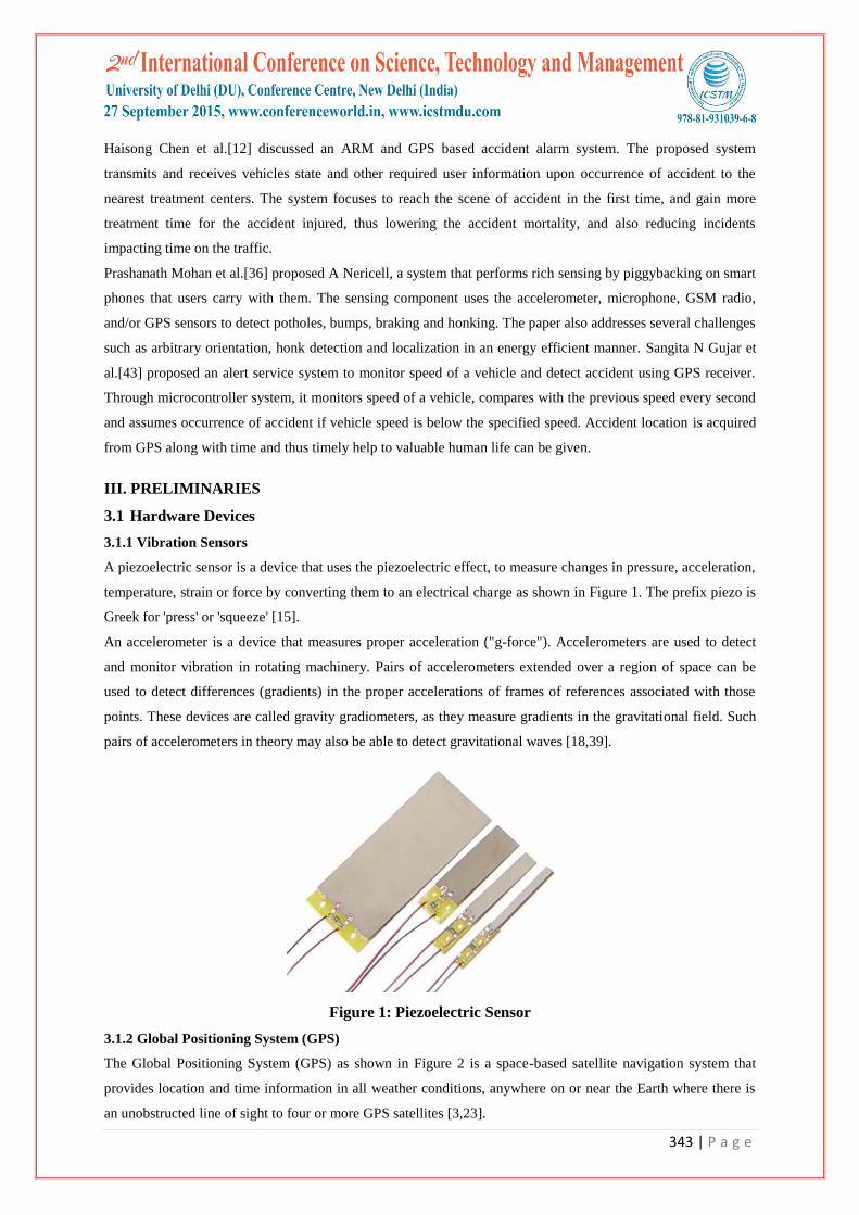
3.1.3 Arduino MEGA/UNO/PROMINI
The Arduino Mega is a microcontroller board based on the ATmega1280 (datasheet) as shown in Figure 3. It
has 54 digital input/output pins (of which 14 can be used as PWM outputs), 16 analog inputs, 4 UARTs
(hardware serial ports), a 16 MHz crystal oscillator, a USB connection, a power jack, an ICSP header, and a
reset button. It contains everything needed to support the microcontroller; simply connect it to a computer with a
USB cable or power it with an AC-to-DC adapter or battery to get started. The Mega is compatible with most
shields designed for the Arduino Duemilanove or Diecimila [17].
Figure 3: Arduino MEGA
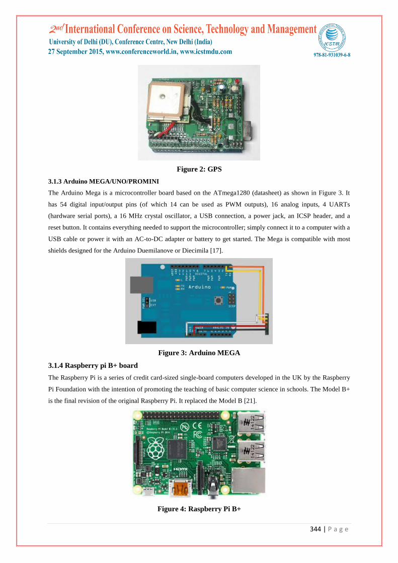
3.1.4 Raspberry pi B+ board
The Raspberry Pi is a series of credit card-sized single-board computers developed in the UK by the Raspberry
Pi Foundation with the intention of promoting the teaching of basic computer science in schools. The Model B+
is the final revision of the original Raspberry Pi. It replaced the Model B [21].
Figure 4: Raspberry Pi B+
345 | P a g e
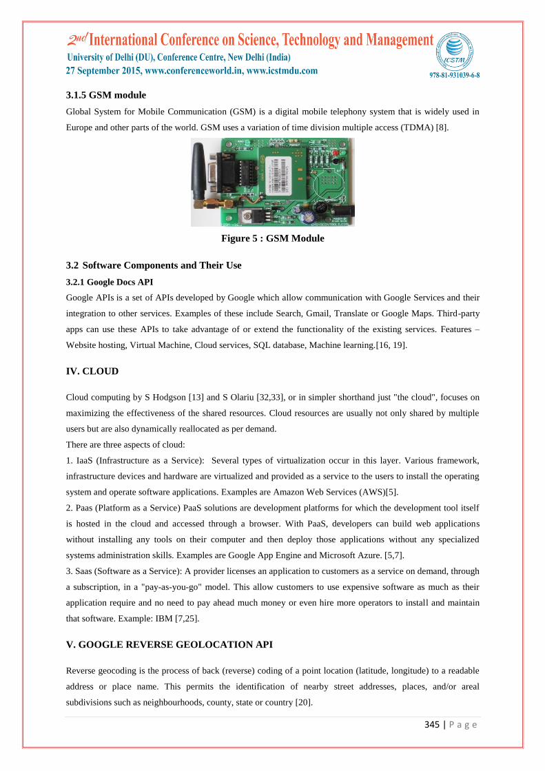
3.1.5 GSM module
Global System for Mobile Communication (GSM) is a digital mobile telephony system that is widely used in
Europe and other parts of the world. GSM uses a variation of time division multiple access (TDMA) [8].
Figure 5 : GSM Module
3.2 Software Components and Their Use
3.2.1 Google Docs API
Google APIs is a set of APIs developed by Google which allow communication with Google Services and their
integration to other services. Examples of these include Search, Gmail, Translate or Google Maps. Third-party
apps can use these APIs to take advantage of or extend the functionality of the existing services. Features –
Website hosting, Virtual Machine, Cloud services, SQL database, Machine learning.[16, 19].
IV. CLOUD
Cloud computing by S Hodgson [13] and S Olariu [32,33], or in simpler shorthand just "the cloud", focuses on
maximizing the effectiveness of the shared resources. Cloud resources are usually not only shared by multiple
users but are also dynamically reallocated as per demand.
There are three aspects of cloud:
1. IaaS (Infrastructure as a Service): Several types of virtualization occur in this layer. Various framework,
infrastructure devices and hardware are virtualized and provided as a service to the users to install the operating
system and operate software applications. Examples are Amazon Web Services (AWS)[5].
2. Paas (Platform as a Service) PaaS solutions are development platforms for which the development tool itself
is hosted in the cloud and accessed through a browser. With PaaS, developers can build web applications
without installing any tools on their computer and then deploy those applications without any specialized
systems administration skills. Examples are Google App Engine and Microsoft Azure. [5,7].
3. Saas (Software as a Service): A provider licenses an application to customers as a service on demand, through
a subscription, in a "pay-as-you-go" model. This allow customers to use expensive software as much as their
application require and no need to pay ahead much money or even hire more operators to install and maintain
that software. Example: IBM [7,25].
V. GOOGLE REVERSE GEOLOCATION API
Reverse geocoding is the process of back (reverse) coding of a point location (latitude, longitude) to a readable
address or place name. This permits the identification of nearby street addresses, places, and/or areal
subdivisions such as neighbourhoods, county, state or country [20].
346 | P a g e
VI. TWILIO
Twilio is a cloud communications (IaaS) company based in San Francisco, California. Twilio allows software
developers to programmatically make and receive phone calls and send and receive text messages using its web
service APIs. Twilio's services are accessed over HTTP and are billed based on usage [22].
VII. PROPOSED APPROACH
The proposed system involves Cloud computing technology in vehicular management to reduce the
computational overhead. This allows the vehicle users to access various resources such as processors, storage,
memory, applications etc. stored in the cloud which is located centrally. This work uses two features of cloud
PaaS and IaaS, IaaS for storing data into the cloud, which is received from the hardware via Google docs. PaaS
provides the environment for running the application (which would be containing the code for performing the
task) for three scenarios named Accident detection and information alert, in case of vehicle theft [40] and
generating warning messages for vehicle pollution check [38].
The proposed system records the parameters of vehicle (car in our case) at regular intervals of time, through a
“smart device” installed in the vehicle and sends these values onto the cloud(for further processing), vehicle
owner (when required) or a third party. The device is made up of various sensors, modules and microprocessor
and is safely suitable for the vehicles as it does not interfere with the hardware or normal functioning of the
vehicle [6, 32, 37].
The system is developed using the .Net framework, Ms Access and Azzure cloud services and many more
intermediary services. A mobile phone is also used for owner's interaction with the device installed in the vehicle,
so that, when the owner wants to track the vehicle or start /stop the vehicle’s functionality, only he/she can do it.
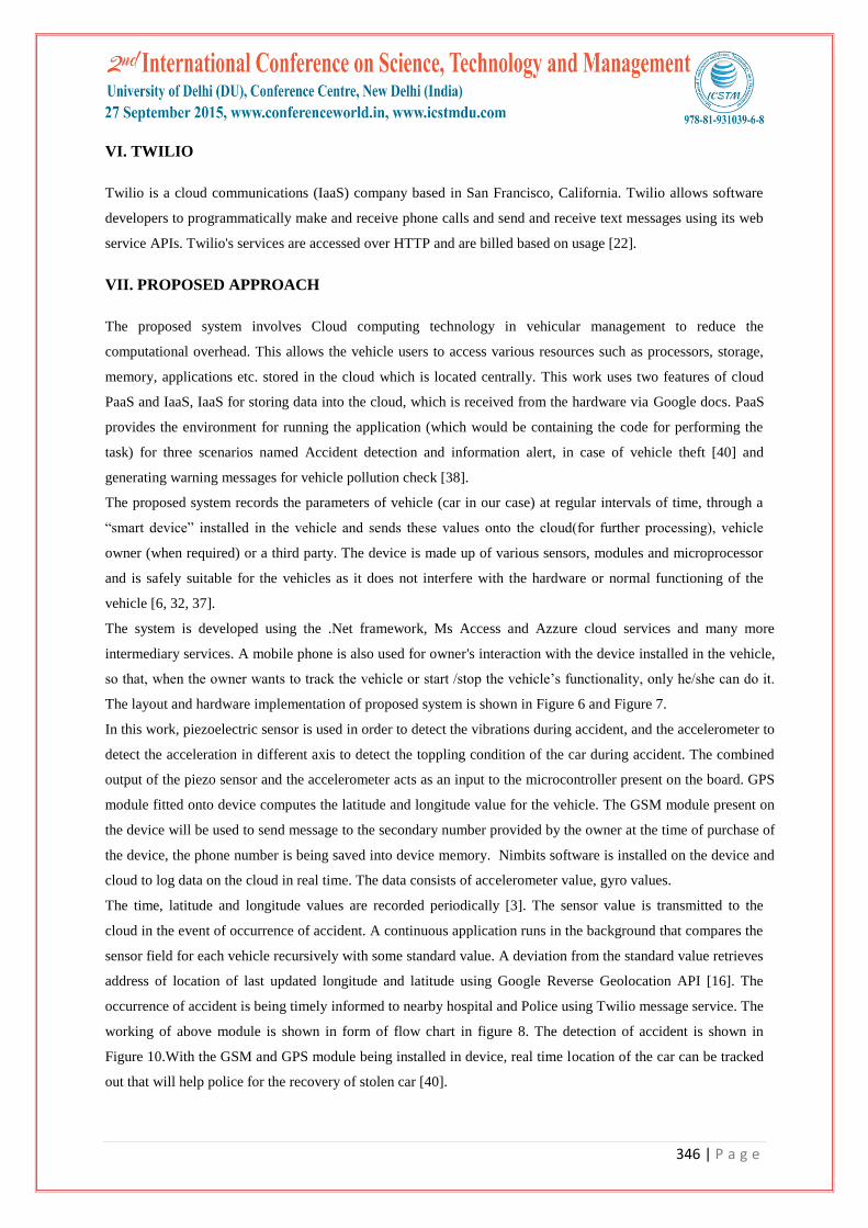
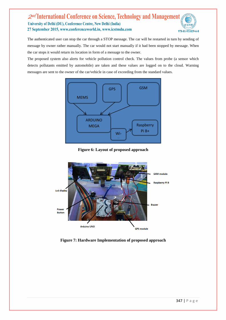
The layout and hardware implementation of proposed system is shown in Figure 6 and Figure 7.
In this work, piezoelectric sensor is used in order to detect the vibrations during accident, and the accelerometer to
detect the acceleration in different axis to detect the toppling condition of the car during accident. The combined
output of the piezo sensor and the accelerometer acts as an input to the microcontroller present on the board. GPS
module fitted onto device computes the latitude and longitude value for the vehicle. The GSM module present on
the device will be used to send message to the secondary number provided by the owner at the time of purchase of
the device, the phone number is being saved into device memory. Nimbits software is installed on the device and
cloud to log data on the cloud in real time. The data consists of accelerometer value, gyro values.
The time, latitude and longitude values are recorded periodically [3]. The sensor value is transmitted to the
cloud in the event of occurrence of accident. A continuous application runs in the background that compares the
sensor field for each vehicle recursively with some standard value. A deviation from the standard value retrieves
address of location of last updated longitude and latitude using Google Reverse Geolocation API [16]. The
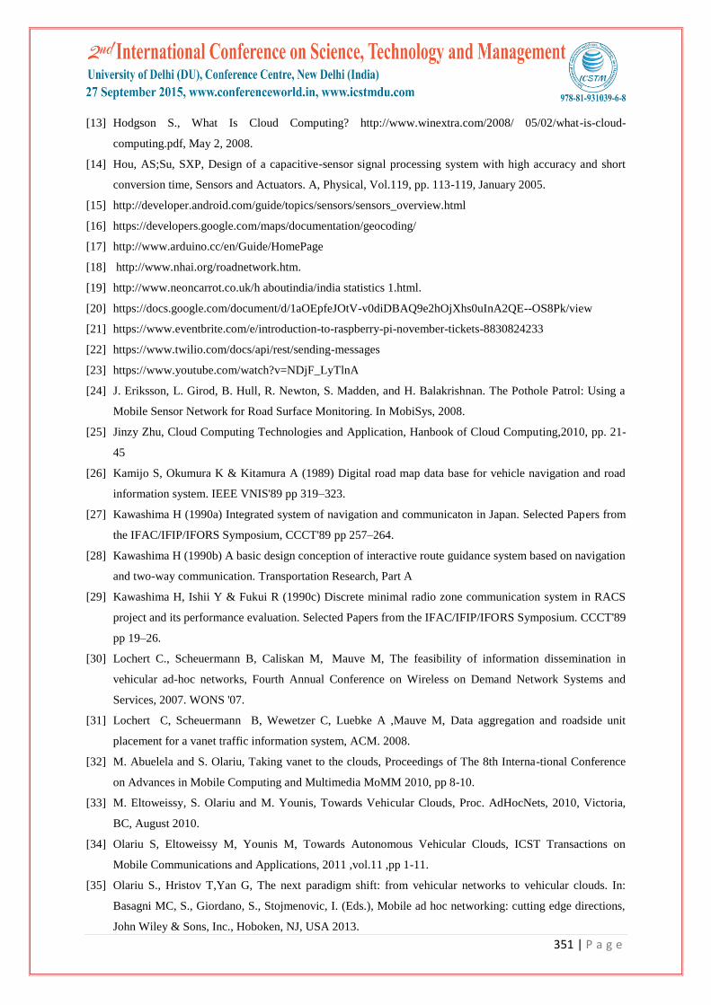
occurrence of accident is being timely informed to nearby hospital and Police using Twilio message service. The
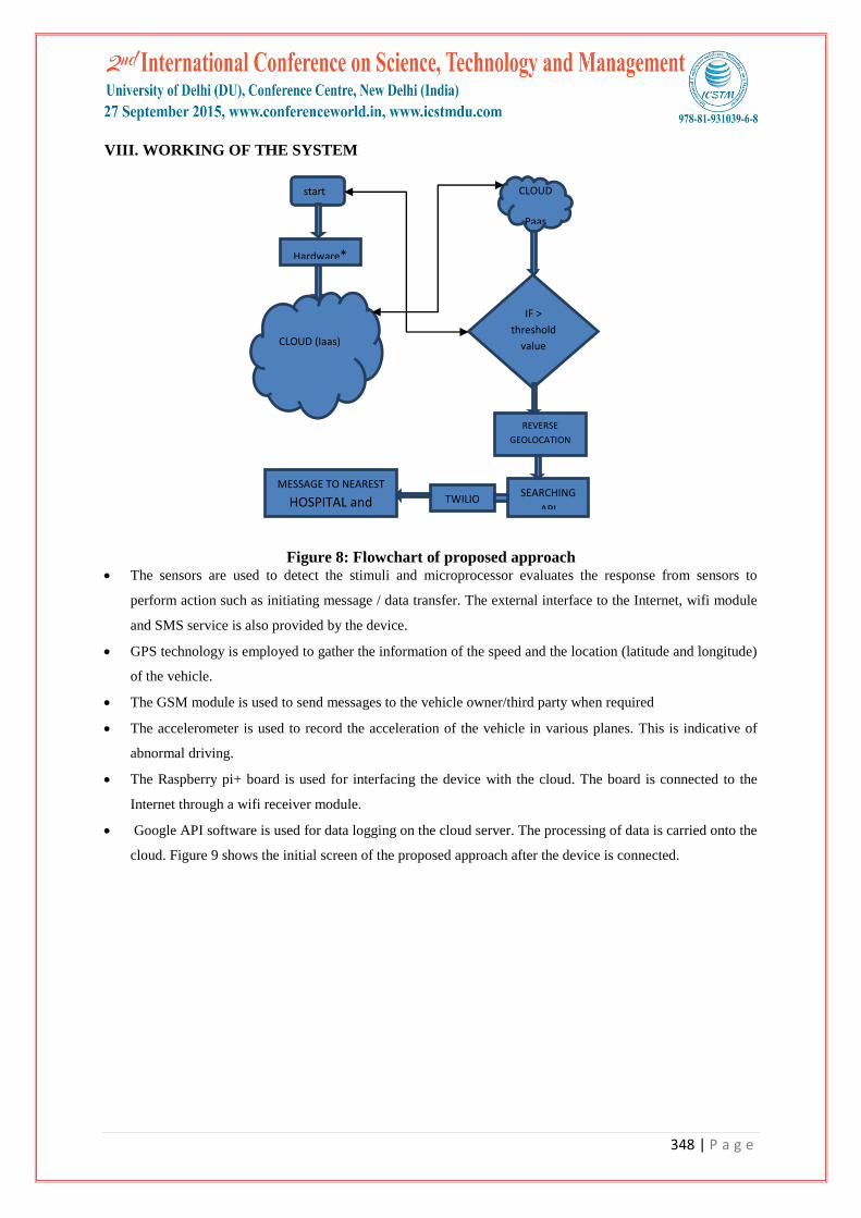
working of above module is shown in form of flow chart in figure 8. The detection of accident is shown in
Figure 10.With the GSM and GPS module being installed in device, real time location of the car can be tracked
out that will help police for the recovery of stolen car [40].
347 | P a g e
The authenticated user can stop the car through a STOP message. The car will be restarted in turn by sending of
message by owner rather manually. The car would not start manually if it had been stopped by message. When
the car stops it would return its location in form of a message to the owner.
The proposed system also alerts for vehicle pollution control check. The values from probe (a sensor which
detects pollutants emitted by automobile) are taken and these values are logged on to the cloud. Warning
messages are sent to the owner of the car/vehicle in case of exceeding from the standard values.
Figure 6: Layout of proposed approach
Figure 7: Hardware Implementation of proposed approach
MEMS
GPS
ARDUINO
MEGA
GSM
Raspberry
Pi B+
Wi-
Fi
348 | P a g e
VIII. WORKING OF THE SYSTEM
Figure 8: Flowchart of proposed approach The sensors are used to detect the stimuli and microprocessor evaluates the response from sensors to
perform action such as initiating message / data transfer. The external interface to the Internet, wifi module
and SMS service is also provided by the device.
GPS technology is employed to gather the information of the speed and the location (latitude and longitude)
of the vehicle.
The GSM module is used to send messages to the vehicle owner/third party when required
The accelerometer is used to record the acceleration of the vehicle in various planes. This is indicative of
abnormal driving.
The Raspberry pi+ board is used for interfacing the device with the cloud. The board is connected to the
Internet through a wifi receiver module.
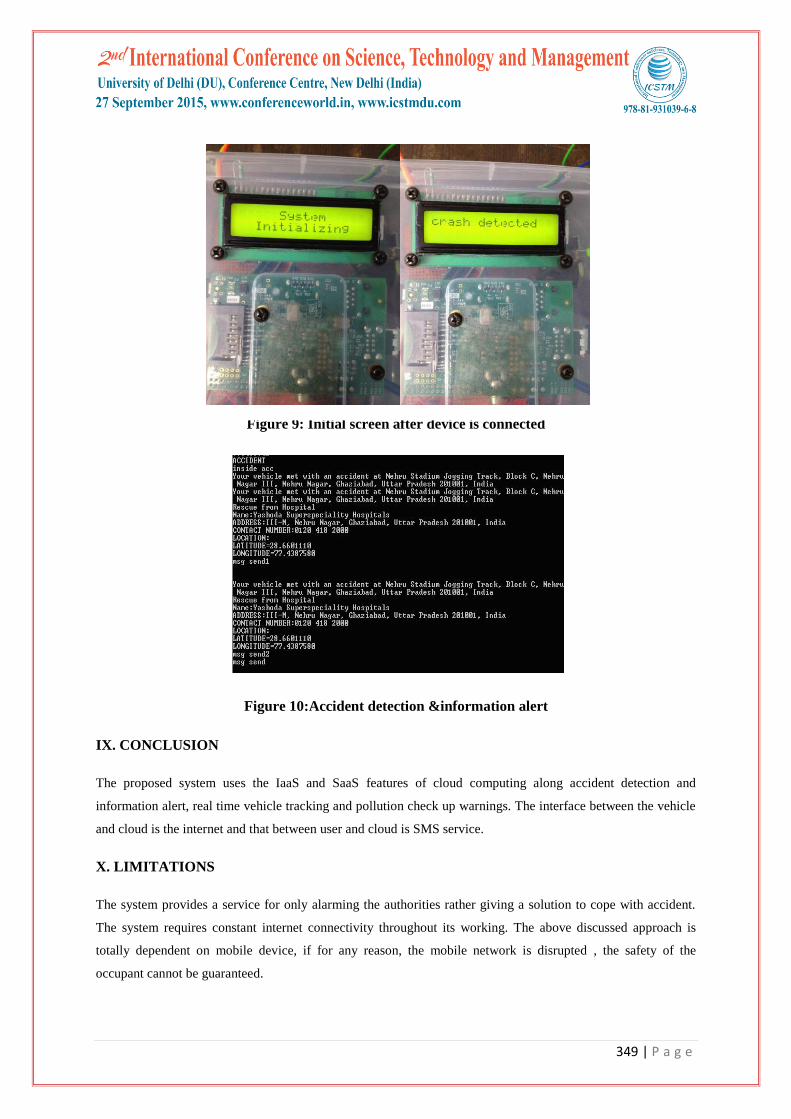
Google API software is used for data logging on the cloud server. The processing of data is carried onto the
cloud. Figure 9 shows the initial screen of the proposed approach after the device is connected.
start CLOUD
Paas
IF >
threshold
value
REVERSE
GEOLOCATION
SEARCHING
API TWILIO
MESSAGE TO NEAREST
HOSPITAL and
POLICE
Hardware*
CLOUD (Iaas)
349 | P a g e
Figure 9: Initial screen after device is connected
Figure 10:Accident detection &information alert
IX. CONCLUSION
The proposed system uses the IaaS and SaaS features of cloud computing along accident detection and
information alert, real time vehicle tracking and pollution check up warnings. The interface between the vehicle
and cloud is the internet and that between user and cloud is SMS service.
X. LIMITATIONS
The system provides a service for only alarming the authorities rather giving a solution to cope with accident.
The system requires constant internet connectivity throughout its working. The above discussed approach is
totally dependent on mobile device, if for any reason, the mobile network is disrupted , the safety of the
occupant cannot be guaranteed.

350 | P a g e
XI. FUTURE SCOPE
The proposed approach implements to control the vehicle theft by using GPS and GSM. Real time data logging
and analysis will be implemented that allows the system to monitor traffic situations in various regions. Various
safety warnings can be issued to the owner of car if car crosses certain defined speed limits. The real-time
alarms can also be set for the unauthorised vehicle movements and other exceptions using a series of geographic
zones together with the time-based rules for vehicle in/out.
XII. ACKNOWLEDGEMENTS
Authors will like to acknowledge the support provided by AKG Engineering College, Ghaziabad.
REFERENCES
[1] Abid H, Phuong LTT, Wang J, Lee S, Qaisar S, V-Cloud: vehicular cyber-physical systems and cloud
computing, In Proceedings of the 4th International Symposium on Applied Sciences in Biomedical and
Communication Technologies, Barcelona, Spain: ACM:2011,pp1-5.
[2] Aijaz A, Bochow B, Dötzer F, Festag A, Gerlach M, Kroh R, et al. Attacks on inter vehicle
communication systems-an analysis; 2006.
[3] Calculate distance, bearing and more between latitude/longitude points. http://www.movable-
type.co.uk/scripts/latlong.html.
[4] Dedicated Short Range Communication Standard (DSRC), Intelligent Transportation System ITS
http://www.standards.its.dot.gov/
[5] Dinh. HT, Lee C, Niyato D, Wang P, A survey of mobile cloud computing: architecture, applications, and
approaches in :Proceedings of the wireless communications and mobile computing;2011 pp 1587-1611
DOI: 10.1002/wcm.1203
[6] Fan Li; Yu Wang;, Routing in vehicular ad hoc networks: A survey, Vehicular Technology Magazine,
IEEE, vol.2, no.2, June 2007,pp.12-22,
[7] Fay Hui: A survey on the characterization of Vehicular Ad Hoc Networks routing solutions ECS 257
Winter 2005
[8] Geomagnetic field. http://hi-android.info/src/android/hardware/ GeomagneticField.java.html.
[9] Gongjun Yan, Rawat, D.B., Towards Secure Vehicular Clouds. 2012 Sixth International Conference on
Complex, Intelligent and Software Intensive Systems (CISIS).
[10] Gongjun Yan , S. Olariu , M. Weigle, Providing location security in vehicular Ad Hoc networks, IEEE
Wireless Communications, v.16 n.6, p.48-55, December 2009 [doi>10.1109/MWC.2009.5361178]
[11] Gongjun Yan , Stephan Olariu , Michele C. Weigle, Providing VANET security through active position
detection, Computer Communications, v.31 n.12, p.2883-2897, July
2008 [doi>10.1016/j.comcom.2008.01.009]
[12] Haisong Chen, Xiuqing Han, The Design of the Scene of the Accident Alarm System Based on ARM and
GPS,in propceedings of International Conference on Electric Information and Control Engineering
(ICEICE), 2011pp 3679 – 3682
351 | P a g e
[13] Hodgson S., What Is Cloud Computing? http://www.winextra.com/2008/ 05/02/what-is-cloud-
computing.pdf, May 2, 2008.
[14] Hou, AS;Su, SXP, Design of a capacitive-sensor signal processing system with high accuracy and short
conversion time, Sensors and Actuators. A, Physical, Vol.119, pp. 113-119, January 2005.
[15] http://developer.android.com/guide/topics/sensors/sensors_overview.html
[16] https://developers.google.com/maps/documentation/geocoding/
[17] http://www.arduino.cc/en/Guide/HomePage
[18] http://www.nhai.org/roadnetwork.htm.
[19] http://www.neoncarrot.co.uk/h aboutindia/india statistics 1.html.
[20] https://docs.google.com/document/d/1aOEpfeJOtV-v0diDBAQ9e2hOjXhs0uInA2QE--OS8Pk/view
[21] https://www.eventbrite.com/e/introduction-to-raspberry-pi-november-tickets-8830824233
[22] https://www.twilio.com/docs/api/rest/sending-messages
[23] https://www.youtube.com/watch?v=NDjF_LyTlnA
[24] J. Eriksson, L. Girod, B. Hull, R. Newton, S. Madden, and H. Balakrishnan. The Pothole Patrol: Using a
Mobile Sensor Network for Road Surface Monitoring. In MobiSys, 2008.
[25] Jinzy Zhu, Cloud Computing Technologies and Application, Hanbook of Cloud Computing,2010, pp. 21-
45
[26] Kamijo S, Okumura K & Kitamura A (1989) Digital road map data base for vehicle navigation and road
information system. IEEE VNIS'89 pp 319–323.
[27] Kawashima H (1990a) Integrated system of navigation and communicaton in Japan. Selected Papers from
the IFAC/IFIP/IFORS Symposium, CCCT'89 pp 257–264.
[28] Kawashima H (1990b) A basic design conception of interactive route guidance system based on navigation
and two-way communication. Transportation Research, Part A
[29] Kawashima H, Ishii Y & Fukui R (1990c) Discrete minimal radio zone communication system in RACS
project and its performance evaluation. Selected Papers from the IFAC/IFIP/IFORS Symposium. CCCT'89
pp 19–26.
[30] Lochert C., Scheuermann B, Caliskan M, Mauve M, The feasibility of information dissemination in
vehicular ad-hoc networks, Fourth Annual Conference on Wireless on Demand Network Systems and
Services, 2007. WONS '07.
[31] Lochert C, Scheuermann B, Wewetzer C, Luebke A ,Mauve M, Data aggregation and roadside unit
placement for a vanet traffic information system, ACM. 2008.
[32] M. Abuelela and S. Olariu, Taking vanet to the clouds, Proceedings of The 8th Interna-tional Conference
on Advances in Mobile Computing and Multimedia MoMM 2010, pp 8-10.
[33] M. Eltoweissy, S. Olariu and M. Younis, Towards Vehicular Clouds, Proc. AdHocNets, 2010, Victoria,
BC, August 2010.
[34] Olariu S, Eltoweissy M, Younis M, Towards Autonomous Vehicular Clouds, ICST Transactions on
Mobile Communications and Applications, 2011 ,vol.11 ,pp 1-11.
[35] Olariu S., Hristov T,Yan G, The next paradigm shift: from vehicular networks to vehicular clouds. In:
Basagni MC, S., Giordano, S., Stojmenovic, I. (Eds.), Mobile ad hoc networking: cutting edge directions,
John Wiley & Sons, Inc., Hoboken, NJ, USA 2013.
352 | P a g e
[36] Prashanth Mohan, Venkata N., Ramachandran Ramjee, Nericell : Rich Monitoring of Road and Traffic
Conditions using Mobile Smartphones, at SenSys, Nov 2008 pp 323-336.
[37] R Bhoraskar, N Vankadhara B. Raman P. Kulkarni, Wolverine : Traffic and Road Condition Estimation
using Smartphone Sensors, The 6th Annual Worshop on Wireless Systems: Advanced Research and
Development (WISARD'12), Bangalore, India, 2012.
[38] R. Sen, B. Raman, and P. Sharma. Horn-ok-please. In MobiSys, 2010,pp 137–150.
[39] R. Sen, P. Siriah, and B. Raman. Roadsoundsense: Acoustic sensing based road congestion monitoring in
developing regions. In SECON, 2011,pp 125–133,.
[40] S. Guha, K. Plarre, D. Lissner, S. Mitra, B. Krishna, P. Dutta, and S. Kumar. Autowitness: locating and
tracking stolen property while tolerating GPS and radio outages. In Proceedings of the 8th ACM
Conference on Embedded Networked Sensor Systems, SenSys ’10, New York, NY, USA, 2010. ACM pp
29–42.
[41] S. Olariu, I. Khalil, and M. Abuelela, Taking VANET to the clouds, International Journal of Pervasive
Computing and Communication, vol. 7, no. 1, 2011 pp. 7-21.
[42] S. Roy, R Sen, S. Kulkarni, P. Kulkarni, B. Raman, L. Singh, “Wireless Across Road: RF based Road
Traffic Congestion Detection”, The 5th Annual Workshop on Wireless Systems: Advanced Research and
Development (WISARD'11), COMSNETS 2011, Bangalore, India 2011.
[43] Sangita N Gujar,Jagruti R Panchal,Smart Car system using Sensor,GPS and GSM, Vol. 3, No. 3, IJEETC
2014.
[44] Sardar Muhammad Bilal , Carlos Jesus Bernardos , Carmen Guerrero, Position-based routing in vehicular
networks: A survey, Journal of Network and Computer Applications, v.36 n.2, p.685-697, March,
2013 [doi>10.1016/j.jnca.2012.12.023]
[45] T. El Gamal, A public key cryptosystem and a signature scheme based on discrete logarithms, IEEE
Transactions on Information Theory, vol. 31, no. 4, pp. 469-472, 1985.
[46] Whaiduzzaman M,Sookhak M,Gani A, Buyya R K,A survey on vehicular cloud computing, Volume 40,
April, 2014 Journal of Network and Computer Applications,pp 325-344.