clinton res & wa.pdf - kansas department of wildlife and parks
TRANSCRIPT

CClintonReservoir &Wildlife Area
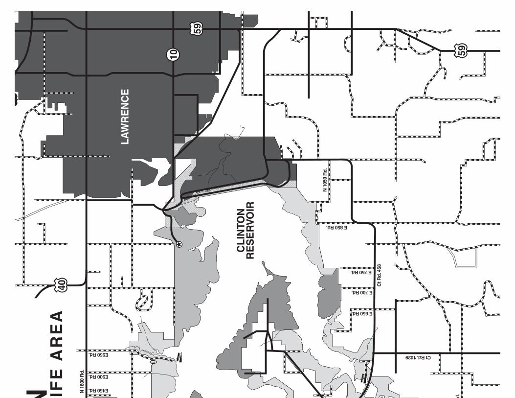
Clinton Reservoir, located near Lawrence inDouglas County, was completed by the Corpsof Engineers in 1977. High bluffs and wooded
shoreline surround the lake. At normal pool, thereservoir stretches 8 miles up the Wakarusa Riverand covers 7,000 acres. In order to minimize theimpact on the natural environment, roads follow landcontours, buildings blend into the landscape, andshoreline development is limited in two areas.
H ISTORY
Investigated archeological sites here indicate that hunt-ing groups began to use the area as early as 8000 B.C.From the time of the first European contact until 1824,the Kansa Indians inhabited northeast Kansas. In 1824,the Kansa sold portions of this land to the U.S. govern-ment, which used the Wakarusa Basin as a reservation forShawnee relocated from Ohio and Missouri. Traffic fromthe nearby Oregon Trail forced the federal government tomove the Shawnee out and open the area for settlementin 1854. That same year, the city of Lawrence was found-ed by abolitionists.
JEFFERSON
MIAMI
JOHNSON
DOUGLAS
SHAWNEE
LEAVEN- WORTH
FRANKLIN
OSAGE
WYANDOTTE
Topeka
Oskaloosa
Leavenworth
KansasCity
Lawrence
Olathe
Lyndon
Ottawa
Paola
470435
635
35
70
4
3168
68
7
6833
92
16
10
5
7
32
92
268
170
150
192
31
4
56
50
59
59
69
73
56
2440
169
75
ClintonReservoir & Wildlife Area
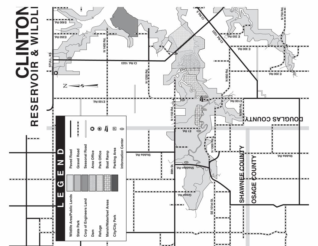
General Area Map Clinton Wildlife Area206 N 1600 Rd.
Lecompton, KS 66050
(Area Office)(785) 887-6882
(Regional Office)(785) 273-6740
www.ksoutdoors.com
Equal opportunity to participate in and benefit from programsdescribed herein is available to all individuals without regard torace, color, national origin, sex, age, disability, sexual orientation,gender identity, political affiliation, and military or veteran status.Complaints of discrimination should be sent to Office of theSecretary, Kansas Department of Wildlife, Parks and Tourism,1020 S Kansas Ave., Topeka, KS 66612-1327. 05/15
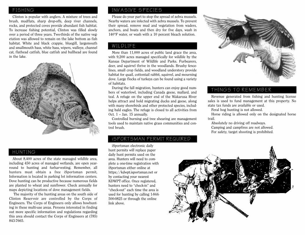
Clinton is popular with anglers. A mixture of trees andbrush, mudflats, sharp drop-offs, deep river channels,rocks, and protected coves provide abundant fish habitat.To increase fishing potential, Clinton was filled slowlyover a period of three years. Two-thirds of the native veg-etation was allowed to remain on the lake bottom as fishhabitat. White and black crappie, bluegill, largemouthand smallmouth bass, white bass, wipers, walleye, channelcat, flathead catfish, blue catfish and bullhead are foundin the lake.
About 8,400 acres of the state managed wildlife area,including 450 acres of managed wetlands, are open year-round to hunting and furharvesting. Remember, allhunters must obtain a free iSportsman permit,Information is located in parking lot information centers.Dove hunting can be productive because numerous fieldsare planted to wheat and sunflower. Check annually formaps depicting locations of dove management fields. The majority of the hunting areas on the south side ofClinton Reservoir are controlled by the Corps ofEngineers. The Corps of Engineers only allows bowhunt-ing in these multi-use areas. Persons interested in findingout more specific information and regulations regardingthis area should contact the Corps of Engineers at (785)843-7665.
F ISH ING
HUNT ING
More than 11,000 acres of public land grace the area,with 9,200 acres managed specifically for wildlife by theKansas Department of Wildlife and Parks. Furbearers,deer, and squirrel thrive in the woodlands. Brushy fence-lines, small crop fields, and woodland understory providehabitat for quail, cottontail rabbit, squirrel, and mourningdove. Large flocks of turkeys can be found using a varietyof habitats. During the fall migration, hunters can enjoy good num-bers of waterfowl, including Canada geese, mallard, andteal. A refuge on the upper end of the Wakarusa Riverhelps attract and hold migrating ducks and geese, alongwith many shorebirds and other protected species, includ-ing bald eagles. The refuge is closed to all activities fromOct. 1 – Jan. 15 annually. Controlled burning and tree shearing are managementtools used to maintain native grass communities and con-trol brush.
WILDL IFE
Revenue generated from fishing and hunting licensesales is used to fund management at this property. Nostate tax funds are available or used. Feral hog hunting is not allowed. Horse riding is allowed only on the designated horsetrail. Absolutely no driving off roadways. Camping and campfires are not allowed. For safety, target shooting is prohibited.
TH INGS TO REMEMBER
INVAS IVE SPEC IES
Please do your part to stop the spread of zebra mussels.Nearby waters are infected with zebra mussels. To preventtheir spread, remove mud and vegetation from waders,anchors, and boats and then dry for five days, wash in140°F water, or wash with a 10 percent bleach solution.
iSPORTSMAN PERMIT REQUIRED
iSportsman electronic dailyhunt permits will replace paperdaily hunt permits used on thearea. Hunters will need to com-plete a one-time registration withiSportsman either online athttps://kdwpt.isportsman.net orby contacting your nearestKDWPT office. Once registered,hunters need to “check-in” and“check-out” each time the area isused for hunting by calling 1-844-500-0825 or through the onlinelink above.
10
40
59
59
70
LA
WR
EN
CE
N IFE
AR
EA
CL
INTO
NR
ES
ER
VO
IR
N 1
600
Rd.
E 750 Rd.
E 850 Rd.
Ct R
d. 4
58
N 1
050
Rd.
E 700 Rd.
E 650 Rd.
d.
Ct Rd. 1029
E450 Rd.
E550 Rd.
E500 Rd.
LE
GE
ND
CL
INTO
NR
ES
ER
VO
IR &
WIL
DL
I
Pav
ed R
oad
Gra
vel R
oad
Sea
son
al R
oad
Are
a O
ffic
e
Par
k O
ffic
e
Bo
at R
amp
Par
kin
g A
rea
Info
rmat
ion
Cen
ter
Wild
life
Are
a/P
ubl
ic L
and
s
Sta
te P
ark
Co
rp o
f E
ng
inee
rs L
and
Dam
Ref
ug
e
Mar
sh/W
ater
fow
l Are
as
Cit
y/C
ity
Par
k
SH
AW
NE
E C
OU
NT
Y
OS
AG
E C
OU
NT
Y
DOUGLAS COUNTY
N 1
400
Rd.
N 1
150
Rd.
N 1
250
Rd.
SE
101
st S
t.N
100
0 R
d.
N 9
00 R
d.
Ct Rd.
102
3
Ct Rd.
6
E 350 Rd.
E 300 Rd.
E 200 Rd.
N 7
50 R
d.
Ct Rd. 1023
Stubbs Rd. Stubbs Rd.
N 9
50 R
d.
89th
St.
Green Rd.
Shadden Rd.
STU
LL, K
S
E350 Rd.
E400 Rd.
E100 Rd. E100 Rd.
E1 Rd.