climate information for resilient development and adaptation (cirda) and its relevance to the naps
TRANSCRIPT

Climate Information for Resilient Development and Adaptation (CIRDA) and
its relevance to the NAPs
Dr. Bonizella Biagini
Manager
CIRDA Programme, UNDP
NAPs EXPO 2016, Bonn, Germany

Outline
Importance of Climate Information for NAPs and concrete adaptation actions
Technology & communication gaps – views from the field
A new vision to find pragmatic solutions
Bringing in the private sector
The last mile
Country Profiles
2

National Adaptation Plans
• Established under the Cancun Adaptation Framework (2010)
• A continuous, progressive and iterative process which follows country-driven, gender-sensitive, participatory and fully transparent approach
• Objectives as agreed by the COP (Decision 5/CP.17) – Reduce the vulnerability to the impacts
of climate change, by building adaptive capacity and resilience
– Facilitate the integration of climate change adaptation, in a coherent manner, into relevant new and existing policies, programmes and activities, in particular development planning processes and strategies, within all relevant sectors and at different levels

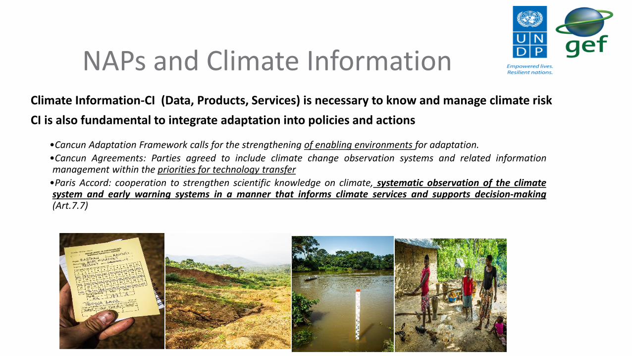
NAPs and Climate InformationClimate Information-CI (Data, Products, Services) is necessary to know and manage climate risk
CI is also fundamental to integrate adaptation into policies and actions
•Cancun Adaptation Framework calls for the strengthening of enabling environments for adaptation.
•Cancun Agreements: Parties agreed to include climate change observation systems and related informationmanagement within the priorities for technology transfer
•Paris Accord: cooperation to strengthen scientific knowledge on climate, systematic observation of the climatesystem and early warning systems in a manner that informs climate services and supports decision-making(Art.7.7)

Information for Adaptation
Lack of CI is a major cause of low adaptive capacity in Africa
Data must be accurate, comprehensive, timely, and consistently maintained (sustainable)
Data must be communicated and understood by end users (policy makers, communities, etc.)
6
CIRDA Programme designed in response to African LDCs’ recognition that adaptation can not be achieved without reliable climate and weather data – currently not sufficiently available
Image of global radar network: Source WMO Radar Database http://wrd.mgm.gov.tr/db/search-basic.aspx?l=en
http://wrd.mgm.gov.tr/db/search-basic.aspx?l=en

Realities on the ground
7
Accessibility
Power and Communications
Quality Control
Pictures from actual field missions

Communication gaps
8
Synoptic AWS - UgandaSMS based SYNOP Reported to GTS

Support
• Data and tech transfer• Identify and reach end users• Mainstream/integrate data into development
planning (NAPs)• Financial sustainability planning/PPP
partnerships
11 Partner countries.
Objectives• Support climate services in their efforts to collect,
analyse and disseminate climate information forlong term planning and adaptation
• Provide timely, high quality climate information toreach the last mile
• Enable policy makers and vulnerable communitiesto make informed decisions
• Save lives and livelihoods
What is CIRDA
Benin
BurkinaFaso
EthiopiaThe Gambia
Liberia
Malawi
São Toméand Príncipe
Tanzania
Uganda
Zambia
Sierra Leone
10
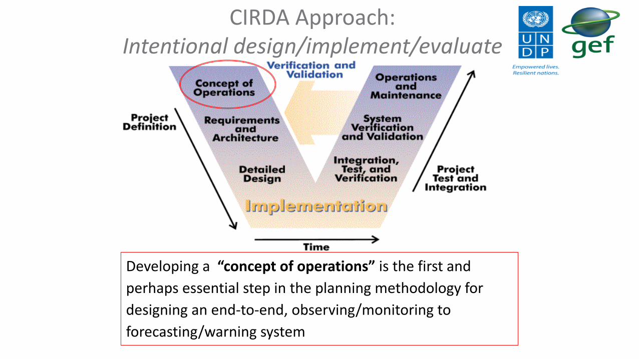
CIRDA Approach:Intentional design/implement/evaluate
Developing a “concept of operations” is the first and
perhaps essential step in the planning methodology for
designing an end-to-end, observing/monitoring to
forecasting/warning system

Non-traditional approaches have potential to support the development and sustainability of weather observing networks
11
Emphasis is on meteorological systems engineering and leapfrog technologies to establish the above sequence of actions.
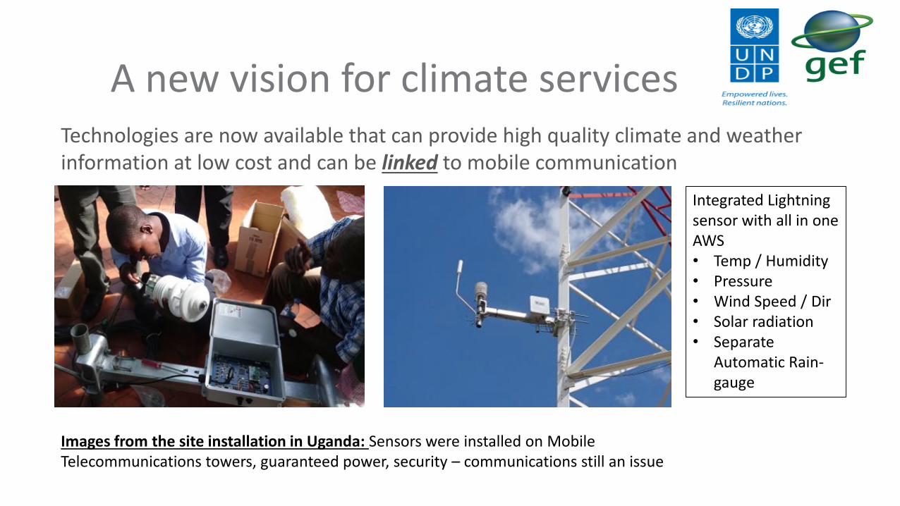
A new vision for climate servicesTechnologies are now available that can provide high quality climate and weather information at low cost and can be linked to mobile communication
12Images from the site installation in Uganda: Sensors were installed on Mobile Telecommunications towers, guaranteed power, security – communications still an issue
Integrated Lightning sensor with all in one AWS • Temp / Humidity• Pressure • Wind Speed / Dir• Solar radiation• Separate
Automatic Rain-gauge

What are the advantagesShared hosting services on cloud platforms – data is available in real time
13
Real Time Network view Real Product view (Operational)

The private sector link
• Companies providing weather observation, analysis and communications are increasingly able to support NHMSs
• There are many commercial needs for weather services (eg aviation, agriculture, etc.) that can potentially provide revenue supporting NHMSs
Partnerships will contribute more broadly to sustainable development goals
There is a continued need to support NHMS to provide CI as a public good particularly to the poorest and most vulnerable

‘The Last Mile’
Engaged with the Brown Institute for Media Innovation (Columbia University) and IRI to promote the Climate Action Hackathon to create software applications to end users. Some of the products they developed in 24 hours:
The Last Mile is the final, most crucial stage for CI. It focuses on the end user, the communities and policy makers.
- Knife’s Edge : Analysis “dashboard” to enable ag extension officers to infer climate/weather information for their practice and application; collated, analysed data can then be sent to farmers via push SMS or by scheduling in person meetings
- Climar: climate information sharing platform that provides tailored advice in 4 local African languages to different sectors of the economy (call in push service)
- #mLisho: SMS (text messages) providing sustainability and market information to nomadic pastoralists based on predictions of range land productivity
- Climate Frame: Frames data by defining specific actions that are executed when defined weather events occur; Information provided pictorially via sms
Conclusions Climate Information (Data, Products, Services) is necessary to develop
strong NAPs
Many vulnerable countries still need reliable data
Technology transfer/purchase is not enough without local capacity, including training, operation and maintenance
Gathering and processing data in not sufficient without communication to the end users (including policymakers)
NAPs preparation and implementation offer an opportunity to identify this gap at the national level and to access the necessary resources to address this issue
16

Thank you
Dr. Bonizella BiaginiManager
CIRDA Programme, [email protected]
www.adaptation-undp/projects/cirdawww.undp-cirda.blogspot.com
Twitter @bonizella

BeninContext
Climate Impact: Changes in precipitation, and sea-level rise threaten the country’s productive infrastructure with severe impacts on both food security and income.
Initial capacity: Lack of reliable hydromet forecasting means (lack of human and technological capacity)
CI/ EWS Project Focus
Upgrade observation infrastructure to provide EWS and climate services with real-time data.
Train NHMS in the use of real time data to create tailored forecasts
UNDP Support (CI/EWS + CIRDA)
Training on forecasting
Purchase and correct installation of hydromet equipment including full EWS system and central servers
Impact
Able to issue flood and hydrological warnings in all parts of the country.
EWS system with capacity to collect digitally the information from equipment in the field. Allows the creation of tailored forecasts.
Institutional agreement for SOP to quickly disseminate EW alerts and save lives. 18

Burkina FasoContext Observation network coverage of only 25%
with very few stations reporting reliable data. Limited budget for equipment maintenance. No real time data.
Lack of SOP or communications strategy for the dissemination of weather information.
Lack of hydromet EWS
CI/EWS Focus
Upgrade to an automatic network, providing the services with real-time data.
Unified SOP with all service providers and involving telephone companies
Increasing human capacity
UNDP Support (CI/EWS + CIRDA) Technical specifications of hydromet equipment
and review of their correct installation.
Integration of real-time data into the forecasts and Early Warning
Development of a unified SOP
Outreach to mobile phone providers
Impact
Observation coverage now at 75% nationwide.
A SOP has been developed, this will have a direct impact in lives saved.
Currently procuring equipment for EWS that will include information from new AWS.
Partnership with Airtel for collecting rain fade information 19

EthiopiaContext
Lack of consolidated data. Exchange of data among institutions is demand-based impeding the automatic integration of data for EW and climate services.
No real-time data on surface- and ground water levels impedes the Ministry of Water's capacity to fulfil its mandate.
CI/EWS Focus
Upgrade to an automatic network, providing the services with real-time data
Training staff on the use of real-time data
Product development and delivery (including EWS)
UNDP Support (CI/EWS + CIRDA) Reviewing the installation of equipment;
Data transmission and management;
Data analysis and product development training;
Information delivery and last mile efforts
Impact
Network of automatic weather stations provides a foundation to build weather and climate products and services
With installation of automatic water level sensor networks, can start working towards integrated water resources management, including water allocation planning.
Training in the installation, operation and maintenance of high-tech automatic weather and hydrological stations, improves the likelihood of sustainability 20

The Gambia
Context
Coastal erosion and salinization are major challenges
Agriculture employs 75% of the population and makes up 20% of GDP
CI/EWS Focus
Strengthen EWS and national climate monitoring and adaptation capabilities
UNDP Support (CI/EWS + CIRDA)
Purchase of hydro met equipment and data server, drafting of technical specifications for EWS and pilotsonde
Signed MoU with the aviation sector
Impact
Increased physical and technical capacity a to monitor and forecast weather and long-term climatic changes
Capacity to enhance the financial sustainability of observation system due to signed MOU and enhanced capacity to communicate climate information
21
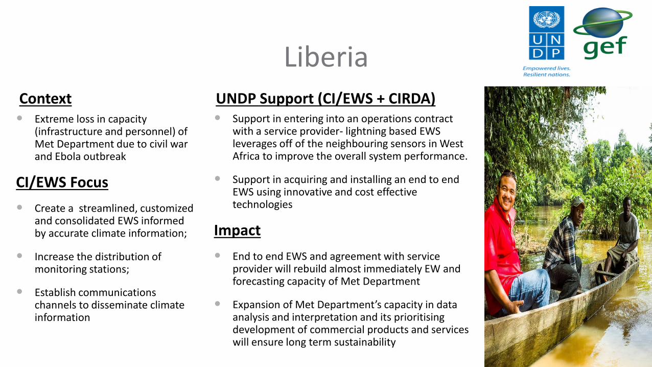
LiberiaContext Extreme loss in capacity
(infrastructure and personnel) of Met Department due to civil war and Ebola outbreak
CI/EWS Focus
Create a streamlined, customized and consolidated EWS informed by accurate climate information;
Increase the distribution of monitoring stations;
Establish communications channels to disseminate climate information
UNDP Support (CI/EWS + CIRDA) Support in entering into an operations contract
with a service provider- lightning based EWS leverages off of the neighbouring sensors in West Africa to improve the overall system performance.
Support in acquiring and installing an end to end EWS using innovative and cost effective technologies
Impact
End to end EWS and agreement with service provider will rebuild almost immediately EW and forecasting capacity of Met Department
Expansion of Met Department’s capacity in data analysis and interpretation and its prioritising development of commercial products and services will ensure long term sustainability 22

MalawiContext
Highly vulnerable to severe flooding and droughts
Declining observation and processing infrastructure
Lack of regional cooperation
CI/EWS Focus
Enhance its monitoring capabilities with a strong emphasis on hydro and water management
Implement an EWS
Create the capacities to deliver the climate information for adaptation planning particularly for agriculture.
UNDP Support (CI/EWS + CIRDA) Outreach to last mile services like HNI 3-
2-1 Service (push service via cell phone)
Training on forecasting
Regional outreach
Impact
Directorate for Climate Change and Meteorological Services (DCCMS) are in the process of application development to integrate all sources of data
DCCMS currently provide weather information to the HNI 3-2-1 service that generates an average usage of 350,000 calls
The next phase of the project includes the deployment of the lightning based EWS and the integration of the hydrological data into a multi-hazard early warning system 23

Sao Tome and Principe
Context
Climate and hydrological monitoring network with 20% of national coverage.
Limited infrastructure and capacity to produce accurate forecasts and EW
No EWS
CI/EWS Focus
Increase coverage of observation network
Increase capacities of Met and Water Departments
Enable an EWS
UNDP Support (CI/EWS +CIRDA)
Implementation and operationalization of the hydro-meteorological services and equipment
Aid in integrating new equipment into an EWS.
Support in purchase and installation of satellite distribution system (SADIS)
Impact
Improved network coverage
Community and national staff equipped and trained in communicating EW- Last Mile
Training in the installation and maintenance of new hydromet equipment- improves sustainability
Improved forecasting capacity for aviation due to SADIS 24

Sierra LeoneContext
Extreme loss in capacity (infrastructure and personnel) through years of civil war and the Ebola outbreak
CI/EWS Focus
Upgrading the meteorological and hydrological observation networks and create the internal capacity to emit EW and climate services
UNDP Support (CI/EWS + CIRDA) Support in entering into an operations contract
with a service provider- lightning based EWS leverages off of the neighbouring sensors in West Africa to improve the overall system performance.
Support in acquiring and installing an end to end EWS using innovative and cost effective technologies
Outreach to the private sector (mining most promising)
Impact
End to end EWS and agreement with service provider will rebuild almost immediately EW and forecasting capacity of Met Department
Expansion of Met Department’s capacity in data analysis and interpretation and its prioritising development of commercial products and services will ensure long term sustainability
25

TanzaniaContext Limited real-time met data received. Lack of
capacity and data management inhibited it being used in forecasting and processed in EW.
No real time data of hydrological information resulting in lack of water allocation planning capacities.
CI/EWS Focus
Improve the coverage of automatic weather stations; create the real time data ability to generate EW and improve the quality of climate information products; create an EWS
Product delivery to end users (new and existing products)
Improve the Ministry of Water's (MoW) integrated water resources management capacity
UNDP Support (CI/EWS + CIRDA) Integration of real-time data into the forecasts; quality
checking of installation of new hydromet equipment;
Transition from an analogue to a digital workflow at the MoW and the Basin Boards;
Facilitated the automated exchange of data and information at an institutional level
Impact
Met department is looking at ways to use the new real-time data in their forecasts;
The MoW are halfway through with the installation of their automatic weather and hydrological stations
3 Government Agencies are working on an MoU to facilitate the free and automated exchange of data and information
Work has started on the Emergency Operations Centre, which will be operational 24/7, and from which early warnings will be sent out 26
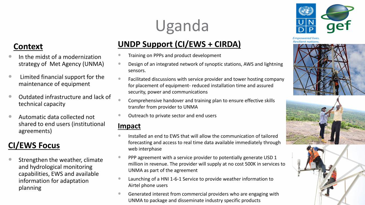
UgandaContext
In the midst of a modernization strategy of Met Agency (UNMA)
Limited financial support for the maintenance of equipment
Outdated infrastructure and lack of technical capacity
Automatic data collected not shared to end users (institutional agreements)
CI/EWS Focus
Strengthen the weather, climate and hydrological monitoring capabilities, EWS and available information for adaptation planning
UNDP Support (CI/EWS + CIRDA) Training on PPPs and product development
Design of an integrated network of synoptic stations, AWS and lightning sensors.
Facilitated discussions with service provider and tower hosting company for placement of equipment- reduced installation time and assured security, power and communications
Comprehensive handover and training plan to ensure effective skills transfer from provider to UNMA
Outreach to private sector and end users
Impact Installed an end to EWS that will allow the communication of tailored
forecasting and access to real time data available immediately through web interphase
PPP agreement with a service provider to potentially generate USD 1 million in revenue. The provider will supply at no cost 500K in services to UNMA as part of the agreement
Launching of a HNI 1-6-1 Service to provide weather information to Airtel phone users
Generated interest from commercial providers who are engaging with UNMA to package and disseminate industry specific products
27

ZambiaContext
Limited amount of working AWS, real time met data collected is not being integrated into forecasting workflows
Data from the automatic water gauges are not publicly available nor optimally used for water resources management purposes
CI/EWS Focus
Expand the network of automatic weather stations and train staff in its operation and maintenance;
Use the real-time AWS data in forecasting, thus improving the forecasting;
Developing new weather and climate information products
UNDP Support (CI/EWS + CIRDA)
Expansion of the AWS network and integration of data
Training in the assimilation of real-time data in the forecasts;
Use of automatic water level gauge data in integrated water resources management;
Facilitating the exchange of data between agencies
Impact
Improved forecasts resulting from new AWS
Telemetric data transmission ensures that problems at weather stations are noticed quickly;
Trained staff starting to use AWS data, paving the way for product development 28