climate change - sig · mapping an urban heat island index for california urban heat islands are...
TRANSCRIPT

sig-gis.com
CLIMATE ASSESSMENTSEvaluate climatic/meteorological data and other relevant information for past, present, and projected future for a define region or project areaCompile a climate library for project boundary to establish a baselineEvaluate changes from baseline(s) in ranges of variability, recent trends, extremes, and provide decision-support on data products
IMPACTS AND VULNERABILITYEvaluate spatially and temporally how climate and weather influence local/ • region conditions, processes, assets, risk factors & project objectivesInfer functional relationships between climate and system components
ADAPTATION PLANNINGImplementation of an adaptive management and collaborative decision making approach to identify priorities and actions for adaptationDevelop strategies to build and maintain adaptive capacity of focal system
MITIGATION STRATEGIES & GHG ASSESSMENTSIdentify, evaluate and prioritize key climate mitigation opportunitiesDesign approaches to mitigate sources of GHGs and mitigate impactsDetermine anticipated impacts from climate change on focal system
SCENARIO MODELINGBuild collaborative teams for a mediated modeling processCreate scenarios of change that capture a range of outcomesAdaptation planning, capacity building and learning through collaboration
CLIMATE RELIABILITY & INVESTMENTSLiterature review, hypothesis generation, experimental design, statistical data analysis, spatial data analysis, and report productionEvaluation of current wildfire policy and scenario modeling of alternative wildfire policies
C limate change is a spatiotemporal phenomenon
that will cause many challenges and opportunities. Understanding, adapting, mitigating requires
knowledge at local / regional scales where most decisions are made, economies operate, solutions developed, etc. SIG can develop and integrate explicit climate data on how climate change and variability will impact ecosystem services, natural hazards, forest and agriculture, sustainable cities, carbon offsets, etc. Below you will find a few representative projects to illustrate our recent work. Please visit the website for additional detail.
Climate Change
Dr. David [email protected]
STAFF CONTACTS
sig-gis.com
Climate ChangeDEVELOPING COSTED GREENHOUSE GAS REFERENCE AND EMISSIONS REDUCTION/ENHANCED REMOVAL SCENARIOS FOR SUBNATIONAL REDD + PLANNING APPLICATIONS IN VIETNAMSIG conducted an integrated scenario forest land use planning and opportunity cost-benefit analysis for the the Lam Dong province and Ngoc Hien commune in Ca Mau province, Vietnam.
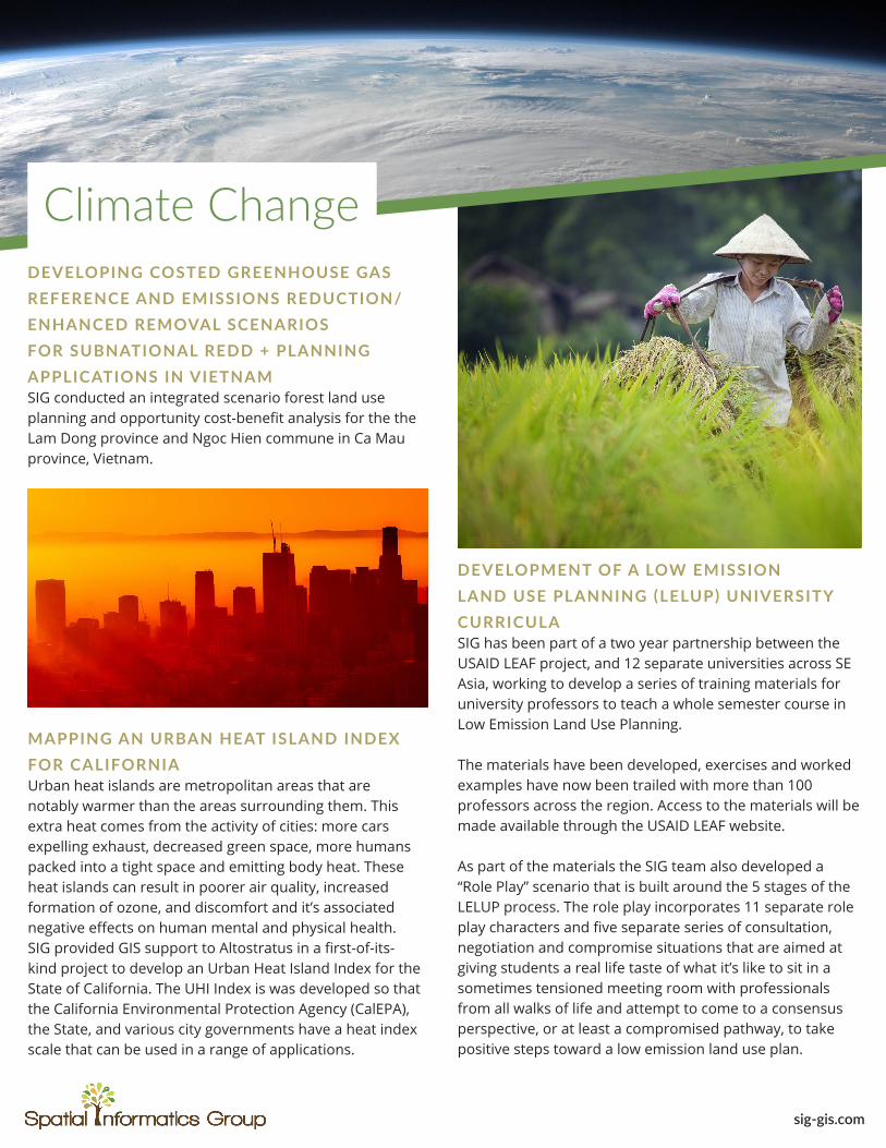
DEVELOPMENT OF A LOW EMISSION LAND USE PLANNING (LELUP) UNIVERSITY CURRICULASIG has been part of a two year partnership between the USAID LEAF project, and 12 separate universities across SE Asia, working to develop a series of training materials for university professors to teach a whole semester course in Low Emission Land Use Planning.
The materials have been developed, exercises and worked examples have now been trailed with more than 100 professors across the region. Access to the materials will be made available through the USAID LEAF website.
As part of the materials the SIG team also developed a “Role Play” scenario that is built around the 5 stages of the LELUP process. The role play incorporates 11 separate role play characters and five separate series of consultation, negotiation and compromise situations that are aimed at giving students a real life taste of what it’s like to sit in a sometimes tensioned meeting room with professionals from all walks of life and attempt to come to a consensus perspective, or at least a compromised pathway, to take positive steps toward a low emission land use plan.
MAPPING AN URBAN HEAT ISLAND INDEX FOR CALIFORNIAUrban heat islands are metropolitan areas that are notably warmer than the areas surrounding them. This extra heat comes from the activity of cities: more cars expelling exhaust, decreased green space, more humans packed into a tight space and emitting body heat. These heat islands can result in poorer air quality, increased formation of ozone, and discomfort and it’s associated negative effects on human mental and physical health. SIG provided GIS support to Altostratus in a first-of-its-kind project to develop an Urban Heat Island Index for the State of California. The UHI Index is was developed so that the California Environmental Protection Agency (CalEPA), the State, and various city governments have a heat index scale that can be used in a range of applications.