clews modelling of the nexus - gwsp · clew s d evelopment n exus integrated climate land energy...
TRANSCRIPT

CLEWS MODELLING OF THE NEXUS DIVISION OF ENERGY SYSTEMS ANALYSIS (KTH-DESA)
Mark Howells, Director [email protected]. se Lucia de Strasser, Researcher [email protected]. se Dimitris Mentis, Researcher [email protected]. se
FAO/ ESA/ GWSP Workshop on Earth Observations and the Water-Energy-Food Nexus 26 March 2014 Rome, Italy

SPI – STRATEGIC POLICIES AND INVESTMENTS
Globally there are key policy and investment levers required for development
• Renewables
• Energy security
• Energy efficiency
• Market design
• Investment portfolios etc.
Quantification of sustainable development and capacity building of stakeholders is a key goal
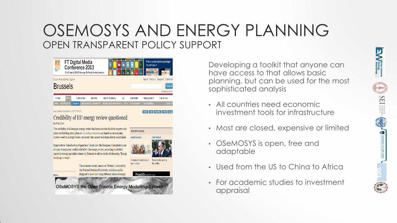
OSEMOSYS AND ENERGY PLANNING OPEN TRANSPARENT POLICY SUPPORT
Developing a toolkit that anyone can have access to that allows basic planning, but can be used for the most sophisticated analysis
• All countries need economic investment tools for infrastructure
• Most are closed, expensive or limited
• OSeMOSYS is open, free and adaptable
• Used from the US to China to Africa
• For academic studies to investment appraisal

SEAP SUSTAINABLE ENERGY FOR ALL PROGRAM
Access to energy is universally agreed as important. We provide insights into what that means, how to ‘get there’ and what it will cost…
• Defining and measuring energy poverty
• Quantifying the investment needed to address it
• Identifying the best techno-economic options
• Incorporating access into national strategies
• Identifying enabling environments
• Developing transferable toolkits

CLEWS DEVELOPMENT NEXUS INTEGRATED CLIMATE LAND ENERGY AND WATER STRATEGIES
More than 20% of the world are without safe water, clean energy or nutritious food. Demand is growing and climate changes makes the poor more vulnerable. We:
• Help identify hotspots and risks
• Evaluate integrated water, food and energy security
• Find and quantify solutions
• At global, regional, national and city level
• Develop case studies, frameworks and tools

SPECIAL FOCUS: AFRICA The continent has high resource
potentials, high growth rates and low energy access levels. We focus on:
Mapping renewable energy potentials
Developing continent wide, regional and national electricity investment scenarios
Capacity building government, utility and universities

CLIMATE, LAND-USE, ENERGY AND WATER SYSTEMS(CLEWS)
• Resources are constrained
• Climate, Land-use, Energy and Water Systems
(CLEWS) can be highly interlinked
• Policy development may not recognise these
linkages
Factors which indicate that a CLEWS approach
might be valuable:
• Integrated policies with implications for
multiple resource systems
• High shares of hydropower
• Climate change induced rainfall changes
• Conflicting water management priorities
• Holistic assessment of greenhouse gas
emissions

CLEWS CASE STUDIES (I) - MAURITIUS Why:
• Producer and exporter of sugar (occupying 80% cultivated land area)
• EU decision in 2009 to cut guaranteed sugar import price by 36%
• Dependent on fuel imports (83%)
• Diverse climate, prone to climate change
• Integrated agricultural and energy policy

CLEWS CASE STUDIES (II) – BURKINA FASO
Rain-fed
Irrigation
Introducing Jatropha

THE CLEW CHALLENGE FOR COMING DECADES
• Need for more “crop per drop” and more crop per hectare
• Produce more energy for a larger and more affluent population in a more sustainable manner.
• Adopt sustainable practices for supply of more freshwater and disposal of wastewater.
• Integrate the possible Effects of Climate Change into our planning.

THE UNECE PROJECT - NEXUS IN TRANSBOUNDARY BASINS
• UNECE Water Convention on the Protection and Use of Transboundary Watercourses and International Lakes
• Task Force on Water-Energy-Food-Ecosystems Nexus
• Selected basins (Alazani, Sava, NWSAS + Niger, Isonzo, Syr Darya)to be assessed until 2015
Human develop-
ment
Climate change
Sectoral policies
Available techno-logies
Water-Food-Energy-Ecosystems Nexus
Country 1: policies and
actions
Country 2: policies and
actions
Communication, collaboration and joint action!

NEXUS CONNECTIONS ILLUSTRATED – DEVELOPING A STORY LINE
A NEXUS approach can be helpful and illustrative to develop
future developments.
What happens with:
MORE AGRICULTURE
MORE INDUSTRY
BIGGER CITIES
???

NEXUS AND EARTH OBSERVATION DATA (1/6)
Such data can be general
• Administrative country data (UNSALB)
• Roads (Natural Earth)
• Elevation (CGIAR-CSI GeoPortal )
Or more specific (related to Nexus components)
• Water
• Energy
• Land Use
• Ecosystems
Earth Observation data are essential in the Nexus assessment in order to visualize potential
nexus hotspots and carry out geospatial calculations (i.e. estimate deforestation figures and
connect with fuel wood consumption)

NEXUS AND EARTH OBSERVATION DATA (2/6)
Data showing Water related activities
• Lakes and wetlands (Global Lakes and Wetlands Database)
• River catchments (European Environment Agency)
• Industrial Activities ( Regional data)
• Urban areas (Global Rural-Urban Mapping Project, GRUMP)
Water related activities (Sava) Water related activities (Alazani)
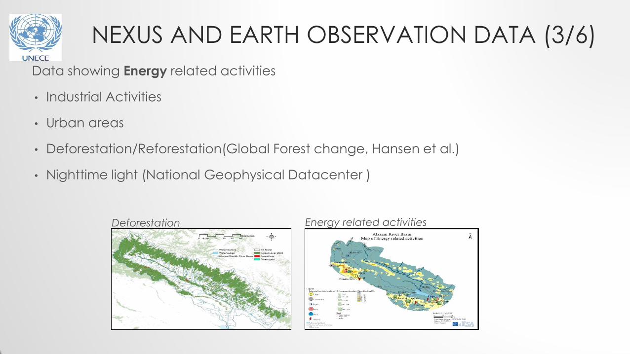
NEXUS AND EARTH OBSERVATION DATA (3/6)
Data showing Energy related activities
• Industrial Activities
• Urban areas
• Deforestation/Reforestation(Global Forest change, Hansen et al.)
• Nighttime light (National Geophysical Datacenter )
Deforestation Energy related activities

NEXUS AND EARTH OBSERVATION DATA (4/6)
Data showing Land Use related activities
Land Use and Land cover data
Land cover data can be extracted from FAO’s and JRC’s databases
Land Use (Sava) Land Use (Alazani)

NEXUS AND EARTH OBSERVATION DATA (5/6)
Data showing Ecosystem related activities
• Protected areas and Ecosystems (World Database on Protected Areas)
• Access to water and upstream protected land (FAO, AQUEDUCT Global Maps)

Challenges in assessing the status of transboundary waters
- application of harmonized approaches across the basin/by the different countries
- continuous data series over long periods of time
- use of consistent classifications
The value-added of RS (Water Convention)
- commonly a lack of basin level information
- for transboundary settings, consistency of RS data is an advantage
- RS also helps to fill gaps left by degradation of in situ monitoring networks experienced in the EECCA (especially for specific applications like monitoring glaciers and snow cover in Central Asia)
- in some geographical application areas of the nexus assessment, RS might be the best available source
Main interest from the UNECE Water Convention's mandate point of view: joint or coordinated monitoring and assessment of transboundary waters (rivers, lakes, groundwaters) and effectiveness of measures taken to prevent, control and reduce transboundary impact
NEXUS AND EARTH OBSERVATION DATA (6/6)

CLEWS IN AFRICA
Renewable Energy Assessment in Africa
• Broad shortage of information on energy matters • More than half billion people lack access to electricity • Apparent lack of knowledge about RES • Most endowed continent in RES • Estimate the actual potential of the domestic energy sources (Solar,
Biomass, Hydro power, Wind) • Optimize the energy mixture considering RES • Optimize the land use for RES • Comply with strategies and legislation framework for RE planning • Preserve protected and sensitive areas • Consider infrastructure investments
Detailed RES resource mapping
Geographical and Socio-economic
constraints
Technical possibilities and
constraints
Technically and economically
feasible RE potential
High resolution maps and relatively small scale RE potentials throughout Africa

MEET THE KTH ENERGY SYSTEMS ANALYSIS TEAM
Professors: M Howells M Bazilian H Rogner
The Sustainable Energy For All Program SEAP
The Open Source Energy Modeling System OSeMOSYS
SPI Strategic Policies and Investments
CLEWs Climate Land Energy Water strategies
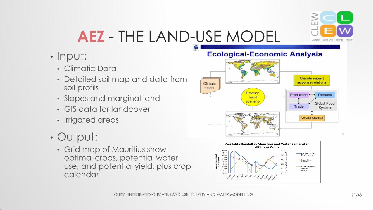
AEZ - THE LAND-USE MODEL • Input:
• Climatic Data
• Detailed soil map and data from soil profils
• Slopes and marginal land
• GIS data for landcover
• Irrigated areas
• Output: • Grid map of Mauritius show
optimal crops, potential water use, and potential yield, plus crop calendar
CLEW - INTEGRATED CLIMATE, LAND USE, ENERGY AND WATER MODELLING 21/43

Geographical Data + Protected Land + Land Use + Industries
NEXUS CONNECTIONS ILLUSTRATED – DEVELOPING A STORY LINE