circular de asesoramiento meetings seminars and workshops/pbn... · d) the route design should...
TRANSCRIPT
AC 91-002 SRVSOP
1
ADVISORY CIRCULAR
DATE : 01/01/13 REVISION : 1 ISSUED BY : PBN TF
SUBJECT: AIRCRAFT AND OPERATORS APPROVAL FOR RNAV 5 OPERATIONS
1. PURPOSE
This advisory circular (AC) provides acceptable means of compliance (AMC) concerning aircraft and operators approval for RNAV 5 operations.
An operator may use other means of compliance, as far as those means are acceptable for their respective Civil Aviation Authority (CAA).
The use of the verb in future or the word “must”, is applied to an applicant or operator choosing to fulfill the criteria described in this AC.
This AC also provides guidelines to operators when the stand-alone global positioning system (GPS) is used as the means of navigation in RNAV 5 operations (where the stand-alone GPS equipment provides the only RNAV capability installed on board the aircraft).
2. RELATED DOCUMENTS
ICAO Doc 9613 Performance based navigation (PBN) Manual
ICAO Doc 9997 PBN Operational Approval Manual
EASA AMC 20-4 Airworthiness approval and operational criteria for the use of navigation systems in European airspace designated for Basic RNAV operations and its related documentation
FAA AC 90-96A Approval of U.S. operators and aircraft to operate under instrument flight rules (IFR) in European airspace designated for basic area navigation (B-RNAV) and precision area navigation (P-RNAV) and its related documentation
3. DEFINITIONS AND ABREVIATIONS
3.1 Definitions
a) Area navigation (RNAV).- A method of navigation which permits aircraft operation on any desired flight path within the coverage of ground or space-based navigation aids or within the limits of the capability of self-contained aids, or a combination of these.
b) Area navigation route.- An Air traffic services (ATS) route established for the use of aircraft capable of employing area navigation.
c) Global positioning system (GPS).- The United States Global navigation Satellite System (GNSS) is a satellite-based radio navigation system which utilizes precise range measurements to determine position, velocity and time in anywhere in the world. The GPS is composed by three elements: space, control, and user. The space element is formed of at least 24 satellites in 6 orbital planes. The control element consists of 5 monitor stations, 3 ground antennas, and a master control station. The user element consists of antennas and receivers that provide positioning, velocity and precise timing to the user.
d) Navigation specifications.- A set of aircraft and air crew requirements, needed to support

SRVSOP AC 91-002
2
performance based navigation operations within a defined airspace. There are two kinds of navigation specifications: RNAV and RNP. A RNAV specification does not include requirements for on-board performance monitoring and alerting. A RNP specification includes requirements for on-board performance monitoring and alerting.
e) Performance based navigation (PBN).- Area navigation based on performance requirements for aircraft operating along an ATS route, on an instrument approach procedure or in a designated airspace.
f) Receiver autonomous integrity monitoring (RAIM).- A technique used within a GPS receiver/processor to determine the integrity of its navigation signals using only GPS signals, or GPS signals augmented with barometrical altitude data. This determination is achieved by a consistency check among redundant pseudo-orange measurements. At least one additional satellite needs to be available in respect to the number of satellites that are needed to obtain the navigation solution.
g) RNAV operations.- Aircraft operations using area navigation for RNAV applications. RNAV operations include the use of area navigation for operations which are not developed in accordance with the PBN manual.
h) RNAV system.- Area navigation system, which permits aircraft operation on any desired flight path within the coverage of ground or space-based navigation aids, or within the limits of the capability of self-contained aids, or a combination of both. A RNAV system may be included as part of the Flight Management System (FMS)
3.2 Abreviations
a) AC Advisory circular
b) ADF Automatic direction finder
c) AFM Aircraft flight manual
d) AIP Aeronautical information publication
e) AIRAC Aeronautical information regulation and control
f) AMC Aceptable means of compliance
g) ANSP Air navigation services provider
h) ATC Air traffic control
i) ATS Air traffic services
j) B-RNAV Basic area navigation
k) CAA Civil Aviation Authority
l) CDI Course deviation indicator
m) CDU Control display unit
n) DME Distance measuring equiment
o) DOP Dilution of precision
p) EASA European Aviation Safety Agency
q) ETSO EASA Technical standard order
r) EUROCAE European organization for civil aviation equipment
s) FAA Federal Aviation Administration (United States)
t) FDE Fault detection and exclusion
AC 91-002 SRVSOP
3
u) FMS Flight management system
v) FTE Flight technical error
w) GNSS Global navigation satellite system
x) GPS Global positioning system
y) HSI Horizontal situation indicator
z) IFR Instrument flight rules
aa) INS Inertial navigation system
bb) IRS Inertial referente system
cc) IRU Inertial referente unit
dd) LOA Letter of authorization/Letter of acceptance
ee) MEL Minimum equipment list
ff) NAVAIDS Navigation aids
gg) NDB Non-directional beacon
hh) ND Navigation display
ii) NOTAM Notice to airmen
jj) OM Operations manual
kk) PBN Performance based navigation
ll) PF Pilot flying
mm) PNF Pilot not flying
nn) POH Pilot operating handboock
oo) RAIM Receiver autonomous integrity monitoring
pp) P-RNAV Precision area navigation
qq) RAIM Receiver autonomous integrity monitoring
rr) RNAV Area navigation
ss) RTCA Radio technical commission for aeronautics
tt) SA Selective availability
uu) SB Service bulletin
vv) STC Supplemental type certificate
ww) TCDS Type certificate data sheet
xx) TLS Target level of safety
yy) TSO Technical standard order
zz) VOR Very hight frecuency (VHF) omni-directional radio range
aaa) WGS World geodetic system
bbb) WPT Waypoint
4. INTRODUCTION
4.1 In January 1998, the European Air Safety Agency (EASA) published the document related to the acceptable means of compliance (AMC 20-4) which replaced the Temporary guidance

SRVSOP AC 91-002
4
Leaflet No. 2 (TGL No. 2) issued by former JAA. This AMC contains acceptable means of compliance related to airworthiness approval and operational criteria for the use of navigation systems in European air space designated for basic area navigation operations (Basic RNAV or B-RNAV).
4.2 In the same manner, the Federal Aviation Administration (FAA) of the United States replaced the AC 90-96 of March 1998 by AC 90-96A issued in January 2005. This new circular provides guidance material in regards to the airworthiness and operational approval for operators of U.S. registered civil aircraft operating in European air space designated for Basic area navigation (B-RNAV) and Precision area navigation (P-RNAV).
4.3 Both current documents, AMC 20-4 and AC 90-96A, require similar operational and functional requirements.
4.4 In the context of the terminology adopted in the Performance based navigation manual (PBN manual) of the International Civil Aviation Organization (ICAO), B-RNAV requirements are termed RNAV 5.
4.5 The basis of specifications developed by EASA and FAA are supported on the capacity of RNAV equipments incorporated in the early 70s.
4.6 While RNAV operation requirements are addressed primarily in an ATS surveillance environment, RNAV 5 implementation has occurred in areas where there is no surveillance. This has required an increase in route spacing to ensure compliance with the desired level of safety (TLS).
4.7 RNAV 5 specification does not require an alert to the pilot in the event of excessive navigation errors, neither requires two RNAV Systems, thus, the potential for loss of RNAV capability requires the aircraft to be provided of an alternative navigation source.
4.8 The performance level selected for RNAV operations allows a wide range of RNAV systems to be approved for these operations, including INS with a two hour limit after its last alignment/position update performed on the ground, when they do not have a function for automatic radio updating of aircraft position.
4.9 Although RNAV 5 specification does not include requirements for on-board performance monitoring and alerting, it does require that the on-board equipment keeps a lateral and longitudinal navigation accuracy on route of + 5 NM or better during 95% of the total flight time.
5. GENERAL CONSIDERATIONS
5.1 Navaid infrastructure
a) The CAA may prescribe RNAV 5 navigation specification for specific routes or for specific areas or flight levels of an airspace.
b) RNAV 5 systems permit aircraft navigation along any desired flight path within the coverage of ground or space-base navigation aids (NAVAIDS) or within the limits of the capability of self-contained aids or a combination of both methods.
c) RNAV 5 operations are based on the use of RNAV equipment which automatically determines the aircraft position in the horizontal plane using input from one sensor or a combination of the following types of position sensors, together with the means to establish and follow a desired path:
1) VOR/DME;
2) DME/DME;
3) INS or IRS; and
4) GNSS.
AC 91-002 SRVSOP
5
Note.- the application of the sensors is subject to the limitations contained in this AC.
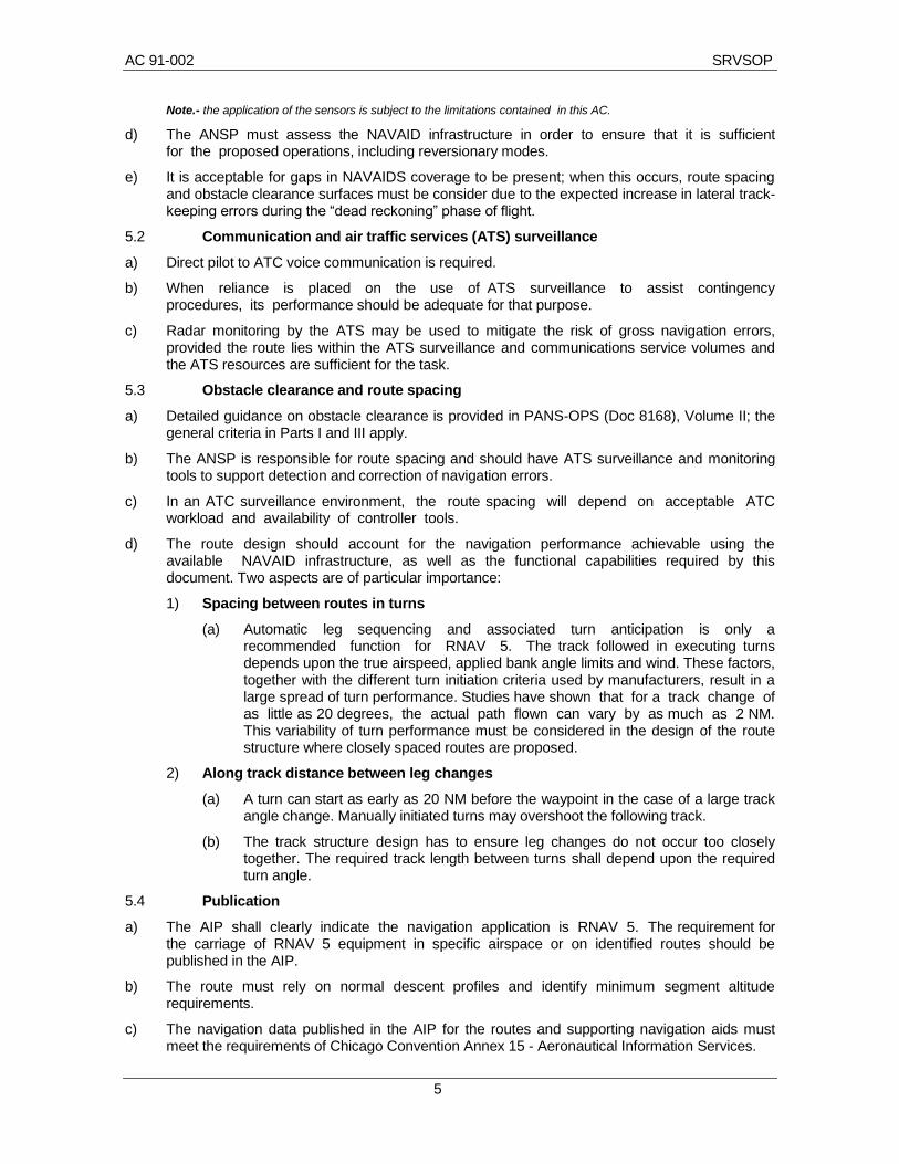
d) The ANSP must assess the NAVAID infrastructure in order to ensure that it is sufficient for the proposed operations, including reversionary modes.
e) It is acceptable for gaps in NAVAIDS coverage to be present; when this occurs, route spacing and obstacle clearance surfaces must be consider due to the expected increase in lateral track-keeping errors during the “dead reckoning” phase of flight.
5.2 Communication and air traffic services (ATS) surveillance
a) Direct pilot to ATC voice communication is required.
b) When reliance is placed on the use of ATS surveillance to assist contingency procedures, its performance should be adequate for that purpose.
c) Radar monitoring by the ATS may be used to mitigate the risk of gross navigation errors, provided the route lies within the ATS surveillance and communications service volumes and the ATS resources are sufficient for the task.
5.3 Obstacle clearance and route spacing
a) Detailed guidance on obstacle clearance is provided in PANS-OPS (Doc 8168), Volume II; the general criteria in Parts I and III apply.
b) The ANSP is responsible for route spacing and should have ATS surveillance and monitoring tools to support detection and correction of navigation errors.
c) In an ATC surveillance environment, the route spacing will depend on acceptable ATC workload and availability of controller tools.
d) The route design should account for the navigation performance achievable using the available NAVAID infrastructure, as well as the functional capabilities required by this document. Two aspects are of particular importance:
1) Spacing between routes in turns
(a) Automatic leg sequencing and associated turn anticipation is only a recommended function for RNAV 5. The track followed in executing turns depends upon the true airspeed, applied bank angle limits and wind. These factors, together with the different turn initiation criteria used by manufacturers, result in a large spread of turn performance. Studies have shown that for a track change of as little as 20 degrees, the actual path flown can vary by as much as 2 NM. This variability of turn performance must be considered in the design of the route structure where closely spaced routes are proposed.
2) Along track distance between leg changes
(a) A turn can start as early as 20 NM before the waypoint in the case of a large track angle change. Manually initiated turns may overshoot the following track.
(b) The track structure design has to ensure leg changes do not occur too closely together. The required track length between turns shall depend upon the required turn angle.
5.4 Publication
a) The AIP shall clearly indicate the navigation application is RNAV 5. The requirement for the carriage of RNAV 5 equipment in specific airspace or on identified routes should be published in the AIP.
b) The route must rely on normal descent profiles and identify minimum segment altitude requirements.
c) The navigation data published in the AIP for the routes and supporting navigation aids must meet the requirements of Chicago Convention Annex 15 - Aeronautical Information Services.

SRVSOP AC 91-002
6
d) All routes must be based upon WGS-84 coordinates.
e) The available NAVAID infrastructure must be clearly designated on all appropriate charts (e.g. GNSS, DME/DME, VOR/DME). Any navigation facilities that are critical to RNAV 5 operations shall be identified in the relevant publications.
f) A navigation database does not form part of the required functionality of RNAV 5. The absence of such a database necessitates manual waypoint entry, which significantly increases the potential for waypoint errors. En-route charts should support gross error checking by the flight crew by publishing fix data for selected waypoints on RNAV 5 routes.
5.5 Additional considerations
a) Many aircraft have the capability to fly a path parallel to, but offset left or right from, the original active route. The purpose of this function is to enable offsets for tactical operations authorized by ATC.
b) In the same way, many aircraft have the capability to execute a holding pattern manoeuvre using their RNAV system; this capability can provide flexibility to ATC in designing RNAV 5 operations.
6. AIRWORTHINESS AND OPERATIONAL APPROVAL
6.1 In order to the operator receives an RNAV 5 authorization, this must comply with two types of approval:
a) Airworthiness approval in charge of the State of registry; (See Art. 31, Chicago Convention, Paragraph 5.2.3 and 8.1.1 of Annex 6, Part I; and
b) Operational approval required by the State of the operator (See Paragraph 4.2.1 and Attachment F of Annex 6 Part I).
6.2 For general aviation operators, the State of registration (See Paragraph 2.5.2.2 of Annex 6 Part II) will submit a Letter of Appointment (LOA) once determined that the aircraft accomplishes all applicable requirements of this document for RNAV 5 operations.
6.3 Compliance with airworthiness requirements by themselves does not constitute the operational approval.
7. AIRWORTHINESS APPROVAL
7.1 Aircraft equipment
a) An aircraft may be considered eligible for an RNAV 5 approval if it is equipped with one or more navigation systems approved and installed in accordance with the guide included in this document.
b) An aircraft capacity to perform RNAV 5 operations can be demonstrated or reached in the following cases
1) First case: Demonstrated capacity in the manufacturing process and declared in the Aircraft flight manual (AFM) or in the AFM supplement or in the Type certificate data sheet (TCDS) or in the Pilot operating handbook (POH).
2) Second case: Capacity reached in-service:
(a) By applying the service bulletin or supplemental type certificate or service letter or equivalent document and inclusion of the supplement in the AFM; or
(b) through aircraft navigation system approval.
7.2 Eligibility based on AFM or AFM supplement or TCDS or POH. To determine eligibility of the aircraft in function of AFM or AFM supplement, TCDS or POH, aircraft RNAV 5 capacity must have been demonstrated in production (aircraft in manufacturing process or new
AC 91-002 SRVSOP
7
construction).
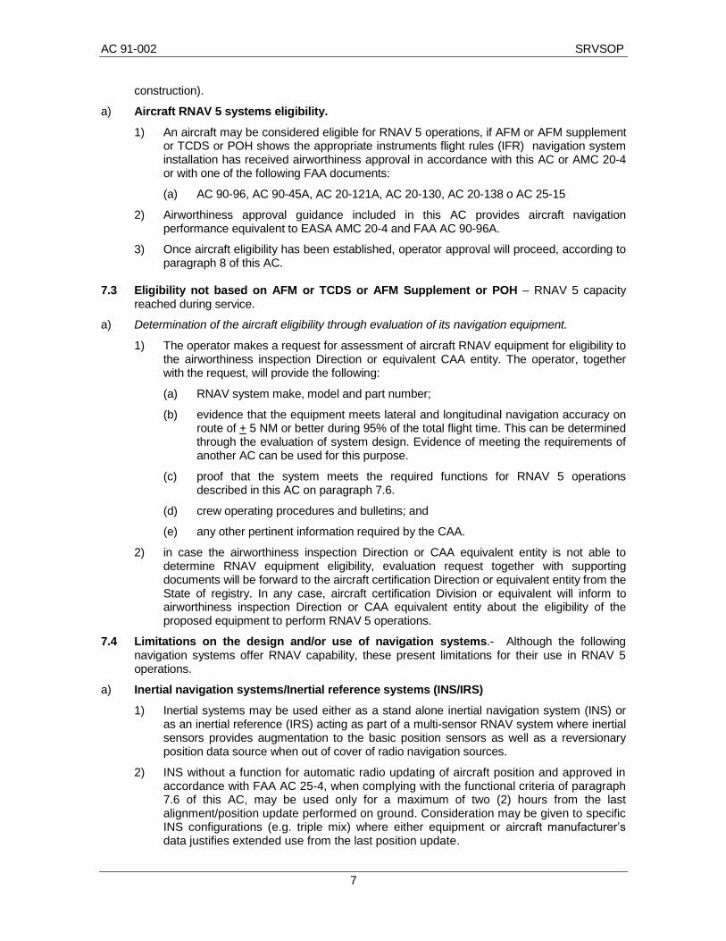
a) Aircraft RNAV 5 systems eligibility.
1) An aircraft may be considered eligible for RNAV 5 operations, if AFM or AFM supplement or TCDS or POH shows the appropriate instruments flight rules (IFR) navigation system installation has received airworthiness approval in accordance with this AC or AMC 20-4 or with one of the following FAA documents:
(a) AC 90-96, AC 90-45A, AC 20-121A, AC 20-130, AC 20-138 o AC 25-15
2) Airworthiness approval guidance included in this AC provides aircraft navigation performance equivalent to EASA AMC 20-4 and FAA AC 90-96A.
3) Once aircraft eligibility has been established, operator approval will proceed, according to paragraph 8 of this AC.
7.3 Eligibility not based on AFM or TCDS or AFM Supplement or POH – RNAV 5 capacity
reached during service.
a) Determination of the aircraft eligibility through evaluation of its navigation equipment.
1) The operator makes a request for assessment of aircraft RNAV equipment for eligibility to the airworthiness inspection Direction or equivalent CAA entity. The operator, together with the request, will provide the following:
(a) RNAV system make, model and part number;
(b) evidence that the equipment meets lateral and longitudinal navigation accuracy on route of + 5 NM or better during 95% of the total flight time. This can be determined through the evaluation of system design. Evidence of meeting the requirements of another AC can be used for this purpose.
(c) proof that the system meets the required functions for RNAV 5 operations described in this AC on paragraph 7.6.
(d) crew operating procedures and bulletins; and
(e) any other pertinent information required by the CAA.
2) in case the airworthiness inspection Direction or CAA equivalent entity is not able to determine RNAV equipment eligibility, evaluation request together with supporting documents will be forward to the aircraft certification Direction or equivalent entity from the State of registry. In any case, aircraft certification Division or equivalent will inform to airworthiness inspection Direction or CAA equivalent entity about the eligibility of the proposed equipment to perform RNAV 5 operations.
7.4 Limitations on the design and/or use of navigation systems.- Although the following navigation systems offer RNAV capability, these present limitations for their use in RNAV 5 operations.
a) Inertial navigation systems/Inertial reference systems (INS/IRS)
1) Inertial systems may be used either as a stand alone inertial navigation system (INS) or as an inertial reference (IRS) acting as part of a multi-sensor RNAV system where inertial sensors provides augmentation to the basic position sensors as well as a reversionary position data source when out of cover of radio navigation sources.
2) INS without a function for automatic radio updating of aircraft position and approved in accordance with FAA AC 25-4, when complying with the functional criteria of paragraph 7.6 of this AC, may be used only for a maximum of two (2) hours from the last alignment/position update performed on ground. Consideration may be given to specific INS configurations (e.g. triple mix) where either equipment or aircraft manufacturer’s data justifies extended use from the last position update.

SRVSOP AC 91-002
8
3) INS without automatic radio updating of aircraft position, including those systems where manual selection of radio channels is performed in accordance with flight crew procedures, must be approved n accordance with FAA AC 90-45A or AC 20-130A or any other equivalent document.
b) VHF omnidirectional radio range (VOR)
1) VOR accuracy can typically meet accuracy requirements for RNAV 5 up to 60 NM from the navigation aid and Doppler VOR up to 75 NM. Specific regions within the VOR coverage may experience larger due to propagation effect (e.g. multipath). Where such errors exist this can be accommodated by prescribing areas where the affected VOR may not be used.
c) Distance measuring equiment (DME)
1) DME signals are considered sufficient to meet requirements of RNAV 5 wherever the signals are received and there is no closer DME on the same channel, regardless of the published coverage volume. Where the RNAV 5 system does not take account of published “Designated operational coverage” of the DME, the RNAV system must execute data integrity checks to confirm that the correct DME signal is being received.
d) Global navigation satellite system (GNSS)
1) Global positioning system (GPS)
(a) The use of GPS to perform RNAV 5 operations is limited to equipment approved in accordance with the TSO-C 129(), TSO-C-145() and TSO-C-146() from FAA or ETSO-129(), ETSO-145() and ETSO-146() from EASA or equivalent documents which include the minimum systems functions specified in the present AC on Paragraph 7.6.
(b) The integrity of GPS system must be provided by the receiver autonomous integrity monitoring (RAIM) or an equivalent means within a multi-sensor navigation system. The equipment must be approved in accordance with the AMC 20-5 or equivalent document. In addition, stand-alone GPS equipment must include the following functions according to the TSO-C 129a or ETSO-129a criteria:
Pseudorange step detection; and
Health word checking
(c) Compliance with these two requirements can be determined the following way:
(1) a statement in the AFM or POH indicating the GPS equipment meets the criteria for primary means of navigation in oceanic and remote airspace; or
(2) a placard on the GPS receiver certifying it meets TSO-C 129 (), TSO-C-145 () and TSO-C-146 () from FAA or ETSO-129 (), ESTO-145 () and ESTO-146 () from EASA; or
(3) a CAA letter of design approval for the applicable equipment. Operators should contact the avionic equipment’s manufacturer to determine if the equipment complies with these requirements and ask if a letter of design approval is available. Manufacturers may obtain this letter by submitting appropriate documentation to the certifications offices of the States of aircraft design or manufacturer. Operators will keep the letter of design approval within the AFM or POH as evidence of the RNAV 5 eligibility..
(d) Traditional navigation equipment (e.g., VOR, DME or automatic direction finder (ADF)) must be installed and operative, so as to provide an alternative navigation means of navigation.
(e) Where approval for RNAV 5 requires the use of traditional navigation equipment as

AC 91-002 SRVSOP
9
a back up in the event of loss of GPS, the required navigation aids as defined in the approval (e.g. VOR, DME or ADF) must be installed and serviceable.
2) Stand-alone GPS equipments
(a) Stand-alone GPS equipments approved in accordance with guidance provided in this AC may be used in RNAV 5 operations, subject to the limitations included in this document. Such equipment must be operated in accordance with procedures acceptable to the CAA. The flight crew must receive appropriate training for use the stand-alone GPS equipment regarding normal and contingency procedures detailed in the Paragraph 9 of this AC.
7.5 RNAV-5 system requirements
a) Accuracy
1) The navigation performance of aircraft approved for RNAV 5 requires a track keeping accuracy equal to or better than + 5 NM during the 95% of the flight time. This value includes signal source error, airborne receiver error, display system error and flight technical error (FTE).
2) This navigation performance assumes the necessary coverage provided by satellite or ground based navigation aids is available for the intended route to be flown.
b) Availability and integrity
The minimum level of availability and integrity required for RNAV 5 systems can be met by a single installed system comprising by:
1) one sensor or a combination of the following sensors: VOR/DME, DME/DME, INS or IRS and GNSS or GPS;
2) RNAV computer;
3) control display unit (CDU); and
4) navigation display(s) [(e.g. navigation display (ND), horizontal situation indicator (HSI) or course indicator deviation (CDI)]provided that the system is monitored by the flight crew and that in the event o a system failure the aircraft retains the capability to navigate relative to ground based navigation aids (e.g. VOR, DME or Non-directional beacon (NDB)).
7.6 Functional requirements
a) Required Functions.- The following system functions are the minimum required to conduct RNAV 5 operations:
1) Continuous indication of the aircraft position relative to track to be displayed to the pilot flying (PF) on a navigation display situated in his primary field of view;
2) In addition, where the minimum flight crew is two pilots, indication of the aircraft position relative to track to be displayed to the pilot not flying (PNF) on a navigation display situated in his primary field of view.
3) Display of distance and bearing to the active (To) waypoint;
4) Display of ground speed or time to active (To) waypoint;
5) Storage of a minimum of 4 waypoints; and
6) Appropriate failure indication of the RNAV system, including the sensors failure.
b) RNAV 5 navigation displays
1) Navigation data must be available for display either on a display forming part of the RNAV equipment or on a lateral deviation display (e.g. CDI, (E)HSI, or a navigation map display).

SRVSOP AC 91-002
10
2) These displays must be used as primary flight instruments for the navigation of the aircraft, for maneuver anticipation and for failure/status/integrity indication. They should meet the following requirements:
(a) The displays must be visible to the pilot when looking forward along the flight path.
(b) The lateral deviation display scaling should be compatible with any alerting and annunciation limits, where implemented.
(c) The lateral deviation display must have a scaling and full-scale deflection suitable
for the RNAV 5 operation.
7.7 Continued airworthiness
a) The operators of aircraft approved to perform RNAV 5 operations, must ensure the continuity of the technical capacity of them, in order to meet technical requirements established in this AC.
b) Each operator who applies for RNAV-5 operational approval shall submit to the CAA of State of registry, a maintenance and inspection program that includes all those requirements of maintenance necessary to ensure that navigation systems continue fulfilling the RNAV 5 approval criteria.
c) The following maintenance documents must be revised, as appropriate, to incorporate RNAV 5 aspects:
1) Maintenance control manual (MCM);
2) Illustrated parts catalogs (IPC); and
3) Maintenance program.
d) The approved maintenance program for the affected aircrafts should include maintenance practices listed in maintenance manuals of the aircraft manufacturer and its components, and must consider:
1) that equipment involved in the RNAV 5 operation should be maintained according to directions given by manufacturer's components;
2) that any amendment or change of navigation system affecting in any way RNAV 5 initial approval, must be forwarded and reviewed by the CAA for its acceptance or approval of such changes prior to its implementation; and
3) that any repair that is not included in the approved/accepted maintenance documentation, and that could affect the integrity of navigation performance, should be forwarded to the CAA for acceptance or approval thereof.
e) Within the RNAV maintenance documentation should be presented the training program of maintenance personnel, which inter alia, should include:
1) PBN concept;
2) RNAV 5 application;
3) equipment involved in a RNAV 5 operation; and
4) MEL use.
8. OPERATIONAL APPROVAL
8.1 Requirements to obtain the operational approval.- To obtain the operational approval, the operator will comply with the following steps considering the operational procedures established in Paragraph 9 of this AC.
a) Airworthiness approval.- The Aircraft must have the corresponding airworthiness approvals as mentioned in Paragraph 7 of this AC.
AC 91-002 SRVSOP
11
b) Documentation.- The operator will present to the CAA the following documents:
1) The application to obtain RNAV 5 authorization;
2) Amendments to the operations manual (OM) which must include operations procedures according to what is described in Paragraph 9 of this AC, for crews and dispatchers, if applicable;
3) Amendments, when applicable, of maintenance manuals and programs which must have the maintenance procedures for the new equipment, as well as the training of the maintenance associated personnel, in accordance with Paragraph 7.7 e);
4) A copy of the AFM parts, or AFM supplement or TCDS or POH, to verify the airworthiness approval for RNAV 5 for each affected aircraft;
5) The amendments to the Minimum Equipment List (MEL), which must identify the minimum necessary equipment to comply with RNAV 5; and
6) Training programs or amendments to the operator’s training program for crews and flight dispatchers, if applicable, according to what is described in Paragraph 10 of this document;
c) Training.- Once the amendments to manuals, programs and documents have been accepted or approved, the operator will provide required training to its personnel.
d) Validation flights.- The CAA may perform a validation flight, if determines it is necessary in the interest of safety.
8.2 Authorization issuance to perform RNAV 5 operations.- Once the operator has successfully completed the operational approval process, the CAA will issue the operator, when applicable, the corresponding authorization to perform RNAV 5 operations.
.
9. OPERATION PROCEDURES
9.1 Flight planning.
a) Before operating on a RNAV 5 route, the operator will ensure that:
1) The aircraft counts on a RNAV 5 approval;
2) The necessary equipment to operate RNAV 5 work correctly and are not degraded;
3) Navigation aids based on space or ground are available;
4) The crews check the contingency procedures.
b) Stand-alone GPS equipment. During the planning phase the following procedures must be accomplish in regards to the stand-alone GPS equipment:
1) An aircraft can depart without further action in the following cases, when:
(a) all satellites are scheduled to be in service; or
(b) one satellite is scheduled to be out of service in case of GPS equipment that includes barometrical altitude.
2) The availability of GPS integrity RAIM shall be confirmed for the intended flight (route and time) through the use of a prediction program either ground-based or incorporated in the on-board system, following the criteria established in Appendix 1, when:
(a) any satellite is scheduled to be out of service; or
(b) more than one satellite is scheduled to be out of service in case of GPS equipment that includes barometric altitude.

SRVSOP AC 91-002
12
3) This prediction is required for any route and route segment RNAV 5 based upon the use of GPS.
4) The specified route of flight, including trajectory to any alternative aerodrome will be defined by a series of waypoints and by the estimated time of pass over them for a speed or series of speed, which at the same time will be in function of the intensity and previous wind direction.
5) Taking in consideration that during flight may occur deviations in regards to the specified ground speedy, prediction must be done using different speeds within the predictable margin for them.
6) Prediction program must be executed with a maximum anticipation of two hours preview to the flight departure. The operator will confirm that data about the state of the constellation and GPS ephemerides, have been updated with the latest information distributed by notice to airmen (NOTAM).
7) In order to get exact prediction, the program will allow manual de-selection of satellites considered non operative, as well as selection of those back to service condition during the flight time.
8) The operator will not dispatch or release a flight in case of continuous prediction loss of RAM higher than 5 minutes to any part of the previewed route. In this event, flight can be delayed, cancelled or re-routed in which RAM requirements may be accomplished.
c) ATS – ICAO flight plan.- At the time to file the ATS flight plan, authorized aircraft operators on RNAV 5 route, will insert corresponding code on flight plan form’s fields 10 and 18, as defined within ICAO Doc 4444 and 7030 for these operations.
9.2 Preview flight procedures at the aircraft.- The crew will perform on the aircraft the following procedures preview to the flight:
a) check registrations and forms to be sure that maintenance actions have been taken in order to correct defects in the equipment; and
b) check data base validation (current AIRAC cycle), if it is installed.
c) route corresponds to the authorization. Flight crews must cross-check the cleared flight plan by comparing charts or other applicable resources with the navigation system textual display and the aircraft map display, taking into account the WPT name, sequencing, heading and distance to the next WPT and the total distance, if applicable. If required (NOTAM, AIP, navigation charts or other resource), the exclusion of specific navigation aids should be confirmed, so as to avoid their inclusion in the position calculation by the navigation system of the aircraft.
9.3 En route operations.
a) The crew will assure the aircraft correct functioning of its navigation system during its operation in a RNAV 5 route, confirming that:
1) necessary RNAV 5 equipment have not degraded during flight;
2) route corresponds to the authorization;
3) aircraft navigation accuracy is pertinent for RNAV 5, assuring this through pertinent cross check;
4) others navigation aids (for example VOR, DME and ADF) must be selected in a way to permit a cross check or immediate reversion in the event of a RNAV capacity loss;
5) For RNAV 5, pilots must use a lateral deviation indicator, flight director or autopilot in lateral navigation mode. Pilots may use a navigation map display as described in Paragraph 7.6 b), without a flight director or autopilot. Pilots of aircraft with a lateral deviation display must ensure that lateral deviation scaling is suitable for the navigation accuracy associated with the route/procedure (e.g. full-scale deflection: ± 5 NM);

AC 91-002 SRVSOP
13
6) All pilots are expected to maintain route centrelines, as depicted by on-board lateral deviation indicators and/or flight guidance, during all RNAV 5 operations, unless authorized to deviate by ATC or under emergency conditions. For normal operations, cross-track error/deviation (the difference between the RNAV system-computed path and the aircraft estimated position relative to that path, FTE) must be limited to ± ½ the navigation accuracy associated with the procedure or route (2.5 NM). Brief deviations from this standard (e.g. overshoots or undershoots) during and immediately after procedure/route turns, up to a maximum of one-times the navigation accuracy (5 NM), are allowable; and
Note.- Some aircraft do not display or compute a path during turns; pilots of these aircraft may not be able to adhere to the ±½ accuracy standard during route turns, but are still expected to satisfy the standard during intercepts of the final track following the turn and on straight segments.
7) If ATS issues a heading assignment taking the aircraft off a route, the pilot must not modify the flight plan in the RNAV system until a clearance is received to rejoin the route or the controller confirms a new clearance. When the aircraft is not on the published route, the specified accuracy requirement does not apply.
9.4 Contingency procedures.
a) Flight crews must familiarize with the following general provisions:
1) An aircraft must not enter or continue the operations in airspace designated as RNAV 5, according to the present ATC authorization, if because of a failure or degradation the navigation systems falls under RNAV 5 requirements, the pilot will obtain as soon as possible an amended authorization;
2) According to ATC instructions, operations will continue in regards to the present ATC authorization, or when not possible, will be requested a revised authorization to return to the VOR/DME conventional navigation;
3) in the event of communications failure, the flight crew must continue with the flight plan, in accordance with the published lost communication procedures; and
4) in any case, the crew must follow contingency procedures established for every operation region, and obtain an ATC authorization as soon as possible.
b) Stand-alone GPS equipment.
1) The operating procedures must identify the flight crew actions required in the event of RAIM function loss or exceedance of integrity alarm limit (erroneous position). This procedures must include:
(a) In case of loss of the RAIM detection function.- The flight crew may continue navigating with the GPS equipment. The flight crew should attempt to cross-check the aircraft position with the information provided for the ICAO conventional navaids: VOR, DME and ADF, in order to confirm the existence of a required level of precision. In other case, the crew must revert to an alternative navigation means;
(b) In the event of an observed failure (including the failure of a satellite impacting the performance of the navigation systems based on GPS), the flight crew must revert to an alternative means of navigation.
(c) In case of exceedance of the alarm limit.- The flight crew must revert to an alternative means of navigation.
2) On-board equipment availability VOR, DME or ADF.- The operator must have installed on the aircraft the VOR, DME or ADF on-board equipment capacity to assure the availability of navigation alternative means in case of a GPS/RNAV system failure.
c) Any incidence registered in flight must be notified to the CAA in a maximum time of seventy two hours, unless justified cause.

SRVSOP AC 91-002
14
10. NAVIGATION ERROR REPORTS FOLLOW UP PROCESS
a) The operator will establish a process to receive, analyze and do a follow up of the navigation error reports which allow determine the appropriate corrective action.
b) Repetitive navigation error occurrences, attributed to a specific part of the navigation equipment must be analyzed in order to correct its cause.
c) The nature and severity of the error may result in temporary withdrawn of the authorization to use the navigation equipment until the cause of the problem has been identified and rectified.
11. TRAINING PROGRAM
a) The training programs for flight crews and flight dispatchers, if correspond, must be reviewed and approved by the CAA. The operator will included at least the following modules:
1) Required equipments, capacities, limitations and operation of these equipments in RNAV 5 airspace.
2) The routes and airspace for which the RNAV system is approved to operate.
3) The NAVAID limitations in respect of the operation of the RNAV system to be used for the RNAV 5 operation.
4) Contingency procedures for RNAV failures.
5) The Radio/Telephony Phraseology for the airspace in accordance to Doc 4444 and Doc 7030 as appropriate.
6) The flight planning requirements for the RNAV operation.
7) RNAV requirements as determined from chart depiction and textual description.
8) RNAV 5 en route procedures;
9) Methods to reduce navigation errors through dead-reckoning techniques.
10) RNAV system-specific information, including:
(a) Levels of automation, mode annunciations, changes, alerts, interactions, reversions, and degradation.
(b) Functional integration with other aircraft systems.
(c) Monitoring procedures for each phase of flight (for example, monitor PROG or LEGS page).
(d) Types of navigation sensors (for example, DME, IRU, GNSS) utilized by the RNAV system and associated system prioritization/weighting/logic.
(e) Turn anticipation with consideration to speed and altitude effects.
(f) Interpretation of electronic displays and symbols.
11) RNAV equipment operating procedures, as applicable, including how to perform the following actions:
(a) Verify currency of aircraft navigation data.
(b) Verify successful completion of RNAV system self-tests.
(c) Initialize RNAV system position.
(d) Fly direct to a waypoint.
(e) Intercept a course/track.
(f) Be vectored off and rejoin a procedure.
AC 91-002 SRVSOP
15
(g) Determine cross-track error/deviation.
(h) Remove and reselect navigation sensor input.
(i) When required, confirm exclusion of a specific navigation aid or navigation aid type.
(j) Perform gross navigation error check using conventional navigation aids.
b) Training program on the GPS as a primary means of navigation.
1) Besides the training modules describe on the previous paragraphs, operators’ training programs which use RNAV systems based on GPS as a primary navigation means will include modules described in Appendix 2.
12. NAVIGATION DATA BASE
Where a navigation database is carried and used, it must be current and appropriate for the region of intended operation and must include the navigation aids and waypoints required for the route.
Note 1.- Navigation databases are expected to be current for the duration of the flight. If the AIRAC cycle is due to change during flight, operators and pilots should establish procedures to ensure the accuracy of the navigation data, including the suitability of navigation facilities used to define the routes for the flight. Traditionally, this has been accomplished by verifying electronic data against paper products.

SRVSOP AC 91-002
16
Appendix 1
GPS integrity monitoring (RAIM) prediction program
Where a GPS integrity monitoring (RAIM) prediction program is used as a means of compliance with the provisions of this document, it should meet the following criteria:
a) The program should provide prediction of availability of the integrity monitoring (RAIM) function of the GPS equipment, suitable for conducting RNAV 5 operations.
b) The prediction program software must be developed in accordance with at least RTCA DO 178B/EUROCAE 12B, Level D guidelines.
c) The program should use either a RAIM algorithm identical to that used in the airborne equipment or an algorithm based on assumptions for RAIM prediction that give a more conservative result.
d) The program should calculate RAIM availability based on a satellite mask angle of not less than 5 degrees, except where use of a lower mask angle has been demonstrated and deemed to be acceptable to the Civil Aviation Authority (CAA).
e) The program should have the capability to manually exclude GPS satellites which have been notified as being out of service for the intended flight.
f) The program should allow the user to select:
1) the intended route and declared alternates; and
2) the time and duration of the intended flight.

AC 91-002 SRVSOP
17
PAGE INTENTIONALLY LEFT BLANK
SRVSOP AC 91-002
18
Appendix 2
Training program on the GPS as a primary means of navigation
The training programs for flight crews that use RNAV 5 systems based on the GPS as a primary means of navigation will include a segment with the following training modules:
a) GPS system components and operating principles.- Understanding of the GPS system and its operating principles:
1) GPS system components: control segment, user segment, and space segment;
2) on-board equipment requirements;
3) GPS satellite signals and pseudo-random code;
4) positioning principle;
5) receiver clock error;
6) masking function;
7) performance limitations of the different types of equipment;
8) WGS84 coordinate system;
b) Navigation system performance requirements.- Define the following terms in relation to the navigation system and evaluate the degree of compliance by the GPS system of the requirements associated with the following terms:
1) precision;
2) integrity;
(a) means to improve GPS integrity: RAIM and fault detection and exclusion (FDE)
3) availability;
4) service continuity
c) Authorizations and documentation.- Requirements applicable to pilots and navigation equipment for GPS operation:
1) pilot training requirements;
2) aircraft equipment requirements;
3) AFM system certification criteria and limitations;
4) GPS-related NOTAMs.
d) GPS system errors and limitations.- Cause and magnitude of typical GPS errors:
1) ephemerides;
2) clock;
3) receiver;
4) atmospheric/ionospheric;
5) multi-reflection;
6) selective availability (SA);
7) total typical error associated to the C/A code;
8) effect of the dilution of precision (DOP) on the position;
9) susceptibility to interference;

AC 91-002 SRVSOP
19
10) comparison of vertical and horizontal errors; and
11) path-tracking precision. Collision avoidance.
e) Human factors and GPS.- Limitations on the use of GPS equipment due to human factors. Operating procedures that offer protection against navigation errors and loss of awareness of the real situation due to the following causes:
1) mode errors;
2) data entry errors;
3) data checks and validation, including independent cross-checking procedures;
4) automation-induced relaxation;
5) lack of standardization of GPS equipment;
6) information processing by humans and situational awareness.
f) GPS equipment – Specific navigation procedures.- Knowledge of the appropriate operating procedures for GPS in the typical navigation tasks for each specific type of equipment in each type of aircraft that includes:
1) selection of the appropriate operating mode;
2) review of the different types of information contained in the navigation database;
3) forecast of the availability of the RAIM function;
4) procedure for entering and checking the waypoints defined by the user;
5) procedure for entering, retrieving and checking flight plan data;
6) interpretation of the typical information shown on the GPS navigation display: LAT/LONG, distance and heading to the waypoint, CDI;
7) interception and maintenance of the GPS-defined routes;
8) in-flight determination of ground speed (GS), estimated time of arrival (ETA), time and distance to the waypoint;
9) indication of waypoints over flight;
10) use of the “DIRECT TO” function;
11) use of the “NEAREST AIRPORT” function;
12) use of the GPS in GPS or DME/GPS arrival procedures.
g) Verification of GPS equipment.- For each type of equipment in each aircraft, the following operational and start-up checks must be conducted at the appropriate time:
1) constellation status;
2) RAIM and FDE functional status;
3) dilution of precision (DOP) status;
4) currency of the instrument flight rules (IFR) database;
5) receiver operating condition;
6) CDI sensitivity;
7) position indication.
h) GPS messages and warnings.- For each type of equipment in each aircraft, timely action must be recognized and taken in face of GPS messages and warnings, including the following:
1) loss of RAIM function;

SRVSOP AC 91-002
20
2) 2D/3D navigation;
3) dead-reckoning navigation mode;
4) database not updated;
5) loss of the database;
6) GPS equipment failure;
7) barometric data entry failure;
8) power failure;
9) prolonged parallel displacement; and
10) satellite failure.

AC 91-002 SRVSOP
21
PAGE INTENTIONALLY LEFT BLANK
SRVSOP AC 91-002
22
Appendix 3
RNAV 5 approval process a) The RNAV 5 approval process is comprised of two types of approvals: the airworthiness
approval and the operational approval, even though, they have different requirements, both must be considered under one process only.
b) This process constitutes a well-arrange method, which is used by the CAA to ensure the
applicants comply with the established requirements. c) The approval process is conformed by the following phases:
1) Phase one: Pre-application
2) Phase two: Formal application
3) Phase three: Analysis of the documentation
4) Phase four: Demonstration and inspection
5) Phase five: Approval
d) In Phase One - Pre-aplication, the CAA holds a meeting with the operator (the pre-aplication meeting), in which the operator will be informed about all the requirements that he needs to comply during the approval process.
e) In Phase Two - Formal application, the operator submits the formal application with all applicable documents.
f) In Phase Three - Analysis of the documentation, the CAA reviews the submission and evaluates the navigation equipment in order to determine the method of approval (aircraft equipment eligibility). As a result of this evaluation the CAA may accept or return the Formal Application with the documentation.
g) In Phase Four - Demonstration and inspection, the operator will accomplish the training program and the validation flight if this is required by the CAA, otherwise the process will advance to the next phase.
h) In phase Five - Approval, the CAA issues the RNAV 5 authorization, once the operator has completed the airworthiness and operations requirements..

AC 91-002 SRVSOP
23
PAGE INTENTIONALLY LEFT BLANK