christine tombleson ccrm june 5, 2015
TRANSCRIPT
Christine Tombleson CCRM
June 5, 2015

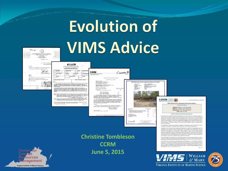
Evolution of the VIMS Report
Since the passage of the Tidal Wetlands Act in 1972 • The VIMS Report has been the primary source of environmental
input to the tidal wetlands decision-making process • Implemented by local wetland boards, VMRC, DEQ & others
permitting agencies
Is a history of how VIMS guidance has been delivered at the individual Joint Permit Application (JPA) (or shoreline project) scale over time.

Evolution of the VIMS Report
1970’s _____________________________________________ 2015

Evolution of the VIMS Report
1970’s
1980’s
1990’s

2001
Bulkhead (ft) 64 _____Impact Sand/Mud Mixed Flat Community (Type XV) (ft2) 30 _____Fill Sand/Mud Mixed Flat Community (Type XV) (ft2) 30 _____
Bulkhead Replacement (ft) 22 _____Impact Sand/Mud Mixed Flat Community (Type XV) (ft2) 44 _____Fill Sand/Mud Mixed Flat Community (Type XV) (ft2) 44 _____
Riprap (ft) 202 _____Impact Sand/Mud Mixed Flat Community (Type XV) (ft2) 1212 _____Fill Sand/Mud Mixed Flat Community (Type XV) (ft2) 606 _____
To Wetlands Board: Please indicate Wetlands Board action on this sheet and return to VIMS
Application Number: 01-0048
Name: Abbott, Thomas F. & Roberta S.
Locality: Lancaster County
Waterway: Moran Creek
Please check here if this application was approved as proposed ____
Complete the form below if the application was modified.
ACTIVITIES___________
PROPOSED PERMITTED__________ ___________
Comments: __________________________________________________________________________________
__________________________________________________________________________________
__________________________________________________________________________________
__________________________________________________________________________________
__________________________________________________________________________________
Certified by: __________________________________________
Virginia Institu te of Marine S cience
School of M arine S cience
P.O. B ox 1346, R oute 1208 G re ate Road
Glouce ster Point, Virgini a 23062-1346
phone: (804)684-7380, fax: (804)684-7179, e-m ail: wetlands@ vims .edu
VIMS Shoreline Permit Application Report # 01-0048
4
#S
Permit Site Study Area
Lancas ter County
RAPPAHANNOCK RIVER
Moran Creek
Open w ater
Roads
Primary
Sec ondary
Tertia ry
Tida l Marsh Inventory - T M I
Arrow Arum -Pick ere lw eed
Big C ordgras s
Black Needlerush
Brack is h W ater Mixed
Catta il
Fres hwater Mixed
Reed Grass
Sal tbush
Sal tm eadow
Sal tm ars h Cordgrass
Yel low Pond L i ly
Pro jec t si te
#S
N
0 0.5 1 Miles
VIMS Shoreline Permit Application Report # 01-0048
3
CH O W A N RIV E R
Y O RK R IV E R
RA P PA H A N N O C K
R IV E R
M ID D LE JA ME S
R IV E R (P IE D MO N T )
L O W E R
PO T O M A C
RI V E R
A PP O MA T T O X RIV E R
U P PE R
P O T O M A C RIV E R/
SH E N A N D O A H
RIV E R
A T L A N T IC
O CE A N
C O A ST A L -
EA S T E RN SH O R E
EA S T E RN SH O R E
B A Y SID E
SO U T H E RN BA Y S H O RE
PE N IN SU LA BA Y S H O RE
MID D L E P E N IN SU L A
BA Y S H O RE
N O RT H E RN N E CK
BA Y S H O RE
LO W E R JA M E S R IV E R
(T ID A L )
A T L A N T IC
O CE A N
C O A ST A L -
V IRG IN IA BE A C H
RAPPAHANNOCK RIVER Watershed
-- La nca ster County
-- Wat ersheds
-- RA PP AH A N NO CK RIV ER Wa tershe d
#S
P ermit s ite st udy area shown on next page
H ydrology
H ydrologic unit s
Lancaste r C ounty
#S P ermit s ite
Lancaster County
Total Permitted Wetlands Loss by Type forRAPPAHANNOCK RIVER : 1996-1999
Com munity Type______________ Extent_____
Vegetated We tlands 45039 ft2
Non-Vegetated W etlands 282442 ft 2
Subaqueous Bottom 82456 ft2
Total Permitted Wetlands Loss by Type forLancaster County : 1996-1999
Com munity Type______________ Extent_____
Vegetated We tlands 24226 ft2
Non-Vegetated W etlands 164096 ft 2
Subaqueous Bottom 213244 ft 2
Total Proposed Shoreline Structures and Activities forLancaster County -- 1996-1999
Struc ture Type____________ Extent_____
Boat R amps 3314 ft2
Boat R amps 3 Openpile
Boat Slips 9
Breakwater 505 ft
Bulkhe ad 3039 ft
Com mercial S tructure 13712 ft2
Genera l Fill 252805 ft 2
Groins 69
Groins 3493 ft
Bulkhe ad Toe Protection 1604 ft
Bulkhe ad R eplacem ent 1495 ft
Beach Nouri shme nt 7250 ft2
Beach Nouri shme nt 225 ft
New Dredging 10681 yd3
Maintena nce dredging 20158 yd3
Riprap 37228 ft
Subm arine Cross ings 13136 ft
Hydrol ogic units represent sm aller, isolated watersheds defined by t opography
and flow directi on. These units can be thought of as i nsul ated ec osys tems or
landscapes within which resources can be managed a t a l arger scal e. The
cum ulative impact of a project to resources within a hydrologic unit m ay be
signi fic antl y grea ter than the impact to the large r wat ershed above.
VIMS Shoreline Permit Application Report # 01-0048
2
ATTENTION
This assessment is based on biological, chemical, geological, and physical factors affecting the marine
environment at and in the vicinity of the proposed activity. Parameters of the marine environment which may
influence recreational, commercial, or industrial activities which are dependent on the marine environment
are also considered where applicable.
The Virginia Institute of Marine Science (VIMS) is aware that regulatory or administrative bodies who weigh
the overall potential public and private benefits and detriments in arriving at decisions must also consider
other factors such as economics, aesthetics, zoning, or community desires.INFORM ATION PR OVIDED IN
THIS REPOR T IS, THEREFORE, ONLY THE EN VIRONM ENTAL AND M ARINE RESOU RCES INPU T INTO
THE DECISION MAKING PR OCESS.
Comments:
The individual and cumulative adverse impacts resulting from this activity will be minimal if the bulkheads
and riprap are constructed as proposed. Erosion and sediment control measures may be needed until the
new terraced bank is stabilized to prevent siltation into the adjacent waterway.
Virginia Institu te of Marine S cience
School of M arine S cience
P.O. B ox 1346, R oute 1208 G re ate Road
Glouce ster Point, Virgini a 23062-1346
phone: (804)684-7380, fax: (804)684-7179, e-m ail: wetlands@ vims .edu
VIMS Shoreline Permit Application Report #
APPLICANT:Immediate Waterway:Locality:Purpose:Application Type:Site Inspection:Report Date:
01-0048
ABBOTT, THOMAS F. & ROBERTA S.Moran CreekLANCASTER COUNTYErosion ControlWetlands1/30/012/7/01
Type of A ctivity Proposed Extent
Bulkhead (ft) 64Impact Sand/Mud Mixed Flat Community (Type XV) (ft2) 30Fill Sand/Mud Mixed Flat Community (Type XV) (ft2) 30
Bulkhead Replacement (ft) 22Impact Sand/Mud Mixed Flat Community (Type XV) (ft2) 44Fill Sand/Mud Mixed Flat Community (Type XV) (ft2) 44
Riprap (ft) 202Impact Sand/Mud Mixed Flat Community (Type XV) (ft2) 1212Fill Sand/Mud Mixed Flat Community (Type XV) (ft2) 606
Total Impacts (ft2) 1286Total Impacts (Wetlands) 1286Total Impacts (Subaqueous) 0Total Impacts (Beach/Dune) 0
Total Fill (ft2) 680
#S
Lanc a ster C o un ty
Project Location
•Color GIS Maps
•Digital Photographs
•Wetland Impact Areas
•Advisory Comments
•Watershed Information
•Cumulative Impacts
•Electronic Distribution
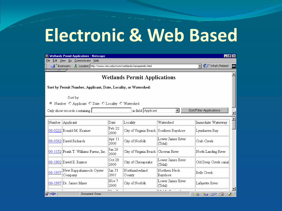
Electronic & Web Based

GPS Coordinates
GPS – Each project location linked to resource
and shoreline inventories in a GIS database

Watershed Perspective VIMS Shoreline Permit Application Report # 01-0048
3
CH O W A N RIV E R
Y O RK R IV E R
RA P PA H A N N O C K
R IV E R
M ID D LE JA ME S
R IV E R (P IE D MO N T )
L O W E R
PO T O M A C
RI V E R
A PP O MA T T O X RIV E R
U P PE R
P O T O M A C RIV E R/
SH E N A N D O A H
RIV E R
A T L A N T IC
O CE A N
C O A ST A L -
EA S T E RN SH O R E
EA S T E RN SH O R E
B A Y SID E
SO U T H E RN BA Y S H O RE
PE N IN SU LA BA Y S H O RE
MID D L E P E N IN SU L A
BA Y S H O RE
N O RT H E RN N E CK
BA Y S H O RE
LO W E R JA M E S R IV E R
(T ID A L )
A T L A N T IC
O CE A N
C O A ST A L -
V IRG IN IA BE A C H
RAPPAHANNOCK RIVER Watershed
-- La nca ster County
-- Wat ersheds
-- RA PP AH A N NO CK RIV ER Wa tershe d
#S
P ermit s ite st udy area shown on next page
H ydrology
H ydrologic unit s
Lancaste r C ounty
#S P ermit s ite
Lancaster County
Total Permitted Wetlands Loss by Type forRAPPAHANNOCK RIVER : 1996-1999
Com munity Type______________ Extent_____
Vegetated We tlands 45039 ft2
Non-Vegetated W etlands 282442 ft 2
Subaqueous Bottom 82456 ft2
Total Permitted Wetlands Loss by Type forLancaster County : 1996-1999
Com munity Type______________ Extent_____
Vegetated We tlands 24226 ft2
Non-Vegetated W etlands 164096 ft 2
Subaqueous Bottom 213244 ft 2
Total Proposed Shoreline Structures and Activities forLancaster County -- 1996-1999
Struc ture Type____________ Extent_____
Boat R amps 3314 ft2
Boat R amps 3 Openpile
Boat Slips 9
Breakwater 505 ft
Bulkhe ad 3039 ft
Com mercial S tructure 13712 ft2
Genera l Fill 252805 ft 2
Groins 69
Groins 3493 ft
Bulkhe ad Toe Protection 1604 ft
Bulkhe ad R eplacem ent 1495 ft
Beach Nouri shme nt 7250 ft2
Beach Nouri shme nt 225 ft
New Dredging 10681 yd3
Maintena nce dredging 20158 yd3
Riprap 37228 ft
Subm arine Cross ings 13136 ft
Hydrol ogic units represent sm aller, isolated watersheds defined by t opography
and flow directi on. These units can be thought of as i nsul ated ec osys tems or
landscapes within which resources can be managed a t a l arger scal e. The
cum ulative impact of a project to resources within a hydrologic unit m ay be
signi fic antl y grea ter than the impact to the large r wat ershed above.
Tidal wetland information was presented on a watershed level • to encourage consideration
of the watershed perspective in the tidal wetland permitting process.

Cumulative Impacts VIMS Shoreline Permit Application Report # 01-0048
3
CH O W A N RIV E R
Y O RK R IV E R
RA P PA H A N N O C K
R IV E R
M ID D LE JA ME S
R IV E R (P IE D MO N T )
L O W E R
PO T O M A C
RI V E R
A PP O MA T T O X RIV E R
U P PE R
P O T O M A C RIV E R/
SH E N A N D O A H
RIV E R
A T L A N T IC
O CE A N
C O A ST A L -
EA S T E RN SH O R E
EA S T E RN SH O R E
B A Y SID E
SO U T H E RN BA Y S H O RE
PE N IN SU LA BA Y S H O RE
MID D L E P E N IN SU L A
BA Y S H O RE
N O RT H E RN N E CK
BA Y S H O RE
LO W E R JA M E S R IV E R
(T ID A L )
A T L A N T IC
O CE A N
C O A ST A L -
V IRG IN IA BE A C H
RAPPAHANNOCK RIVER Watershed
-- La nca ster County
-- Wat ersheds
-- RA PP AH A N NO CK RIV ER Wa tershe d
#S
P ermit s ite st udy area shown on next page
H ydrology
H ydrologic unit s
Lancaste r C ounty
#S P ermit s ite
Lancaster County
Total Permitted Wetlands Loss by Type forRAPPAHANNOCK RIVER : 1996-1999
Com munity Type______________ Extent_____
Vegetated We tlands 45039 ft2
Non-Vegetated W etlands 282442 ft 2
Subaqueous Bottom 82456 ft2
Total Permitted Wetlands Loss by Type forLancaster County : 1996-1999
Com munity Type______________ Extent_____
Vegetated We tlands 24226 ft2
Non-Vegetated W etlands 164096 ft 2
Subaqueous Bottom 213244 ft 2
Total Proposed Shoreline Structures and Activities forLancaster County -- 1996-1999
Struc ture Type____________ Extent_____
Boat R amps 3314 ft2
Boat R amps 3 Openpile
Boat Slips 9
Breakwater 505 ft
Bulkhe ad 3039 ft
Com mercial S tructure 13712 ft2
Genera l Fill 252805 ft 2
Groins 69
Groins 3493 ft
Bulkhe ad Toe Protection 1604 ft
Bulkhe ad R eplacem ent 1495 ft
Beach Nouri shme nt 7250 ft2
Beach Nouri shme nt 225 ft
New Dredging 10681 yd3
Maintena nce dredging 20158 yd3
Riprap 37228 ft
Subm arine Cross ings 13136 ft
Hydrol ogic units represent sm aller, isolated watersheds defined by t opography
and flow directi on. These units can be thought of as i nsul ated ec osys tems or
landscapes within which resources can be managed a t a l arger scal e. The
cum ulative impact of a project to resources within a hydrologic unit m ay be
signi fic antl y grea ter than the impact to the large r wat ershed above.
Total permitted wetland losses listed by: • Locality • Watershed • To encourage consideration of
cumulative impacts in the decision making process

Adaptations of the New VIMS Report
Modernized shoreline assessment methods
Updated tidal wetlands database impacts
Encouraged consideration of
watershed perspective
cumulative impacts
Reduced administrative time and paperwork
Provided a foundation for future online permit review process
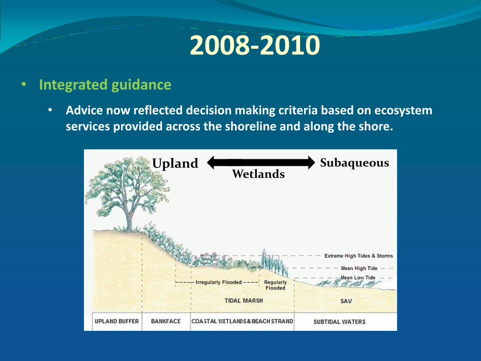
2008-2010 • Integrated guidance
• Advice now reflected decision making criteria based on ecosystem services provided across the shoreline and along the shore.
Upland Wetlands
Subaqueous

2008-2010 • Standardized comments
•Alternatives analysis & Recommendations
•Efficiency and consistency
• Preferred Approach Provided • Based on Decision Tree Tool

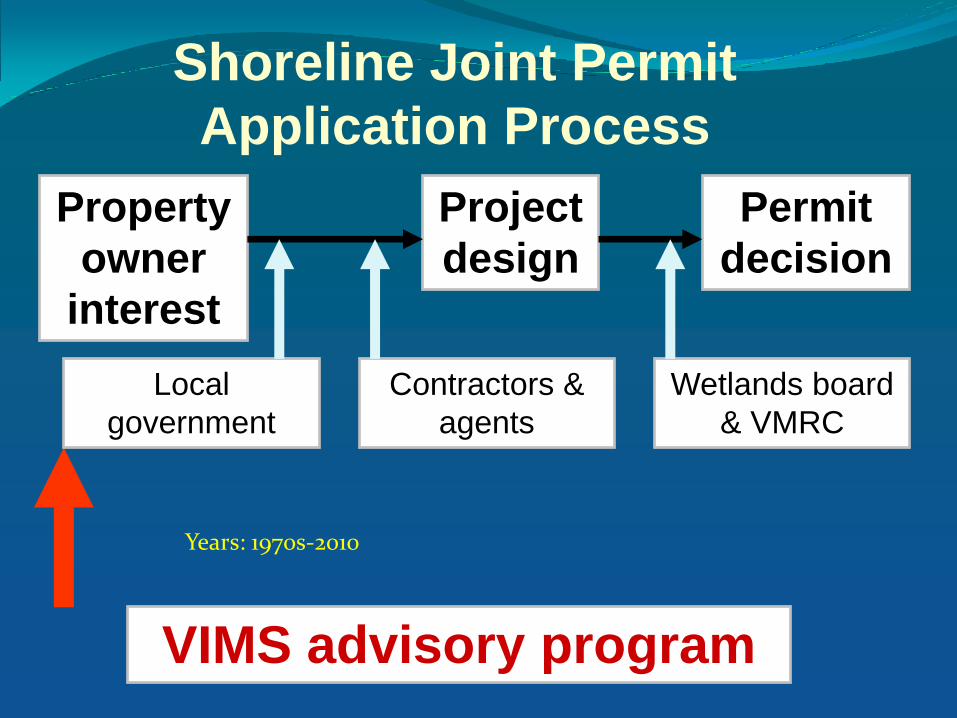
Wetlands board
& VMRC
Property
owner
interest
Project
design
Permit
decision
Shoreline Joint Permit
Application Process
VIMS advisory program
Contractors &
agents
Local
government
rep
ort
s
Years: 1970s-2010
Wetlands board
& VMRC
Property
owner
interest
Project
design
Permit
decision
Shoreline Joint Permit
Application Process
VIMS advisory program
Contractors &
agents
Local
government
Years: 1970s-2010
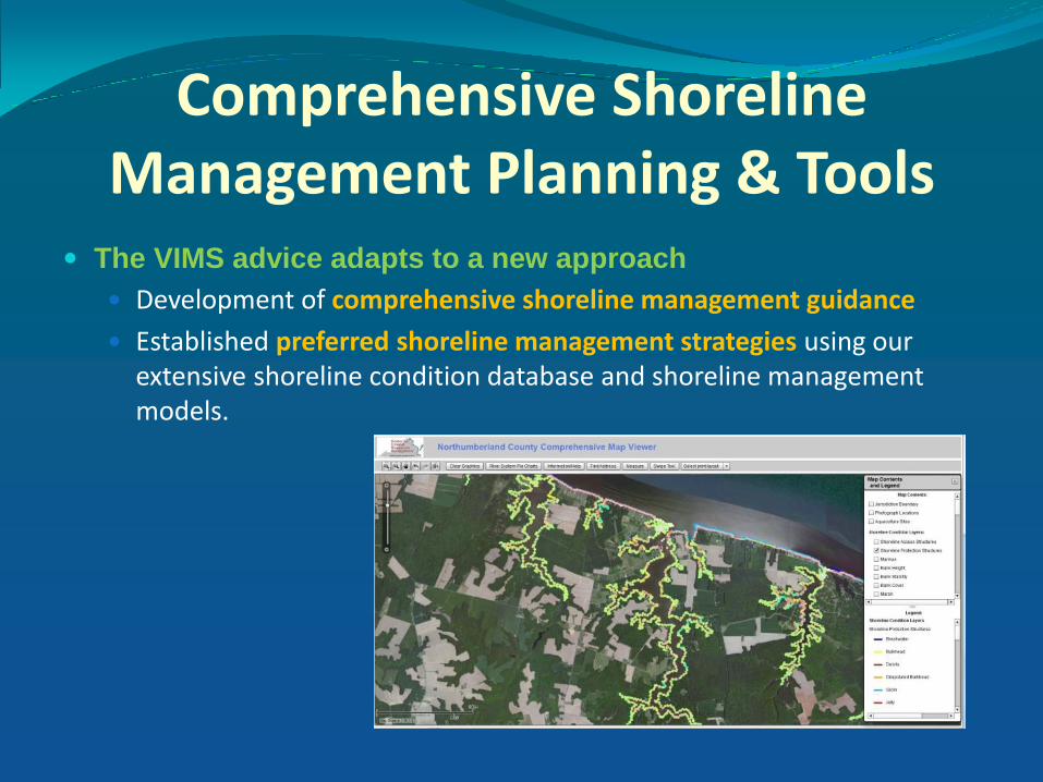
Comprehensive Shoreline Management Planning & Tools
The VIMS advice adapts to a new approach
Development of comprehensive shoreline management guidance
Established preferred shoreline management strategies using our extensive shoreline condition database and shoreline management models.

Goals of
• VIMS Comprehensive Coastal Resource Management Guidance
• Preferred shoreline management strategies Are to:
• Facilitate
• integrated shoreline management
• to maintain & preserve ecosystem services
• Promote resource sustainability
• using living shoreline designs where appropriate
• to provide erosion control
• applying traditional shoreline hardening only in areas where they are necessary

2015 – The “NEW” VIMS REPORT
• Preferred shoreline management strategies recommendations
• based on broad ecosystem viewpoint
• Not necessarily specifically detailed to individual parcels

2015 – The “NEW” VIMS REPORT
But the VIMS Report is still delivered at the end of the process?
These tools are available to anyone involved in the process
• Property Owner, Contractor, Staff, Wetlands Board Members
Using new generation of shoreline and tidal marsh inventory updates, GIS tools, geo-spatial models, decision trees, and other tools
Preferred shoreline management strategies are determined:

CCRMP Map Viewer

Shoreline Assessment Mapper

Decision Trees

Google Earth

2015
Advice provided in new reports is based on:
• The natural resources and physical characteristics of the shoreline
• obtained from the data tools
• VIMS Comprehensive Coastal Resource Management Guidance
Advice is not dependent upon the project being proposed

Objectives of the VIMS report/advice today…
Help decision makers steer in a different direction…
Not to get caught up with what is proposed!
Consider and evaluate sustainable shoreline alternatives
Focus on what is good for the resource
…why is this important?

In spite of over 40 years of advisory reports at the project
(JPA) level:
• Feedback gained from tracking final wetland board permit decisions has shown…

The majority of past and present decisions have resulted in
shoreline hardening…

Miles of Shoreline Hardening: Shoreline Inventory
0
20
40
60
80
100
120
140
Mil
es
Locality
Hardened Shoreline
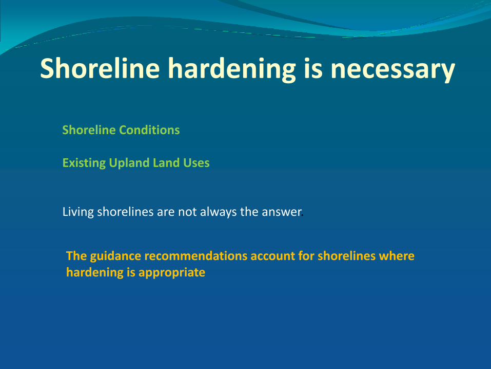
Shoreline hardening is necessary
Shoreline Conditions Existing Upland Land Uses
Living shorelines are not always the answer.
The guidance recommendations account for shorelines where hardening is appropriate

Miles of Shoreline Hardening: Shoreline Inventory vs. Guidance
0
20
40
60
80
100
120
140
Mil
es
Locality
Hardened Shoreline
Guidance IndicatesHardening Appropriate

If shorelines continue to be hardened …
What will be the future of Virginia’s:
Natural resources, habitats, and other ecosystem services along our tidal shorelines?
AND
The ability of communities to sustain in the face of sea level rise?
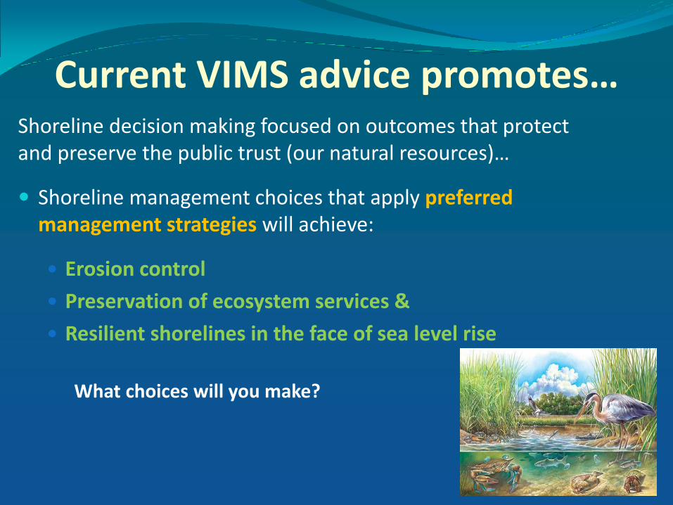
Current VIMS advice promotes…
Shoreline decision making focused on outcomes that protect and preserve the public trust (our natural resources)…
Shoreline management choices that apply preferred management strategies will achieve:
Erosion control
Preservation of ecosystem services &
Resilient shorelines in the face of sea level rise
What choices will you make?

Christine Tombleson CCRM (804)-684-7912 [email protected]