characteristics of headwater streams and considerations for stream restoration on hollow fills in...
TRANSCRIPT
Characteristics Characteristics of Headwater of Headwater Streams and Streams and
Considerations Considerations for Stream for Stream
Restoration on Restoration on Hollow Fills Hollow Fills
in in Eastern Eastern
KentuckyKentuckyThe Stream The Stream
InstituteInstituteUniversity of University of
LouisvilleLouisville
Art ParolaArt ParolaCivil & Environmental Civil & Environmental
[email protected]@louisville.edu
STREAM
INSTITUTE
Sponsors and Sponsors and AcknowledgementAcknowledgement
EPA 319 and Kentucky Division of EPA 319 and Kentucky Division of WaterWater Regional Stream Assessment of Headwater Regional Stream Assessment of Headwater
StreamsStreams Margi Jones – 319 Project ManagerMargi Jones – 319 Project Manager
EPA 401 Wetlands Grant and EPA 401 Wetlands Grant and Kentucky Division of WaterKentucky Division of Water Evaluation of Stream RestorationsEvaluation of Stream Restorations John Dovak and Jennifer Garland, supervisors, John Dovak and Jennifer Garland, supervisors,
Water Quality Certification Section, Kentucky Water Quality Certification Section, Kentucky Division of WaterDivision of Water
Assistance also provided by Kentucky Assistance also provided by Kentucky Department for Natural ResourcesDepartment for Natural Resources Jennifer Thompson and Mark CarewJennifer Thompson and Mark Carew
STREAM
INSTITUTE
AcknowledgementAcknowledgementULSI StaffULSI Staff
Jeffery Jack, Ph.D. – Associate Professor, Jeffery Jack, Ph.D. – Associate Professor, Biology Department, University of LouisvilleBiology Department, University of Louisville
Michael Croasdaile, Ph.D. - Research AssociateMichael Croasdaile, Ph.D. - Research Associate William S. Vesely, Research Project EngineerWilliam S. Vesely, Research Project Engineer Ben Mater – Graduate StudentBen Mater – Graduate Student Chandra Hansen – Technical Research WriterChandra Hansen – Technical Research Writer Dana S K Jackman, M.S. - Program CoordinatorDana S K Jackman, M.S. - Program Coordinator
STREAM
INSTITUTE
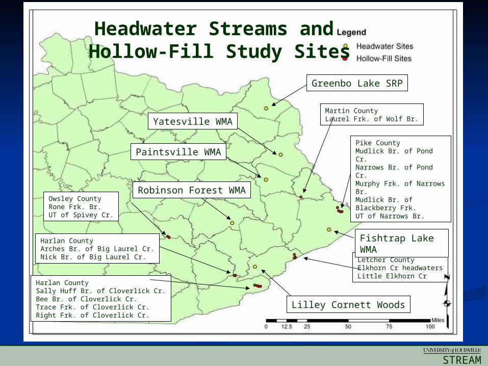
Headwater Streams and Hollow-Fill Study Sites
Greenbo Lake SRP
Yatesville WMA
Paintsville WMA
Robinson Forest WMA
Lilley Cornett Woods
Pike CountyMudlick Br. of Pond Cr. Narrows Br. of Pond Cr. Murphy Frk. of Narrows Br. Mudlick Br. of Blackberry Frk. UT of Narrows Br.
Letcher CountyElkhorn Cr headwatersLittle Elkhorn Cr
Harlan CountyArches Br. of Big Laurel Cr.Nick Br. of Big Laurel Cr.
Owsley CountyRone Frk. Br.UT of Spivey Cr.
Fishtrap Lake WMA
Martin CountyLaurel Frk. of Wolf Br.
Harlan CountySally Huff Br. of Cloverlick Cr.Bee Br. of Cloverlick Cr.Trace Frk. of Cloverlick Cr.Right Frk. of Cloverlick Cr.
STREAM
INSTITUTE
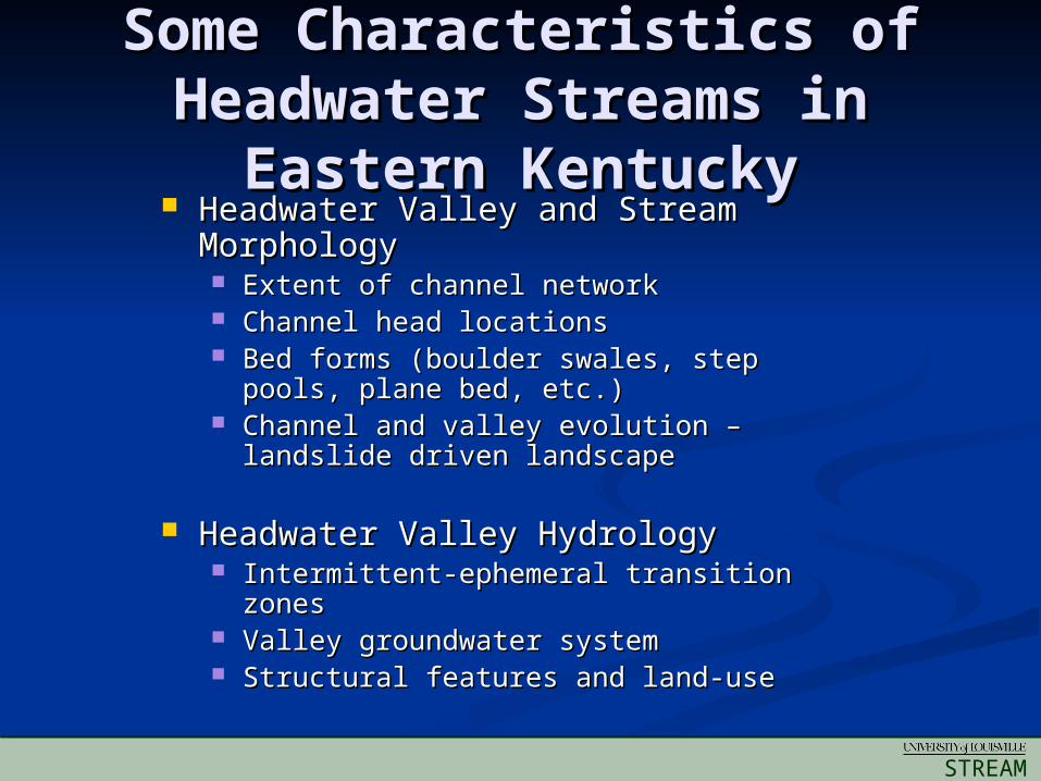
Some Characteristics of Some Characteristics of Headwater Streams in Headwater Streams in
Eastern KentuckyEastern Kentucky Headwater Valley and Stream Headwater Valley and Stream
MorphologyMorphology Extent of channel networkExtent of channel network Channel head locationsChannel head locations Bed forms (boulder swales, step pools, Bed forms (boulder swales, step pools,
plane bed, etc.)plane bed, etc.) Channel and valley evolution – landslide Channel and valley evolution – landslide
driven landscapedriven landscape
Headwater Valley HydrologyHeadwater Valley Hydrology Intermittent-ephemeral transition zonesIntermittent-ephemeral transition zones Valley groundwater systemValley groundwater system Structural features and land-useStructural features and land-use
STREAM
INSTITUTE
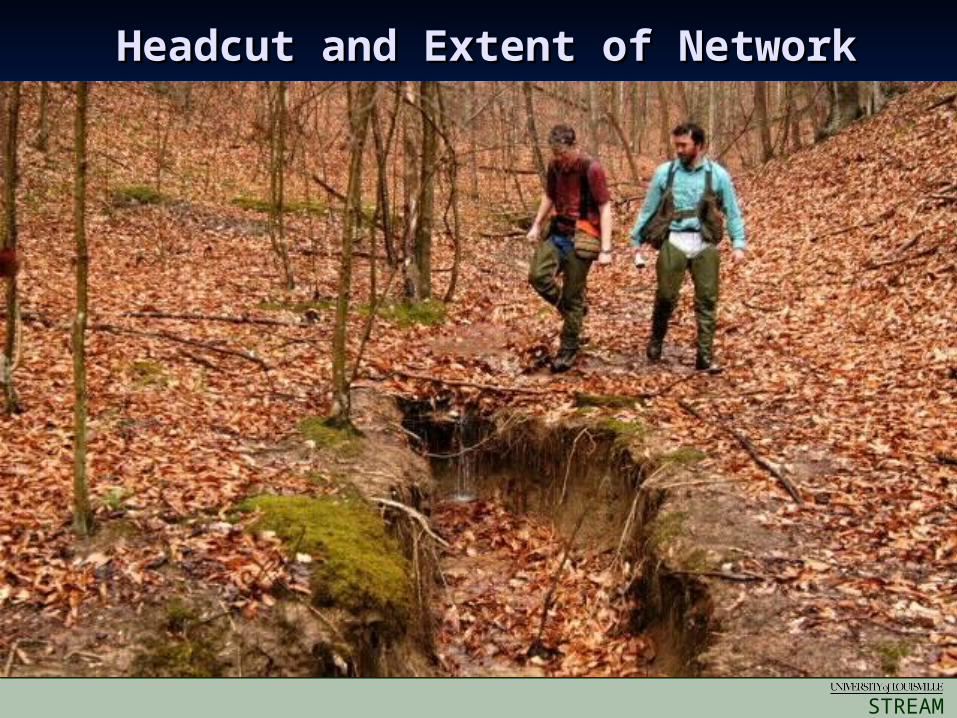
Headcut and Extent of NetworkHeadcut and Extent of Network
STREAM
INSTITUTE
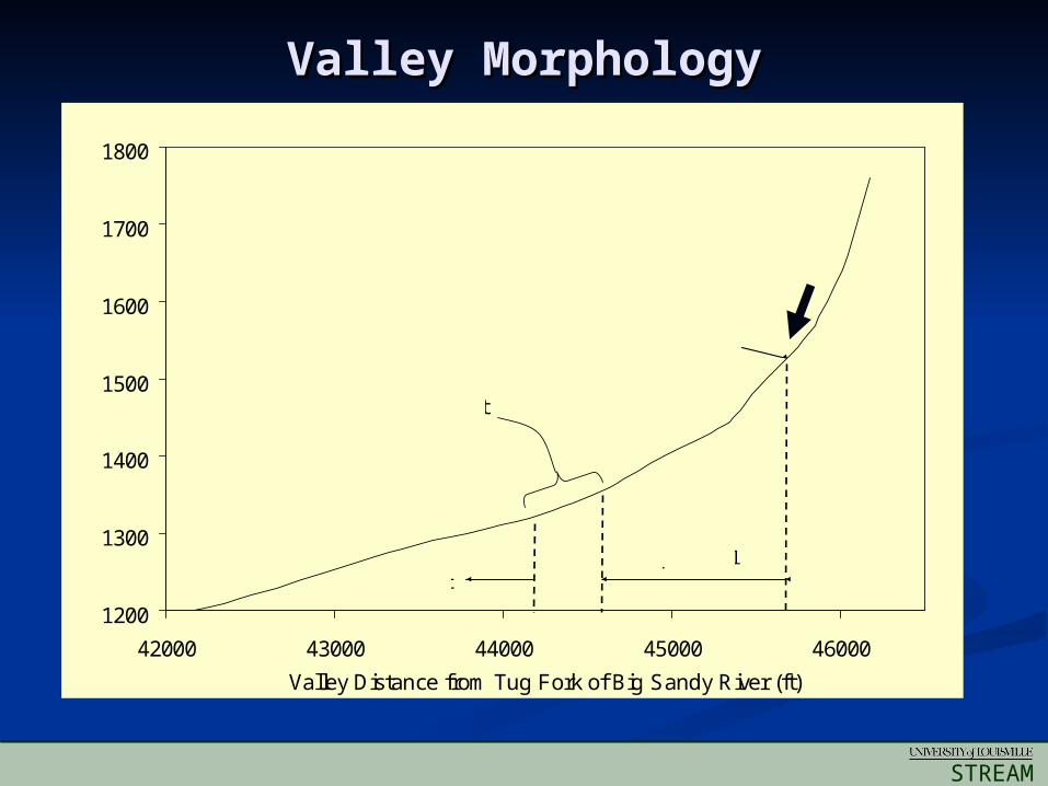
Valley MorphologyValley Morphology
1200
1300
1400
1500
1600
1700
1800
42000 43000 44000 45000 46000
Valley Distance from Tug Fork of Big Sandy River (ft)
IntermittentEphemeral
Landslide Debris and Soil
Ele
vatio
n (f
t)
Ephemeral-intermittent transition zone
Channel head
STREAM
INSTITUTE
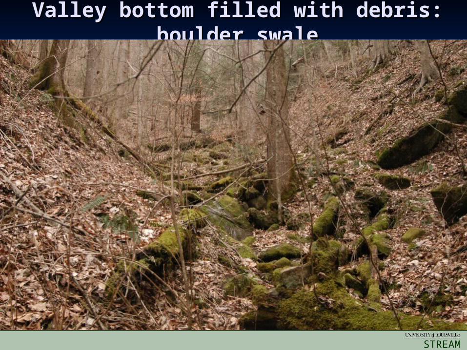
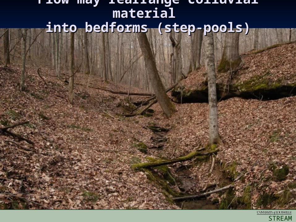
Valley bottom filled with debris: Valley bottom filled with debris: boulder swaleboulder swale
STREAM
INSTITUTE
Flow may rearrange colluvial material Flow may rearrange colluvial material into bedforms (step-pools)into bedforms (step-pools)
STREAM
INSTITUTE
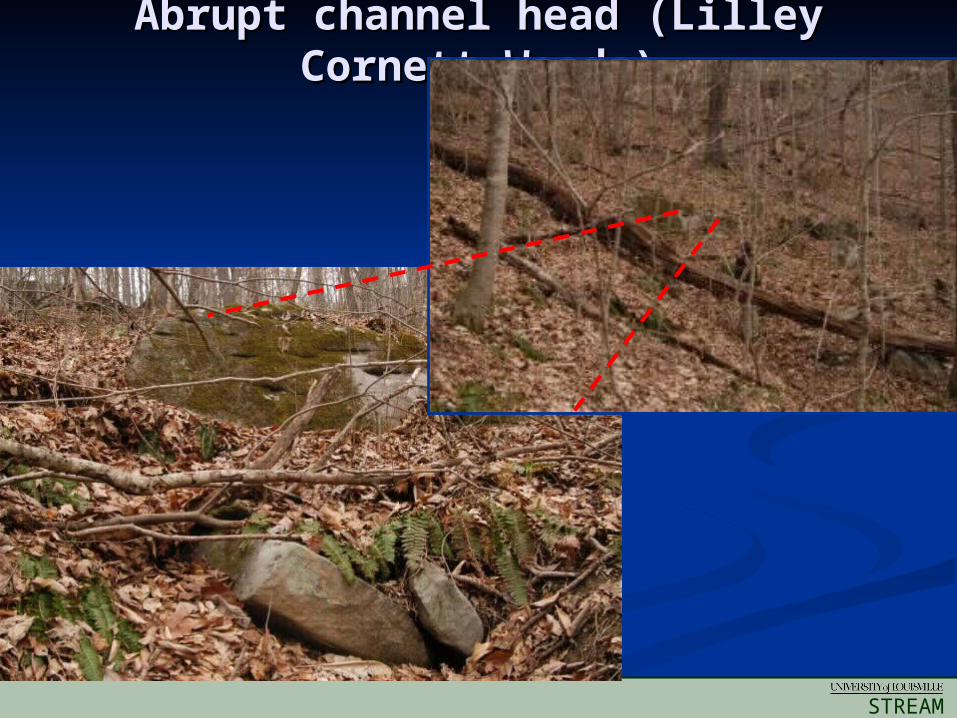
Abrupt channel head (Lilley Abrupt channel head (Lilley Cornett Woods)Cornett Woods)
STREAM
INSTITUTE
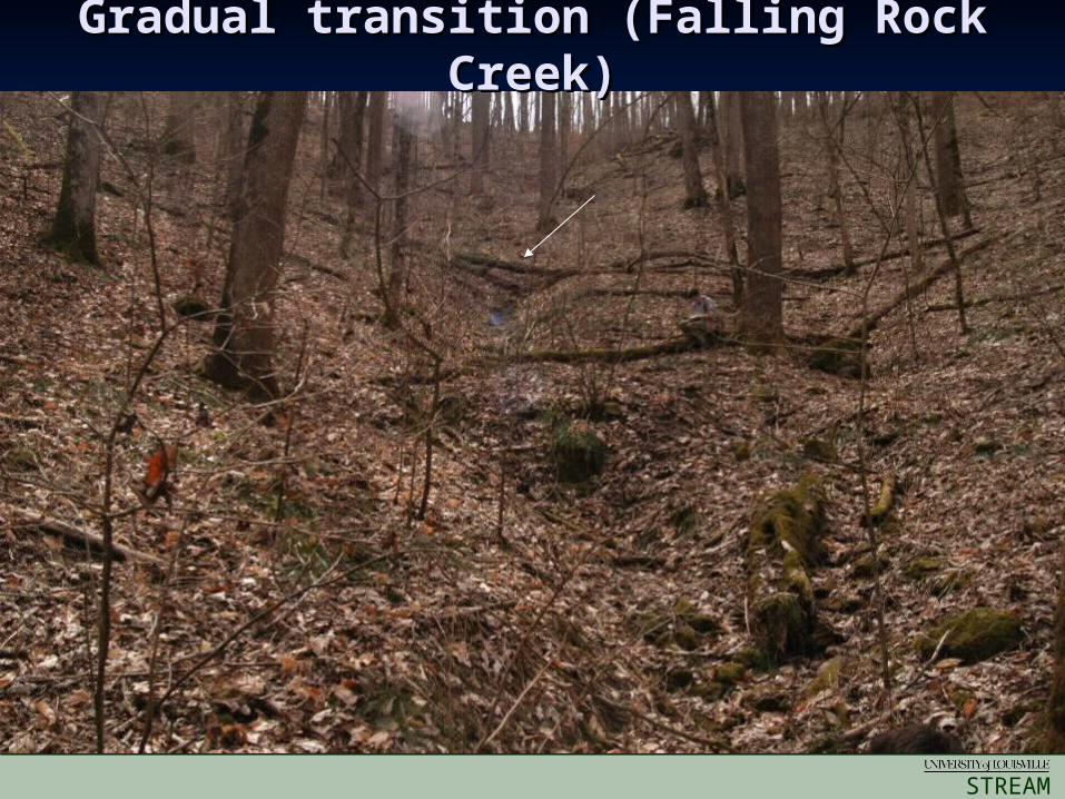
Gradual transition (Falling Rock Gradual transition (Falling Rock Creek)Creek)
STREAM
INSTITUTE
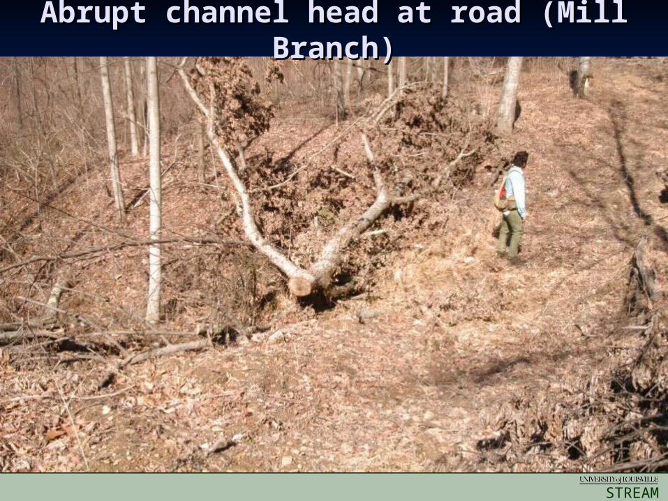
Abrupt channel head at road (Mill Abrupt channel head at road (Mill Branch)Branch)
STREAM
INSTITUTE
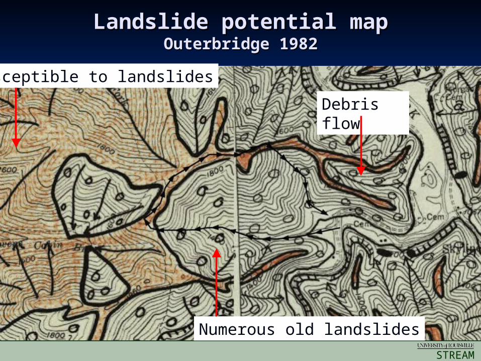
Landslide potential mapLandslide potential mapOuterbridge 1982Outerbridge 1982
Debris flow
Susceptible to landslides
Numerous old landslides
STREAM
INSTITUTE
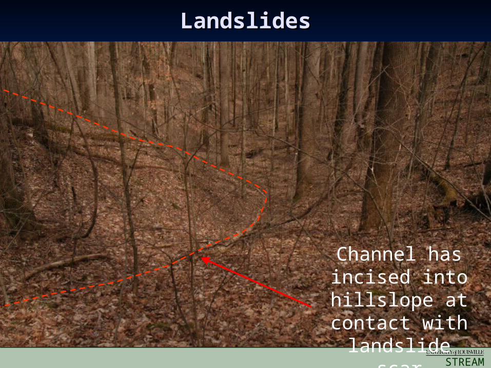
LandslidesLandslides
Channel has incised into
hillslope at contact with landslide scar
STREAM
INSTITUTE
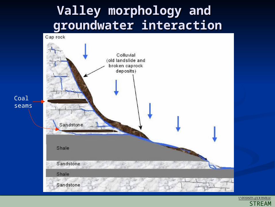
Valley morphology and Valley morphology and groundwater interactiongroundwater interaction
Coal seams
STREAM
INSTITUTE
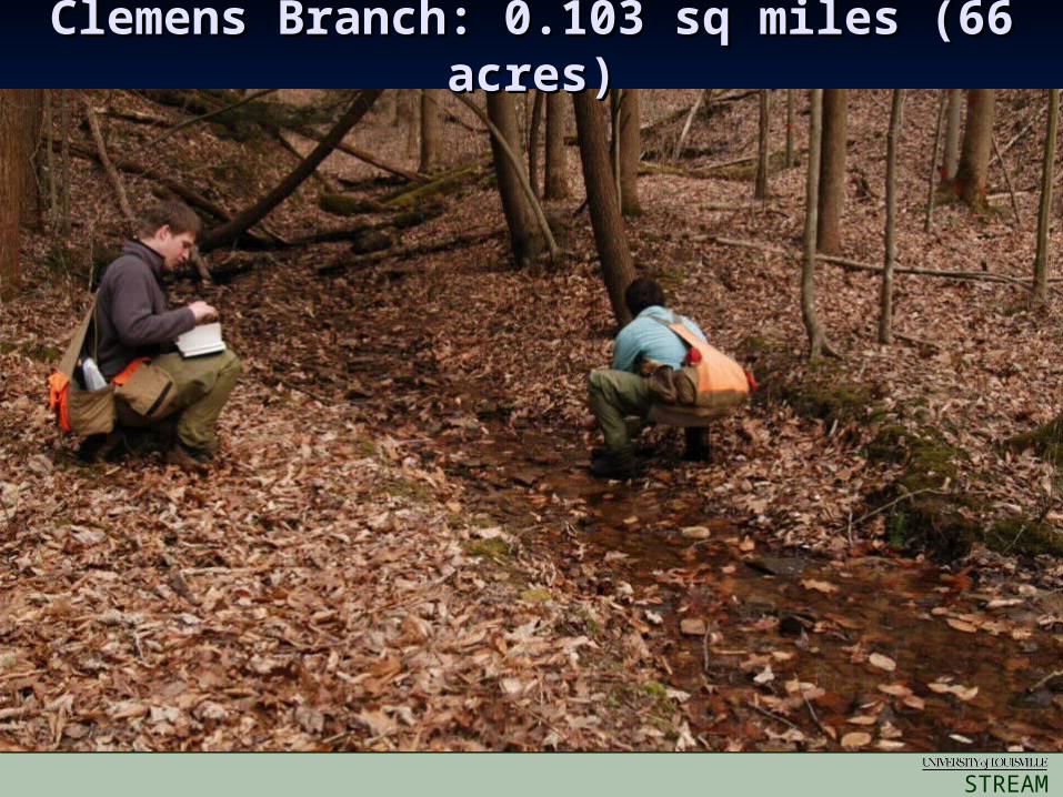
Clemens Branch: 0.103 sq miles (66 Clemens Branch: 0.103 sq miles (66 acres)acres)
STREAM
INSTITUTE
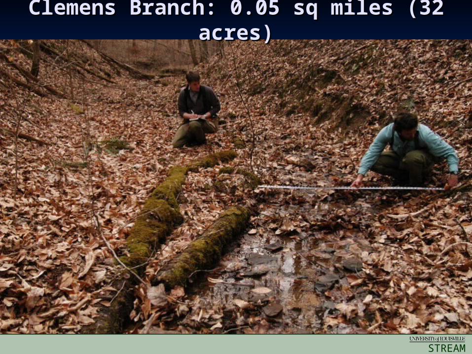
Clemens Branch: 0.05 sq miles (32 Clemens Branch: 0.05 sq miles (32 acres)acres)
STREAM
INSTITUTE
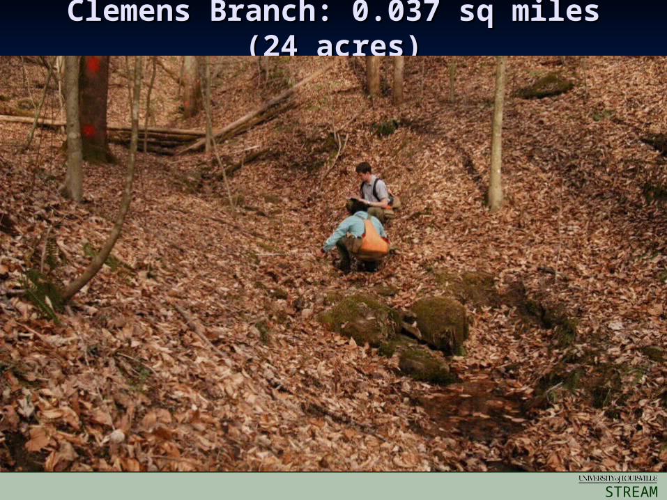
Clemens Branch: 0.037 sq miles Clemens Branch: 0.037 sq miles (24 acres)(24 acres)
STREAM
INSTITUTE
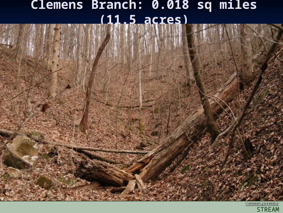
Clemens Branch: 0.018 sq miles Clemens Branch: 0.018 sq miles (11.5 acres)(11.5 acres)
STREAM
INSTITUTE
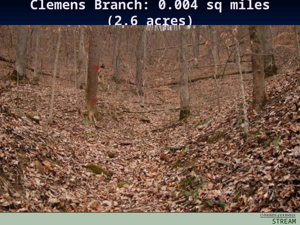
Clemens Branch: 0.004 sq miles Clemens Branch: 0.004 sq miles (2.6 acres)(2.6 acres)
STREAM
INSTITUTE
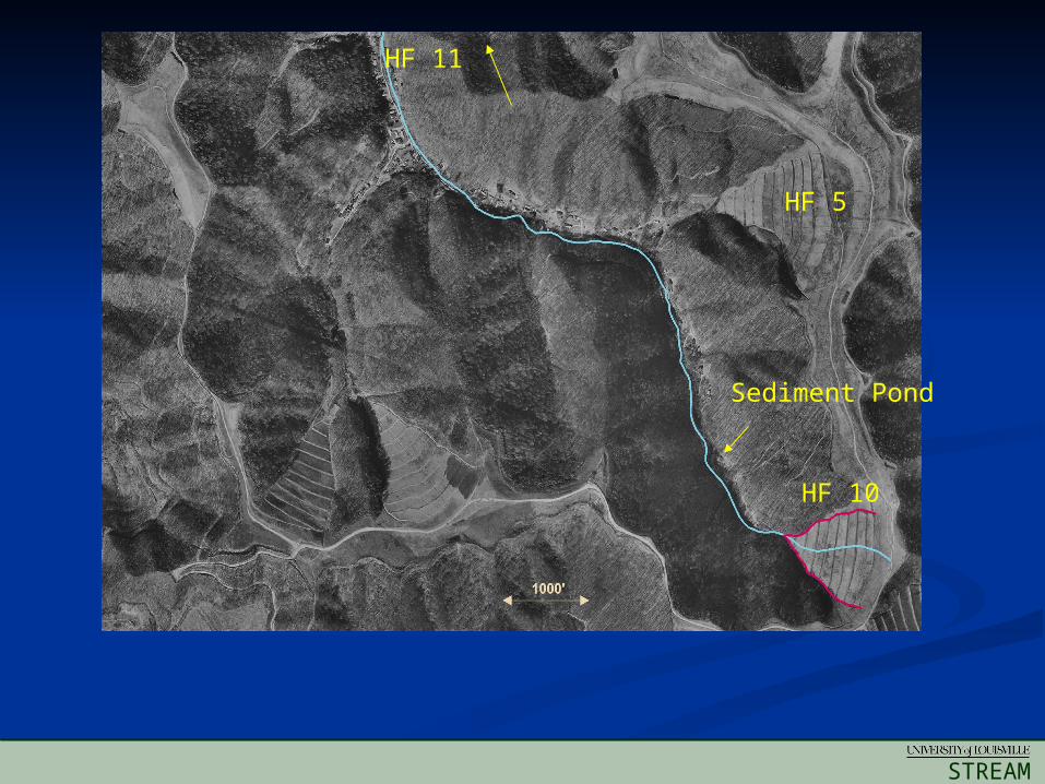
HF 5
HF 10
HF 11
Sediment Pond
STREAM
INSTITUTE
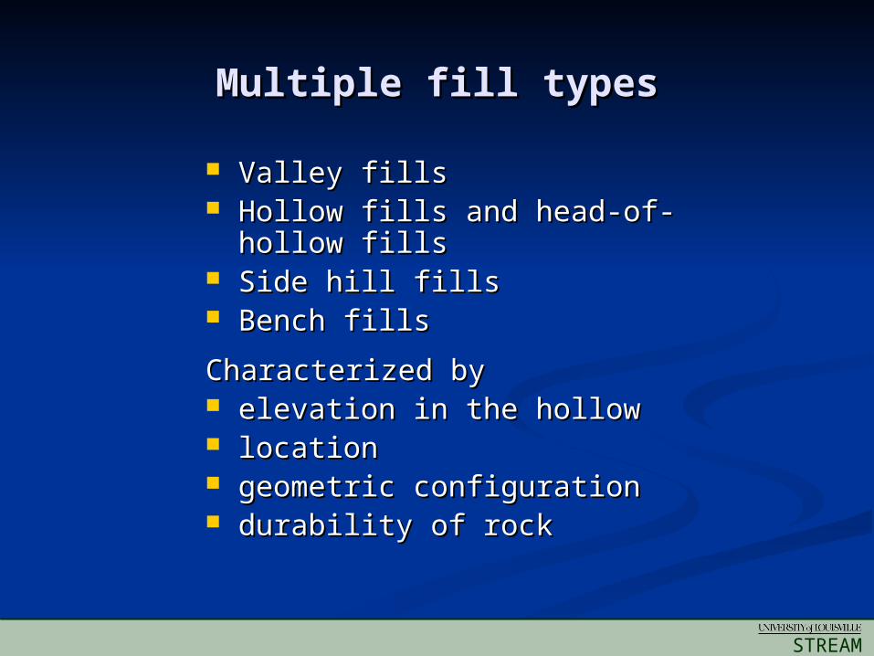
Multiple fill typesMultiple fill types
Valley fillsValley fills Hollow fills and head-of-hollow Hollow fills and head-of-hollow
fillsfills Side hill fillsSide hill fills Bench fillsBench fills
Characterized byCharacterized by elevation in the hollowelevation in the hollow locationlocation geometric configurationgeometric configuration durability of rockdurability of rock
STREAM
INSTITUTE
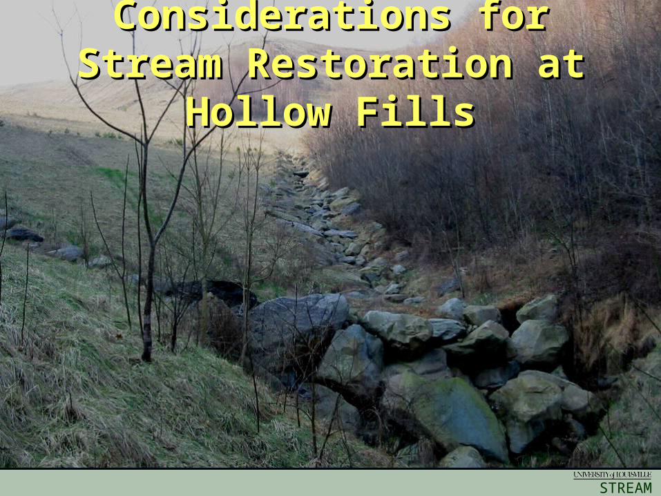
Considerations for Considerations for Stream Restoration at Stream Restoration at
Hollow FillsHollow Fills
STREAM
INSTITUTE
STREAM
INSTITUTE
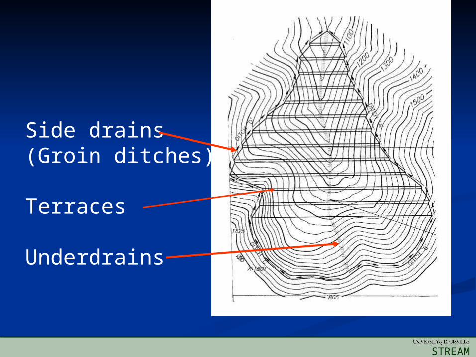
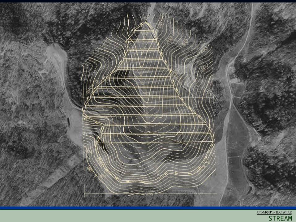
Side drains(Groin ditches)
Terraces
Underdrains
STREAM
INSTITUTE
STREAM
INSTITUTE

STREAM
INSTITUTE
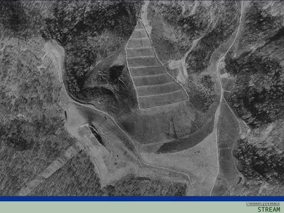
HF 5
HF 10
HF 11
Sediment Pond
STREAM
INSTITUTE
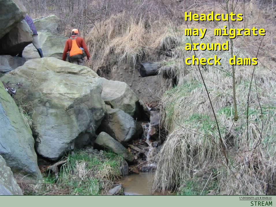
Mud LickMud Lick Headcuts Headcuts may may migrate migrate around around check damscheck dams
STREAM
INSTITUTE
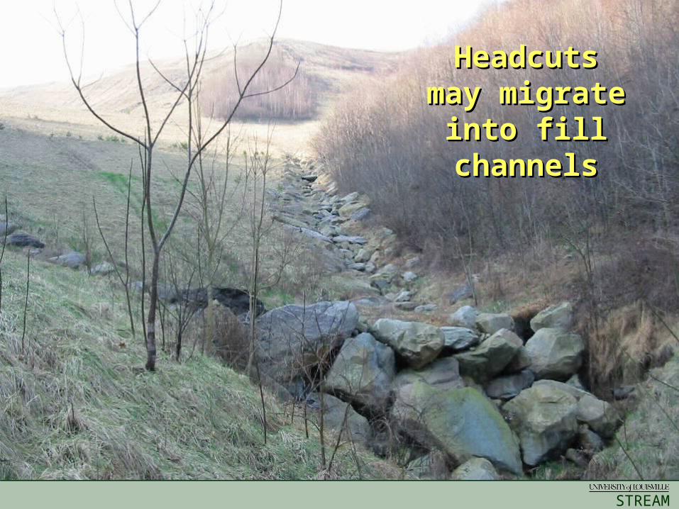
Headcuts Headcuts may may
migratemigrateinto fill into fill
channelschannels
STREAM
INSTITUTE
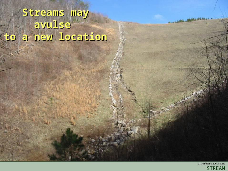
Streams may Streams may avulse avulse
to a new locationto a new location
STREAM
INSTITUTE
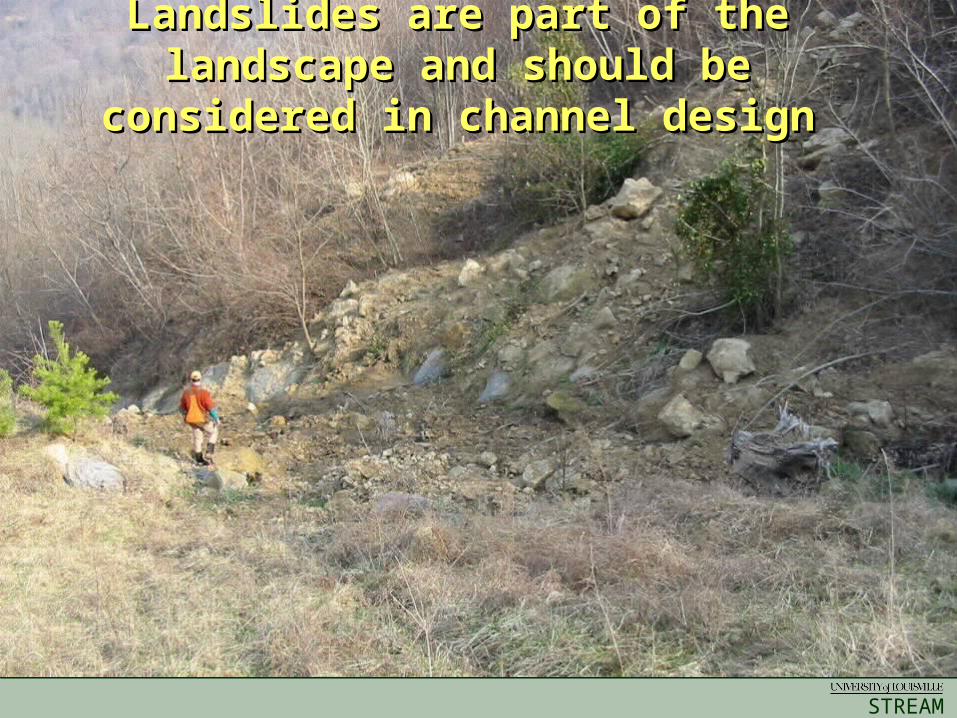
Landslides are part of the Landslides are part of the landscape and should be landscape and should be
considered in channel designconsidered in channel design
STREAM
INSTITUTE
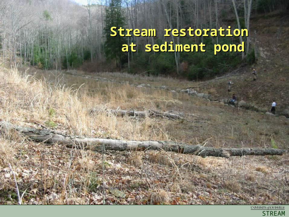
Stream restoration Stream restoration at sediment pondat sediment pond
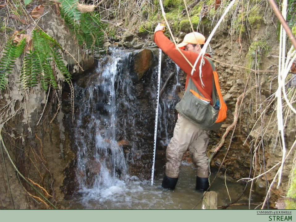
STREAM
INSTITUTE
Mud LickMud Lick
STREAM
INSTITUTE
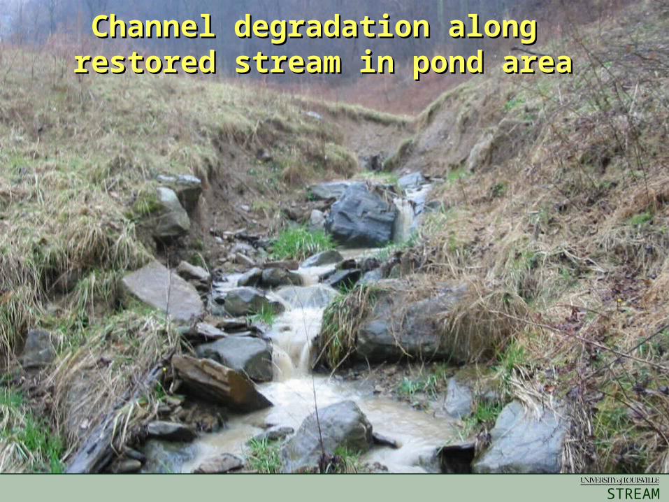
Channel degradation along Channel degradation along restored stream in pond arearestored stream in pond area
STREAM
INSTITUTE
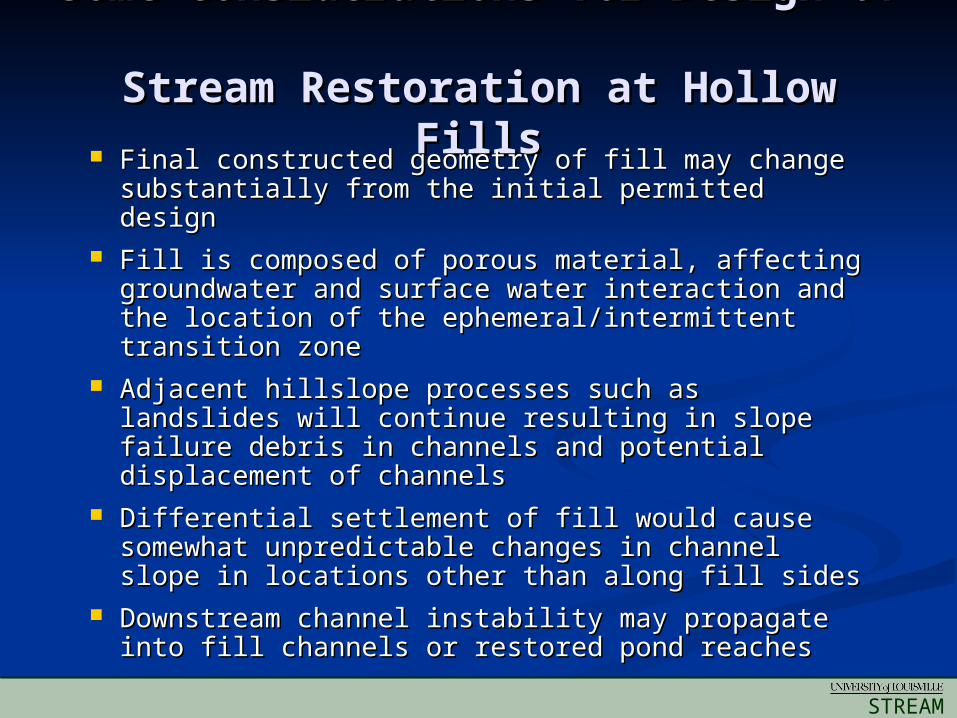
Some Considerations for Design of Some Considerations for Design of
Stream Restoration at Hollow FillsStream Restoration at Hollow Fills Final constructed geometry of fill may change Final constructed geometry of fill may change
substantially from the initial permitted designsubstantially from the initial permitted design Fill is composed of porous material, affecting Fill is composed of porous material, affecting
groundwater and surface water interaction and groundwater and surface water interaction and the location of the ephemeral/intermittent the location of the ephemeral/intermittent transition zonetransition zone
Adjacent hillslope processes such as landslides Adjacent hillslope processes such as landslides will continue resulting in slope failure debris in will continue resulting in slope failure debris in channels and potential displacement of channelschannels and potential displacement of channels
Differential settlement of fill would cause Differential settlement of fill would cause somewhat unpredictable changes in channel somewhat unpredictable changes in channel slope in locations other than along fill sidesslope in locations other than along fill sides
Downstream channel instability may propagate Downstream channel instability may propagate into fill channels or restored pond reachesinto fill channels or restored pond reaches
STREAM
INSTITUTE
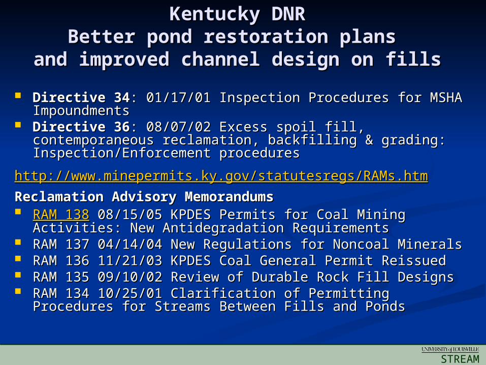
Kentucky DNRKentucky DNRBetter pond restoration plans Better pond restoration plans
and improved channel design on fillsand improved channel design on fills
Directive 34Directive 34: 01/17/01 Inspection Procedures for MSHA : 01/17/01 Inspection Procedures for MSHA Impoundments Impoundments
Directive 36Directive 36: 08/07/02 Excess spoil fill, contemporaneous : 08/07/02 Excess spoil fill, contemporaneous reclamation, backfilling & grading: Inspection/Enforcement reclamation, backfilling & grading: Inspection/Enforcement proceduresprocedures
http://http://www.minepermits.ky.gov/statutesregs/RAMs.htmwww.minepermits.ky.gov/statutesregs/RAMs.htm
Reclamation Advisory MemorandumsReclamation Advisory Memorandums RAM 138RAM 138 08/15/05 KPDES Permits for Coal Mining Activities: 08/15/05 KPDES Permits for Coal Mining Activities:
New Antidegradation RequirementsNew Antidegradation Requirements RAM 137 04/14/04 New Regulations for Noncoal MineralsRAM 137 04/14/04 New Regulations for Noncoal Minerals RAM 136 11/21/03 KPDES Coal General Permit ReissuedRAM 136 11/21/03 KPDES Coal General Permit Reissued RAM 135 09/10/02 Review of Durable Rock Fill DesignsRAM 135 09/10/02 Review of Durable Rock Fill Designs RAM 134 10/25/01 Clarification of Permitting Procedures for RAM 134 10/25/01 Clarification of Permitting Procedures for
Streams Between Fills and Ponds Streams Between Fills and Ponds
STREAM
INSTITUTE
Questions?Questions?