(chapter background photo © jeff martin, jmar foto-werks)
TRANSCRIPT
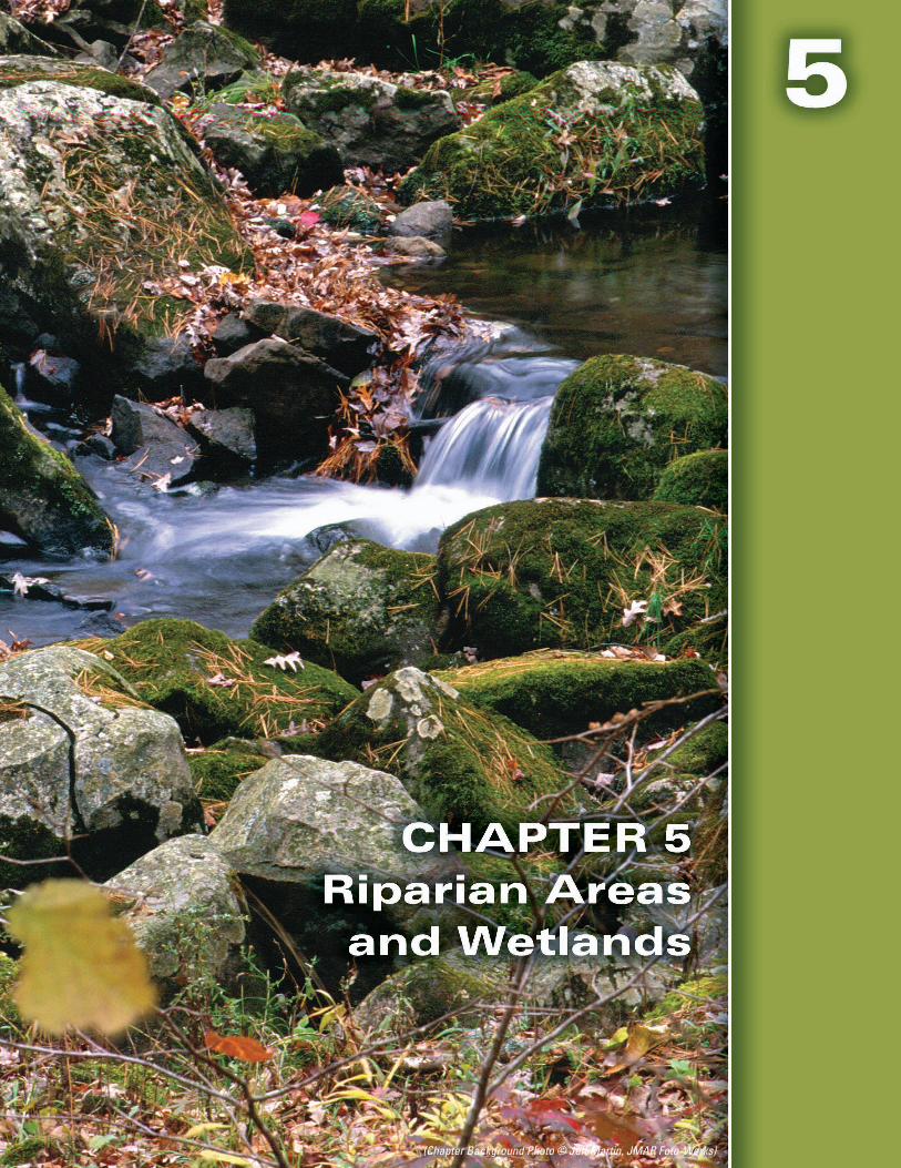
(Chapter Background Photo © Jeff Martin, JMAR Foto-Werks)
Revised 2018
Chapter 5 – Riparian Areas and Wetlands
CHAPTER 5 RIPARIAN AREAS AND WETLANDS
THE VALUE OF RIPARIAN AREAS ........................................................5-2
A Transition from Aquatic to Terrestrial Ecosystems ..................................................................................5-2
Protecting Water Quality ..................................................................................................................................5-3
Forestry BMPs for Water Quality ....................................................................................................................5-5
RIPARIAN MANAGEMENT ZONES .......................................................5-7
What Exactly is a Riparian Management Zone? ..........................................................................................5-7
Regulations .........................................................................................................................................................5-7
BMPs FOR RIPARIAN MANAGEMENT ZONES ....................................5-8
BMPs Common to All Three RMZ Categories ..............................................................................................5-9
BMPs: Lakes, Designated Trout Streams and Streams 3 Feet Wide and Wider ...................................5-9
BMPs: Streams Less Than 3 Feet Wide .......................................................................................................5-10
BMP: Streams Less Than 1 Foot Wide .........................................................................................................5-10
WETLANDS ..........................................................................................5-11
Wetland Identification .....................................................................................................................................5-12
BMPs: General Wetlands ...............................................................................................................................5-13
Regulations .......................................................................................................................................................5-13
BMPs: Wetland Filter Strip ............................................................................................................................5-14
RESOURCES FOR ADDITIONAL INFORMATION ................................5-15
5-1
Revised 2018
Chapter 5 – Riparian Areas and Wetlands
5-2
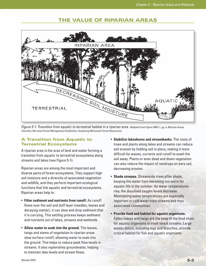
A Transition from Aquatic to Terrestrial Ecosystems
A riparian area is the area of land and water forming a transition from aquatic to terrestrial ecosystems along streams and lakes (see Figure 5-1).
Riparian areas are among the most important and diverse parts of forest ecosystems. They support high soil moisture and a diversity of associated vegetation and wildlife, and they perform important ecological functions that link aquatic and terrestrial ecosystems. Riparian areas help to:
• Filter sediment and nutrients from runoff. As runoff flows over the soil and duff layer (needles, leaves and decaying matter), it can slow and drop sediment that it is carrying. This settling process keeps sediment and nutrients out of lakes, streams and wetlands.
• Allow water to soak into the ground. The leaves, twigs and stems of vegetation in riparian areas slow surface runoff, allowing water to soak into the ground. This helps to reduce peak flow levels in streams. It also replenishes groundwater, helping to maintain lake levels and stream flows.
• Stabilize lakeshores and streambanks. The roots of trees and plants along lakes and streams can reduce soil erosion by holding soil in place, making it more difficult for waves, currents and runoff to wash the soil away. Plants or even dead and down vegetation can also reduce the impact of raindrops on bare soil, decreasing erosion.
• Shade streams. Streamside trees offer shade, keeping the water from becoming too warm for aquatic life in the summer. As water temperatures rise, the dissolved oxygen levels decrease. Maintaining water temperatures are especially important in cold water trout streams and their associated communities.
• Provide food and habitat for aquatic organisms. Fallen leaves and twigs are the base of the food chain for aquatic organisms in small forest streams. Large woody debris, including logs and branches, provide critical habitat for fish and aquatic organisms.
THE VALUE OF RIPARIAN AREAS
Figure 5-1: Transition from aquatic to terrestrial habitat in a riparian area. (Adapted from Figure RMZ-1, pg. 4, Riparian Areas, Voluntary Site-level Forest Management Guidelines: Sustaining Minnesota Forest Resources)
Revised 2018
Chapter 5 – Riparian Areas and Wetlands
5-3
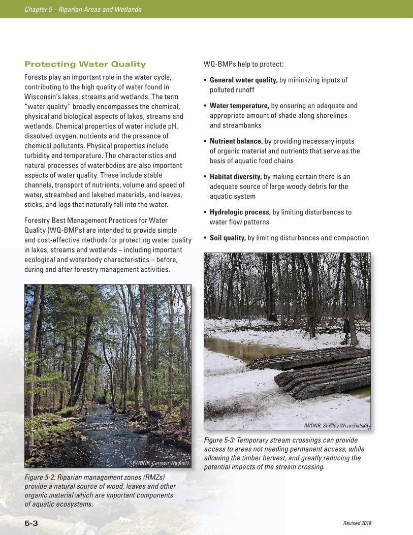
Protecting Water Quality
Forests play an important role in the water cycle, contributing to the high quality of water found in Wisconsin’s lakes, streams and wetlands. The term “water quality” broadly encompasses the chemical, physical and biological aspects of lakes, streams and wetlands. Chemical properties of water include pH, dissolved oxygen, nutrients and the presence of chemical pollutants. Physical properties include turbidity and temperature. The characteristics and natural processes of waterbodies are also important aspects of water quality. These include stable channels, transport of nutrients, volume and speed of water, streambed and lakebed materials, and leaves, sticks, and logs that naturally fall into the water.
Forestry Best Management Practices for Water Quality (WQ-BMPs) are intended to provide simple and cost-effective methods for protecting water quality in lakes, streams and wetlands – including important ecological and waterbody characteristics – before, during and after forestry management activities.
WQ-BMPs help to protect:
• General water quality, by minimizing inputs of polluted runoff
• Water temperature, by ensuring an adequate and appropriate amount of shade along shorelines and streambanks
• Nutrient balance, by providing necessary inputs of organic material and nutrients that serve as the basis of aquatic food chains
• Habitat diversity, by making certain there is an adequate source of large woody debris for the aquatic system
• Hydrologic process, by limiting disturbances to water flow patterns
• Soil quality, by limiting disturbances and compaction
Figure 5-2: Riparian management zones (RMZs) provide a natural source of wood, leaves and other organic material which are important components of aquatic ecosystems.
(WDNR, Carmen Wagner)
Figure 5-3: Temporary stream crossings can provide access to areas not needing permanent access, while allowing the timber harvest, and greatly reducing the potential impacts of the stream crossing.
(WDNR, Shelley Wrzochalski)
Revised 2018
Chapter 5 – Riparian Areas and Wetlands
5-4
Maintaining water quality can be a complex process, but WQ-BMPs provide easy, practical ways to achieve this goal. Most of these BMPs address water quality concerns by providing methods to keep sediment out of lakes, streams and wetlands and by preserving the physical integrity and natural processes of water resources. If these issues are addressed, then most other aspects of water quality will also be protected.
If WQ-BMPs are not followed, water quality has the potential to be impacted in a number of ways including:
• Reducing the soil’s ability to absorb water. This can occur when the forest floor is rutted, compacted or otherwise damaged by equipment.
• Increasing the potential for soil erosion. The likelihood of soil being carried away by runoff increases when soil is moved or when bare soil is exposed.
• Concentrating water flows. Roads, skid trails, landings, and drainage structures can collect runoff and funnel it, eroding soil and creating gullies.
• Diverting water flows. Roads and skid trails can intercept water flowing over or through the soil. If the natural flow pattern (hydrology) is altered, wetlands or other water resources may be denied the water that they depend on or may become impounded (flooded) with water as their natural drainageways are blocked by roads and skid trails.
• Increasing water flows. Harvesting a significant percentage of the trees in a watershed can increase the amount of water running off the land, since fewer trees are left to use the water. Higher water flows can increase the potential for streambank erosion and may lead to flooding.
• Reducing the benefits of vegetation next to water resources. Harvesting adjacent to streams can open the tree canopy and cause more light to reach the water surface. This may cause water temperatures to rise. Harvesting next to lakes and streams can also remove the natural source of woody debris for aquatic habitat, and can eliminate the leaf litter that is an important food source for many aquatic insects.
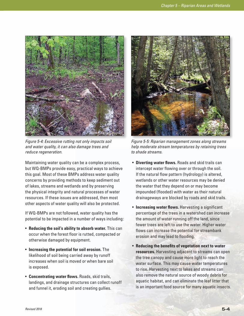
Figure 5-4: Excessive rutting not only impacts soil and water quality, it can also damage trees and reduce regeneration.
(WDNR, Carmen Wagner)
Figure 5-5: Riparian management zones along streams help moderate stream temperatures by retaining trees to shade streams.
(WDNR, Kristin Lambert)
Revised 2018
Chapter 5 – Riparian Areas and Wetlands
5-5
Forestry BMPs for Water Quality
The most practical and cost-effective method to assure that forestry operations do not adversely affect water quality in Wisconsin is through the use of the voluntary best management practices (BMPs). These BMPs are voluntary in the sense that they are not legally mandated. However, the Wisconsin DNR strongly encourages their use by all Wisconsin forest landowners, land managers and forestry professionals.
Many public and private landowners in Wisconsin use Forestry BMPs for Water Quality (WQ-BMPs) to guide their management activities. Those who have made commitments to follow these BMPs include:
• National forests
• State forests
• County forests
• The majority of Wisconsin’s large land ownerships (formerly known as industrial forestlands) which are participating in forest certification programs.
In addition to WQ-BMPs, you should be aware of existing municipal, county, state, and federal regulations relating to forest management and water quality (see Appendices D and E for information on permits and regulations).
This guide can help you when making decisions about management activities on your land. WQ-BMPs are identified by “” to help separate them from other recommendations in this guide. Applications of WQ-BMPs may be modified for specific site conditions with guidance from a natural resource professional, if modifications provide equal or greater water quality protection, or if the modification has no impact on water quality. Seek professional advice on WQ-BMPs and all forest management activities from natural resource professionals such as:
• Consulting foresters
• Industrial foresters
• Wisconsin DNR foresters, fish managers and water quality staff
• USDA Natural Resources and Conservation Service staff
• County Land Conservation Department staff
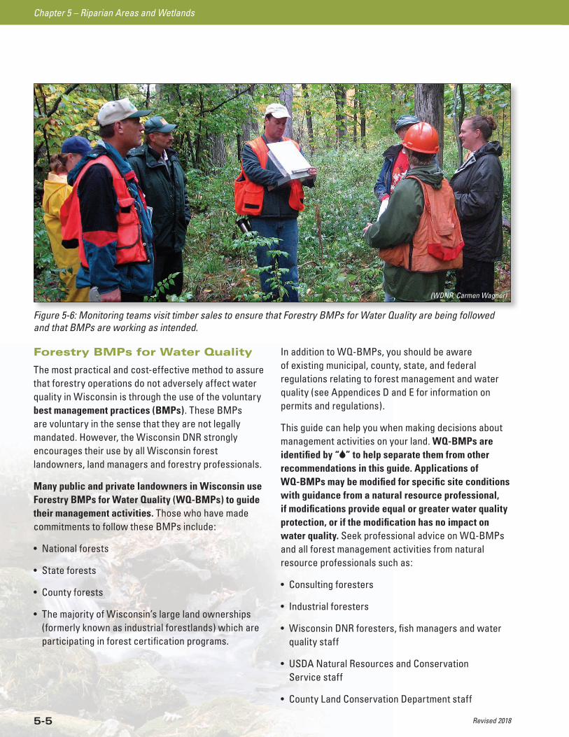
Figure 5-6: Monitoring teams visit timber sales to ensure that Forestry BMPs for Water Quality are being followed and that BMPs are working as intended.
(WDNR, Carmen Wagner)
Revised 2018
Chapter 5 – Riparian Areas and Wetlands
5-6
Careful planning for forest management activities, such as road construction, timber harvesting and site preparation, will help protect water quality. A well thought-out plan will lead to harvest operations that use WQ-BMPs, remove forest products efficiently and profitably, and promote sustainable forest growth and water quality protection.
A comprehensive forest management plan should include WQ-BMPs. The level of formality and detail should be appropriate to the project size, cost and environmental risk. The plan should also be flexible and adaptable to changing conditions.
Wisconsin DNR foresters and consulting or industrial foresters can work with you to develop a list of WQ-BMPs to include in your forest management plan. Cost-sharing assistance may be available for plans written by a consulting forester.
Contractors (e.g., loggers or road developers) along with landowners, land managers and foresters are all responsible in planning, designing and implementing WQ-BMPs. They should select the best forest management strategy to protect water quality that is specific to their site and timber harvest.
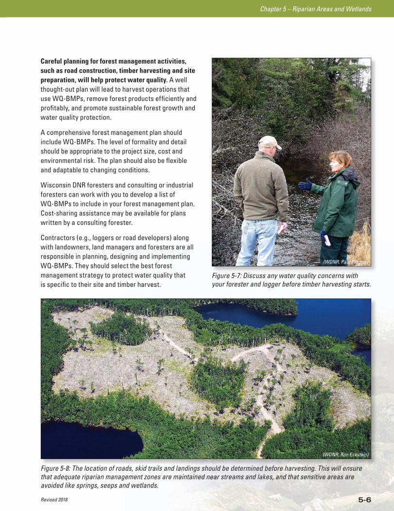
Figure 5-8: The location of roads, skid trails and landings should be determined before harvesting. This will ensure that adequate riparian management zones are maintained near streams and lakes, and that sensitive areas are avoided like springs, seeps and wetlands.
(WDNR, Ron Eckstein)
Figure 5-7: Discuss any water quality concerns with your forester and logger before timber harvesting starts.
(WDNR, Paul Pingrey)
Revised 2018
Chapter 5 – Riparian Areas and Wetlands
5-7
RIPARIAN MANAGEMENT ZONES
DETERMINING NAVIGABILITY OF WATERWAYS AND WATERBODIES
LAKE/PONDA waterbody is navigable if it 1) has an ordinary high water mark, 2) has a bed and banks, and 3) is a “reasonably permanent” body of water, although it may dry up during periods of drought.
STREAMA waterway is navigable if it 1) has a bed and banks, 2) can float the smallest recreational craft on a regular reoccurring basis.
ORDINARY HIGH WATER MARK (OHWM)The point on a bank or shore up to which the presence and action of water is so continuous that it leaves a distinct mark either by erosion, destruction of terrestrial (land) vegetation, or other easily recognized characteristics.
What Exactly is a Riparian Management Zone?
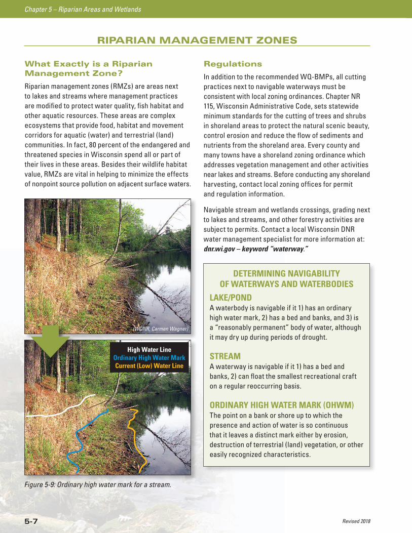
Riparian management zones (RMZs) are areas next to lakes and streams where management practices are modified to protect water quality, fish habitat and other aquatic resources. These areas are complex ecosystems that provide food, habitat and movement corridors for aquatic (water) and terrestrial (land) communities. In fact, 80 percent of the endangered and threatened species in Wisconsin spend all or part of their lives in these areas. Besides their wildlife habitat value, RMZs are vital in helping to minimize the effects of nonpoint source pollution on adjacent surface waters.
Figure 5-9: Ordinary high water mark for a stream.
(WDNR, Carmen Wagner)
High Water Line Ordinary High Water Mark Current (Low) Water Line
Regulations
In addition to the recommended WQ-BMPs, all cutting practices next to navigable waterways must be consistent with local zoning ordinances. Chapter NR 115, Wisconsin Administrative Code, sets statewide minimum standards for the cutting of trees and shrubs in shoreland areas to protect the natural scenic beauty, control erosion and reduce the flow of sediments and nutrients from the shoreland area. Every county and many towns have a shoreland zoning ordinance which addresses vegetation management and other activities near lakes and streams. Before conducting any shoreland harvesting, contact local zoning offices for permit and regulation information.
Navigable stream and wetlands crossings, grading next to lakes and streams, and other forestry activities are subject to permits. Contact a local Wisconsin DNR water management specialist for more information at: dnr.wi.gov – keyword “waterway.”
Revised 2018
Chapter 5 – Riparian Areas and Wetlands
5-8
BMPs FOR RIPARIAN MANAGEMENT ZONES
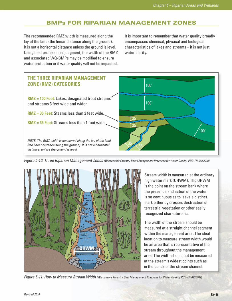
The recommended RMZ width is measured along the lay of the land (the linear distance along the ground). It is not a horizontal distance unless the ground is level. Using best professional judgment, the width of the RMZ and associated WQ-BMPs may be modified to ensure water protection or if water quality will not be impacted.
It is important to remember that water quality broadly encompasses chemical, physical and biological characteristics of lakes and streams – it is not just water clarity.
100’
100’
35’
35’
35’ 35’
100’
THE THREE RIPARIAN MANAGEMENTZONE (RMZ) CATEGORIES
NOTE: The RMZ width is measured along the lay of the land(the linear distance along the ground). It is not a horizontaldistance, unless the ground is level.
RMZ = 100 Feet: Lakes, designated trout streamsand streams 3 feet wide and wider.
RMZ = 35 Feet: Steams less than 3 feet wide.
RMZ = 35 Feet: Streams less than 1 foot wide.
Figure 5-10: Three Riparian Management Zones (Wisconsin’s Forestry Best Management Practices for Water Quality, PUB-FR-093 2010)
Figure 5-11: How to Measure Stream Width (Wisconsin’s Forestry Best Management Practices for Water Quality, PUB-FR-093 2010)
Stream width is measured at the ordinary high water mark (OHWM). The OHWM is the point on the stream bank where the presence and action of the water is so continuous as to leave a distinct mark either by erosion, destruction of terrestrial vegetation or other easily recognized characteristic.
The width of the stream should be measured at a straight channel segment within the management area. The ideal location to measure stream width would be an area that is representative of the stream throughout the management area. The width should not be measured at the stream’s widest points such as in the bends of the stream channel.
OHWM
Revised 2018
Chapter 5 – Riparian Areas and Wetlands
5-9
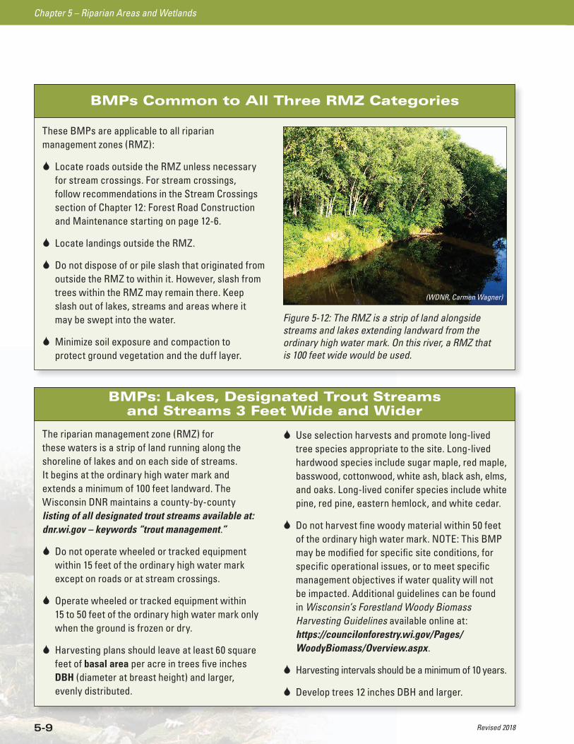
BMPs Common to All Three RMZ Categories
These BMPs are applicable to all riparian management zones (RMZ):
Locate roads outside the RMZ unless necessary for stream crossings. For stream crossings, follow recommendations in the Stream Crossings section of Chapter 12: Forest Road Construction and Maintenance starting on page 12-6.
Locate landings outside the RMZ.
Do not dispose of or pile slash that originated from outside the RMZ to within it. However, slash from trees within the RMZ may remain there. Keep slash out of lakes, streams and areas where it may be swept into the water.
Minimize soil exposure and compaction to protect ground vegetation and the duff layer.
Figure 5-12: The RMZ is a strip of land alongside streams and lakes extending landward from the ordinary high water mark. On this river, a RMZ that is 100 feet wide would be used.
(WDNR, Carmen Wagner)
BMPs: Lakes, Designated Trout Streams and Streams 3 Feet Wide and Wider
The riparian management zone (RMZ) for these waters is a strip of land running along the shoreline of lakes and on each side of streams. It begins at the ordinary high water mark and extends a minimum of 100 feet landward. The Wisconsin DNR maintains a county-by-county listing of all designated trout streams available at: dnr.wi.gov – keywords “trout management.”
Do not operate wheeled or tracked equipment within 15 feet of the ordinary high water mark except on roads or at stream crossings.
Operate wheeled or tracked equipment within 15 to 50 feet of the ordinary high water mark only when the ground is frozen or dry.
Harvesting plans should leave at least 60 square feet of basal area per acre in trees five inches DBH (diameter at breast height) and larger, evenly distributed.
Use selection harvests and promote long-lived tree species appropriate to the site. Long-lived hardwood species include sugar maple, red maple, basswood, cottonwood, white ash, black ash, elms, and oaks. Long-lived conifer species include white pine, red pine, eastern hemlock, and white cedar.
Do not harvest fine woody material within 50 feet of the ordinary high water mark. NOTE: This BMP may be modified for specific site conditions, for specific operational issues, or to meet specific management objectives if water quality will not be impacted. Additional guidelines can be found in Wisconsin’s Forestland Woody Biomass Harvesting Guidelines available online at: https://councilonforestry.wi.gov/Pages/ WoodyBiomass/Overview.aspx.
Harvesting intervals should be a minimum of 10 years.
Develop trees 12 inches DBH and larger.
Revised 2018
Chapter 5 – Riparian Areas and Wetlands
5-10
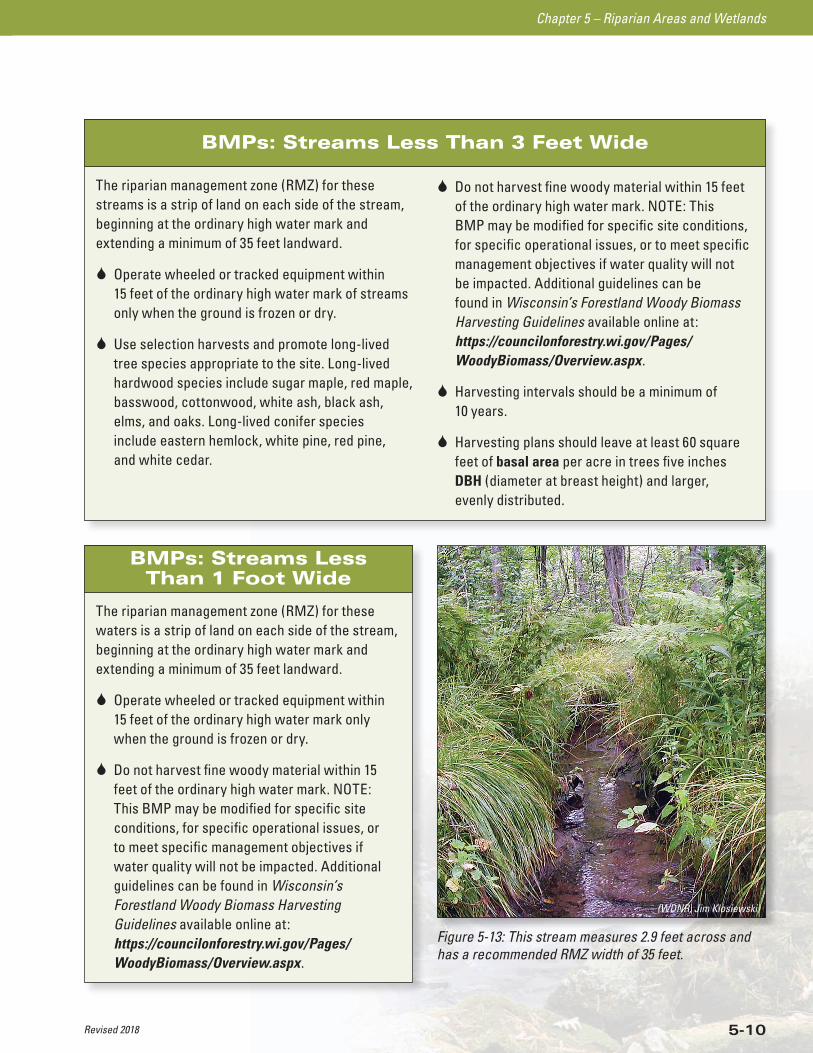
BMPs: Streams Less Than 3 Feet Wide
The riparian management zone (RMZ) for these streams is a strip of land on each side of the stream, beginning at the ordinary high water mark and extending a minimum of 35 feet landward.
Operate wheeled or tracked equipment within 15 feet of the ordinary high water mark of streams only when the ground is frozen or dry.
Use selection harvests and promote long-lived tree species appropriate to the site. Long-lived hardwood species include sugar maple, red maple, basswood, cottonwood, white ash, black ash, elms, and oaks. Long-lived conifer species include eastern hemlock, white pine, red pine, and white cedar.
Do not harvest fine woody material within 15 feet of the ordinary high water mark. NOTE: This BMP may be modified for specific site conditions, for specific operational issues, or to meet specific management objectives if water quality will not be impacted. Additional guidelines can be found in Wisconsin’s Forestland Woody Biomass Harvesting Guidelines available online at: https://councilonforestry.wi.gov/Pages/ WoodyBiomass/Overview.aspx.
Harvesting intervals should be a minimum of 10 years.
Harvesting plans should leave at least 60 square feet of basal area per acre in trees five inches DBH (diameter at breast height) and larger, evenly distributed.
BMPs: Streams Less Than 1 Foot Wide
The riparian management zone (RMZ) for these waters is a strip of land on each side of the stream, beginning at the ordinary high water mark and extending a minimum of 35 feet landward.
Operate wheeled or tracked equipment within 15 feet of the ordinary high water mark only when the ground is frozen or dry.
Do not harvest fine woody material within 15 feet of the ordinary high water mark. NOTE: This BMP may be modified for specific site conditions, for specific operational issues, or to meet specific management objectives if water quality will not be impacted. Additional guidelines can be found in Wisconsin’s Forestland Woody Biomass Harvesting Guidelines available online at: https://councilonforestry.wi.gov/Pages/ WoodyBiomass/Overview.aspx.
Figure 5-13: This stream measures 2.9 feet across and has a recommended RMZ width of 35 feet.
(WDNR, Jim Klosiewski)
Revised 2018
Chapter 5 – Riparian Areas and Wetlands
5-11
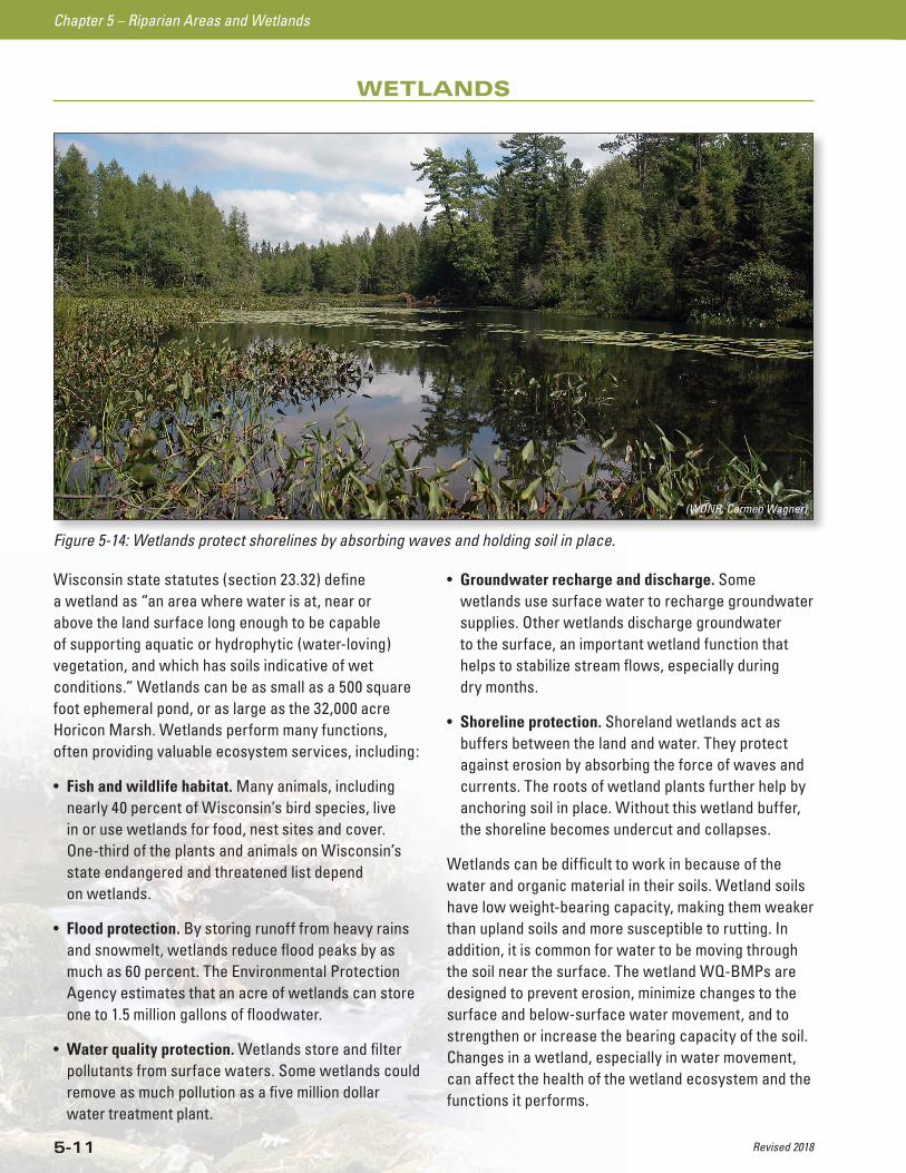
Wisconsin state statutes (section 23.32) define a wetland as “an area where water is at, near or above the land surface long enough to be capable of supporting aquatic or hydrophytic (water-loving) vegetation, and which has soils indicative of wet conditions.” Wetlands can be as small as a 500 square foot ephemeral pond, or as large as the 32,000 acre Horicon Marsh. Wetlands perform many functions, often providing valuable ecosystem services, including:
• Fish and wildlife habitat. Many animals, including nearly 40 percent of Wisconsin’s bird species, live in or use wetlands for food, nest sites and cover. One-third of the plants and animals on Wisconsin’s state endangered and threatened list depend on wetlands.
• Flood protection. By storing runoff from heavy rains and snowmelt, wetlands reduce flood peaks by as much as 60 percent. The Environmental Protection Agency estimates that an acre of wetlands can store one to 1.5 million gallons of floodwater.
• Water quality protection. Wetlands store and filter pollutants from surface waters. Some wetlands could remove as much pollution as a five million dollar water treatment plant.
• Groundwater recharge and discharge. Some wetlands use surface water to recharge groundwater supplies. Other wetlands discharge groundwater to the surface, an important wetland function that helps to stabilize stream flows, especially during dry months.
• Shoreline protection. Shoreland wetlands act as buffers between the land and water. They protect against erosion by absorbing the force of waves and currents. The roots of wetland plants further help by anchoring soil in place. Without this wetland buffer, the shoreline becomes undercut and collapses.
Wetlands can be difficult to work in because of the water and organic material in their soils. Wetland soils have low weight-bearing capacity, making them weaker than upland soils and more susceptible to rutting. In addition, it is common for water to be moving through the soil near the surface. The wetland WQ-BMPs are designed to prevent erosion, minimize changes to the surface and below-surface water movement, and to strengthen or increase the bearing capacity of the soil. Changes in a wetland, especially in water movement, can affect the health of the wetland ecosystem and the functions it performs.
WETLANDS
Figure 5-14: Wetlands protect shorelines by absorbing waves and holding soil in place.
(WDNR, Carmen Wagner)
Revised 2018
Chapter 5 – Riparian Areas and Wetlands
5-12
Wetland Identification
Wetlands are areas where standing water or saturated soil conditions are present long enough to support water-loving plants like marsh marigolds, willows, tag alders, and other species. These wet conditions will also lead to development of specific soil types that can help identify wetlands. Wetland soils develop after repeated cycles of saturation which last 14 days or more. These saturated conditions may only exist every other year (50 percent of the time). When there is standing water or the soil is saturated, anaerobic conditions exist and the soil pores are filled with water instead of air.
Wetlands are common along the edges of lakes and streams, but can also be found in flat areas or depressions which collect water. Wetlands are also found in unlikely places, such as on hillsides, where water may seep out of the ground.
More than 30 different types of wetlands are recognized in Wisconsin. Wetland types that are common in forested areas include ephemeral ponds, floodplain forests, northern hardwood swamps, northern wet-mesic forests, and tamarack/spruce swamps.
There are a number of tools that can help you make a preliminary determination as to whether your project will affect wetlands including:
• Wisconsin DNR Wetland Inventory maps
• Wisconsin DNR Wetland Indicator maps
• Natural Resources Conservation Service (NRCS) Soil Surveys
These maps can be reviewed at Wisconsin DNR and local zoning offices. They are also available online at the Wisconsin DNR and NRCS websites. Remember that maps are just guides and a field visit is necessary to confirm what the maps show. Wetland indicators to look for in the field include water, soils and vegetation.
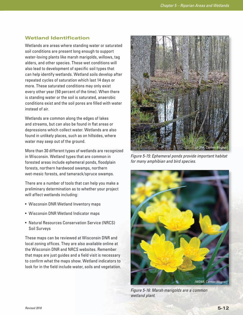
Figure 5-15: Ephemeral ponds provide important habitat for many amphibian and bird species.
(WDNR, Carmen Wagner)
Figure 5-16: Marsh marigolds are a common wetland plant.
(WDNR, Carmen Wagner)
Revised 2018
Chapter 5 – Riparian Areas and Wetlands
5-13
Regulations
Activities in wetlands are often subject to municipal, county, state, and federal permits and regulatory requirements. Permit and regulatory information can be found in Appendices D and E. If you are building a road or conducting an activity in an area suspected to be a wetland, be sure to contact the following offices regarding applicable permits and regulations:
• local zoning offices (town, village, city, and/or county)
• local Wisconsin DNR water management specialist
• local U.S. Army Corps of Engineers (USACE) project manager
BMPs: General Wetlands
Whenever practical, avoid locating roads and landings in wetlands; otherwise use extreme caution.
Whenever possible, forest management activities in wetlands should occur on frozen ground to minimize rutting.
For activities in wetlands, consider allowing more flexibility regarding completion dates in timber sale contracts, allowing the logger time to complete logging activities during firm or frozen ground conditions.
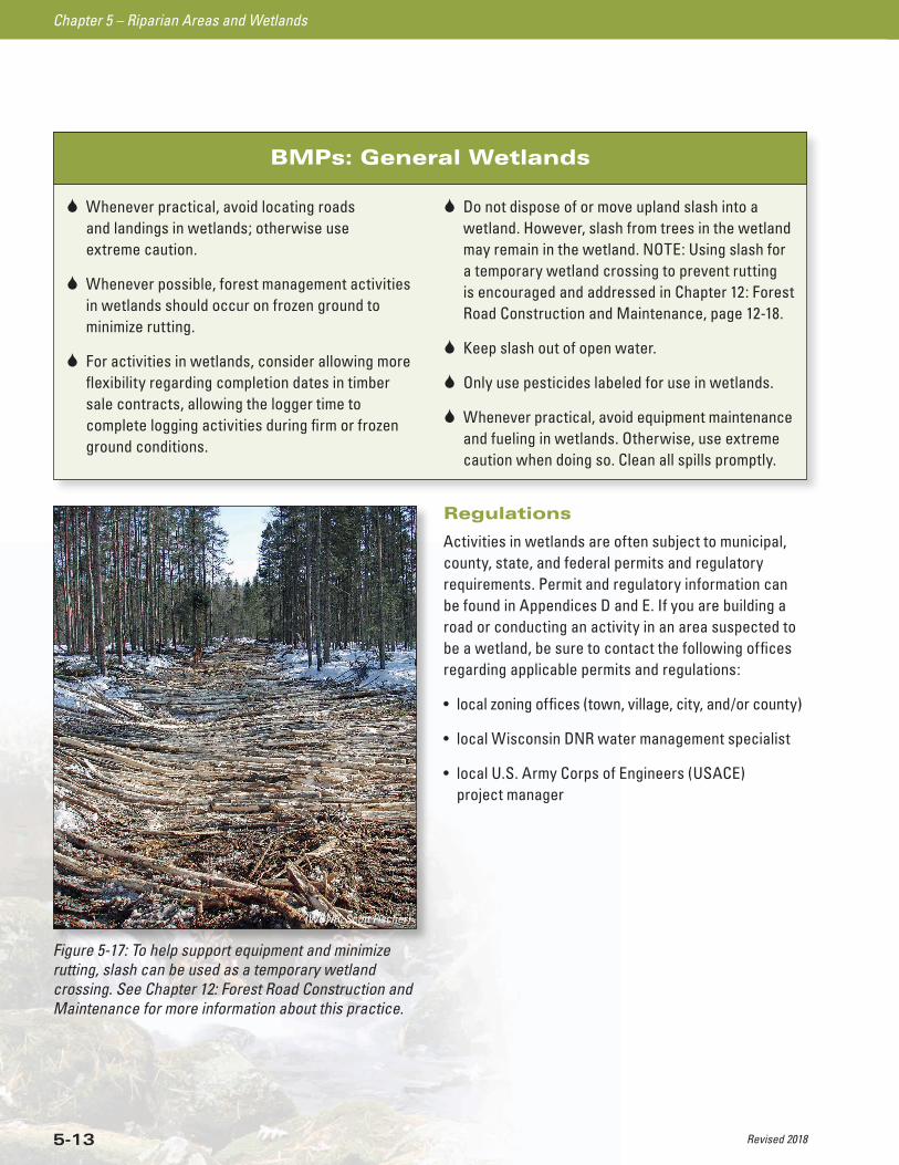
Do not dispose of or move upland slash into a wetland. However, slash from trees in the wetland may remain in the wetland. NOTE: Using slash for a temporary wetland crossing to prevent rutting is encouraged and addressed in Chapter 12: Forest Road Construction and Maintenance, page 12-18.
Keep slash out of open water.
Only use pesticides labeled for use in wetlands.
Whenever practical, avoid equipment maintenance and fueling in wetlands. Otherwise, use extreme caution when doing so. Clean all spills promptly.
Figure 5-17: To help support equipment and minimize rutting, slash can be used as a temporary wetland crossing. See Chapter 12: Forest Road Construction and Maintenance for more information about this practice.
(WDNR, Scott Fischer)

Revised 2018
Chapter 5 – Riparian Areas and Wetlands
5-14
BMPs: Wetland Filter Strip
Filter strips are strips of land located adjacent to wetlands that trap sediment and other pollutants from runoff before it reaches wetlands. Harvesting and other forest management activities can occur both in the wetland and the filter strip. Care should be taken to prevent exposing bare soil that may erode into the wetland. A wetland filter strip begins at the edge of the wetland and extends a minimum of 15 feet away from the wetland.
Whenever practical, avoid locating roads and landings in the wetland filter strip; otherwise use extreme caution.
Minimize soil exposure and compaction to protect ground vegetation and the duff layer in the wetland filter strip.
Operate equipment in the wetland filter strip only when the ground is firm or frozen.
Figure 5-18: How to Measure Wetland Filter Strips (Wisconsin’s Forestry Best Management Practices for Water Quality, PUB-FR-093 2010)
A wetland filter strip begins at the edge of the wetland and extends a minimum of 15 feet away from the wetland. NOTE: The width of a wetland filter strip is measured along the lay of the land (the linear distance along the ground). It is not a horizontal distance, unless the ground is level.
15’
WETLAND FILTER STRIP(Minimum of 15 feet)
WETLAND BOUNDARY
Revised 2018
Chapter 5 – Riparian Areas and Wetlands
5-15
RESOURCES FOR ADDITIONAL INFORMATIONThese resources are specific to the information in this chapter only. Refer to the Resource Directory for additional resources related to this chapter.
WISCONSIN WETLANDS ASSOCIATIONhttp://wisconsinwetlands.org/
WATER QUALITY FORESTRY BMPs dnr.wi.gov – keywords “water quality forestry BMPs”
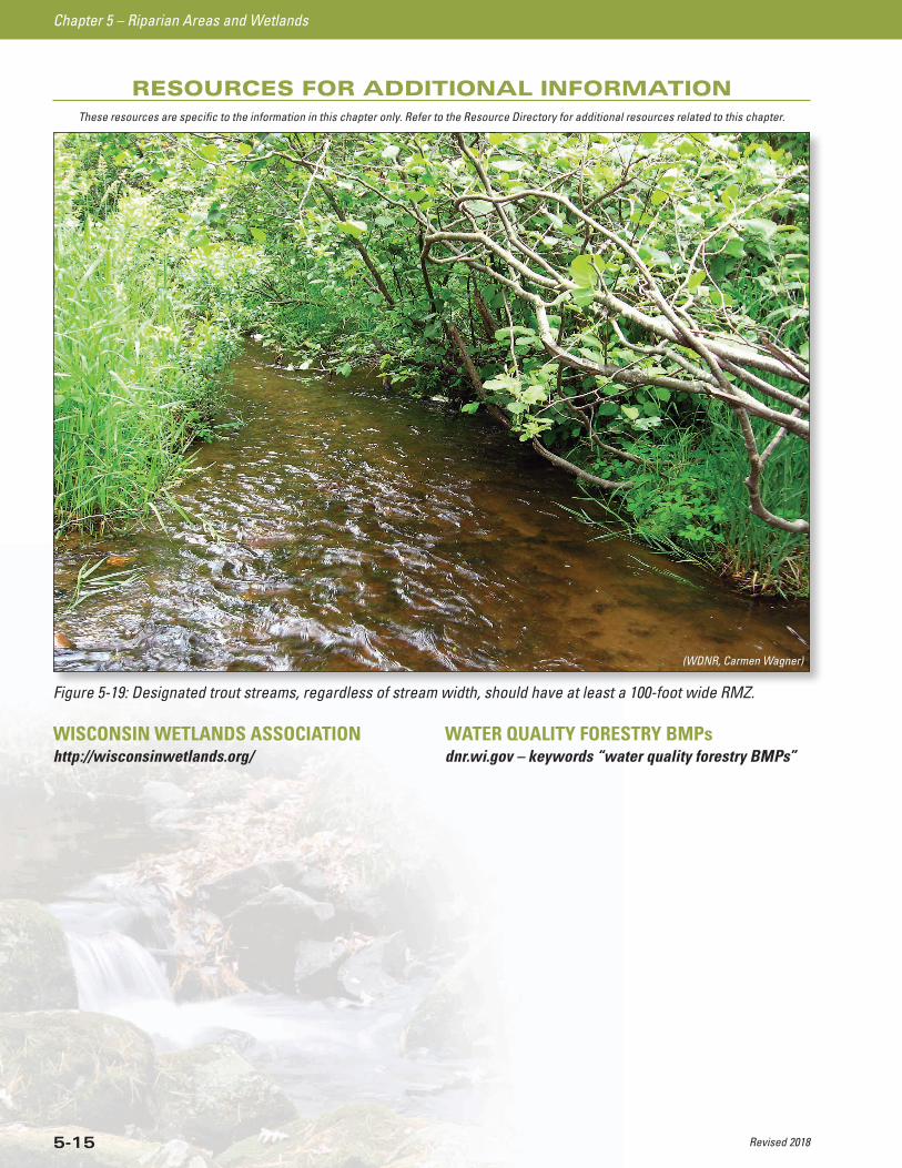
Figure 5-19: Designated trout streams, regardless of stream width, should have at least a 100-foot wide RMZ.
(WDNR, Carmen Wagner)
WISCONSIN DEPARTMENT OF NATURAL RESOURCES
NOTICE OF FINAL GUIDANCE & CERTIFICATION
Pursuant to ch. 227, Wis. Stats., the Wisconsin Department of Natural Resources has finalized and hereby certifies the
following guidance document.
DOCUMENT ID
FA-20-0005
DOCUMENT TITLE
Wisconsin Forest Management Guidelines
PROGRAM/BUREAU
Forest Economics and Ecology, Applied Forestry Bureau
STATUTORY AUTHORITY OR LEGAL CITATION
S. 823.075, Wis. Stats. & NR 1.25, Wis. Admin. Code
DATE SENT TO LEGISLATIVE REFERENCE BUREAU (FOR PUBLIC COMMENTS)
2/10/2020
DATE FINALIZED
4/6/2020
DNR CERTIFICATION
I have reviewed this guidance document or proposed guidance document and I certify that it complies with sections
227.10 and 227.11 of the Wisconsin Statutes. I further certify that the guidance document or proposed guidance
document contains no standard, requirement, or threshold that is not explicitly required or explicitly permitted by a
statute or a rule that has been lawfully promulgated. I further certify that the guidance document or proposed guidance
document contains no standard, requirement, or threshold that is more restrictive than a standard, requirement, or
threshold contained in the Wisconsin Statutes.
March 27, 2020
Signature Date