chapter 7 global climates. climate -what is climate? -“characteristic pattern of average weather...
TRANSCRIPT
Chapter 7
Global Climates
0
2
4
6
8
10
12
14
16
18
20
Month
Pre
cip
(in)
0
10
20
30
40
50
60
70
80
90
Tem
p (F
)
Climate
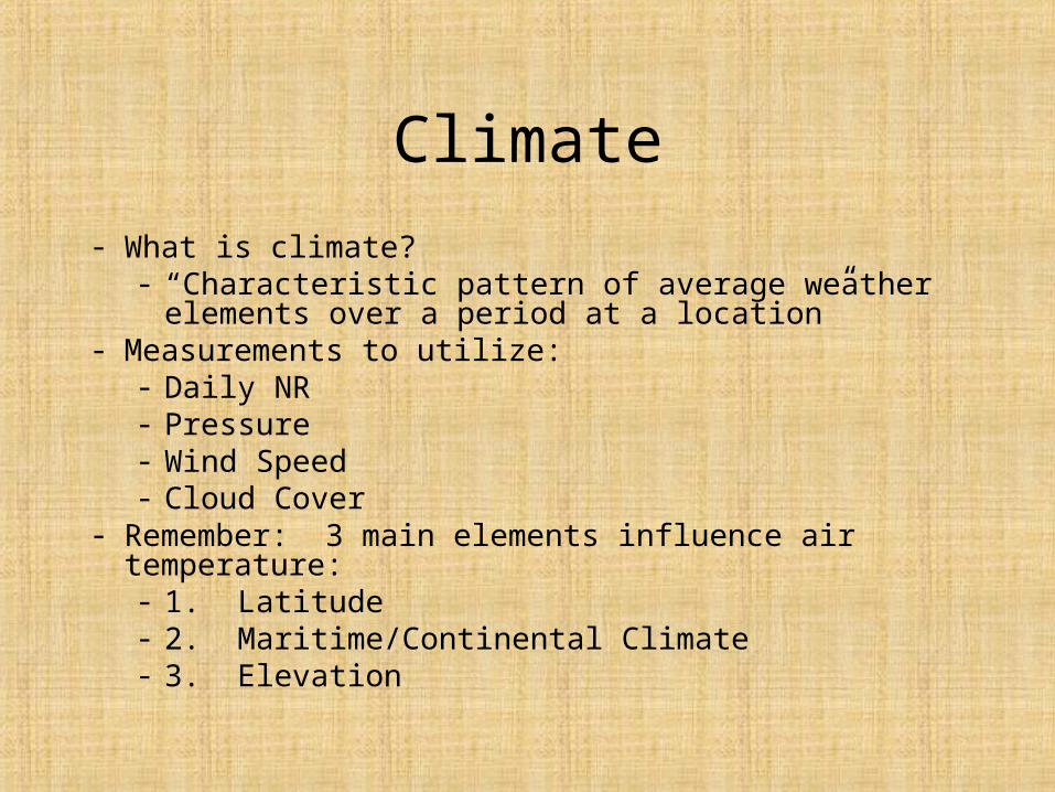
- What is climate?- “Characteristic pattern of average weather elements over
a period at a location”- Measurements to utilize:
- Daily NR- Pressure- Wind Speed- Cloud Cover
- Remember: 3 main elements influence air temperature:- 1. Latitude- 2. Maritime/Continental Climate- 3. Elevation

Temperature Regimes
• Temperature Regimes- distinctive types of annual temperature cycles related to latitude and location– Equatorial *Continental vs. Maritime– Tropical– Midlatitude Ex: Cameroon vs. Algeria– Subarctic
Global Precipitation
• Categories– 1. Wet Equatorial Belt– 2. Trade Wind Coasts– 3. Tropical Deserts– 4. Midlatitude Deserts and Steppes– 5. Moist Subtropical Regions– 6. Midlatitude West Coasts– 7. Arctic and Polar Deserts
Precipitation Variability
• Why is variation is precipitation on an annual basis important?– Uniformity vs. non-uniformity = Different
vegetation and landscape
• 3 types of monthly precipitation patterns:– 1. Uniform distribution of precipitation– 2. Precipitation max. during Summer– 3. Precipitation max. during Winter

Applications of Climatology
• Classification
• Solving “operational problems,” such as for agricultural purposes
• Prediction – what can we expect?
• Analysis – why did something happen?
• Improved understanding of human impacts on the environment

A Quick Example
• Analysis of particulate matter (PM)• Obtained PM measurements from sites around
Tucson• Looked at weather conditions for certain cases• Wanted to determine how atmospheric circulation
patterns affected PM levels• Determined which patterns generally produced
higher PM measurements
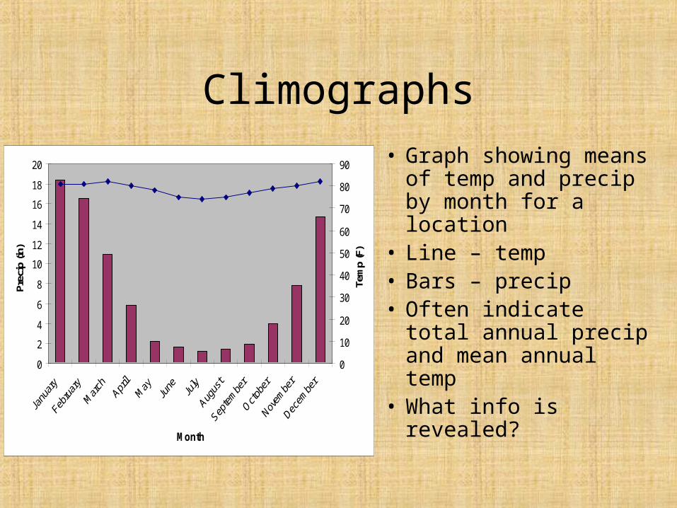
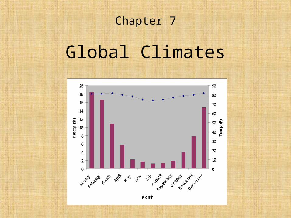
Climographs
• Graph showing means of temp and precip by month for a location
• Line – temp• Bars – precip• Often indicate total
annual precip and mean annual temp
• What info is revealed?
0
2
4
6
8
10
12
14
16
18
20
Month
Prec
ip (i
n)
0
10
20
30
40
50
60
70
80
90
Tem
p (F
)

Classification Schemes
• Provide a short-hand that allows scientists to recognize climatic conditions and characteristics
• Use a variety of data to determine climate types
• Numerous schemes ranging from general/global to very specific, project-oriented and regional
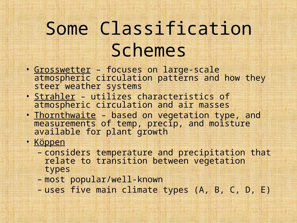
Some Classification Schemes
• Grosswetter – focuses on large-scale atmospheric circulation patterns and how they steer weather systems
• Strahler – utilizes characteristics of atmospheric circulation and air masses
• Thornthwaite – based on vegetation type, and measurements of temp, precip, and moisture available for plant growth
• Köppen– considers temperature and precipitation that relate to
transition between vegetation types– most popular/well-known– uses five main climate types (A, B, C, D, E)

3 Groups of Climates
• Group 1- Low-Latitude Climates (4)– Dominated by cT, mT, and mE– Influence by ITCZ and subtropical H pressure
• Group 2- Mid-Latitude Climates (6)– Intense interaction between unlike air masses– Wave cyclones are common
• Group 3- High-Latitude Climates (3)– Polar and Arctic air masses

Dry vs. Moist Climates
• Dry climates– “When total annual evaporation from soil/plants exceeds
annual precip”– 2 categories:
• 1. Semi-arid (Steppe)• 2. Arid
• Moist climates– “Those climates with sufficient rainfall to maintain the soil in
a moist condition throughout the year”• 2 of 13 climate types cannot be classified as dry or moist:
– 3—Wet-Dry Tropical– 7—Mediterranean
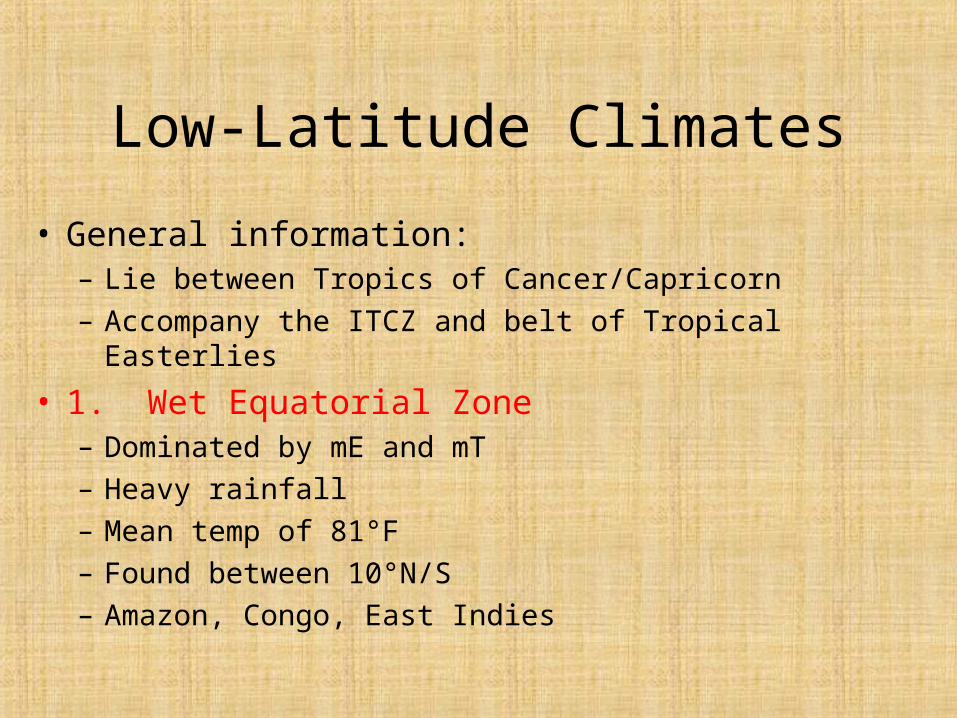
Low-Latitude Climates
• General information:– Lie between Tropics of Cancer/Capricorn
– Accompany the ITCZ and belt of Tropical Easterlies
• 1. Wet Equatorial Zone– Dominated by mE and mT
– Heavy rainfall
– Mean temp of 81°F
– Found between 10°N/S
– Amazon, Congo, East Indies
Low-Latitude Climates
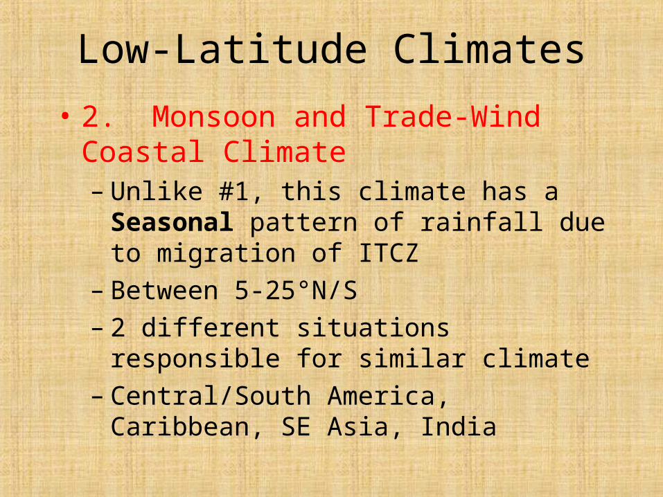
• 2. Monsoon and Trade-Wind Coastal Climate– Unlike #1, this climate has a Seasonal pattern
of rainfall due to migration of ITCZ– Between 5-25°N/S– 2 different situations responsible for similar
climate– Central/South America, Caribbean, SE Asia,
India

Low-Latitude Climates
• 3. Wet-Dry Tropical Climate– Just North of #2 Climate– Winter (cT), Summer (mT and mE)– 5-20°N/S– Example: Guinea– Vegetation: Savannah
Low-Latitude Climates
• 4. Dry-Tropical Climate– Found in center and East sides of subtropical
H pressure– Rainfall=Rare– 15-25°N/S– Examples: Sahara, central Australia, Western SA– Steppes– Figure 7.18
Mid-Latitude Climates
• General Information:– Almost all mid-latitude climates are in N hem.
– Zone of interaction (mT vs. mP/cP)
• 5. Dry Subtropical Climate– Poleward extension of #4, but with greater temp. range
– TUCSON
– Plants/Trees
– Freezing temps
– North/South Africa, Mojave/Sonoran Deserts
Mid-Latitude Climates
• 6. Moist Subtropical Climate– Subtropical H pressure provides warm, moist
air on Eastern sides of continents– Tropical cyclones– Convection-based rainfall– 20-35°N/S– Examples: Southern China, US(SE)
• Charleston, SC
– Vegetation

Mid-Latitude Climates
• 7. Mediterranean Climate
– Reason: Poleward mov’t of subtropical H pressure during Summer
– Location along West coasts
– Summer (cT), Winter (mP)– 30-45°N/S– Monterrey, CA– Vegetation (Adaptation to survive for dry part
of year)
Mid-Latitude Climates
• 8. Marine West-Coast Climate– Midlatitude West coasts– Westerly winds from oceans = mP air masses– Small annual temp range– Oregon/Washington, BC, Portugal, France– 35-60°N/S– Vegetation: Large, expansive forests
Mid-Latitude Climates
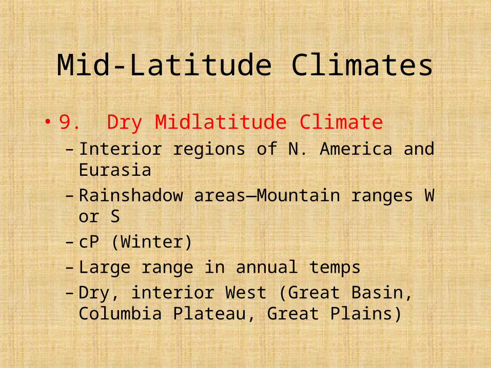
• 9. Dry Midlatitude Climate– Interior regions of N. America and Eurasia– Rainshadow areas—Mountain ranges W or S– cP (Winter)– Large range in annual temps– Dry, interior West (Great Basin, Columbia
Plateau, Great Plains)
Mid-Latitude Climates
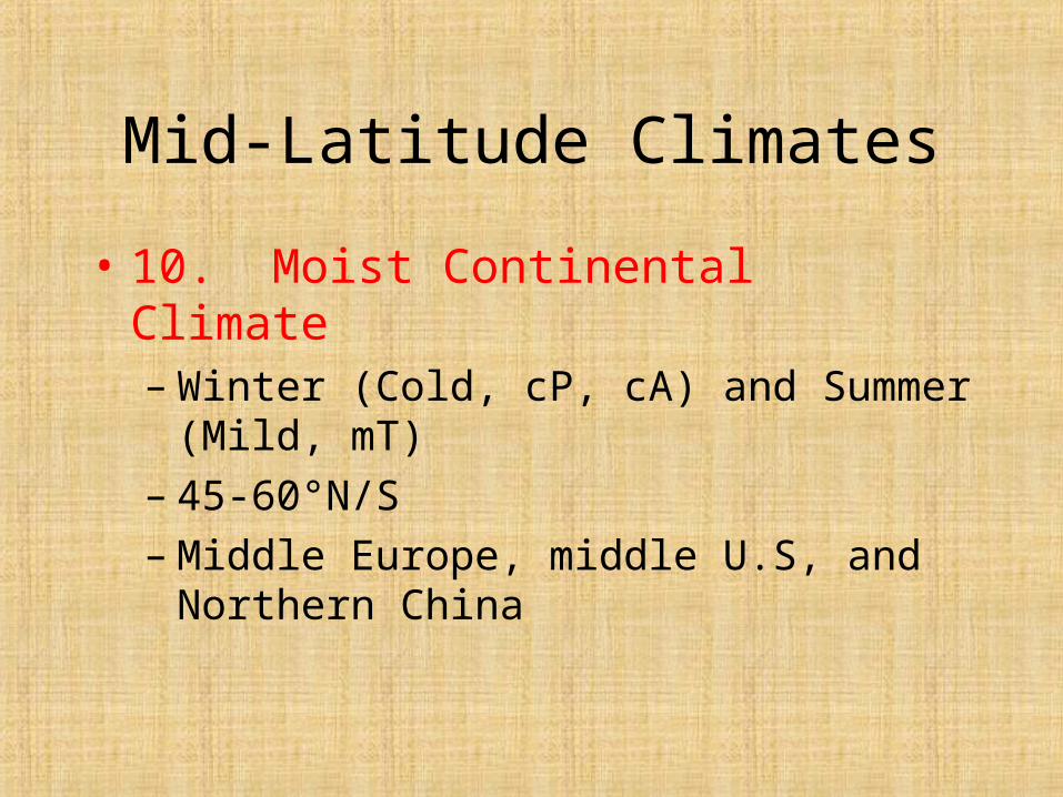
• 10. Moist Continental Climate– Winter (Cold, cP, cA) and Summer (Mild, mT)– 45-60°N/S– Middle Europe, middle U.S, and Northern
China

High-Latitude Climates
• 11. Boreal Forest Climate– Source region for cP– Invasion by cA COMMON– Great temp. range– Precip. Increase during summer– Alaska, Canada, middle Russia
High-Latitude Climates
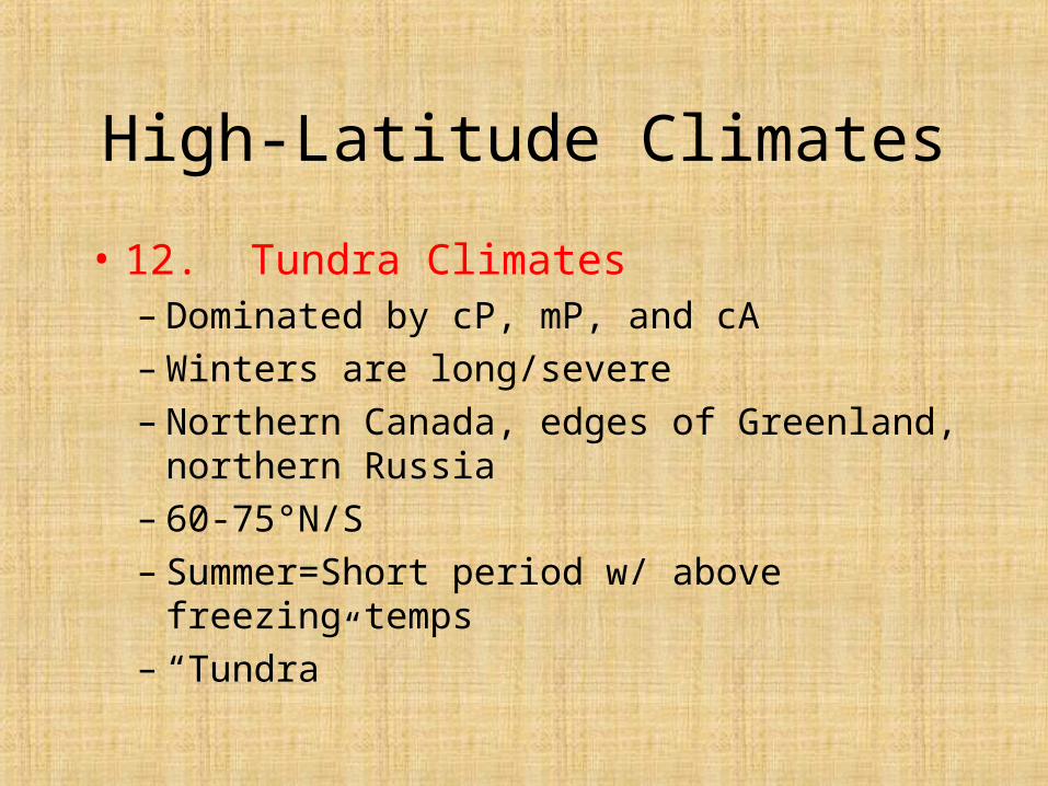
• 12. Tundra Climates– Dominated by cP, mP, and cA– Winters are long/severe– Northern Canada, edges of Greenland, northern
Russia– 60-75°N/S– Summer=Short period w/ above freezing temps– “Tundra”

High-Latitude Climates
• 13. Ice Sheet Climate– No mean monthly temp above freezing– 65-90°N/S