chapter 6 · 2014-02-06 · chapter 6 l program summary strategic assessment report the queensland...
TRANSCRIPT

Page intentionally left blank
INSERT IMAGE
Chapter 6program summary
6. Program summary ...................................1996.1 Introduction .............................................. 1996.2 Foundational management ......................2016.3 Strengthening management.....................2036.4 Forward committments ............................205

Page intentionally left blank
Extract from Great Barrier Reef Coastal Zone Strategic Assessment terms of reference1. Purpose and description of the ProgramThe Strategic Assessment Report must include an overview of the Program including its purpose and the area in which it will be implemented. For the purposes of the strategic assessment, the life of the Program is 25 years.The Program Report will include:1. the purpose of the Program2. a description of the area to which the strategic assessment applies (the strategic assessment area)3. the component legislation, plans, policies and other material that make up the Program, including program commitments4. the likely activities that will occur under the Program5. the state and regional context (environmental, social, and economic) in which the Program operates, including activities outside the strategic assessment area that may influence the Program6. other relevant national, state or regional planning or management frameworks that affect the Program7. a description of how the Program identifies, protects and manages matters of national environment significance (MNES)8. identification of how long the Program will be in effect and the process for review of the Program, including adaptive management9. identification of the relevant authorities responsible for the implementation of the Program.

GREAT BARRIER REEF COASTAL ZONE STRATEGIC ASSESSMENT6-199 Strategic Assessment Report
CHAP
TER
6 l p
rogr
am s
umm
ary
Strategic Assessment Report
6. Program summary
Values Management
1. Background
2. Social and economic context
3. Assessment approach
4. Condition & trend
5. Pressures
8. Projected condition
6. Program summary
7. Program effectiveness
9. Adaptive management
10. Recommended changes
STRATEGIC ASSESSMENT REPORT
6.1 Introduction
The GBR coastal zone is a vast area where a range of activities are undertaken, including conservation, tourism, agriculture, recreation, urban development, mining, port development, fishing and shipping. These activities have been continually subject to an evolving range of Queensland Government regulatory tools including legislation and ongoing management programs. Through its Program and supporting legislation and policies, the Queensland Government is committed to ensuring that planning, development and management in the GBR coastal zone is appropriate to ensure that MNES, including the GBR and Wet Tropics WHAs retain the values for which they were declared, and that they continue to be two of the best managed protected areas in the world for future generations.
The concept of ESD is embedded in the Queensland environmental regulation and management framework, and therefore, the Queensland Government’s Program. The Queensland environmental regulation and management framework requires effective integration of economic, social and environmental considerations in the decision-making processes. The way in which the Program achieves the principles of ESD is addressed in section 9.1.The proposed Program is a collection of commitments and outcomes that will be delivered for MNES within the GBR Coastal Zone over the next 25 years. The Queensland Government’s proposed Program includes at its core a set of commitments articulating how the Queensland Government will deliver on the goal of protecting, managing and enhancing MNES in the GBR coastal zone (Figure 6.1 1). These commitments build upon the work done collaboratively between

GREAT BARRIER REEF COASTAL ZONE STRATEGIC ASSESSMENT6-200 Strategic Assessment Report
CHAP
TER
6 l p
rogr
am s
umm
ary
Strategic Assessment Report
the Australian and Queensland governments to identify high environmental standards that must be met for the Australian Government to consider accreditation of state systems.The proposed Program is a framework within which planning and development approval decisions are made. It is supported by a range of management tools designed to achieve the Program objectives and commitments (see Figure 6.1 2). This includes legislation, policies, plans and programs, both existing and new, as well as a range of forward commitments.
Fig 6.1-1 Program commitments
Fig 6.1-2 Snapshot of management tools that will support achievement of the Program objectives and commitments
Goal: To protect,
manage and enhance MNES

GREAT BARRIER REEF COASTAL ZONE STRATEGIC ASSESSMENT6-201 Strategic Assessment Report
CHAP
TER
6 l p
rogr
am s
umm
ary
Strategic Assessment Report
The Queensland Government’s Program is a combination of existing, strengthened and proposed new components. The Program is made up of the following three elements (Figure 6.1 3): ▪ foundational management– existing statutory and
non-statutory policies, plans and programs ▪ strengthening management – proposed new
management arrangements that strengthen the Program ▪ forward commitments – things that the Queensland
Government commits to do as part of the Program, including monitoring and reporting. Forward commitments also include implementation of proposed strengthening management arrangements.
The program report outlines the package of foundational management measures that the Queensland Government has in place to protect MNES, including the OUV of the GBRWHA. It also describes a range of new measures designed to strengthen management to ensure coastal development occurs in a balanced way, taking into account world renowned environmental values. The program report also outlines how the Queensland Government will work with its partners to implement the outcomes of the strategic assessment. This chapter provides a brief summary of the Queensland Government Program elements.
6.2
The Queensland Government’s foundational management arrangements are extensive and include various legislation, as well as supporting policies, plans and programs. These policies and programs were not specifically established for MNES, but were designed to more broadly protect Queensland’s environmental values. However, in doing so, they also protect values of national interest. They are grouped for the purposes of this report to show how the Program overall identifies MNES, avoids, mitigates and offsets significant impacts and how the Program enhances and improves the condition of MNES. A summary snapshot is provided in Figure 6.2 1.
Fig 6.1-3 The Queensland Government Program
Identify MNESProtected matters search toolMore refined mapping of essential habitat, species sightings, wetlandsScientific assessments of threats to MNES
Avoid MNESNational parks and protected area estateQueensland’s planning and development assessment frameworkPort land use plans, State Development Area development schemes, etc
Minimise impacts on MNES (direct/indirect)EIS process and conditions on approvals to minimise direct and indirect impactsAssessment of cumulative impacts 25 pieces of Queensland legislation Fisheries management, shipping regulations, island and national park management
Offset residual impacts on MNESQueensland current offsets policies (under review)
Enhance the condition of MNESReef Water Quality Protection PlanPrioritisation of threatened species recovery actionsNatural Resource Management programs (Everyone’s Environment Grants, Qld NRM Investment program)
Fig 6.2-1 Snapshot of how the foundational management arrangements identify MNES, avoid, minimise or offset impacts and enhance the condition of MNES
Foundational management
Strengthening management
Forward commitments
Queensland Government Program
Foundational management

GREAT BARRIER REEF COASTAL ZONE STRATEGIC ASSESSMENT6-202 Strategic Assessment Report
CHAP
TER
6 l p
rogr
am s
umm
ary
Strategic Assessment Report
The ‘avoid, mitigate, offset’ approach is central to Queensland Government’s Program and is the basis for considering future coastal development. Other parts of the Program are designed to improve the condition or enhance MNES and address the legacy of past impacts. The first priority is avoiding impacts on MNES. This occurs by setting aside important areas in the protected area estate or using the planning system to identify areas for future development that are located away from high value areas important for MNES. Where development cannot avoid MNES, the next priority is to ensure impacts are mitigated as far as possible through the design and construction of the project, through development of management plans or by timing of operations. Mitigation measures are routinely built into the conditions on project approvals. Where impacts cannot be reasonably avoided and impacts are mitigated as much as practicable, residual impacts must be offset to ensure that the value which is being impacted is no worse off. This occurs through the Queensland Government’s offsets policies and may take the form of positive management interventions such as restoration of degraded habitat or conversion of land to protected areas. A review of the Queensland Government’s approach to offsets is seeking to ensure alignment with the Australian Government’s offsets policy where possible and to deliver more strategic outcomes. This hierarchy will effectively ensure that unacceptable impacts on MNES will not occur. With a more strategic approach to offsets, and continued efforts to enhance MNES through other supporting programs, a net gain can be achieved for MNES.The Program is based around the well-established ‘avoid, mitigate, offset’ approach which is enshrined in a number of pieces of Queensland legislation. The first priority is to avoid impacts on MNES where possible. This occurs by identifying and considering MNES during planning investigations so that development can be located away from areas that are important for MNES. This routinely happens as part of planning investigations during the preparation of local government planning schemes, and development schemes for ports, state development areas and priority development areas. Sophisticated Queensland and Australian government mapping and decision support tools help identify important areas for MNES and inform planning processes. Impacts on MNES are also avoided through Queensland’s protected area estate where little or no development is permitted.Where impacts cannot be avoided, they must be mitigated or minimised as far as possible. This primarily occurs through the development assessment process where appropriate conditions are placed on individual development approvals.
In terms of mitigating impacts of future development, there are five key pieces of legislation in Queensland: 1. the SP Act provides the framework for the development
assessment process in Queensland2. the SDPWO Act provides the framework for development in
SDAs and the EIS process for ‘coordinated projects’3. the EP Act provides for management of mining on land and
other environmentally relevant activities4. the TI Act outlines the process for port development 5. the ED Act outlines the process for PDAs for urban
development. Other than the TI Act and ED Act, these laws include environmental impact assessment mechanisms which have been accredited by the Australian Government through an ‘assessment bilateral agreement’ established under the EPBC Act. This bilateral agreement, which was last refreshed in 2012, recognises that EIS processes under the respective Acts meet the requirements of the EPBC Act in identifying and assessing the impacts on MNES from proposed major projects. In practical terms this means the proponent is only required to prepare a single EIS to address both Australian and Queensland legislative requirements. The agreement only deals with the assessment phase, not the decision-making phase. Each jurisdiction continues to make its own decision.In addition to avoiding, mitigating and offsetting future impacts, the Program also aims to ‘enhance’ MNES through a range of supporting programs. This includes initiatives designed to address the legacy impacts of past activities and build resilience in MNES to cope with likely future impacts of climate change. Amongst these are the successful Reef Water Quality Protection Plan, Everyone’s Environment Grants and the Queensland Natural Resource Management Investment program. These present the best opportunity to directly support MNES over the 25 year life of the Program.

GREAT BARRIER REEF COASTAL ZONE STRATEGIC ASSESSMENT6-203 Strategic Assessment Report
CHAP
TER
6 l p
rogr
am s
umm
ary
Strategic Assessment Report
Values Management
PROGRAM REPORT
1. Background
2. Social and economic context
3. Assessment approach
4. Condition & trend
5. Pressures
6. Projected condition
7. Program summary
8. Program effectiveness
9. Adaptive management
10. Recommended changes
Foundational management
Strengthening management
Forward commitments
FINAL PROGRAM REPORT
public consultation
STRATEGIC ASSESSMENT REPORT
Figure 6.3 -1: Relationship between strategic assessment report and program report
6.3 Strengthening management
The assessment of Program effectiveness within the strategic assessment report identifies opportunities where the Queensland Government can further strengthen its Program to better and more explicitly identify, assess, avoid, mitigate and offset impacts on MNES and enhance the condition of MNES over time. The strategic assessment report recommends improvements (see chapter 10) for elements of Queensland Government’s Program identified as only partially effective. These recommendations led to the development of proposed strengthened management arrangements in the program report. Figure 6.3 1 shows the relationship between the strategic assessment report and the program report and how they have informed each other.

GREAT BARRIER REEF COASTAL ZONE STRATEGIC ASSESSMENT6-204 Strategic Assessment Report
CHAP
TER
6 l p
rogr
am s
umm
ary
Strategic Assessment Report
Table 6.3 1 Summary of proposed measures to strengthen the ProgramProposed measures to
strengthen managementRationale MNES
GB
R W
HA
/ MP
/ C
omm
’th m
arin
e
Wet
Tro
pics
RA
MSA
R
Thre
aten
ed a
nd
mig
rato
ry
Thre
aten
ed e
colo
gica
l co
mm
uniti
es
SM1: Queensland Ports Strategy More efficient, consolidated use of existing port capacity.
• • •
SM2: Single State Planning Policy (SPP) Through the SPP Queensland will include measures to protect the environmental values of the coastal zone and explicitely incorporate consideration of MNES.
SM3: New approach to regional planning A simplified approach to regional planning, focused on resolving competing interests.
• • • • •
SM4: Guideline for MNES in Queensland’s Planning system
Will provide greater certainty and clarity of the consideration of MNES during decision making for state planning activities
• • • • •
SM5: Guideline for MNES in Queensland’s state development assessment processes
Will provide certainty and clarity for the consideration of MNES during development assessment
• • • • •
SM6: Cumulative Impact Assessment Guideline
Will provide guidance on and identify matters that proponents should consider when assessing cumulative impacts on the Great Barrier Reef World Heritage Area.
• • • • •
SM7: Introduction of standard MNES conditions
Will ensure standard and agreed conditions are placed on approvals in relation to MNES where appropriate
• • • • •
SM8: One government offsets policy More strategic use of offsets which will help deliver a net benefit overall and ensure that funds derived from the GBR region are used to tackle the most significant issues facing the GBR
• • • • •
SM9: Reef Plan 2013 More targeted approach to water quality improvement to address key risks
• • •
SM10: Queensland Regional NRM Investment Program
A greater focus on on-ground activities that will improve water quality, address weeds and pests and encourage sustainable agriculture.
• • • • •
SM11: Integrated monitoring Better integration of existing monitoring programs relevant to the GBRWHA.
• • •
SM12: Gladstone Healthy Harbour Partnership
Will deliver open, honest and accountable management, annual report cards on ecosystem health and management recommendations based on sound science, monitoring and stakeholder engagement
• •

GREAT BARRIER REEF COASTAL ZONE STRATEGIC ASSESSMENT6-205 Strategic Assessment Report
CHAP
TER
6 l p
rogr
am s
umm
ary
Strategic Assessment Report
6.4 Forward commitments
As part of its proposed Program the Queensland Government is making a number of forward commitments to provide confidence that Queensland’s system will continue to meet high standards and respond to key challenges. Many of the forward commitments demonstrate the Queensland Government’s commitment to implementing the World Heritage Committee’s recommendations regarding the GBRWHA. They also demonstrate the Queensland Government’s desire to work collaboratively with the Australian Government in joint management of the GBR, and provide detail on forward commitments to implement the proposed strengthening management arrangements. Table 6.4 1 summarises the Queensland Government’s forward commitments.
Table 4.9-3 Summary of Queensland Government’s forward commitmentsForward commitment Link to
recommendationsMeeting international obligations
FC1 Queensland will provide information to the Australian Government on proposed developments that may impact upon World Heritage properties to ensure Australia’s international obligations continue to be met.
-
FC2 Queensland will work with the Australian Government to develop and implement a Long Term Sustainability Plan for the Great Barrier Reef World Heritage Area by the end of 2014.
REC13
FC3 Queensland will work with the Australian Government to jointly develop an outcomes-based framework for the GBRWHA.
REC17
FC4 Queensland will continue to work with industry and other stakeholders in Gladstone Harbour to establish and implement the Gladstone Healthy Harbour Partnership which will inform future management decisions.
REC 18 and 19
Managing coastal development
FC5 Queensland is committed to working with the Australian Government to improve identification of MNES
REC2, 3 and 5
FC6 Queensland will continue to work with the Australian Government and other states and territories to achieve consistent national listing of threatened species.
-
FC7 Queensland will complete regional plans in the GBR coastal zone where there is a gap and continue to update other regional plans to ensure they respond to the latest information and pressures.
REC8
Implementing strengthened management measures
FC8 Queensland will develop and implement the Queensland Ports Strategy which build on and further strengthen the government’s commitment to consolidate existing port capacity and strengthen port-related management of the Great Barrier Reef coastal zone.
REC9
FC9 Queensland will work with the Australian Government and GBRMPA to develop guidelines proponents should consider when assessing cumulative impacts for EPBC Act approvals including those that impact on the Great Barrier Reef World Heritage Area.
REC6
FC10 Implement a new Queensland offsets policy that delivers more strategic outcomes and ensures funds derived from the GBR coastal zone are used to tackle the most significant issues facing the GBR and seek to align with the objectives of the Australian Government Offsets Policy and proposed Reef Trust where possible.
REC14
FC11 Queensland will also work with GBRMPA and seek to utilise the outcomes of recent research (coastal basin assessments) in implementing the new offsets policy, including the through development of a Direct Benefit Management Plan for the Great Barrier Reef.
REC14

GREAT BARRIER REEF COASTAL ZONE STRATEGIC ASSESSMENT6-206 Strategic Assessment Report
CHAP
TER
6 l p
rogr
am s
umm
ary
Strategic Assessment Report
Forward commitment Link to recommendations
Enhancing MNES
FC12 Queensland will continue to support the Reef Water Quality Protection Plan and the associated Paddock to Reef monitoring program to help achieve the long term goal of no detrimental impact from water entering the GBR.
REC15
FC13 At Reef Plan’s next review (2018), consideration will be given to expanding its scope to other sources of pollutants other than broadscale land use.
REC16
FC14 Queensland will continue to support programs that improve the Wet Tropics WHA. REC15
FC15 Queensland will continue to undertake broader activities to improve the character of wetlands through the Queensland Wetlands Program
REC15
FC16 Queensland will prioritise actions to recover species, taking into account national recovery plans, threat abatement plans and conservation advices
REC15
Adaptive management
FC17 Incorporate reporting into Queensland state of the environment reporting in relation to MNES condition and trend.
REC20
FC18 Work with the Australian Government to develop an integrated monitoring program that incorporates existing Queensland monitoring programs and provides improved information to underpin the long term sustainability plan.
REC19
FC19 Advise the Australian Government of any proposed changes to the Program and prepare an MNES Impact Statement where a significant change is considered.
REC18
FC20 Report annually to the Great Barrier Reef Ministerial Forum on implementation of the strategic assessment.
REC20
FC20 The Queensland Government will report annually to the Great Barrier Reef Ministerial Forum on implementation of the strategic assessment
REC21

Page intentially left blank

Page intentially left blank

Page intentionally left blank
Chapter 7program effectiveness 7. Program effectiveness ............................211
7.1 Introduction .............................................. 2117.2 Structure of this chapter ........................... 2127.3 Approach .................................................. 2127.4 Overview of key findings .......................... 2177.5 How well the Program identifies MNES and
OUV ......................................................... 2237.6 How well the Program assesses impacts on
MNES and OUV ....................................... 2257.7 How well the Program avoids impacts on
MNES ....................................................... 2297.8 How well the Program mitigates impacts on
MNES ....................................................... 2597.9 How well the Program offsets residual
impacts ..................................................... 2637.10 How well the Program enhances MNES .. 2687.11 How well the Program deals with impacts from
outside the program ................................. 279

GREAT BARRIER REEF COASTAL ZONE STRATEGIC ASSESSMENT7-210 Strategic Assessment Report
CHAP
TER
7 l p
rogr
am e
ffect
iven
ess
Strategic Assessment Report
Extract from Great Barrier Reef Coastal Zone Strategic Assessment terms of reference2.3 Measures to avoid, mitigate and offset impactsThe Strategic Assessment Report must describe the avoidance, mitigation and offsetting measures that are proposed for future activities taken under the Program and analyse the effectiveness of these measures in protecting and enhancing MNES including OUV. This analysis may use demonstration cases to illustrate the application and effectiveness of particular measures and approaches and must include, but not be limited to:(a) describing how impacts on MNES including OUV are avoided, including how alternative approaches are considered, including for restricted or no development(b) describing, where impacts of development cannot be avoided, how impacts are mitigated and offset(c) describing, where impacts of development cannot be avoided or mitigated, how impacts are offset, including through securing additional areas where development is restricted or excluded(d) describing the extent to which cumulative impacts on MNES including OUV are considered and the methods used to determine cumulative impacts……… 2.4 Demonstration of the ProgramThe Strategic Assessment Report must include a detailed analysis of the Program, through the use of demonstration cases to test the effectiveness of the Program in identifying and protecting MNES, including OUV, at a local and/or regional scale.Demonstration cases will relate to a regional or local plan under Queensland’s planning legislation and a development area, such as a port, state development area or urban area. They could also include a transect approach to demonstration cases which extends from key coastal zones through the Great Barrier Reef marine environment.The locations for the demonstration cases will be chosen by Queensland in consultation with the Australian Government. This should be based on the following criteria:(a) there should be multiple impacts acting upon the region, locality or value(b) demonstration cases may relate to a specific value, place or pressure/impact(c) learning that could transfer to other areas(d) there may be an urgent need to act on a particular issue or area(e) there is an opportunity to build capacity for future management.Queensland will work with GBRMPA to identify demonstration cases relevant to both strategic assessments.

GREAT BARRIER REEF COASTAL ZONE STRATEGIC ASSESSMENT7-211 Strategic Assessment Report
CHAP
TER
7 l p
rogr
am e
ffect
iven
ess
Strategic Assessment Report
7. Program effectiveness
Values Management
1. Background
2. Social and economic context
3. Assessment approach
4. Condition & trend
5. Pressures
8. Projected condition
6. Program summary
7. Program effectiveness
9. Adaptive management
10. Recommended changes
STRATEGIC ASSESSMENT REPORT
7.1 Introduction
This chapter provides an analysis of the effectiveness of Queensland’s Government’s Program focusing on its foundational arrangements. The analysis is based on how well the Program identifies MNES, how well impacts are avoided, mitigated or offset and how well the Program enhances MNES more broadly. The findings from the analysis have helped inform recommended improvements to management which have led to the development of Queensland Government’s strengthening management arrangements presented in chapter 10.The analysis of Program effectiveness (see Figure 7.1 1) has been undertaken at a systems level rather than looking at the impact of every likely development or activity which may occur
within the next 25 years. This is because it is impossible to predict given the extent and variety of activities and MNES that occur within the GBR coastal zone.The grading statements that have been used in this chapter to summarise the effectiveness of the Program are defined in chapter 3.

GREAT BARRIER REEF COASTAL ZONE STRATEGIC ASSESSMENT7-212 Strategic Assessment Report
CHAP
TER
7 l p
rogr
am e
ffect
iven
ess
Strategic Assessment Report
7.2 Structure of this chapter
This chapter is structured in the following way: ▪ Approach ▪ Overview of key findings ▪ How well the Program identifies MNES and OUV ▪ How well the Program avoids impacts on MNES – gaps and
improvements - reef wide and regional analysis - protected areas - future priority conservation areas - state and regional planning and urban development
▪ How well the Program mitigates impacts on MNES ▪ How well the Program offsets residual impacts on MNES
– gaps and improvements ▪ How well the Program considers cumulative impacts on
MNES – gaps and improvements ▪ How well the Program enhances MNES – gaps and
improvements ▪ How the Program accounts for impacts from outside the
Program.
7.3 Approach
7.3.1 Approach to assessing Program effectiveness
As described in chapter 3 and chapter 6, the Queensland Government’s Program uses the avoid, mitigate, offset approach to sustainably manage MNES. This is also the basis of the endorsement criteria for the Program as outlined in the TOR. Program effectiveness is measured by the degree of effectiveness and the trend over time. A four level scale is used to grade effectiveness including: very effective, effective, partially effective and ineffective. Trend is measured on a three level scale including: improving, stable and declining. The the grading statements used to evaluate the Program are outlined in chapter 3 and are based closely on the endorsement criteria. Demonstration cases and case studies are used to demonstrate the effectiveness of the Program in protecting MNES at different locations in the GBR coastal zone, regional and local scale.
7.3.2 Demonstration cases and case studies
The TOR for the strategic assessment provide for undertaking demonstration case studies to assess in finer detail the effectiveness of the Program to protect and manage the MNES, including OUV. Regional and value specific assessments were made by way of demonstration cases and smaller case studies. Together this approach explores the effectiveness of the Program in protecting MNES at the strategic, regional and value specific scale. Where joint management arrangements exist between the Queensland Government and the GBRMPA, demonstration cases have been prepared jointly. Snapshots from the demonstration cases are presented in relevant locations in this chapter to provide an example of how particular Program components operate in different locations. The demonstration cases are provided in Appendix I. Small case studies have also been included in this chapter to provide further examples of the process where a particular Program component has not been presented in the demonstration cases. Table 7.3 1 describes how demonstrations cases address the various TOR criteria. Table 7.3 2 then summarises the demonstration case snapshots and case studies presented in this chapter and the corresponding MNES and OUV, type of activity and Program component.
Figure 7.1-1 Broad components of assessing Program effectiveness

GREAT BARRIER REEF COASTAL ZONE STRATEGIC ASSESSMENT7-213 Strategic Assessment Report
CHAP
TER
7 l p
rogr
am e
ffect
iven
ess
Strategic Assessment Report
Table 7.3 -1 Meeting the selection criteria for demonstration casesTOR Criteria Demonstration case To test the effectiveness of the Queensland Government’s Program in identifying and protecting MNES, including OUV, at a local and/or regional scale.
All the demonstration cases address effectiveness of management, covering a range of activities and pressures at multiple spatial scales.
Demonstration cases will relate to a regional or local plan under Queensland’s planning legislation and a development area, such as a port, state development area or urban area.
The demonstration cases cover a range of activities including urban, tourist, industrial and port development and agriculture.
They could also include a transect approach to demonstration cases which extends from key coastal zones through the Great Barrier Reef marine environment
The Mackay transects contain demonstration cases which show connectivity across coastal and marine systems.
a) there should be multiple impacts acting upon the region, locality or value.
Demonstration cases represent a variety of spatial scales from region to locality and the multiple pressures acting at those spatial scales, for example the Mackay, Isaac and Whitsunday Regional Plan (region) and the Andergrove Urban Development Area (locality).
b) demonstration cases may relate to a specific value, place or pressure/impact.
Multiple pressures/impacts on MNES values including the Wet Tropics WHA and Bowling Green Bay Ramsar site are also explored in demonstration cases.
c) learning that could transfer to other areas. All demonstration cases provide lessons and outcomes that can be transferred to other areas.
d) there may be an urgent need to act on a particular issue or area
The Mackay Water Quality Improvement and Abbot Point state development area demonstration cases were selected to highlight the urgent need to act.
e) Opportunity to build capacity for future management. The outcomes of the demonstration cases will inform capacity building for future management.

GREAT BARRIER REEF COASTAL ZONE STRATEGIC ASSESSMENT7-214 Strategic Assessment Report
CHAP
TER
7 l p
rogr
am e
ffect
iven
ess
Strategic Assessment Report
Table 7.3 2 Demonstration cases and relevant MNES and activity, and overall relevance to the Queensland Government’s Program
Demonstration case / Case Study
MNES and OUV Type of activity
Relevance to Program
Program Component
Mackay, Isaac and Whitsunday Regional Plan
Threatened speciesThreatened ecological communitiesMigratory species
Urban development Tourist developmentIndustrial development
Effectiveness of regional plans in urban development to avoid MNES
SP Act
Andergrove Urban Development Area
WHA/OUV/GBRMPThreatened speciesThreatened ecological communities
Urban development
Effectiveness of UDA in urban development to avoid and enhance MNES
ED Act
Wet Tropics Management Plan
Wet Tropics WHA/OUVThreatened species
WHA management Tourist development
Effectiveness of the Wet Tropics Management Plan in the management of the Wet Tropics WHA
Wet Tropics ActWet Tropics Conservation Strategy
Abbot Point State Development Area Land Use Plan and Cumulative Impact Assessment
WHA/OUV/ GBRMPThreatened species
Port and industrial developmentShipping
Effectiveness of SDAs to avoid and protect MNESEffectiveness of a Port LUP to avoid, mitigate and protect MNESA demonstration of process to determine cumulative impacts.
SDPWO ActTI Act
Ella Bay Resort Development EIS Process
Wet Tropics WHA/OUVThreatened species
Residential development Tourist developmentWHA management
Effectiveness of the EIS process in mitigating impacts on MNES
SDPWO Act
Offsets in Gladstone Harbour
All A range Effectiveness of the Queensland Offset Policies in Gladstone Harbour
Queensland Government Environmental Offsets Policy

GREAT BARRIER REEF COASTAL ZONE STRATEGIC ASSESSMENT7-215 Strategic Assessment Report
CHAP
TER
7 l p
rogr
am e
ffect
iven
ess
Strategic Assessment Report
Demonstration case / Case Study
MNES and OUV Type of activity
Relevance to Program
Program Component
Water Quality improvements in the Mackay Whitsundays Region
Demonstration case prepared jointly with the GBRMPA
All All land use Effectiveness of actions at reducing impacts on water quality and enhancing resilience of the GBR
EP Act Environmental Protection (Water) Policy 2009Water ActReef Rescue Marine Monitoring and ReportingPaddock to Reef ProgramMackay Whitsunday Water Quality Improvement PlanGreat Barrier Reef Water Quality Guidelines
Island management
Demonstration case prepared jointly with the GBRMPA
WHA/OUV/GBRMPThreatened SpeciesListed Migratory SpeciesWetlands of International Importance
Recreational useTourism and commercial developmentWHA managementResidential management
Effectiveness of island management to avoid, mitigate and protect MNES
Great Barrier Reef field management program. Protected area estateGreat Barrier Reef Coast Marine Park ZoningTraditional Use of Marine Resource Agreements
Bowling Green Bay RAMSAR site
Wetlands of international importance
Recreational use (national parks and marine park)AgricultureUrban development
Effectiveness of wetlands management Downstream impacts
EP Act Environmental Protection (Water) PolicyWater ActGBR Wetlands state planning policyQueensland Wetlands Program
Dugong
Demonstration case prepared jointly with the GBRMPA
Migratory speciesWHA/OUV/GBRMP
All Effectiveness of threatened species management
Back on Track program
Case studies
Cassowary Threatened speciesWHA
Management Demonstrate the use of protected areas to avoid and protect a threatened species
NC Act - Conservation Areas

GREAT BARRIER REEF COASTAL ZONE STRATEGIC ASSESSMENT7-216 Strategic Assessment Report
CHAP
TER
7 l p
rogr
am e
ffect
iven
ess
Strategic Assessment Report
Demonstration case / Case Study
MNES and OUV Type of activity
Relevance to Program
Program Component
Shipping WHA/OUV/GBRMPThreatened speciesMigratory species
Port developmentshipping
Demonstrate the management of shipping in the GBRWHA
Marine Parks ActTPC ActNorth-east Shipping Management Plan
Mount Peter’s master plan area
WHA/OUV Management Effectiveness of planning a large-scale urban area adjacent to a WHA.
SP Act
Weed and pest management in the Wet Tropics WHA
WHA/OUVThreatened ecological communitiesThreatened speciesMigratory species
Management Demonstrate the weed and pest management strategy in the Wet Tropics WHA as a tool to enhance MNES
Wet Tropics Act Wet Tropics Conservation Strategy
Burnett Mary Region Healthy Habitats
Threatened ecological communitiesThreatened species
Management Demonstrate an NRM initiative to protect and enhance significant biodiversity assets
Regional NRM Plans and Funding

GREAT BARRIER REEF COASTAL ZONE STRATEGIC ASSESSMENT7-217 Strategic Assessment Report
CHAP
TER
7 l p
rogr
am e
ffect
iven
ess
Strategic Assessment Report
7.4 Overview of key findings
There is a strong foundation of management in the Queensland Government Program, the highlights of which include: ▪ A large proportion (32 per cent) of the GBR coastal zone is
within conservation areas. Eighty-nine per cent of the Wet Tropics WHA is contained in national parks, and large proportion of the Bowling Green Bay and Shoalwater/Corio Bay Ramsar wetlands are within terrestrial or marine protected areas (approximately 99 per cent and 80 per cent respectively). Ninety-six per cent of the area of the GBRWHA within the GBR coastal zone is within a marine protected area.
▪ A robust planning system which aims to avoid areas of high importance to MNES (although not explicitly in all cases). There is a specific planning framework for the Wet Tropics WHA.
▪ A sophisticated mapping system that helps identify TECs, essential habitat required to support terrestrial threatened species and key roosting and breeding sites for migratory species, provides an important tool for planning.
▪ A well established development assessment process that applies conditions to approvals to avoid, mitigate and offset impacts on MNES. The Queensland Government’s process for assessing projects that require environmental impact statements has been accredited by the Australian Government under a bilateral agreement.
▪ Vegetation management laws that prevent broadscale clearing of remnant vegetation for agriculture and protects riparian vegetation in GBR catchments.
▪ The successful Reef Plan which is halting and reversing the decline in water quality from broadscale agriculture, with excellent results so far.
However, some of Queensland Government’s foundational arrangements have been identified as only partially effective. Typically these components have been primarily designed to address environmental considerations of importance (to the state) across issues that include but are broader than MNES. Areas where alignment and transparency for the management of MNES can be improved include: ▪ Planning for ports. There are no specific restrictions on
where port development can occur, although port land use plans do promote consolidated development.
▪ A lack of explicit consideration of MNES. Queensland Government’s planning and development assessment is well advanced, but doesn’t explicitly require impacts on MNES to be considered and avoided, mitigated or offset.
▪ Queensland’s approach to offsets. A number of offsets policies are in place, but they are not well integrated and do not deliver strategic outcomes or a net benefit to MNES.
▪ The lack of a clear framework for cumulative impacts. While all EIS assessments are required to report on direct, indirect and cumulative impacts on MNES from the development, to date, there is no consistent method to determine the cumulative impacts of a development.
By looking in more depth at how management currently operates, the demonstration cases have also highlighted a number of strengths and weaknesses of the Program as shown in Table 7.4 2.

GREAT BARRIER REEF COASTAL ZONE STRATEGIC ASSESSMENT7-218 Strategic Assessment Report
CHAP
TER
7 l p
rogr
am e
ffect
iven
ess
Strategic Assessment Report
Table 7.4 1 Summary of program effectiveness
MNES Summary
Identify M
NES
Asses
impacts on
MN
ES
Avoid (protected areas)
Avoid (coastal planning)
Mitigate
Offset
Consider
cumulative
impacts
Enhance M
NES
Summary of key evidence
GBRWHAGBR Marine ParkCommonwealth Marine area
Effective
Very effective
Very effective
Partially effective
Effective
Partially effective
Partially effective
Very effective
Management of the GBRWHA is partially effective. A number of values continue to decline as a result of the legacy of past management or from impacts outside the direct control of local management (e.g. climate change). Major programs to improve water quality are helping to address one of the most significant pressures on the reef and will enhance the WHA over time and build resilience against climate change. A large proportion of the GBR coastal zone is within conservation areas (over 30 % terrestrial and over 40 % marine). Proposed coastal development is expected to occur in just over 3 % of the GBR coastal zone. This will continue to have some flow on impacts on the GBR, but new arrangements to limit port development to existing ports will ensure that development and associated impacts such as dredging is constrained to a smaller footprint. There is a well established development assessment process that applies conditions to approvals to mitigate impacts on MNES.While all EIS projects are required to report on direct, indirect and cumulative impacts on MNES from the development, to date, there is no consistent method to determine the cumulative impacts of a development.Marine offsets have only been partially effective, but a proposed new policy will contribute to improved outcomes.

GREAT BARRIER REEF COASTAL ZONE STRATEGIC ASSESSMENT7-219 Strategic Assessment Report
CHAP
TER
7 l p
rogr
am e
ffect
iven
ess
Strategic Assessment Report
MNES Summary
Identify M
NES
Asses
impacts on
MN
ES
Avoid (protected areas)
Avoid (coastal planning)
Mitigate
Offset
Consider
cumulative
impacts
Enhance M
NES
Summary of key evidence
Wet Tropics WHA
Very Effective
Very effective
Very effective
Effective
Effective
Partially effective
Partially effective
Effective
Management of the Wet Tropics WHA is effective. Separate legislation and a statutory authority overseeing protection and management ensure impacts are identified and managed. 89 % of the WHA is protected in conservation areas. The Wet Tropics Management Plan provides protection through regulation of activities with potential to impact on OUV and provides direction for management within the WHA, including areas outside national parks, and comprises a zoning scheme and permit system. There is a robust system of reporting on the condition of the WHA and the WTMA works closely with Queensland Government to manage impacts from outside the WHA through the FNQ Regional Plan 2009 – 2031.The identification of strategic rehabilitation areas within and outside the WHA indicates a new approach to offsetting the impacts of development activity in the region.The review of the Wet Tropics Plan and other Program components has enabled progress to be made toward the control of pest species.The assessment tool provided by the World Heritage Centre for the WTMA to undertake the 2011 UNESCO Periodic Reporting concludes the following with respect to management effectiveness:• No serious management
needs have been identified for management of the property
• The integrity of the World Heritage property is intact
• The Area’s OUV has been maintained.

GREAT BARRIER REEF COASTAL ZONE STRATEGIC ASSESSMENT7-220 Strategic Assessment Report
CHAP
TER
7 l p
rogr
am e
ffect
iven
ess
Strategic Assessment Report
MNES Summary
Identify M
NES
Asses
impacts on
MN
ES
Avoid (protected areas)
Avoid (coastal planning)
Mitigate
Offset
Consider
cumulative
impacts
Enhance M
NES
Summary of key evidence
Ramsar wetlands
Very Effective
Very effective
Very effective
Partially effective
Effective
Partially effective
Partially effective
Effective
The Ecological Character Descriptions for the Ramsar sites provide an excellent tool to identify values and assess impacts. On-site impacts are effectively avoided through terrestrial and marine protected areas. Off-site cumulative impacts from development are not avoided as effectively, however there are some key measures in place (e.g. avoiding high impact earthworks that may impact on the site) and a requirement for EISs to consider downstream impacts. There are a range of programs that are directly enhancing the condition of the wetlands, including water quality improvement programs. There has been significant investment in the Queensland Wetlands Program through the Queensland Regional NRM Investment Program.
Threatened ecological communities
Effective
Very effective
Very effective
Partially effective
Effective
Partially effective
Partially effective
Effective
Broadscale clearing for agriculture was ended in 2006 and riparian vegetation in priority GBR catchments has been protected since 2009. The vegetation offsets policy is partially effective but will be significantly improved under the one government offsets policy which will deliver more strategic outcomes and net improvement for MNES. Most of the area of Broadleaf tea-tree is located in moderate use areas and therefor its condition may decline.The Littoral rainforest and coastal vine thicket TEC is considered to be in very good condition in conservation areas and in good condition in minimal use areas. Only five per cent is subject to intensive use and less than one per cent in urban areas. The trend for this TEC is considered stable.

GREAT BARRIER REEF COASTAL ZONE STRATEGIC ASSESSMENT7-221 Strategic Assessment Report
CHAP
TER
7 l p
rogr
am e
ffect
iven
ess
Strategic Assessment Report
MNES Summary
Identify M
NES
Asses
impacts on
MN
ES
Avoid (protected areas)
Avoid (coastal planning)
Mitigate
Offset
Consider
cumulative
impacts
Enhance M
NES
Summary of key evidence
Threatened and migratory species
Effective
Very effective
Partially effective
Effective
Partially effective
Partially effective
Effective
Queensland Government’s mapping system provides an excellent tool which provides detail that supports the information provided by the Australian Governments Protected Matters Search Tool by identifying the critical habitat required to support threatened species and is based on a rigorous methodology built over the last 10 years. The mapping provides a useful decision support tool for planning and natural resource management programs and also identifies key roosting and breeding sites for migratory species.The condition of habitat for key migratory species is expected to improve with 94 per cent of the area in conservation or minimal use areas. A total of six per cent of migratory species are in habitats subject to moderate or intensive use which are considered to be in poor to very poor condition.The biodiversity offsets policy is partially effective, but will be significantly improved under the proposed new government offsets policy which will deliver more strategic outcomes and net improvement for MNES. A well established development assessment process that applies conditions to approvals to mitigate impacts on MNES including threatened and migratory species. Queensland Government’s process for assessing projects that require environmental impact statements has been accredited by the Australian Government under a bilateral agreement.

GREAT BARRIER REEF COASTAL ZONE STRATEGIC ASSESSMENT7-222 Strategic Assessment Report
CHAP
TER
7 l p
rogr
am e
ffect
iven
ess
Strategic Assessment Report
Table 7.4 2 Strengths and weaknesses of the Program, drawn from demonstration cases
Management component
Strengths Weaknesses
Identifying MNES Consistent and rigorous mapping methodology for identifying MNES.
Planning processes are not explicitly required to identify MNES.Flow-on consequences for avoiding and mitigating impacts if not adequately identified.Reliance on mapping.Not enough studies/research.
Assessing impacts on MNES
There is a rigorous and well established process in place supported by legislation for assessing projects that may impact on MNES.
There are no established standards or guidelines to help proponents and decision makers consider and address cumulative impacts.There is currently significant duplication in assessment processes across jurisdictions.
Avoiding MNES Draft Queensland Ports Strategy will concentrate port development to existing ports.Protected areas provide a strong foundation for continued conservation of MNES.The field management program is a major strength of the Program, not only in relation to compliance, but also the on ground activities that improve MNES.Good on ground efforts on islands through the joint field management program which avoids impacts and improves values
Gaps remain in regional plans (North Queensland and Central Queensland).Planning documents are not explicitly required to avoid impacts on MNES.There is currently significant duplication in protected area management and permitting arrangements between GBRMPA and Queensland.There are inadequate resources available to meet current and future demands. Current penalties don’t provide sufficient deterrent for repeat offenders. Further work required to address biosecurity issues on islands and more strategically plan activities that will improve island natural integrity.
Mitigating MNES Good capacity to mitigate impacts through conditions on development approvals, some of which exceed standards.
A range of different conditions have historically been applied to project approvals, although Queensland is beginning to use more standardised conditions.
Offsetting MNES Some examples of more strategic approaches to offsets through the Coordinator-General.
The current approach to offsets, limits opportunities to deliver more holistic and strategic outcomes.
Enhancing MNES Major programs to improve water quality backed by significant resources.Excellent planning tools to prioritise on ground activities (eg Wet Tropics Conservation Strategy).
No explicit overall program to coordinate efforts to enhance MNES.Research priorities are well understood for water quality, but there is a need to better prioritise research needs in other areas.
Monitoring and evaluation
Range of existing monitoring and reporting programs in place that are fit for purpose.
Monitoring could be more efficient and better integrated and should focus around an agreed outcomes framework. Monitoring and reporting is not explicitly focused around MNES.
Governance There are good examples of the Queensland Government responding to new information and adapting management. There is a strong foundation of governance with the Great Barrier Reef Intergovernmental Agreement, Ministerial Forum and Reef Plan governance.
Governance arrangements are relatively strong across the management components but could be strengthened in some areas such as coastal management, port planning and monitoring.

GREAT BARRIER REEF COASTAL ZONE STRATEGIC ASSESSMENT7-223 Strategic Assessment Report
CHAP
TER
7 l p
rogr
am e
ffect
iven
ess
Strategic Assessment Report
the Australian Government Protected Matters Search Tool (PMST) is used. If the PMST identifies potential for MNES to occur, proponents are required to undertake surveys to determine with greater accuracy the occurrence and extent of MNES in the proposed impact area and the likely impacts. The assessment of the proposed impact sets out the findings of these surveys. Similar processes are used for planning activities. The Queensland Government uses a number of decision support tools to ensure MNES are appropriately considered through planning and development schemes. For SDAs and priority development areas PDAs, formerly known as urban development areas (UDAs), a range of studies are routinely undertaken to assess the environmental values of areas proposed for development. This includes use of the PMST and ecological surveys which determine the key environmental values of a particular site so that development schemes can be prepared that avoid these areas (for further information see demonstration cases on Abbot Point SDA and Andergrove UDA).The Queensland Government also maps its own matters of state environmental significance (MSES). MSES is defined in the draft State Planning Policy and includes areas protected under state environmental legislation, and provides a trigger for further
7.5 How well the Program identifies MNES and OUV
7.5.1 Mechanisms for identification of MNES and OUV
The Program uses a number of mechanisms to identify MNES, from landscape scale mapping to site based investigations for specific activities. The mechanism used depends on the MNES being considered (Figure 7.5 1). The more detailed methodologies for mapping are provided in chapter 3.For MNES with fixed geographical boundaries, such as WHAs, the GBR Marine Park and Ramsar wetlands, the boundaries are used for planning or development purposes. For example, the Far North Queensland Regional Plan explicitly identifies the Wet Tropics WHA. These areas are often protected through conservation tenures. In Queensland these are primarily protected areas under the NC Act, or protective zoning regimes under a MP Act or Fisheries Act.For MNES without fixed geographical boundaries, such as threatened species habitat, TECs and migratory species, identification requires tools appropriate to the scale and type of assessment. To determine if MNES may occur in any given site
Figure 7.5 1 Mechanisms to identify MNES

GREAT BARRIER REEF COASTAL ZONE STRATEGIC ASSESSMENT7-224 Strategic Assessment Report
CHAP
TER
7 l p
rogr
am e
ffect
iven
ess
Strategic Assessment Report
7.5.3 Summary of effectiveness to identify MNES
Management effectiveness component
Grading Confidence Trend Summary of evidence
Demonstrated ability to identify MNES including OUV
MNES: All
Effective Adequate MNES must be explicitly identified and assessed through project by project assessment. Sophisticated mapping of matters of state environmental significance currently informs coastal planning and there is a significant overlap with MNES. However, MNES will be more clearly and explicitly identified in future as part of the planning process (through the draft SPP and planning guidelines).
Effective: Assessment processes effectively ensure that MNES are identified
assessment at site level when development is proposed. MSES mapping draws upon a range of datasets, such as species habitat models, species sightings data (to identify where threatened species may be found in the landscape) and precise regional ecosystem mapping (to identify regulated vegetation). Much of the mapping for MSES overlaps significantly with MNES.Mapping will continue to be an important input into planning through the life of the Program to ensure impacts can be avoided from the outset. While mapping is a useful tool to inform planning, more detailed assessment of the environmental values of an area proposed for development will have to be undertaken. Information gained from these area or site assessments can be used to enhance the databases on which mapping systems are based.
7.5.2 Gaps and improvements
To improve the ability of the Program to identify MNES the Queensland Government is committed to working with the Australian Government to improve and align the resolution of mapping and to ensure that all EPBC Act listed threatened species, TECs and listed migratory species are accurately identified. While there are effective decision support tools such as the PMST and the use of processes for identifying MNES, the Program components differ in whether there are explicit requirements to identify MNES. These range from statutory
mechanisms, to formal guidelines, to there being no specific requirements. A more explicit requirement to identify MNES throughout the Program would provide improved transparency and consistency in the identification of MNES.To assist in the consistent identification of MNES the Queensland Government is proposing to develop a guideline for MNES in the Planning System in consultation with the Australian Government. The Guideline will be a tool for decision makers relevant to land use planning, including for PDAs, port development, SDAs and local planning schemes and assessment of development or project proposals. It will provide detail on how significant impacts should be avoided, mitigated and offset; and to outline the circumstances in which a planned development would be considered to have unacceptable or unsustainable impacts on MNES. It will provide specific details about the OUV of WHAs, drawing significantly from the Interim Guidelines for OUV recently published by the Australian Government.This approach is consistent with the findings of the recent Independent Review of the Port of Gladstone, which found that while environmental management and governance within the Port of Gladstone is generally comprehensive, there is a need to incorporate World Heritage and other environmental protection considerations in a single, comprehensive and consultative port planning process.

GREAT BARRIER REEF COASTAL ZONE STRATEGIC ASSESSMENT7-225 Strategic Assessment Report
CHAP
TER
7 l p
rogr
am e
ffect
iven
ess
Strategic Assessment Report
7.6 How well the Program assesses impacts on MNES and OUV
7.6.1 Assessment of impacts
For projects which are likely to have significant environmental impacts, including on MNES, the preparation of an environmental impact statement (EIS) is usually required under either the EP Act (for mining and other environmentally relevant activities), the
SP Act (for urban and other types of development), or under the SDPWO Act (where a development has been declared as requiring coordinated assessment or is within a SDA). An assessment bilateral agreement is in place with the Australian Government to ensures that EISs address both Queensland and Australian government assessment requirements with MNES addressed in a specific chapter of an EIS. This process leads to consideration of options to mitigate impacts that are identified through the assessment process and the application of conditions to ensure this occurs.
DEMONSTRATION CASE SNAPSHOT: ELLA BAY RESORT DEVELOPMENT EIS PROCESS
The Ella Bay Integrated Resort was declared a ‘significant project’ under the SDPWO Act, requiring the proponent of the development to prepare an EIS. The Ella Bay site is surrounded on three sides (north, west and part south) by the Ella Bay National Park. Most of the surrounding area is located in the Wet Tropics WHA. The site is separated from the GBRWHA to the east by a gazetted esplanade.The EIS documentation indicated that the proposed Ella Bay development would be designed, constructed and managed to avoid (where possible) potential adverse impacts on tropical rainforest, swampland (Wet Tropics WHA) and coastal and aquatic (GBRWHA) ecosystems or on the geological and geomorphological characteristics of the region that underlie the ecological diversity of the Wet Tropics and the GBR. MNES were addressed in both the EIS and SEIS documentation. During the latter stages of the EIS process, additional work was undertaken to better understand, analyse and synthesise the potential impacts of the whole project on MNES. Where impacts on MNES including OUV cannot be avoided, the proponent committed to an environmental management regime and proposed a number of measures to minimise and mitigate potential impacts. An offsets proposal was also put forward by the proponent to address residual impacts.
OVERALL EFFECTIVENESS
Very effective
7.6.2 Summary of effectiveness in assessing impacts
Management effectiveness component
Grading Confidence Trend Summary of evidence
Effectiveness in assessing impacts
MNES: All
Very effective
Adequate Impacts on MNES are assessed under an EIS process. A bilateral agreement between the Australian and Queensland governments ensures that MNES are considered. This bilateral agreement is continually being refined and improved.
Very effective: EIS processes effectively ensure that impacts on MNES are assessed

GREAT BARRIER REEF COASTAL ZONE STRATEGIC ASSESSMENT7-226 Strategic Assessment Report
CHAP
TER
7 l p
rogr
am e
ffect
iven
ess
Strategic Assessment Report
7.6.3 How well the Program considers
cumulative impacts
Cumulative impacts resulting from historical land uses, the growth of Queensland’s communities and economy are monitored and managed at various scales through a variety of tools in the Program as shown in Table 7.6 1 below. The cumulative impacts of growth are controlled through planning, development assessment and natural resource management based activities. Planning and development assessmentWhere possible, the consolidation of land use and activities means that design and management approaches can be employed to address the cumulative impacts of development more effectively. In a broad sense, this enables Queensland Government to consolidate development in particular areas to lessen the footprint of specific types of development, which assists in minimising cumulative impacts. Examples of this include the establishment of urban areas to consolidate residential development, the establishment of strategic port land to contain port development, and declaring industrial areas and infrastructure corridors to manage the location of industrial activities. Development assessment processes limit the nature and extent of development with potential to have significant impacts on the environment, either individually or cumulatively, through setting conditions and the mandatory application of standards or offsets. Such development may include environmentally relevant activities for which an environmental approval is required, and conditions set to assess and minimise the environmental impacts of those activities. The cumulative impact assessment voluntarily undertaken by developers of proposed new coal terminals at the Port of Abbot Point is a good example of a process used to assess cumulative impacts.
Standards and guidelinesApproval conditions ensure adherence to state policies such as Environmental Protection Policies which contribute to addressing cumulative impacts by outlining standards for air, water and noise. For example, the Environment Protection Regulations 2008 and Environmental Protection (Water) Policy 2009 (EPP Water) includes a framework that: ▪ identifies environmental values (EVs) for aquatic
ecosystems and for human uses (e.g. water for drinking, farm supply, agriculture, industry and recreational use)
▪ determines water quality guidelines (WQGs) and water quality objectives (WQOs) to enhance or protect those environmental values.
EVs and WQOs that are adopted by the Queensland Government for particular waters are included in Schedule 1 of the EPP Water. The following waters have EVs and WQOs scheduled in the EPP Water: ▪ Mary River Basin/Great Sandy Region – including all waters
of the Mary, Fraser Island, Burrum (part), and Noosa (part) basins, Hervey Bay and State coastal waters.
▪ Wet Tropics (north) and Trinity Inlet – including all waters of the Daintree and Mossman basins, Trinity Inlet, and State coastal waters.
▪ Fitzroy Basin – covering all waters of the Comet, Callide, Dawson, Fitzroy, Isaac (including Connors River catchment), Mackenzie and Nogoa Sub-basins.
In areas where no WQOs are scheduled, the Queensland Water Quality Guidelines 2009 apply as default objectives. The GBRMPA has also prepared Water Quality Guidelines for the GBR Marine Park134 for maintaining the health and resilience of the GBR. These guidelines describe the concentrations of sediment, nutrients, and pesticides that are needed for the protection and maintenance of marine species and the GBR’s ecosystem health. Areas that are not covered in the Water
Table 7.6 1 Example of elements of the Program that consider cumulative impacts at different scales
GBR scale Pressure or impact scale
MNES specific Species scale Project scale
State of the environment reporting
Annual Reef Plan report cards on marine health
Water quality monitoring programs and risk assessments
Adequate Wet Tropics report cards
Ecological character descriptions for Ramsar sites.
Back on Track prioritisation framework for threatened species
Cumulative impact analysis in individual Environmental Impact Statements
Cumulative Impact Assessments by multiple proponents (e.g. Abbot Point).

GREAT BARRIER REEF COASTAL ZONE STRATEGIC ASSESSMENT7-227 Strategic Assessment Report
CHAP
TER
7 l p
rogr
am e
ffect
iven
ess
Strategic Assessment Report
Quality Guidelines for the Great Barrier Reef Marine Park default to the Queensland Water Quality Guidelines 2009 or the Australian and New Zealand Guidelines for Fresh and Marine Water Quality 2000. The Queensland Government monitors ecosystem health in rivers, estuaries and coastal areas throughout the eastern coast of Queensland including the GBR coastal zone. In addition, the Queensland Government also regulates industries through licensing waste outputs into waterways.ReportingReef report cards measure marine health and exceedances from guidelines. For the Wet Tropics, annual report cards also track the key pressures and condition of the Wet Tropics WHA. Similarly, ECDs for Ramsar wetlands identify the character of the site and key threats. Species scaleAt a species scale, the Back on Track program systematically considers the range of cumulative threats to individual threatened species and prioritises on-ground actions that will be most effective. NRM ProgramsRegional NRM programs provide one of the best opportunities to reduce the cumulative impacts on MNES by managing some of the most chronic and systemic threats facing MNES. A range of programs are in place and are described in the following section on how well the program enhances MNES. Whilst further progress needs to be made, the Queensland Government’s Program has demonstrated some success in managing cumulative impacts. This has been demonstrated most clearly through improvements in water quality parameters reported through Reef Plan.
7.6.4 Gaps and improvements
There are significant challenges that need to be considered in further improving the way Queensland Government’s Program manages cumulative impacts along the 2300 kilometre GBR coastal zone. The challenges primarily relate to the absence of an established consistent framework and methodology for assessing cumulative impacts on a site by site or project by project basis. Currently the terms of reference for project-specific environmental assessments conducted under the SDPWO Act, EP Act and SP Act outline the requirement to address cumulative environmental impacts. Those projects which trigger the EPBC Act are then considered by the Australian Government under the EPBC Act. However, the absence of specific guidance on how
this should be addressed by proponents results in discrepancies in the depth and scale of information provided for assessment. Similarly guidance is required for officers on how they should assess proposals to achieve consistency.In working together to improve the consideration and assessment of cumulative impacts, the Australian and Queensland governments will need to consider approaches to address issues such as: ▪ the scale at which assessment should be conducted i.e.
local, regional, catchment, GBR wide ▪ the knowledge base supporting determinations of
interactions between potential impacts and the environment ▪ timeframes for defining periods over which cumulative
impacts should be described and assessed ▪ identifying and evaluating the source, pathways of impacts
and interactions between pressures ▪ determining legacy and current activity based and non-
activity based impacts ▪ expected management outcomes and ensuring that
management strategies contain sufficient flexibility to address the unknown
▪ how impacts from weather events and other events that are outside the ability of the Program to address should be considered
▪ how cooperative holistic approaches can be supported.The GBR coastal zone is a large and diverse area. An agreed methodology is needed to measure and monitor cumulative impacts to ensure reliable, consistent and regular monitoring is undertaken. In the meantime, there are national and international guidelines which provide information on identifying, monitoring and reporting cumulative impacts at the local and regional scale, including Cumulative Impacts - A good practice guide for the Australian coal mining industry.135
The Queensland Government is commitment to working closely with the Australian Government to improve understanding of cumulative impacts and provide clearer guidance on how proponents and decision makers should address cumulative impacts (See chapter 10).An innovative model for this kind of assessment has been piloted at Abbot Point through North Queensland Bulk Ports Corporation and private proponents, as described in the Abbot Point cumulative impact assessment (CIA) demonstration case in section 5.5. This CIA project is in line with the draft GBR Ports Strategy which identifies that ‘environmental assessments of port development should have an increasing focus on cumulative impacts including shipping.’

GREAT BARRIER REEF COASTAL ZONE STRATEGIC ASSESSMENT7-228 Strategic Assessment Report
CHAP
TER
7 l p
rogr
am e
ffect
iven
ess
Strategic Assessment Report
7.6.5 Summary of effectiveness in considering cumulative impacts
Management effectiveness component
Grading Confidence Trend Summary of evidence
Effectiveness in considering cumulative impacts
MNES: All
Partially effective Limited All EIS are required to report on cumulative impacts on MNES from the development. To date, however, there is no consistent method to determine the cumulative impacts of a development.
Partially effective: Cumulative impacts are considered upfront in planning and assessment. There is no consistent method to determine the cumulative impacts of a development.
DEMONSTRATION CASE SNAPSHOT: ABBOT POINT CUMULATIVE ENVIRONMENTAL IMPACT ASSESSMENT (CIA)
The developers of proposed new coal terminals at the Port of Abbot Point have undertaken a comprehensive investigation of environmental impacts from their port development projects.The CIA will help ensure that the Port of Abbot Point is designed and developed in a manner consistent with environmental best practice and considerate of the OUV of the GBRWHA.North Queensland Bulk Ports Corporation, as the port authority, and BHP Billiton, GVK Hancock Coal and Adani, as the developers of future terminal projects at the port, have together produced a consolidated assessment report providing comprehensive information to inform individual approval decisions at the port.The CIA considered impacts on the marine environment, terrestrial environment, Kaili (Caley) Valley wetland and GBRWHA. The CIA identified conservation objectives and has informed the development of a proposed Joint Environmental Management Framework which will provide for coordinated and adaptive management of the port to mitigate impacts. This collaborative and proactive approach to measuring and addressing cumulative impacts is the first of its kind and provides a performance model for addressing cumulative impacts across multiple proponents. The CIA also looked specifically at the impacts on the OUV of the GBR and provides a benchmark for future explicit consideration of World Heritage values.Source: NQBP. Further information can be found at: http://www.nqbp.com.au/abbot-point/
OVERALL EFFECTIVENESS
Partially effective

GREAT BARRIER REEF COASTAL ZONE STRATEGIC ASSESSMENT7-229 Strategic Assessment Report
CHAP
TER
7 l p
rogr
am e
ffect
iven
ess
Strategic Assessment Report
7.7 How well the Program avoids impacts on MNES
The establishment of conservation areas, such as national parks, under the NC Act, provides one of the most important means by which impacts on MNES can be avoided. However, reserving land in national parks or other protected areas cannot provide the only means of protecting MNES values in a multiple use landscape.In terms of managing future coastal development, Queensland Government’s overall approach through its Program is to contain coastal development to key areas, such as urban localities, SDAs, PDAs and port areas. There are restrictions on what types of activities may occur outside these areas. Constraining and encouraging development in certain well-defined nodes and avoiding areas of MNES provides a strategic basis for protecting MNES. This approach is supported by general consensus that nodal development has significantly less impact than linear or ribbon development which fragments the landscape.136 In general, the Queensland Government’s Program considers environment impacts of development at three stages.
▪ The first is through a decision to designate an area for development; such as the declaration of a SDA, Port Area, PDA or an urban footprint. This is the preferred stage to identify MNES areas or values and ensure that future development avoids significant impacts on these values.
▪ The second is through a structure/master planning or development planning stage where areas within the ‘declared’ development area are zoned for future development or set aside to protect the environment.
▪ The third is through development assessment, where a specific proposal is assessed for its potential to have a significant impact on MNES. At any of these stages, if it is not feasible to avoid impacts on MNES, the ‘minimise and offset impacts’ policy can be applied.
7.7.1 Reef wide analysis
Only three per cent of the GBR coastal zone is currently developed or identified as likely to be developed in the near future. Over 30 per cent of the terrestrial GBR coastal zone is within a conservation area, which is significantly greater than the Queensland average of just over five per cent.20 See Table 7.7 1 below.
Table 7.7 1 Area in Conservation Areas and areas identified for future development in the GBR coastal zone
Terrestrial MarineConservation areas
Protected areas (e.g. national parks)Marine ParksConservation parksFish Habitat Areasother protected areas
31.9% 44.3%
96% (of GBRWHAcoastal zone inmarine parks)In no take zones of marine parks
Areas currently developed or identified for future development
Urban localitiesPriority Development Areas State Development AreasStrategic port land
3.0% 0%
Source: 20

GREAT BARRIER REEF COASTAL ZONE STRATEGIC ASSESSMENT7-230 Strategic Assessment Report
CHAP
TER
7 l p
rogr
am e
ffect
iven
ess
Strategic Assessment Report
7.7.2 Regional analysis
Figures 7.7 1 to Figure 7.7 6 show the conservation areas and areas currently developed or identified for future development within each NRM region. They also show the areas of significance for MNES where further investigation or studies may be necessary to determine the level of impact on MNES from potential development. Table 7.7 2 details the proportion of conservation areas and areas currently developed or identified for future development in each NRM region within the GBR coastal zone. Cape York and the Wet Tropics have the greatest proportion of conservation area and the lowest proportion of area identified for future development. In contrast, the Burdekin and Fitzroy regions (particularly around Gladstone) have the highest amount of area designated for future development. Development in the Wet Tropics and Burnett Mary is lower relative to the other catchments south of Cape York. The areas of significance for MNES where further investigation may be necessary to determine the level of impact on MNES from potential development is also included in Table 7.7 2.
Table 7.7 2 Area in Conservation Areas and areas identified for future development in the NRM Regions
NRM Region Areas currently developed or identified for future development (%)
Conservation Areas (%)
Cape York 0.1 46.4
Wet Tropics 2.7 42.3
Burdekin 8.1 21.3
Mackay Whitsunday
2.7 26.1
Fitzroy 3.4 13.4
Burnett Mary 0.7 30.9
Source: 20
For many of the developed catchments, the legacy of past land use changes are having an ongoing impact on the GBRWHA. Other than in Cape York region, large areas of the other NRM regions have been cleared, mostly for agriculture. These areas are not designated for future coastal development, but they are not of high environmental value because of the modification that has taken place. However, best practice management of these areas is critical to the long-term health of the GBRWHA. The GBRMPA’s Informing the Outlook Report4 highlights areas of intensive agriculture in the lower floodplain as major contributors to the significant loss of forested floodplain and freshwater wetland ecosystems in the GBR coastal zone. Some cleared areas have been identified as critical for many ecological processes (e.g. groundwater recharge and discharge, water, nutrient and sediment cycling and regulation (see chapter 4), habitat and feeding areas, recruitment and nursery areas for ecologically important flora and fauna) and areas where future restoration work could be focused.

GREAT BARRIER REEF COASTAL ZONE STRATEGIC ASSESSMENT7-231 Strategic Assessment Report
CHAP
TER
7 l p
rogr
am e
ffect
iven
ess
Strategic Assessment Report
Figure 7.7 1 Conservation and future development areas within the Cape York NRM Region

GREAT BARRIER REEF COASTAL ZONE STRATEGIC ASSESSMENT7-232 Strategic Assessment Report
CHAP
TER
7 l p
rogr
am e
ffect
iven
ess
Strategic Assessment Report
Figure 7.7 2 Conservation and future development areas within the Wet Tropics NRM Region

GREAT BARRIER REEF COASTAL ZONE STRATEGIC ASSESSMENT7-233 Strategic Assessment Report
CHAP
TER
7 l p
rogr
am e
ffect
iven
ess
Strategic Assessment Report
Figure 7.7-3 Conservation and future development areas within the Burdekin NRM Region

GREAT BARRIER REEF COASTAL ZONE STRATEGIC ASSESSMENT7-234 Strategic Assessment Report
CHAP
TER
7 l p
rogr
am e
ffect
iven
ess
Strategic Assessment Report
Figure 7.7 4 Conservation and future development areas within the Mackay Whitsunday NRM Region

GREAT BARRIER REEF COASTAL ZONE STRATEGIC ASSESSMENT7-235 Strategic Assessment Report
CHAP
TER
7 l p
rogr
am e
ffect
iven
ess
Strategic Assessment Report
Figure 7.7 5 Conservation and future development areas within the Fitzroy NRM Region

GREAT BARRIER REEF COASTAL ZONE STRATEGIC ASSESSMENT7-236 Strategic Assessment Report
CHAP
TER
7 l p
rogr
am e
ffect
iven
ess
Strategic Assessment Report
Figure 7.7 6 Conservation and future development areas within the Burnett Mary NRM Region

GREAT BARRIER REEF COASTAL ZONE STRATEGIC ASSESSMENT7-237 Strategic Assessment Report
CHAP
TER
7 l p
rogr
am e
ffect
iven
ess
Strategic Assessment Report
7.7.3 Avoiding impacts on MNES
through conservation areas
In Queensland, protected areas are established under the NC Act, Fisheries Act and MP Act and include state lands managed by the QPWS. Protected areas, such as national parks are critical to the preservation of our environment and provide a broader whole-of-landscape and seascape approach to biodiversity conservation. They will continue to be extremely important for biodiversity conservation in the light of the emerging threats from global climate change as well as the continuing legacy of past land use changes.
7.7.3.1 Protected areasQueensland’s protected area estate in the GBR coastal zone provides an important basis for managing MNES. Protected areas, such as national parks and private conservation reserves (nature refuges), are declared under the NC Act on terrestrial areas and islands. A large proportion (32 per cent) of the GBR coastal zone is within terrestrial conservation areas. There are 84 national parks protected under the NC Act within the GBR terrestrial coastal zone, covering 18 per cent of the area. Marine parks, including high protection zones, are established under the MP Act. Declared Fish habitat Areas (FHAs) are established under the Fisheries Act. Protected areas on state land and state marine parks are managed by the QPWS.The majority of the Wet Tropics WHA and Ramsar wetlands are in protected areas. Protected areas also provide a stronghold for threatened species. Eighty-nine per cent of the Wet Tropics WHA is contained in national parks, and large proportion of the Bowling Green Bay and Shoalwater/Corio Bay Ramsar wetlands are within terrestrial or marine protected areas. Ninety-six per cent of the area of the GBRWHA within the GBR coastal zone is within a state or Commonwealth marine protected area (all marine park zones included) (see Table 7.7 3).
Table 7.7 3 Examples of MNES and the proportion within terrestrial or marine protected areas
Examples of MNES Proportion in protected area (%)
Great Barrier Reef WHA (within the coastal zone)
96 (in marine parks)
Wet Tropics WHA 89
Bowling Green Bay RAMSAR site 99
Shoalwater/Corio Bay Ramsar site 80
Source: DEHP 2013
Other national parks provide an important stronghold for threatened species. For example, approximately 89 per cent of essential habitat for cassowary in the Wet Tropics lies within protected tenures (see cassowary case study below).To achieve their purpose, protected areas require management. Key aspects of management of Queensland’s national parks are focussed on management of key threatening processes of fire and pests as well as addressing sustainable use: ▪ Fire – The QPWS Fire Management System sets
standards and operational aspects for planned burns and bushfire responses in protected areas, forests and other areas of land. The Fire Management System also encompasses fire management operational policies and procedures, environmental principles and an incident control system. The Queensland Government recently released Planned Burn Guidelines for specific bioregions to help land managers maintain healthy ecosystems and promote awareness of fire management issues.41
▪ Pest management – A statewide pest management system guides planning and on-ground activities and encourages an integrated approach to the management of pests. The operational policy titled ‘Management of pests on QPWS managed areas’ is prepared under the requirements of the LP Act.
▪ Sustainable use – A key goal of QPWS is managing the sustainable use of protected areas, while protecting their natural and cultural values. Permits and management strategies are used to regulate visitor use of protected areas.

GREAT BARRIER REEF COASTAL ZONE STRATEGIC ASSESSMENT7-238 Strategic Assessment Report
CHAP
TER
7 l p
rogr
am e
ffect
iven
ess
Strategic Assessment Report
Case study:CASSOWARYThe southern cassowary (Casuarius casuarius johnsonii) is listed as Endangered under the EPBC Act. The Wet Tropics population is also listed as Endangered in Queensland under the NC Act and it is ranked as a critical priority under the EHP Back on Track species prioritisation framework. The Cape York populations are listed as Vulnerable in Queensland (NC Act) and are ranked as a medium priority under the EHP Back on Track species prioritisation framework.Like the emu and ostrich, the southern cassowary is a ratite – a large flightless bird with unusual feathers and other features that distinguish it from all other birds. A striking bird with glossy black plumage, the adult southern cassowary has a tall, brown casque (helmet) on top of its head, a vivid blue and purple neck, long drooping red wattles and amber eyes. Newly hatched chicks are striped dark brown and creamy white (Figure 7.7 7 - left). After three to six months the stripes fade and the plumage changes to brown. As the young mature, the plumage darkens, the wattles and casque develop and the skin colour on the neck and wattles brighten. The cassowary is mature by about three years of age (Figure 7.7 7- right).Adult cassowaries can grow to an imposing two metres tall. In general the sexes are fairly similar in appearance, though females are slightly larger and can weigh up to 76 kilogrammes. Males can weigh up to 55 kilogrammes.
The cassowary requires a high diversity of fruiting trees to be present within its habitat to ensure it has a year-round supply of fleshy fruits. Although occurring primarily in rainforest, it also uses woodlands, melaleuca swamps, mangroves and even beaches, both as intermittent food sources and as connecting habitat between more suitable sites. Cassowaries play an important role in maintaining the diversity of rainforest trees. They are one of only a few frugivores (fruit eaters) that can disperse large rainforest fruits and are the only long distance dispersal vector for large seeded fruits.
Figure 7.7 7 A cassowary chick (left) and an adult cassowary (right)
Source: 137
At the time of European settlement of Australia, the cassowary lived in tropical rainforests of north-east Queensland, from Paluma Range (north of Townsville) to the tip of Cape York. Its present distribution remains similar but is greatly reduced and fragmented by forest clearing. On Cape York, it now occurs in two separate populations: a southern population in the vine forests of the McIlwraith and Iron ranges and a northern population in the less extensive vine forests north of Shelburne Bay (Figure 7.7 8).A number of factors affect cassowary survival. The major threats include the loss, fragmentation and modification of habitat, vehicle strikes, dog attacks, human interactions, pigs, disease and natural catastrophic events. Once common in far north Queensland the cassowary’s traditional feeding grounds, particularly the coastal lowlands, have been seriously reduced by land clearing for farming, urban settlement and other development. Widespread clearing and fragmentation of rainforest habitat have reduced cassowary numbers until today; the cassowary is now threatened with extinction. Most of their lowland habitat has been cleared and urban development threatens the continued existence of local populations outside of protected areas.In the Wet Tropics cassowaries are distributed widely from Cooktown to Paluma Range with approximately 89 per cent of remaining essential habitat in the Wet Tropics being within protected tenures.
Figure 7.7 8 The cassowary distribution in QueenslandSource: 38

GREAT BARRIER REEF COASTAL ZONE STRATEGIC ASSESSMENT7-239 Strategic Assessment Report
CHAP
TER
7 l p
rogr
am e
ffect
iven
ess
Strategic Assessment Report
7.7.3.2 Islands in the GBRWHAThe GBR coastal zone includes the islands of the GBR coastal waters. Seventy-seven islands have been declared national parks under the NC Act and 361 of the islands (45 per cent) contain areas that have been declared national parks.138
GBR islands provide valuable nesting sites for a variety of threatened species including turtles and migratory sea birds. Management plans for protected areas islands in the GBRWHA clearly articulate how a protected area will be managed to protect its natural and cultural values, support visitor use and manage other uses. They also include comprehensive listings of
DEMONSTRATION CASE SNAPSHOT: ISLAND MANAGEMENT
Managing around 1050 islands in the GBRWHA is a complex task. The State of Queensland has jurisdiction over approximately 980 of these islands. About 330 of them are protected areas, national parks, and the tenure on the other 650 islands includes leasehold, freehold, Unallocated State Land, Commonwealth or Deed-of-Grant in Trust land. The degree of active management for the 1050 islands in the GBRWHA varies widely. For around 700 islands (many of which have important values such as seabird rookeries) there are a range of ‘managers’ covering a variety of tenures (leasehold, freehold, Unallocated State Land, Commonwealth and Aboriginal Land). The Queensland Government and the GBRMPA adopt risk-based approaches to the management of these islands. Key challenges in the management of islands include resource limitations, the remote locations of many islands and the aforementioned ecological and jurisdictional complexities. This led to the establishment of joint management arrangements and a formal partnership between the Australian and Queensland governments in the 1979 Emerald Agreement and the current Great Barrier Reef Intergovernmental Agreement 2009. Over the 30 year period, an extremely effective partnership between QPWS and other state and Australian government agencies has delivered day-to-day management as a Field Management Team. Overall, management of islands was endorsed by the independent reviewers as mostly effective, with the exception that significant long term financial commitments from both the Queensland and Australian governments are required if priority actions to achieve agreed objectives are to be implemented.The protection of natural, social, cultural and economic values of islands with national park or other conservation tenure requires: ▪ improved field management resources, personnel and fit-for-purpose vessels to deploy to all protected area islands
at the frequency and duration for effective on-ground management ▪ a focus on biosecurity awareness and the prevention of pest invasions ▪ improved capacity for regional and site specific tourism and recreation planning (including infrastructure planning)
to stay ahead of demand, and to sustain visitor enjoyment ▪ improved protection of high value island environments (such as marine turtle and bird nesting islands) ▪ improved understanding and resourcing for management of historic heritage ▪ a focussed program for Traditional Owner partnerships specifically related to protection and active management of
Indigenous heritage ▪ a strong capacity for adaptive governance, which could include the capacity to use island condition and trend
information to adjust on-ground actions and mitigate climate change impacts ▪ strengthening island condition and trend monitoring for adaptive management and reporting.
Many of the identified management improvements would also benefit non-protected area islands.Demonstration case jointly prepared with the GBRMPA
OVERALL EFFECTIVENESS
Partially effective

GREAT BARRIER REEF COASTAL ZONE STRATEGIC ASSESSMENT7-240 Strategic Assessment Report
CHAP
TER
7 l p
rogr
am e
ffect
iven
ess
Strategic Assessment Report
species, habitats and pressures. For example the Raine Island National Park (Scientific) Management Statement 2006–2016 provides a full description of the values and management intent for the island. The Island Management Demonstration Case highlights some of the work being done in island national parks to enhance MNES. For islands that fall within the Queensland Government’s jurisdiction but have not been declared as national parks or partial national parks the same management regime applies as to the mainland. Generally, their isolated nature means they are subject to fewer pressures than mainland areas and the pressures are mostly focused around tourism infrastructure. However, there are some islands close to mainland urban centres where there is more significant urban development (e.g. Magnetic Island).
7.7.3.3 Other conservation areasNature refuges and state forestsLandholders can protect native wildlife and wildlife habitat by having their property declared a nature refuge. Nature refuges can be declared over any land, state leasehold or freehold. They protect significant natural resources such as wildlife habitat and provide for controlled use of those natural resources, taking into account the landholder’s interests. The property can still be used for agriculture, grazing, timber production and tourism, provided those activities are ecologically sustainable. A total of 39 nature refuges are in place, covering over 30 000 hectares – 1.1 per cent of the GBR coastal zone. The number and area of nature refuges in Queensland has increased significantly over the last decade. The number of nature refuges containing threatened species and their habitat is a measure of the conservation value of nature refuges. Over 84 per cent of nature refuges record the presence of at least one species listed under the NC Act and over 81 per cent of nature refuges record at least one species listed under the EPBC Act.There are a number of other areas where limited development occurs, including state forests. In recent years, a large area of state forests (185 966 hectares) has been converted to National Park.108 Indigenous protected areas and managementThere are other specific agreements in place to enable traditional Aboriginal and Torres Strait Islander heritage and cultural practices to continue within protected areas. These agreements are designed to recognise the traditional practices of Aboriginal and Torres Strait Islander people while allowing marine and terrestrial resources to be managed in a sustainable way. Three such agreements are TUMRA, ILUA and IPA. TUMRAs play an important role in enabling traditional Indigenous
use of marine resources within their sea country. These agreements describe how Traditional Owner groups manage the natural resources (including protected species) and their role in compliance and monitoring activities relating to the condition of plants, animals and human activities within the GBR Marine Park. An ILUA is an agreement between a native title group and others, such as governments, about the use and management of land and waters. They were introduced following amendments to the Native Title Act 1993. ILUA are intended to be flexible, practical agreements that allow Traditional Owners to control and manage their use of their land and sea country. They may be negotiated over areas where native title has, or has not yet, been determined.An IPA is an area of Indigenous owned land or sea country where Traditional Owners have entered into an agreement with the Australian Government to promote biodiversity and cultural resource conservation. There are currently two IPA located within the GBR coastal zone.Mandingalbay Yidinji Indigenous Protected Area encompasses a small section of both the Wet Tropics and GBR WHAs in north Queensland, just east of Cairns across Trinity Inlet. It is made up of a number of protected areas that were joined up following recognition of native title over the Mandingalbay Yidinjii country in 2006. The Djunbunji Land and Sea Program through the Djunbunji Rangers manage this country on behalf of the Mandingalbay Yidinji people.Girringun region Indigenous Protected Area is a voluntary declaration by the Djiru, Bandjin, Gulnay, Girramay, Warrgamay, Warungnu, Gugu Badhun and Nywaigi (with the support of Jirrbal) Traditional Owners. The Country within the Girringun region Indigenous Protected Area forms part of the Wet Tropics and GBR WHAs.On Cape York Peninsula, Traditional Owners have entered into agreements with the Queensland Government to establish national parks on Aboriginal land under the NC Act. These include: ▪ Kutini-Payamu (Iron Range) National Park ▪ Lama Lama National Park ▪ Rinyirru (Lakefield) National Park

GREAT BARRIER REEF COASTAL ZONE STRATEGIC ASSESSMENT7-241 Strategic Assessment Report
CHAP
TER
7 l p
rogr
am e
ffect
iven
ess
Strategic Assessment Report
Case study:MANJAL JIMALJI TRAIL, DAINTREE NATIONAL PARK The Daintree National Park in far north Queensland forms part of the Wet Tropics WHA. It is situated about 100 kilometres northwest of Cairns and is renowned for its stunning natural beauty and the many rare and threatened plant and animal species that can be found within its limits. The Wet Tropics has great cultural significance for the Aboriginal people who have traditional links with the area and its surrounds. The Daintree National Park itself is of great cultural significance to the Eastern Kuku Yalanji Aboriginal people who are the Traditional Owners of the national park. The Manjal Jimalji trail within the Daintree National Park recognises the Eastern Kuku Yalanji people’s connection to this important cultural site and tells the story of fire creation.In October 2007, the Eastern Kuku Yalanji people signed an ILUA with the State of Queensland and the WTMA. The ILUA forms part of 144 000 hectares of native title claim first lodged in 1994. The signatories to the Indigenous land use agreement consent to, among other things, the:• declaration of certain land as freehold Aboriginal Land• declaration of a new national park• the surrender of any native title rights over the Cartaar Road opening area, and• the creation of the South Arm Permit area which will include a reserve to be used for cultural and environmental purposes.Manjal Jimalji is the Eastern Kuku Yalanji place name for what is known locally as Devil’s Thumb. The trail begins in the Whyanbeel Valley at Little Falls Creek around 17 kilometres north of Mossman. It is a renowned bird watching trail where the range of bird life changes with altitude and can include metallic starlings, yellow-spotted honeyeaters, the endangered southern cassowary, fernwrens, grey-headed robins and chowchillas. The Kuku Nyungkal and Jalunji-Warra ranger groups take a lead role in managing this country through conservation work. To date their work has resulted in the development of cultural management plans, cultural heritage surveys and the implementation of fire and pest management plans.139 In partnership with the Australian Government and the QPWS, the Eastern Kuku Jalunji-Warra and Kuku Nyungkal are hoping to develop a number of sustainable businesses. These include a health retreat, eco-cultural tourism, walking tours and cultural education to provide employment and economic opportunities for the local community.

GREAT BARRIER REEF COASTAL ZONE STRATEGIC ASSESSMENT7-242 Strategic Assessment Report
CHAP
TER
7 l p
rogr
am e
ffect
iven
ess
Strategic Assessment Report
Under these arrangements and organised partnership projects, there is a range of activities to promote the conservation of biodiversity. In the GBR coastal zone, Queensland’s Land and Sea Ranger Program fund several land and sea rangers. These rangers ensure the unique ecology of Queensland’s natural environment, including MNES values are protected through activities such as: ▪ managing weeds, feral animals and other threats ▪ performing fuel reduction and ecological burning ▪ collecting data on protected species and habitats ▪ supporting disaster recovery efforts ▪ managing visitor activity ▪ recording traditional stories ▪ helping manage national parks.
In acknowledging the different levels of participation and knowledge among Traditional Owner groups in managing country, an adaptive and flexible approach to partnerships is required. The concept of co-management has formed the platform for managing country in the region since the 1990s, and has helped form a number of ongoing partnerships between Traditional Owners, government authorities and other stakeholders.
7.7.3.4 Marine ParksThe GBR Coast Marine Park was declared under Queensland law in 2004. It extends over Queensland’s coastal waters the full length of the GBR Marine Park from just north of Baffle Creek (north of Bundaberg) to Cape York, generally congruent with the Commonwealth GBR Marine Park (see Figure 7.7 9). However, the boundary of the two marine parks differ in that the Queensland GBR Coast Marine Park extends to high water mark whereas the Commonwealth GBR Marine Park extends to the low water mark. The intertidal areas included in the GBR Coast Marine Park are crucial to the functioning of coastal ecosystems and the GBR. The Queensland GBR Coast Marine Park therefore protects intertidal areas and most estuaries and other tidal waterways. There are a number of areas excluded from the Queensland and Australian Government GBR marine parks. These are generally port areas. The GBR Coast Marine Park complements the GBR Marine Park through adopting similar zone objectives, and entry and use provisions. A total of 39 per cent of the GBR Coast Marine Park is considered protected. Under the MP Act and relevant zoning plans, permits are required for a range of activities, including installation and operation of structures (including moorings), any work such as repairs to structures, dredging and dumping, waste discharge from a fixed structure anchoring and mooring for an extended period. The Queensland Government works closely with the GBRMPA to deliver joint permits for the GBR Marine Park and the GBR Coast Marine Park.

GREAT BARRIER REEF COASTAL ZONE STRATEGIC ASSESSMENT7-243 Strategic Assessment Report
CHAP
TER
7 l p
rogr
am e
ffect
iven
ess
Strategic Assessment Report
Figure 7.7 9 Map of a section of the Australian Government GBR Marine Park and Queensland GBR Coast Marine Park

GREAT BARRIER REEF COASTAL ZONE STRATEGIC ASSESSMENT7-244 Strategic Assessment Report
CHAP
TER
7 l p
rogr
am e
ffect
iven
ess
Strategic Assessment Report
7.7.3.5 Other marine conservation areasFish habitat areasDeclared fish habitat areas (FHAs) are areas protected from physical disturbance associated with coastal development and declared under the Fisheries Act. There are 41 declared FHAs covering more than 1.1 million hectares, eight per cent of the GBR coastal zone (Figure 7.7 10). They are part of Australia’s Nationally Representative System of Marine Protected Areas, and fit within the International Union for the Conservation of Nature and Natural Resources (IUCN) Protected Area Management Category VI - ‘Managed Resource Protected Area’. The FHAs allow all legal forms of fishing – recreational, commercial and indigenous – and restrict the level of coastal development and its impacts on these key fish habitats. The key habitats support a diverse fish fauna that sees many species, such as prawns and gamefish, moving into offshore waters, while other species, such as barramundi and mangrove jack, move upstream to mature in freshwaters.All development in a FHA, except self-assessable development, requires approval before activities start. A resource allocation authority (RAA) issued under the Fisheries Act is required, as well as a fisheries development approval under the SP Act. Development in a declared FHA is limited to key public infrastructure, such as boat ramps, although limited private structures, such as jetties, may also be approved. Building work in a declared FHA is self-assessable under the Fisheries Act, if the work is reasonably necessary for educational or research purposes relating to the declared FHA (Sustainable Planning Regulation 2003, schedule 3, part 2).The declared FHA Network Strategy 2009-14 sets the direction for expansion and ongoing management of the network of FHAs. The 2012 Declared Fish Habitat Area Assessment Report140 documented the overall good condition of the network, inclusive of key fish habitat diversity and fisheries-related activity. Marine plant protectionMarine plants grow on or adjacent to tidal lands. They include mangroves, seagrass, saltcouch, algae, and samphire (succulent) vegetation.All marine plants are protected under the Fisheries Act. The destruction, damage or disturbance of marine plants without prior approval from Fisheries Queensland is prohibited. Heavy penalties apply to any unauthorised disturbances that impact on marine plants. Protection applies to all marine plants, no matter where they grow, including private, leasehold or public lands, and whether the marine plants are alive or dead. Coastal residents and
landholders must apply for prior approval to undertake certain activities, such as building a jetty, that require them to cut, trim or remove mangroves or other marine plants.Dugong Protection Areas There are 15 dugong protection areas along the GBR coast, covering 5.7 per cent of the GBR coastal zone. Within these areas set fishing nets (i.e. stationary nets) are either prohibited or have restrictions placed on them. The Dugong Protection Areas are declared under the Fisheries Act and the NC Act. Two types of protection areas have been established. Zone A has more stringent controls over netting practices. Foreshore set nets and offshore set and drift nets are prohibited in most Zone A protection areas. In Zone B mesh netting is permitted but with restrictions on the type, size and location of nets, and requirements for attendance at nets.
Figure 7.7 10 Fish Habitat Areas in Queensland.
Source: 140

GREAT BARRIER REEF COASTAL ZONE STRATEGIC ASSESSMENT7-245 Strategic Assessment Report
CHAP
TER
7 l p
rogr
am e
ffect
iven
ess
Strategic Assessment Report
7.7.3.6 Identification of future priority conservation areasThe Queensland Government continues to add to its protected area estate over time and seeks to ensure a comprehensive, adequate and representative system that protects a range of ecosystems and species. As described above, the Queensland Government has identified areas of significant biodiversity value. This includes areas that would benefit from strategic rehabilitation or may be of high value and warrant incorporation into the protected area estate (including through nature refuges) at some time in the future. Since the 1970s, the design intent for building Queensland’s terrestrial network has been the systematic protection of a full range of biodiversity across the state, including not only the scenic and diverse areas near the coast, but also samples of deserts, woodlands and grasslands. This has been based on a bioregional approach, using REs as a finer-level representation of biodiversity to guide protected area selection. The bioregional approach is the basis of the ‘comprehensive, adequate and representative’ protected area network, which is a primary goal of the terrestrial National Reserve System.Each RE has been assigned a conservation status which is based on its current remnant extent (how much of it remains from its pre-cleared extent) in a bioregion. The RE mapping is one of the consideration in selecting areas for additions to the Queensland National Park estate. As a result, the future acquisition of national parks will most likely incorporate TECs, the majority of which are listed as ‘of concern’ or ‘endangered’ REs under the VM Act.
Under a new approach to offsets, strategic investment corridors will also be identified for particular values, where offset delivery could be prioritised in order to benefit impacted matters and to provide strategic landscape scale benefits.
7.7.3.7 Gaps and improvementsThe remote locations and diverse ecological and jurisdictional complexities involved with conservation area management has led to the development of a risk-based approach, resulting in joint management approaches between the Australian and Queensland governments and Traditional Owners. Whilst this approach has resulted in an extremely effective partnership to deliver day-to-day management, a long term management commitment by both governments and assistance for Traditional Owners is required for agreed objectives to be implemented to improve the Program.
7.7.3.8 Summary of effectiveness of avoiding impacts on MNES through conservation areas
Management effectiveness component
Grading Confidence Trend Summary of evidence
Effectiveness in avoiding impacts through conservation areas
MNES: All
Very effective
Appropriate Management of protected areas is the cornerstone of protection for MNES. A large proportion of the GBR coastal zone is within conservation areas (31.9 % terrestial and 44.3 % marine).
Very effective: Planning, development and management processes effectively and explicitly ensure that impacts on MNES are avoided.

GREAT BARRIER REEF COASTAL ZONE STRATEGIC ASSESSMENT7-246 Strategic Assessment Report
CHAP
TER
7 l p
rogr
am e
ffect
iven
ess
Strategic Assessment Report
7.7.4 Avoiding impacts on MNES through
Queensland Government’s planning system
Queensland Government’s planning system provides for consideration of environmental values in the early stages of identifying locations for future urban or industrial areas. While not explicit, this includes consideration of MNES amongst the suite of environmental values that are considered in planning. The early consideration of MNES is the best means of avoiding and minimising impacts on MNES and minimises the requirement to address MNES issues when development proposals are put forward. The planning system has the capacity to provide a direct line of sight from the global level right down to the local level, by taking into account national and international matters and reflecting these in state planning instruments which in turn are then reflected at the local level (see Figure 7.7 11).Through Queensland Government’s Program, planning for different activities, including urban, port and industrial development are covered by different Program components. These include the SP Act and its mechanisms such as state planning policies, state planning regulatory provisions and Regional Plans, the SDPWO Act through SDAs, TI Act through Port Land Use Plans and the ED Act through PDAs.
7.7.4.1 Queensland’s state planning policyQueensland Government’s Program includes a number of planning and development laws and other instruments as outlined in the program report. These include a number of existing state planning policies (SPP) that guide development and include requirements to avoid impacts on a range of environmental values in Queensland. The Queensland Government is simplifying and streamlining the planning and development framework of the SP Act by establishing a single SPP that considers the state’s interests as a whole. This is expected to replace the many issue-specific planning policies and the Coastal Protection State Planning Regulatory Provision that have been prepared over a period of 20 years.
The single SPP is expected to set out the interests and policy provisions that local government must take into account when preparing or amending their local planning schemes or assessing certain types of development applications. Local government planning instruments must reflect relevant state interests and provide local context to those interests. This ensures that the state planning interests are frontloaded into local government planning activities. It is expected that the single SPP will commence in late 2013.The draft State Planning Policy (draft SPP) was released in April 2013 for public consultation; the draft as released is currently being reviewed and is subject to change prior to finalisation. It included provisions for coastal environment protection, biodiversity conservation and water quality improvement. The draft SPP made specific reference to avoiding, mitigating and offsetting impacts on MNES, an approach that will help ensure that Australian Government environmental interests (MNES) are considered upfront in the local planning process, allowing early avoidance and mitigation of development impacts.

GREAT BARRIER REEF COASTAL ZONE STRATEGIC ASSESSMENT7-247 Strategic Assessment Report
CHAP
TER
7 l p
rogr
am e
ffect
iven
ess
Strategic Assessment Report
FIGU
RE 7.
7-11
Line
of si
ght in
plan
ning f
rom
the in
terna
tiona
l to th
e loc
al lev
el

GREAT BARRIER REEF COASTAL ZONE STRATEGIC ASSESSMENT7-248 Strategic Assessment Report
CHAP
TER
7 l p
rogr
am e
ffect
iven
ess
Strategic Assessment Report
7.7.4.2 Regional plans and urban developmentRegional plans seek to provide the strategic direction to achieve regional outcomes that align with the state’s interest in planning and development. Regional plans prepared between 2008 and 2012 have included biodiversity conservation policies broadly similar to those in the draft SPP. Historically, regional plans have identified future development and growth areas to ensure that future growth was accommodated within the most appropriate locations that will have the least environmental impact. There are currently three statutory regional plans for the catchments adjacent to the GBR, the Far North Queensland Regional Plan, the Mackay, Isaac and Whitsunday Regional Plan and the Wide Bay Burnett Regional Plan. The Mackay, Isaac, Whitsundays Regional Plan Demonstration Case provides an example of how MNES has been incorporated into a regional plan. There are also non-statutory plans in place for central Queensland and north Queensland which will be replaced by statutory plans in due course. Examples of detailed structure planning for newly designated urban area are the Mount Peter (Cairns) case study and Andergrove (Mackay) master planning demonstration case. A new generation of statutory regional plans are currently being prepared for Cape York and central Queensland. Further gaps in the regional planning program will be filled during the life of the Program (see chapter 10).
Certain types of urban development areas (priority development areas - PDA) are planned and developed under the ED Act. Each PDA requires a development scheme; a regulatory document that controls land use and infrastructure planning and development in the PDA. The development schemes ensure development is planned and managed appropriately and that environmental impacts are avoided and minimised. The PDA development schemes override local and other state government planning instruments related to the use of land. The Andergrove Urban Development Area Demonstration Case provides an example of this.The Draft Coastal Management Plan 2013 under the Coastal Protection and Management Act 1995 (Coastal Act) was recently released for public comment. The objective of the Coastal Act is to provide, conserve, rehabilitate and manage the coastal zone while having regard for the ecologically sustainable use of the Queensland coastal zone including the Great Barrier Reef area.
7.7.4.3 Gaps and improvementsThe current suite of state planning policies do not explicitly consider or seek to avoid impacts on MNES specifically, although many of the existing planning policies protect environmental values that overlap significantly with MNES (e.g. wetlands). A guideline addressing the consideration of MNES in Queensland Government’s planning system is required to provide greater certainty and clarity of the consideration of MNES during decision making for state planning activities.
7.7.4.4 Summary of effectiveness of avoiding impacts on MNES through conservation areas
Management effectiveness component
Grading Confidence Trend Summary of evidence
Effectiveness in avoiding impacts (urban development)
MNES: All
Partially effective
Adequate State planning policies, regional planning and development schemes for urban development areas all specifically aim to avoid areas of state significance currently, but not MNES. (see program report – Strengthening Management section).
Partially effective: Planning policies do not explicitly consider MNES (including OUV), but do deliver some tangible outcomes for MNES.

GREAT BARRIER REEF COASTAL ZONE STRATEGIC ASSESSMENT7-249 Strategic Assessment Report
CHAP
TER
7 l p
rogr
am e
ffect
iven
ess
Strategic Assessment Report
DEMONSTRATION CASE SNAPSHOT: MACKAY, ISAAC, WHITSUNDAYS REGIONAL PLAN
The Mackay, Isaac, Whitsundays Regional Plan (MIW Regional Plan) was introduced in 2012 to help manage one of the GBR coast’s fastest growing regions. The MIW Regional Plan is designed to balance a range of competing state interests and help manage and guide development in the region. Local governments must align their individual planning schemes with the intent/requirements of the MIW Regional Plan and all other relevant state planning instruments, unless the minister accepts the local government’s justification for being inconsistent with an aspect of those instruments. At the time the MIW Regional Plan commenced, Queensland Government identified and spatially represented areas of significant biodiversity value in Queensland that were of international, national, state or regional importance as of high ecological significance (HES). MNES were embedded within the HES mapping methodology, including threatened species, migratory species and TECs. This mapping was then used in association with the MIW Regional Plan to support local governments and development proponents to identify where the relevant policies of the regional plan were likely to apply. The maps identifying AES published in the ‘MIW Regional Plan’ document are provided as guidance to support local government decision-making and are not statutory in the context of the MIW Regional Plan for the purposes of the SP Act.The regional planning process also involved identifying land with increasing levels of sensitivity based on the AES mapping methodology and planning for three regional land use categories. Despite the non-statutory effect of mapping associated with these three land use categories, the mapping is still being used because regional plan policies refer to these areas: • Urban Footprint – land projected to meet the projected urban development needs to 2031• Rural Living Area – areas suitable for rural residential development• Regional Landscape and Rural Production Area – areas not planned for urban or rural residential development over
the planning horizon due to values such as significant biodiversity or fauna habitat, cultural and landscape heritage values, natural economic resources (e.g. mineral and extractive resources) and good quality agricultural land.
Where the MIW Regional Plan has identified pressures and impacts on MNES (for example impacts of development on biodiversity or water quality and/or resource demands on the coastal zone), it provides principles, policies and programs for avoiding, mitigating and offsetting these impacts through desired regional outcomes (DROs). In relation to biodiversity, the policies within the MIW Regional Plan that apply to the protection of MNES include:• development in non-urban areas maintains the integrity of areas with significant biodiversity values• in urban areas, impacts from development on areas with significant biodiversity values where they cannot be
avoided are offset in accordance with established policies, codes and frameworks• the values of regional biodiversity networks are protected for the long term through improved ecological
connectivity, enhanced habitat extent and condition, and rehabilitation of degraded areas.
OVERALL EFFECTIVENESS
Partially effective

GREAT BARRIER REEF COASTAL ZONE STRATEGIC ASSESSMENT7-250 Strategic Assessment Report
CHAP
TER
7 l p
rogr
am e
ffect
iven
ess
Strategic Assessment Report
Case study:MOUNT PETER’S MASTER PLAN AREA The far north Queensland (FNQ) regional plan sets out a regional land use pattern based on a preferred pattern of development to achieve desired regional outcomes. The Mount Peter’s master plan area (MPA) was identified as the area to receive the greatest amount of urban growth under the FNQ regional plan.The MPA encompasses 3330 hectares, and is located in the Mulgrave River catchment in the Wet Tropics NRM region, between Edmonton and Gordonvale within the Cairns LGA. The MPA is bordered by the Wet Tropics WHA to the south and west. The main waterways that cross the MPA flow into the Cairns Trinity Inlet, which is part of the GBRWHA .141
Waterways and riparian corridors within the MPA provide important known and potential habitat for threatened wildlife species listed under the provisions of the Australian Government’s EPBC Act and Queensland Government’s NC Act. Downstream stretches of the MPA are subject to tidal influence and form part of the Queensland’s Coastal Zone. The Trinity Inlet Fish Habitat Area adjoins the north-east section of the MPA.The MPA is linked to the GBRWHA through the habitats that support the biodiversity for MNES and the processes that underpin MNES. Key aspects of the MPA are therefore:
• land use that impacts on in-stream quality: removal of habitat, modifying catchment physical, chemical and ecological processes • in-stream habitat management: modifying natural systems, in-stream barriers and poor water quality.
One of the primary tools under the SP Act for managing urban development is local planning schemes, developed and administered by local government. Planning schemes include existing and future urban areas and local strategic outcomes to be achieved, and the measures to facilitate these outcomes. Local planning schemes also include priority infrastructure plans and may include structure plans for master planned areas. Other Program components relevant to the MPA are the Coastal Act, VM Act, Fisheries Act and the Water Act.To manage urban drainage, including stormwater, the SP Act is supported by a number of legislative tools:
• Environmental Protection Act 1994 (EP Act) • Environmental Protection (Water) Policy 2009 • SPP for Healthy Waters • Guidelines.
The SPP for Healthy Waters specifically addresses urban stormwater runoff, waste water and waterway management. The policy ensures that the planning, design, construction and operation of development includes the management of stormwater to protect the environmental values specified in the Environmental Protection (Water) Policy 2009.89

GREAT BARRIER REEF COASTAL ZONE STRATEGIC ASSESSMENT7-251 Strategic Assessment Report
CHAP
TER
7 l p
rogr
am e
ffect
iven
ess
Strategic Assessment Report
DEMONSTRATION CASE SNAPSHOT: ANDERGROVE URBAN DEVELOPMENT AREA
In 2010 the Mackay region was identified as one of the 10 largest growing local government areas in regional Queensland with a marked increase in one and two person households. In April 2010, the Queensland Government declared an urban development area (UDA) (now known as a priority development area (PDA)) in Andergrove, approximately five kilometres north of Mackay’s CBD, five kilometres from the coast and within the GBR coastal zone. One of the main aims of the UDA was to act as a demonstration case for smaller lot housing to address diverse community needs whilst also providing housing for the increased population in the region.Prior to declaration the Urban Land Development Authority (ULDA) undertook preliminary investigations to identify any constraints that may prevent development from occurring. The investigations included reviewing state and local constraints mapping and consultation with local government and state agencies. The investigations identified that the western and southern sections of the site were mapped as an area of HES supporting remnant vegetation and a seasonal wetland. The northern portion of the site was leased for cattle grazing but had previously been used for liquid waste disposal.Once the ULDA was satisfied that any constraints could be addressed and the site could be redeveloped, declaration of the UDA occurred with an early development parcel, not contaminated or otherwise constrained by environmental values, being identified in the Andergrove Interim Land Use Plan (ILUP). An ILUP guides development for up to 12 months until a development scheme for the area comes into force. Following declaration further studies were undertaken to gain a deeper understanding of the UDA’s constraints and opportunities. One of the main studies undertaken for the Andergrove UDA was an ecological study which examined significant vegetation, the seasonal wetland, bushfire hazard, and flora and fauna on the site. The study found no MNES on the site although potential habitat resources for a number of threatened species listed under the EPBC Act were identified.Through the development scheme the potential habitat resources were protected through the avoidance of remnant vegetation and the seasonal wetland by including the area within a bushland and open space zone. The zone fulfils a multi-functional role including maintaining the area’s significant environmental values, passive community recreation and stormwater management. Through the project it is anticipated that potential habitat resources for a number of threatened species listed under the EPBC Act will improve, which may promote the return of some of the threatened and migratory species that may have previously inhabited the site. In addition storm water management measures will result in an improved quality of water entering the wetland and ultimately the GBRWHA and GBR Marine Park.
OVERALL EFFECTIVENESS
Effective
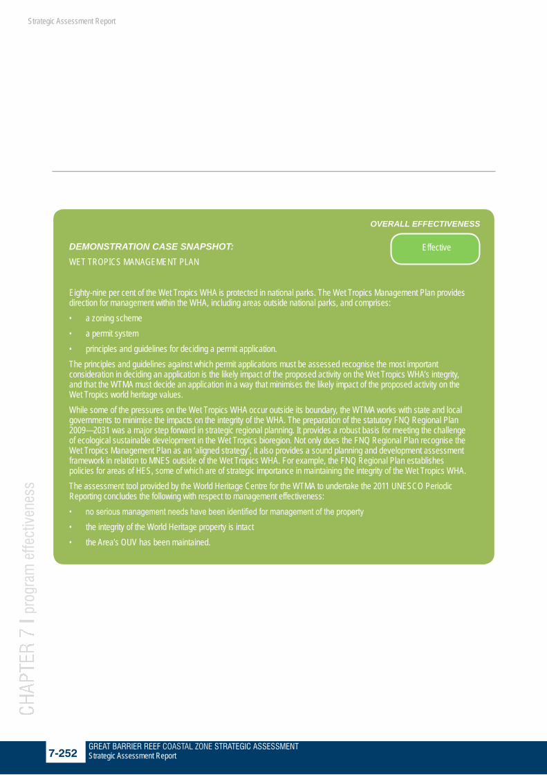
GREAT BARRIER REEF COASTAL ZONE STRATEGIC ASSESSMENT7-252 Strategic Assessment Report
CHAP
TER
7 l p
rogr
am e
ffect
iven
ess
Strategic Assessment Report
DEMONSTRATION CASE SNAPSHOT: WET TROPICS MANAGEMENT PLAN
Eighty-nine per cent of the Wet Tropics WHA is protected in national parks. The Wet Tropics Management Plan provides direction for management within the WHA, including areas outside national parks, and comprises:• a zoning scheme• a permit system • principles and guidelines for deciding a permit application.The principles and guidelines against which permit applications must be assessed recognise the most important consideration in deciding an application is the likely impact of the proposed activity on the Wet Tropics WHA’s integrity, and that the WTMA must decide an application in a way that minimises the likely impact of the proposed activity on the Wet Tropics world heritage values. While some of the pressures on the Wet Tropics WHA occur outside its boundary, the WTMA works with state and local governments to minimise the impacts on the integrity of the WHA. The preparation of the statutory FNQ Regional Plan 2009—2031 was a major step forward in strategic regional planning. It provides a robust basis for meeting the challenge of ecological sustainable development in the Wet Tropics bioregion. Not only does the FNQ Regional Plan recognise the Wet Tropics Management Plan as an ‘aligned strategy’, it also provides a sound planning and development assessment framework in relation to MNES outside of the Wet Tropics WHA. For example, the FNQ Regional Plan establishes policies for areas of HES, some of which are of strategic importance in maintaining the integrity of the Wet Tropics WHA. The assessment tool provided by the World Heritage Centre for the WTMA to undertake the 2011 UNESCO Periodic Reporting concludes the following with respect to management effectiveness:• no serious management needs have been identified for management of the property • the integrity of the World Heritage property is intact • the Area’s OUV has been maintained.
OVERALL EFFECTIVENESS
Effective

GREAT BARRIER REEF COASTAL ZONE STRATEGIC ASSESSMENT7-253 Strategic Assessment Report
CHAP
TER
7 l p
rogr
am e
ffect
iven
ess
Strategic Assessment Report
7.7.5 Avoiding impact from urban
developments in the Wet Tropics
Almost ninety per cent of the Wet Tropics WHA is national park, with some areas of state forest, state leasehold (for grazing), aboriginal freehold and a small part privately owned as freehold. Specific legislation has been made for this area and the Wet Tropics Management Authority (WTMA) was established in 1992 to plan for the management of this WHA. The Wet Tropics Management Plan 1998 has a zoning scheme aimed at protecting most of the area while allowing for limited sustainable use (tourism facilities, roads and service infrastructure). The demonstration case snapshot below describes the management plan.
7.7.5.1 Gaps and improvementsExisting legislation and management plans protecting the values of the Wet Tropics WHA are recognised to be effective and maintaining and protecting the integrity of this area and the OUV for which the area is recognised. Ongoing review and adaptive management will continue to apply to maintain relevance of protection measures and management actions. Alignment of management actions applicable to the WHA with pressures that occur outside its boundary will continue to be a focus.
7.7.5.2 Summary of effectiveness in avoiding impacts from urban developments in the Wet Tropics WHA
Management effectiveness component
Grading Confidence Trend Summary of evidence
Effectiveness in avoiding impacts (urban development)
MNES: Wet Tropics WHA
Effective Adequate The Wet Tropics Management Plan provides specific planning arrangements that avoid and minimise impacts from urban development within for the Wet Tropics WHA.
Effective: Planning, development and management processes effectively ensure that impacts are avoided.
7.7.6 Planning for industrial development
Major state sponsored industrial development areas (SDA) are established under the SDPWO Act. SDAs are clearly defined areas of land to promote economic development in Queensland. They typically take the form of one of the following: ▪ Existing industrial hubs for large-scale, heavy industry –
mainly located on the Queensland coast – in close proximity to ports, rail and major road networks
▪ multi-user infrastructure corridors – for the co-location of infrastructure such as rail lines, water and gas pipelines, and electricity transmission lines
▪ major public infrastructure sites – for example, the Queensland Children’s Hospital.
There are four SDAs in the GBR coastal zone – Townsville, Abbot Point, Gladstone and the Stanwell to Gladstone Infrastructure Corridor. The SDPWO Act provides the legislative framework for the declaration, development planning (development schemes) and assessment of development proposals within SDAs. The development scheme is a regulatory document controlling land use and infrastructure planning and development in the SDA. The development schemes ensure development is planned and managed appropriately and that environmental impacts are avoided and minimised. SDA development schemes override local and other state government planning instruments related to the use of land.

GREAT BARRIER REEF COASTAL ZONE STRATEGIC ASSESSMENT7-254 Strategic Assessment Report
CHAP
TER
7 l p
rogr
am e
ffect
iven
ess
Strategic Assessment Report
DEMONSTRATION CASE SNAPSHOT: ABBOT POINT STATE DEVELOPMENT AREA
A high level concept study was undertaken to determine the area of land adjacent to the Port of Abbot Point that could be suitable for large scale industrial development. The Bowen and Abbot Point Industrial Land Concept Plan and Infrastructure Plan (the concept study)142 involved land suitability assessments which were primarily based on desktop data analysis, and examined the environmental characteristics of the land to determine where industry would be best suited. The land suitability assessment considered geology, topography, hydrology, vegetation communities, flora, fauna, fauna habitat areas, and the environmental and legislative policy framework in force at that time, including the EPBC Act.The concept study concluded that the area provided an excellent opportunity for major industrial development in Queensland adjacent to an existing deep water port. It provided conceptual planning and siting principles for industrial development and infrastructure to service that development, which were used to inform a boundary of the proposed Abbot Point State Development Area (APSDA), and delineate precincts within the boundary. The proposed APSDA was divided into three draft land use precincts, including a buffer precinct, industrial precinct and transport precinct. The APSDA was declared in June 2008 to facilitate port-related development. Following the declaration, Queensland’s Coordinator-General undertook a range of studies to inform preparation of the development scheme for the area which would guide the location of future development. As part of this process MNES were identified and reviewed for the site. The studies informed the identification of land use precincts to ensure that industry and infrastructure development are located in areas with low to little ecological significance. Only around 27 per cent of the SDA is designated for industrial development while the rest is allocated to environmental areas, buffers and infrastructure corridors. In particular, the Kaili (Caley) Valley wetland, while not a MNES on its own, represents important habitat for migratory species and has been designated in the development scheme as an environmental management precinct. The APSDA is regulated and managed by a development scheme which controls strategic / operational land use planning and approval within the boundaries of the SDA. The scheme ensures development is well planned and managed, and ensures as far as possible that from the outset impacts on MNES are avoided through appropriate planning and the inclusion of specific objectives to protect environmental values and areas of HES within and adjacent to the Abbot Point SDA. The development scheme also includes an objective for development to consider the cumulative impacts from development.
OVERALL EFFECTIVENESS
Partially effective
Source: 143
IMAGE MISSING

GREAT BARRIER REEF COASTAL ZONE STRATEGIC ASSESSMENT7-255 Strategic Assessment Report
CHAP
TER
7 l p
rogr
am e
ffect
iven
ess
Strategic Assessment Report
The Abbot Point SDA demonstration case shows an example where areas of MNES are identified, considered, and where appropriate avoided, upfront in planning.The declaration of a new SDA requires a regulation amendment and approval by the Governor in Council. Currently, consideration of impacts on MNES is not a legislative requirement at the declaration stage. However, it is usually considered by the Coordinator-General as part of the scoping and background planning before declaration of the SDA. It is proposed that more explicit consideration of MNES be required as part of the new Guideline for MNES.Outside of SDAs industrial development is generally restricted to industrial areas identified under local government planning schemes.
7.7.6.1 Gaps and improvementsHistorically, development schemes for SDAs have considered MNES in a number of cases; however this consideration is not explicitly required. Mapping of areas of environmental significance has been incorporated into development schemes to avoid impacts on MNES. However, this could be made more explicit in the future. A guideline addressing the consideration of MNES is required to provide greater certainty and clarity of the consideration of MNES during decision-making for declaration of SDAs and planning for SDAs.
7.7.6.2 Summary of effectiveness in avoiding impacts from industrial developments
Management effectiveness component
Grading Confidence Trend Summary of evidence
Effectiveness in avoiding impacts (industrial development)
MNES: All
Partially effective
Limited Historically, development schemes for SDAs have considered MNES in a number of cases; however this consideration is not explicitly required. Mapping of areas of significance has been incorporated into development schemes to avoid impacts on MNES, however, this could be made more explicit in future.
Partially effective: Planning, development and management processes effectively ensure that impacts are identified and considered. Mapping (where relevant) of areas of significance is integrated into planning, but may not be explicit

GREAT BARRIER REEF COASTAL ZONE STRATEGIC ASSESSMENT7-256 Strategic Assessment Report
CHAP
TER
7 l p
rogr
am e
ffect
iven
ess
Strategic Assessment Report
7.7.7 Port planning
The designation of new or extended port areas under the TI Act does not specifically require consideration of environment impacts or involve a public process. However, the Queensland Government’s aim is to ensure port development in the GBR coastal zone occurs in a balanced and incremental way to support economic development while maintaining the environmental value of the GBR. Through the TI Act the Program requires that all ports develop a comprehensive Port Land Use Plan (LUP) which includes measures to manage impacts on the environment including MNES. These plans are reviewed every eight years to ensure they remain contemporary.
Port boundaries in the GBRWHA Since the World Heritage Listing of the GBR in 1981, port limits have undergone very few amendments. A listing of amendments and a comparison of maps illustrating port limits in 1993 compared to current boundaries indicates only minor amendments have taken place. In fact, in the case of Mackay and Innisfail (now Mourilyan), some port boundaries were actually reduced significantly. The only additional port since the World Heritage Listing was Abbot Point, established in 1982.Other than minor changes to address the alignment of port limits for the ports of Mackay and Hay Point in 2007, there has not been any change to the port limits of any other Queensland port since 2005. The port limits for the Port of Rockhampton which includes Port Alma and Balaclava Island have not changed since 1994.
The LUP designates areas for environmental protection which typically exhibit recognised ecological and/or cultural heritage values that are to be protected, managed and enhanced. Any development or activity that conflicts with the conservation of these values is inappropriate in areas designated for environmental protection. LUPs are required to identify Desired Environmental Outcomes which provide the overarching vision and direction for future development.A demonstration case of port land use planning, using the Port of Abbott Point LUP as the example, provides details of the considerations, including environmental, that port land use planning addresses. A snapshot is provided below.
Recognising the important role of ports and the contribution port planning makes to the management of impacts on MNES and OUV of the GBRWHA the Queensland Government released for public consultation the Great Barrier Reef Ports Strategy, outlining the government’s vision for port development adjacent to the GBR: to develop an efficient Queensland port network that will grow Queensland’s four pillar economy while protecting the GBR.The Great Barrier Reef Ports Strategy and feedback received from public consultation has been used to inform the development of a Queensland wide ports strategy (the Queensland Ports Strategy) during 2013. The Queensland Ports Strategy will extend the principles enunciated in the Great Barrier Reef Ports Strategy to all Queensland ports. It will outline the Queensland Government’s approach to future port development and planning including:• establishing a master planning framework for Queensland
ports, with consistent principles for environmental, social and economic planning
• supporting the efficient, commercial operation of ports including consideration of governance, investment models, and opportunities to streamline process
• providing for improved port and infrastructure corridor protection
• improving landside infrastructure planning for port supply chains.
The Draft Queensland Ports Strategy 2013 was released for public comment on 17 October 2013. When finalised it will be the Queensland Government’s blueprint for managing and improving the efficiency and environmental management of the state’s port network over the next decade. It is intended to strengthen the effectiveness of environmental management at ports. Key actions will focus on the concentration of port development around long-established major ports in Queensland, and will provide guidance for port master planning through consistent principles for environmental, social and economic planning. Through such actions, ports will be better able to identify and manage potential environmental impacts in the GBR coastal zone including MNES and OUV. The Draft Strategy maintains the commitments of the Draft Great Barrier Reef Ports Strategy and also prohibits capital dredging for the development of deep water port facilities outside Queensland’s long-established major port areas.

GREAT BARRIER REEF COASTAL ZONE STRATEGIC ASSESSMENT7-257 Strategic Assessment Report
CHAP
TER
7 l p
rogr
am e
ffect
iven
ess
Strategic Assessment Report
7.7.7.1 Gaps and improvementsAs identified in the Independent Review of the Port of Gladstone, port planning is comprehensive, but doesn’t necessarily take into account World Heritage values. Port planning does not currently require specific consideration of MNES (including OUV) and this could be made more explicit in the future. A guideline addressing the consideration of MNES and OUV including World Heritage values is required to provide greater certainty and clarity and ensure they are appropriately considered in port planning.
7.7.7.2 Summary of effectiveness in avoiding impacts from port developments
Management effectiveness component
Grading Confidence Trend Summary of evidence
Effectiveness in avoiding impacts (port development)
MNES: All
Partially effective
Limited All ports are required to develop comprehenive Land Use Plans that can designate areas for envionmental protection. Guidance on how MNES, OUV and World Heritage values should be considered in port planning is limited.The Queensland Government has commited to restrict any significant port development, within and adjoining the Great Barrier Reef World Heritage Area, to within existing port limits to 2022
Partially effective: Planning, development and management processes avoid some impacts on MNES up front, but indirect impacts are not well planned for or managed.

GREAT BARRIER REEF COASTAL ZONE STRATEGIC ASSESSMENT7-258 Strategic Assessment Report
CHAP
TER
7 l p
rogr
am e
ffect
iven
ess
Strategic Assessment Report
DEMONSTRATION CASE SNAPSHOT: ABBOT POINT LAND USE PLAN
The TI Act facilitates the planning, construction and operation of State roads, railways and ports, in conjunction with the Transport Planning and Coordination Act 1994 (TPC Act). A port authority can be declared under the TI Act, with defined port limits able to be established by a regulation. The TI Act empowers port authorities to undertake a number of functions including land use planning and control of development on port land.The TI Act requires that at least every eight years, a port authority must prepare a LUP to guide the development and management of Strategic Port Land which can include seabed and tidal areas. Desired environmental outcomes (DEOs) are identified in the LUPs and structured around ecological processes, community wellbeing, and economic development - the three foundations of ‘ecological sustainability.’ The Abbot Point state development area (APSDA) is divided into land use precincts, an Industry Precinct, an Infrastructure and Corridors Precinct and a Restricted Development Precinct. The Restricted Development Precinct provides physical separation of significant industrial and infrastructure activities within APSDA from sensitive land uses outside APSDA. It also allows for the utilisation of limited areas for uses which will have no adverse impact on premises located outside APSDA and are compatible with being in close proximity to industry. The minister approved the current Abbot Point LUP on 28 March 2011. The current ecological DEOs within the Abbot Point LUP are:• Protection and enhancement of the natural port environment will be achieved through pursuing high standards of
environmental performance and incorporating sustainable environmental management into all aspects of port planning, development and operations at the port.
• Development on port land will not adversely affect the values of identified areas with high conservation significance, including the GBRMP and adjacent Caley Valley Wetlands.
• Climate change assessment will form part of the design of projects on strategic port land, as appropriate.• Development of port land will comply with air, water, waste and noise policies administered under the EP Act. Apart from being addressed in the LUP, DEOs are also reflected through corporate planning programs, the port Environmental Management Plan, supporting development guidelines and other relevant processes and programs administered by NQBP.
OVERALL EFFECTIVENESS
Partially effective

GREAT BARRIER REEF COASTAL ZONE STRATEGIC ASSESSMENT7-259 Strategic Assessment Report
CHAP
TER
7 l p
rogr
am e
ffect
iven
ess
Strategic Assessment Report
7.8 Program mitigates impacts on MNES
In situations where a proposed development cannot be sited to avoid impacts on MNES, the Program uses measures to mitigate potential impacts. In such instances the mitigation of impacts is considered on a case by case basis through design considerations and the condition of approvals. For example, impacts may be avoided by locating the development in a cleared or highly modified area under appropriate management to avoid adverse impacts on MNES. This requires detailed site surveys to determine the presence or absence of MNES and an assessment of whether the development may impact on MNES values beyond the development site. Design and siting of development, together with carefully managing the manner in which it operates can ensure that significant impacts can be minimised. For example, careful urban design and measures taken during construction can reduce or eliminate the impacts of stormwater flowing from urban areas into waterways that may contain MNES or flow into areas of MNES, such as the GBRWHA.A range of plans, policies, programs and guides have been developed by the Queensland Government to reduce the level of impact from development.
7.8.1 Conditioning of approvals
There are five key pieces of Queensland legislation in Queensland which work towards mitigating impacts of future development:1. the SP Act provides the framework for the development
assessment process in Queensland2. the SDPWO Act provides the framework for development in
SDAs and the EIS process for ‘coordinated projects’3. the EP Act provides for management of mining on land and
other environmentally relevant activities4. the TI Act outlines the process for port development 5. the ED Act outlines the process for PDAs for urban
development. Other than the TI Act and ED Act, these laws include environmental impact assessment mechanisms which have been accredited by the Australian Government through an ‘assessment bilateral agreement’ established under the EPBC Act. Further details on the role of the five key pieces of legislation and other legislation that mitigate impacts on MNES are provided in section 3.5 of the program report.
Under the accredited EIS process, impacts on MNES are specifically considered and conditions are recommended that address both direct and indirect impacts. In the case of ‘coordinated projects’, the Coordinator-General prepares an evaluation report that includes a specific chapter on MNES. Conditions are regularly imposed on development approvals to mitigate impacts on MNES. For projects that are declared ‘coordinated’ projects under the SDPWO Act, conditions are set by the Queensland Coordinator-General. In other cases, the relevant state decision-making agency or local government apply conditions to the relevant approvals. Conditions can cover a range of areas and may include:• minimising water quality impacts from runoff• treating wastewater on site• managing pests and weeds • establishing environmental management plans • minimising the risk of ASS. In highly sensitive areas such as the GBRWHA, more stringent conditions are often placed on development. For example, the water quality limits placed on discharges from the LNG plants into Gladstone Harbour were more stringent than those prescribed in the guidelines under the GBR Marine Park legislative framework. In addition, the Coordinator-General asked proponents to reduce the burden on the offshore environment by connecting to the mainland water and sewerage systems and facilitated the approvals for that connection in time to cater for all proponents.A number of supporting tools are in place to inform conditioning, including information on appropriate fishway design to ensure connectivity between ecosystems, dredging guidelines to limit impacts and design guidelines for Water Sensitive Urban Design to minimise impacts on water quality. Detailed guidelines also support many existing SPPs which provide development assessment guidance for addressing potential environmental impacts of development.The Ella Bay Resort Development Demonstration Case discusses the EIS process and conditions that can be applied to a development to mitigate impacts on MNES.
How well the

GREAT BARRIER REEF COASTAL ZONE STRATEGIC ASSESSMENT7-260 Strategic Assessment Report
CHAP
TER
7 l p
rogr
am e
ffect
iven
ess
Strategic Assessment Report
7.8.2 State Assessment and Referral Agency
The five core pieces of legislation apply to different types of development, but all work in a similar way to ensure development is appropriately planned, assessed and conditioned. The other pieces of Queensland Government legislation that apply in the GBR coastal zone sometimes overlap, but are integrated and coordinated to the extent possible. Combined, the suite of legislation provides full coverage of key management issues for the GBR coastal zone and leaves no significant gaps. In some cases, there may not be an explicit reference to MNES, but the administrative implementation of the legislation delivers this in practice.
On 1 July 2013, the Queensland Government launched the State Assessment and Referral Agency (SARA). This provides for a single agency lodgement and assessment point for development applications, where the state government has a jurisdiction (i.e. where a state agency is a concurrence agency). The new arrangements mean the chief executive of the SP Act (being the Director-General of the Department of State Development, Infrastructure and Planning (DSDIP)), will be the assessment manager or referral agency for these development applications and will coordinate Queensland Government input into the decision. This will deliver a more coordinated, whole-of-government approach to the state’s assessment of development applications.
DEMONSTRATION CASE SNAPSHOT: ELLA BAY RESORT DEVELOPMENT EIS PROCESS
The Ella Bay Integrated Resort was declared a ‘significant project’ under the SDPWO Act, requiring the proponent of the development to prepare an EIS. The Ella Bay site is surrounded on three sides (north, west and part south) by the Ella Bay National Park. Most of the surrounding area is located in the Wet Tropics WHA. The site is separated from the GBRWHA to the east by a gazetted esplanade.The EIS documentation indicated that the proposed Ella Bay development would be designed, constructed and managed to avoid (where possible) potential adverse impacts on tropical rainforest, swampland (Wet Tropics WHA) and coastal and aquatic (GBRWHA) ecosystems or on the geological and geomorphological characteristics of the region that underlie the ecological diversity of the two WHAs. MNES were addressed in both the EIS and supplementary EIS documentation. During the latter stages of the EIS process, additional work was undertaken to better understand, analyse and synthesise the potential impacts of the whole project on MNES. Where impacts on MNES including OUV cannot be avoided, the proponent committed to an environmental management regime and proposed a number of measures to minimise and mitigate potential impacts. An offsets proposal was also put forward by the proponent to address residual impacts.As a result of the EIS process for the Ella Bay Integrated Resort project and evaluation by the Coordinator-General, the proponent is required to operate under a range of conditions and implement a variety of management strategies to mitigate potential construction and operational related impacts on fauna, flora and communities. These include an offsets strategy, Environment Management Plans, protected area management and species-specific management sub-plans. Management sub-plans have been developed for the cassowary, stream-dwelling rainforest frogs, spectacled flying-fox, marine turtles and significant flora. These sub-plans identify impacts of the development on these fauna and flora and provide a number of strategies to manage or mitigate these impacts. The EIS process undertaken by the proponent and its evaluation by Queensland’s Coordinator-General and the Australian Government Environment Minister has also provided several positive tangible outcomes for the Ella Bay property. These include an expected net increase in essential cassowary habitat of approximately 238 hectares, full fencing for each precinct and all internal roads, and dedicated facilities for research including a cassowary research station. It is considered that increases in cassowary habitat, the return of land to national park, offsets arrangement proposed by the proponent, and environmental management plans have the potential to improve the condition of MNES in the area. As a result of the EIS process it is expected that should the project proceed, the condition of MNES including OUV would be relatively similar to predevelopment condition. In some respects, it could be concluded the condition of MNES would have improved as a result of offsets arrangements, environmental management plans and strategies that the project proponent is required to undertake.
OVERALL EFFECTIVENESS
Very effective

GREAT BARRIER REEF COASTAL ZONE STRATEGIC ASSESSMENT7-261 Strategic Assessment Report
CHAP
TER
7 l p
rogr
am e
ffect
iven
ess
Strategic Assessment Report
7.8.3 Specific measures to mitigate impacts on MNES
7.8.3.1 Fisheries management During the last 30 years significant commercial fishing management changes in Queensland east coast waters have helped to ensure that fisheries remain ecologically sustainable. The management of fishing activity and shipping have made significant contributions toward the mitigation of impacts on MNES in the marine environment of the GBR coastal zone. Management of fisheries in the GBRWHA is primarily the responsibility of the Queensland Government, however, the GBRMPA has a direct management role in administering the GBR Marine Park zoning plan, which prohibits fishing in certain sections of the GBR Marine Park.Changes to the Fisheries Act have been made to ensure that fisheries remain ecologically sustainable. Some of those changes include: major reductions in fishing effort and fleet size, including a $9 million buyout of the East Coast net fishery; by-catch reduction devices and satellite vessel monitoring in the trawl fishery; and the establishment of FHAs and dugong protection areas.Annual status reports are prepared for each fishery identifying interactions with protected species and any management changes. All of Queensland’s fisheries have been assessed and endorsed by the Australian Government as part of an independent assessment of all export fisheries. More than 70 declared FHAs provide protection to key fish inshore and estuarine habitats within more than 1.1 million hectares.
7.8.3.2 Shipping managementShipping management within the GBR Marine Park is primarily the responsibility of the Australian Maritime Safety Authority and the GBRMPA, who work in close collaboration with Maritime Safety Queensland, which is responsible for ship safety within port limits and in Queensland waters.The introduction of the Great Barrier Reef and Torres Strait Vessel Traffic Service (REEFVTS) is also an effective tool to assist in the mitigation of impacts to MNES in the GBRWHA. This mandatory ship reporting system has attributed to significantly reducing the number of groundings in the Great Barrier Reef and Torres Strait – from one per year between 1997 and 2003 to only one incident between the years 2004 and 2009.
Other improvements to shipping management have included establishing designated shipping areas and defined traffic routes, limiting shipping to specific zones along the Reef as well as extending the compulsory pilotage area to include Torres Strait. Shipping safety measures in the GBR are generally managed through the North East Shipping Management Group, of which the Queensland Government is a part. The group is developing the North East Shipping Management Plan which will set strategies for managing shipping in the GBR with the aim of reducing the risk of a shipping incident and pollution of the marine environment.
7.8.3.3 Protected area managementWith careful management, people can enjoy national parks and forests without damaging them. A masterplan for Queensland’s park system sets out how protected areas will be managed in Queensland for the next 20 years. Management plans or statements for each park, including any new protected areas, outline their management. The public is invited to provide input whenever a plan or statement is being prepared.QPWS actively manages fire, pest plants and animals in parks and other areas gazetted under the NC Act in order to protect the biodiversity and natural processes in these areas. The Queensland Government also provides over $8 million a year for the joint field management program for the GBR Marine Park which includes compliance, management of visitor facilities and education. The Australian Government matches this funding, with QPWS delivering the activities. Pest management under the field management program successfully manages introduced species such as wild pigs which can prey on the nests, or young of many species.

GREAT BARRIER REEF COASTAL ZONE STRATEGIC ASSESSMENT7-262 Strategic Assessment Report
CHAP
TER
7 l p
rogr
am e
ffect
iven
ess
Strategic Assessment Report
7.8.4 Gaps and improvements
Projects that are conditioned by separate state agencies do not have an explicit requirement to address MNES. A guideline addressing the consideration of MNES would provide greater clarity of how MNES are considered during these assessments and clarify where relevant management controls are applied.
7.8.5 Summary of effectiveness in mitigating impacts
Management effectiveness component
Grading Confidence Trend Summary of evidence
Effectiveness in mitigating impacts
MNES: All
Effective Adequate Project by project assessment involves appropriate conditioning of approvals to mitigate impacts on MNES. A range of fisheries management measures are in place to minimise the impacts on the GBRWHA. Interactions with threatened species are minimised through a range of by-catch reduction devices. All Queensland export fisheries have been assessed and endorsed under the EPBC Act.
Effective: Systems are in place to minimise the impacts on MNES (including OUV). Conditions may be applied to development in certain circumstances.

GREAT BARRIER REEF COASTAL ZONE STRATEGIC ASSESSMENT7-263 Strategic Assessment Report
CHAP
TER
7 l p
rogr
am e
ffect
iven
ess
Strategic Assessment Report
7.9 Program offsets residual impacts
Environmental offsets compensate for unavoidable impacts on significant environmental values, such as highly valuable species and ecosystems and MNES. They are used when it is determined that a significant environmental impact of a development cannot be avoided or mitigated. Offsets can take the form of positive management interventions such as restoration of degraded habitat, arrested degradation or averted risk, or protecting areas and improving resilience where there is imminent or projected loss of biodiversity. A number of pieces of planning, development and management legislation include a mechanism through which impacts on environmentally significant areas can be offset, such as the SP Act and the SDPWO Act. Offsetting occurs through the overarching Queensland Government Environmental Offset Policy (QGEOP).The QGEOP provides the principles for offsets and forms the foundation for development of detailed specific-issue offset policies. The QGEOP offset principles are as follows:• Principle 1: Offsets will not replace or undermine existing
environmental standards or regulatory requirements, or be used to allow development in areas otherwise prohibited through legislation or policy.
• Principle 2: Environmental impacts must first be avoided, then minimised, before considering the use of offsets for any remaining impact.
• Principle 3: Offsets must achieve an equivalent or better environmental outcome.
• Principle 4: Offsets must provide environmental values as similar as possible to those being lost.
• Principle 5: Offset provision should minimise the time-lag between the impact and delivery of the offset.
• Principle 6: Offsets must provide additional protection to environmental values at risk, or additional management actions to improve environmental values.
• Principle 7: Offsets must be legally secured for the duration of the offset requirement.
The four specific issue offset policies that Queensland has in place are implemented with the framework provided by the QGEOP (Figure 7.9 1). These are aligned with other offset tools including the Australian Government Offsets policy and local government planning schemes and laws.
Figure 7.9 1 The Queensland Government Environmental offsets policy and the supporting specific issue policies
Strategic rehabilitation areas have been specifically identified in some regions. These areas have been identified as priority areas on the basis that they would provide improved essential habitat for connectivity of MNES. For example, the Wet Tropics Conservation Strategy identifies critical cassowary habitats within the Mission Beach area, and where linkages should be made to other coastal and mountain sections of the WHA. A number of rehabilitation projects have been undertaken to target restoration in these corridors.
How well the

GREAT BARRIER REEF COASTAL ZONE STRATEGIC ASSESSMENT7-264 Strategic Assessment Report
CHAP
TER
7 l p
rogr
am e
ffect
iven
ess
Strategic Assessment Report
7.9.1 Gaps and improvements
Queensland Government’s existing specific issue offset policies have been developed separately over a number of years and are not well integrated. As our knowledge of issues impacting on the GBR coastal zone has improved it is important that offset policies are reviewed to ensure that they are targeted at the key issues impacting the GBR coastal zone and GBRWHA. The Queensland Government is currently reviewing its offsets framework to create a single, strategic policy focussed on delivering outcomes for impacted environmental matters which aligns with the Australian Government Offsets policy.
7.9.2 Summary of effectiveness in offsetting impacts
Management effectiveness component
Grading Confidence Trend Summary of evidence
Effectiveness in offsetting impacts
MNES: All
Partially effective
Limited A number of offsets policies are in place under the QGEOP, but they are not well integrated and may not deliver strategic outcomes in all instances. The different MNES are adequately captured in the existing policies, but not explicitly. It is expected that outcomes will be significantly improved under the proposed one-government offsets policy which will deliver more strategic offsets and a net improvement for MNES
Partially effective: Offsets policies do not explicitly consider MNES (including OUV), but do deliver some tangible outcomes for MNES, but not a net improvement.

GREAT BARRIER REEF COASTAL ZONE STRATEGIC ASSESSMENT7-265 Strategic Assessment Report
CHAP
TER
7 l p
rogr
am e
ffect
iven
ess
Strategic Assessment Report
DEMONSTRATION CASE SNAPSHOT: OFFSETS IN GLADSTONE HARBOUR
The Western Basin Dredging and Disposal Project is being undertaken by Gladstone Ports Corporation (GPC). It accommodates the long-term dredging and disposal of dredged spoil material that is required to provide safe and efficient access to the existing and proposed Gladstone Western Basin port facilities (in Port Curtis, from Auckland Point to The Narrows) particularly for the emerging liquefied natural gas industry in the Gladstone region. The SDPWO Act provides an assessment process for significant projects which includes preparation of an EIS against terms of reference. This EIS identifies and protects the environmental values underpinning MNES. Through this process, project proponents are required to consider avoiding or minimising impacts on MNES including OUV when preparing their EIS. Where they cannot avoid or mitigate impacts, offsets must be considered. The EIS process for the project collected the information deemed sufficient to assess impacts on MNES.At the time that the Coordinator-General assessed the Western Basin project144, offsets were only required under QGEOP and the fish habitat offset policy. The Coordinator-General’s report on the Western Basin Dredging and Disposal Project referred to the draft Australian Government policy statement regarding the use of environmental offsets under the EPBC Act to provide guidance on projects that may trigger consideration of an offset by the Australian Government. Through the EIS process, the Coordinator-General applied a strategic approach to offset identification. This approach enabled the identification of a practical offset arrangement that will protect a significant area of high value habitat over the long term. The Coordinator-General placed 143 conditions on the project after careful consideration of the likely impacts. The majority of these conditions related to avoiding and mitigating impacts. Five conditions related specifically to environmental offsets in the following areas:• Marine habitat offset• Commercial fisheries offset• Recreational fishing and boating offset• Marine and coastal biodiversity offsetThe Coordinator-General’s report on the Western Basin Dredging and Disposal Project also imposed a condition requiring additional offset measures for shorebirds and marine fauna protected under the EPBC Act to be included in the projects Flora and Fauna Management Plan (FFMP).The main difference between conditions imposed by the Coordinator-General and the Australian Government relates to seagrass protection. The Coordinator-General felt the provision of a direct offset or land-based offset for seagrass was impracticable and directed a financial contribution be provided by GPC for habitat enhancement/restoration actions in the region or the wider bioregion. The Australian Government instead required offsets specifically for seagrass.While the QGEOP provided useful guidance on the appropriate use of environmental offsets across marine and terrestrial environments, to ensure that the environmental benefits of offsets are maximised, the Queensland Government is undertaking a review of its offsets policy. A revised Queensland offsets policy will deliver more strategic outcomes and seek to align with the objectives of the Australian Government Offsets Policy where possible.
OVERALL EFFECTIVENESS
Partially effective

GREAT BARRIER REEF COASTAL ZONE STRATEGIC ASSESSMENT7-266 Strategic Assessment Report
CHAP
TER
7 l p
rogr
am e
ffect
iven
ess
Strategic Assessment Report
Figure 7.9 2 Strategic rehabilitation areas in the Wet Tropics NRM region.

GREAT BARRIER REEF COASTAL ZONE STRATEGIC ASSESSMENT7-267 Strategic Assessment Report
CHAP
TER
7 l p
rogr
am e
ffect
iven
ess
Strategic Assessment Report
Figure 7.9 3 Rehabilitation priority areas for the Wet Tropics World Heritage Area. Source: 123

GREAT BARRIER REEF COASTAL ZONE STRATEGIC ASSESSMENT7-268 Strategic Assessment Report
CHAP
TER
7 l p
rogr
am e
ffect
iven
ess
Strategic Assessment Report
7.10 How well the Program enhances MNES
Over the 150 years since European settlement, significant changes have been made to Queensland’s environment as a result of land clearing for agriculture and urban purposes. While it may not be possible to restore environmental values to their pre-European settlement condition, a large part of the Queensland Government’s Program is aimed at improving the condition and trend of those values that have been significantly impacted from past activities. The revised offsets policy discussed in section 7.9 will improve Queensland’s management of impacts on MNES.There are a number of important supporting programs in place to enhance and improve MNES in the GBR coastal zone include:• Everyone’s environment grants• Regional NRM Investment Program• Reef Water Quality Protection Plan• Gladstone Healthy Harbour Partnership• Indigenous Land and Sea Rangers Program• Wet Tropics Conservation Strategy• Queensland Wetlands Program• Queensland’s Biodiversity Strategy• Back on Track species prioritisation frameworkNRM programs play an important role in addressing legacy impacts through a broad and long-term approach to finding and implementing solutions to address environmental and natural resource management threats. Currently, Queensland NRM funding is addressing biodiversity, wetlands, water quality, coastal risk, weeds and pest management, and sustainable agricultural practices. Program components to enhance MNES are also targeted on the main pressures and impacts on MNES in the GBR coastal zone including loss of habitat extent and condition, decline in water quality and pest and weed species. Maintaining and enhancing the condition of MNES areas is critical to enable recovery of the ecological processes of these areas from extreme weather events and the consequences of climate change.In their capacity as local government authorities, Aboriginal Shire Councils servicing remote areas of the GBR coastal zone do not just provide natural resource management services to their respective regions. These councils also form critical economic, educational and social hubs for their communities. All vary greatly with regard to the nature and scope of services and programs they offer, while providing expert knowledge in representing the interests and cultural heritage of their communities in partnership with Traditional Owners. Several regional NRM bodies have Traditional Owners and/or other representatives of Aboriginal and Torres Strait Islander people on their boards. As directors and/or members of regional NRM bodies, these officers provide a key link between Indigenous interests and matters relating to country and government natural resource management. Although limited, part of their role is to ensure consultation and engagement processes between Traditional Owner groups and government representatives is ongoing and meaningful.The following sections describe how the Queensland Government’s Program enhances MNES within the GBR coastal zone.
7.10.1 World Heritage Areas
7.10.1.1 Great Barrier Reef World Heritage AreaThe 2009 Great Barrier Reef Outlook Report4 noted that the threat of climate change dominates most aspects of the GBR’s outlook over the next few decades. Therefore measures to improve the resilience of the GBR to adapt to climate change by reducing other threats will be critical to its conservation. This is also acknowledged in the companion GBR Region strategic assessment.One of the most significant and successful programs of work improving the resilience of the GBRWHA are the actions being taken to address poor water quality. The Queensland and Australian governments have been working together since 2003 to deliver actions to halt and reverse the decline in water quality through the Reef Water Quality Protection Plan (the Reef Plan) (see the Water Quality Demonstration Case). Reef Plan’s purpose is to address runoff of pollutants (i.e. nutrients, pesticides and sediment) from broadscale agriculture (e.g. sugarcane, grazing and horticulture). The Queensland Government contributes $35 million a year to GBR water quality initiatives, including extension and education. One of Queensland’s major contributions to Reef Plan is the development of the sugarcane and grazing Best Management Practice (BMP) programs. Annual Reef Plan report cards are showing positive progress towards targets, with reductions in all key pollutants and significant uptake of improved practices by landholders. Even if further coastal development, including agriculture, was to cease tomorrow, the GBR would still be faced with a significant legacy of poor water quality from changes in land use over the past 150 years. Improving water quality in the GBR relies on continued contributions and commitments from many different groups and individuals, ranging from the Australian and Queensland governments, industry organisations, NRM organisations and individual land managers. By working together to develop, prioritise and implement improved land management practices, the GBR has the best chance of long term survival. It is critical that across the GBR coastal zone this legacy is addressed by continuing the range of programs designed to improve land management and water quality flowing to the GBR. This will significantly improve and enhance the condition of the GBR, including its OUV. In conjunction with improved resilience through water quality improvements associated with land use management, the control of pests, weeds and fire in all areas remains a challenge for land and resource managers. Impacts from these threatening processes place significant pressures on MNES. Management of these pressures is a primary responsibility of landholders and natural resource managers. The Queensland Government is responsible for state-owned land including national parks. Biosecurity Queensland is responsible for managing biosecurity risks to Queensland. The Australian Government is responsible for Commonwealth owned land and marine areas.

GREAT BARRIER REEF COASTAL ZONE STRATEGIC ASSESSMENT7-269 Strategic Assessment Report
CHAP
TER
7 l p
rogr
am e
ffect
iven
ess
Strategic Assessment Report
DEMONSTRATION CASE SNAPSHOT: WATER QUALITY IMPROVEMENT IN MACKAY WHITSUNDAY REGION
Measures to improve water quality present one of the best opportunities to improve the condition of the GBRWHA and increase its resilience to other impacts such as climate change. A range of significant programs are in place to halt and reverse the decline in water quality. These are coordinated through the Reef Water Quality Protection Plan (the Reef Plan). A key target of the Reef Plan is to achieve a 50 per cent reduction in nutrient loads entering the GBR by 2018 and ensure that by 2020 catchment runoff has no detrimental impact on the health and resilience of the GBR. Total fertiliser use on farming lands in the catchment has been reduced in recent years and recent monitoring and modelling show current initiatives are successfully reducing nutrient concentrations in catchment runoff. There was an estimated 7 per cent reduction in nitrogen, 6 per cent reduction in sediment load and a 15 per cent reduction in pesticide loads as a result of land management changes between 2009 and 2011.36 There is a range of programs to deliver against these targets. These include the Australian Government’s Reef Rescue Program, which offers incentives to landholders to adopt improved practices, and the Queensland Government’s water quality program which provides a regulatory framework for best practice and is currently transitioning to a co-management approach working with industry to develop best management practice programs. Accelerated actions under the Reef Plan since 2009 are already showing reductions in pollutant loads which are expected to drive improvements in marine health over the longer term. Reef Plan has been shown to be an effective mechanism for coordinating and integrating actions across governments in close partnership with industry, regional NRM bodies and conservation groups. It is also an appropriate mechanism to ensure adaptive management based on sophisticated and integrated monitoring programs and water quality guidelines. The report from the recent visit by UNESCO praised the efforts by government and partners on actions to improve water quality. This was also reflected by the World Heritage Committee which, at its 36th session in July 2012, ‘welcomed the initial positive results of the Reef Plan and associated measures to address major long-term impacts on the property from poor water quality.’ Efforts were further acknowledged at the 2013 meeting where the results of the second report card were praised.
Demonstration case jointly prepared with the GBRMPA
OVERALL EFFECTIVENESS
Effective
The Queensland Government also contributes significantly to a range of other management programs designed to improve the GBRWHA and enhance MNES, including:• over $8 million a year for joint field management for the
GBR Marine Park which includes compliance, management of visitor facilities and education
• over $21 million a year for fisheries management, and an additional $9 million to buy-out of the net fishery on the east coast of Queensland which will have financial benefits for the fishery, as well as conservation benefits for the GBR.
The Queensland Government also invests in a range of activities designed to restore coastal ecosystems and enhance MNES. The Everyone’s Environment Grants provides $12 million statewide to community-based groups over three years to tackle environmental degradation. In the first round of grants, fourteen
projects that will improve environmental degradation in the GBR coastal zone were successful. Funds granted for these projects totals $0.55 million. Other funds are also dedicated to the Queensland Wetlands Program ($0.5 million a year) which provides a number of tools to help restore the function of important wetlands adjacent to the GBR that support a healthy functioning reef ecosystem. Queensland also invests around $5 million a year to support on ground activities through its Queensland Regional NRM Investment program in the GBR coastal zone.Queensland Government has also committed $1 million to control COTS outbreaks which cause serious degradation to corals. This commitment is independent of management objectives targeted at water quality improvements, which also have effect on reducing risk of impact from COTS. This control commitment is through the Skilling Queensland program, which

GREAT BARRIER REEF COASTAL ZONE STRATEGIC ASSESSMENT7-270 Strategic Assessment Report
CHAP
TER
7 l p
rogr
am e
ffect
iven
ess
Strategic Assessment Report
provides a range of activities including job preparation, work placement and accredited training to assist local long-term unemployed jobseekers. Work placement participants assist in small scale control of the COTS infestation on selected and popular coral reefs.
7.10.1.2 Gaps and improvementsAlthough management of the direct threats of climate change to the GBR are beyond the scope of the Queensland Program, there are significant opportunities to improving the GBR’s resilience to climate impacts through commitments against improving water quality, reducing impacts from fire, weeds and pests including COTS. The success of all parallel programs in achieving the single resilience objective will require alignment of how each program is achieving its individual objectives to enable adaptive management to inform improvements in the Program as needed. Partial coordination across the programs focussed on water quality and land use management improvements currently occurs through measures such as the Reef Plan. Overarching coordination across the Queensland Program that also captures other threatening processes could be considered to support development, prioritisation and implementation of all resilience measures to ensure the GBR has the best chance of long-term survival.
7.10.1.3 Summary of effectiveness of enhancing MNES in GBRWHA
Management effectiveness component
Grading Confidence Trend Summary of evidence
Contribution to enhancement of MNES including OUV and management of existing pressures
MNES: GBRWHA
Very effective
Limited Improving water quality is a major contributor to building GBR resilience and improving MNES and OUV and the Queensland Government invests heavily in this key area. The Queensland Government also contributes to a range of programs that will enhance the GBR World Heritage Area over time.
Very effective: Existing programs effectively and explicitly contribute to enhancement of MNES including OUV and management of existing pressures.
7.10.1.4 Wet Tropics World Heritage AreaThe governance arrangements for the Wet Tropics provide an outstanding example of how to effectively manage a WHA. The Wet Tropics WHA has its own legislation, a statutory authority, the Wet Tropics Management Authority, and a statutory management plan (and permitting system) to oversee protection and management. There is periodic reporting on the values underpinning the OUV of the Wet Tropics WHA. Significant programs are also in place to enhance the Wet Tropics WHA.
Additional Program components relevant to the management of the Wet Tropics WHA include:• Wet Tropics Conservation Strategy 2004• State of the Wet Tropics annual reporting to the Queensland
and Australian governments• Wet Tropics Walking Strategy 2010 - 2014• Wet Tropics Nature Based Tourism StrategyOne of the main pressures on the MNES in the GBR coastal zone is pest and weed species. The Wet Tropics Conservation Strategy includes measures targeting pest and weed species (see the Weed and pest management in the Wet Tropics WHA case study below). By targeting pest and weed species within the Wet Tropics WHA, MNES will also be protected and enhanced.

GREAT BARRIER REEF COASTAL ZONE STRATEGIC ASSESSMENT7-271 Strategic Assessment Report
CHAP
TER
7 l p
rogr
am e
ffect
iven
ess
Strategic Assessment Report
Case study:WEED AND PEST MANAGEMENT IN THE WET TROPICS WHA The Wet Tropics Conservation Strategy145 has developed management priorities to ensure the conservation, rehabilitation and transmission to future generations of the WHA, including the control of invasive species.The Wet Tropics Conservation Strategy sets out a strategic approach to weed control, including prioritising the allocation of available resources to:• prevent the introduction of new species of invasive weeds to the Wet Tropics region• eradicate new and localised outbreaks of environmental weeds which can disrupt and transform ecosystems• prioritise weed eradication in more pristine areas rather than in disturbed areas• ensure weed eradication programs are achievable and incorporate long-term monitoring and rehabilitation• provide educational materials about the identification, reporting and eradication of weeds for land managers and the public• research the ecology and management of priority weeds in the Wet Tropics.Historically, weed control has focused on established outbreaks of weeds which affect agricultural productivity. A recent initiative in the Wet Tropics WHA has focused on environmental weeds which are becoming established in the Wet Tropics and could potentially overrun intact ecosystems, but where eradication is still achievable. Targeting new incursions of miconia species, mikania vine, Koster’s curse, Siam weed and limnocharis, the Australian and Queensland governments have provided $490 000 for the first year of eradication and guaranteed funding for five years.The Wet Tropics Conservation Strategy also sets out a strategic approach to pest management of exotic and feral animals, including prioritising the allocation of available resources to:• monitor outbreaks of feral deer and goats and support localised, integrated eradication programs across all tenures• monitor, record and report the occurrence of foxes and rabbits within the WHA and surrounds and support integrated control
programs• eradicate feral cattle populations from the WHA where possible• apply the management principles of the draft national threat abatement plan for predation, habitat degradation, competition and
disease transmission by feral pigs within the Wet Tropics region• develop and implement integrated feral pig control programs involving targeted baiting programs (based on research into new
bait technology), trapping and where appropriate, shooting• protect critical populations of endangered species with pig exclusion fencing where appropriate and achievable• target pig control programs during dry times when pigs are congregated and target areas are more readily accessible

GREAT BARRIER REEF COASTAL ZONE STRATEGIC ASSESSMENT7-272 Strategic Assessment Report
CHAP
TER
7 l p
rogr
am e
ffect
iven
ess
Strategic Assessment Report
7.10.1.5 Gaps and improvementsThe pest and weed program in place for the Wet Tropics WHA is considered to be effective. Legacy impacts are well understood. Maintaining currency of knowledge around emerging pest and weed threats and appropriate controls requires ongoing revision for improvement of the program. Specific issues in need of improvement include a comprehensive early warning system, contingency plans for weeds, pests and diseases, building regional capability and increased community awarenesss.
7.10.1.6 Summary of effectiveness of enhancing MNES in Wet Tropics WHA
Management effectiveness component
Grading Confidence Trend Summary of evidence
Contribution to enhancement of MNES including OUV and management of existing pressures
MNES: Wet Tropics WHA
Effective Adequate The Wet Tropics Conservation Strategy is designed to improve the OUV of the property by controlling targetting priority weeds and pests, installing animal overpasses and rehabilitating areas to improve connectivity.
Effective: Legacy impacts are well understood and some measures are in place to recover or improve MNES (including OUV). Some resources are applied to address the key threats.
7.10.2 Ramsar wetlands
In 2003, the Australian and Queensland governments established the Queensland Wetlands Program to support projects that will result in long-term benefits to the sustainable use, management, conservation and protection of Queensland wetlands. Since then the Queensland Wetlands Program has supported more than 70 projects to help with all aspects of wetland management, from mapping and classification, through assessment to monitoring and communication of wetlands information. A range of new mapping, information and decision-making tools and products have been developed under the Queensland Wetlands Program to enable local, state and national government agencies, landowners, regional natural resource management bodies and conservation groups to protect and manage wetlands into the future. The tools include mapping of wetland extent, development of a framework for assessing wetland condition and a toolbox for identifying the policy and legislation relating to wetlands.
In addition, a range of guidelines have been delivered to assist with defining and delineating wetlands, buffer planning, rehabilitation and the management of wetlands in farming systems. Wetland management profiles and conceptual models further enhance knowledge and understanding of wetland systems. The ability to update the wetlands mapping and the development of tools for monitoring risk and condition means Queensland is one of the few states with the ability to monitor wetland extent, risk and condition changes and assess the effectiveness of policies.The Queensland Wetlands Program directly contributes to enhancement of Ramsar Wetlands, as well as other nationally important wetlands not listed under the EPBC Act, that also provide critical habitat for a range of migratory species. The Bowling Green Bay demonstration case outlines some of the programs in place to enhance Ramsar wetlands.

GREAT BARRIER REEF COASTAL ZONE STRATEGIC ASSESSMENT7-273 Strategic Assessment Report
CHAP
TER
7 l p
rogr
am e
ffect
iven
ess
Strategic Assessment Report
DEMONSTRATION CASE SNAPSHOT: BOWLING GREEN BAY RAMSAR SITE
The Bowling Green Bay Ramsar site is one of two sites within the GBR coastal zone listed under the Convention on Wetlands of International Importance especially as Waterfowl Habitat (Ramsar Convention). An Ecological Character Description (ECD) has been prepared for the site which identifies the ecological character, as well as key threats to the site, knowledge gaps, monitoring needs and communication messages. Ninety-nine per cent of the Ramsar site is within protected areas. A management plan is in place to guide ongoing management of the site including, for example, fire and visitor management. However, the site experiences a range of pressures from activities outside its boundaries. The main pressures have been identified as poor water quality from agricultural, urban and industrial development. Reef Plan aims to halt and reverse the decline in water quality entering the GBR from broadscale agriculture and has the potential to contribute significant benefits to the site. Work has also been completed under the Environment Protection (Water) Policy to set water quality objectives and targets specific to the region. The Wetlands state planning policy also helps prevents high impact earthworks that would affect high value wetlands, including the Bowling Green Bay Ramsar site. Other programs, such as the Queensland Wetlands Program are significantly improving understanding of the site and the pressures on it and funding on-ground activities that aim to improve its function (e.g. through natural resource management programs). The future condition of the site will be largely dependent on the effective management of key pressures in the surrounding catchment area, particularly where they relate to modification of surface water and groundwater hydrology and pollution. On site management will continue to focus on key issues such as pest and weed species, the impacts of recreational activities and altered fire regimes to ensure the ecological character of the site is maintained.The ESD framework provides a comprehensive foundation for informing future management actions, site planning, research initiatives and stakeholder engagement. Rolling reviews will assist with evaluation and reporting of progress and inform an adaptive management approach to site management.
OVERALL EFFECTIVENESS
Effective
7.10.2.1 Gaps and improvementsPressures from outside the RAMSAR wetland boundaries including poor water quality and impacts from significant earthworks present a challenge to the ongoing protection of the these wetland areas. Developing a greater understanding of the impacts from human activities and the interactions of many naturally occurring processes would assist in revising the limits on acceptable change in relation to the ecological character of the site. Detailed studies of the flux and flow of pollutants such as nutrients and herbicides delivered through groundwater flows into the GBR coastal zone both annually and on a seasonal basis would assist in this endeavour.
A better understanding of the interactions, function and ecological values of critical ecosystems on the receiving environments when under stress would provide a greater context for understanding how to improve resilience. Other knowledge gaps include an understanding of oceanographic processes, invasive species, estimates of species which use the site, habitat types, cumulative impacts of toxins and the interaction between surface and ground water.

GREAT BARRIER REEF COASTAL ZONE STRATEGIC ASSESSMENT7-274 Strategic Assessment Report
CHAP
TER
7 l p
rogr
am e
ffect
iven
ess
Strategic Assessment Report
7.10.2.2 Summary of effectiveness of enhancing Ramsar wetlands
Management effectiveness component
Grading Confidence Trend Summary of evidence
Contribution to enhancement of MNES including OUV and management of existing pressures MNES: Ramsar wetlands
Effective Adequate Stable The Queensland Wetlands Program is delivering a range of benefits to Ramsar wetlands and tools to assist in improving their condition over time.
Effective: Legacy impacts are well understood and some measures are in place to recover or improve MNES (including OUV). Some resources are applied to address the key threats.
7.10.3 Threatened ecological communities and
threatened/migratory species habitat
Past activities leading to the loss of vegetation, altered fire regimes and grazing have impacted TECs and species habitat. Broadscale clearing for agriculture ceased in Queensland at the end of 2006 under the VM Act, which has led to a significant reduction in clearing rates. Protection was further enhanced in 2009 through regulating the clearing of vegetation within 50 metres of watercourses in priority GBR catchments.
Queensland Government’s vegetation management framework effectively provides protection for EPBC Act listed TECs and species habitats. In some cases however, a RE that forms part of a TEC or species habitat is actually listed as ‘least concern’ under the VM Act because it is regionally more abundant (i.e. more than 30 per cent of remnant remains). This listing provides a slightly lower level of protection than ‘of concern’ and ‘endangered’ REs under the VM Act. The VM Act protects only endangered REs in urban areas being developed for urban purposes. Queensland’s NRM program is contributing to further improvements through habitat rehabilitation programs, as evidenced in the Burnett Mary Region Healthy Habitats Case Study, below.

GREAT BARRIER REEF COASTAL ZONE STRATEGIC ASSESSMENT7-275 Strategic Assessment Report
CHAP
TER
7 l p
rogr
am e
ffect
iven
ess
Strategic Assessment Report
Case study:BURNETT MARY REGION HEALTHY HABITATS
The Healthy Habitats is an initiative of the Burnett Mary Regional NRM Group to protect and enhance the region’s significant biodiversity assets. Healthy Habitats is jointly funded by the Australian Government through the Caring for our Country and the complementary Queensland Regional NRM Investment program.Healthy Habitats has three components:• on-ground investment in terrestrial and coastal biodiversity priority areas• priority species and ecosystems research and monitoring• biodiversity education and awareness raising.The object of these programs is to support a range of high priority activities and to improve the long term security of the region’s significant biodiversity assets.In partnership with catchment care groups, landholders and managers, Burnett Mary Regional NRM Group’s Healthy Habitats team accomplished on-ground actions to assist in reducing critical threats within 21 243 hectares of native vegetation including habitat for threatened plants and animals.Key recovery and conservation plan actions were carried out in a total of 1 040 hectares of TECs for Brigalow, Semi- Evergreen Vine Thicket, Littoral Rainforest Coastal Vine Thicket and Box Gum Grassy Woodland. 2 615 hectares of remnant vegetation within the Bulburin area have been enhanced through the implementation of feral animal control activities and improved fire management. The national park and adjoining private land serves as significant refugia for terrestrial biodiversity in the north of the Burnett Mary region and contains a high incidence of threatened species.

GREAT BARRIER REEF COASTAL ZONE STRATEGIC ASSESSMENT7-276 Strategic Assessment Report
CHAP
TER
7 l p
rogr
am e
ffect
iven
ess
Strategic Assessment Report
DEMONSTRATION CASE SNAPSHOT: DUGONG MANAGEMENT
Dugongs have been a focus of management agencies for many decades, with high-level leadership from the former Great Barrier Reef Ministerial Council. In the 1980s the GBRMPA’s original zoning plan protected some important dugong habitats (seagrass meadows) in ‘no-take’ and ‘no-go’ zones. The level of spatial protection was increased significantly in response to the serious decline in dugongs in the GBRWHA south of Cooktown, and outside the GBRWHA in Hervey Bay in 1997. These emergency measures established 16 Dugong Protection Areas under Queensland fisheries legislation (which imposed spatial and gear restrictions and prohibited the use of some types of fishing nets). Soon after, additional measures to protect seagrass habitats from trawling were introduced, as well as netting restrictions and net attendance rules to reduce the incidental capture of dugong within the East Coast Inshore Fin Fish Fishery, and a review of the use of nets in the Queensland Shark Control Program. Other management arrangements were introduced with the Department of Defence for activities in the Shoalwater Bay Defence Training Area.Dugong habitats were explicitly taken into consideration when the GBR Marine Park was re-zoned in 2004. In combination with other management measures such as improving water quality and fisheries management, approximately 96 per cent of high conservation value dugong habitats are highly protected. Furthermore, 24 per cent of known shallow water seagrass meadows are included in highly protected green zones that prohibit extractive activities. Major efforts to improve water quality through Reef Plan are expected to have positive outcomes for seagrass in the medium term.Mapping and qualitative models have been used to aid understanding of cumulative impacts on dugongs. The condition for dugong populations is projected to decline to very poor in the southern GBRWHA, and to remain good in the north in the coming decades.The most critical management action for dugongs is to ensure the health of seagrass meadows. The recovery, protection and increased resilience of seagrass habitats is fundamental to the recovery of dugong populations. It will be particularly important to continue long-term collaborative arrangements to halt and reverse the declines in water quality entering the GBR lagoon, such as those in place under Reef Plan.Community action and compliance activities at a local and regional scale will continue to help to reduce and minimise mortality or ill-health of dugongs (for example, from entanglement and drowning in nets, vessel strike, marine debris, disease, noise or interference).Additionally, avoiding entanglement and incidental drowning can be achieved by reviewing the Queensland Shark Control Program to meet bather protection objectives and achieve zero mortality for dugongs, and by adopting best-practice net fishing techniques and technology through regional co-management between government, fishers and the broader community. TUMRAs are a valuable tool to facilitate sustainable traditional hunting without impacting on dugong populations.Adaptive management requires monitoring, evaluation and review of the abundance and distribution of dugong and seagrass to allow better understanding of trends.
Demonstration case jointly prepared with the GBRMPA
OVERALL EFFECTIVENESS
Effective

GREAT BARRIER REEF COASTAL ZONE STRATEGIC ASSESSMENT7-277 Strategic Assessment Report
CHAP
TER
7 l p
rogr
am e
ffect
iven
ess
Strategic Assessment Report
Case study:REVEGETATION OF MAHOGANY GLIDER HABITAT
Traditional Owners of the Wet Tropics region possess a rich and complex knowledge of the region’s natural environment. Their unique knowledge of Wet Tropics ecosystems has provided the basis for environmental management in the region for thousands of years, and forms a critical part of how Traditional Owners care for their country. Knowledge of species distribution, breeding patterns, food requirements and seasonal growth patterns strengthens the close kinship between people, country, and its flora and fauna.The Queensland Government in cooperation with Terrain NRM, the WTMA, and Aboriginal communities, councils and representatives are working to optimise Indigenous intellectual property and knowledge in protecting the Wet Tropics region and WHA. In conjunction with scientific knowledge, Traditional Owner knowledge and input is being used to restore habitat of the critically endangered mahogany glider within the Wet Tropics region.The mahogany glider (Petaurus gracilis) is a critically endangered glider thought to be extinct since the 1880s until a living specimen was found in 1989. The glider’s greatest threat is from habitat loss through land clearing. As it is not dependent on rainforest and prefers woodland and swampy coastal plains, the glider’s range falls outside the protection of the WHA. To protect the glider’s remaining habitat, several government programs including buy back schemes and population identification and monitoring projects have been undertaken by various authorities including the Girringun Rangers.
As part of the joint Australian and Queensland governments’ Recovery Plan for the Mahogany Glider Petaurus Gracilis, Traditional Owners of the Wet Tropics region are identified as key proponents of efforts to save this endangered species. Actions identified in the plan indicate that Traditional Owners and their representatives have a role to play in assessing habitats and corridors, engaging private landholders and implementing strategies to preserve or rehabilitate mahogany glider habitat. Traditional Owners also hold a key stake in promoting and facilitating broader community involvement in programs and activities to save the glider.Projects from these arrangements are being delivered by Terrain NRM with the assistance of the Girringun Rangers run by the Girringun Aboriginal Corporation. Terrain’s Caring for our Country funded Habitat Incentives Project is designed to increase the habitat for two hundred threatened species in the Wet Tropics region including the mahogany glider.Working on country belonging to the Girramay people, the Girringun Rangers are helping revegetate mahogany glider habitat on part of the Girramay native title determination. Activities of this project include weed control and revegetating riparian areas along Meunga Creek. Many of the trees being planted on the site are also of cultural significance to the Girramay people and will be used as educational tools in the long-term.

GREAT BARRIER REEF COASTAL ZONE STRATEGIC ASSESSMENT7-278 Strategic Assessment Report
CHAP
TER
7 l p
rogr
am e
ffect
iven
ess
Strategic Assessment Report
7.10.3.1 Gaps and improvementsAs evidenced through the Mackay, Isaac and Whitsunday Regional Plan demonstration case, the methodology for mapping does not separate individual biodiversity values into separate mapping layers. Identifying these specific values on a particular site needs to be transparently facilitated through a more interactive mapping facility to assist in the planning process. It is anticipated that the implementation of a single SPP will clearly articulate the matters of state interests which will provide the necessary direction for local government to also consider MNES in the planning process.
TEC and species habitat areas are mostly protected from direct loss (clearing) through the VM Act or being located in conservation areas. However, all TECs and habitats face pressures from pests and altered fire regimes and those located in minimum use and moderate use areas face additional pressure from grazing and other activities. Improved land management practices to deal with these pressures are required to enhance these MNES values.
7.10.3.2 Summary of effectiveness of enhancing threatened ecological communities and threatened/mirgatory species
Management effectiveness component
Grading Confidence Trend Summary of evidence
Contribution to enhancement threatened ecological communities and threatened/migratory species
Effective Adequate (TEC)Limited (Habitat)
Stable Clearing of vegetation over the last 150 years has created a significant lasting impact on the extent of TECs and species habitat. The VM Act halted broadscale clearing in Queensland in 2006. Clearing of regrowth in riparian areas in also prohibited in high priority catchments.
Effective: Legacy impacts are well understood and some measures are in place to recover or improve MNES (including OUV). Some resources are applied to address the key threats.

GREAT BARRIER REEF COASTAL ZONE STRATEGIC ASSESSMENT7-279 Strategic Assessment Report
CHAP
TER
7 l p
rogr
am e
ffect
iven
ess
Strategic Assessment Report
7.11 How well the Queensland Government’s Program deals with impacts from outside the Program
7.11.1 Likely impacts of climate change
and severe weather events
One of the greatest influences on the future of a number of MNES, including the GBRWHA, is the likely impacts of climate change and severe weather events. Whilst the Queensland Government’s Program can put in place measures to improve the resilience of MNES so ecosystems and species have a better capacity to adapt to the likely changes from climate change, such as improving water quality and reducing other threats like pest species, addressing greenhouse gas emissions is outside the scope of the strategic assessment. Action on climate change mitigation is not within the scope of the Program, however given its pervasive nature each component of the Program addresses the expected impacts. Similarly to climate change, severe weather events such as cyclones and flooding cannot be avoided through the Program. Management measures that improve the resilience of MNES and thereby its capacity to recover afford the best opportunities to address the impacts of severe weather events.
7.11.2 Shipping
Responsibility for shipping through the GBR is primarily the responsibility of the Australian Government, although the Queensland Government does have responsibility for managing ship movements within port limits. Maritime Safety Queensland (MSQ) works in partnership with the Australian Maritime Safety Authority (AMSA) and the GBRMPA to ensure shipping management is coordinated and integrated. The North East Shipping Management Plan will set strategies, including additional or enhanced measures that may be needed in the future, for managing shipping in the GBR with the aim of reducing the risk of a shipping incident and subsequent pollution of the marine environment.The shipping case study below shows that despite an increase in shipping traffic through the GBR, shipping incidents have not increased. This shows the effectiveness of the management measures in place.

GREAT BARRIER REEF COASTAL ZONE STRATEGIC ASSESSMENT7-280 Strategic Assessment Report
CHAP
TER
7 l p
rogr
am e
ffect
iven
ess
Strategic Assessment Report
Case study:SHIPPING
Management of shipping in the GBR has significantly improved since the area was inscribed on the World Heritage list and subsequently designated as a Particularly Sensitive Sea Area by the International Maritime Organisation.While shipping movements in the GBRWHA have increased over the past 25 years, the number of major shipping incidents occurring each year has not. The Queensland and Australian governments have a range of existing protections in place to manage the risk of ship movements, including compulsory pilotage (requiring a local pilot who understands local conditions, navigation and shipping routes) and vessel monitoring, which was extended to the southern boundary of the GBR after the grounding of the Shen Neng 1 in 2010.These measures have significantly reduced groundings (Figure 7.11 1). The following graph showing the number of groundings from 1986 to 2009 illustrates the impact of the enhanced ship management measures that have been put in place since the 1990s
Figure 7.11 1 Ship groundings since 1996 Source: 146
As shipping numbers increase over the next 25 years, it is expected that management will need to continue to adapt to manage emerging risks. To maintain preparedness, the North East Shipping Management Group is developing the North East Shipping Management Plan which is assessing whether the current safety and management measures will be effective in 10-20 years’ time if shipping activity significantly increases.

Page intentionally left blank

Page intentially left blank

Page intentionally left blank
Chapter 8projected condition
8. Projected condition ..................................2858.1 Introduction .............................................. 2858.2 Great Barrier Reef World Heritage Area and
Marine Park .............................................. 2888.3 Wet Tropics World Heritage Area ............. 2908.4 Ramsar sites ............................................ 2928.5 Threatened ecological communities ........ 2958.6 Threatened and migratory species .......... 2978.7 Summary and conclusion ......................... 299

Page intentionally left blank
Extract from Great Barrier Reef Coastal Zone Strategic Assessment terms of reference2.5 Recommendations for changes to the ProgramThe Strategic Assessment Report must include an evaluation of the resulting projected condition of MNES including OUV within the strategic assessment area of the Program taking into account:(a) the baseline scenario, i.e. the analysis of the current condition of MNES including OUV, projected trends and existing threats………

GREAT BARRIER REEF COASTAL ZONE STRATEGIC ASSESSMENT8-285 Strategic Assessment Report
CHAP
TER
8 l p
roje
cted
con
ditio
nStrategic Assessment Report
Values Management
1. Background
2. Social and economic context
3. Assessment approach
4. Condition & trend
5. Pressures
8. Projected condition
6. Program summary
7. Program effectiveness
9. Adaptive management
10. Recommended changes
STRATEGIC ASSESSMENT REPORT
8. Projected condition
8.1 Introduction
This chapter provides an analysis of the projected condition of the GBR coastal zone’s MNES over the 25 year timeframe for the Program, including proposed improvements and forward commitments. The projected condition of MNES draws upon on a synthesis of information including:• the existing extent, condition (state) and trend for MNES• an understanding of activities and pressures impacting on
MNES, including risk to MNES• the effectiveness of the Program, including forward
commitments, to avoid future impacts and enhance MNES• an assessment of resilience.
This is achieved by considering the findings from chapter 4 on condition and trend, chapter 5 on pressures and cumulative impacts, chapter 7 on Program effectiveness and the overall risk of the potential future impacts to MNES in the GBR coastal zone. The Australian Standard procedure for risk assessment147 has been used to assess the risks posed by pressures or impacts to MNES in the GBR coastal zone. Both the likelihood and consequence of each predicted impact has been ranked on a five-point scale (see section 3.8). An overall risk level for each pressure or impact was then determined, based on both its likelihood and consequence (Table 8.1 1).

GREAT BARRIER REEF COASTAL ZONE STRATEGIC ASSESSMENT8-286 Strategic Assessment Report
CHAP
TER
8 l p
roje
cted
con
ditio
nStrategic Assessment Report
Table 8.1 1 Potential impacts on MNES and risk assessment
Potential impacts Likelihood Consequence Summary Risk
Loss of habitat and Connectivity
Possible Moderate Projected increases in urban and industrial development makes the likely clearing and modification of MNES areas possible at a local scale.However, with the general prohibition on clearing of native vegetation for agriculture under the VM Act, 32 % of terrestrial MNES located in protected areas, the expected inclusion of MNES areas in Queensland’s mapping and a better approach to vegetation offsets the likelihood of further loss of habitat is reduced
Medium
Decline in water quality Posssible Major Ongoing improvements in land management are likely to reduce sediment and nutrient loads in catchment runoff in the future.However, there is likely to be a significant lag time between land management and measurable water quality improvements
High
Pest and weed species and disease
Possible Major Limited resources available to NRM programs in the GBR coastal zone is likely to lead to an increase in pest and weed species occurrence and dispersal.
High
Inappropriate fire regimes Likely Moderate Altered fire regimes have been associated with changes to species and community abundance, diversity and distribution and have resulted in a loss of biodiversity. The impacts of climate effects may additionally contribute to this pressure.
High
Disturbance of species Almost Certain Minor Increases in population, tourism and recreation use of the GBR coastal zone is likely to lead to an increase in disturbance of species
Medium
Altered flow regimes Likely Major Artificial barriers in the catchment continue to affect freshwater and estuarine systemsChange the timing and magnitude of flows can prevent fish migration, disrupt natural breeding cycles and affect freshwater inflows into the GBR lagoon
High

GREAT BARRIER REEF COASTAL ZONE STRATEGIC ASSESSMENT8-287 Strategic Assessment Report
CHAP
TER
8 l p
roje
cted
con
ditio
nStrategic Assessment Report
A summary of the current condition and recent trend of key MNES is presented in Table 8.1 2. The current condition across the key MNES are assessed as good to very good with one noted exception for the Broad leaf tea-tree woodlands. Despite the current condition, the recent trend for the GBRWHA has been deteriorating. This is also true for the Broad leaf tea-tree woodlands.
Table 8.1 2 Summary of current condition and recent trend of key MNES and values underpinning MNES
MNES/value Current condition Recent trend
GBRWHA (OUV) Good DeterioratingWet Tropics WHA (OUV) Good StableRamsar sites Very good StableTEC - Broad leaf tea-tree woodlands Poor DeterioratingTEC - Littoral Rainforest Good Stable
Threatened species habitat Good Stable
GBR coastal zone migratory species habitat Good Improving
A summary of the current condition, trend, impacts and management effectiveness of each key MNES category follows. This information has been used to determine the projected condition. Overall the projected trend for the GBR coastal zone is very positive. The analysis shows that the key MNES and values underpinning MNES are expected to improve into the future. In particular, the GBRWHA recent condition had been assessed as declining but is now expected to improve over time and into the future. The exception to this clear upward trend is the Broad Leaf tea-tree woodland which has been in poor condition in recent times and was expected to continue to deteriorate. More recent assessments of the woodland indicate that despite the condition remaining poor, the future trend is expected to stabilise.
Future management of the GBR coastal zone will start to focus more specifically on cumulative pressures to maintain the health and resilience of the GBR. Water quality in particular has the potential to build resilience in the GBR coastal zone and minimise the cumulative impacts of past activities and inform future activities with regard to management strategies. Realising improvements in other MNES as a result of improved water quality will take more time.

GREAT BARRIER REEF COASTAL ZONE STRATEGIC ASSESSMENT8-288 Strategic Assessment Report
CHAP
TER
8 l p
roje
cted
con
ditio
nStrategic Assessment Report
8.2 Great Barrier Reef World Heritage Area and Marine Park
8.2.1 Condition and trend
As a result of historical (settlement) land clearing, wetland drainage and ongoing diffuse rural pollution (sediment, nutrients and pesticides) from agricultural and grazing land within the GBR catchments many ecosystems in the GBRWHA have experienced significant and ongoing decline. On a regional scale, the marine environment adjacent to the Cape York NRM region is generally in better condition than those to the south, notwithstanding recent findings of anthropogenic derived sediment being observed in the marine environment. Nevertheless, the trend within marine and estuarine areas adjacent Cape York Peninsula is expected to remain stable for all MNES values. However, the situation is different south of Cooktown due to greater levels of historical land clearing and greater intensity of agriculture and grazing leading to poorer quality freshwater flows into the GBR lagoon. There are early positive signs that NRM programs aimed at achieving best management practice in the agricultural and grazing sectors are slowing the decline in water quality entering
the GBR lagoon. Unfortunately, these improvements have in the past two years been overwhelmed by extreme weather events and associated heavy rains that have flushed catchments that had previously experienced extended periods of below average rain, if not drought. The assessment identified overwhelming evidence that a range of threats is continuing to affect inshore habitats along the coast and the species that use these habitats. Extreme weather events and poor water quality from catchment runoff are the prime reason for the continuing loss of habitats such as seagrass and inshore corals (Table 4.10 2). There have been declines recorded in dolphins, dugongs and shorebirds, although seabirds and estuarine crocodile populations are in good condition. Conversely, mangrove ecosystems may have benefited from increased sedimentation. The processes of sedimentation, nutrient cycling and connectivity are in poor condition and are continuing to deteriorate. In summary, while catchment NRM programs aimed at improving land management practices are showing signs of success, the trend continues to be one of deterioration.

GREAT BARRIER REEF COASTAL ZONE STRATEGIC ASSESSMENT8-289 Strategic Assessment Report
CHAP
TER
8 l p
roje
cted
con
ditio
nStrategic Assessment Report
Further vegetation clearing associated with urban development and industrial activities could create additional pressures and subsequent impacts.The Queensland Government Program and forward commitments will aim to concentrate development in the GBR coastal zone to promote sustainable development and limit possible impacts The overall findings are that the extents of MNES habitats declined in the past, but however, they are now stable due to the end of broadscale clearing under the VM Act which came into effect in 1999. The overall condition of MNES habitat was found to be good. However, there are some areas of particular concern.The assessment identified overwhelming evidence that a range of threats continue to affect inshore habitats along the coast and the species that use these habitats. The key impacts affecting habitats and species are extreme weather events, poor water quality from catchment runoff, and loss of habitats. Land and natural resource management practices have improved during the past few decades. Although better management of many agricultural systems has reduced their impacts on the environment, a number of issues around nutrient and soil management remain. Improved management techniques currently being implemented in the GBR coastal zone have started to yield better water quality results. However, there will be a time lag to halt and subsequently reverse overall water quality results.The northern inshore habitats of the GBR remain in good condition, whereas the southern inshore habitats have deteriorated – especially seagrass meadows and inshore coral reefs (Table 4.10 2). Populations of migratory species vary. There have been declines recorded in dolphins, dugongs and shorebirds, although seabirds and estuarine crocodile populations are in good condition. The processes of sedimentation, nutrient cycling and connectivity are in poor condition and are continuing to deteriorate.
8.2.2 Impacts
The most significant impacts on the GBR continue to be the likely impacts of climate effects and poor water quality. The impacts of poor water quality are more pronounced in the southern inshore area of the GBR, compared with the northern and offshore areas. Previous clearing and modification of the catchments has also had an impact on inshore functionality, particularly through changes to natural waterways. The impacts of urban, port and industrial development tend to be locally significant and do not pose a significant threat to the GBRWHA. Continued improvements expected with regard to those activities make it less likely that condition will decline (see section 5.4).
8.2.3 Management effectiveness
Project by project assessment involves appropriate conditioning of approvals to avoid, mitigate or offset impacts on MNES. Impacts are avoided, mitigated or offset through legislation, plans, policies and programs included in the Queensland Government’s Program. The planning and development assessment and monitoring regime outlined in the Program, limit and minimise impacts on MNES, including OUV. Major project conditions restrict and control the nature and extent of development to ensure only sustainable development occurs with minimal impacts on the surrounding environment.A number of offsets policies are in place under the Queensland Government Environmental Offsets Policy, but are not well integrated to ensure strategic outcomes. They deliver some tangible outcomes for MNES, but not a net improvement and therefore are assessed as partially effective. Management plans are in place for protected areas to address ongoing cumulative impacts although further improvements could be made to identify and manage cumulative impacts from development activities. Proponents of major projects are required to identify and assesspotential cumulative impacts on MNES as part of the EIS process. To date, however, there is no consistent method to determine the cumulative impacts of a development proposal. Based on this, the Program’s effectiveness in addressing cumulative impacts is assessed as partially effective.Significant progress is being made to improve water quality through the Reef Plan. These actions will build the resilience of the GBR and improve the ability of MNES to deal with the likely impacts of climate change. The Queensland Government also contributes to a range of other programs that will improve MNES over time. Legacy impacts of past activities are well understood andmeasures are in place to improve MNES (including OUV). The Queensland Government continues to work closely with the GBRMPA in areas of joint management of the GBR Marine Park, particularly in relation to field management (i.e. compliance and island management).
8.2.4 Projected condition
Some values of the GBRWHA are expected to improve in response to:• significant investment in water quality improvement• improved data that supports mapping of MNES areas.The Commonwealth marine area is outside the GBR coastal zone, however, the values, pressures, impacts and projected condition of this MNES are the same as those for the GBRWHA.

GREAT BARRIER REEF COASTAL ZONE STRATEGIC ASSESSMENT8-290 Strategic Assessment Report
CHAP
TER
8 l p
roje
cted
con
ditio
nStrategic Assessment Report
8.3 Wet Tropics World Heritage Area
8.3.1 Condition and trend
The 2011 UNESCO Periodic Reporting concluded the following with respect to condition and trend of the Wet Tropics WHA:• no serious management needs have been identified for
management of the property; • the integrity of the World Heritage property is intact • the Area’s OUV has been maintained.The Wet Tropics WHA is in good condition. Pressures on biodiversity are generally not geographically uniform. Analysis of the condition indicators for the Wet Tropics report card suggests that, with respect to the status and trends of biodiversity, the overall assessment for the entire Wet Tropics WHA was ‘good’. In areas outside the WHA, the condition is poor, with extensive areas historically cleared in the coastal floodplains, and increased risk of impacts from development, the spread of pests and weeds, and extreme weather events (see section 4.3.1).
8.3.2 Impacts
The Wet Tropics NRM region is the most populated of the NRM regions adjacent to the GBR and the population is growing. Tourism relies almost exclusively on marketing the natural values of the region, particularly the GBR and Wet Tropics WHAs. Despite the economic importance of industry, it relies on MNES values and is therefore careful to avoid or minimise its environmental impacts. As a result, these impacts are neglibile.Vegetation loss stands at 22 per cent of the pre-clearing extent.124 The topography and relative remoteness of this NRM region has helped protect the area, as has World Heritage designation in 1988 and resultant extensive conservation. The region is characterised by areas of coastal habitat separated from mountain habitat by a narrow coastal plain that has been intensively developed, mostly for growing sugarcane. This development has led to poor catchment water quality and limited habitat connectivity between coastal and mountain habitats.

GREAT BARRIER REEF COASTAL ZONE STRATEGIC ASSESSMENT8-291 Strategic Assessment Report
CHAP
TER
8 l p
roje
cted
con
ditio
nStrategic Assessment Report
The predicted future development in the Wet Tropics NRM region will include urban and tourism development. Development in the Wet Tropics NRM region has the potential to impact on the Wet Tropics WHA.While there have been many major advances in conserving the WHA through research, technology, legislation and community participation and support, there remain some serious threats to the Wet Tropics WHA’s OUV. Some major underlying and emerging threats are: • The impacts of climate change on endemic and threatened
species, particularly in montane rainforests.• Major biosecurity issues due to the arrival of highly invasive
weeds, feral animals and diseases. The arrival of myrtle rust and its potential impact on Wet Tropics species and ecosystems, and the threatening advance of tramp ants such as the electric ant and yellow crazy ants into the WHA are of particular concern.
• The significant damage and disturbance caused by three cyclones in recent decades crossing the WHA between Babinda and Cardwell (tropical cyclones Winifred [1986], Larry [2006]) and Yasi [2011]). This part of the Wet Tropics is home to threatened species such as the cassowary and mahogany glider. Forests damaged during these events will take decades to recover.
• Urban and rural development and associated activities which may result in loss of remnant vegetation and habitat, presents the possibility of fragmentation between sections of the WHA and a loss of connectivity essential for certain species.
8.3.3 Management effectiveness
Management of the Wet Tropics WHA is effective. Separate legislation and a statutory authority (the WTMA) overseeing management in the Wet Tropics WHA ensure impacts are identified and managed. Seventy-nine per cent of the WHA is protected in national parks. The Wet Tropics Management Plan provides direction for management within the WHA, including areas outside national parks, and comprises a zoning scheme and permit system. There is a robust system of reporting on the condition of the WHA and the WTMA works closely with the Queensland Government to manage impacts from outside the WHA through the FNQ regional plan.The contribution to the enhancement of MNES including OUV, and the management of existing impacts is assessed as effective. The Wet Tropics Conservation Strategy is designed to improve the OUV of the Wet Tropics WHA by controlling weeds and pests, installing animal overpasses and rehabilitating areas to improve connectivity.
8.3.4 Projected condition
Separate legislation and a statutory authority oversee the management of the Wet Tropics WHA. The condition is projected to remain very good and may further improve as a result of enhancement under the Wet Tropics Conservation Strategy.

GREAT BARRIER REEF COASTAL ZONE STRATEGIC ASSESSMENT8-292 Strategic Assessment Report
CHAP
TER
8 l p
roje
cted
con
ditio
nStrategic Assessment Report
8.4 Ramsar sites
8.4.1 Condition and trend – Bowling
Green Bay Ramsar site
This Ramsar site is in very good condition and continues to demonstrate its ecological character. The draft ECD for the Bowling Green Bay Ramsar site assessed that the site continues to meet the Ramsar nomination criteria (see section 4.4.1).
8.4.2 Impacts – Bowling Green Bay Ramsar site
Land use within this Ramsar site catchment area is almost entirely agricultural and pastoral, with extensive agricultural lands associated with the Burdekin river irrigation area occurring further inland. Livestock (cattle) grazing is also carried out in portions of the site, mainly in the brackish and freshwater areas north-west of the Haughton River. The northern seaward portion of the site abuts the GBR Marine Park. Several small townships (Cungulla and Hucks Landing) are encompassed by the site but do not form part of it. At the
northern extremities of Capes Bowling Green and Cleveland, there are small lighthouse reserves (approximately 80 hectares and 3 hectares respectively) and a further 208 hectares has been excised at the western end of Bowling Green Bay for the Australian Institute of Marine Science.Agricultural, urban and industrial developments in the catchment area external to the site, pose the most significant threats to the integrity of the area, particularly in the lowland areas. The potential impact posed by these is the result of cumulative impacts causing changes to water regimes and the chemistry of both surface and sub-surface waters. As already evident within the coastal region, this initiates rapid changes in biological communities and degrades the natural functioning of wetlands within the landscape and their value as habitat 148.The predominant impact on the Bowling Green Bay Ramsar site is from extreme weather events. Other impacts to the Ramsar site come from activities outside its boundaries, including a decline in water quality, habitat fragmentation and pest and weed species (see section 5.4).

GREAT BARRIER REEF COASTAL ZONE STRATEGIC ASSESSMENT8-293 Strategic Assessment Report
CHAP
TER
8 l p
roje
cted
con
ditio
nStrategic Assessment Report
8.4.3 Management effectiveness – Bowling
Green Bay Ramsar site
As 99 per cent of this Ramsar site is within a protected area, on-site impacts are effectively avoided through terrestrial and marine protected areas. Despite the lack of a general management plan, portions of this Ramsar site are subject to controlled burning practices to reduce the damaging effects of wildfire. Shallow seasonal wetlands are also subject to controlled grazing to maintain the wetlands for waterfowl by preventing the invasion of upland grasses into the swamps during the dry spring. Limited public access is available to the whole area for fishing and camping. Minor facilities are available at one location (Barramundi Creek) and proposed for another (Bald Rock at Cape Cleveland). The area is actively patrolled by two full time rangers of the QPWS who enforce regulations on the site.Off-site cumulative impacts from development activity are not avoided as effectively, however there are some key measures in place (e.g. avoiding high impact earthworks). A range of programs are directly enhancing the condition of the wetlands, including water quality improvement programs. There has been significant investment in the Queensland Wetlands Program which provides supporting tools for management.
8.4.4 Condition and trend – Shoalwater
and Corio Bays Ramsar site
The Shoalwater and Corio Bays Ramsar site encompasses coastal and sub-coastal ecosystems which are relatively undisturbed. This Ramsar site is in very good condition and continues to demonstrate its ecological character. The ECD for the site assessed that the site continues to meet the Ramsar nomination criteria, with no significant deterioration in the ecological character of the site outside the realms of natural variability 43 (see section 4.5.1).
8.4.5 Impacts – Shoalwater and Corio Bays Ramsar Site
The Shoalwater Bay area has been gazetted as a Defence Practice Area under the Defence Act 1903 (Cth). A Commission of Inquiry acknowledged that Defence use should be the primary use of the Area but recommended ‘that conservation use of the area as a whole – land and sea – be elevated in importance and explicitly recognised as being a concurrent and equally significant use with Defence use of the area’ 149. Defence activities within the nominated area are localised and are appropriately managed under the Area’s integrated management plan. Deliberate burning by Indigenous people and pastoralists occurred historically as a fire control measure and has had some long-term impact on the area.
Commercial and recreational fishing is an important activity at both bays and minor tourism and other recreation activities also occur. Prohibition of trawling in much of the area and the current low level use for tourism and recreation mean these activities appear to pose little threat to the values of the area. Oyster banks in the area are licensed by the Queensland Department of Agriculture, Fisheries and Forestry (DAFF).Around Shoalwater Bay commercial and recreational fishing, agricultural and pastoral activities, and recreation activities are limited. Around Corio Bay, state forest and national park dominate with limited urban land use, tourism, recreation and agriculture making up most of the remaining activities. Future growth in marine-based tourism and increased recreational activities is predicted. There has been an increase in the use of the freshwater area by Indigenous people as they renew their cultural and spiritual links to the land.Defence training activities pose localised disturbance in the Shoalwater Bay Training Area but are appropriately managed under the guidelines of the area’s integrated strategic plan. Threats posed by the use of fire as a management tool and feral pests (cat, fox, rabbit, cattle, horses, pigs and goats) and weeds (Lantana camara, Passiflora suberosa and Emilia sonchifolia) have been addressed through the implementation of the management plan for this Ramsar site. Illegal fishing practices (e.g. netting) pose a threat to dugongs, turtles and fish stocks (especially barramundi and salmon), and breaches are enforced under the Fisheries Act.The predominant impact on the Shoalwater and Corio Bay Ramsar sites is from extreme weather events. Other impacts to the Ramsar site come from activities outside its boundaries, including a decline in water quality, changes in groundwater hydrology and pest and weed species (see section 5.4).

GREAT BARRIER REEF COASTAL ZONE STRATEGIC ASSESSMENT8-294 Strategic Assessment Report
CHAP
TER
8 l p
roje
cted
con
ditio
nStrategic Assessment Report
8.4.6 Management effectiveness – Shoalwater
and Corio Bays Ramsar site
The Shoalwater Bay area has been listed on the Register of the National Estate since 1980150. Corio Bay is a gazetted FHA and has restrictions placed on it to protect its fish habitat values. The entire area is within the GBR Marine Park and managed within the provisions of its zoning plan. Conservation management of the marine areas are the responsibility of the GBRMPA, and Queensland Government DEHP and DAFF. On-site impacts are effectively avoided through terrestrial and marine protected areas, 80 per cent of the Ramsar site is within a protected area. Access to the Shoalwater Bay Training Area is restricted and existing tourism and recreation use is at a low level. All tourism and recreational opportunities are marine-based and these are totally restricted when the area is in military use. Current levels of recreational fishing and tourism from the coast are not causing damage to the national estate values.Although there are some key measures in place (e.g. avoiding high impact earthworks), off-site cumulative impacts from development are not as effectively avoided. There is however, a range of programs that are directly enhancing the condition of the wetlands, including water quality improvement programs. There has been significant investment in the Wetlands Program which provides supporting tools for management.
8.4.7 Projected condition
Significant impacts on the two Ramsar sites are effectively avoided through terrestrial and marine protected areas. Programs are also in place to directly enhance or mitigate impacts from outside the Ramsar sites, including water quality improvement programs. Both Ramsar sites are projected to remain in very good condition and programs to improve water quality will translate into improved condition.

GREAT BARRIER REEF COASTAL ZONE STRATEGIC ASSESSMENT8-295 Strategic Assessment Report
CHAP
TER
8 l p
roje
cted
con
ditio
nStrategic Assessment Report
8.5 Threatened ecological communities
8.5.1 Condition and trend
Terrestrial habitats in northern GBR catchments are generally in good condition, however in the southern GBR catchments these habitats have been substantially modified, especially wetlands and forests. TECs are made up of multiple REs which do not all share the same conservation status. For some ecological communities, there is a mixture of ‘endangered’ and ‘least concern’ REs as classified by the Queensland Herbarium. The TECs with a significant proportion of their extent within the GBR coastal zone are:• broad leaf tea-tree woodlands in high rainfall coastal north
Queensland• littoral rainforest and coastal vine thickets of eastern
Australia.See section 4.6.1 for further detail.
The broad leaf tea-tree woodlands TEC is generally in poor condition and the trend is considered to be deteriorating, because a significant proportion of this TEC has been cleared and much of its remaining extent is located in areas of moderate use. The ‘littoral rainforest’ on the other hand retains much of its original extent and a significant proportion is located in conservation and minimum use areas.
8.5.2 Impacts
The landscape within which the broad leaf tea tree ecological community occurs is subject to a range of land uses including grazing. Some areas are subject to small-scale clearing for hobby-farms and fire breaks. The key threats impacting upon the ecological community are clearing and fragmentation, weed invasion, inappropriate grazing regimes, forestry practices, inappropriate fire regimes, and illegal wildlife harvesting. The main potential threats to the ecological community relate to myrtle rust and changes in hydrological regimes 151.

GREAT BARRIER REEF COASTAL ZONE STRATEGIC ASSESSMENT8-296 Strategic Assessment Report
CHAP
TER
8 l p
roje
cted
con
ditio
nStrategic Assessment Report
Generally, the littoral rainforest and coastal vine thickets of eastern Australia ecological community has been significantly reduced and fragmented by sandmining, agriculture and coastal development. However this TEC is less impacted in the GBR coastal zone. Presently, the main key threats to the ecological community include clearing, coastal development, visitor disturbance, weed invasion, animal grazing/browsing, fire and the effects of fragmentation 45. In addition, natural disturbances, such as storms and cyclones can impact the ecological community, and are likely to increase in frequency and intensity with climate change.The impacts on TECs have been significantly reduced since broadscale clearing ended in 2006. Since that time, vegetation across Queensland has increased. The main impact on TECs is loss of habitat and connectivity, altered fire regimes and the spread of weeds, as identified in section 5.4.
8.5.3 Management effectiveness
Management of protected areas and vegetation clearing under the VM Act is important in the protection of TECs. A large proportion of the GBR coastal zone is within conservation areas (over 30 per cent), with the VM Act providing important protection outside conservation areas. Very little of the remaining extent of the two TECs are located in urban or other intensive use areas.Legacy impacts on TECs are well understood and some measures are in place to recover or improve MNES. The halting of broadscale clearing in Queensland under the VM Act in 2006 and the protection of riparian vegetation in priority GBR catchments under the VM Act in 2009 will further protect and improve TECs in the GBR coastal zone. The vegetation offsets policy is partially effective but will be significantly improved under the proposed new offsets policy which will deliver more strategic outcomes and net improvement for MNES.
8.5.4 Projected condition
The projected condition of the broad leaf tea tree TEC is expected to move from deteriorating to stable in response to the protection of native vegetation under the VM Act, while the projected condition of the littoral rainforest TEC is expected to move from stable to improve due to the extent of this TEC within protected and minimum use areas and the protection afforded by the VM Act.

GREAT BARRIER REEF COASTAL ZONE STRATEGIC ASSESSMENT8-297 Strategic Assessment Report
CHAP
TER
8 l p
roje
cted
con
ditio
nStrategic Assessment Report
8.6 Threatened and migratory species
8.6.1 Condition and trend
Based on habitat extent, the condition and trend for threatened and migratory species in the GBR coastal zone varies. However, taken together the general picture is that around 25 per cent of habitat for the key species assessed has been lost due to historical clearing, which is far less than for many habitat types in coastal Queensland. Additonally, of the remaining habitat extent, around 60 to 80 per cent is located in conservation or minimum use areas, thereby providing this habitat with a high degree of protection. For all key species the recent trend is considered to be stable or improving.Populations of threatened and migratory species vary. There have been declines recorded for dolphins, dugongs and shorebirds. Estuarine crocodiles, seabirds and bony fish populations are in good condition and improving (see section 4.7). Species records indicate that populations of some species is very low (e.g. yellow chat, cassowary and bare-rumped sheathtail bat). Further, some species, such as the cassowary
population around Mission Beach, are under pressure due to being in close proximity to urban areas and risking dog attacks, vehicle collision and habitat fragmentation. Some species have been affected by experiencing several extreme weather events over several consecutive years. Beaches and coastlines, mangroves, saltmarsh and seagrass are important habitats for migratory shorebirds, seabirds and marine turtles. In the remote north, they remain relatively undisturbed, except for by marine debris. However, saltmarsh and seagrass have been assessed as in poor or very poor condition south of Cooktown due to sedimentation from freshwater inflows..
8.6.2 Impacts
The impacts vary across the different threatened and migratory species. For terrestrial threatened species, the major impacts are loss and fragmentation of habitat and pest species. Altered fire regimes are a major impact on threatened species’ essential habitat (see section 5.4).

GREAT BARRIER REEF COASTAL ZONE STRATEGIC ASSESSMENT8-298 Strategic Assessment Report
CHAP
TER
8 l p
roje
cted
con
ditio
nStrategic Assessment Report
Other impacts that are specific to certain species or act on a local scale include:• Roads and traffic: cassowaries are killed by vehicles on
roads, major transport corridors disrupt mahogany glider movements – a number of road kills on the Bruce Highway have been recorded.
• Dog and cats attacks: urban development brings more domestic dogs and cats.
• Diseases: aspergillosis, avian tuberculosis, toxoplasmosis and hydatids.
• Natural catastrophic events: cyclones.• Altered hydrology: this causes habitat degradation.For marine species, the major impacts from activities in the GBR coastal zone are poor water quality which has flow on impacts on habitat (seagrass and coral cover). Further detail on other impacts on marine species is provided in the GBRMPA’s strategic assessment report. The impacts on terrestrial migratory species primarily relate to pests and predation from introduced animals and a decline in water quality. Altered fire regimes are a major impact on migratory species’ feeding, breeding and roosting habitat (see section 5.4). Some structures near urban centres and ports have extensively modified coastline habitats in localised areas.
8.6.3 Management effectiveness
The effectiveness of the Program to enhance MNES and manage existing pressures on MNES, including threatened species, is assessed as effective.The process for the listing of species under the NC Act ensures that conservation initiatives and land use requirements reflect current scientific knowledge. Queensland’s Back on Track Prioritisation Framework provides an effective scientific mechanism for prioritising actions for threatened species and informs management and on-ground actions. Significant portions of habitat are within conservation areas. However, the Queensland Government Program relies on funding from NRM programs and other programs to deliver actions on the ground. The Queensland Regional NRM Investment Program directs funding to priority on-ground actions.The biodiversity offsets policy is partially effective, but will be significantly improved under the one government offsets policy which will deliver more strategic outcomes and net improvement for MNES.
Queensland’s mapping system enables identification of the essential habitat required to support terrestrial threatened species and key roosting and breeding sites for migratory species. This helps ensure that areas critical for MNES are avoided from the outset and no further habitat fragmentation occurs.The draft State Planning Policy, released in April 2013, included proposed biodiversity policies to facilitate the protection of MNES. It also proposed requiring that when planning for development, significant and adverse environmental impacts are to be avoided, or minimised and offset.
8.6.4 Projected condition
Based on the remnant extent of habitat, the projected condition of most threatened and migratory species is expected to improve in response to: • the extent of habitat in conservation and minimum use areas• the protection of native vegetation under the VM Act• a revised mapping product that will deliver more information
about the actual MNES and state environmental values present at a search site
• a better approach to biodiversity offsets and prioritising actions for threatened species.
However, some species are expected to take longer (multiple decades) to respond to management programs or continue to decline because of slower growth rates or low population numbers.

GREAT BARRIER REEF COASTAL ZONE STRATEGIC ASSESSMENT8-299 Strategic Assessment Report
CHAP
TER
8 l p
roje
cted
con
ditio
nStrategic Assessment Report
8.7 Summary and conclusion
The resilience of the GBR ecosystems is challenged by a range of stressors acting over multiple temporal and spatial scales. Whether the GBR coastal zone ecosystems will be resilient enough to sustain important functions and biodiversity under current and predicted future threats and pressures is important for the health of the GBR. The 2013 Scientific Consensus Statement investigated the resilience of the GBR coral reefs, finding that a reduction in water quality is considered likely to lower the GBR’s resilience 36. However, there is strong evidence that recent improvements to water quality within the GBR catchment will contribute to enhancing the resilience of marine and coastal ecosystems to other disturbances.Future management of the GBR will need to more thoroughly address cumulative pressures to maintain its health and resilience. Currently, water quality is being improved through targeted efforts from government and stakeholder involvement via the implementation of the Reef Plan and Reef Rescue initiative. Realising improvements in other MNES as a result of improved water quality will take longer.
A summary of the current and projected condition and trend of MNES in the GBR coastal zone is provided in Table 8.7 1. The two Ramsar sites (which are entirely in protected or minimal areas) are projected to be in very good condition. A number of values that underpin MNES are also projected to be in good condition, including the GBRWHA, Wet Tropics WHA, Littorial rainforest TEC and threatened species habitat.The MNES in poor condition are likely to remain in poor condition, although with appropriate management intervention the deteriorating trend in some values is expected to be halted and reversed over the life of the Program.
Table 8.7 1 Summary of current and projected condition and trend of MNES and the values that underpin MNES
MNES/value Current condition
Trend Projected condition
Projected trend
GBRWHA (OUV) Good Deteriorating Good ImprovingWet Tropics WHA (OUV) Good Stable Good ImprovingRamsar sites Very good Stable Very good ImprovingTEC - Broad leaf tea-tree woodlands Poor Deteriorating Poor StableTEC - Littoral Rainforest Good Stable Good Improving
Threatened species habitat Good Stable Good Improving
GBR coastal zone migratory birds habitat Good Improving Good Improving

Page intentionally left blank

Page intentionally left blank
Chapter 9adaptive management
9. Adaptive management ..............................3039.1 Introduction ................................................3039.2 Adaptive management ...............................3049.3 Ecologically sustainable development .......3069.4 Governance ...............................................3079.5 Compliance ................................................3089.6 Monitoring ..................................................3129.7 Reporting...................................................3219.8 Independent scientific input.......................3239.9 The way forward ......................................323

Page intentionally left blank
Extract from Great Barrier Reef Coastal Zone Strategic Assessment terms of reference2.2 Identification and analysis of the potential impactsThe Strategic Assessment Report must describe how potential future impacts of activities taken under the Program are identified and taken into account in relevant decision making processes, in the context of past and existing impacts as described in Section 2.1 above.……… In doing so, the Strategic Assessment Report must:……… (f) describe how social and economic impacts and issues are considered and assessed……… 2.3 Measures to avoid, mitigate and offset impactsThe Strategic Assessment Report must describe the avoidance, mitigation and offsetting measures that are proposed for future activities taken under the Program and analyse the effectiveness of these measures in protecting and enhancing MNES including OUV. This analysis may use demonstration cases to illustrate the application and effectiveness of particular measures and approaches and must include, but not be limited to:……… (f) analysing resourcing, monitoring, evaluation and compliance regimes.……… 3 Promoting Ecologically Sustainable DevelopmentThe Strategic Assessment Report must describe how the principles of ecologically sustainable development have been applied in the Program.4 Adaptive management: addressing uncertainty and managing riskThe Strategic Assessment Report must identify the key adaptive management measures addressing uncertainties and risks inherent in the decision making process. Uncertainties could include knowledge gaps in scientific understanding and the timing, effectiveness, or capacity to implement, maintain, operate and enforce management measures.The Strategic Assessment Report must describe how the adaptive management strategies will be implemented under the Program to ensure MNES including OUV are effectively protected over the life of the Program. This includes:(a) how the monitoring of MNES including OUV will occur, how the monitoring will be analysed throughout the life of the Program and how the results of the monitoring will influence the Program(b) how new information relating to MNES, OUV or the Program is to be assessed and accounted for in management of the area affected by the Program.5 Auditing and reportingThe Strategic Assessment Report must describe:(a) a monitoring, review and public reporting process to ensure implementation of the Program continues to adequately protect MNES including OUV(b) the parties responsible for undertaking the monitoring, review, reporting and implementation of the activities arising.6 Review, modification or abandonmentThe Strategic Assessment Report must identify and analyse the likely circumstances and procedures that may result in the review, modification or abandonment of the Program. This is to include a discussion of how any commitments under the Program will continue to be met under these situations.

GREAT BARRIER REEF COASTAL ZONE STRATEGIC ASSESSMENT9-303 Strategic Assessment Report
CHAP
TER
9 l a
dapt
ive
man
agem
ent
Strategic Assessment Report
9. Adaptive management
Values Management
1. Background
2. Social and economic context
3. Assessment approach
4. Condition & trend
5. Pressures
6. Projected condition
7. Program summary
8. Program effectiveness
9. Adaptive management
10. Recommended changes
STRATEGIC ASSESSMENT REPORT
9.1 Introduction
Adaptive management involves continually monitoring a process to evaluate its effectiveness, and improving the process based on this evaluation. It requires transparent planning systems and implementation strategies, and a strong emphasis on monitoring and reviewing to ensure emerging information is reflected in future planning. The Queensland Government is committed to the principles of adaptive management and the continuous improvement of the Queensland Government Program to protect MNES. To ensure ongoing protection and management within the GBR coastal zone, the Queensland Government will continue to base its management on using the best available information, with the capacity to make continual improvements as new information emerges.
The Program includes a regulatory framework which provides a wide range of monitoring, audit, compliance, and enforcement powers. Complementing the regulatory management framework are long-term monitoring and reporting programs reporting at different spatial scales – from those covering the entire GBR to those working at regional and/or value specific scales. Together these monitoring activities improve the effectiveness of the Program as a whole to improve outcomes for MNES. The monitoring program is enhanced further by ensuring that the findings of scientific and other research is considered when adapting Program components. This chapter details how adaptive management has been applied in the Queensland Government Program. This includes the use of compliance, monitoring, auditing, review and reporting processes to inform and allow for the continued effectiveness of

GREAT BARRIER REEF COASTAL ZONE STRATEGIC ASSESSMENT9-304 Strategic Assessment Report
CHAP
TER
9 l a
dapt
ive
man
agem
ent
Strategic Assessment Report
the Program. The information gathered from monitoring activity will then be used to update the Program components to better identify, protect and manage MNES. The application of the principles of ESD in the development of the Queensland’s Program is also outlined in this chapter. Information from the adaptive management process is also used to update the knowledge underpinning ESD within the Program.
Figure 9.2 1 Adaptive management process applied by the Queensland Government Source: State of Environment, 2012
9.2 Adaptive management
Adaptive management allows for best practice environmental management to be implemented as technologies develop over time. Adaptive management frameworks are widely used to address unknown and unintended impacts when making important management decisions. Figure 9.2 1 below illustrates the stages involved in adaptive management.

GREAT BARRIER REEF COASTAL ZONE STRATEGIC ASSESSMENT9-305 Strategic Assessment Report
CHAP
TER
9 l a
dapt
ive
man
agem
ent
Strategic Assessment Report
The Queensland Government has a history of adaptive management in environmental management and has demonstrated the capacity to address emerging issues over the last three decades, for example the introduction during the 1990s of legislation to improve the ongoing protection of the environment (see section 1.5). Continued adaptive management will be underpinned by the best available information from a range of sources.The 2009 Outlook Report identified a number of deficiencies in the management of coastal development. These concerns have been addressed through the evolution of Queensland’s highly sophisticated planning system and more recently the draft Queensland Ports Strategy and State Planning Policy.
The management systems in place include mechanisms to ensure management adapts to new information. The effectiveness varies across the management components. For example, clearer mechanisms are in place for adaptive management of the Wet Tropics WHA compared to other MNES. Nevertheless, stakeholders are regularly engaged in management decisions as they relate to MNES. Public reporting mechanisms such as state of the environment reporting underpin management decisions. As with any adaptive management system, there are often delays between the collection of new information (e.g. recovery actions for threatened species) and implementation of new actions to improve the management effectiveness of the Queensland programs.
9.2.1 Summary of effectiveness
Management effectiveness component
Grading Confidence Trend Summary of evidence
Demonstrated ability to adapt system over time to incorporate new knowledge
Partially effective
Limited Improving There have been demonstrated examples of the Queensland Government responding to new information and adapting management. The forward commitments outlined in the strategic assessment provide further evidence of this. Governance arrangements are relatively strong across the management components but could be strengthened in some areas such as coastal management.
Partially effective: Management systems provide some guidance, but are not consistently delivering around implementation of management actions, stakeholder engagement, adaptive management or reporting.

GREAT BARRIER REEF COASTAL ZONE STRATEGIC ASSESSMENT9-306 Strategic Assessment Report
CHAP
TER
9 l a
dapt
ive
man
agem
ent
Strategic Assessment Report
9.3 Ecologically sustainable development
Coastal development represents one of the most challenging areas in which to balance the principles of ESD. The GBR coastal zone includes a range of unique biodiversity values that need to be protected, and it is also a mixed use area where almost one million people live, many people visit and a range of economic activities occur. While much of the GBR coastline remains in excellent condition or is well protected, maintaining a balance between coastal development and environmental protection is a challenge.Queenslanders expect governments to ensure that there is continuing economic, social and environmental well-being in the GBR coastal zone. The Queensland Government Program is designed to allow economic development to occur in a balanced and incremental way, whilst maintaining strong protection for the key values in the GBR coastal zone. The endorsement criteria for an EPBC Act strategic assessment require the principles of ESD to be considered as part of the assessment process. The way in which the Queensland Government Program achieves the principles of ESD is outlined below:3A (a) decision-making processes should effectively integrate both long-term and short-term economic, environmental, social and equitable considerations.The Program demonstrates the effective integration of economic, environmental and social considerations in an equitable manner for the short- and long-term by identifying a range of outcomes that provide for economic, social and environmental benefits. The environmental benefits include a strong plan to concentrate development around key nodes and to avoid significant high value areas critical to MNES. The strategic assessment approach is considered to be far more effective in identifying, planning and supporting environmental outcomes than individual, project-by-project assessments.The GBR coastal zone contains important supply chain links inland to Queensland’s rich resource deposits. Efficient, well connected ports are vital to Queensland’s export reliant economy, and to the Australian economy. The coal industry alone exported $31 billion through Queensland ports in 2011-12 . The liquefied natural gas industry is projected to export a further $3.2 billion 138 out of Queensland ports. Currently 34 000 people are directly employed by the coal industry, and the LNG industry is projected to support an additional 18 000 jobs by 2020 138.While Queensland major bulk commodity ports are located along the GBR coast, maintenance of a healthy and resilient GBRWHA will also underpin the tourism industry which generates over $5.7 billion per year to the Queensland economy and more than 54 000 jobs directly 138.
Activities within the catchments adjacent to the GBR are also important to the Queensland economy, with the beef, sugarcane and horticulture industries contributing approximately $3.7 billion a year in gross value of production, and supporting significant regional employment 35.Recreational fishing provides an important social and economic benefit to Queenslanders and helps support the tackle and boating industry. In addition, recreational fishing provides an economic stimulus to local businesses which benefit when recreational fishers visit their local area. An estimated 600 000 recreational fishing days occur in GBR coastal waters. In fishing regions adjacent to the GBR, coral trout, redthroat emperor, morwong and sweetlip form a key part of the harvest. More than 400 000 coral reef fin fish were caught by recreational fishers in the GBR coastal waters, with approximately half of these being released back into the water.The Queensland Government Program provides an equitable approach to ensure sustainable development can occur, in balance with appropriate environmental protection. 3A (b) if there are threats of serious or irreversible environmental damage, lack of full scientific certainty should not be used as a reason for postponing measures to prevent environmental degradation (the Precautionary Principle)The precautionary principle is enshrined in Queensland’s planning system and provides guidance for all future land use planning decision-making (at state, regional and local levels) under the Queensland Government Program. In particular, applying the precautionary principle in decision-making processes, such as when preparing a planning instrument, is required in order to advance the purpose of the SP Act. In application, the Program will ensure that where there is scientific uncertainty, the Queensland Government will seek to use the best available evidence to inform decision-making, including advice through public consultation. The Queensland Government is actively seeking to improve the consideration of cumulative impacts and will work closely with the GBRMPA and the Australian Government to develop a robust and consistent methodology.Scientific knowledge of the key risks are presented in the State of the Environment Report every four years. The Queensland Government will seek to ensure that this reporting will specifically capture information on MNES in the future. 3A (c) the principle of inter-generational equity – that the present generation should ensure that the health, diversity and productivity of the environment is maintained or enhanced for the benefit of future generationsThe principle of intergenerational equity is enshrined in Queensland’s planning system.

GREAT BARRIER REEF COASTAL ZONE STRATEGIC ASSESSMENT9-307 Strategic Assessment Report
CHAP
TER
9 l a
dapt
ive
man
agem
ent
Strategic Assessment Report
The Queensland Government Program will seek to manage impacts on MNES in the GBR coastal zone by having a strong hierarchy of identifying, avoiding, mitigating and offsetting likely impacts. A more strategic approach to offsets will ensure that there is net gain of MNES, that the values underpinning MNES are protected and enhanced for future generations, and that the services they provide will continue.The Queensland Government will continue to invest in programs addressing the legacy of past land use, such as the Reef Water Quality Protection Plan, which presents one of the most valued opportunities to improve the condition of the GBR coastal zone for future generations.3A (d) the conservation of biological diversity and ecological integrity should be a fundamental consideration in decision-making Environmental considerations, including maintaining the OUV of the WHAs, are fundamentally integrated into Queensland’s planning development and managementsystems. The availability of mapping in relation to environmental matters is a valuable tool that can be used and integrated into state and local decision-making. Forward commitments under the Queensland Government Program will require consideration of important biodiversity values by state and local government in planning activities, to support the protection of biological diversity and ensure the integrity of the GBR environment.The Program will deliver substantial conservation outcomes, particularly by concentrating development around key nodes and offsetting unavoidable impacts in a way that will achieve net gain of MNES. 3A (e) Improved valuation, pricing and incentive mechanisms should be promotedThe strategic assessment represents a significant positive incentive for development to occur in an ecologically sustainable manner. It identifies the environmental values that could be affected and the systems for managing potential impacts of certain proposed actions, and provides incentives for responsible development to occur in well planned areas where impacts can be avoided, minimised of offset. Improvements to the offsets policy, including strategic offsets and the more effective use of monetised offsets will deliver more strategic outcomes and will seek to achieve net gain of MNES.
9.4 Governance
Coastal management is a highly complex jurisdictional issue, with all levels of government involved, as well as a wide variety of stakeholders including industry, conservation groups and landcare, and regional NRM bodies. Stakeholders are regularly engaged in decision-making through a range of forums and there
are arrangements between the Queensland and Australian governments which focus on various management areas. The Great Barrier Reef Intergovernmental Agreement 2009 between the Australian and Queensland governments establishes the governance arrangements for the protection and management of the GBR. The Agreement provides an opportunity to ensure collaborative and complementary management arrangements for the GBR and facilitates ongoing joint adaptive management. Similarly, the intergovernmental agreement for the Wet Tropics WHA facilitates the same adaptive management for that area.The complexity of management in the GBR coastal zone and the uniqueness of the collaborative arrangements established under the Intergovernmental Agreement were noted in a report by the House of Representatives Joint Standing Committee on Climate Change, Water, Environment and the Arts assessing Australia’s preparedness to manage the coast in a changing climate 152. Recommendations were made that these arrangements be investigated as a pilot for improved integrated coastal zone management in Australia. As part of a project funded through the National Environmental Research Program, Dale et al. 31, undertook a preliminary risk assessment of the governance arrangements in place for the GBR. Broadly, Dale et al. 31 found that there are strong governance arrangements in place for fisheries management, water resource planning and research. There are also a number of areas where governance arrangements have stabilised in recent years including reef water quality and regional NRM programs. Some management areas are finely balanced on the divide between significant risk of failure or potential success, where the consequences of system failure are important but not catastrophic. This includes the reef protection regulations, agricultural property planning and Indigenous governance. Dale et al. 31 identified that there are some areas where there is a risk of governance failure and recommend there needs to be a clearer cumulative impact assessment, more streamlined and coordinated assessment processes, integrated monitoring programs, and a market framework for ecosystem services.Building on the learnings from the Reef Plan, and as an outcome from the strategic assessment, the Queensland and Australian governments are scoping a GBR Long Term Sustainability Plan to guide joint management. This will ensure a coordinated approach to adaptive management, address some of the potential governance risks, and in part respond to the World Heritage Committee’s recommendations for a sustainable development plan for the GBRWHA.The Queensland Government agencies responsible for various aspects of the Program are provided in chapter 6 of the program report.

GREAT BARRIER REEF COASTAL ZONE STRATEGIC ASSESSMENT9-308 Strategic Assessment Report
CHAP
TER
9 l a
dapt
ive
man
agem
ent
Strategic Assessment Report
9.5 Compliance
Each piece of Queensland’s legislation has built in compliance mechanisms. DEHP undertakes the majority of compliance activities in relation to environmental matters and uses a regulatory compliance program to achieve Queensland’s legislated obligations. It is founded on a targeted and transparent approach to compliance, supported by a modern and strong enforcement program. DEHP carries out two main types of compliance activity to ensure risks are being managed appropriately:• Reactive compliance: DEHP responds to reports about
incidents that affect the environment and natural resources. These reports can come from members of the public, industry self-reporting or from monitoring programs. This responsive work drives remedial and/or enforcement action on a site-by-site basis.
• Proactive compliance: DEHP plans a variety of compliance activities throughout the year aimed at addressing risks before they become problems, many of which would be irreversible.
Major compliance incidents are those regarded as severe and become priority matters for the Queensland Government. The distribution of major incidents across the state varies according to the types of industries, their potential risks, and the environmental impacts of the activities that are undertaken. As part of the strategic assessment, the Queensland Government will continue to engage in proactive compliance activities targeted towards addressing emerging, large scale, or ongoing environmental threats. These activities are: • Regulating environmentally relevant activities – mining and
energy development, waste, water, sewage, chemical storage, motor vehicle workshops, and oil and gas processes. Consequently, the major activities requiring environmental approvals are mining and energy extraction, transport and treatment of regulated waste, chemical storage, sewage treatment, and compost manufacturing and fuel burning activities.
• Annual Compliance Plans set out the proactive compliance activities in each of the areas that it regulates. The plans include programs linked to the key regulatory areas of coastal and inland waters, environmental management, Queensland heritage conservation, Indigenous heritage conservation, land management, estate management, vegetation management, wildlife and ecosystems, and water supply.
• Planned compliance inspections are conducted at a number of sites licensed under the EP Act. These comprise localities undertaking activities considered to be high risk, where the
environmental significance demands particular attention and emerging problems or trends pose new risks which need to be managed. The public interest and concerns raised also demand focused attention. Inspections are concentrated on certain catchments, particular industrial estates’ activities and certain licensable activities. For example, hazardous wastes activities such as recycling, storage, transport and disposal of regulated wastes around the Cairns, Gold Coast, Mackay, and Townville areas. During 2010-2011, the Queensland Government undertook 1131 planned inspections of licensed activities, focusing primarily on inspections of licensed sites posing the greatest environmental risk.
• Compliance under the Program is performed by a number of Queensland state agencies including:
• Department of Environment and Heritage Protection (DEHP)• Department of State Development, Infrastructure and
Planning (DSDIP)• Department of Natural Resources and Mines (DNRM)• Department of Agriculture, Fisheries and Forestry (DAFF).A number of Program components have compliance requirements and these are outlined below.
9.5.1 Environmental Protection Act and
Economic Development Act
The EP Act provides for compliance and enforcement penalties and is administered by DEHP. In 2011–12, the department secured a range of penalties and more than $2.2 million in fines and costs. The department’s Service Delivery Statement also included as a service standard the number of sites engaging in activities regulated under the EP Act inspected for compliance under the following levels: • Level A (Basic inspections)• Level B (Condition audit)• Level C (Performance audit).

GREAT BARRIER REEF COASTAL ZONE STRATEGIC ASSESSMENT9-309 Strategic Assessment Report
CHAP
TER
9 l a
dapt
ive
man
agem
ent
Strategic Assessment Report
Table 9.4 1 below outlines the targets for planned compliance inspections of sites carrying out regulated activities and the number of planned compliance inspections achieved during 2011–12.
Table 9.5 1 DEHP inspections 2011-12
Inspection level
2011-12 target 2011-12 achieved
Level A 180 258Level B 430 509Level C 80 71
Source: DEHPAn example of prosecution in the GBR coastal zone is the Gladstone Magistrates Court’s ruling against a large Australian chemical manufacturing company in November 2012. The company was operating near Gladstone and was penalised $432 000. The defendant was charged with four offences of contravening a condition of a development approval under section 435(2) of the EP Act, by allowing contaminated water and contaminated effluent to be discharged from the site. The company was ordered to allocate $250 000 of the fine to public-benefit projects in the Gladstone area. For further information, refer to the DEHP Prosecution Bulletin: www.ehp.qld.gov.au/management/pdf/prosecution-bulletin04-2012.pdfThe ED Act also provides for compliance and enforcement penalties and is administered by the Department of State Development, Infrastructure and Planning (DSDIP).
9.5.2 The Sustainable Planning Act
The SP Act provides for compliance and enforcement penalties and is administered by the DSDIP. The SP Act prescribes maximum penalties for each offence. The SP Act also provides for some exemptions, including carrying out emergency development to prevent danger to life or to ensure the structural adequacy of a building. Enforcement mechanisms available under the SP Act include:• show cause notices• enforcement notices • enforcement proceedings in the Magistrates Court and the
Planning and Environment Court. Monitoring and compliance mechanisms under the SP Act rely on the compliance and enforcement mechanisms under the assessor’s authority as prescribed in the assessor’s legislation. However, the SP Act sets out a number of offences, including:
• carrying out development without a compliance permit or development permit
• failure to comply with a development approval, compliance permit, compliance certificate or master plan
• carrying out prohibited development. A show cause notice may be given where an assessing authority reasonably believes a person has committed or is committing a development offence. Generally a show cause notice should be given before issuing an enforcement notice, however the assessing authority may proceed directly to issuing an enforcement notice if it considers it appropriate – for example if urgent action is necessary to address a danger to public health or safety.
9.5.3 State Development And Public
Works Organisation Act
The SDPWO Act provides for compliance and enforcement penalties and is administered by DSDIP. Under the SDPWO Act, the Coordinator-General (CG) can impose conditions of approval on projects to ensure their impacts are properly managed. Any conditions or recommendations imposed by the CG under the SDPWO Act are legally enforceable and apply to anyone who undertakes the project, including the project proponent and their agents, contractors, subcontractors or licensees. The CG may also state conditions that must be attached to future approvals, such as an environmental authority or a mining or petroleum lease. Compliance with these ‘stated conditions’ is monitored and enforced by the relevant administering authority. The CG may nominate an administering authority to have jurisdiction of an imposed condition, such as DEHP.Compliance with imposed conditions is monitored by the administering authority (DSDIP), however the CG remains responsible for the auditing and enforcement of the condition. On behalf of the CG, DSDIP’s compliance unit:• monitors and enforces project proponents’ compliance with
all imposed conditions of approval• works collaboratively with administering authorities• reviews and provides advice to the CG on third-party audit
reports• ensures non-compliance is addressed appropriately• advises the CG on the conditioning of approvals, to ensure
the conditions are effective and enforceable.

GREAT BARRIER REEF COASTAL ZONE STRATEGIC ASSESSMENT9-310 Strategic Assessment Report
CHAP
TER
9 l a
dapt
ive
man
agem
ent
Strategic Assessment Report
DSDIP uses a range of compliance measures to ensure project proponents comply with the CG’s imposed conditions of approval for a project. Non-compliance with imposed conditions is addressed through:• education• remediation• enforcement actions.Additionally, project proponents are required to engage an independent and suitably qualified person/s to conduct a third-party audit of compliance with imposed conditions. The audit reports must be submitted to the CG for review. The frequency of project auditing varies, but they are generally conducted every 6 to 12 months during the conditioned audit period. The audit period can be for the life of the project.
9.5.4 Vegetation Management Act
The VM Act is administered by Department of Natural Resources and Mines (DNRM). It regulates the clearing of native vegetation in Queensland in conjunction with SP Act and includes compliance and enforcement mechanisms. These Acts in conjunction with the State Development and Assessment Provisions set down rules and regulations to guide what land clearing can occur, and how it must be done to meet the requirements of the law. Compliance notices may be issued to landholders who have carried out, or are in the process of carrying out, vegetation clearing offences. The notice is aimed at restoring the vegetation to its previous condition through a series of management requirements. A compliance notice outlines the vegetation clearing offence and how it has been committed. It may also include conditions on how vegetation is to be restored. Between the year 2000 and July 2009, there were approximately 77 cases, involving 25 000 hectares of illegally cleared vegetation, resulting in approximately $218 000 in fines. Since July 2009, 23 prosecutions have been finalised for offences totalling over 15 000 hectares of illegally cleared vegetation, resulting in approximately $1.3 million in fines.
9.5.5 Fisheries Act
The Department of Agriculture, Fisheries and Forestry (DAFF) Queensland Boating and Fisheries Patrol (QBFP) enforce Queensland’s fisheries legislation through a fisheries compliance program. QBFP officers undertake around 49 000 patrol hours each year, of which about half is in the GBR coastal region. Operational capacity includes random and targeted patrols and inspections, surveillance services and specialist investigators. In 2011-12, there were 13 608 fisheries inspections in the GBR region, resulting in 245 Fisheries Infringement Notices and 18
prosecutions for alleged offences against the Fisheries Act. The majority of infringements were for regulated fish offences, including taking undersized fish or taking fish in excess of the possession limit. The overall compliance rate for 2011-12 in the GBR coastal region was 96 per cent.
9.5.6 Other Program components
There a number of other supporting Program components which include legislative mechanisms that help protect Queensland’s environment and MNES, including the following, which are administered by DEHP, DNRM and NPRSR: • Coastal Protection and Management Act 1995• Nature Conservation Act 1992• Queensland Heritage Act 1992• Water Act 2000• Land Protection (Pest and Stock Route Management) Act
2002• Land Act 1994• Water Supply (Safety and Reliability) Act 2008• Recreation Areas Management Act 2006.The Joint Field Management Program plans and executes field operations in the GBR marine parks and on island national parks within the GBRWHA. The field management program, jointly undertaken by the GBRMPA and QPWS plays a key role in compliance activities through a multi-agency approach which allows use of a broad range of legislative and compliance tools, with vessel and aerial surveillance activities by all agencies coordinated by the Field Management Compliance Unit.

GREAT BARRIER REEF COASTAL ZONE STRATEGIC ASSESSMENT9-311 Strategic Assessment Report
CHAP
TER
9 l a
dapt
ive
man
agem
ent
Strategic Assessment Report
9.5.7 Summary of effectiveness
As part of its commitment to transparency, DEHP publishes compliance and enforcement-related information. The compliance update e-newsletter is regularly sent to subscribers to increase their awareness of important compliance and enforcement information.DEHP seeks to ensure voluntary compliance with its environmental legislation by working with industry and individuals to promote sustainable behaviours. However, DEHP will pursue enforcement action against those ignoring their legal obligations to the environment and other natural resources. The enforcement pyramid below (see Figure 9.4 1) demonstrates the path of escalation. The department has a strong record of enforcement and prosecution where there are significant breaches of legislation.Compliance resourcing is strong: DEHP has approximately 180 environmental officers involved in frontline environmental compliance work, three times as many as four years ago. These officers comprise one part of the department’s full contingent of approximately 380 authorised environmental officers, who are all able to identify and respond to instances of non-compliance across the state. In 2010-11, the Queensland Government invested $23.4 million into frontline environmental compliance services. This funding was used to recruit environmental officers, technical specialists, investigators, lawyers and other staff. In 2011-2012, this funding increased to $25.4 million, in recognition of the extra resources required to be committed to the expanding mining, coal seam gas and liquified natural gas sectors.
Figure 9.4 1 DEHP Enforcement Guidelines Source: adapted from a model provided by Ayers and Braithwaite
9.5.8 Summary of effectiveness Management effectiveness component
Grading Confidence Trend Summary of evidence
Resourcing and compliance
Effective Limited Improving Queensland has a strong compliance system in place supported by appropriate funding and staffing resources. There are demonstrated examples of effective enforcement and prosecutions.
Effective: Financial and staffing resources are mostly adequate to address management issues, but may not be secure. Biophysical and socioeconomic information is available to inform decisions, although there may be deficiencies in some areas. Systems are in place for enforcement and compliance.

GREAT BARRIER REEF COASTAL ZONE STRATEGIC ASSESSMENT9-312 Strategic Assessment Report
CHAP
TER
9 l a
dapt
ive
man
agem
ent
Strategic Assessment Report
9.6 Monitoring
As detailed in the program report, the Queensland Government undertakes a broad range of long-term monitoring programs to underpin its adaptive management arrangements. These are summarised in Table 9.5 1.
Monitoring is performed by a number of state agencies including:• Department of Environment and Heritage Protection (DEHP)• Department of Science, Information Technology, Innovation
and the Arts (DSITIA)• Department of Natural Resources and Mines (DNRM)• Department of Agriculture, Fisheries and Forestry (DAFF)• Department of Transport and Main Roads (DTMR).
Table 9.6 1 Summary of Queensland Government monitoring programs
Prpgram Purpose of monitoring Type of monitoring Agency
Waterway monitoringQueensland Integrated Monitoring Framework
Improve the coordination and comprehensiveness of waterway monitoring programs and enhance how data is shared and used to improve water quality and ecosystem health.
The framework is implementing a range of projects designed to advance the integration of government monitoring activities in priority regions as well as addressing statewide issues
DNRM
Paddock to Reef Integrated Monitoring, Modelling and Reporting Program
Integrates information from across a range of scales to provide a link between management actions and water quality outcomes for the GBR
Measures status of land management, water quality and ecosystem health in paddock, catchment and marine areas
Joint program led by DPC with significant input from DEHP, funding from DNRM Input also from regional NRM bodies, DAFF, CSIRO & other research providers
Regional waterway monitoring programs
Utilised in priority areas where there are significant policy issues and associated risks to waterways
Estuarine monitoring and water quality monitoring under the Reef Plan.
Undertaken by DSITIA for DNRM
Gladstone Healthy Harbour Partnership
Align activities in Gladstone Harbour to monitor and improve ecosystem health
Integrated Aquatic investigation program which monitors water quality and fish health
GHHP
Coastal Monitoring To provide information on tides, waves, floods, storms and cyclones, and changes in sea level
Storm tide, wave height, sea surface temperature gauging
DEHP
Maritime safety monitoring Ongoing monitoring of ship movements in the GBR and ports. Provides information on marine incidents
Ship movement monitoring within the GBR
DTMR

GREAT BARRIER REEF COASTAL ZONE STRATEGIC ASSESSMENT9-313 Strategic Assessment Report
CHAP
TER
9 l a
dapt
ive
man
agem
ent
Strategic Assessment Report
Prpgram Purpose of monitoring Type of monitoring Agency
Vegetation MonitoringRegional Ecosystem Mapping Mapping on the extent
of vegetation used for a wide range of purposes by both government and non-government agencies. Central to Queensland’s vegetation management framework
Fine scale maps showing the extent of 85% of the state’s vegetation communities and contains information on the extent of vegetation pre and post-clearing
Undertaken by DSITIA for DEHP and DNRM
Statewide Land Cover and Tree Study (SLATS)
To inform vegetation management, planning and compliance, and for greenhouse gas inventory purposes
Vegetation monitoring initiative using satellite imagery over Queensland to estimate wooded vegetation cover and woody land cover change information. Provides the base data for RE mapping (see below)
Undertaken by DSITIA (with funding from DNRM)
BioCondition Assessment Manual
Vegetation condition assessed against benchmarks, and monitored as part of various land management regulatory processes and offset programs
Site based method assessing the condition of native vegetation. Outlines a framework for measuring how a terrestrial ecosystem is functioning for the maintenance of biodiversity values
DEHP
Species MonitoringRoutine monitoring of threatened species
Species level monitoring and tracking of threatened species.
Methods currently vary, and include annual population census, tagging animals for recapture, and satellite tracking to find out more about movement patterns
Undertaken by DSITIA for DEHP
Strandnet Strandings information on whales, seals, sealions, dugong and turtle
Records information on where sick, injured, dying and dead animals are found
DEHP
Fisheries monitoring Outline information on the operation of the fishery, trends in catch and fishing effort, impacts on ecosystems and management regimes in place
Annual Fisheries status reporting.Data regularly collected from fishery dependent and fishery independent sources including daily logbooks from fishing boats, regular recreational fisher surveys, long term biological monitoring to collect data for scientific assessment of key species
DAFF

GREAT BARRIER REEF COASTAL ZONE STRATEGIC ASSESSMENT9-314 Strategic Assessment Report
CHAP
TER
9 l a
dapt
ive
man
agem
ent
Strategic Assessment Report
Prpgram Purpose of monitoring Type of monitoring Agency
Land MonitoringQueensland Land Use Mapping Program (QLUMP)
Ongoing monitoring of land use and land management practices that can affect water quality and catchment, soil erosion, acidification, nutrient decline and carbon losses
Ongoing provision of mapping Undertaken by DSITIA (with funding from DNRM)
Community SurveysQueensland Parks and Wildlife surveys
Aim to understand the motivations, visitation patterns, annual visitor estimates, needs and values of the Queensland community in relation to national parks and the performance of the Queensland Parks and Wildlife Service
Survey NPRSR
Some of these comprehensive monitoring programs are delivered through the collaborative efforts of a number of state agencies (Table 9.5 1). A number of these are discussed below
9.6.1 Waterway monitoring
9.6.1.1 Queensland Integrated Waterway Monitoring Framework
The Queensland Integrated Waterway Monitoring Framework aims to improve the coordination and comprehensiveness of waterway monitoring programs and enhance how data is shared and used to improve water quality and ecosystem health. The framework is led by DNRM, together with DEHP, DSITIA, DAFF and also the GBRMPA. Key legislative and policy drivers for Queensland waterways monitoring include Australian and Queensland government legislation, government agreements and specific strategies to protect particular waterways such as the GBR catchments. The framework is implementing a range of projects to advance the integration of government monitoring activities in priority regions, as well as addressing statewide issues, such as information management and reporting.There are six long-term Queensland waterway monitoring programs that form part of the integrated framework. These are: • Surfacewater Water Quality Network• Stream Gauging Station Network• Stream and Estuary Assessment Program (SEAP)
• Environmental Flows Assessment Program (EFAP)• Groundwater Water Levels Network• Groundwater Water Quality Network.Regional monitoring programs are supported in priority areas where there are significant policy issues and associated risks to waterways. These programs include the estuarine monitoring programs from the Fitzroy to Tin Can Bay and the Burnett–Mary. Coordinated monitoring and evaluation of water quality in the GBR catchments and lagoon is crucial for measuring the success of other government driven management initiatives such as the Reef Plan.
9.6.1.2 Paddock to reef monitoringThe Paddock to Reef Integrated Monitoring, Modelling and Reporting Program (Paddock to Reef program) integrates information from across a range of scales to provide a link between management actions and water quality outcomes for the GBR. The Paddock to Reef program measures the status of land management, water quality and ecosystem health in paddock, catchment and marine areas. Progress towards the goals and targets of the Reef Plan are assessed through the program and form the basis of the Annual Reef Report Card. The Paddock to Reef program is based on a philosophy of continuous improvement which will help improve data confidence over time. The design of the Paddock to Reef program as part of the Reef Plan will ensure alignment of monitoring and modelling

GREAT BARRIER REEF COASTAL ZONE STRATEGIC ASSESSMENT9-315 Strategic Assessment Report
CHAP
TER
9 l a
dapt
ive
man
agem
ent
Strategic Assessment Report
at different scales and locations, improve paddock scale water quality monitoring to measure effectiveness of management practices and ensure the strategic location of monitoring sites in key areas.The Paddock to Reef Program is led by DPC. DSITIA, DNRM, regional NRM bodies, DAFF, CSIRO and other research providers undertake components of the program. Funding for the paddock and marine components is through the Australian Government (via Reef Rescue). The Queensland Government provides funding through DNRM.
9.6.1.3 Gladstone Healthy Harbour PartnershipThe Queensland Government is committed to ensuring that the Gladstone region, at the southern end of the GBR, can continue its role as a key economic base with a sustainable and healthy environment. Gladstone comprises the single largest concentration of major industry and port facilities in Queensland. On 4 May 2012, the Queensland Premier announced a partnership agreement would be established to ensure the ongoing monitoring and improvement of Gladstone Harbour and surrounding catchments. The GHHP includes representatives from national, state and local government, industry, research and community interests. The purpose of the GHHP is to align activities, harness the co-investment potential, implement an adaptive management framework and deliver a shared vision for a healthy Gladstone Harbour. The GHHP will agree strategic directions and leverage the benefits of streamlined monitoring, targeted management and expert science advice and deliver a shared vision for a healthy Gladstone Harbour through adaptive management.An independent science panel has been established to inform the decisions made by the GHHP. In turn, the partnership will be responsible for the Gladstone Healthy Harbour Report Card and any actions needed to address its findings.Gladstone Integrated Aquatic Investigation ProgramThe Integrated Aquatic Investigation Program for Gladstone Harbour was an expanded integrated program aimed at applying further monitoring and research towards understanding the causes of the fish health issues reported in Gladstone Harbour in 2011.Key elements of this program included:• building on the existing monitoring effort by testing well-
formed hypotheses and conceptual models about potential causal factors and to improve our understanding of aquatic ecosystems. This also included expanded fish health and water quality monitoring investigations.
• commissioning and reviewing scientific research to inform
the above studies, and investigating the use of alternative testing methodologies where appropriate
• Ensuring collaboration and integration with existing institutional, industry and community based research and monitoring such as the Port Curtis Integrated Monitoring Program (PCIMP)
The program involved regular public reporting, including:• regular progress reports at stakeholder meetings• status updates/report cards published in brochure format• publication of reports on the water quality and fish health
investigation.Formal program investigations were completed in September 2012 and the Gladstone Harbour Integrated Aquatic Investigation Program 2012 Report was released in January 2013 summarising the key findings to date and acknowledging that a wide range of fish, crustacean and mollusc species were still undergoing more detailed studies. These studies have now been finalised and two reports have been released. These are:• An Analysis of Water Quality in Relation to Fish Health in
Gladstone Harbour and Waterways September 2011–September 2012
• The Gladstone Harbour Fish Health Investigation 2011–2012.
Results of the fish health investigation indicated that flooding, combined with a significant introduction of fish from Lake Awoonga into Gladstone Harbour and adjacent waterways, stressed the ecosystem. While it is possible that dredging and associated turbidity put additional stress on the ecosystem, it was not the primary cause. Reports from the investigation can be found at http://www.ehp.qld.gov.au/gladstone

GREAT BARRIER REEF COASTAL ZONE STRATEGIC ASSESSMENT9-316 Strategic Assessment Report
CHAP
TER
9 l a
dapt
ive
man
agem
ent
Strategic Assessment Report
Case study:GLADSTONE HARBOUR AQUATIC INVESTIGATION
After significant rainfall in the summer of 2010–2011, Gladstone Harbour experienced some abnormal occurrences associated with fish and health of the marine environment. In August 2011, concerns for human health and the health of fish in Gladstone waterways were raised with the Queensland Government.In response an investigation program was set up, working closely with key interest groups to understand the extent and nature of the issue. The program aimed at identifying any specific causes for the fish and marine environment health issues and included extensive fish, water quality and sediment sampling and testing in and around Gladstone Harbour as well as interviews and testing of human health issues. Gladstone Harbour and surrounding areas were also closed to fishing for a three week period in response to the concerns about human health and the possible transfer of disease between fish and humans and entry into the food chain.The initial government response was reviewed by the independent Gladstone Fish Health Scientific Advisory Panel, which acknowledged and supported ongoing investigation and noted the progress already made. After an extensive review of available data and literature, the panel released its final report in January 2012. The report confirmed there was no risk to human health but there was no conclusive view on the cause of the fish conditions observed in Gladstone Harbour. Further monitoring and research was recommended while noting that:• identifying the cause(s) of the disease(s) and prevalence of parasites on fish in Gladstone Harbour was a complex and difficult
task, further complicated by significant rainfall in the summer of 2010–2011 and the historical and ongoing industrial development of the harbour
• determining conclusively whether any environmental changes have anything to do with the reported fish health problems is a formidable and perhaps impossible undertaking
• the Queensland Government has already acted upon some of its recommendations including undertaking analysis of dissolved metals but notes that there is no evidence of metal impacts on fish.
Following the panel’s recommendation for further research, the Queensland Government set up the ‘Integrated Aquatic Investigation Program for Gladstone Harbour’ to expand on the work already undertaken. As part of the program regular monitoring reports were published on DEHP and DAFFs’ websites.Formal program investigations were completed in September 2012 and the Gladstone Harbour Integrated Aquatic Investigation Program 2012 Report was released in January 2013 summarising the key findings to date and acknowledging that a wide range of fish, crustacean and mollusc species were still undergoing more detailed studies. These studies have now been finalised and two reports have been released. These are:• An Analysis of Water Quality in Relation to Fish Health in Gladstone Harbour and Waterways September 2011 – September 2012• The Gladstone Harbour Fish Health Investigation 2011–2012.

GREAT BARRIER REEF COASTAL ZONE STRATEGIC ASSESSMENT9-317 Strategic Assessment Report
CHAP
TER
9 l a
dapt
ive
man
agem
ent
Strategic Assessment Report
9.6.1.4 Coastal monitoringA network of 25 storm tide gauges along Queensland’s coastline monitor flooding from the sea, usually associated with storm surge during tropical cyclones. The storm tide gauges record the rise and fall of the tide automatically at regular time intervals providing sea level information in near real time. This network is vital in helping communities to prepare for extreme events.A number of Waverider buoys are used to measure the height of waves along the Queensland coast. Wave reports are generated ‘on-line’, describing wave conditions at various locations along the Queensland coast. Wave data are collected, stored and analysed to help short and long-term investigations of natural coastal processes, including accretion (deposition of sediments) and erosion (loss of sediments). Sea surface temperature is collected at the same time as wave height and direction. When a cyclone is approaching the coast, advice is provided to the State Counter Disaster Organisation on the potential impact of waves on coastal communities, while maritime organisations use wave data to plan port activities and to support navigational information.
9.6.1.5 Maritime safety monitoring The Department of Transport and Main Roads (DTMR) plans, manages and delivers Queensland’s integrated transport system to achieve sustainable transport solutions for road, rail, air and sea. The department is committed to environmental management and improving its environmental performance including, atmosphere, land, water, noise and cultural heritage. Maritime Safety Queensland (MSQ) is a division of the DTMR responsible for waterways. MSQ is responsible for: • improving maritime safety for shipping and small craft
through regulation and education• minimising vessel-sourced pollution and responding to
marine pollution• providing essential maritime services such as pilotage for
regional ports and aids to navigation• encouraging and supporting innovation in the maritime
industry.MSQ, in conjunction with the Australian Maritime Safety Authority (AMSA), operates the GBR and Torres Strait Vessel Traffic Service (REEFVTS) that tracks and monitors ship movements within areas of the GBR and Torres Strait. Since 1997 Australia has had a mandatory ship reporting system (REEFREP) to improve navigational safety, reduce the risk of shipping incidents and minimise any resulting ship-sourced pollution in the GBR and the Torres Strait. Since this time Australia has improved the delivery of services in the region through a range of measures. These measures led to the introduction of REEFVTS in 2004.
After the Shen Neng 1 ran aground in the GBR in April 2010, the measures for mitigating risks associated with shipping activity in the GBR were reassessed. In December 2010 the International Maritime Organization (IMO) approved Australia’s submission to extend the mandatory ship reporting requirements of REEFREP to the southern boundary of the GBR Marine Park effective from 1 July 2011.MSQ also provides summary information of current shipping movements in Queensland ports. Information provided includes ships in a particular port and movements in the port from a day prior, to seven days ahead of a specified date. The monthly ship movement reports show the numbers and gross tonnage of ships that use Queensland ports, including arrivals and departures by port. The reports are available at the MSQ website http://www.msq.qld.gov.au/Shipping/Shipping-movements.aspx.MSQ produces annual reports on marine incidents in accordance with Section 127 of the Transport Operations (Marine Safety) Act 1994. This provides a valuable summary of the more serious marine incidents in Queensland waters and a factual basis for informed consideration of how the safety risks associated with boating activities might be better managed in the future.
9.6.2 Vegetation monitoring
9.6.2.1 Regional ecosystems mappingQueensland is the only Australian jurisdiction to have a statewide, vegetation-mapping program at a regional scale. RE mapping provides the foundation for biodiversity conservation in Queensland. These are fine scale maps (1:100 000) showing the extent of 85 per cent of the state’s vegetation communities 153, containing information on the extent of vegetation both pre- and post-clearing. This foundation information layer is used for a wide range of purposes by both government and non-government agencies and is central to Queensland’s vegetation management framework.
9.6.2.2 Statewide land-cover and tree studyThe Statewide Land-cover and Tree Study (SLATS) is a major vegetation monitoring initiative. It uses satellite imagery over the entire state to estimate wooded vegetation cover and woody land cover change to inform vegetation management, planning and compliance and for greenhouse gas inventory purposes.
9.6.2.3 The BioCondition assessment manual Compared with vegetation extent, the assessment of vegetation condition is considerably less well documented in Queensland. BioCondition is a vegetation condition assessment tool to measure how well a terrestrial ecosystem is maintaining biodiversity values at a local or property scale. In BioCondition, vegetation condition is described in comparison to the same

GREAT BARRIER REEF COASTAL ZONE STRATEGIC ASSESSMENT9-318 Strategic Assessment Report
CHAP
TER
9 l a
dapt
ive
man
agem
ent
Strategic Assessment Report
vegetation in its reference state. The assessment provides vegetation condition assessed against benchmarks, and monitored as part of various land management regulatory processes and offset programs. Benchmark documents have been developed and are available for a subset of REs. Where benchmarks are not available, the reference site manual describes a methodology to derive them. The BioCondition information is helpful to inform developmental approvals, incentive payments and market-based investments, as well as NRM programs.
9.6.3 Species monitoring
9.6.3.1 Routine monitoring of threatened species The Back on Track species prioritisation framework (Back on Track) is an initiative of the Queensland Government that:• prioritises Queensland’s native species to guide
conservation management and recovery• enables the strategic allocation of limited conservation
resources for achieving greatest biodiversity outcomes• increases the capacity of government, NRM bodies and
communities to make informed decisions by making information widely accessible.
Back on Track actions for biodiversity documents identify research and monitoring actions to improve the recovery of priority species for conservation management. The monitoring methods vary, and include annual population census, tagging animals for recapture, and satellite tracking to find out more about movement patterns.At a species level, there is routine monitoring of threatened species, including estuarine crocodiles and marine turtles.
Case study:QUEENSLAND TURTLE CONSERVATION PROGRAM
Queensland’s marine turtle conservation program has been running for more than 40 years. Over this time turtle populations have been monitored through annual censuses at key nesting beaches along Queensland’s coast and by tagging turtles for recapture in later years. Turtles have also been fitted with satellite transmitters to learn more about local and regional movement patterns. At other times of the year, turtles have been captured and tagged at shallow water turtle feeding sites, where growth and survival data contribute to the understanding of these species and how they have been responding to management interventions.Information from the work has provided a basis for strong management changes, such as the introduction of turtle exclusion devices that became compulsory in 2001 for the east coast trawl and northern prawn fisheries. Evidence generated by the research is used to change local management practices, such as avoiding street lighting near turtle nesting beaches and zoning plans for Queensland marine parks. A number of ‘go slow’ zones have been created to reduce the rate of boat strikes in key turtle habitats in marine parks.This work contributes to a better understanding of the state of marine ecosystems. Turtles are indicators of water quality and respond to large scale events, such as floods, as well as localised impacts from changes in water quality. Following the flooding that occurred in 2011, surveys have confirmed that at least parts of Queensland’s immature east coast turtle population was experiencing extreme stress and had poor body condition. Improvements in water quality and reduction of sediment run-off are central to improving the resilience of inshore marine habitats and MNES to future extreme weather events

GREAT BARRIER REEF COASTAL ZONE STRATEGIC ASSESSMENT9-319 Strategic Assessment Report
CHAP
TER
9 l a
dapt
ive
man
agem
ent
Strategic Assessment Report
9.6.3.2 StrandNetDEHP maintains StrandNet, a database of marine wildlife strandings and deaths. The primary focus of the database is to record information on where sick, injured, dying and dead marine cetaceans (whales and dolphins), pinnipeds (seals and sea lions), dugong and turtles have been found in Queensland and assess causes of injury and death, if possible. Incidental information on sharks, rays, seabirds and other marine animals is also recorded.
Data collected and collated in the strandings database is summarised in annual reports. The information published as at November 2012 data for dugongs and turtles in included in Table 9.5 2 and Table 9.5 3.
Table 9.6 2 Reported dugong strandings 2009-2012
Year 2012 2011 2010 2009All of Queensland 51 total (including
4 released alive)186 79 56
Hervey Bay, 25° 6 20 8 11Gladstone, 23° 9 12 3 1Mackay, 21° 1 4 2 1Townsville, 19° 5 54 19 11
Cairns, 16° 6 13 17 10Remainder of Qld 24 83 30 22
Source: 154
Table 9.6 3 Reported marine turtle strandings 2009-2012
Year 2012 2011 2010 2009All of Queensland 1187 verified
on StrandNet (including 211 released alive)111 require verification
1611 740 855
Hervey Bay, 25° 123 136 72 102Gladstone, 23° 57 304 48 43Mackay, 21° 23 79 14 19Townsville, 19° 298 286 82 43
Cairns, 16° 74 43 17 11Remainder of Qld 612 763 507 637
Source: 155

GREAT BARRIER REEF COASTAL ZONE STRATEGIC ASSESSMENT9-320 Strategic Assessment Report
CHAP
TER
9 l a
dapt
ive
man
agem
ent
Strategic Assessment Report
9.6.3.3 Fisheries monitoringDAFF has a number of monitoring and management measures relevant to MNES. The measures outline information on the operation of the fishery, trends in catch and fishing effort, impacts on ecosystems and management regimes.Science plays a key role in ensuring that harvesting of valuable fish from Queensland’s ecosystems is sustainable. Relevant information about fish stocks and the fisheries they support is continuously collected to enhance their sustainability. Data are regularly collected from fishery-dependent and fishery-independent sources including:• daily logbook returns from all commercial fishing boats,
documenting target and by-product species and species of conservation interest
• regular recreational fisher surveys• a long-term biological monitoring program collecting
fishery-dependent and independent data for scientific assessment of key species.
Annual fisheries status reports outline information on the operation of the fishery, trends in catch and fishing effort, impacts on ecosystems and management regimes.An example of this is the Queensland logbook system. Since 1988, commercial fishers operating in Queensland’s state-managed fisheries are required to complete daily catch and effort logbooks. The logbook collects details on where, when and how fishing took place, and what was caught. The Commercial Fisheries Information System (CFISH) is a database which stores the fishing information from the logbooks of all licensed operators. CFISH helps Fisheries Queensland assess the status of Queensland’s fisheries resources. The information is also valuable in developing fisheries management plans and helping determine the effectiveness of measures already in place. Today CFISH represents one of the most comprehensive fisheries information systems in Australia. It continues to expand and improve thanks to the cooperation of fishers, researchers, managers and logbook section staff.Further logbooks and reporting requirements exist for the various fisheries managed by Fisheries Queensland, reflecting the unique characteristics of each fishery. Fisheries Queensland has monitoring programs to collect biological information for a range of species. These programs involve either dedicated scientific surveys or the community collecting information from their fisheries. Of particular importance is the Species of Conservation Interest (SOCI) logbook which has been required by commercial fishers since 2005. The ability to report on a fleet-wide basis will greatly assist Fisheries Queensland in its efforts to comply with Australian Government requirements for the ecological sustainability of Queensland’s fisheries.
9.6.4 Land monitoring
9.6.4.1 Queensland land use mapping program The DNRM’s soil and land mapping, modelling and monitoring are critical to understanding land productivity and land degradation risk. The Queensland Land Use Mapping Program (QLUMP) provides for the ongoing monitoring of land use and land management practices that can affect water quality and catchment, soil erosion, acidification, nutrient decline and carbon losses. It has also helped in assessing agricultural productivity and opportunities for diversification, conducting cost benefit-analyses for major natural resource investments and trade-offs from land use change, developing solutions for sustainable land management, and using integrated modelling to predict the behaviour of a catchment under different management options. The DNRM also provides ASS maps and coastal hazard maps to inform land use planning and development decisions. Since 1995, the department has initiated a number of projects to identify the extent, location, and risk level of ASS in Queensland. The DNRM also has in place the Queensland Acid Sulfate Soils Investigation Team (QASSIT) which has advised on many coastal development proposals and provided technical advice on management of ASS for developments totalling in excess of $3 billion.
9.6.5 Integrated monitoring framework
As identified above, within the GBR coastal zone monitoring is undertaken by a wide range of agencies. In addition to Queensland Government monitoring programs, there are a number of other research and monitoring providers such as AIMS, CSIRO, the GBRMPA and universities, as well as community based monitoring programs. A recent review of existing monitoring programs in the GBRWHA, undertaken as part of the Integrated Monitoring Framework project, identified more than 65 privately and publicly funded monitoring programs that are relevant to MNES31. While some of these monitoring programs have been specifically designed to meaningfully inform management of MNES values (e.g. the Paddock to Reef Program), there is no overarching framework to ensure these various programs are aligned with each other so that their findings can be integrated to better inform management of the property. There are gaps in existing monitoring both spatially and in regards to some of the identified monitoring priorities. For example, the far northern GBR is generally poorly covered by monitoring, as are deep water portions of seagrass meadows and deep water reefs. Furthermore, for many cause-effect interactions, only the cause or the effect is monitored; there are

GREAT BARRIER REEF COASTAL ZONE STRATEGIC ASSESSMENT9-321 Strategic Assessment Report
CHAP
TER
9 l a
dapt
ive
man
agem
ent
Strategic Assessment Report
very few instances where both the pressure and the value are adequately monitored. Some values, such as coral reefs, are the focus of multiple monitoring programs with differing objectives. There is an opportunity to better draw together, evaluate, interpret and report the relevant results for these groups of programs and achieve efficiencies in monitoring and reporting. Through the project, the monitoring needs for management, legacy of past monitoring programs and the capacity of existing
monitoring programs are being brought together by a multi-disciplinary, multi-institutional, effort to provide a blueprint for an integrated approach to monitoring the GBR. The draft framework explicitly links management objectives, monitoring objectives and monitoring programs in a driver, pressure, state, impact and response framework to provide a solid foundation for considering an Integrated Monitoring Program for the GBRWHA.
6.11.1 Summary of effectiveness
Management effectiveness component
Grading Confidence Trend Summary of evidence
Monitoring Effective Adequate Improving A number of monitoring programs are in place to inform management. There is capacity to improve the integration of existing monitoring programs to improve efficiency and report against broader outcomes.
Effective: Existing monitoring programs and strategies are effective at informing management of MNES
9.7 Reporting
The Queensland Government Program includes reporting mechanisms using the suite of monitoring data available. This includes:• The state of the environment reports (SoE), required under
the EP Act and Coastal Act every four years• Annual Report Cards on reef water quality and marine
health through the Reef Plan.• As required by the EP and Coastal Acts, SoE reports must:
- include an assessment of the condition of Queensland’s major environmental and coastal resources
- identify significant trends in environmental and coastal values
- review significant programs, activities and achievements of persons and public authorities relating to the protection, restoration or enhancement of Queensland’s environment and coastal zone
- evaluate the efficiency and effectiveness of environmental and coastal management strategies implemented.
SoE reporting is an important part of the Queensland Program’s integrated adaptive management framework. SoE reports provide assessments of Queensland’s natural and cultural assets, outlining if the state of natural and cultural assets has remained
the same, improved or deteriorated, since the previous report. The findings reflect how well Queensland is responding to environmental challenges, both in reducing or eliminating pressures and the underlying driving forces that cause these pressures. Actions to achieve this include protecting the environment and preventing or limiting damaging activities; restoring and rehabilitating degraded natural assets; and changing behaviour and practices to reduce the demand or pressures placed on environmental resources. Reporting on the state of the environment is important to provide objective measures of the effectiveness of the Queensland Program to protect and manage MNES. Additionally, SoE reporting assists strategic planning within the Queensland Program by identifying new and emerging issues requiring intervention.Another reporting mechanism which is used to provide an indication of effectiveness of Queensland Program at protecting and managing MNES is the annual report cards as part of the Reef Plan. The annual report cards outline progress towards Reef Plan’s goals and targets (Figure 9.6 2). Three report cards have been published to date and demonstrate good progress towards targets.The Queensland Government also contributes and responds to the Great Barrier Reef Outlook Report prepared by the GBRMPA every five years. This report tool also provides an opportunity to assess the effectiveness of the Queensland Program and

GREAT BARRIER REEF COASTAL ZONE STRATEGIC ASSESSMENT9-322 Strategic Assessment Report
CHAP
TER
9 l a
dapt
ive
man
agem
ent
Strategic Assessment Report
Figure 9.6 1 2011 Report Card resultsSource: 36

GREAT BARRIER REEF COASTAL ZONE STRATEGIC ASSESSMENT9-323 Strategic Assessment Report
CHAP
TER
9 l a
dapt
ive
man
agem
ent
Strategic Assessment Report
address issues facing the GBR and refocus joint management between the governments.
9.8 Independent scientific input
Underpinning Queensland’s environmental management systems is robust scientific knowledge and evidence gathering. Both short-term intensive studies to understand specific events or processes, as well as long-term continuous monitoring programs are needed to understand cumulative impacts occurring over timescales from years to decades. Using the best available science is important in the adaptive management process of the Queensland Program, by providing robust knowledge and information needed to refine the Program components to protect and manage MNES.Scientific efforts relevant to the GBR coastal zone include data collected under the Reef Plan and GHHP.A key feature of Reef Plan is the Independent Science Panel which provides independent scientific advice on water quality issues for the GBR. This includes advice on knowledge gaps, science priorities and delivery associated with the overall implementation of the Reef Plan. The panel:• conducts scientific reviews of the Reef Plan activities and
initiatives, including annual and other reports, and makes specific recommendations about the direction, content and details of future activities
• provides timely independent scientific advice and review to ensure Reef Plan implementation, monitoring and reporting.
As previously mentioned, in 2012 the Queensland Government established a partnership agreement to ensure the ongoing monitoring and improvement of Gladstone Harbour and surrounding catchments.The GHHP includes representatives from government, industry, research, community and other interests. The purpose of the partnership is to align activities, harness co-investment potential, implement an adaptive management framework and deliver a shared vision for a healthy Gladstone Harbour. The GHHP will focus on best practice collaborative monitoring and management of the harbour. It is envisaged that industry, the Australian Government, Queensland Government, local government, universities and research institutions will partner in investment to agree on the strategic directions and leverage the benefits of streamlined monitoring, targeted management and expert science advice.An independent science panel will inform the decisions made by the GHPP. In turn, the GHHP will be responsible for the
Gladstone Healthy Harbour Report Card and any actions needed to address its findings. By implementing collaborative actions, the GHHP will maintain and continuously improve harbour health. A number of information gaps have been highlighted in this strategic assessment report. The forward commitments will address many of these during the life of the Program, improving certainty and directly contributing to improving the management of the GBR coastal zone. A range of research and development programs are in place to increase knowledge of the GBR coastal zone ecosystem and ultimately significantly improve its management,these include:• a water quality risk assessment, which will identify priority
pollutants and areas• the e-reefs project which will better link catchment runoff to
marine ecosystem health through a receiving waters model• an updated 2013 scientific consensus statement on water
quality that will inform the next update of the Reef Plan• conservation planning in the coastal zone, funded through
the National Environmental Research Program (NERP).
9.9 The way forward
The Queensland Government recognises that continuous improvement in monitoring and reporting activities are required to provide the best environmental outcomes for the GBR. Adaptive management involves using compliance, monitoring and reporting outcomes to continually improve the Program. The process focuses on clear planning and implementation, with an emphasis on monitoring, reporting and reviewing to ensure that as new information emerges it is embedded in future planning.The Program will evolve over its 25 year lifespan in accordance with adaptive management, as new information emerges and new procedures are introduced. The Queensland Government Program’s regulatory framework, supported by compliance mechanisms and long-term monitoring and reporting programs, such as the SoE Report and Reef Plan Report Cards, will ensure the Program is adapted to reflect any changes and achieve improved outcomes for MNES. The Queensland Government undertakes a statutory review process for all regulatory mechanisms as well as regular review of long-term plans and programs, such as the components of the Queensland Government Program. The statutory review is to ensure continuous improvement towards achieving the desired outcomes. Through the mechanisms detailed in this chapter the Queensland Government will continue to monitor and review the effectiveness of the Program in achieving its objectives to protect and manage MNES in the GBR coastal zone. Especially

GREAT BARRIER REEF COASTAL ZONE STRATEGIC ASSESSMENT9-324 Strategic Assessment Report
CHAP
TER
9 l a
dapt
ive
man
agem
ent
Strategic Assessment Report
important is improving the baseline data used to develop management strategies and actions at the regional and reef-wide levels to provide for improved environmental outcomes. The Queensland Government also recognises and supports industry initiatives such as the Abbot Point Cumulative Impact Assessment which can be used to inform monitoring and reporting programs being undertaken by the Government. Further information and analysis of the Abbot Point CIA is provided in the demonstration case at Appendix I. The Queensland Government will continue to work with the GBRMPA and the Australian Government, through the joint field management program and other initiatives, in revising and/or establishing new activities to achieve shared agreed objectives for MNES in the GBR. Implementation arrangements for the Program are outlined in the program report and include a commitment to report to the Great Barrier Reef Ministerial Forum annually on implementation of the Program. The Australian and Queensland governments are also working together to develop a Long Term Sustainability Plan for the Great Barrier Reef World Heritage Area. The plan will inform future development by drawing together the marine and coastal components of the comprehensive strategic assessment, providing an over-arching framework to guide the protection and management of the GBRWHA from 2015 to 2050. It will target the identified areas of action from the strategic assessments and seek to address gaps important for future management of the WHA. Queensland Government expects that changes to the Program will be achievable under the endorsed Program and within the scope of the conditions provided under Section 146B of the EPBC Act. Other variations may require amendment of those conditions. This would occur pursuant to Section 143 of the EPBC Act. Changes will take into account the best available scientific information. The forward commitments and recommended improvements to the Program are discussed in chapter 10.

Page intentially left blank

Page intentially left blank

Page intentionally left blank
Chapter 1010. Recommended changes and forward .......... committments ........................................329
10.1 Introduction ..............................................32910.2 How recommended improvements were
identified .....................................................33010.3 Summary of findings from strategic
assessment report .....................................33110.4 The need to strengthen Queensland .............
Government’s Program ..............................33310.5 Recomemnded improvements .................33410.6 GBRMPA’s recommended improvements..33610.7 Forward commitments.............................. 341
recommended changes andforward commitments

GREAT BARRIER REEF COASTAL ZONE STRATEGIC ASSESSMENT10-328 Strategic Assessment Report
CHAP
TER
10 l
reco
mm
ende
d ch
ange
s an
d fo
rwar
d co
mm
ittm
ents
Strategic Assessment Report
Extract from Great Barrier Reef Coastal Zone Strategic Assessment terms of reference2.5 Recommendations for changes to the ProgramThe Strategic Assessment Report must include an evaluation of the resulting projected condition of MNES including OUV within the strategic assessment area of the Program taking into account:(a) the baseline scenario, i.e. the analysis of the current condition of MNES including OUV, projected trends and existing threats(b) the likely net impacts on MNES including OUV from implementing the Program and the effects of any ongoing management and enhancement activities.The Strategic Assessment Report must include recommendations for changes to the Program if the assessment identifies that MNES including OUV are not adequately protected by the Program. The Strategic Assessment Report may include recommendations to:(a) modify the state’s processes for identifying MNES including OUV either through mapping or non-mapped descriptions of biophysical and heritage attributes(b) change the policy framework by which impacts on MNES including OUV are considered by the Program(c) change the state’s processes for declaring, planning and deciding development including how certain types of development or activity may be specifically prohibited to avoid impacts on MNES, including OUV(d) change the state’s processes for identifying, declaring and managing protected areas to protect and enhance MNES, including OUV(e) change to the state programs to avoid, mitigate and establish offsets1 for impacts on MNES, including OUV(f) establish a program for further strategic assessments of specific areas and plans, policies or programs(g) describe and analyse the circumstances where impacts on MNES and OUV are likely to be unacceptable and any process for resolving conflicts.Recommendations for changes to the Program will seek to achieve a net benefit in terms of how the Program addresses impacts on MNES including the OUV of the GBRWHA.

GREAT BARRIER REEF COASTAL ZONE STRATEGIC ASSESSMENT10-329 Strategic Assessment Report
CHAP
TER
10 l
reco
mm
ende
d ch
ange
s an
d fo
rwar
d co
mm
ittm
ents
Strategic Assessment Report
10. Recommended changes and
Values Management
1. Background
2. Social and economic context
3. Assessment approach
4. Condition & trend
5. Pressures
8. Projected condition
6. Program summary
7. Program effectiveness
9. Adaptive management
10. Recommended changes
STRATEGIC ASSESSMENT REPORT
10.1 Introduction
This chapter provides a description of the forward commitments and recommended improvements to the Queensland Government’s management arrangements to better identify, protect and manage MNES in the GBR coastal zone, including the OUV of the GBRWHA. Recommendations are designed to strengthen the identification and protection of MNES and guide improvements to the management of impacts, including actions required to avoid, mitigate, offset and adaptively manage impacts on the MNES.
The accompanying program report is focussed on the Queensland Government’s current management arrangements and has regard to these recommendations. It contains a description of the Queensland Government’s existing foundational management arrangements, proposed measures to strengthen management and forward commitments. The recommended improvements have directly informed the Strengthening Management and Forward Commitments sections of the draft Program (see Figure 10 1). The public consultation process will help identify potential additional improvements to management arrangements.
forward commitments

GREAT BARRIER REEF COASTAL ZONE STRATEGIC ASSESSMENT10-330 Strategic Assessment Report
CHAP
TER
10 l
reco
mm
ende
d ch
ange
s an
d fo
rwar
d co
mm
ittm
ents
Strategic Assessment Report
Figure 10.1 1 Relationship between Strategic Assessment Report and Program Report
10.2 How recommended improvements were identified
An assessment of Program effectiveness (chapter 7) has highlighted numerous strengths in the Queensland Government’s Program and noted some existing and potential weaknesses which need to be addressed. In order to ensure that MNES, including the OUV of the Great Barrier Reef and Wet Tropics World Heritage Areas, are adequately identified, protected and managed, a number of improvements are recommended to the Program. The recommended improvements are designed to ensure activities that have the potential to impact upon MNES,
proceed in a manner consistent with the principles of ecologically sustainable development.The recommended improvements proposed for the Queensland Government’s Program are based on the key findings of the strategic assessment. They include specific consideration of the outcomes from:• an assessment of the current and projected condition and
trend of key indicators of matters of national environmental significance (chapter 8, Table 8.7-1)
• an assessment of pressures and impacts on MNES and projected risks (chapter 5, Table 5.4-1)
Values Management
PROGRAM REPORT
1. Background
2. Social and economic context
3. Assessment approach
4. Condition & trend
5. Pressures & impacts
6. Projected condition
7. Program summary
8. Program effectiveness
9. Adaptive management
10. Recommended changes
Foundational management
Strengthening management
Forward commitments
FINAL PROGRAM REPORT
public consultation
STRATEGIC ASSESSMENT REPORT

GREAT BARRIER REEF COASTAL ZONE STRATEGIC ASSESSMENT10-331 Strategic Assessment Report
CHAP
TER
10 l
reco
mm
ende
d ch
ange
s an
d fo
rwar
d co
mm
ittm
ents
Strategic Assessment Report
• a review of the Program’s management effectiveness (chapter 9 and Appendix G)
• an understanding of the application of the existing program provided through the demonstration cases (chapter 7 and Appendix I)
• the objectives of the adaptive management approach to the constantly evolving and dynamic environment of the Great Barrier Reef and adjacent coastal zone (chapter 9).
The preliminary results from regional sustainability projects, the recommendations of the World Heritage Committee and the findings of the GBRMPA’s strategic assessment have all contributed the formulation of recommendations in this report.
10.3 Summary of findings from strategic assessment report
10.3.1 Condition and trend
A summary of current and projected condition and trend of MNES and the values that underpin MNES (Table 8.7-1) shows that current condition is good to very good with the corresponding recent trend data indicating either ‘stable’ or ‘improving,’ with the exception of the GBRWHA and the Broad leaf tea-tree woodlands which were both deteriorating. However, the projected condition and trend of MNES is very encouraging, with all showing an improving trend. This is a very strong positive outcome and reflects the effectiveness of the Queensland Program.Historically, there has been a significant loss of terrestrial, fresh-water aquatic and estuarine ecosystems as a result of past land use decisions, particularly through the clearing of vegetation and the development of agriculture. At the scale of the GBR coastal zone, most areas of MNES, particularly species habitat and TECs are assessed to have experienced a significant reduction in extent with some now in poor condition. On a regional scale, the habitats and species within the Cape York NRM region, the Wet Tropics World Heritage Area, Ramsar wetlands and conservation reserves are in very good condition, but the condition and trend decline significantly outside these areas and progressing south.The assessment identified overwhelming evidence that a range of threats is continuing to affect inshore habitats along the coast and the species that use these habitats. The key impacts affecting habitats and species are extreme weather events, climate change, poor water quality from catchment runoff from rural diffuse pollution, and loss of habitats. Terrestrial habitats in northern catchments are generally in good condition, however, in southern catchments, where habitats have been substantially modified, the existing condition varies, especially for wetlands and forests. Populations of threatened
terrestrial species range from poor to very poor condition and in most cases are declining. Populations of migratory species vary; for example, estuarine crocodile populations are in good condition and improving, but the processes of sedimentation, nutrient cycling and connectivity are in poor condition despite having started to stabilise in recent years as a result of management intervention. Land and natural resource management practices have improved during the past few decades but resources remain suboptimal, particularly in relation to pest management and ecological fire management. Although better management of many agricultural systems has reduced their impacts on the environment, a number of issues around nutrient and soil management from past agricultural activities remain. For some species and habitats, their current condition is assessed as poor or very poor and declining. This is despite strong initiatives to address the factors affecting their populations.
10.3.2 Impacts
The most significant current impacts on the GBR coastal zone continue to be extreme weather events, the chronic long term impacts of poor water quality and the impact of pest and weed species. The impacts of poor water quality are more pronounced in the southern inshore area of the GBRWHA, compared with the northern and offshore areas. Previous clearing and modification of the catchments has also had an impact on inshore ecosystem functionality, particularly through changes to natural waterways. Proposed coastal development is expected to occur in just over three per cent of the GBR coastal zone. Whilst the impacts of urban, port and industrial development may present as locally significant around population centres and ports, they are relatively small at the scale of the GBR coastal zone. The major source of impacts will continue to be climate change and catchment runoff. In particular, the impacts of climate change, particularly the intensification of extreme weather events, sea temperature increases, ocean acidification and sea level rise and catchment runoff from past agricultural activities, continue to dominate the outlook for the coastal zone.

GREAT BARRIER REEF COASTAL ZONE STRATEGIC ASSESSMENT10-332 Strategic Assessment Report
CHAP
TER
10 l
reco
mm
ende
d ch
ange
s an
d fo
rwar
d co
mm
ittm
ents
Strategic Assessment Report
10.3.2 Program effectiveness
The Queensland Government’s foundational management tools vary in terms of their effectiveness. Table 10.3 1 summarises the key findings from the review of program effectiveness and highlights that some aspects of the program are effective or very effective, including the identification of MNES and the assessment of potential impacts, while other areas are only partially effective, including Queensland’s approach to offsets. Overall, there is a strong foundation of management in the Queensland Government’s Program which is proving to be an effective protection mechanism in the GBR and adjacent coastal zone, the highlights of which include:• Queensland’s protected area estate, which is the
cornerstone of protection for MNES. A large proportion of the GBR coastal zone is within conservation areas (over 30 per cent terrestrial and over 40 per cent marine). The majority of the Ramsar wetlands and Wet Tropics WHA is protected in national parks.
• A robust planning system which aims to avoid areas of high importance to MNES (although not explicitly in all cases). There is a specific planning framework for the Wet Tropics WHA.
• A sophisticated mapping system that helps identify areas of MNES including the essential habitat required to support terrestrial threatened species and key roosting and breeding sites for migratory species and is an important tool for planning.
• A well established development assessment process that applies conditions to approvals to identify, avoid, mitigate and offset impacts on MNES. Queensland’s process for assessing major project and planning developments that require environmental impact statements has been accredited by the Australian Government under a bilateral agreement.
• A highly co-ordinated and well developed Field Management Program which has for more than three decades provided on-ground management, site management and planning and compliance for the GBR. This program has been jointly funded by both the Australian and Queensland governments since its inception.
• Vegetation management laws that generally prevent broadscale clearing of remnant vegetation for agriculture and protect riparian vegetation in GBR catchments.
• The very effective Reef Plan whose programs are demonstrating a clear trend toward halting and reversing the decline in water quality from broadscale agriculture.
Some of the Queensland Government’s foundational arrangements have been assessed as partially effective with regard to managing cumulative impacts, applying offsets and some aspects of coastal planning noted in Table 10.3 1. Typically these components have been primarily designed to address environmental considerations of importance (to the state) across issues that include but are broader than MNES. Areas where alignment and transparency for the management of MNES can be improved include:• A lack of explicit consideration of MNES. Queensland’s
planning and development assessment is well advanced, but doesn’t explicitly require impacts on MNES or OUV to be identified, avoided, mitigated or offset.
• The lack of a framework to address cumulative impacts. While all EIS are required to report on expected direct, indirect and cumulative impacts on MNES from proposed development, to date, there is no consistent method to determine or manage the cumulative impacts of a development.
• Queensland’s approach to offsets. A number of offsets policies are in place, but they are not well integrated and do not deliver strategic outcomes or a net benefit to MNES.
• Planning for ports. While significant port development, within and adjoining the Great Barrier Reef World Heritage Area, is restricted to within existing port limits to 2022, this commitment can be strengthened to promote more concentrated development.

GREAT BARRIER REEF COASTAL ZONE STRATEGIC ASSESSMENT10-333 Strategic Assessment Report
CHAP
TER
10 l
reco
mm
ende
d ch
ange
s an
d fo
rwar
d co
mm
ittm
ents
Strategic Assessment Report
Table 10.3 1 Summary of Program effectiveness
MNES Program effectivenessIdentify MNES
Avoid (protected areas)
Avoid (coastal planning)
Mitigate Offset Consider cumulative impacts
Enhance MNES
GBRWHAGBR Marine ParkCommonwealth marine
Effective Very effective Partially effective
Effective Partially effective
Partially effective
Very effective
Wet Tropics WHA Effective Very effective Effective Effective Partially effective
Partially effective
Effective
Ramsar wetlands Effective Very effective Partially effective
Effective Partially effective
Partially effective
Effective
Threatened ecological communities
Effective Very effective Partially effective
Effective Partially effective
Partially effective
Effective
Threatened and migratory species
Effective Very effective Partially effective
Effective Partially effective
Partially effective
Effective
10.4 The need to strengthen Queensland Government’s Program
The GBR is acknowledged as one of the best managed reefs in the world. In part, this is because the Queensland and Australian governments are constantly evolving management arrangements to respond to emerging trends and impacts. This practice is continuing. The Queensland Government is using improved planning systems, rigorous assessment processes and emerging science to strengthen its program of management to influence the resilience of the GBR coastal zone and hasten its recovery after extreme weather events. Similarly, improved management practices are being adopted to support the future growth of the coastal zone in a sustainable manner. This strategic assessment is a critical piece of work that will help inform the continued improvement of management strategies and ensure that both Queensland and national interests are explicitly considered in planning and development assessment.
This strategic assessment report has identified that the Great Barrier Reef and adjacent coastal zone will be subject to a range of cumulative impacts into the future. Without appropriate intervention, MNES values in the Great Barrier Reef coastal zone are likely to deteriorate further. However, with careful management and a more strategic approach that focuses on addressing the greatest risks and investing where the greatest environmental gains can be achieved, it is possible to improve the condition of the coastal zone, while facilitating economic growth.The recommended improvements outlined in this chapter are specifically designed to address those aspects of the Program that have been assessed as only partially effective. They have been informed by both the broadscale analysis of management effectiveness, and by the findings of the demonstration cases.

GREAT BARRIER REEF COASTAL ZONE STRATEGIC ASSESSMENT10-334 Strategic Assessment Report
CHAP
TER
10 l
reco
mm
ende
d ch
ange
s an
d fo
rwar
d co
mm
ittm
ents
Strategic Assessment Report
10.5 Recommended improvements
The strategic assessment has provided valuable insight into the strengths and weaknesses of the Queensland Government’s management arrangements and has informed a number of recommendations for improvement. In order to accommodate future coastal development and deliver the outcomes detailed in the program report, future management will need to:• avoid impacts from development activity through improved
planning mechanisms to enhance the protection of coastal ecosystems
• identify potential cumulative impacts of development through establishing guidelines which will facilitate a consistent rigorous approach to the development assessment process
• concentrate development in the coastal zone to spatially minimise impacts and improve productivity and sustainable development
• offset unavoidable residual impacts to ensure no net loss of MNES, which includes the OUV of the GBRWHA
• focus efforts on actions that enhance MNES and build resilience, including improving water quality, rehabilitating critical habitat, re-establishing corridors and recovering threatened and migratory species.
Table 10.5 1 outlines the recommended improvements to the Program and has informed the Strengthening Management arrangements identified in the program report.
Table 10.5 1 Recommended improvements from the Strategic Assessment Report
Management components
Strengths Weaknesses Recommended improvements
Identifying MNES Consistent and rigorous mapping methodology for identifying MNES
Planning processes are not explicitly required to identify MNESFlow-on consequences for avoiding and mitigating impacts if not adequately identified.
REC1: More explicitly incorporate consideration of MNES into the planning and development assessment system and provide clearer guidance on how MNES should be considered. REC2: Ensure that mapping is readily available in order to inform local planning and is provided in such a way that the specific values at the site can be understood.
Reliance on mapping REC3: Work closely with GBRMPA and the Australian Government to help identify values of the GBRWHA that are not easily mapped. REC 4: Work with GBRMPA and Traditional Owners to undertake an assessment of the Indigenous heritage values of the Great Barrier Reef WHA.
Not enough studies/research REC5: Seek to include additional information in the mapping system, particularly for:• intertidal and inshore coastal ecosystems
where information is currently limited, • threatened ecological communities; and• migratory species.
Assessing impacts on MNES
There is a rigorous and well established process in place supported by legislation for assessing projects that may impact on MNES
There are no established standards or guidelines to help proponents and decision makers consider and address cumulative impacts.
REC6: Work closely with the Department of the Environment and the GBRMPA to improve understanding of cumulative impacts within and adjacent to the Great Barrier Reef and provide clearer guidance on how proponents and decision makers should address cumulative impacts in impact assessments.
There is currently significant duplication in assessment processes across jurisdictions
REC7: Streamline assessment processes across jurisdictions and seek to have a more coordinated approach to community consultation.

GREAT BARRIER REEF COASTAL ZONE STRATEGIC ASSESSMENT10-335 Strategic Assessment Report
CHAP
TER
10 l
reco
mm
ende
d ch
ange
s an
d fo
rwar
d co
mm
ittm
ents
Strategic Assessment Report
Management components
Strengths Weaknesses Recommended improvements
Avoiding impacts on MNES
Draft Queensland Ports Strategy will concentrate port development to existing ports.
Gaps remain in regional plans (North Queensland and Central Queensland)
REC8: Commit to filling the remaining gaps in regional plans and establish a timetable for completion.
Planning documents are not explicitly required to avoid impacts on MNES.
See REC1.REC9: Implement arrangements to concentrate port development around long-established major ports in Queensland, and encourage port master planning which includes community engagement.
Protected areas provide a strong foundation for continued conservation of MNES.
There is currently significant duplication in protected area management and permitting arrangements between GBRMPA and Queensland
REC10: Improve alignment between Queensland and GBRMPA protected area and tourism management arrangements and pursue opportunities to streamline.
The field management program is a major strength of the Program, not only in relation to compliance, but also the on ground activities that improve MNES.
There are inadequate resources available to meet current and future demands. Current penalties don’t provide sufficient deterrent for repeat offenders.
REC 11: Improve compliance through increased coordination across jurisdictions to prevent repeat offending.
Good on ground efforts on islands through the joint field management program which has improved values.
Further work required to address biosecurity issues on islands and more strategically plan activities that will improve island natural integrity.
REC12: Support a collaborative, Reef-wide management strategy for islands and contribute to its development and implementation.
Mitigating impacts on MNES
Good capacity to mitigate impacts through conditions on development approvals, in some cases which exceed standards.
A range of different conditions have historically been applied to project approvals, although Queensland is beginning to use more standardised conditions.
REC13: Work closely with the Australian Government to establish standard MNES conditions that should be applied to certain types of development that give confidence that impacts will be mitigated as far as possible.
Offsetting impacts on MNES
Some examples of more strategic approaches to offsets through the Coordinator-General.
The current approach to offsets, limits opportunities to deliver more holistic and strategic outcomes.
REC14: Review Queensland’s approach to offsets to ensure more strategic outcomes that help deliver a net benefit overall. Seek to align a new offsets approach to the Commonwealth offsets policy where possible.
Enhancing MNES Major programs to improve water quality backed by significant resources.Excellent planning tools to prioritise on ground activities (e.g. Wet Tropics Conservation Strategy).
No explicit overall program to coordinate efforts to enhance MNES.
REC15: Develop and implement the Long Term Sustainability Plan for the GBRWHA in cooperation with the Australian Government to better coordinate programs designed to manage and improve the condition of the reef. REC16: Consider expanding the scope of Reef Plan to incorporate other sources of pollutants (e.g. urban, port) to provide a sound coordination mechanism.

GREAT BARRIER REEF COASTAL ZONE STRATEGIC ASSESSMENT10-336 Strategic Assessment Report
CHAP
TER
10 l
reco
mm
ende
d ch
ange
s an
d fo
rwar
d co
mm
ittm
ents
Strategic Assessment Report
Management components
Strengths Weaknesses Recommended improvements
Research priorities are well understood for water quality, but there is a need to better prioritise research needs in other areas.
REC17: Work with partners to identify critical research needs to inform management and support the Long Term Sustainability Plan for the GBRWHA.
Monitoring and evaluation
Range of existing monitoring and reporting programs in place that are fit for purpose
Monitoring could be more efficient and better integrated and should focus around an agreed outcomes framework. Monitoring and reporting is not explicitly focused around MNES.
REC18: Work with GBRMPA and the Australian Government to identify agreed outcomes for MNES that can be monitored over time to assess the effectiveness of management.REC19: Work with GBRMPA to look for opportunities to integrate existing monitoring programs and focus on reporting against consistent outcomes.REC20: More explicitly report on the condition and trend of MNES.
Governance There are good examples of the Queensland Government responding to new information and adapting management.
There is a strong foundation of governance with the Great Barrier Reef Intergovernmental Agreement, Ministerial Forum and Reef Plan governance
Governance arrangements are relatively strong across the management components but could be strengthened in some areas such as coastal management, port planning and monitoring.
REC 21: Consider improved governance arrangements for the management and coordination of coastal development issues in the GBR coastal zone, using the Reef Plan governance framework as a benchmark.
10.6 The GBRMPA’s recommended improvements
As part of the complementary Great Barrier Reef Region strategic assessment, the GBRMPA has made a number of recommendations to improve management. Some of these overlap and are consistent with Queensland’s recommendations, for example, development of an outcomes-based framework, the long term plan for the GBRWHA, integrated monitoring program and improved understanding of cumulative impacts. Both sets of recommendations are provided in Table 10.6-1 to demonstrate their alignment.A number of the GBRMPA’s recommendations relate to matters for which Queensland is directly responsible, or has joint responsibility for. This includes a range of recommendations on port management, fisheries management, water quality, coastal development and biodiversity management. Queensland has worked closely with the GBRMPA to consider the recommendations and try to identify consistent and collaborative recommended improvements.
Public consultation on both strategic assessments will provide further input into proposed and additional recommended improvements. As part of Queensland Government’s proposed Program a number of forward commitments are made to provide confidence that Queensland Government’s system will continue to meet high standards and respond to key challenges. Many of the forward commitments demonstrate Queensland Government’s commitment to implementing the World Heritage Committee’s recommendations regarding the Great Barrier Reef World Heritage Area. They also demonstrate Queensland’s desire to work collaboratively with the Australian Government in joint management of the Great Barrier Reef and detail forward commitments to implement the proposed strengthened management arrangements. The forward commitments are outlined in the accompanying program report.

GREAT BARRIER REEF COASTAL ZONE STRATEGIC ASSESSMENT10-337 Strategic Assessment Report
CHAP
TER
10 l
reco
mm
ende
d ch
ange
s an
d fo
rwar
d co
mm
ittm
ents
Strategic Assessment Report
Table 10.6-1: Alignment between Queensland Government’s and the GBRMPA’s recommended improvements
Management component
Queensland Government recommended improvements
GBRMPA recommended improvements
Identifying MNES REC1: More explicitly incorporate consideration of MNES into the planning and development assessment system and provide clearer guidance on how MNES should be considered.
REC1: Explicitly incorporate consideration of all values relevant to matters of national environmental significance, including elements of the property’s outstanding universal value, into the Authority’s programs, plans and policies.
REC2: Ensure that mapping is readily available in order to inform local planning and is provided in such a way that the specific values at the site can be understood.REC3: Work closely with GBRMPA and the Australian Government to help identify values of the GBRWHA that are not easily mapped.
REC3: Work closely with Australian and Queensland government agencies to help identify values of the Great Barrier Reef World Heritage Area that are not easily represented and measured such as aesthetic values.REC6: Improve understanding of the role that the Great Barrier Reef plays in the life of the community.
REC 4: Work with GBRMPA and Traditional Owners to undertake an assessment of the Indigenous heritage values of the Great Barrier Reef WHA.
REC4: Collaborate with Traditional Owners to undertake an assessment of the Indigenous heritage values of the Region.
REC5: Seek to include additional information in the mapping system, particularly for:• intertidal and inshore coastal ecosystems
where information is currently limited, • threatened ecological communities; and• migratory species.
REC2: Improve spatial mapping capabilities to support planning and assessment decision making, including the range of values mapped and public availability.REC5: Develop and implement knowledge management systems for Indigenous and historic heritage information, including a protocol for managing culturally sensitive information and improved information sharing arrangements.
Assessing impacts on MNES
REC6: Work closely with the Department of the Environment and GBRMPA to improve understanding of cumulative impacts within and adjacent to the Great Barrier Reef and provide clearer guidance on how proponents and decision makers should address cumulative impacts in impact assessments.
REC7: Work closely with Australian and Queensland government agencies to improve understanding and management of cumulative impacts from activities within and adjacent to the Region and provide clearer guidance on how proponents and decision makers should address cumulative impacts in assessments.
REC7: Streamline assessment processes across jurisdictions and seek to have a more coordinated approach to community consultation.
REC8: Streamline assessment processes across jurisdictions and seek to have a more coordinated approach to community consultation.
Avoiding impacts on MNES
REC8: Commit to filling the remaining gaps in regional plans and establish a timetable for completion.
Not applicable to GBRMPA.

GREAT BARRIER REEF COASTAL ZONE STRATEGIC ASSESSMENT10-338 Strategic Assessment Report
CHAP
TER
10 l
reco
mm
ende
d ch
ange
s an
d fo
rwar
d co
mm
ittm
ents
Strategic Assessment Report
Management component
Queensland Government recommended improvements
GBRMPA recommended improvements
REC9: Implement arrangements to concentrate port development around long-established major ports in Queensland, and encourage port master planning which includes community engagement.
REC11: Support development of a Queensland ports strategy that concentrates port development around long-established major ports in Queensland, and encourage port master planning.
REC10: Improve alignment between Queensland and GBRMPA protected area and tourism management arrangements and pursue opportunities to streamline
REC9: Improve alignment between the Authority’s and Queensland Government’s protected area and tourism management arrangements and look for opportunities to streamline.
REC 11: Improve compliance through increased coordination across jurisdictions to prevent repeat offending.
REC16: Improve compliance through more effective surveillance and compliance activities, access to latest technology, increased coordination across jurisdictions and strengthened powers to prevent repeat offending.
REC12: Support a collaborative, Reef-wide management strategy for islands and contribute to its development and implementation.
REC17: Support a collaborative, Reef-wide management strategy for islands and contribute to its development and implementation.REC10: Develop and implement plans of management in areas of the Great Barrier Reef Marine Park that have high growth for recreation and other uses.REC12: Promote a strategic approach to the development and operation of marinas and other access infrastructure along the Great Barrier Reef coast.REC13: Review and update the Great Barrier Reef Marine Park Heritage Strategy to guide management actions to strengthen recognition and protection of heritage values.REC14: Promote, recognise and encourage stewardship and best practice efforts by community, industry and government.REC15: Support increased investment in site infrastructure to protect matters of national environmental significance in the Great Barrier Reef Region.
Mitigating impacts on MNES
REC13: Work closely with the Australian Government to establish standard MNES conditions that should be applied to certain types of development that give confidence that impacts will be mitigated as far as possible.
REC18: Update and strengthen the Great Barrier Reef water quality guidelines to address a broader range of habitats and species and account for cumulative impacts.REC19: Improve the effectiveness of the Authority’s hydrodynamic guidelines as a decision making tool by requiring consideration of a greater range of environmental factors, and regularly reviewing them to reflect improvements in understanding.REC20: Support research on critical ecosystem thresholds, with a focus on inshore biodiversity and associated ecosystems.REC21: Improve understanding and the Authority’s management of the impacts of noise on species, particularly at-risk and inshore species.REC22: Reduce crown-of-thorns outbreaks by continuing to improve water quality and through a long-term control program.

GREAT BARRIER REEF COASTAL ZONE STRATEGIC ASSESSMENT10-339 Strategic Assessment Report
CHAP
TER
10 l
reco
mm
ende
d ch
ange
s an
d fo
rwar
d co
mm
ittm
ents
Strategic Assessment Report
Management component
Queensland Government recommended improvements
GBRMPA recommended improvements
Offsetting impacts on MNES
REC14: Review Queensland’s approach to offsets to ensure more strategic outcomes that help deliver a net benefit overall. Seek to align a new offsets approach to the Commonwealth offsets policy and proposed Reef Trust where possible.
REC23: Develop a policy and supporting mechanisms to facilitate strategic and collaborative implementation of offsets across jurisdictions.REC24: Inform implementation of Australian and Queensland government offsets policies and restoration programs by identifying actions that will maximise the delivery of environmental benefits to the Region.
Enhancing MNES REC15: Develop and implement a Long Term Sustainability Plan for the GBRWHA in cooperation with the Australian Government to better coordinate programs designed to manage and improve the condition of the reef.
REC26: Develop and implement a long-term sustainability plan for the Great Barrier Reef World Heritage Area in cooperation with Australian and Queensland government agencies to better coordinate programs designed to manage and improve the condition of the Reef.
REC16: Consider expanding the scope of Reef Plan to incorporate other sources of pollutants (e.g. urban, port) to provide a sound coordination mechanism
REC27: Strengthen engagement with all relevant partners to facilitate actions that maintain and enhance the condition of values and reduce impacts, particularly in relation to climate change, catchment run-off, degradation of coastal ecosystems and direct use.
REC17: Work with partners to identify critical research needs to inform management and support the Long Term Sustainability Plan for the GBRWHA.
REC30: Improve alignment and coordination of strategic research priorities and strengthen partnerships between the Authority and research institutions to facilitate the delivery of critical research needs.REC28: Develop a comprehensive management framework and an Indigenous heritage strategy for Traditional Owner use and management of the Great Barrier Reef.REC29: Adopt regionally-based cooperative approaches to protect inshore biodiversity hotspots – supporting local actions and encouraging cooperation
Monitoring and evaluation
REC18: Work with GBRMPA and the Australian Government to identify agreed outcomes for MNES that can be monitored over time to assess the effectiveness of management.
REC25: Establish a management framework with clear outcomes and targets for the protection of values and the management of impacts, including cumulative impacts.
REC19: Work with GBRMPA to look for opportunities to integrate existing monitoring programs and focus on reporting against consistent outcomes.
REC31: Implement an integrated monitoring, reporting and adaptive management program for the Great Barrier Reef World Heritage Area, including more explicit reporting on the condition and trend of matters of national environmental significance.REC32: Maintain and improve monitoring, investigation and data management relating to critical species and habitats.
REC20: More explicitly report on the condition and trend of MNES.
Governance REC 21: Consider improved governance arrangements for the management and coordination of coastal development issues in the GBR coastal zone, using the Reef Plan governance framework as a benchmark.
REC34: Contribute to the development of improved governance arrangements for the management and coordination of development activities that affect the Great Barrier Reef.

GREAT BARRIER REEF COASTAL ZONE STRATEGIC ASSESSMENT10-340 Strategic Assessment Report
CHAP
TER
10 l
reco
mm
ende
d ch
ange
s an
d fo
rwar
d co
mm
ittm
ents
Strategic Assessment Report
Management component
Queensland Government recommended improvements
GBRMPA recommended improvements
Climate change REC35: Communicate the implications of climate change impacts for the Great Barrier Reef and the critical need to halt increasing concentrations of global greenhouse gases and restore them to levels that will support growth, recruitment and recovery processes of the Great Barrier Reef ecosystem.REC36: Ensure the impacts of climate change and extreme weather are appropriately considered in the Authority’s management decisions.REC37: Encourage reduction of greenhouse gas emissions in the Great Barrier Reef Region in partnership with industry and communities.REC38: Support initiatives to build the capacity of management agencies and Reef users to adapt and respond to climate change and extreme weather events.

GREAT BARRIER REEF COASTAL ZONE STRATEGIC ASSESSMENT10-341 Strategic Assessment Report
CHAP
TER
10 l
reco
mm
ende
d ch
ange
s an
d fo
rwar
d co
mm
ittm
ents
Strategic Assessment Report
Forward commitments
The following summary of proposed forward commitments proposed is outlined in chapter 6 of the program report to provide confidence that the Queensland Government’s system will continue to meet high standards and respond to key challenges. These commitments demonstrate how the Queensland Government will implement the World Heritage Committee’s recommendations regarding the GBRWHA and the desire to work collaboratively with the Australian Government in the joint management of the GBR.
Table 10.7 1 Summary of forward commitments
Forward commitment Link to recommendations
Meeting international obligationsFC1 Queensland will provide information to the Australian Government on proposed
developments that may impact upon World Heritage properties to ensure Australia’s international obligations continue to be met.
-
FC2 Queensland will work with the Australian Government to develop and implement a Long Term Sustainability Plan for the Great Barrier Reef World Heritage Area by the end of 2014.
REC13
FC3 Queensland will work with the Australian Government to jointly develop an outcomes-based framework for the GBRWHA.
REC17
FC4 Queensland will continue to work with industry and other stakeholders in Gladstone Harbour to establish and implement the Gladstone Healthy Harbour Partnership which will inform future management decisions.
REC 18 and 19
Managing coastal developmentFC5 Queensland is committed to working with the Australian Government to improve
mapping to ensure that all EPBC listed threatened species and ecological communities and listed migratory species relevant to Queensland are accurately identified.
REC2, 3 and 5
FC6 Queensland will continue to work with the Australian Government and other states and territories to achieve consistent national listing of threatened species.
-
FC7 Queensland will complete regional plans in the GBR coastal zone where there is a gap and continue to update other regional plans to ensure they respond to the latest information and pressures.
REC8
Implementing strengthened management measuresFC8 Queensland will develop and implement the Queensland Ports Strategy which
build on and further strengthen the government’s commitment to consolidate existing port capacity and strengthen port-related management of the Great Barrier Reef coastal zone.
REC9
FC9 Queensland will work with the Australian Government and GBRMPA to develop guidelines proponents should consider when assessing cumulative impacts for EPBC Act approvals including those that impact on the Great Barrier Reef World Heritage Area.
REC6
FC10 Implement a new Queensland offsets policy that delivers more strategic outcomes and ensures funds derived from the GBR coastal zone are used to tackle the most significant issues facing the GBR and seek to align with the objectives of the Australian Government Offsets Policy and proposed Reef Trust where possible.
REC14
10.7

GREAT BARRIER REEF COASTAL ZONE STRATEGIC ASSESSMENT10-342 Strategic Assessment Report
CHAP
TER
10 l
reco
mm
ende
d ch
ange
s an
d fo
rwar
d co
mm
ittm
ents
Strategic Assessment Report
Forward commitment Link to recommendations
FC11 Queensland will also work with GBRMPA and seek to utilise the outcomes of recent research (coastal basin assessments) in implementing the new offsets policy, including the through development of a Direct Benefit Management Plan for the Great Barrier Reef.
REC14
Enhancing MNESFC12 Queensland will continue to support the Reef Water Quality Protection Plan and
the associated Paddock to Reef monitoring program to help achieve the long term goal of no detrimental impact from water entering the GBR.
REC15
FC13 At Reef Plan’s next review (2018), consideration will be given to expanding its scope to other sources of pollutants other than broadscale land use.
REC16
FC14 Queensland will continue to support programs that improve the Wet Tropics WHA. REC15FC15 Queensland will continue to undertake broader activities to improve the character
of wetlands through the Queensland Wetlands ProgramREC15
FC16 Queensland will prioritise actions to recover species, taking into account national recovery plans, threat abatement plans and conservation advices
REC15
Adaptive managementFC17 Incorporate reporting into Queensland state of the environment reporting in
relation to MNES condition and trend.REC20
FC18 Work with the Australian Government to develop an integrated monitoring program that incorporates existing Queensland monitoring programs and provides improved information to underpin the long term sustainability plan
REC19
FC19 Advise the Australian Government of any proposed changes to the Program and prepare an MNES Impact Statement where a significant change is considered.
REC18
FC20 Report annually to the Great Barrier Reef Ministerial Forum on implementation of the strategic assessment.
REC20

GREAT BARRIER REEF COASTAL ZONE STRATEGIC ASSESSMENT10-343 Strategic Assessment Report
CHAP
TER
10 l
reco
mm
ende
d ch
ange
s an
d fo
rwar
d co
mm
ittm
ents
Strategic Assessment Report

GREAT BARRIER REEF COASTAL ZONE STRATEGIC ASSESSMENT3-344 Strategic Assessment Report
REFE
RENC
ESStrategic Assessment Report
References

GREAT BARRIER REEF COASTAL ZONE STRATEGIC ASSESSMENT3-345 Strategic Assessment Report
REFE
RENC
ESStrategic Assessment Report
1. ABS, 2011, Population by Age and Sex Regions of Australia, 2011, Cat No. 3235.0. Sourced from the Office of the Government Statistician Queensland Regional Database.
2. Access Economics, 2012, Economic Contribution of the Great Barrier Reef Marine Park 2006 – 07. . Townsville, Australia.
3. Department of Sustainability, Environment, Water, Population and Communities (SEWPaC), 2012, Draft Framework of Standards for Accreditation of Environmental Approvals under the Environment Protection and Biodiversity Conservation Act 1999, July 2012, http://www.environment.gov.au/epbc/publications/accreditation-standards-framework.html.
4. Great Barrier Reef Marine Park Authority (GBRMPA), 2009, Great Barrier Reef Outlook Report 2009. Australian Government.
5. Deloitte Access Economics, 2013, Economic contribution of the Great Barrier Reef, Great Barrier Reef Marine Park Authority, Townsville. http://www.environment.gov.au/sustainability/regional-development/gbr/publications/gbr-economic-contribution.html. Townsville, Australia.
6. ABS, 2008-09, Land Account. Cat no. 4609.0.55.001.7. Tourism Queensland, 2012, Tourism Facts and Figures.
Tourism Queensland.8. ABS, 2005-06, Agricultural Commodities, Australia 2005-06
cat. No 7125.9. Ports Australia, 2012, Trade statistics for 2011/2012., <
http://www.portsaustralia.com.au/tradestats/ Last accessed November 2012>.
10. Oxford Economics, 2009, Valuing the effects of Great Barrier Reef bleaching. Great Barrier Reef Foundation. Newstead, Queensland. www.barrierreef.org/Portals/0/Oxford_report/GBRF_OxfordReport_Final_WEB.pdf.
11. Australian Government, 1980, Offshore constitutional settlement. Selected statements and document 1978 – 1979. Attorney-General’s Department, Canberra. http://www.law.uq.edu.au/documents/maslu/offshore-constitutional-settlement-selected-documents-full.pdf.
12. Department of Environment and Resource Management (DERM), 2011, Queensland Regional Natural Resource Management Framework. Queensland Department of Environment and Resource Management, Brisbane, Australia.
13. Queensland Government, 2013, Agriculture. , <http://www.business.qld.gov.au/industry/agriculture Accessed January 2013>.
14. Department of Agriculture Fisheries and Forestry (DAFF), 2012, Queensland AgTrends 2012-13: Forecasts and trends in Queensland agricultural, fisheries and forestry production.
15. Department of State Development Infrastructure and Planning (DSDIP), 2012, Great Barrier Reef Ports Strategy 2012-2022, October 2012, <http://dsdip.qld.gov.au/resources/plan/great-barrier-reef-ports-strategy.pdf Last accessed January 2013>.
16. Hand, T., 2003, An economic and social evaluation of implementating the representative areas program by rezoning the Great Barrier Reef Marine Park. Report on the revised zoning plan. Great Barrier Reef Marine Park Authority and PDP Australia Pty Ltd.
17. Marsden Jacob Associates, 2010, The economic and social impacts of protecting environmental values in Great Barrier Reef catchment waterways and the reef lagoon. A report prepared by Marsden Jacob Associates for the Department of Environment and Resource Management.
18. Millennium Ecosystem Assessment (MEA), 2003, Ecosystems and Human Well-being. . Island Press.
19. Department of Sustainability Environment Water Population and Communities (SEWPaC), 2011, Australia State of the Environment 2011. Independent report to the Australian Government Minister for Sustainability, Environment, Water and Population and Communities. . Canberra, Australia.
20. Department of Environment and Heritage Protection (DEHP), 2012, State of the Environment Queensland 2011 Report. Brisbane. Australia.
21. Department of Sustainability Environment Water Population and Communities (SEWPaC), 2011, Approved Conservation Advice for Coolibah – Black Box Weedlands of the Darling Riverine Plains and the Brigalow Belt South Bioregions ecological community, < http://www.environment.gov.au/biodiversity/threatened/communities/pubs/66-conservation-advice.pdf; Last accessed 30 January 2013>.
22. Australian Standard, 2004, Risk Management AS/NZS 4360:2004.
23. Wet Tropics Management Authority (WTMA), 2012, Wet Tropics Management Authority Annual Report and state of the Wet Tropics Report 2011-2012, <http://www.wettropics.gov.au/site/user-assets/docs/wtma_annrep_2011-2012_a4qld.pdf; Last accessed, 21 January 2013>.
24. SKM, 2013, Improved dredge material management for the Great Barrier Reef Region, Great Barrier Reef Marine Park Authority. Townsville, Australia.
25. GHD, 2013, Environmental Best Practice Port Development: An Analysis of International Approaches. Report prepared

GREAT BARRIER REEF COASTAL ZONE STRATEGIC ASSESSMENT3-346 Strategic Assessment Report
REFE
RENC
ESStrategic Assessment Report
for the Department of Sustainability, Environment, Water, Population and Communities, Canberra, Australia.
26. GHD, 2013, Ship anchorage management in the Great Barrier Reef World Heritage Area: Great Barrier Reef Marine Park Authority, Townsville. Brisbane, Australia.
27. Great Barrier Reef Marine Park Authority (GBRMPA), 2012, Coastal Ecosystems Assessment Framework 2012. Townsville, Australia.
28. Anthony, K. R., Dambacher, J. M., Walshe, T.and Beeden, R., 2013, A Framework for Understanding Cumulative Impacts and Supporting Environmental Decisions: To Inform Resilience-Based Management of the Great Barrier Reef World Heritage Area. Great Barrier Reef Marine Park Authority, Townsville, Australia.
29. Whiteway, T., Smithers, S., Potter, A.and Brooke, B., 2013, Geological and Geomorphological features of Outstanding Universal Value in the Great Barrier Reef World Heritage Area. Report prepared for SEWPaC. Coastal Marine and Climate Change Group, Geoscience Australia and School of Earth and Environmental Sciences, James Cook University, Townsville, Australia.
30. Context Pty Ltd, 2013, Defining the aesthetic values of the Great Barrier Reef: Final Report. Report prepared for SEWPaC.
31. Dale, A., in prep., Governance, planning and the effective application of emerging ecosystem service markets to secure climate change adaptation and landscape resilience in far north Queensland: Project 12.4.
32. Nelder, V. J., Wilson, B. A., Thompson, E. J.and Dillewaard, H. A., 2005, Methodology for Survey and Mapping of Regional Ecosystems and Communities in Queensland. Version 3.1.Queensland Herbarium. . Environmental Protection Agency Brisbane, Australia.
33. Department of Environment and Resource Management (DERM), 2011, Landcover change in Queensland 2008–09: a Statewide Landcover and Trees Study (SLATS) Report Department of Environment and Resource Management, Brisbane, Australia.
34. Department of Premier and Cabinet (DPC), 2011, Reef Water Quality Protection Plan (Reef Plan) 2009 -First Report Card. Queensland Government, Brisbane, Australia.
35. Department of the Premier and Cabinet (DPC), 2009, Reef Water Quality Protection Plan (Reef Plan) 2010 - Second Report Card. Department of the Premier and Cabinet, Brisbane, Australia.
36. Department of Premier and Cabinet (DPC), 2013, Reef Water Quality Protection Plan (Reef Plan) 2010 - Second
Report Card, (report card yet to be released). Queensland Government, Brisbane, Australia.
37. De’ath, G., Kathatrina, E., Sweatman, H.and Puotinen, M., 2012, The 27–year decline of coral cover on the Great Barrier Reef and its causes. Proceedings of the National Academy of Sciences 109.44, 17995-17999.
38. Department of Environment and Heritage Protection (DEHP), 2013, Gladstone Harbour Integrated Aquatic Investigation Program 2012 Report. Brisbane. Australia.
39. Great Barrier Reef Marine Park Authority (GBRMPA), in prep, Great Barrier Reef Region Strategic Assessment Report.
40. Wet Tropics Management Authority (WTMA), 2009, Annual Report & State of the Wet Tropics Report 2008-2009, <http://www.wettropics.gov.au/site/user-assets/docs/2009_sowt_report.pdf; Last accessed 11 October 2013>.
41. Department of National Parks Recreation Sport and Racing (DNPRSR), 2013, Planned Burn Guidelines Wet Tropics Bioregion of Queensland., Brisbane, Australia.
42. Kelly, K. E.and Lee Long, W. J., 2011, Ecological Character Description for the Bowling Green Ramsar site, Report produced by URS Australia Pty Limited for the Department of Sustainability, Environment, Water, Population and Communities, Australian Government, Canberra.
43. BMT WBM, 2010, Shoalwater and Corio Bays Ramsar site Ecological Character Description.
44. Department of Sustainability Environment Water Population and Communities (SEWPaC), 2013, Broad leaf tea-tree (Melaleuca viridiflora) woodlands in high rainfall coastal north Queensland in Community and Species Profile and Threats Database, <http://www.environment.gov.au/cgi-bin/sprat/public/publicshowcommunity.pl?id=122&status=Endangered; Last accessed 20 February 2013>.
45. Department of Sustainability Environment Water Population and Communities (SEWPaC), 2013, Littoral Rainforest and Coastal Vine Thickets of Eastern Australia in Community and Species Profile and Threats Database, <http://www.environment.gov.au/cgi-bin/sprat/public/publicshowcommunity.pl?id=76&status=Critically+Endangered. Last accessed 20 February 2013>.
46. Department of Sustainability Environment Water Population and Communities (SEWPaC), 2013, Saccolaimus saccolaimus nudicluniatus in Species Profile and Threats Database, < http://www.environment.gov.au/cgi-bin/sprat/public/publicspecies.pl?taxon_id=66889; Last accessed January 2013>.

GREAT BARRIER REEF COASTAL ZONE STRATEGIC ASSESSMENT3-347 Strategic Assessment Report
REFE
RENC
ESStrategic Assessment Report
47. Schultz, M.and Thomson, B., 2007, Recovery plan for the Bare-rumped Sheathtail Bat Saccolaimus saccolaimus nudicluniatus 2007-2011. Report to Department of the Environment and Heritage, Canberra. , <http://www.environment.gov.au/biodiversity/threatened/publications/s-nudicluniatus.html.>.
48. Queensland Parks and Wildlife Service (QPWS), 2000, Bowling Green Bay National Park Management Plan 2000
49. Queensland Parks and Wildlife Service (QPWS), 2001, Parks, forests and wildlife services performance review. QPWS/EPA Annual Report 2000/01. Queensland Government, Brisbane, Australia.
50. Department of Sustainability Environment Water Population and Communities (SEWPaC), 2013, Petaurus gracilis in Species Profile and Threats Database, Department of Sustainability, Environment, Water, Population and Communities, Canberra. http://www.environment.gov.au/cgi-bin/sprat/public/publicspecies.pl?taxon_id=26775 Accessed January 2013.
51. Department of Environment and Resource Management (DERM), 2010, National recovery plan for the Proserpine rock-wallaby Petrogale persephone: Report to Department of Sustainability, Environment, Water, Population and Communities, Canberra. . Queensland Department of Environment and Resource Management, Brisbane, Australia.
52. Department of Sustainability Environment Water Population and Communities (SEWPaC), 2013, Petrogale persephone in Species Profile and Threats Database, < http://www.environment.gov.au/cgi-bin/sprat/public/publicspecies.pl?taxon_id=226; Last accessed January 2013>.
53. Nolan, B.and Johnson, P., 2001, Recovery plan for the Proserpine rock-wallaby Petrogale persephone 2000–2004. Report to Environment Australia, Canberra. . Queensland Parks and Wildlife Service., Brisbane, Australia.
54. Department of Sustainability Environment Water Population and Communities (SEWPaC), 2013, Xeromys myoides in Species Profile and Threats Database <http://www.environment.gov.au/cgi-bin/sprat/public/publicspecies.pl?taxon_id=66; Last accessed January 2013>.
55. Department of Sustainability Environment Water Population and Communities (SEWPaC), 2013, Epthianura crocea macgregori in Species Profile and Threats Database, <http://www.environment.gov.au/cgi-bin/sprat/public/publicspecies.pl?taxon_id=67090; Last accessed January 2013>.
56. Garnett, S., Szabo, J.and Dutson, G., 2011, The Action Plan for Australian Birds 2010. CSIRO Publishing.
57. Department of Sustainability Environment Water Population and Communities (SEWPaC), 2013, Casuarius casuarius johnsonii in Species Profile and Threats Database, <http://www.environment.gov.au/cgi-bin/sprat/public/publicspecies.pl?taxon_id=25986; Last accessed January 2013>.
58. Jones, D. L., 1984, Palms in Australia. . Reed Books. .59. Jones, D. L., 1996, Palms in Australia; third edition. . Reed
New Holland.60. Landsberg, L.and Clarkson, J., 2004, Threatened plants of
Cape York Peninsula, Tropical Savannahs., CRC.61. Tucker, R., 1988, Palms of Subequatorial Queensland. .
Palms and Cycad Societies of Australia.62. Jones, D. L.and Lavarack, P. S., 1989, A new species of
Calochilus (Orchidaceae) from North-eastern Queensland Proceedings of the Royal Society of Queensland 100, 100–103.
63. Department of the Environment Water Heritage and the Arts (DEWHA), 2008, Approved Conservation Advice for Calochilus psednus (Bearded Orchid). Released 2008.
64. Jones, D. L., 2006, A complete guide to native orchids of Australia, including the island territories., New Holland Australia.
65. Nicholls, W. H., 1969, Orchids of Australia. Nelson.66. Lavarack, P. S.and Gray, B., 1985, Tropical Orchids of
Australia. Nelson.67. Dockrill, A. W., 1992, Australian Indigenous Orchids, revised
edition, SGAP NSW Region.68. Lavarack, B., Harris, W.and Stocker, G., 2000, Dendrobium
and its relatives. Kangaroo Press.69. Queensland Department of Natural Resources (QDNR),
2001, Updated map prepared from information supplied by the Queensland Herbarium, Queensland Government, Brisbane, Queensland.
70. Hewson, H. J., 1985, In Flora of Australia, Australian Government Publishing Service, 188-196.
71. Belleng Pty Ltd., 2004, Proposed Residential Development Lot 3 RP35335 Doolong Road South, Hervey Bay, Preliminary Information (Part 1) for Environmental Assessment & Approval under Chapter 4 of the Environment Protection and Biodiversity Conservation Act 1999.
72. Department of Sustainability Environment Water Population and Communities (SEWPaC), 2013, Cycas silvestris in Species Profile and Threats Database., <http://www.environment.gov.au/cgi-bin/sprat/public/publicspecies.pl?taxon_id=55778; Last accessed March 2013>.

GREAT BARRIER REEF COASTAL ZONE STRATEGIC ASSESSMENT3-348 Strategic Assessment Report
REFE
RENC
ESStrategic Assessment Report
73. Plant, R., Taylor, C., Hamstead, M.and Prior, T., 2012, Recognising the broader benefits of aquatic systems in water planning: an ecosystem services approach: Waterlines Report Series No. 87, <http://www.nwc.gov.au/__data/assets/pdf_file/0010/23221/Recognising-the-broader-benefits-of-aquatic-systems.pdf; Last accessed 25 October 2013>.
74. Australian Heritage Commission, 2002, Australian Natural Heritage Charter for conservation of places of natural heritage significance. Second Edition. . Australian Heritage Commission, Canberra, Australia.
75. Millennium Ecosystem Assessment (MEA), 2005, Ecosystem Services and Human Well-Being: Wetlands & Water: Synthesis. 2005. Millennium Ecosystem Assessment report to the Ramsar Convention. World Resources Institute, Washington D.C., USA.
76. Ramsar Convention, 2005, Resolution IX.1 Annex A. A Conceptual Framework for the wise use of wetlands and the maintenance of their ecological character. , <http://www.ramsar.org/cda/en/ramsar-documents-resol-resolution-ix-1-annex-a/main/ramsar/1-31-107%5E23536_4000_0__ ; Last accessed 22 October 2013>.
77. Department of the Environment Water Heritage and the Arts (DEWHA), 2008, National Framework and Guidance for Describing the Ecological Character of Australia’s Ramsar Wetlands. Module 2 of Australian National Guidelines for Ramsar Wetlands – Implementing the Ramsar Convention in Australia.
78. Scheltinga, D. M., Fearon, R., Bell, A.and Heydon, L., 2006, Assessment of Information Needs for Freshwater Flows into Australian Estuaries Fisheries Research and Development Corporation (FRDC) and Land & Water Australia (LWA).
79. Kelley, R., Barnett, B., Bainbridge, Z., Brodie, J.and Pearson, R., 2006, Nutrients, Catchments and Reefs – a guide to nutrients in your landscape: Catchment to Reef Program.
80. Connolly, N., Kelley, R., Pearson, R.and Prior, T., 2005, Catchment to reef – an interpretive poster and booklet: A publication from the Catchment to Reef Program, a joint initiative of Rainforest CRC and CRC Reef Research Centre.
81. Pawert, M., Müller, E.and Triebskorn, R., 1998, Ultrastructural changes in fish gills as biomarker to assess small stream pollution. Tissue and Cell 30, 617-626.
82. Allan, J. D., 2004, Landscapes and riverscapes: the influence of land use on stream ecosystems. Annual Review of Ecology, Evolution and Systematics 35, 257-284.
83. Camargo, M. M. P.and Martinez, C. B. R., 2007,
Histopathology of gills, kidney and liver of a Neotropical fish caged in an urban stream. Neotropical Ichthyology 5, 327-336.
84. Allendorf, F. W., 1983, In Genetics and conservation: A refeence for managing wild animal and plant populations (eds C.M. Schonewald-Cox, S.M. Chambers, B. MacBryde, & W.L. Thomas), Benjamin Cummins, 51-65.
85. Hughes, J. M., 2007, Constraints on recovery: using molecular methods to study connectivity of aquatic biota in rivers and streams. Freshwater Biology 52, 616-631.
86. University of the Sunshine Coast, 2009, Assessing the impacts of climate change on ecosystem services in south-east Queensland, report for SEQ Catchments.
87. Millennium Ecosystem Assessment (MEA), 2005, Ecosystems and human well-being: current state and trends. . Millennium Ecosystem Assessment. Island Press.
88. Department of the Environment Water Heritage and the Arts (DEWHA), 2008, Assessment of Australia’s Terrestrial Biodiversity 2008: Report prepared by the Biodiversity Assessment Working Group of the National Land and Water Resources Audit for the Australian Government., Canberra, Australia.
89. Department of Environment and Resource Management (DERM), 2010, Climate change in Queensland: what the science is telling us. Office of Climate Change, Queensland Government, Brisbane, Australia.
90. Commonwealth Scientific and Industrial Research Organisation (CSIRO), 2012, The Implications of Climate Change for Biodiversity Conservation and the National Reserve System: Final Synthesis: A report prepared for the Department of Sustainability, Environment, Water, Population and Communities, and the Department of Climate Change and Energy Efficiency. CSIRO Climate Adaptation Flagship, Canberra, Australia.
91. Climate Commision, 2012, http://climatecommission.gov.au/basics/.
92. Steffen, W., Hughes, L., Sahajwalla, V.and Hueston, G., 2012, The Critical Decade: Queensland climate impacts and opportunities, <http://climatecommission.gov.au/wp-content/uploads/Queensland-report_web_final-Dec.pdf: Last accessed 25th October 2013>.
93. Church, J., A,and White, N. J., 2011, Sea-level rise from the late 19th to the early 21st Century. Surveys in Geophysics 10.
94. Australian Academy of Science, 2010, The Science of Climate Change Questions and Answers <http://www.science.org.au/reports/climatechange2010.pdf; Last

GREAT BARRIER REEF COASTAL ZONE STRATEGIC ASSESSMENT3-349 Strategic Assessment Report
REFE
RENC
ESStrategic Assessment Report
accessed 22 January 2013>.95. Brodie, J., Binney, J. et al., 2008, Scientific consensus
statement on water quality in the Great Barrier Reef, <http://www.reefplan.qld.gov.au/about/assets/scientific-consensus-statement-on-water-quality-in-the-gbr.pdf; Last accessed 21 January 2013>.
96. Lobegeiger, R., 2012, Ross Report to farmers: Aquaculture production survey Queensland 2010–11 <http://www.daff.qld.gov.au/documents/Fisheries_Aquaculture/Report-to-farmers-10-11.pdf>.
97. Preston, N. P., Macleod, I., Rothlisberg, P. C.and Long, B., 1997, In 2, Vol. Proceedings, CSIRO, Melbourne, (eds D.A. Hancock, D.C. Smith, A. Grant, & J.P. Beumer), 471-477.
98. Department of State Development Infrastructure and Planning (DSDIP), 2012, Great Barrier Reef Coastal Zone: Economic Report. Queensland Government, Brisbane, Australia.
99. Great Barrier Reef Marine Park Authority (GBRMPA), 2012, Climate change adaptation: Outcomes from the Great Barrier Reef Climate Change Action Plan 2007-2012. Townsville, Australia.
100. Vance, R. R., 1988, Ecological succession and the climax community on a marine subtidal rock wall. Marine Ecology Progress Series 48, 125-136.
101. Erftemeijer, P. L. A.and Lewis, R. R. R., 2006, Environmental impacts of dredging on seagrasses: A review. Marine Pollution Bulletin 52, 1553-1572.
102. Great Barrier Reef Marine Park Authority (GBRMPA), 2013, Dredging and spoil disposal in the Marine Park, <http://www.gbrmpa.gov.au/about-us/consultation/legislative-requirements-for-permits/dredging-and-spoil-disposal-in-the-marine-park; Last accessed 13 February 2013>.
103. Knott, A. K., Aulbury, J. P., Brown, T. H.and Johnston, E. L., 2009, Contemporary ecological threats from historical pollution sources: impacts of large-scale resuspension of contaminated sediments on sessile invertebrate recruitment. Journal of Applied Ecology 46, 770-781.
104. 104 Cruz-Motta, J. J.and Collins, J., 2004, Impacts of dredged material disposal on a tropical soft-bottom benthic assemblage. Marine Pollution Bulletin 48, 270-280.
105. Fitzroy Basin Association (FBA), 2012, Fitzroy River Estuary Development Proposals – A review of Issues April 2012, prepared by Ebernard Consulting, <http://www.protectkeppelbay.org/Welcome_files/Final-Fitzroy-Ports-synthesis-report-270412.pdf; Last accessed 21 January 2013>.
106. Commonwealth Scientific and Industrial Research
Organisation (CSIRO), 2010, Baseline pollutants loads to the Great Barrier Reef: Water for a Healthy Country Flagship Report. Canberra, Australia.
107. Csurhes, S.and Hankamer, C., 2012, Pest animal risk assessment: Yellow Crazy Ant (Anoplolepis gracilipes). 1 - 27 DEEDI, Biosecurity QLD.
108. Queensland Department of Science Information Technology Innovation and the Arts (DSITIA), 2012, Land use summary 1999–2009: Great Barrier Reef catchments. Queensland Government, Brisbane, Australia.
109. Far North Queensland Natural Resource Management (FNQ NRM) Ltd and Rainforest Cooperative Research Centre, 2004, Sustaining the Wet Tropics: A Regional Plan for Natural Resource Management 2004–2008, <http://www.terrain.org.au/images/stories/publications/nrm-plans/V4-Region-Plan-for-NRM.pdf; Last accessed viewed 21 January 2013>.
110. Fahrig, L., 2003, Effects of Habitat Fragmentation on Biodiversity. Annual Review of Ecology, Evolution, and Systematics 34, 487-515.
111. Kroon, F., Turner, R.and Smith R, W. M., Hunter H, Bartley R, Wilkinson S, Lewis S, Watres D, Carroll C, 2013, 2013 Scientific Consensus Statement: Chapter 4 – Sources of sediment, nutrients, pesticides and other pollutants in the Great Barrier Reef catchment. Queensland Government, Brisbane, Australia.
112. Department of Primary Industries and Fisheries (DPIF), 2008, Queensland Biosecurity Strategy 2009-14. Queensland Government.
113. Reddiex, B.and Forsyth, D. M., 2004, Review of existing Red Fox, Feral Cat, Feral rabbit and Feral Goat control in Austrlia. II. Information Gaps <http://www.environment.gov.au/biodiversity/invasive/publications/information-gaps/introduction.html; Last accessed 24 October 2013>.
114. Commonwealth Department of Agriculture Fisheries and Forestry, 2013, The marine pest threat, <http://www.marinepests.gov.au/marine_pests; Last accessed 24 October 2013>.
115. Department of Agriculture Fisheries and Forestry (DAFF), 2013, Weeds, pest animals and ants, <http://www.daff.qld.gov.au/plants/weeds-pest-animals-ants/weeds; Last accessed 24 October 2013>.
116. Department of Natural Resources and Mines (DNRM), 1996, Rubber Vine (Cryptostegia grandiflora) in Queensland Pest Status Review Series – Land Protection Branch., Brisbane, Australia.
117. Australian Government and Queensland Department of

GREAT BARRIER REEF COASTAL ZONE STRATEGIC ASSESSMENT3-350 Strategic Assessment Report
REFE
RENC
ESStrategic Assessment Report
Natural Resources Mines and Water (DRNM), 2006, Pond apple Annonna glabra Annonaceae management, <http://www.weeds.org.au/WoNS/pondapple/docs/pond_apple_MM.pdf; Last accessed 21 January 2013>.
118. Wet Tropics Management Authority (WTMA), 2008, Climate Change in the Wet Tropics Impacts and Responses State of the Wet Tropics Report 2007-2008, <http://www.wettropics.gov.au/site/user-assets/docs/2008sowt_report_climatechange.pdf; Last accessed 21 January 2013>.
119. Department of Environment and Heritage Protection (DEHP), 2012, State of the Environment Queensland 2011 Report - Chapter 3: Pressures, <http://www.ehp.qld.gov.au/state-of-the-environment/report-2011/index.html; Last accessed 16 October 2013>.
120. Williams, K. J., Dunlop, M. et al., 2012, Queensland’s biodiversity under climate change: impacts and adaptation – synthesis report. A Report Prepared for the Queensland Government, Brisbane. . CSIRO Climate Adaptation Flagship, Canberra.
121. Dunlop, M., Hilbert, D. W. et al., 2012, Implications for policymakers: Climate change, biodiversity conservation and the National Reserve System’, A report prepared for the Department of Sustainability, Environment, Water, Population and Communities, and the Department of Climate Change and Energy Efficiency. . CSIRO Climate Adaptation Flagship, Canberra.
122. Booth, C., 2007, Barbed Wire Action Plan, <http://www.wildlifefriendlyfencing.com/view.pdf>.
123. Wet Tropics Management Authority (WTMA), 2004, Wet Tropics Conservation Strategy: the conservation, rehabilitation and transmission to future generations of the Wet Tropics World Heritage Area. Cairns, Australia.
124. Great Barrier Reef Marine Park Authority (GBRMPA), 2012, Informing the outlook for the Great Barrier Reef coastal ecosystems. Townsville, Australia.
125. Marsh, H., Penrose, H., Eros, C.and Hugues, J., 2002, Dugong Status Report and Action Plans for Countries and Territories., United Nations Environment Programme, Nairobi.
126. Bentrupperbaümer, J., 1998, Reciprocal ecosystem impact and behavioural interactions between cassowaries, Casuarius casuarius and humans (Homo sapiens) Ph.D. Thesis thesis.
127. Poff, N. L., Allan, J. D. et al., 1997, The natural flow regime. BioScience 47, 769-784.
128. Bunn, S., E,and Arthington, A., H,, 2002, Basic Principles and Ecological Consequences of Altered Flow Regimes for
Aquatic Biodiversity. Environmental Management 30, 492-507.
129. Steffen, W., Burbridge, A. et al., 2009, Australia’s biodiversity and climate change.
130. Rainforest CRC, 2003, Global Warming in the Wet Tropics. Issues in Tropical Forest Landscapes. Issue 2.
131. Productivity Commission, 2013, Major Project Development Assessment Processes, Draft Research Report, <http://www.pc.gov.au/__data/assets/pdf_file/0005/125429/major-projects-draft.pdf>.
132. United States Environmental Protection Agency, 1999, Consideration Of Cumulative Impacts In EPA Review of NEPA Documents, EPA 315-R-99_002, <http://www.epa.gov/compliance/resources/policies/nepa/cumulative.pdf; Last accessed 24 October 2013>.
133. North Queensland Bulk Ports Corporation (NQBP), 2013, Aboot Point Port, <http://www.nqbp.com.au/abbot-point/; Last accessed 24 October 2013>.
134. Great Barrier Reef Marine Park Authority (GBRMPA), 2010, Water quality guidelines for the Great Barrier Reef Marine Park – revised edition 2010. Townsville, Australia.
135. Franks, D. M., Brereton, D., Moran, C. J., Sarker, T.and Cohen, T., 2010, Cumulative impacts - A good practice guide for the Australian coal mining industry. Australian Coal Association Research Program. . Centre for Social Responsibility in Mining & Centre for Water in the Minerals Industry, Sustainable Minerals Institute, The University of Queensland, Brisbane, Australia.
136. Department of Environment and Resource Management (DERM), 2012, Queensland Coastal Plan. Brisbane, Australia.
137. Department of Environment and Heritage Protection (DEHP), 2013, Cassowary, <http://www.ehp.qld.gov.au/wildlife/threatened-species/endangered/endangered-animals/cassowary.html; Last accessed 24 October 2013>.
138. Queensland Resources Council (QRC), 2009, State of the Sector Report: December Quarter 09 – Edition 4, Volume 1, No. 4, <https://www.qrc.org.au/_dbase_upl/SOSDec09_web2.pdf; Last accessed 24 October 2013>.
139. Commonwealth Government Department of Sustainability Environment Water Population and Communities (SEWPaC), 2013, Eastern Kuku Yalanji: Wet Tropics, Queensland Declared an Indigenous Protected Area in May 2013, <http://www.environment.gov.au/indigenous/ipa/pubs/fs-eky.pdf; Last accessed 24 June 2013>.
140. Department of Agriculture Fisheries and Forestry (DAFF), 2012, The 2012 Declared Fish Habitat Area Assessment

GREAT BARRIER REEF COASTAL ZONE STRATEGIC ASSESSMENT3-351 Strategic Assessment Report
REFE
RENC
ESStrategic Assessment Report
Report. Fisheries Queensland.141. Cairns Regional Council, 2010, Mount Peter Structure Plan:
Summary Report, <http://www.cairns.qld.gov.au/__data/assets/pdf_file/0003/69105/1-Final-Summary-Report-for-Mount-Peter-Master-Planning-Area.pdf; Last accessed 24 October 2013>.
142. Worley Parsons, unpublished, Bowen and Abbot Point Industrial Land Concept Plan and Infrastructure Plan. Prepared for the Queensland Government Coordinator-General, 2007., Brisbane, Australia.
143. North Queensland Bulk Ports Corporation (NQBP), 2013, Abbot Point Cumulative Impact Assessment Report.
144. Queensland Department of State Development Infrastructure and Planning (DSDIP), 2010, Western Basin dredging and Disposal Project: Coordinator-General’s report for an environmental impact statement, <http://www.dsdip.qld.gov.au/resources/project/port-of-gladstone-western-basin-dredging-disposal-project/wbdp-cg-report-22-july-10.pdf; Last accessed 17 October 2013>.
145. Wet Tropics Management Authority (WTMA), 2003, State of the Wet Tropics Report 2002-2003 Annual Report, <http://www.wettropics.gov.au/site/user-assets/docs/2003a_report.pdf; Last accessed 15 October 2013>.
146. Australian Maritime Safety Authority (AMSA), 2010, Improving safe navigation in the Great Barrier Reef, <http://www.amsa.gov.au/navigation/services/gbr-and-torres-strait-vts/documents/AMSA-report-of-safe-navigation-in-the-GBR.pdf; Last accessed 25 October 2013>.
147. Australian Standard, 2013, Australian Standard procedure for risk assessment AS/NZS 4360:2004
148. Blackman, J. G.and Brooke, G., 1994, In Rural Queensland - A Sustainable Future, Royal Society of Queensland. Proceedings of a Symposium 1989.
149. Australian Government, 1994, Commonwealth commission of inquiry, Shoalwater Bay, Capricornia Coast, Queensland - Final report. Australian Government Publishing Service, Canberra, Australia.
150. Australian Heritage Commission, 1980, Shoalwater Bay Area. Register of the National Estate.
151. Department of Sustainability Environment Water Population and Communities (SEWPaC), 2013, Lowland Rainforest of Subtropical Australia in Community and Species Profile and Threats Database, Department of Sustainability, Environment, Water, Population and Communities, Canberra. http://www.environment.gov.au/cgi-bin/sprat/public/publicshowcommunity.pl?id=101&status=Critically+Endangered. Accessed 20/02/2013.
152. Australian Government, 2010, Managing our coastal zone in a changing climate: the time to act is now. Australian Government Response to House of Representatives Standing Committee on Climate Change, Water, Environment and the Arts House of Representatives Committee Report.
153. Department of Environment and Heritage Protection (DEHP), 2010, State of the Environment Queensland 2011 Report – Chapter 6 Responses, <http://www.ehp.qld.gov.au/state-of-the-environment/report-2011/pdf/responses.pdf; Last accessed 25 October 2013>.
154. Biddle, T. M., Boyle, M.,and Limpus, C. J., 2011, Marine wildlife stranding and mortality database annual report 2009 and 2010. Dugong. Conservation Technical and Data Report 2010 2, 1to59.
155. Biddle, T. M.and Limpus, C. J., 2011, Marine wildlife stranding and mortality database annual reports 2005–2010. Marine Turtles. Conservation Technical and Data Report 2010 1, 1-124.

GREAT BARRIER REEF COASTAL ZONE STRATEGIC ASSESSMENT3-352 Strategic Assessment Report
REFE
RENC
ESStrategic Assessment Report
Appendices

GREAT BARRIER REEF COASTAL ZONE STRATEGIC ASSESSMENT3-353 Strategic Assessment Report
APPE
NDIC
ESStrategic Assessment Report

Partners

Department of State Development, Infrastructure and PlanningPO box 15009City East Qld 4002 Australiawww.dsdip.qld.gov.au