chapter 2 - responses to comments.pdf - placer county, ca
TRANSCRIPT

FINAL EIR Whitehawk I & II Projects
FEBRUARY 2019
Chapter 2 – Responses to Comments 2 - 1
This chapter contains responses to each of the comment letters submitted regarding the Whitehawk I & II Projects Draft EIR. Each bracketed comment letter is followed by numbered responses to each bracketed comment. The responses amplify or clarify information provided in the Draft EIR and/or refer the reader to the appropriate place in the document where the requested information can be found. Comments that are not directly related to environmental issues (e.g., opinions on the merits of the project that are unrelated to its environmental impacts) are either discussed or noted for the record, as appropriate. Where revisions to the Draft EIR text are required in response to the comments, such revisions are noted in the response to the comment, and are also listed in Chapter 3 of this Final EIR. All new text is shown as double underlined and deleted text is shown as struck through. The changes to the analysis contained in the Draft EIR represent only minor clarifications/amplifications and do not constitute significant new information. In accordance with CEQA Guidelines, Section 15088.5, recirculation of the Draft EIR is not required.
2 RESPONSES TO COMMENTS

FINAL EIR Whitehawk I & II Projects
FEBRUARY 2019
Chapter 2 – Responses to Comments 2 - 2
Letter 1
1-1
1-2
1-3
FINAL EIR Whitehawk I & II Projects
FEBRUARY 2019
Chapter 2 – Responses to Comments 2 - 3
Letter 1 Cont’d

FINAL EIR Whitehawk I & II Projects
FEBRUARY 2019
Chapter 2 – Responses to Comments 2 - 4
LETTER 1: TERRI SHIRHALL, CITY OF ROSEVILLE Response to Comment 1-1 The comment summarizes the commenter’s letter on the Notice of Preparation for the proposed project, specifically related to analysis of the Sierra College Boulevard/Douglas Boulevard intersection. Responses to specific concerns raised by the commenter are provided below. Response to Comment 1-2 In response to this comment, it is important to emphasize that the traffic analysis evaluates three existing plus project scenarios: 1) development of Whitehawk I (WHI) only; 2) development of Whitehawk II (WHII) only; and 3) development of both WHI and WHII. Impact 14-3 of the Draft EIR evaluates study roadway segment impacts that would result from each of these scenarios. The results will be summarized to clarify the Draft EIR conclusions for the commenter. WHI Only The Draft EIR concludes that no significant roadway segment impacts would occur under the WHI only scenario (pg. 14-50). WHII Only Woodgrove Way to Seeno Avenue. The Draft EIR concludes that one significant roadway segment impact would occur under the WHII only scenario – Douglas Boulevard from Woodgrove Way to Seeno Avenue (pg. 14-52). This portion of Douglas Boulevard would experience an increase of 440 average daily trips (ADT) over four lanes as a result of the WHII project, thus triggering the County’s threshold of significance of 100 ADT per lane. The Draft EIR states that widening the portion of Douglas Boulevard from Woodgrove Way to Seeno Avenue from four to six lanes would mitigate the impact; however, the Granite Bay Community Plan (GBCP) Circulation Element establishes that Douglas Boulevard shall remain a four lane roadway from Cavitt Stallman Road South, east to Auburn Folsom Road (Draft EIR, pg. 14-55; see also Table 9.7-1A, Recommended Future Design Characteristics, of the GBCP Circulation Element). As a result of the Community Plan policies related to ultimate infrastructure configuration of Douglas Boulevard east of Cavitt Stallman Road South, Placer County has not identified or collected funding associated with widening the roadway to six lanes. For this reason, the mitigation measure to widen the portion of Douglas Boulevard from Woodgrove Way to Seeno Avenue from four to six lanes has been determined to be infeasible. As a result, the WHII only impact along Douglas Boulevard, from Woodgrove Way to Seeno Avenue is determined to be significant and unavoidable. The segment Level of Service methodology presented in the DEIR utilizes the Average Daily Traffic (ADT) information as presented in the Placer County General Plan. In an effort to provide an alternative picture of the segment LOS on Douglas Boulevard between Woodgrove Way and Seeno Avenue, the following analysis is provided which utilizes current Highway Capacity Manual methodology which bases the finding of LOS off of Free Flow Speed, or vehicle speeds.

FINAL EIR Whitehawk I & II Projects
FEBRUARY 2019
Chapter 2 – Responses to Comments 2 - 5
The table below provides the findings from the Highway Capacity Manual analysis. The roadway segment of Douglas Boulevard from Woodgrove Way from Seeno Avenue performs within the LOS C threshold.
Douglas Blvd: Cavitt Stallman Rd. S to Seeno Ave. Travel Speed %BFFS LOS
Existing Eastbound 51 83% A Westbound 46 74% C
Existing + WH I Eastbound 51 82% A Westbound 46 74% C
Existing + WH II Eastbound 47 76% B Westbound 46 74% C
Existing + WH I & II Eastbound 47 76% B Westbound 46 74% C
Cumulative No Project Eastbound 51 82% A Westbound 45 72% C
Cumulative + WH I Eastbound 51 82% A Westbound 45 72% C
Cumulative + WH II Eastbound 47 75% C Westbound 45 72% C
Cumulative + WH I & II Eastbound 47 75% B Westbound 45 72% C
Although the Highway Capacity Manual Free Flow Speed methodology is not the current standard set forth in the Placer County General Plan or the Granite Bay Community Plan, it demonstrates a technical basis for consideration of infrastructure need in this segment of Douglas Boulevard east of Cavitt Stallman Road South. based on the most current industry analysis methodology at the date of publication of this document. Furthermore, Placer County Department of Public Works is currently in the process of updating the Granite Bay Community Plan Circulation Element, in which the LOS standards and methodologies used to set those standards will be evaluated. WHI and WHII Combined Sierra College Boulevard to Seeno Avenue. The Draft EIR concludes that if both the WHI and WHII projects were developed, the segment of Douglas Boulevard from Sierra College Boulevard to Seeno Avenue would experience a significant impact due to traffic from both projects. The ultimate significance conclusion, however, is different, depending upon the segment in question, as demonstrated below.
Sierra College Boulevard to Cavitt Stallman Road South The Draft EIR determines that it is feasible to widen this portion of Douglas Boulevard from four to six lanes (Draft EIR, pg. 14-56). This is based on the following factors: Unlike the segments of Douglas Boulevard east of Cavitt Stallman Road South, the GBCP Circulation Element recommends the widening of Douglas Boulevard, from Sierra College Boulevard to Cavitt Stallman Road South, to six lanes (see Table 9.7-1A, Recommended Future Design Characteristics, of the GBCP Circulation Element). In addition, this

FINAL EIR Whitehawk I & II Projects
FEBRUARY 2019
Chapter 2 – Responses to Comments 2 - 6
widening improvement is included in the Granite Bay Benefit District of the Placer County Countywide CIP (August 2017). As a result, the Draft EIR includes Mitigation Measure 14-3, which requires the widening of Douglas Boulevard from Sierra College Boulevard to Cavitt Stallman Road South, and determines this mitigation to be feasible and fully implementable. Thus, the ultimate conclusion for this segment of Douglas Boulevard is less than significant. It is important to note, however, that the language of the mitigation measure recognizes that, because this is an impact triggered only by both the WHI and WHII projects combined, this improvement shall be required with the development of the second of the two Whitehawk projects. Further, since projects other than the second of the two WHI and WHII projects to be developed could trigger the requirement for widening of Douglas Boulevard from Sierra College Boulevard to Cavitt Stallman Road South, the mitigation measure language recognizes that if this improvement has been previously constructed by another project, then the project’s obligation for constructing this improvement shall be considered satisfied. Cavitt Stallman Road South to Seeno Avenue This is the portion of Douglas Boulevard impacted under the WHI and WHII scenario that the Draft EIR determines is infeasible to widen based on the above-described factors (Draft EIR, pg. 14-59). Thus, the ultimate conclusion for this segment of Douglas Boulevard is significant and unavoidable.
Response to Comment 1-3 Please see Response to Comment 1-2.

FINAL EIR Whitehawk I & II Projects
FEBRUARY 2019
Chapter 2 – Responses to Comments 2 - 7
2-1
2-2
Letter 2

FINAL EIR Whitehawk I & II Projects
FEBRUARY 2019
Chapter 2 – Responses to Comments 2 - 8
LETTER 2: ANN HOBBS, PLACER COUNTY AIR POLLUTION CONTROL DISTRICT Response to Comment 2-1 The comment is an introductory statement and does not address the adequacy of the Draft EIR. Response to Comment 2-2 The County would require, as a condition of approval, that the Covenants, Conditions, and Restrictions (CC&R) for the WHI and WHII projects prohibit installation of wood burning appliances within the proposed residential units.
FINAL EIR Whitehawk I & II Projects
FEBRUARY 2019
Chapter 2 – Responses to Comments 2 - 9
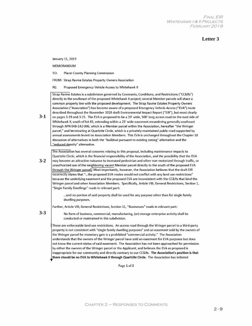
Letter 3
3-1
3-2
3-3

FINAL EIR Whitehawk I & II Projects
FEBRUARY 2019
Chapter 2 – Responses to Comments 2 - 10
Letter 3 Cont’d
3-3 cont’d

FINAL EIR Whitehawk I & II Projects
FEBRUARY 2019
Chapter 2 – Responses to Comments 2 - 11
LETTER 3: STRAP RAVINE ESTATES PROPERTY OWNER’S ASSOCIATION Response to Comment 3-1 The County agrees that this is a privately-maintained public road (the final parcel map offers “for dedication to the public for road purposes the roads shown hereon…”). Pursuant to South Placer Fire District requirements for dead-end roads, an EVA would also be required in both the “Buildout Pursuant to Existing Zoning” and the “Reduced Density” alternatives shown in Chapter 18 of the Draft EIR. Response to Comment 3-2 The WHII HOA would be responsible for the ongoing maintenance of the EVA, gates, and signage. The design of the EVA is proposed to use a “Grasscrete” type of system rather than pavement and would allow the surface to be covered with grasses to help conceal the EVA. Additionally, the location and types of gates and fencing are intended to minimize the likelihood of the EVA becoming an attractive nuisance. An additional tube steel triangular-shaped barrier gate would be located across the existing sewer easement road installed at the southeast corner of WHII. Response to Comment 3-3 The EVA provides a safety feature for the proposed Whitehawk II project as well as the existing Quartzite Circle residents. The EVA would serve residents of either neighborhood in the event of a future emergency which might result in the need for an alternative evacuation route.

FINAL EIR Whitehawk I & II Projects
FEBRUARY 2019
Chapter 2 – Responses to Comments 2 - 12
Letter 4
4-1
4-2
4-3
4-4
FINAL EIR Whitehawk I & II Projects
FEBRUARY 2019
Chapter 2 – Responses to Comments 2 - 13
LETTER 4: CHERYL BERKEMA, LETTER 1 OF 5 Response to Comment 4-1 The County has elected not to extend the public comment period for the Draft EIR beyond the State-mandated minimum 45-day period. Response to Comment 4-2 A number of approved and proposed projects have required, or will require, a General Plan Amendment. The proposed land development projects that have requested a General Plan Amendment include the WHI and WHII projects, Granite Bay Medical Complex (on-hold), Hawk Homestead (withdrawn), Granite Rock Estates (on-hold), Quarry Ridge Professional, and Amazing Facts Residential (pre-development meeting only). These and other pending (or potential) projects have been incorporated into the land use assumptions used for the traffic modeling efforts. Fehr & Peers, the traffic consultant working on the Granite Bay Circulation Element update and cumulative modeling, prepared the Transportation Impact Study for the WHI and WHII projects. The cumulative traffic model prepared for the Circulation Element update was used to analyze traffic impacts from the WH projects and other proposed Granite Bay projects that are currently under review by the County. The data and modeling platform is consistent across the projects and the cumulative update. Review of individual projects were designed to track together concurrently. The technical analysis performed by the consultant team identified future traffic volumes and projected regional growth including: anticipated increased traffic, approved, pending, and known projects in the GBCP area, and potential development in Granite Bay based on underlying zoning and the Placer County General Plan land use designations. The future improvements to the transportation network are also incorporated. These improvements are primarily based on the SACOG 2016 MTP/SCS Tier 1 project list and the Granite Bay Capital Improvement Project (CIP) list. The Tier 1 project list includes transportation enhancements and expansions to the roadway, transit, and bicycle and pedestrian facilities in the SACOG region that are expected to occur over the life of the plan (by 2036). Response to Comment 4-3 The sewer analysis within the Draft EIR relied on best available data for the Granite Bay (SMD 2) sewer system1 and future development projections. This approach enabled the County to accurately determine whether the projects will result in the need to expand the existing sewer system, as further discussed in Response to Comment 17-18 below.
��� This includes primarily the Technical Memorandum: Hydraulic Model Analysis (February 25, 2011), prepared
by Brown and Caldwell.�

FINAL EIR Whitehawk I & II Projects
FEBRUARY 2019
Chapter 2 – Responses to Comments 2 - 14
Response to Comment 4-4 The comment is a concluding statement summarizing the concerns discussed above.

FINAL EIR Whitehawk I & II Projects
FEBRUARY 2019
Chapter 2 – Responses to Comments 2 - 15
Letter 5
5-1

FINAL EIR Whitehawk I & II Projects
FEBRUARY 2019
Chapter 2 – Responses to Comments 2 - 16
LETTER 5: SHANNON QUINN, LETTER 1 OF 3 Response to Comment 5-1 The CEQA Guidelines do not include a mandatory page limit for EIRs. The page limits noted in Section 15154 are guidelines, rather than strict standards. The length of the Draft EIR is reflective of the depth of analysis necessary to review separate and combined approval of both the WHI and WHII projects at an appropriate level of detail and address concerns voiced by the public during the NOP public review period for the proposed projects. The County has elected not to extend the public comment period for the Draft EIR beyond the State-mandated minimum 45-day period.

FINAL EIR Whitehawk I & II Projects
FEBRUARY 2019
Chapter 2 – Responses to Comments 2 - 17
Letter 6
6-1

FINAL EIR Whitehawk I & II Projects
FEBRUARY 2019
Chapter 2 – Responses to Comments 2 - 18
LETTER 6: SHANNON QUINN, LETTER 2 OF 3 Response to Comment 6-1 Please see Response to Comment 5-1.

FINAL EIR Whitehawk I & II Projects
FEBRUARY 2019
Chapter 2 – Responses to Comments 2 - 19
Letter 7
7-1
7-2

FINAL EIR Whitehawk I & II Projects
FEBRUARY 2019
Chapter 2 – Responses to Comments 2 - 20
LETTER 7: LARISSA BERRY, LETTER 1 OF 3 Response to Comment 7-1 Please see Response to Comment 5-1. Response to Comment 7-2 Please see Response to Comment 5-1.

FINAL EIR Whitehawk I & II Projects
FEBRUARY 2019
Chapter 2 – Responses to Comments 2 - 21
Letter 8
8-1
8-2

FINAL EIR Whitehawk I & II Projects
FEBRUARY 2019
Chapter 2 – Responses to Comments 2 - 22
LETTER 8: CHERYL BERKEMA, LETTER 2 OF 5 Response to Comment 8-1 Please see Response to Comment 5-1 above. Please note that the Draft EIR is an environmental document prepared pursuant to the State CEQA Guidelines. As such, the Draft EIR is not subject to federal page limits. Response to Comment 8-2 The commenter requests information from the County regarding the processing of the project, and does not address the adequacy of the Draft EIR. This comment has been forwarded to the decision-makers.

FINAL EIR Whitehawk I & II Projects
FEBRUARY 2019
Chapter 2 – Responses to Comments 2 - 23
Letter 9
9-1
9-2
9-5
9-6
9-7
9-8
9-9
9-3
9-4

FINAL EIR Whitehawk I & II Projects
FEBRUARY 2019
Chapter 2 – Responses to Comments 2 - 24
LETTER 9: STAN AND JANIS OHARA Response to Comment 9-1 As noted on page 18-21 of the Draft EIR, the No Project (No Build) Alternative evaluated in the Draft EIR would be considered a “no build” alternative, wherein the existing environmental setting is maintained. Thus, development at a lower density than the No Project (No Build) Alternative is not possible. Please note that the Buildout Pursuant to Existing Zoning Alternative and Reduced Density Alternative presented in the Draft EIR both represent buildout of the project sites at a reduced density compared to the proposed projects. Response to Comment 9-2 The layout of the project is designed to maximize natural resource preservation. As originally designed, single-family homes were to be constructed within individual building envelopes of approximately 4,500 to 4,875 square feet (sf) each and a 1,200- to 1,300-sf private residential courtyard. The residential courtyards were not contained within the building envelopes; they were located within a private use easement within the open space/common area. The nearby Greyhawk II and III projects utilize a similar layout. Subsequent to the circulation of the WHI and WHII Mitigated Negative Declarations, based on market feedback the project developer decided to redesign the project to retain the existing layout but to provide private yards for each unit. The result is not a typical residential subdivision, but a clustered development of homes on “small” (i.e., averaging approximately ¼-acre) lots. The County’s Planned Residential Development regulations are less restrictive in terms of lot size in order to provide flexibility to the land planner in the design of projects which can often result in greater compliance with the goals and policies of the GBCP. The resulting lot sizes range from 9,049 to 16,639 sf in WHI and from 9,007 to 14,501 sf in WHII. The County’s lot coverage limitations are designed to ensure that lots are not overdeveloped but can impede single-story home construction on smaller lots. Per Sections 17.44.010 and 17.52.040 of the Placer County Code, Planned Residential Development projects are limited to site coverage restrictions of 25 percent maximum for lots 15,000 to 17,000 sf in size, 30 percent maximum for single-story residences on lots 10,000 to 15,000 sf, and 40 percent maximum for single-story residences on lots less than 10,000 sf. The proposed projects would require a Variance to increase the allowable building coverage to 50 percent to allow construction of single-story residences on all of the proposed lots. The proposed increase would allow for development of the WHI and WHII sites at the proposed densities without necessitating the development of two-story homes. By limiting the proposed homes to single-story elevations, the proposed projects would minimize the potential for land use incompatibilities with existing lower density residential development in the project area. Specific reasons that constitute special circumstances or a hardship upon a parcel are acceptable for the granting of a Variance. Those reasons for the WHI and WHII projects include exceptional topographic conditions including on-site wetlands, the Strap Ravine corridor, and the required 300-foot residential setback along the south side of Douglas Boulevard.

FINAL EIR Whitehawk I & II Projects
FEBRUARY 2019
Chapter 2 – Responses to Comments 2 - 25
The purpose of Variances is to provide procedures for the adjustment from the development standards of the Placer County Zoning Ordinance only when, because of special circumstances applicable to the property, including location, shape, size, surroundings, or topography, the strict application of the Zoning Code denies the property owner privileges enjoyed by other property owners in the vicinity and under identical zoning districts. Any Variance granted is subject to conditions that will ensure that the Variance does not constitute a granting of special privilege(s) inconsistent with the limitations upon other properties in the vicinity and zoning district in which the property is situated. The Placer County Zoning Ordinance has specific findings that must be made when granting a Variance; the criteria is set forth in California Government Code Section 65906 and listed in Section 17.60.100 of the Zoning Ordinance. According to state law, a Variance must be limited solely to the physical circumstances of the property and is only for use in unusual, individual circumstances creating an unnecessary hardship for the applicant if the usual zoning standards were imposed. The comment does not specifically address the adequacy of the Draft EIR. The physical environmental impacts of the proposed projects were analyzed in compliance with CEQA. The decision-makers will make the ultimate determination as to whether the findings for granting a variance can be made. Response to Comment 9-3 The point of reference in the Draft EIR to which the commenter is referring is not clear. It is noted that page 18-24 of the Draft EIR states the following regarding the Buildout Pursuant to Existing Zoning Alternative:
[…] Granite Bay includes a larger number of large-lot and rural type developments, and the Buildout Pursuant to Existing Zoning Alternative would add to this existing stock without providing housing diversity as sought in project objective 8. […]
The comment does not specify why the analysis presented in the Draft EIR regarding the Buildout Pursuant to Existing Zoning Alternative is deficient, noting only disagreement with the conclusions the Draft EIR reaches. Thus, a detailed response to the comment cannot be provided. Response to Comment 9-4 The comment refers to maintaining the same mix of housing types identified in the GBCP to maintain the rural character of the community. In Preserve Poway v. City of Poway (2016) 245 Cal.App.4th 560, the Appellate Court evaluated whether community character is a consideration in CEQA and whether changes to community character or social impacts constitute an environmental impact under CEQA. The Court determined CEQA does not require an analysis of subjective psychological feelings or social impacts. Rather, CEQA’s overriding and primary goal is to protect the physical environment. CEQA defines a “significant effect on the environment” as “substantial, or potentially substantial, adverse changes in physical conditions ....” (PRC section 21100. subd. (d)). The comment will be forwarded to the decision-makers for consideration.

FINAL EIR Whitehawk I & II Projects
FEBRUARY 2019
Chapter 2 – Responses to Comments 2 - 26
Response to Comment 9-5 Rather than addressing the adequacy of the Draft EIR, the comment is a policy consideration for the decision-makers as it raises concerns about the proposed higher density WHI and WHII projects, for which an amendment to the General Plan/GBCP is required. It is noted that such an amendment does not require voter approval, as the commenter suggests. General Plan or Community Plan amendments are discretionary actions that require approval from the legislative body, in this case, the Placer County Board of Supervisors. CEQA requires an EIR discuss inconsistences with applicable plans (CEQA Guidelines Section 15125(d)). Although not required by CEQA, this EIR also discusses consistencies of the proposed projects with applicable General and Community Plan objectives, goals and policies. However, the final determination of whether the proposed projects would be consistent with Placer County General Plan and GBCP rests with the Board of Supervisors as the decision-making body. Thus, to the extent that a commenter disagrees with the EIR’s consistency discussion, the comment is noted. However, the Final EIR does not resolve any such disagreements with General Plan or Community Plan goals and policies because the same is beyond the scope of a response to comments under CEQA. The Final EIR, including the commenters’ disagreements regarding issues of plan inconsistency will be forwarded to the Planning Commission and Board of Supervisors for consideration during their respective deliberations on the proposed projects. Response to Comment 9-6 Please see Response to Comment 3-3. Response to Comment 9-7 Transitions between land uses is a planning consideration not a direct CEQA consideration. The extent to which transitions require evaluation under CEQA is limited to whether transitions are adequate to ensure no adverse physical environmental impacts would occur from the placement of one land use next to another. The evaluation of whether the placement of the proposed single-family homes next to other rural residential uses would result in physical environmental impacts is addressed throughout the technical chapters of the Draft EIR. The Draft EIR determined that all such potential impacts, as noted in GBCP Policy 3.2 (Specific Policies for Intensity of Use, 4 – noise, traffic, night lighting) could be reduced to less-than-significant levels with mitigation.2 Notwithstanding the above, the Draft EIR includes a planning-level discussion of transitions between the proposed projects and adjacent uses on pp. 11-20 and 11-21 of the Draft EIR. With respect to WHI, page 11-20 of the Draft EIR states the following, as slightly amended in Chapter 3 of this Final EIR:
[…] the proposed project would develop 24 single-family detached dwelling units on minimum lot sizes of approximately 9,000 sf, in an area that consists of residential lots
� While significant and unavoidable traffic impacts were identified in the Draft EIR, these were identified for
Douglas Boulevard and Sierra College Boulevard, which is not relevant to this discussion of transitions between lower and higher density residential uses.��

FINAL EIR Whitehawk I & II Projects
FEBRUARY 2019
Chapter 2 – Responses to Comments 2 - 27
ranging from medium density-sized lots to the north, to large lot rural residential lots to the south. While the proposed project would develop homes on lots that are smaller than some of those in the immediate vicinity, there is a wide range of housing types and sizes in the surrounding unincorporated area, and many of the lots along Douglas Boulevard to the north are smaller in size than the average lot size proposed for the project (approximately 10,869 sf). The neighborhood across Douglas Boulevard is also comprised of single-family homes on approximately 9,000-sf lots that are similar in size. The Greyhawk neighborhood to the west is comprised of single-family homes on approximately 15,000-sf minimum lots, which are larger than the proposed project, but not substantially so, as WHI would include lot sizes up to 16,639 sf. The proposed project is designed to maintain a 300-foot, open space setback from Douglas Boulevard so as to not be visible from the public, scenic roadway. The GBCP acknowledges that adjoining properties could have different zoning and Policy 3.2.6 requires that transitional areas or landscape buffers be constructed to minimize potential land use conflicts (Land Use, Policy 6). Individual home lots are adjacent to the project site boundaries on the east and south sides of the site. A 10-foot landscape lot would be provided at the rear of Lots 1-3 along the site’s eastern boundary along with a six-foot tall solid wood fence. A 10-foot landscape easement was proposed along the southern boundary but was eliminated and replaced by an increased sewer easement (from 20 to 30 feet) required by the SMD2. The easement areas would contain existing natural vegetation to lessen the impact of the subdivision on the surrounding property.
Page 11-21 of the Draft EIR further states with respect to WHII:
The proposed project is designed to maintain a 300-foot, open space setback from Douglas Boulevard so as to not be visible from the public, scenic roadway. The GBCP acknowledges that adjoining properties could have different zoning and Policy 3.2.6 requires that transitional areas or landscape buffers be constructed to minimize potential land use conflicts (Land Use, Policy 6). Individual home lots are adjacent to the project site boundaries on the east and south sides of the site. The lots have been oriented so that the main living area windows of the proposed residences do not directly face existing neighboring homes. A 10- to 30-foot landscape area would be provided at the rear of Lots 45 through 47 along the site’s eastern boundary, and a 30-foot sewer easement would be provided along the site’s southern boundary, which would contain some natural vegetation. The landscape areas would also contain existing natural vegetation, as well as new native plantings, to lessen the impact of the subdivision on the surrounding property.
The above sections of the Draft EIR demonstrate that the proposed projects have been designed to include appropriate transitions (i.e., setbacks) from adjacent rural residential development. It is also important to note that all of the proposed single-family homes within both projects would be single-story to minimize the potential for land use incompatibilities with existing adjacent lower density residential development. Response to Comment 9-8 Please see Responses to Comments 4-2 and 4-3.

FINAL EIR Whitehawk I & II Projects
FEBRUARY 2019
Chapter 2 – Responses to Comments 2 - 28
Response to Comment 9-9 The comment expresses an opinion that the project merits no statement of overriding considerations. According to CEQA Guidelines Section 15093,
CEQA requires the decision-making agency to balance, as applicable, the economic, legal, social, technological, or other benefits, including region-wide or statewide environmental benefits, of a proposed project against its unavoidable environmental risks when determining whether to approve the project. If the specific economic, legal, social, technological, or other benefits, including region-wide or statewide environmental benefits, of a proposed project outweigh the unavoidable adverse environmental effects, the adverse environmental effects may be considered “acceptable.”
The decision as to whether the benefits of the proposed projects outweigh the unavoidable adverse environmental effects listed on page 17-85 of the Draft EIR is the responsibility of the Placer County Board of Supervisors. This is not a question related to the adequacy of the Draft EIR; and the comment has been forwarded to the decision-makers.

FINAL EIR Whitehawk I & II Projects
FEBRUARY 2019
Chapter 2 – Responses to Comments 2 - 29
Letter 10
10-1
10-2
10-4
10-5
10-6
10-7
10-8
10-9
10-3

FINAL EIR Whitehawk I & II Projects
FEBRUARY 2019
Chapter 2 – Responses to Comments 2 - 30
LETTER 10: MARK MORENO Response to Comment 10-1 Please see Response to Comment 9-1. Response to Comment 10-2 Please see Response to Comment 9-2. Response to Comment 10-3 Please see Response to Comment 9-3. Response to Comment 10-4 Please see Response to Comment 9-4. Response to Comment 10-5 Please see Response to Comment 9-5. Response to Comment 10-6 Please see Response to Comment 9-6. Response to Comment 10-7 Please see Response to Comment 9-7. Response to Comment 10-8 Please see Responses to Comments 4-2 and 4-3. Response to Comment 10-9 Please see Response to Comment 9-9.

FINAL EIR Whitehawk I & II Projects
FEBRUARY 2019
Chapter 2 – Responses to Comments 2 - 31
Letter 11
11-1
11-2
11-3
11-5
11-6
11-7
11-4

FINAL EIR Whitehawk I & II Projects
FEBRUARY 2019
Chapter 2 – Responses to Comments 2 - 32
11-8
11-9
11-10
Letter 11 Cont’d

FINAL EIR Whitehawk I & II Projects
FEBRUARY 2019
Chapter 2 – Responses to Comments 2 - 33
LETTER 11: LARISSA BERRY, LETTER 2 OF 3 Response to Comment 11-1 The comment provides a correction to the government code section referenced by the commenter in Comment 11-3. The comment does not address the adequacy of the Draft EIR. Response to Comment 11-2 Please see Response to Comment 9-1. Response to Comment 11-3 Please see Response to Comment 9-2. Response to Comment 11-4 Please see Response to Comment 9-3. Response to Comment 11-5 Please see Response to Comment 9-4. Response to Comment 11-6 Please see Response to Comment 9-5. Response to Comment 11-7 Please see Response to Comment 9-6. Response to Comment 11-8 Please see Response to Comment 9-7. Response to Comment 11-9 Please see Responses to Comments 4-2 and 4-3. Response to Comment 11-10 Please see Response to Comment 9-9.

FINAL EIR Whitehawk I & II Projects
FEBRUARY 2019
Chapter 2 – Responses to Comments 2 - 34
Letter 12
12-1
12-2
12-3
12-4
12-5
12-6
12-7
12-8
12-9
12-10
12-11

FINAL EIR Whitehawk I & II Projects
FEBRUARY 2019
Chapter 2 – Responses to Comments 2 - 35
LETTER 12: CAMILLE AND RICH HELLAND Response to Comment 12-1 The comment is an introductory statement and does not address the adequacy of the Draft EIR. Please note that as discussed on page 3-18 of the Draft EIR, the proposed building setbacks would generally be as follows:
Front: 20 feet minimum to front-on garage doors, 10 feet to the front of a home (including roof eaves) (Note: corner lots shall only have one ‘front’);
Rear: 20 feet minimum; Sides: five feet minimum; and Streetside: 10 feet to side of home (including roof eaves).
Based on the above, the proposed single-family homes would include setbacks, and would not be zero lot line homes as the commenter suggests. Furthermore, as noted on page 10-37 of the Draft EIR, Mitigation Measures 10-4(a) through 10-4(c) would ensure that the proposed buildings include appropriate setbacks from Strap Ravine and the unnamed tributary within the WHII site. As illustrated in Figures 9-1, 9-2, and 9-3 of the Hazards and Hazardous Materials chapter of the Draft EIR, extensive soil testing has occurred on both the WHI and WHII sites. The soil sampling efforts and results are described in detail on pages 9-3 through 9-8 for WHI, and pages 9-9 and 9-10 for WHII. The extensive sampling efforts have demonstrated that all metals were found to be present at a concentration that did not pose a risk to human health or the environment. Based on the results, Wallace Kuhl Associates determined that the sites are suitable for residential development (Draft EIR, pp. 9-7 and 9-9). Response to Comment 12-2 With regard to soil contamination, please see Response to Comment 12-1. Response to Comment 12-3 Please see Response to Comment 9-1. Response to Comment 12-4 Please see Response to Comment 9-2. Response to Comment 12-5 Please see Response to Comment 9-3.

FINAL EIR Whitehawk I & II Projects
FEBRUARY 2019
Chapter 2 – Responses to Comments 2 - 36
Response to Comment 12-6 Please see Response to Comment 9-4. Response to Comment 12-7 Please see Response to Comment 9-5. Response to Comment 12-8 Please see Response to Comment 9-6. Response to Comment 12-9 Please see Response to Comment 9-7. Response to Comment 12-10 Please see Responses to Comments 4-2 and 4-3. Response to Comment 12-11 Please see Response to Comment 9-9.

FINAL EIR Whitehawk I & II Projects
FEBRUARY 2019
Chapter 2 – Responses to Comments 2 - 37
Letter 13
13-1
13-2 13-3
13-5 13-6
13-7
13-8
13-9
13-10 13-11 13-12 13-13
13-14
13-15
13-4

FINAL EIR Whitehawk I & II Projects
FEBRUARY 2019
Chapter 2 – Responses to Comments 2 - 38
LETTER 13: CHERYL BERKEMA, LETTER 3 OF 5 Response to Comment 13-1 The comment does not address the adequacy of the Draft EIR. Response to Comment 13-2 Please see Response to Comment 4-2. Response to Comment 13-3 Please see Response to Comment 4-2. Response to Comment 13-4 The comment is noted. Regional traffic using Douglas Boulevard is captured in the traffic counts that were conducted for the traffic impact study. Thus, the traffic impact analysis accounts for regional traffic occurring on Douglas Boulevard. Response to Comment 13-5 The County was not forced to prepare an EIR for the WH projects. Rather, the decision to prepare an EIR was made by Placer County, as the CEQA lead agency, after carefully considering the public comments submitted on the Initial Study/Mitigated Negative Declarations that were released for the WH projects in November 2016. Response to Comment 13-6 Please see Response to Comment 4-2. Response to Comment 13-7 The sewer analysis within the Draft EIR relied on best available data for the Granite Bay (SMD 2) sewer system3 and future development projections. This approach enabled the County to accurately determine whether the projects will result in the need to expand the existing sewer system, as further discussed in Response to Comment 17-18 below. Response to Comment 13-8 Please see Response to Comment 9-2 regarding variance concerns. The comment that there is no section of overriding consideration is unclear. An EIR is not required to include a statement of overriding consideration(s). Such a statement is prepared separately from an EIR, and pursuant to
��� This includes primarily the Technical Memorandum: Hydraulic Model Analysis (February 25, 2011), prepared
by Brown and Caldwell.�

FINAL EIR Whitehawk I & II Projects
FEBRUARY 2019
Chapter 2 – Responses to Comments 2 - 39
CEQA Guidelines Section 15093, must set forth the benefits of the project that outweigh the unavoidable adverse environmental effects. This statement of overriding consideration(s) must be presented to the decision-making body, in this case the Board of Supervisors, along with the EIR, for consideration of approval. Response to Comment 13-9 CEQA Guidelines section 15124(b) requires an EIR’s project description to describes the purpose of the proposed project including a statement of the objectives sought by the proposed project: “A clearly written statement of objectives will help the lead agency develop a reasonable range of alternatives to evaluate in the EIR and will aid the decision makers in preparing findings or a statement of overriding considerations, if necessary. The statement of objectives should include the underlying purpose of the project.” For a private project such as this, the project applicant routinely proposes the objectives and works with the lead agency to further refine the same to guide the selection of feasible alternatives to be evaluated in the EIR. The County’s role as lead agency is to ensure the objectives are not so narrowly drafted as to artificially narrow the range of identified feasible alternatives (see In re Bay-Delta (2008) 43 Cal.4th 1143, 1166). In short, the project’s objectives are basically the applicant’s objectives for the proposed project. While the commenter states generally that the developer’s goals are in conflict with the GBCP, no specific examples of such alleged conflicts are provided. Response to Comment 13-10 The removal of wetlands and riparian areas was not determined to be significant and unavoidable in the Draft EIR for reasons set forth in the following response to comment. In short, the projects are required by mitigation measures set forth in the Draft EIR to fully offset their impacts to wetlands and riparian areas. It should also be noted that the majority of wetland and riparian resources on both project sites would be avoided. For example, as shown on Table 6-10 and discussed on page 6-58 of the Draft EIR, only 0.9-acre of the 3.9 acres of riparian woodland would be impacted by WHI, and only 0.10-acre of the 2.7 acres of riparian woodland would be impacted by WHII. For wetlands, approximately 75 percent of the wetlands on WHI would be avoided, and approximately 60 percent of the wetlands on WHII would be avoided. Response to Comment 13-11 The County’s mitigation program for oak woodlands is not outdated, as will be demonstrated in the following discussion. Mitigation for woodland losses within the development footprint must be achieved off-site. For larger projects, there are two mitigation options: preservation of existing woodlands or payment of an in-lieu fee. Both of these options are common approaches to oak woodland mitigation in the region, and are not considered “outdated.” In addition, these methods are consistent with Public Resources Code Section 21083.4 regarding oak woodland conservation, which identifies, among

FINAL EIR Whitehawk I & II Projects
FEBRUARY 2019
Chapter 2 – Responses to Comments 2 - 40
other potential methods, conserving oak woodlands through the use of conservation easements, and contributing funds for the purpose of purchasing oak woodlands conservation easements. With regard to preserving oak woodlands, the project applicant or project sponsor may dedicate to private or public ownership one or more areas equivalent to twice the area of woodland lost, with County consent. These areas must be acceptable to the County as being equivalent (or better) in quality to the woodlands lost. In addition to the donation of land, an endowment for management must be provided. The County in consultation with the designated owner/manager will determine the amount of the endowment. The second option is for a project applicant or project sponsor to make an in-lieu payment to the County of $24,000 for each acre of woodland lost (representing a 2:1 ratio). These funds are used by the County to purchase conservation easements or fee title to other woodlands in the County. A proportion of the funds are set-aside as an endowment for managing the preserved property. Tree preservation funds have been utilized to purchase properties or easements with significant woodland resources including Hidden Falls Regional Park site, an oak tree conservation easement on the Kirk Ranch near Sheridan, and the acquisition of the Harvego/Bear River Preserve. For the WH projects, the applicant is planning to purchase riparian woodland mitigation credits at the Sacramento River Ranch, and for impacts to oak woodlands (2:1 ratio) and cottonwood stands (4:1 ratio), providing funding to the Placer Land Trust to assist with the purchase of the Laursen Outback property within the Lower Bear River Focus Areas of the Spenceville Conceptual Area Protection Plan. It is noted that while cottonwood stands are not protected under County policy or ordinance, the loss of these areas on the WH project sites is being mitigated at the request of CDFW given their status as a sensitive natural community. Response to Comment 13-12 As summarized in Table 18-9 of the Draft EIR, development of the WHI and WHII sites under the Buildout Pursuant to Existing Zoning Alternative would result in fewer impacts to biological resources compared to the proposed project. The comment does not address the adequacy of the Draft EIR. Response to Comment 13-13 The County’s mitigation approach for wetlands is not outdated, as will be demonstrated in the following discussion. For wetlands, project applicants are required to provide written evidence of payment that compensatory habitat has been established through the purchase of mitigation credits at a wetland mitigation bank. Wetland mitigation banking is a common approach to mitigating wetland impacts that is supported by the U.S. Army Corps of Engineers (USACE), and is not considered “outdated.”4 The USACE strives to achieve a goal of no net loss of aquatic resources. Consistent with this goal, the amount of money required to purchase credits must be equal to the amount necessary to replace wetland or riparian habitat acreage on a no net loss basis. Evidence of payment must describe the amount and type of habitat purchased at the bank site and resource
4 U.S. Army Corps of Engineers. Mitigation. Available at: https://www.spk.usace.army.mil/Missions/Regulatory/Mitigation/. Accessed February 2019.

FINAL EIR Whitehawk I & II Projects
FEBRUARY 2019
Chapter 2 – Responses to Comments 2 - 41
values including compensation for temporal loss. The WHI and WHII projects intend to mitigate for CDFW-related impacts to Strap Ravine by preserving riparian habitat at the Sacramento River Ranch Wetlands Mitigation Bank at a 2:1 ratio, thus ensuring no net loss. For impacts to wetlands, the applicant’s intent is to purchase wetland credits from a USACE-approved mitigation bank at a 1:1 ratio, thus ensuring no net loss. Although the County in the past has collected wetland impact mitigation fees and has purchased properties with wetlands or credits at mitigation banks with those funds, most applicants elect to purchase credits on their own, satisfying their mitigation obligations under CEQA. Consequently, the County has less than $150,000 in the wetland preservation fund and this money is expected to be transferred into the Placer County Conservation Plan program once it is approved and operating. Response to Comment 13-14 Please see Response to Comment 3-3. Response to Comment 13-15 Runoff from new impervious surfaces would be routed to each project’s internal storm drainage system so as to prevent runoff from flowing onto adjacent parcels. Stormwater runoff from new impervious surfaces would be routed through the proposed stormwater drainage systems, including the proposed bio-retention basins, before discharging to Strap Ravine. While some stormwater runoff would infiltrate the soils underlying the bio-retention basins, in general, the proposed stormwater systems would not be designed to provide for detention. As noted on page 10-31 of the Draft EIR, this would be consistent with the County’s approach to peak flow management in the watershed. The project site is located in an area identified in the Dry Creek Watershed Flood Control Plan where local stormwater detention is not recommended. Mitigation measures for development in this area include payment of flood control development fees to fund regional detention basins to reduce flooding on major streams in the Dry Creek watershed (see Mitigation Measure 10-3(b) of the Draft EIR).
To assess potential impacts of the WHI and WHII projects on flows within Strap Ravine in the project vicinity, both project sites were modeled with impervious surfaces ranging from 35 percent to 65 percent. It is important to note that these results reflect flows that would result from full buildout of the land uses shown in the various community plans and General Plan for the Dry Creek Watershed. Peak flow rates shown in Table 10-3 of the Draft EIR (pg. 10-32) are for Strap Ravine and include the 187 cubic feet per second (cfs) of flow through the reconstructed unnamed tributary that flows through the WHII site. As shown in the table, the 100-year post development peak flows downstream of the site were shown to increase from 838.5 cfs to 840.8 cfs, approximately 2.3 cfs (conservatively) or 0.28 percent. While the upstream and downstream 100-year flood water surface elevations would not be significantly increased after development of the sites (0.02-foot to 0.04-foot increase), any base flood water-surface elevation (WSEL) increase from proposed construction within a regulatory floodway requires a Conditional Letter of Map Revision (CLOMR) through FEMA. The Draft EIR includes Mitigation Measures 10-3(a-c) and 10-4(a-f). It is noted that Mitigation Measure 10-4(e) requires the applicant(s) to submit a final drainage report, demonstrating that the proposed

FINAL EIR Whitehawk I & II Projects
FEBRUARY 2019
Chapter 2 – Responses to Comments 2 - 42
project will not significantly increase the limits or water surface elevation of the Strap Ravine 100-year floodplain upstream and downstream of the project site to the satisfaction of the Engineering and Surveying Division and the Placer County Flood Control District.

FINAL EIR Whitehawk I & II Projects
FEBRUARY 2019
Chapter 2 – Responses to Comments 2 - 43
14-1
14-2
14-3
14-4
14-5
Letter 14

FINAL EIR Whitehawk I & II Projects
FEBRUARY 2019
Chapter 2 – Responses to Comments 2 - 44
LETTER 14: RICHARD RYAN Response to Comment 14-1 The comment is an introductory statement and does not address the adequacy of the Draft EIR. Responses to the specific concerns raised by the commenter are provided below. Response to Comment 14-2 Although Quartzite Circle is signed prohibiting truck traffic, Recology provides weekly household and green waste service to the Granite Bay community, including Quartzite Circle. Recology’s trucks weigh 54,000 pounds gross vehicular weight (GVW) and, it was recently confirmed that they are not aware of any damage, complaints, or asserted damage as a result of weekly trips, each using two trucks. According to South Placer Fire District (SPFD), they have driven Quartzite Circle for “National Night Out” on numerous occasions over the past decade. SPFD’s fire equipment ranges between 40,000 and 75,000 pounds GVW. According to SPFD there are 21 EVAs located within Granite Bay neighborhoods (not including two recently-approved projects which have not yet been constructed), none of which have ever been used except perhaps for the final inspection and acceptance of the specific EVA improvement. Consequently, the suggested mitigation is unwarranted given the anticipated (in)frequency of use by future WHII residents. Furthermore, the EVA will also be available to Quartzite residents in the event of an emergency necessitating evacuation through WHII. Response to Comment 14-3 The details of the gate(s) are not part of the vesting tentative map, but it is the County’s understanding that the project applicant intends to install a 4-foot tall wrought iron gate at the eastern property line of the WHII project. Fencing north and south of that gate will be the existing barbed wire, continuing north of the gate along the Wringer’s property line, and south of the gate to the top of the bank for the swale, which conveys drainage from the east through the WHII site. The barbed wire fencing will continue from the top of south bank of the swale along the eastern boundary, south to where the southeast corner of WHII intersects with the existing sewer easement. At that wrought iron gate, and at a post and cable fence to be located 30 feet off the edge of pavement of the interior street within WHII, 12” x 18” signs will be placed stating “No Pedestrian Access – Private Property – Emergency Access Only”. A simple tube steel triangular-shaped barrier gate will be located 30 feet off the edge of Quartzite Circle’s pavement and will include the same signage. The County Development Review Committee will review all improvements including, but not limited to, fencing, the gate features, and signage. The comment does not address the adequacy of the Draft EIR, but will be forwarded to the decision-makers. Response to Comment 14-4 The WHII HOA will be responsible for the ongoing maintenance of the EVA, gates, and signage. This will be referenced in the project’s Conditions of Approval as well as the CC&Rs. The EVA surface will not be paved but instead will be comprised of “Grasscrete” or similar system with an

FINAL EIR Whitehawk I & II Projects
FEBRUARY 2019
Chapter 2 – Responses to Comments 2 - 45
open honeycomb-like structural concrete or plastic section placed upon a gravel base at a thickness designed to support the weight of emergency equipment and provide a pervious surface for drainage that also allows native grasses or other low-profile plantings to grow through the open structural section resulting in the EVA being far less conspicuous than a paved road. The comment does not address the adequacy of the Draft EIR, but will be forwarded to the decision-makers. Response to Comment 14-5 The comment is noted. See Response to Comment 14-3.

FINAL EIR Whitehawk I & II Projects
FEBRUARY 2019
Chapter 2 – Responses to Comments 2 - 46
Letter 15
15-1

FINAL EIR Whitehawk I & II Projects
FEBRUARY 2019
Chapter 2 – Responses to Comments 2 - 47
LETTER 15: JUDY BRUCKMAN Response to Comment 15-1 The comment does not address the adequacy of the Draft EIR. The proposed projects are not entirely consistent with the current zoning designations for their respective sites, which is why a rezone is being requested for each project. However, it should be noted that the current zoning district for both sites is Residential Agricultural (RA) and would remain as such. The rezones are related to changing the minimum building site and planned development combining district densities. Rezones are discretionary actions that require approval from the legislative body, in this case, the Placer County Board of Supervisors. This comment has been forwarded to the Planning Commission and Board of Supervisors for consideration during their respective deliberations on the proposed projects.

FINAL EIR Whitehawk I & II Projects
FEBRUARY 2019
Chapter 2 – Responses to Comments 2 - 48
16-1
16-2
Letter 16
FINAL EIR Whitehawk I & II Projects
FEBRUARY 2019
Chapter 2 – Responses to Comments 2 - 49
LETTER 16: HOLLY JOHNSON, LETTER 1 OF 2 Response to Comment 16-1 Please see Response to Comment 5-1. Response to Comment 16-2 Regarding the requested variance and density bonus, please see Response to Comment 9-2. Issues related to traffic and congestion are discussed in Chapter 14, Transportation and Circulation, of the Draft EIR. As noted on pages 14-48 through 14-49, with implementation of mitigation, impacts to study intersections would be less-than-significant. While significant and unavoidable impacts are identified for study roadway segments under the Existing Plus WHII and Existing Plus WHI and WHII conditions, implementation of Mitigation Measure 14-3 would reduce the significance of the impact to the maximum extent feasible. As noted in Chapter 4, Aesthetics, of the Draft EIR, with implementation of mitigation, impacts to aesthetics resources within the project area were determined to be less-than-significant. It is important to note that each project incorporates and protects a 300-foot scenic setback from Douglas Boulevard, in which all existing natural vegetation would remain, except for that which would be removed for constructing the project entry way. In so doing, the natural appearance of the project sites would be largely retained, as viewed from Douglas Boulevard.

FINAL EIR Whitehawk I & II Projects
FEBRUARY 2019
Chapter 2 – Responses to Comments 2 - 50
Letter 17
17-1
17-2
17-3
17-4
17-5
17-6
17-7
17-8

FINAL EIR Whitehawk I & II Projects
FEBRUARY 2019
Chapter 2 – Responses to Comments 2 - 51
17-9
17-10
17-11
17-12
17-13
17-14
17-15
17-16
17-17
17-18
17-19
Letter 17 Cont’d

FINAL EIR Whitehawk I & II Projects
FEBRUARY 2019
Chapter 2 – Responses to Comments 2 - 52
17-20
17-21
Letter 17 Cont’d

FINAL EIR Whitehawk I & II Projects
FEBRUARY 2019
Chapter 2 – Responses to Comments 2 - 53
Letter 17 Cont’d

FINAL EIR Whitehawk I & II Projects
FEBRUARY 2019
Chapter 2 – Responses to Comments 2 - 54
Letter 17 Cont’d

FINAL EIR Whitehawk I & II Projects
FEBRUARY 2019
Chapter 2 – Responses to Comments 2 - 55
LETTER 17: LARISSA BERRY, LETTER 3 OF 3 Response to Comment 17-1 The comment cites sections of the CEQA Guidelines that include recommendations for responding to public comments, and does not address the adequacy of the Draft EIR. Response to Comment 17-2 Please see Comment 9-10 regarding compatibility with the neighboring residential uses. Response to Comment 17-3 The site configuration suggested by the commenter is similar to the Buildout Pursuant to Existing Alternative evaluated in Chapter 18 of the Draft EIR. Response to Comment 17-4 As noted by the commenter, the project area contains numerous one-acre or larger residential parcels. However, the project area also includes many considerably smaller parcels that are similar in size to the parcels included in the WHI and WHII projects. The commenter cites Policy 1.O.3 of the General Plan, but omits reference to the recommendations included in the policy, which are intended to ensure that new development is compatible with the scale and character of the area. These recommendations are as follows:
Structures, especially those outside of village, urban, and commercial centers, should be designed and located so that: a. They do not silhouette against the sky above ridgelines or hilltops; b. Roof lines and vertical architectural features blend with and do not detract from the
natural background or ridge outline; c. They fit the natural terrain; and d. They utilize building materials, colors, and textures that blend with the natural
landscape (e.g., avoid high contrasts). With respect to ‘a’, because all of the proposed homes would be single-story, they would not silhouette against the sky. With respect to ‘b’, the single-story roof lines would not detract from the natural background. As discussed in Response to Comment 9-10, buffers/setbacks have been included in the proposed project to ensure that native vegetation and/or landscaping is maintained around the project edges to help screen the proposed homes. With respect to ‘c’, it should first be noted that the terrain of both project sites has been altered due to past mining activities. Thus, while cut and fill is required, this is largely a result of the need to create building pads where tailings currently exist. In general, as discussed in the Aesthetics chapter of the Draft EIR (pp. 4-13 through 4-16), the projects have been designed to retain significant portions of natural features. For example, 54 percent, or 9.82 acres, of the WHI project site would be open space including 5.39 acres of ‘restricted open space’, 4.1 acres of ‘open space – common area’, and a 0.33-acre park. For WHII, 47 percent, or 15.47 acres, of the project site would be open space, including 10.8

FINAL EIR Whitehawk I & II Projects
FEBRUARY 2019
Chapter 2 – Responses to Comments 2 - 56
acres of ‘restricted open space’, 3.8 acres of ‘open space – common area’, and a 0.87-acre park. With respect to ‘d’, as discussed on pg. 3-18 of the Project Description chapter of the Draft EIR, the proposed projects would include a set of design guidelines (Whitehawk Architectural and Design Guidelines) which would establish standards for architectural design, building materials, colors, streetscape design, setbacks, massing, entry features, lighting, landscaping, fencing, and hardscapes. The Whitehawk Architectural and Design Guidelines, enforced by the projects’ Homeowners Association(s), would supplement the Placer County Design Guidelines Manual. Consistent with the Placer County Design Guidelines Manual (i.e., Section E.4., Granite Bay Special District Guidelines), the projects would utilize earth tone colors, and materials, including wood, brick, and stone, that blend with the natural landscape. The above demonstrates that the proposed projects are compatible with the scale and character of the area. Incorporation of greater setbacks from immediately adjacent parcels is considered in the Alternatives Analysis chapter of the Draft EIR (Chapter 18). Response to Comment 17-5 The comment does not address the adequacy of the Draft EIR. Regarding the requested variance, see Response to Comment 9-2. Response to Comment 17-6 Policy 1.K.4 of the Placer County General Plan, quoted by the commenter, pertains to protecting visual and scenic resources (pg. 39 of the Placer County General Plan). While some significant cut and fill work is required for the proposed projects, the soil work would not have the effect of substantially degrading visual and scenic resources, such as could occur with hillside developments. The cut and fill work is primarily required as a result of the varying on-site topography due to past mining activities. Notwithstanding this, approximately half of each project site would remain undisturbed. As noted on page 11-35 of the Draft EIR, overall, approximately 9.82 acres of the WHI site (54 percent) and 15.47 acres of the WHII site (47 percent), including Strap Ravine and the associated floodplain, would be retained as open space; development within the open space would be limited to access roadways and an unpaved public trail. For WHI, of the above amount, approximately 5.39 acres of the site (approximately 30 percent), including Strap Ravine and the associated floodplain, would be retained as restricted open space. For WHII, of the above amount, approximately 10.8 acres of the site (approximately 33 percent), including Strap Ravine and the associated floodplain, would be retained as restricted open space. As noted on page 11-41 of the Draft EIR, for areas where development is proposed, all proposed grading improvements would conform to provisions of the County Grading Ordinance (Ref. Article 15.48, Placer County Code). The proposed grading plans would be subject to review by the Placer County Engineering and Surveying Division. Based on the above, grading would be limited to the maximum extent feasible within the project sites.

FINAL EIR Whitehawk I & II Projects
FEBRUARY 2019
Chapter 2 – Responses to Comments 2 - 57
Response to Comment 17-7 Exhibit C included by the commenter is an internal memo from Placer County Environmental Health to the Planning Department (dated March 1, 2006), which references soil sampling conducted on the WHI project site (formerly known as “Beaver Creek”) in February 2006 by Geocon Consultants, Inc. The memo summarizes discussion between Placer County Environmental Health staff and DTSC regarding said sampling, and indicates that DTSC recommended additional, deeper sampling in areas of potential disturbance such as the proposed bridge site, future utilities, and lots located on tailings (future swimming pools, etc.). As noted on page 9-6 of the Draft EIR (Chapter 9, Hazards and Hazardous Materials), as a result of this recommendation, Geocon conducted deeper testing at WHI for the presence of elevated levels of metals in tailings. More specifically, Geocon excavated five additional exploratory trenches to facilitate observation and sampling of deeper tailings. Each trench was excavated to approximately 10 feet below ground surface (bgs). Representative tailings samples were collected from depths of five and 10 feet bgs. Geocon reported that concentrations of lead and mercury from the deeper tailings samples collected from the WHI site are below the regulatory guidelines for residential soil (Cal-EPA CHHSLs and USEPA PRGs) and appear to be consistent with naturally-occurring background levels of the above metals. Geocon determined that the lack of detections of mercury above background levels in 31 to 34 samples collected from the site, including all ten deeper samples, suggests that impacts from past mining activity were minimal and further environmental investigation of soil and tailings was not warranted. As discussed on page 9-7 of the Draft EIR, subsequent to Geocon’s 2006 sampling, in July 2014, Wallace Kuhl Associates collected additional soil samples at the WHI property, the objective of which was to evaluate dredge tailings and locations identified to contain imported soil. The results show that the levels detected for all CAM 17 metals do not pose a risk to human health or the environment based on a residential land use. Similar conclusions were reached for WHII, as noted on page 9-9 of the Draft EIR. The soil sampling for the project sites was conducted consistent with applicable standards, including DTSC and EPA. The National Institute for Occupational Safety and Health (NIOSH) standards referenced by the commenter do not represent industry standard guidance for soil sampling of development sites. Response to Comment 17-8 See Response to Comment 17-7. Response to Comment 17-9 Provision of a 3-D rendering is not necessary, nor required by CEQA, to determine whether the proposed projects, or the alternatives evaluated in Chapter 18, could result in visual impacts. Such an evaluation is often done qualitatively, as is the case for the WHI and WHII analysis, with the exception of the various 2-D figures and the 3-D rendering provided in Figure 4-5 of the Aesthetics chapter. Figure 4-5 provides a typical view of the WHII site from the backyard of one of the nearest

FINAL EIR Whitehawk I & II Projects
FEBRUARY 2019
Chapter 2 – Responses to Comments 2 - 58
existing residences, located at the terminus of Farschon Place, along with a visual simulation illustrating the potential changes in visual character that could result from implementation of the WHII project. As shown in Figure 4-5, existing vegetation within the proposed open space – common area at the site’s southern boundary would help to screen views of the proposed residences; existing sensitive viewers to the south of the WHII site would have very limited views of proposed homes. Elsewhere the Draft EIR includes 2-D exhibits (Figures 4-4, 4-6, and 4-7), showing proposed setback dimensions of the WHI and WHII residences from the nearest existing homes. The discussion acknowledges that noticeable changes in visual character of the project sites would occur as a result of the projects. However, the threshold of significance for determining visual impact is whether the changes would substantially degrade the visual character of the project site or area (emphasis added; see pg. 4-11 of the Aesthetics chapter for the thresholds of significance). The aesthetics analysis presented on pp. 4-12 through 4-21 of the Draft EIR, along with the associated figures, demonstrates that adequate setbacks have been included in the proposed projects so as to ensure that the visual character of the sites/area would not be substantially degraded, as viewed by the nearest sensitive receptors. For example, for both WHI and WHII, as a result of the required 300-foot scenic setback from Douglas Boulevard, changes to views of the project sites for motorists, bicyclists, and pedestrians traveling on Douglas Boulevard would be limited to frontage improvements, minor road widening, and the proposed gated entryway; all other on-site improvements would be screened from view by the intervening oak woodland on the northern portion of the site. With respect to alternatives, the Draft EIR determined that both the Buildout Pursuant to Existing Zoning Alternative and the Reduced Density Alternative would have fewer aesthetic impacts than the proposed projects. Sufficient detail is provided in the Alternatives Chapter of the Draft EIR (i.e., conceptual alternative site plans) to enable the comparative visual effects of the alternatives, without the need for 3-D renderings. Response to Comment 17-10 Discretionary entitlements subject to CEQA review on property occupied by oak woodland of two acres or greater fall under the County’s Oak Woodland Impact Guidelines. Oak woodland is defined as a plant community in which the tree crown canopy coverage is 10 percent/acre or greater and the dominant tree species are native California oaks. Dominance is defined as canopy cover, as viewed from above, >50 percent of total canopy. Impacts are determined by the development footprint (acres) and additional mitigation is required for any Significant Oak trees (>24 inches in diameter at breast height (DBH) or clumps with the largest stem > 24-inches DBH). The development footprint is the entire area proposed for grading, construction and/or installation of infrastructure necessary to accommodate uses on the site plus a 50-foot buffer surrounding this area. Mitigation for oak woodland losses within the development footprint must be achieved off-site. No credit is provided for oak woodland preserved on-site. The WHI project would result in the

FINAL EIR Whitehawk I & II Projects
FEBRUARY 2019
Chapter 2 – Responses to Comments 2 - 59
loss of four Significant Oaks totaling 147 inches DBH, as stated on page 6-58 of the Draft EIR, and the WHII project would result in the removal of 12 Significant Oaks totaling 777 inches DBH, as stated on page 6-61 of the Draft EIR. As also presented on page 6-58 and 6-61 of the Draft EIR, respectively, canopy impacts are 10.9 acres on WHI and 20.9 acres on WHII. The canopy and Significant Oak impacts for the WHI project are depicted on Figures 6-4 and 6-5 respectively and for WHII, Figures 6-6 and 6-7. Response to Comment 17-11 The first portion of the comment, before the indented bullet point, is unclear. The County cannot offer a response without entering into speculation as to the meaning of the comment. The second part of the comment is clear and notes that the Draft EIR has not taken into account that the less dense alternatives may not require infrastructure upgrades. In response, it is noted that the Alternatives Analysis in Chapter 18 states that, similar to the proposed projects, the less intense alternatives would require extension of the water line in Douglas Boulevard so the homes could receive service (pp. 18-24, 18-38). With respect to the cumulative setting, the Alternatives Analysis notes that although the less intense alternatives would result in the generation of a reduced amount of wastewater compared to the proposed project, the alternatives would result in the contribution of some level of wastewater to the wastewater infrastructure in the project area under the cumulative project setting, and upsizing of the North Trunk present within the project sites would still be required (pp. 18-37 and 18-51). In addition, the majority of roadway improvements identified for the proposed projects would still be required for the less intense alternatives. For example, the westbound left-turn lane lengthening at Douglas Boulevard/Seeno Avenue would still be required for the WHII alternatives (pp. 18-35 and 18-50). Response to Comment 17-12 The point of reference in the Draft EIR to which the commenter is referring is not clear. The GBCP describes Granite Bay as “… [containing] a mix of suburban and rural-residential parcel sizes. Residential development in Granite Bay covers a spectrum of densities and architectural styles and expressions.”5 The GBCP also assumes continued population growth in Granite Bay; with the greatest demand for housing continuing to be for single-family homes on large parcels or on somewhat smaller lots, where public services and utilities are available; and the development of higher densities of housing will occur where public services and utilities are available. As the project sites provide direct access to a major roadway and are readily connected to existing utility infrastructure, development of the project sites at a higher density of housing is not unexpected on the project sites.
5 Placer County Planning Services Division, Community Development/Resource Agency. 2012 (February).
Granite Bay Community Plan. Introduction. page 5.

FINAL EIR Whitehawk I & II Projects
FEBRUARY 2019
Chapter 2 – Responses to Comments 2 - 60
The comment refers to maintaining the same mix of housing types identified in the GBCP to maintain the rural character of the community recognized by both the GBCP and the Placer County General Plan. As noted in Response to Comment 9-4, in Preserve Poway v. City of Poway (2016) 245 Cal.App.4th 560, the Appellate Court evaluated whether community character is a consideration in CEQA and whether changes to community character or social impacts constitute an environmental impact under CEQA. The Court determined CEQA does not require an analysis of subjective psychological feelings or social impacts. Rather, CEQA’s overriding and primary goal is to protect the physical environment. CEQA defines a “significant effect on the environment” as “substantial, or potentially substantial, adverse changes in physical conditions ....” (PRC section 21100. subd. (d)). The physical impacts on the environment are addressed in the technical chapters of the Draft EIR. Response to Comment 17-13 Please see Response to Comment 17-12. Response to Comment 17-14 Please see Response to Comment 17-12. Response to Comment 17-15 The proposed projects’ incremental contribution to cumulative demands on fire protection services is addressed on page 17-44 of the Draft EIR, as follows:
As discussed in Chapter 13, Public Services and Recreation, of this EIR, the response times to the proposed projects would be consistent with General Plan Policy 4.4.2. Both projects would be subject to payment of a Fire Impact Fee, which is used to fund anticipated capital improvement needs identified in the South Placer Fire Protection District Capital Facilities Plan Update 2017 (2017 CFP). In addition, development within the proposed project sites, as well as other future development throughout Granite Bay, would be required to comply with all applicable regulations imposed by the South Placer Fire Protection District (South Placer FD) and the California Fire Code, as adopted by Section 15.04.510 of the Placer County Code. With payment of the Fire Impact Fee, the proposed projects, in combination with future development occurring under buildout of the GBCP, would not be anticipated to result in the need for new, or physical improvements to existing, fire protection facilities, construction of which could cause significant environmental impacts, and a less-than-significant cumulative impact related to fire protection services would occur.
The above demonstrates that there are no project-level impacts to fire protection services due to the WHI and WHII projects. Cumulative demand can be appropriately addressed through payment of impact fees, as noted on page 17-72 of the Draft EIR. Furthermore, it is noted that, in the court case City of Hayward v. Board of Trustees of the California State University, the First District Court of Appeal affirmed that the analysis of fire

FINAL EIR Whitehawk I & II Projects
FEBRUARY 2019
Chapter 2 – Responses to Comments 2 - 61
protection services pursuant to CEQA is appropriately limited to the physical environmental impacts that may result from construction of new or expanded fire facilities needed to provide adequate fire protection services to a proposed project.6 Response time is not a CEQA issue per se; it can be indirectly related to an environmental effect if a new or expanded fire station, the construction of which could cause environmental effects, is needed to ensure adequate response times can be provided to a project site. As discussed above, a new or expanded fire station is not needed to ensure adequate response times are provided to the Whitehawk projects; thus, a less-than-significant impact would result, and, a National Fire Safety Standards analysis for emergency response is not required. Response to Comment 17-16 Please see Response to Comment 3-3. Response to Comment 17-17 Please see Response to Comment 3-3. Response to Comment 17-18 Chapter 15, Utilities and Services Systems, of the Draft EIR provides a detailed analysis of the Granite Bay sewer system (i.e., SMD 2), based upon best available data for the Granite Bay sewer system.7 As discussed on page 15-31 of the Draft EIR, the analysis shows the existing sewer system can accommodate both the proposed WHI and WHII projects in addition to the proposed (“interim”) developments. “Interim” is defined as Granite Bay growth since 2010, when the sewer modeling was performed by Brown and Caldwell. The proposed projects’ contribution to regional sewer demand, in combination with future buildout of the SMD 2 area, is addressed in detail in the Cumulative chapter of the Draft EIR. Specifically, pp. 17-70 through 17-72 provide an analysis of cumulative wastewater treatment and conveyance. Page 17-71 notes that:
The analysis completed by Brown and Caldwell…showed that portions of the SMD 2 system would experience deficiencies under buildout of the SMD 2 and SMD 3 service areas. The creation of deficiencies due to cumulative buildout of the GBCP area would be considered a significant cumulative impact. Although the majority of the identified deficiencies are upstream of the WHI and WHII project sites, areas of anticipated deficiencies exist downstream from both the WHI and WHII project sites, as well. Because anticipated areas of deficiency are located downstream from the WHI and WHII project sites, the proposed project sites would contribute increased wastewater flows to areas of SMD 2 experiencing deficiencies.
�� First District Court of Appeal. City of Hayward v. Board of Trustees of the California State University. November
30, 2015.�7 This includes primarily the Technical Memorandum: Hydraulic Model Analysis (February 25, 2011), prepared
by Brown and Caldwell.

FINAL EIR Whitehawk I & II Projects
FEBRUARY 2019
Chapter 2 – Responses to Comments 2 - 62
Connection fees for wastewater are required pursuant to Section 13.12.010 of the County Code to provide for the impact of the connection on the existing capacity of the sewerage system. According to CEQA Section 15130(a)(3), paying a “fair share fee” is permissible as effective mitigation for cumulative impacts if the fees are part of a reasonable plan of actual mitigation that the relevant agency commits itself to implementing. The Placer County Board of Supervisors has determined that a development impact fee is needed in order to finance public improvements to wastewater infrastructure and to pay for the development’s fair share of the construction costs of these improvements. The proposed projects, whether implemented independently or together, would be subject to fair share fees, which is estimated at $2,289.00 per equivalent dwelling unit (EDU).
Mitigation Measure 17-17 of the Draft EIR requires the applicants to pay the applicable sewer fair share fees prior to recordation of the Final Map(s). In summary, the analysis within the Draft EIR relied on best available data for the SMD 2 sewer system to determine that the projects will contribute to the need to update the sewer system. The Draft EIR appropriately relied on payment of the projects’ fair share sewer impact fees towards future improvements to the existing wastewater infrastructure (Mitigation Measure 17-17) to conclude that the projects’ incremental contribution to impacts on the sewer system would be less than cumulatively considerable. Response to Comment 17-19 The analysis done for the WHI and WHII projects is consistent with the modeling effort prepared in conjunction with the Circulation Element update. Utilizing this data, Fehr & Peers confirmed that some of the proposed projects’ traffic impacts may not be fully mitigated. It is not necessary to wait for the release of the Circulation Element update in order to accurately predict which immitigable traffic impacts could result from the WH projects. For a list of the significant and unavoidable traffic impacts resulting from the proposed project, see Section 17.6 of the Cumulative Impacts and Other CEQA Sections chapter of the Draft EIR. Response to Comment 17-20 This comment letter cites more than one policy, so it is unclear which specific policy the commenter is referring to. The following is offered in response. Policy conflicts do not, in and of themselves, constitute a significant adverse environmental impact.8 A policy inconsistency is considered to be a significant adverse environmental impact when it is related to a policy adopted for the purpose of avoiding or mitigating an environmental effect. Such policies are addressed in Table 11-5, Placer County General Plan and Granite Bay Community Plan Policy Discussion, of the Draft EIR. As can be seen by reviewing these policies, they are designed to provide policy guidance rather than to specify regulatory requirements or prohibitions. Agencies have particularly broad discretion in determining a project’s consistency with such policies. As concluded on page 11-19 of the Draft EIR, the projects as proposed, would be generally consistent with the goals and
8 Stephen L. Kostka and Michael H. Zischke. Practice Under the California Environmental Quality Act, Second
Edition [Oakland: Continuing Education of the Bar, pg. 12-44.1]. March 2018 Update.

FINAL EIR Whitehawk I & II Projects
FEBRUARY 2019
Chapter 2 – Responses to Comments 2 - 63
policies of the General Plan and Community Plan that are applicable to the sites and their proposed residential land uses. The physical environmental effects of tree loss are addressed in Chapter 6, Biological Resources, of the Draft EIR. As noted, tree loss due to the proposed projects would be fully mitigated through compliance with Mitigation Measure 6-7(a). In addition to the purchase of mitigation credits for aquatic resource impacts, Mitigation Measure 6-7(a) requires the purchase of mitigation credits for oak woodland impacts at a 2:1 ratio and impacts to cottonwood canopy at a 4:1 ratio. Such mitigation would ensure that while portions of on-site habitat would be lost, a larger amount of habitat within the region would be protected and no net-loss of habitat would occur. As noted in the Draft EIR, for the WH projects, the applicant is planning to purchase riparian woodland mitigation credits at the Sacramento River Ranch, and for impacts to oak woodlands and cottonwood stands, fee contributions to the Placer Land Trust to assist with the purchase of the Laursen Outback property within the Lower Bear River Focus Areas of the Spenceville Conceptual Area Protection Plan. Response to Comment 17-21 The following response will demonstrate that additional studies are not required to evaluate the effects of earthwork at the project sites. The effects of soil disturbance, including cuts and fills, are addressed throughout the technical sections of the Draft EIR. Potential contamination of Strap Ravine as a result of project earthwork is addressed in Impacts 8-3 and 10-1 of the Geology and Soils and Hydrology and Water Quality chapters of the Draft EIR, respectively. The Draft EIR determined that the projects could result in a significant impact to Strap Ravine; thus, Mitigation Measures 8-2(a), 8-2(b), 8-3(a), and 8-3(b) are required to ensure that the water quality of Strap Ravine is protected during construction. With respect to groundwater, page 8-5 of the Draft EIR notes that permanent groundwater was not encountered within the test pits on the project sites, which extended to the maximum depth explored of approximately 10 feet below existing site grades. The permanent groundwater table is indicated to be at a depth of at least 100 feet below existing site grades. Therefore, earthwork at the project sites would not adversely affect groundwater underlying the sites. In the event that any perched groundwater is present during winter or early spring months, dewatering would be appropriately handled through the State National Pollutant Discharge Elimination Permit (Construction General Permit) required for each project. With respect to flooding of adjacent parcels, runoff from new impervious surfaces would be routed to each project’s internal storm drainage system so as to prevent runoff from flowing onto adjacent parcels. Stormwater runoff from new impervious surfaces would be routed through the proposed stormwater drainage systems, including the proposed bio-retention basins, before discharging to Strap Ravine. While some stormwater runoff would infiltrate the soils underlying the bio-retention basins, in general, the proposed stormwater systems would not be designed to provide for detention. As noted on page 10-31 of the Draft EIR, this would be consistent with the County’s approach to peak flow management in the watershed. The project site is located in an area identified in the Dry Creek Watershed Flood Control Plan where local stormwater detention is not

FINAL EIR Whitehawk I & II Projects
FEBRUARY 2019
Chapter 2 – Responses to Comments 2 - 64
recommended. Mitigation measures for development in this area include payment of flood control development fees to fund regional detention basins to reduce flooding on major streams in the Dry Creek watershed (see Mitigation Measure 10-3(b) of the Draft EIR).
To assess potential impacts of the WHI and WHII projects on flows within Strap Ravine in the project vicinity, both project sites were modeled with impervious surfaces ranging from 35 percent to 65 percent. It is important to note that these results reflect flows that would result from full buildout of the land uses shown in the various community plans and General Plan. Peak flow rates shown in Table 10-3 of the Draft EIR (pg. 10-32) are for Strap Ravine and include the 187 cubic feet per second (cfs) of flow through the reconstructed unnamed tributary that flows through the WHII site. As shown in the table, the 100-year post development peak flows downstream of the site were shown to increase from 838.5 cfs to 840.8 cfs, approximately 2.3 cfs (conservatively) or 0.28 percent. While the upstream and downstream 100-year flood water surface elevations would not be significantly increased after development of the sites (0.02-foot to 0.04-foot increase), any base flood water-surface elevation (WSEL) increase from proposed construction within a regulatory floodway requires a Conditional Letter of Map Revision (CLOMR) through FEMA. The Draft EIR includes Mitigation Measures 10-3(a-c) and 10-4(a-f). It is noted that Mitigation Measure 10-4(e) requires the applicant(s) to submit a final drainage report, demonstrating that the proposed project will not significantly increase the limits or water surface elevation of the Strap Ravine 100-year floodplain upstream and downstream of the project site to the satisfaction of the Engineering and Surveying Division and the Placer County Flood Control District. With respect to the comments pertaining to trees, Mitigation Measure 6-7(b) includes a list of tree protection methods that will be included on the project improvements plans, which would include the grading plan. Among the methods are the requirements to avoid cuts and fills around trees where feasible; to prohibit soil surface removal greater than one-foot within the driplines of oak trees to be preserved; and to prohibit earthen fill greater than one-foot within the driplines of oak trees to be preserved.

FINAL EIR Whitehawk I & II Projects
FEBRUARY 2019
Chapter 2 – Responses to Comments 2 - 65
Letter 18
18-1
18-2
18-3
18-4
18-5
18-1 18-6

FINAL EIR Whitehawk I & II Projects
FEBRUARY 2019
Chapter 2 – Responses to Comments 2 - 66
Letter 18 Cont’d
18-6
18-7
18-8
18-9

FINAL EIR Whitehawk I & II Projects
FEBRUARY 2019
Chapter 2 – Responses to Comments 2 - 67
LETTER 18: SHANNON QUINN, LETTER 3 OF 3 Response to Comment 18-1 The comment is an introductory statement and does not address the adequacy of the Draft EIR. Response to Comment 18-2 The traffic analysis employs a “global” peak hour and “global” peak hour factor (PHF) for intersections along corridors and in zones where intersections are clustered together in close proximity. The peak hour is identified based on the total traffic at all intersections in that zone. The global PHF is calculated by dividing the total peak hour traffic volume for the zone by the peak 15-minute traffic flow for the zone, per the PHF formula. This results in a global PHF of 0.92 in the AM peak hour and 0.94 in the PM peak hour for Intersections 1-5, 8, and 9 along Douglas Boulevard and Sierra College Boulevard; and a global PHF of 0.90 in the AM peak hour and 0.96 in the PM peak hour for Intersections 7, 11, and 12 along the Auburn Folsom Road corridor. Intersections 6 and 10 are isolated, and therefore use the observed PHF as shown in the traffic count data sheets. In response to the comment, Fehr & Peers conducted spot analyses of intersections where the individual intersection PHF was lower than the global PHF used in the analysis. The resulting change in delay was no more than 2.5 seconds and did not result in a change in LOS. Response to Comment 18-3 The May 2017 traffic counts reflect conditions at the time the NOP was released in January 2018. Major land developments or roadway projects in Granite Bay, eastern Roseville, or northern Folsom have not occurred that would have greatly changed traffic levels between May 2017 and January 2018. Therefore, the May 2017 count data is appropriate to use for the HCS7 analysis. In response to the comment, Fehr & Peers reviewed publicly available traffic count data from the City of Roseville for the intersections of Douglas Boulevard/Sierra College Boulevard, and Douglas Boulevard/Cavitt Stallman Road South, for May 2017, May 2018, October 2018, and January 2019 to verify that traffic volumes have not greatly changed. The daily, AM peak hour and PM peak hour traffic volumes in May 2018 and October 2018 were roughly equal to May 2017 with a maximum deviation of +/-5 percent, which is within the typical range of day-to-day fluctuations. Traffic volumes in January 2019 were generally lower than May 2017 (from roughly equal to a 10 percent decrease). Response to Comment 18-4 The traffic analysis shows that the projects will not add trips to Olive Ranch/Cavitt Stallman Road intersection, or cause existing traffic to divert to Olive Ranch Road as an alternate to Douglas Boulevard. Therefore, a traffic count was not collected at this intersection.

FINAL EIR Whitehawk I & II Projects
FEBRUARY 2019
Chapter 2 – Responses to Comments 2 - 68
Response to Comment 18-5 The diverted traffic concern was identified in comment letters on the NOP from February 2018. Therefore, the WHI and WHII traffic study included a diverted traffic evaluation as presented in the report. The traffic counts show minimal westbound traffic on Douglas Boulevard turning right onto Seeno Avenue or Quail Oaks Drive in the PM peak hour to avoid congestion on Douglas Boulevard (18 westbound right-turns at Seeno Avenue; four westbound right-turns at Quail Oaks Drive). These are reasonable amounts of trips into these neighborhoods given the number of residential units. Higher AM peak hour westbound right turns at Seeno Avenue correspond with the start of the school day at Greenhills Elementary. These traffic counts further support the conclusion that diverted traffic from Douglas Boulevard is minimal, even during the busiest (i.e., peak) hours of the day; and that the few trips generated by the proposed projects are not likely to result in an increased diversion of trips from Douglas Boulevard. Response to Comment 18-6 Please see Responses to Comments 13-2 and 18-3. Response to Comment 18-7 Fehr & Peers reviewed the ADT numbers presented at the Circulation Element Update workshop on January 9, 2019 and the data presented in Table 5 of the WHI and WHII Traffic Impact Study, and verified that the ADT data is consistent with each other. The graphics presented at the Circulation Element Update workshop do not label every segment due to the scale of the graphic. Therefore, the data in Table 5 is presented at a greater level of detail than the workshop graphics, which may have led to the confusion. Response to Comment 18-8 The project's impact and need for mitigation is determined by Placer County's Impact Analysis Methodology of Assessment memorandum. This memorandum states that the project would trigger a significant roadway segment impact and therefore require mitigation if the project adds 100 ADT or more per lane. Because this segment of Douglas Boulevard is four lanes, the project would need to add more than 400 ADT to trigger an impact. WHI is forecasted to add 170 ADT to this segment, which does not meet this threshold and therefore does not trigger an impact or require mitigation. Similarly, WHII by itself is forecasted to add 370 ADT to this segment, which also does not meet this threshold and therefore does not trigger an impact or require mitigation. Only the combination of both WHI and WHII exceeds the 400 ADT trigger, with a combined addition of 540 ADT to this segment. This is disclosed as Impact 14-3 and mitigated by Mitigation Measure 14-3 in the Draft EIR. Response to Comment 18-9 Traffic counts are not a reliable indicator of population growth in Granite Bay because a substantial portion of the traffic is through-traffic from and to neighboring jurisdictions, including Folsom and Roseville.

FINAL EIR Whitehawk I & II Projects
FEBRUARY 2019
Chapter 2 – Responses to Comments 2 - 69
The GBCP estimated the maximum potential build-out for the GBCP area based upon the Land Use Designations in the Plan at the time. This was a forecast of what the future population would be, based upon the combined acreage of those undeveloped properties within the Plan Area. These growth and population projections are not population caps but an estimate of what the population could be in 2035 based upon “low growth” and “high growth” scenarios. The “low-growth” scenario projected that one-third of unbuilt housing units permitted by the 2012 land use designations and zoning are constructed by 2035. The second assumed a “moderate” development rate with two-thirds of the housing units constructed. Both scenarios assumed that changes to the Land Use diagram to permit higher densities would not occur. Based on 2012 Land Use Designations and acreages of all properties (developed and undeveloped), there is a potential of 10,493 housing units in the Plan area (there were 7,580 housing units in the Plan area in 2012). Utilizing the household size of 2.75 persons per household (2010 Census), the Land Use Plan has an ultimate estimated “population holding capacity” of 28,855 persons (page 18 in the Population and Housing chapter of the GBCP). Because many areas of Granite Bay have been developed at less than permitted density, the population of Granite Bay would not be expected to reach the 28,855 population level, unless many significant land use changes are made in the future. Therefore, a population of 26,000 at full build-out was deemed a “reasonable assumption.” In early 2018, the Planning Department analyzed residential building permit data for the number of completed homes since the adoption of the GBCP and the number under construction homes at that point in time in 2018. Staff also compiled information on approved, under-development, and proposed residential projects in the Plan area. This information was used in the wastewater capacity discussion in Section 15-2 of the Draft EIR. Since 2010, 222 new primary and secondary dwelling units have been completed and five units have been demolished for a net of 217 new units. In addition, 28 units were under construction, including primary and secondary units and one demolition permit issued but not finalized, for 27 net new units in process. Since 2010, one congregate care home with 86 beds had been completed. A number of subdivisions approved since 2010 have come online and still contain vacant lots within them. In addition, new residential projects and congregate care facilities have been approved but have not started construction. Furthermore, other projects such as WHI and WHII have been proposed but not approved. Such approved or possibly future projects include an estimated 456 housing units and 340 congregate care beds. Based upon the 2010 Census per persons per household count of 2.75, a net increase of 217 residential units and 86 congregate care beds in the 2010 to 2018 time period, the population has increased from 20,825 in 2010 to an estimated 21,508 in 2018, or a total of 3.28 percent. It should be noted that this 21,508 Granite Bay population estimate for 2018 is slightly reduced from what was included on pages 11-9, and 11-22 through 11-24 of the Draft EIR. The difference is due to a minor calculation error. The Draft EIR estimate is hereby revised on page 11-9 as follows:

FINAL EIR Whitehawk I & II Projects
FEBRUARY 2019
Chapter 2 – Responses to Comments 2 - 70
Population According to the 2010 U.S. Census, the population of Granite Bay in 2010 was 20,8257. As part of this EIR, the County conducted an analysis of the number of residential units that have been built since 2010, as well as the number of units that are under construction. The resultant Granite Bay population, as of April 2018, is approximately 21,8185798.
Corresponding footnote 8 is revised as follows:
Based on 7,910824 units * 2.747 persons per household + 86 new assisted living beds. The population references on pages 11-22 and 11-24 are similarly revised.

FINAL EIR Whitehawk I & II Projects
FEBRUARY 2019
Chapter 2 – Responses to Comments 2 - 71
Letter 19
19-1
19-2
19-3
19-5
19-4

FINAL EIR Whitehawk I & II Projects
FEBRUARY 2019
Chapter 2 – Responses to Comments 2 - 72
Letter 19 Cont’d
19-6

FINAL EIR Whitehawk I & II Projects
FEBRUARY 2019
Chapter 2 – Responses to Comments 2 - 73
LETTER 19: LARISSA BERRY, LETTER 4 OF 4 Response to Comment 19-1 The County has elected not to extend the public comment period for the Draft EIR beyond the State-mandated 45-day period. Response to Comment 19-2 Please see Response to Comment 5-1. Response to Comment 19-3 The comment states that the Draft EIR relies on vague language and relies on analysis of economic feasibility, but does not note a specific deficiency within any particular portion of the analysis presented in the Draft EIR. With regard to aesthetic resources and 3-D imagery, please see Response to Comment 17-9. Response to Comment 19-4 Contrary to the comment, the purpose of the EIR, pursuant to CEQA Guidelines Section 15121, and as noted on page 1-2 of the Draft EIR, is to (a) inform public agency decision-makers, and the public generally, of the significant environmental effects of the project, (b) identify possible ways to minimize the significant adverse environmental effects, and (c) describe reasonable and feasible project alternatives which reduce environmental effects. Response to Comment 19-5 The comment does not address the Draft EIR, but references other EIRs released by the County. The commenter’s concerns have been forwarded to the decision-makers for their consideration. Response to Comment 19-6 Please see Response to Comment 5-1.

FINAL EIR Whitehawk I & II Projects
FEBRUARY 2019
Chapter 2 – Responses to Comments 2 - 74
Letter 20
20-1
20-2
20-4
20-5
20-6
20-3

FINAL EIR Whitehawk I & II Projects
FEBRUARY 2019
Chapter 2 – Responses to Comments 2 - 75
Letter 20 Cont’d
20-7

FINAL EIR Whitehawk I & II Projects
FEBRUARY 2019
Chapter 2 – Responses to Comments 2 - 76
LETTER 20: AMBER BECKLER Response to Comment 20-1 Please see Response to Comment 19-1. Response to Comment 20-2 Please see Response to Comment 5-1. Response to Comment 20-3 Please see Response to Comment 19-3. Response to Comment 20-4 Please see Response to Comment 19-4. Response to Comment 20-5 Please see Response to Comment 19-5. Response to Comment 20-6 Please see Response to Comment 19-6.

FINAL EIR Whitehawk I & II Projects
FEBRUARY 2019
Chapter 2 – Responses to Comments 2 - 77
Letter 21
21-1
21-2
21-3
21-4
21-5
21-6

FINAL EIR Whitehawk I & II Projects
FEBRUARY 2019
Chapter 2 – Responses to Comments 2 - 78
LETTER 21: PEGGY PETERSON Response to Comment 21-1 Please see Response to Comment 19-1. Response to Comment 21-2 Please see Response to Comment 5-1. Response to Comment 21-3 Please see Response to Comment 19-3. Response to Comment 21-4 Please see Response to Comment 19-4. Response to Comment 21-5 Please see Response to Comment 19-5. Response to Comment 21-6 Please see Response to Comment 19-6.

FINAL EIR Whitehawk I & II Projects
FEBRUARY 2019
Chapter 2 – Responses to Comments 2 - 79
Letter 22
22-1
22-2
22-3
22-5
22-6
22-4

FINAL EIR Whitehawk I & II Projects
FEBRUARY 2019
Chapter 2 – Responses to Comments 2 - 80

FINAL EIR Whitehawk I & II Projects
FEBRUARY 2019
Chapter 2 – Responses to Comments 2 - 81
LETTER 22: BJ BAKER Response to Comment 22-1 Please see Response to Comment 19-1. Response to Comment 22-2 Please see Response to Comment 5-1. Response to Comment 22-3 Please see Response to Comment 19-3. Response to Comment 22-4 Please see Response to Comment 19-4. Response to Comment 22-5 Please see Response to Comment 19-5. Response to Comment 22-6 Please see Response to Comment 19-6.

FINAL EIR Whitehawk I & II Projects
FEBRUARY 2019
Chapter 2 – Responses to Comments 2 - 82
Letter 23
23-1
23-2
23-3

FINAL EIR Whitehawk I & II Projects
FEBRUARY 2019
Chapter 2 – Responses to Comments 2 - 83
LETTER 23: HOLLY JOHNSON, LETTER 2 OF 2 Response to Comment 23-1 Please see Response to Comment 5-1. Response to Comment 23-2 The comment references two development projects that are unrelated to the proposed projects. Nonetheless, the commenter’s concerns have been forwarded to the decision-makers for their consideration. The comment does not address the adequacy of the Draft EIR. Response to Comment 23-3 Please see Response to Comment 5-1.

FINAL EIR Whitehawk I & II Projects
FEBRUARY 2019
Chapter 2 – Responses to Comments 2 - 84
Letter 24
24-1
24-2
24-3
24-4

FINAL EIR Whitehawk I & II Projects
FEBRUARY 2019
Chapter 2 – Responses to Comments 2 - 85
Letter 24 Cont’d
24-4

FINAL EIR Whitehawk I & II Projects
FEBRUARY 2019
Chapter 2 – Responses to Comments 2 - 86
LETTER 24: CHERYL BERKEMA, LETTER 4 OF 5 Response to Comment 24-1 Please see Response to Comment 19-1. Response to Comment 24-2 The federal government shutdown has no bearing on being able to perform an adequate review of the Draft EIR. Federal housing agencies do not have input or authority over the WH projects, and no federally threatened or endangered plant or wildlife species were identified as having the potential to be adversely impacted as a result of the projects. Nevertheless, with respect to federal resource agencies, the applicant will be required to coordinate with them to obtain necessary federal permits (i.e., Section 404 Nationwide Permit (or Letter of Permission) from the United States Army Corps of Engineers). Response to Comment 24-3 The County has elected not to extend the public comment period for the Draft EIR beyond the State-mandated 45-day period. Response to Comment 24-4 Please see Response to Comment 5-1.

FINAL EIR Whitehawk I & II Projects
FEBRUARY 2019
Chapter 2 – Responses to Comments 2 - 87
Letter 25
25-1
25-2
25-3
25-4
FINAL EIR Whitehawk I & II Projects
FEBRUARY 2019
Chapter 2 – Responses to Comments 2 - 88
LETTER 25: LAURA WILKIN Response to Comment 25-1 The comment expresses a concern about development in Granite Bay and has been forwarded to the decision-makers. Response to Comment 25-2 The commenter expresses concern regarding issues related to traffic, water supply, sewer, and emergency services, and claims that the Draft EIR did not adequately address any of these issues. However, no specific examples are provided. In keeping with CEQA Guidelines Section 15088(c), as recently amended by the State, the level of detail contained in a response may correspond to the level of detail provided in the comment (i.e., responses to general comments may be general). The following general responses are offered in response to the comment.
Traffic – A technical traffic impact study was prepared by Fehr & Peers Transportation Consultants to evaluate the potential traffic impacts resulting from both the WHI and WHII projects. The traffic impact study included an evaluation of project-level impacts and cumulative impacts, resulting from development of the WH projects, in combination with other approved, pending, and reasonably foreseeable projects. The traffic impact study included traffic counts at several intersections and roadway segments, which were proposed by the traffic consultant and approved by Placer County Department of Public Works staff. Using the most recent Granite Bay Circulation Element update traffic model (see Response to Comment 4-2), project-level and cumulative-level impacts were identified and mitigated to the extent feasible. The results of the traffic impact study were incorporated in the Draft EIR. Issues related to traffic are addressed in Chapter 14, Transportation and Circulation, of the Draft EIR, as well as Chapter 17, Cumulative Impacts and Other CEQA Sections (see pp. 17-47 to 17-69).
Water Supply – Issues related to water supply are discussed in Chapter 15, Utilities and Service Systems, of the Draft EIR. As discussed on pages 15-33 through 15-34, the San Juan Water District (SJWD) has provided Placer County with letters of water availability for the projects, informing the County that SJWD maintains adequate water supplies to serve the WH projects.
Sewer – Issues related to sewer are discussed in Chapter 15, Utilities and Service Systems, of the Draft EIR. As noted on page 15-22, the proposed projects would not exceed wastewater treatment capacity of the Dry Creek Wastewater Treatment Plant. Please refer to Response to Comment 17-18 for discussion related to the Draft EIR analysis of sewer conveyance infrastructure.
Emergency Services – Issues related to emergency services are discussed in Chapter 13, Public Services and Recreation, of the Draft EIR. As noted therein, the proposed projects, either separate or combined, would result in less-than-significant impacts related to fire and police protection services.

FINAL EIR Whitehawk I & II Projects
FEBRUARY 2019
Chapter 2 – Responses to Comments 2 - 89
Based on the above, the Draft EIR adequately addresses the issue areas referenced by the commenter. Response to Comment 25-3 The comment does not address the adequacy of the Draft EIR, but states that the projects do not comply with the GBCP. The proposed projects require amendments to the General Plan/GBCP to change the land use designations of the project sites (see Draft EIR, pg. 3-27). General Plan and GBCP amendments are discretionary actions that require approval from the legislative body, in this case, the Placer County Board of Supervisors. Please see also Response to Comment 9-5. Response to Comment 25-4 The comment expresses concern regarding the projects rather than the Draft EIR. The comment has been forwarded to the decision-makers.

FINAL EIR Whitehawk I & II Projects
FEBRUARY 2019
Chapter 2 – Responses to Comments 2 - 90
Letter 26
26-1
26-2
26-3
26-4
26-5
26-6
26-7

FINAL EIR Whitehawk I & II Projects
FEBRUARY 2019
Chapter 2 – Responses to Comments 2 - 91
Letter 26 Cont’d
26-8
26-9
26-10
FINAL EIR Whitehawk I & II Projects
FEBRUARY 2019
Chapter 2 – Responses to Comments 2 - 92
LETTER 26: BILL PETERSON Response to Comment 26-1 The comment is an introductory statement and does not address the adequacy of the Draft EIR. Response to Comment 26-2 The conveyance of an easement does not result in a property being “split up”. In addition to the proposed EVA easement, the Wringer’s property also includes a waterline easement granted to SJWD for a pipe serving the Quartzite properties. The CC&Rs (Article IV, Section 4) specifically refer to a prohibition against any lot being further divided without the prior consent of the Association and the County of Placer. An example of this would be Unit 2 of Strap Ravine Estates, recorded in 1978, which included a 9.91-acre lot which was split and sold in 1987 by the Wringers. Response to Comment 26-3 The comment does not address the adequacy of the Draft EIR, but states that the projects go against current zoning of the area. The proposed projects require rezones (see Draft EIR, pg. 3-27). Zone changes are discretionary actions that require approval from the legislative body, in this case, the Placer County Board of Supervisors. Please see also Response to Comment 9-5. It should be noted that the current zoning district for both sites is Residential Agricultural (RA) and would remain as such. The rezones are related to changing the minimum building site and planned development combining district densities. This comment has been forwarded to the Planning Commission and Board of Supervisors for consideration during their respective deliberations on the proposed projects. Response to Comment 26-4 “Protected” vegetation as referred to by the commenter, could be considered oak woodlands. The environmental effects of tree loss are addressed in Chapter 6, Biological Resources, of the Draft EIR. As noted, tree loss due to the proposed projects would be fully mitigated through compliance with Mitigation Measure 6-7(a). In addition to the purchase of mitigation credits for aquatic resource impacts, Mitigation Measure 6-7(a) requires the purchase of mitigation credits for oak woodland impacts at a 2:1 ratio and impacts to cottonwood canopy at a 4:1 ratio. Such mitigation would ensure that while portions of on-site habitat would be lost, a larger amount of habitat within the region would be protected and no net-loss of habitat would occur. Response to Comment 26-5 The comment does not address the adequacy of the Draft EIR.

FINAL EIR Whitehawk I & II Projects
FEBRUARY 2019
Chapter 2 – Responses to Comments 2 - 93
Response to Comment 26-6 Page 17-83 of the Draft EIR states the following regarding potential future development of the Mac Bride parcel located between the WHI and WHII sites:
As a result of public comments received during the NOP public review period, this EIR includes a discussion of whether development of the WHI and WHII projects, individually or combined, would incentivize/induce development of the 19.2-acre Mac Bride parcel located between the WHI and WHII sites. As discussed in Chapter 14, Transportation of this EIR, north of Lot 1 in WHI and between Lots 1 and 2 in WHII, 26-foot-wide easements would be provided to the property lines of the Mac Bride property to accommodate potential future roadway connections. In addition, an easement between Lots 17 and 18 of WHI would allow for a future trail connection to and through the Mac Bride Family Trust property. The provision of direct access to the Mac Bride parcel as part of the proposed projects would help avoid the addition of another intersection on Douglas, and would pre-determine the vehicular circulation for the future redevelopment of the parcel. The Mac Bride parcel is not owned or controlled by the project applicant and is improved with an existing single-family residence and numerous outbuildings. While the WHI and WHII projects are proposing to stub internal roadways at their common property boundaries with the Mac Bride property, access to the Mac Bride property as currently developed would still be from Douglas Boulevard, and this access has been in existence for many years and serves as the current owner’s sole access. Therefore, the proposed project would not provide access to an area for which existing access is not available. Furthermore, the Mac Bride parcel is currently designated Rural Low Density Residential and Rural Residential. The parcel is zoned Residential Agricultural, minimum Building Site of 100,000 sf (RA-B-100) and Residential Single-Family, combining Agriculture, minimum Building Site of 100,000 square feet [sf], combining Planned Residential Development of one unit per acre (RS-AG-B-100 PD=1). Such existing designations substantially limit the development potential of the parcel. The estimated development potential is eight units, though the on-site natural resources (e.g., Strap Ravine) may further limit the development potential. Thus, development of the Mac Bride parcel with an increased density of residential uses would require an amendment to the GBCP and a Rezone, which are both legislative acts requiring action by the County Board of Supervisors. Separate studies, conceptual plans, and environmental review under CEQA would also be required to consider the environmental effects of increased densities at the Mac Bride property. The potential for the proposed projects to directly enable such development is speculative, rather than a foregone conclusion.
Based on the above, the Mac Bride parcel would not be developed as part of either of the proposed projects, and future development of the parcel would not be a direct or indirect result of the projects. Response to Comment 26-7 If the overall acreage of WHI was divided by the number of proposed lots it would equate to an average of 0.75 acre per lot, but that does not accurately reflect the proposed density of 1.33 units

FINAL EIR Whitehawk I & II Projects
FEBRUARY 2019
Chapter 2 – Responses to Comments 2 - 94
per acre or the 54% (9.8 acres) of open space preserved as part of the planned development, including areas along the edges to buffer the adjacent rural areas. If the overall acreage of WHII was divided by the number of proposed lots it would equate to an average of 0.6 acre per lot, but that does not accurately reflect the proposed density of 1.67 units per acre or the 47% (15.5 acres) of open space preserved as part of the planned development, including areas along the edges to buffer the adjacent rural areas. This is not considered high density residential, per the density standards of four to ten units per acre included in the GBCP. The commenter’s concern about changing the rural area is not a CEQA issue, as discussed further in Response to Comment 9-4. Response to Comment 26-8 The County recognizes the importance of traffic circulation in the Granite Bay area. Traffic was studied in detail as part of the Draft EIR. A technical traffic impact study was prepared by Fehr & Peers Transportation Consultants to evaluate the potential traffic impacts resulting from both the WHI and WHII projects. The traffic impact study included an evaluation of project-level impacts and cumulative impacts, resulting from development of the WH projects, in combination with other approved, pending, and reasonably foreseeable projects. The traffic impact study included traffic counts at several intersections and roadway segments, which were proposed by the traffic consultant and approved by Placer County Department of Public Works staff. Using the most recent Granite Bay Circulation Element update traffic model (see Response to Comment 4-2), project-level and cumulative-level impacts were identified and mitigated to the extent feasible. The results of the traffic impact study were incorporated in the Draft EIR. Issues related to traffic are addressed in Chapter 14, Transportation and Circulation, of the Draft EIR, as well as Chapter 17, Cumulative Impacts and Other CEQA Sections (see pp. 17-47 to 17-69). Response to Comment 26-9 Analysis of issues related to property values is not required under the State CEQA Guidelines and, thus, such analysis is not included in the Draft EIR. Specifically, per Section 15064(e), “Economic and social changes resulting from a project shall not be treated as significant effects on the environment. […]” With regard to potential impacts related to traffic congestion, please see Response to Comment 26-8 above. Response to Comment 26-10 The comment does not address the adequacy of the Draft EIR. The concerns expressed by the commenter have been forwarded to the decision-makers.

FINAL EIR Whitehawk I & II Projects
FEBRUARY 2019
Chapter 2 – Responses to Comments 2 - 95
Letter 27
27-1
27-2
27-3
27-4
27-5
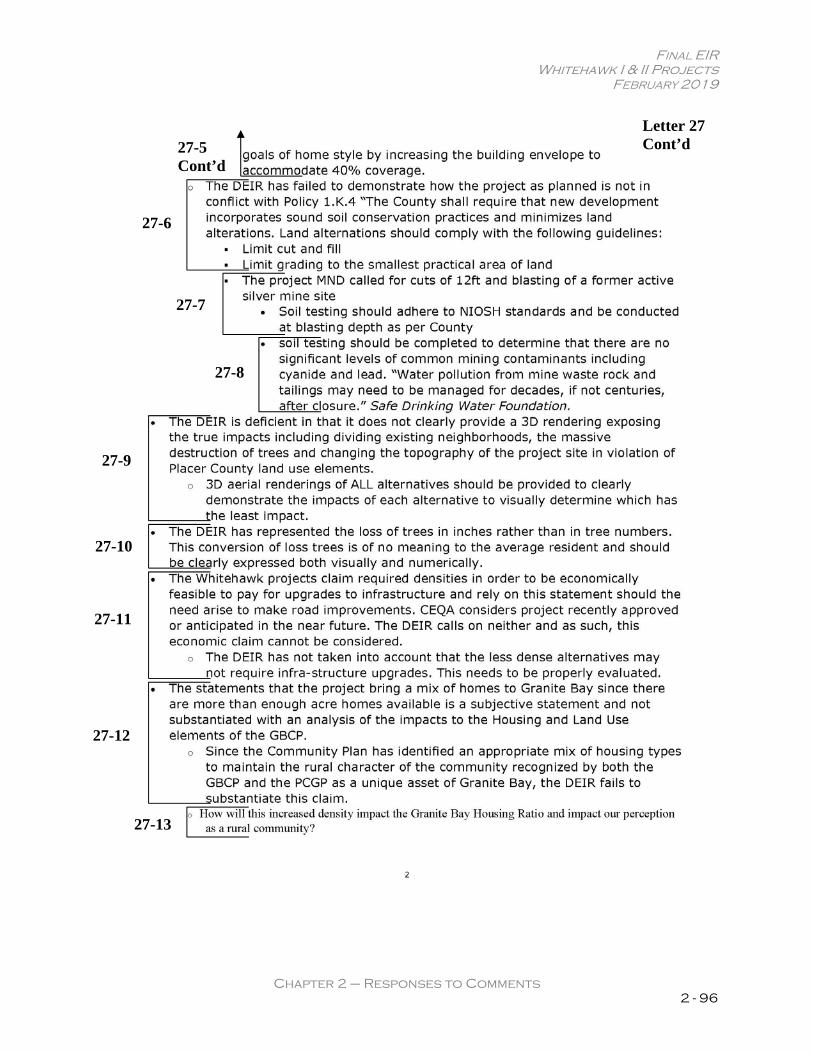
FINAL EIR Whitehawk I & II Projects
FEBRUARY 2019
Chapter 2 – Responses to Comments 2 - 96
Letter 27 Cont’d 27-5
Cont’d
27-6
27-7
27-8
27-9
27-10
27-11
27-12
27-13

FINAL EIR Whitehawk I & II Projects
FEBRUARY 2019
Chapter 2 – Responses to Comments 2 - 97
Letter 27 Cont’d
27-14
27-15
27-16
27-17
27-18
27-19
27-20
27-21

FINAL EIR Whitehawk I & II Projects
FEBRUARY 2019
Chapter 2 – Responses to Comments 2 - 98
LETTER 27: SCOTT VAUGHAN Response to Comment 27-1 Please see Response to Comment 17-1. Response to Comment 27-2 Please see Response to Comment 17-2. Response to Comment 27-3 Please see Response to Comment 17-3. Response to Comment 27-4 Please see Response to Comment 17-4. Response to Comment 27-5 Please see Response to Comment 17-5. Response to Comment 27-6 Please see Response to Comment 17-6. Response to Comment 27-7 Please see Response to Comment 17-7. Response to Comment 27-8 Please see Response to Comment 17-8. Response to Comment 27-9 Please see Response to Comment 17-9. Response to Comment 27-10 Please see Response to Comment 17-10. Response to Comment 27-11 Please see Response to Comment 17-11.

FINAL EIR Whitehawk I & II Projects
FEBRUARY 2019
Chapter 2 – Responses to Comments 2 - 99
Response to Comment 27-12 Please see Response to Comment 17-12. Response to Comment 27-13 Please see Response to Comment 17-13. Response to Comment 27-14 Please see Response to Comment 17-14. Response to Comment 27-15 Please see Response to Comment 17-15. Response to Comment 27-16 Please see Response to Comment 17-16. Response to Comment 27-17 Please see Response to Comment 17-17. Response to Comment 27-18 Please see Response to Comment 17-18. Response to Comment 27-19 Please see Response to Comment 17-19. Response to Comment 27-20 Please see Response to Comment 17-20. Response to Comment 27-21 Please see Response to Comment 17-21.

FINAL EIR Whitehawk I & II Projects
FEBRUARY 2019
Chapter 2 – Responses to Comments 2 - 100
Letter 28
28-1
28-2
28-3
28-4
28-5
28-6
28-7
28-8

FINAL EIR Whitehawk I & II Projects
FEBRUARY 2019
Chapter 2 – Responses to Comments 2 - 101
Letter 28 Cont’d
28-9
28-10
28-11
28-12
28-13
28-14
28-15 28-16
28-17
28-18
28-19
28-20
FINAL EIR Whitehawk I & II Projects
FEBRUARY 2019
Chapter 2 – Responses to Comments 2 - 102
LETTER 28: CHERYL BERKEMA, LETTER 5 OF 5 Response to Comment 28-1 The scoping meeting PowerPoint slide(s) referred to by the commenter reflect the language on the last page of the NOP, stating that the EIR will include an Effects Not Found to be Significant chapter, which is anticipated to include but not be limited to:
Agriculture and Forestry Resources; Questions related to septic system use (from the Geology and Soils section of Appendix
G); and Population and Housing
It is clear that this NOP language did not lead the public to believe that they could not include comments on the population study and housing elements given that many public comment letters submitted on the NOP included such comments. Refer to Appendix B of the Draft EIR, which includes all of the public comment letters submitted in response to the NOP. It is not uncommon for the scope of an EIR to be expanded in response to meaningful public comments made in response to a NOP. This is because the scope of an EIR is not fixed when a NOP is released; rather, the scope reflects the lead agency’s preliminary determination as to which issues should be studied in the EIR. The lead agency solicits public input to ascertain whether its preliminary determination is sufficient, or whether additional issues may need to be studied based on meaningful public input. Here, in the case of the WH projects, the County decided to include a more robust population analysis in the EIR in response to the NOP comments. Response to Comment 28-2 See Response to Comment 5-1. The County is not aware of any “legal precedent” that the commenter appears to be indirectly referring to with respect to excessive technical data. As stated in CEQA Guidelines Section 15147, Technical Detail:
The information contained in an EIR shall include summarized technical data, maps, plot plans, diagrams, and similar relevant information sufficient to permit full assessment of significant environmental impacts by reviewing agencies and members of the public. Placement of highly technical and specialized analysis and data in the body of an EIR should be avoided through inclusion of supporting information and analyses as appendices to the main body of the EIR. Appendices to the EIR may be prepared in volumes separate from the basic EIR document, but shall be readily available for public examination and shall be submitted to all clearinghouses which assist in public review.
Thus, the CEQA Guidelines clearly allow for inclusion of highly technical and specialized analysis in an Appendix to an EIR, which may be a separate volume(s) from the basic EIR document. Such an approach was taken with the Draft EIR in an effort to keep the highly technical and specialized analysis out of the body of the EIR, but still make it available in a technical appendix for public disclosure purposes.
FINAL EIR Whitehawk I & II Projects
FEBRUARY 2019
Chapter 2 – Responses to Comments 2 - 103
Response to Comment 28-3 Please see Response to Comment 9-2. Response to Comment 28-4 Please see Responses to Comments 4-2 and 4-3. With respect to the requested population study, the comment lacks specificity with respect to the desired scope of such a study. Pages 11-22 through 11-25, and pages 17-36 through 17-38, of the Draft EIR include a detailed evaluation of Granite Bay’s current and projected population, using best available data, and the effects of the WH projects’ incremental population increase. Response to Comment 28-5 As illustrated in Figures 9-1, 9-2, and 9-3 of the Hazards and Hazardous Materials chapter of the Draft EIR, extensive soil testing has occurred on both the WHI and WHII sites. The soil sampling efforts and results are described in detail on pages 9-3 through 9-8 for WHI, and pages 9-9 and 9-10 for WHII. In addition, grading exhibits, illustrating the proposed areas of cut and fill for both the WHI and WHII project sites, were shared with Wallace Kuhl & Associates, who subsequently determined, based on a review of the results of previous sampling efforts, that no additional samples were warranted.9 Response to Comment 28-6 The commenter provides no specific evidence of where the Draft EIR provides “…less relevant data then [sic] the MND for the projects.” The assertion that this implies that impacts exposed in the Mitigated Negative Declarations (MNDs) prepared for the projects are not being surfaced in the Draft EIR is speculation and lacks any supporting substantiation. Response to Comment 28-7 The commenter provides no specific evidence to substantiate the claim. Furthermore, the Beaver Creek MND has no bearing on the Draft EIR and its conclusions. The County prepared a new environmental analysis, independent from previous MNDs, including the Beaver Creek MND, which relied on new technical studies and the best available information. Response to Comment 28-8 Please see Response to Comment 3-3.
��� Email from Dennis Nakamoto PG, CHG, CEG, Senior Hydrogeologist, Wallace-Kuhl & Associates, May 11,
2018. �

FINAL EIR Whitehawk I & II Projects
FEBRUARY 2019
Chapter 2 – Responses to Comments 2 - 104
Response to Comment 28-9 Legal requirement to prepare a greenhouse gas evaluation of the planned and proposed densities for the project sites do not exist. According to CEQA Guidelines Section 15064.4(b):
A lead agency should consider the following factors, among others, when determining the significance of impacts from greenhouse gas emissions on the environment:
(1) The extent to which the project may increase or reduce greenhouse gas emissions as compared to the existing environmental setting; (2) Whether the project emissions exceed a threshold of significance that the lead agency determines applies to the project. (3) The extent to which the project complies with regulations or requirements adopted to implement a statewide, regional, or local plan for the reduction or mitigation of greenhouse gas emissions…
As seen in part (b)(1), consideration should be given to the extent to which the project may increase or reduce greenhouse gas emissions as compared to the existing environmental setting (emphasis added). Nothing requires a comparison to the planned density for a project site. The greenhouse gas emissions analysis conducted for the WHI and WHII projects, contained in Chapter 17, Cumulative Impacts and Other Sections, of the Draft EIR (pp. 17-15 to -31), is consistent with CEQA Guidelines Section 15064.4. Response to Comment 28-10 The drainage and water quality reports prepared for the WHI and WHII projects are contained in appendices J and K of the Draft EIR. These reports were prepared for the proposed projects, as described in Chapter 3 of the Draft EIR, and were independently reviewed and verified for accuracy by Placer County staff. The drainage systems for the proposed projects would not discharge any runoff onto Quartzite Circle; in fact, drainage from Quartzite Circle flows west through the WHII site before reaching Strap Ravine. All storm water drainage from the developed project sites would be collected and treated on-site via bio-retention basins, after which it will be routed to Strap Ravine. As discussed on page 10-31 of the Draft EIR, this would be consistent with the County’s approach to peak flow management in the watershed. The project site is located in an area identified in the Dry Creek Watershed Flood Control Plan where local stormwater detention is not recommended. Mitigation measures for development in this area include flood control development fees to fund regional detention basins to reduce flooding on major streams in the Dry Creek watershed. The projects will contribute their fair share toward the regional detention facilities through compliance with Mitigation Measure 10-3(b). Furthermore, as noted in Response to Comment 28-7, the County prepared a new environmental analysis for the proposed projects, independent of any previous MNDs. Response to Comment 28-11 Please see Response to Comment 17-20.

FINAL EIR Whitehawk I & II Projects
FEBRUARY 2019
Chapter 2 – Responses to Comments 2 - 105
Response to Comment 28-12 Please see Response to Comment 17-12. Response to Comment 28-13 The comment is unclear as the Draft EIR concludes that both the Buildout Pursuant to Existing Zoning Alternative and the Reduced Density Alternative would have fewer environmental impacts than the proposed projects (see Table 18-9 on page 18-56 of the Draft EIR). Response to Comment 28-14 The comment does not address the adequacy of the Draft EIR. Parking is not a consideration under CEQA. Notwithstanding, the following response is offered: A Variance to parking requirements is not required. The Planned Residential Development regulations do allow for flexibility in parking standards. Special parking provisions can be established by the Conditions of Approval of a project’s Conditional Use Permit. The Zoning Ordinance requires four off-street parking spaces on roads less than thirty-two feet wide, exclusive of garage parking. Due to the proposed width of the proposed roadways, no on-street parking will be permitted. For WHI, a total of 96 off-street parking spaces are required by the Zoning Ordinance’s parking standards. A total of 83 off-street parking spaces are proposed, exclusive of garage parking. Twenty-four spaces are visitor parking spaces in four parking bays dispersed throughout the site. Eleven of the units will have driveway parking for three cars for a total of 33 spaces. Thirteen of the units will have two spaces in each residence’s driveway for 26 spaces. In total, there will be 142 garage, driveway, and parking bay spaces within the development. The Zoning Ordinance parking standards require WHII to provide 220 off-street parking spaces. A total of 194 off-street parking spaces are proposed, of which, 55 spaces are visitor parking spaces in six parking bays dispersed throughout the site. Twenty-nine of the units will have driveway parking for three cars for a total of 87 spaces. Twenty-six of the units will have two spaces in each residence’s driveway for 52 spaces. In total, there will be 333 garage, driveway, and parking bay spaces within the development. Response to Comment 28-15 The comment does not address the adequacy of the Draft EIR. Notwithstanding, the following response is offered: The projects are proposing private gated access onto Douglas Boulevard. This is consistent with GBCP Circulation Policy 28, wherein gates are allowed for subdivisions “directly accessed off a Major Arterial roadway”, such as Douglas Boulevard. As required in the GBCP, unrestricted pedestrian access would be maintained from dawn to dusk into the neighborhood through a pedestrian gate.

FINAL EIR Whitehawk I & II Projects
FEBRUARY 2019
Chapter 2 – Responses to Comments 2 - 106
The neighborhood entries on Douglas Boulevard would be landscaped with native vegetation, indigenous features, and marked with enhanced hardscape features. The entries would feature a project-identification monument, a landscaped traffic circle, and a vehicle gate south of the traffic circle. The GBCP contains specific residential gating design guidelines including:
Wrought iron, natural stone and wood shall be the prime materials. Existing vegetation and wooded areas should be incorporated into entrance design. The gated entrance design allows for paved adequate turn-around and keypad setback
per the Engineering and Surveying Department’s recommended design. Structural entrance features must satisfy zoning ordinance setback requirements DPW
sight-clearance standards, and fire district access requirements. Landscaping should be consistent with the ultimate configuration of the intersection and should include low-lying shrubs and groundcover to maintain adequate site distance.
Non-native and “formal” type landscape design and vegetation are discouraged. Entrance feature lighting should be restricted to identification purposes, minimally
illuminative, and with only directed and shielded lighting on the identifying portion of the entrance feature.
The preliminary designs for the gated entryways for WHI and WHII meet these requirements. The final design of the entry features would be reviewed during the County’s Improvement Plan Check and Design Review process. Response to Comment 28-16 The Draft EIR meets CEQA’s alternatives requirement by evaluating a reasonable range of alternatives (15126.6(f)). According to 15126.6(a), an EIR need not consider every conceivable alternative to a project. Rather it must consider a reasonable range of potentially feasible alternatives that will foster informed decision making and public participation. The alternatives evaluated in the Draft EIR present a range of alternatives that meet most of the basic objectives of the proposed projects and avoid one or more significant effects of the proposed project (15126.6(c)). In doing so, they meet CEQA requirements for an alternatives analysis and foster informed decision making. Response to Comment 28-17 Please see Response to Comment 9-10. Response to Comment 28-18 Please see Response to Comment 17-9. Response to Comment 28-19 Please see Response to Comment 17-10.

FINAL EIR Whitehawk I & II Projects
FEBRUARY 2019
Chapter 2 – Responses to Comments 2 - 107
Response to Comment 28-20 Please see Response to Comment 17-11.

FINAL EIR Whitehawk I & II Projects
FEBRUARY 2019
Chapter 2 – Responses to Comments 2 - 108
Whitehawk I and II Draft EIR Public Comment Meeting Summary Date: December 13, 2018 Time: 10:00 AM Location: Placer County Community Development Resource Center
Planning Commission Hearing Room 3091 County Center Drive, Auburn, CA 95603
I. VerbalComments(arrangedinorderof“appearance”ofcommenter):
Jeff Caravelli
The commenter states that he is making statements on behalf of the Strap Ravine Estates Property Owners Association (SREPOA).
Several member parcels will share a common property line with the proposed development. The commenter refers to the proposed emergency vehicle access (EVA) road for
Whitehawk II on pages 3-19 and -21 of the Draft EIR. The EVA would meander through a member parcel and terminate on Quartzite Circle,
which is a privately maintained, public road supported by annual assessments levied on association members.
The commenter states that the SREPOA has concerns related to the maintenance impacts that could occur on Quartzite Circle due to EVA use. SREPOA is financially responsible for Quartzite Circle maintenance, and is also concerned that the EVA may become an “attractive nuisance” to increase pedestrian and other non-motorized through traffic, or unauthorized use of a neighboring vacant member parcel directly to the south of the member parcel in question.
The commenter notes that, “most importantly,” the DEIR incorrectly states that the proposed EVA route would not conflict with any land use restrictions. The underlying easement and proposed EVA are inconsistent with CC&Rs that bind the member parcel and other association members. Specifically, there are restrictions that say, “And no portion of said property shall be used for any purpose other than for single-family dwelling purposes,” and also, “No form of business commercial, manufacturing, or storage enterprise activity shall be conducted or maintained in this subdivision.” These are enforceable land use restrictions. An access road through a member’s parcel to a third-party property is not consistent with the concept of single-family dwelling purposes; and an easement sold for monetary gain is a prohibited commercial activity. The association has not been approached for permission, and, therefore, believes the EVA is contrary to CC&Rs.
The commenter states that the SREPOA will be researching enforcement options and will submit written comments by the deadline.
Letter 29
29-1
29-2
29-3

FINAL EIR Whitehawk I & II Projects
FEBRUARY 2019
Chapter 2 – Responses to Comments 2 - 109
Bill Peterson
The commenter states that the CC&Rs deem the road to be a common area and that the subdivision could be liable if someone were to get hurt on the EVA.
The commenter states that traffic is a huge problem in the area and the project will greatly increase traffic.
The commenter states that traffic on Douglas Boulevard is bad and asserts that other EVAs have become public roads to avoid traffic congestion and provide a way out of the subdivision.
Density should be lowered.
Sandy Harris The commenter has concerns with calling the project a “mixed residential opportunity
area” as identified in the Community Plan, and states this characterization of the project is a total misconception.
The commenter notes that the Granite Bay Community Plan (GBCP) states that commercial sites along Douglas Boulevard and Auburn-Folsom Road corridors may provide an opportunity to create such a center if redeveloped with a range of housing, commercial, and employment uses. These are aging commercial sites.
The commenter states, when the GBCP was being prepared, they talked about existing commercial sites maybe someday, if redeveloped, could include lofts or something similar. The project is not a mixed use. It is totally a housing development.
The commenter states that she does not know where the connecting road is located as she can see it on Whitehawk II but not on Whitehawk I.
The commenter has concerns with the increased density to 50 percent coverage and states that reducing the size of proposed residences would solve the problem.
The commenter states that the Planning Commission has recently supported tiny homes on wheels that could be crammed in her neighborhood without gates or CC&Rs to prevent this type of building.
The commenter is concerned that the project would not provide affordable housing and states that Placer County has ordinances which require new development projects to have 10 percent affordable housing; but they could meet this obligation by paying in-lieu fees.
The commenter asks why this development does not have to share the burden of providing affordable housing, yet the county is mandating it in her neighborhood.
The commenter suggests that bottom lots that back up to 5-acre, 2-acre, and 3-acre lots include smaller houses that could provide affordable housing for maybe seniors.
Chris Anderson
The commenter notes that he is well-aware of some of the drainage issues. The commenter described his credentials as a veteran of the California Department of
Housing, as Chief Building Official for residential construction in the State of California. The commenter routinely dealt with State and local agencies in disaster recovery.
The commenter states that the Commission should consider comments made by the CAL FIRE Director, which recommend that government officials should consider banning home construction in vulnerable areas of California.
Letter 29 Cont’d
29-4
29-5
29-6
29-7
29-8
29-9
29-10
29-11
29-12
29-13

FINAL EIR Whitehawk I & II Projects
FEBRUARY 2019
Chapter 2 – Responses to Comments 2 - 110
The commenter states that the project sites are in a wildland-urban interface area and are
vulnerable to wildfire. The commenter displayed a Google map of the area and discussed concerns that a wildland
fire in the area with strong winds would destroy his house and other areas. Embers advance one to two miles ahead of the flames, creating a hot environment with spot fires all over. This could lead to a wall of flame destroying anything in its path, as seen in Paradise, Santa Rosa, Lake County, Calaveras County, San Diego, etc.
The commenter states that the Commission should consider other alternatives for housing.
John Millburn The commenter states the EIR does not make mention of the undeveloped land between
Whitehawk I and Whitehawk II, and should consider the future development of that area as an infill site at the same density as the Whitehawk I and II projects.
The commenter states that Douglas Boulevard widening traffic mitigation for the combined Whitehawk I and II projects should be applied to whichever phase of the project is built first.
The commenter states that setbacks should be increased to give a sense of a more rural and undeveloped nature. Proposed setbacks for the Whitehawk projects are 20 feet while current Quartzite properties have 50-foot rear-yard setbacks and 30-foot side-yard setbacks. The commenter would be more comfortable if setbacks, particularly on the southern portion of Whitehawk II, are increased.
The commenter notes their familiarity with a prior development proposal for the sites involving construction of condominiums, whereas the current proposal includes single-family homes on individual lots.
The commenter states that the streets are too narrow to accommodate street parking. Twenty percent of Whitehawk II does not have any off-site parking. For lots 45-55 (11 lots), there is no parking. There is no place for visitors to park.
Letter 29 Cont’d
29-13 cont’d
29-14
29-15
29-16
29-17
29-18
29-19

FINAL EIR Whitehawk I & II Projects
FEBRUARY 2019
Chapter 2 – Responses to Comments 2 - 111
LETTER 29: PUBLIC MEETING COMMENTS Response to Comment 29-1 Please see Responses to Comments 3-1 and 3-2. Response to Comment 29-2 Please see Response to Comment 3-3. Response to Comment 29-3 The comment notes the intent of the commenter to submit written comments on the Draft EIR. The letter that the County subsequently received from the commenter is included herein as Letter 3. Response to Comment 29-4 The comment does not address the adequacy of the Draft EIR, and has been forwarded to the decision-makers. Response to Comment 29-5 Please see Response to Comment 26-8 regarding traffic. The WHII EVA would be used for emergency purposes only, will be conditioned as such in the project’s conditions of approval, and would not become a public road for general traffic circulation purposes. Response to Comment 29-6 The comment does not address the adequacy of the Draft EIR. The comment has been forwarded to the decision-makers for their consideration. Please note that the Buildout Pursuant to Existing Zoning Alternative and Reduced Density Alternative presented in the Draft EIR both represent buildout of the project sites at a reduced density compared to the proposed projects. Response to Comment 29-7 As noted on page 11-8 of the Draft EIR, in the GBCP, both the WHI and WHII project sites were identified as a potential “Mixed-Residential Opportunity Area.” Notably, the GBCP identifies two subcategories of Opportunity Areas – one permitting mixed-uses, including commercial space, and one permitting a mix of residential housing types (GBCP, Land Use Element, pg. 38). The latter is referred to in the GBCP as a “Mixed-Residential Opportunity Area”. The GBCP states the following regarding this type of Opportunity Area (pg. 38):

FINAL EIR Whitehawk I & II Projects
FEBRUARY 2019
Chapter 2 – Responses to Comments 2 - 112
The one suggested Mixed-Residential location consists of vacant parcels on the south side of Douglas immediately east of the Greyhawk subdivision and at the corner of Berg Road and Douglas. Other parcels and locations could also be considered for such designation however. Housing on a Mixed-Residential Opportunity site may come in a variety of forms. Appropriate residential uses include apartments, lofts, townhomes, live/work units, condominiums, and clustered units.
It is instructive that the description refers to vacant parcels on the south side of Douglas Boulevard, immediately east of the Greyhawk subdivision. Such a description includes the WH project sites. Response to Comment 29-8 Please see Response to Comment 29-7 above. Response to Comment 29-9 The comment is unclear, but appears to be referring to the proposed on-site roadway stubs at the eastern property line of WHI and the western property line of WHII. These are shown on the site plan exhibits included in Chapter 3, Project Description, of the Draft EIR and were discussed in Response to Comment 26-6 above. Response to Comment 29-10 For concerns regarding the requested Variances, please see Response to Comment 9-2 above. Response to Comment 29-11 The commenter’s concerns regarding affordable housing have been forwarded to the decision-makers. The comment does not address the adequacy of the Draft EIR. As noted in Table 11-5 of the Draft EIR,
Pursuant to Placer County Housing Element Policy B-14, the WHI and WHII projects are required to include an affordable housing component. Placer County Housing Element Policy B-14 requires the County to consider projects that increase residential density to include 10 percent of the units to be affordable, pay an in-lieu fee, or provide a comparable affordable housing measure(s) found acceptable to the County. Placer County does not have an adopted affordable housing in-lieu fee at this time. The applicant is required to provide an affordable housing measure (i.e., construction deed-restricted affordable housing units) and submit an affordable housing plan to the County for review and approval that details how this measure fulfills the projects’ Affordable Housing obligation. Considering that the proposed projects would include an affordable housing component executed by an affordable

FINAL EIR Whitehawk I & II Projects
FEBRUARY 2019
Chapter 2 – Responses to Comments 2 - 113
housing plan approved by the County, the proposed projects would be in compliance with the County’s affordable housing requirements, including County Policy B-14. This will be a Condition of Approval of the project(s).
Response to Comment 29-12 Please Response to Comment 13-15. Response to Comment 29-13 As noted on page 9-11 of the Draft EIR, according to the California Department of Forestry and Fire Protection (CAL FIRE) Fire and Resource Assessment Program (FRAP), the WHI and WHII sites are located within an unincorporated Local Responsibility Area (LRA). An LRA is an area that is not under federal or State responsibility and in which the local agencies have sole responsibility for fire suppression activities. Furthermore, the WHI and WHII sites are not located within a Very High Fire Hazard Severity Zone (VHFHSZ) – see Draft EIR, pg. 9-11. Thus, while the potential for wildfire could exist, the project sites are not in an area which has been classified as being subject to a substantial hazard due to wildland fires. It should also be noted that, according to the South Placer Fire District, the WH projects are not in a wildland urban interface area and would not be subject to Chapter 7A building requirements in the California Building Code.10 Furthermore, development of the sites for residential uses would reduce the risk of wildland fire because removal of existing vegetation for site improvements, such as roadways, driveways and irrigated landscaping, would reduce readily combustible vegetation. The vegetation on the WH project sites that established after the mining consists primarily of small, multi-stemmed interior live oaks, cottonwoods and a dense understory of native and introduced shrubs. The resulting woodlands have a much more dense understory than normal. This dense understory could serve as ladder fuels during a wildfire – increasing the likelihood that the area could sustain a destructive wildfire. In addition, many of the oak trees in the project have very poor structure (poor branch attachment, co-dominant leaders, cavities, etc.). An Operations and Management Plan will be prepared by the WHI and WHII HOAs for both sites with open space management strategies including fire/fuel modification, maintenance (e.g. mowing), permitted and prohibited uses, preserve management techniques, and trail and preserve maintenance. The Operations and Management Plan for the open space areas on the sites would require non-intrusive fuel load reduction efforts to reduce the risk of wildfires. As such, the WHI and WHII projects would result in reduced wildfire hazards relative to existing conditions. In addition, as noted on page 9-25 of the Draft EIR, the projects would be designed in accordance with the latest requirements of the California Fire Code and Placer County. Improvement Plans for WHI and WHII would be routed to the South Placer Fire District, which provides fire prevention services to Placer County, for review and approval.
10 Mike Ritter, Division Chief, South Placer Fire District. Personal communication [email] with Nick Pappani, Vice
President, Raney Planning and Management. January 25, 2019.

FINAL EIR Whitehawk I & II Projects
FEBRUARY 2019
Chapter 2 – Responses to Comments 2 - 114
Response to Comment 29-14 The commenter’s suggestion has been forwarded to the decision-makers for their consideration. Response to Comment 29-15 Please see Response to Comment 26-6 above. Response to Comment 29-16 Please see Response to Comment 18-8. Response to Comment 29-17 The comment does not address the adequacy of the Draft EIR. The commenter’s concerns have been forwarded to the decision-makers for their consideration. Response to Comment 29-18 The comment does not address the adequacy of the Draft EIR. Response to Comment 29-19 Please see Response to Comment 28-14.