chapter 18: water in the atmosphere 18.2 clouds high:...
TRANSCRIPT

1/11/2013
1
All images courtesy of the National Weather Service unless otherwise indicated.
Chapter 18: Water in the Atmosphere
18.2 Clouds
• High: Above 7000 meters
–Cirrus
–Cirrostratus
–Cirrocumulus
Cirrus Cirrostratus
Cirrocumulus Chapter 18: Water in the Atmosphere
18.2 Clouds
• Middle: About 2000 to 7000 meters
–Altostratus
–Altocumulus

1/11/2013
2
Stratus Altostratus
Chapter 18: Water in the Atmosphere
18.2 Clouds
• Low: Below about 2000 meters
–Stratus
–Nimbostratus
–Stratocumulus
–Cumulus
Stratus
Nimbostratus Stratocumulus

1/11/2013
3
Cumulus Cumulonimbus
Cumulonimbus (photo taken from a passenger jet)
Cloud Animation
http://www.clouds365.com/video/
Thunderstorm Animationhttp://vimeo.com/48731737
http://vimeo.com/15084868
Cloud Formation & Satellite Imagery
Cumulus Cloud Formation• Condensation Level: the height
at which clouds form
• Dependent on a constant supply of warm, moist air
• Also dependent on temperature and dew point temperature
1/11/2013
4
Condensation Level
Cumulus Cloud Formation
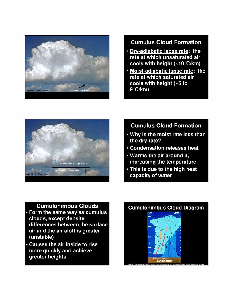
• Dry-adiabatic lapse rate: the rate at which unsaturated air cools with height (~10°C/km)
• Moist-adiabatic lapse rate: the rate at which saturated air cools with height (~5 to 9°C/km)
Dry-adiabatic Lapse Rate
Moist-adiabatic Lapse Rate
Cumulus Cloud Formation
• Why is the moist rate less than the dry rate?
• Condensation releases heat
• Warms the air around it, increasing the temperature
• This is due to the high heat capacity of water
Cumulonimbus Clouds• Form the same way as cumulus
clouds, except density differences between the surface air and the air aloft is greater (unstable)
• Causes the air inside to rise more quickly and achieve greater heights
Cumulonimbus Cloud Diagram
http://www.uwsp.edu/geo/faculty/ritter/images/atmosphere/severe%20weather/mature_stage_NOAA_nssl1012.jpg

1/11/2013
5
Layer Clouds• Form in stable air; the density
difference between the surface air and the air aloft is small
• Causes the air inside to spread out horizontally rather than vertically like cumulus clouds
Layer Clouds• Can form in 2 ways:
1.Air can be forced slowly upward to its condensation level
2.The layer of air can cool to its dew point by radiating heat or mixing with cooler air
Satellite Imagery GOES Weather Satellites• There are a few satellites
orbiting Earth gathering many types of weather data, including “pictures” of clouds
• Satellites are centered over the equator, over 22,000 miles up
• Geosynchronous: orbits Earth at same rate of Earth’s rotation
Satellite Imagery• There are 3 main types of
images:
1.Visible: visible light from the sun is reflected to the satellite
2.Infrared: infrared light (heat) is sensed
3.Water vapor: detects moisture in mid/upper troposphere
Compare 3 Images
http://www.srh.noaa.gov/jetstream/remote/goes.htm
http://www.weather.gov