challenging cartography in arcgis - research group...
TRANSCRIPT
Challenging Cartography in ArcGISwith the Carto-Tools from Esri Switzerland
Mark Wigley
Esri Switzerland Ltd.
Zurich, February 2014
2 © 2014 Esri Switzerland Ltd.
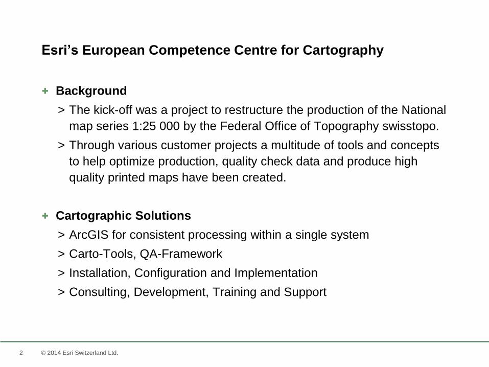
+ Background
> The kick-off was a project to restructure the production of the National
map series 1:25 000 by the Federal Office of Topography swisstopo.
> Through various customer projects a multitude of tools and concepts
to help optimize production, quality check data and produce high
quality printed maps have been created.
+ Cartographic Solutions
> ArcGIS for consistent processing within a single system
> Carto-Tools, QA-Framework
> Installation, Configuration and Implementation
> Consulting, Development, Training and Support
Esri’s European Competence Centre for Cartography

33 © 2014 Esri Switzerland Ltd.
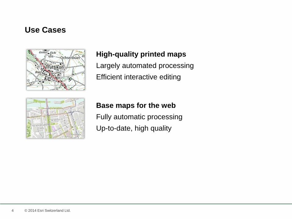
Use Cases
4 © 2014 Esri Switzerland Ltd.
High-quality printed maps
Largely automated processing
Efficient interactive editing
Base maps for the web
Fully automatic processing
Up-to-date, high quality
Use Cases
5 © 2014 Esri Switzerland Ltd.
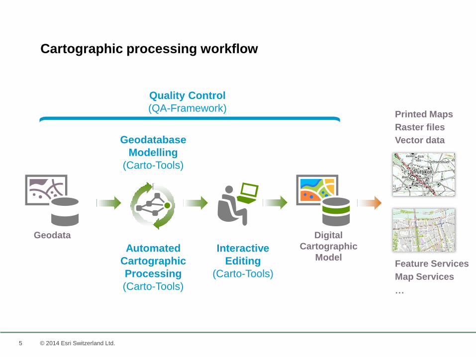
Cartographic processing workflow
Quality Control
(QA-Framework)
Geodatabase
Modelling
(Carto-Tools)
Automated
Cartographic
Processing
(Carto-Tools)
Interactive
Editing
(Carto-Tools)
Digital
Cartographic
Model
Geodata
Printed Maps
Map Services
Raster files
Vector data
Feature Services
…
6 © 2014 Esri Switzerland Ltd.
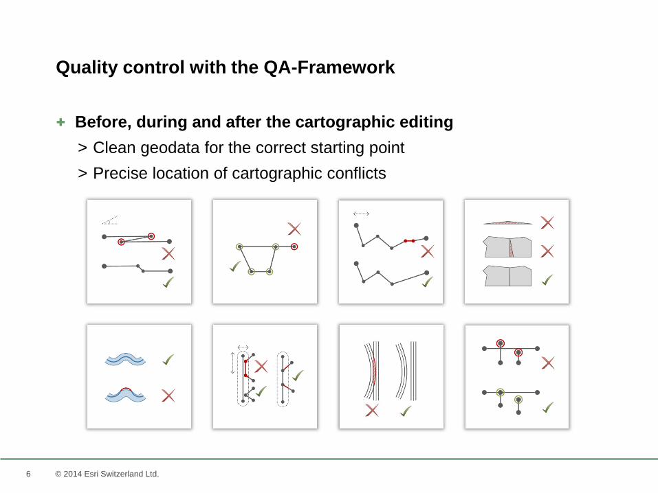
+ Before, during and after the cartographic editing
> Clean geodata for the correct starting point
> Precise location of cartographic conflicts
Quality control with the QA-Framework

77 © 2014 Esri Switzerland Ltd.
Carto-Tools
8 © 2014 Esri Switzerland Ltd.
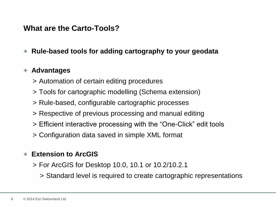
+ Rule-based tools for adding cartography to your geodata
+ Advantages
> Automation of certain editing procedures
> Tools for cartographic modelling (Schema extension)
> Rule-based, configurable cartographic processes
> Respective of previous processing and manual editing
> Efficient interactive processing with the “One-Click” edit tools
> Configuration data saved in simple XML format
+ Extension to ArcGIS
> For ArcGIS for Desktop 10.0, 10.1 or 10.2/10.2.1
> Standard level is required to create cartographic representations
What are the Carto-Tools?
9 © 2014 Esri Switzerland Ltd.
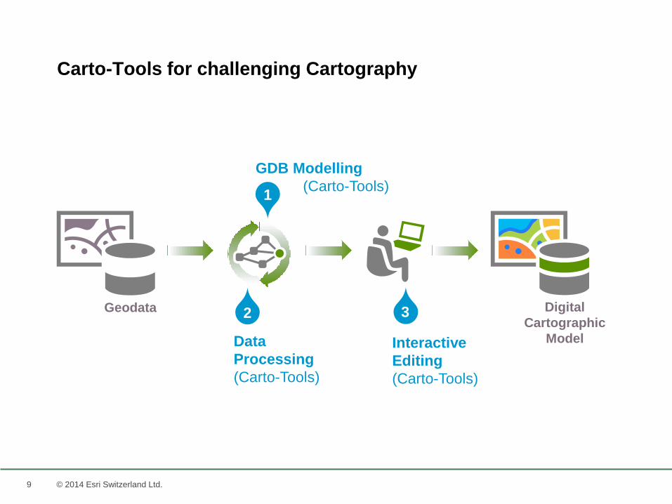
Carto-Tools for challenging Cartography
GDB Modelling
(Carto-Tools)1
Data
Processing
(Carto-Tools)
2
Interactive
Editing
(Carto-Tools)
3 Digital
Cartographic
Model
Geodata
10
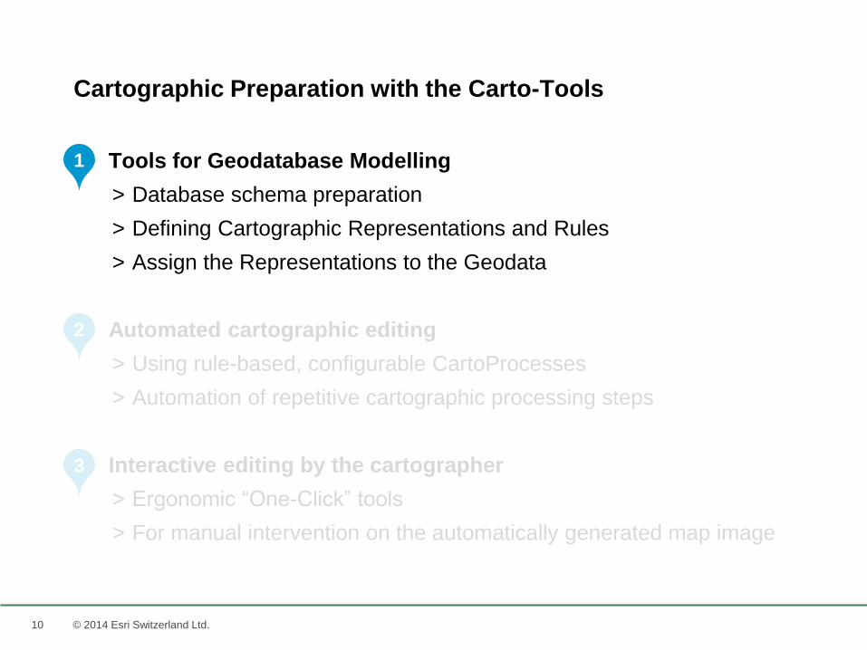
+ Tools for Geodatabase Modelling
> Database schema preparation
> Defining Cartographic Representations and Rules
> Assign the Representations to the Geodata
+ Automated cartographic editing
> Using rule-based, configurable CartoProcesses
> Automation of repetitive cartographic processing steps
+ Interactive editing by the cartographer
> Ergonomic “One-Click” tools
> For manual intervention on the automatically generated map image
© 2014 Esri Switzerland Ltd.
Cartographic Preparation with the Carto-Tools
1
2
3
11 © 2014 Esri Switzerland Ltd.
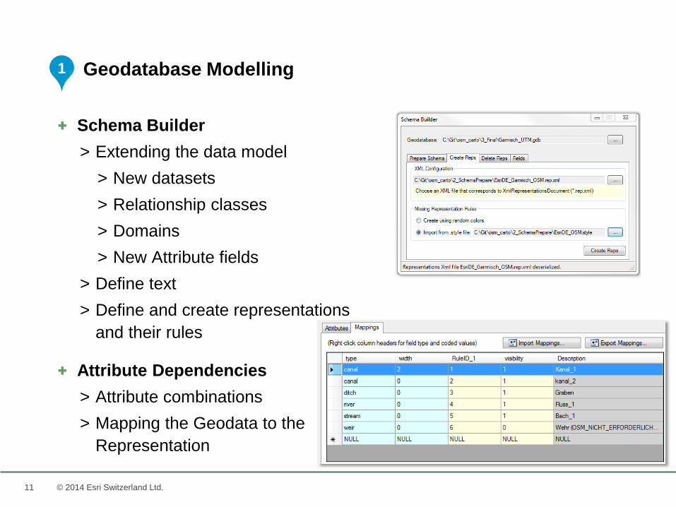
+ Schema Builder
> Extending the data model
> New datasets
> Relationship classes
> Domains
> New Attribute fields
> Define text
> Define and create representations
and their rules
+ Attribute Dependencies
> Attribute combinations
> Mapping the Geodata to the
Representation
Geodatabase Modelling1
12
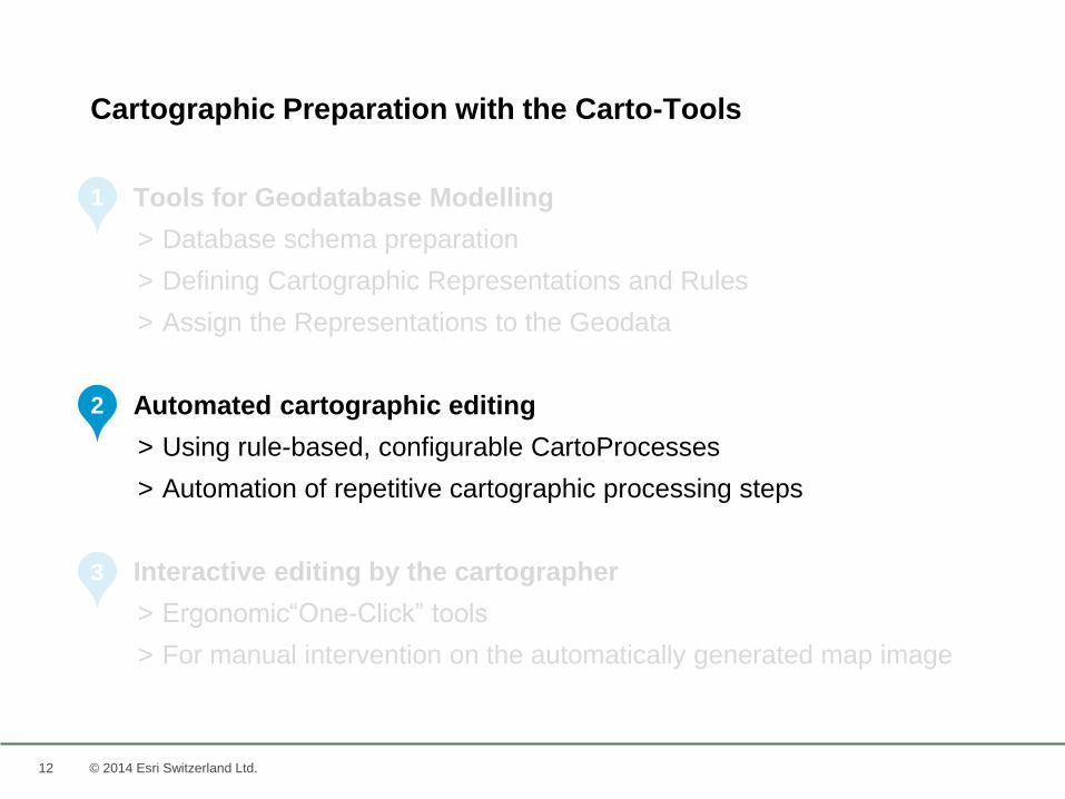
+ Tools for Geodatabase Modelling
> Database schema preparation
> Defining Cartographic Representations and Rules
> Assign the Representations to the Geodata
+ Automated cartographic editing
> Using rule-based, configurable CartoProcesses
> Automation of repetitive cartographic processing steps
+ Interactive editing by the cartographer
> Ergonomic“One-Click” tools
> For manual intervention on the automatically generated map image
© 2014 Esri Switzerland Ltd.
Cartographic Preparation with the Carto-Tools
1
2
3
13 © 2014 Esri Switzerland Ltd.
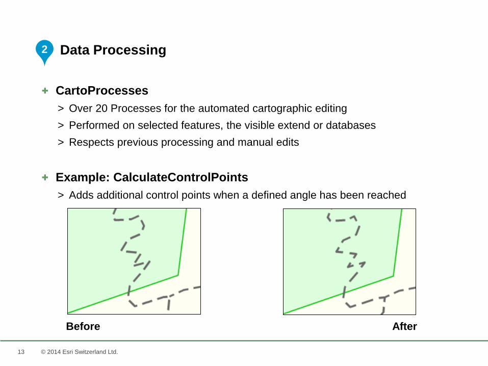
+ CartoProcesses
> Over 20 Processes for the automated cartographic editing
> Performed on selected features, the visible extend or databases
> Respects previous processing and manual edits
+ Example: CalculateControlPoints
> Adds additional control points when a defined angle has been reached
Data Processing2
Before After
14 © 2014 Esri Switzerland Ltd.
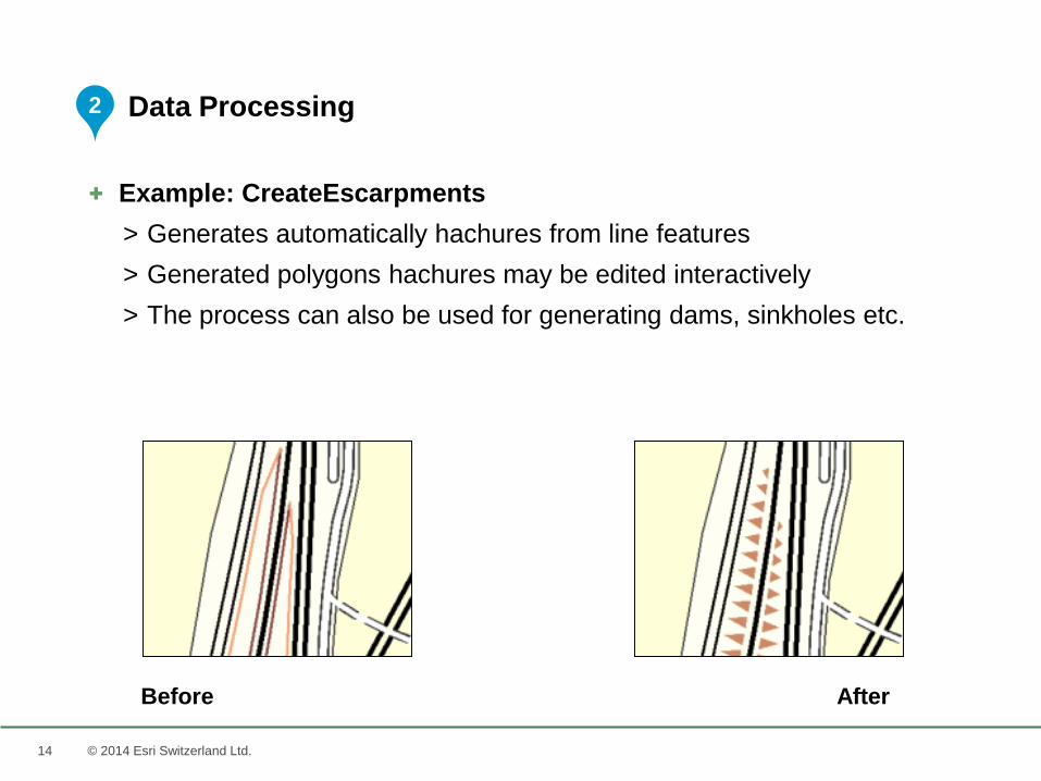
+ Example: CreateEscarpments
> Generates automatically hachures from line features
> Generated polygons hachures may be edited interactively
> The process can also be used for generating dams, sinkholes etc.
Data Processing2
Before After
15 © 2014 Esri Switzerland Ltd.
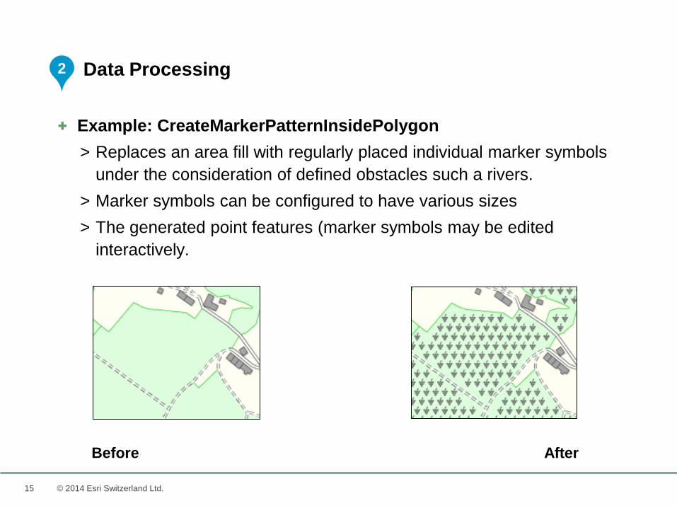
+ Example: CreateMarkerPatternInsidePolygon
> Replaces an area fill with regularly placed individual marker symbols
under the consideration of defined obstacles such a rivers.
> Marker symbols can be configured to have various sizes
> The generated point features (marker symbols may be edited
interactively.
Data Processing
Before After
2
16 © 2014 Esri Switzerland Ltd.
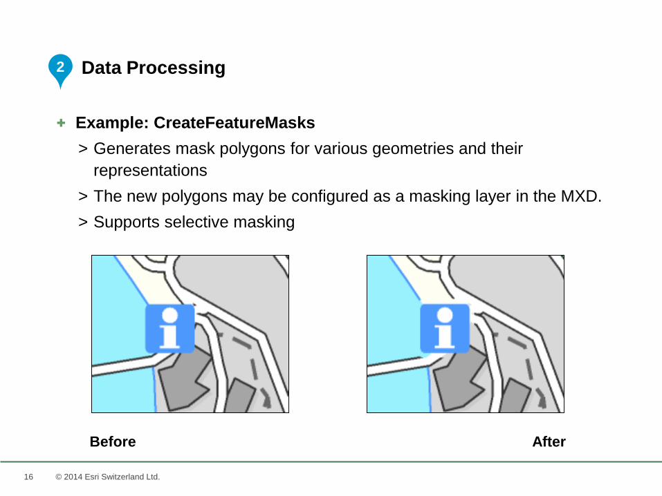
+ Example: CreateFeatureMasks
> Generates mask polygons for various geometries and their
representations
> The new polygons may be configured as a masking layer in the MXD.
> Supports selective masking
Data Processing
Before After
2
17 © 2014 Esri Switzerland Ltd.
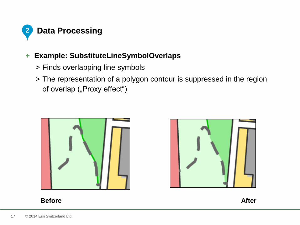
+ Example: SubstituteLineSymbolOverlaps
> Finds overlapping line symbols
> The representation of a polygon contour is suppressed in the region
of overlap („Proxy effect“)
Data Processing
Before After
2
18 © 2014 Esri Switzerland Ltd.
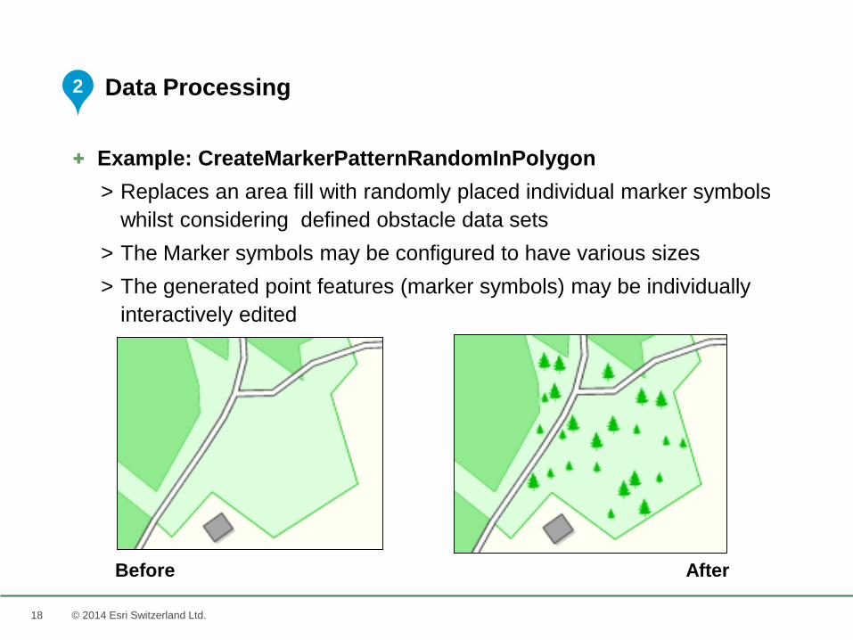
+ Example: CreateMarkerPatternRandomInPolygon
> Replaces an area fill with randomly placed individual marker symbols
whilst considering defined obstacle data sets
> The Marker symbols may be configured to have various sizes
> The generated point features (marker symbols) may be individually
interactively edited
Data Processing
AfterBefore
2
19 © 2014 Esri Switzerland Ltd.
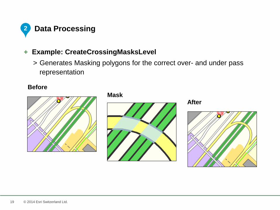
+ Example: CreateCrossingMasksLevel
> Generates Masking polygons for the correct over- and under pass
representation
Data Processing
Before
AfterMask
2
20 © 2014 Esri Switzerland Ltd.
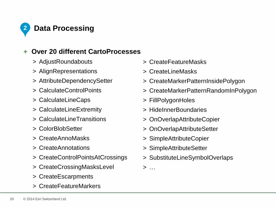
+ Over 20 different CartoProcesses
> AdjustRoundabouts
> AlignRepresentations
> AttributeDependencySetter
> CalculateControlPoints
> CalculateLineCaps
> CalculateLineExtremity
> CalculateLineTransitions
> ColorBlobSetter
> CreateAnnoMasks
> CreateAnnotations
> CreateControlPointsAtCrossings
> CreateCrossingMasksLevel
> CreateEscarpments
> CreateFeatureMarkers
Data Processing
> CreateFeatureMasks
> CreateLineMasks
> CreateMarkerPatternInsidePolygon
> CreateMarkerPatternRandomInPolygon
> FillPolygonHoles
> HideInnerBoundaries
> OnOverlapAttributeCopier
> OnOverlapAttributeSetter
> SimpleAttributeCopier
> SimpleAttributeSetter
> SubstituteLineSymbolOverlaps
> …
2
21
+ Tools for Geodatabase Modelling
> Database schema preparation
> Defining Cartographic Representations and Rules
> Assign the Representations to the Geodata
+ Automated cartographic editing
> Using rule-based, configurable CartoProcesses
> Automation of repetitive cartographic processing steps
+ Interactive editing by the cartographer
> Ergonomic “One-Click” tools
> For manual intervention on the automatically generated map image
© 2014 Esri Switzerland Ltd.
Cartographic Preparation with the Carto-Tools
1
2
3
22 © 2014 Esri Switzerland Ltd.
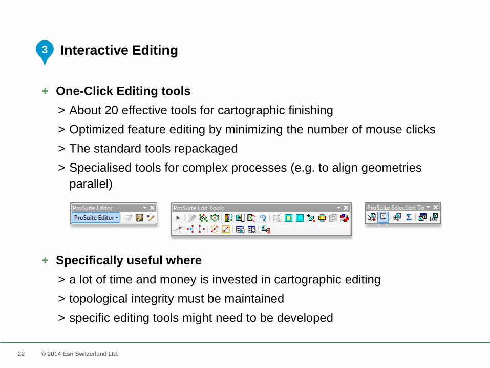
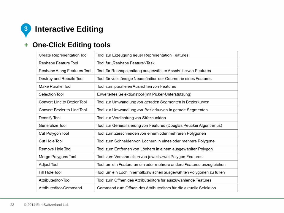
+ One-Click Editing tools
> About 20 effective tools for cartographic finishing
> Optimized feature editing by minimizing the number of mouse clicks
> The standard tools repackaged
> Specialised tools for complex processes (e.g. to align geometries
parallel)
+ Specifically useful where
> a lot of time and money is invested in cartographic editing
> topological integrity must be maintained
> specific editing tools might need to be developed
Interactive Editing3
23 © 2014 Esri Switzerland Ltd.
+ One-Click Editing tools
Interactive Editing3
2424 © 2014 Esri Switzerland Ltd.
References
25 © 2014 Esri Switzerland Ltd.
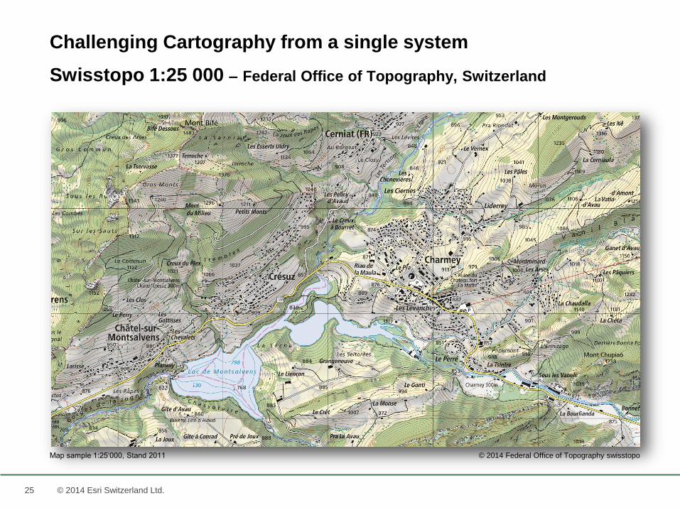
Challenging Cartography from a single system
Swisstopo 1:25 000 – Federal Office of Topography, Switzerland
© 2014 Federal Office of Topography swisstopoMap sample 1:25‘000, Stand 2011
26 © 2014 Esri Switzerland Ltd.
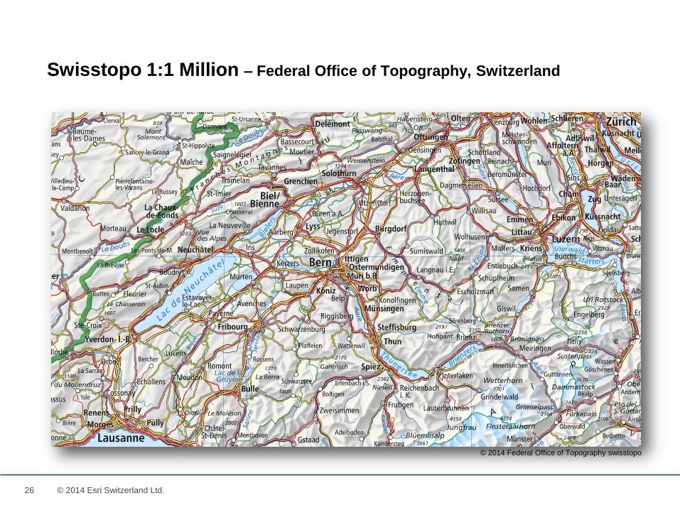
Swisstopo 1:1 Million – Federal Office of Topography, Switzerland
© 2014 Federal Office of Topography swisstopo
27 © 2014 Esri Switzerland Ltd.
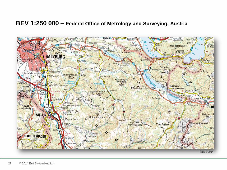
BEV 1:250 000 – Federal Office of Metrology and Surveying, Austria
©BEV 2014
28 © 2014 Esri Switzerland Ltd.
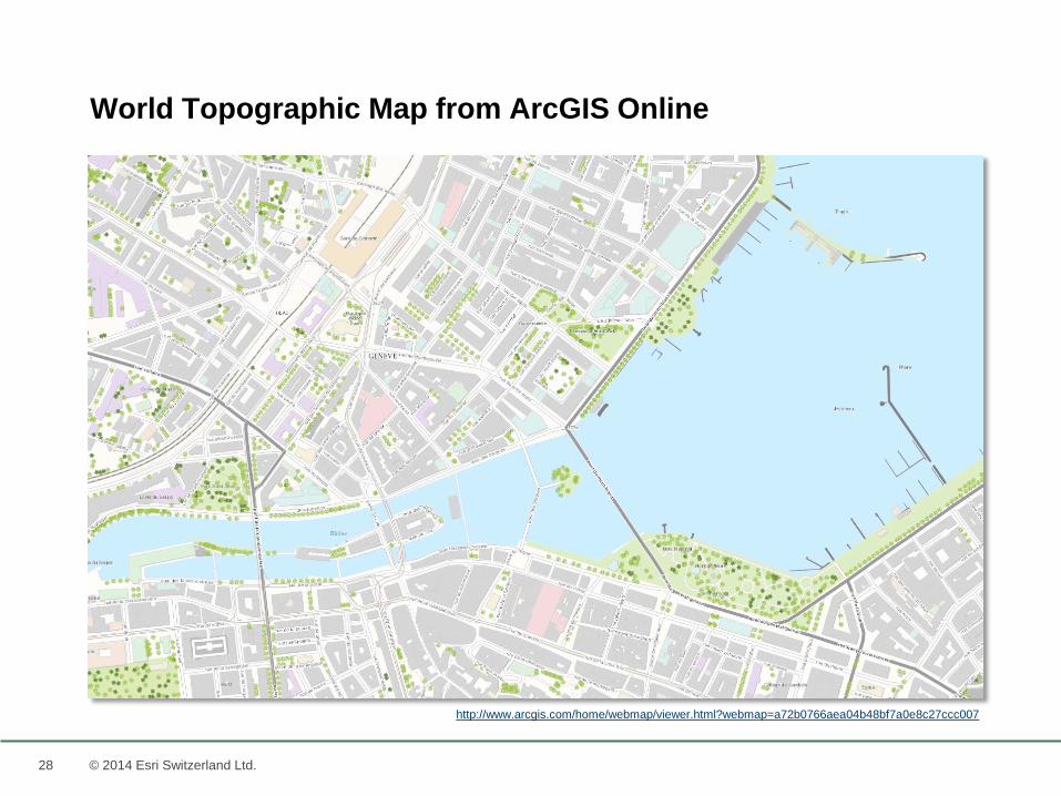
World Topographic Map from ArcGIS Online
http://www.arcgis.com/home/webmap/viewer.html?webmap=a72b0766aea04b48bf7a0e8c27ccc007
29
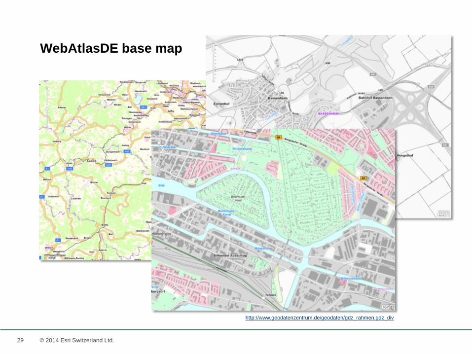
WebAtlasDE base map
© 2014 Esri Switzerland Ltd.
http://www.geodatenzentrum.de/geodaten/gdz_rahmen.gdz_div
33
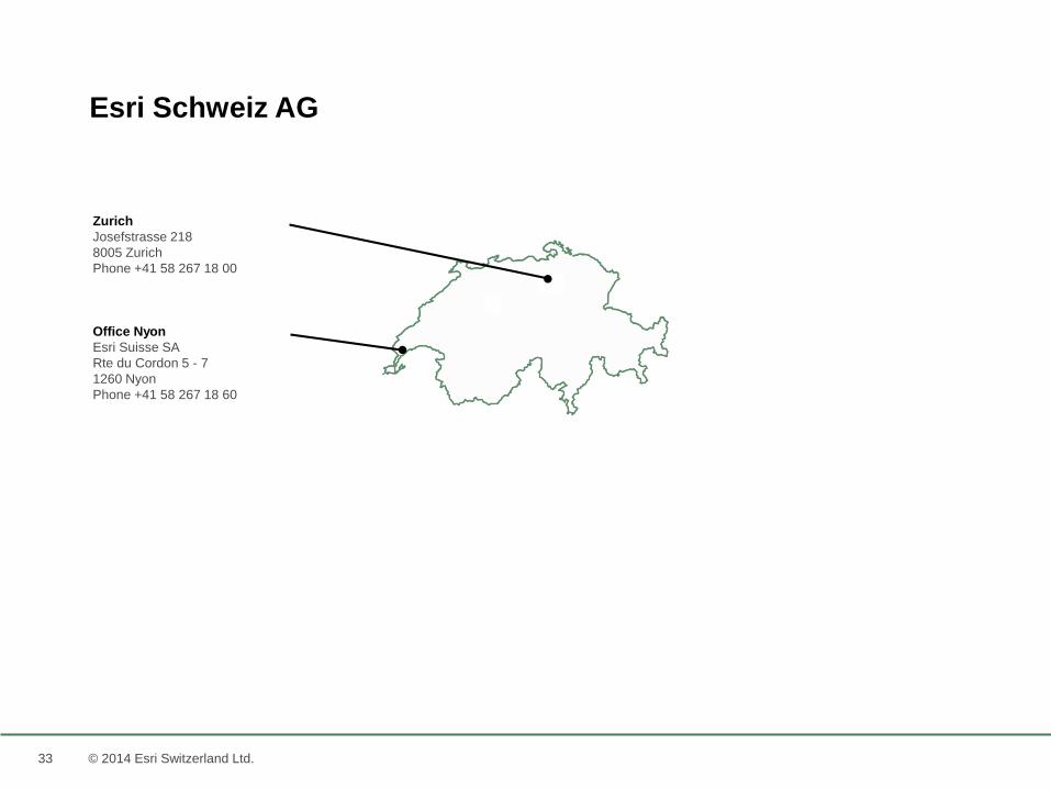
Esri Schweiz AG
Zurich
Josefstrasse 218
8005 Zurich
Phone +41 58 267 18 00
Office Nyon
Esri Suisse SA
Rte du Cordon 5 - 7
1260 Nyon
Phone +41 58 267 18 60
© 2014 Esri Switzerland Ltd.
34
Take Away’s
Thank you for listening and remember….
“It’s Ok to be a Cartographer!”
Georg Gartner, ICC 2013
© 2014 Esri Switzerland Ltd.