challenges in geospatial policy formulation and...
TRANSCRIPT

Challenges in Geospatial Policy Formulation and Programme Management
Luiz Paulo Souto Fortes, PhD
An Exchange with the Geospatial Industry for UN-GGIM
Seoul, October 23, 2011
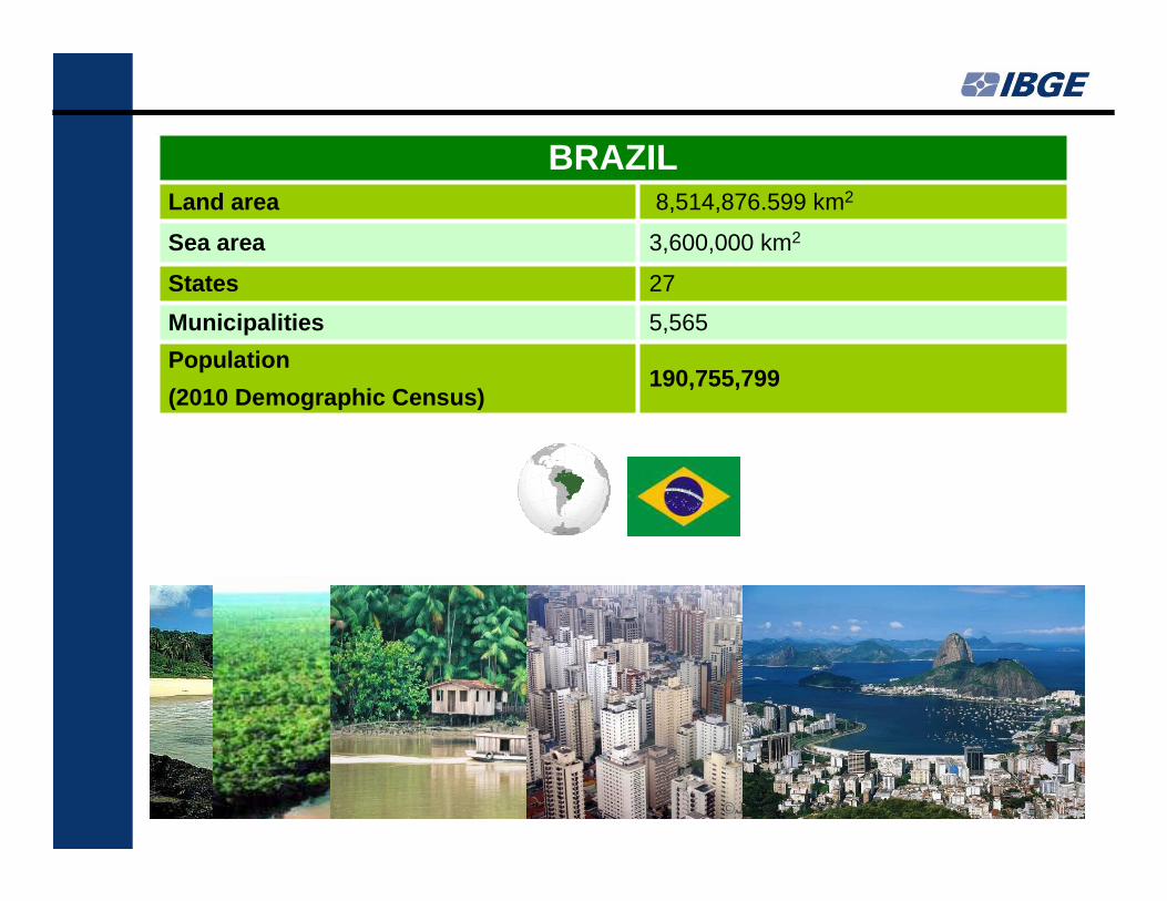
BRAZILLand area 8,514,876.599 km2
Sea area 3,600,000 km2
States 27
Municipalities 5,565
Population
(2010 Demographic Census)190,755,799
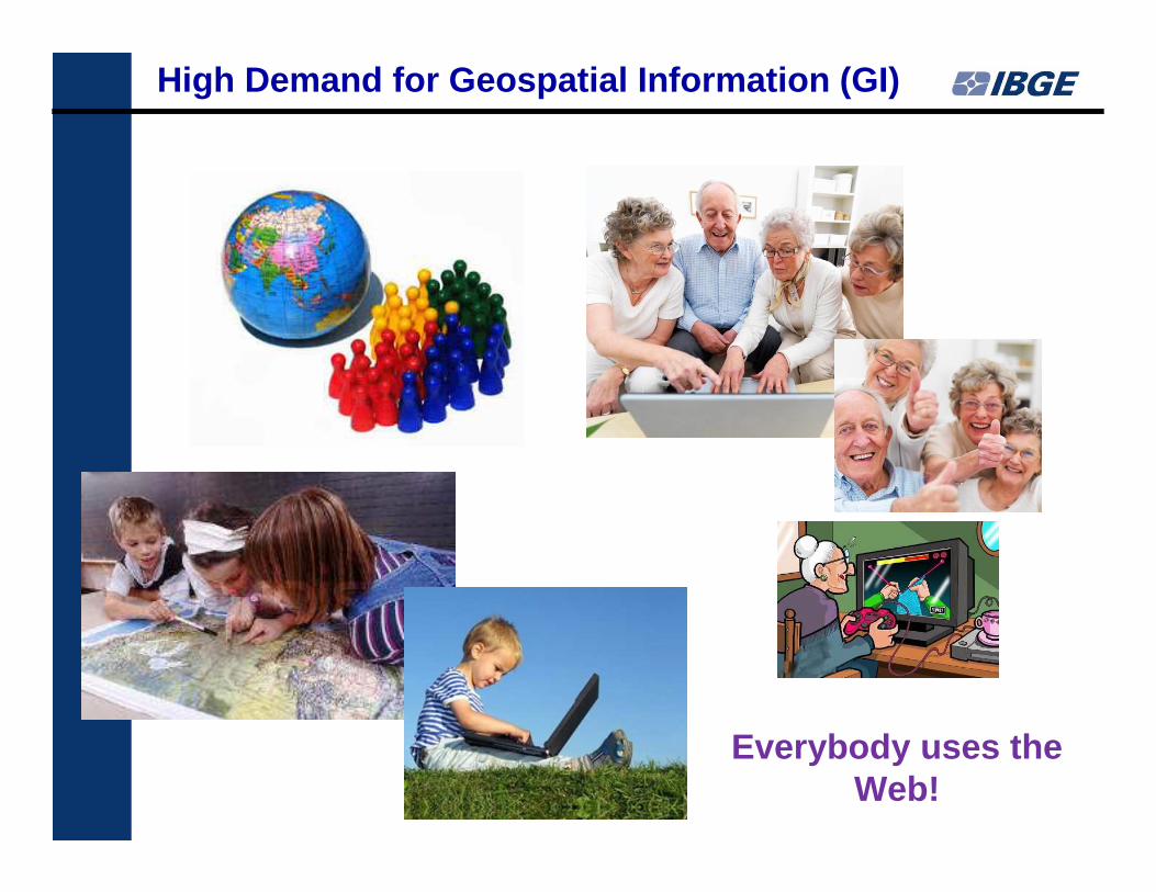
Everybody uses the Web!
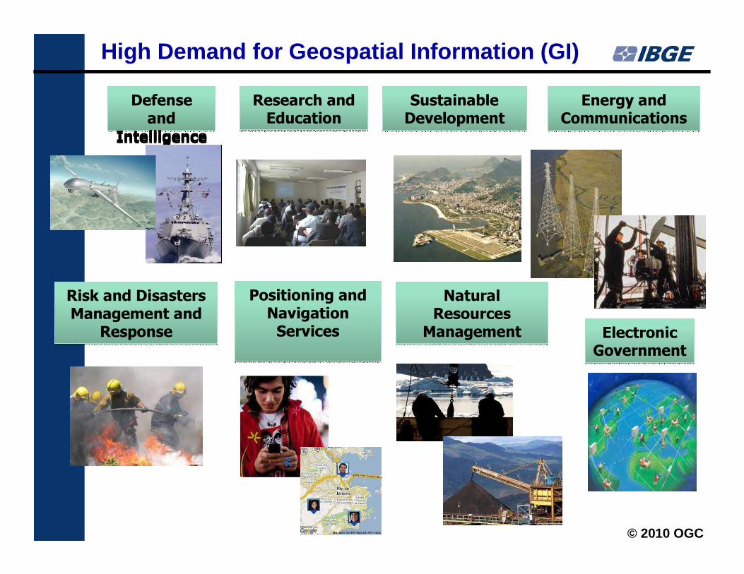
High Demand for Geospatial Information (GI)
High Demand for Geospatial Information (GI)
© 2010 OGC
Research and Education
Research and Education
Sustainable Development
Sustainable Development
Energy and Communications
Energy and Communications
Positioning and Navigation Services
Positioning and Navigation Services
Natural Resources
Management
Natural Resources
Management
Risk and Disasters Management and
Response
Risk and Disasters Management and
Response Electronic Government
Electronic Government
Defense and
Intelligence
Defense and
Intelligence
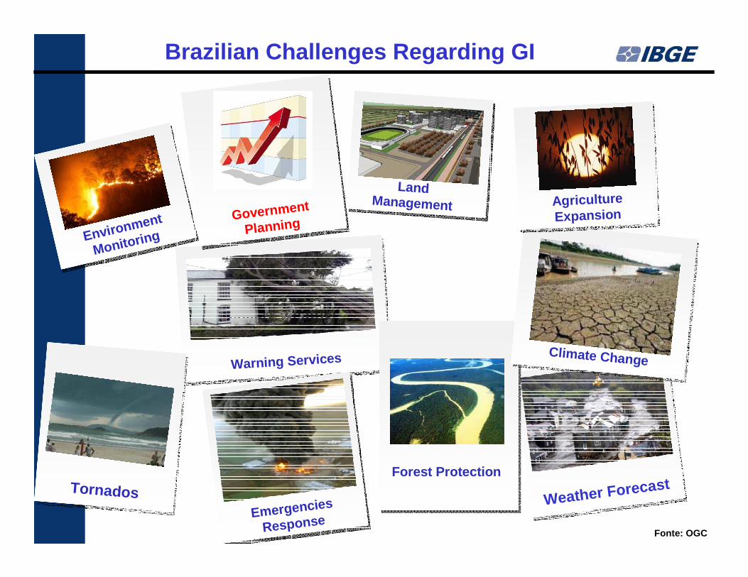
severe weather
Warning Services
severe weather
Warning Services
Emergencies
ResponseEmergencies
ResponseWeather ForecastWeather ForecastTornadosTornados
Environment
MonitoringEnvironment
Monitoring
Climate ChangeClimate Change
Agriculture Expansion
Agriculture Expansion
Fonte: OGC
Land Management
Forest Protection
Brazilian Challenges Regarding GI
Government
PlanningGovernment
Planning
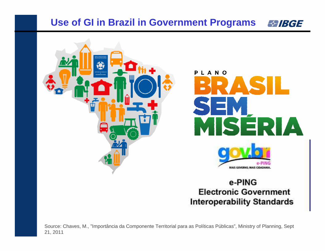
Use of GI in Brazil in Government Programs
Source: Chaves, M., ”Importância da Componente Territorial para as Políticas Públicas”, Ministry of Planning, Sept 21, 2011
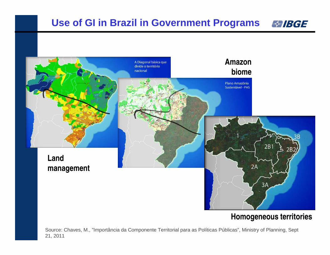
Land
management
Amazon
biome
Homogeneous territories
Use of GI in Brazil in Government Programs
Source: Chaves, M., ”Importância da Componente Territorial para as Políticas Públicas”, Ministry of Planning, Sept 21, 2011
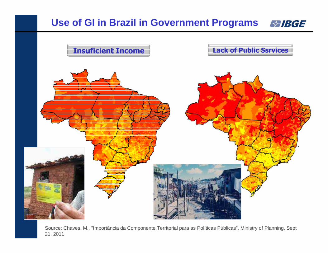
Insuficient Income Lack of Public Ssrvices
Use of GI in Brazil in Government Programs
Source: Chaves, M., ”Importância da Componente Territorial para as Políticas Públicas”, Ministry of Planning, Sept 21, 2011
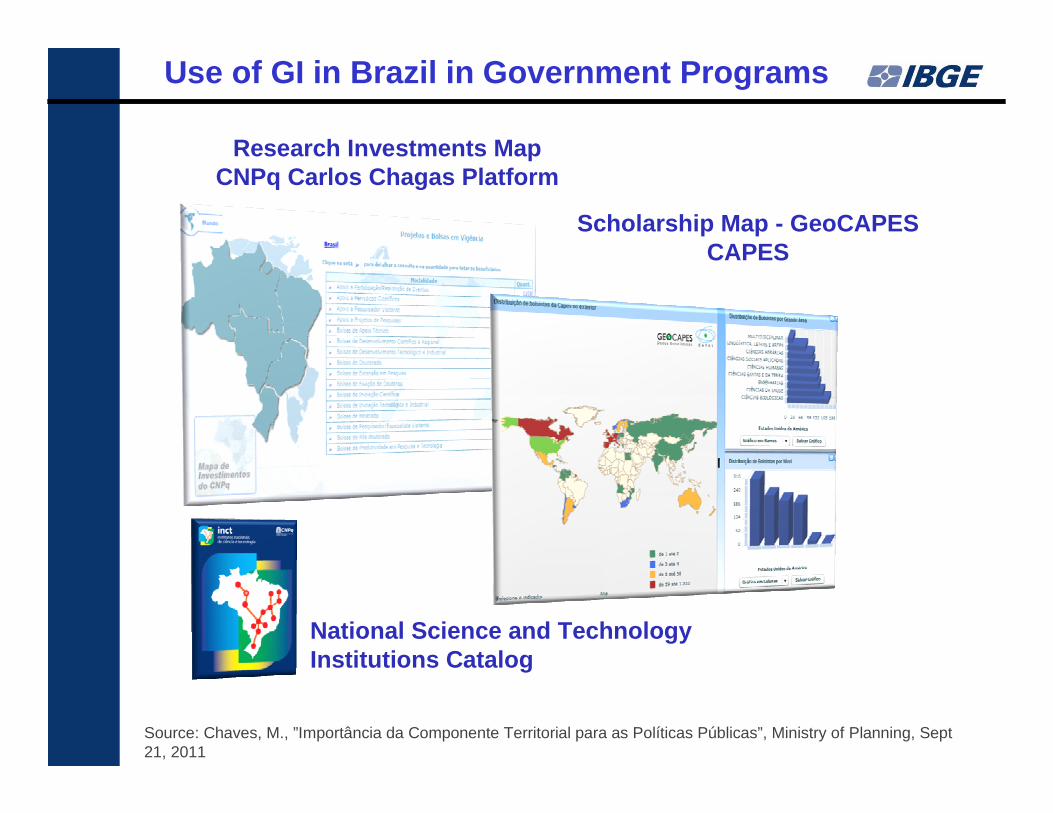
Research Investments MapCNPq Carlos Chagas Platform
Scholarship Map - GeoCAPESCAPES
National Science and Technology Institutions Catalog
Use of GI in Brazil in Government Programs
Source: Chaves, M., ”Importância da Componente Territorial para as Políticas Públicas”, Ministry of Planning, Sept 21, 2011
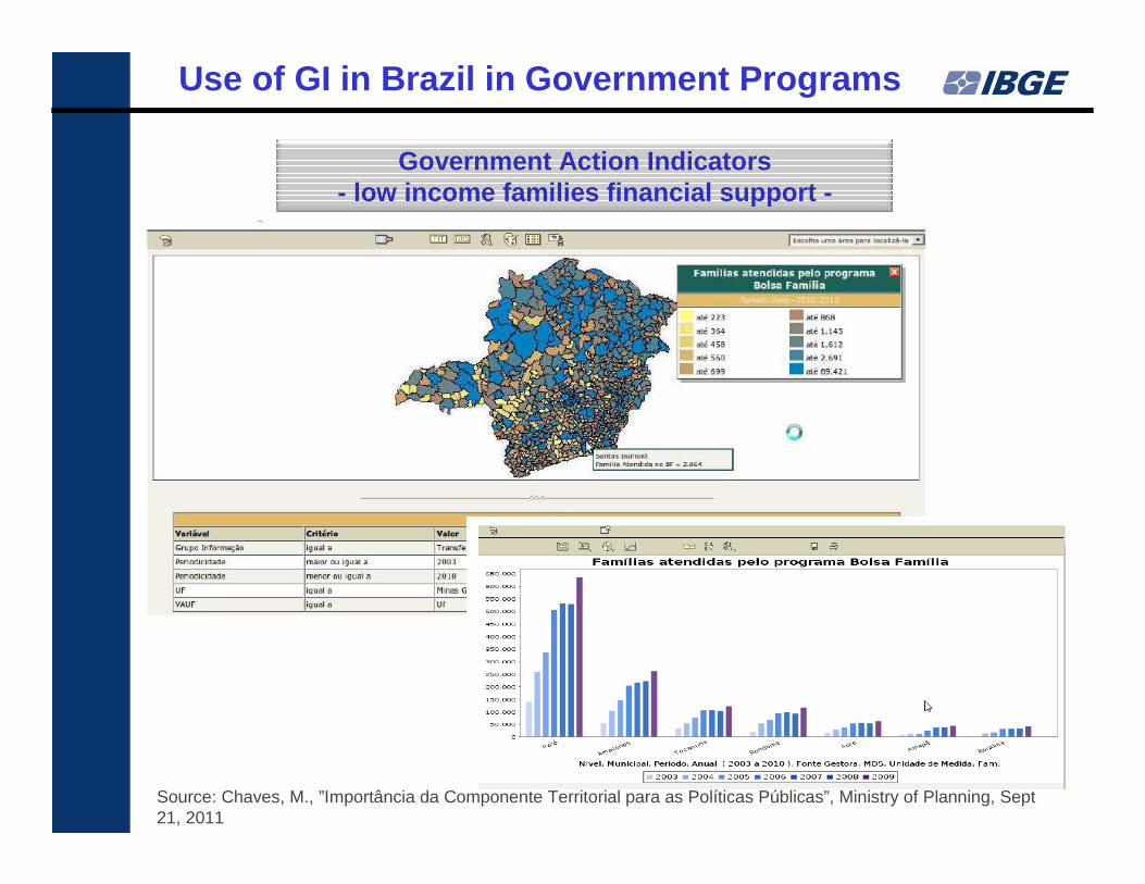
Government Action Indicators- low income families financial support -
Use of GI in Brazil in Government Programs
Source: Chaves, M., ”Importância da Componente Territorial para as Políticas Públicas”, Ministry of Planning, Sept 21, 2011
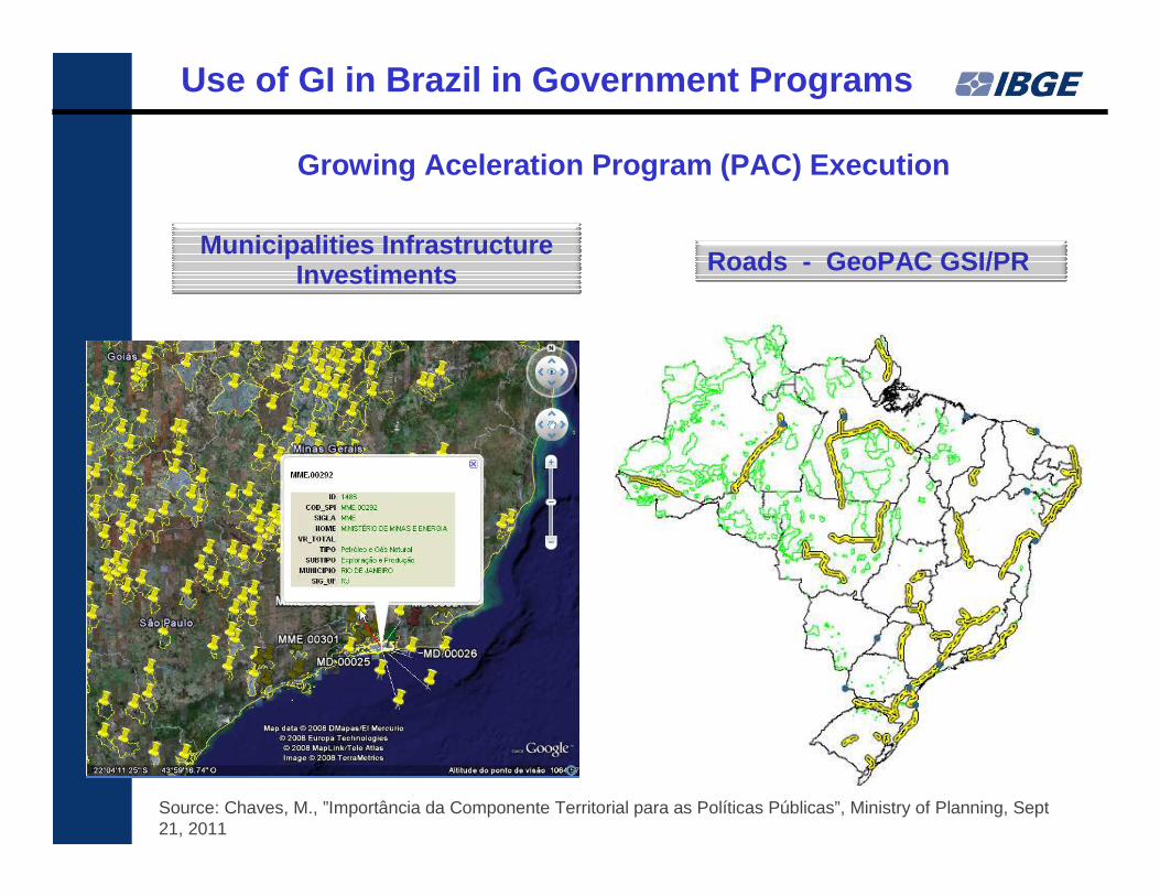
Municipalities Infrastructure Investiments Roads - GeoPAC GSI/PR
Growing Aceleration Program (PAC) Execution
Use of GI in Brazil in Government Programs
Source: Chaves, M., ”Importância da Componente Territorial para as Políticas Públicas”, Ministry of Planning, Sept 21, 2011
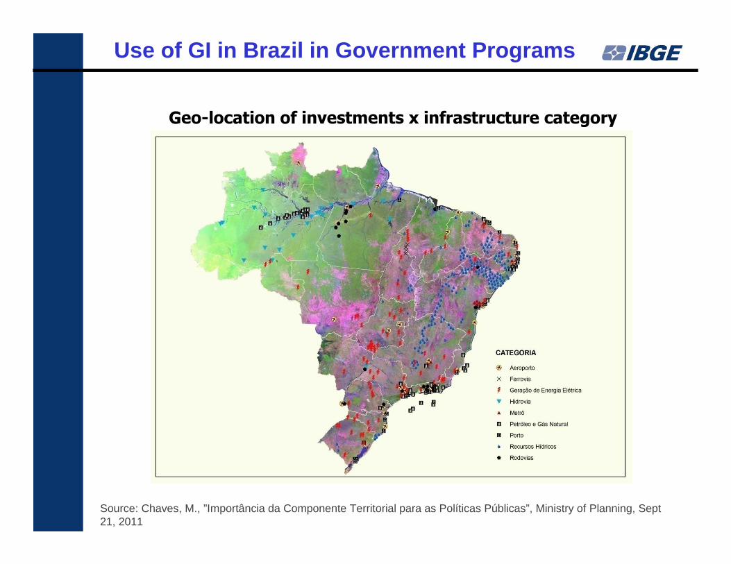
Geo-location of investments x infrastructure category
Use of GI in Brazil in Government Programs
Source: Chaves, M., ”Importância da Componente Territorial para as Políticas Públicas”, Ministry of Planning, Sept 21, 2011
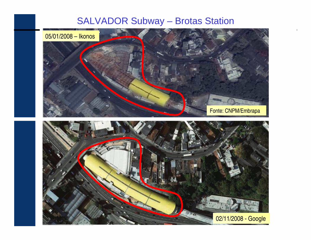
05/01/2008 – Ikonos
Fonte: CNPM/Embrapa
02/11/2008 - Google
SALVADOR Subway – Brotas Station
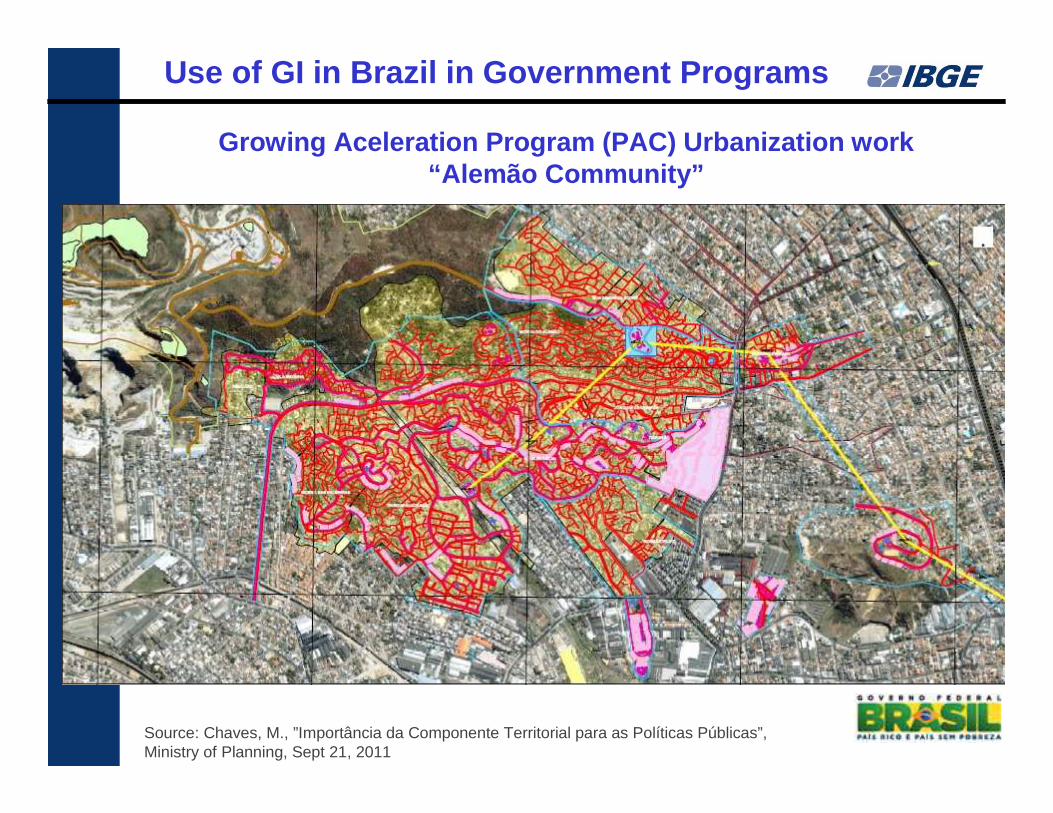
Growing Aceleration Program (PAC) Urbanization work“Alemão Community”
Use of GI in Brazil in Government Programs
Source: Chaves, M., ”Importância da Componente Territorial para as Políticas Públicas”, Ministry of Planning, Sept 21, 2011
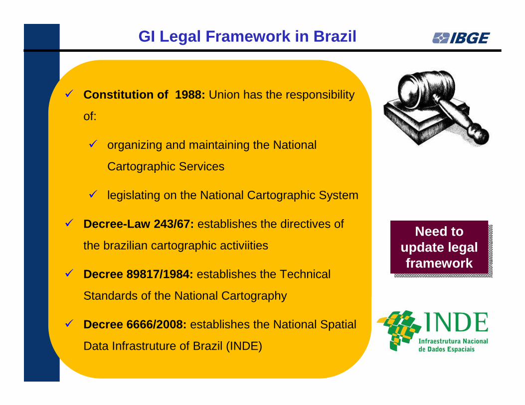
� Constitution of 1988: Union has the responsibility
of:
� organizing and maintaining the National
Cartographic Services
� legislating on the National Cartographic System
� Decree-Law 243/67: establishes the directives of
the brazilian cartographic activiities
� Decree 89817/1984: establishes the Technical
Standards of the National Cartography
� Decree 6666/2008: establishes the National Spatial
Data Infrastruture of Brazil (INDE)
GI Legal Framework in Brazil
Need to update legal framework
Need to update legal framework
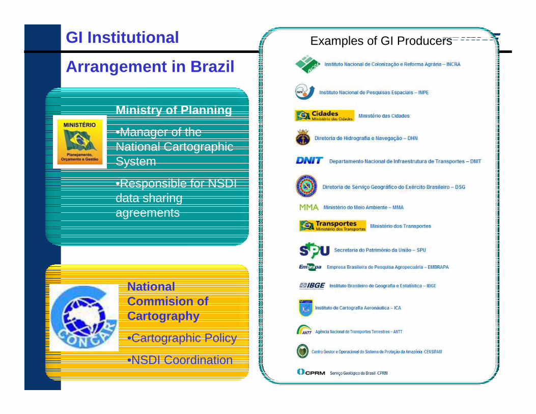
Ministry of Planning
•Manager of the National Cartographic System
•Responsible for NSDI data sharing agreements
National Commision of Cartography
•Cartographic Policy
•NSDI Coordination
Examples of GI ProducersGI Institutional
Arrangement in Brazil
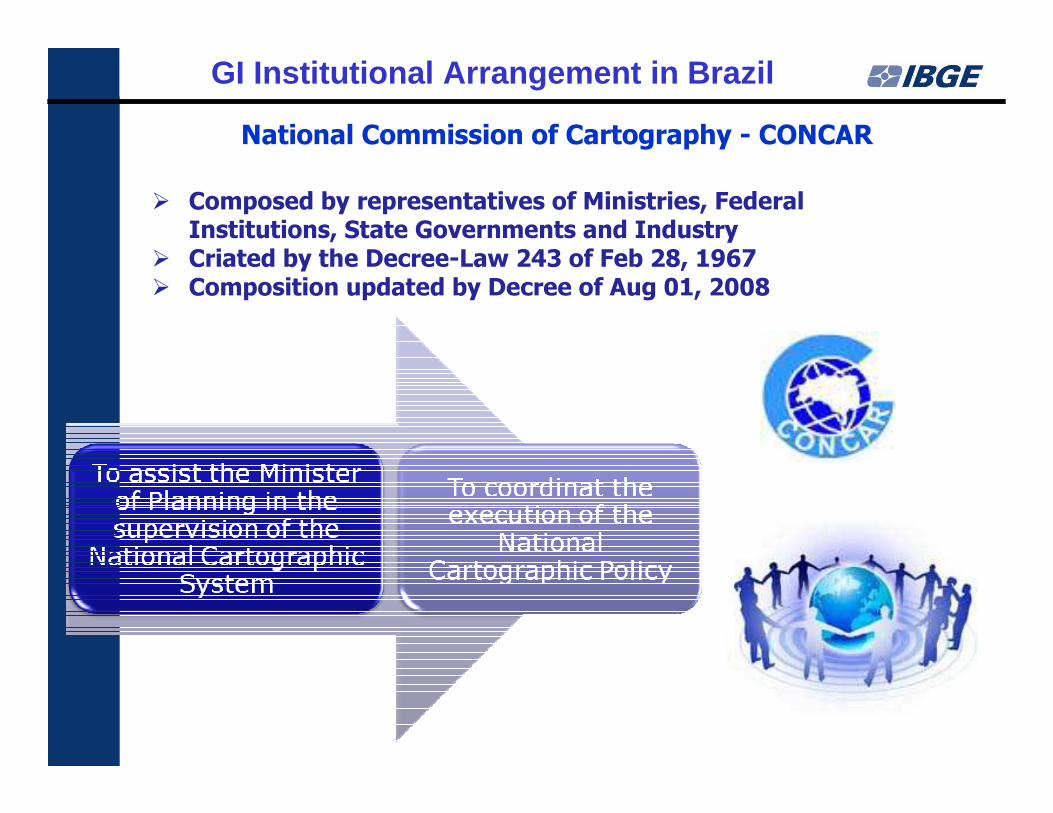
� Composed by representatives of Ministries, Federal Institutions, State Governments and Industry
� Criated by the Decree-Law 243 of Feb 28, 1967� Composition updated by Decree of Aug 01, 2008
National Commission of Cartography - CONCAR
GI Institutional Arrangement in Brazil
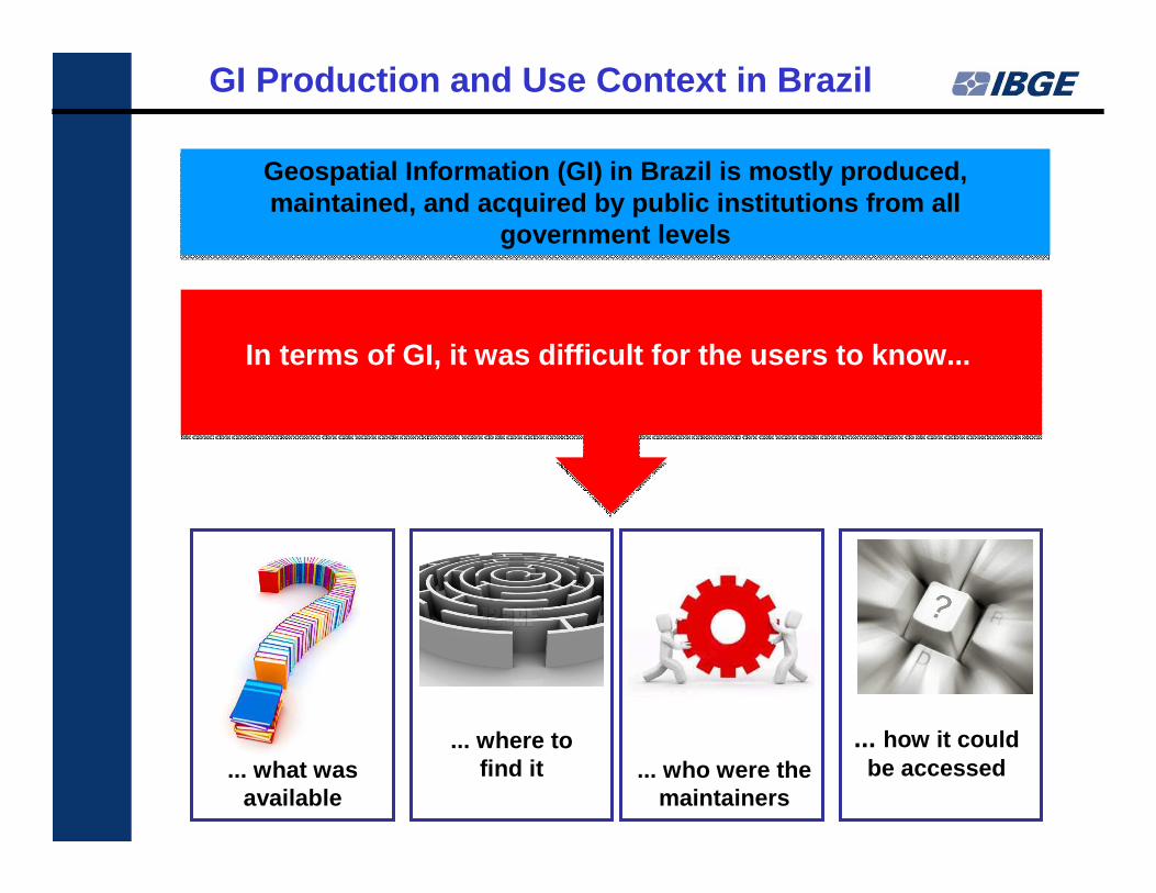
Geospatial Information (GI) in Brazil is mostly pro duced, maintained, and acquired by public institutions fro m all
government levels
Geospatial Information (GI) in Brazil is mostly pro duced, maintained, and acquired by public institutions fro m all
government levels
In terms of GI, it was difficult for the users to k now...
... what was available
... how it could be accessed... who were the
maintainers
... where to find it
GI Production and Use Context in Brazil
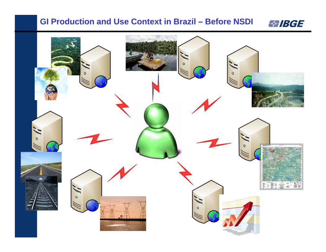
GI Production and Use Context in Brazil – Before NSD I
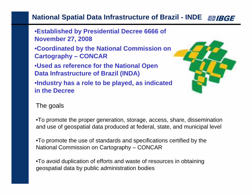
The goals
•To promote the proper generation, storage, access, share, dissemination and use of geospatial data produced at federal, state, and municipal level
•To promote the use of standards and specifications certified by the National Commission on Cartography – CONCAR
•To avoid duplication of efforts and waste of resources in obtaining geospatial data by public administration bodies
National Spatial Data Infrastructure of Brazil - IND E
•Established by Presidential Decree 6666 of November 27, 2008
•Coordinated by the National Commission on Cartography – CONCAR
•Used as reference for the National Open Data Infrastructure of Brazil (INDA)
•Industry has a role to be played, as indicated in the Decree
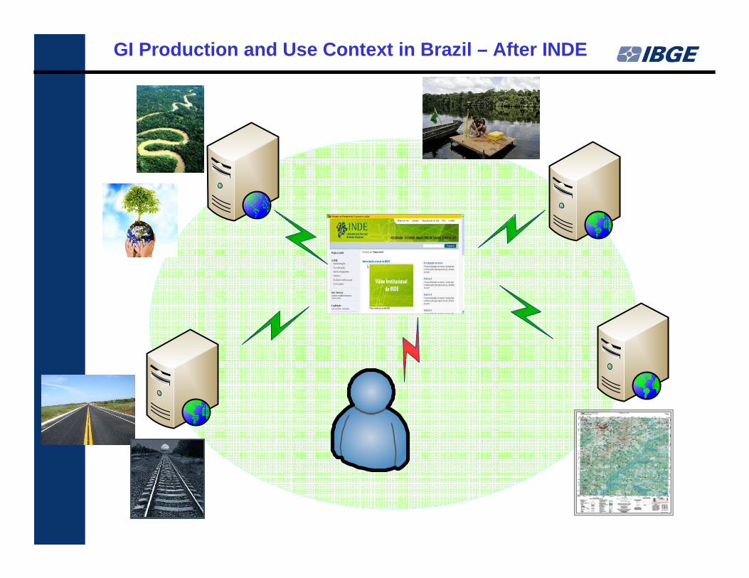
GI Production and Use Context in Brazil – After INDE
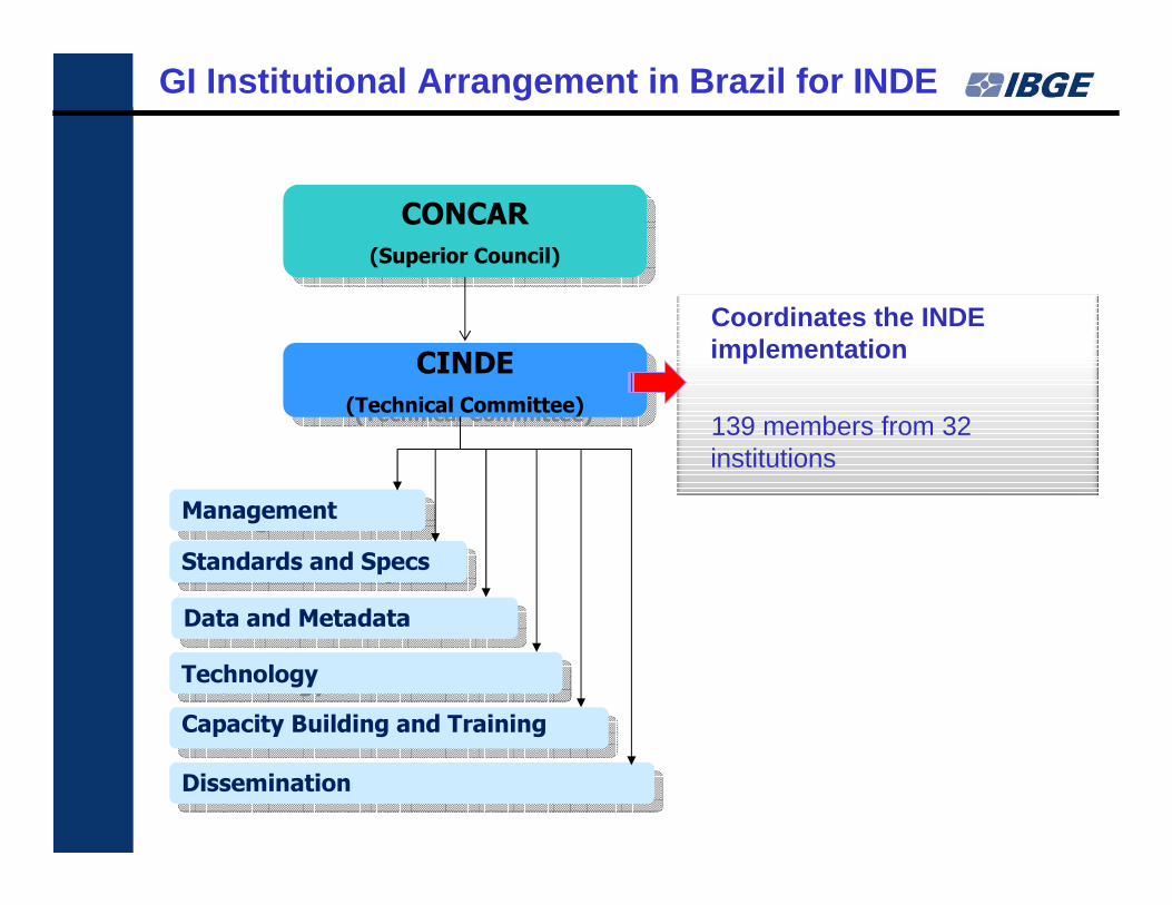
CONCAR
(Superior Council)
CONCAR
(Superior Council)
CINDE
(Technical Committee)
CINDE
(Technical Committee)
Standards and SpecsStandards and Specs
Data and MetadataData and Metadata
TechnologyTechnology
Capacity Building and TrainingCapacity Building and Training
DisseminationDissemination
ManagementManagement
Coordinates the INDE implementation
139 members from 32 institutions
GI Institutional Arrangement in Brazil for INDE
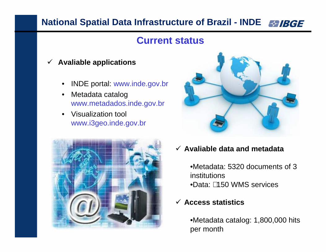
� Avaliable applications
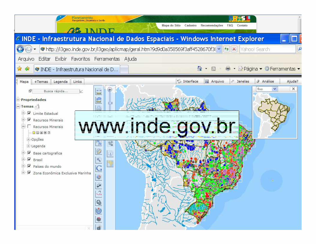
• INDE portal: www.inde.gov.br
• Metadata catalogwww.metadados.inde.gov.br
• Visualization toolwww.i3geo.inde.gov.br
Current status
� Avaliable data and metadata
•Metadata: 5320 documents of 3 institutions•Data: ∼150 WMS services
� Access statistics
•Metadata catalog: 1,800,000 hits per month
National Spatial Data Infrastructure of Brazil - IND E
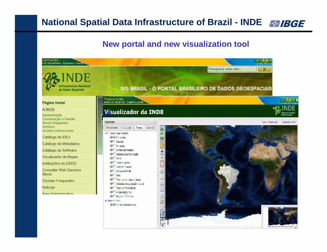
New portal and new visualization tool
National Spatial Data Infrastructure of Brazil - IND E
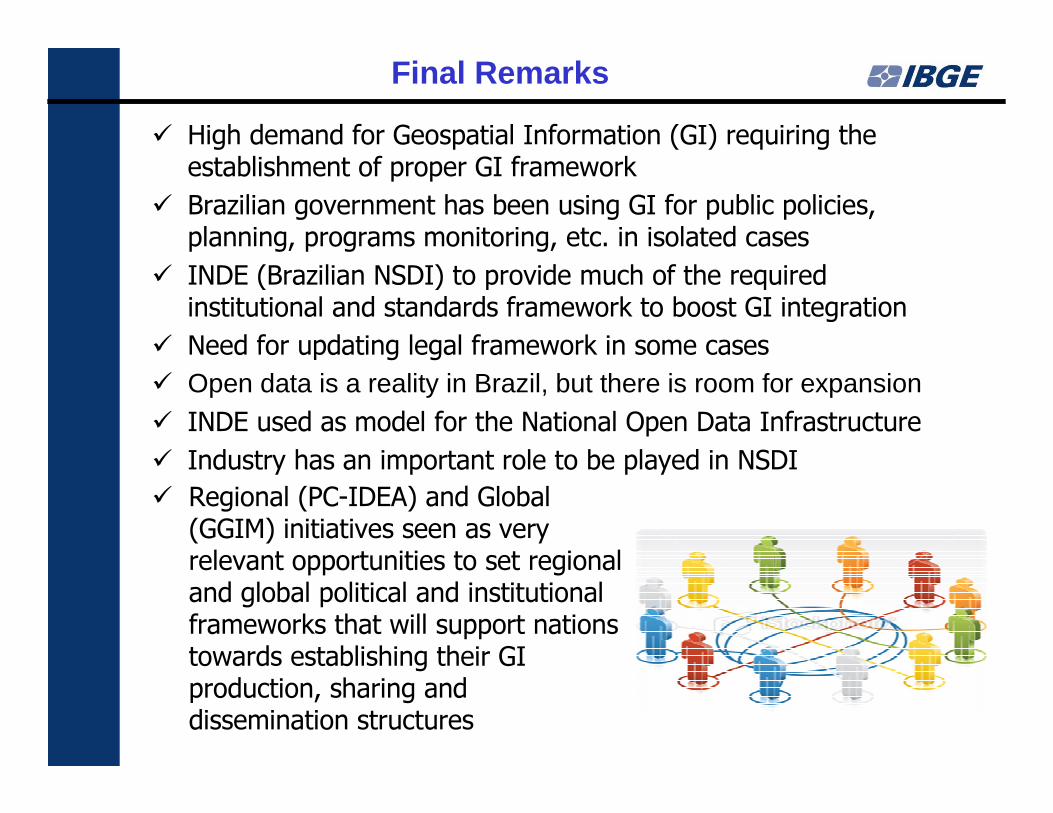
Final Remarks
� High demand for Geospatial Information (GI) requiring the establishment of proper GI framework
� Brazilian government has been using GI for public policies, planning, programs monitoring, etc. in isolated cases
� INDE (Brazilian NSDI) to provide much of the required institutional and standards framework to boost GI integration
� Need for updating legal framework in some cases
� Open data is a reality in Brazil, but there is room for expansion
� INDE used as model for the National Open Data Infrastructure
� Industry has an important role to be played in NSDI
� Regional (PC-IDEA) and Global (GGIM) initiatives seen as very relevant opportunities to set regional and global political and institutional frameworks that will support nations towards establishing their GI production, sharing and dissemination structures
1958
1962
1970
1994
2002

Waiting for you all in 2014!!!!