caught on camera - victorian national parks association · 8 caught on camera – a monitoring...
TRANSCRIPT
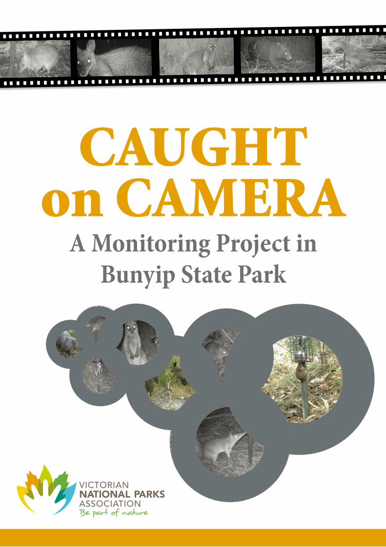
CAUGHT
on CAMERAA Monitoring Project in
Bunyip State Park

2 CAUGHT ON CAMERA – A Monitoring Project in Bunyip State Park CONTENTS
ViCTORiAN NATiONAl PARkS ASSOCiATiON
The Victorian National Parks Association (VNPA) helps to shape the agenda for creating and managing national parks, conservation reserves and other important natural areas across land and sea.
The VNPA works with all levels of government, the scientific community and the general community to achieve long term, best practice environmental outcomes.
The VNPA is also Victoria’s largest bushwalking club and provides a range of information, education and
activity programs to encourage Victorians to get active for nature.
NATUREWATCH
The VNPA’s NatureWatch program is a community-based biodiversity monitoring program that informs, educates and engages the community in conservation management and practices. The NatureWatch program actively builds links between community members, scientists and land managers, and develops scientifically based, practical projects that contribute to a better understanding of species and ecosystems, and the management of natural areas.
PROjECT PARTNERS
Friends of Bunyip State Park
Friends of Bunyip State Park undertake activities in collaboration with Parks Victoria including walking track planning, creation and maintenance, tree planting, fauna and flora surveys, signage and interpretation, and restoration of habitat for indigenous animal populations.
The Arthur Rylah institute for Environmental Research (ARi)
ARI is the biodiversity research base for the Department of Environment and Primary Industries (DEPI) in Victoria and is a leading centre for applied ecological research.
ACkNOWlEdGEMENTS
ARi: Ed McNabb assisted with training and site selection, Ryan Chick for designing and building bait stations. Jenny Nelson, Ryan Chick and Michael Scroggie for developing training material, Phoebe Macak provided helpful comments on this report.
VNPA: Team leaders and volunteers for collecting the data and running trips, John Kotsiaris and Beatrix Spender for image cataloguing.
Friends of Bunyip State Park: Including President Ian Vaskess, Jasper Hailes and David Lockwood.
department of Environment and Primary industries: Fiona Hamilton and Karen Lester.
Parks Victoria: Andrew Musgrove, Daniel Bowen and Mark Antos.
This project was funded by the lord Mayor’s Charitable Foundation and supported by the Australian Government’s Caring for our Country Community Action Grants.
SUMMARY 3
Caitlin Griffith (Victorian National Parks Association), Matt Bruce, Laura Mueck, and Richard loyn (Arthur Rylah institute for Environmental Research).
CAUGHT
on CAMERAA Monitoring Project in
Bunyip State Park

4 CAUGHT ON CAMERA – A Monitoring Project in Bunyip State Park CONTENTS
Summary ...............................................................................................................................P5
1.0 Introduction ..................................................................................................................P6
Caught on Camera project .........................................................................................................................................6Project background – fire ecology and monitoring .........................................................................................6
Motion-sensing cameras ............................................................................................................................................7
2.0 Methods .........................................................................................................................P8
Study area .........................................................................................................................................................................8
Sites .....................................................................................................................................................................................8
Survey methods – methods of involving and training community ............................................................8
3.0 Results .......................................................................................................................... P10
4.0 Discussion ................................................................................................................... P12
References .......................................................................................................................... P14
CONTENTS
SUMMARY 5
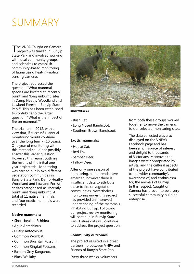
SUMMARY
The VNPA Caught on Camera project was trialled in Bunyip
State Park and involved working with local community groups and scientists to establish community-based monitoring of fauna using heat-in-motion sensing cameras.
The project addressed the question: “What mammal species are located at ‘recently burnt’ and ‘long unburnt’ sites in Damp Heathy Woodland and Lowland Forest in Bunyip State Park?” This has been established to contribute to the larger question: “What is the impact of fire on mammals?”
The trial ran in 2012, with a view that, if successful, annual monitoring would continue over the long term (>10 years). One year of monitoring with this method could not possibly answer this larger question. However, this report outlines the results of the initial one year project trial. Monitoring was carried out in two different vegetation communities in Bunyip State Park, Damp Heathy Woodland and Lowland Forest at sites categorised as ‘recently burnt’ and ‘long unburnt’. A total of 11 native mammals and four exotic mammals were recorded.
Native mammals:
• Short-beaked Echidna.• Agile Antechinus.• Dusky Antechinus.• Common Wombat.• Common Brushtail Possum.• Common Ringtail Possum.• Eastern Grey Kangaroo.• Black Wallaby.
• Bush Rat.• Long Nosed Bandicoot.• Southern Brown Bandicoot.
Exotic mammals:
• House Cat.• Red Fox.• Sambar Deer.• Fallow Deer.
After only one season of monitoring, some trends have emerged, however there is insufficient data to attribute these to fire or vegetation communities. Nevertheless, monitoring under this project has provided an improved understanding of the mammals inhabiting Bunyip. Following our project review monitoring will continue in Bunyip State Park. Future data will continue to address the project question.
Community outcomes
The project resulted in a great partnership between VNPA and Friends of Bunyip State Park.
Every three weeks, volunteers
from both these groups worked together to move the cameras to our selected monitoring sites.
The data collected was also displayed on the VNPA’s Facebook page and has been a rich source of interest and delight to thousands of Victorians. Moreover, the images were appropriated by artists, and the cultural aspects of the project have contributed to the wider community’s awareness of, and enthusiasm for, the animals of Bunyip. In this respect, Caught on Camera has proven to be a very successful community building enterprise.
Black Wallabies.

6 CAUGHT ON CAMERA – A Monitoring Project in Bunyip State Park iNTROdUCTiON
1.0 INTRODUCTION
Caught on Camera project
The VNPA Caught on Camera project involves working
with local community groups to establish long-term monitoring by the community using heat-in-motion sensing cameras.
In Wombat State Forest and Bunyip State Park, it involves looking at the impact of fire on fauna, and in the Hindmarsh region, it involves comparing revegetation sites with cleared sites, and sites with remnant bush.
The Caught on Camera project objectives in Wombat State Forest and Bunyip State Park are:
• To provide crucial data on the long-term impacts of control burning on Australian fauna to land managers, community groups, scientists and government.
• To create working partnerships with government, researchers and community groups to establish and run monitoring.
• To demonstrate and promote to government the need for ongoing, strategic and comprehensive monitoring in response to fire.
This project specifically asks the question:
“What mammal species are located at ‘recently burnt’ and ‘long unburnt’ sites in Damp Heathy Woodland and Lowland Forest”. The ‘recently burnt’ sites are those that were burnt
in 2009 or 2008 and the ‘long unburnt’ sites were those that have not been burnt since 1970.
This has been established to contribute to the larger question: “What is the impact of fire on mammals?”
Project stages
Over July to November 2012 the VNPA’s NatureWatch program ran a one-season trial of Caught on Camera, a citizen science project in Bunyip State Park in partnership with Friends of Bunyip State Park, a local community group. This project ran as a pilot and is intended to be developed further to run long-term and following this project trial, the project will be set up to run annual fauna monitoring using motion-sensing cameras.
This report
This report presents the results of the trial and recommendations for the development of ongoing monitoring.
1.1 Project background – fire ecology and monitoring
“Altered fire regimes threaten biodiversity and interact with other threats in complex ways that are not yet fully understood.” – DEWHA 2009, p7.
In Australia, we have a limited
understanding of the impacts of fire on our biodiversity.
This is particularly the case when it comes to the impacts on fauna (Clarke 2008; MacHunter et al. 2009). Without effective, repeatable, ongoing monitoring there will continue to be limitations to how we understand the impacts of fire and how planned burning is used in the landscape.
“Much monitoring of fauna is of such a small scale and short duration that the statistical likelihood of detecting a positive or negative effect of the management regime is minute. Such shortcomings will only be overcome through broad-scale and/or long-term studies of fauna.” – Clarke 2008, p385.
In order for land managers to improve planned burning techniques, particularly in response to our native fauna, it is essential to understand the impact of fire on all life forms, not just impacts on plants. This is particularly relevant when working in a fragmented landscape, such as Victoria.
“The ability of fire planners to meaningfully implement the dual aspirations of protecting life and property and achieving ecological goals is dependent on the availability of science and evidence that informs operational processes, and monitoring that influences future management.”– MacHunter et al. 2009, p9.
Through establishing long term projects with good

iNTROdUCTiON 7
cameras in these locations at regular intervals. The method is also less stressful for the fauna than trapping and can provide data on the presence of certain species that are unlikely to be caught in traps. However, motion sensing cameras do not have the ability to provide data on sizes of populations of particular fauna.
Given this, it is important to see camera monitoring as providing information on the presence of particular species at a site, rather than detailed data on the size of populations. It is also important to note that this camera monitoring provides useful information on selected fauna in response to fire, but does not provide comprehensive data on population sizes etc. Camera
monitoring is also a great community education tool, where images of the different species being ‘caught on camera’ in the local area can be regularly displayed.
scientific basis, that are linked to management of planned
burning, it is possible for the
community to be involved in carrying out this monitoring and to contribute to building
our knowledge base on the
impact of fire on fauna.
1.2 Motion-sensing cameras
Monitoring of fauna can be highly labour intensive. Motion-sensing cameras provide the
opportunity to gather data on selected animal groups (e.g.
small mammals, some arboreal
mammals) with much less
labour than methods such as
trapping. It is possible to select
sites for cameras and place
Southern Brown Bandicoot, listed nationally as an endangered species.

8 CAUGHT ON CAMERA – A Monitoring Project in Bunyip State Park METHOdS
2.0 METHODS
Recently Burnt long Unburnt Total
Damp Heathy Woodland 6 4 10
Lowland Forest 5 5 10
Total 11 9 20
Figure 1. Map of the study sites in Bunyip State Park and kurth kiln Regional Park.
Table 1. The number of sites in fire category and vegetation community in this study.
Study area
The study was conducted in Bunyip State Park,
about 45km southeast of the Melbourne CBD. The park covers about 16,000ha.
There are a variety of vegetation communities within the park including heathland, Damp Heathy Woodland, Lowland Forest, Damp Forest and Wet Forest (DEPI 2013a). In 2009 about 45% of the park was burnt by wildfire (PV 2010).
Bunyip State Park is home to many native mammals including state and federally listed species such as Southern Brown Bandicoot, Broad-toothed Rat and Swamp Antechinus (DEPI 2013a) as well as key fire response species such as Bush Rat, Black Wallaby and Mountain Brushtail Possum (DEPI 2013b; MacHunter et al. 2009).
SitesThe sites selected for this study were a subset of sites established by the Arthur Rylah Institute as long-term monitoring sites. These sites were established in a range of vegetation types and have a range of fire histories. Due to time constraints 20 sites were selected for this study. Parameters for selection of sites included:
• Ease of site access for community volunteers.
• A range of fire histories.• Similarity of vegetation
community.• Inclusion of some sites with
forthcoming planned fires.
The sites were selected to represent two different fire categories: recently burnt (site was last burnt in 2009 or 2008) and long unburnt (site has remained unburnt since at least 1970).
Two vegetation communities were also sampled: Damp Heathy Woodland and Lowland Forest. Table 1 shows
the number of sites in each category. Eighteen sites were located in Bunyip State Park and two in the adjacent Kurth Kiln Regional Park.
Survey methods – methods of involving and training community As this is a community project, volunteers undertook the on-

METHOdS 9
ground monitoring activities. This required coordination and training, led by the VNPA and Friends of Bunyip State Park. A community training activity took place as part of the Friends of Bunyip State Park’s planned monthly activity on Saturday 7 July 2012.
The training activity was attended by more than 25 eager participants who were provided with the project background, organisational details of VNPA and Friends of Bunyip State Park, visited a site in Bunyip State Park and trained by ARI scientists in how to set up bait stations and cameras on site.
Following the training activity, community volunteers from VNPA and Friends of Bunyip State Park volunteered every
three weeks to pack down,
move and set up cameras
and bait stations at selected
locations.
Two heat-in-motion sensing cameras (Reconyx Hyperfire) were installed at each site. At
each site volunteers located
the centre of the site (using
GPS coordinates) and used the nearest suitable trees to set up
cameras.
A GPS was used to record camera positions to ensure
volunteers could re-locate them. A bait cage containing
six stainless steel tea strainers
was attached to a plastic garden
stake and placed 2m in front of
the camera with the base of the
cage 20cm above the ground.
Each tea strainer contained a
mixture of rolled oats, peanut butter and golden syrup. Each camera was positioned 50cm above the ground and aligned so that the bait station appeared in the horizontal centre of the frame and the bottom of the bait cage was in the vertical centre of the frame.
The vegetation between the camera and bait station, and one metre behind was cleared to ensure a clear view of animals. The cameras were left to operate for a minimum of 21 days. Upon collection, cameras were checked to see if they were still operating and this was noted. Initial photo identification was done by a trained VNPA volunteer.
The photos were then sent to ARI for further identification. Where possible, animals were identified to species level. In cases where some doubt existed they were assigned to a more generic category, for example “Unidentified Brushtail Possum”.
The data from both cameras at one site was combined and the percentage of sites at which each species was found was calculated for each fire category in each vegetation type.
long-nosed Bandicoot.

10 CAUGHT ON CAMERA – A Monitoring Project in Bunyip State Park RESUlTS
TABlE 2: PERCENTAGE OF SiTES iN WHiCH EACH SPECiES WAS FOUNd iN BURNT & UNBURNT VEGETATiON FOR THE TWO VEGETATiON COMMUNiTiES iN THiS STUdY
damp Heathy Woodland lowland Forest All sites
Recently Burnt
Long Unburnt
Recently Burnt
Long Unburnt
Mammals
Agile Antechinus 100 50 80 80 80
Antechinus sp. 50 25 20 40 35
Bandicoot sp. 33 0 60 20 30
Black Wallaby 100 100 100 100 100
Bush Rat 100 75 100 80 90
House Cat 50 0 40 20 30
Common Brushtail Possum 16.5 0 60 20 25
Common Ringtail Possum 16.5 0 20 20 15
Common Wombat 33 50 60 60 50
Deer sp. 0 0 0 20 5
Dusky Antechinus 0 25 20 40 20
Eastern Grey Kangaroo 33 50 20 0 25
Fallow Deer 0 25 0 40 15
Long-nosed Bandicoot 83 25 80 40 60
Rat sp. 16.5 0 20 20 15
Red Fox 50 0 0 40 25
Sambar Deer 16.5 0 0 0 5
Short-beaked Echidna 50 75 80 60 65
Southern Brown Bandicoot 83 50 20 0 40
Birds
Basian Thrush 0 0 40 20 15
Brush Bronzewing 16.5 0 0 0 5
Buff-banded Rail 16.5 25 0 0 10
Eastern Yellow Robin 16.5 0 20 40 20
Grey Currawong 0 25 0 0 5
Grey Shrike-thrush 16.5 0 0 0 5
Laughing Kookaburra 0 0 0 20 5
Superb Fairy-Wren 0 0 40 60 25
Superb Lyrebird 0 0 0 40 10
Wonga Pigeon 0 0 20 0 5
Reptiles
Lace Monitor 0 0 20 0 5
3.0 RESULTS
Fifteen mammal species, 11 native and four exotic,
were positively identified from the photos.
The most commonly detected mammals were Black Wallaby (100% of sites), Bush Rat (90% of sites) and Agile Antechinus (80% of sites). There were a number of instances where animals could not be identified to species level, particularly in the case of antechinus, rats, bandicoots and deer.
Ten bird species were also identified with Superb Fairy-Wren (25% of sites) and Eastern Yellow Robin (20% of sites) the most common.
Table 2 shows the percentage of sites at which each species was found in the burnt or unburnt categories for each vegetation community.
Black Wallabies were found at every site, while Fallow Deer were only recorded at unburnt sites.
Cats and Long-nosed Bandicoots were observed at more burnt sites than unburnt, while Dusky Antechinus were more often at unburnt sites.
Bush Rats were recorded more frequently than all other species (except Black Wallaby) and were found in both fire histories and vegetation types.
Agile Antechinus, another commonly observed species, were recorded at more recently burnt sites than long unburnt sites in Damp Heathy Woodland, but were present at equal proportions in recently burnt and long unburnt
sites in Lowland Forest.
Southern Brown Bandicoots were more common in
Damp Heathy Woodland than Lowland Forest, Common Brushtail and Ringtail possums
were more often recorded
in Lowland Forest.
A number of bird species,
including Superb Fairy-Wren, Superb Lyrebird and Bassian Thrush, were only observed in Lowland Forest. The Superb Fairy-Wren was observed at
RESUlTS 11
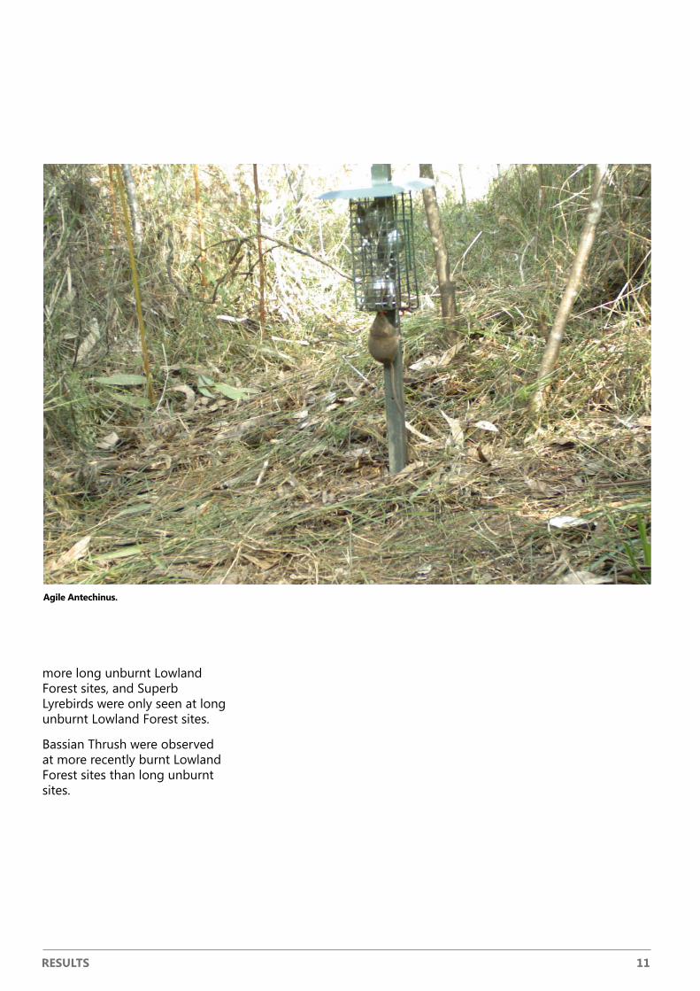
Agile Antechinus.
more long unburnt Lowland Forest sites, and Superb Lyrebirds were only seen at long unburnt Lowland Forest sites.
Bassian Thrush were observed at more recently burnt Lowland Forest sites than long unburnt sites.
12 CAUGHT ON CAMERA – A Monitoring Project in Bunyip State Park diSCUSSiON
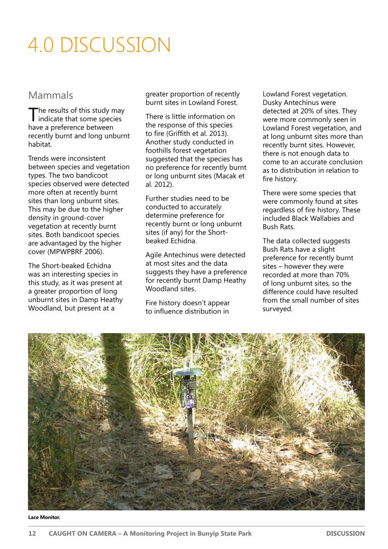
lace Monitor.
4.0 DISCUSSION
Mammals
The results of this study may indicate that some species
have a preference between recently burnt and long unburnt habitat.
Trends were inconsistent between species and vegetation types. The two bandicoot species observed were detected more often at recently burnt sites than long unburnt sites. This may be due to the higher density in ground-cover vegetation at recently burnt sites. Both bandicoot species are advantaged by the higher cover (MPWPBRF 2006).
The Short-beaked Echidna was an interesting species in this study, as it was present at a greater proportion of long unburnt sites in Damp Heathy Woodland, but present at a
greater proportion of recently burnt sites in Lowland Forest.
There is little information on the response of this species to fire (Griffith et al. 2013). Another study conducted in foothills forest vegetation suggested that the species has no preference for recently burnt or long unburnt sites (Macak et al. 2012).
Further studies need to be conducted to accurately determine preference for recently burnt or long unburnt sites (if any) for the Short-beaked Echidna.
Agile Antechinus were detected at most sites and the data suggests they have a preference for recently burnt Damp Heathy Woodland sites.
Fire history doesn’t appear to influence distribution in
Lowland Forest vegetation. Dusky Antechinus were detected at 20% of sites. They were more commonly seen in Lowland Forest vegetation, and at long unburnt sites more than recently burnt sites. However, there is not enough data to come to an accurate conclusion as to distribution in relation to fire history.
There were some species that were commonly found at sites regardless of fire history. These included Black Wallabies and Bush Rats.
The data collected suggests Bush Rats have a slight preference for recently burnt sites – however they were recorded at more than 70% of long unburnt sites, so the difference could have resulted from the small number of sites surveyed.

diSCUSSiON 13
Birds
Camera trapping is not a standard technique for surveying birds and therefore it is beyond the scope of this study to comment on any apparent trends in this group. A different survey method should be used if targeting birds, such as the two hectare, 20 minute count technique (Loyn 1986).
Limitations of survey method
Automated wildlife survey cameras are well suited to use in citizen science projects such as this one. They are relatively easy to set up, provide feedback via photos and also a permanent record of species found at a site.
The use of remote cameras have been used in similar studies, including the Caught on Camera program (Griffith et al. 2013), and have received positive feedback from volunteers (Macak et al. 2012).
The major limitation of this method is that the statistical analysis requires expertise beyond the capability of most community groups, hence the need to work closely with scientists to further develop the project. For that reason such analysis is beyond the scope of this report.
Recommendations
As this is the second project to pilot the use of automated cameras as a community
research tool under the Caught on Camera program we recommend the project be developed further following this project trial and that a review of the program be undertaken.
Project development should consider the scientific validity of future projects, the level of interest to volunteers and the needs of local land managers.
We also recommend that consideration is given to projects other than those looking at the effects of fire. For example, consideration could be given to using cameras to monitor the response of native mammals to predator control.
Black Wallaby with young.

14 CAUGHT ON CAMERA – A Monitoring Project in Bunyip State Park REFERENCES
REFERENCES
Clarke MF (2008) Catering for the needs of fauna in fire management: science or just wishful thinking? Wildlife Research 35, 385-394.
DEPI (2013a) Biodiversity Interactive Map, version 3.2. accessed 27/06/2013. Department of Environment and Primary Industries, Victoria.
DEPI (2013b) Victorian Biodiversity Atlas, version 3.0.6. accessed 27/06/2013. Department of Environment and Primary Industries, Victoria.
DEWHA (2009) Assessment of Australia’s Terrestrial Biodiversity 2008. Report prepared by the Biodiversity Assessment Working Group of the National Land and Water Resources Audit for the Australian Government. Department of the Environment, Water, Heritage and the Arts, Canberra.
Griffith C, Kotsiaris J, Bruce M, Kirkham M, Loyn R (2013) Caught on Camera. A monitoring project in the Wombat State Forest. Victorian National Parks Association.
Loyn RH (1986) The 20 minute search – A simple method for counting forest birds. Corella 10, 58-60.
Macak PV, Bruce MJ, Loyn RH (2012) Community finding fauna – naturalist groups contributing to research on the response of fauna to fire. Black Saturday Victoria 2009 – Natural Values Recovery Program. Department of Sustainability and Environment, Heidelberg, Victoria.
MacHunter J, Menkhorst P, Loyn R (2009) Towards a Process for Integrating Vertebrate Fauna into fire Management Planning. Arthur Rylah Institute for Environmental Research Technical Report Series No. 192. Department of Sustainability and Environmnent, Heidelberg, Victoria.
MPWPBRF (2006) Recovery of the Southern Brown Bandicoot in the Mornington Peninsula and Western Port Biosphere Reserve and surrounding districts – A report on the public meeting, 14 November 2006. Mornington Peninsula and Western Port Biosphere Reserve Foundation Ltd., Hastings, Victoria.
PV (2010) Park Note – Bunyip State Park. Parks Victoria.

REFERENCES 15

Address: Level 3, 60 Leicester Street, Carlton, Victoria 3053.Phone: 03 9347 5188.
Email: [email protected]
Website: www.vnpa.org.au