case officer: sarah kay file no: che/16/00591/ful tel. no...
TRANSCRIPT

Case Officer: Sarah Kay File No: CHE/16/00591/FUL Tel. No: (01246) 345786 Plot No: 2/1192 Ctte Date: 9th January 2017
ITEM 2
RESIDENTIAL DEVELOPMENT OF 13 UNITS AND ASSOCIATED ANCILLARY WORKS (CORRESPONDENCE RECEIVED 11/10/2016 AND REVISED PLANS / DETAILS RECEIVED 13/10/2016, 22/11/2016, 07/12/2016 AND 16/12/2016) AT THE SHRUBBERIES, 46 NEWBOLD ROAD, CHESTERFIELD, DERBYSHIRE, S41 7PL FOR PEPPERMINT GROVE LTD Local Plan: Unallocated Ward: Brockwell 1.0 CONSULTATIONS
DCC Highways Comments received 11/10/2016 – see report
DCC Strategic Planning Comments received 27/09/2016
– see report Lead Local Flood Authority Comments received 22/09/2016
– see report CBC Forward Planning Comments received 19/10/2016
– see report CBC Design Services No comments received CBC Environmental Services Comments received 16/09/2016
– see report CBC Conservation Officer Comments received 28/10/2016
– see report CBC Urban Design Officer Comments received 26/10/2016
– see report CBC Tree Officer Comments received 14/10/2016
– see report

Yorkshire Water Services Comments received 03/10/2016
– see report Derbyshire Wildlife Trust Comments received 06/10/2016
– see report Derby & Derbyshire DC Archaeologist Comments received
21/09/2016 – see report Crime Prevention Design Advisor Comments received 14/09/2016
– no observations Economic Development Unit No comments received NHS No comments received Coal Authority Comments received 26/09/2016
– see report Ward Members No comments received Site Notice / Neighbours Nine letters of representation
received & three letters of representation received as a result of re-consultation
2.0 THE SITE 2.1 The application site (known locally as The Shrubberies, 46
Newbold Road) is a 0.4ha previously developed parcel of land located on the north western edge of Chesterfield Town Centre, positioned at the south side of the B6051 Newbold Road. It has previously been utilised as office accommodation for the NHS Primary Care Trust, featuring one building on site, parking and gardens which all remain in situ but are currently vacant. The site is enclosed with boundary walls to all adjoining aspects and features a number of mature trees which are all protected by Tree Preservation Order 4901.133.
2.2 Uses in the surrounding area represent a transition from the mixed
uses of the town centre becoming more predominantly residential. To the north (on the opposite side of Newbold Road) there is a mix
of commercial and residential properties which face the site and align Highfield Road. To the west are the rear elevations of neighbouring residential properties which front onto Cobden Road. To the south is the playing field of St. Mary's Catholic Primary School and to the east is the detached property St Joseph’s which also currently lies vacant (but was recently operated as a residential care / support home).
3.0 RELEVANT SITE HISTORY
3.1 CHE/0193/0034 - Permanent change of use from residential to
office accommodation. Conditional permission granted 18/03/1993.
3.2 CHE/1093/0622 - Outline application for erection of office building.
Condition permission granted 10/02/1994. 3.3 CHE/0395/0146 - Extension to offices and alteration to car park.
Application withdrawn 07/07/1995. 3.4 CHE/0597/0222 - Car parking provision for up to 14 vehicles.
Conditional permission granted 25/06/1997. 3.5 CHE/1197/0584 - Waiver of condition 2 and 7 of CHE/597/222
relating to site entrance site entrance. Conditional permission granted 24/02/1998.
3.6 CHE/08/00413/TPO - Work to T4 Hawthorn, T14 Sycamore and
T15 Oak and fell T11 & T12. Conditional permission granted 25/07/2008.
3.7 CHE/09/00202/TPO - T1-T10 Crown lift + reduce. Conditional
permission granted 16/04/2009. 3.8 CHE/10/00012/FUL - Replace timber rear gates that face onto
Cobden Road. Conditional permission granted 10/03/2010. 4.0 THE PROPOSAL 4.1 The application submitted seeks full planning permission for
demolition of No 46 Newbold Road and erection of a scheme comprising 13 no. dwellings. The scheme detailed comprises predominantly of a courtyard one and half storey development of

detached, semi-detached and terrace properties served by a single shared access driveway to Newbold Road. The site layout also includes an additional detached one and half storey property located closest the Newbold Road frontage served separately off the shared driveway.
4.2 The scheme submitted adopts a contemporary design and the
development focuses on a mono-pitched one and half storey concept which is replicated in both the courtyard development and the detached dwelling located at the entrance to the site. Access into the site is maintained in its current location within the Newbold Road frontage but is subject to reconfiguration to maximise visibility and amendments are also detailed to the frontage boundary wall to Newbold Road, due to existing damage (weathering and structural).
4.3 The scheme comprises a mix of two and three bedroom properties,
each which include at least 1 no. bedroom at GF level. House types B, C D and E are detailed. All units are served by a single driveway parking space and a single integral garage space.
4.4 The application submission has been accompanied by the
following list of plans / supporting documentation: PG.218516.101C Planning Layout
PG.218516.102B Landscaping Masterplan PG.218516.103A Site Sections PG.218516.104 Survey Block Plan Overlay PG.218516.111A Type B Proposed Plans PG.218516.112 Type C Proposed Plans PG.218516.113 Type D Proposed Plans PG.218516.115B Courtyard Block Elevations PG.218516.116B Courtyard Block Elevations PG.218516.117A Type E Elevations PG.218516.118 Type E Plans PG.218516.SS Indicative Streetscene Visuals (1-5) 21620_OGL-REV0 – Topographical Survey TSC 01B Tree Survey TSC 02B Tree Constraints Plan TSC 03B Tree Protection Plan TSC 04 Landscape Masterplans PG.218516.DA Design & Access Statement PH.218516.SH Shadow Study

Ecology Scoping Survey (prepared by Prime Environment) dated December 2016 Phase 1 Geotechnical and Geo-environmental Site Investigation Report (prepared by Eastwoods & Partners) dated 03 August 2016 Arboricultural Method Statement – Nov 2016 Letters and Emails from Agent dated 11/10/2016, 13/10/2016, 21/11/2016, 07/12/2016 and 16/12/2016.
4.5 Revisions, amendments and supplementary information to the
application submission were received on 11/10/2016, 13/10/2016, 22/11/2016, and 07/12/2016 and this information was subject to re-consultation on 08/12/2016.
5.0 CONSIDERATIONS 5.1 Local Plan Issues 5.1.1 The site is situated within the built settlement of Brockwell in an
area predominantly residential in nature. Having regard to the nature of the application policies CS2 and CS18 of the Core Strategy and the wider National Planning Policy Framework (NPPF) apply. In addition the Councils Supplementary Planning Document on Housing Layout and Design ‘Successful Places’ is also a material consideration.
5.1.2 Policy CS2 (Principles for Location of Development) states that
when assessing planning applications for new development not allocated in a DPD, proposals must meet the following criteria / requirements:
a) adhere to policy CS1 b) are on previously developed land c) are not on agricultural land d) deliver wider regeneration and sustainability benefits e) utilise existing capacity in social infrastructure f) maximise walking / cycling and the use of public transport g) meet sequential test requirements of other national / local
policies All development will be required to have an acceptable impact on
the amenity of users or adjoining occupiers taking into account noise, odour, air quality, traffic, appearance, overlooking, shading or other environmental, social or economic impacts.

5.1.3 Policy CS18 (Design) states that all development should identify, respond and integrate with the character of the site and its surroundings and development should respect the local character and the distinctiveness of its context. In addition it requires development to have an acceptable impact on the amenity of neighbours.
In addition to the above, the NPPF places emphasis on the importance of good design stating:
‘In determining applications, great weight should be given to outstanding or innovative designs which help raise the standard of design more generally in the area. Planning permission should be refused for development of poor design that fails to take the opportunities available for improving the character and quality of an area and the way it functions.’
5.1.4 In addition to the above, in July 2013 the Council adopted
‘Successful Places’ which is a Supplementary Planning Document which guides Sustainable Housing Layout and Design. The development proposed should be assessed against the design principles set out in this supporting document.
5.2 Principle of Development 5.2.1 The site the subject of the application is unallocated and is situated
within the built settlement of Brockwell ward surrounded by a combination of residential properties and commercial properties which reflect the transition from the nearby town centre to the peripheral suburban residential areas.
5.2.2 Policies CS1 and CS2 of the Core Strategy set the Councils overall
spatial strategy and the principles for the location of new development stating that all new development and growth should be located in areas which are within walking and cycling distances of centres. In regard to the sites spatial setting, the site is within walking / cycling distance of the Chesterfield Town Centre (Policy CS1) and is therefore considered in principle to be an appropriate infill development site for new development.

5.3 Design and Appearance Considerations (inc. Neighbouring Effect)
Use
5.3.1 The site lies in an established residential area, but which also contains a mix of transitional uses, leading away from the town centre. These include St Marys Primary School, bed and breakfasts, a church, a care home etc. The site is sustainably located and the principle of residential development on the site is acceptable, subject to a design which reconciles the various site constraints.
Amount
5.3.2 The submission proposes thirteen dwellings, with 12 units arranged around a central courtyard and a single detached unit situated at the front of the site. A development of 13 dwellings would equate to a gross density of 31.7 dwellings per hectare. This represents a fairly standard suburban density.
Layout
5.3.3 The proposals are designed in the form of a courtyard arrangement which backs onto Newbold Road and creates a largely insular, inward looking layout. Ordinarily a format that achieves a positive relationship with the streetscene that looks towards and addresses the road would be sought.
5.3.4 Notwithstanding this however given the presence of mature trees
along the site frontage and the stand alone nature of the current building, developing further into the site is considered to be a legitimate design response on this site.
5.3.5 The proposed units comprise a mix of two and three bedroom
dwellings and gardens should achieve a minimum of 50sqm for 2-bed units and 70sqm for 3-bed units. Overall the proposals exceed these requirements for the majority of plots, although Plots 4, 9 and 10 appear to fall slightly below the minimum garden size thresholds for a 3-bed house.
5.3.6 The proposed layout will require the removal of a considerable
number of trees in order to accommodate the proposed layout. This will inevitably reduce the amount of visible tree cover currently contained within the site, potentially detracting from the appearance of the Newbold Road streetscene and diminishing

sylvan qualities of the site and its contribution to the appearance of the locale.
5.3.7 Notwithstanding this the remaining trees along the front margin of
the site alongside Newbold Road would retain a presence of some mature trees, although this would provide only a thin layer relative to the depth of mature tree cover currently present. As per the Tree Officers comment below however a compensatory planting scheme is detailed which will strengthen this cover over time.
5.3.8 It is assumed the access road is unlikely to be adopted by the local
highway authority and as such a bin collection point (BCP) will be required close to the entrance to enable waste collection to take place from Newbold Road. During a double bin collection day sufficient space would be required to accommodate two bins per property (26 in total). Large BCP’s have the potential to appear utilitarian and unsightly. As such, any BCP would need to be carefully located and designed to avoid adverse visual impacts on the amenity of the development and streetscene. An appropriate planning condition can be imposed to this effect to require further details to be submitted for approval.
Scale and massing
5.3.9 The courtyard layout creates a concentrated form of development with units on the eastern and western edges of the site in very close proximity to the party boundary. Although the removal of the existing building would result in a more open aspect to the outlook from Nos. 48 Newbold Road and 43-45 Cobden Road, the outlook from Nos. 35-41 Cobden Road would be more significantly impacted by the proposed layout and Plots 9 and 10 in particular, which run the full length of these rear gardens, within approximately 1.0m of the current boundary wall.
5.3.10 The DAS indicates that the scale is intended to be subservient with
a layout and windows designed to respect neighbour amenity. The submission is accompanied by site sections which accurately reflect the position of the existing boundary wall and the scale / mass of the proposed development. The proposed units have been designed as 1.5 storey dwellings with some accommodation contained within the roof spaces, although no direct overlooking would result due to the positioning of roof windows.

5.3.11 Throughout the application process there has been an ongoing dialogue with the applicant over the scheme proposed. One concern which was raised related to the scale and massing of the development relative to Nos. 35-41 Cobden Road as described above.
5.3.12 As a result of these concerns the design of the scheme was
amended and the height of the roofs to the attached garages were reduced to add some visual relief to the ridgeline along the western boundary as viewed from the neighbouring properties along Cobden Road. Having regard to these alterations it is considered that whilst some of the neighbouring properties to Cobden Road have enjoyed uninterrupted views from their rear gardens boundaries the right to a view is not a material consideration as circumstances can change where new development is proposed.
5.3.13 In order to assess the impact of such circumstances described
above, the LPA have prepared a Supplementary Planning Document (SPD) specifically to inform judgement of new residential development and this document sets out appropriate separation distances to protect and preserve neighbouring amenity. In this instance the development proposed meets the parameters of the SPD and therefore whilst an impact would occur (given the current circumstances enjoyed) the severity of the impact would not be sufficient as to warrant refusal of planning permission.
Hard Landscaping
5.3.14 The front boundary wall is constructed from a type of early aggregate block with a core of brick which is revealed in places due to erosion. The wall itself is a substantial height, but its materials are not characteristic of the local area. It is possible that the wall may need to be removed and a new boundary reinstated. Any replacement boundary treatment will need to be appropriate to the streetscene, as well as in relation to the retained trees however, screen fencing would not be appropriate on such a prominent frontage.
5.3.15 It is consider that an appropriate hard landscaping condition could
be imposed on any decision issued to secure the exact detail and finish to this boundary wall.

Appearance 5.3.16 The application proposes a contemporary approach to the
architectural form of the houses, mixing dual pitched, asymmetrical and mono-pitched roofs. This styling would be in contrast to the largely Victorian and Edwardian character of the locality. Nevertheless there is no objection in principle to employing contemporary design, provided that the selection of materials and finishes is harmonious with its setting.
5.3.17 The materials should reflect those of the locale and therefore an
appropriate condition can also be imposed on any permission issued to control the choices and finishes in this respect.
5.3.18 In the context of the provisions of Policies CS2 and CS18 of the
Core Strategy and the material planning considerations in relation to neighbour impact, it is concluded the proposals will not adversely impact upon the privacy and/or outlook of the adjoining and/or adjacent neighbours and are acceptable in terms of these policies. Notwithstanding this however, due to the proximity of some of the adjoining and adjacent neighbouring properties and internal plot relationships it could be possible that permitted development extensions may pose a threat to privacy and amenity and therefore it is considered necessary to impose a condition removing these rights to maintain control over the future relationship any such extensions or alterations would have upon the neighbours.
5.4 Highways Issues 5.4.1 Comments have been received from the Local Highways
Authority (LHA) as follows:
‘The site has been the subject of a previous informal enquiry and in principle residential development is considered acceptable. It should be noted that on the layout as indicated the Highway Authority would not consider the access for adoption as part of the publicly maintainable highway and the developer should be aware of the implications of this in terms of lack of future maintenance etc.
The access shall be constructed as a standard vehicular dropped crossing to give priority to pedestrians and not with kerbed radii.

Information provided indicates that the applicant is under the assumption that a refuse vehicle will enter the site. This should be clarified with the refuse/recycling collection authority and in the event this will not be the case a bin dwell area will be required clear of the highway and access and will need to be of adequate dimensions to accommodate the maximum number of bins on any one collection day.
It is understood that each dwelling will have a single integral garage and it is assumed, in the absence of any specific information that these are of adequate internal dimensions i.e. 3m x 6m with a door opening of 2.3m.
Subject to the above, there are no objections and it is recommended that the following conditions are included in any consent.
01. No development shall take place including any works of
demolition until a construction management plan or construction method statement has been submitted to and been approved in writing by the Local Planning Authority. The approved plan/statement shall be adhered to throughout the construction period. The statement shall provide for but not necessarily be restricted to the following as appropriate - Parking of vehicles of site operatives and visitors - routes for construction traffic - hours of operation - method of prevention of debris being carried onto highway - pedestrian and cyclist protection - proposed temporary traffic restrictions - arrangements for turning vehicles
02. No part of the development shall be occupied until the
following works have been carried out in accordance the details first submitted to and approved, in writing, by the Local Planning Authority in respect of any necessary alterations to the footway crossing for the access to the site such that a vehicular dropped crossing is provided rather than kerbed radii.
03. No dwelling shall be occupied until space has been laid out
within the site in accordance with drawing No. UR Revision A for cars to be parked and for vehicles to turn so that they may enter and leave the site in forward gear.

04. The garages hereby permitted and car parking spaces to be
provided shall be kept available for the parking of motor vehicles at all times. Notwithstanding the provisions of the Town and Country Planning (General Permitted Development) Order 1995 (or any Order revoking and/or re-enacting that Order) the garage/car parking space(s) hereby permitted shall be retained as such and shall not be used for any purpose other than the garaging of private motor vehicles associated with the residential occupation of the property without the grant of further specific planning permission from the Local Planning Authority.
05. There shall be no gates or other barriers on the
access/driveway.
06. The proposed access to Newbold Road shall be no steeper than 1:30 for the first 10m from the nearside highway boundary and 1:12 thereafter. Individual drives shall not exceed a maximum longitudinal gradient of 1:14.
07. No part of the development shall be occupied until details of
arrangements for storage of bins and collection of waste have been submitted to and approved by the Local Planning Authority. The development shall be carried out in accordance with the agreed details and the facilities retained for the designated purposes at all times thereafter.
08. No development shall be commenced until details of the
proposed arrangements for future management and maintenance of the proposed streets within the development have been submitted to and approved by the local planning authority.’
5.4.2 Having regard to the comments received from the LHA above, it is
confirmed that the internal garage measurements commented upon meet the dimensions standards sought by the LHA. Furthermore the issue of refuse collection has been highlighted to the applicant, who has been informed that is it is highly unlikely the refuse collection vehicle would enter the site to undertake collections. The applicant has accepted this scenario and confirmed that would be happy to provide further details by condition of a refuse collection area at the entrance of the site where residents would present their bins on collection day to allow

collection to take place at Newbold Road. In this regard it is not unusual for a development of this nature to have refuse collection service in this manner and there is appropriate space located within the application site boundary adjacent the shared driveway proposed to ensure a bin collection facility can be accommodated without detriment to highway safety.
5.4.3 The site at present is currently served by a dropped crossing
access point and the desire of the LHA for this to be maintained as part of appropriate access alterations are noted. This would ensure that pedestrian priority is maintained across the site frontage.
5.4.4 Given the sites previous use as offices and the level of on site car
parking evident in association with this use, whilst highway safety associated with residential use is raised by a number of objectors, it is unlikely that the number of vehicle movements associated with 13 no. dwellings would be significantly greater than the number of vehicle movements which took place in association with the previous use / fall-back position. It is noted that the LHA have not raised any objections to the use of the single access point to serve a residential development and overall it is considered that the scheme provides an appropriate level of off street parking commensurate with the scale and type of development being sought. It is considered that the development, subject to appropriate condition, meets the requirements of policies CS2, CS18 and CS20 in respect of highway safety matters.
5.5 Heritage/Archaeology 5.5.1 Having regard to the fact that the application proposals involve the
proposed demolition of an existing detached dwelling, matters arising in respect of heritage/archaeology (given the age of the dwelling) have been considered in the context of policy CS19 of the Core Strategy and the wider NPPF.
5.5.2 Both the Councils Conservation Officer (CO) and the Derby &
Derbyshire Development Control Archaeologist (D&D DC Arch) have commented on the application proposals as follows:
CO – ‘The proposed development site is located within a predominantly residential area of the town centre developed during the C19. The properties in this area tend to be Victorian villa style

dwellings constructed for the town’s emerging middle class as the town grew in population. This includes Queen St, Cobden Rd, Gladstone St, Avondale Rd, Cromwell Rd, Fairfield Rd and parts of Cross St and Newbold Rd. These streets are important to the town’s development and character and cumulatively represent a consistent identity and group value, which in my view justifies putting the area forward as a potential Conservation Area. A significant amount of properties retain original features such as traditional doors, windows, chimney pots and curtilage walls and some of the larger properties include decorative features often only found on C19 Victorian villa style properties. It is also worth noting that many of the houses along Queen St, Gladstone Rd, Compton St, and Cross St were built via the ‘Chesterfield Benefit Building Society’. This was part of the Freehold Land Society Movement which aimed to give working people the vote by encouraging them to become property owners (it is likely that Cobden Rd was named after Richard Cobden who was one of the original members of the National Parliamentary and Financial Reform Association, which campaigned to increase the number of people entitled to vote).
No. 46 Newbold Road (aka the Shrubberies) is an earlier and grander version of the villa style properties in this area. The building appears on historic maps of the 1870s so it is likely that it was constructed in the early to mid C19. It is more Georgian in style with neo-classical features and proportions including timber sash windows, porticos, projecting eaves, bay windows and window cornices (supported by corbels). As such the property has historic and architectural value and makes an important contribution to the surrounding street scene and its history. Moreover, these types of Georgian style villas are increasingly uncommon in Chesterfield; the emphasis should be on retaining those that do remain as their loss is irreversible. Whilst the building is not statutorily listed, it is included on the Council’s draft Local List of Heritage Assets (approved by Deputy Leader and Executive Member for Planning 27th July 2016), hence some weight can be given to the protecting the house in planning terms (e.g. NPPF paragraphs 126 – 136).
Given the above I would strongly object to the proposed demolition of No. 46 Newbold Road. Whilst I would not object to the proposed housing (subject to proper landscaping and consideration of trees - I note the Council’s Tree Officer has been consulted), my view is

that the proposed demolition represents an unacceptable erosion of the town’s historic character and identity. A much better strategy would be to include No. 46 in the development as a residential conversion to apartments or dwellings. The house is located on the western boundary of the site some distance away from the vehicle access point and proposed development platform, hence it is feasible for the house to be retained and included as part of the scheme without sterilising the proposed housing layout to the south or main access point. Whilst the proposed housing is contemporary in style (and very different to the surrounding street scene), given the proposed massing of the houses, design palette (notwithstanding some issues over proposed materials) and careful attention to the surfacing and landscaping (as shown in the applicant’s Design & Access Statement), my view is that the new housing would provide an interesting, but successful, visual juxtaposition between the contemporary and the historic.
I notice that the applicant did not engage in any pre-application discussion with the planning authority or local community which might have given the applicant the opportunity to assess or understand the area in more detail. This is regrettable. I would recommend that the applicant put forward a revised scheme which includes the retention of No. 46.’
D&D DC Arch – ‘The proposal site is some way outside the Town Centre Historic Core (Local Plan policies) corresponding to the area of medieval and Roman activity in Chesterfield. The area seems to have been developed only in the 19th century and the current buildings on the site (late 19th century) appear to have been the first. There is consequently little or no potential for buried archaeological remains on the site and I recommend that the proposals will have no archaeological impact. The late 19th century buildings on the site create a high quality built environment and contribute to the streetscene and urban character of the area. However, they have not been identified as ‘heritage assets’ sensu NPPF.’
5.5.3 In the context of the comments raised by both consultees above it
is commented that the site the subject of the application does not lie in a conservation area; nor is the building the subject of

demolition a ‘listed building’ on any statutory register therefore the property is not afforded any degree of protection from demolition. Whilst the CO comments that the building has been identified for its heritage interest on the Council’s Local List, this listing has not been through any stage of public consultation and therefore despite the COs comments very little weight can be given to this situation (which is acknowledged in the comments raised by the D&D DC Arch).
5.5.4 The applicant was approached as part of the application
considerations to offer an explanation why a potential conversion of the building was discounted in favour of redevelopment of the whole site. The following comments were given:
The client has spent much time and deliberation on the development of the site at The Shrubberies. In determining the direction on redevelopment of the land it was concluded that the existing building is to be removed.
The building in its current condition does not conform to modern standards in its use as offices and the commercial liabilities of bringing it to the modern requirements are un-commercial.
The visual inspection as highlighted on the site visit of; small rooms, multiple staircases, many linking corridors, fire safety requirements, electrical requirements, natural lighting issues and the old fabric of the construction are compounded issues that would need to be resolved in bringing this to a modern office requirement of tenable occupation.
In reviewing its use as a residential conversion the location of the building on site, its aspect and current access / egress locations in the built form would again make conversion into two houses commercially unviable due to the conversions costs and ultimate market value.
When looked at for conversion to flats the conversion costs and ultimate large accommodation of each unit (due to the aspect and access issues as previous) would make the proposals commercially unviable.
Buildings of this type are, when appropriate, converted in multi occupation buildings such as let rooms, bedsits or to a house of
multiple occupation. This option was again rejected due to the negative issues buildings of this type can bring to existing neighbourhoods and to any further additional residential development on site.
The scheme of a residential type of two and three bedroom dwellings with primary ground floor accommodation as proposed is deemed to be the most appropriate use of the site. A type and form of accommodation much lacking in the area indeed in Chesterfield generally.
5.5.5 Having regard to the commentary above the building on site is of
recognised local architectural significance however its siting, scale and design present challenges to its conversion and incorporation into a scheme of redevelopment; and the public benefits of this scheme have to be weighed up against the harm resulting in the loss of the building on site which is offered no statutory protection. Therefore whilst it is accepted that the building could be a candidate for conversion, its retention cannot be insisted upon, and in this context it is considered that the development proposals presented offer a comprehensive design solution to the redevelopment of the whole site which would otherwise have been compromised by the constraints of the building remaining in situ. Accordingly it is concluded that there is an overriding degree of public benefit to accepting the loss of the building in the wider public interest.
5.6 Trees & Ecology
Trees 5.6.1 Having regard to the fact the application site is covered by a
blanket of trees protected by tree preservation order the application submission was accompanied by an Arboricultural Method Statement and Tree Survey, Tree Constraints Plan, Tree Protection Plans and Landscape Masterplans.
5.6.2 These documents and the application proposals were reviewed by
the Council’s Tree Officer who offered the following comments: ‘A detailed tree survey has been submitted with the application by Weddle Landscape Design dated July 2016. It is proposed that 29 individual trees on the site are to be felled for the development, including 12 of 19 under tree preservation 4901.133.

Two of the protected trees reference T11 and T12 on the TPO plan attached are replacement Oak trees which replaced two willow trees from the original order. These two trees have recently been planted and could possibly be planted elsewhere in the scheme or alternatively new trees planted as replacements due to their small size. It is proposed that T11 is retained in the scheme in its current location however its ultimate height and spread so close to the proposed development would cause considerable problems in the future. The re-location of this tree is therefore recommended.
Other trees within the Order reference T2, T4, T7 & T9 Hawthorn are either dead or dying. T8 Whitebeam, T13 Hawthorn, and T14 Sycamore are of poor shape due to overcrowding by other trees or smothered in ivy which has reduced their visual appearance and loss of internal structure.
The poor condition and limited life expectancy of T16 Weeping Ash (decay in the upper crown and limited branch framework), T18 Cherry (included union at the base) and T19 Sycamore (decay in the main stem and base) also make them unsuitable to be retained in any development scheme where the risk of failure and potential damage they may cause increases dramatically.
This leaves just 7 trees within the Order which are of good condition and worthy of retaining. Five of these trees reference T1, T5, T6 & T10 Purple Beech and T3 Whitebeam are located to the frontage of the site off Newbold Road and have very high visual amenity and should be retained in the scheme and protected throughout the demolition and construction phases.
The other two protected trees are located further into the site and which are proposed to be removed reference T15 Oak and T17 Sycamore. These two trees lack visual amenity due to their position within the site. After an assessment of the two trees and walking around the public highway around the site, the Helliwell Amenity Evaluation system was used to assess their amenity value. It was concluded that these two trees lack visual amenity because of the limited visual impact they have on the surrounding area and the only visual advantage points are from St Mary’s school grounds and the surrounding houses. T15 Oak also seems to be suffering from stress which is shown by the amount of epicormics growth in the trees crown and may be attributed to the

new tarmac driveway which has been constructed all around the tree. I therefore have no objection to these two trees being removed to accommodate the proposal as long as new trees are planted in mitigation for the loss.
It was also noted on a recent site visit that the front boundary wall is of very poor condition due to the materials used and how it was constructed. This wall will probably have to be removed at some stage because of this deterioration, cracking and bulging around T1Beech. It is unclear at this stage if it will be possible to rebuild the wall around T1 Beech until the wall is removed and further assessed. There is also a land level change in this area and the walls removal might compromise the stability of T1 Beech if the trees main anchoring roots are found to be the cause of the problem. This will therefore have to be reassessed once any action is taken whether or not the application is approved.
Plot 13 One dwelling is proposed to the frontage of the site reference plot 13 which may have an impact on T1 & T5 Purple Beech and T3 Whitebeam. The dwelling will also be overshadowed by the protected trees to the frontage. This dwelling is only 4 metres away from the nearest protected tree and will also restrict any new tree planting to the frontage for the trees lost.
Pressure will also be put onto the local authority to have the trees pruned or felled in the future to reduce any perceived nuisance from overhanging branches, leaf fall, shade and light issues.
The new proposed dwelling and driveway will also run through the RPA of T5 Purple Beech and T3 Whitebeam. The dwelling should therefore be removed from the scheme unless the applicant can show how any impact on the rooting system of T5 through above ground construction methods can be avoided and how any perceived nuisance that the existing and new tree planting can be avoided without affecting the quality of life to any new occupier of the dwelling. Due to the lack of suitable tree planting locations on the site which would improve the visual amenity for the general public for the tree lost then the dwellings removal if the preferred option.

Other trees on the site Other trees on the site as shown in the tree survey submitted with the application by Weddle Landscape Design dated July 2016 have been categorised as C2 (trees of low quality with low landscaping benefits) and U trees (Those is such a condition that they cannot be realistically retained). I am in agreement with the assessment as the trees are either of poor condition, small in size, located next to walls or other structures and/or are crowded out by other more dominant trees.
New Landscaping As so many trees are to be removed from within the site through natural decline and to accommodate the development, a revised landscaping scheme should be submitted if the development is approved. Any new planting scheme should enhance the frontage of the site and the proposal should consist of new trees to replace the protected trees lost and an understorey of small woodland trees and shrubs to enhance the biodiversity of the site. As stated in the Derbyshire Wildlife comments, there will be a net loss of biodiversity within the proposal which would not comply with NPPF. This could be offset by a wildlife zone to the frontage to provide a source of beneficial vegetation for wildlife and creating new habitats such as bird boxes, wood piles and low nesting sites by using low woodland vegetation.
The revised landscaping scheme should also show the location of the replacement trees replacing the ones removed from the Order which will then be automatically covered by the existing Tree Preservation Order.
The replacement trees should be planted to the satisfaction of the Borough Council during the first available planting season i.e. 1st November 2017 to 31st March 2018 following the completion of the development and they shall be maintained under the terms and provisions of the aforementioned Tree Preservation Order.
The replacement trees should be a mixture of Mountain Ash, Hawthorn, Silver Birch, Hazel and Field Maple or an agreed alternative and conform to BS8545: Trees: from the nursery to independence in the landscape-Recommendations, 2014, Section 10 Planting.
The replacement trees shall comprise of standard size trees with a stem circumference of 8-10cm which should be staked and tied.
Tree Protection A tree constraints plan reference TSC 02 Rev A and a tree protection plan reference TSC 03 Rev A by Weddle Landscape design have been submitted with the application. The plans supplied are acceptable and a condition should be attached if the scheme is given approval which ties the tree protection measures and location of tree protective fencing to the scheme before any demolition of construction commences on the site.
Further details need to be provided showing how any disturbance to the rooting environment of T5 Purple Beech can be avoided for the driveway to plot 13 if consent is granted for this plot. Details of an approved ‘no dig’ construction method should be submitted for consideration showing how the driveway can be achieved without root severance and compaction to the T5. Any hard surfaces/driveways within the retained tree RPA must be constructed using the ‘no dig method’. This means that construction will have to be above ground but with no change in ground level and using a 3-dimentional load spreader in filled with a no-fines aggregate to allow oxygen to diffuse and creating a free draining environment.
Facilitating Pruning Before construction work commences details of any intended tree pruning works shall have been submitted in the form of a formal tree application to the Local Planning Authority for consideration. Only those works approved in writing by the Local Planning Authority shall be undertaken in a method which accords with BS 3998.
I therefore have no objections to application CHE/16/00591/FUL as long as the above mentioned comments are taken into consideration and the conditions below are attached.
Conditions
Trees T1, T5, T6 & T10 Purple Beech and T3 Whitebeam of Tree preservation Order 4901.133 shall be retained.
A revised landscaping scheme shall be submitted showing addition wildlife planting to the frontage of the site off Newbold Road and show the location of the replacement trees replacing

the ones removed from the Tree Preservation Order 4901.133 which will then be automatically covered by the existing Tree Preservation Order.
To protect the trees during demolition/removal of hard surfaces and construction a root protection area (RPA) calculated to form a construction exclusion zone around the trees should be established as shown in drawing TSC 03 Rev A by Weddle Landscape design.
The trees should then be protected by fencing as shown on drawing TSC 03 Rev A by Weddle Landscape design conforming to BS 5837 during site clearance and while any construction is in progress. Notices should be attached to the fencing at regular intervals to this effect.
The protective fencing around the trees root protection area’s should be inspected and approved by an Officer of the Council or appointed Arboriculturalist before any materials and machinery are brought on to the site and before the removal of hard surfaces, soil stripping and construction commences.
Once erected, barriers should not be removed or altered without prior approval of the local planning authority.
For tree roots to be retained undamaged there must be no excavations, no soil stripping and no grading of the site within the RPA. There should also be no storage of materials within the RPA.
A plan showing where the storage of materials, site cabins, plant and machinery and any other construction material and parking will be located on the site. This should be submitted and approved before demolition, soil stripping and construction commences.
A method statement should be submitted to the Council demonstrating how the existing hard surfaces, services are to be removed within the designated root protection areas before construction on the site commences. The removal of any existing hard surfaces within the RPA should be carried out without the use of any heavy machinery and care must be taken not to disturb tree roots that may be present beneath it. Hand held tools or appropriate machinery should be used to remove the existing surface.
Any hard surfacing within the root protection areas should be constructed above ground using a recognised ‘no dig’ method. Details of the ‘no dig’ construction method should be submitted

and approved before construction within the RPA’s commences.
Any works not agreed within the Root Protection Area must be discussed with the Planning Officer before any operations commence.
The protective fencing shall be retained intact for the full duration of the development and should not be repositioned or removed without prior written approval from the Local Planning Authority.
Before any operations commence, details of the space provided within the site for the storage of plant, and materials, site accommodation, loading, unloading and manoeuvring of goods vehicles, parking and manoeuvring of employees and visitors vehicles first submitted to and approved in writing by the Local Planning Authority avoiding the Root Protection Areas (RPA) of the retained trees on the site and adjacent land. Once implemented the facilities shall be retained and not relocated within the retained trees RPA throughout the construction period.’
5.6.3 In response to the comments made above the applicant prepared
a package of revised drawings and plans (21 November 2016) which were further reviewed by the Tree Officer who commented as follows:
‘Further details have now been provided in response to my previous comments on the 14th October 2016 and meeting with the applicant on the 23rd November 2016.
Revised Drawing PG.218516.104 Rev B Planning Layout The drawing now shows the driveway to plot 13 further to the south and outside the root protection area (RPA) of T5 Beech `as shown on drawing KL-63TSC03 Rev B ‘Tree Protection Plan’ by Weddle Landscape Design. The driveway can now be constructed using a traditional method without the need for an above ground system being used. As the driveway edge is on the outer perimeter of the root protection area, care must be taken when excavating for the driveway edgings and any excavations must not encroach into the RPA.
Revised drawing PG-218516-102 Rev B Landscaping Masterplan The submitted drawing shows hedge planting to the frontage of the site off Newbold Road which is contradictive of drawing TSC04

Landscape Master Plan and Planting Details by Weddle Landscape Design which shows a wildlife shrub planting as requested in my previous comments and which will mitigate against the loss of trees and shrubs from the development proposal.
The landscaping proposals and species, quantity, size and location on drawing TSC04 Landscape Master Plan and Planting are acceptable and will provide a valuable wildlife habitat and varied ornamental shrub planting around the site. Also noted is the relocation of the replacement TPO trees reference T11 & T12 Oak which have been moved from the southern boundary to the frontage of the site off Newbold Road.
11 protected trees out of a total of 19 will be removed due to the development with 16 new trees being planted around the site. Two new trees to the north of plots 1 & 12 consisting of one Mountain Ash and one Field Maple as shown on drawing TSC04 Landscape Master Plan and Planting Details will be highly visible in the street scene when viewed from Newbold Road and should therefore be included as replacement trees for T2 & T4 Hawthorn of TPO 133 so that the Council has control over any further proposals to fell or prune the trees.
I therefore have no objections to application CHE/16/00591/FUL as long as the above mentioned comments are taken into consideration and the conditions from my previous comments as amended below are attached.
Conditions
Trees T1, T5, T6 & T10 Purple Beech and T3 & T8 Whitebeam of Tree preservation Order 4901.133 shall be retained.
Trees T11 & T12 Oak of tree preservation order 4901.133 shall be relocated to the frontage of the site as shown in drawing TSC04 Landscape Master Plan and Planting Details by Weddle Landscape Design. If these two trees fail during transplanting and thereafter, two new heavy standard Oak trees shall be planted as their replacements and maintained under the terms and provisions of the aforementioned Tree Preservation Order.
Two trees consisting of one Mountain Ash, Sorbus aucuparia and one Field Maple, Acer campestre shall be planted in the first available planting season after the development is completed in the location as shown on drawing TSC04

Landscape Master Plan and Planting Details by Weddle Landscape Design to the frontage of the site off Newbold Road as replacement trees for T2 & T4 Hawthorn of tree preservation order 133 and maintained under the terms and provisions of the aforementioned Tree Preservation Order.
To protect the trees during demolition/removal of hard surfaces and construction a root protection area (RPA) calculated to form a construction exclusion zone around the trees should be established as shown in drawing TSC 03 Rev A by Weddle Landscape design.
The trees should then be protected by fencing as shown on drawing TSC 03 Rev B by Weddle Landscape design conforming to BS 5837 during site clearance and while any construction is in progress. Notices should be attached to the fencing at regular intervals to this effect.
The protective fencing around the trees root protection area’s should be inspected and approved by an Officer of the Council or appointed Arboriculturalist before any materials and machinery are brought on to the site and before the removal of hard surfaces, soil stripping and construction commences.
The protective fencing shall be retained intact for the full duration of the development and should not be repositioned or removed without prior written approval from the Local Planning Authority.
For tree roots to be retained undamaged there must be no excavations, no soil stripping and no grading of the site within the RPA. There should also be no storage of materials within the RPA.
A plan showing where the storage of materials, site cabins, plant and machinery and any other construction material and parking will be located on the site. This should be submitted and approved before demolition, soil stripping and construction commences. This should be outside the designated Root Protection Areas.
A method statement should be submitted to the Council demonstrating how the existing hard surfaces, services are to be removed within the designated root protection areas before construction on the site commences. The removal of any existing hard surfaces within the RPA should be carried out without the use of any heavy machinery and care must be taken not to disturb tree roots that may be present beneath it. Hand

held tools or appropriate machinery should be used to remove the existing surface.
Any hard surfacing within the root protection areas should be constructed above ground using a recognised ‘no dig’ method. Details of the ‘no dig’ construction method should be submitted and approved before construction within the RPA’s commences.
Any works not agreed within the Root Protection Area must be discussed with the Planning Officer before any operations commence.’
Ecology 5.6.4 In addition to the comments received from the Tree Officer above
the application submission and supporting documentation was also reviewed by Derbyshire Wildlife Trust (DWT) who offered the following observations:
‘I am currently reviewing the above planning application and the submitted ecology report prepared by Prime Environmental (July, 2016) and the Masterplan for the site. I have a number of concerns with regards to the development:
The building and trees on site were assessed as having potential to support bats - Further surveys prior to determination should be
undertaken between May to September 29 tree are proposed to be removed - Although 17 trees are proposed to be planted and the trees
along Newbold Road will be retained, there will be a net loss of biodiversity within the proposal, which would not comply with the NPPF.
The ecology report discusses the building to have very low bat potential. Following the relevant bat conservation guidelines, buildings have ‘negligible’, ‘low’, ‘moderate’ or ‘high’ potential; depending on the classification of the buildings depends on the number of surveys. If the ecologist is confident that the building offers ‘negligible’ potential for roosting bats and with regards to language within the report (following the guidelines) no further surveys would be required. If the ecologist is not 100% confident in the terminology, then further surveys would rule out the likelihood of bats being present. Therefore further surveys will need to be undertaken in April/May 2017. Due to the timescale, it

is recommended that the application is withdrawn to allow further surveys to commence.
Due to the number of trees to be removed and their potential to support bats and birds, it is recommended that any trees that are scheduled to be removed or affected by the proposed works are subject to more detailed bat surveys to assess their potential and to determine the presence or absence of bat roosts. This should include tree climbing inspection (if safe to do so) and bat nocturnal (emergence/dawn re-entry) surveys, if required. Foraging and commuting activity by bats within the site should also be assessed in order to assess potential impacts due to the removal of habitats on site.
Following the recommended survey work, a bat mitigation strategy should be prepared once further surveys have been undertaken, that demonstrates how the loss of any bat roosts or other impacts on bats will be mitigated, how potential lighting impacts will be minimised and what habitat retention/creation proposals will be implemented. It is critical that the survey work is undertaken prior to submission of the application so that any mitigation requirements for bats are fully taken into account as part of the planning process.
With the above in mind, the proposed development will largely take open area of land, and the ecological assessment work must therefore play a pivotal role in informing the site layout and which areas are to remain unbuilt. Site master planning and layout should have regard to the existing site constraints and opportunities, with existing landscape and biodiversity features retained and enhanced, wherever possible, providing a network around which a built development can be designed.
It is considered that the application as submitted is not accompanied by sufficient information in order to demonstrate the presence or otherwise of protected species and the extent that they may be affected by the proposed development. In the absence of adequate information on European Protected Species (i.e. bats), the Local Planning Authority is unable to discharge its duties in respect of regulation 9(5) of the Habitats Regulations.

We would advise that additional ecological survey work as well as a revised layout should be undertaken to prior to determination of this application to clarify and inform the concerns identified above.’
5.6.5 In respect of the comments received from DWT (dated 06 October
2016) it is noted that the advice given suggests further survey work is necessary prior to the application being determined in respect of bats. In this context bat surveys can only be undertaken between May and September and therefore DWT are suggesting that the application should be held in abeyance or withdrawn until the survey window opens. That would mean delaying issuing a decision on the application for a further 5 months which the LPA considers to be unreasonable and in the context of the NPPF is neither positive nor proactive in facilitating development.
5.6.6 The comments of DWT suggest that a survey of all the trees on
site is necessary to quantify the potential impact of their loss on bats and birds to inform an appropriate mitigation strategy. They also suggest that based upon a technicality of the language used by the ecologist in the Ecological Survey; a further bat survey of the building in May – September is also necessary. However it is clear that had the term negligible potential been used instead of low potential DWT would not be seeking further survey work of the building.
5.6.7 In response to the initial comments raised by DWT a revised
Ecological Survey was submitted in December 2016 which was amended to reflect the comments of DWT above.
5.6.8 Overall in the context of the comments which have been offered by
DWT it is argued that appropriate planning conditions could be put in place to require further surveys of the trees to be undertaken to facilitate formation of an appropriately designed mitigation strategy for the site (incorporating any relevant licensing measures, new landscaping and enhancement measures such as bird and bat boxes in the design of the buildings) prior to development commencing (inc. site clearance and demolition). Whilst DWT also argue that these surveys would inform appropriate amendments to the scheme layout to accommodate enhancement it is disputed that there will be sufficient communal and private garden spaces to allow compensatory tree planting and inclusion of bird and bat boxes in the design of properties such that the scheme can be

accepted and conditioned accordingly without the need to hold up the decision making process which should after all be a balanced decision by the LPA of all the impacts and benefits of the development overall.
5.7 Flood Risk & Drainage 5.7.1 In respect of matters of drainage and potential flood risk (having
regard to policy CS7), it is noted that the application site lies within flood risk zone 1 and therefore is unlikely to be at risk from fluvial flooding. In respect of drainage, the application details that the development is to be connected to existing mains drain for foul water and mains drain / soak away for surface water.
5.7.2 The Councils Design Services team and Yorkshire Water
Services have both commented on the application raising no objections in principle however details of the proposed site drainage strategy will need to be submitted for approval in accordance with the Council ‘Minimum Standards for Drainage’. The developer will be required to demonstrate that sustainable measures of handling surface water drainage are not feasible prior to the scheme being accepted for connection to the mains system. Appropriate conditions can be imposed to this effect, if permission is granted.
5.7.3 The Lead Local Flood Authority (LLFA) has also commented on
the application submission and have indicated that in their opinion the following information be sought prior to the application being determined. - Appropriate evidence to support how the site will drain. - Basic calculations of the greenfield/brownfield runoff and
discharge rates for the site. - A quick storage estimate to show the required storage volume
of surface water on site and an indication of the likely location. 5.7.4 Notwithstanding the above it is considered that an appropriate
drainage strategy can be requested by planning condition and it is not reasonable of the LLFA to request the information prior to determination. The site is of sufficient size that it will easily accommodate appropriate storm storage and given the parameters of the site the handling of surface water run off to appropriate discharge rates can be secured under the same condition without requiring detailed designs at this stage.

5.8 Land Condition/Contamination 5.8.1 The site the subject of the application is in part previously
developed land and in part former garden/open land and therefore it is essential to ensure that the ground conditions are appropriate, or can be appropriately remediated to an appropriate level, to ensure that the ground is suitable for the development being proposed.
5.8.2 In accordance with policy CS8 of the Core Strategy and wider
advice contained in the NPPF the application submission is accompanied by a Phase 1 Geotechnical and Geo-environmental Site Investigation Report (prepared by Eastwoods & Partners) which has been reviewed alongside the application submission by the Coal Authority and Environmental Health Officer.
5.8.3 The Coal Authority (CA) commented as follows:
‘The Coal Authority concurs with the recommendations of the Phase 1 Geotechnical and Geo-environmental Site Investigation Report; that coal mining legacy potentially poses a risk to the proposed development and that intrusive site investigation works should be undertaken prior to development in order to establish the exact situation regarding coal mining legacy issues on the site.
The Coal Authority recommends that the LPA impose a Planning Condition should planning permission be granted for the proposed development requiring these site investigation works prior to commencement of development.
In the event that the site investigations confirm the need for remedial works to treat the areas of shallow mine workings to ensure the safety and stability of the proposed development, this should also be conditioned to ensure that any remedial works identified by the site investigation are undertaken prior to commencement of the development.
A condition should therefore require prior to the commencement of development: * The submission of a scheme of intrusive site investigations for approval; * The undertaking of that scheme of intrusive site investigations;

* The submission of a report of findings arising from the intrusive site investigations; * The submission of a scheme of remedial works for approval; and * Implementation of those remedial works.
The Coal Authority therefore has no objection to the proposed development subject to the imposition of a condition or conditions to secure the above.’
5.8.4 Specifically in relation to land condition, the Councils
Environmental Health Officer (EHO) has offered the following comments: ‘Should planning consent be granted, please restrict the hours of demolition and construction to minimise noise disturbance to the residents of nearby existing properties.
I see that the planning application is supported by a Phase 1/desk study. The recommendations of this report are to carry out a detailed site investigation. I agree with this and should planning consent be granted, I recommend that the site investigation report is submitted to the local planning authority in writing and approved prior to commencement of development.
All lighting installed on site shall be designed as to minimise glare and overspill off site. The applicant shall submit a detailed lighting plan.’
5.8.5 Having regard to the comments detailed above it is considered that
all of the issues raised by the EHO and CA can be subject to appropriate planning conditions (under policy CS8 of the Core Strategy) if permission is granted.
5.9 Community Infrastructure Levy 5.9.1 Having regard to the nature of the application proposals the
development comprises the creation of 13 no. new dwellings and the development is therefore CIL Liable.
5.9.2 The site the subject of the application lies within the medium CIL
zone and therefore the CIL Liability has been calculated (using calculations of gross internal floor space [GIF]) as follows:

New GIF (sqm)
Calculation Total
Dwellings 1202sqm
Building to be demolished
- 574sqm
CIL Liable GIF sqm
628sqm 628 x £50 £31,400
Total £31,400
5.10 Other Considerations S106 Contributions 5.10.1 Having regard to the nature of the application proposals, if the
principle of development is accepted, several contribution requirements would be triggered given the scale and nature of the proposals (major application / residential development). Policy CS4 of the Core Strategy seeks to secure necessary green, social and physical infrastructure commensurate with the development to ensure that there is no adverse impact upon infrastructure capacity in the Borough.
5.10.2 Internal consultation has taken place with the Councils own
Economic Development team, as well as externally with Derbyshire County Councils Strategic Planning team to ascertain what specific contributions should be sought.
5.10.3 The responses have been collaborated and considered alongside
the development plan concluding a requirement to secure S106 Contributions / Legal Agreements in respect of negotiations up to 1% of the overall development cost for a Percent For Art scheme (Policy CS18); and appointment of an external management company to manage and maintain the on site drainage systems, communal areas and landscaping (Policies CS9). Matters in respect of education contributions (as requested in DCCs Strategic Policy response) and green infrastructure are now dealt with by CIL contributions (see section 5.9 above).
5.10.4 In respect of the remaining policy considerations and comments
received the LPA would to look to secure by planning condition the requirement for local labour and the provision of on-site high speed broadband connections (Policy CS13).

6.0 REPRESENTATIONS 6.1 The application has been publicised by site notice posted on
19/09/2016, by advertisement placed in the local press on 15/09/2016 and by neighbour notification letters sent on 12/09/2016. As a result of the application publicity there were nine letters of representation received as follows:
39 Cobden Road The development proposals will destroy 20+ protected trees on
site; and the soft landscaping proposed will in no way compensate for this loss;
The ecology survey undertaken recommended a night time survey of the site and this should in my view be completed;
The existing building is in a good state of repair but no consideration has been given to retention as part of the scheme;
The development will have a significant impact upon highway safety and Newbold Road is a main trunk road serving the town and local area. Pedestrian safety is also a concern;
Properties in the surrounding area have been subject to subsidence and further development at the site and removal of tree balls could further affect this;
The development proposals will have a major effect on the neighbourhood characteristics, and includes no social housing which would unbalance the local area;
The design of the development is not in keeping with the surrounding area and will introduce issues of overlooking, loss of light and privacy;
The proposals have an unacceptable high density and result in the loss of parcels of open space within the site;
The design of the development raises concerns in relation to surface water and drainage as there will be loss of trees and green open spaces. The scheme appears to include no SuDS and there is insufficient capacity in the existing sewer network to accept further pressure resulting from the scheme; and
It is considered that a more suitable sustainable scheme could be considered taking into account the sites characteristics.
48 Cobden Road I wish to object to the application on the following grounds:
- The architecture is unexciting and drab, totally out of character with the predominantly Victorian town houses in the local area;

- A planning officer recently visited my property and was surprised the area was not a conservation area; but schemes in the locality have been required to be amended to reflect the surrounding area;
- The scheme includes the felling of a number of trees which include ash and elm which are already under threat from disease;
- The Shrubberies is an attractive building which is part of Newbold Road’s heritage;
- Previous schemes at the site were turned down because the access was considered unsuitable;
- Landscaping proposals appear to be predominantly paving which will exacerbate flood risk;
- There is a covenant on the land which requires the building to be used for medical / social purposes;
- The design and orientation of the proposals seem to have no regard to the houses on Cobden Road and will overlook our properties.
35 Cobden Road I am writing to object to the planning application:
- The proposed development would have an adverse effect on the residential amenity of neighbours on Cobden Road by reason of overlooking, overshadowing, loss of light / privacy;
- The windows in the rear elevations will be positioned only metres away from our garden wall and the sun will rise behind the development overshadowing our garden;
- The proposed development is an unacceptably high density and chronic overdevelopment which will be a blight for neighbours destroying the open aspect enjoyed;
- There are already problems with drainage in the area and it appears no sustainable drainage proposals are detailed in this scheme. Removal of tree cover will also affect flood possibility;
- The removal of trees will in no way be compensated by the shrubs and new planting proposed. Officer and Member should visit the site to assess the visual impact;
- The development will be completely out of keeping with the housing surrounding which are Victorian / Edwardian town houses;
- The size of the development proposals will adversely affect highway safety and convenience to road users and could be a location for future accidents due to conflict with other uses in the local area;
- Cobden Road has already experienced subsidence issue to historic mine workings and this could be further exacerbated by the loss of trees and root balls;
- The loss of trees will adversely affect bats and other wildlife and surveys should be undertaken;
- The listed building on site is in a good state of repair and there is a covenant on the land requiring the house to be used for health / medical / social purposes; and
- The indicative development plan made by the NHS when the land was sold was more reasonable lower scale development with less impact on trees, highways and wildlife.
33 Cobden Road I am writing to object to the proposals as follows:
- I feel the design is not in keeping with the surrounding characteristics and the design is of cheap 70’s style buildings inappropriate for an area of predominantly brick houses. Neighbours will have to overlook these proposals and this is adversely affect our amenity;
- I object to the felling of 29 mature trees, many of which are protected, and argue the token replacement proposals are not enough. This is area is a current green oasis for wildlife and what is the point of revoking a protection order to just allow the developer to maximise their profit;
- The development will overshadow and overlook houses on Cobden Road, losing our privacy and light;
- All sorts of people live on Cobden Road but there is no social housing proposed as part of this development;
- I am concerned about potentially 26 cars using the access onto Newbold Road. This is an area where there are local schools and pedestrians, the road is already busy and we do not want another accident;
- The surveys carried out are shallow and inaccurate, drains are already at capacity and this has not been investigated; and
- There is a covenant on the house saying it should be used by the Health Authority; I have asked the Planning Department about this but am yet to hear back.
43 Cobden Road I wish to object to the planning application on the following
grounds:

- The ground disturbance involved in a development of this nature will inevitably increase the risk of further subsidence to dwellings on Cobden Road ;
- The height of the buildings will overshadow properties and garden and result in loss of light and loss of privacy from overlooking;
- The removal of TPOd trees and the courtyard proposal will materially impact upon drainage of surface water, where drainage problem already exist;
- The proposal is overdevelopment of the site and with only one vehicle entrance proposed this will create highway safety issues;
- The development will have a severely adverse effect on the character of the surrounding area and neighbourhood – particular the demolition of the 19th century building on site which is the subject of a restrictive covenant. When a pre-planning proposal was lodged earlier it was suggested the building could be converted and provide social housing which would be more sympathetic to the local area;
- The development will destroy present view of massive mature trees in the centre of the site and diminish views for the overall neighbourhood. The trees are protected for a reason and the Tree Officers views should not be disregarded;
- The trees also provide habitat for a wide variety of birds, bats and other wildlife; and
- Recent national planning policy has highlighted environmental concerns about retaining green open spaces to help address climate change issues on a local scale.
12 Cobden Road
We wish to object to the application as we feel the development is too dense for the site;
We would be disappointed with the proposed demolition of the building and the loss of so many mature trees. It will have an adverse effect on wildlife in the area such as bats, birds, hedgehogs and other species;
We appreciate that more houses need to be built but there will be too many dwelling built on an unspoiled green oasis;
Vehicle access onto such a busy road is not acceptable and fifty yards to the left of the entrance is a serious blind spot;
We also feel that the development is too close to occupants on Cobden Road and would have a devastating impact on their daily lives; and

The drainage system in the area is already overloaded with the impact of the football ground development and this new development will add to the problem.
41 Cobden Road The proposed development will have an adverse effect on my
property and those of my neighbours. There will be a loss of light to our gardens and a loss of privacy due to the position of the houses;
The felling of trees with a protection order on them is of concern, as is the impact of the loss these trees root balls upon the stability of my boundary wall; and
The loss of the listed building seems perverse and it has a covenant on it. Only in 2015 was it being considered suitable for conversion.
37 Cobden Road Demolition of the building would be a great loss as it has so much
local history; When the site was up for sale I spoke to the estate agents who
advised me it could not be demolished only converted; I was also told that the trees were protected and could not be cut
down; We enjoy watching the bats which live on the site; 13 houses would make the site overcrowded; and The entrance to the site is next to the local school and extra traffic
and congestion would be a danger to local school children. A Local Resident
I agree with the Conservation Officer's objection regarding the demolition of No. 46 Newbold Road and feel that the modern design of the proposed buildings is out of keeping with the area's character. Officer Response – Please refer to sections 5.2, 5.3, 5.4, 5.5, 5.6, 5.7 and 5.8 above. The covenant mentioned in some of the representations received is not a material planning consideration.

6.2 Neighbours were also re-consulted on the package of revised plans on 08/12/2016 giving a further 14 days for any additional comments. The following three letters of representation were received:
39 Cobden Road The proposed development still intends to destroy multiple mature
trees including ones at the rear of my property; The Tree Officers suggestion that a 20ft tree is to be relocated in
unrealistic; The landscaping plan does not intend to substitute the loss of
vegetation and their values have been underestimated – the destruction would be a disgrace;
Still no effort has been made to incorporate the existing building into the scheme and I reiterate my comments about its value to the community;
The development still poses a significant impact on highway safety and local road users – the development would increase probability of a road accident onto Newbold Road as the previous use has generated a only 10-14 cars per day;
I am still extremely concerned about the impact of the development and the loss of trees will have upon the structural stability of my boundary wall;
Even though the updated design has lowered the roof eaves, given that they are two storey houses and the large windows will allow people to look directly into my property resulting in a loss of privacy;
There are discrepancies in the site sections document and the roof height as amended;
The development will still severely diminish the open aspect I currently have available; and
There has been no investigation into the impact the development will have upon the existing services in the area.
35 Cobden Road The amendments address only some of the issues contained in my
original objection letter; however where they are addressed this is not sufficient to alleviate my concerns which remain.
37 Cobden Road The new development is a mere 7 metres from their house, facing
east and will receive virtually no sunshine on the back garden. As a disabled 76 year old this will deny the pleasure of sitting in her

back garden with the dog. In high density areas it is usual to have house garden, garden house rather than the houses garden house garden configuration proposed which is unacceptable.
When the NHS cut some trees down over the boundary subsidence was experienced in their properties .Can the Council and developers guarantee this will not happen when remaining trees are removed. Would the boundary wall become unstable? This is important because the wall retains their ground which is six to ten feet higher than the development site.
The Shrubberies (formerly known and Matrons) is a much loved building and held with great affection by the local community. To see its loss would be a great shame.
7.0 HUMAN RIGHTS ACT 1998 7.1 Under the Human Rights Act 1998, which came into force on 2nd
October 2000, an authority must be in a position to show:
Its action is in accordance with clearly established law
The objective is sufficiently important to justify the action taken
The decisions taken are objective and not irrational or arbitrary
The methods used are no more than are necessary to accomplish the legitimate objective
The interference impairs as little as possible the right or freedom
7.2 It is considered that the recommendation is objective and in
accordance with clearly established law. 7.3 The recommended conditions are considered to be no more than
necessary to control details of the development in the interests of amenity and public safety and which interfere as little as possible with the rights of the applicant.
7.4 Whilst, in the opinion of the objector, the development affects their
amenities, it is not considered that this is harmful in planning terms, such that any additional control to satisfy those concerns would go beyond that necessary to accomplish satisfactory planning control
8.0 STATEMENT OF POSITIVE AND PROACTIVE WORKING WITH
APPLICANT 8.1 The following is a statement on how the Local Planning Authority
(LPA) has adhered to the requirements of the Town and Country

Planning (Development Management Procedure) (England) (Amendment No. 2) Order 2012 in respect of decision making in line with paragraphs 186 and 187 of the National Planning Policy Framework (NPPF).
8.2 Given that the proposed development does not conflict with the
NPPF or with ‘up-to-date’ Development Plan policies, it is considered to be ‘sustainable development’ and there is a presumption on the LPA to seek to approve the application. The LPA has used conditions to deal with outstanding issues with the development and has been sufficiently proactive and positive in proportion to the nature and scale of the development applied for.
8.3 The applicant / agent and any objector will be provided with copy
of this report informing them of the application considerations and recommendation / conclusion.
9.0 CONCLUSION 9.1 The proposals are considered to be designed such that whilst
contemporary, they would still be appropriate having regard to the character of the surrounding area and would not have an unacceptable detrimental impact on the amenities of neighbouring residents or highway safety. As such, the proposal accords with the requirements of policies CS2, CS10, CS18 and CS20 of the Core Strategy and the wider National Planning Policy Framework.
9.2 Furthermore subject to the imposition of appropriate planning
conditions the proposals are considered to demonstrate wider compliance with policies CS7, CS8, CS9 and CS10 of the Core Strategy and the wider NPPF in respect of drainage, flood risk, land condition and contamination.
10.0 ADDITIONAL RECOMMENDATION 10.1 That a S106 agreement be negotiated and signed concurrent with
the planning permission and dealing with:
Negotiations up to 1% of the overall development cost for a Percent For Art scheme; and
Appointment of an external management company to manage and maintain the on site drainage, open space and communal landscaping.
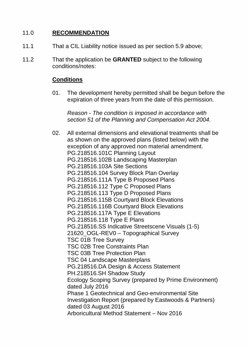
11.0 RECOMMENDATION 11.1 That a CIL Liability notice issued as per section 5.9 above; 11.2 That the application be GRANTED subject to the following
conditions/notes:
Conditions
01. The development hereby permitted shall be begun before the expiration of three years from the date of this permission.
Reason - The condition is imposed in accordance with section 51 of the Planning and Compensation Act 2004.
02. All external dimensions and elevational treatments shall be
as shown on the approved plans (listed below) with the exception of any approved non material amendment.
PG.218516.101C Planning Layout PG.218516.102B Landscaping Masterplan PG.218516.103A Site Sections PG.218516.104 Survey Block Plan Overlay PG.218516.111A Type B Proposed Plans PG.218516.112 Type C Proposed Plans PG.218516.113 Type D Proposed Plans PG.218516.115B Courtyard Block Elevations PG.218516.116B Courtyard Block Elevations PG.218516.117A Type E Elevations PG.218516.118 Type E Plans PG.218516.SS Indicative Streetscene Visuals (1-5) 21620_OGL-REV0 – Topographical Survey TSC 01B Tree Survey TSC 02B Tree Constraints Plan TSC 03B Tree Protection Plan TSC 04 Landscape Masterplans PG.218516.DA Design & Access Statement PH.218516.SH Shadow Study Ecology Scoping Survey (prepared by Prime Environment) dated July 2016 Phase 1 Geotechnical and Geo-environmental Site Investigation Report (prepared by Eastwoods & Partners) dated 03 August 2016 Arboricultural Method Statement – Nov 2016

Reason - In order to clarify the extent of the planning permission in the light of guidance set out in "Greater Flexibility for planning permissions" by CLG November 2009.
Drainage
03. The site shall be developed with separate systems of drainage for foul and surface water on and off site.
Reason - In the interest of satisfactory and sustainable drainage.
04. No development shall take place until details of the proposed
means of disposal of surface water drainage, including details of any balancing works and off-site works, have been submitted to and approved by the local planning authority. Furthermore, unless otherwise approved in writing by the local planning authority, there shall be no piped discharge of surface water from the development prior to the completion of the approved surface water drainage works.
Reason - To ensure that no surface water discharges take place until proper provision has been made for its disposal.
05. No development shall take place until a detailed design and
associated management and maintenance plan of surface water drainage for the site, in accordance with Defra Non-statutory technical standards for sustainable drainage systems, has been submitted to and approved in writing by the Local Planning Authority. The approved drainage system shall be implemented in accordance with the approved detailed design prior to the use of the building commencing.”
Reason - To ensure that the principles of sustainable drainage are incorporated into this proposal and sufficient detail of the construction, operation and maintenance of sustainable drainage systems is provided to the LPA in advance of full planning consent being granted.
06. No development shall take place until a detailed assessment
has been provided to and approved in writing by the Local Planning Authority to demonstrate that the proposed
destination for surface water accords with the hierarchy in Approved Document Part H of the Building Regulations 2000.”
Reason - To ensure that surface water from the development is directed towards the most appropriate waterbody in terms of flood risk and practicality by utilising the highest possible priority destination on the hierarchy of drainage options. The assessment should demonstrate with appropriate evidence that surface water runoff is discharged as high up as reasonably practicable in the following hierarchy: 1. into the ground (infiltration); 2. to a surface water body; 3. to a surface water sewer, highway drain, or another drainage system; 4. to a combined sewer.
Site Investigations/Contamination
07. Development shall not commence until intrusive site
investigations have been carried out by the developer to establish the exact situation regarding coal mining legacy issues on the site and approval for commencement of development given in writing by the Local Planning Authority. The investigation and conclusions shall include any remedial works and mitigation measures required/proposed for the stability of the site. Only those details which receive the written approval of the Local Planning Authority shall be carried out on site.
Reason - To fully establish the presence and / or otherwise of any coal mining legacy and to ensure that site is remediated, if necessary, to an appropriate standard prior to any other works taking place on site.
08. A. Development shall not commence until details as specified in this condition have been submitted to the Local Planning Authority for consideration and those details, or any amendments to those details as may be required, have received the written approval of the Local Planning Authority. I. A desktop study/Phase 1 report documenting the
previous land use history of the site. II. A site investigation/Phase 2 report where the previous
use of the site indicates contaminative use(s). The site
investigation/Phase 2 report shall document the ground conditions of the site. The site investigation shall establish the full extent, depth and cross-section, nature and composition of the contamination. Ground gas, groundwater and chemical analysis, identified as being appropriate by the desktop study, shall be carried out in accordance with current guidance using UKAS accredited methods. All technical data must be submitted to the Local Planning Authority.
III. A detailed scheme of remedial works should the investigation reveal the presence of ground gas or other contamination. The scheme shall include a Remediation Method Statement and Risk Assessment Strategy to avoid any risk arising when the site is developed or occupied.
B. If, during remediation works any contamination is identified that has not been considered in the Remediation Method Statement, then additional remediation proposals for this material shall be submitted to the Local Planning Authority for written approval. Any approved proposals shall thereafter form part of the Remediation Method Statement. C. The development hereby approved shall not be occupied until a written Validation Report (pursuant to A II and A III only) has been submitted to and approved in writing by the Local Planning Authority. A Validation Report is required to confirm that all remedial works have been completed and validated in accordance with the agreed Remediation Method Statement.
Reason - To protect the environment and ensure that the redeveloped site is reclaimed to an appropriate standard.
09. In the event it is proposed to import soil onto site in
connection with the development the proposed soil shall be sampled at source and analysed in a MCERT certified laboratory, the results of which shall be submitted to the Local Planning Authority for consideration. Only the soil approved in writing by the Local Planning Authority shall be used on site.

Reason - To protect the environment and ensure that the redeveloped site is reclaimed to an appropriate standard.
Highways
10. No development shall take place including any works of
demolition until a construction management plan or construction method statement has been submitted to and been approved in writing by the Local Planning Authority. The approved plan/statement shall be adhered to throughout the construction period. The statement shall provide for but not necessarily be restricted to the following as appropriate - parking of vehicles of site operatives and visitors - routes for construction traffic - hours of operation - method of prevention of debris being carried onto highway - pedestrian and cyclist protection - proposed temporary traffic restrictions - arrangements for turning vehicles
Reason – In the interests of highway safety.
11. No part of the development shall be occupied until the
following works have been carried out in accordance the details first submitted to and approved, in writing, by the Local Planning Authority in respect of any necessary alterations to the footway crossing for the access to the site such that a vehicular dropped crossing is provided rather than kerbed radii.
Reason – In the interests of highway safety.
12. No dwelling shall be occupied until space has been laid out
within the site in accordance with approved planning layout for cars to be parked and for vehicles to turn so that they may enter and leave the site in forward gear.
Reason – In the interests of highway safety.
13. The garages hereby permitted and car parking spaces to be
provided shall be kept available for the parking of motor vehicles at all times. Notwithstanding the provisions of the Town and Country Planning (General Permitted
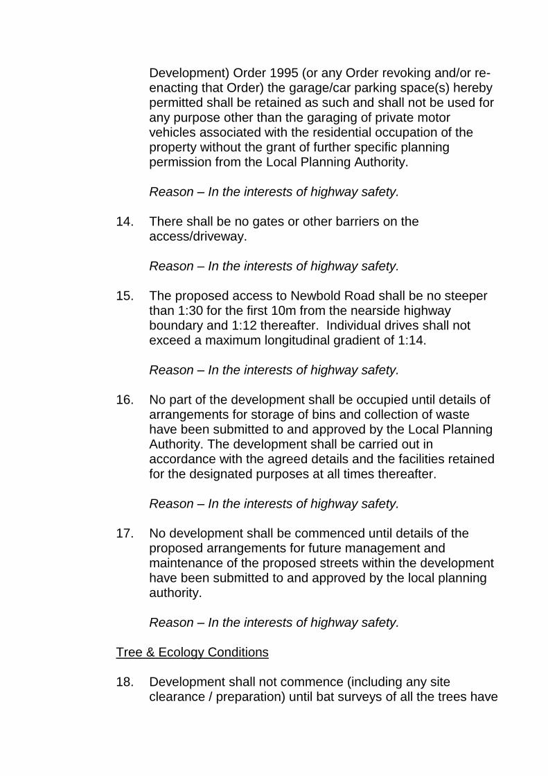
Development) Order 1995 (or any Order revoking and/or re-enacting that Order) the garage/car parking space(s) hereby permitted shall be retained as such and shall not be used for any purpose other than the garaging of private motor vehicles associated with the residential occupation of the property without the grant of further specific planning permission from the Local Planning Authority.
Reason – In the interests of highway safety.
14. There shall be no gates or other barriers on the
access/driveway.
Reason – In the interests of highway safety.
15. The proposed access to Newbold Road shall be no steeper than 1:30 for the first 10m from the nearside highway boundary and 1:12 thereafter. Individual drives shall not exceed a maximum longitudinal gradient of 1:14.
Reason – In the interests of highway safety.
16. No part of the development shall be occupied until details of
arrangements for storage of bins and collection of waste have been submitted to and approved by the Local Planning Authority. The development shall be carried out in accordance with the agreed details and the facilities retained for the designated purposes at all times thereafter.
Reason – In the interests of highway safety.
17. No development shall be commenced until details of the
proposed arrangements for future management and maintenance of the proposed streets within the development have been submitted to and approved by the local planning authority.
Reason – In the interests of highway safety.
Tree & Ecology Conditions
18. Development shall not commence (including any site clearance / preparation) until bat surveys of all the trees have

been undertaken and the result submitted to the Local Planning Authority for written approval. Only once the survey / report has been considered by the Local Planning Authority and its written approval has been given shall any works (which may include necessary mitigation works) commence on site and the works shall be completed exclusively in accordance with the scheme receiving written approval.
Reason – To ensure that any ecological interest on site is appropriately addressed and can be mitigated against, prior to any development taking place, in accordance with policy CS9 and the wider NPPF.
19. No removal of vegetation that may be used by breeding birds
shall take place between 1st March and 31st August inclusive, unless a competent ecologist has undertaken a careful, detailed check of the vegetation for active birds’ nests immediately before the vegetation is cleared and provided written confirmation that no birds will be harmed and/or that there are appropriate measures in place to protect nesting bird interest on site. Any such written confirmation should be submitted to the local planning authority.
Reason – In the interests of biodiversity and to accord with policy CS9 of the Local Plan: Core Strategy 2011-2031 and the National Planning Policy Framework.
20. Prior to the commencement of development a detailed
lighting strategy shall be submitted to and approved in writing by the LPA. Such approved measures must be implemented in full and maintained thereafter. This is to be ensure that a sensitive lighting is designed in line with guidance within Paragraph 125 of the NPPF. Reason – To ensure that any ecological interest on site is appropriately addressed and can be mitigated against, prior to any development taking place, in accordance with policy CS9 and the wider NPPF.
21. Prior to the commencement of development a detailed
enhancement strategy that provides details of enhancement

measures for roosting bats and nesting birds shall be submitted to and approved in writing by the LPA. Such approved measures must be implemented in full and maintained thereafter. Please note that it is expected that provision is made within the new dwellings (as integral boxes) rather than in retained trees to ensure that the roost and nest boxes cannot be tampered with and are secure in the long-term.
Reason – To ensure that any ecological interest on site is appropriately addressed and can be mitigated against, prior to any development taking place, in accordance with policy CS9 and the wider NPPF.
22. Under Tree Preservation Order 4901.133 Trees T1, T5, T6 &
T10 Purple Beech and T3 & T8 Whitebeam shall be retained; furthermore in the first available planting season prior to any development commencing Trees T11 and T12 of the same Order shall be translocated to the frontage of the site as shown in drawing TSC04 Landscape Master Plan and Planting Details by Weddle Landscape Design and detailed in the Arboricultural Method Statement Nov 2016. If either of these two trees fail during transplanting two new heavy standard Oak trees shall be planted as their replacements as shown in drawing TSC04 Landscape Master Plan and Planting Details by Weddle Landscape Design / detailed in the Arboricultural Method Statement Nov 2016 and thereafter maintained under the terms and provisions of the aforementioned Order.
Reason – In the interests of protecting any retained and protected trees; maintaining their health and wellbeing in accordance with policy CS9 of the Core Strategy and wider NPPF.
23. Prior to development commencing (including site clearance /
demolition) the Root Protection Area’s (RPAs) illustrated on drawing no. TSC03 Rev A Tree Protection Plan by Weddle Landscape Design and as detailed in the Arboricultural Method Statement Nov 2016 shall be established to all retained protected trees within the application site boundary. Protective fencing to define these RPAs shall be erected conforming to BS 5837 ‘Trees in Relation to Design,

demolition and construction - Recommendations’ 2012) during site clearance and while any construction is in progress and notices should be attached to the fencing at regular intervals to this effect. There must be no excavations, no soil stripping and no grading of the site within the RPAs and there should also be no storage of materials within the RPAs.
Reason – In the interests of protecting the rooting environment of any retained and protected trees; maintaining their health and wellbeing in accordance with policy CS9 of the Core Strategy and wider NPPF.
24. Removal of any hard surfacing, boundary walls, retaining
walls and services within the defined Root Protection Areas (RPAs) shall be undertaken strictly in accordance with the Arboricultural Method Statement Nov 2016. The removal of any existing hard surfaces within the RPAs should be carried out without the use of any heavy machinery and care must be taken not to disturb tree roots that may be present beneath it. Hand held tools or appropriate machinery should be used to remove the existing surfaces unless prior written approval is sought in writing by the Local Planning Authority.
Reason – In the interests of protecting the rooting environment of any retained and protected trees; maintaining their health and wellbeing in accordance with policy CS9 of the Core Strategy and wider NPPF.
25. Prior to the commencement of development details of the
location of site cabins, materials, construction vehicles and parking shall be submitted to the Local Planning Authority for consideration and written approval; and these should be outside the RPAs of the retained trees.
Reason – In the interest of safeguarding the retained / neighbouring trees, having regard to their root protection areas, and in the interest of the appearance of the surrounding area.
26. Within 2 months of commencement of development, unless
otherwise agreed in writing by the Local Planning Authority, full details of hard and soft landscape works for the approved

development shall be submitted to the Local Planning Authority for consideration. The hard landscaping scheme shall take account of any established root protection areas to retained trees on site and may require alternative measures of construction and finishes to be considered (as detailed in the Arboricultural Method Statement Nov 2016 – or any subsequent revisions thereto). Hard landscaping includes proposed finished land levels or contours; means of enclosure; minor artefacts and structures (e.g. furniture, play equipment, refuse or other storage units, signs, lighting etc.) retained historic landscape features and proposals for restoration, where relevant. These works shall be carried out as approved prior to the occupation of the dwelling.
Reason - The condition is imposed in order to enhance the appearance of the development and in the interests of the area as a whole.
Others 27. Work shall only be carried out on site between 8:00am and
6:00pm Monday to Friday, 9:00am to 5:00pm on a Saturday and no work on a Sunday or Public Holiday. The term "work" will also apply to the operation of plant, machinery and equipment.
Reason - In the interests of residential amenities.
28. Prior to development commencing an Employment and Training Scheme shall be submitted to the Local Planning Authority for consideration and written approval. The Scheme shall include a strategy to promote local supply chain, employment and training opportunities throughout the construction of the development.
Reason - In order to support the regeneration and prosperity of the Borough, in accordance with the provisions of Policy CS13 of the Core Strategy.
29. The development hereby approved shall include the
provision of appropriate infrastructure to enable the dwellings to have high speed broadband, in accordance with details to

be submitted to, and approved in writing, by the Local Planning Authority.
Reason – In the interests of sustainable development and to ensure that the development is capable of meeting the needs of future residents and / or businesses in accordance with policy CS4 of the Core Strategy and para. 42 of the NPPF.
30. Before construction works commence or ordering of external
materials takes place, precise specifications or samples of the walling and roofing materials to be used shall be submitted to the Local Planning Authority for consideration. Only those materials approved in writing by the Local Planning Authority shall be used as part of the development.
Reason - The condition is imposed in order to ensure that the proposed materials of construction are appropriate for use on the particular development and in the particular locality.
31. Notwithstanding the provision of the Town and Country
Planning (General Permitted) Development Order 1995 (as amended) there shall be no extensions, outbuildings or garages constructed (other than garden sheds or greenhouses of a volume less than 10 cubic metre) or additional windows erected or installed at or in the dwelling hereby approved without the prior written agreement of the Local Planning Authority.
Reason - In the interests of the amenities of occupants of adjoining dwellings.
Notes 01. If work is carried out other than in complete accordance with
the approved plans, the whole development may be rendered unauthorised, as it will not have the benefit of the original planning permission. Any proposed amendments to that which is approved will require the submission of a further application.
02. This approval contains condition/s which make requirements
prior to development commencing. Failure to comply with

such conditions will render the development unauthorised in its entirety, liable to enforcement action and will require the submission of a further application for planning permission in full.
Highways
03. Pursuant to Section 184 of the Highways Act 1980 and
Section 86(4) of the New Roads and Streetworks Act 1991 prior notification shall be given to the Department of Economy, Transport & Communities at County Hall, Matlock regarding access works within the highway. Information, and relevant application forms, regarding the undertaking of access works within highway limits is available via the County Council’s website http://www.derbyshire.gov.uk/transport_roads/roads_traffic/development_control/vehicular_access/default.asp, email [email protected] or telephone Call Derbyshire on 01629 533190.
04. The Highway Authority recommends that the first 5m of the
proposed access/driveway should not be surfaced with a loose material (i.e. unbound chippings or gravel etc). In the event that loose material is transferred to the highway and is regarded as a hazard or nuisance to highway users, the Authority reserves the right to take any necessary action.
05. Pursuant to Sections 149 and 151 of the Highways Act 1980,
steps shall be taken to ensure that mud or other extraneous material is not carried out of the site and deposited on the public highway. Should such deposits occur, it is the applicant’s responsibility to ensure that all reasonable steps (e.g. street sweeping) are taken to maintain the roads in the vicinity of the site to a satisfactory level of cleanliness.
06. The following clause shall be included in the deeds of the
dwellings to ensure that at no time will adoption of any part of the access road be sought: “The lessee or purchaser shall not at any time, either alone or jointly with others, seek adoption of any part of the driveway intended to serve the development as a highway maintainable at the public expense, it being the intention that

same shall at all times remain private up to the point where the same abuts Newbold Road.
07. Construction works are likely to require Traffic Management
and advice regarding procedures should be sought from Dave Bailey, Traffic Management, 01629 538686. All road closure and temporary traffic signal applications will have to be submitted via the County Councils web-site; relevant forms are available via the following link - http://www.derbyshire.gov.uk/transport_roads/roads_traffic/roadworks/default.asp
08. The applicant is advised that to discharge Condition 17 that
the local planning authority requires the constitution and details of a Private Management and Maintenance Company confirming funding, management and maintenance regimes.
Trees 09. This permission does not extend to tree works proposed to
TPO trees proposed to be retained as part of the development. A separate TPO Tree Works application will need to be submitted to cover these issues inc. the removal of T2, T4 T7 and T9 Hawthorn where replacement trees will be required.