canada the united states and teachers 1812 · personalities to engage students with defining...
TRANSCRIPT


The collection of education guides uses themes of perspective, identity and personalities to engage students with defining moments in Canadian history and international relations in both historical and contemporary contexts. These resources focus on developing important historical thinking skills that assist students in thinking critically about the past.
The largest independent organization dedicated to Canadian history, identity and citizenship, The Historica-Dominion Institute is committed to bringing forward the stories and experiences of Canada. This guide is made possible with generous support from the Government of Canada.
The tools provided here are supplemented with additional activities and resources at Historica-Dominion.ca/1812. We hope this guide will assist you in teaching this important period of Canadian history in your Social Studies, Geography or History classroom.
Table of ContentsMessage to Teachers and Introduction Page 2
Canada, the United States and the War of 1812 Today Page 2
Borders Debate Page 4
Integrating Geography and History Page 5
War on the Waves Page 5
Battles and Borders in Upper and Lower Canada Page 6
Post-War: The Rush-Bagot Agreement Page 6
This guide is designed to complement The Historica-Dominion Institute’s introductoryWar of 1812 guide and themed guides. This guide discusses the importance of borders and geography to war.
INTRODUCTIONIn this guide, borders are defined in geographic, political, national, linguistic and cultural terms. Sometimes they are clearly defined and other times they are abstract, though still significant to the populations affected by them. During the War of 1812, borders were often unclear as no proper survey had been done to define the boundaries. Border decisions were made by government leaders and frequently led to decades of disagreements. When borders changed, they often affected the people living on either side by determining their nationality and their ability to trade for goods and services.
When Canadians think of the border today, they might think of a trip to the United States on vacation, but the relationship between these bordering countries is the result of over 200 years of relationship-building. During the War of 1812 the border was in flames and in need of defence, but today we celebrate the peace and partnership that has lasted since then.
2
A project of Sponsored by
Message to
Get in touch!
Plan of the Niagara Region This map from 1810 shows the American Fort, Old Niagara, jutting out into the
mouth of the Niagara River at Lake Ontario with the British Fort George on the opposite bank. A. Gray, 1810. Courtesy Library and Archives Canada.
Teachers
CANADA, THE UNITED STATES AND the WaR OF18 12
“Just two miles up the road, there’s a border crossing. Through it, thousands of people pass to and from the United States every day. And, as they do so, it seems inconceivable that we should have ever had reason to go to war against our great friends across the river.” –Prime Minister Stephen Harper, 2010
The Historica-Dominion Institute1-866-701-1867staff@historica-dominion.caHistorica-Dominion.caTwitter: @1812Canada
Fort Niagara(American)
Fort George(British)

Five themes of geography
3
Two hundred years after the War of 1812, Canada and the United States are strong allies who share many things, including significant economic ties and military co-operation. But how does each country view a war that divided them two hundred years ago? The Historica-Dominion Institute commissioned a public opinion poll to measure Canadian and American attitudes on the War of 1812 and bicentennial commemorations. Analysing Poll Results In groups of three to five, analyse the poll results below and develop some possible explanations for the results. • What might explain the similarities and the differences?
• Determine what your group believes is the most significant finding among the results. Poll Results
Canada United States
81% believe the War of 1812 should be mandatory teaching in schools.
88% believe the War of 1812 should be mandatory teaching in schools.
77% feel the bicentennial of the war is important to celebrate and
national governments should support it.
80% feel the bicentennial of the war is important to celebrate and
national governments should support it.
79% believe the war is an important part of their country’s identity and 83% believe it is an important part
of their country’s history.
77% believe the war is an important part of their country’s identity and 84% believe it is an important part of their
country’s history.
77% of Canadians identified an important outcome of the war.
64% of Americans identified an important outcome of the war.
Additional poll findings for your classroom discussion • 66% of Canadians incorrectly believe that Sir John A. Macdonald, the country’s first prime
minister in 1867, was a major figure in the War of 1812.
• Fewer people from Québec (65%) than other Canadians (77%) believe that the bicentennial of 1812 is an important commemoration.
• 25% of Canadians believe that winning the war is a defining aspect of Canadian identity; more than beating the U.S. at hockey (6%), but less than free health care (53%).
Discussion Questions 1. Do some research on these results under the Polls tab at Historica-Dominion.ca. What
are the significant outcomes identified by Canadians and Americans, and what do they tell us about the importance of the war to each country?
2. Notice that Americans are less likely to believe that the War of 1812 had important outcomes or that it was important to the formation of their national identity. However, Americans are still slightly more likely to believe it should be commemorated and considerably more likely to think it should be mandatory teaching in their schools. What do you think might explain these differences?
3. Much of the War of 1812 was fought along the Canadian-American border. Do you think that Canadians and Americans living in these areas might respond to the poll questions differently than those living in other regions?
4. How do borders help to create national identity? Extension Activity: Public Opinion Polling Develop five questions to help you gather information about how Canadians see the War of 1812 or historical anniversaries more broadly. Ask your class or your entire school and tally your own poll results. What did you find? Did the results surprise you or confirm what you thought?
The Battle of Queenston Heights This 1836 drawing is a copy of an oil painting made by Major James Dennis, a British officer present at the Battle of Queenston Heights. Courtesy Library and Archives Canada.
Theme EXAMPLE
Location (where a place is located)
Queenston Heights; 43˚ N latitude 79˚ W longitude
Place (what makes it unique)
Elevated area (promontory) on the Niagara Escarpment
Movement (of people and things in an environment)
Easy to move goods and people across and along river; need to guard against
possible invasion
Region (area of Earth with similar characteristics)
Great Lakes - St. Lawrence region
Human Environmental Interaction (how people use the environment)
Farming in region; waterway essential to trade and travel

Was the War of 1812 really the war nobody won? This question has been debated since the war ended in 1815. Part of the reason for debate is that neither side achieved a strategic victory over the other. By the end of the war, no borders had changed from the pre-war period. Many historians agree that the group who lost the most in the War of 1812 was the continent’s Aboriginal peoples, who incurred major losses with very little political gain.
4
BORDERS DEBATETheatre/seat of war – The area covered by land, sea or air that is involved, or disputed, in war. Niagara Peninsula – The Niagara Peninsula lies between Lakes Ontario and Erie and the Niagara River in southwestern Ontario. The river is on the international border between Canada and the U.S. Impressment – The forced recruitment of people into military service.
Definitions
Consider the quotations below, taken from a variety of sources.
“In one way the Canadians had won the war. They had successfully defended their lives and homes from American invaders. This had drawn them closer together and created a sense of Canadian nationalism.” –Allan D. Hux et al.,America: A History
“Having won the last battle, the Americans were convinced that they won the War of 1812. Having stemmed the tide of invasion and kept the Americans out of their country, Canadians believed that they won the war. Having ceded nothing they considered important, the British were serene in the conviction that they won it.” –Pierre Berton, Flames Across the Border
“Neither Canada nor the United States seems sufficiently aware that the disparate Indian nations of the Old Northwest, which fought and gave so much in the struggle, received in the war a death blow to their identity as a social and political power – from both the American soldiery and the abandonment of their cause by Britain in the peace that followed.” –Victor Suthren, The War of 1812
Be it resolved that the Americans won the War of 1812.
Be it resolved that the British and Canadians won the War of 1812.
Be it resolved that Aboriginal peoples won the War of 1812.
Be it resolved that no side won the War of 1812.
Resolutions can be debated in teams of two or the class can be divided into two teams with each side creating a list of arguments to present.
Debate Tip: Be sure to define what is meant by ‘victory’ and have evidence to support your view. Your debate speech should follow this simple formula:
Introduce your argument.
Make your argument, using facts and conviction.
Conclude with a review of your argument.
For information on how to conduct a debate, please visit Historica-Dominion.ca/1812.
A debate traditionally addresses a resolution (an expression of opinion), which one side defends and the other opposes. For your purposes, you can debate one of the resolutions below:
British Valour and Yankee Boasting This image depicts the British capture of the USS Chesapeake as an easy victory over “bumbling” Americans. George Cruikshank, 1813. Courtesy Library of Congress.
Map of the seat of war in North AmericaThis map depicts the theatre of war and the areas affected by the War of 1812. John Melish, 1813-1815. Courtesy Library and Archives Canada.
Battle of New Orleans This image depicts the American
victory at the Battle of New Orleans in 1815. William Edward West, 1817.
Courtesy Library of Congress.
Death of General PikeThis woodcut shows the death of
American General Pike and the explosion of the grand magazine at the Battle of
York, 27 April 1813. Courtesy Library and Archives Canada.

5
INTEGRATING GEOGRAPHY AND HISTORY
WAR ON THE WAVES“British military officers marveled at the American failure to contest the St. Lawrence River, which served as the critical supply line of British Canada.” –Alan Taylor, The Civil War of 1812
Given the importance of maritime trade, disputes on the seas played a significant role in the war. In fact, war was declared on the basis of a number of maritime issues, including the British navy’s forced recruitment of seamen on American ships (among them British navy deserters).
As part of their war against Napoleonic France, Great Britain blocked American trade with European countries allied to France. The British inspected all American ships crossing the Atlantic Ocean, and if British-born sailors were found on board, the Royal Navy insisted they serve with them. In declaring war against Britain, the United States Congress cited impressment as a major issue.
British naval bases in New Brunswick, Nova Scotia and Newfoundland played an important role during the war. The blockade of the American coastline, which eventually extended to the Gulf of Mexico, was based in Halifax.
Few roads and a shortage of horses and wagons in the Canadas meant inland lakes and major rivers of North America offered the easiest means of movement. Control of these waters was essential to providing supplies, equipment and reinforcements to land forces.
Early in the war, the British capture of Fort Mackinac, situated at the junction of Lake Michigan and Lake Huron, was important because it cemented an alliance with Aboriginal groups in the Great Lakes.
In 1813, the Americans controlled Lake Erie, blocking British access to Lake Huron. The Royal Navy shipped supplies north on land and then used boats and Aboriginal trails to reach Lake Huron and beyond.
In September 1814, the British launched the largest warship ever constructed on the Great Lakes. Built at Kingston, HMS St. Lawrence was operated by 837 sailors and armed with 112 guns, giving the British control of Lake Ontario. Major battles also took place on and around Lake Erie and the St. Lawrence River. Activity
Unless a border is identified by a physical landmark, it is often difficult to see where one territory ends and another begins. When borders fall in the middle of large bodies of water, they become even less clear. In the open seas, there are no borders.
1. Choose a body of water (in red) mentioned in the paragraphs above. Research its role in the War of 1812 and report your findings in an oral, written or visual presentation. Remember to outline key events and their consequences.
2. Make an annotated map of the Great Lakes region and St. Lawrence River Valley showing key events and locations from the War of 1812. An annotated map should contain labels and brief descriptions of key events that took place on the major bodies of water.
Geography has an important influence on the character of war. The main theatre of war in the War of 1812 encompassed lands on both sides of the modern Canadian-American border east of Manitoba. This massive territory spans the same distance as from Paris to Moscow, approximately 2,500 km. The physical geography of the area, including the Great Lakes and the St. Lawrence and Niagara Rivers, played a significant role in the course of the war and its outcome.
Geography influences strategic decisions. The Niagara Peninsula was very important because the Niagara River was easy to cross and it gave access to the rest of Upper Canada (now Ontario). Numerous actions occurred there in 1812 and 1813. Between July and November 1814 the longest and bloodiest campaign was fought along the Canadian bank of the peninsula. To investigate the role of geography in this war, consider the five themes of geography (see page 3) and apply them to your historical studies by discussing one of the battles below. You can begin your research at eighteentwelve.ca.
The Chesapeake-Leopard Affair HMS Leopard and USS Chesapeake in battle on June 22, 1807. Britain’s impressment of sailors serving with the Americans sparked controversy. Painting by F. Muller. Courtesy Library of Congress.
Capture of Fort Mackinac, July 1812Battle of York, April 1813Battle of Beaver Dams, June 1813Battle of Châteauguay, October 1813Battle of Crysler’s Farm, November 1813
Download a map template at Historica-Dominion.ca/1812
6
During the War of 1812, the border between Upper Canada (now Ontario) and Lower Canada (now Québec and Labrador) was an important division. Lower Canada had approximately 330,000 inhabitants, while Upper Canada had an estimated 90,000. The division was also a linguistic and cultural border, separating English-speaking (Upper Canada) from French-speaking (Lower Canada) inhabitants.
Indigenous peoples in North America had their own territorial divisions. Many territories pre-dated European arrival and therefore crossed settlers’ borders, such as the Mohawk territory of Akwesasne. In other cases, like that of the Grand River Tract, the colonial British government offered land in recognition of loyalty and in an attempt to build alliances.
During the War of 1812, Aboriginal peoples living on both sides of the United States border were in a difficult situation. Some members of these communities sided with the British, while others supported the Americans or stayed neutral.
A key American objective was to cut off the supply route between Upper and Lower Canada by striking at Kingston or Montréal. The two most important battles in this theatre of war were the Battle of Crysler’s Farm and the Battle of Châteauguay. Conduct some research at eighteentwelve.ca and create a chart to compare the two battles.
DISCUSSION Questions 1. What roles did borders play in these battles? Think of geographic
borders as well as political and national borders.
2. How were the battles similar and how were they different?
3. How would the outcome of the war have been different if the Americans had succeeded in taking Montréal?
Enrichment For more on the Battle of Châteauguay, watch this 30-minute film: nfb.ca/film/battle_of_the_chateauguay
POST-WAR: THE RUSH-BAGOT AGREEMENT “At the time when the Rush-Bagot Agreement was made few people if any thought that there would never be another war between Britain and the United States. In fact, for more than fifty years afterwards such a war always seemed possible. Sometimes it seemed decidedly probable.” –C.P. Stacey, The Undefended Border: The Myth and the Reality One of the most significant agreements following the War of 1812 was the Rush-Bagot Agreement of 1817. It de-militarized the Great Lakes by limiting the number of warships each country could operate on the lakes.
Search for “Rush-Bagot Agreement” at these sites: cmhg.forces.gc.ca or thecanadianencyclopedia.com
Activity
1. How did this agreement alter the strategy for defending British North America?
2. Why do you think people still thought a war was possible after the agreement was signed?
3. Compare the Rush-Bagot Agreement with some current Canadian-American agreements. What are their similarities and differences?
BATTLES AND BORDERS IN UPPER AND LOWER CANADA
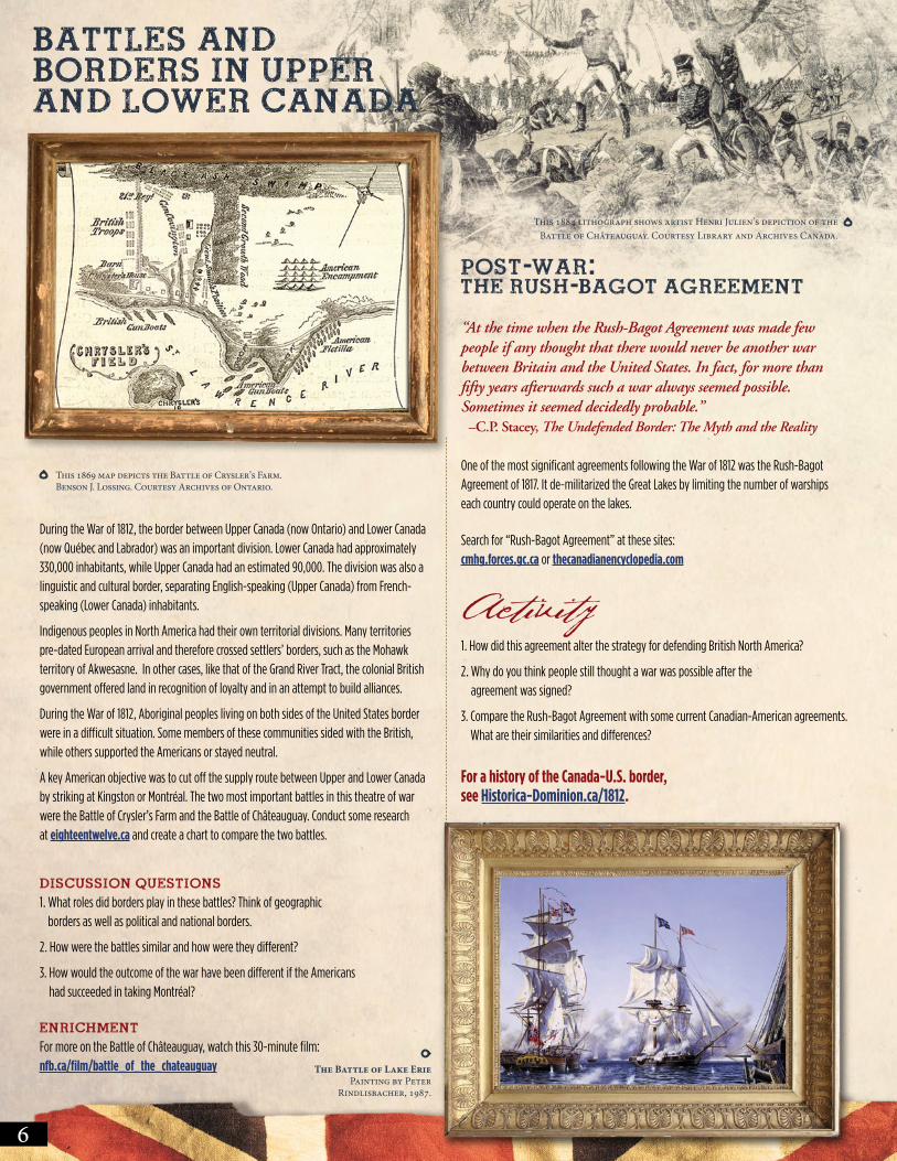
This 1869 map depicts the Battle of Crysler’s Farm. Benson J. Lossing. Courtesy Archives of Ontario.
The Battle of Lake Erie Painting by Peter
Rindlisbacher, 1987.
This 1884 lithograph shows artist Henri Julien’s depiction of the Battle of Châteauguay. Courtesy Library and Archives Canada.
For a history of the Canada-U.S. border, see Historica-Dominion.ca/1812.