by definition anything can only become a hazard when the event may cause loss of life, injury,...
TRANSCRIPT

Physical Impacts ofTectonic Hazards

By definition anything can only become a hazard when the event may cause loss of life, injury, property damage and economical/environmental damage. So therefore the tectonic activity is not always a hazard as it can occur far from any known life. However when the tectonic activity is near populated places it can generate a wide range of disasters.
Volcanic Hazards are: Throw out hot ash and lava starting fires and melting anything in its path. Send up thinner ash that can block planes from flying reducing aid availability. Pyroclastics that can vary from bomb like rocks to micron sized particles.
Lahars which are devastating mudslides of pyroclastic rock. Earthquakes however have a very different set of hazards; Ground shaking which can knock over buildings and disable infrastructure Displacement in the ground can cause huge holes and gaps to break up and
roads to fall away Liquefaction where solid ground becomes saturated and can act as quicksand in
an almost liquid state running down hills and sinking homes. Tsunamis are almost a disaster in there own right and can cause huge 50ft high
walls of water to smash through cities literally wiping out everything in its path. Both of these hazards have the same basic cause and that is movement of the
lithoshperic plates in either a; Destructive, Convergent, Divergent or Constructive plate margin and these margins can develop hotspots for this type of tectonic event.
What makes tectonic activity hazardous?
What makes tectonic activity hazardous?

There are 4 main types of hazards that arise from a volcano, These are;•Lava•Ash•Pyroclastics•Lahars
Lava is the molten rock expelled by a volcano during an eruption This molten rock is formed in the inside the earths core. The source of the heat that liquefies the rock within the earth is geothermal energy.
When first erupted from a volcanic vent, lava is a liquid at temperatures from 700 to 1,200 °C (1,292 to 2,192 °F). Up to 100,000 times as viscous as water, lava can flow great distances before cooling and solidifying because of its thixtrotphic and shear thinning properties.
Lava

Volcanic ash is made of tiny fragments of jagged rock, minerals, and volcanic glass. Unlike the soft ash created by burning wood, volcanic ash is hard, abrasive, and does not dissolve in water. Generally, particles of volcanic ash are 2 mm across or smaller.
Wind can carry small volcanic ash particles great distances. Ash has been found thousands of km away from an eruption site. The smaller the particle, the further the wind will carry it. The 2008 eruption of Chaitén in Chile produced an ash cloud that blew 1,000 km (620 miles) across Patagonia to Argentina, reaching both the Atlantic and Pacific coasts.
Ash
Pyroclastic flows are high-density mixtures of hot, dry rock fragments and hot gases that move away from the vent that erupted them at high speeds.
They may result from the explosive eruption of molten or solid rock fragments, or both. They may also result from the non-explosive eruption of lava when parts of dome or a thick lava flow collapses down a steep slope.
Most pyroclastic flows consist of two parts: a ‘base’ flow of coarse fragments that moves along the ground, and a turbulent cloud of ash that rises above the ‘base’ flow.
Pyroclastics

One of the greatest volcanic hazards is lahars. Lahars are similar to pyroclastic flows but contain more water.
They have a wide range of velocities varying from 1 m/s to 40 m/s.
When moving, a lahar looks like a mass of wet concrete that carries rock debris ranging in size from clay to boulders more than 10 m in diameter.
Lahars

• Ground Shaking is when an earthquake produces huge seismic waves that violently shakes land and so it generates a large enough shaking intensity that structures like buildings, bridges and dams are severely damaged, and cliffs/sloping ground is destabilised. The intensity of ground shaking depends upon the magnitude of the earthquake, the local geology and the distance from the epic centre.
• Ground displacement occurs when the shaking of the ground during earthquakes causes landslides and avalanches. If a structure (a building, road, etc.) is built across a fault, the ground displacement during an earthquake could seriously damage or rip apart that structure.
• E.g. the Loma Prieta earthquake in 1989 where a 6.9 magnitude earthquake caused the famous Nimitz freeway to collapse and also caused severe damage to other buildings and highways. Its cost was estimated at around $5-6 bn due to ground displacement.
Ground Displacement / Shaking
A2 Geography, Philip Allen, 2009

A landslide is a mass movement of material, such as rock, earth or debris, down the slope of a hill or cliff. They can happen suddenly or move slowly over long periods of time. They are usually triggered by earthquakes and some of the factors can increase a chance of a landslide occuring are: Magnitude of an earthquake Steepness of slope Type of rock Water (rainfall or the movement of the sea) Lack of vegetation Erosion processes — such as coastal erosion Landslides can often cause a lot of economic
damage and lead to lots of fatalities E.g. Ecuador. 1948 where an earthquake caused a massive landslide to
occur. An estimated 6,000 people died with a further 20,000 people injured. Houses fell down hills and others were buried. Approximately 100,000 people lost their homes. The landslides also caused some flooding by changing water-flow patterns. Some of the victims lost their lives to drowning.
Landslides
www.bgs.ac.uk/discoveringGeology/hazards/landslides/home.html?src=topNav
A2 Geography, Philip Allen, 2009

Liquefaction occurs when vibrations or water pressure within a mass of soil cause the soil particles to lose contact with one another. As a result, the soil behaves like a liquid, has an inability to support weight and can flow down very gentle slopes. This condition is usually temporary and is most often caused by an earthquake vibrating water-saturated fill or unconsolidated soil.
Liquefaction can lead to buildings and other structures sinking into the ground and an example of this is in 1964, Niigata, Japan where an earthquake that caused liquefaction lead to around 300+ buildings being damaged. Structures which were damaged by the Niigata Earthquake included port and harbour facilities, water supply systems, railroads, roads, bridges, airport, power facilities and agricultural facilities as a result of liquefaction
Liquefaction most often occurs when three conditions are met Loose, granular sediment or fill Saturation by groundwater Strong shaking
Liquefaction
www.geology.com/usgs/liquefaction/
www.youtube.com/watch?v=ysltbbKYVKUA2 Geography, Philip Allen,
2009
A tsunami is a series of ocean waves that sends surges of water, sometimes reaching heights of over 100 feet (30.5 meters), onto land. These walls of water can cause widespread destruction when they crash ashore. Tsunamis are caused by an underwater earthquake, a volcanic eruption, an sub-marine rockslide, or, more rarely, by an asteroid crashing into in the water from space. Most tsunamis are caused by underwater earthquakes, but not all underwater earthquakes cause tsunamis - an earthquake has to be over about magnitude 6.75 on the Richter scale for it to cause a tsunami.
Tsunamis have the potential to cause devastating economic damage and tremendous loss of life and a classic example of a major tsunami was the 2004 boxing day tsunami that occurred in the Indian Ocean. It was the result of the Indio-Australian Plate subducting below the Eurasian Plate. It was caused by an earthquake measuring more than magnitude 9. The earthquake caused the seafloor to uplift, displacing the seawater above.
The impacts were: 250,000 people died Two million people were made homeless. Thirteen countries were affected, the worst being Indonesia. $10 bn of economic losses in all 13 countries causing huge impacts on the
tourism and fishing industries
Tsunamis
A2 Geography, Philip Allen, 2009
Examples of tectonic hazards

Location: Washington State, USAVolcano type: StratovolcanoPlate Boundary: Convergent subductive (Juan de
Fuca & North American plates)Date of notable eruption: 1980
Areal Extent: Magnitude: 5.1Deaths: 57Notable Statistic: Affected 229 square miles and
destroyed timber valued at several million dollars. The deadliest and most economically destructive volcanic event in the history of the United States.
5 eruptions in the 19th century
Mount St Helens
www.ngdc.noaa.gov/hazard/stratoguide/helenfact.html
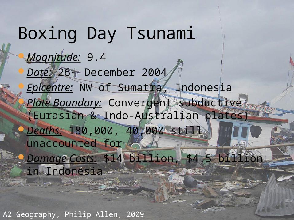
Magnitude: 9.4Date: 26th December 2004Epicentre: NW of Sumatra, IndonesiaPlate Boundary: Convergent subductive
(Eurasian & Indo-Australian plates)Deaths: 180,000, 40,000 still unaccounted forDamage Costs: $14 billion, $4.5 billion in
Indonesia
Boxing Day Tsunami
A2 Geography, Philip Allen, 2009

Causes of tectonic hazards

How Volcanoes Workhttps://www.youtube.com/watch?v=ryrXAGY1
dmE

Volcanoes can occur at convergent plate margins as oceanic crust is more dense than the continental crust the denser crust is subducted into the asthenosphere beneath the less dense. The subducted plate is heated and partially melts under the pressure. This rises through cracks in the rocks causing a volcanic eruption
Volcanoes can also occur at divergent plate boundaries as the plates separate and the magma rises through the gap
Earthquakes and Tsunamishttps://www.youtube.com/watch?v=xyKgamje
gtQ

Earthquakes occur at all types of plate boundaries due to pressure building up as the plates get caught. When the pressure is released an earthquake occurs.
Earthquakes can also cause tsunamis as the tremors can force up a huge wall of water
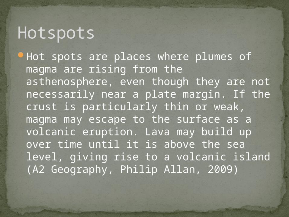
HotspotsHot spots are places where plumes of magma
are rising from the asthenosphere, even though they are not necessarily near a plate margin. If the crust is particularly thin or weak, magma may escape to the surface as a volcanic eruption. Lava may build up over time until it is above the sea level, giving rise to a volcanic island (A2 Geography, Philip Allan, 2009)
Distribution of tectonic hazards
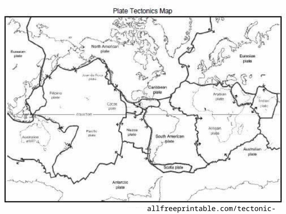

Convergent A convergent plate margin is one where two plates move towards each other
causing a collision. From this, you can split this category in to two categories:
1. Convergent (destructive) plate boundary This happens when a continental plate meets an oceanic plate. The lighter oceanic plate subductes underneath the denser continental plate. This causes the creation of fold mountains and volcanic mountains. E.g. the convergent plate boundary between the oceanic Nazca plate and the
continental South American plate. This created the Andes mountain range and the formation of the Volcano Nevada del Ruiz in 1985 which killed 636
2. Convergent (collision) plate boundary This happens when two continental plates collide with each other. As they have the same density, they collide straight into each other causing
the plate to be pushed upwards. This creates fold mountains. E.g. the convergent plate boundary between the Eurasian plate and the Indian
plate. This caused the Himalayan mountain range.
A2 Geography, Philip Allen, 2009
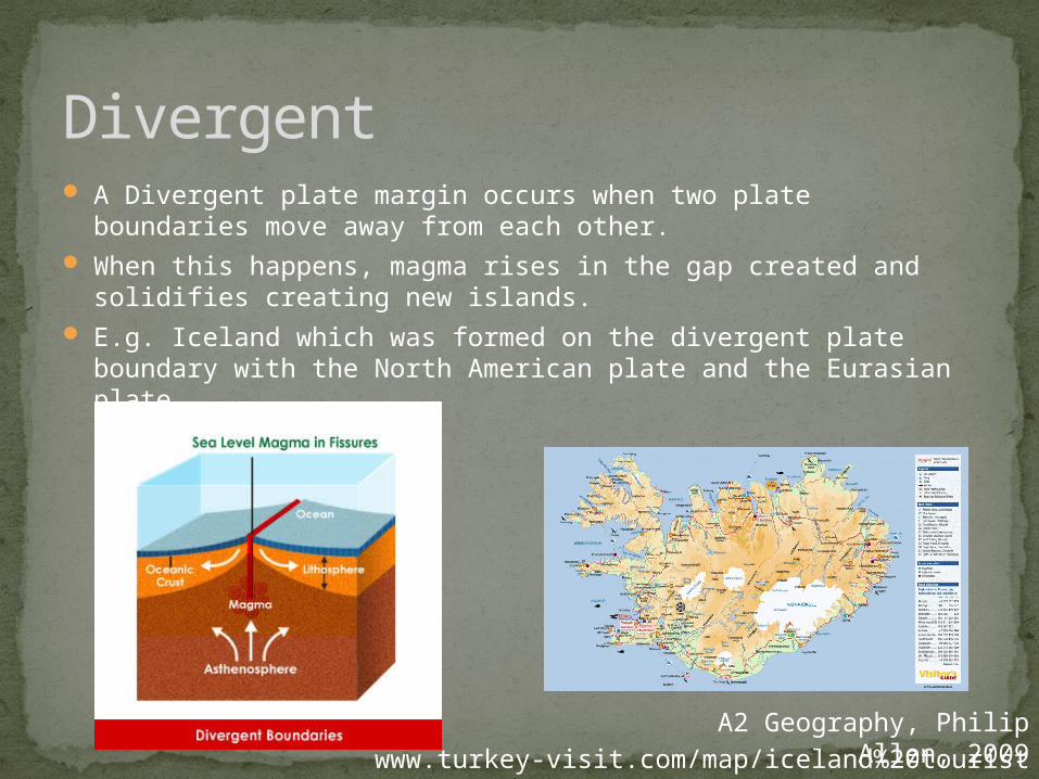
Divergent A Divergent plate margin occurs when two plate boundaries move
away from each other. When this happens, magma rises in the gap created and solidifies
creating new islands. E.g. Iceland which was formed on the divergent plate boundary
with the North American plate and the Eurasian plate.
A2 Geography, Philip Allen, 2009www.turkey-visit.com/map/iceland%20tourist
%20map.gif

Transform A transform plate boundary occurs when two plates move laterally
past each other which is also known as a conservative plate boundary.
This can cause large earthquakes due to the friction created between the two plates.
E.g. the San Andreas fault line which is a transform plate boundary between the Pacific plate and the North American plate.
A2 Geography, Philip Allen, 2009searchoflife.com/wp-content/uploads/2013/11/san-andreas-
fault.jpg