bulletin of the american association of petroleum … · 2017-02-19 · (/ t/ bulletin of the...
TRANSCRIPT
(/ t/ BULLETIN OF THE AMERICAN ASSOCIATION OF PETROLEUM GEOLOGISTS
VOL. 41, NO. 11 (NOVEMBER, 1957), PP. 2475·2492. 12 FIGS,
PALEONTOLOGY AND STRATIGRAPHY OF SOME lviARINE PLEISTOCENE DEPOSITS IN NORTHWEST
LOS ANGELES BASIN, CALIFORNIA!
PETER U. RODDA' Los Angeles, California
ABSTRACT
21-fo 2
Recent excavations made in the Cheviot Hills, Los Angeles County, California, have exposed fossiliferous marine Pleistocene strata. Two new formations occur in this area. The lower Pleistocene Anchor silt consists of 6o feet of soft buff silts, and is unconformably overlain by the upper Pleistocene Medill sand, consisting of 6o feet of grayish, loosely consolidated sand and gravel.
Eighty-three species of fossils, mostly mollusks, arc identified from five localities in the Anchor silt, and 21 species of mollusks are identified from a single locality in the Medill sand. The fauna of the Anchor silt probably lived offshore at a depth of 25-35 fathoms on a silty or muddy bottom, and in water considerably colder than: that present today at this latitude and depth. The fauna of the Medill sand represents a warm bay habitat.
The Anchor silt is faunally and lithologically similar to parts of the San Pedro and Timms Point formations at San Pedro, to small exposures of lower Pleistocene in the Pacific Palisades area, and to
•unnamed lower Pleistocene units in the Baldwin Hills. The Cheviot Hills are along the Newport-Inglewood uplift, z! miles southwest of the Beverly
Hills oil field . ·
Il\TRODUCTION
Recent excavations made in connection with real estate development near Castle Heights Avenue in the Cheviot Hills, Los Angeles, have exposed fossilifero.us marine Pleistocene strata. The fauna is chiefly molluscan, and it is the purpose of this paper to describe the stratigraphy ancl paleontology of the Castle Heights area with emphasis on the molluscan paleontology. The work on which this report is based was done during parts of 1954 and 1955.
LOCATIO:\
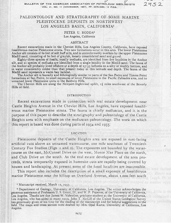
Pleistocene deposits of the Castle Heights a rea are exposed in east- fa cing artificial cuts above an unnamed \Yatcrcourse, one mile southeas t of Twentieth Century Fox Studios (Figs. 1 and 2). Th e exposures are bounded by the wa tercourse on the east, l\fcConnel Drive on the west, :'donte :\Iar Place on the north, and Club Drive on the south. As the real estate development of the area proceeds, strata temporarily exposed in homesite cuts are rapidly being covered by houses and landscaping. At present some of the fossil localities are inaccessible.
This report a]so includes the descrip tion of a small exposure of fossiliferous marine Pfeistocene near the hilltop on Overland Avenue, about r,ooo feet south
1 Manuscript received, ll'farch zz, 195 7.
2 Department rof Geology, University of Calif()rnia, Los :\ngeles. The writer acknowlctlges the generous assistance of Professors U.S. Grant, IV, and W. P. Popcnoc, of the University of California, Los Angeles. Thanks are due James vV. Valentine, graduate student at the University of California, Los Angeles, who has aided in ma.ny ways. John T. !\.fcGill of the United States Geological Su rvey has generously given of his time for the reading oi the manuscript and for helpful suggestions in the field. The maps and cross section were drafted by lllrs. Opal Kurtz, University of California, Los Angeles.
2475

J>l~T!~R U . RODDA
N
l
10
WILtS
WAP A lri4 AP B
\ 0Hllt.CAEST I :
COUNTRY CLUB ,' \
lit
WII.E
I :
/ { ~l ,\=~o
/ ' / ' .... 'J:
Ftc. I.-Index maps showing western Los Angeles basin and location of Castle Heights area. In Map A, heavy dashed line is trace of Newport-Inglewood fault zone, and X indicates loca tion oi lower Pleistocene localities of Hoots (1931). I n Map B, shaded rectangle is Castle Heights area, shown in detail on geologic map (Fig. 3) .
of National Boulevard, and one mile southwest of the Cast le Heights area (Figs. 1 and 2) .
PREVIOUS WORK
P ublished geologic maps that incorporate the Castle Heights area include th·ose by Eldridge and Arnold (1907, Pl. 18), Hoots (1931, P l. 16), Hoots and Kew (1932, Pl. 6), Woodford et al. (1954, Pl. 1), and Woodring (1938, Pl. 2).
The areas discussed in this paper have previously been mapped as marine upper Pleistocene. The work of H oots is the most detailed.
The only previous report of Pleistocene fossi ls from the Cheviot Hills is the Overland Avenue locality of H oots (1 931, p. 122 and Pl. r6) , which con tained a very small fauna and was assigned to the upper P leistocene. A locality probably identical with this was collected by the wri ter and is discussed.
,. "

MARI1YE PLDSTOCf.: .\"F. D J-:J)OS!TS, J.ns A .\"G!i.!JS 2477
f: •.. ! . - .-\ ir l'icll' n•Hlh11·ard from Baldll'in Hill s across Cu l\'cr City to San ta :'li on ira :'ll ou nta in s an d J,e~·ond. l~ c·ctang l c .· ·~' ('a,tlr Hci~hts area; recent homesite cuts CXJHJsing fo;silifcrous stra ta han· J,cl·n nHHk in l>arc' cast -lacin ,1! J,Juff;. X is ·!J!1d :\venue locality ( L 34.!CJ). Photograph hy .·pence :\ir Photos, :\ugu:< t (,, l<l.i' ·
ST R .·\ T 1 C. R .·\ l' ll \'
Gcnerai. --Thc stra ta exposed in the ('as ti r Height s area arc co mposed of soit sil ts, sa nds, and grave ls, and a re divided int o 1 11·o ~upcrposcd forma tions. Sign itican t exposures a re confrned to the recently made nrts bctll'ecn .-\ nchor .-\1·enue and :'llcConnel Dri ve. T otal thick ness oi the exposed sec tion is about 120
icet, and the beds are nearly horizontal, ll'i th /the highest reco rded clip. Holl'el·e r, some local con torted bedding was noted at a fel\' local ities in t he Anchor si lt (Fig. 7).
' .... \: ~; . • l . • ' ·
·~·
·.:.;

PETER U. RODDA
The Castle Heights area lies along the axis of t he Newport-Inglewood uplift, 1! miles southwest of the Heverly Hills oil field. ·
.·lnchor sil/.- - This unit, the older of the two formations, is named from ex
posures along Anchor :\venue. Its maximum thickness is 6o feet, and consists largely of massive, buff-colored, line sands and silts with thin, irregular beds of cobble gravel. This unit is well developed north of Beverlywood Street in the cuts between Anchor Avenue and Krim Drive, and at the northwest corner of Beverlywood Street and .Krim Drive.
The base of the formation is not exposed. The stratigraphically lowest exposures crop out at the northern end of Anchor Avenue, and consist of 5 feet of
gravelly sand containing abundant well rounded pebbles and cobbles of white siliceous shale 2-3 inches in diameter (Fig. 6) .
• I .,>< .., , "'" I
' . ~H D
0
~ = .. .,
OC===~===c==~==~'OiO=O==~==~====E:~2000 FEET
Frc. 3.-Geologic map of Castle Heights area. Figures at street corners give curb elevations_ to nearest foot. Street base and curb elevations from Los Angeles City Engineering Bureau, I955· Lme of cross section of Figure 4 is approximately coincident with trace of fossil bed L 3396.

3395
MARIXE PLEISTOCEIYE DEPOSITS, !.OS A.\"GELF.S 2479
N
... , : ,,·';;:;:Nhi,.';~1:t·ii·:W!W:g., ..... . Anchor sill ----
L3395 -x-x-x-x-x-x-x-x-x-
L3394 -x-x-x-
-x-x-x- fouil btd a UCLA loc:alily
FIG. 4.-Schematic cross section showing relations of Anchor silt and Mcdill sand. L 3463 is "stack." Not to scale.
The lowest fossil bed is superjacent to this gravel, and is exposed for rso feet along Anchor Avenue (Fig. 3). This bed is 3 feet thick, and the fossils are in a matrix of buff, sandy silt.
Twenty feet of non-fossiliferous silt and gravelly sand separate the lower and upper fossil beds in the Anchor silt. This second gravel ly sand, which is conl1ned to the upper 4 feet, is similar in composition to the lower gravel. The overlying fossil bed has a matrix of sandy silt, is 2 feet thick, and is exposed for a distance of soo feet, from Beverlywood Street to a point nearly opposite· the nonh end of Krim Drive (Fig. s). I t a lso crops out at the north\\'est corner of I3everly\\·ood Street and Krim Drive (Figs. 7 a nd 8). The sandy silt above and belo\\' the fossi l
bed is concretionary and hard.
Ftc. s.- Looking west from Anchor Avenue, 200 feet nor th of Bevcrlywood Street. Thin white band above piles of lumber on house foundation is upper fossil bed (L 3395) in Anchor silt .

1'1-.TFR C. RODD. I
Ftc. 6. - -Ciosc-up of lower parl o i :\nchor sil t showing gran•JJ~· character. P ho tograph tak,·" alon~ wcsl side of .-\nchor ;\\-ernrr, 400 it·t-l sotr th oi ~lonlt- ~!ar !'lace. Length ni hammer, t2 inch,·,;. Sma ll white patchc·s in upper pan oi photugraph arc io>>ils in lown iossil bl'd t I. 33()-I J·
The upper 2.) feet oi the .-\nt:lwr s ilt <He composed of iinc :;and and ~ ill , sparin'gly fossiliferous and irrcgul:tr ly runcre tionary.
The Anchor silt is in discon forma ble rontact 1\'ith the overlying :\Jeclill sand. Cut-ancl-lill siru\'lures are presen t aL the top of t he .-\nchor silt, a nd the contact is cha racte rized by a rathe r ab rupt increase in g rain size irom the .-\n chor silt to
FIG. 7.-Norlhll'est corner of Krim Drive and l3cvcrl~· ll'ood Street looking northwes t. Contar~ oi Anchor silt and Mcdi ll sa nd is fell' feel abo,·c bench cut on lot in iorcground. (·untuned bcddtng shows above fi replug.
MARINE PLE!STOCE:VE DEPOSITS, LOS ~ I.YGEU~S 2481
the Medii! sand. The contact between the two format ions, though loca lly irreg ular, has a rather even slope of less than 2°S . The contact_ is at a n elevat ion of about
22 5 feet a long the northern part of Krim Dri ve, and is at abou r 19 5 ieet a t the wuthern end of Anc hor Avenue (Figs. 3 and 4).
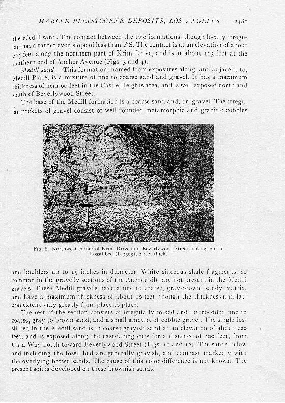
Medill sand.- This formation, named from exposures a long, and a djacen t to, \Iedill Place, is a mixture of fine to coarse sand and gravel. It has a maxim um thickness of near 6o feet in t he Castl e Heights area, and is well exposed north and
south of Beverlywood Street. The base of the ?I·I edill formation is a coa rse sand a nd, or, grave l. The irregu
l;t r pockets of gravel consist of well rounded meta morphic and granitic cobbles
F1c. S. :-..rorthwcst corner oi Krim Drive and lh·,·nh·\\·oorl S t rc<:l lonki ng north. Fossil bed ( L J39j), 2 i('c l thick.
and boulders up to rs inches in diameter. \\"h i te siliceous sha le fragment s, so rom mon in the gravelly sections of the .-\nchor silt , arc no t present in t he \l edi ll grave ls. These :\leclill gravels ha\'c a line to coa rse, gra .v-brow n , sanely matrix, and have a maximum thickness of about 10 fee t , t hough the t hickness and la teral extent vary greatly from place to place.
The rest of the section consists of irregularly mixed a nd in terbcdclcd fine to coarse, gray to brown sand, and a small amount of coblde grave l. The s ing le fossil bed in the l\ Iedill sand is in coarse gray ish sand at an elevat ion o f about 220
feet, and is exposed along the east-facing cut s for a d is tance oi soo feet, i rom
t;irla \Nay north toward Beverl ywood Street ( figs. 1 r and 1 2 ) . The sa nds be low and including the fossil bed are generally grayish, and con t rast ma rkedly 11·i th the- overly ing brown sands. The cause of this color diffe rence is not knoll"n. The present soil is de veloped on these brownish sands.