bull trout distribution, movements and habitat use in the ... day final... · bull trout...
TRANSCRIPT

Bull Trout Distribution, Movements and Habitat Use in the John Day River Basin
Final Report
Prepared by:
Paul M. Sankovich
Donald R. Anglin
Department of the Interior
U.S. Fish and Wildlife Service
Columbia River Fisheries Program Office
1211 SE Cardinal Court, Suite 100
Vancouver, WA 98683
March 21, 2014

2
Table of Contents
Table of Contents…………………………………………………………………………………. 2
List of Figures…………………………………………………………………………………….. 3
List of Tables……………………………………………………………………………………... 4
Abstract………………………………………………………………………………………….... 5
Introduction………………………………………………………………………………………..6
Methods……………………………………………………………………………………………9
Movement and Distribution………………………………………………………………….. 9
Adults……………………………………………………………………………………... 9
Subadults………………………………………………………………………………… 10
Spawning Ground Surveys…………………………………………………………………. 11
In-stream Structures………………………………………………………………………... 12
Results…………………………………………………………………………………………… 13
Movement and Distribution………………………………………………………………… 13
Adults……………………………………………………………………………………. 13
Subadults………………………………………………………………………………… 16
Spawning Ground Surveys…………………………………………………………………. 19
In-stream Structures………………………………………………………………………... 19
Discussion……………………………………………………………………………………….. 21
Acknowledgements………………………………………………………………………….…... 26
References……………………………………………………………………………………….. 27
Appendix………………………………………………………………………………………… 31

3
List of Figures
Figure 1. Map showing the location of the North Fork John Day River, weir and screw
trapping sites, and relevant tributaries and landmarks…………………………………... 10
Figure 2. Spotting in the dorsal fins of three fish (codes 145 and 125 [top left and right]
and 127 [bottom]) captured in an upstream migrant trap in the North Fork John
Day River in 2005-2006. Tri-coloration in the left ventral fin of 145 is also
evident………………………………………………………………………………….... 14
Figure 3. Tracking data for a bull trout (code 144) and an apparent brook trout x bull trout
hybrid (code 145) radio tagged on the North Fork John Day River in July 2005………. 15
Figure 4. Tracking data for bull trout (codes 128, 129, and 130) and apparent brook trout x
bull trout hybrids (codes 125 and 127) radio tagged on the North Fork John Day
River in July 2006……………………………………………………………………….. 17
Figure 5. Location of structures in the main stems of the John Day, Middle Fork John
Day, and North Fork John Day rivers in August 2012………………………………….. 22

4
List of Tables
Table 1. Date of capture, radio tag code, fork length (FL), and weight (WT) of migratory
adult bull trout and apparent brook trout x bull trout hybrids in the North Fork John
Day River in 2005 and 2006. The radio tag codes of apparent hybrids are listed
in bold…………………………………………………………………………………… 13
Table 2. Date of tagging, radio tag code, fork length, weight, and capture and release site
of bull trout captured in a screw trap in the North Fork John Day River in 2009………. 18
Table 3. Locations of radio-tagged bull trout in the North Fork John Day River at release
and during tracking events from 13 November 2009 to 23 February 2010. A dash
indicates the fish was not located on a given date. River kilometers are continuous
from the mouth of the North Fork (rkm 0) upstream to the headwaters………………… 18
Table 4. Redd counts in the North Fork John Day River (NFJD), Baldy Creek, and South
Fork Desolation Creek (SFD) in 2005-2008. Section descriptions are provided in
the Methods section……………………………………………………………………... 20
Table 5. Locations (in UTMs, WGS 84) and types of structures in the John Day and
Middle Fork John Day rivers in August 2012, and proposed year of replacement of
some of those structures. Site locations are given in Figure 5…………………………. 21

5
Abstract
In 2005-2012, the U.S. Fish and Wildlife Service conducted studies in the John Day
River (JDR) basin to provide information needed to develop recovery actions for bull trout
Salvelinus confluentus listed as threatened under the Endangered Species Act. We focused on
bull trout in the North Fork John Day River (NFJDR) sub-basin because little information was
available about them, migratory bull trout in the upper JDR sub-basin had been studied
previously, and only a few relatively small and almost exclusively resident populations of bull
trout remained in the Middle Fork John Day River (MFJDR) sub-basin. Our objectives were to
1) describe the seasonal movement and distribution of migratory subadult and adult bull trout,
and determine where thermal barriers or other factors might be restricting the movement and
distribution of those fish, 2) conduct spawning ground surveys in the NFJDR, Baldy Creek, and
South Fork Desolation Creek (primarily to obtain information on the abundance and distribution
of migratory spawners so we could determine where individuals might be captured for tagging
purposes, but also to obtain general information on bull trout abundance and distribution), and 3)
survey the main stems of the JDR, MFJDR, and NFJDR to identify the locations of push up
dams or other in-stream structures that might impede fish passage and negatively affect
connectivity between the three sub-basins. Due to an exceedingly low abundance of migratory
bull trout, our sample sizes were small, and we were unable to adequately describe the seasonal
movement and distribution of migratory bull trout. The only migratory adult-sized fish for
which we were able to document an annual pattern of movement was an apparent brook trout S.
fontinalis x bull trout hybrid. There appeared to be no impediments to its movements within the
upper 79 km of the NFJDR. Six subadult bull trout trapped, radio tagged, and released at river
kilometer 97 on the NFJDR in fall 2010 continued migrating downstream after their release but
remained within the NFJDR during the lives of their 96-day tags. A past study indicated
subadult bull trout originating in the NFJDR may overwinter in the JDR, so our findings did not
expand our existing knowledge of subadult distribution. We found no irrigation structures or
other impediments to fish passage in the NFJDR, the MFJDR and the lower 301 km of the JDR.
Thus, an inability of migratory fish to move freely throughout those areas, at least during the
colder months of the year when stream temperatures are suitable, can be ruled out as a factor
limiting migratory bull trout abundance. A more likely factor may be high stream temperatures
that restrict bull trout to cooler headwater areas during the warmer months of the year. In the
JDR, we found 24 in-stream structures (17 push-up dams and 7 lay flat stanchion dams), all
upstream from the mouth of the NFJDR. Some of those held the potential to, at least seasonally,
limit bull trout movements and connectivity.

6
Introduction
Bull trout Salvelinus confluentus were officially listed as threatened under the
Endangered Species Act (ESA) in 1999. The U.S. Fish and Wildlife Service (FWS)
subsequently issued a Draft Recovery Plan (FWS 2002), which included a chapter for the John
Day Recovery Unit (Chapter 9). That chapter was updated in 2004 (FWS 2004) and is the
current guide for recovery actions in the John Day River basin. The goal of bull trout recovery
planning by the FWS is to describe courses of action necessary for the ultimate delisting of this
species, and to ensure the long-term persistence of self-sustaining, complex interacting groups of
bull trout distributed across the species’ native range (FWS 2004).
Bull trout in the John Day River basin exhibit two different life history strategies.
Migratory adult bull trout spawn in headwater streams and juveniles rear in these streams for one
to four years before migrating downstream as subadults to larger main stem areas, and possibly
to the Columbia River, where they grow and mature, returning to the tributary stream to spawn
(Fraley and Shepard 1989). Downstream migration of subadults generally occurs during the
spring, although it can occur throughout the year (Hemmingsen et. al. 2001a, 2002). These
migratory forms occur in areas where conditions allow for movement from upper watershed
spawning streams to larger downstream waters that contain greater foraging opportunities
(Dunham and Rieman 1999). Stream-resident bull trout also occur in the basin, and they
complete their entire life cycle in the tributary streams where they spawn and rear. Resident and
migratory forms of bull trout may be found living together for portions of their life cycle, but it is
unknown if they can give rise to one another (Rieman and McIntyre 1993). Bull trout size is
variable depending on life history strategy. Resident adult bull trout tend to be smaller than
fluvial adult bull trout (Goetz 1989). Under appropriate conditions, bull trout regularly live to 10
years, and under exceptional circumstances, reach ages in excess of 20 years. They normally
reach sexual maturity in four to seven years (Fraley and Shepard 1989; McPhail and Baxter
1996).
When compared to other North American salmonids, bull trout have more specific habitat
requirements. The habitat components that shape bull trout distribution and abundance include
water temperature, cover, channel form and stability, valley form, spawning and rearing
substrates, and migratory corridors (FWS 1998). Throughout their lives, bull trout require
complex forms of cover, including large woody debris, undercut banks, boulders, and pools
(Fraley and Shepard 1989; Watson and Hillman 1997). Juveniles and adults frequently inhabit
side channels, stream margins, and pools with suitable cover (Sexauer and James 1997).
McPhail and Baxter (1996) reported that newly emerged fry are secretive and hide in gravel
along stream edges and in side channels. They also reported that juveniles are found in pools,
riffles, and runs where they maintain focal sites near the bottom, and that they are strongly
associated with in-stream cover, particularly overhead cover. Bull trout have been observed
over-wintering in deep beaver ponds or pools containing large woody debris (Jakober 1998).
Habitat degradation and fragmentation (Fraley and Shepard 1989), barriers to migration (Rieman
and McIntyre 1995), and reduced stream flows have all contributed to the decline in bull trout
populations in the Columbia River basin.

7
In summary, bull trout need adequate stream flows and temperatures and the
corresponding habitat for each of the different life history functions at specific times of the year
in order to persist. Habitat conditions must be adequate to provide spawning, rearing, and
migration opportunities, cover, forage, seasonal movement, and over-wintering refuges.
The goal of the FWS’s studies in the John Day River basin has been to develop
information and analyses to assist in assessing the relative merit of potential action strategies in
making progress towards meeting the requirements outlined in the John Day Recovery Unit
chapter of the Draft Recovery Plan (FWS 2004) for the recovery and delisting of bull trout.
Specifically, the FWS’s studies were designed to address the following recovery plan objectives:
Restore and maintain suitable habitat conditions for all bull trout life history
stages and strategies, and
Conserve genetic diversity and provide opportunity for genetic exchange.
The approach the FWS used to plan work in the John Day Basin consisted of the
following steps:
Identify information needed to assess if criteria for recovery objectives were
being achieved;
To that end, design and implement studies to describe bull trout distribution,
movement, and seasonal habitat use patterns;
Use information gained through these studies to assist in guiding actions needed
to make progress towards bull trout recovery.
Bull trout in the John Day River basin inhabit the Middle Fork John Day River, North
Fork John Day River, and upper John Day River sub-basins. For this study, we focused on bull
trout in the North Fork John Day River sub-basin. The seasonal movements and distribution of
migratory bull trout from the upper John Day River sub-basin had been described in the recent
past (Hemmingsen et al. 2001a, b, c). The Middle Fork John Day River sub-basin supports a
small number of bull trout populations at low abundance levels, with apparently few migratory
individuals remaining (FWS 2004). Thus, the prospect of describing the seasonal movements
and distribution of migratory bull trout from that sub-basin appeared poor. Information on
migratory bull trout in the North Fork John Day River sub-basin was limited, but given portions
of the upper North Fork John Day River and its tributaries lie within a wilderness area, local
biologists believed migratory bull trout might be relatively abundant, and that we could
successfully describe their seasonal movements and distribution.
The John Day River Recovery Unit Team identified six local populations of bull trout in
the North Fork John Day River sub-basin: 1) upper North Fork John Day River (Crawfish,
Baldy, Cunningham, Trail, Onion, and Crane Creeks and the North Fork John Day River
upstream from Granite Creek), 2) upper Granite Creek (Bull Run, Deep, Boundary, Boulder,
and upper Granite creeks), 3) Clear, Lightning, and Salmon creeks upstream from the Pete Mann
8
ditch, 4) Clear and Lightning creeks below the Pete Mann ditch, 5) Desolation Creek (South
Fork Desolation Creek below a barrier falls, and North Fork Desolation Creek), and 6) upper
South Fork Desolation Creek upstream from the barrier falls (FWS 2004). Leading up to our
study, there were no reliable abundance estimates for these populations. Migratory bull trout
were believed to persist only among the upper North Fork John Day, upper Granite Creek, and
Desolation Creek local populations (FWS 2004), and there was evidence indicating their
abundance in the latter two local populations was extremely low (P. Howell, U. S. Forest Service
[USFS], personal communication; P.M.S., unpublished data). Little information was available
on the migratory patterns of these bull trout. Based on observations of two radio-tagged
subadults and the incidental capture of migratory adults by steelhead Oncorhynchus mykiss
anglers, it was evident the overwintering area extended downstream into the lower North Fork
John Day and John Day rivers (Hemmingsen et al. 2001a; T. Unterwegner, Oregon Department
of Fish and Wildlife [ODFW] retired, personal communication). The telemetry data also showed
subadult migrations could be extensive, with one individual traveling at least 220 km between its
winter and summer rearing sites (Hemmingsen et al. 2001a).
There are no dams on North Fork John Day River and water withdrawals from it are
limited to the lower 24 km, where several irrigation pumps are operated. In all but extreme
drought years (e.g., 1977), the lower river has sufficient flow to provide fish passage during the
irrigation season (T. Unterwegner, ODFW retired, personal communication). The Pete Mann
Ditch is the only other significant water diversion in the sub-basin. It traverses a number of
tributaries to Clear Creek and diverts varying portions of their flow into the Powder River basin.
Because migratory bull trout are believed to no longer persist in the Clear Creek system, the Pete
Mann Ditch presumably has the potential to impact only resident bull trout and their localized
movements.
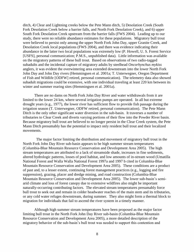
The major factor limiting the distribution and movement of migratory bull trout in the
North Fork John Day River sub-basin appears to be high summer stream temperatures
(Columbia-Blue Mountain Resource Conservation and Development Area 2005). The high
stream temperatures are attributed to a lack of streamside shade, increases in fine sediments,
altered hydrologic patterns, losses of pool habitat, and low amounts of in-stream wood (Umatilla
National Forest and Walla Walla National Forest 1997a and 1997 b cited in Columbia-Blue
Mountain Resource Conservation and Development Area 2005). These conditions are a product
of past and, to a lesser extent, continuing forest management practices (e.g., logging and fire
suppression), grazing, placer and dredge mining, and road construction (Columbia-Blue
Mountain Resource Conservation and Development Area 2005). The lower sub-basin’s semi-
arid climate and loss of forest canopy due to extensive wildfires also might be important
naturally-occurring contributing factors. The elevated stream temperatures presumably force
bull trout to seek out and remain in colder headwater reaches of the main stem and its tributaries,
or any cold water refuges downstream, during summer. They also might form a thermal block to
migration for individuals that fail to ascend the river system in a timely manner.
Although high summer stream temperatures have been proposed as the major factor
limiting bull trout in the North Fork John Day River sub-basin (Columbia-Blue Mountain
Resource Conservation and Development Area 2005), a more detailed description of the
migratory behavior of the sub-basin’s bull trout was needed to support this contention and

9
determine where thermal barriers or other factors might be restricting the movement and
distribution of those fish. Our work in the North Fork John Day sub-basin occurred between
2005 and 2012 and was aimed at meeting three objectives: 1) describe the seasonal movement
and distribution of migratory adult and subadult bull trout, 2) conduct spawning ground surveys
in the North Fork John Day River, Baldy Creek, and South Fork Desolation Creek (primarily to
obtain information on the abundance and distribution of migratory spawners so we could
determine where individuals might be captured for tagging purposes, but also to obtain general
information on bull trout abundance and distribution), and 3) survey the main stems of the John
Day, Middle Fork John Day, and North Fork John Day (downstream from the mouth of the
Middle Fork) rivers to identify the locations of push up dams or other in-stream structures that
might impede fish passage and negatively affect connectivity between the three sub-basins.
Methods
Movements and Distribution
Adults
We used radio telemetry to monitor the movements and distribution of migratory adult
bull trout (bull trout > 300 mm fork length [FL]). We also passive integrated transponder (PIT)
tagged the adults we radio tagged so they might be detected by other researchers working in the
John Day River basin, or at detection sites in the Columbia River basin. To capture adults for
tagging, we angled in the upper North Fork John Day River (upstream from river kilometer
[rkm] 160) and its tributary South Fork Desolation Creek from 2 July to 22 August 2005 and
operated a weir trap in the North Fork, just downstream from the mouth of Baldy Creek (rkm
170; Figure 1), from 10 July to 3 August 2006 and 12 June to 12 August 2007. We fished the
North Fork from its headwaters downstream to approximately 1 km downstream from the North
Fork John Day campground (Figure 1) so individuals destined for Trail, Onion, Baldy, and
Crawfish creeks might be included in the sample. In South Fork Desolation Creek, we focused
our effort on and near a pool at the base of a large falls at rkm 4. Six migratory adults were
observed by a diver in that pool, whereas few were seen scattered throughout the remainder of
the stream in August 2003 (I. Tattam, Oregon State University, personal communication).
When angling, we carried our tagging equipment in a backpack and performed surgery as
bull trout were captured. Fish caught in the weir trap and by angling were held prior to surgery
in a covered Rubbermaid tub containing aerated river water. Our surgical procedures followed
those described by Sankovich et al. (2003) and Anglin et al. (2008), except we inserted a PIT tag
into the abdomen rather than the cheek of each fish. The 23-mm PIT tags we used (versus the
12-mm tags used by Sankovich et al.) could not be accommodated in the fish’s cheek. Each
individual (including apparent brook trout x bull trout hybrids—see below) was weighed (nearest
1 g), measured (nearest 1 mm), and outfitted with a Lotek model MCFT-3FM radio tag. The
tags had a 5 s burst rate, 12 hr on and 12 hr off duty cycle, and warranty life of 755 d. They
weighed 10 g in air, and based on length/weight relationships developed for other bull trout
populations (Budy et al. 2004; P.M.S, unpublished data), we estimated they would be suitable for
bull trout approximately 330 mm FL or longer at 3% of the host’s weight. For the fish we
tagged, the tags ranged from 2.2 to 2.7% of the host’s weight.

10
Figure 1. Map showing the location of the North Fork John Day River, weir and screw trapping
sites, and relevant tributaries and landmarks.
Among the fish captured in 2005 and 2006 were three greater than 370 mm FL that
appeared to be brook trout x bull trout hybrids based on the presence of spotting throughout their
dorsal fins. We radio tagged these fish so we could later locate and recapture them to determine
if they were mature, and to monitor their movements and determine if they participated in
spawning activities.
We tracked the radio-tagged fish by vehicle, and by foot and air in areas not accessible by
road. During tracking, fish positions were recorded using a GPS unit. The coordinates were
later entered into a mapping program (MAPTECH’s Terrain Navigator) to determine the
location, in river kilometers, of each individual. Tracking occurred one to two times per month
in spring through early fall when the bull trout were actively migrating. In all years, we were
unable to track for most of the late fall and early winter due either to inclement weather or our
pilot’s airplane being inoperable.
Subadults
We also used radio telemetry to monitor the movements and distribution of subadult bull
trout (bull trout < 300 mm FL). To capture subadults for tagging, we operated a rotary screw

11
trap in the North Fork John Day River at two sites, one suitable for an eight-foot screw trap in
spring, and another suitable for a five-foot screw trap in fall. The eight-foot screw trap was
operated at rkm 104 (Figure 1) from 19 June to 7 July 2009 and 19 April to 30 June 2010. We
had intended to begin operating the trap earlier in the spring in 2009, but were not issued a
special use permit from the USFS in a timely manner. The five-foot screw trap was operated at
rkm 97 (Figure 1) from 11 November to 1 December 2009, when anchor and surface ice formed
in the river. We selected trap sites in the middle section of the North Fork, far downstream from
juvenile rearing areas, to increase the likelihood of capturing farther-migrating subadults that
might use the John Day River. The upper screw trap site was located about 7 rkm upstream from
the mouth of Desolation Creek; therefore, subadults from the Desolation Creek local population
would not have been susceptible to capture in it unless they migrated from Desolation Creek
upstream past the trap site and then returned downstream while the trap was operating.
Subadults from all of the local populations in the North Fork John Day River sub-basin would
have been susceptible to capture at the lower screw trap site because it was located just
downstream from the mouth of Desolation Creek.
The screw traps were checked daily. We measured (nearest 1 mm) all bull trout captured
and weighed (nearest 1 g) a portion of them. All other species captured were simply enumerated.
We followed the methods described in Sankovich et al. (2003) and Anglin et al. (2008) to
radio tag the subadults. We used model NTC-3-2 tags (Lotek Wireless Fish and Wildlife
Monitoring) that weighed 1.2 g in air, had a 9.5 s burst rate, and a warranty life of 96 d. Based
on length/weight relationships developed for other bull trout populations (Budy et al. 2004;
P.M.S. unpublished data), we estimated the model NTC-3-2 tags would be suitable for bull trout
as short as 164 mm FL at 3% of the host’s weight. For the fish that were tagged and weighed,
the tags actually were less than 1.2% of the host’s weight. The tagged fish were allowed to
recover from anesthesia before being released in a slow water section of river downstream from
the trap site.
We tracked the radio-tagged fish by road and by airplane in areas not accessible by road.
Fish positions were documented as outlined above for adult bull trout. The frequency of
telemetry surveys varied depending on the movement of the tagged fish and our ability to track
by air, which was affected by weather in late fall and winter.
Spawning Ground Surveys
We conducted spawning ground surveys in the upper North Fork and its tributaries Baldy
and South Fork Desolation creeks. Based on the available information, these streams appeared
most likely among those in the North Fork John Day River sub-basin to support migratory bull
trout spawners. The North Fork and Baldy Creek were surveyed in 2005-08 and South Fork
Desolation Creek was surveyed in 2006 and 2007. The surveys were conducted in September
and October, with the exception of one that occurred in early November in Baldy in 2006. In
2005, the North Fork was surveyed from the bridge at the North Fork John Day campground
(rkm 163) upstream to a 10-m long cascade in the headwaters at about rkm 178. We believe this
reach included all spawning habitat in the North Fork. Summer stream temperatures downstream
from the bridge were likely too high to support bull trout, and we observed no bull trout or other

12
fishes upstream from the cascade while radio tracking on foot. Fish should have been visible if
present upstream from the cascade because the habitat was not complex and there was little
stream flow. During the surveys in 2005, it became evident that little spawning habitat existed in
the North Fork downstream from Baldy Creek, and there were no redds found there. In
subsequent years, therefore, we surveyed only the reach upstream from Baldy Creek. We
divided this reach into two sections. Section 1 extended from Baldy Creek to the Peavy Cabin
trailhead (rkm 175), and Section 2 extended from the Peavy Cabin trailhead to the cascade in the
headwaters.
We surveyed Baldy Creek from its mouth upstream to rkm 5 each year. This reach was
split into two sections, one extending from the mouth of Baldy Creek upstream 1.2 km to the
lower boundary of a bull trout redd count index area used by ODFW (Section 1), and the index
area (Section 2). This reach did not include all of the bull trout spawning habitat.
South Fork Desolation Creek was surveyed from USFS road number 45 (1.6 km above
the mouth) upstream approximately 4 km to a falls that appeared to be a significant obstacle to
fish passage, but may not have been be totally impassable, particularly under higher flows.
When conducting the spawning ground surveys, we flagged redds with surveyor’s tape as
they were discovered and gave them a unique number that was written on the flagging along with
the date. We also recorded this information in a notebook along with the length and width of
each redd and our impression of whether the redd was made by a fluvial or resident female based
on its size and the size of the substrate. The length was measured from the upstream end of the
pit to the downstream end of the pillow, and the width, at the widest part of the pillow. In 2006,
personnel from ODFW conducted the last survey of Baldy Creek and measured only the width of
redds. We subsequently classified the five redds they measured as belonging to fluvial or
resident females if they were greater than or less than or equal to 50 cm wide, respectively. We
based this criterion on data collected in the Little Minam River, which supports only resident bull
trout (ODFW, unpublished data).
In-stream Structures
We flew a fixed-winged aircraft (Cessna 182J) to survey the main stems of the John Day,
North Fork John Day, and Middle Fork John Day rivers and document the locations of in-stream
structures that might impede fish passage. We conducted the survey late in the irrigation season
on 28-29 August 2012 to allow time for structures like push up dams to be constructed. The
John Day River was surveyed from the Malhuer National Forest boundary in its headwaters to its
mouth. The North Fork John Day River was surveyed from its confluence with the Middle Fork
John Day River to its mouth. No agriculture occurs along the North Fork John Day River
upstream from the mouth of the Middle Fork. The Middle Fork John Day River was surveyed
from its headwaters to its mouth. When we located a structure in the stream, we circled the
aircraft and took photos of the structure. We then recorded the coordinates, type of structure,
extent to which it spanned the stream, whether it was associated with an irrigation ditch or pump,
and if it was associated with a ditch, whether the ditch was screened. This information, along
with the photos and a map showing the location of all the structures, was shared with personnel
from ODFW’s District Office in John Day and Grant County Soil and Water District so that in

13
consultation with them we could determine which structures were designed to provide fish
passage, and which were not and might be forming a blockage.
Results
Movements and Distribution
Adults
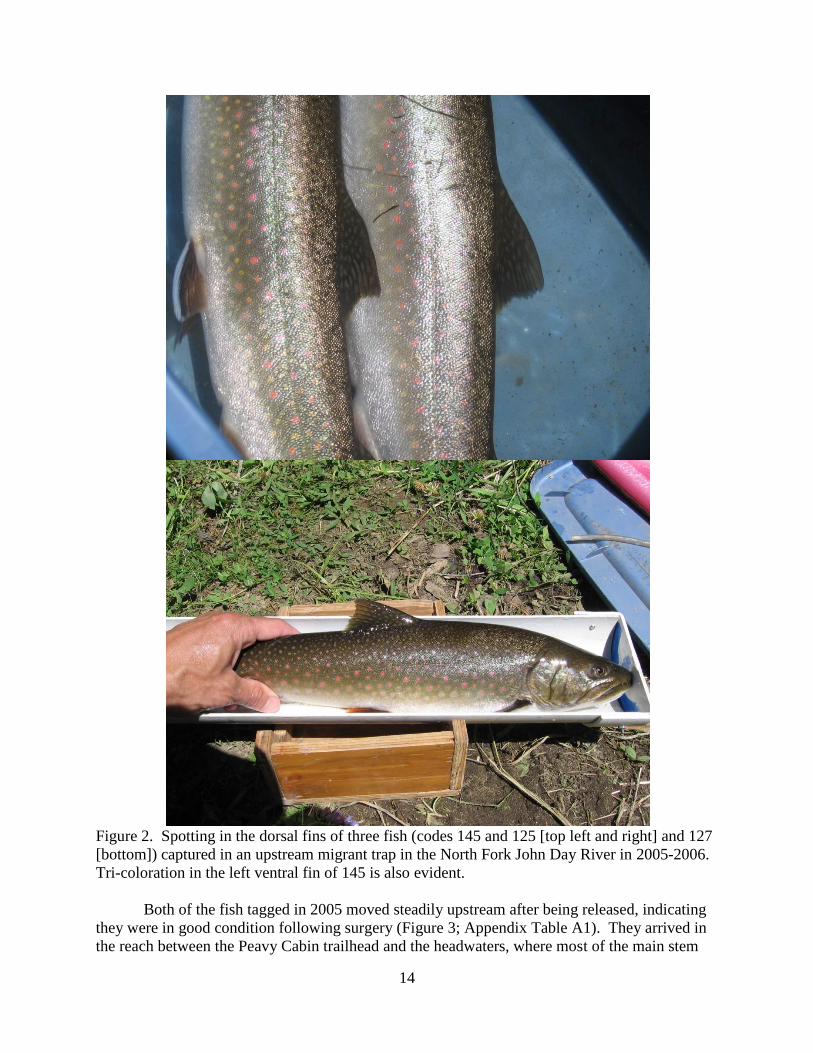
While angling in 2005, we captured only three migratory adult-sized char. Two were bull
trout and one was an apparent brook trout x bull trout hybrid (Table 1; Figure 2). We also
incidentally captured approximately 40 fish <300 mm FL, most of which appeared to be brook
trout x bull trout hybrids. Three of these apparent hybrids were caught just downstream from the
North Fork John Day campground (i.e., downstream from the spawning grounds in the North
Fork and Trail and Baldy creeks) and presumably were migratory subadults. All of the
migratory adult-sized char were caught in the North Fork John Day River between the North
Fork John Day campground and a point about 200 m upstream from the mouth of Baldy Creek.
We radio tagged one of the bull trout and the apparent hybrid (Table 1). The other bull trout was
released without being tagged because it was bleeding from the hook wound. In 2006, while
operating the weir trap in the North Fork John Day River, we captured six migratory adult-sized
char (Table 1). Three were bull trout and three were apparent brook trout x bull trout hybrids
(Table 1; Figure 2). One of the apparent hybrids (code 145) was a recapture, having been
captured and tagged in 2005. We radio tagged the three bull trout and two apparent hybrids that
had not been tagged previously. In 2007, we caught no bull trout or apparent hybrids in the weir
trap. Thus, over the three years only four bull trout and three apparent hybrids were captured
and tagged. These individuals were relatively uniform in size, ranging from 370 to 455 mm FL
(Table 1).
Table 1. Date of capture, radio tag code, fork length (FL), and weight (WT) of migratory adult
bull trout and apparent brook trout x bull trout hybrids in the North Fork John Day River in 2005
and 2006. The radio tag codes of apparent hybrids are listed in bold.
Date
Radio
FL (mm) WT (g)
tag
Year code
2005 7/2 145 370
7/6 144 445
2006 7/11 129 424 806
7/12 130 420 775
7/12 128 420 837
7/16 127 442 902
7/16 145 403 716
7/16 125 455 944
14
Figure 2. Spotting in the dorsal fins of three fish (codes 145 and 125 [top left and right] and 127
[bottom]) captured in an upstream migrant trap in the North Fork John Day River in 2005-2006.
Tri-coloration in the left ventral fin of 145 is also evident.
Both of the fish tagged in 2005 moved steadily upstream after being released, indicating
they were in good condition following surgery (Figure 3; Appendix Table A1). They arrived in
the reach between the Peavy Cabin trailhead and the headwaters, where most of the main stem

15
spawning occurred, on or before 4 September. On 29 September, we observed one of the fish
(code 144) exhibiting male behavior while paired with a female that was actively constructing a
redd. This fish had migrated downstream off the spawning grounds by mid-October and was
near the North Fork John Day campground in early November. It eventually either died or shed
its tag at that location, where on 11 July 2006 we determined its tag was buried in the streambed.
The other fish (code 145), an apparent hybrid, migrated downstream off the spawning
grounds between tracking events on 4 and 29 September (Figure 3; Appendix Table A1). During
the remainder of the spawning period, we did not locate this fish between the headwaters and
North Fork John Day campground (where we restricted our tracking during the spawning
season), so it presumably had migrated downstream into the North Fork John Day Wilderness.
In February 2006, it was located at rkm 105, 71 rkm downstream from its uppermost location in
the North Fork. It began moving upstream between tracking events on 30 March and 30 May,
was just downstream from the weir trap site (rkm 170) on 11 July, and was trapped on 16 July
(Figure 3; Appendix Table A1). As in 2005, it continued upstream to the spawning grounds and
left them in the early half of the spawning season, sometime between tracking events on 21
August and 22 September. We were not able to conduct a winter telemetry flight until 19 March
2007. On that date, the apparent hybrid was located at rkm 103, within 2 km of its wintering site
the previous year. It remained there until at least 20 April, when its tag’s signal was last
detected. It presumably did not return to the spawning grounds in 2007 because it was not
captured in our weir trap. Based on our observations of this fish (Figure 3; Appendix Table A1),
there appeared to be no impediments to its movement between wintering sites and the spawning
grounds.
Figure 3. Tracking data for a bull trout (code 144) and an apparent brook trout x bull trout
hybrid (code 145) radio tagged on the North Fork John Day River in July 2005.
Code 144
100 110 120 130 140 150 160 170 180
Jul
Code 145
100 110 120 130 140 150 160 170 180
Date
Riv
er k
ilo
mete
r
Aug Sep Oct Nov Dec Apr Jan Feb Mar May Jun Jul Aug Oct Dec Feb Mar May Sep Nov
2005 2006 2007
Jan Apr Jun

16
Of the remaining five fish captured in the weir trap in 2006, four (two bull trout and two
apparent hybrids) migrated upstream onto the spawning grounds in the North Fork John Day
River and one (a bull trout) migrated onto the spawning grounds in Baldy Creek (Figure 4;
Appendix Table A1). We recaptured the two hybrids (codes 125 and 127) from the same pool
using a dipnet on 22 September. They had developed no secondary sexual characteristics, and
no milt or eggs could be stripped from them. We never observed them or 145 (which we were
unable to recapture) displaying spawning behavior during tracking events. Instead, these fish
were always found in habitat typically used by staging individuals (e.g., log jams and undercut
banks).
The two apparent hybrids and one bull trout (code 130) tagged in 2006 either died or shed
their tags prior to winter 2006-07. The apparent hybrids had begun to move downstream in
October. We continued to find them at their October locations through spring and eventually
determined their tags were buried in the streambed. There was a large gap in the tracking data
for the bull trout in Baldy Creek because we did not track there between August 2006 and
September 2007. We were tracking the North Fork during that time, and because we were not
locating 130 there, assumed it was still in Baldy Creek, where it was last located in August 2006.
In September 2007, we hiked into Baldy Creek to confirm that 130 was dead or had lost its tag
and found its tag in log jam out of the water.
The two remaining bull trout tagged in 2006 (codes 128 and 129) were never found after
being located in the headwaters in late August 2006. We conducted telemetry surveys along the
entire North Fork, the John Day River from its mouth to a point about 16 upstream from its
confluence with the North Fork, and the Columbia River near the mouth of the John Day River
to try to locate these fish. They were not detected by other researchers working in the John Day
River basin or at PIT tag detection sites in the Columbia River basin (nor were any of the other
bull trout or apparent brook trout x bull trout we PIT tagged).
Overall, we were able to document the pattern of annual migration of only one of the
seven fish we tagged (the apparent hybrid with tag code 145). We determined all of the bull
trout and hybrids migrated onto spawning grounds, and one bull trout (code 144) and the three
apparent hybrids began to return downstream from the spawning grounds in September and
October.
Subadults
In spring and early summer 2009 and 2010, no bull trout were captured in the screw trap
at rkm 104. Among the fish captured incidentally were 385 Chinook salmon (Oncorhynchus
tshawytscha) fry, 227 Chinook salmon smolts, 120 steelhead (O. mykiss) smolts, 99 suckers
(Catastomus spp.), 83 larval lamprey (Entosphenus tridentatus or Lampetra richardsoni), 81
speckled dace (Rhinichthys osculus), 10 redside shiners (Richardsonius balteatus), 6 steelhead or
rainbow trout (O. mykiss) fry, 4 sculpin (Cottus spp.), and 1 steelhead kelt.
In fall 2009, we caught four bull trout in the screw trap at rkm 97 ranging in size from
203 to 300 mm fork length (Table 2). We radio tagged all of those fish, which were presumably
subadults based on their size (the 300-mm individual being a possible exception). Among the

17
Figure 4. Tracking data for bull trout (codes 128, 129, and 130) and apparent brook trout x bull
trout hybrids (codes 125 and 127) radio tagged on the North Fork John Day River in July 2006.
fish incidentally captured in the screw trap were 2,186 Chinook salmon pre-smolts, 9
juvenile and 7 adult mountain whitefish (Prosopium williamsoni), 9 suckers, 7 larval lamprey, 4

18
Table 2. Date of tagging, radio tag code, fork length, weight, and capture and release site of bull
trout captured in a screw trap in the North Fork John Day River in 2009.
Radio
tag
Date code FL (mm) WT (g) Capture/release site (rkm)
11/11/09 16 225 112.3 97
11/11/09 17 250
97
11/11/09 18 300
97
11/20/09 19 203 84.3 97
dace, 2 juvenile steelhead or rainbow trout, 2 adult rainbow trout, and 1 adult smallmouth bass
(Micropterus dolomieu).
During the initial telemetry survey along the North Fork John Day River road on 13
November 2009, we located two of the three tagged subadults at large on that date (codes 17 and
18). They had moved approximately 6 and 18 km downstream from the trap site (rkm 97; Table
3). The other subadult (16) presumably had moved downstream of Potamus Creek (rkm 63),
which was the farthest downstream we could track by road on the 72 km section of river between
the trap site and the town of Monument. During the following survey along the same road on 20
November, one of the previously located subadults (18) had moved downstream another 16 km,
while the other (17) remained at its previous location. We again failed to locate the subadult
with tag code 16. On 8 December, after a week of sub-freezing weather that lead to the
formation of substantial amounts of surface and anchor ice on and in the North Fork, we found
none of the radio-tagged fish (including an additional one that had been released on the day of
the previous survey) between the trap site and Potamus Creek. On 21 December, we tracked the
North Fork from its mouth upstream to Monument, and the John Day River from Service Creek
(rkm 251) to a point 16 km upstream from the mouth of the North Fork (rkm 312). Since none
of the radio-tagged bull trout were found, they presumably were in the North Fork between
Monument and Potamus Creek. We were unable to confirm this because all of our scheduled
telemetry flights through 22 February 2010 were cancelled due to inclement weather.
Table 3. Locations of radio-tagged bull trout in the North Fork John Day River at release and
during tracking events from 13 November 2009 to 23 February 2010. A dash indicates the fish
was not located on a given date. River kilometers are continuous from the mouth of the North
Fork (rkm 0) upstream to the headwaters.
Radio tag code
Date 16 17 18 19
11/11/09 97.0 97.0 97.0
11/13/09 - 77.5 91.5
11/20/09 - 77.5 75.0 97.0
12/8/09 - - - -
12/21/09 - - - -
2/23/10 - - - -

19
On 23 February 2010, we flew from the screw trap site to the mouth of the North Fork
and downstream in the John Day River to the town of Spray (rkm 274). None of the radio-tagged
fish were found; however, their radio tags were 10 or more days past their calculated lives and
may have been dead.
Spawning Ground Surveys
In 2005, we counted 17 redds in the North Fork John Day River and 10 redds in Baldy
Creek (Table 4). Most of the redds in the North Fork were located upstream from the trailhead
at Peavy Cabin. None were downstream from the mouth of Baldy Creek. Based on redd and
substrate sizes, we estimated nine redds in the North Fork and eight in Baldy Creek were made
by migratory females.
In 2006, we counted three redds each in the North Fork John Day River and Baldy Creek
(Table 4). All the redds in the North Fork were upstream from the trailhead at Peavy Cabin and
appeared to have been made by migratory females. One of the redds in Baldy Creek might have
been made by a resident female based on its size (about 46 cm in width); the two others were
greater than 76 cm in width and were likely made by migratory females. No redds were found in
South Fork Desolation Creek.
In 2007, we counted three redds in the North Fork John Day River (Table 4). All were
upstream from Peavy Cabin. Based on their size and the size of the substrate, we estimated two
were made by resident females and one was made by a migratory female. The latter redd was
observed by Chinook salmon spawning ground surveyors on 11 September (T. Schultz, ODFW,
personal communication) prior to our discovering it on 25 September. A large, migratory female
bull trout was present at the redd on 11 September. We observed two other bull trout during the
surveys in the North Fork that may have been migratory adults. They were about 350 mm FL
and were together, but were not involved in spawning and were not near a redd at the time. In
Baldy Creek and South Fork Desolation Creek, we found no redds (Table 4).
In 2008, we counted six redds in the North Fork John Day River and two redds in Baldy
Creek (Table 4). Based on their size and the size of the substrate, it appeared only one redd, in
Baldy Creek, was made by a migratory female.
In-stream Structures
We found 25 structures in the main stems of the John Day, North Fork John Day, and
Middle Fork John Day rivers (Table 5; Figure 5). Twenty-four were in the main stem John
DayRiver, all upstream from the mouth of the North Fork John Day River, and one was in the
Middle Fork John Day River near rkm 72. No structures were observed in the North Fork John
Day River. Seventeen of the structures in the John Day River were identified as push up dams,
and seven were identified as lay flat stanchion dams, which are designed to provide fish passage
(Table 5). Two of the push up dams (sites 15 and 21) were obviously impassable, while another
four (sites 9, 17, 18, and 19) might have been, but it was not possible to determine unequivocally
from the air if they were. Eight of the push up dams (sites 1, 2, 3, 4, 13, 17, 19, and 22; Table 5)

20
Table 4. Redd counts in the North Fork John Day River (NFJD), Baldy Creek, and South Fork
Desolation Creek (SFD) in 2005-2008. Section descriptions are provided in the Methods
section.
New Redds
Year Stream Date Section 1 Section 2 Total redds
2005 NFJD 26-Sep 1 5 6
17-Oct 4 7 11
28-Oct
0 0
17
Baldy Cr 27-Sep 1 4 5
27-Oct 3 2 5
10
2006 NFJD 26-Sep 0 2 2
30-Oct 0 1 1
3
Baldy Cr 4-Oct 0 3 3
7-Nov 0 0 0
3
SFD 28-Oct 0 0 0
2007 NFJD 25-Sep 0 3 3
16-Oct
0 0
28-Oct
0 0
3
Baldy Cr. 27-Sep 0 0 0
18-Oct
0 0
0
SFD 2-Oct 0
0
2008 NFJD 23-Sep
3 3
7-Oct
3 3
28-Oct
0 0
6
Baldy Cr. 19-Sep 1 1 2
9-Oct
0 0
26-Oct
0 0
2
are proposed to be replaced with lay flat station dams between 2013 and 2019. The design of the
sole structure in the Middle Fork John Day River could not be identified initially (Sankovich and
Anglin 2013). The structure was subsequently visited on the ground and determined to be the
remains of three log weirs associated with dredge tailings (J. Neil, ODFW, personal

21
communication). The weirs had been breached at their bases and the remains hovered over the
stream surface and did not impede fish passage.
Table 5. Locations (in UTMs, WGS 84) and types of structures in the John Day and Middle
Fork John Day rivers in August 2012, and proposed year of replacement of some of those
structures. Site locations are given in Figure 5.
Type of Location (UTM) Proposed year
Site diversion Easting Northing of replacement
1 push-up dam 371606 4919997 2015
2 push-up dam 360154 4922560 2015
3 push-up dam 347030 4920015 2019
4 push-up dam 340889 4921081 2018
5 lay flat dam 339547 4920815
6 push-up dam 335988 4920222
7 lay flat dam 335580 4920079
8 lay flat dam 330681 4919639
9 push-up dam 328493 4920537
10 push-up dam 324507 4920619
11 lay flat dam 321467 4921070
12 lay flat dam 319180 4921700
13 push-up dam 317604 4922919
14 lay flat dam 315756 4922905
15 push-up dam 312932 4923250 2013
16 lay flat dam 307062 4925163
17 push-up dam 303505 4926247 2016
18 push-up dam 300746 4926728
19 push-up dam 299955 4925572 2014
20 push-up dam 296770 4929103
21 push-up dam 296595 4929138
22 push-up dam 294927 4929788 2016
23 push-up dam 293169 4931229
24 push-up dam 290316 4955430
25 log weirs 355681 4953135
Discussion
Based on our results from angling in 2005, trapping in 2006 and 2007, and the spawning
ground surveys in 2005-08, it is evident the abundance of migratory adult bull trout in the North
Fork John Day River and Baldy Creek was extremely low. There also appeared to be an
extremely low abundance, if not absence, of migratory adults in South Fork Desolation Creek

22
Figure 5. Location of structures in the main stems of the John Day, Middle Fork John Day, and
North Fork John Day rivers in August 2012.
based on our results from angling in 2005 and the spawning ground surveys in 2005-2007. Our
findings are consistent with those of other researchers. In 2005, personnel from Utah State
University (USU) captured only three migratory adult bull trout (which they defined as being
>370 mm FL) while electrofishing a 12-km study area in the North Fork John Day River
between the North Fork John Day Campground and Cunningham Creek (R. Al-Chokhachy,
USU, personal communication), which enters the main stem about 8 km downstream from its
headwaters. The estimated abundance of migratory adult bull trout based on re-sighting of
marked fish while snorkeling was nine (R. Al-Chokhachy, USU, personal communication). This
estimate was imprecise and did not account for any migratory adults that might have been
upstream from the study area. Nevertheless, it is consistent with the number of redds we
attributed to migratory females (9) that year. In August 2003, personnel from ODFW counted
only three migratory adult-sized bull trout during a census snorkel survey of South Fork
Desolation Creek from its mouth upstream to a the suspected barrier falls that was the upper
boundary of our spawning ground survey reach (I. Tattam, ODFW, personal communication).

23
Given the low abundance of migratory adult bull trout, we were able to capture and tag
only a small number of them (although perhaps a large portion of those in the system). Because
of this, and because all of the tagged bull trout either died or shed their tag before completing an
annual pattern of migration, we were unable to adequately describe the seasonal distribution and
movement of migratory adult bull trout and determine whether there were any impediments to
their movement. The single individual for which we were able to describe an annual pattern of
migration was an apparent brook trout x bull trout hybrid. Its annual pattern of migration was
typical of those of migratory adult bull trout in relatively undisturbed stream systems (e.g.,
Starcevich et al. 2010, 2012), with no apparent impediments to its seasonal movements within
the 72 km of river between its lower- and upper-most locations.
We also were unable to adequately describe the seasonal movement and distribution of
subadult bull trout. Use of the main stem John Day River by subadult bull trout that presumably
originated in the North Fork John Day River sub-basin has been demonstrated previously
(Hemmingsen et al. 2001a). None of the bull trout we tagged in the North Fork were located in
the main stem John Day River. Thus, we were unable to increase our understanding of the
distribution and movements of subadults in the main stem. That we captured few subadults
probably was due to a combination of the location of the screw trap (relatively far downstream in
the system), low subadult abundance, and low trap efficiency, particularly in spring. Although
we caught only four subadults, they provided evidence that at least some level of subadult
production was occurring. Given the location of the trap, there presumably were more subadults
rearing upstream from the trap site, although perhaps not a large number given the small size of
the migratory adult population in the sub-basin. As noted above for migratory adults, subadults
should at least seasonally have access to a large stream area free of impediments to their
movement.
Through our angling, trapping, and telemetry efforts, we identified apparent brook trout x
bull trout hybrids in the North Fork John Day River and found they were undertaking extensive
migrations, residing on the spawning grounds during the bull trout spawning period, and
attaining sizes comparable to those of migratory adult bull trout. The larger migratory hybrids
were also relatively abundant compared to migratory adult bull trout based on their
representation in the weir trap catch. Other researchers have documented the existence of
migratory brook trout x bull trout hybrids (Chandler and Richter 2000; Kanda et al. 2002). The
presence of such fish in the North Fork could add to the threat brook trout pose to bull trout in
that system. Larger hybrids, at the least, might compete with migratory adult bull trout for
resources. If fertile, they might also increase the potential for brook trout genes to become
incorporated in the bull trout gene pool, and for bull trout reproductive effort to be wasted,
because they would not be restricted through size assortive mating from pairing with larger bull
trout on the spawning grounds, unlike brook trout and smaller resident hybrids. We found no
evidence the apparent hybrids in the North Fork were mature and involved in spawning;
however, other researchers have shown brook trout x bull trout hybrids can be fertile (Kanda et
al. 2002), so there is still cause for concern.
We conducted spawning ground surveys primarily to determine where migratory adult-
sized individuals might be captured for tagging purposes, but also to obtain general information
on bull trout abundance and distribution. We believe our counts of redds made by migratory

24
adult females were reasonably accurate, since they were consistent with the findings of other
researchers, as noted above. Although we provided information on resident redd numbers, we
urge caution in interpreting those results. Drawing inferences from the count of resident redds is
complicated by the presence of brook trout spawners in the streams we surveyed, and by the
potential for the counts to have been negatively biased, as is often the case when counting
resident redds (Hemmingsen et al. 2001b; Starcevich et al. 2005). The presence of brook trout
spawners is a less relevant issue given we counted a small number of resident redds each year.
Whether brook trout made all or none of them, the number belonging to bull trout would have
been exceedingly small. Surveyor bias, on the other hand, could have been a significant
problem. Hemmingsen et al. (2001b) counted only 21 redds in a stream supporting an estimated
885 mature resident bull trout. Starcevich et al. (2005) found surveyor bias to be less substantial
in another stream, but it was still high, with 45% of the redds made by resident bull trout going
undetected. Although the magnitude of any bias in our counts is unknown, it is worth noting the
North Fork and Baldy and South Fork Desolation creeks and the stream in Hemmingsen et al.’s
study contain large amounts of fine granitic substrate, unlike the stream in Starcevich et al.’s
study (P.M.S., personal observation). Small redds built in fine granitic substrate are difficult to
detect. Therefore, any bias in our counts might be more in line with that evident in Hemmingsen
et al.’s study. Abundance estimates for bull trout >120 mm FL in the North Fork John Day
River and Baldy Creek in 2005 and 2006 (Budy et al. 2006, 2007) were far greater than our
counts of resident redds in those streams in those years, providing further evidence that our
counts might have been negatively biased. Bull trout in the >120 mm FL size class could have
been immature or mature resident adults, or resident or migratory juveniles, so it is not possible
to make a direct comparison between the abundance estimates and resident redd counts in 2005
and 2006.
We found no push up dams or other potential impediments to fish passage in the main
stem of the North Fork John Day River or in the John Day River downstream from the North
Fork. In systems where no physical barriers to movement exist (other than seasonally high
stream temperatures) and human land and water use is low, bull trout migrations can be
extensive (Starcevich et al. 2010, 2012). Thus, we might expect the same to be true of the
migrations of bull trout from the North Fork John Day River sub-basin, unless migration distance
decreases with decreasing abundance (due, for example, to decreased competition for space or
prey at reduced density), which has not been demonstrated. Whatever the case, in terms at least
of passage conditions and available space in the migratory corridor and wintering area, the
potential should exist for migratory bull trout from the North Fork John Day River sub-basin to
express a broad, although perhaps not complete, array of migration patterns. Considering only
the North Fork John Day River and John Day River downstream from the North Fork, there are
476 km of river available during most of the year when stream temperatures are suitable for bull
trout. Bull trout are likely limited to cooler headwater areas in the North Fork John Day River
sub-basin during the warmer months of the year (U.S. Fish and Wildlife Service 2002), and this
restriction to their movement and distribution could be limiting the abundance of migratory
individuals.
Based on results from a radio telemetry study (Hemmingsen et al. 2001b) and on the
incidental capture of bull trout in a screw trap at rkm 326 in the John Day River (e.g., Wilson et
al. 2007), it is evident some bull trout from local populations in the upper John Day River use the

25
stream section containing all but one (the lower-most) of the irrigation structures we documented
in the John Day River. It is also evident bull trout may pass through that river section
successfully under certain conditions, presumably after impassable structures have been naturally
removed by high stream flow, or stream flow has increased sufficiently to allow fish to pass over
those structures. Prior to becoming passable, those structures could delay the downstream
migration of subadult and adult bull trout in fall and winter. Migratory bull trout do not tend to
move extensively after reaching their wintering area (Starcevich et al. 2012), but impassable
structures could also interfere with the localized movements of individuals wintering near them.
Impacts later in the year to the upstream movement of adults during their spawning run are
probably of less concern since those movements should occur when the previously impassable
structures have been made passable. The same could be true of any potential impacts to the
upstream movements of subadults and adults seeking to avoid increasing stream temperatures in
the section of stream containing the irrigation structures.
Migratory bull trout do not appear to be prevalent among the local populations in the
Middle Fork John River (FWS 2002), but they have been captured occasionally in a screw trap at
rkm 24 on the Middle Fork in recent years (Wilson et al. 2007). To promote an increase in
abundance of migratory bull trout, it will be important to maintain the conditions we observed
(no passage impediments) in the main stem Middle Fork John Day River in the future. The
current low abundance of migratory bull trout in the Middle Fork is likely largely a result of the
past existence of fish passage impediments, and of other forms of habitat degradation, some of
which are currently being addressed.

26
Acknowledgements
Tim Unterwegner, Jeff Neal, and Mike Flesher of the Oregon Department of Fish and
Wildlife, John Kinney of the U.S. Fish and Wildlife Service, and Paul Shorb and Cale Flesher
(volunteers) helped angle for bull trout. Ryan Seeger of the Confederated Tribes of the Umatilla
Indian Reservation provided the weir trap used to capture bull trout and assisted with its
installation and removal each year. Marshall Barrows, Darren Gallion, Ryan Koch, Courtney
Newlon, and Joe Skalicky of the U.S. Fish and Wildlife Service helped install and remove the
screw trap. Randy Tweten of the National Marine Fisheries Service and numerous individuals
from the Oregon Department of Fish and Wildlife’s Northeast-Central Oregon Research and
Monitoring Program provided assistance whenever extra hands were needed to meet the
challenges of maintaining and operating the screw trap. Steve Reid of Sky Runners Corporation
piloted the aircraft used for the telemetry and in-stream structure surveys. Jason Kehrberg and
Kyle Sullivan of the Grant County Soil and Water Conservation District and Jeff Neal helped
identify the types of in-stream structures. Tim Unterwegner and Jeff Neal provided valuable
input and support for our work in their district. David Hines of the U.S. Fish and Wildlife
Service produced some of the figures in this document. Funding for this study was provided by
the U.S. Fish and Wildlife Service.

27
References
Anglin, D. R., D. G. Gallion, M. Barrows, C. Newlon, P. Sankovich, T. J. Kisaka, and H.
Schaller. 2008. Bull trout distribution, movements, and habitat use in the Walla Walla and
Umatilla River basins. 2004 Annual Report. Department of Interior, U.S. Fish and Wildlife
Service, Vancouver, Washington.
Budy, P., R. Al-Chokhachy, and G. P. Thiede. 2004. Bull trout population assessment and life-
history characteristics in association with habitat quality and land use: a template for
recovery planning. Annual Progress Report for 2003. USGS Utah Cooperative Fish and
Wildlife Research Unit, Utah State University, Logan, Utah.
Budy, P., R. Al-Chokhachy, K. Homel, and G. P. Thiede. 2006. Bull trout population
assessment in northeastern Oregon: a template for recovery planning. Annual Progress
Report for 2005. USGS Utah Cooperative Fish and Wildlife Research Unit, Utah State
University, Logan, Utah.
Budy, P., R. Al-Chokhachy, and G. P. Thiede. 2007. Bull trout population assessment in
northeastern Oregon: a template for recovery planning. Annual Progress Report for 2006.
USGS Utah Cooperative Fish and Wildlife Research Unit, Utah State University, Logan,
Utah.
Chandler, J. A., and T. J. Richter. 2000. Downstream fall migrations of native salmonids from
major tributaries associated with the Hells Canyon complex-Snake River. Technical bulletin
2001-4. Challenge Cost Share Prepared for the Lower Snake River District Office, Bureau of
Land Management, Boise, Idaho.
Columbia-Blue Mountain Resource Conservation and Development Area. 2005. John Day
Subbasin Revised Draft Plan. Northwest Power and Conservation Council, Portland, Oregon.
Dunham, J. B., and B. E. Rieman. 1999. Metapopulation structure of bull trout: Influences of
physical, biotic, and geometrical landscape characteristics. Ecological Applications. 9: 642-
655.
Fraley, J. J., and B. B. Shepard. 1989. Life history, ecology and population status of migratory
bull trout (Salvelinus confluentus) in the Flathead Lake and River system, Montana.
Northwest Science 63:133-143.
Goetz, F. 1989. Biology of the bull trout. United States Department of Agriculture, Forest
Service, Willamette National Forest, literature review, Eugene, Oregon.
Hemmingsen, A. R., S. L. Gunckel, P. M. Sankovich, and P. J. Howell. 2001a. Bull trout life
history, genetics, habitat needs, and limiting factors in central and northeast Oregon, 2000
Annual Report. Bonneville Power Administration, Portland, Oregon.

28
Hemmingsen, A. R., B. L. Bellerud, S. L. Gunckel, and P. J. Howell. 2001b. Bull trout life
history, genetics, habitat needs, and limiting factors in central and northeast Oregon, 1998
Annual Report. Bonneville Power Administration, Portland, Oregon.
Hemmingsen, A. R., S. L. Gunckel, and P. J. Howell. 2001c. Bull trout life history, genetics,
habitat needs, and limiting factors in central and northeast Oregon, 1999 Annual Report.
Bonneville Power Administration, Portland, Oregon.
Hemmingsen, A. R., S. L. Gunckel, P. M. Sankovich, and P. J. Howell. 2002. Bull trout life
history, genetics, habitat needs, and limiting factors in central and northeast Oregon, 2001
Annual Report. Bonneville Power Administration, Portland, Oregon.
Kanda, N., R. F. Leary, and F. W. Allendorf. 2002. Evidence of introgressive hybridization
between bull trout and brook trout. Transactions of the American Fisheries Society 131:772-
782.
McPhail, J. D., and J. Baxter. 1996. A Review of bull trout (Salvelinus confluentus) life-history
and habitat use in relation to compensation and improvement opportunities. Fisheries
Management Report No. 104. Department of Zoology, U.B.C., Vancouver, B.C.
Muhlfeld, C. C., and B. Marotz. 2005. Seasonal movement and habitat use by subadult bull
trout in the upper Flathead River system, Montana. North American Journal of Fisheries
Management 25:797-810.
Rieman, B. E., and J. D. McIntyre. 1993. Demographic and habitat requirements for
conservation of bull trout. United States Department of Agriculture, Forest Service,
Intermountain Research Station, General Technical Report INT-302, Ogden, Utah.
Rieman, B. E., and J. D. McIntyre. 1995. Occurrence of bull trout in naturally fragmented
habitat patches of varied size. Transactions of the American Fisheries Society. 124:285-296.
Sankovich, P. M., S. L. Gunckel, A. R. Hemmingsen, I. A. Tattam, and P. J. Howell. 2003.
Migratory patterns, structure, abundance, and status of bull trout populations from subbasins
in the Columbia Plateau, 2002 Annual Report. Bonneville Power Administration, Portland,
Oregon.
Sankovich, P. M., and D. R. Anglin. 2006. Bull trout movement, distribution, and habitat use in
the Umatilla and John Day River Basins, 2005 annual report. U. S. Fish and Wildlife Service,
Columbia River Fisheries Program Office, Vancouver, Washington.
Sankovich, P. M., and D. R. Anglin. 2007. Bull trout movement, distribution, and habitat use in
the Umatilla and John Day River Basins, 2006 annual report. U. S. Fish and Wildlife Service,
Columbia River Fisheries Program Office, Vancouver, Washington.

29
Sankovich, P. M., and D. R. Anglin. 2008. Bull trout movement, distribution, and habitat use in
the Umatilla and John Day River Basins, 2007 annual report. U. S. Fish and Wildlife Service,
Columbia River Fisheries Program Office, Vancouver, Washington.
Sankovich, P. M., and D. R. Anglin. 2009. Bull trout movement, distribution, and habitat use in
the Umatilla and John Day River Basins, 2008 annual report. U. S. Fish and Wildlife Service,
Columbia River Fisheries Program Office, Vancouver, Washington.
Sankovich, P. M., and D. R. Anglin. 2010. Bull trout movement, distribution, and habitat use in
the Umatilla and John Day River Basins, 2009 annual report. U. S. Fish and Wildlife Service,
Columbia River Fisheries Program Office, Vancouver, Washington.
Sankovich, P. M., and D. R. Anglin. 2011. Bull trout movement, distribution, and habitat use in
the Umatilla and John Day River Basins, 2010 annual report. U. S. Fish and Wildlife Service,
Columbia River Fisheries Program Office, Vancouver, Washington.
Sexauer, H. M., and P. W. James. 1997. Microhabitat use by juvenile bull trout in four streams
located in the eastern Cascades, Washington. Pp. 361-370 in Friends of the Bull Trout
Conference Proceedings (Mackay, W.C., M.K. Brewin, and M. Monita, eds.). Bull Trout
Task Force (Alberta), c/o Trout Unlimited Canada, Calgary, AB.
Starcevich, S. J., S. Jacobs, and P. J. Howell. 2005. Migratory patterns, structure, abundance,
and status of bull trout populations from subbasins in the Columbia Plateau and Blue
Mountain Provinces, 2004 Annual Report. Bonneville Power Administration, Portland,
Oregon.
Starcevich, S. J., P. J. Howell, S. E. Jacobs, P. M. Sankovich. 2010. Migratory distribution of
fluvial adult bull trout in relation to land use and water use in watersheds within the Mid-
Columbia and Snake River Basins. Pages 258-266 in R.F. Carline and C. LoSapio, editors.
Conserving wild trout. Porceeding of the Wild Trout X symposium, Bozeman, MT. 370
pages. (Copy available at www.wildtroutsymposium.com)
Starcevich, S. J., P. J. Howell, S. E. Jacobs, P. M. Sankovich. 2012. Seasonal distribution of
fluvial adult bull trout in selected watersheds of the mid-Columbia and Snake River Basins.
PLoS ONE 7(5): e37257. doi: 10.1371/journal.pone.0037257
Stevens, D. L. and A. R. Olsen. 2004. Spatially balanced sampling of natural resources. Journal
of the American Statistical Association 99: 262-278.
U. S. Fish and Wildlife Service. 1998. Klamath River and Columbia River bull trout population
segments: status summary. Prepared by the Service's bull trout listing team.
U. S. Fish and Wildlife Service. 2002. Bull Trout (Salvelinus confluentus) Draft Recovery Plan,
Portland, Oregon.

30
U. S. Fish and Wildlife Service. 2004. Unpublished revised draft. Chapter 9, John Day Recovery
Unit, Oregon. 164 p. January 14, 2004.
Watson, G., and T. W. Hillman. 1997. Factors affecting the distribution and abundance of bull
trout: an investigation at hierarchical scales. North American Journal of Fisheries
Management 17:237–252.
Wilson, W., T. Schultz, J. Ruzycki, R. Carmichael, J. Hair, J. Schricker. 2007. Escapement and
productivity of Spring Chinook and Summer Steelhead in the John Day Basin, 2004-2005
Technical Report. Bonneville Power Administration. Portland, Oregon.

31
Appendix Table A1. Locations of radio-tagged bull trout in the North Fork John Day River and
Baldy Creek during tracking events from July 2005 to October 2007. River kilometers are
continuous from the mouth of the North Fork into Baldy Creek (tag code 130) or the upper
mainstem (the remaining tag codes). Baldy Creek enters the North Fork at river kilometer 170.
River kilometers in italics indicate the fish had died or shed its tag.
Radio tag code
Date 125 127 128 129 130 144 145
7/2/05 162.9
7/6/05 170.6
7/13/05 170.6 165.7
8/3/05 174.2
8/12/05 178.6 174.2
9/4/05 178.6 176.0
9/29/05 178.5
10/17/05
10/24/05 173.1
11/7/05 163.0
2/20/06 161.1 105.2
3/30/06 105.0
5/30/06 161.1 114.9
7/11/06 170.4 162.5 170.2
7/12/06 170.4 170.4
7/14/06 170.7 172.5 170.7
7/16/06 170.4 170.4 170.4
7/31/06 176.3 177.0 176.2 177.6 173.6
8/8/06 173.7
8/21/06 176.3 176.3 177.3 177.5 173.6
9/22/06 176.3 176.3
10/2/06 176.3 176.8
10/20/06 173.9 165.9
3/19/07 167.3 104.6
4/20/07 173.9 167.3 103.6
6/28/07 167.3
9/27/07 173.9
11/03/07 173.7