building up land concession inventories
TRANSCRIPT
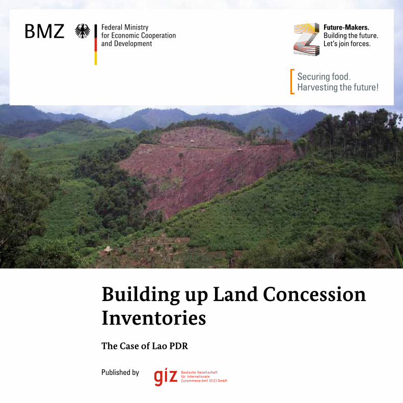
Building up Land Concession Inventories The Case of Lao PDR
Published by
2
Table of contents
Large-scale investments in land – A global challenge 4 Approach 4 Advisory services 6
An example from the field – Combatting land grabbing in Lao PDR 8 Seeking greater land transparency 8 Methodology 12 Financing 20 Experiences with the process 21 Findings of the analysis 23 Impact 26 Summary 28
References 30
3
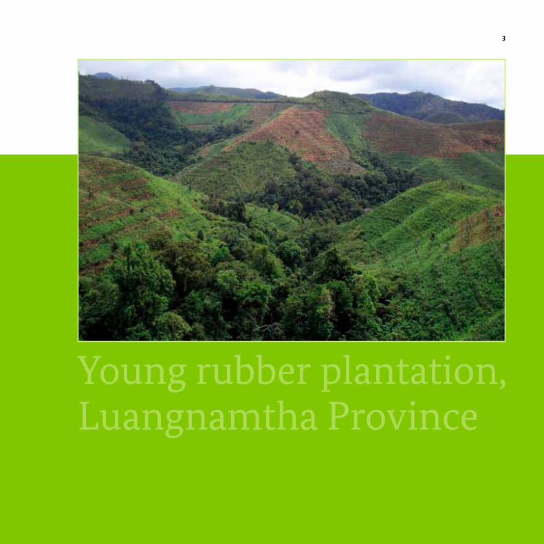
Young rubber plantation, Luangnamtha Province
In recent years, the number of large-scale land acquisitions by national and international investors has skyrocketed. The Land Matrix project1 reports land deals amounting to more than 35 million hectares of land worldwide.
Analyses have shown that the majority of the investments are made in countries with weak governance structures. Existing land and water rights are regularly disregarded, food security and the environment are threatened, and often there is only insufficient compensation for the local population, if they are compensated at all.
As things stand, non-transparent granting and implemen-tation processes often provide little incentive for investors and governments to act responsibly. In recent years, international organisations have collected aggregated figures on worldwide patterns of land-based investment and individual investment cases have been analysed. In Lao PDR, a partner country of German development cooperation and a country that is significantly affected by land deals, a systematic, nationwide assessment of the dimensions and patterns of land-based investments has now been carried out with the support of the Deutsche Gesellschaft für Internationale Zusammenarbeit (GIZ) GmbH on behalf of the German Federal Ministry of Economic Cooperation and Development (BMZ) as well as the Swiss Centre for Development and Environment (CDE) and Swiss Development Cooperation (SDC).
4 LARGE-SCALE InvESTMEnTS In LAnD – A GLoBAL CHALLEnGE
Large-scale investments in land – A global challenge
1 The LAND Matrix (www.landmatrix.org) is an online public database of large-scale land deals facilitated by a partnership between the following organisations:
the International Land Coalition (ILC), Center for Development and Environment (CDE), Centre de Coopération Internationale en Recherche Agronomique pour le
Développement (CIRAD), GIGA German Institute of Global and Area Studies and Gesellschaft für Internationale Zusammenarbeit (GIZ) GmbH.
5LARGE-SCALE InvESTMEnTS In LAnD – A GLoBAL CHALLEnGE
Approach The national inventory of land purchases and leases in Lao PDR is unique in providing comprehensive in-depth analysis of the extent and impacts of large scale land acquisitions across the country. It represents a major contribution to achieving greater transparency in what has previously been a very opaque field of business, and could serve as a model for other countries. Its major asset is the systematic and spatially-referenced compilation of data on the location, extent and implementation status of land-based investments. These data are useful for the following reasons:
• Governments are able to take informed decisions when allocating land for purchase or lease.
• The social, economic and ecological impacts of investments are explained.
• It is possible to conduct regular monitoring of investment activities and irresponsible companies can be called to account. A scientific baseline is provided for future reference.
• Shortcomings in investment policies or land policies are revealed and evidence-based policy-making is enabled.
6 LARGE-SCALE InvESTMEnTS In LAnD – A GLoBAL CHALLEnGE
Advisory services In regard to this approach GIZ offers the following advisory services to its partners:
TeChniCAL SuPPoRT: GIZ provides technical advice to partner organisations on designing and implementing data collection systems (e.g. quantity and location of projects, investors, implementation status), setting up a database, and data processing.
CAPACiTy DeveLoPmenT: GIZ offers staff training courses on land surveying, database management, handling of geographic information systems (GIS), and project management, which qualify government staff to set up land concession inventories on their own responsibility.
DATA AnALySiS: GIZ supports its partners in improving their capacity to systematically collect and analyse data on investment projects while taking social, economic and ecological factors into account in the specific national context.
muLTi-STAkehoLDeR PRoCeSSeS: GIZ advises its partners regarding the initialisation and facilitation of dialogue among different governmental agencies and ministries at the national and subnational level on the process of approving, monitoring and managing land leases and concessions. This is crucial for the governments to be able to harmonise activities and regulations relating to land-based investments.
PoLiCy ReCommenDATionS: GIZ encourages its partners to develop comprehensive analytical skills, enabling them to draw up recommen-dations for policies on land, agriculture and invest-ment issues.
7LARGE-SCALE InvESTMEnTS In LAnD – A GLoBAL CHALLEnGE
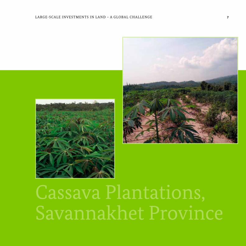
Cassava Plantations, Savannakhet Province
8 An ExAMPLE FRoM THE FIELD – CoMBATTInG LAnD GRABBInG In LAo PDR
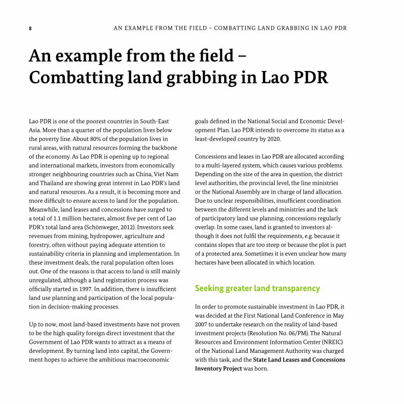
Lao PDR is one of the poorest countries in South-East Asia. More than a quarter of the population lives below the poverty line. About 80% of the population lives in rural areas, with natural resources forming the backbone of the economy. As Lao PDR is opening up to regional and international markets, investors from economically stronger neighbouring countries such as China, viet nam and Thailand are showing great interest in Lao PDR’s land and natural resources. As a result, it is becoming more and more difficult to ensure access to land for the population. Meanwhile, land leases and concessions have surged to a total of 1.1 million hectares, almost five per cent of Lao PDR’s total land area (Schönweger, 2012). Investors seek revenues from mining, hydropower, agriculture and forestry, often without paying adequate attention to sustainability criteria in planning and implementation. In these investment deals, the rural population often loses out. one of the reasons is that access to land is still mainly unregulated, although a land registration process was officially started in 1997. In addition, there is insufficient land use planning and participation of the local popula-tion in decision-making processes.
Up to now, most land-based investments have not proven to be the high quality foreign direct investment that the Government of Lao PDR wants to attract as a means of development. By turning land into capital, the Govern-ment hopes to achieve the ambitious macroeconomic
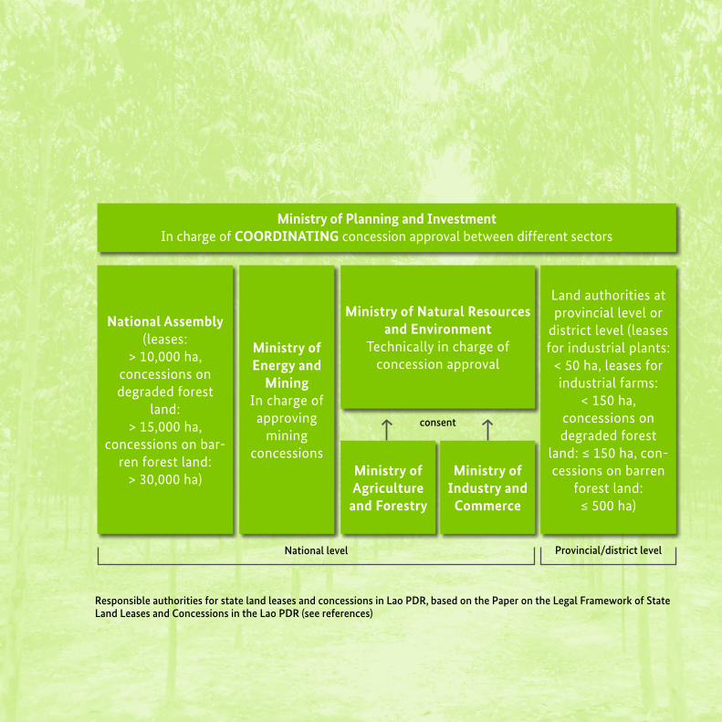
goals defined in the national Social and Economic Devel-opment Plan. Lao PDR intends to overcome its status as a least-developed country by 2020. Concessions and leases in Lao PDR are allocated according to a multi-layered system, which causes various problems. Depending on the size of the area in question, the district level authorities, the provincial level, the line ministries or the national Assembly are in charge of land allocation. Due to unclear responsibilities, insufficient coordination between the different levels and ministries and the lack of participatory land use planning, concessions regularly overlap. In some cases, land is granted to investors al-though it does not fulfil the requirements, e.g. because it contains slopes that are too steep or because the plot is part of a protected area. Sometimes it is even unclear how many hectares have been allocated in which location.
Seeking greater land transparency
In order to promote sustainable investment in Lao PDR, it was decided at the First national Land Conference in May 2007 to undertake research on the reality of land-based investment projects (Resolution no. 06/PM). The natural Resources and Environment Information Center (nREIC) of the national Land Management Authority was charged with this task, and the State Land Leases and Concessions Inventory Project was born.
An example from the field – Combatting land grabbing in Lao PDR
9An ExAMPLE FRoM THE FIELD – CoMBATTInG LAnD GRABBInG In LAo PDR
Responsible authorities for state land leases and concessions in Lao PDR, based on the Paper on the Legal Framework of State Land Leases and Concessions in the Lao PDR (see references)
consent
National level Provincial/district level
ministry of Planning and investmentIn charge of CooRDinATinG concession approval between different sectors
Land authorities at provincial level or
district level (leases for industrial plants:
< 50 ha, leases for industrial farms:
< 150 ha, concessions on degraded forest
land: ≤ 150 ha, con-cessions on barren
forest land: ≤ 500 ha)
national Assembly(leases:
> 10,000 ha, concessions on degraded forest
land:> 15,000 ha,
concessions on bar-ren forest land:
> 30,000 ha)
ministry of natural Resources and environment
Technically in charge of concession approval
ministry of Agriculture
and Forestry
ministry of industry and
Commerce
ministry of energy and
miningIn charge of approving
mining concessions
10 An ExAMPLE FRoM THE FIELD – CoMBATTInG LAnD GRABBInG In LAo PDR
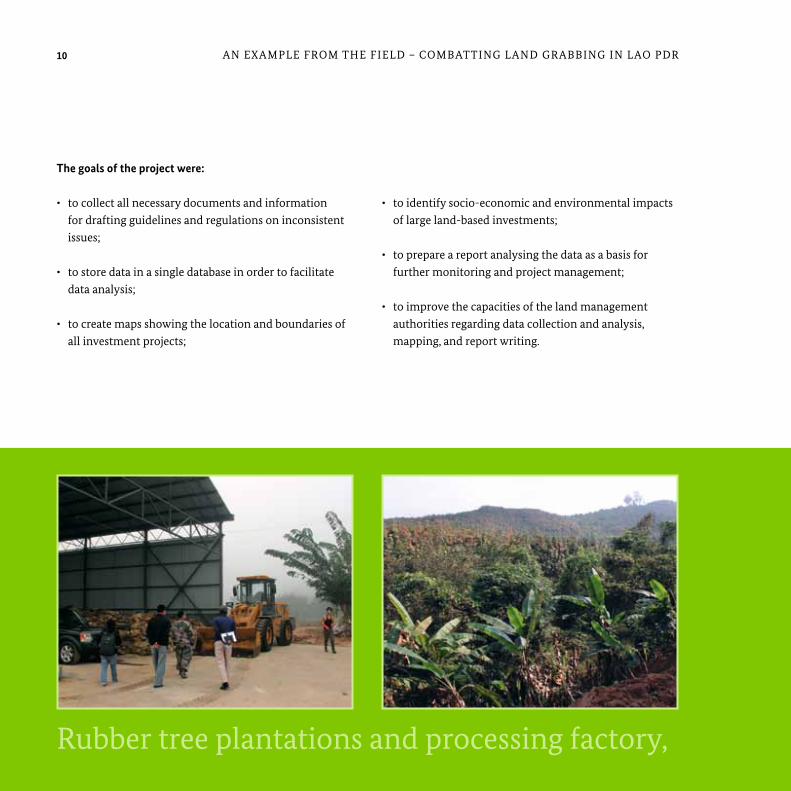
Rubber tree plantations and processing factory Luangnamtha Province
The goals of the project were:
• to collect all necessary documents and information for drafting guidelines and regulations on inconsistent issues;
• to store data in a single database in order to facilitate data analysis;
• to create maps showing the location and boundaries of all investment projects;
• to identify socio-economic and environmental impacts of large land-based investments;
• to prepare a report analysing the data as a basis for further monitoring and project management;
• to improve the capacities of the land management authorities regarding data collection and analysis, mapping, and report writing.
Rubber tree plantations and processing factory, Luangnamtha Province
11An exAmple from the field – CombAtting lAnd grAbbing in lAo pdr
may 2007 First national Land Conference assigns the ministry of natural Resources and environment the task of storing land lease and concession data
2007-2008
First phase of State Land Leases and Concessions inventory Project: data collection from provincial authorities data
october 2008 Start of second project phase: district level data collection and ground truthing activities in two provinces
2010-2012 Rollout of the approach in all provinces
January 2013 Launch of a consolidated national report
Progress of the State Land Leases and Concessions inventory Project
Rubber tree plantations and processing factory Luangnamtha ProvinceRubber tree plantations and processing factory, Luangnamtha Province
12 An ExAMPLE FRoM THE FIELD – CoMBATTInG LAnD GRABBInG In LAo PDR
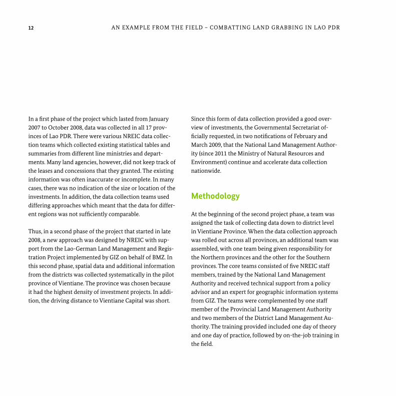
In a first phase of the project which lasted from January 2007 to october 2008, data was collected in all 17 prov-inces of Lao PDR. There were various nREIC data collec-tion teams which collected existing statistical tables and summaries from different line ministries and depart-ments. Many land agencies, however, did not keep track of the leases and concessions that they granted. The existing information was often inaccurate or incomplete. In many cases, there was no indication of the size or location of the investments. In addition, the data collection teams used differing approaches which meant that the data for differ-ent regions was not sufficiently comparable.
Thus, in a second phase of the project that started in late 2008, a new approach was designed by nREIC with sup-port from the Lao-German Land Management and Regis-tration Project implemented by GIZ on behalf of BMZ. In this second phase, spatial data and additional information from the districts was collected systematically in the pilot province of vientiane. The province was chosen because it had the highest density of investment projects. In addi-tion, the driving distance to vientiane Capital was short.
Since this form of data collection provided a good over-view of investments, the Governmental Secretariat of-ficially requested, in two notifications of February and March 2009, that the national Land Management Author-ity (since 2011 the Ministry of natural Resources and Environment) continue and accelerate data collection nationwide.
methodology
At the beginning of the second project phase, a team was assigned the task of collecting data down to district level in vientiane Province. When the data collection approach was rolled out across all provinces, an additional team was assembled, with one team being given responsibility for the northern provinces and the other for the Southern provinces. The core teams consisted of five nREIC staff members, trained by the national Land Management Authority and received technical support from a policy advisor and an expert for geographic information systems from GIZ. The teams were complemented by one staff member of the Provincial Land Management Authority and two members of the District Land Management Au-thority. The training provided included one day of theory and one day of practice, followed by on-the-job training in the field.
13An ExAMPLE FRoM THE FIELD – CoMBATTInG LAnD GRABBInG In LAo PDR
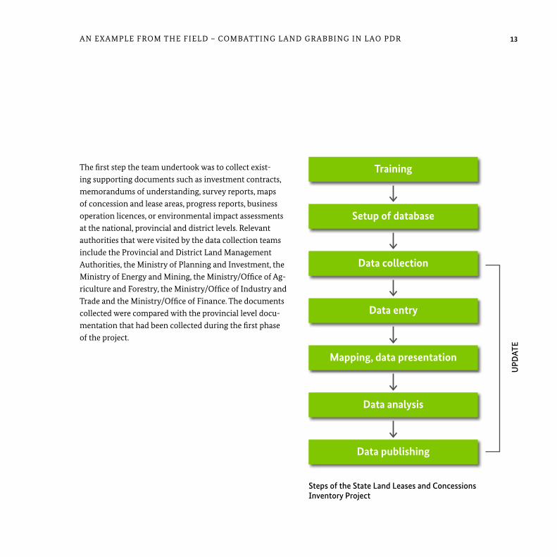
The first step the team undertook was to collect exist-ing supporting documents such as investment contracts, memorandums of understanding, survey reports, maps of concession and lease areas, progress reports, business operation licences, or environmental impact assessments at the national, provincial and district levels. Relevant authorities that were visited by the data collection teams include the Provincial and District Land Management Authorities, the Ministry of Planning and Investment, the Ministry of Energy and Mining, the Ministry/office of Ag-riculture and Forestry, the Ministry/office of Industry and Trade and the Ministry/office of Finance. The documents collected were compared with the provincial level docu-mentation that had been collected during the first phase of the project.
Steps of the State Land Leases and Concessions Inventory Project
UPD
ATE
Training
Setup of database
Data collection
Data entry
mapping, data presentation
Data analysis
Data publishing
14 An ExAMPLE FRoM THE FIELD – CoMBATTInG LAnD GRABBInG In LAo PDR
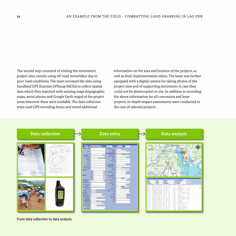
The second step consisted of visiting the investment project sites, mostly using off-road motorbikes due to poor road conditions. The team surveyed the sites using handheld GPS (Garmin GPSmap 60CSx) to collect spatial data which they matched with existing maps (topographic maps, aerial photos and Google Earth maps) of the project areas wherever these were available. The data collection team used GPS recording forms and noted additional
information on the area and location of the projects, as well as their implementation status. The team was further equipped with a digital camera for taking photos of the project sites and of supporting documents in case they could not be photocopied on site. In addition to recording the above information for all concession and lease projects, in-depth impact assessments were conducted in the case of selected projects.
Data collection Data entry Data analysis
From data collection to data analysis

Data collection in the field
Whenever necessary, the team was accompanied by staff members of the District Land Management Authority or Provincial Land Management Authority which were close-ly involved in the whole process. In addition, the village authorities often helped in finding the project locations.
Each Provincial Land Management Authority was provided with a computer on which the project database was stored. With the support of GIZ, staff members in the provincial offices were trained in entering and updating data in the database. They were also made responsible for forwarding any news on existing and new investment projects to the national Land Management Authority.
A database system was set up for the collected data, updates and analysis. The database was initially based on Microsoft Access and visual Studio net for the non-spatial data and ArcGIS for the spatial data. A company, and later a consultant, were drafted in to oversee the setup. The database structure was created and implemented in MS Access within two months, including the data entry form.
After data collection had been completed for all provinces in 2011, the national Land Management Authority, with the support of GIZ, published reports analysing the pre-liminary results for each of the 17 provinces. The reports were also translated from the Lao language into English in order to make them accessible for international experts.
15An ExAMPLE FRoM THE FIELD – CoMBATTInG LAnD GRABBInG In LAo PDR 1515
16 An ExAMPLE FRoM THE FIELD – CoMBATTInG LAnD GRABBInG In LAo PDR
• Quantum GIS is an open source GIS desktop platform that offers good capacity for editing and processing spatial information. Being open source, it can easily be customised for specific needs and translated into Lao. Quantum GIS has a large range of interfaces with Data-base Management Systems, programming languages and other GIS software. It also supports various data formats.
• Both platforms have relatively low requirements for hard disk space.
The problems that were encountered during the migration to PostgreSQL were mostly related to a lack of knowledge of open source solutions. As open source is still quite new and often believed to be inferior to proprietary solutions, many organisations and experts have not yet embraced it. It was therefore difficult to find local companies or devel-opers with expertise regarding open source solutions. It was possible, however, to gain significant documentation and support from online communities. After a steep learn-ing curve, the use of PostgreSQL and Quantum GIS rapidly became manageable, with the local staff quick to grasp how it worked once trained. Altogether, the high integrity, flexibility and stability of PostgreSQL in combination with Quantum GIS, proved that the migration to open source was the right decision.
From the beginning of 2012 until mid-2012, the data was cleared by 4-5 staff members of the natural Resources and Environment Information Centre before it was migrated to open source software (the database PostgreSQL, as well as PostGIS and Quantum GIS in the case of the spatial data). This migration was necessary for various reasons:
• MS Access and ArcGIS are both proprietary software and therefore cost-intensive; significant budget constraints make it difficult to establish an operational system on a long term basis.
• Due to their proprietary nature, MS Access and ArcGIS have limited interfaces with other software. This significantly reduces the flexibility of the information system and makes future adjustments dependent on an environment that is determined by single companies.
• Unlike PostgreSQL/PostGIS, MS Access is not capable of storing GIS data (coordinates of the project location and boundaries of the project area).
• PostgreSQL is the most sophisticated open source database management system available at the moment and it easily integrates with Quantum GIS.
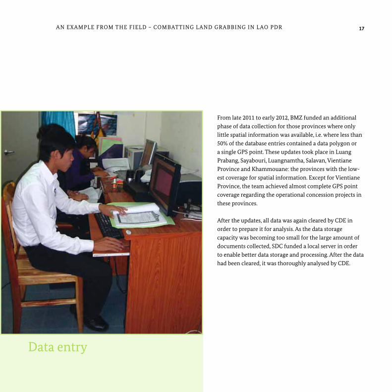
Data entry
From late 2011 to early 2012, BMZ funded an additional phase of data collection for those provinces where only little spatial information was available, i.e. where less than 50% of the database entries contained a data polygon or a single GPS point. These updates took place in Luang Prabang, Sayabouri, Luangnamtha, Salavan, vientiane Province and Khammouane: the provinces with the low-est coverage for spatial information. Except for vientiane Province, the team achieved almost complete GPS point coverage regarding the operational concession projects in these provinces. After the updates, all data was again cleared by CDE in order to prepare it for analysis. As the data storage capacity was becoming too small for the large amount of documents collected, SDC funded a local server in order to enable better data storage and processing. After the data had been cleared, it was thoroughly analysed by CDE.
17An ExAMPLE FRoM THE FIELD – CoMBATTInG LAnD GRABBInG In LAo PDR
18 An ExAMPLE FRoM THE FIELD – CoMBATTInG LAnD GRABBInG In LAo PDR
In January 2013, in vientiane Capital, the Ministry of natural Resources and Environment of Lao PDR and CDE launched a consolidated national report on the inventory, entitled: ‘Concessions and leases in the Lao PDR, Taking Stock of Land Investments’.
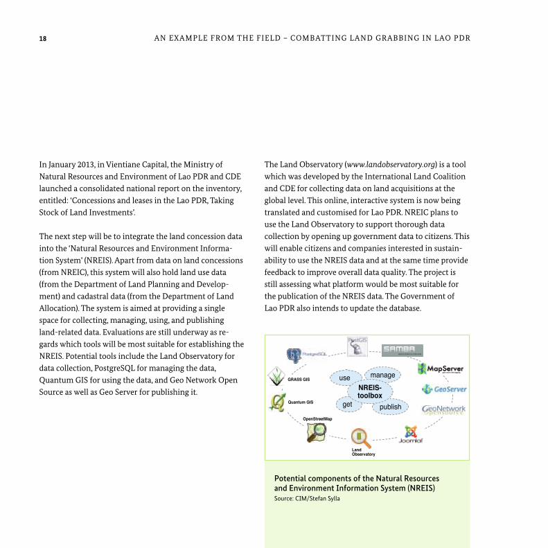
The next step will be to integrate the land concession data into the ‘natural Resources and Environment Informa-tion System’ (nREIS). Apart from data on land concessions (from nREIC), this system will also hold land use data (from the Department of Land Planning and Develop-ment) and cadastral data (from the Department of Land Allocation). The system is aimed at providing a single space for collecting, managing, using, and publishing land-related data. Evaluations are still underway as re-gards which tools will be most suitable for establishing the nREIS. Potential tools include the Land observatory for data collection, PostgreSQL for managing the data, Quantum GIS for using the data, and Geo network open Source as well as Geo Server for publishing it.
The Land observatory (www.landobservatory.org) is a tool which was developed by the International Land Coalition and CDE for collecting data on land acquisitions at the global level. This online, interactive system is now being translated and customised for Lao PDR. nREIC plans to use the Land observatory to support thorough data collection by opening up government data to citizens. This will enable citizens and companies interested in sustain-ability to use the nREIS data and at the same time provide feedback to improve overall data quality. The project is still assessing what platform would be most suitable for the publication of the nREIS data. The Government of Lao PDR also intends to update the database.
Potential components of the Natural Resources and Environment Information System (NREIS) Source: CIM/Stefan Sylla
Land Observatory
OpenStreetMap
Quantum GIS
GRASS GISmanage
publishget
useNREIS-toolbox

19An ExAMPLE FRoM THE FIELD – CoMBATTInG LAnD GRABBInG In LAo PDR
Launching Workshop of the national Land Concession and Lease Report. From left to right: Dr. Bounthavy Sisouphanthong, vice Minister, Ministry of Planning and Investment; Dr. Akhom Tounalom, vice Minister, Ministry of natural Resources and Environment; Dr. Phouang Parisak Pravongviengkham, vice Minister, Ministry of Agriculture and Forestry

20 An ExAMPLE FRoM THE FIELD – CoMBATTInG LAnD GRABBInG In LAo PDR
(two motorbikes were bought at a cost of around USD 3800, additional motorbikes were rented when needed), four GPS (around USD 2500), photocopies, communica-tion, and office equipment. In addition, GIZ employed one GIS expert and one land policy advisor at a cost of around USD 7000 per month. The costs for the concession inventory in vientiane Capital have not yet been reviewed in detail.
The final analysis of the data at national level was finan-cially supported by SDC.
Financing
Data collection in all provinces was funded by BMZ, which commissioned GIZ with the planning and implementation of the project. According to the provincial reports for all provinces apart from vientiane Capital, the costs of the first round of data collection amounted to roughly USD 60,000. This includes the remuneration of field staff as well as allowances for the national, Provincial and District Land Management Authorities (around 68% of all costs), costs for training materials, transportation
Costs of the State Land Leases and Concessions Inventory Project (as detailed in the provincial reports, excluding Vientiane Capital)
allowances of the survey team, NLMA, PLMA, DLMA68%
Photocopies, Communication, office equipment
others
trainings
4%GPS
4%
travelling costs, motorbikes23%

experiences with the process During data collection, the teams faced several challenges. one of the greatest difficulties was the highly dispersed nature of relevant information. The documents obtained from government agencies were often incomplete, especially regarding the process of concession approval. Some authorities had either not collected the required
information or were hesitant to cooperate with the data collection teams. Progress reports and information on implementation status (e.g. land clearance, planting, and production) were very difficult to obtain. This was either because the government authorities did not monitor project activities or because the companies had not sub-mitted these documents to the authorities.
21An ExAMPLE FRoM THE FIELD – CoMBATTInG LAnD GRABBInG In LAo PDR
Challenges during data collection: poor road conditions
22 An ExAMPLE FRoM THE FIELD – CoMBATTInG LAnD GRABBInG In LAo PDR
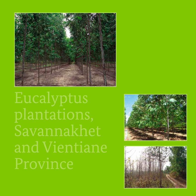
Eucalyptus plantations, Savannakhet and vientiane Province
In some cases, poor road conditions restricted access to the project sites with the result that some sites could not be visited at all and for others, only a single GPS point could be recorded. In many of these cases, budget and time constraints did not allow the teams to circumnavigate the vast plots on foot. But wherever possible, the approximate boundaries were outlined using satellite imagery. Where it was possible to access project sites, the teams were often not able to collect detailed information on the investments as the companies’ management was rarely present and the representatives or workers either did not have the relevant information or were not entitled to share it. Information gaps were also partly due to language barriers in cases where foreign investors were involved.
Sometimes the same investing company was recorded under different names in different official documents, causing confusion regarding the total number of con-cessions or leases.
These issues led to varying data quality for the different provinces. only 53% of all entries are accompanied by spatial data and a few investment projects are not included in the database at all.
Despite these flaws, the Concession Inventory is the most comprehensive national data set on land-based invest-ments in Lao PDR. It is the first system that provides spatial information on concessions and leases on a large scale and for different sectors. The implementation of the project demonstrates a great political will within Lao PDR to generate more transparency and improve investment quality. This resolve is broadly acknowledged by the international community.
Findings of the analysis An analysis of the national Concessions Inventory2 in 2012 focused on over 2600 land deals amounting to a total area of 1.1 million hectares. This represents around five per cent of the territory of Lao PDR. Domestic investors hold around 65% of all projects, but their investments tend to be much smaller than international investments. of the international investments, vietnamese projects cover the largest land area, followed by Chinese and Thai investments. A small number of large-scale projects (five per cent of all projects) make up 89% of the total area under investment.
23An ExAMPLE FRoM THE FIELD – CoMBATTInG LAnD GRABBInG In LAo PDR
2 Schönweger O., Heinimann A., Epprecht M., Lu J. , Thalongsengchanh P. , 2012: Concessions and Leases in the Lao PDR: Taking Stock of Land Investments.
Centre for Development and Environment (CDE), University of Bern, Bern and Vientiane: Geographica Bernensia.
24 An ExAMPLE FRoM THE FIELD – CoMBATTInG LAnD GRABBInG In LAo PDR
• Concessions and leases have been approved on land not suitable for industrial or agricultural use because of conservation forest, primary forest, healthy secondary forest or slopes with an inclination of over 45 degrees.
• Concession areas granted to different companies overlap.
• Land has been granted to investors without consulting the local population that used the areas, e.g. as produc-tion land or forest.
• no socio-economic and environmental impact assess-ments, site surveys, or feasibility studies were carried out before land was granted to investors.
• Site surveys that were conducted before the land was granted to investors were inaccurate.
• Investors are not making use of the land that has been allocated to them.
• Investors are not using the land according to the agree-ments. In many cases, they are clearing or using more than the land granted to them.
Most projects in Lao PDR are engaged in forestry (mainly rubber, eucalyptus), agriculture (mainly coffee, livestock and jatropha), and mineral extraction (tin, copper, iron etc.). Investments in secondary sectors such as construc-tion, electricity and manufacturing account for 30% of all investment projects, but only two per cent of the total area under investment. Projects in the tertiary sector (tourism, services, transport, trade etc.) constitute 20% of all invest-ment projects and seven per cent of the total investment area.
A remarkable 77% of all projects had started operations at the time of data collection. They cover 717,896 hectares, about two thirds of all land under investment, easing concerns that many projects are merely speculative.
In addition to these facts, the State Land Leases and Concessions Inventory disclosed many irregularities in the process of granting leases and concessions as well as in the implementation of the projects.
In some cases the following was observed:
• Concessions and leases have been granted by authorities that, according to laws and regulations, were not man-dated to do so. For example, a district governor granted an area of over 3 hectares in Luangnamtha although the approval should have come from the provincial level.
25An ExAMPLE FRoM THE FIELD – CoMBATTInG LAnD GRABBInG In LAo PDR
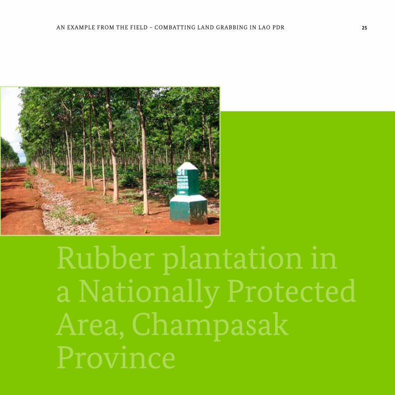
Rubber plantation in a nationally Protected Area, Champasak Province

26 An ExAMPLE FRoM THE FIELD – CoMBATTInG LAnD GRABBInG In LAo PDR
impact
The evidence collected suggests that some members of relevant authorities have abused their mandates. These cases have been thoroughly investigated by the Govern-ment of Lao PDR. Some officials have been prosecuted. Some of the provincial reports also hint at companies not fulfilling their land lease or concession contracts. Following an investigation by the Land Inspection Team, the Government of Lao PDR recently decided to annul the licenses of investors who do not act according to the contractual provisions. The provincial authorities have cancelled many projects which were not approved by the appropriate administrative level.
The results of the analyses have attracted broad attention among political decision makers. The findings of the pro-vincial reports were presented to the Prime Minister and to line ministers at several governmental meetings. The Concession Inventory even appeared on the agenda of the national Assembly. Reports of the inventory have been distributed to the delegates of the national Assembly, at meetings of the Government of Lao PDR, as well as to line ministries and provincial governments. When the national report was published in vientiane in early 2013, the vice ministers of three responsible line ministries ensured that the results will feed into the ongoing process of develop-ing a national land policy for Lao PDR.
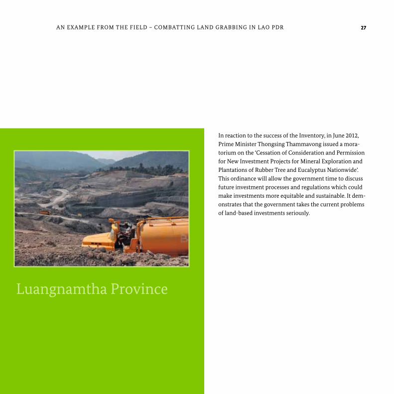
open-pit mining, Luangnamtha Province
27An ExAMPLE FRoM THE FIELD – CoMBATTInG LAnD GRABBInG In LAo PDR
In reaction to the success of the Inventory, in June 2012, Prime Minister Thongsing Thammavong issued a mora-torium on the ‘Cessation of Consideration and Permission for new Investment Projects for Mineral Exploration and Plantations of Rubber Tree and Eucalyptus nationwide’. This ordinance will allow the government time to discuss future investment processes and regulations which could make investments more equitable and sustainable. It dem-onstrates that the government takes the current problems of land-based investments seriously.
27
open-pit mining, Luangnamtha Province
Lao PDR is a developing country that was significantly affected by the trend of foreign investments in land. Inves-tors, primarily from the economically stronger neighbour-ing countries China, viet nam and Thailand, are seeking revenues from mining, hydropower, agriculture and for-estry. So far, most of these investments have not proven to be the high quality foreign direct investment that the Gov-ernment of Lao PDR wants to attract as a means of devel-opment. In many cases, the local people lose out on these investment deals. They receive only insufficient compen-sation, if they are compensated at all, for relocation, and they suffer from the impacts of environmental degrada-tion and dwindling natural resources. In Lao PDR, and in many other developing countries, these negative effects of foreign investment in land are rooted in poor land governance systems, e.g. inadequate legal frameworks, poor cooperation between line agencies and different administrative levels, non-transparent decision-making processes and insufficient participation on the part of the local population.
In order to improve investments in land in Lao PDR, it was decided at the First national Land Conference in May 2007 in vientiane that research on the reality of land-based investment projects would be undertaken as a start-ing point for further improvement measures – the ‘State Land Leases and Concessions Inventory Project’ was born. Comprehensive information on the extent and effects of
existing large-scale land acquisitions was gathered and analysed. This practice substantially enhances transpar-ency in the sector, supports meaningful decision making and generates recommendations on how to improve land governance.
The implementation of the State Land Leases and Conces-sions Inventory Project led to the following findings:
• Analysis of the national Concession Inventory in 2012 focused on over 2600 land deals accounting for a total land area of 1.1 million hectares and around five per cent of the territory of Lao PDR.
• Around 65% of all projects are in the hands of domestic investors.
• vietnamese projects cover the largest land area, followed by Chinese and Thai investments.
• Five per cent of all projects make up 89% of the total area under investment.
• Most projects in Lao PDR are engaged in forestry (mainly rubber, eucalyptus), agriculture (mainly coffee, livestock and jatropha), and mineral extraction (tin, copper iron, etc.).
SUMMARY
Summary
28
• Investments in the secondary sector account for 30% of all investment projects, but only two per cent of the total area under investment.
• Investments in the tertiary sector constitute 20% of all investment projects and seven per cent of the total investment area.
• 77% of all projects had started operations at the time of data collection.
• The State Land Leases and Concession Inventory disclosed many irregularities in the process of granting leases and concession as well as in the implementation of the projects.
• The provincial authorities cancelled many projects which had not been approved by the appropriate administrative level.
Lao PDR – as a partner of German development coopera-tion – received support for the project from the Deutsche Gesellschaft für Internationale Zusammenarbeit (GIZ) working on behalf of the German Federal Ministry of Economic Cooperation and Development (BMZ). The Swiss Centre for Development and Environment (CDE) and Swiss Development Cooperation (SDC) also partici-pated in the project. This report describes the methodol-ogy of the project, from the training of the staff to data collection through to data analysis. Finally, it summarises the findings of the Land Leases and Concession Inventory and addresses the impacts these findings might have.
Generally speaking, a national inventory of land purchases and leases – as demonstrated by the unique example of Lao PDR – represents a very valuable contribution to great-er transparency in what has previously been a very opaque field of business and could also serve as a model for other countries. Its major asset is the systematic and spatially-referenced compilation of data on the location, extent and implementation status of land-based investments.
29SUMMARY 29
If you have further questions on the Land Leases and Concessions Inventory in Lao PDR or the applicability of a similar approach in your field of work, please contact the GIZ Sector Project Land Policy and Land Management: [email protected]

30 REFEREnCES
GTZ (2010): FDI in land and the need to establish a concession inventory. The case of Lao PDR. vientiane Capital City.
National Land Management Authority, Land and Natural Resource Information and Research Center (2009-2011): Reports on the ‘Findings of State Land Lease and Concession Inventory Project’ for the provinces of Attapeu, Bokeo, Champasak, Khammuan, Kongkham, Luangnamtha, Luangprabang, Saravan, vientiane, xayabouly and xiengkhouang. vientiane Capital City.
Schönweger, O., Heinimann, A., Epprecht, M., Lu, J. and Thalongsengchanh, P. (2012): Concessions and Leases in the Lao PDR. Taking Stock of Land Investments. Centre for Development and Environment (CDE) and University of Bern, Bern and vientiane.
Wellmann, D. (2012): The Legal Framework of State Land Leases and Concessions in the Lao PDR (discussion paper developed as part of the GIZ nU-IRDP contribution to the nUDP), vientiane Capital City.
Most information for this publication is derived from qualitative interviews with government officials, GIZ project staff and CDE staff in Lao PDR which were conducted in January 2013 as well as from unpublished project documents. other sources include:
Anseeuw, W., Boche, M., Breu, T., Giger, M., Lay, J., Messerli, P. and Nolte, K. (2012): Transnational Land Deals for Agriculture in the Global South. Analytical Report based on the Land Matrix Data-base. CDE/CIRAD/GIGA, Bern/Montpellier/Hamburg.
BMZ (2012): Investments in Land and the Phenomenon of Land Grabbing. Challenges for Development (Policy BMZ Strategy Paper 02/2012e). Bonn.
GIZ (2012): Land Concession Inventory. Dimensions and Impact of Land Concessions in Laos, Presentation held at the Launching Workshop of the BMZ Strategy Paper 02/2012e. Berlin.
References

31
Published byDeutsche Gesellschaft für Internationale Zusammenarbeit (GIZ) GmbH
Registered officesBonn and Eschborn I Germany
Sector Project Land Policy and Land Management Dag-Hammarskjöld-Weg 1-5 I 65760 Eschborn I Germany Tel. +49 (0) 6196 79 - 0 Fax +49 (0) 6196 79 - [email protected] I www.giz.de/landmanagement
Edited byNike Affeld Design and layoutJeanette Geppert, Frankfurt
Printed byTop Kopie GmbH, FrankfurtPrinted on FSC-certified paper Photo creditsCover and p.3 © GIZ/Christian Metzger; p. 5 © CIM/Stefan Sylla; p. 7, 22, 25 © Soukanh Lathsavongh;p. 10, 11, 26, 27 © Nike Affeld; p. 15, 17, 21 © GIZ/Viladeth Sisoulath; p. 19 © CDE
As atFebruary 2014
GIZ is responsible for the content of this publication.
On behalf ofFederal Ministry for Economic Cooperation and Development (BMZ); Division Rural Development, Agriculture, Food Security
Addresses of the BMZ officesBMZ Bonn BMZ BerlinDahlmannstraße 4 I 53113 Bonn I Germany Stresemannstraße 94 I 10963 Berlin I Germany Tel. +49 (0) 228 99 535 - 0 Tel. +49 (0) 30 18 535 - 0 Fax +49 (0) 228 99 535 - 3500 Fax +49 (0) 30 18 535 - 2501 [email protected] I www.bmz.de