building a repository to share hydrologic event data
DESCRIPTION
Building a Repository to Share Hydrologic Event Data. Creating the Minnesota Reach Address Database (MnRAD). Project Cooperators: Mark Olsen, MPCA Susanne Maeder, LMIC Tommy Dewald, USEPA/OW. Minnesota Water Quality Business Needs. - PowerPoint PPT PresentationTRANSCRIPT
Project Cooperators:Mark Olsen, MPCA
Susanne Maeder, LMIC
Tommy Dewald, USEPA/OW
Building a Repository to Share
Hydrologic Event Data
Creating the Minnesota Reach Creating the Minnesota Reach Address Database (MnRAD)Address Database (MnRAD)
Minnesota Water Quality Business Needs
Integrate water related information from different sources
Electronic data access and exchange
3
Minnesota Water Quality Challenges
Distributed authority– Requires cooperation– Need to integrate and
exchange data
Legacy data– Standards: codified and
defacto
Data inconsistencies

4
Key Components Standards Based Approach for
Critical Infrastructure– STORET/Assessment Database (ADB)– Environmental Data Access (EDA)
• Public and timely access• Better use of local data• Competent repository
– National Hydrography Dataset (NHD)– Exchange Network– MnRAD
5
Key Components - NHD Formal coordination mechanism
– Governor’s Council Local buy-in
– Use of value added data– Cross reference to existing systems– Involvement in production process
Partnerships– Fund match– Expertise– Tools and data
Outreach– Education and training
• Reach Indexing Tool (RIT)• NHD data and use
6
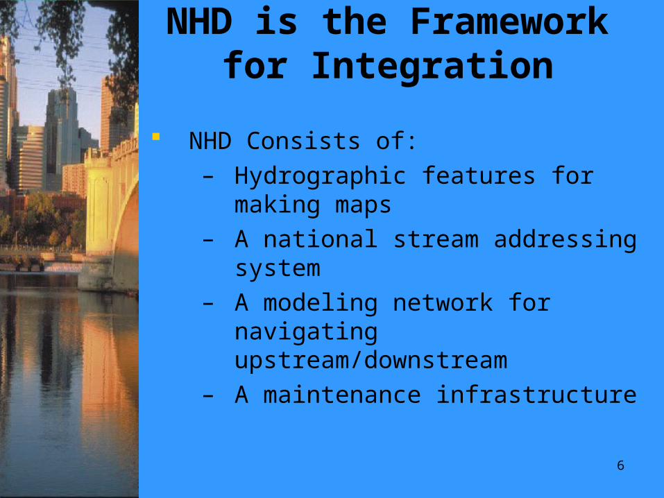
NHD is the Framework for Integration
NHD Consists of:– Hydrographic features for making
maps– A national stream addressing
system– A modeling network for navigating
upstream/downstream– A maintenance infrastructure
77
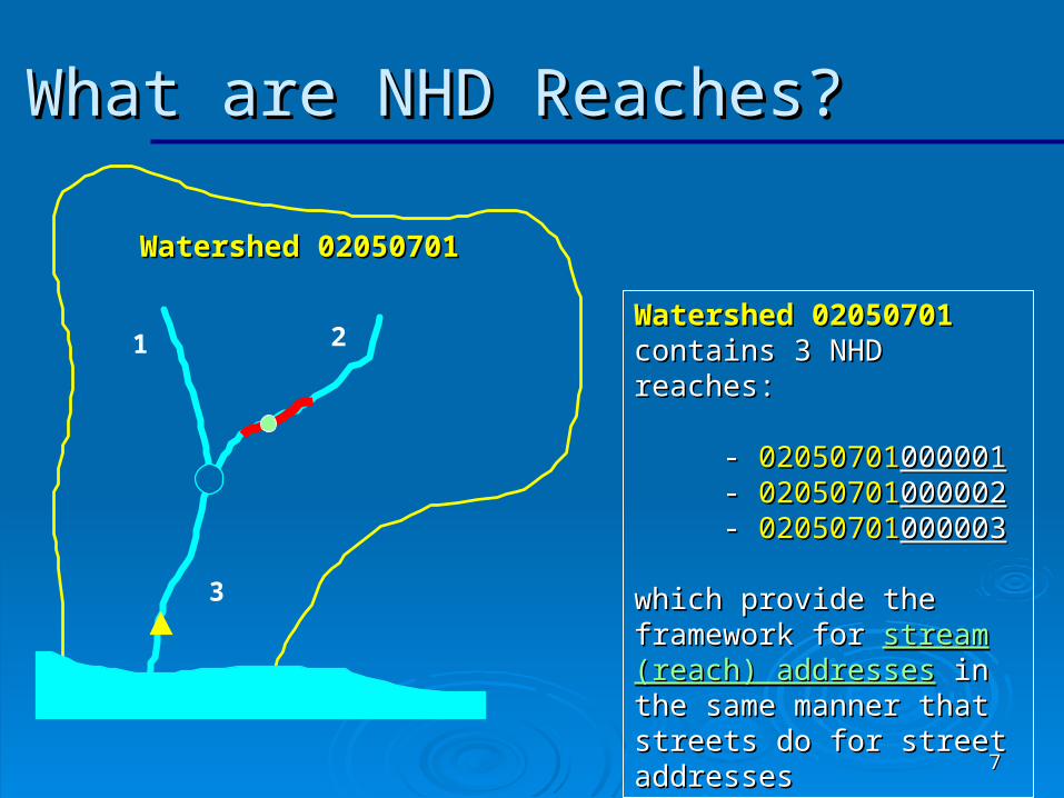
Watershed 02050701Watershed 02050701 contains 3 NHD reaches:contains 3 NHD reaches:
- - 0205070102050701000001000001 - - 0205070102050701000002000002 - - 0205070102050701000003000003
which provide the which provide the framework for framework for stream stream (reach) addresses(reach) addresses in the in the same manner that streets same manner that streets do for street addressesdo for street addresses
What are NHD Reaches? What are NHD Reaches?
Watershed 02050701Watershed 02050701
1 2
3
88
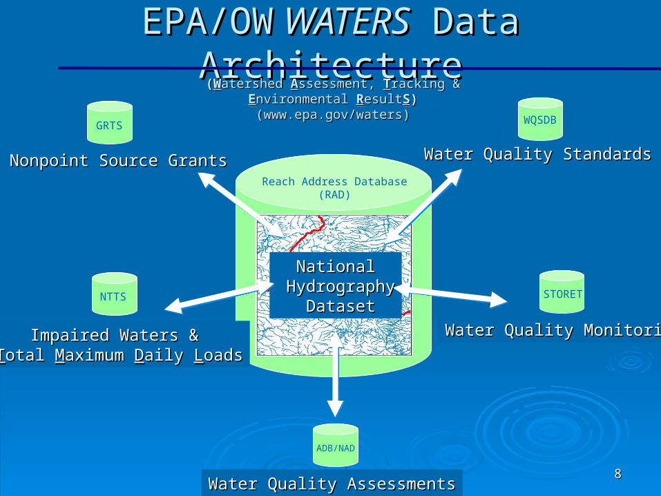
NationalNational HydrographyHydrography
DatasetDataset
EPA/OWEPA/OW WATERS WATERS Data Architecture Data Architecture
Nonpoint Source GrantsNonpoint Source Grants
Impaired Waters & Impaired Waters & TTotal otal MMaximum aximum DDaily aily LLoadsoads
Water Quality AssessmentsWater Quality Assessments
Water Quality MonitoringWater Quality Monitoring
Water Quality StandardsWater Quality Standards
((WWatershed atershed AAssessment, ssessment, TTracking & racking & EEnvironmental nvironmental RResultesultSS))(www.epa.gov/waters)(www.epa.gov/waters)
((WWatershed atershed AAssessment, ssessment, TTracking & racking & EEnvironmental nvironmental RResultesultSS))(www.epa.gov/waters)(www.epa.gov/waters)
GRTS WQSDB
NTTS STORET
ADB/NAD
Reach Address Database(RAD)
9
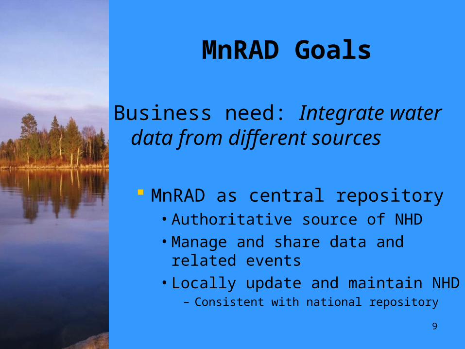
MnRAD Goals
Business need: Integrate water data from different sources
MnRAD as central repository• Authoritative source of NHD• Manage and share data and related
events• Locally update and maintain NHD
– Consistent with national repository

10
MnRAD Goals
Business need: Electronic data access and exchange
Enable electronic exchange of water quality data with EPA
• Programmatic data– Assessed and impaired waters
(305(b)/303(d) )
• Geospatial data
– NHD events relating to that reporting
11
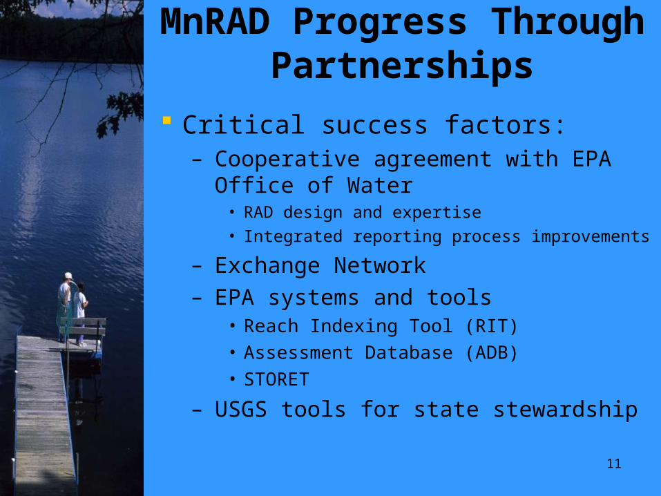
MnRAD Progress Through Partnerships
Critical success factors:– Cooperative agreement with EPA Office of
Water• RAD design and expertise
• Integrated reporting process improvements
– Exchange Network– EPA systems and tools
• Reach Indexing Tool (RIT)• Assessment Database (ADB)• STORET
– USGS tools for state stewardship
12
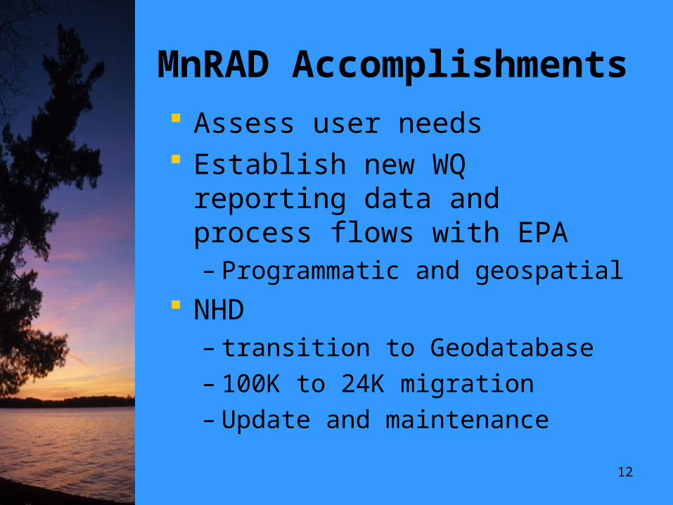
MnRAD Accomplishments
Assess user needs Establish new WQ reporting data
and process flows with EPA– Programmatic and geospatial
NHD – transition to Geodatabase– 100K to 24K migration– Update and maintenance
16
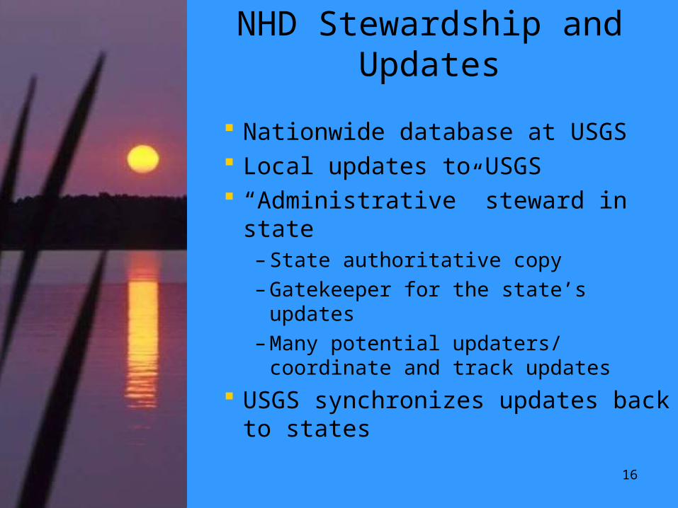
NHD Stewardship and Updates
Nationwide database at USGS Local updates to USGS “Administrative” steward in state
– State authoritative copy– Gatekeeper for the state’s updates– Many potential updaters/ coordinate
and track updates
USGS synchronizes updates back to states

19
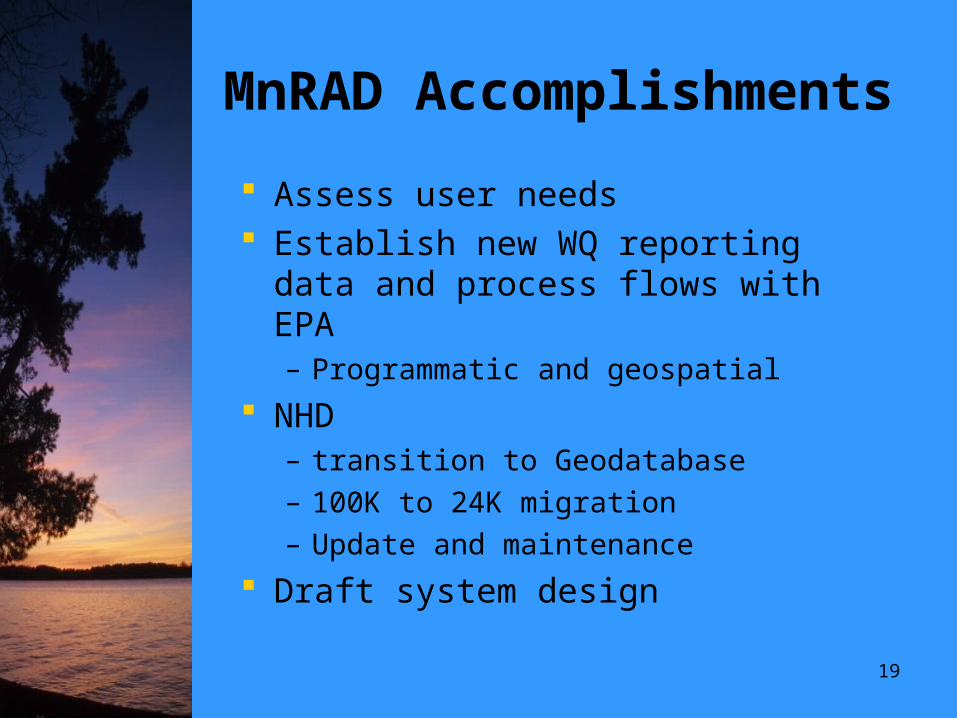
MnRAD Accomplishments
Assess user needs Establish new WQ reporting data and
process flows with EPA– Programmatic and geospatial
NHD – transition to Geodatabase– 100K to 24K migration– Update and maintenance
Draft system design

20
MnRAD CDX Spatial Data Submission:
Part 1: Minnesota Data Submittal
21
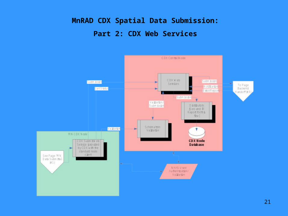
MnRAD CDX Spatial Data Submission:
Part 2: CDX Web Services
22
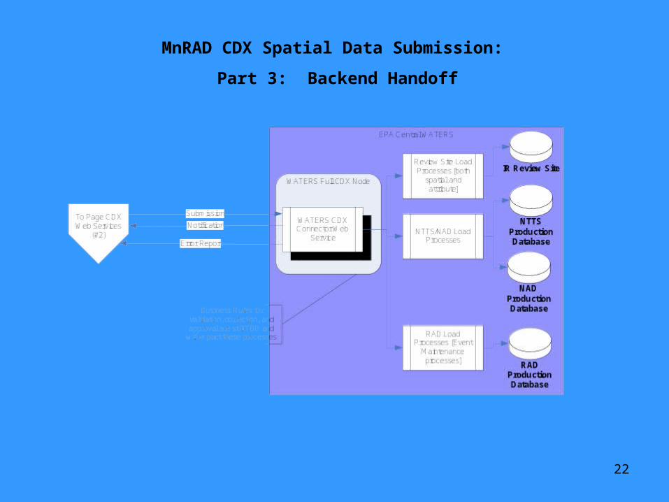
MnRAD CDX Spatial Data Submission:
Part 3: Backend Handoff
23
MnRAD Next Steps
Complete system design and implement
Finalize flow configuration document for integrated reporting
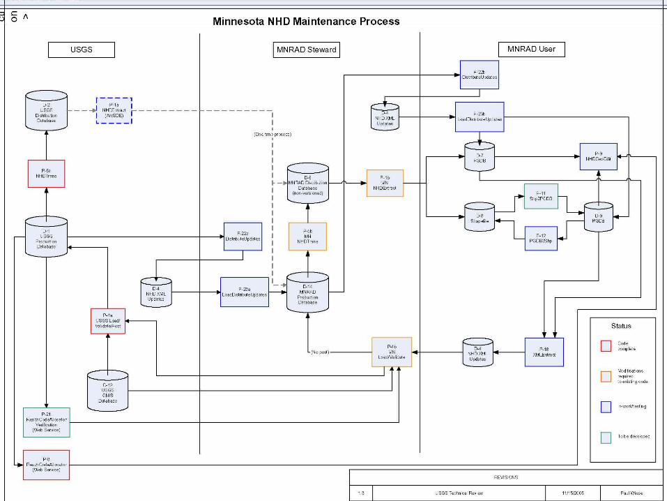
Develop system and methods to update the NHD for Minnesota