b.sc. agri i foswce unit 1 surveying
TRANSCRIPT
Surveying
Course: B.Sc. Agricultural
Subject :Fundamental of Soil, Water and Conservation engineering
Unit: 1
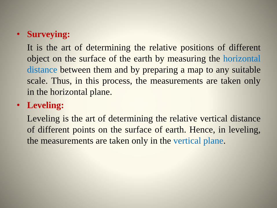
• Surveying:
It is the art of determining the relative positions of different
object on the surface of the earth by measuring the horizontal
distance between them and by preparing a map to any suitable
scale. Thus, in this process, the measurements are taken only
in the horizontal plane.
• Leveling:
Leveling is the art of determining the relative vertical distance
of different points on the surface of earth. Hence, in leveling,
the measurements are taken only in the vertical plane.
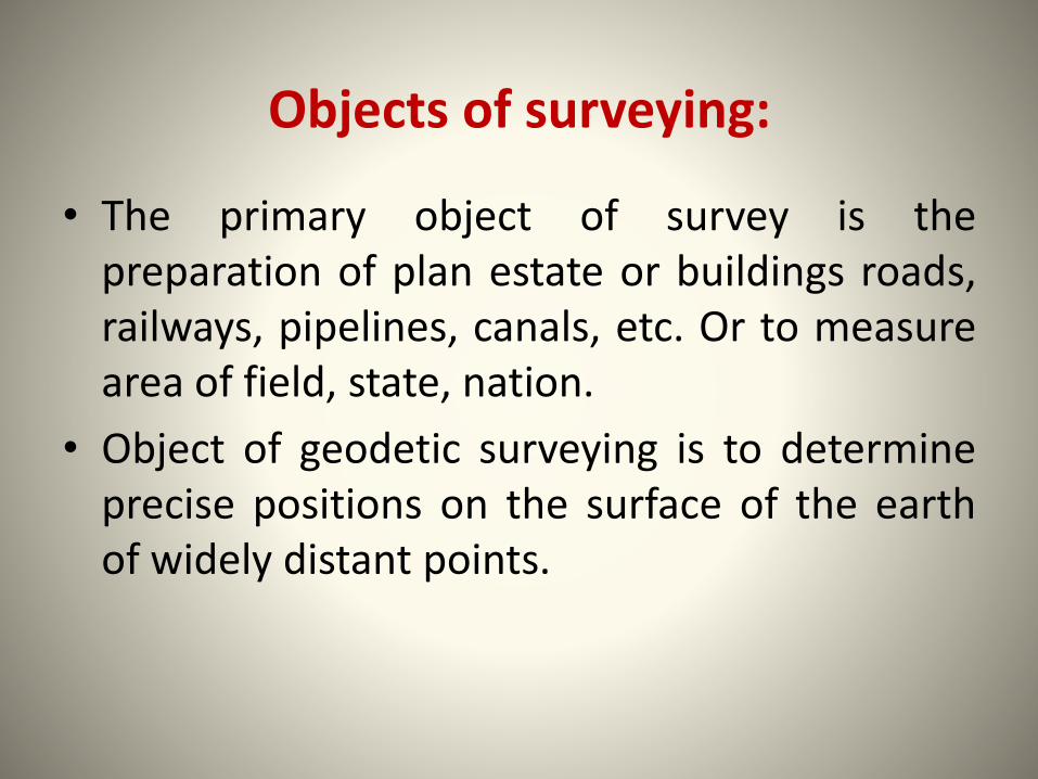
Objects of surveying:
• The primary object of survey is thepreparation of plan estate or buildings roads,railways, pipelines, canals, etc. Or to measurearea of field, state, nation.
• Object of geodetic surveying is to determineprecise positions on the surface of the earthof widely distant points.
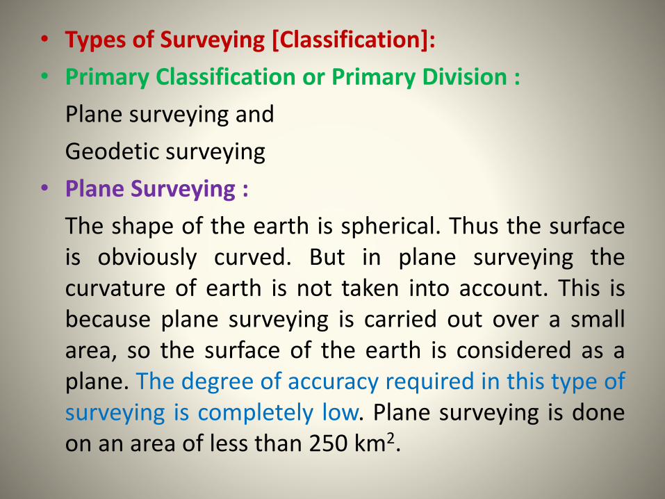
• Types of Surveying [Classification]:
• Primary Classification or Primary Division :
Plane surveying and
Geodetic surveying
• Plane Surveying :
The shape of the earth is spherical. Thus the surfaceis obviously curved. But in plane surveying thecurvature of earth is not taken into account. This isbecause plane surveying is carried out over a smallarea, so the surface of the earth is considered as aplane. The degree of accuracy required in this type ofsurveying is completely low. Plane surveying is doneon an area of less than 250 km2.
• Geodetic surveying :
• In geodetic surveying the curvature of the earth istaken into consideration. It is extended over alarge area greater than 250 km2.
• The line joining any two points considered as acurved line. Very refined methods andinstruments are used in this type of surveying. Inthis method very high precision or accuracy isrequired.
• Secondary classification:
Survey can be classified on different bases.
• 1. Based on instrument:
- Chain Survey
- Compass survey
- Plane Table survey
- Theodolite survey
- Tacheometric Survey
- Photographic survey
• 2. Based on methods:
- Triangulation Survey
- Traverse Survey
• 3. Based on Objects:
- Geological survey
- Mine survey
- Archeological Survey
- Military survey
• 4. Based on nature of field
- Land Survey- Marine survey- Astronomical survey
• Again Land Survey is classified into following Classes:
• 1. Topographical Survey
To determine natural features of a country such as valleys,rivers and artificial features such as road, railways, etc.
• 2. Cadastral Survey:
To determine boundaries of field, estate
• 3. City survey:
To locate premises, streets, water supply and drainagesystems
• 4. Engineering survey:
To collect detailed data for the design for of projects involvingroads, railways, etc Engineering surveys are sub divided into:
1. Reconnaissance Survey
2. Preliminary Survey
3. Location Survey
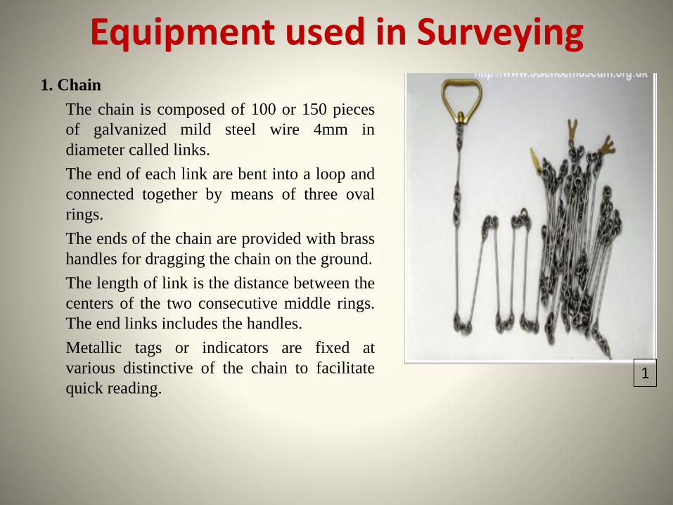
Equipment used in Surveying1. Chain
The chain is composed of 100 or 150 pieces
of galvanized mild steel wire 4mm in
diameter called links.
The end of each link are bent into a loop and
connected together by means of three oval
rings.
The ends of the chain are provided with brass
handles for dragging the chain on the ground.
The length of link is the distance between the
centers of the two consecutive middle rings.
The end links includes the handles.
Metallic tags or indicators are fixed at
various distinctive of the chain to facilitate
quick reading.1
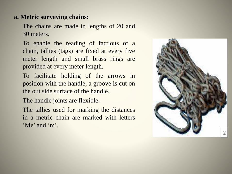
a. Metric surveying chains:
The chains are made in lengths of 20 and
30 meters.
To enable the reading of factious of a
chain, tallies (tags) are fixed at every five
meter length and small brass rings are
provided at every meter length.
To facilitate holding of the arrows in
position with the handle, a groove is cut on
the out side surface of the handle.
The handle joints are flexible.
The tallies used for marking the distances
in a metric chain are marked with letters
‘Me’ and ‘m’.2
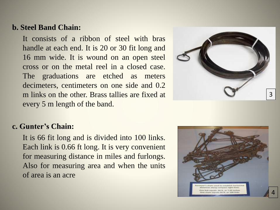
b. Steel Band Chain:
It consists of a ribbon of steel with bras
handle at each end. It is 20 or 30 fit long and
16 mm wide. It is wound on an open steel
cross or on the metal reel in a closed case.
The graduations are etched as meters
decimeters, centimeters on one side and 0.2
m links on the other. Brass tallies are fixed at
every 5 m length of the band.
c. Gunter’s Chain:
It is 66 fit long and is divided into 100 links.
Each link is 0.66 ft long. It is very convenient
for measuring distance in miles and furlongs.
Also for measuring area and when the units
of area is an acre
3
4
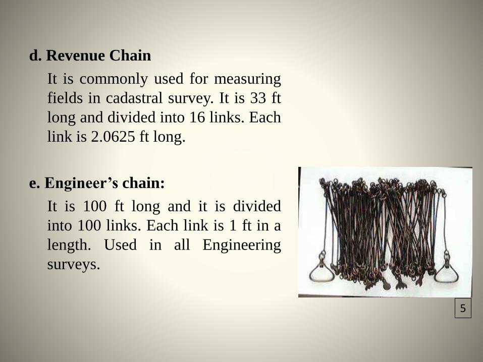
d. Revenue Chain
It is commonly used for measuring
fields in cadastral survey. It is 33 ft
long and divided into 16 links. Each
link is 2.0625 ft long.
e. Engineer’s chain:
It is 100 ft long and it is divided
into 100 links. Each link is 1 ft in a
length. Used in all Engineering
surveys.
5
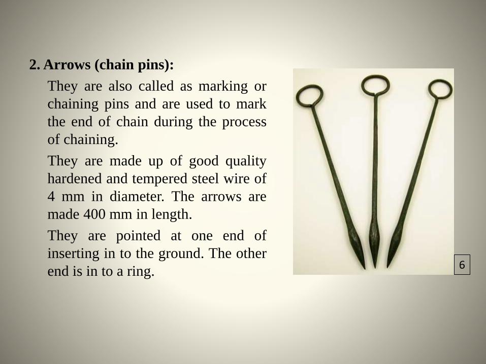
2. Arrows (chain pins):
They are also called as marking or
chaining pins and are used to mark
the end of chain during the process
of chaining.
They are made up of good quality
hardened and tempered steel wire of
4 mm in diameter. The arrows are
made 400 mm in length.
They are pointed at one end of
inserting in to the ground. The other
end is in to a ring.6
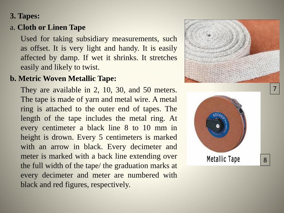
3. Tapes:
a. Cloth or Linen Tape
Used for taking subsidiary measurements, such
as offset. It is very light and handy. It is easily
affected by damp. If wet it shrinks. It stretches
easily and likely to twist.
b. Metric Woven Metallic Tape:
They are available in 2, 10, 30, and 50 meters.
The tape is made of yarn and metal wire. A metal
ring is attached to the outer end of tapes. The
length of the tape includes the metal ring. At
every centimeter a black line 8 to 10 mm in
height is drown. Every 5 centimeters is marked
with an arrow in black. Every decimeter and
meter is marked with a back line extending over
the full width of the tape/ the graduation marks at
every decimeter and meter are numbered with
black and red figures, respectively.
7
8
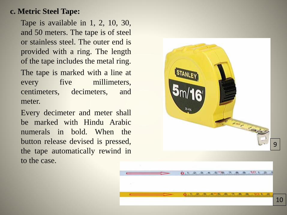
c. Metric Steel Tape:
Tape is available in 1, 2, 10, 30,
and 50 meters. The tape is of steel
or stainless steel. The outer end is
provided with a ring. The length
of the tape includes the metal ring.
The tape is marked with a line at
every five millimeters,
centimeters, decimeters, and
meter.
Every decimeter and meter shall
be marked with Hindu Arabic
numerals in bold. When the
button release devised is pressed,
the tape automatically rewind in
to the case.
9
10
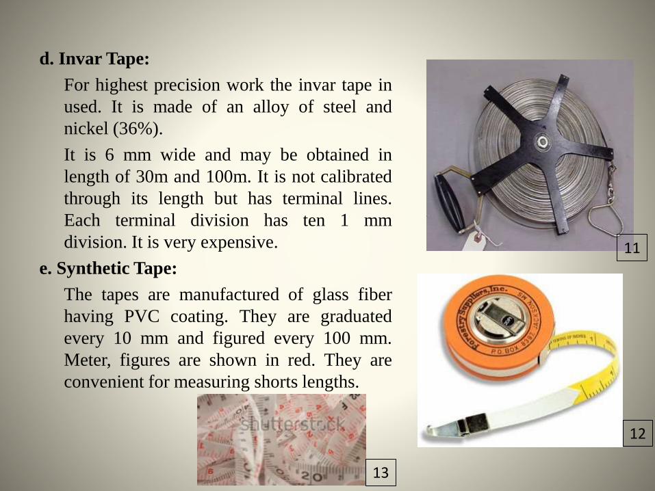
d. Invar Tape:
For highest precision work the invar tape in
used. It is made of an alloy of steel and
nickel (36%).
It is 6 mm wide and may be obtained in
length of 30m and 100m. It is not calibrated
through its length but has terminal lines.
Each terminal division has ten 1 mm
division. It is very expensive.
e. Synthetic Tape:
The tapes are manufactured of glass fiber
having PVC coating. They are graduated
every 10 mm and figured every 100 mm.
Meter, figures are shown in red. They are
convenient for measuring shorts lengths.
11
12
13
Instruments for marking stations:
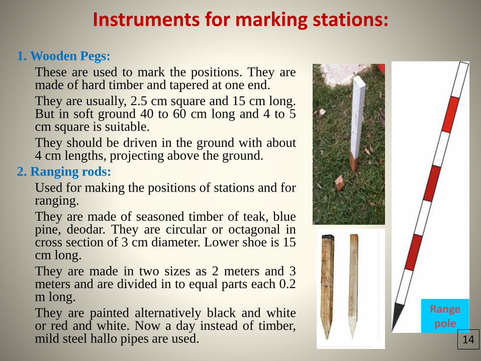
1. Wooden Pegs:
These are used to mark the positions. They aremade of hard timber and tapered at one end.
They are usually, 2.5 cm square and 15 cm long.But in soft ground 40 to 60 cm long and 4 to 5cm square is suitable.
They should be driven in the ground with about4 cm lengths, projecting above the ground.
2. Ranging rods:
Used for making the positions of stations and forranging.
They are made of seasoned timber of teak, bluepine, deodar. They are circular or octagonal incross section of 3 cm diameter. Lower shoe is 15cm long.
They are made in two sizes as 2 meters and 3meters and are divided in to equal parts each 0.2m long.
They are painted alternatively black and whiteor red and white. Now a day instead of timber,mild steel hallo pipes are used.
Range pole
14
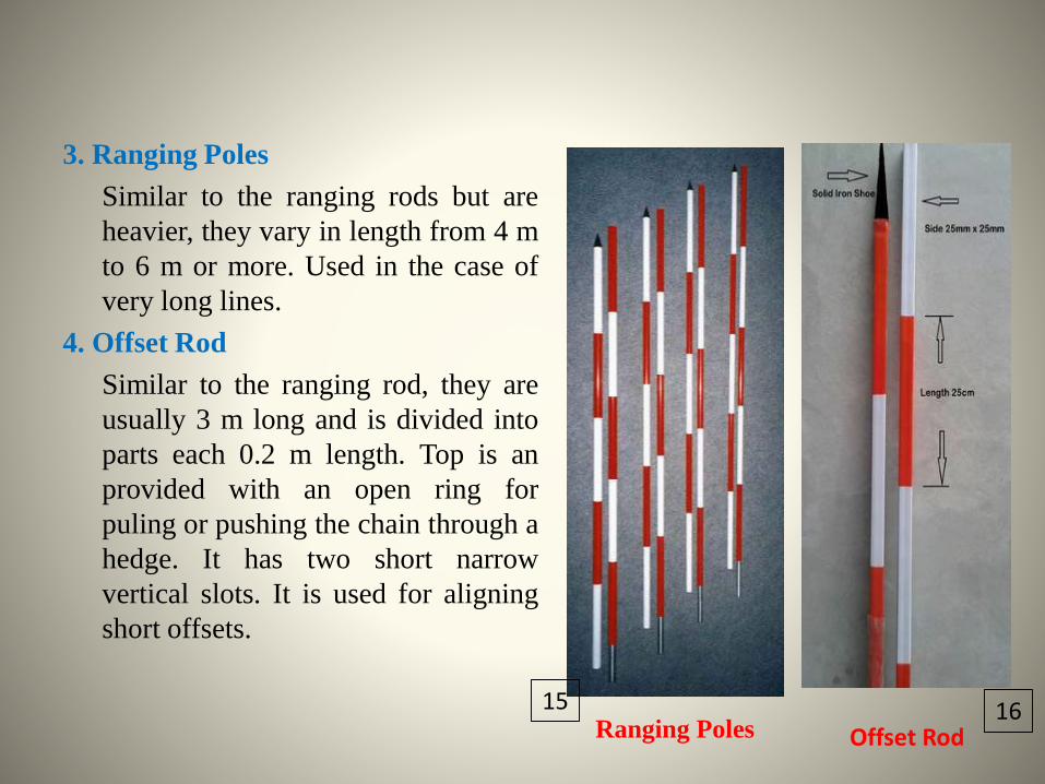
3. Ranging Poles
Similar to the ranging rods but are
heavier, they vary in length from 4 m
to 6 m or more. Used in the case of
very long lines.
4. Offset Rod
Similar to the ranging rod, they are
usually 3 m long and is divided into
parts each 0.2 m length. Top is an
provided with an open ring for
puling or pushing the chain through a
hedge. It has two short narrow
vertical slots. It is used for aligning
short offsets.
Offset RodRanging Poles15 16
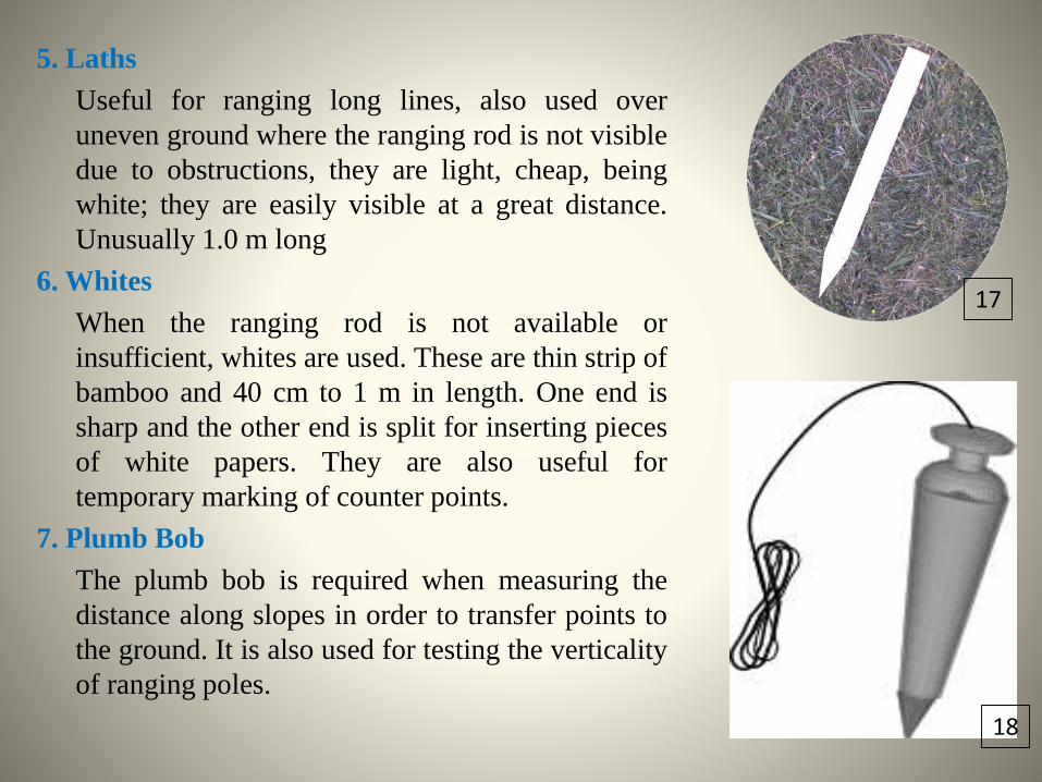
5. Laths
Useful for ranging long lines, also used over
uneven ground where the ranging rod is not visible
due to obstructions, they are light, cheap, being
white; they are easily visible at a great distance.
Unusually 1.0 m long
6. Whites
When the ranging rod is not available or
insufficient, whites are used. These are thin strip of
bamboo and 40 cm to 1 m in length. One end is
sharp and the other end is split for inserting pieces
of white papers. They are also useful for
temporary marking of counter points.
7. Plumb Bob
The plumb bob is required when measuring the
distance along slopes in order to transfer points to
the ground. It is also used for testing the verticality
of ranging poles.
17
18
Uses of Surveying:
• To prepare a topographical map this shows the hills, valley, rivers, villages,
town, etc, of a country.
• To prepare a cadastral map showing the boundaries of fields houses, and other
properties.
• To prepare an engineering map to show details like roads, railways, canals, etc.
• To prepare military map showing roads and railways, communication with
different parts of country.
• To prepare contour map and to determine capacity of a reservoirs and ton find
the best possible route for roads, railways etc.
• To prepare archeological map including places where ancient relics exist.
• To prepare a geological map showing areas including underground resources.
Chain Survey
• Chain survey is the simplest method of surveying. In
this survey only measurements are taken in the field,
and the rest work, such as plotting calculation etc. are
done in the office.
• This is most suitable adapted to small plane areas with
very few details. If carefully done, it gives quite
accurate results.
• The necessary requirements for field work are chain,
tape, ranging rod, arrows and some time cross staff.
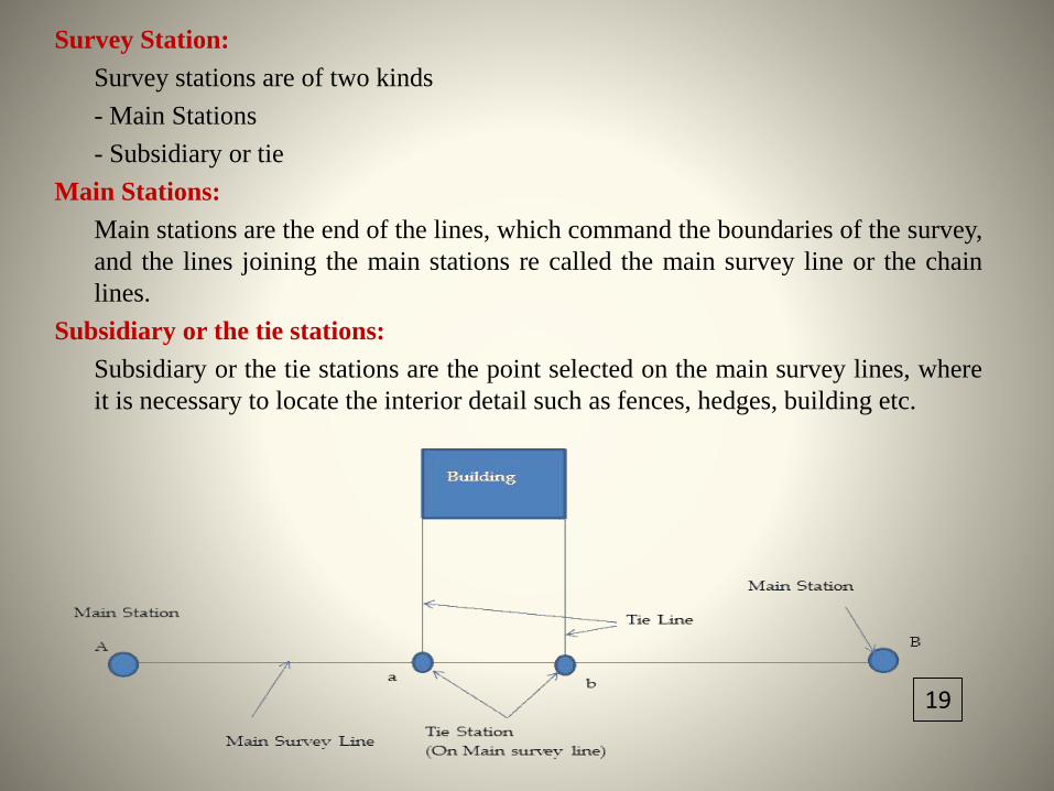
Survey Station:
Survey stations are of two kinds
- Main Stations
- Subsidiary or tie
Main Stations:
Main stations are the end of the lines, which command the boundaries of the survey,
and the lines joining the main stations re called the main survey line or the chain
lines.
Subsidiary or the tie stations:
Subsidiary or the tie stations are the point selected on the main survey lines, where
it is necessary to locate the interior detail such as fences, hedges, building etc.
19
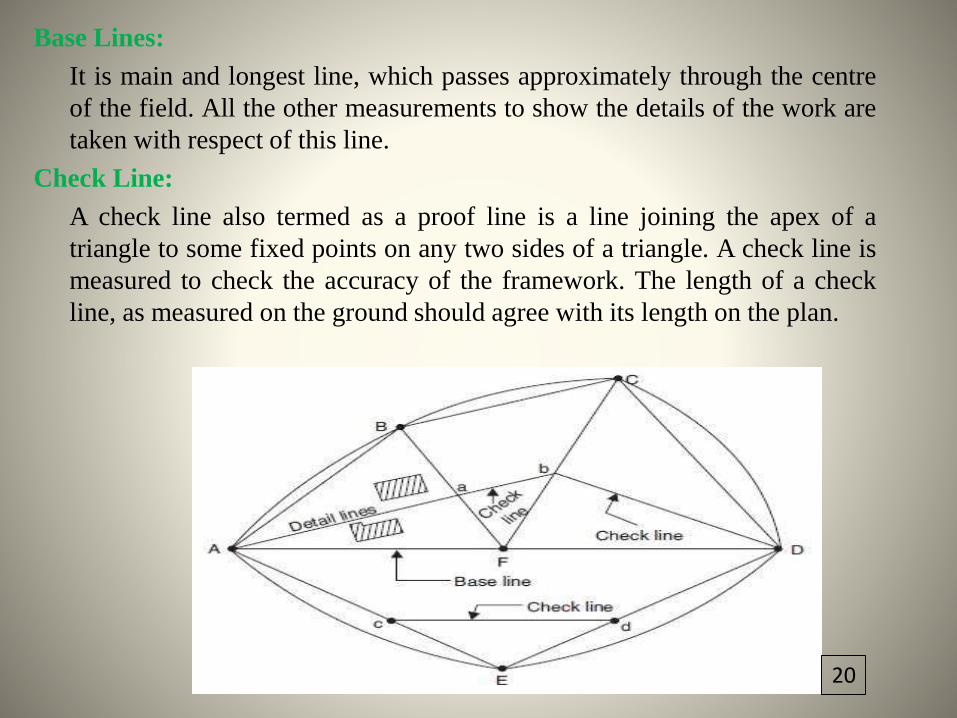
Base Lines:
It is main and longest line, which passes approximately through the centre
of the field. All the other measurements to show the details of the work are
taken with respect of this line.
Check Line:
A check line also termed as a proof line is a line joining the apex of a
triangle to some fixed points on any two sides of a triangle. A check line is
measured to check the accuracy of the framework. The length of a check
line, as measured on the ground should agree with its length on the plan.
20
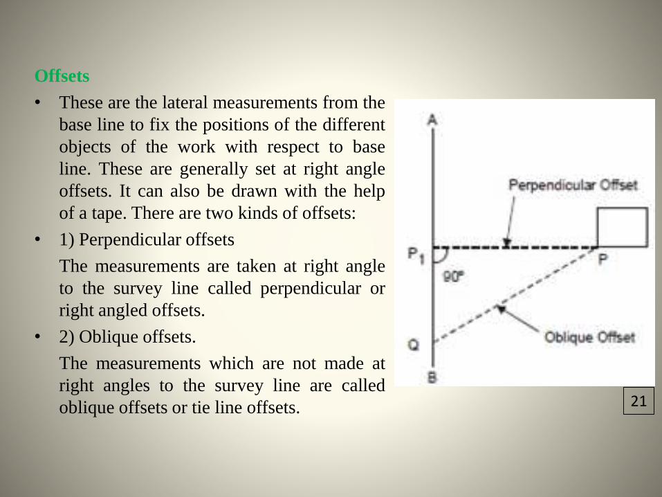
Offsets
• These are the lateral measurements from the
base line to fix the positions of the different
objects of the work with respect to base
line. These are generally set at right angle
offsets. It can also be drawn with the help
of a tape. There are two kinds of offsets:
• 1) Perpendicular offsets
The measurements are taken at right angle
to the survey line called perpendicular or
right angled offsets.
• 2) Oblique offsets.
The measurements which are not made at
right angles to the survey line are called
oblique offsets or tie line offsets. 21
Procedure in chain survey
1. Reconnaissance:
The preliminary inspection of the area to be surveyed is called
reconnaissance. The surveyor inspects the area to be surveyed, survey or
prepares index sketch or key plan.
2. Marking Station:
Surveyor fixes up the required no stations at places from where maximum
possible stations are possible.
3. Then he selects the way for passing the main line, which should be
horizontal and clean as possible and should pass approximately through the
centre of work.
4. Then ranging roads are fixed on the stations.
5. After fixing the stations, chaining could be started.
6. Make ranging wherever necessary.
7. Measure the change and offset.
8. Enter in the field the book.
Cross Staff Survey
• This type of survey is undertaken to locate boundaries of a field or a field
or plat and determinations of its area.
• Principle:
The principle of the survey is to divide the given area in to no of right
angled triangles and trapezoids and to calculate and plot the areas of
triangles and trapezoids.
• Instruments/Material Required:
Two Chains, arrows taps, ranging rods, cross-staff and drawing material
Procedure
Two chains are usually provided one for measuring distance along the
chain line and other for measuring the offsets.
The cross staff is used to set out the perpendicular directions for offsets.
In this survey, the base line runs through the center of the area, so that the
offsets are left or right side of base line are fairly equal.
To check accuracy length of the boundary lines may also be measured.
After the field work is over, the survey is plotted to a suitable scale.
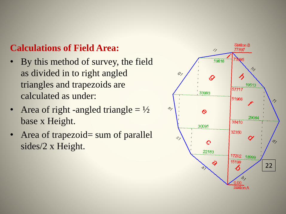
Calculations of Field Area:
• By this method of survey, the field
as divided in to right angled
triangles and trapezoids are
calculated as under:
• Area of right -angled triangle = ½
base x Height.
• Area of trapezoid= sum of parallel
sides/2 x Height.
22
Reference/Sources1.https://lh3.ggpht.com/eN01oZR9PxNPxpsDcr9gUZdGSUdrKiuiSM6uTY64ECJcAz1TzwZ03Up9CNHifvn5U6bl=s852.https://lh3.ggpht.com/9tUsVmdka8MeE5TQBNnJxhCik9XqSmuy2OwXq4ySVbnZbDufCvWRltLY_uJ_DuJwhm45=s953.https://lh4.ggpht.com/0afGESSNNYsmMmMv0loH0lVDvvyLKk9TetlZYwohJQn1inU_MrNSTxooTwcJC8rNizo2QYw=s1184.https://lh5.ggpht.com/xGo7qFS_xe99jBmWfVyx4wpDYVFSaK7aFT8dG1bwuk8lt404M3kHteFbBg2jprX8BPg7dtg=s1095. https://lh6.ggpht.com/KZR-0kE9ynzZpTPcZ5Tm1Gf7-5LkWs_YvUWe4csapsMxIdK9J-wUg9FX2zNAZR6ErIFmpA=s1136. https://lh6.ggpht.com/5_1Oqvwfg6P1u0HrPM-NSwMwfkklQsJ-vK8KJHA_sH03MToBGrpOyD_2sFBy1Es5DkfxSgM=s857. https://lh5.ggpht.com/eSch4M7mxb7IG-7aSArIvAfjonkDzrpMUAXVF1QcNUsKpCjsAYu6RNxJMTePz2JMaq_7bQ=s1278.https://lh3.ggpht.com/89hYheAiDqv0qR7mfGLsk39eZzDX0bI_iEpAdcNL9tBRA_UMv-kEZBKGXrS8u6jVvX2K=s859. https://lh4.ggpht.com/RBK5wB-
8WfdHm4QEo1MFeIVzD9MNYB8pzuYsTwBIk1tRroqGncPaFUpbyHPRCjCzk7oWOA=s8510. https://lh6.ggpht.com/3KB089IL-sNL7vByq4yw01aSe_b83wIvGMbEOiCZS9V0QvEXdfdpP-
kYEQD2S5QZSXMVug=s17011. https://lh3.ggpht.com/au8-70sN4qC4zzR2pN9V31mPy7eDOCCziYpJXOYfr9IbvGQzGVs2M1XZlIb8HlvYkndtSw=s10912. https://lh4.ggpht.com/Xlzt0Gnb7IYSfJuLlZHImrdKbKRw0U9unqb5A9qIPmy1AgqiHz-Y4DaKIsleCRQBO4pM_0Q=s10013. https://lh5.ggpht.com/SmNyiqF7EFp5UpA8cq3rXsCFTy9iNz0vmT8lutb_UW2d1RJ67cOBMlhjroTxwUjfkrCXQQ=s15614. https://lh4.ggpht.com/9IdAjwfXk5NXO3Mxzja-cOF80Bm3iY2XKJLsCRSHXwiFW1dpW6UKSFqrxw0lMJh-AYVuMg=s8515. https://lh6.ggpht.com/FwoZ0gcetDtRPRqJZ9CXjK9cLGT10P8ccMlyRJ2L2TDvMnY672beNQ6SbW4r3f3lMPnhPw=s8516. https://lh5.ggpht.com/tAjBWoJITFJ-gbI5exI2y8hZyRm5b134OgcujZma6suoHSTU3k0GgnHtgtZtMdAIv-MZvg=s8517. https://lh5.ggpht.com/WBZVAKVq183n8jC93lbQK4fHri3MFKte-6KjuFPG930ZcF7UIxj5xNWTRighBR_QPgucRA=s8518. https://lh5.ggpht.com/C7x33N0T2jtep5hKLMR7rGHFjKkC6Dt9Lj15E6Jvv15zya6RV7qeety4PByksrOh9ezP5A=s8519. https://lh4.ggpht.com/zgg7DK37XvrSyZHSCelix_FWW661DAKjqw00hLjIPiW2716qEEumiOCKu3T1A_Izkj-w=s17020. https://lh4.ggpht.com/4RiRKWY8MxCZl4h5bQRcZ_vnruopNr86yq6bFcUDlDdcCalFVVwKlSKUF3r0GN4PMrhu=s10221.https://lh4.ggpht.com/RIurXcgclWcPIZOjkudo-DoJw78NxwiLM8ZhQxITEks9JvB3xlIPJRq4IXk8COeXA8J5tAc=s8522. https://lh5.ggpht.com/tb3-E1StbD-UA2xhajIhLxI5IjjJZUodP6VHGkdFOjMkb9_ChG3svh8IjFirbPRF-Gf6=s85

Text book and web sources
- www.agriinfo.in
- ecourses.iasri.res.in
- Soil erosion and Conservation by R. P. Tripathiand H. P. Singh