brownfield land registers data standard: preparing · pdf file ·...
TRANSCRIPT

July 2017 Department for Communities and Local Government
Brownfield Land Registers Data Standard: Preparing and publishing a register

© Crown copyright, 2017
Copyright in the typographical arrangement rests with the Crown.
You may re-use this information (not including logos) free of charge in any format or medium, under the terms of the Open Government Licence. To view this licence,http://www.nationalarchives.gov.uk/doc/open-government-licence/version/3/ or write to the Information Policy Team, The National Archives, Kew, London TW9 4DU, or email: [email protected].
This document/publication is also available on our website at www.gov.uk/dclg
If you have any enquiries regarding this document/publication, complete the form at http://forms.communities.gov.uk/ or write to us at:
Department for Communities and Local Government Fry Building 2 Marsham Street London SW1P 4DF Telephone: 030 3444 0000
For all our latest news and updates follow us on Twitter: https://twitter.com/CommunitiesUK
July 2017
ISBN: 978-1-4098-5087-8

1
Contents
Introduction 3
Purpose 3
The Data Standard 4
Part 1 and Part 2 of the Register 4
Columns in the Register 5
OrganisationURI 6
OrganisationLabel 7
SiteReference 7
PreviouslyPartOf 8
SiteNameAddress 8
SiteplanURL 9
CoordinateReferenceSystem 9
GeoX 11
GeoY 11
Hectares 12
OwnershipStatus 12
Deliverable 13
PlanningStatus 13
PermissionType 14
PermissionDate 15
PlanningHistory 15
ProposedForPIP 16
MinNetDwellings 16
DevelopmentDescription 17
NonHousingDevelopment 18
Part2 18
NetDwellingsRangeFrom 19
NetDwellingsRangeTo 19
HazardousSubstances 20
SiteInformation 21
Notes 21

2
FirstAddedDate 22
LastUpdatedDate 22
Data structures 23
The CSV file format 23
Basic rules for writing csv files 23
Types of Field 24
Cardinality 25
Mandatory / Optional? 25
Checking that a file complies with the data standard 25
Validation 25
Publishing the brownfield land register 25
Formats 25
File Naming Convention 26
Publishing to the Web 27
Registering the location of files so that they can be discovered. 27
Licensing 27
The Ordnance Survey Presumption to Publish 27
The Open Government Licence 28
Annex 1: Sample data 29
Brownfield Land Register Part 1 Example 29
Brownfield Land Register Part 2 Example 31

3
Introduction
Purpose The Secretary of State has the power to require local planning authorities to provide information from their brownfield land registers in a particular format (see regulation 18(2) of the Town and Country Planning (Brownfield Land Register) Regulations 2017 “the 2017 Regulations”). Local planning authorities will be able to meet the obligation to provide information in a particular format by preparing and publishing their registers in accordance with this document, therefore this document sets out the national data standard that all local planning authorities in England are encouraged to follow in preparing and publishing their brownfield land registers. The data standard has been developed collaboratively by the Department for Communities and Local Government (DCLG), iStandUK and representatives of the local planning authorities that took part in a pilot project in 2016. It is essential that the registers published by local planning authorities are consistent and published in an open data format to ensure that they can be aggregated by users of the data.
Background
The 2017 Regulations introduced the requirement for all local planning authorities in England to prepare, maintain and publish registers of previously developed land within their area that they consider appropriate for residential development (brownfield land registers). The 2017 Regulations set out in detail the steps that local planning authorities are required to follow in preparing and publishing their brownfield land registers. Those authorities specified in section 37 of the Planning and Compulsory Purchase Act 2004 “the 2004 Act” are required to publish a brownfield land register. They are: district councils, London borough councils, metropolitan district councils, county councils (in areas where there is no district council), the Broads Authority, National Park authorities and a Mayoral Development Corporation where it is the local planning authority for the purposes of Part 2 of the 2004 Act. Brownfield land registers will ensure that standardised information and data about brownfield land that is suitable and available for residential development is kept up-to-date and made publicly available. This will provide certainty for local authorities, developers and communities and encourage investment on brownfield land. Registers will also enable the aggregation of data on brownfield land that is suitable for housing, including progress being made on getting planning permissions in place. Brownfield land registers are also a vehicle for granting permission in principle on suitable sites helping to increase the number of planning permissions for new homes. DCLG has published National Planning Practice Guidance on GOV.UK in relation to brownfield land registers and permission in principle which should be read alongside this document. Local planning authorities are required to publish their brownfield land registers by 31 December 2017 and to review them at least once a year.

4
Design Principles for the Data Standard The data standard has been designed to ensure that brownfield land registers are accessible for those entering data and navigating the information they contain. The information will also be capable of digital analysis which can be used to gain a more comprehensive understanding about the location and capacity of brownfield land suitable for residential development.
Registers will typically be published on local authority web sites. They will be published in an ‘open’ format that can be read without proprietary software. Files from all local authorities will be in a consistent structure enabling information to be linked and analysed with other data. A standard approach to registering the location of data will make it possible to find, collect and analyse the data. The standard incorporates existing good practice for designing opendata, including: ● A number of data structures recommended for use by The Local Government Association when
publishing open data from local authorities. Re-using these patterns can improve the potential to join up data across themes.
● A series of recommendations from The Cabinet Office Open Standards Board on how some classes
of data should be published by Government. Using these patterns makes public open data more consistent and easier to use.
The Data Standard
A spreadsheet style representation of a Register A brownfield land register is to be published in a spreadsheet style; that is, as a file containing a series rows, where each row has a consistent set of columns.
Each row will represent a single brownfield site. Brownfield sites that are included in brownfield land registers are those that local planning authorities have assessed against the criteria in regulation 4 of the 2017 Regulations and any other relevant considerations such as the NPPF.
Part 1 and Part 2 of the Register Part 1 of a brownfield land register will comprise all brownfield sites that a local planning authority has assessed as appropriate for residential development, having carried out any procedures such as consultation, which they consider appropriate. This will include sites with extant full planning permission, outline planning permission and permission in principle as well as sites without planning permission.
Where relevant, Part 1 of the register will consist of information entered in the columns:
● OrganisationURI ● OrganisationLabel ● SiteReference ● PreviouslyPartOf
5
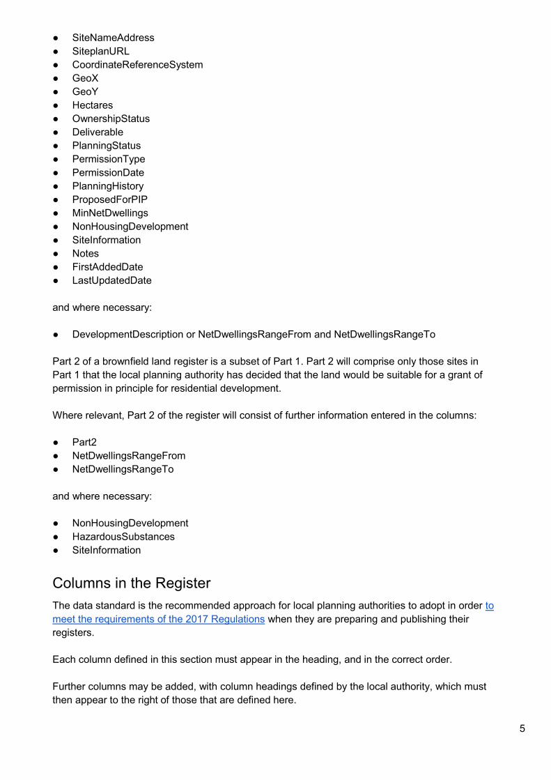
● SiteNameAddress ● SiteplanURL ● CoordinateReferenceSystem ● GeoX ● GeoY ● Hectares ● OwnershipStatus ● Deliverable ● PlanningStatus ● PermissionType ● PermissionDate ● PlanningHistory ● ProposedForPIP ● MinNetDwellings ● NonHousingDevelopment ● SiteInformation ● Notes ● FirstAddedDate ● LastUpdatedDate
and where necessary:
● DevelopmentDescription or NetDwellingsRangeFrom and NetDwellingsRangeTo
Part 2 of a brownfield land register is a subset of Part 1. Part 2 will comprise only those sites in Part 1 that the local planning authority has decided that the land would be suitable for a grant of permission in principle for residential development.
Where relevant, Part 2 of the register will consist of further information entered in the columns: ● Part2 ● NetDwellingsRangeFrom ● NetDwellingsRangeTo
and where necessary:
● NonHousingDevelopment ● HazardousSubstances ● SiteInformation
Columns in the Register The data standard is the recommended approach for local planning authorities to adopt in order to meet the requirements of the 2017 Regulations when they are preparing and publishing their registers.
Each column defined in this section must appear in the heading, and in the correct order.
Further columns may be added, with column headings defined by the local authority, which must then appear to the right of those that are defined here.

6
See the later section on Data Structures for an explanation of ● Field Type ● Cardinality ● Mandatory / Optional
Column Number
1
Column Name OrganisationURI
Field Type URL
Cardinality 1
Mandatory / Optional?
Mandatory
Definition To identify the Local Authority within whose area the parcel of land lies.
Validation These URIs all start with ‘http://opendatacommunities.org/id/’. For example, the URI for Sedgemoor District Council is http://opendatacommunities.org/id/district-council/sedgemoor
Notes The OrganisationURI must be selected from a list of existing URIs, provided by DCLG. iStandUK provide some guidance about how to find the right URI. The Local Government Association provide a simple tool to find the right URI for a local authority at http://uris.opendata.esd.org.uk/. This field will be repeated for every row in a register that refers to the same local authority. Some files may be compiled for a partnership of councils, in which case there will be more than one OrganisationURI throughout the file. These URIs are useful as they can be looked up to give more structured information about a local authority, including for example, the coordinates of its boundary. Using URIs in this way can give valuable information that app developers can use to provide a rich linked view of information, which is otherwise not contained in the register. Where land is spread across local authority boundaries, each local planning authority must enter into the register that part of land within its own boundaries, taking into account the criteria in the 2017 Regulations.

7
Column Number
2
Column Name OrganisationLabel
Field Type string
Cardinality 1
Mandatory / Optional?
Mandatory
Definition The name of the local authority that is identified using the OrganisationURI.
Validation Up to 100 characters.
Notes This should be laid out as per the authority’s preference, for example Sedgemoor District Council. This field will be repeated for every row in a register that refers to the same local authority.
Column Number
3
Column Name SiteReference
Field Type string
Cardinality 1
Mandatory / Optional?
Mandatory
Definition A reference applied by the local authority to identify a site.
Validation Up to 50 characters.
Notes Unique to the local authority, but not necessarily nationally. This reference should be used consistently to identify the same site whilst it remains on future versions of a register. The reference may be reused from existing listings of sites such as the Strategic Housing Land Availability Assessment (SHLAA).

8
If a site is known by more than one reference, perhaps across different systems, these alternative references could be listed in an additional column. The extra column could have a column heading of ‘AlternativeReferences’. It may be useful to prefix a reference with some initials to identify the local source system e.g pa:1234.
Column Number
4
Column Name PreviouslyPartOf
Field Type string
Cardinality 1
Mandatory / Optional?
Optional
Definition The SiteReference that this site was previously a part of when reported on an earlier register.
Validation Up to 50 characters.
Notes This field will typically be blank. Where an entry of land on the register is only partly permissioned, and where in the opinion of the local planning authority the remaining land should have a separate entry in the register, this field may be used to link back to the original entry. Using this field will promote the availability of the remaining part of the land.
Column Number
5
Column Name SiteNameAddress
Field Type string
Cardinality 1
Mandatory / Optional?
Mandatory

9
Definition The name and address of a site, which should be sufficient to describe its location.
Validation Up to 255 characters.
Notes This is a single line of text, which is not intended to be strictly structured. i.e. no need to put street name or town in a particular part. Parts of the address may be separated using commas, in which case this field should be surrounded by double-quotes.
Column Number
6
Column Name SiteplanURL
Field Type URL
Cardinality 1
Mandatory / Optional?
Mandatory
Definition A URL to a web page giving a site plan for the site.
Validation Web links will start with http:// or https://
Notes A good approach to this field will be a link to a GIS style web page showing the extent of the selected site, overlaid on a map. That page might also show other related information and other geographic layers such as constraints. It is also valid for the field to link to a static web page or document containing an image of the extent of the select site. It is also acceptable, but less desirable, for the field to link to a common landing page for a GIS service, where the user would then have to enter more information, such as the SiteReference, to then bring up the selected site.
Column Number
7
Column Name CoordinateReferenceSystem

10
Field Type encoded list
Cardinality 1
Mandatory / Optional?
Mandatory
Definition The Coordinate Reference System that is used for the fields ‘GeoX’ and ‘GeoY’.
Validation One of: ● WGS84 ● OSGB36 ● ETRS89
Notes The field must contain one of the following values: ● WGS84 (see http://en.wikipedia.org/wiki/WGS84) – version of latitude and
longitude. ● OSGB36 (see http://en.wikipedia.org/wiki/Ordnance_Survey_National_Grid)
– version of northing and easting. ● ETRS89 (see
https://en.wikipedia.org/wiki/European_Terrestrial_Reference_System_1989) – version of longitude and latitude. This is the coordinate reference system that is required for use with INSPIRE.
The Cabinet Office Open Standards Board have adopted a standard for expressing point locations in open data at https://www.gov.uk/government/publications/open-standards-for-government/exchange-of-location-point The adopted standard requires that points are expressed using the ETRS89 system, with an option to use the WGS84 system where a reduced level of precision is acceptable. Therefore, although this field has three options, local authorities should use the ETRS89 system. The Ordnance Survey provide a web facility to transform a batch of coordinates in OSGB36, to ETRS89, at https://www.ordnancesurvey.co.uk/gps/transformation/batch If a publisher wishes to also publish OSGB36 coordinates, extra columns can be added for
● Easting ● Northing

11
Column Number
8
Column Name GeoX
Field Type number
Cardinality 1
Mandatory / Optional?
Mandatory
Definition Longitude or east grid reference for the visual centroid of the site boundary.
Validation A decimal number.
Notes A Longitude will typically be stated to 6 decimal places of a degree. An Easting will typically be a whole number, or with up to 2 decimal places.
Column Number
9
Column Name GeoY
Field Type number
Cardinality 1
Mandatory / Optional?
Mandatory
Definition Latitude or north grid reference for visual of application boundary.
Validation A decimal number.
Notes A Latitude will typically be stated to 6 decimal places of a degree. A Northing will typically be a whole number, or with up to 2 decimal places.

12
Column Number
10
Column Name Hectares
Field Type number
Cardinality 1
Mandatory / Optional?
Mandatory
Definition The size of the land in hectares.
Validation A decimal number with up to 2 decimal places.
Notes
Column Number
11
Column Name OwnershipStatus
Field Type encoded list
Cardinality 1
Mandatory / Optional?
Mandatory
Definition The ownership status of the land.
Validation One of: ● owned by a public authority ● not owned by a public authority ● mixed ownership ● unknown ownership
Notes These terms are defined in paragraph 5 of Schedule 2 to the 2017 Regulations.

13
Column Number
12
Column Name Deliverable
Field Type encoded list
Cardinality 1
Mandatory / Optional?
Optional Must be completed where relevant
Definition To indicate if the land is 'Deliverable'.
Validation One of: ● yes
Notes Where the land is ‘deliverable’ the value ‘yes’ must be selected. ‘Deliverable’ is defined in paragraph 5 to Schedule 2 of the 2017 Regulations as, “there is a reasonable prospect that residential development will take place on the land within 5 years beginning with the entry date”.
Column Number
13
Column Name PlanningStatus
Field Type encoded list
Cardinality 1
Mandatory / Optional?
Mandatory
Definition To indicate the stage, if any, that has been reached in the planning process for the site.
Validation One of: ● permissioned ● not permissioned ● pending decision
Notes This field is helpful to monitor the progress of individual sites as they appear on

14
successive versions of a register, and to derive statistics. These terms are defined in paragraph 5 of Schedule 2 of the 2017 Regulations. Where part of a site is permissioned, it should be recorded as ‘permissioned’ here, and the Notes field used to explain why it is only partly permissioned.
Column Number
14
Column Name PermissionType
Field Type encoded list
Cardinality 1
Mandatory / Optional?
Optional A value must be given where the ‘PlanningStatus’ field contains the value ‘permissioned’.
Definition The latest type of permission that has been granted on the site.
Validation One of: ● full planning permission ● outline planning permission ● reserved matters approval ● permission in principle ● technical details consent ● planning permission granted under an order ● other
Notes These terms are defined in paragraph 5 of Schedule 2 to the 2017 Regulations. Where more than one permission exists for the site, identify the latest permission granted and any other permissions, including the date that such permission was granted or deemed to have been granted, in the ’Notes’ column. ‘planning permission granted under an order’ means planning permission granted under a local development order, a mayoral development order or a neighbourhood development order.

15
Column Number
15
Column Name PermissionDate
Field Type date
Cardinality 1
Mandatory / Optional?
Optional A value must be given where the ‘PlanningStatus’ field contains the value ‘permissioned’.
Definition The date permission was granted for the permission set out in the field ‘PermissionType’.
Validation A valid date in the form yyyy-mm-dd.
Notes
Column Number
16
Column Name PlanningHistory
Field Type URL
Cardinality many
Mandatory / Optional?
Optional
Definition Links to webpages giving information about the planning history of the site.
Validation Web links will start with http:// or https://. If more than one link is given, they should be separated by the pipe character (|).
Notes Avoid links to history which is not relevant to the site in its brownfield state.

16
Column Number
17
Column Name ProposedForPIP
Field Type encoded list
Cardinality 1
Mandatory / Optional?
Optional Must be completed where relevant.
Definition To indicate if the site has been proposed for residential development (permission in principle).
Validation One of: ● yes
Notes ‘yes’ means that the land is proposed for residential development (permission in principle). This field must be completed within 7 days of the local authority displaying a site notice under regulation 6(1) of the 2017 Regulations where - (a) land has been entered in Part 1; and, (b) first publication of Part 1, (in accordance with paragraph (2) of regulation 3 of the 2017 Regulations), has taken place.
Column Number
18
Column Name MinNetDwellings
Field Type number
Cardinality 1
Mandatory / Mandatory
17
Optional?
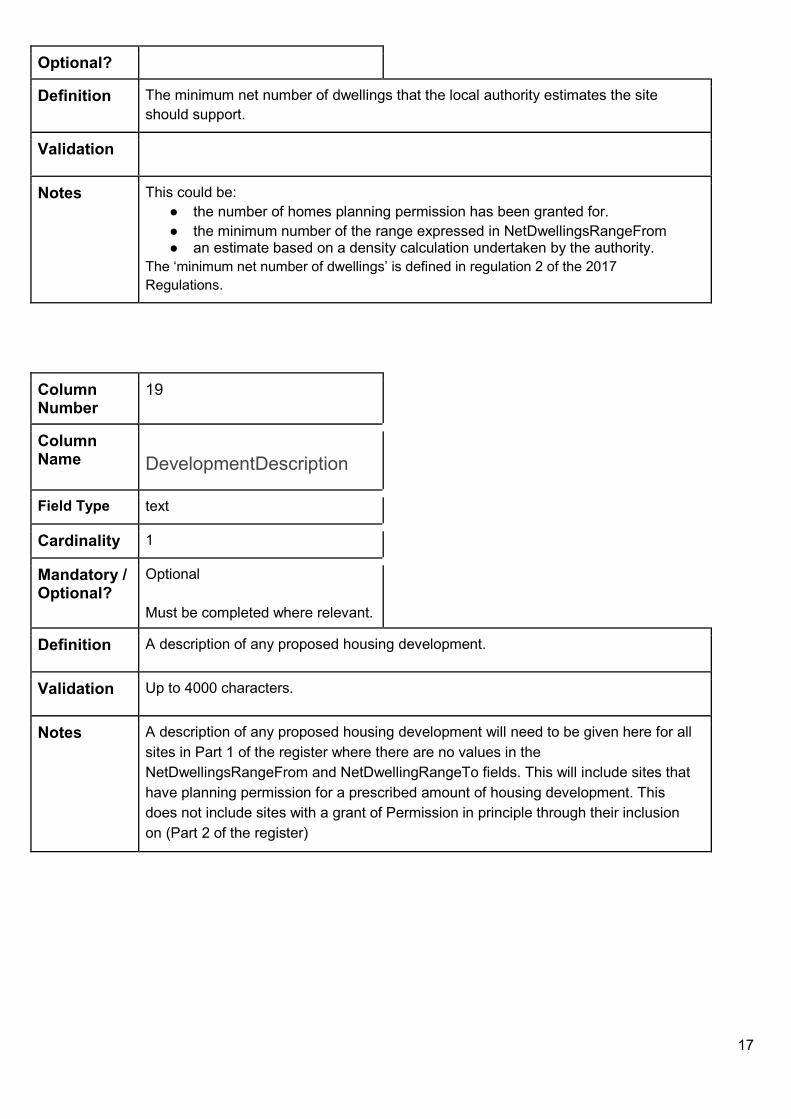
Definition The minimum net number of dwellings that the local authority estimates the site should support.
Validation
Notes This could be: ● the number of homes planning permission has been granted for. ● the minimum number of the range expressed in NetDwellingsRangeFrom ● an estimate based on a density calculation undertaken by the authority.
The ‘minimum net number of dwellings’ is defined in regulation 2 of the 2017 Regulations.
Column Number
19
Column Name DevelopmentDescription
Field Type text
Cardinality 1
Mandatory / Optional?
Optional Must be completed where relevant.
Definition A description of any proposed housing development.
Validation Up to 4000 characters.
Notes A description of any proposed housing development will need to be given here for all sites in Part 1 of the register where there are no values in the NetDwellingsRangeFrom and NetDwellingRangeTo fields. This will include sites that have planning permission for a prescribed amount of housing development. This does not include sites with a grant of Permission in principle through their inclusion on (Part 2 of the register)

18
Column Number
20
Column Name NonHousingDevelopment
Field Type text
Cardinality 1
Mandatory / Optional?
Optional. Must be completed where relevant.
Definition A description of any proposed non-housing development
Validation Up to 4000 characters.
Notes Must be completed for all relevant sites in Part 1 where the development includes non-housing development, and provide a description of the type, including an indication of the use of the buildings or land, and the scale of any such development. For the purposes of section 59 of the Town and Country Planning Act 1990, to allocate land for residential development in a brownfield land register, the register must contain a value in this field, in relation to each entry of land in Part 2 where the development includes non-housing development, and provide a description of the type, including an indication of the use of the buildings or land, and the scale of any such development.
Column Number
21
Column Name Part2
Field Type encoded list
Cardinality 1
Mandatory / Optional?
Optional Must be completed where relevant.
Definition To indicate that a site is in Part 2 of the register.
Validation One of: ● yes

19
Notes ‘yes’ is to mean that the site has been allocated for residential development for the purposes of section 59A of the Town and Country Planning Act 1990 (permission in principle). Where land is entered in Part 2 of the register, where there is a ‘yes’ value in the ProposedForPiP field, this must be removed. That means, if this field is set to ‘yes’, the ProposedForPIP field must be blank.
Column Number
22
Column Name NetDwellingsRangeFrom
Field Type number
Cardinality 1
Mandatory / Optional?
Optional Must be completed where relevant.
Definition The minimum net number of dwellings which, in the authority’s opinion, the land is capable of supporting.
Validation
Notes This field must be completed for all entries in Part 1 of the register where the DevelopmentDescription field has not been completed. For the purposes of section 59 of the Town and Country Planning Act 1990, to allocate land for residential development in a brownfield land register, the register must contain a value in this field, in relation to each entry of land in Part 2 The ‘minimum net number of dwellings’ is defined in regulation 2 of the 2017 Regulations.
Column Number
23
Column Name NetDwellingsRangeTo
Field Type number

20
Cardinality 1
Mandatory / Optional?
Optional. Must be completed where relevant.
Definition The maximum net number of dwellings which, in the authority’s opinion, the land is capable of supporting.
Validation
Notes This field must be completed for all entries in Part 1 of the register where the DevelopmentDescription field has not been completed. For the purposes of section 59 of the Town and Country Planning Act 1990, to allocate land for residential development in a brownfield land register, the register must contain a value in this field, in relation to each entry of land in Part 2 The ‘maximum net number of dwellings’ is defined in regulation 2 of the 2017 Regulations.
Column Number
24
Column Name HazardousSubstances
Field Type encoded list
Cardinality 1
Mandatory / Optional?
Optional Must be completed where relevant.
Definition To indicate the presence of certain characteristics of the site.
Validation One of: ● yes
Notes This field is to indicate, as set out in paragraph 3 of Schedule 2 to the 2017 Regulations, the information required by regulation 26(3) of the Planning (Hazardous Substances) Regulations 2015 SI 2015/627 for sites in Part 2 of the register, that the:
● development of that land would, in the opinion of the local planning authority, be a relevant project for the purpose of regulation 26 of the Planning

21
(Hazardous Substances) Regulations 2015; … and
● the local planning authority is the competent authority for the purpose of that regulation.
Where this field has a value, use the SiteInformation field to record one or more links to the associated information.
Column Number
25
Column Name SiteInformation
Field Type URL
Cardinality many
Mandatory / Optional?
Optional. Must be completed where relevant.
Definition Links to webpages giving further information about the site.
Validation Web links will start with http:// or https://. If more than one link is given, they should be separated by the pipe character (|).
Notes Where the Indicators field includes ‘hazardous substances’, this field must contain one or more links to the information required by paragraph (3) of regulation 26 of the Planning (Hazardous Substances) Regulations 2015.
Column Number
26
Column Name Notes
Field Type text
Cardinality 1
Mandatory / Optional

22
Optional?
Definition General information about a site and its entry on the register.
Validation Up to 4000 characters.
Notes Information that developers might find useful, such as: ● Where permission in principle has been granted, aspects of the technical
details consent application that the local planning authority would expect to see can be provided
● Details of planning permissions, including the date that such permission was granted or deemed to have been granted, where more than one exists for a site
● Where part of a site is permissioned,and has been recorded as ‘permissioned’ in the ‘PlanningStatus’ field, an explanation of why it is only partly permissioned can be recorded here
● Any other information relevant to the development of the site
Column Number
27
Column Name FirstAddedDate
Field Type date
Cardinality 1
Mandatory / Optional?
Mandatory
Definition The date that the site was first added to the register.
Validation A valid date in the form yyyy-mm-dd.
Notes
Column Number
28
Column Name LastUpdatedDate

23
Field Type date
Cardinality 1
Mandatory / Optional?
Mandatory
Definition The date that information about the site was last updated.
Validation A valid date in the form yyyy-mm-dd.
Notes If information about the site has not been updated since first being added to the register, this should repeat the ‘FirstAddedDate’ field.
Data structures
The CSV file format
To meet the requirement for 3* open data, registers will be published in ‘csv’ format.
‘csv’ stands for ‘comma separated values’, which is a file format, in plain text, where ● each row is separated from the next by a new line; ● each column is separated from next by a comma.
The ‘csv’ format provides a way to publish spreadsheet style data which can be read by a wide range of both proprietary and open source tools.
The format is a simple text file, which could be written using a text editor such as notepad. Most popular spreadsheet or database programs have a facility to export to ‘csv’ format, so data is typically prepared in a spreadsheet form and exported, rather than being created and edited as a text file.
The ‘csv’ format is not precisely defined. We follow the advice from the Open Data Institute, and use the definitions of how to write good csv at
http://csvlint.io/about
Basic rules for writing csv files
Entering data into CSV format requires the user to follow basic rules, the CSV Lint About page provides the information needed for CSV.
Some key characteristics, as applied to brownfield land registers are: ● The first row is a header row that contains each of the the column names, separated by a comma.
These must be exactly as specified in this document, paying particular regard to ○ upper and lower case

24
○ underscore characters ‘_’, not to be confused with dashes ‘-’ ○ no spaces
● Each row that follows the header describes a brownfield site. There must be no blank rows as
spacers, and no ‘total’ rows.
● Each field is then placed in a row, separated by a comma, so that it is in the correct sequence with the column name in the header row.
● Where a column is defined as having Cardinality of ‘many’, a field may contain many separate values.
These are then separated using the pipe (|) character. For example, the SiteInformation field can contain many references which may look like
○ http://123456789012|http://234567890123
● If a field contains a comma, a line ending or a double quote, then the whole field should be enclosed in double-quotes. If the field contains a double quote, then it should be prefixed with another double quote. E.g. A field that should read as ○ “Big Ben” Clock Tower
… would be placed in a csv field as ○ “““Big Ben”” Clock Tower”
Types of Field Each column definition has been given a ‘Field Type’. This table explains what each means
date A date in the format dd/mm/yyyy.
encoded list Encoded lists are fixed sets of labels from which you select one, to populate a field.
number A number, which may or may not have decimal places, except where stated otherwise. Note that zero is considered as a value that is distinguished from a null (or absent) value.
string A single line of characters.
text One or more lines of text. Multiple lines can be delimited by carriage return and line feed characters. If these characters are used, the entire field value must be enclosed in quotes.
URL A link to a page on a web site which should be given in full, for instance, http://www.data.gov.uk.

25
Cardinality Each column definition has been given a ‘Cardinality’. Cardinality gives the number of values that may be present in a field for one row. For this dataset, the cardinality of the fields are either ● 1 - there can be only one value in the field. ● many - there can be many values in the field.
○ where there are many values, they must be separated by the pipe (|) character.
Other data standards may have more complicated cardinality requirements, for example specifying a minimum number, and/or maximum number of occurrences for values in a field.
Mandatory / Optional?
Each column definition has been given a ‘Mandatory/Optional’.
● optional - the field may be left empty, but must be included. ‘Where relevant’ indicates where additional information is required by Schedule 2 of the 2017 Regulations.
● mandatory - there must be a valid value in the field.
Checking that a file complies with the data standard The publishing local authority should satisfy themselves that a file complies with the data standard, before publication.
Validation This guidance describes how each of the fields should be completed; we have also put those rules into a schema file, which can be used at http://csvlint.io from the Open Data Institute, or http://opendata.esd.org.uk/ from the Local Government Association, to validate that a data file ● is a good ‘csv’ file; ● has all of the right fields with valid content.
iStandUK have described the steps to take to validate a file.
Publishing the brownfield land register
Formats As a minimum, local authorities should publish brownfield land registers in at least two formats: ● a ‘csv’ file, as described in this guidance; ● an INSPIRE compliant polygon format.

26
Local authorities may also wish to publish their data in other formats that may be more attractive to some groups of users. For example ● pdf ● html ● odf ● xlsx ● rdf
… and so on.
File Naming Convention Brownfield land register files in all formats should be published with a name using the guidance below to construct a filename in the following form
{publisher name}_brownfieldregister_{effective date}_rev{revision number}.{format}
publisher name
The name of the local authority publishing the register. The publisher name should be taken from the label associated with the URI that is used with the field ‘OrganisationURI’. That label can easily be found by looking up the OrganisationURI on the web, so for example, looking up http://opendatacommunities.org/doc/district-council/sedgemoor … shows the label ‘Sedgemoor’ The publisher name should use that label converted to lowercase, and with any spaces removed. Using name from a list will help DCLG to monitor that all files have been published.
Effective date In the format, yyyy-mm-dd. For example, to represent 31st December 2017, use 2017-12-31. This is the effective date of the contents of the register – this could be the date that a committee agreed to the publication of a register or the date the register was updated.
Revision Number
The initial publication of a register for an ‘effective date’ will always have a ‘revision number’ of 1. If a file has been published, and then subsequently amended or corrected, it can be re-issued, with the same ‘effective date’ and with an incremented revision number. When a file is published for a later effective date, the revision number will revert to 1.

27
Format At least one rendition of a register must be in ‘csv’ format, and therefore the filename should have the suffix:
● csv A council may also wish to publish data in many formats for example ● pdf ● html ● odf ● xlsx … and so on.
An example of a typical file name is sedgemoor_brownfieldregister_2017-12-31_rev1.csv
The following guidance will be helpful in naming your file: ● case - the filename should be in lowercase ● underscores - the elements of the file name are separated by underscores and should not be mixed
with dashes, but note that the date has dashes in it. ● spaces - there should be no spaces on the filename
Publishing to the Web
Local authorities will make their own arrangements to publish their data to the web, which will typically be to their own web site, or an open data portal.
DCLG intend to ‘harvest’ each local authority’s register from data.gov.uk and aggregate into a single file, but this will not be published as a national register.
Registering the location of files so that they can be discovered.
Local authorities should register the location of their brownfield land register files at data.gov.uk, specifying this data standard as the schema. This will enable DCLG, and others, to ‘harvest’ each file from every local authority.
Publishers should use the ‘ordering’ feature at data.gov.uk, to make sure that the latest file is always in position 0. This will provide a stable link to always get the latest file.
The features, and design, of data.gov.uk are currently being refreshed. iStandUK have described the steps to register a brownfield land register file, and how that relates to INSPIRE.
Licensing
The Ordnance Survey Presumption to Publish
The Ordnance Survey have reviewed the data requirement for brownfield land registers, and conclude that, where data provided under the ‘Public Sector Mapping Agreement’ has been used, the publication meets their ‘Presumption to Publish’ criteria. Therefore, as long some simple terms are followed, local authorities can publish this brownfield land register data under the Open Government Licence.

28
http://www.nationalarchives.gov.uk/doc/open-government-licence/version/3/
Each Local Authority should notify the Ordnance Survey that they are publishing brownfield land register data, which can be done using a link on the page at
https://www.ordnancesurvey.co.uk/business-and-government/help-and-support/public-sector/guidance/presumption-to-publish-criteria.html
The Open Government Licence
When publishing the brownfield land register data, the web pages where the data can be downloaded from will need to reference the Open Government Licence and contain the right acknowledgements.
Further information Please address any queries about brownfield registers and permission in principle to: brownfieldregistersandpermissioninprinciple@communities.gsi.gov.uk

29
Annex 1: Sample data
Brownfield Land Register Part 1 Example This example shows a single row of fictitious data for an entry in Part 1 of a brownfield land register. Here, it is laid out down the page, but in reality, the csv format would represent this as a header row and a data row.
Header row column name Data row example data Points to note.
OrganisationURI http://opendatacommunities.org/id/district-council/examplecouncil
OrganisationLabel Example District Council
SiteReference B123
PreviouslyPartOf
SiteNameAddress “Land at rear of High Street, Test Town”
As this contains a comma, the field is surrounded by double-quotes.
SiteplanURL http://www.example.gov.uk/siteview.html?siteref=B123
Illustrating how a deep link might be given to present a brownfield site map in a GIS style web page.
CoordinateReferenceSystem ETRS89
GeoX 7.300345
GeoY 49.958888
Hectares 5.25
OwnershipStatus owned by a public authority Must use one of the permitted values for this field.
Deliverable yes Must use one of the permitted values for this field.
PlanningStatus permissioned Must use one of the permitted values for this field.
PermissionType outline planning permission This field must have a value when ‘PlanningStatus’ is set to ‘permissioned’. Must use one of the permitted values for this field.
PermissionDate 2017-12-01 This field must have a value when ‘PlanningStatus’ is set to ‘permissioned’.

30
Must be in the form yyyy-mm-dd.
PlanningHistory http://www.example.gov.uk/planning/applications?appref=abc123
ProposedForPIP
MinNetDwellings 50
DevelopmentDescription “Erection of 25, two-storey two bedroom semi-detached houses. 1 block containing 25 x one bedroom flats. Change of class from Sui generis to C3”
As this information contains a new line, it is surrounded by double-quotes.
NonHousingDevelopment
Part2
NetDwellingsRangeFrom
NetDwellingsRangeTo
HazardousSubstances
SiteInformation
Notes “Former scrap yard use, assessment of land contamination completed. A site allocation in accordance with the “xxx development plan.””
As this information contains a new line, a comma, and double-quotes, it is surrounded by double-quotes. The double-quotes in the text then need to be repeated.
FirstAddedDate 2017-11-10 Note the format of date.
LastUpdatedDate 2017-11-10 The information has not been amended since it first appeared on the register.

31
Brownfield Land Register Part 2 Example
This example shows a single row of fictitious data for an entry in Part 2 of a brownfield land register. Note which fields are now mandatory for completion. Here, it is laid out down the page, but in reality, the csv format would represent this as a header row and a data row.
Header row column name Data row example data Points to note.
OrganisationURI http://opendatacommunities.org/id/county-council/examplecouncil
OrganisationLabel Example County Council
SiteReference C123
PreviouslyPartOf
SiteNameAddress “Land next to Example Lane, Test Village”
As this contains a comma, the field is surrounded by double-quotes.
SiteplanURL http://www.example.gov.uk/siteview.html?siteref=C123
Illustrating how a deep link might be given to present a brownfield site map in a GIS style web page.
CoordinateReferenceSystem ETRS89
GeoX 1.009012
GeoY 70.123665
Hectares 2.25
OwnershipStatus mixed ownership Must use one of the permitted values for this field.
Deliverable yes Must use one of the permitted values for this field.
PlanningStatus permissioned Must use one of the permitted values for this field.
PermissionType permission in principle This field must have a value when ‘PlanningStatus’ is set to ‘permissioned’. For Part 2 entries the value must be ‘permission in principle’.
PermissionDate 2017-08-10 This field must have a value when ‘PlanningStatus’ is set to ‘permissioned’. Must be in the form yyyy-mm-dd.
PlanningHistory http://www.example.gov.uk/planning/applications?appref=C123
ProposedForPIP If previously proposed for

32
permission in principle, this field must be changed to blank for Part 2 entries.
MinNetDwellings 10
DevelopmentDescription
NonHousingDevelopment “Class D2 - Outdoor recreational space 1002 m.”
Part2 yes
NetDwellingsRangeFrom 10
NetDwellingsRangeTo 20
HazardousSubstances hazardous substances
SiteInformation http://www.example.gov.uk/planning/applications?appref=C123
Notes “Where permission in principle is granted, aspects of the technical details consent application that the local planning authority would expect to see can be provided. Any other information relevant to the development of the site.”
As this information contains a new line, a comma, and double-quotes, it is surrounded by double-quotes. The double-quotes in the text then need to be repeated.
FirstAddedDate 2017-07-01 Note the format of date.
LastUpdatedDate 2017-08-17 The information has been amended since it first appeared on the register.