bringing water and land use together
TRANSCRIPT

BRINGING WATER AND LAND USE TOGETHER
Local Government Commission
Leaders for Livable Communities
Final Report to the Community Foundation Water Initiative
on the Equitable Integration of Water and Land Use
Prepared by The Local Government Commission
April 2019
i
CONTENTSExecutive Summary . . . . . . . . . . . . . . . . . . . . . . . . . . . . . . . . . . . . . . . . . . . . . . . . . . . . . . . . . . . . . . . . . . 1
Defining the Challenge, Identifying Opportunities . . . . . . . . . . . . . . . . . . . . . . . . . . . . . . . . . . . . . 1
Equity Considerations . . . . . . . . . . . . . . . . . . . . . . . . . . . . . . . . . . . . . . . . . . . . . . . . . . . . . . . . . . . . . 2
Statewide Challenges . . . . . . . . . . . . . . . . . . . . . . . . . . . . . . . . . . . . . . . . . . . . . . . . . . . . . . . . . . . . . . 2
Regional Diversity . . . . . . . . . . . . . . . . . . . . . . . . . . . . . . . . . . . . . . . . . . . . . . . . . . . . . . . . . . . . . . . . . 3
Statewide Recommendations . . . . . . . . . . . . . . . . . . . . . . . . . . . . . . . . . . . . . . . . . . . . . . . . . . . . . . . 3
Regional Recommendations . . . . . . . . . . . . . . . . . . . . . . . . . . . . . . . . . . . . . . . . . . . . . . . . . . . . . . . . 4
A Strategy for Achieving Integration . . . . . . . . . . . . . . . . . . . . . . . . . . . . . . . . . . . . . . . . . . . . . . . . . 5
I. Introduction . . . . . . . . . . . . . . . . . . . . . . . . . . . . . . . . . . . . . . . . . . . . . . . . . . . . . . . . . . . . . . . . . . . . . . . 6
Impetus for the Project . . . . . . . . . . . . . . . . . . . . . . . . . . . . . . . . . . . . . . . . . . . . . . . . . . . . . . . . . . . . 6
Background on the Issue . . . . . . . . . . . . . . . . . . . . . . . . . . . . . . . . . . . . . . . . . . . . . . . . . . . . . . . . . . . 7
Water, Land Use and Equity . . . . . . . . . . . . . . . . . . . . . . . . . . . . . . . . . . . . . . . . . . . . . . . . . . . . . . . . 9
Situation Analysis Methods . . . . . . . . . . . . . . . . . . . . . . . . . . . . . . . . . . . . . . . . . . . . . . . . . . . . . . . . 12
II. Status Of Current Water and Land-Use Integration . . . . . . . . . . . . . . . . . . . . . . . . . . . . . . . . . . . . 17
Challenges and Barriers to Statewide Integration . . . . . . . . . . . . . . . . . . . . . . . . . . . . . . . . . . . . . 17
Regional Integration . . . . . . . . . . . . . . . . . . . . . . . . . . . . . . . . . . . . . . . . . . . . . . . . . . . . . . . . . . . . . 20
The San Francisco Region . . . . . . . . . . . . . . . . . . . . . . . . . . . . . . . . . . . . . . . . . . . . . . . . . . . . . 21
The Silicon Valley Region . . . . . . . . . . . . . . . . . . . . . . . . . . . . . . . . . . . . . . . . . . . . . . . . . . . . . . . . . . 22
The Central Valley Region . . . . . . . . . . . . . . . . . . . . . . . . . . . . . . . . . . . . . . . . . . . . . . . . . . . . . . . . . 23
The Los Angeles Region . . . . . . . . . . . . . . . . . . . . . . . . . . . . . . . . . . . . . . . . . . . . . . . . . . . . . . . . . . . 24
The San Diego Region . . . . . . . . . . . . . . . . . . . . . . . . . . . . . . . . . . . . . . . . . . . . . . . . . . . . . . . . . . . . 25
III. Case Studies . . . . . . . . . . . . . . . . . . . . . . . . . . . . . . . . . . . . . . . . . . . . . . . . . . . . . . . . . . . . . . . . . . . . . 27
Community Engagement . . . . . . . . . . . . . . . . . . . . . . . . . . . . . . . . . . . . . . . . . . . . . . . . . . . . . . . . . . 27
Collaboration . . . . . . . . . . . . . . . . . . . . . . . . . . . . . . . . . . . . . . . . . . . . . . . . . . . . . . . . . . . . . . . . . . . . 28
Planning . . . . . . . . . . . . . . . . . . . . . . . . . . . . . . . . . . . . . . . . . . . . . . . . . . . . . . . . . . . . . . . . . . . . . . . . 30
Funding Strategies . . . . . . . . . . . . . . . . . . . . . . . . . . . . . . . . . . . . . . . . . . . . . . . . . . . . . . . . . . . . . . . 32
Infrastructure . . . . . . . . . . . . . . . . . . . . . . . . . . . . . . . . . . . . . . . . . . . . . . . . . . . . . . . . . . . . . . . . . . . 33
IV. Opportunities and Recommendations for Improving Water and Land-Use Integration . . . . . 35
Statewide Opportunities . . . . . . . . . . . . . . . . . . . . . . . . . . . . . . . . . . . . . . . . . . . . . . . . . . . . . . . . . . 35
Statewide Recommendations . . . . . . . . . . . . . . . . . . . . . . . . . . . . . . . . . . . . . . . . . . . . . . . . . . . . . . 36
Statewide Policies for Equitable Integration . . . . . . . . . . . . . . . . . . . . . . . . . . . . . . . . . . . . . . . . . . 41
ii
Regional Opportunities and Recommendations . . . . . . . . . . . . . . . . . . . . . . . . . . . . . . . . . . . . . . 42
V. Bringing Water and Land-Use Together: How to Make it Happen . . . . . . . . . . . . . . . . . . . . . . . . 48
Similarities and Common Ground Across Regions . . . . . . . . . . . . . . . . . . . . . . . . . . . . . . . . . . . . 48
Major Variations Between Regions . . . . . . . . . . . . . . . . . . . . . . . . . . . . . . . . . . . . . . . . . . . . . . . . . 49
Greatest Needs Across the State . . . . . . . . . . . . . . . . . . . . . . . . . . . . . . . . . . . . . . . . . . . . . . . . . . . 50
Immediate Next Steps . . . . . . . . . . . . . . . . . . . . . . . . . . . . . . . . . . . . . . . . . . . . . . . . . . . . . . . . . . . . 51
Signs of Hope . . . . . . . . . . . . . . . . . . . . . . . . . . . . . . . . . . . . . . . . . . . . . . . . . . . . . . . . . . . . . . . . . . . 56
Endnotes . . . . . . . . . . . . . . . . . . . . . . . . . . . . . . . . . . . . . . . . . . . . . . . . . . . . . . . . . . . . . . . . . . . . . . . . . . 59
Appendix A: Defining Terms . . . . . . . . . . . . . . . . . . . . . . . . . . . . . . . . . . . . . . . . . . . . . . . . . . . . . . . . . . 61
Appendix B: Participants . . . . . . . . . . . . . . . . . . . . . . . . . . . . . . . . . . . . . . . . . . . . . . . . . . . . . . . . . . . . . 64
Appendix C: Planning Document Evaluation . . . . . . . . . . . . . . . . . . . . . . . . . . . . . . . . . . . . . . . . . . . . 70
Justification . . . . . . . . . . . . . . . . . . . . . . . . . . . . . . . . . . . . . . . . . . . . . . . . . . . . . . . . . . . . . . . . . . . . . 71
Goal . . . . . . . . . . . . . . . . . . . . . . . . . . . . . . . . . . . . . . . . . . . . . . . . . . . . . . . . . . . . . . . . . . . . . . . . . . . . 72
Process . . . . . . . . . . . . . . . . . . . . . . . . . . . . . . . . . . . . . . . . . . . . . . . . . . . . . . . . . . . . . . . . . . . . . . . . . 72
Representative Analysis - San Diego County Planning Document Evaluation . . . . . . . . . . . . . . 72
Appendix D: Data Analysis: Code Co-Occurrence . . . . . . . . . . . . . . . . . . . . . . . . . . . . . . . . . . . . . . . . 76
Appendix E: Regional Profiles . . . . . . . . . . . . . . . . . . . . . . . . . . . . . . . . . . . . . . . . . . . . . . . . . . . . . . . . . 83
Central Valley Region . . . . . . . . . . . . . . . . . . . . . . . . . . . . . . . . . . . . . . . . . . . . . . . . . . . . . . . . . . . . . 84
Los Angeles Region . . . . . . . . . . . . . . . . . . . . . . . . . . . . . . . . . . . . . . . . . . . . . . . . . . . . . . . . . . . . . . . 91
San Diego Region . . . . . . . . . . . . . . . . . . . . . . . . . . . . . . . . . . . . . . . . . . . . . . . . . . . . . . . . . . . . . . . . 99
San Francisco Region . . . . . . . . . . . . . . . . . . . . . . . . . . . . . . . . . . . . . . . . . . . . . . . . . . . . . . . . . . . . 106
Silicon Valley Region . . . . . . . . . . . . . . . . . . . . . . . . . . . . . . . . . . . . . . . . . . . . . . . . . . . . . . . . . . . . . 115
California Statewide . . . . . . . . . . . . . . . . . . . . . . . . . . . . . . . . . . . . . . . . . . . . . . . . . . . . . . . . . . . . . 121
Appendix F: StoryMaps . . . . . . . . . . . . . . . . . . . . . . . . . . . . . . . . . . . . . . . . . . . . . . . . . . . . . . . . . . . . . 125
Appendix H: Resources Database & Literature Cited . . . . . . . . . . . . . . . . . . . . . . . . . . . . . . . . . . . . 127
Appendix I: Planning Document Database & Representative Plans . . . . . . . . . . . . . . . . . . . . . . . . 134

1
Bringing Water And Land Use Together
EXECUTIVE SUMMARYCalifornia is moving toward a more holistic approach to managing our water and land resources as the 21st century unfolds. This perspective recognizes the interconnectivity between two traditionally fragmented sectors.
In 2005, the California Legislature passed new laws that enable communities to join together to adopt Integrated Regional Water Management (IRWM) policies and practices. This comprehensive planning approach considers water resources in the context of an interconnected watershed with a network of regional governance, rather than as a combination of fragmented parts. Unfortunately, the IRWM program is dominated by the water sector and in most regions has not pursued alignment with land use .
Similarly, the Sustainable Communities Strategies (SCS) mandated through [legislation] establish a framework for aligning land use practices (predominantly housing and transportation) across jurisdictions within a larger geographic region. Yet very few SCSs have taken water resources into account .
While water management and land-use planning remain highly fragmented across the state, we are making progress toward a more integrated approach, especially when setting new state-level policies, regulations and guidance. The 2014 Sustainable Groundwater Management Act (SGMA) is a leap forward in this direction. For the first time, local land use agencies have an opportunity to be full partners with water agencies in shaping groundwater governance. It is too soon to determine how well these two sectors are integrating under SGMA, but early results are promising.
Defining the Challenge, Identifying OpportunitiesOur current system is failing us. The disconnect between how our communities are organized and how our natural resources are managed is not only inefficient, but harmful to people and nature. Reconnecting water and land use will ensure vibrant, resilient communities for all. Unfortunately, the disconnect is far more common across the country than the integrated approach we so desperately need.
The obstacles to better alignment are varied. Population growth and economic development drive political boundaries, institutions and policy. Water supply is critical for economic development, but water management tends to run on shorter cycles and in response to – not in collaboration with – economic and land-use planning.1 Strong political forces behind housing, production and energy industries often conflict with ecological water supply and water quality needs .2 Those political boundaries and institutions are often at odds with interdependent hydrologic and ecologic functions.3 Despite the importance of integrated water management and land-use planning, these factors illustrate the difficulty in accomplishing this goal.
Policies that favor sprawl development, along with a lack of attention to the natural functions and limits of our environment, often lead to degraded ecosystems, unsustainable communities and exacerbated, disproportionate impacts on communities already experiencing disadvantages.
Disregard for interconnected systems has led to segregation of land-use planning agencies and water management agencies statewide. Yet, there is a growing awareness and interest in alternative approaches, such as smart growth, integrated regional water management, green infrastructure and “multisolving.”
2
Bringing Water And Land Use Together
“Multisolving” – also known as “multiple benefit solutions” – refers to finding solutions that address multiple issues or priorities with one intervention or action, in which multiple sector or interested parties are needed, and each voice matters equally. Multisolving is flexible – it can start small, then scale up in size or out in geography.
Multisolving: finding solutions that address multiple issues or priorities with one intervention or action .
Climate Interactive, an NGO based in Washington, DC, coined this term as a way to describe acting on climate change while making your community more attractive, livable and equitable .4 This term will be used throughout this report in place of “multi–benefit” or “multi-purpose.”
Equity ConsiderationsThe negative impacts of segregated and misaligned planning are not distributed evenly across California’s communities. Integrating water management and land-use planning is critically important to the resilience of our state, but must be achieved through actions that enhance equity .
Inequities arise in the context of all public services – here, they often include toxic pollution that hovers over some neighborhoods because zoning codes allowed residential development next door to industrial facilities; residential water and wastewater pipes skirt a community because the city that provides the water and wastewater services chose not to annex the neighboring community; new towns sprout up where existing communities lack basic infrastructure.
Equitable planning and management can help existing communities thrive by giving them a voice in decision-making processes and providing neighborhood amenities such as parks and green spaces for all residents.
Statewide ChallengesLeadership for Integrated Solutions Overlapping jurisdictional boundaries and authority creates tension between sectors and limits the implementation of integrated solutions . Public and private entities compete with one another, instead of coordinating efforts to maximize overall and shared benefits. Developing a coalition of leaders for integration, both within and across each of California’s major regions, will help realign priorities, shift behavior, and change the existing segregated approach to planning.
Limited Natural ResourcesCalifornia’s economy and population continue to grow at alarming rates. Natural resource availability so far is keeping up with demand, much thanks to human ingenuity and advances in technology. But these resources are finite, and must be carefully managed.
California’s complex hydrology coupled with its incredibly fragmented governance system limits how much water is available to each community at any given point in time.
Water is a limited resource. California’s complex hydrology coupled with its incredibly fragmented water governance system limits how much water is available to each community at any given point in time. Conservation, efficiency and reuse enable regions to grow without increasing water
3
Bringing Water And Land Use Together
demand and still provide a reliable supply to most of the state’s residents. Yet many underserved California communities face regular water shortages or water quality disruptions. If current water infrastructure is not adequately meeting the needs of all Californians, this begs the question of how the state will meet future demand.
Land is also a limited resource. Much of the state’s developable acreage is in high demand for future growth, which threatens the protection of agriculture, open space and natural ecosystems. Smart-growth practices and infill development, on the other hand, provide significant long-term benefits for community resilience and vibrancy .
Reaching a Shared PerspectiveA critical component for effective coordination is establishing a set of shared principles, knowledge and thinking about problems and opportunities. Technical terminology can stand in the way of meaningful conversations, as shared language is essential to more informed decision-making. Although water and land use are intrinsically connected, they are often distinctly separate sectors among government agencies and officials who each have their own vocabulary, perspectives and beliefs. Traditional sector–based approaches threaten equitable, efficient water and land-use planning. This mindset is passed down through institutions, continuously impeding integrated planning efforts.
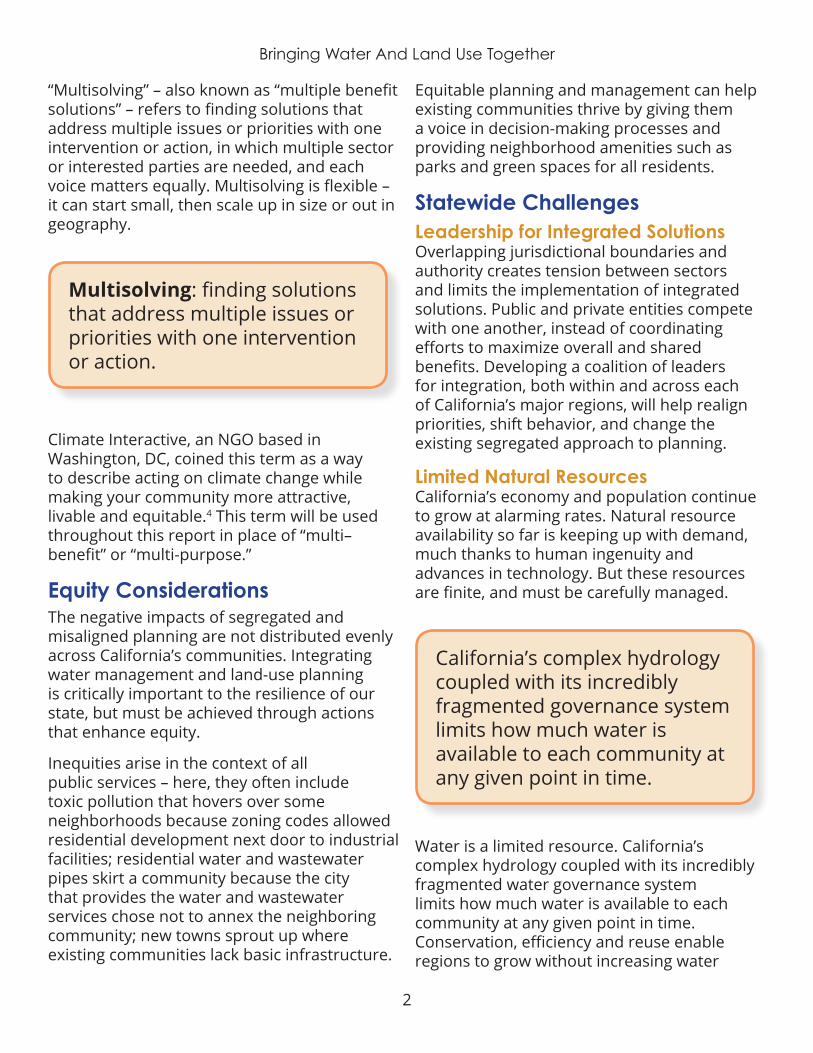
Regional DiversityEfforts to integrate water and land use must be tailored to the specific needs and priorities of each region. No single, one-size-fits-all approach will succeed in every region. Important distinctions exist between regions that will affect the guiding principles and best practices of local water and land-use integration. The greatest variations between regions that impact water and land use integration include the following:
¡ population density influences on housing strategies;
¡ overall cost of living;
¡ local water quality and supply factors; and
¡ current status of coordinated planning.
Each of these components are expanded on in the full report; these factors must be considered when determining the best opportunity for integration or specific recommendations to pursue .
Regional Variations Impacting Water & Land Use Integration
¡ Population density
¡ Local water quality
¡ Housing make-up
¡ Local water supply
¡ Cost of living ¡ Planning coordination
Statewide RecommendationsThis report is based on a review of existing literature, analysis of various policies, conversations with countless water and land-use experts, and an evaluation of the principles and opportunities outlined above . Four general recommendations emerged to provide opportunities that can significantly affect the potential success of integrating water management and land-use planning, while also being politically feasible in a number of situations:
1 . Prioritize infrastructure investments that support existing communities, especially underserved communities, before new development .
4
Bringing Water And Land Use Together
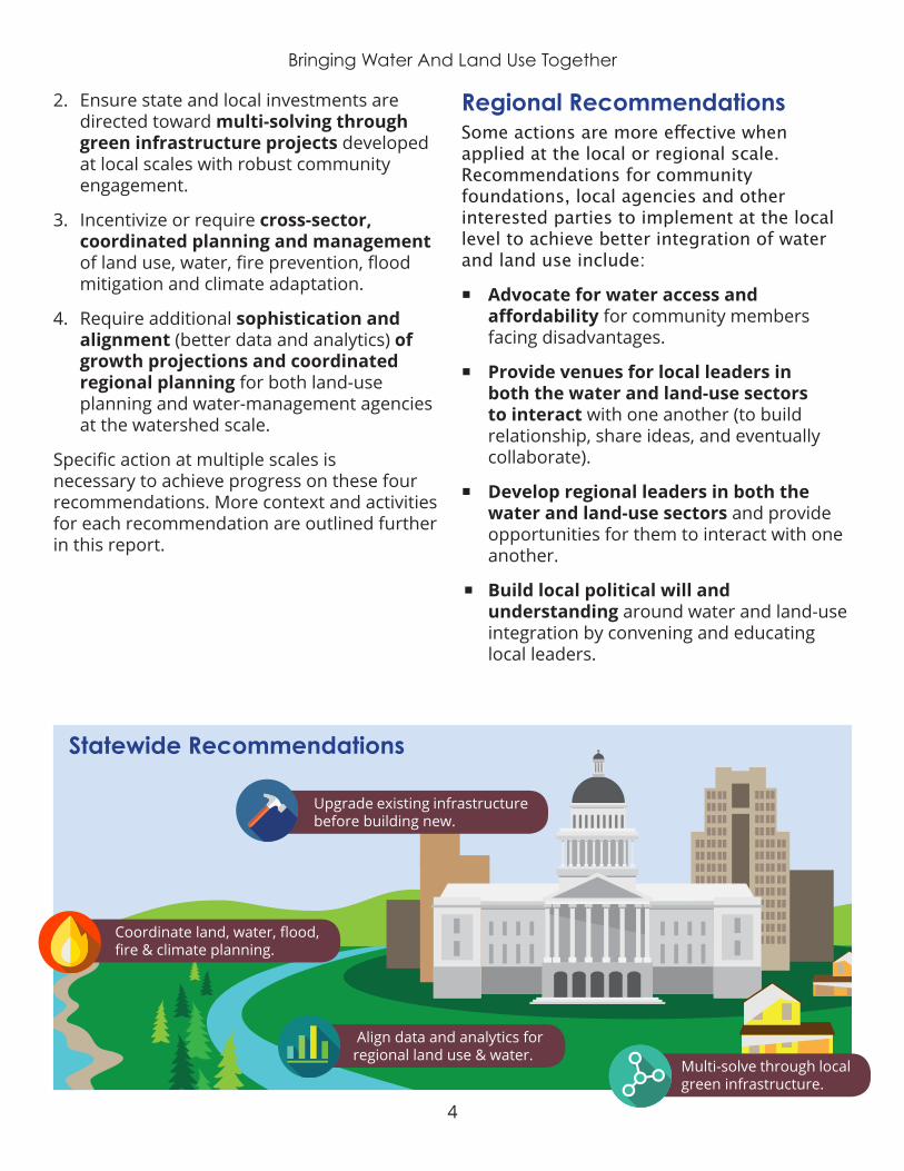
Upgrade existing infrastructure before building new.
Coordinate land, water, flood, fire & climate planning.
Multi-solve through local green infrastructure.
Align data and analytics for regional land use & water.
Statewide Recommendations
2 . Ensure state and local investments are directed toward multi-solving through green infrastructure projects developed at local scales with robust community engagement.
3 . Incentivize or require cross-sector, coordinated planning and management of land use, water, fire prevention, flood mitigation and climate adaptation.
4 . Require additional sophistication and alignment (better data and analytics) of growth projections and coordinated regional planning for both land-use planning and water-management agencies at the watershed scale .
Specific action at multiple scales is necessary to achieve progress on these four recommendations . More context and activities for each recommendation are outlined further in this report .
Regional RecommendationsSome actions are more effective when applied at the local or regional scale. Recommendations for community foundations, local agencies and other interested parties to implement at the local level to achieve better integration of water and land use include:
¡ Advocate for water access and affordability for community members facing disadvantages.
¡ Provide venues for local leaders in both the water and land-use sectors to interact with one another (to build relationship, share ideas, and eventually collaborate).
¡ Develop regional leaders in both the water and land-use sectors and provide opportunities for them to interact with one another .
¡ Build local political will and understanding around water and land-use integration by convening and educating local leaders .
5
Bringing Water And Land Use Together
A Strategy for Achieving IntegrationDespite the many challenges and barriers to integration, opportunities abound in the Golden State . Policymakers and practitioners are beginning to acknowledge that something needs to change in our state’s collective water management and land-use planning.
California’s community foundations, NGOs and advocacy groups have proven experience in building partnerships and developing political will to address local challenges. Interested stakeholders can leverage these existing skills to foster water and land-use integration.
The most effective strategy will be a three-pronged approach: (1) engage local elected officials (city councils and county commissions) who have the decision-making authority, using state-government guidance and regulatory frameworks; (2) educate and empower local residents and businesses to push for better integration; and (3) endow water and land-use practitioners with funding and incentives to do the difficult work of collaborating and integrating their operations.
3-Pronged Approach To Water/Land-Use Integration
1 . Engage local decision-makers
2 . Educate & empower local communities
3 . Fund and incentive collaboration
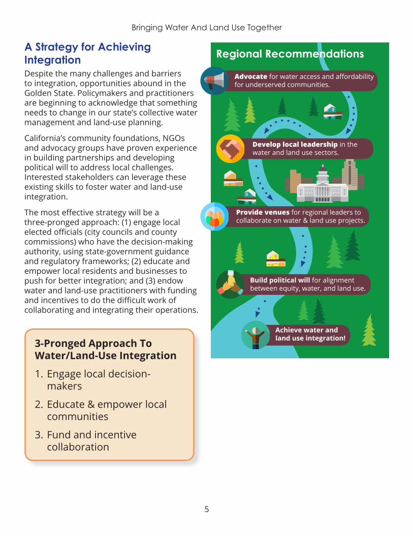
Advocate for water access and affordability for underserved communities.
Develop local leadership in the water and land use sectors .
Provide venues for regional leaders to collaborate on water & land use projects.
Build political will for alignment between equity, water, and land use.
Achieve water and land use integration!
Regional Recommendations

6
Bringing Water And Land Use Together
I. INTRODUCTIONImpetus for the ProjectIn 2015, the S. D. Bechtel, Jr. Foundation launched the Community Foundation Water Initiative to build the capacity of local foundations to better engage in water issues within their communities. A handful of community foundation partners agreed to participate, working individually and collectively to advance sustainable water management solutions.
The Community Foundation Water Initiative’s partners currently include The San Francisco Foundation, the Silicon Valley Community Foundation, the Central Valley Community Foundation, California Community Foundation (Los Angeles) and The San Diego Foundation.
These foundations have been advancing social equity, community education and civic engagement, youth empowerment, economic opportunity, public health and environmental sustainability within their communities for decades . They possess the credibility and capability to advance progress on complex issues within their region and across the state.
Building on this record, these five foundations, in partnership with the Bechtel Foundation, are striving to build durable capacity and institutional knowledge within the philanthropic sector to engage in sustainable water management efforts throughout California.
Each partner foundation recognizes the varied effects that water has on their communities, and approaches the topic from their unique institutional perspective. Some focus on climate adaptation programs, while others emphasize equity, agriculture, land-use or housing priorities.
Foundation partners connect in person on a quarterly basis to share progress and lessons learned from their individual efforts, and explore ways to connect local and regional efforts for broader statewide impact.
Integrating water management and land-use planning emerged as a shared interest area among the Community Foundation Water Initiative members. The cohort commissioned this report to help identify and pursue opportunities at the intersection of integrated water management and land-use planning that advance equity, regional economic development, climate adaptation, housing and transportation planning.
Through this effort, the Community Foundation Water Initiative and its members are gaining a robust understanding of water management needs and opportunities for improved integration with land-use planning at local, regional and statewide levels. By advocating for and investing in efforts that effectively integrate water management and land-use planning, local community foundations will help make all of California’s communities more equitable and resilient .
Image 1: Community Foundation Water Initiative members

7
Bringing Water And Land Use Together
This report identifies strategies for community foundations and other local leaders to leverage the multiple benefits of an integrated, collaborative planning approach. These results benefit the project’s community and agency stakeholders, and will have a “scaling up” effect to influence regional and statewide practices.
Rather than replicate existing reports and analyses, we seek to connect all of the work already being done at the regional and state level . This situation analysis and strategy development will help position local community foundations to ignite better integration of watershed-scale land-use planning and water management.
Background on the IssueHistory: How We Got HereMany experts see the disconnect between water resources management and land-use planning as a significant barrier to long-term community resilience . This divide has a long history, beginning with post-World War II-era community design that emphasized accommodating cars and widespread migration to sprawling suburbs.5
Image 2: Highway congestion
Natural resources management and planning accommodated this urban shift by segregating into unique specialties, and regulatory structures followed suit.6 An era of decentralization resulted in a multiplicity of specialized agencies, departments and bodies of law for each domain – ranging from water supply and wastewater to transportation, housing and urban planning.
This formal differentiation between planning and management philosophy and practice inhibits collaboration and mechanisms for reaping co–benefits. The inefficiencies, duplications, conflicting policies, and wasteful actions that result have been well documented .7
The past half-century of segregated planning and management efforts have led to innumerable negative impacts to our natural resources, community health, social well-being and collective resilience in the face of climate change.8
As the volume and distribution of water supply, in particular, becomes a more pressing resource-management issue both locally and regionally (across the state and around the nation), more attention to integrated planning is needed .
Current Status: How Things Look NowThe disconnect between water and land use is often framed as a technical problem. However, it is also a political and cultural problem in many parts of the state.
The disconnect between water and land-use is not only a technical problem; it's also a political and cultural problem .

8
Bringing Water And Land Use Together
The authority of cities and counties to regulate land use in their own jurisdiction is deeply anchored in California history and cherished by local communities. Local governments focus on sustaining a strong economy through land-use decisions that contribute to development, which in turn generates local government revenue to cover the costs of community services .
Meanwhile, water-management agencies operate within their own authority, making decisions about water-infrastructure investments, pricing and other elements within their purview to maximize their ability to deliver water and/or treat wastewater (and thus generate revenue to cover their service costs). Despite overlapping jurisdictions and competing priorities, few governance structures or regulatory requirements currently exist to align water management and land-use planning.
The benefits of water and land-use coordination are as numerous as the negative impacts of the existing fragmented approach. Prior research has demonstrated two key benefits: (1) improved cost-effectiveness and outcomes for planning and management of water quality and supply, and (2) better distribution of water between ecosystem and consumptive uses .9
In recent years, however, the land-use planning and natural-resources management sectors have undergone a cultural shift toward integrated, collaborative planning. Leaders in water resources and urban planning are calling for a return to the holistic management of our water and land resources . “Water should be a core planning theme if we are to be effective in addressing the needs of communities in today’s world,” according to the American Planning Association’s Water Task Force.10
This approach is gaining momentum and recognition in California, due in part to a heightened sense of urgency as a result of
climate change, the state’s growing population, and mounting equity concerns. Integrated solutions are being implemented across the state, both arising organically and in response to new policy drivers, such as the Integrated Regional Water Management, Sustainable Groundwater Management Act and the environmental-justice element of city and county General Plans .
Two Key Benefits of Water and Land-Use Integration:
1 . Improved cost effectiveness outcomes for water quality and supply
2 . Improved distribution between ecosystem and human uses
Moving Forward: Where We’re HeadedDespite recent advancement toward integration, there is still a lot of work to be done. A comprehensive planning approach at the watershed scale is needed to address our natural and built environment as a socio-ecological system rather than a collection of disjointed parts.11 Water and land-use management inherently reflects geographic differences, dominant ideologies, political preferences, economic conditions and available technology. Thus, the appropriate scale for change is at local and regional levels. Implementation strategies that reflect watershed-scale processes and conditions will be far more effective than a standardized top-down approach mandated by state agencies or completely bifurcated between specialized sectors .
9
Bringing Water And Land Use Together
The current political and cultural atmosphere favors a myopic view of challenges and single-issue immediate solutions. As a result, we need additional capacity-building in leadership, education and policy change.
Deeply intertwined issues require an integrated-systems approach to solutions. Through collaboration and integration, practitioners can gain a better understanding of water availability and impacts of development (population growth, economic development and urbanization). They will then be more likely to choose smarter urban-planning options to decrease negative impacts on our natural resources, such as infill development, urban water use efficiency, conservation and reuse structures, and preserving open space.12 Local integration can then inform state policy.
Now is the time for community foundations to embrace opportunities for advancing integrated water management and land-use planning. There is no simple solution or single approach to accomplish this goal. It will take a collection of many actions at multiple scales to equitably integrate water management and land-use planning. As leaders in the integrated water-management are fond of saying, “There’s no silver bullet, but a lot of silver buckshot.”
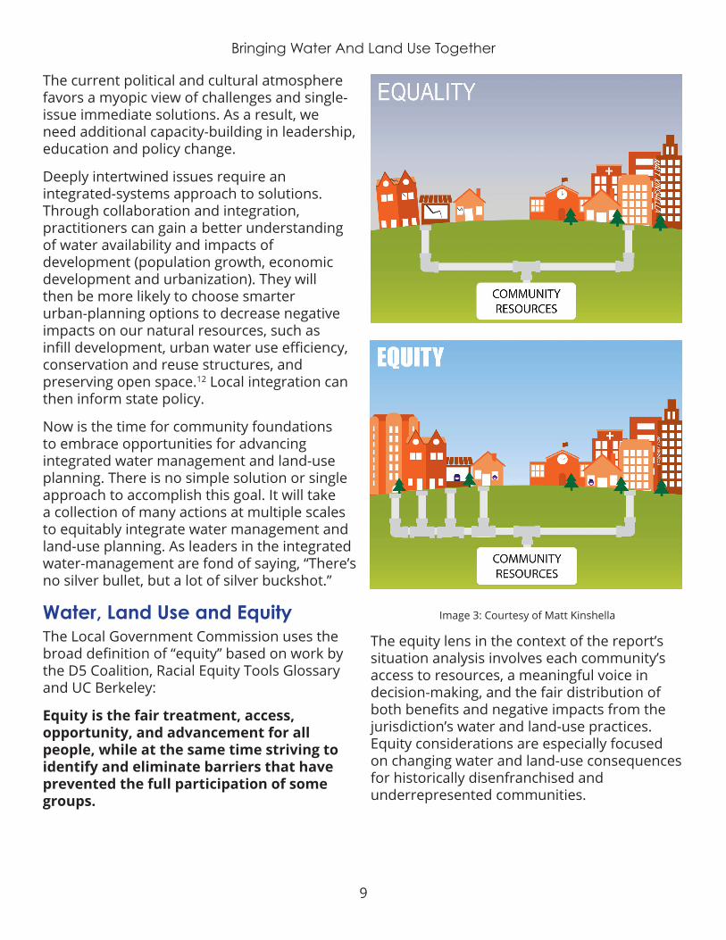
Water, Land Use and EquityThe Local Government Commission uses the broad definition of “equity” based on work by the D5 Coalition, Racial Equity Tools Glossary and UC Berkeley:
Equity is the fair treatment, access, opportunity, and advancement for all people, while at the same time striving to identify and eliminate barriers that have prevented the full participation of some groups.
The equity lens in the context of the report’s situation analysis involves each community’s access to resources, a meaningful voice in decision-making, and the fair distribution of both benefits and negative impacts from the jurisdiction’s water and land-use practices. Equity considerations are especially focused on changing water and land-use consequences for historically disenfranchised and underrepresented communities .
Image 3: Courtesy of Matt Kinshella
10
Bringing Water And Land Use Together
California acknowledges that government action, at both the state and local level, is necessary to mitigate the potentially catastrophic impacts of climate change and ensure our communities are resilient enough – and equitably resilient – to adapt to changing conditions . While climate leadership at the federal level is stalled, Californians and their elected leaders are embracing the need for strong climate policy.
California continues to experience strong economic growth while maintaining its ambitious climate policies. Yet, this economic growth is not evenly distributed across the state or its communities. The income gap is growing, and cost of living is increasing at an alarming rate.
Although the average Californian earns 11% more than their counterparts in the rest of the nation, the state’s cost of living is also disproportionately higher, including mortgage payments that are 44% higher.13
Income disparities and affordability are at the forefront of social justice, and closely tied to water and housing affordability. Economic development is heavily influenced by available resources and decisions governing how those resources are used. Who benefits from water management and land-use decisions, and the economic development associated with these decisions, is the heart of the water/land-use/equity nexus .
Land-use and water-management decisions have been influenced by bias and institutional racism for generations. Those factors limit the access of some groups to natural resources, social capital and decision-making, while disproportionately benefiting others.
Planning and decision-making through an equity lens helps ensure that all communities are represented in the planning and decision-making process, and that they will share in the benefits from the results. Decisions that
should include an equity lens include (but are not limited to) development patterns, affordable housing, fair zoning, infrastructure investments, and adequate water and wastewater services .
State agencies, local governments, and engaged stakeholders must work together to address persistent inequities from past decisions, and the subsequent inequitable burden these decisions place on underrepresented communities . State agencies can improve equity by establishing policies that direct benefits to communities facing disadvantages through funding and technical assistance. For example, we must prioritize workforce development that benefits residents and policies that prevent displacement .
Equity is the fair treatment, access, opportunity, and advancement for all people, while at the same time striving to identify and eliminate barriers that have prevented the full participation of some groups.
Increasing access to opportunity will decrease the equity gap and help create a resilient future for all of California’s residents. Perhaps the two greatest inequities facing California are: the housing-affordability gap and the human right to water.
Communities across California, large and small alike, are in a housing crisis. Experts say California must build 100,000 more houses per year to meet demand. Affordable housing is especially lacking in the state, most acutely in economic centers such as the
11
Bringing Water And Land Use Together
San Francisco, Silicon Valley and Los Angeles regions. Statewide, California is 1.5 million housing units short of what it needs, a deficit that makes it extremely difficult for low-income community members to find housing they can afford. As their cost of living increases for housing, transportation, food and other basic needs, many residents can no longer afford to live in the communities they’ve called home.
Local governments are struggling to recruit developers to build more affordable housing in their communities. As public agencies and developers rush to meet housing demand, there is a significant risk that this new housing stock will follow a sprawl-development pattern, rather than meeting the sustainability targets needed to ensure community resilience – such as development that is compact, infill, walkable and close to transit, and preserves permeability and green spaces.
Sprawl patterns reinforce existing inequities by contributing to longer commute times, poor air quality, increased flood risk from stormwater runoff and increased water costs. Here, we see how housing and water are inextricably linked. Communities can’t grow without reliable water supply, while communities with inadequate housing often also have inadequate water and sewer services .
California was the first state in the nation to legislatively acknowledge the “Human Right to Water.” Assembly Bill 685 requires safe, clean, affordable and accessible drinking water for the state’s nearly 40 million residents.
Though state law recognizes this basic human right, it does not codify how to meet the needs of California’s more than one million residents currently lacking access to safe and reliable drinking water, or the 1.7 million Californians who don’t have complete plumbing facilities .
Not surprisingly, the people without water access often live in the same communities that have been historically disenfranchised or underrepresented. African Americans are more than twice as likely as whites to live without adequate plumbing. Rural, unincorporated and tribal lands, in particular, often lack basic water and wastewater infrastructure.14
“Those already burdened by economic, environmental, or health challenges are especially vulnerable. Typically, low income, communities of color, children, and the elderly. The impacts of water stress on physical and mental health, child development, and economic mobility are cumulative, and often compounded by underlying challenges such as poverty and unemployment – two other common symptoms of institutionalized racism and injustice.”
– U.S. Water Alliance15
Communities cannot recruit new businesses to promote economic growth or expand their supply of affordable housing to accommodate population growth without an adequate and reliable water supply . Communities that lack financial resources to invest in water infrastructure or purchase water supply from other regions will continue to struggle, while communities with sufficient funding to ensure adequate water for growth will continue to grow and thrive.
Communities with restricted resources – disproportionally rural or communities of color – also struggle to invest in land-use projects like creekside parks or stormwater infrastructure that will improve the quality of life for residents and preserve clean water for the ecosystem‘s flora and fauna. Elsewhere, California’s affluent urban and coastal communities have the resources and the political will to invest in water-infrastructure projects to ensure continued economic growth and meet their housing demand.

12
Bringing Water And Land Use Together
The housing-affordability crisis and the disparities of water access are closely intertwined inequities that will require great effort and better coordination between community advocates, local governments, state agencies and policymakers across the state .
The imperative for equity is gaining emphasis in both public policy and social consciousness .
This shift is exemplified through California’s Human Right to Water Bill (AB 685), the addition of environmental justice as a requirement of the General Plan guidelines (SB 1000) and CEQA’s Tribal consultation requirements (AB 52).
Despite this progress, more resources and cultural shifts are needed to reverse institutionalized bias and inequities, and more adequately meet the needs of disadvantaged, underserved communities. Low-income communities and communities of color are at greatest risk for economic and health consequences of climate change. Policymakers must be purposeful in working through an equity lens to implement climate-resilient policies that don’t exacerbate existing inequities .
California has an opportunity to address these historic inequities. Water and land-use decisions are critical components to ending the cycle of poverty and injustice, and can be primary catalysts for change. State policy that requires equity in all policies (especially water and land-use policy), along with guidance to implementing local and regional agencies, will help prevent inequitable policymaking in the future.
Scaling out local equity campaigns and grassroots projects, such as the Community Water Center’s Community Water Leaders Network will help hold local institutions accountable, while also identifying existing inequities that must be resolved . The Community Water Leaders Network has
coordinated a leadership cohort of local water boardmembers to address the Human Right to Water in the San Joaquin Valley . This model could be used at the statewide level to improve transparency and accountability of decision-makers, encourage information sharing, and ensure active participation in the processes that directly affect communities throughout the state .
Efforts like these help ensure accountability, while also identifying existing inequities that must be resolved. Successful implementation will require building trust among historically underrepresented and underserved communities, building broad coalitions, and investing in water and land-use projects that reflect the voices of all affected parties .
Situation Analysis MethodsPurpose And GoalsBeyond conducting a situation analysis and providing recommendations to the Community Foundation Water Initiative, our ultimate goal in conducting this work is to establish integrated water and land-use planning as the norm across California. This effort can help create a bridge between regional situation analyses, best-practice case studies and scaling-up integration to statewide action.
The Local Government Commission followed a mixed-methods applied research approach to identify the primary challenges and barriers that prevent integration across sectors, and to develop recommendations with the greatest potential for improving integration between water management and land-use planning in California.
Research ApproachOur approach begins with a literature review and synthesis of the best available ideas about integrated water management and land-use planning, as well as known implementation obstacles. With this foundation of knowledge,
13
Bringing Water And Land Use Together
we conducted interviews and focus groups with water and land-use experts across the state to further identify specific local challenges, exemplary case studies and a menu of potential solutions. We then distilled the most effective tools and strategies for overcoming the key challenges to integration at both regional and statewide levels.
Background ResearchThe Local Government Commission used the existing body of literature, including the organization’s own institutional knowledge, to inform each phase of the project, such as determining interviewees, developing interview questions, evaluating planning documents, and identifying themes for data coding and analysis. As part of the literature review process, we created a compendium of more than 50 documents relevant to water and land-use integration.
This resource, which includes research reports, journal articles and guidance documents, is organized by media type and subject area, and provides a description of the content and a weblink to the item. This free, curated database will be available as a public resource to help advance water and land-use integration across the state, making it easier to share on foundation websites and other digital media.
Evaluating Planning DocumentsThe Local Government Commission compiled a database of all the counties and municipalities within each of the five community foundation regions. This database will also be available to the public as a reference document. In each region, one representative county and three representative cities were selected to conduct an evaluation of major planning documents.
We used CalEnviroScreen 3.0 scores to identify communities that are disproportionately burdened by, and vulnerable to, multiple pollution sources .
CalEnviroScreen analyzes environmental, health and socioeconomic information to produce scores for every census tract in the state . The tool allowed us to select cities that included the most burdened census tracts (95-100th percentile), least burdened (in the 1-5th percentile) and average areas (50-55th percentile).
The planning-document database includes links to relevant water management and land-use planning documents for each of the selected “representative” communities. Each planning document was reviewed to evaluate the degree of collaboration, the degree of alignment and to identify opportunities for integrated planning. The results were incorporated into the “current status of integration” and “strategies, opportunities, and recommendations” sections of this report, as well as the five regional profiles.
Our more detailed analysis is included in the appendix for reference.
Creating Regional ProfilesThe Local Government Commission compiled key features of each part of the state into five regional profiles – one for each community foundation partner – as well as online story maps . These documents include local demographics, water-management and land-use planning data, and information gleaned from expert interviews and focus groups about inequities, integration challenges, strategies and opportunities, and key recommendations.
Information from these profiles is integrated throughout the report, and they also supplement this report as stand-alone documents. Brief case studies are included in both the regional profiles and this report; they highlight positive examples of water, land-use and equity integration across the state. These case studies illustrate real-life scenarios that address integrated planning, and add context to this research .

14
Bringing Water And Land Use Together
Image 4: Coding wordcloud
Please note: Some case studies showcase examples from outside the geographically designated region, but were included because the strategy and context are relevant to several regions. These too will be available on our website (www.lgc.or/water-land-use) as a free resource to further advance water and land-use integration.
Conducting Expert Interviews and Focus GroupsThe Local Government Commission conducted interviews with 29 water and land-use experts and practitioners from across the state to gain in-depth insights into local water-management and land-use conditions for each region, as well as to explore primary challenges and possible solutions to improve integration.
We talked with two water experts and two land-use experts in each region. Interviewees included practitioners from jurisdictions with exemplary programs and processes that can serve as models for other communities, as well as from communities needing additional support to encourage equitable integration.
Three focus group discussions supplemented these interviews, and were held during important statewide events to leverage opportunities to bring together many community leaders around this topic .
Analyzing the DataAll interview and focus group data were imported into Dedoose, a sophisticated qualitative-research application, and analyzed using coding methods to identify commonalities across regions, recurring themes and possible strategies for improving integration. Coding criteria were informed by the literature review, background research and institutional expertise .
We were open and receptive to the voices of foundation representatives when determining coding criteria and analyzing the results. Data was first coded into general categories, then recurring themes, and finally into specific granular topics (see Table 1).
$
Planning
Governance &Representation
Coordination
Economics
PolicyIntegration &
Alignment
Image 5: Top 5 themes from all data analysis
Categories, themes and topics are completely independent of each other, rather than corresponding to one another in a hierarchy. This approach allowed for the greatest complexity in analysis .
Codes were analyzed for several factors, including high and low frequencies, ratios, co–occurrences and descriptors . This analysis generated case studies, challenges/

15
Bringing Water And Land Use Together
barriers, opportunities, strategies and recommendations to highlight for each region and the state as a whole . We then relied on institutional knowledge and expertise gained through our research to interpret and present the research findings.
Data exports from Dedoose (charts, tables and plots) are included in the appendix for reference and transparency.
The same five themes emerged across all data sources in our analysis, including planning; governance and representation; coordination; economics; and policy integration and alignment. These themes offer the greatest challenges or need for water and land-use integration. Conversely, these themes also provide the greatest opportunities for positive impacts if the integration of water and land use is to be achieved . These are the areas in which foundations and other stakeholders at the state, regional and local scale should focus their efforts.
TABLE 1: CODES USED IN DEDOOSE ANALYSIS
Categories
Case Study
Challenge/Barrier
Need
Opportunity
Recommendations
Resource
Strategy
Themes
Accountability
Capacity
Collaboration
Coordination
Data and Information/Research
Disadvantaged Communities/Equity
Economics
Governance and/or Representation
Incentives
Infrastructure
Integration/Alignment
Jurisdiction
Language
Mindset/Conceptual Understanding
Multiple Benefits
Planning
Policy
Public Engagement/Education
Regulation
Relationships
Technical Assistance
Topics
Affordability
Agriculture
Climate
Conservation and Efficiency
Development
Dialogue/Communication
Drought
Economic
Flood
Groundwater
Growth
Habitat
Housing
Implementation
Monitoring
Jobs
Land Use
Leadership Development
Legislation
Reliability
Schools
Skills
Specific Plans
Stormwater
Transportation
Unincorporated Areas
Wastewater
Water Quality
Water Supply
16
Bringing Water And Land Use Together
Although “equity” was highly recurring in the analysis, this is primarily due to the Local Government Commission’s guiding questions. Most interviewees didn’t raise the topic unless first prompted by the interviewer. Responses sometimes revealed a lack of awareness or inclusion of equity considerations. Thus, it can also be inferred that more education and advocacy is needed in both the water and land-use sectors to better inform practitioners and stakeholders of relevant equity considerations.
Within these themes, the highest-ranking topics – in order of priority – were water supply, development, land use, water quality, groundwater, growth, housing, affordability, dialogue and conversation, and implementation and monitoring. Many of the report’s recommendations center around these topics .

17
Bringing Water And Land Use Together
II. STATUS OF CURRENT WATER AND LAND-USE INTEGRATION California is moving toward a more holistic approach to managing our water and land resources as the 21st century unfolds. This perspective recognizes the interconnectivity between two traditionally fragmented sectors.
In 2005, the California Legislature passed new laws that enable communities to join together to adopt Integrated Regional Water Management (IRWM) policies and practices. This comprehensive planning approach considers water and related land resources as an interconnected regional system rather than as a combination of fragmented parts.
Local jurisdictions across the state convene as Regional Water Management Groups to implement their plans . Anticipated and realized benefits of IRWM include improved cost effectiveness and outcomes for planning and management of water quality and supply, as well as better distribution of water between ecosystem and human uses .
While water management and planning remain highly fragmented across the nation, several states are moving toward this more integrated approach, especially when setting new state-level policies, guidance and regulations. At least 20 states currently have some sort of watershed-oriented organizational structures,16 and others are following suit. In California, examples include the Integrated Regional Water Management program and the Sustainable Communities Strategy processes. These efforts have been successful in at least some regions. SGMA is still in its early stages of implementation, so results are yet to be seen.
Challenges and Barriers to Statewide IntegrationIntegrating water and land-use decisions may easily be misconstrued as simply a matter of cross-sector collaboration. However, integration (or the lack thereof) are deeply rooted in past decision-making that purposefully divided water and land-use management conversations. This has set the stage for a deeply decentralized system in which water and land use are systematically isolated from one another.
For example, discussions with various state experts noted that there are contrary attitudes about the effectiveness of General Plans among water and land-use planners. Local governments who adopt the plans tend to view them favorably as dynamic tools for planning and land use because city councilmembers or county supervisors have the ability to approve general plan amendments.
On the other hand, local residents and environmental advocates often voice frustration with their local government not implementing the general plan, and amendments are made without adequate representation of all affected stakeholders.
Some interviewees even cited the negative impacts on their communities from strong relationships between decision-makers and particular developers, and the political maneuvering that ensues. This illustrates the importance of more effective governance and representation .
Four primary areas of difficulty currently prevent effective integration of water and land use: the need for strong leadership; constraints caused by limited natural resources; the socio-political mindset of water and land-use practitioners; and limitations in funding to support integration.
18
Bringing Water And Land Use Together
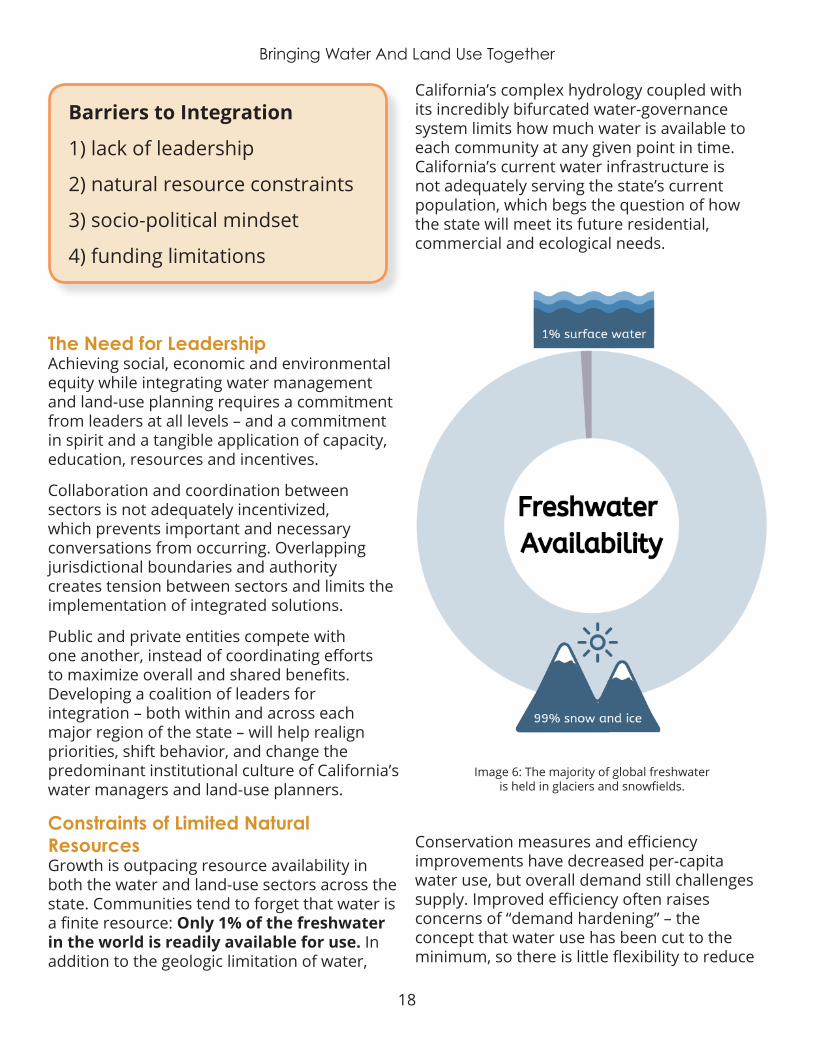
Barriers to Integration
1) lack of leadership
2) natural resource constraints
3) socio-political mindset
4) funding limitations
The Need for Leadership Achieving social, economic and environmental equity while integrating water management and land-use planning requires a commitment from leaders at all levels – and a commitment in spirit and a tangible application of capacity, education, resources and incentives.
Collaboration and coordination between sectors is not adequately incentivized, which prevents important and necessary conversations from occurring. Overlapping jurisdictional boundaries and authority creates tension between sectors and limits the implementation of integrated solutions.
Public and private entities compete with one another, instead of coordinating efforts to maximize overall and shared benefits. Developing a coalition of leaders for integration – both within and across each major region of the state – will help realign priorities, shift behavior, and change the predominant institutional culture of California’s water managers and land-use planners.
Constraints of Limited Natural ResourcesGrowth is outpacing resource availability in both the water and land-use sectors across the state. Communities tend to forget that water is a finite resource: Only 1% of the freshwater in the world is readily available for use. In addition to the geologic limitation of water,
California’s complex hydrology coupled with its incredibly bifurcated water-governance system limits how much water is available to each community at any given point in time. California’s current water infrastructure is not adequately serving the state’s current population, which begs the question of how the state will meet its future residential, commercial and ecological needs.
Image 6: The majority of global freshwater is held in glaciers and snowfields.
Conservation measures and efficiency improvements have decreased per-capita water use, but overall demand still challenges supply. Improved efficiency often raises concerns of “demand hardening” – the concept that water use has been cut to the minimum, so there is little flexibility to reduce
19
Bringing Water And Land Use Together
demand further. For example, a farmer is so efficient with her water use that she is only using the exact amount her crop needs. If she is forced to reduce water use, her crop will die and she will lose her economic investment . Yet research and experience to date counterargues this concern. Water conservation and efficiency efforts reduce waste in the system and set more realistic water use targets.
Diminishing resource availability due to population growth and human-induced pollution restricts access to a basic human necessity – safe drinking water. Concurrently, water agencies set water rates based on projected demand. If less water is used, the water agency experiences a revenue loss.
California’s water-finance system therefore creates a disincentive to conserve. If water agencies then increase rates to cover their deficit, these costs are distributed evenly across their customers, regardless of ability to pay, causing significant affordability inequities.
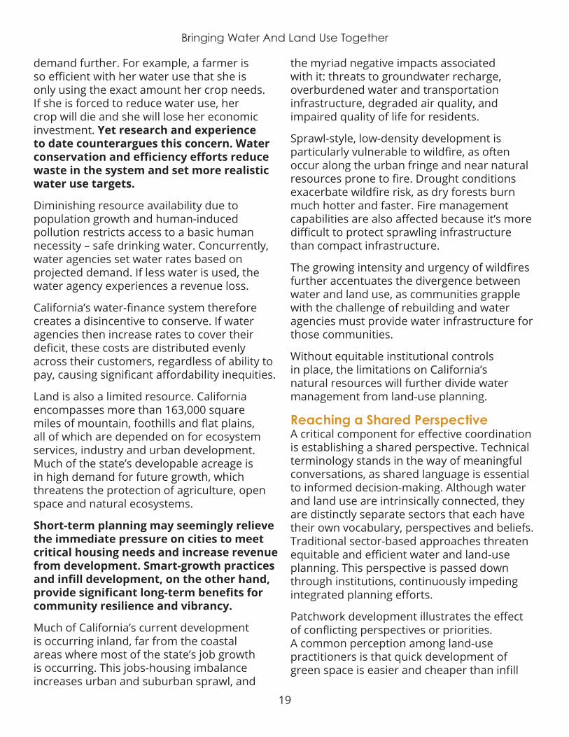
Land is also a limited resource. California encompasses more than 163,000 square miles of mountain, foothills and flat plains, all of which are depended on for ecosystem services, industry and urban development. Much of the state’s developable acreage is in high demand for future growth, which threatens the protection of agriculture, open space and natural ecosystems .
Short-term planning may seemingly relieve the immediate pressure on cities to meet critical housing needs and increase revenue from development. Smart-growth practices and infill development, on the other hand, provide significant long-term benefits for community resilience and vibrancy.
Much of California’s current development is occurring inland, far from the coastal areas where most of the state’s job growth is occurring. This jobs-housing imbalance increases urban and suburban sprawl, and
the myriad negative impacts associated with it: threats to groundwater recharge, overburdened water and transportation infrastructure, degraded air quality, and impaired quality of life for residents.
Sprawl-style, low-density development is particularly vulnerable to wildfire, as often occur along the urban fringe and near natural resources prone to fire. Drought conditions exacerbate wildfire risk, as dry forests burn much hotter and faster. Fire management capabilities are also affected because it’s more difficult to protect sprawling infrastructure than compact infrastructure.
The growing intensity and urgency of wildfires further accentuates the divergence between water and land use, as communities grapple with the challenge of rebuilding and water agencies must provide water infrastructure for those communities .
Without equitable institutional controls in place, the limitations on California’s natural resources will further divide water management from land-use planning.
Reaching a Shared PerspectiveA critical component for effective coordination is establishing a shared perspective. Technical terminology stands in the way of meaningful conversations, as shared language is essential to informed decision-making. Although water and land use are intrinsically connected, they are distinctly separate sectors that each have their own vocabulary, perspectives and beliefs. Traditional sector-based approaches threaten equitable and efficient water and land-use planning. This perspective is passed down through institutions, continuously impeding integrated planning efforts.
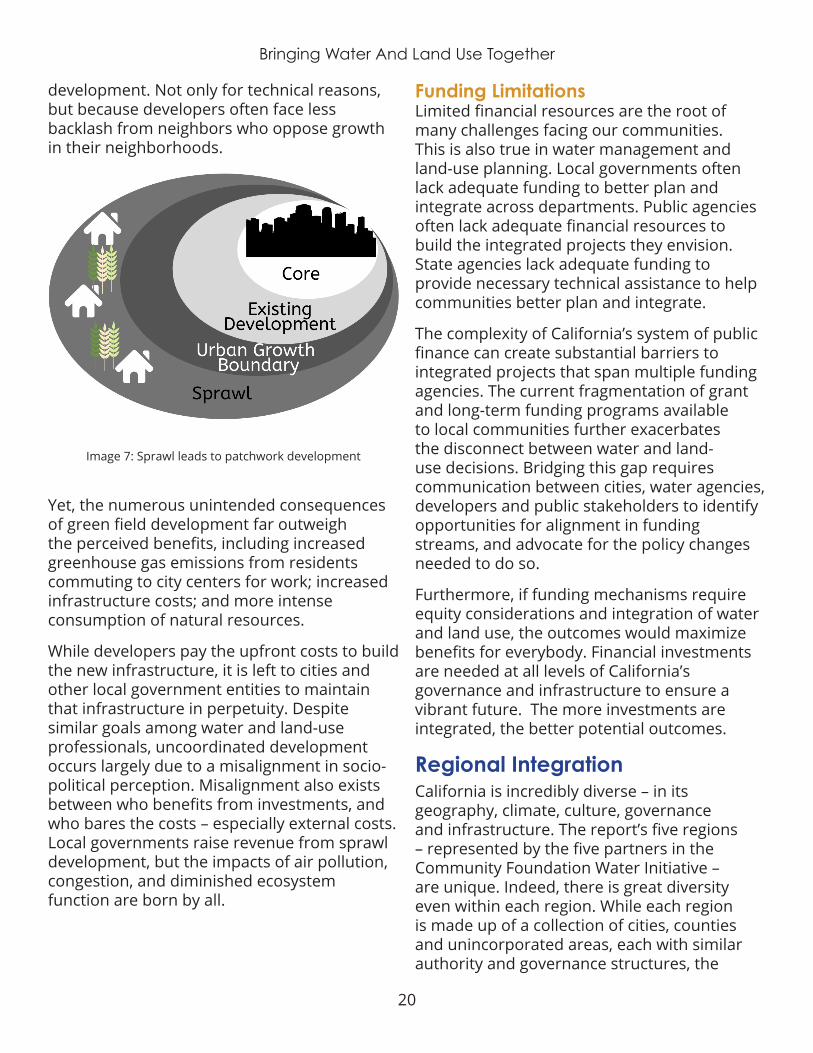
Patchwork development illustrates the effect of conflicting perspectives or priorities. A common perception among land-use practitioners is that quick development of green space is easier and cheaper than infill
20
Bringing Water And Land Use Together
development. Not only for technical reasons, but because developers often face less backlash from neighbors who oppose growth in their neighborhoods.
Image 7: Sprawl leads to patchwork development
Yet, the numerous unintended consequences of green field development far outweigh the perceived benefits, including increased greenhouse gas emissions from residents commuting to city centers for work; increased infrastructure costs; and more intense consumption of natural resources.
While developers pay the upfront costs to build the new infrastructure, it is left to cities and other local government entities to maintain that infrastructure in perpetuity. Despite similar goals among water and land-use professionals, uncoordinated development occurs largely due to a misalignment in socio-political perception. Misalignment also exists between who benefits from investments, and who bares the costs – especially external costs . Local governments raise revenue from sprawl development, but the impacts of air pollution, congestion, and diminished ecosystem function are born by all.
Funding LimitationsLimited financial resources are the root of many challenges facing our communities. This is also true in water management and land-use planning. Local governments often lack adequate funding to better plan and integrate across departments. Public agencies often lack adequate financial resources to build the integrated projects they envision. State agencies lack adequate funding to provide necessary technical assistance to help communities better plan and integrate.
The complexity of California’s system of public finance can create substantial barriers to integrated projects that span multiple funding agencies. The current fragmentation of grant and long-term funding programs available to local communities further exacerbates the disconnect between water and land-use decisions. Bridging this gap requires communication between cities, water agencies, developers and public stakeholders to identify opportunities for alignment in funding streams, and advocate for the policy changes needed to do so .
Furthermore, if funding mechanisms require equity considerations and integration of water and land use, the outcomes would maximize benefits for everybody. Financial investments are needed at all levels of California’s governance and infrastructure to ensure a vibrant future. The more investments are integrated, the better potential outcomes.
Regional Integration California is incredibly diverse – in its geography, climate, culture, governance and infrastructure. The report’s five regions – represented by the five partners in the Community Foundation Water Initiative – are unique. Indeed, there is great diversity even within each region. While each region is made up of a collection of cities, counties and unincorporated areas, each with similar authority and governance structures, the
21
Bringing Water And Land Use Together
specific character of local governance and decision-making within each region varies greatly. Similarly, each region faces its own unique water and land-use challenges.
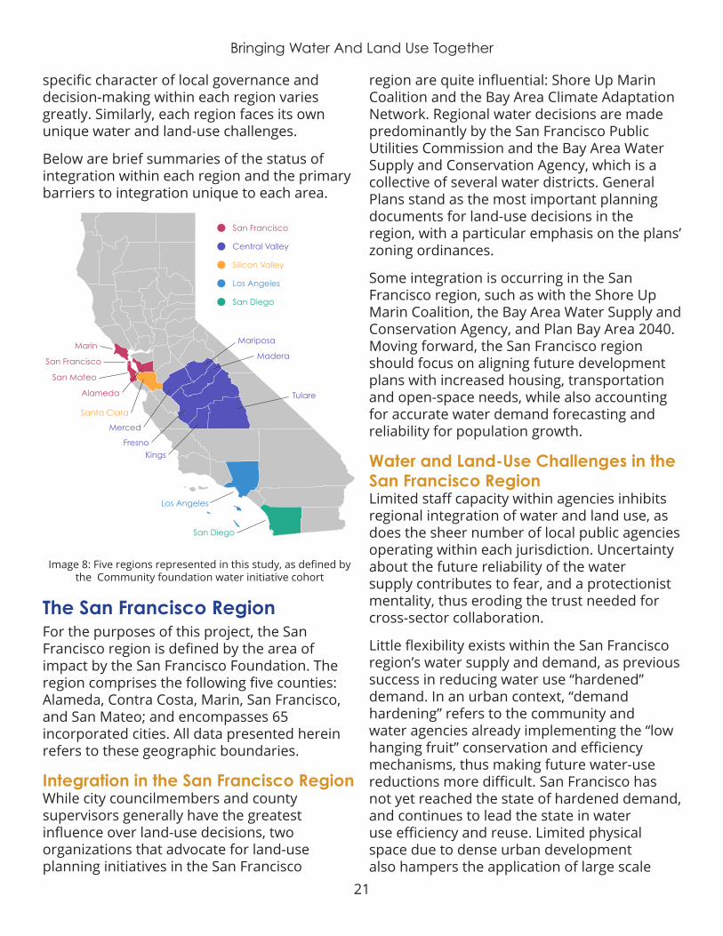
Below are brief summaries of the status of integration within each region and the primary barriers to integration unique to each area.
Image 8: Five regions represented in this study, as defined by the Community foundation water initiative cohort
San Francisco
San Mateo
Alameda
Santa Clara
Los Angeles
San Diego
Merced
Mariposa
San Francisco
Central Valley
Silicon Valley
Los Angeles
San Diego
Madera
Tulare
FresnoKings
Marin
The San Francisco Region For the purposes of this project, the San Francisco region is defined by the area of impact by the San Francisco Foundation . The region comprises the following five counties: Alameda, Contra Costa, Marin, San Francisco, and San Mateo; and encompasses 65 incorporated cities . All data presented herein refers to these geographic boundaries.
Integration in the San Francisco RegionWhile city councilmembers and county supervisors generally have the greatest influence over land-use decisions, two organizations that advocate for land-use planning initiatives in the San Francisco
region are quite influential: Shore Up Marin Coalition and the Bay Area Climate Adaptation Network. Regional water decisions are made predominantly by the San Francisco Public Utilities Commission and the Bay Area Water Supply and Conservation Agency, which is a collective of several water districts. General Plans stand as the most important planning documents for land-use decisions in the region, with a particular emphasis on the plans’ zoning ordinances.
Some integration is occurring in the San Francisco region, such as with the Shore Up Marin Coalition, the Bay Area Water Supply and Conservation Agency, and Plan Bay Area 2040. Moving forward, the San Francisco region should focus on aligning future development plans with increased housing, transportation and open-space needs, while also accounting for accurate water demand forecasting and reliability for population growth.
Water and Land-Use Challenges in the San Francisco RegionLimited staff capacity within agencies inhibits regional integration of water and land use, as does the sheer number of local public agencies operating within each jurisdiction. Uncertainty about the future reliability of the water supply contributes to fear, and a protectionist mentality, thus eroding the trust needed for cross-sector collaboration.
Little flexibility exists within the San Francisco region’s water supply and demand, as previous success in reducing water use “hardened” demand. In an urban context, “demand hardening” refers to the community and water agencies already implementing the “low hanging fruit” conservation and efficiency mechanisms, thus making future water-use reductions more difficult. San Francisco has not yet reached the state of hardened demand, and continues to lead the state in water use efficiency and reuse. Limited physical space due to dense urban development also hampers the application of large scale
22
Bringing Water And Land Use Together
landscape green infrastructure projects to integrate water and land use. The region will have to turn to other multisolving strategies more suited to water and land-use integration in an urban setting, such as on-site purification and direct non-potable reuse.
The quality of water-service infrastructure varies widely from community to community within the region. Lower-income communities are more likely to have aging infrastructure with deferred maintenance. This can degrade water quality and result in higher rates of leaks at the household scale – which means some communities pay the same price for lower
quality water and wastewater service, or water they are not receiving at all (due to pipe leaks on the customer’s side of their water meter).
The Silicon Valley RegionFor the purposes of this project, the Silicon Valley Region is defined by the area of impact from the Silicon Valley Community Foundation. The region comprises San Mateo and Santa Clara Counties, and encompasses 35 incorporated cities . All data presented herein refers to these geographic boundaries.
Los Angeles
San Diego
San Francisco
Silicon Valley
Central Valley
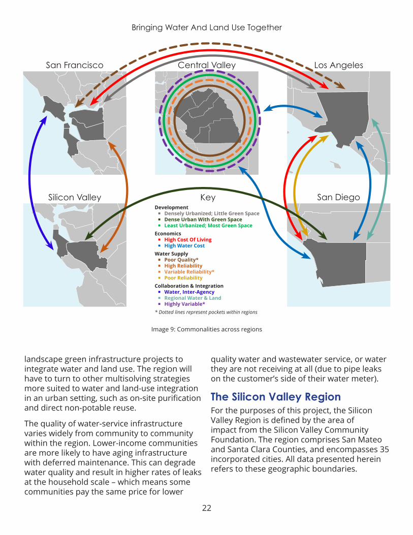
Development ¡ Densely Urbanized; Little Green Space ¡ Dense Urban With Green Space ¡ Least Urbanized; Most Green Space
Economics ¡ High Cost Of Living ¡ High Water Cost
Water Supply ¡ Poor Quality* ¡ High Reliability ¡ Variable Reliability* ¡ Poor Reliability
Collaboration & Integration ¡ Water, Inter-Agency ¡ Regional Water & Land ¡ Highly Variable*
* Dotted lines represent pockets within regions
Key
Image 9: Commonalities across regions
23
Bringing Water And Land Use Together
Integration in the Silicon Valley RegionIn the Silicon Valley region, the county planning commissions, city councils, city planning departments, and the City/County Association of Governments of San Mateo County are all key land-use decision-makers. Water decisions are made by the Santa Clara Valley Water District, San Francisco Public Utilities Commission, the Bay Area Water Supply and Conservation Agency, private water companies and various water districts .
Local experts have identified cross-agency collaboration as the most important tool for improving integration of water and land use. Some integration is occurring between water agencies in the region, but this does not extend to local land-use planning efforts.
Both San Mateo and Santa Clara counties engage in some land-use planning integration activities. For example, the San Mateo County Resource Conservation District shares staff with the county, and are able to provide input on land-use planning with a strong water resource perspective. In many parts of the region, however, there is a lack of emphasis or interest in integrated planning. Developing leaders interested in integration, and strengthening regional collaboration, will help Silicon Valley meet current and future needs for all residents.
Water and Land-Use Challenges In The Silicon Valley RegionSimilar to the San Francisco region, the Silicon Valley region’s water supply and governance system is incredibly complex, which hinders multi-agency coordination and alignment. The variability in water-supply reliability across the region and between agencies generates a protectionist mentality, particularly among the agencies with the greatest certainty in their water supply. Trust is lacking, thus preventing cross-agency collaboration. Population growth further strains infrastructure systems and increases pressure on water agencies to meet future demand.
Land-use planning and decision-making in Silicon Valley is highly politicized due to quick-paced economic growth and accompanying population growth that adds stress on an already critical housing shortage near urban centers and mounting housing unaffordability. Gentrification is occurring rapidly as lower-income and middle-class residents are being priced out of the skyrocketing rental market. Competition over land and resources for housing, agriculture and open space causes significant tension between jurisdictions, further inhibiting integration.
The Central Valley RegionFor the purposes of this project, the Central Valley Region is defined by the area of impact from the Central Valley Community Foundation. The region comprises six counties: Fresno, Madera, Mariposa, Merced, Tulare, and Kings and encompasses 34 incorporated cities. All data presented herein refers to these geographic boundaries.
Integration in the Central Valley RegionThe Central Valley includes several important land-use decision-makers, such as city councilmembers, county supervisors, the Local Agency Formation Commission, city planning departments and developers. Key water decision-makers include water districts, private water companies, the agriculture industry and state entities such as the Department of Water Resources .
General plans are the most important documents in the region – with community plans being the most important for unincorporated communities . Local experts also highlighted transportation plans, including the Sustainable Communities Strategy element, as important in the planning process.

24
Bringing Water And Land Use Together
There is a historic disconnect between water professionals and city planners in the Central Valley region, which makes integration difficult. Some coordination does occur, though, mostly in Fresno County . Current initiatives such as regional transportation planning and General Plan revisions actively encourage integrated planning.
The Central Valley must also consider the effects that its planning process will have on the agriculture industry and the region’s significant open space. Several organizations have become more active in the environmental-justice movement and want to play a greater role in the planning process, particularly on the issue of drinking water quality, and the lack of development to support existing communities.
The creation of Groundwater Sustainability Agencies provides the Central Valley region with an opportunity to connect water supply and allocation to population growth and development boundaries. As a result, local experts identified planning and coordination as the most important integration activities needed in the region.
Water and Land-Use Challenges in the Central Valley RegionLack of a shared vision and leadership for the Central Valley region’s future stifles integration. Coordination and alignment across sectors and between jurisdictions is difficult due to the region’s myriad water management and land-use planning agencies, which is especially apparent in groundwater management. Many of the region’s groundwater basins are contaminated with nitrates from past agricultural practices, leaving it unsafe to consume. Other man-made and naturally occurring chemicals – including arsenic, coliform bacteria, pesticides, disinfectant byproducts and uranium – also diminish local water quality. According to the State Water Resources Control Board, contaminated
groundwater is the source of drinking water for more than one million residents in the Central Valley region.
Competition for development funds and natural resources frequently prevents full collaboration between jurisdictions and levels of government. Like other regions, increased housing demand has pushed costs up, pricing many families out of their neighborhoods. These same community members must travel long distances to get to work, increasing their transportation costs and affecting their health.
Many of the region’s communities are unincorporated, and often lack adequate land-use infrastructure and maintenance, such as adequate parks, roads, sidewalks and stormwater management.
The Los Angeles RegionFor the purposes of this project, the Los Angeles Region is defined by the area of impact from the California Community Foundation. The region comprises the entire geographic boundary of the County of Los Angeles, and encompasses 88 incorporated cities. All data presented herein refers to these geographic boundaries.
Integration in the Los Angeles RegionLand-use decisions are made by the county supervisors, city councilmembers, planning commissions and planning departments in the Los Angeles region. Those decisions are often influenced by nonprofit organizations, such as Climate Resolve, the Mayor’s Office and a number of active homeowner associations. Water decision-makers include water agencies, regional water quality boards and local public-works departments . General plans drive most of the planning discussion in this region, with significant importance placed on zoning, transportation and significant ecological areas.

25
Bringing Water And Land Use Together
With more than 200 water agencies and overlapping jurisdictions, integration in the Los Angeles region is complex. However, the Los Angeles region has made progress toward integrated planning, as evidenced by plans completed by the Mayor’s Office and the Los Angeles Regional Collaborative. The region’s next step is to ensure that these plans are implemented with collaboration and equity in mind .
Water and Land-Use Challenges in the Los Angeles RegionFragmented governance and lack of representation impact already overburdened communities in the Los Angeles region. The region contains more than 200 small water agencies, and there is no continuity in governance or management between neighborhoods. Seven in 10 residents in the city of Los Angeles rent their homes, with water bills sent to property owners . Local water boards are elected by the property owners, who are not necessarily city residents themselves. This system tends to discourage low-income residents from participating in elections, which means water agencies tend to be more responsive to property owners – who may not be representative of all the people who live in the community .
Affordable housing is the most prominent equity challenge in the Los Angeles region. Like many communities, LA County has not met its Regional Housing Needs Allocation. Due to the LA region’s extremely high cost of living (and high development costs), local developers are challenged to design projects that meet subsidy and funding program requirements to maintain economic feasibility.
Displacement and homelessness are major threats to individuals and families in the area.
The market demand for single-family homes encourages more sprawl development and drives up costs. Water projects in low-income neighborhoods often don’t pass feasibility
analysis, so water agencies are forced to pass infrastructure costs onto residents through metering and increased rates – even through the region’s poorest households already have some of the region’s highest water bills.
The San Diego RegionFor the purposes of this project, the San Diego Region is defined by the area of impact from the San Diego Foundation. The region comprises the entire geographic boundary of the County of San Diego, and encompasses 18 incorporated cities . All data presented herein refers to these geographic boundaries.
Integration in the San Diego RegionSan Diego’s land-use decisions are made by city and county officials, but is heavily influenced by regional planning through the Sustainable Community Strategy. Planning does not occur at the neighborhood level, which is where inequities are most often manifested. Most water decisions are made by city departments, where there is a fragmentation of water agencies, and it’s extremely difficult to keep track of jurisdictions and responsibilities .
Like most regions in California, general plans are the most important planning documents, and conversations surrounding integrated planning occur during plan updates and revisions. Local experts have identified planning as the most important step towards integrated planning in the region. Regional land-use planning is occurring, but there is very little integration at the local level.
Regional climate collaboratives, in particular, are trying to move integrated planning beyond city fragmentation. The San Diego region should continue to develop strong leaders and build political will for integration, while working to streamline and consolidate the planning process to improve local integration.

26
Bringing Water And Land Use Together
Water and Land-Use Challenges in the San Diego RegionFragmented governance and overlapping jurisdictions with disparate planning processes inhibits integrated planning and management. San Diego County has 24 retail water agencies serving 19 jurisdictions. Individual jurisdictions are not integrating water and land-use planning at the local level, despite their regional land-use planning alignment. To achieve regional-scale resilience, all jurisdictions’ plans must be aligned.
Political pressure to develop, combined with notable apathy toward smart-growth priorities in parts of the region, threaten the region’s long-term resilience and affordability. The San Diego region is already facing a housing supply and affordability crisis. Despite a laudable general-plan update with urban growth boundaries and water-efficiency targets, some local jurisdictions continue to allow (or even promote) sprawl through general-plan amendments and variances .
Limited funding availability and misalignment between funding programs for all services – but especially water infrastructure and affordable housing – contributes to the tension between public agencies and the community.
Image 10: Data analysis of top themes highlighted in each region
Some agencies try to “build their way out of the problem” and pass costs on to their already overburdened constituents. Opponents of San Diego’s new Poseidon desalination plant, for example, cite the high infrastructure price tag coupled with the increased cost of desalted water adding pressure to community members already burdened by some of the highest water bills in the state, if not the nation. San Diego’s residential water bills are expected to increase as a result of the desal plant, when other more affordable methods of increasing water supply reliability are yet available .
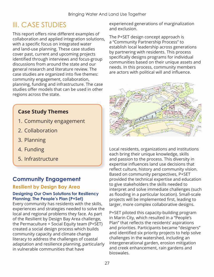
27
Bringing Water And Land Use Together
III. CASE STUDIESThis report offers nine different examples of collaboration and applied integration solutions, with a specific focus on integrated water and land-use planning. These case studies cover past, current and upcoming projects identified through interviews and focus-group discussions from around the state and our general research and literature review. The case studies are organized into five themes: community engagement, collaboration, planning, funding and infrastructure. The case studies offer models that can be used in other regions across the state.
Case Study Themes
1 . Community engagement
2 . Collaboration
3 . Planning
4 . Funding
5 . Infrastructure
Community EngagementResilient by Design Bay AreaDesigning Our Own Solutions for Resiliency Planning; The People’s Plan (P+Set)Every community has residents with the skills, experiences and strategies needed to solve the local and regional problems they face. As part of the Resilient by Design Bay Area challenge, the Permaculture + Social Equity team (P+SET) created a social design process which builds community capacity and climate change literacy to address the challenges of coastal adaptation and resilience planning, particularly in vulnerable communities that have
experienced generations of marginalization and exclusion .
The P+SET design concept approach is a “Community Partnership Process” to establish local leadership across generations by partnering with residents. This process specifically designs programs for individual communities based on their unique assets and needs. In this process, community members are actors with political will and influence.
Local residents, organizations and institutions each bring their unique knowledge, skills and passion to the process . This diversity in expertise influences land use decisions that reflect culture, history and community vision. Based on community perspectives, P+SET provided the technical expertise and education to give stakeholders the skills needed to interpret and solve immediate challenges (such as flooding in a particular location). Small-scale projects will be implemented first, leading to larger, more complex collaborative designs.
P+SET piloted this capacity-building program in Marin City, which resulted in a “People’s Plan” that reflects the residents’ aspirations and priorities. Participants became “designers” and identified six priority projects to help solve challenges in the watershed, including an intergenerational garden, erosion mitigation and creek enhancement, rain gardens and bioswales .
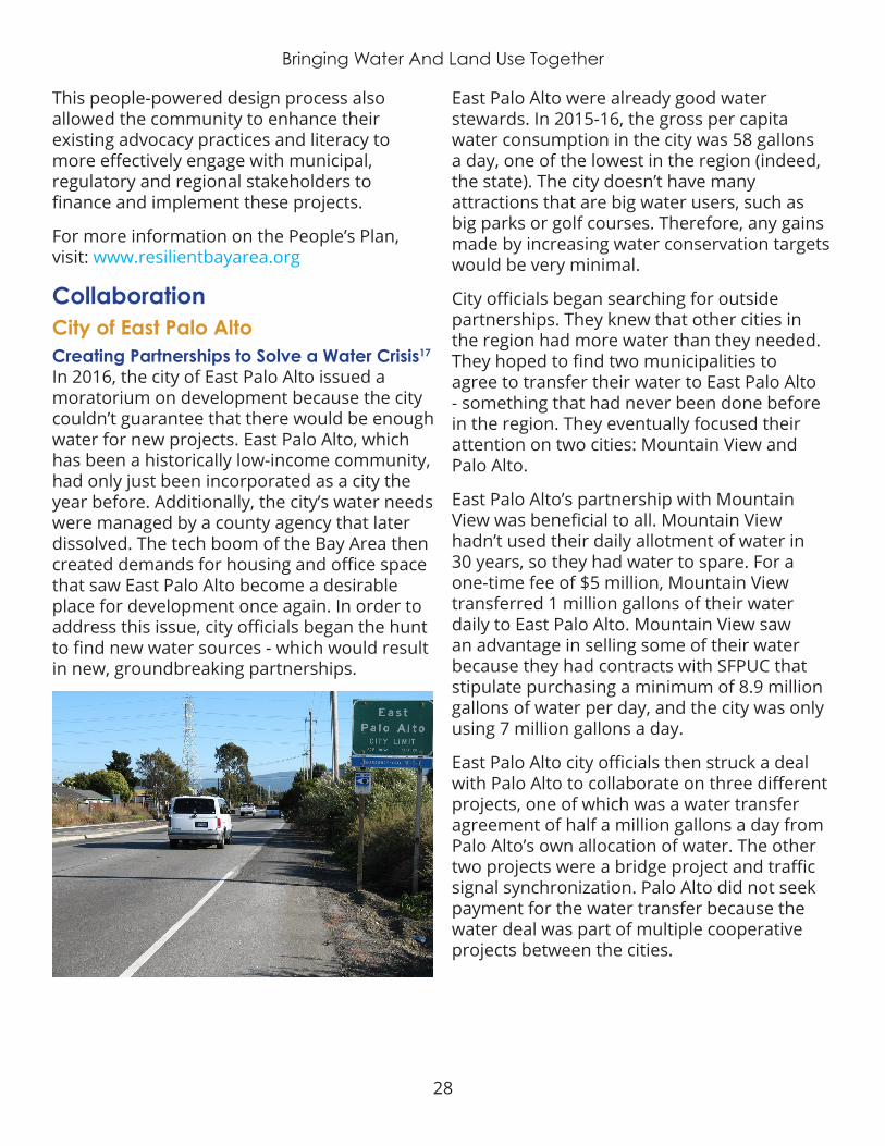
28
Bringing Water And Land Use Together
This people-powered design process also allowed the community to enhance their existing advocacy practices and literacy to more effectively engage with municipal, regulatory and regional stakeholders to finance and implement these projects.
For more information on the People’s Plan, visit: www.resilientbayarea.org
CollaborationCity of East Palo AltoCreating Partnerships to Solve a Water Crisis17 In 2016, the city of East Palo Alto issued a moratorium on development because the city couldn’t guarantee that there would be enough water for new projects. East Palo Alto, which has been a historically low-income community, had only just been incorporated as a city the year before. Additionally, the city’s water needs were managed by a county agency that later dissolved. The tech boom of the Bay Area then created demands for housing and office space that saw East Palo Alto become a desirable place for development once again. In order to address this issue, city officials began the hunt to find new water sources - which would result in new, groundbreaking partnerships.
East Palo Alto were already good water stewards. In 2015-16, the gross per capita water consumption in the city was 58 gallons a day, one of the lowest in the region (indeed, the state). The city doesn’t have many attractions that are big water users, such as big parks or golf courses. Therefore, any gains made by increasing water conservation targets would be very minimal .
City officials began searching for outside partnerships . They knew that other cities in the region had more water than they needed. They hoped to find two municipalities to agree to transfer their water to East Palo Alto - something that had never been done before in the region. They eventually focused their attention on two cities: Mountain View and Palo Alto .
East Palo Alto’s partnership with Mountain View was beneficial to all. Mountain View hadn’t used their daily allotment of water in 30 years, so they had water to spare. For a one-time fee of $5 million, Mountain View transferred 1 million gallons of their water daily to East Palo Alto . Mountain View saw an advantage in selling some of their water because they had contracts with SFPUC that stipulate purchasing a minimum of 8.9 million gallons of water per day, and the city was only using 7 million gallons a day.
East Palo Alto city officials then struck a deal with Palo Alto to collaborate on three different projects, one of which was a water transfer agreement of half a million gallons a day from Palo Alto’s own allocation of water. The other two projects were a bridge project and traffic signal synchronization. Palo Alto did not seek payment for the water transfer because the water deal was part of multiple cooperative projects between the cities.

29
Bringing Water And Land Use Together
By creating these unique and co-beneficial projects with their neighbors, the city of East Palo Alto can now move forward with the sustainable growth plans envisioned in their General Plan .
For more information about the East Palo Alto water crisis, visit: https://currentwater.co/2017/08/21/water-shortage-east-palo-alto-construction-on-hold
San Diego Regional Climate CollaborativeInnovative Partnerships and InitiativesThe San Diego Regional Climate Collaborative (SDRCC) was launched in 2012 as a network designed to support public agencies with preparing for the impacts of climate change and mitigate greenhouse gas emissions. The San Diego region faces a number of threats exacerbated by climate change, including diminishing water supplies, increasing wildfire risks, rising temperatures, and increasing coastal flooding and erosion due to sea-level rise .
SDRCC supports local governments and regional agencies across San Diego County to respond to these impacts, reduce emissions, and foster a clean energy and vibrant economy and community. SDRCC was initially formed by five public agencies (the Cities of Chula Vista and San Diego, the County of San Diego, the Port of San Diego, and the San Diego Association of Governments, or SANDAG); the University of San Diego (USD); the region’s energy utility, San Diego Gas & Electric (SDG&E); and The San Diego Foundation (TSDF).
The collaborative’s mission is to create regional partnerships between the region’s residents, local businesses, public service agencies, and private companies . The collaborative also works to create a network for public agencies to learn from each other and to plan for the impacts of climate change.
SDRCC also provides a venue for cross-jurisdictional and cross-sectoral dialogue. The collaborative organizes regular workshops and trainings for local decision-makers on climate-related topics of interest, as well as provides direct technical assistance to jurisdictions in the region. In addition to coordinating stakeholders and providing networking opportunities, SDRCC has also helped build new innovative partnerships in furtherance of specific climate-related goals and initiatives, such as the Climate Science Alliance .
For more information on the San Diego Climate Collaborative, see: www.sdclimatecollaborative.org
San Joaquin Valley GreenprintInteractive Mapping for Regional Solutions18 The San Joaquin Valley Greenprint project grew out of the San Joaquin Valley Blueprint – after the Blueprint revealed the need for better regional mapping of the Valley’s non-urban areas to assist land use and resource management decisions. The project is funded by a grant from the California Strategic Growth Council to the San Joaquin Valley Policy Council, managed by the Fresno Council of Governments, and guided by the San Joaquin Valley Greenprint Advisory Committee . The goal of the project is to promote regional collaboration by providing more sophisticated planning data to water and planning professionals – with a focus on sustainability and economic development strategies for the San Joaquin Valley region.
The Greenprint is primarily a collection of maps, assembled as a comprehensive, interactive database that catalogs current
30
Bringing Water And Land Use Together
conditions and trends related to the region’s resources. The maps and data collected for the Greenprint are publicly available, and are presented in an interactive, easy-to-use online tool. The collection of maps shows how resources are interrelated across political boundaries and how they are changing under the influence of population growth, changing land use practices, resource limitations, and changing climate.
Phase I of the Greenprint focused on identifying and mapping Valley resources for the eight counties that comprise the San Joaquin Valley, including Kern, Tulare, Kings, Fresno, Madera, Merced, Stanislaus, and San Joaquin Counties . The compiled information includes over 100 datasets related to agriculture, biodiversity, energy, and water resources, as well as supplemental datasets including land use planning, transportation, soils, and land cover.
Phase II of the Greenprint built on the work in Phase I by demonstrating the real world utility of this information, as well as finding an appropriate platform for these curated resources, specifically a host that could provide a user-friendly interface as well as the capacity to update and maintain the data . The San Joaquin Valley Gateway, hosted by Data Basin, was identified as the best platform.
The San Joaquin Valley faces many challenges and opportunities associated with the management and conservation of water, agricultural, energy, and biological resources. The SJV Greenprint project was developed to provide reliable data in support of the State and Federal agencies; non-governmental organizations; community-based organizations; universities and colleges; and individuals who are working to address these issues .
The Greenprint was also intended to provide a forum for elected officials, agencies, local business leaders, and other stakeholders to collaborate on issues that affect the rural areas of the Valley.
For more information on the San Joaquin Valley Greenprint, see: www.sjvgreenprint.ice.ucdavis.edu
PlanningCity Of Fresno General PlanPreserving Land for Natural Groundwater RechargeUntil very recently, the City of Fresno has been dependent on groundwater for about 88% of its water supply. Unfortunately, the rate of groundwater recharge has been inadequate to keep up with the amount being withdrawn. Over the past 100 years, the city has lost 100 feet of water from the aquifer.
The City recently struck an agreement to use Fresno Irrigation District canals to distribute water to Fresno Flood Control District basins throughout Fresno for groundwater recharge during dry months. The City has budgeted more than $850,000 to construct the connections and make necessary improvements such as flow monitoring to allow for efficient recharge.
31
Bringing Water And Land Use Together
The City has had ongoing projects with the neighboring city of Clovis, the Fresno Irrigation District and the Fresno Metro Flood Control District for groundwater recharge. This partnership is delivering an average of about 60,000 acre-feet of water to underground storage every year.
According to its Urban Water Management Plan, an ever-increasing volume of rain water can no longer soak through the soil to the groundwater aquifer as urbanization covers once open land with pavement, roads and buildings. There is enough storage capacity in the aquifer to serve the city’s needs and natural recharge is not able to keep up with pumping. More active recharge facilities – such as Managed Aquifer Recharge – are needed to replace the loss of natural recharge capacity.
The City’s 2014 General Plan supports the use of a natural-drainage system in new development to capture and infiltrate water on-site. This may be paid for by the City alone or in partnership with the Fresno irrigation and flood-control districts.
Most importantly, the new General Plan and development code, for the first time, limit the expansion of growth on undeveloped areas and redirects it to existing areas. This is
accomplished through policies that support infill development and that establish minimum rather than maximum densities . These policies are projected to slow the urbanization of the city’s sphere of influence and protect lands currently available for natural recharge for an additional 25 years .
Because current groundwater recharge efforts are not keeping up with the current drinking-water needs and are seriously depleted, the City is preparing to augment existing groundwater and surface-water supplies by bringing water from the Kings River to a newly constructed southeast surface-water treatment facility. The new water treatment plant will soon supply 53% of Fresno residents’ needs from treated water drawn from the San Joaquin and Kings rivers. It is expected that this measure will allow Fresno to meet its Sustainable Groundwater Management Act requirements .
Culver CityConnecting Cities to Nature, Ballona WetlandsNumerous studies of the hydrology of wetlands have shown that they are a central focus of groundwater recharge. The Ballona Wetlands sit on land owned by the State of California, just south of Marina del Rey. They were once a 2,000-acre area overflowing with fish and waterfowl. Almost 100 years ago, Ballona Creek was transformed into a nine-mile concrete flood protection channel, which blocked the flow of saltwater, and reduced the amount of freshwater in the wetlands. Today, the topography is mostly cement, leaving only a very small percentage of wetlands in this watershed . Cemented streets have lead to increased runoff and pollutant infiltration, which ultimately makes its way to the Ballona Creek, and eventually to the Pacific Ocean.
Today, more than 95% of Southern California’s wetlands have been lost due to human development – the largest loss of any region in

32
Bringing Water And Land Use Together
the nation. Wetlands are important for many reasons - they are a rest stop for birds, shelter for young fish, a water filtration system, a source of groundwater recharge, air purifier, and great source of local pride and beauty.
After the State acquired the land, they released a study that explored a range of potential infrastructure improvement projects, new structures and more access and activities for the public. Partnership were formed in order to investigate the feasibility of features such as bike trails, community centers, outdoor classroom and walking paths.
Stakeholders have witnessed progress being made since then, such as the Milton Street Park project (a $3MM linear park) adjacent the bike trail, which has added aesthetic appeal and a much needed rest stop for users of Ballona Creek trail. Significant bike path improvements in recent years include native landscaping, artist-designed gates, benches, drinking fountains, murals and other projects by public agencies and local non-profit organizations. Other opportunities include the integration of an educational component to the creek, i.e., using the creek as an outdoor classroom. This is the sort of necessary measures which must be pursued, in order
to ensure that the younger generation better understands and appreciates what the creek has to offer to their neighborhood, but even more importantly to the region at large.
For more information on the Ballona Creek Revitalization Plan, see: www.ballonarestoration.org
Funding StrategiesUc Santa CruzRecharge Net-Metering Pilot ProgramIn 2016, the University of California-Santa Cruz, the Pajaro Valley Water Management Agency (PV Water) and the Resource Conservation District of Santa Cruz County partnered to test a program that would help address the economic challenges of groundwater recharge projects. The result of that partnership is a five-year pilot program to incentivize local landowners to build a managed aquifer recharge (MAR) system on their property – where it can recharge underground water aquifers.
PV Water agreed to issue said landowners rebates to help offset the costs of installing and operating such a system. Initiated in 2016, the first year of the recharge net-metering program was tested on a five-acre parcel of farmland. It was highly successful, and has since been replicated on other properties .

33
Bringing Water And Land Use Together
The strategy was well-received, as Pajaro Valley relies heavily on groundwater, and is currently experiencing high levels of overpumping and saltwater intrusion. The pilot program could serve as a model for other regions experiencing similar groundwater challenges.
This innovative program has occurred through the agency’s partnership with the Resource Conservation District of Santa Cruz County and UC Santa Cruz Professor Andrew Fisher.
Fisher’s team has mapped the lands in the district that have the hydrologic and geologic conditions needed to absorb stormwater and recharge the aquifer.
Some property owners in these areas are being offered a reduction in the Water District’s groundwater pumping fees proportional to the volume of water that they have captures and percolated into the aquifer. This program is called “Recharge Net Metering (ReNeM).”
The Resource Conservation District has contracted for the management of the program with UC Santa Cruz providing the technical information needed to perform the recharge net-metering calculations.
InfrastructureLos Angeles Department Of Public WorksEast Los Angeles Sustainable Median Stormwater Capture19
The East Los Angeles Sustainable Median Stormwater Capture Project is located in the unincorporated area of East Los Angeles. This project will capture and treat approximately 232 acre-feet (AF) of stormwater in an average rainfall year from a 3,000-acre tributary area. The water will be captured, then infiltrated to remove pollutants such as metals and various bacteria from reaching the Los Angeles River. Updates to the medians will include drought tolerant landscaping, and other amenities
such as jogging paths and benches – providing benefit to the nearby residential community. A portion of the funding comes from the State’s Water Quality, Supply, and Infrastructure Improvement Act of 2014 (Proposition 1), and the project partners are Los Angeles County Supervisor Hilda Solis, California the Natural Resource Agency – Urban Greening Grant Program, the State Water Resources Control Board – Proposition 1 Stormwater Implementation Grant Program, and the Los Angeles County Flood Control District. As part of meeting the Proposition 1 requirements, the Proposed Project would include educational signage at the project site. Construction is expected to begin in Fall 2018 and last for approximately 12 months .
This multi-benefit project will improve water quality, increase water supply and enhance recreation and the community. Infiltration wells and low impact development, such as bioswales, will divert and infiltrate stormwater runoff to help improve the water quality of our rivers, channels, and ocean. Wells will also divert stormwater runoff into underground aquifers, replenishing our local groundwater supply. Over 300 trees will be planted and drought tolerant landscaping will enhance the community space and reduce the effects of greenhouse gases. Furthermore, passive recreation and educational signage will enhance the community space and increase public awareness on sustainable development .
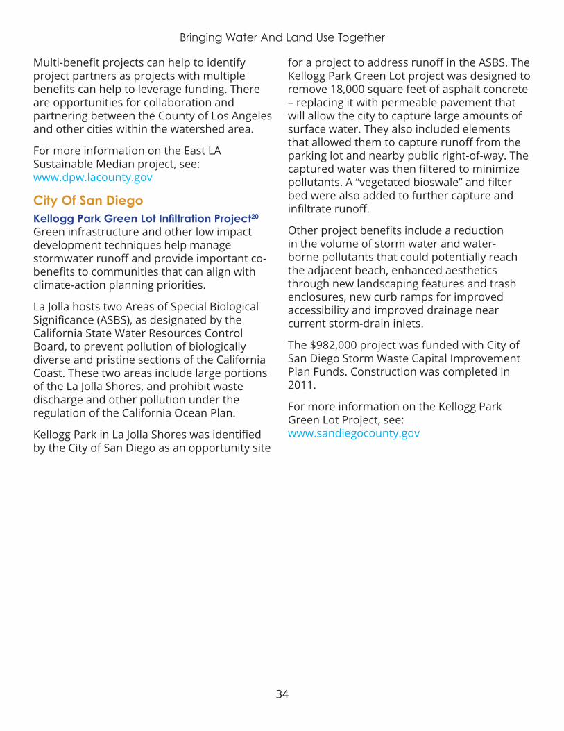
34
Bringing Water And Land Use Together
Multi-benefit projects can help to identify project partners as projects with multiple benefits can help to leverage funding. There are opportunities for collaboration and partnering between the County of Los Angeles and other cities within the watershed area .
For more information on the East LA Sustainable Median project, see: www.dpw.lacounty.gov
City Of San DiegoKellogg Park Green Lot Infiltration Project20
Green infrastructure and other low impact development techniques help manage stormwater runoff and provide important co-benefits to communities that can align with climate-action planning priorities.
La Jolla hosts two Areas of Special Biological Significance (ASBS), as designated by the California State Water Resources Control Board, to prevent pollution of biologically diverse and pristine sections of the California Coast. These two areas include large portions of the La Jolla Shores, and prohibit waste discharge and other pollution under the regulation of the California Ocean Plan.
Kellogg Park in La Jolla Shores was identified by the City of San Diego as an opportunity site
for a project to address runoff in the ASBS. The Kellogg Park Green Lot project was designed to remove 18,000 square feet of asphalt concrete – replacing it with permeable pavement that will allow the city to capture large amounts of surface water. They also included elements that allowed them to capture runoff from the parking lot and nearby public right-of-way. The captured water was then filtered to minimize pollutants. A “vegetated bioswale” and filter bed were also added to further capture and infiltrate runoff.
Other project benefits include a reduction in the volume of storm water and water-borne pollutants that could potentially reach the adjacent beach, enhanced aesthetics through new landscaping features and trash enclosures, new curb ramps for improved accessibility and improved drainage near current storm-drain inlets.
The $982,000 project was funded with City of San Diego Storm Waste Capital Improvement Plan Funds . Construction was completed in 2011 .
For more information on the Kellogg Park Green Lot Project, see: www.sandiegocounty.gov
35
Bringing Water And Land Use Together
IV. OPPORTUNITIES AND RECOMMENDATIONS FOR IMPROVING WATER AND LAND-USE INTEGRATIONThe vast majority of strategies, opportunities and recommendations from statewide focus-group participants and the community foundations engaged in this project reference “infrastructure.” This illustrates that the need for infrastructure investment is one of the state’s most pressing issues. Inadequate infrastructure impacts communities already facing disadvantages more acutely than other communities .
Identifying and addressing infrastructure needs is also the “low hanging fruit.” While costly, there is a more direct path to infrastructure solutions to more ambiguous challenges of softer skill development and institutional change.
Expert interviewees, in contrast with focus group participants, emphasized “planning” and “regulations” as top themes. Recommendations to address governance and representation, as well as financial recommendations also ranked high. Topically, recommendations addressed water supply over any other concept . Many recommendations also addressed land use, development, and the need for better dialogue and communication .
Interestingly, more strategies and recommendations came from land-use experts than water experts . While only conjecture, this may illustrate that land-use planners will be the easier party to catalyze integration between the two sectors. This is further illustrated by the American Planning Association hosting a “Water and Planning Connect” conference for this exact purpose.
Furthermore, it’s far more common to encounter water-themed topics at planning events than land use-themed topics at water forums.
Clearly, a “carrot” and a “stick” approach are both necessary to achieve integration. Both top–down legislative mandates and community-level organizing and citizen-driven political engagement are needed to hold decision-makers accountable.
The following subsections outline recommendations that are considered most important and supported by the broadest range of participants from this study. Strategies, opportunities and recommendations are arranged by statewide or regional actions. All other recommendations identified through this project are included in the Appendix .
Statewide OpportunitiesData collection and analysis for this project elicited many opportunities for improved integration of water management and land-use planning. While the appropriate strategies needed to achieve integration may vary from region to region, opportunities noted here are applicable statewide .
California now has a new governor, as well as several new legislators. Community foundations and water and planning professionals have a rare opportunity to engage at the state-policy level early on to gain traction with the new administration .
In the early stages of the administration is the perfect time to influence the new governor and highlight integrated water and land-use planning as a priority for California. The Strategic Growth Council, in particular, composed of members appointed by the governor, is an ideal agency to integrate water management into land-use planning statewide.
36
Bringing Water And Land Use Together
Alignment in stakeholder engagement is an important strategy for achieving integration. Interest groups and public-service providers alike are constantly competing for the same “mindshare” or mental capacity for attention from their customers. Community members are constantly bombarded with competing messaging via social media and other more traditional marketing avenues.
A unified message from multiple sources, targeted to complement rather than compete with one another for mindshare, is far more effective in reaching its intended audience. Collaboration between agencies for a shared-messaging public-engagement campaign is an “easy win” to start building cross-agency, cross-jurisdictional and cross-sector relationships. These relationships can then form the foundation toward greater integration.
Shared data and leveraging resources or joint financing of shared technology and innovation provide the next steps in building collaborative partnerships that will help foster integration. This alignment will also help avoid unnecessary duplication of efforts and is a more competitive approach for grant funding.
The American Planning Association held its “Water and Planning Connect” conference in September 2018. The gathering was the first of its kind, bringing together water and land-use planning professionals from the public and private sectors. The conference sought to help shape dialogue around the intersection of land-use planning and water resource management, recognize significant water issues facing the nation (contamination, drought and sea-level rise), and provide participants the opportunity to explore new ways to approach water and land-use planning issues. The APA closed the conference with a commitment to regularly hosting these conversations in the future. This conference was an important first step in encouraging more collaboration between water and land-use planning.
Statewide RecommendationsThrough review of existing literature, analysis of various policies and conversations with countless water and land-use experts, and review of the above strategies and opportunities, three primary needs emerge as the greatest potential solutions to achieving the equitable integration of water and land use .
These three recommendations are complex and historically controversial . While there is general consensus from both water and land use experts that each is necessary, the mechanisms by which they are implemented remain contentious – especially whether each should be optional or compulsory:
1 . Each hydrologic region should establish a regional water budget (similar to those being developed for groundwater basins), reviewed and approved by the state, which the region as a whole must maintain in balance.
2 . Establish stronger guidelines and incentives for regional planning agencies (Councils of Governments, Metropolitan Planning Organizations) to ensure alignment between development decisions at the city and county level and recommendations in their respective Sustainable Community Strategy.
3 . Amend the State Constitution to address water financing; including Proposition 218 reform to enable more flexibility in addressing our water needs, and a statewide public-goods charge on water to assure the supply of safe drinking water and sanitation to all Californians.
Additional recommendations that are perhaps more politically feasible and will still have a significant impact on water and land-use integration – the lower hanging fruit – also emerged:

37
Bringing Water And Land Use Together
1 . Require greater sophistication and alignment (through better data and analytics sharing) in growth projections and coordinated planning for both land-use planning and water management agencies.
2 . Promote cross-sector coordinated planning and management of land use, water management, flood mitigation and climate adaptation .
3 . Direct state and local investments toward multisolving through groundwater recharge and green infrastructure projects developed at local scales with robust community engagement
4 . Prioritize infrastructure investments that support existing communities, especially underserved communities, before new development .
Specific action at multiple scales is necessary to achieve progress on these four recommendations . Each initiative will be less controversial if resources are provided to support the activity, and if all parties involved are assured they will retain their existing authorities .
Additional context and activities for each are outlined below, but a more comprehensive strategy for implementation should be developed for each.
Require greater sophistication and alignment (through better data and analytics sharing) in growth projections and coordinated planning for both land-use planning and water management agencies.
¡ One of the primary barriers to interagency coordination is limited institutional capacity . State (especially the Department of Water Resources and the Governor’s Office of Planning and Research) and local agencies (city and county planning, stormwater and
transportation, local water agencies) should invest in increased staffing dedicated to land-use planning and water management integration. A unique model is the Los Angles Mayor’s Office of Sustainability hiring a staff position funded in part by a local philanthropic organization and the Los Angles Department of Water and Power. Similarly, the Statewide Energy Efficiency Best Practices Coordinator is funded by the California Energy Commission, and managed jointly by three relevant NGOs (Local Government Commission, Institute for Local Government and ICLEI).
¡ Historic inequities in development and investments are perpetuated today by failing to integrate planning efforts. The Strategic Growth Council, Housing and Community Development, and the Governor’s Office of Planning and Research should provide guidance for regional alignment in planning and housing development, to ensure equitable and sustainable distribution of increased housing and growth. Density should be distributed in accordance with available local resources and existing local context (urban, suburban, exurban, rural).
¡ Population allocations used by local and regional planning agencies (cities, counties, Councils of Governments, Metropolitan Planning Organizations, Joint Powers Authorities) should include water availability and reliability analysis, as well as other relevant regional factors (sea-level rise for coastal communities, flooding). This will help prevent unsustainable growth where there is inadequate water supply or water management infrastructure.
¡ Additional improvements to accurate growth projections could be made through Sustainable Communities Strategies and General Plans using Urban Footprint or a similar scenario planning tool; Urban Water Management Plans relying on real-time
38
Bringing Water And Land Use Together
water-use efficiency data and Sustainable Community Strategies growth projections to establish demand forecasting.
¡ To ensure cross-sector engagement and better alignment between planning efforts, local and regional agencies should provide dedicated seats for planning staff on water committees, and vice versa. Each agency must also allocate adequate staff time for meaningful participation. For example, amended Urban Water Management Plans could stipulate who needs to participate, and revisions to the Sustainable Groundwater Management Act could require land use planners sitting on technical advisory committees for Groundwater Sustainability Plan development .
¡ State agencies and/or philanthropic organizations should provide technical assistance for communities needing additional support to implement the activities proposed above .
Promote cross-sector coordinated planning and management of land use, water management, flood mitigation and climate adaptation.
¡ State and local investments (grants, loans and bond financing) should be directed toward multisolving – integrated planning and projects developed at local scales with robust community engagement that address more than one need and provide a range of public benefits.
¡ State funding agencies (Department of Water Resources, the State Water Board, and California Fish and Wildlife; Strategic Growth Council, Caltrans, and Housing and Community Development) should first integrate across their own programs, and
then prioritize funding for local and regional multisolving. This was attempted under the Schwarzenegger administration, but failed due to constraining bond language and statute. A more successful approach will be to educate legislators and advocates about the value of flexible funding language that focuses on outcomes and not process. Any new funding legislation should provide agencies flexibility in implementing their grant programs so long as the intended outcomes are being realized.
¡ Grant programs should require collaborative, integrated planning for funding eligibility, and metrics for tracking collaboration in grant reporting. Department of Water Resources Integrated Regional Water Management Program already does this to some extent, particularly through their Disadvantaged Community Involvement Program. These same agencies should fund technical assistance and decision support tools to identify benefits and allocate costs accordingly, for integrated projects. The Proposition 84 Strategic Growth Council grants are an excellent example of this type of support.
¡ The Governor’s Office of Planning and Research should provide leadership, guidance, and technical assistance to support local jurisdictions in conducting a full analysis of their development codes and regulations, seeking opportunities to integrate and streamline permitting processes, so as to enable development of cost-effective, sustainable, equitable projects that integrate water and land use.
¡ The State Legislature should amend Urban Water Management Plan requirements to be consistent with Groundwater Sustainability Plans . Protocols should be established for determining imported water, surface water and groundwater

39
Bringing Water And Land Use Together
supplies are based on the water basin . This change will help to integrate agricultural and urban water planning for more accurate analysis and consistency .
¡ The State Legislature should appropriate adequate budget for the Governor’s Office of Planning and Research to: provide leadership, guidance, and technical assistance to support local jurisdictions in conducting a full analysis of their development codes and regulations, seeking opportunities to integrate, streamline permitting process, to enable development of cost-effective, sustainable, equitable projects that integrate water and land use. Local jurisdictions across California should proactively seek to do the same, in the absence of state leadership, while also advocating for this support.
¡ Many local and regional agencies across the state are eager to better integrate their water management and land-use planning efforts, but are unclear where to start. State agencies and relevant NGOs should compile existing local structures and best practices for water/land use integration into a centralized statewide framework and resource guide. This framework should include guidance for state agency alignment, policy and regulatory alignment, local integration between sectors, regional integration across jurisdictions, and best practices for collaboration. Developing such a framework should follow a similar yet more robust process as the research resulting in this report, or that which was followed to develop the general-plan guidelines.
Direct state and local investments toward multisolving through groundwater recharge and green infrastructure projects developed at local scales with robust community engagement.
¡ Stormwater green infrastructure projects are often “low hanging fruit” to achieve water/land-use integration, and to gain community buy-in. Statewide advocacy and education about the value of multisolving, through projects that address stormwater compliance while providing other benefits, ensures that new public investments provide the greatest range of benefits possible to the communities funding them.
¡ Natural infrastructure is now mandated as an adaptation strategy in General Plan safety elements (SB 379). Local and state agencies should ensure they are using the same terminology, and expanding the definition of “green infrastructure” beyond stormwater to include all natural approaches .
¡ There is also new and substantial opportunity for alignment between water management and land use planning within our forested communities. Forestry management is one particular multisolving approach with significant benefits.
¡ State and local regulations are often the primary barrier to implementing strong integrated green-infrastructure projects. State and local public agencies should streamline their respective regulations and establish “umbrella” or “programmatic” permitting for integrated, multisolving projects.
¡ The State should invest in a comprehensive ecosystem services and groundwater recharge agenda developed at local and

40
Bringing Water And Land Use Together
regional scale to statewide standards. Agencies involved in establishing standards should include Department of Water Resources, State Water Resources Control Board, California Fish and Wildlife Service, Strategic Growth Council, and the Governor’s Office of Planning and Research. The statewide agenda can build on work already developed by The Nature Conservancy and CA Department of Fish and Wildlife. This approach should include a manual of compiled and refined best management practices, decision–support tools and pilot demonstration projects.
¡ Local and state agencies should incentivize or require the identification and protection of groundwater recharge and stormwater infiltration areas. This can be achieved by cities, counties, regional, and state commissions (such as Coastal Commissions) setting aside more land as habitat conservation area and preventing expansion in those areas; or by mandating general plans and groundwater sustainability plans coordinate efforts to identify and zone these areas to prevent development in priority recharge zones. Guidelines should be strong enough to prevent unsustainable development, but flexible enough to adapt to changing information. Butte County is an excellent example of a region studying the issue, identifying high recharge areas, and then having to adjust their decisions as they discovered some of their assumptions were incorrect .
¡ Rural communities should adopt an ordinance that prevents land zoned for agricultural purposes from being converted to urban development to protect floodplain and groundwater recharge areas. Establishing a fund or trust for purchasing agricultural lands from willing sellers at a fair market value and converting these lands to open space or other passive
use will protect the economic interest of existing agricultural land owners.
Prioritize infrastructure investments that support existing communities, especially those experiencing disadvantages, before new development.
Infrastructure investments are often subsidized by federal, state and local funding sources. Projects that are not aligned with state water and climate goals should not receive public funding. Under AB 2800, the legislature commissioned an Infrastructure Resilience Report that evaluates the state’s exposure to risk. Results from the AB 2800 working group should be used to prioritize future infrastructure investments. The state should codify the working group as a standing Water and Land-Use Infrastructure Sustainability and Coordination Commission responsible for preventing unsustainable sprawl development .
This commission would establish evaluation criteria as well as monitoring and reporting requirements for local and regional agencies to follow in considering infrastructure needs and analyzing development proposals. The commission could serve as a funding and technical assistance provider to support local implementation, and also serve as a regulatory backstop if the public feels local investments are inconsistent with Sustainable Communities Strategies, General Plans, Groundwater Sustainability Plans and other state policies .
¡ Local agencies (cities and counties) should conduct more stringent review of project siting to ensure better alignment with General Plans, Sustainable Communities Strategies and Regional Transportation Plans, and Groundwater Sustainability Plans to ensure equity in investments, and prevent environmental injustice and negative water and land-use impacts.
41
Bringing Water And Land Use Together
This can be accomplished by requiring additional community benefits and a higher level of community engagement or public participation prior to approving development projects.
¡ Legislatively establishing an oversight agency with strong incentives (such as state funding eligibility) to ensure adequate alignment and consistency among plans and actions will also help ensure equitable and sustainable infrastructure investments. For example, the Alluvial Fan Taskforce recommends the local government (city or county) Planning Department as lead, in partnership with local water and flood management agencies. State entities should continue to administer the Affordable Housing and Sustainable Communities Program, provide technical assistance to local agencies interested in infill development, and distribute best practices statewide .
¡ Department of Water Resources created an Alluvial Fan Task Force in 2010, which recommended a Model Ordinance approach to protect priority groundwater recharge areas. Cities and Counties should adopt this Model Ordinance approach, which does not challenge the existing and use authority of local governments.
¡ Gentrification and displacement are real threats to existing communities when infrastructure investments are made. To ensure existing residents receive the benefits of infrastructure investments, local agencies (cities, counties, water districts) should establish “Community Stabilization Teams” to work directly with communities anticipating development to ensure they continue to receive adequate services (water, wastewater, transportation, housing) while also preventing displacement . The Mission Action Plan 2020, produced by the City of San Francisco,
is an excellent model . A Community Water Sustainability Planning Task Force based on Urban Water Management Plan review and implementation would be an effective adaptation of this model.
¡ Funding for infrastructure seems to always fall far short of actual need for infrastructure improvements. New finance mechanisms – such as distributed infrastructure bond financing and enhanced infrastructure financing districts – should be supported and encouraged. State and local agencies should explore opportunities to implement these alternative funding strategies, while also striving to overcome existing barriers to smart public investments, such as those presented by Proposition 218 and Proposition 13 requirements .
¡ Chronically failing water systems place constant strain on local communities . While the state is providing technical assistance and investments to solve chronic water system failures, including consolidation when appropriate under AB 2050, many experts agree that additional support (and possibly stricter enforcement) is still needed .
Statewide Policies for Equitable IntegrationIn some instances, legislation is needed to make real statewide progress toward the equitable integration of water management and land-use planning. These six policy changes would significantly improve water and land-use integration, and are broadly supported by a wide range of water, land-use and equity experts:
1 . Make collaborative, integrated planning a requirement for funding eligibility, and provide technical assistance and decision-support tools for integration in state grant projects.
42
Bringing Water And Land Use Together
2 . Require alignment of county and city zoning and land use plans with all water management plans, similarly to how fire and flood risks were added to the Safety Element under AB 2140 . The state should also consider a new fire bill to integrate fire standards across the entire wildlands-urban interface.
3 . Revise General Plan requirements to include analysis of water-supply reliability and vulnerability in the adaptation section, developed in close collaboration with local water agencies. Alternatively, require water agencies to align water supply reliability and vulnerability analysess to local government jurisdictional boundaries for inclusion in Hazard Mitigation Plans and Groundwater Sustainability Plans .
4 . Establish collaboration commissions at the watershed scale, in which department heads meet regularly to determine how to better integrate their planning and operations, and report regularly to the state .
5 . Update “show me the water” legislation (SB 221 and SB 610) to require more comprehensive analysis when a municipality presents a new development plan (the water agency would explicitly state how it will provide the requested water, where it will come from, and at what cost). As a stopgap measure, grant the State Water Resources Control Board approval/denial authority over all new water systems .
6 . Streamline new finance mechanisms for water infrastructure and affordability (such as SB 623, distributed infrastructure financing and enhanced infrastructure financing districts); and overcoming existing barriers to smart public investments (Prop 218 and Prop 13).
Community foundations and other engaged groups are encouraged to advocate for one or more of these policies.
Regional Opportunities and RecommendationsThe statewide strategies, opportunities and recommendations described above can also be applied at the regional and local level to help improve integration. Some actions, however, are more effective when applied at a local or regional scale.
This section of the report highlights opportunities and recommendations unique to each region based on each region’s diverse challenges, needs and strengths. Presented first are more detailed recommendations that apply to all California regions, followed by general opportunities and specific recommendations that would be most relevant or most impactful for each region.
Recommendations are presented according to rough orders of magnitude in terms of the cost to implement, denoted by one-, two- or three-dollar signs ($). Before implementing any of these recommendations, community foundations or other stakeholders would need to develop a more comprehensive implementation strategy with specific target outcomes, actions and budget.
Recommendations for All Regions ¡ $ Advocate for water access and
affordability for community members facing disadvantages. This includes supporting potential legislation similar to the following past efforts:
¡ SB 623, SB 844 and SB 845, which would have established a safe drinking-water fund.
¡ SB 778, which incentivizes the consolidation of water agencies where appropriate .
¡ SB 1000, which requires General Plans for regions that include disadvantaged communities to include an Environmental Justice Element .
43
Bringing Water And Land Use Together
¡ $$ Provide venues for local leaders in both the water and land-use sectors to interact with one another; and provide resources (funding and/or staff time) to enable their participation. Key participants include city and county planning and community development departments, COGs and local water agencies. Effective models can be found in the Sonoran Institute’s “Growing Water Smart” program (https://sonoraninstitute.org/2017/rcw-program-workshops/) and the Local Government Commission’s Alliance of Regional Collaboratives for Climate Adaptation (ARCCA) (arccacalifornia.org).
¡ $$ Develop regional leaders in both the water and land-use sectors and provide opportunities for them to interact with one another. Developing a coalition of informed and passionate local decision-makers will combat this short-sightedness. The Local Government Commission’s Capital Region Dinner Forums and Water Education for Latino Leaders UnTapped Fellowship are effective leadership development and coalition-building models. The new Water Solutions Network is also promising.
¡ $$ Build local political will and understanding around water and land-use integration by convening and educating local leaders. Local elected officials in particular have excessive demands on their time and many complex issues competing for their attention. Without the luxury of time to fully understanding complex issues, robust planning documents and policies to ensure resilience are easily bypassed in favor of quick fixes in the form of inequitable sprawl development and big infrastructure projects. Developing a coalition of informed and passionate local decision-makers can help combat this short-sightedness. The same models listed above for regional leadership development can be applied here .
San Francisco Regional Opportunities and RecommendationsOpportunitiesThe San Francisco region has several successful multi-jurisdictional collaboratives, such as the Bay Area Water Supply and Conservation Agency and the San Francisco IRWM, that can be leveraged to increase water and land-use integration. Since this significant institutional infrastructure already exists, precious capacity and resources should be used to support and engage in these groups.
The San Francisco region also has a unique opportunity to discover new and exciting water conservation and efficiency solutions as a hub of advanced technology. Imagine H2O, an international startup accelerator founded in 2008 and based in San Francisco, provides early-stage water startups with introductions to investors, potential partners, product users and mentors throughout the early days of their operations to support their quest to solve water challenges. Maximizing local water supply, such as groundwater, seawater and surface water, through technology and innovation, especially for new property development, is well within reach for this tech hub .
Another crucial opportunity in the region is the high cost of living. Much is made of the region’s lack of affordable housing (one of the most expensive housing markets in the country), and the high cost of water to communities is an additional financial concern for residents. Equitable water pricing and housing-affordability strategies such as low-income rate assistance and income-based rent structures will greatly assist overburdened residents in the region.

44
Bringing Water And Land Use Together
Recommendations ¡ $$$ Partner with technology companies,
policy hubs, and community-based organizations to establish workforce development opportunities within the housing and water sectors to provide living-wage jobs within the community and increase diversity across the profession. Excellent models include the Governor’s Initiative AmeriCorps program CivicSpark; the Eastern Municipal Water District’s Youth Ecology Corps, and the Fresno Economic Opportunities Commission’s Local Conservation Corps .
Silicon Valley Regional Opportunities and Recommendations OpportunitiesThe Silicon Valley region also has the opportunity to leverage existing institutional infrastructure such as regional collaboratives and integration-focused nonprofits organizations and community service agencies. Being neighbors to the San Francisco region allows them to participate in collaborative initiatives such as the Bay Area Water Supply and Conservation Agency and the San Francisco IRWM. The City/County Association of Governments of San Mateo County also works on several environmental issues, including housing and transportation. They encourage cities and counties to collaborate, and even though there isn’t much collaboration between water and planning professionals yet, they are well-placed and well-suited to lead the way toward more integrated planning.
Public transportation options in the Silicon Valley region are too few, and not enough residents take advantage of these systems. Improving convenient, affordable transportation options that allow people to move across the region more efficiently will improve overall equity and foster more integrated planning, reduce traffic congestion, and encourage smart growth.
Like the San Francisco region, the Silicon Valley region is a hub of technology and innovation. Silicon Valley can encourage progressive research and development of technologies for water conservation. Utility and water-conservation experts can work with technologists and entrepreneurs to develop a wide range of different types of solutions. Silicon Valley investments could draw more attention to water and energy conservation and the changing business models of utility companies, and lead to real change in the energy sector.
Recommendations ¡ $ Work with jurisdictions in Santa Clara
County to implement the countywide climate-adaptation guidebook and replicate the guidebook for other jurisdictions in the region. The guidebook maps out explicit steps for the region to achieve resilience, but success will depend on effective collaboration, alignment and accountability .
¡ $$$ Partner with technology companies, policy hubs, and community-based organizations to establish workforce development opportunities within the housing and water sectors to provide living-wage jobs within the community and increase diversity across the profession. Good models include the Governor’s Initiative AmeriCorps program CivicSpark, the Eastern Municipal Water District’s Youth Ecology Corps, and the Fresno Economic Opportunities Commission’s Local Conservation Corps .
Central Valley Regional Opportunities and RecommendationsOpportunitiesMulti-benefit projects can bring better coordination and integration to the Central Valley region, where there are so many different interest groups – from cities and counties to environmental-justice and

45
Bringing Water And Land Use Together
agriculture coalitions. Multi-benefit projects can bring traditionally competitive groups together around a shared vision. For example, some Central Valley farmers use on-farm flooding for groundwater recharge, which is significantly more cost-effective than dedicated groundwater basins – making this a cost-saving strategy for many farmers.
Along with more access to multi-benefit projects, strong partnerships and effective community engagement efforts are required for project implementation and long-term monitoring and sustainability. Engaging all affected and interested communities in the region will foster innovative and integrated solutions to water and land use by using the historical and institutional knowledge of residents who have been living on the land for many generations.
Workforce development in the form of job training and education programs emphasizing collaboration skills will prepare the workforce for more integration between the water and land use sectors. Improvements and investment in Central Valley communities has the potential to displace current residents. Investment in the people and anti-displacement policies should always accompany investment in the infrastructure.
Compliance with the Sustainable Groundwater Management Act provides a perfect opportunity to integrate groundwater management with future land use decisions. The act can be a wonderful tool for integration if planners, water managers and residents convene to consider the potential opportunities. In particular, the required creation of a Groundwater Sustainability Agency can create a bridge between other agencies in the region.
Recommendations ¡ $ Engage local communities in long-
range planning and visioning. The Central Valley region lacks a sense of shared vision and path toward a resilient future in the face of development pressure. Without this vision, the region will continue to face difficulty integrating between water and land-use sectors. Bringing communities together across jurisdictions to determine what the Valley’s future will look like is the first step toward collaborative, integrated planning.
¡ $$$ Provide technical assistance to help communities evaluate agency consolidation. The Central Valley is plagued with failing small water systems. New legislation (AB 2050) establishes a path to consolidate smaller agencies, but many of these agencies – and the communities they serve – lack the capacity and technical skill to adequately evaluate whether consolidation is the best option . Additional support to facilitate community-engaged consolidation evaluations will have a tremendous long-term impact for the region.
Los Angeles Regional Opportunities and RecommendationsOpportunitiesThe Los Angeles region has an immediate opportunity to capitalize on potential local legislation. In November 2018, Los Angeles County residents will vote on a proposed property tax that would fund stormwater capture, treatment and infiltration – dubbed the “Safe Clean Water Program.” Passing the stormwater fee will catalyze integrated multi-benefit projects and provide a steady revenue stream for necessary operations and maintenance . The initiative could help protect creeks and streams, build parks, liven up concrete landscapes, and create green space for the community.

46
Bringing Water And Land Use Together
The Los Angeles region possesses tremendous political power, as well as institutions with deep technical expertise and capacity. Its leaders have an opportunity to catalyze cross-regional and inter-disciplinary partnerships to advance integration. Implementing the human right to water and addressing housing affordability are the two most pressing issues requiring significant political power.
Cities in the Los Angeles region have an opportunity to ensure equitable, water-smart development through stronger incentives and constraints within their general plans and zoning codes. Similar to Measure JJJ, cities can provide generous financial and process incentives for priority redevelopment and infill areas, affordability, aggressive permeability and on-site stormwater capture and reuse, highly water-efficient buildings and other positive features.
Recommendations ¡ $$$ Invest in grassroots organizing for
self–advocacy to provide opportunities for the lowest-income, most-vulnerable communities to have a real voice in planning processes. This will require deep engagement to educate the community about the value of integrating water management and land-use planning, while also teaching political engagement and self-advocacy skills. The Community Water Center and Self Help Enterprises provide successful models for building local capacity to ensure equity in decision-making.
San Diego Regional Opportunities and RecommendationsOpportunitiesThe San Diego region has some excellent planning documents, especially the City of San Diego’s General Plan update, the Climate Adaptation Plan, the IRWM Plan and the Habitat Conservation Plan. These
plans represent a significant opportunity to ensure regional resilience by holding local jurisdictions accountable to implementing them . A local measure proposed in San Diego would have required a public vote to approve any proposed amendments that would change the General Plan or increase density in undeveloped areas of the county did not make it on the November 2018 ballot . This would have been a strong mechanism for the community to better hold its leaders accountable .
SANDAG’s technical working group is an ideal venue for the region’s planners to convene, share ideas, and potentially converge around a more resilient shared vision for the region’s water and land use. Similarly, San Diego Coastkeeper is convening the heads of the city’s water and planning departments to align decision-making.
Many San Diego residents share an interest in open space and natural habitats . Leveraging these shared principles provides an opportunity to engage and educate the community about the value and importance of integrating water management and land-use planning.
Recommendations ¡ $ Advocate for strong, local legislation
that promotes affordable, efficient and anti–sprawl development and integrated water management. This includes ensuring equitable local implementation of the new Water Use Efficiency Standards (AB 1668). Facilitating equitable local water agency consolidation through SB 778 will also support long-term integration and alignment. The San Diego Region can ensure a sustainable water future through its land use decision–making.
47
Bringing Water And Land Use Together
¡ $$$ Invest in existing integrated planning efforts (such as SANDAG’s regional planning technical working group, San Diego County IRWM and the San Diego Climate Action Plan); and ensure plans are implemented. The Sonoran Institute’s “Growing Water Smart” program is an excellent model for bringing multiple
jurisdictions through the integrated planning and implementation process. If an unbiased third–party (non–advocacy) organization tracks plan implementation through metrics and communicates key findings to community stakeholders, jurisdictions will also be held more accountable for their decisions.
48
Bringing Water And Land Use Together
V. BRINGING WATER AND LAND-USE TOGETHER: HOW TO MAKE IT HAPPENCalifornia is extremely diverse. Each of the five regions represented in this study has its own unique geography, economy, culture and politics, and each area faces its own unique challenges with solutions that work best for it.
California infrastructure varies by region, as does their primary water supply. Yet, each region is working within the same system of state laws and regulations, and dependent on the same statewide hydrologic system. Each region has its own unique microclimate, which will influence their vulnerability to climate-change impacts, but the state as a whole is facing the same changing climate.
While priorities vary from region to region and strategies for overcoming challenges must be tailored to each unique region, the same common themes emerge regardless of the specific context in which we are striving to integrate water and land use. The general barriers to integration and the best practices for overcoming those barriers exist regardless of the specific issues we are trying to address through that integration.
Similarities and Common Ground Across RegionsCommonalities across regions can help unify efforts to integrate water and land use. The following factors that impact water management and land use planning are shared across all five regions – indeed, all of California.
Virtually every community in California is facing a housing crisis. They lack sufficient housing stock – especially affordable housing – to meet current demand and future growth projections. This is especially problematic from an equity perspective, as communities
already facing disadvantages are even more vulnerable to increasing costs. These residents are displaced from their neighborhoods, and then must travel farther distances to their workplaces, thus increasing their transportation costs and putting greater stress on their health and well–being.
Communities statewide must also face mounting costs and potential disruption from failing infrastructure. Years of deferred maintenance and lack of investment at the local, regional and state level have left us with a $500-billion price tag statewide. Regional and local agencies can reduce costs and service disruption by coordinating infrastructure investment across sectors .
California is made up of thousands of jurisdictions and special-purpose agencies. Various policy and cultural factors contributed over the years to the vast web of overlapping and often misaligned governance structures, the result of which is inefficiency, complexity and an over–abundance of plans. This is a challenge for every region across the state.
California’s regulatory and policy framework is equally complex to its governance system. Our regulatory process results in a plethora of single-purpose laws and policies that rarely align and sometimes counteract one another. This lack of statewide regulatory and policy drivers for integration is a missed opportunity and a significant barrier across the state. A new guidance document, Creating Sustainable Communities and Landscapes21, can help local communities overcome this challenge
In our increasingly busy and distracted society, Californians’ attention and interests are divided among many priorities. It is easier to rally support around more seemingly urgent issues than the concept of water and land-use integration. The difficulty in illustrating the importance of integration results in a lack of local and statewide leadership or public interest in the issue .

49
Bringing Water And Land Use Together
Major Variations Between RegionsWater and land-use integration efforts must be tailored to the specific needs and priorities of each region – no single approach will succeed in every region. The following are important distinctions between regions that will impact local water and land-use integration.
DensityThe San Francisco and Los Angeles regions are largely built out, with less open space for green infrastructure or additional development. Communities in these regions are challenged to address population growth and increased housing needs within their existing footprint.
The Silicon Valley and San Diego regions are relatively built out, but do still have large swaths of open space available for green infrastructure. These regions are also less densely populated than San Francisco and Los Angeles, and thus can increase housing stock within their existing growth boundaries.
The Central Valley is the least densely developed region and has the most open space. This provides an opportunity for coordinated planning and green infrastructure, and a risk for continued sprawl and patchwork development .
Cost of LivingCosts vary greatly by region. The overall cost of living is higher in coastal regions than in communities inland, and highest in the Los Angeles, San Francisco and Silicon Valley regions. The overall size of the regional economy, and by extension the region’s ability to bear the burden of infrastructure investments, correlates with its cost of living.
Water costs are much higher in Southern California (Los Angeles and San Diego regions) than Northern California (San Francisco and Silicon Valley regions), regardless of the size of the local economy. Overall cost of living is
much lower in the Central Valley, but its water costs are relatively high, and the region’s smaller economy is overburdened by the need for infrastructure investment.
Water SupplyDrinking water quality is the primary issue in the Central Valley, but is much less of a problem in the other four regions. Pockets of the San Francisco and Los Angeles regions face drinking water quality issues as well, but these are caused by local infrastructure needs, rather than the water supply itself.
Water supply reliability is a major issue in the Los Angeles and San Diego regions, where local waters sources are extremely limited. Costs for importing and treating water are also higher in these regions than the others. This is less of an issue in the San Francisco and Silicon Valley regions, where a diversified water portfolio increases supply reliability. The Central Valley’s water supply reliability is more nuanced than the others. While the region is relatively “water rich,” its agriculture-driven economy is highly water dependent and more vulnerable to changes in water supply. An overreliance on groundwater diminishes local water supply and creates competition between demand for residential water use and water for agricultural irrigation.
Coordinated Planning and IntegrationWater agencies in the San Francisco and Silicon Valley regions are collaborating more than elsewhere in the state, but these regions are not coordinating with local land-use planning.
The Los Angeles and San Diego regions are integrating water management and land-use planning at the broader regional scale more than other regions, but not at the local level.
Coordination between water management and land-use planning varies greatly from community to community in the Central Valley, with very little regional collaboration.
50
Bringing Water And Land Use Together
Greatest Needs Across the StateDespite the variation among regions, several key needs persist statewide . Since water and land use are intertwined, the decisions made about each must consider the other . The question of inequity adds another complex factor to the equation. Since local government are often the ones making the decisions that affect water and land use, their role is essential to ensuring integration.
California’s strong political preference for local control can result in misalignment with state priorities. In the absence of regulation or statewide guidance, local communities have little incentive to pursue equitable water and land-use integration. Local communities consequently lack the capacity to push for integration.
Coordination is further complicated by the sheer number of local and regional agencies. California has 58 counties, 482 municipalities and more than 5,000 water-related agencies. Overlapping jurisdiction and conflicting priorities significantly inhibit integration. Incentivizing leaders to coordinate with another and supporting local leaders who act as champions of integration will encourage the breaking down of these barriers. Aligning institutions or consolidating when appropriate can also create opportunities for integration.
Entities throughout the state must make these decisions within the confines of existing resources . This includes natural resources as well as the built infrastructure, which can be used to increase the integration of water and land use. Protecting the available resources to ensure their sustainability is a key factor when integrating water management decisions with land-use planning. To accommodate for these limitations, water agencies should be encouraging water use efficiency and conservation through incentives. On the land
use side, local entities should be pushing for infill development using smart growth principles to limit sprawling, patchwork development .
Despite the well-recognized benefits of collaborative and integrated planning, it is hard work . Collaboration is time and resource intensive, requiring significant investment in relationship-building to garner trust between agencies. Integrating across sectors is complicated and requires vulnerability . No one is an expert in everything – that’s why we need representatives from multiple sectors to rely on one another to achieve the desired results. Overcoming competing priorities to achieve collaboration requires a serious shift in institutional culture and perspective .
This shared mindset can be achieved through guidance documents and well-publicized best practices that are provided to all sectors for equitable integration of water and land use. This requires rigorous education and outreach with local elected officials, agency leads and the public. Through expanded engagement efforts, integration can become the new “norm” and the accepted approach to decision-making for both water management and land use planning.
Because funding is always an issue in both water management and land-use planning, we need to integrate both. While other challenges are important, the lack of sufficient funding is a consistent, primary barrier that needs to be overcome to adequately address the inequities and lack of integration currently occurring in both sectors. Tangible ways to secure funding include investing subsidies in disadvantaged communities to ensure access to safe, reliable and affordable drinking water. Similarly, in land use, developers would need to be incentivized to build affordable housing that considers clean, safe, reliable and affordable water supply .

51
Bringing Water And Land Use Together
Immediate Next StepsThe needs, challenges, opportunities, strategies and recommendations laid out in this report may seem daunting. Achieving equitable integration of water and land use is an ambitious goal, and will take many years of active engagement to reach. The following summary of small steps lays out various stakeholders can take – starting now – to advance this effort.
What the State Can Do
$
Planning
Governance &Representation
Coordination
Economics
PolicyIntegration &
Alignment
The State of California, its executive leadership and its many agencies and departments, has tremendous power and resources to bear on ensuring equity in integrating water and
land use. The State could take these useful actions immediately, without needing new legislation:
1 . Review all existing and upcoming state-funded programs for opportunities to prioritize integrated planning and multisolving projects developed at local scales with robust community engagement. This can be accomplished by incorporating collaboration and community engagement criteria in all funding eligibility guidelines.
2 . Create a framework and best practices for water/land-use integration, following a similar process undertaken to develop the General Plan guidelines and Tribal consultation policy guidelines. The framework could be incorporated into the General Plan guidelines to better contextualize water and land use. At the very least, this guidance or framework should include a basic set of overarching “integration” principles applicable to all regions and agencies, as well as specific guidance about which agencies, planning processes and the types of projects are best suited for integration. More
robust guidance could include regional analysis and process outline for achieving integration at various scales.
3 . Provide guidance for regional alignment in planning and housing development to enable development of cost-effective, sustainable, equitable projects that integrate water and land use. This should include technical assistance to help local jurisdictions conduct a full analysis of their development codes and regulations with the goal of integrating and streamlining their permitting processes. Any permit streamlining should ensure equitable and sustainable distribution of increased housing and population growth, based on distributing density in accordance with available local resources and existing local context .
4 . Evaluate all state level regulations that govern water management and land-use planning and establish “umbrella” or “programmatic” permitting for multisolving projects that integrate water and land use. This approach has been highly successful with CEQA permitting programs for habitat-protection and ecosystem-restoration projects.
5 . Develop a comprehensive ecosystem services and groundwater recharge agenda for state-managed lands and state-funded projects on non-state managed lands. The Department of Water Resources has already created guidance on measuring ecosystem services, through the California Water Plan process, and some guidance on groundwater recharge through their Sustainable Groundwater Management Act implementation team . The Department of Water Resources, the California Fish and Wildlife Service, California State Parks and the State Water Board should work together on a comprehensive approach to ecosystem services and groundwater

52
Bringing Water And Land Use Together
recharge. This approach should include a statewide manual with refined best management practices, decision-making support tools and pilot demonstration projects.
What Foundations Can Do
$
Planning
Governance &Representation
Coordination
Economics
PolicyIntegration &
Alignment
Community foundations can play a significant role in improving water and land-use integration. Community foundations as independent neutral parties are ideal conveners for bringing
disparate groups together. As a voice for local communities, community foundations are well equipped to engage in the political arena and advocate for necessary change on behalf of their constituents .
Community foundations as funders can leverage necessary investment in local efforts directly within the communities they serve .
The following recommendations describe next steps for community foundations, grouped into three overarching themes: maintaining collective momentum; advocating for state level policy change; and investing in local integration.
Maintain Collective Momentum
$
Planning
Governance &Representation
Coordination
Economics
PolicyIntegration &
Alignment
The Community Foundation Water Initiative is a successful model of coordinated investment and network development. By working together as a cohort, the
Initiative built the group’s collective capacity to address interconnected state-level issues while also building individual capacity of each participating foundation to support their own local water-related initiatives. This momentum is just building, and should be nurtured for further impact.
¡ Current cohort members should continue meeting together and working on collective water/land-use integration projects.
¡ Community Foundation Water Initiative should share their work broadly and recruit additional California funders to join the network .
¡ The Community Foundation Water Initiative should also engage with the national Water Funder Initiative to pursue coordination and broader impact .
¡ Community Foundation Water Initiative members should work together to organize and host convenings of regional thought leaders to share the findings of this report and develop tangible actions for improving integration within their regions.
¡ The Community Foundation Water Initiative should also develop a coalition of water/land-use integration advocates from a broad range of perspectives, to help continue advancing identified strategies.
Advocating for State Level Policy Change
$
Planning
Governance &Representation
Coordination
Economics
PolicyIntegration &
Alignment
Community foundations can advance water and land-use integration by advocating for changes in state-level policies. Many recommendations surfaced during this research;
the six listed in the “Statewide Policies to Push For” section are relatively achievable and would have a significant impact toward equitable integration. The Community Foundation Water Initiative cohort should choose one to three of those policies to develop and launch an advocacy campaign to advance those policy initiatives .
Investing in Local Integration
$
Planning
Governance &Representation
Coordination
Economics
PolicyIntegration &
Alignment
Community foundations as grant makers and engagement experts can invest in local integration via leadership development, community education, technical assistance, and project funding.
Community foundations can also fund legislation that mandates integrated data

53
Bringing Water And Land Use Together
sharing, consistency, and management across agencies. The Community Foundation Water Initiative cohort should choose one of the following strategies to work on collectively – through coordinated, statewide initiatives implemented locally within their regions. Once a strategy is selected, the cohort should work with key advisors to develop a more specific implementation plan. Individual cohort members should also consider investing independently in the other strategies.
Leadership Development
$
Planning
Governance &Representation
Coordination
Economics
PolicyIntegration &
Alignment
Community foundations can educate local policymakers about the importance of water and land-use integration, and can convene cohorts of local water and land use leaders to
interact with one another . Leadership development should be conducted at the basin or watershed scale, as the first step to integrating water and land use is understanding where your water comes from. Leadership development should also include establishing a basic understanding of the water/land use nexus, shared understanding of one another’s sectors (water knowledge for land-use planners; planning knowledge for water managers), as well as basic collaboration skills .
Next steps should include collectively exploring opportunities to collaborate and integrate water and land use in each region. Effective models include the Water Education for Latino Leaders (WELL) UnTapped fellowship program and the Local Government Commission’s Association of Regional Climate Change Collaboratives (ARCCA).
Community Engagement and Education
$
Planning
Governance &Representation
Coordination
Economics
PolicyIntegration &
Alignment
Community foundations can engage local community members and educate them about the value of integrating water management and land-use
planning, while also teaching them political engagement and self–advocacy skills. As a cohort, the Community Foundation Water Initiative could invest in a shared statewide curriculum with regional variations, and simultaneously launch a collective community engagement campaign. Such a campaign will be most effective if centered around a specific local action or policy change. The Community Water Center, Self Help Enterprises, and Youth United for Community Action provide successful models for building local capacity to ensure equity in decision-making.
Technical Assistance to Facilitate Integrated Planning
$
Planning
Governance &Representation
Coordination
Economics
PolicyIntegration &
Alignment
Community foundations can provide technical assistance to support water and land use integration in pilot communities through the “Growing Water Smart” community-assistance
training program model. The program convenes multi–disciplinary teams from each participating jurisdiction, educates them about water and land-use integration, facilitates local visioning and goal-setting, works through development of a tangible action plan, and then provides ongoing technical assistance during plan implementation.
Alternatively, foundations can build relationships directly with jurisdictions willing to improve integration and fund technical assistance providers to facilitate the cross-jurisdictional collaborative process. Effective models of local technical assistance include the Central Coast Low Impact Development Initiative for stormwater management and the CivicSpark AmeriCorps program.
Projects that Integrate Water and Land Use
$
Planning
Governance &Representation
Coordination
Economics
PolicyIntegration &
Alignment
Community foundations as local grantmakers can provide competitive funding opportunities that require cross-jurisdictional water and land-use
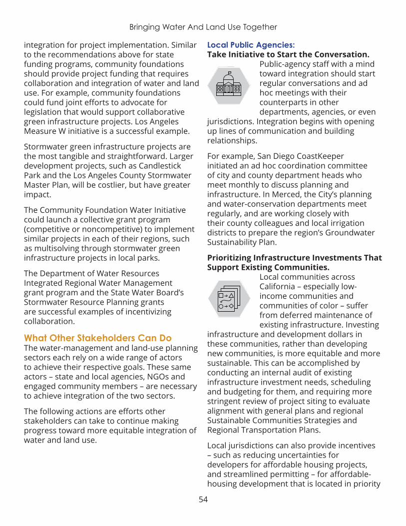
54
Bringing Water And Land Use Together
integration for project implementation. Similar to the recommendations above for state funding programs, community foundations should provide project funding that requires collaboration and integration of water and land use. For example, community foundations could fund joint efforts to advocate for legislation that would support collaborative green infrastructure projects. Los Angeles Measure W initiative is a successful example.
Stormwater green infrastructure projects are the most tangible and straightforward. Larger development projects, such as Candlestick Park and the Los Angeles County Stormwater Master Plan, will be costlier, but have greater impact .
The Community Foundation Water Initiative could launch a collective grant program (competitive or noncompetitive) to implement similar projects in each of their regions, such as multisolving through stormwater green infrastructure projects in local parks.
The Department of Water Resources Integrated Regional Water Management grant program and the State Water Board’s Stormwater Resource Planning grants are successful examples of incentivizing collaboration .
What Other Stakeholders Can DoThe water-management and land-use planning sectors each rely on a wide range of actors to achieve their respective goals. These same actors – state and local agencies, NGOs and engaged community members – are necessary to achieve integration of the two sectors.
The following actions are efforts other stakeholders can take to continue making progress toward more equitable integration of water and land use .
Local Public Agencies:Take Initiative to Start the Conversation.
$
Planning
Governance &Representation
Coordination
Economics
PolicyIntegration &
Alignment
Public-agency staff with a mind toward integration should start regular conversations and ad hoc meetings with their counterparts in other departments, agencies, or even
jurisdictions. Integration begins with opening up lines of communication and building relationships .
For example, San Diego CoastKeeper initiated an ad hoc coordination committee of city and county department heads who meet monthly to discuss planning and infrastructure. In Merced, the City’s planning and water-conservation departments meet regularly, and are working closely with their county colleagues and local irrigation districts to prepare the region’s Groundwater Sustainability Plan .
Prioritizing Infrastructure Investments That Support Existing Communities.
$
Planning
Governance &Representation
Coordination
Economics
PolicyIntegration &
Alignment
Local communities across California – especially low-income communities and communities of color – suffer from deferred maintenance of existing infrastructure. Investing
infrastructure and development dollars in these communities, rather than developing new communities, is more equitable and more sustainable . This can be accomplished by conducting an internal audit of existing infrastructure investment needs, scheduling and budgeting for them, and requiring more stringent review of project siting to evaluate alignment with general plans and regional Sustainable Communities Strategies and Regional Transportation Plans.
Local jurisdictions can also provide incentives – such as reducing uncertainties for developers for affordable housing projects, and streamlined permitting – for affordable-housing development that is located in priority

55
Bringing Water And Land Use Together
development areas (for communities that have them) and consistent with both General Plans and Sustainable Community Strategies. The same applies for infill and redevelopment projects. These actions will help ensure equity, prevent environmental injustices, and minimize negative water and land-use impacts.
Implement Multisolving Through Stormwater Green-Infrastructure Projects.
$
Planning
Governance &Representation
Coordination
Economics
PolicyIntegration &
Alignment
Green infrastructure is the most tangible illustration of the water/land-use nexus. Projects can be implemented at all scales – from small pocket parks and street medians to large regional mixed-
use spaces. Regardless of scale, projects can be used to educate the community (and other agencies) about water and land use; provide local green economy jobs and job training opportunities; and address a range of local infrastructure needs – such as multi-use public spaces, flood attenuation, water quality and groundwater recharge.
Larger development and redevelopment projects, such as Hunter’s Point Shipyard and Candlestick Park in San Francisco provide more opportunity for collaboration and integration.
Collaborative projects between multiple agencies and/or departments will yield the best results (municipal stormwater departments, parks departments, community development departments, transportation agencies, school districts, wastewater agencies, groundwater sustainability agencies and water supply agencies).
Leverage the Sustainable Groundwater Management Act.
$
Planning
Governance &Representation
Coordination
Economics
PolicyIntegration &
Alignment
New Groundwater Sustainability Agencies (GSA) have an incredible opportunity to improve water and land-use integration. The Sustainable Groundwater Management Act
requires consideration of general plans in groundwater sustainability plans, and vice versa. SGMA gave any agency with land use authority eligibility to serve as a GSA, therefore creating an opportunity for water managers and land managers to be equals at the table. Despite this opportunity, many GSAs across the state were formed by existing water agencies, without land use agency representation. Communities will be far more resilient if GSAs, cities and counties proactively collaborate. These agencies should work together to identify and protect priority recharge areas, develop green-infrastructure projects that promote recharge, and conduct planning using shared data – especially growth projections and demand forecasting.
Groundwater Sustainability Agencies (and overdrafted basins operating under adjudications that are exempt from SGMA), cities and counties should also coordinate planning efforts with the metropolitan boundaries (areas of influence beyond jurisdictional boundaries), commute-sheds and Local Agency Formation Commissions of the communities relying on the basin’s groundwater.
Ngos and Community Members1 . Educate yourselves and others.
$
Planning
Governance &Representation
Coordination
Economics
PolicyIntegration &
Alignment
The first step in achieving integration is an educated populace that understands the value and importance of integrating water management and land use
planning. NGOs should seek opportunities to learn more about water and land use integration themselves, and then share that knowledge with the public in the context of how water and land use decisions impact their communities, and how integration can improve conditions. Youth United for Community Action followed a “teach the teacher” model to first learn themselves,
56
Bringing Water And Land Use Together
and then engage other community members in advocating for a safe, clean, affordable and reliable water supply. A similar model should be followed for water/land-use integration.
2 . Hold public agencies accountable.
$
Planning
Governance &Representation
Coordination
Economics
PolicyIntegration &
Alignment
City councilmembers, county commissioners, water agency board members and state legislators are public servants, beholden to their constituents. It is up to the
public to engage in the local political process – voice our concerns and share our priorities with these governing bodies. NGOs and community members should engage in planning processes (such as general plans, groundwater sustainability plans and sustainable community strategies) to advocate for better coordination between agencies and more equitable distribution of investment in infrastructure.
3 . Advocate for state policies that ensure integrated planning.
$
Planning
Governance &Representation
Coordination
Economics
PolicyIntegration &
Alignment
State investments should be directed to multisolving via projects developed at local scales with robust community engagement. Specific policy recommendations to advance
water and land use integration are outlined above. NGOs should actively engage state agencies and legislators to push for such policies, and community members should support such policies .
4 . Host or sponsor local pilot projects.
$
Planning
Governance &Representation
Coordination
Economics
PolicyIntegration &
Alignment
NGOs can serve as important partners for local governments to apply for grant funding and carry out projects for which public agencies lack the capacity or
expertise. With their more broad, holistic
perspective, NGOs can guide project planning and implementation to ensure equity, collaboration, and integration throughout. NGOs can also help publicize the positive outcomes of integrated projects, thus encouraging other communities to do the same. One particular area ripe for local project participation is multisolving solutions to stormwater compliance, especially in communities with stormwater fees, so as to ensure that public investments provide the greatest range of benefits to the communities financing that investment.
Signs of HopeCalifornia acknowledges water and sanitation as a basic human right. Ensuring access to clean, safe, reliable, and affordable water and wastewater services for all Californians must be the primary objective of any effort to integrate water management and land-use planning.
Access to affordable housing and transportation is inherently interconnected with access to drinking water and sanitation services. Infrastructure investments (gray or green), agency consolidation, future development patterns, policy and financing mechanisms that encourage integration must include considerations of their positive and negative impacts on all community members, especially those already facing disadvantages. Costs and benefits should be distributed equitably. Affordability evaluations must include not only costs, but also the ability of community members to pay . Those community members who already face disadvantages and are historically underrepresented in decision-making must be effectively engaged to ensure their needs are met .
Despite the many challenges and barriers to integration, opportunities abound in the Golden State . Policymakers and practitioners

57
Bringing Water And Land Use Together
are beginning to acknowledge that something needs to change about our state’s water management and land-use planning.
Establishing the Integrated Regional Water Management program in 2005 and creating Metropolitan Planning Organizations to develop Sustainable Communities Strategies in 2008 (via SB 375) were two early steps toward integration. A beneficial next step would be for Local Agency Formation Commissions to align municipal service review (MSR) data and information with Sustainable Communities Strategies, and vice versa.
The 2014 Sustainable Groundwater Management Act (SGMA) is another step toward integrating water and land use. The 2015 requirement to include climate adaptation in General Plan safety element updates (SB 379) is yet another step toward integration. The California Economic Summit three 1 Million Challenges integrate housing, jobs and water as critical to ensuring a vibrant future for California.
Some coordinated planning and integration is already happening at both the state and regional scale:
¡ The California State University System recently submitted a proposal for evaluating opportunities to integrate water and land use across their campuses .
¡ The Governor’s Office of Planning and Research is considering guidance for integrating water into city and county general plans.
¡ Metropolitan Planning Organizations (MPOs) and Councils of Governments (COGs) are already integrating climate resilience, housing and transportation in their Sustainable Community Strategies.
¡ Regional water collaboratives in the San Francisco and Silicon Valley regions unite water retailers (BAWSCA) and wastewater
agencies (BAWA), while Plan Bay Area takes a coordinated look at regional planning for future growth.
¡ Central Valley COGs have been mapping ecosystem services of working lands through their San Joaquin Valley Greenprint initiative .
¡ A new NGO, Fresnoland, is working to integrate water and land-use planning within the Central Valley’s largest city.
¡ In the Los Angeles region, the city and county are working together on a massive stormwater capture, treatment, and infiltration project that integrates water management with multisolving land-use planning.
¡ The San Diego Integrated Regional Water Management Plan is coordinating various aspects of water management with land-use planning across the region. Community foundations and other stakeholders can learn from and leverage these existing efforts to link and expand integration efforts regionally and across the state.
Successful models exist for integrating water management and land-use planning, from both within and outside California. In Florida, which struggles with many of the same water and land-use challenges as California, the state completely restructured its water governance system around watershed boundaries . Each water-management district sets its regional water budget and approves development projects based on available water supply and infrastructure capacity. Australia followed a similar approach amid its historic Millennium Drought, but took it one drastic step further – restructuring the island nation’s entire water-rights structure.
Sonoma County and the Sonoma County Water Agency share both geographic boundaries and a board of supervisors. This shared
58
Bringing Water And Land Use Together
governance and authority over both water and land-use planning encourages integrated planning and management.
California’s community foundations, NGOs and advocacy groups have proven experience in building partnerships and developing political will to address local challenges. Interested stakeholders can leverage these existing skills to foster water and land-use integration.
The most effective strategy will be a three-pronged approach: (1) engaging local elected officials (city councils and county commissions) whom have the local decision-making authority, using state government influence through regulatory frameworks; (2) educate and empower local community members to advocate for better integration; and (3) provide funding for water and land-use practitioners to incentivize the difficult work of collaborating and integrating their operations.
California is at a critical juncture. Intense pressure for further development, shifting hydrologic and ecological conditions, and a new administration present both significant risk and opportunity . We as a state and within each region can either “get it right” by equitably integrating water and land use, leading to a more resilient and vibrant future for all, or “get it wrong” by maintaining the status quo, and perpetuating historic inequities and exacerbating the negative impacts of both climate change and sprawl development. Community foundations as leaders, conveners, and funders have a unique opportunity to impact real and lasting change. The recommendations in this report provide the first steps for doing so.

59
Bringing Water And Land Use Together
ENDNOTES1 Margerum, R.D. (1999). Implementing Integrated Planning and Management: A typology of approaches. Australian Planner, 36:3, 155-161.
2 Lubell, M., & Lippert, L. (2011). Integrated regional water management: a study of collaboration or water politics-as-usual in California, USA. International Review of Administrative Sciences, 77:1, 76-100.
3 Lubell, Mark. (2010). Integrated regional water management: Collaboration or water politics as usual? Technical Completion Reports, University of California Water Resources Center. UC Berkeley.
4 Sawin, E., & McCauley, S. (2018). Multisolving at the Intersection of Health and Climate: Lessons from Success Stories. Climate Interactive. See: https://img.climateinteractive.org/wp-content/uploads/2018/02/Multisolving-at-the-Intersection-of-Health-and-Climate-1.pdf
5 Local Government Commission (LGC). (1991). The Ahwahnee Principles for Resource Efficient Communities. Sacramento. See: http://www.lgc.org/about/ahwahnee/principles
6 Local Government Commission (LGC). (2007). Addressing the Disconnect: Water Resources and Local Land Use Decisions. Sacramento. See: http://www.lgc.org/resources/water
7 Innes, J. E., Connick, S., Kaplan, L., & Booher, D. E. (2006). Collaborative governance in the CALFED program: Adaptive policy making for California water. Berkeley CA: Institute of Urban and Regional Development.
8 Ibid. LGC 1991; Margerum, R.D. (1999). Implementing Integrated Planning and Management: A typology of approaches. Australian Planner, 36:3, 155-161.
9 Najjar, K., and Collier, C. R., Integrated Water Resources Management, Water Resources Impact, 2011 13(3), 3-
10 American Planning Association (APA). (2015). Recommendations and Report of APA’s Water Task Force. See: https://www.planning.org/leadership/agendas/2015/spr/pdf/WaterTaskForceFinal.pdf
11 Hanak, E., Lund, J. R., Dinar, A., Gray, B., Howitt, R., Mount, J., Moyle, P., & Thompson, B. (2011). Managing California’s Water: From Conflict to Reconciliation. Public Policy Institute of California. San Francisco.; Dixon, J. A., Easter, K., & Hufschmidt, M. M. (1986). Watershed resources management: an integrated framework with studies from Asia and the Pacific. No. 556 .18 WAT .
12 Ibid. LGC 1991; ibid. LGC 2007
13 Shellenberger, Michael. “Number One In Poverty, California Isn’t Our Most Progressive State –– It’s Our Most Racist One.” Forbes, Forbes Magazine, 5 June 2018, www.forbes.com/sites/michaelshellenberger/2018/05/31/number–one–in–poverty–california–isnt–our–most–progressive–state–its–our–most–racist–one/#dcfccbb5cd

60
Bringing Water And Land Use Together
14 US Water Alliance. (2017). An Equitable Water Future: A National Briefing Paper. See: http://uswateralliance.org/sites/uswateralliance.org/files/publications/uswa_waterequity_FINAL.pdf
15 Ibid. US Water Alliance 2017
16 Alaska, Arizona, California, Delaware, Florida, Georgia, Idaho, Massachusetts, Minnesota, Montana, Nebraska, New Jersey, North Carolina, Oregon, South Carolina, Tennessee, Texas, Utah, Washington. From Nagle, D.G., W. Curey, W. Hall, and J.L. Lape. 1996. Integrating the point source permitting program into a watershed management program. Watersheds 96. Alexandria, VA.: Water Environment Federation.
17 Croft, Jennifer. Water shortage in East Palo Alto and construction is put on hold. Current Water. August 2017. See: https://currentwater.co/2017/08/21/water-shortage-east-palo-alto-construction-on-hold/
18 http://sjvgreenprint.ice.ucdavis.edu/content/welcome-san-joaquin-valley-greenprint
19 https://dpw.lacounty.gov/wmd/stwq/EastLA.aspx
20 BMP Design Fact Sheets, County of San Diego BMP Design Manual, Appendix E. 2016. See: https://www.sandiegocounty.gov/content/dam/sdc/dpw/WATERSHED_PROTECTION_PROGRAM/watershedpdf/County_BMPDM_App_E.pdf
21 California Strategic Growth Council, Governor’s Office of Planning and Research, and California Association Local Agency Formation Commissions. Creating Sustainable Communities and Landscapes Recommended practices and tools for local collaboration on climate-smart growth. October 2018. See: http://sgc.ca.gov/resources/docs/20181004-Creating_Sustainable_Communities_and_Landscapes.pdf

61
Appendix A - Defining Terms
APPENDIX A: DEFINING TERMS

62
Appendix A - Defining Terms
Term Understanding in the context of this report
Access
ensuring a clear path to opportunities for all; often in the context of participation and voice in decision-making or ability to experience benefits. e.g., beyond ensuring everyone at the table has an opportunity to speak, access requires that all impacted or interested parties are aware that the table exists and they are invited in an earnest manner to share their voice .
Alignmentensuring decisions, policies, or regulations are complementary to one another, rather than at conflict with one another; striving toward a common objective.
Collaboration
two or more individuals or entities (e.g., departments, agencies, sectors) working together toward a common outcome or problem solving together to benefit from everyone's expertise; often in the context of planning processes or implementation projects
Coordinationsynchronizing the efforts of more than one individual, entity, policy or planning document to create a unified goal or action; often in the context of aligning existing regulations or planning processes
Developmentincrease in economic activity or investment, such as investing in residential or CII infrastructure; also referring to the expansion of the built environment or urban foot print
Equity
the fair treatment, access, opportunity, and advancement for all people, while at the same time striving to identify and eliminate barriers that have prevented the full participation of some groups; ensuring the fair access to resources, voices in decision-making, and equitable distribution of both benefits and negative impacts
Growth increase in population (e.g., residential, employee, or tourism) within a region or community
Housing single-family and multi-family residential property; may refer to availability of, competition for, lack of, or affordability of housing
Integration
combining two or more policies, plans, goals, or actions into a unified outcome, in which each component fully complements the othes; often in the context of weaving water and land use policies, plans, and decisions into one another
Land Usezoning decisions and other regulations and/or policy decisions that impact how physical property within a geographic boundary can be used; e.g., parks, open space, habitat, recharge, CII, residential, etc.
Multisolving addressing more than one issue or concern through a unified, integrated approach; often referred to as "multi-benefit" solutions or projects
Planning
the process of preparing for future scenarios, often in the context of preparing for future population growth scenarios that will affect the availability of resources; also referring to the professional sector responsible for these activities (i.e., "planners," "planning department"
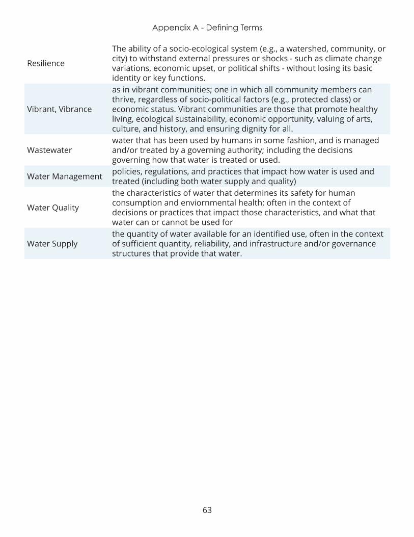
63
Appendix A - Defining Terms
Resilience
The ability of a socio-ecological system (e.g., a watershed, community, or city) to withstand external pressures or shocks - such as climate change variations, economic upset, or political shifts - without losing its basic identity or key functions.
Vibrant, Vibrance
as in vibrant communities; one in which all community members can thrive, regardless of socio-political factors (e.g., protected class) or economic status . Vibrant communities are those that promote healthy living, ecological sustainability, economic opportunity, valuing of arts, culture, and history, and ensuring dignity for all.
Wastewaterwater that has been used by humans in some fashion, and is managed and/or treated by a governing authority; including the decisions governing how that water is treated or used.
Water Management policies, regulations, and practices that impact how water is used and treated (including both water supply and quality)
Water Quality
the characteristics of water that determines its safety for human consumption and enviornmental health; often in the context of decisions or practices that impact those characteristics, and what that water can or cannot be used for
Water Supplythe quantity of water available for an identified use, often in the context of sufficient quantity, reliability, and infrastructure and/or governance structures that provide that water .

64
Appendix B – Participants
APPENDIX B: PARTICIPANTS
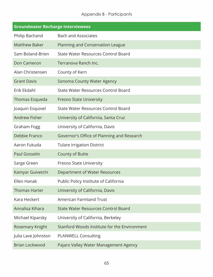
65
Appendix B - Participants
Groundwater Recharge Interviewees
Philip Bachand Bach and Associates
Matthew Baker Planning and Conservation League
Sam Boland-Brien State Water Resources Control Board
Don Cameron Terranova Ranch Inc.
Alan Christensen County of Kern
Grant Davis Sonoma County Water Agency
Erik Ekdahl State Water Resources Control Board
Thomas Esqueda Fresno State University
Joaquin Esquivel State Water Resources Control Board
Andrew Fisher University of California, Santa Cruz
Graham Fogg University of California, Davis
Debbie Franco Governor's Office of Planning and Research
Aaron Fukuda Tulare Irrigation District
Paul Gosselin County of Butte
Sarge Green Fresno State University
Kamyar Guivetchi Department of Water Resources
Ellen Hanak Public Policy Institute of California
Thomas Harter University of California, Davis
Kara Heckert American Farmland Trust
Annalisa Kihara State Water Resources Control Board
Michael Kiparsky University of California, Berkeley
Rosemary Knight Stanford Woods Institute for the Environment
Julia Lave Johnston PLANWELL Consulting
Brian Lockwood Pajaro Valley Water Management Agency

66
Appendix B – Participants
Groundwater Recharge Interviewees
Susan Lien Longville San Bernardino Valley Municipal Water District
Gabriele Ludwig Almond Board of California
Jay Lund University of California, Davis
Bryce Lundberg Lundberg Family Farms
Lisa Lurie Resource Conservation District of Santa Cruz County
Jenny Marr Department of Water Resources
Sandi Matsumoto The Nature Conservancy
Craig McNamara Sierra Orchards
Kate Meis Local Government Commission
Daniel Mountjoy Sustainable Conservation
Mark Nordberg Department of Water Resources
Tim O'Halloran Yolo County Flood Control and Water Conservation District
Lynnea Ormiston Sacramento Area Council of Governments
Jonathan Parker Kern Water Bank Authority
Pete Parkinson Sonoma County (retired)
Elizabeth Patterson City of Benicia
Julie Rentner River Partners
Kristin Sicke Yolo County Flood Control and Water Conservation District
Tim Snellings County of Butte
Stacey Sullivan Sustainable Conservation
Water and Land Use Interviewees
Tameeka Bennet Youth United for Community Action
Mark Gold University of California, Los Angeles
Jason Greenspan Southern California Association of Governments

67
Appendix B - Participants
Water and Land Use Interviewees
Kara Gross Joint Venture Silicon Valley Climate Task Force
Laurel Hunt Los Angeles Regional Collaborative for Climate Action and Sustainability
Steve Maxey County of Merced
Kellyx Nelson San Mateo Resource Conservation District
Matt O'Malley San Diego Coastkeeper
John Rahaim City of San Francisco
Nicole Sandkula Bay Area Water Supply & Conservation Agency (BAWSCA)
Mark Stadler San Diego County Water Authority
Muggs Stoll San Diego Association of Governments
Keith Bergthold Fresno Metro Ministry
Stephanie Pincetl University of California, Los Angeles
Nilmini Silva-Send Energy Policy Initiative Center, University of San Diego
Dan Silver Endangered Habitats League
Water and Land Use Focus Group Attendees
Jeffrey Aalfs City of Portola Valley
Judy Abdo The Metropolitan Water District
Mike Antos Santa Ana Watershed Project Authority (SAWPA)
Danielle Bergstrom Fresnoland
Homero Clemente University of Southern California/Coastal Environments
Martha Davis Community Water Center
Mary Ann Dickinson Alliance for Water Efficiency
Hannah Doress Word Out Consulting
Kim Fuentes South Bay Cities Council of Governments
Charles Gardiner The Catalyst Group, Inc.
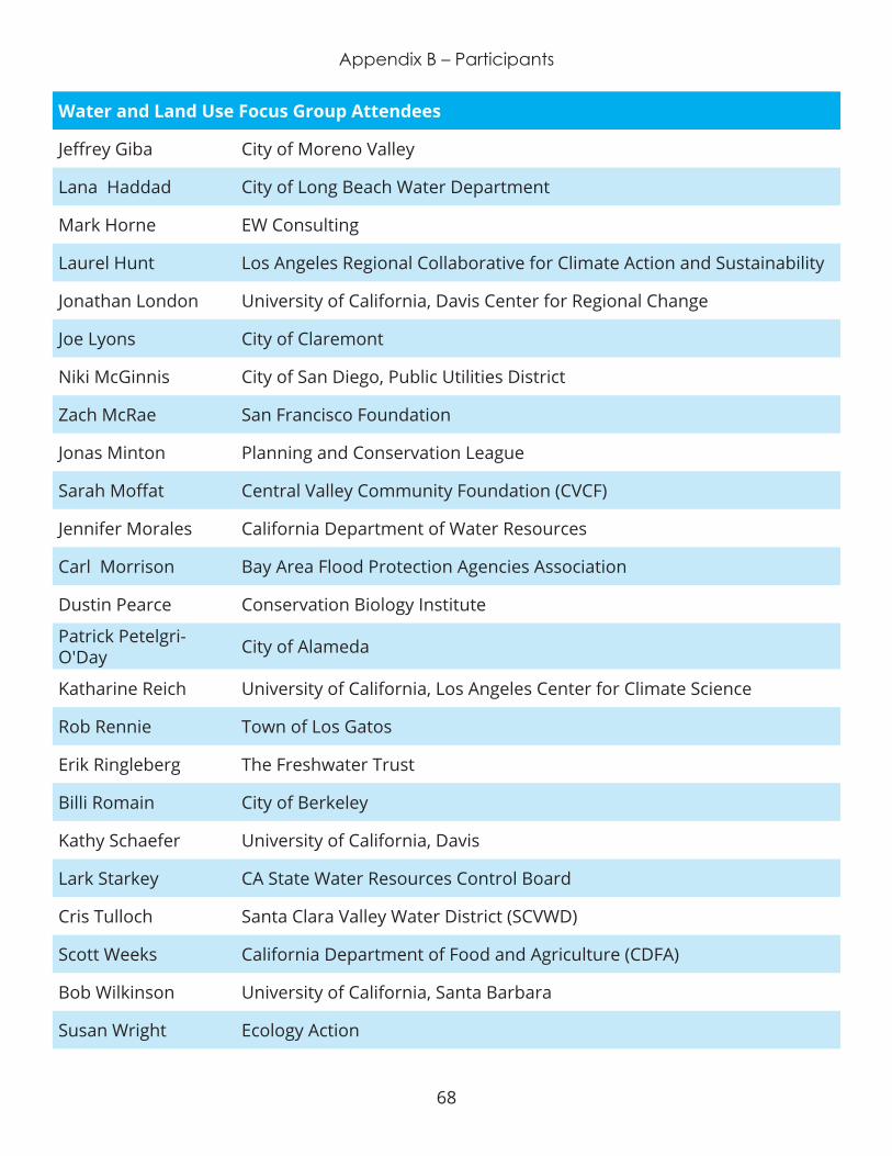
68
Appendix B – Participants
Water and Land Use Focus Group Attendees
Jeffrey Giba City of Moreno Valley
Lana Haddad City of Long Beach Water Department
Mark Horne EW Consulting
Laurel Hunt Los Angeles Regional Collaborative for Climate Action and Sustainability
Jonathan London University of California, Davis Center for Regional Change
Joe Lyons City of Claremont
Niki McGinnis City of San Diego, Public Utilities District
Zach McRae San Francisco Foundation
Jonas Minton Planning and Conservation League
Sarah Moffat Central Valley Community Foundation (CVCF)
Jennifer Morales California Department of Water Resources
Carl Morrison Bay Area Flood Protection Agencies Association
Dustin Pearce Conservation Biology Institute
Patrick Petelgri-O'Day City of Alameda
Katharine Reich University of California, Los Angeles Center for Climate Science
Rob Rennie Town of Los Gatos
Erik Ringleberg The Freshwater Trust
Billi Romain City of Berkeley
Kathy Schaefer University of California, Davis
Lark Starkey CA State Water Resources Control Board
Cris Tulloch Santa Clara Valley Water District (SCVWD)
Scott Weeks California Department of Food and Agriculture (CDFA)
Bob Wilkinson University of California, Santa Barbara
Susan Wright Ecology Action

69
Appendix B - Participants
Report & Recommendations Reviewers
Celeste Cantu CEO
Mike Antos Senior Watershed Manager
Elizabeth Patterson Environmental Scientist
Judy Corbett California Stewardship Council
Ron Milam Interim Director
Julia Lave Johnston President Elect
Robert Wilkinson Adjunct Professor
Debbie Franco Community and Rural Affairs Advisor
Jeff Loux City Manager
Martha Davis Retired Annuitant
Keith Bergthold Executive Director
Margaret Bruce Board Member
Zachary McRae Program Associate
Jack Chin Foundation Program Consultant
Remy Goldsmith Senior Community Leadership Officer
Marselle Alexander-Ozinskas Program Officer
Tara Moran Program Lead, Sustainable Groundwater
Susan Lien Longville Director/President
Mark Stadler San Diego Integrated Regional Water Management Program Manager
70
Appendix C – Planning Document Evaluation
APPENDIX C: PLANNING DOCUMENT EVALUATION
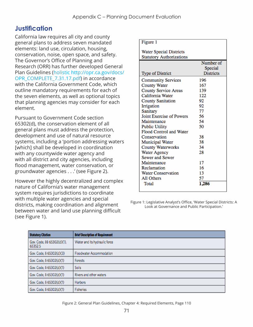
71
Appendix C – Planning Document Evaluation
JustificationCalifornia law requires all city and county general plans to address seven mandated elements: land use, circulation, housing, conservation, noise, open space, and safety. The Governor’s Office of Planning and Research (ORR) has further developed General Plan Guidelines (holistic http://opr.ca.gov/docs/OPR_COMPLETE_7.31.17.pdf) in accordance with the California Government Code, which outline mandatory requirements for each of the seven elements, as well as optional topics that planning agencies may consider for each element .
Pursuant to Government Code section 65302(d), the conservation element of all general plans must address the protection, development and use of natural resource systems, including a ‘portion addressing waters [which] shall be developed in coordination with any countywide water agency and with all district and city agencies, including flood management, water conservation, or groundwater agencies . . .’ (see Figure 2).
However the highly decentralized and complex nature of California’s water management system requires jurisdictions to coordinate with multiple water agencies and special districts, making coordination and alignment between water and land use planning difficult (see Figure 1).
Figure 2: General Plan Guidelines, Chapter 4: Required Elements, Page 110
Figure 1: Legislative Analyst’s Office, ‘Water Special Districts: A Look at Governance and Public Participation.’

72
Appendix C – Planning Document Evaluation
Additionally, general plans are not required by State law to follow any common structure, and planning agencies may choose to consolidate elements, add additional elements, and include community or specific plans as part of the general plan. Some elements, such as noise and safety, tend to have stand-alone policies that are easily comparable across plans, whereas the interrelated content of other elements - such as land use, open space, and conservation - tend to be divided into or spread across multiple sections of the plan. It is virtually impossible to determine any best practices or guiding framework for integrated planning when the disparate plans do not align with one-another in any tangible way.
GoalThe Purpose of the Planning Document Evaluation is to scan a representative sample of both water and land use plans produced by local agencies within each of the study’s five regions; to determine the extent to which these documents are complementary or contradictory, the extent to which these documents can be integrated or aligned; and to provide recommendations for local agencies to improve integration between their respective plans at the regional and local level.
ProcessOne representative county and 3 representative cities within that county were identified for each region. LGC used CalEnviroScreen 3.0 scores to identify the “most disadvantaged” (scores between x-x), “least disadvantaged” (scores between x-x), and “average” (scores between x-x) jurisdiction. CalEnviroScreen analyses environmental, health, and socioeconomic information to produce scores for every census tract in the state . Analysis was limited to incorporated cities to ensure that each had a general plan for comparative purposes. Incorporated cities were identified by the California State Association of Counties (http://www.counties.
org/cities-within-each-county).
The following plans were reviewed for each region:
¡ County General Plan (GP)
¡ Integrated Regional Water Management Plan (IRWMP)
¡ Regional Transportation Plan / Sustainable Communities Strategy (RTP/SCS)
¡ City General Plans (GP)
¡ Urban Water Management Plans (UWMP)
Each plan was reviewed for plan content, stakeholder engagement, and reference of state policies that address water and land use integration.
The following representative analysis for San Diego County is provided for reference and case study purposes .
Representative Analysis - San Diego County Planning Document EvaluationOverviewThe three representative cities identified were the City of San Diego (average; CalEnviroScreen 3.0 score of xx), National City (most disadvantaged; CalEnviroScreen 3.0 score of xx), and Del Mar (least disadvantaged; CalEnviroScreen 3.0 score of xx). The City of San Diego General Plan framework includes community-based policy documents for more than 50 planning areas (called Community Plans or Specific Plans), which includes each of these cities .
The following water and land use planning documents were reviewed for the San Diego Region:
¡ San Diego County General Plan
¡ San Diego Forward Regional Plan (SANDAG)
73
Appendix C – Planning Document Evaluation
¡ SANDAG 2050 Regional Transportation Plan, Chapter 3 ‘Forging a Path Toward More Sustainable Living: A Sustainable Communities Strategy’
¡ San Diego County Water Authority Urban Water Management Plan (UWMP)
¡ San Diego Integrated Regional Water Management Plan (SDIRWMP)
¡ City of San Diego General Plan
¡ National City General Plan
¡ Del Mar Community Plan
EvaluationSan Diego County is making significant progress on coordinating water and land use planning across multiple planning agencies. The County General Plan is closely aligned with the Regional Transportation Plan / Sustainable Community Strategy. Specific sections of each where information is aligned are outlined in this spreadsheet: https://docs.google.com/spreadsheets/d/16ALPr6LYWP8crPC6MPDxUt94JJUKQbXt0KQ6t5wYueQ/edit#gid=1085732352
The San Diego County GP integrates water and land use in the following sections:
¡ Development—Environmental Balance (Sustainable Stormwater Management, Flooding) [3-28]
¡ Aquifers and Groundwater Conservation. [3-30]
¡ Integration of Natural Features in Villages - streambeds, low impact development and design
¡ Adequate Water Quality, Supply, and Protection [3-34]
¡ Wastewater treatment [3-35]
¡ Protection and Enhancement of Wetlands [5-8]
¡ Floodwater Accommodation [5-9]
¡ COS-4 Water Management ( [5-12] (Water Conservation., Drought-Efficient Landscaping, Stormwater Filtration, Groundwater Contamination, Recycled Water)
¡ COS-5 Protection and Maintenance of Water Resources. [5-13] (Impact to Floodways and Floodplains, Impervious Surfaces, Downslope Protection, Invasive Species, Impacts of Development to Water Quality.)
¡ Sustainable Agricultural Industry - Best Management Practices. Encourage best management practices in agriculture and animal operations to protect watersheds, reduce GHG emissions, conserve energy and water, and utilize alternative energy sources
¡ Water Supply. Ensure that water supply systems for development are adequate to combat structural and wildland fires. [7-9]
¡ Protection of Life and Property. Minimized personal injury and property damage losses resulting from flood events. (Floodplain Maps, Development in Floodplains, Development in Flood Hazard Areas, Development in the Floodplain Fringe) [7-18]
¡ S-10 Floodway and Floodplain Capacity [7-20] (Land Uses within Floodways, Use of Natural Channels, Flood Control Facilities, Stormwater Management, Development Site Improvements, Stormwater Hydrology)
¡ Environmentally Sensitive Road Design [4-14]
¡ Parking Area Design for Stormwater Runoff [4-27]
For all three cities, the conservation element (including the mandated water sections)

74
Appendix C – Planning Document Evaluation
is dispersed across multiple elements and sections, making it virtually impossible to review all general plans in any consistent and comprehensive way. For example, the City of San Diego structures its General Plan using a framework of 10 elements, including land use concepts that are mentioned in Urban Design, Land Use and Community Planning and Public Facilities elements . The National City General Plan structures the mandatory requirements across 9 elements . The Del Mar Community Plan functions as a general plan and contains three elements: Environmental Planning, Transportation, and Community Development. It is virtually impossible to determine any best practices or guiding framework for integrated planning when the plans do not align with one-another .
¡ City of SD elements (10): Land Use and Community Planning; Mobility (Circulation); Economic Prosperity; Public Facilities, Services and Safety; Urban Design(?); Recreation; Historic Preservation; Conservation; Noise; and Housing .
¡ National City: Land Use and Community Character; Circulation; Housing; Safety; Noise and Nuisance; Open Space and Agriculture; Conservation and Sustainability; Health and Environmental Justice; Education and Community Participation
¡ Del Mar: all goals, objectives and policies were integrated into three Environmental Management (which includes an integrated section on conversation, seismic safety, open space, and safety); Transportation (which includes an integrated section focused on circulation, scenic highways, and noise); and Community Development (which includes clearly identified sections on land use and housing)
Recommendations State Level:
¡ Codify recommendations included in General Plan Guidelines into law:
¡ Form joint committees to synchronize planning timelines between water and land use,
¡ Coordinate with local integrated regional water management plans (IRWM)
¡ Use watersheds as the planning area and/or explicitly acknowledge the relationship with an existing watershed.
¡ Establish an evaluation and compliance mechanism to ensure adequacy in plan alignment required by existing legislation.
¡ SB 221 & 610; GC § 66473.7 - requires water supply districts to prepare water supply verifications and assessments for some large-scale projects, including subdivisions of over 500 dwelling units.
¡ GC § 65352.5 - When amending its general plan, a jurisdiction shall coordinate with any public water agency to analyze available water supply information and identify adequate water for anticipated growth.
¡ SB 375; GC § 65080 (b)(2)(J)) - requires consistency between the city or county’s land use plans and regional planning documents .
¡ SB 244 - requires review and update the Land Use Element of the General Plan to identify disadvantaged unincorporated communities concurrent with the requirement to update their housing elements .
75
Appendix C – Planning Document Evaluation
¡ SB 1000 - requires cities and counties with disadvantaged communities to incorporate environmental justice (EJ) policies into their General Plans, either in a separate EJ element or by integrating related goals, policies, and objectives throughout the other elements .
Regional Level: ¡ Establish long-term engagement
arrangements, through the IRWM Stakeholder Engagement process, to ensure coordination between water management and land use agencies (at both the regional and local scale).
¡ Water authority staff provide direct technical assistance, through ad-hoc committee meetings and technical guidance documents, to local land use agencies (e.g., cities and counties) to incorporate water priorities in new and redevelopment projects (e.g., water recycling).
¡ Ensure demographic shifts accounted for by land use planning agencies are included in water demand projections.
¡ Improve coordination between land use and groundwater planning, and establish minimum standards for sustainable groundwater management, to comply with SGMA .
Local Level: ¡ Use consistent language and element
structure across all city plans within the County
“Standardized designations were developed so that over time, community plans will share a common terminology, enabling better citywide land use analysis and measurement against regional programs.”
- City of San Diego General Plan
¡ Prioritize equity in development and balance community investments accordingly.
“Measures to support attainment of equitable development will occur as a part of village master plans or other long-range plans as appropriate. General Plan policies call for working toward environmental justice through broadening public input, prioritizing and allocating citywide resources to benefit communities in need, and striving for equity in environmental protection and in the location of undesirable land uses, among other initiatives.”
¡ Take advantage of opportunities to integrate water recycling and green infrastructure into all new development and redevelopment projects.
76
Appendix D – Data Analysis: Code Co-Occurrence
APPENDIX D: DATA ANALYSIS: CODE CO-
OCCURRENCE

77
Appendix D – Data Analysis: Code Co-Occurrence
Topi
cs
Affor
dabi
lity
Cons
erva
tion
& E
ffici
ency
Dev
elop
men
t
Gro
undw
ater
Gro
wth
Hab
itat
Hou
sing
Relia
bilit
y
Stor
mw
ater
Tran
spor
tatio
n
Wat
er Q
ualit
y
Wat
er S
uppl
y
agri
cultu
re
clim
ate
dial
ogue
/ co
mm
unic
atio
n
econ
omic
flood
impl
emen
tatio
n &
Mon
itori
ng
inve
stm
ent
jobs
land
use
lead
ersh
ip d
evel
opm
ent
legi
slat
ion
scho
ols
skill
s
spec
ific
plan
s
unin
corp
orat
ed a
reas
was
tew
ater
Tota
ls
Category 55 11 4 18 5 9 1 9 2 8 1 9 15 1 5 5 1 9 8 5 2 1 1 3 4 812
Case Study 17 3 7 7 4 3 1 5 1 5 9 1 4 2 2 4 6 1 1 2 3 408
Challenge/ Barrier 30 9 2 13 6 9 9 1 3 1 6 14 1 2 3 1 4 1 1 3 1 1 1 2 2 524
Need 18 4 2 6 2 4 4 2 4 6 1 1 2 1 1 2 1 1 1 361
Opportunity 25 2 2 4 5 1 3 6 3 8 1 2 4 2 5 1 4 2 1 2 446
Recommendations 11 2 5 1 1 2 1 1 5 4 1 4 3 4 1 1 2 220
resource 5 2 1 1 2 1 1 1 1 1 1 1 91
strategy 26 3 2 10 4 6 3 1 4 1 3 7 5 3 1 2 1 2 5 5 2 1 3 2 585
Event or Data Source 6 5 3 6 4 6 4 1 5 3 6 7 1 2 4 2 3 4 1 1 2 4 2 1 1 1 3 3 37
7
CA Water Policy Conference Focus Group
Email Exchange
Expert Interview 6 6 3 7 4 7 1 5 1 5 4 6 8 1 3 5 2 3 5 2 1 3 5 3 1 1 2 4 3 428
Yosemite Focus Group
Great Quotes 17 2 2 3 2 2 3 1 4 8 2 1 2 1 2 1 1 2 307
Interview Questions 38 7 5 15 11 10 6 2 9 2 10 16 2 2 4 4 2 8 1 2 6 9 2 1 1 1 4 4 847
1. Water / Land Use Context 10 2 1 5 4 5 3 1 4 1 2 9 1 3 1 2 1 3 2 2 1 28
9
10 . Additional Contacts 4 2 2 1 1 1 2 1 2 1 1 1 1 1 1 14
6
2. Needs/Challenges 6 4 2 5 3 5 4 1 3 5 5 1 1 1 2 1 1 1 2 1 3 1 206
3. Planning docs & policies 8 3 1 1 1 2 5 1 1 1 1 3 1 2 3 1 16
3

78
Appendix D – Data Analysis: Code Co-Occurrence
Topi
cs
Affor
dabi
lity
Cons
erva
tion
& E
ffici
ency
Dev
elop
men
t
Gro
undw
ater
Gro
wth
Hab
itat
Hou
sing
Relia
bilit
y
Stor
mw
ater
Tran
spor
tatio
n
Wat
er Q
ualit
y
Wat
er S
uppl
y
agri
cultu
re
clim
ate
dial
ogue
/ co
mm
unic
atio
n
econ
omic
flood
impl
emen
tatio
n &
Mon
itori
ng
inve
stm
ent
jobs
land
use
lead
ersh
ip d
evel
opm
ent
legi
slat
ion
scho
ols
skill
s
spec
ific
plan
s
unin
corp
orat
ed a
reas
was
tew
ater
Tota
ls
4. Disadvantaged Communities 4 3 1 2 1 1 1 1 1 1 1 1 88
5. Challenges/barriers 4 1 2 1 2 1 1 1 1 1 1 14
0
6. Overcoming Challenges 6 1 2 2 1 1 1 2 3 1 3 1 1 1 1 2 18
7
7. Opportunities 5 1 1 2 1 2 2 4 2 1 1 2 1 2 190
8 . Case Studies 5 3 1 3 3 3 1 1 1 1 2 2 1 1 2 164
9. Questions/ Final Thoughts 3 1 1 1 1 1 1 2 1 96
NEED TO FOLLOW UP 8 4 1 1 1 1 3 1 2 3 1 1 1 15
7
Perspective 6 6 3 7 4 7 1 5 1 5 4 6 8 1 3 5 2 3 5 2 1 3 5 3 1 1 2 4 3 450
Foundation 22
Land Use 3 5 1 5 2 4 1 4 3 4 3 6 1 2 4 1 1 4 1 3 4 2 1 2 3 2 280
Water 4 3 3 4 3 4 2 1 4 2 4 5 2 3 1 3 2 1 1 1 2 2 1 1 2 253
Planning Documents 14 6 3 1 3 1 2 1 3 2 5 4 1 1 1 2 1 26
3
General Plan 12 5 4 1 1 3 1 2 3 1 1 2 212
IRWM 3 2 1 1 1 1 100
Other Planning Docs 5 2 3 2 1 2 1 1 2 2 1 2 1 90
SCS 2 2 79
Stormwater Plans 2 2 30
UWMP 1 1 1 53
Questions
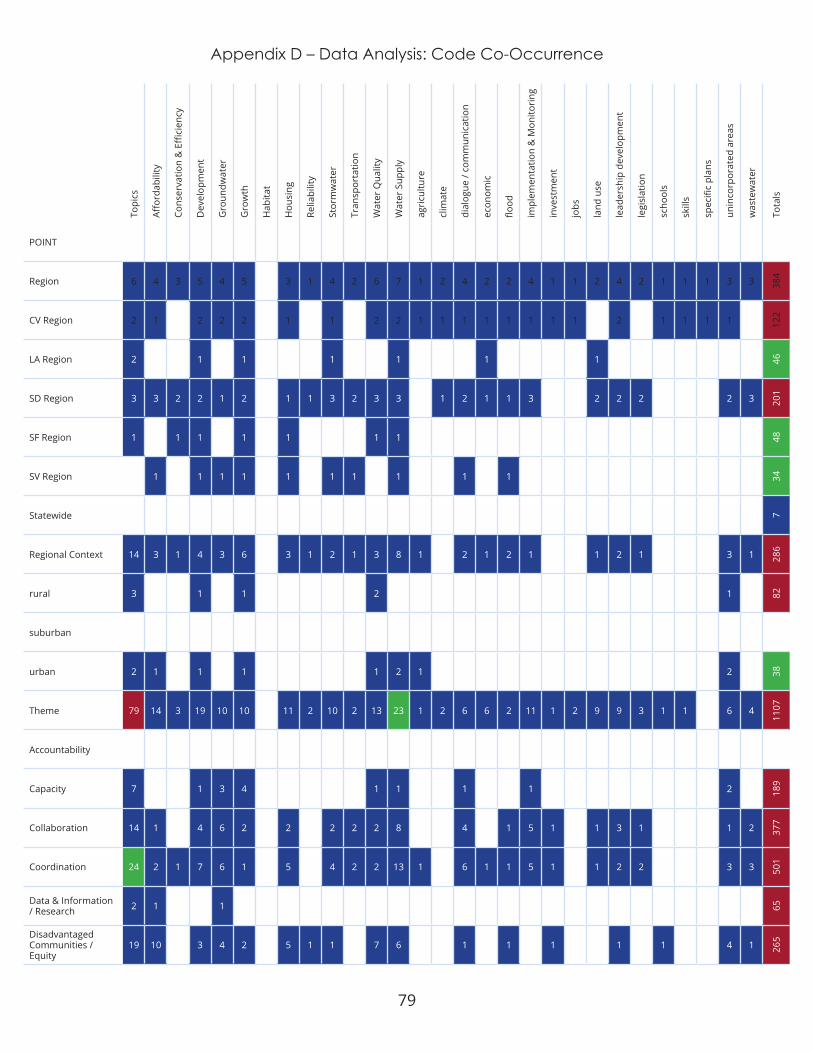
79
Appendix D – Data Analysis: Code Co-Occurrence
Topi
cs
Affor
dabi
lity
Cons
erva
tion
& E
ffici
ency
Dev
elop
men
t
Gro
undw
ater
Gro
wth
Hab
itat
Hou
sing
Relia
bilit
y
Stor
mw
ater
Tran
spor
tatio
n
Wat
er Q
ualit
y
Wat
er S
uppl
y
agri
cultu
re
clim
ate
dial
ogue
/ co
mm
unic
atio
n
econ
omic
flood
impl
emen
tatio
n &
Mon
itori
ng
inve
stm
ent
jobs
land
use
lead
ersh
ip d
evel
opm
ent
legi
slat
ion
scho
ols
skill
s
spec
ific
plan
s
unin
corp
orat
ed a
reas
was
tew
ater
Tota
ls
POINT
Region 6 4 3 5 4 5 3 1 4 2 6 7 1 2 4 2 2 4 1 1 2 4 2 1 1 1 3 3 384
CV Region 2 1 2 2 2 1 1 2 2 1 1 1 1 1 1 1 1 2 1 1 1 1 122
LA Region 2 1 1 1 1 1 1 46
SD Region 3 3 2 2 1 2 1 1 3 2 3 3 1 2 1 1 3 2 2 2 2 3 201
SF Region 1 1 1 1 1 1 1 48
SV Region 1 1 1 1 1 1 1 1 1 1 34
Statewide 7
Regional Context 14 3 1 4 3 6 3 1 2 1 3 8 1 2 1 2 1 1 2 1 3 1 286
rural 3 1 1 2 1 82
suburban
urban 2 1 1 1 1 2 1 2 38
Theme 79 14 3 19 10 10 11 2 10 2 13 23 1 2 6 6 2 11 1 2 9 9 3 1 1 6 4
1107
Accountability Capacity 7 1 3 4 1 1 1 1 2 18
9
Collaboration 14 1 4 6 2 2 2 2 2 8 4 1 5 1 1 3 1 1 2 377
Coordination 24 2 1 7 6 1 5 4 2 2 13 1 6 1 1 5 1 1 2 2 3 3 501
Data & Information / Research 2 1 1 65
Disadvantaged Communities / Equity
19 10 3 4 2 5 1 1 7 6 1 1 1 1 1 4 1 265

80
Appendix D – Data Analysis: Code Co-Occurrence
Topi
cs
Affor
dabi
lity
Cons
erva
tion
& E
ffici
ency
Dev
elop
men
t
Gro
undw
ater
Gro
wth
Hab
itat
Hou
sing
Relia
bilit
y
Stor
mw
ater
Tran
spor
tatio
n
Wat
er Q
ualit
y
Wat
er S
uppl
y
agri
cultu
re
clim
ate
dial
ogue
/ co
mm
unic
atio
n
econ
omic
flood
impl
emen
tatio
n &
Mon
itori
ng
inve
stm
ent
jobs
land
use
lead
ersh
ip d
evel
opm
ent
legi
slat
ion
scho
ols
skill
s
spec
ific
plan
s
unin
corp
orat
ed a
reas
was
tew
ater
Tota
ls
Financial 21 8 1 8 3 5 3 1 3 2 4 9 1 4 2 1 4 1 3 3 3 3 456
Governance and/or Representation 17 2 7 3 5 1 3 1 3 5 2 1 1 4 1 1 3 6 1 3 2 44
5
Incentives 9 4 6 1 2 4 1 1 1 4 1 1 2 1 1 1 204
Infrastructure 10 6 3 1 1 3 1 5 5 2 168
Integration / alignment 17 1 5 2 1 5 1 3 9 3 1 1 4 3 5 2 2 3 40
2
Jurisdiction 7 6 2 1 2 1 3 2 4 2 5 1 3 2 211
Language 1 19
Mindset / Conceptual Understanding
13 2 4 2 2 3 1 1 4 1 1 4 1 2 2 269
Multiple Benefits 5 3 2 1 1 1 1 69
Planning 32 1 13 6 6 1 7 1 3 13 2 4 2 2 7 1 9 5 2 5 3 542
Policy 18 3 1 9 3 6 2 2 1 3 4 2 4 4 2 3 1 1 339
Public Engagement / Education 5 1 2 1 2 2 1 1 2 1 1 1 1 3 1 1 1 21
8
Regulation 17 3 3 5 2 2 1 1 2 1 3 9 1 2 4 1 1 3 2 2 2 293
Relationships 1 1 4 1 1 2 1 1 1 1 1 64Technical Assistance 3 1 1 1 1 1 1 67
Topics 15 5 21 14 12 12 2 11 2 17 29 2 2 5 7 2 12 1 9 7 3 1 1 7 4 925
Affordability 15 1 5 1 8 1 3 6 2 1 1 1 195
Conservation & Efficiency 5 1 1 1 1 3 1 71
Development 21 5 1 10 1 11 3 2 1 10 2 3 6 4 1 10 3 1 6 2 382

81
Appendix D – Data Analysis: Code Co-Occurrence
Topi
cs
Affor
dabi
lity
Cons
erva
tion
& E
ffici
ency
Dev
elop
men
t
Gro
undw
ater
Gro
wth
Hab
itat
Hou
sing
Relia
bilit
y
Stor
mw
ater
Tran
spor
tatio
n
Wat
er Q
ualit
y
Wat
er S
uppl
y
agri
cultu
re
clim
ate
dial
ogue
/ co
mm
unic
atio
n
econ
omic
flood
impl
emen
tatio
n &
Mon
itori
ng
inve
stm
ent
jobs
land
use
lead
ersh
ip d
evel
opm
ent
legi
slat
ion
scho
ols
skill
s
spec
ific
plan
s
unin
corp
orat
ed a
reas
was
tew
ater
Tota
ls
Groundwater 14 1 1 4 1 4 7 1 1 1 1 1 1 1 183
Growth 12 10 4 1 1 2 4 1 1 3 1 4 1 1 4 222
Habitat 1 1 2 12
Housing 12 8 11 4 2 2 2 1 1 171
Reliability 2 1 1 1 2 2 32
Stormwater 11 1 3 1 2 1 4 1 2 2 2 1 3 2 4 192
Transportation 2 2 1 2 1 1 1 1 1 1 1 65
Water Quality 17 3 1 1 4 2 2 1 8 1 1 1 1 1 1 1 203
Water Supply 29 6 3 10 7 4 4 2 4 1 8 1 3 2 2 4 1 3 3 1 3 3 416
agriculture 2 2 1 1 1 27
climate 2 1 1 1 1 1 39
dialogue / communication 5 2 3 1 1 2 2 1 3 1 1 2 2 1 2 14
4
economic 7 6 1 3 2 2 1 2 1 1 1 1 2 1 1 1 105
flood 2 1 2 2 1 1 1 62implementation & Monitoring 12 1 4 1 2 1 1 1 4 1 1 2 2 1 1 18
8
investment 1 1 1 27
jobs 1 1 1 1 1 1 1 29
land use 9 10 4 1 3 1 1 3 1 2 2 2 1 3 2 169
leadership development 7 3 2 1 1 3 2 1 2 1 1 1 1 2 14
9
legislation 3 1 1 1 1 1 58
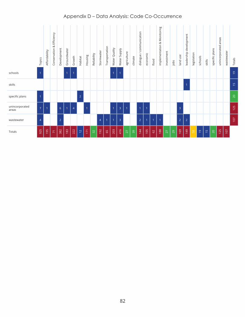
82
Appendix D – Data Analysis: Code Co-Occurrence
Topi
cs
Affor
dabi
lity
Cons
erva
tion
& E
ffici
ency
Dev
elop
men
t
Gro
undw
ater
Gro
wth
Hab
itat
Hou
sing
Relia
bilit
y
Stor
mw
ater
Tran
spor
tatio
n
Wat
er Q
ualit
y
Wat
er S
uppl
y
agri
cultu
re
clim
ate
dial
ogue
/ co
mm
unic
atio
n
econ
omic
flood
impl
emen
tatio
n &
Mon
itori
ng
inve
stm
ent
jobs
land
use
lead
ersh
ip d
evel
opm
ent
legi
slat
ion
scho
ols
skill
s
spec
ific
plan
s
unin
corp
orat
ed a
reas
was
tew
ater
Tota
ls
schools 1 1 1 1 1 19
skills 1 15
specific plans 1 2 20
unincorporated areas 7 1 6 1 4 1 1 3 1 1 1 3 12
5
wastewater 4 2 4 1 1 3 2 1 1 1 2 2 107
Totals 925
195
71 382
183
222
12 171
32 192
65 203
416
27 39 144
105
62 188
27 29 169
149
58 19 15 20 125
107

83
Appendix E - Regional Profiles
APPENDIX E: REGIONAL PROFILES

84
Appendix E - Central Valley Regional Profile
DEFINING THE REGIONFor the purposes of this project we use the Central Valley Community Foundation’s geographic definition of the Central Valley. The region comprises 6 counties: Fresno, Madera, Mariposa, Merced, Tulare, and Kings. There are 34 incorporated cities within this region, the largest of which is the City of Fresno with over 527,000 people. The region’s unique climate enables the Central Valley to grow over 230 different crops and provide agricultural products worldwide .
DemographicsThe Central Valley region is home to over 2 million people dispersed across nearly 18,000 square miles. It is a diverse region with a large immigrant population, which contributes to its cultural richness . The per capita income in each Central Valley county is lower than the statewide average, and the poverty rates of each county are higher than the statewide average. This is due in part to agriculture being the driving industry for the region’s economy. Madera, Merced, Tulare, and Fresno counties are growing, while population in Mariposa and
Kings Counties is declining. As cost of living continues to rise, particularly in the Bay Area and Southern California, population trends are expected to increase significantly throughout the Central Valley .
WATER MANAGEMENTWatersheds
Two watersheds drain the Central Valley region: the San Joaquin River watershed, which is 15,800 square miles, and the Tulare Lake Basin
watershed, which is 13,670 square miles. Countless small streams and rivers flow into the San Joaquin River, most notably the Merced, Tuolumne, and Stanislaus. The Kings, Kaweah, Tule, and Kern Rivers (among other smaller streams) used to flow into the Tulare Lake Basin, but now are all dammed for irrigation and urban waters supply.
Integrated Regional Water ManagementIntegrated Regional Water Management is a voluntary program managed by the CA
Equitable Integration of Water and Land Use
CENTRAL VALLEY REGION

85
Appendix E - Central Valley Regional Profile
Department of Water Resources, in an effort to incentivize coordination of water management and planning efforts at a watershed scale. Seven separate Integrated Regional Water Management (IRWM) groups operate within the Central Valley Region. Each IRWM group is made up of various water and planning authorities within their geographic range. Yet portions of Kings, Fresno, and Merced counties are not included in any IRWM plans.
Water SupplyThe majority of the region’s water supply comes from groundwater. In the rural areas of the Valley, landowners pump water from private wells. The State Water Project, the Central Valley Project, and local water projects make up the remainder. The Central Valley Project is a federally owned water infrastructure system that stores and transports 7 million acre-feet of water each year. Most of this goes directly to agricultural contractors in the Central Valley region.
The City of Fresno, which is the fifth largest city in the state, only recently started metering their residents’ water use. The recent drought and increasing water stress initiated a shift to metering – and thus more efficient water use. Yet the region’s agricultural sector and rural regions continue to operate as before. Many are on private, independent wells. Lack of coordination between the urban core and rural parts of the region will perpetuate unsustainable water management challenges.
Water ProvidersThere are over 50 water providers throughout the Central Valley including water agencies, irrigation districts, public utilities, and more. The fragmentation of these entities makes regional coordination extremely difficult.
GroundwaterThe Central Valley aquifer is California’s largest groundwater basin and is estimated
to hold 800 million acre-feet. This seemingly endless supply of water, coupled with the region’s 270 days of sun a year, enabled the Central Valley to become an agricultural powerhouse . Overreliance on the aquifer and lack of regulation led to groundwater overdraft, subsidence, and soil compaction which diminishes recharge ability. Central Valley groundwater challenges were a major contributor to passage of the 2014 Sustainable Groundwater Management Act. SGMA requires all groundwater basins identified as high or medium priority to form new Groundwater Sustainability Agencies (GSAs) and develop Groundwater Sustainability Plans (GSPs) by 2020 or 2022, and achieve sustainability by 2042. 65 GSAs formed to manage the Region’s groundwater – adding additional layers of governance to the region’s already complex water management system.
Water Quality & AffordabilityAccess to clean, safe, reliable and affordable water is a major challenge for Central Valley residents. Much of the groundwater is contaminated with nitrates from legacy agriculture, leaving it unsafe to cook with or drink. Other manmade and naturally-occurring chemicals — including arsenic, coliform bacteria, pesticides, disinfectant byproducts, and uranium — also diminish local water quality. Although recent legislation failed to create the Safe and Affordable Drinking Water Fund, conversations are occurring at the state level to ensure equitable access to water for all .

86
Appendix E - Central Valley Regional Profile
CASE STUDY Preserving Land for Natural Groundwater Recharge City of Fresno General Plan
Until very recently, the city of Fresno has been dependent on groundwater for about 88% of its water supply. Unfortunately, the rate of groundwater recharge has been inadequate to keep up with the amount being withdrawn. Over the past 100 years, the city has lost 100 feet of water from the aquifer.
The City of Fresno recently struck an agreement to use Fresno Irrigation District canals to distribute water to Fresno Flood Control District Basins throughout the city for groundwater recharge during dry months, the city has budgeted over $850,000 for constructing the connections and making necessary improvements such as flow monitoring to allow for efficient recharge. The city has had ongoing projects with the neighboring city of Clovis, the Fresno Irrigation District and the Fresno Metro Flood Control District for groundwater recharge. This partnership is delivering an average of about 60,000 acre-feet of water to underground storage every year.
According to the city’s Urban Water Management Plan, as urbanization covers once open land with pavement, roads and buildings, an ever increasing volume of rain water can no longer soak through the soil to the groundwater aquifer. While there is enough storage capacity in the aquifer to serve the city’s needs, natural recharge is no longer able to keep pace. To replace the loss of natural
recharge capacity, more intentional recharge facilities need to be created.
The city’s 2014 General Plan supports the use of a natural drainage system in new development to capture and infiltrate water on site. This may be paid for by the city alone or in partnership with the Fresno Irrigation and Flood Control Districts. Most importantly, the new City general plan and development code, for the first time, limits the expansion of growth on undeveloped areas and redirects it to existing areas. This is accomplished through policies that support infill development and that establish minimum rather than maximum densities. These policies are projected to slow the urbanization of the city’s sphere of influence and protect lands currently available for natural recharge for an additional 25 years.
Because current groundwater recharge efforts are not keeping up with the current drinking water needs and are seriously depleted, the city is preparing to augment existing groundwater and surface water supplies by bringing water from the Kings River to a newly constructed southeast surface water treatment facility. The new water treatment plant will soon supply 53 percent of Fresno residents needs from treated water drawn from the San Joaquin and Kings River. It is expected that this will enable Fresno to meet requirements of the Sustainable Groundwater Management Act.

87
Appendix E - Central Valley Regional Profile
LAND USE PLANNING The Central Valley region is characterized by rural agricultural communities and sprawling suburbs fanning out from urban
centers as agricultural land cedes to housing development. Strategic land use planning is critical to ensuring the Central Valley has adequate natural resources to support its population growth. Development should continue in urban centers and already developed areas, leaving agricultural and natural lands available to provide ecosystem services. Regional planning provides opportunities for counties to work together in determining how and where to grow while preserving their own unique character.
Landscape FeaturesThe Central Valley’s most defining characteristic is likely its vast acreage of agriculture; it is one of the most productive regions in the world. This vast floodplain is the flattest place on Earth. The valley is bordered by the Coastal Range to the west and the Sierra Nevada to the east, and is transected by
many rivers. The Central Valley region is also home to iconic geographic features: forests of Giant Sequoia, Kings Canyon, and the granite monoliths of Yosemite Valley.
Flooding Historically, the Central Valley region’s many rivers would flood every year. Urban development in this flood prone region threatens human safety and property, particularly during large storm events. Outdated infrastructure and continued population growth near flood-prone areas increases residents’ vulnerability, especially with future climate projections of larger, more frequent storms punctuating extensive drought periods. Widespread adoption of green infrastructure techniques to capture, treat and infiltrate stormwater, as well as setback levees that allow rivers to swell, will help alleviate some flood risk.
Development PatternsAs cost-of-living continue to rise in other regions, more people are moving to the comparably affordable Central Valley. Population growth is placing development pressure on the region’s traditional farm lands. The Valley’s characteristic low-density housing and patchwork development away from urban centers overburdens natural resources and prevents conservation of open space. Better planning that encourages economic development in existing urban centers and concentrates housing of mixed densities and affordability in already developed areas will improve the region’s sustainability and social equity .
TransportationCharacteristic of the region’s low-density development, many residents live further away from urban centers and jobs. Public transit is very limited, due in part to the low population density, sprawling development pattern, and vast geographic area of the region. The
Image from USGS California Water Science Center

88
Appendix E - Central Valley Regional Profile
planned high speed rail line will transect the Central Valley region, which may spark additional transit development .
EQUITYThe Central Valley region faces many equity issues relevant to water and land use. A large proportion of the region’s
population is Latino families in low-wage agricultural and service industry jobs. Increased demand for housing pushed costs up, pricing many families out of their neighborhoods. These same community members must travel long distances to get to work, increasing their transportation costs and impacting their health. Many of the region’s communities are unincorporated, and thus lack adequate land use infrastructure and maintenance, such as parks, roads, sidewalks, and stormwater management.
Access to safe, reliable, affordable drinking water and wastewater infrastructure is also a major issue in the region. Communities served by small rural water systems are paying their monthly water utility bill – for water they can’t use – and then also paying out-of-pocket for bottled water. These small water agencies lack the economies of scale to maintain or upgrade their infrastructure, and their customer base
cannot support rate increases. These factors contributing to water quality and supply reliability challenges.
Seemingly affordable water rates can be extremely burdensome on low-income families who have to pay more than 2.5% of their income on water – a threshold set by the EPA to determine affordability of the resource. These are the same community members who are easily overlooked in discussions around water and equity. Communities already facing disadvantages have less capacity to engage in governance discussions via public meetings or forums, and are also less likely to vote on rate increases. This is especially true of undocumented residents, those for whom English is a second language, and individuals who rent rather than own their homes .
INTEGRATIONThe Central Valley region is a prime locale for integrating water management and land use planning. If communities across the valley
coordinate efforts to identify inter-connected priority development areas away from the flood plain and with adequate water supply infrastructure they will reduce costs for public agencies and residents. Communities should also map priority groundwater recharge and water treatment areas, preserving those lands for agriculture and multi-benefit open space.
Expert PerspectivesWater and land use experts from the Central Valley Region elevated 6 themes for improving integration.
Challenges ¡ Lack of a shared vision and leadership
for the future of the Central Valley region stifles integration.
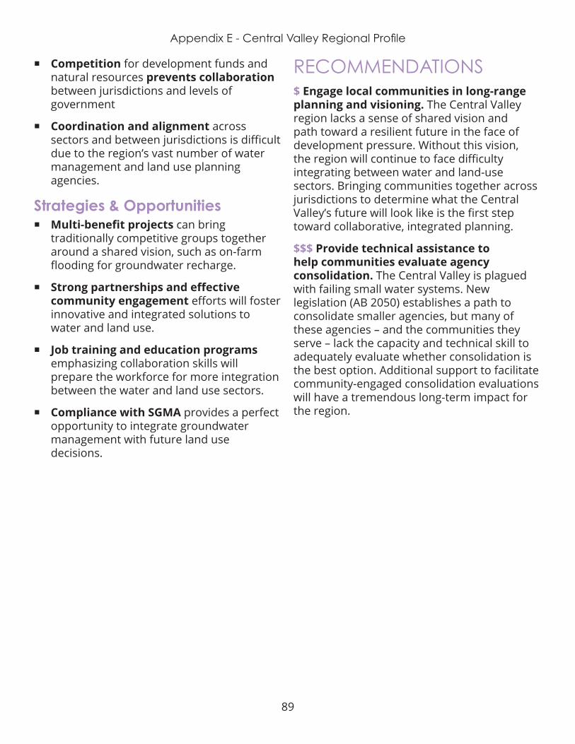
89
Appendix E - Central Valley Regional Profile
¡ Competition for development funds and natural resources prevents collaboration between jurisdictions and levels of government
¡ Coordination and alignment across sectors and between jurisdictions is difficult due to the region’s vast number of water management and land use planning agencies.
Strategies & Opportunities ¡ Multi-benefit projects can bring
traditionally competitive groups together around a shared vision, such as on-farm flooding for groundwater recharge.
¡ Strong partnerships and effective community engagement efforts will foster innovative and integrated solutions to water and land use .
¡ Job training and education programs emphasizing collaboration skills will prepare the workforce for more integration between the water and land use sectors .
¡ Compliance with SGMA provides a perfect opportunity to integrate groundwater management with future land use decisions .
RECOMMENDATIONS$ Engage local communities in long-range planning and visioning. The Central Valley region lacks a sense of shared vision and path toward a resilient future in the face of development pressure. Without this vision, the region will continue to face difficulty integrating between water and land-use sectors. Bringing communities together across jurisdictions to determine what the Central Valley’s future will look like is the first step toward collaborative, integrated planning.
$$$ Provide technical assistance to help communities evaluate agency consolidation. The Central Valley is plagued with failing small water systems. New legislation (AB 2050) establishes a path to consolidate smaller agencies, but many of these agencies – and the communities they serve – lack the capacity and technical skill to adequately evaluate whether consolidation is the best option. Additional support to facilitate community-engaged consolidation evaluations will have a tremendous long-term impact for the region.
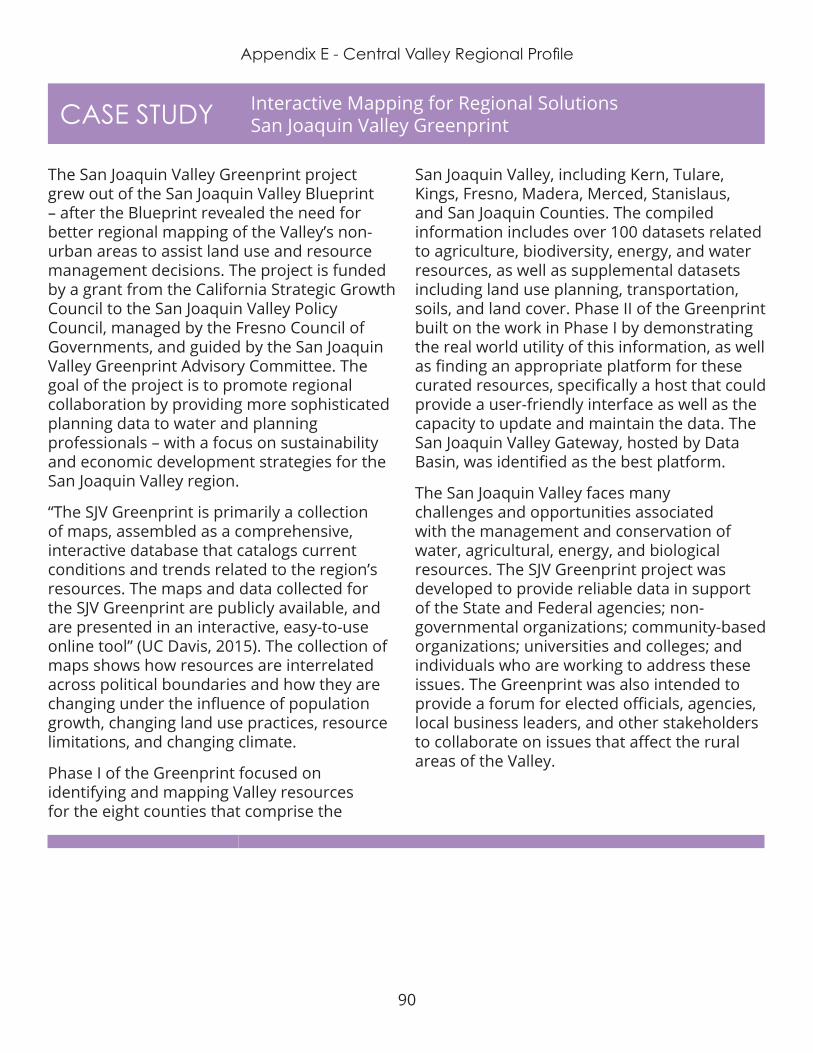
90
Appendix E - Central Valley Regional Profile
CASE STUDY Interactive Mapping for Regional Solutions San Joaquin Valley Greenprint
The San Joaquin Valley Greenprint project grew out of the San Joaquin Valley Blueprint – after the Blueprint revealed the need for better regional mapping of the Valley’s non-urban areas to assist land use and resource management decisions. The project is funded by a grant from the California Strategic Growth Council to the San Joaquin Valley Policy Council, managed by the Fresno Council of Governments, and guided by the San Joaquin Valley Greenprint Advisory Committee . The goal of the project is to promote regional collaboration by providing more sophisticated planning data to water and planning professionals – with a focus on sustainability and economic development strategies for the San Joaquin Valley region.
“The SJV Greenprint is primarily a collection of maps, assembled as a comprehensive, interactive database that catalogs current conditions and trends related to the region’s resources. The maps and data collected for the SJV Greenprint are publicly available, and are presented in an interactive, easy-to-use online tool” (UC Davis, 2015). The collection of maps shows how resources are interrelated across political boundaries and how they are changing under the influence of population growth, changing land use practices, resource limitations, and changing climate.
Phase I of the Greenprint focused on identifying and mapping Valley resources for the eight counties that comprise the
San Joaquin Valley, including Kern, Tulare, Kings, Fresno, Madera, Merced, Stanislaus, and San Joaquin Counties . The compiled information includes over 100 datasets related to agriculture, biodiversity, energy, and water resources, as well as supplemental datasets including land use planning, transportation, soils, and land cover. Phase II of the Greenprint built on the work in Phase I by demonstrating the real world utility of this information, as well as finding an appropriate platform for these curated resources, specifically a host that could provide a user-friendly interface as well as the capacity to update and maintain the data . The San Joaquin Valley Gateway, hosted by Data Basin, was identified as the best platform.
The San Joaquin Valley faces many challenges and opportunities associated with the management and conservation of water, agricultural, energy, and biological resources. The SJV Greenprint project was developed to provide reliable data in support of the State and Federal agencies; non-governmental organizations; community-based organizations; universities and colleges; and individuals who are working to address these issues . The Greenprint was also intended to provide a forum for elected officials, agencies, local business leaders, and other stakeholders to collaborate on issues that affect the rural areas of the Valley.

91
Appendix E - Los Angeles Regional Profile
DEFINING THE REGIONFor the purpose of this project, the Los Angeles Region is defined as the roughly 4,000 square mile geographic boundary of Los Angeles County . There are 88 incorporated cities in LA County, but 65% of the county is unincorporated .
DemographicsOver 10 million people live in Los Angeles County, 4 million of which are in the city of Los Angeles. The region, which is already densely developed, is expected to grow by an additional 1 million people by 2035 . Communities across LA County must coordinate planning efforts to ensure they can accommodate anticipated growth without overstraining the region’s natural resources.
WATER MANAGEMENTThe LA region’s water history is one of scarce natural supply and audacious human ingenuity. As communities struggled to provide
adequate water for both urban and
agricultural needs a complicated and fragmented governance system emerged. Today the region faces both water supply reliability, affordability, and water quality challenges that differ from one community to the next .
WatershedsThe region comprises six major watersheds: the Los Angeles River, the San Gabriel River, Dominguez Channel/Los Angeles Harbor, South Santa Monica Bay, North Santa Monica Bay, and Santa Clara river. Few sections of free-flowing river remain in the region, as most waterways were channelized and lined with concrete to address local flood risk. Yet efforts are underway to “daylight” sections of rivers and streams throughout the region, restoring ecosystem benefits of the watersheds. One of the largest and well-known daylighting efforts has been in the works on the LA River for more than 30 years .
Integrated Regional Water ManagementThe Los Angeles region is part of the Greater
Equitable Integration of Water and Land Use
LOS ANGELES REGION

92
Appendix E - Los Angeles Regional Profile
Los Angeles County IRWM Region, a voluntary collaborative planning group which focuses on water resource management and creates a platform for future funding. The group published its Integrated Regional Water Management Plan in 2014. The watershed planning areas of Los Angeles County include North Santa Monica Bay, Upper Los Angeles River, Upper San Gabriel River, Lower San Gabriel/Lower Los Angeles River, and South Bay .
Water SupplyThe arid Los Angeles region has little natural waters supply – with rivers that seasonally run dry and average rainfall below 20 inches a year. The region imports the majority of its water supply from the State Water Project and the Colorado River Aqueduct . Local sources account for approximately 1/3 of the supply and include groundwater, local surface water, and reclaimed water. Yet a major proportion of what is considered local water is actually delivered via the LA Aqueduct, conveying water from the Owens River over 200 miles away.
Water ProvidersNearly 100 public and private entities supply drinking water to LA region residents. These include cities, special districts, Investor Owned Utilities, Municipal Water Districts, and Mutual Water Companies. Some of these water
providers – including the City of LA, the City of Compton, West Basin Municipal Water District, are “member agencies” to Metropolitan Water District of Southern California, the largest water wholesaler in the state. This complex, decentralized water governance system inhibits integrated planning and increases uncertainty about future water supply reliability .
GroundwaterThe Los Angeles region has over 200 community water systems, roughly one third of which are 100% reliant on local groundwater. Local groundwater is contaminated with trihalomethanes, arsenic, nitrate, perchlorate, and coliform. The 2014 Sustainable Groundwater Management Act (SGMA) requires all groundwater basins identified as high or medium priority to form new Groundwater Sustainability Agencies (GSAs) and develop Groundwater Sustainability Plans (GSPs) by 2020 or 2024, and achieve sustainability by 2040 or 2042, respectively. The LA region overlies 4 medium and 4 high priority basins. Six new GSAs formed to manage the region’s groundwater – adding additional layers of governance to the region’s already complex water management system. It is yet unclear whether GSAs will be responsible for addressing groundwater quality issues.
Water AffordabilityWater rates vary widely across the Los Angeles region, due in part to the cost of importing water, and in part resulting from the region’s highly decentralized governance system. Local water agencies must invest in infrastructure maintenance and upgrades to secure their water supply, but these costs are passed on the customer .
As the region grows and competition for available water supply rises, communities must work together to ensure safe, clean,
Image from UCLA Luskin Atlas and Policy Guide
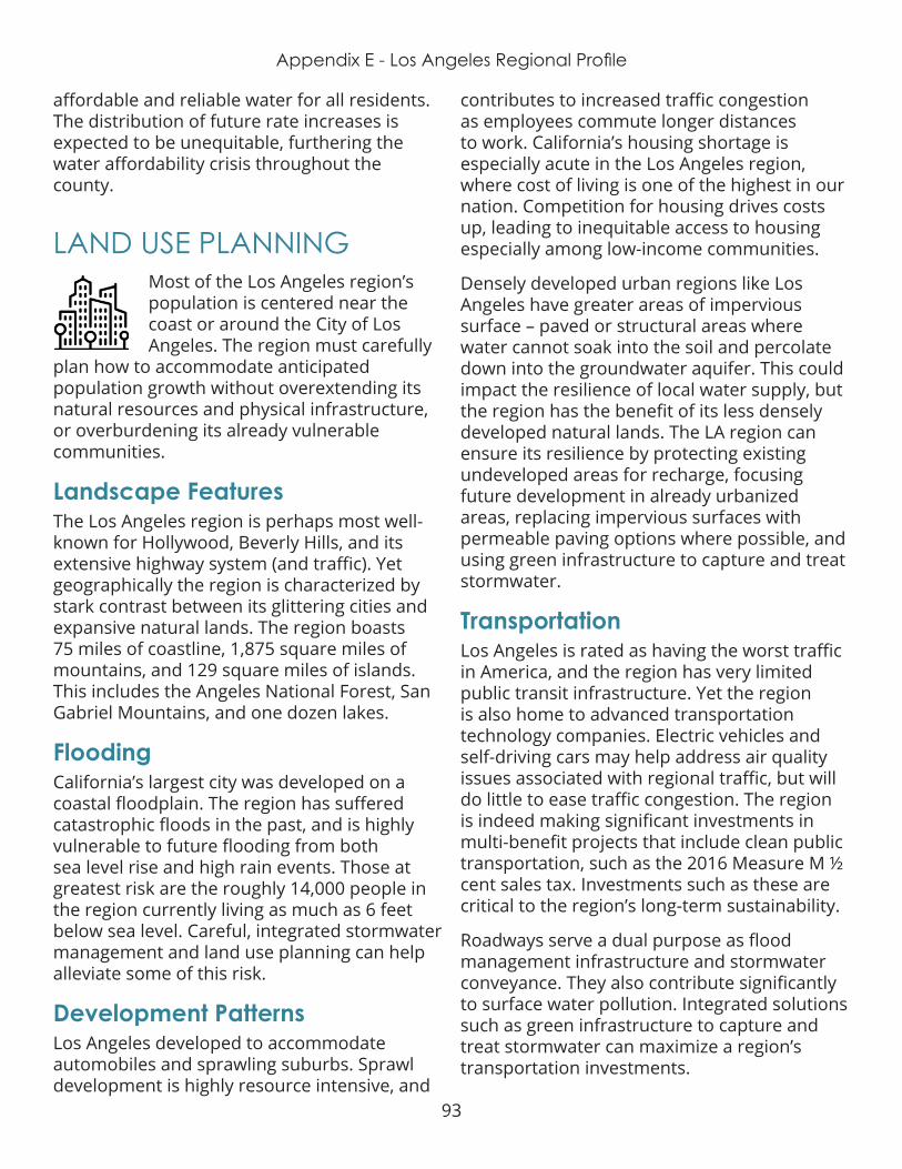
93
Appendix E - Los Angeles Regional Profile
affordable and reliable water for all residents. The distribution of future rate increases is expected to be unequitable, furthering the water affordability crisis throughout the county .
LAND USE PLANNING Most of the Los Angeles region’s population is centered near the coast or around the City of Los Angeles. The region must carefully
plan how to accommodate anticipated population growth without overextending its natural resources and physical infrastructure, or overburdening its already vulnerable communities .
Landscape FeaturesThe Los Angeles region is perhaps most well-known for Hollywood, Beverly Hills, and its extensive highway system (and traffic). Yet geographically the region is characterized by stark contrast between its glittering cities and expansive natural lands. The region boasts 75 miles of coastline, 1,875 square miles of mountains, and 129 square miles of islands. This includes the Angeles National Forest, San Gabriel Mountains, and one dozen lakes.
Flooding California’s largest city was developed on a coastal floodplain. The region has suffered catastrophic floods in the past, and is highly vulnerable to future flooding from both sea level rise and high rain events. Those at greatest risk are the roughly 14,000 people in the region currently living as much as 6 feet below sea level. Careful, integrated stormwater management and land use planning can help alleviate some of this risk.
Development PatternsLos Angeles developed to accommodate automobiles and sprawling suburbs. Sprawl development is highly resource intensive, and
contributes to increased traffic congestion as employees commute longer distances to work. California’s housing shortage is especially acute in the Los Angeles region, where cost of living is one of the highest in our nation. Competition for housing drives costs up, leading to inequitable access to housing especially among low-income communities.
Densely developed urban regions like Los Angeles have greater areas of impervious surface – paved or structural areas where water cannot soak into the soil and percolate down into the groundwater aquifer. This could impact the resilience of local water supply, but the region has the benefit of its less densely developed natural lands. The LA region can ensure its resilience by protecting existing undeveloped areas for recharge, focusing future development in already urbanized areas, replacing impervious surfaces with permeable paving options where possible, and using green infrastructure to capture and treat stormwater .
TransportationLos Angeles is rated as having the worst traffic in America, and the region has very limited public transit infrastructure. Yet the region is also home to advanced transportation technology companies. Electric vehicles and self-driving cars may help address air quality issues associated with regional traffic, but will do little to ease traffic congestion. The region is indeed making significant investments in multi-benefit projects that include clean public transportation, such as the 2016 Measure M ½ cent sales tax. Investments such as these are critical to the region’s long-term sustainability.
Roadways serve a dual purpose as flood management infrastructure and stormwater conveyance. They also contribute significantly to surface water pollution. Integrated solutions such as green infrastructure to capture and treat stormwater can maximize a region’s transportation investments .

94
Appendix E - Los Angeles Regional Profile
EQUITYAccess to affordable housing is the most prominent equity challenge in the Los Angeles region. The region has not met the state’s
requirements for affordable housing. High demand and limited availability of housing – especially multi-family unites – results in steep competition and rising costs for both renters and homeowners. Adjusted incomes are not keeping up with increasing housing prices, and the region’s poverty rate is increasing. Residents facing disadvantages – especially low wage earners – are priced out of the local housing market. Displacement and homelessness are major threats to individuals and families within the Los Angeles region. Displaced individuals must then face higher costs for transportation and temporary housing.
Access to safe, reliable, affordable drinking water and wastewater infrastructure is another equity issue in the Los Angeles region. Contaminated drinking water and outdated infrastructure disproportionately impact low-income residents in the region’s noncoastal communities. These community-members are paying high prices for inadequate quality water. Additionally, the ability to pay for water service varies widely across the region. A water rate that is affordable for a family near the median income level is unbearable for a family living at or near the poverty line.
INTEGRATIONThe unique geography and demographics of the Los Angeles region highlight the importance and value of water-land use integration
to ensure the region can adequately bear the
impacts of a changing climate. Only by closely aligning future development plans – for housing, transportation, and open space – with accurate water demand forecasting and investments in water supply reliability – will the region be able to meet the needs of its community members without overburdening those individuals already facing the greatest disadvantages. Improving equitable distribution of water and land use benefits requires regional collaboration between both water management and land use planning agencies.
Expert PerspectivesWater and land use experts from the Los Angeles Region elevated 6 themes for improving integration, the greatest of which was Public Engagement and Education. Although the LA Region is a leader in integrated planning, exemplified by the City’s One Water LA plan, the Mayor’s Office Sustainable City Plan and Los Angeles Regional Collaborative’s A Greater LA Climate Action Framework, there is a gap between the planning process and its portrayal to the community .
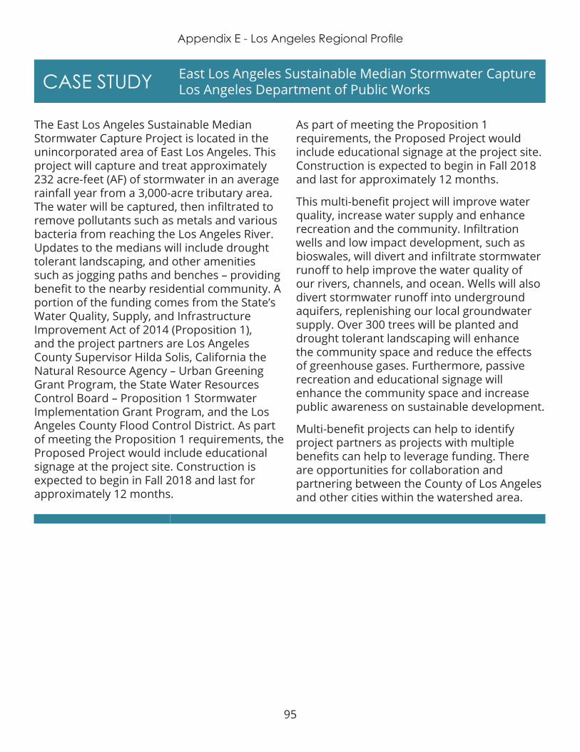
95
Appendix E - Los Angeles Regional Profile
CASE STUDY East Los Angeles Sustainable Median Stormwater Capture Los Angeles Department of Public Works
The East Los Angeles Sustainable Median Stormwater Capture Project is located in the unincorporated area of East Los Angeles. This project will capture and treat approximately 232 acre-feet (AF) of stormwater in an average rainfall year from a 3,000-acre tributary area. The water will be captured, then infiltrated to remove pollutants such as metals and various bacteria from reaching the Los Angeles River. Updates to the medians will include drought tolerant landscaping, and other amenities such as jogging paths and benches – providing benefit to the nearby residential community. A portion of the funding comes from the State’s Water Quality, Supply, and Infrastructure Improvement Act of 2014 (Proposition 1), and the project partners are Los Angeles County Supervisor Hilda Solis, California the Natural Resource Agency – Urban Greening Grant Program, the State Water Resources Control Board – Proposition 1 Stormwater Implementation Grant Program, and the Los Angeles County Flood Control District. As part of meeting the Proposition 1 requirements, the Proposed Project would include educational signage at the project site. Construction is expected to begin in Fall 2018 and last for approximately 12 months .
As part of meeting the Proposition 1 requirements, the Proposed Project would include educational signage at the project site. Construction is expected to begin in Fall 2018 and last for approximately 12 months.
This multi-benefit project will improve water quality, increase water supply and enhance recreation and the community. Infiltration wells and low impact development, such as bioswales, will divert and infiltrate stormwater runoff to help improve the water quality of our rivers, channels, and ocean. Wells will also divert stormwater runoff into underground aquifers, replenishing our local groundwater supply. Over 300 trees will be planted and drought tolerant landscaping will enhance the community space and reduce the effects of greenhouse gases. Furthermore, passive recreation and educational signage will enhance the community space and increase public awareness on sustainable development .
Multi-benefit projects can help to identify project partners as projects with multiple benefits can help to leverage funding. There are opportunities for collaboration and partnering between the County of Los Angeles and other cities within the watershed area .

96
Appendix E - Los Angeles Regional Profile
CASE STUDY Connecting Cities to Nature Ballona Wetlands, City of Culver City
Numerous studies of the hydrology of wetlands have shown that they are a central focus of groundwater recharge. The Ballona Wetlands sit on land owned by the State of California, just south of Marina del Rey. They were once a 2,000-acre area overflowing with fish and waterfowl. Almost 100 years ago, Ballona Creek was transformed into a nine-mile concrete flood protection channel, which blocked the flow of saltwater, and reduced the amount of freshwater in the wetlands. Today, the topography is mostly cement, leaving only a very small percentage of wetlands in this watershed . Cemented streets have lead to increased runoff and pollutant infiltration, which ultimately makes its way to the Ballona Creek, and eventually to the Pacific Ocean.
Today, more than 95% of Southern California’s wetlands have been lost due to human development – the largest loss of any region in the nation. Wetlands are important for many reasons - they are a rest stop for birds, shelter for young fish, a water filtration system, a source of groundwater recharge, air purifier, and great source of local pride and beauty.
After the State acquired the land, they released a study that explored a range of potential infrastructure improvement projects, new structures and more access and activities for the public. Partnership were formed in order to investigate the feasibility of features such as bike trails, community centers, outdoor classroom and walking paths.
Stakeholders have witnessed progress being made since then, such as the Milton Street Park project (a $3MM linear park) adjacent the bike trail, which has added aesthetic appeal and a much needed rest stop for users of Ballona Creek trail. Significant bike path improvements in recent years include native landscaping, artist-designed gates, benches, drinking fountains, murals and other projects by public agencies and local non-profit organizations. Other opportunities include the integration of an educational component to the creek, i.e., using the creek as an outdoor classroom. This is the sort of necessary measures which must be pursued, in order to ensure that the younger generation better understands and appreciates what the creek has to offer to their neighborhood, but even more importantly to the region at large.

97
Appendix E - Los Angeles Regional Profile
Challenges ¡ Fragmented governance and lack
of representation impact already overburdened communities . LA County contains over 200 small water agencies, there is no continuity in governance or management between neighborhoods. Seventy percent residents in the City of LA rent their homes. Local water agency boards are elected by and are therefore accountable to the property owners, not necessarily residents .
¡ Housing and water affordability are critical issues in the LA region. Local developers are challenged to design projects that meet subsidy and funding program requirements to maintain economic feasibility. Demand for single-family homes encourages further sprawl development and drives up costs . Water projects in lower income neighborhoods often do not pass feasibility analysis, so water agencies are forced to pass infrastructure costs onto residents via metering. Yet many of the region’s lowest income communities already have some of the region’s highest water bills.
¡ Lack of coordination and alignment at the local level inhibits integrated planning and management. Little coordination exists between local land use planning agencies (i.e., development and permitting departments) and local water supply agencies. Coordinating development entitlements with water service agreements would improve integration.
¡ Public awareness of water and land use issues in the LA Region is significantly lacking. Additional community engagement and education beyond water rates and public safety is necessary to enhance political will for integration.
Strategies & Opportunities ¡ In November, LA County voters will decide
on a new property tax to fund stormwater capture, treatment, and infiltration. Passing the stormwater fee will catalyze integrated multi-benefit projects and provide a steady revenue stream for necessary operations and maintenance .
¡ The LA Region possesses tremendous political power, as well as institutions with deep technical expertise and capacity . The region’s leaders have an opportunity to catalyze cross-region and inter-disciplinary partnerships to advance integration. Implementing the human right to water and addressing affordability are the two most pressing issues requiring significant political power.
¡ Cities in the LA region have an opportunity to ensure equitable, water-smart development through stronger incentives and constraints within their general plans and zoning codes. Similar to Measure JJJ, cities can provide generous financial and/or process incentives for: priority redevelopment and infill areas, affordability, aggressive permeability and on-site stormwater capture and reuse, highly water efficient buildings, and other positive features.
RECOMMENDATIONS$ Advocate for state-level legislation to implement the human right to water: ensuring all Californians have access to clean, safe, reliable and affordable drinking water and sanitation services . This includes supporting potential legislation similar to the following bills:
¡ SB 623 or SB 844 & 845 that would establish a safe drinking water fund
98
Appendix E - Los Angeles Regional Profile
¡ SB 778 which incentivizes water agency consolidation
¡ AB 1668 which establishes indoor and outdoor water use efficiency standards
¡ SB 1000 which requires all General Plans to include an Environmental Justice element
¡ Strengthening “show me the water” requirements (SB 221 & 610) to ensure more explicit alignment between development plans and urban water management plans
$$ Provide venues for local leaders in both the water & land use sectors to interact with one another . Participants should include department heads from city and county planning, public works, community and economic development, stormwater, and local
and regional water supply and wastewater utilities. Effective models include the Sonoran Institute “Growing Water Smart” program and the Local Government Commission’s Alliance of Regional Collaboratives for Climate Adaptation (ARCCA).
$$$ Invest in grassroots organizing for self-advocacy; to provide opportunities for the lowest income, most vulnerable communities to have real voice in planning processes. This will require deep engagement to educate the community about the value of integrating water management and land use planning, while also teaching them political engagement and self-advocacy skills. Community Water Center and Self Help Enterprises provide successful models for building local capacity to ensure equity in decision-making.
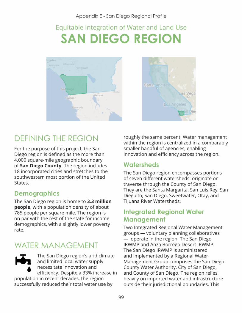
99
Appendix E - San Diego Regional Profile
DEFINING THE REGIONFor the purpose of this project, the San Diego region is defined as the more than 4,000 square-mile geographic boundary of San Diego County. The region includes 18 incorporated cities and stretches to the southwestern most portion of the United States .
DemographicsThe San Diego region is home to 3.3 million people, with a population density of about 785 people per square mile. The region is on par with the rest of the state for income demographics, with a slightly lower poverty rate .
WATER MANAGEMENTThe San Diego region’s arid climate and limited local water supply necessitate innovation and efficiency. Despite a 33% increase in
population in recent decades, the region successfully reduced their total water use by
roughly the same percent. Water management within the region is centralized in a comparably smaller handful of agencies, enabling innovation and efficiency across the region.
WatershedsThe San Diego region encompasses portions of seven different watersheds: originate or traverse through the County of San Diego. They are the Santa Margarita, San Luis Rey, San Dieguito, San Diego, Sweetwater, Otay, and Tijuana River Watersheds.
Integrated Regional Water ManagementTwo Integrated Regional Water Management groups — voluntary planning collaboratives — operate in the region: The San Diego IRWMP and Anza Borrego Desert IRWMP. The San Diego IRWMP is administered and implemented by a Regional Water Management Group comprises the San Diego County Water Authority, City of San Diego, and County of San Diego. The region relies heavily on imported water and infrastructure outside their jurisdictional boundaries. This
Equitable Integration of Water and Land Use
SAN DIEGO REGION

100
Appendix E - San Diego Regional Profile
requires careful coordination between multiple agencies and jurisdictions for water supply reliability. The Anza Borrego Desert IRWM falls in the eastern portion of the county and is entirely reliant on local groundwater supply.
Water SupplyThe San Diego region used to rely almost entirely on imported water from the Colorado River and State Water Project, delivered by the Metropolitan Water District of Southern California. Recent water shortages prompted the San Diego County Water Authority to diversify the region’s water supply portfolio. The region’s water supply now includes groundwater, recycled water, seawater desalination, and conservation.
Image from UCLA Luskin Atlas and Policy Guide
Water ProvidersThe San Diego County Water Authority (SDCWA) is the primary water provider for the region, supplying water to 24 retail water agencies. These include cities, special districts and the Camp Pendleton military base . San Diego County Water Authority’s recent investments greatly improve the region’s water supply reliability .
GroundwaterGroundwater demand in the San Diego region often exceeds recharge, especially in drought years when surface water deliveries are curtailed. The San Diego region sits atop five
groundwater basins designated as medium priority by the state . The 2014 Sustainable Groundwater Management Act (SGMA) requires all groundwater basins identified as medium priority to form new Groundwater Sustainability Agencies (GSAs) and develop Groundwater Sustainability Plans (GSPs) by 2022, and achieve sustainability by 2042. Four new GSAs formed to manage the region’s groundwater – adding additional layers of governance to the region’s already complex water management system.
Water AffordabilityWater rates in the San Diego region are higher than other parts of the state, as water agencies must cover the cost of importing water great distances and treating poor quality water to drinking water standards. Recent investments in supply reliability must also be borne by the customer, as in the case of San Diego’s new Poseidon desalination plant. The high infrastructure price tag coupled with the increased cost of desalted water add pressure to community members already burdened by some of the highest water bills in the state, if not the nation. San Diego’s residential water bills are expected to increase as a result of the desalination plant, when other more affordable methods of increasing water supply reliability are yet available .
LAND USE PLANNING Most of the San Diego region’s population is centered near the coast or around the City of San Diego. The region must carefully
plan how to accommodate anticipated population growth without overextending its natural resources and physical infrastructure, or overburdening its already vulnerable communities .
101
Appendix E - San Diego Regional Profile
Landscape FeaturesThe San Diego region is known for its beautiful beaches along the 70 miles of coastline, as well as its southern border with Tijuana, Mexico. The region also boasts mountain ranges reaching 6,500 ft in elevation. Due to its topography and geography, San Diego is prone to severe wildfires, further complicating land use planning.
Flooding Low-lying portions of the San Diego region are prone to flooding, and have suffered several large floods from storm events causing millions of dollars in damage. Anticipated climate change impacts, with more variable precipitation patterns and sea level rise, will exacerbate flood risks. Flood-impacted areas are often also communities facing other disadvantages. These communities have fewer resources to prepare for or rebound after a flood.
Development PatternsAs with the rest of the state, the San Diego region is currently experiencing a housing crisis. To meet the current housing demand, the pace of development is quickening. Rapid development pressure, especially in the rural eastern portion of the region, inhibits integrated planning and threatens open space. Current planning efforts seeking to combat climate change prove to encourage sprawl. Future integrated water and land use planning that concentrates new development within the current urban footprint is necessary to ensure the region is resilient to future climate impacts.
TransportationPublic transportation throughout San Diego county is managed by the Metropolitan Transit System, which has several subsidiaries that include bus and trolley services . Continued investment in public transportation infrastructure near housing and employment
centers ensures equitable development . Roadways serve a dual purpose as flood management infrastructure and stormwater conveyance. They also contribute significantly to surface water pollution. Integrated solutions such as green infrastructure to capture and treat stormwater can maximize a region’s transportation investments .
EQUITYAccess to affordable housing is one of the San Diego region’s greatest equity challenges. The region’s median home price is one of the
highest in the state. High demand and limited availability of housing – especially multi-family unites – results in steep competition and rising costs for both renters and homeowners. Residents facing disadvantages – especially low wage earners – are priced out of the local housing market. Displacement and homelessness are major threats to individuals and families within the San Diego region.
Water affordability is another equity issue in the San Diego region. The ability to pay for water service varies widely; a water rate that is affordable for a family near the median income level is unbearable for a family living at or near the poverty line .
INTEGRATIONThe San Diego region is a prime locale for integrating water management and land use planning. If communities across the region
coordinate efforts to identify inter-connected priority development areas within already developed areas they will reduce costs for both public agencies and residents. Communities should also map priority groundwater recharge and water treatment areas, preserving those lands for agriculture and multi-benefit open space.

102
Appendix E - San Diego Regional Profile
CASE STUDY Kellogg Park Green Lot Infiltration Project City of San Diego
Green infrastructure and other low impact development techniques help manage stormwater runoff and provide important co-benefits to communities that can align with climate action planning priorities.
The California State Water Resources Control Board created Areas of Special Biological Significance (ASBS) to protect our oceans and prevent pollution within some of the most pristine and biologically diverse sections of California’s coast. La Jolla is home to two ASBS, which encompass a large portion of the La Jolla Shores marine environment .
To protect the water environment off the coast, pollution and other waste discharges into the ASBS are prohibited by the California Ocean Plan.
Kellogg Park in La Jolla Shores was identified by the city of San Diego as an opportunity to develop a project to address the issue of runoff in the ASBS. The Kellogg Park Green Lot project was designed to remove 18,000 square feet of asphalt concrete - replacing it with pavement that will allow the city to capture large amounts of surface water. They also included elements that allowed them to capture runoff from the parking lot and nearby public right-of-way. The captured water was then filtered to minimize pollutants. Additionally, a “vegetated bioswale” and filter bed were added in order to further capture and infiltrate runoff.
103
Appendix E - San Diego Regional Profile
CASE STUDY Innovative Partnerships and Initiatives San Diego Regional Climate Collaborative
The San Diego Regional Climate Collaborative (SDRCC) was launched in 2012 as a network designed to support public agencies with preparing for the impacts of climate change and mitigate greenhouse gas emissions. The San Diego region faces a number of threats exacerbated by climate change, including diminishing water supplies, increasing wildfire risks, rising temperatures, and increasing coastal flooding and erosion due to sea-level rise .
SDRCC supports local governments and regional agencies across San Diego County to respond to these impacts, reduce emissions, and foster a clean energy and vibrant economy and community. SDRCC was initially formed by five public agencies (the Cities of Chula Vista and San Diego, the County of San Diego, the Port of San Diego, and the San Diego Association of Governments, or SANDAG); the University of San Diego (USD); the region’s energy utility, San Diego Gas & Electric (SDG&E); and The San Diego Foundation (TSDF).
The collaborative’s mission is to create regional partnerships between the region’s residents, local businesses, public service agencies, and private companies . The collaborative also works to create a network for public agencies to learn from each other and to plan for the impacts of climate change.
SDRCC provides a venue for cross-jurisdictional and cross-sectoral dialogue. The collaborative organizes regular workshops
and trainings for local decision-makers on climate-related topics of interest, as well as provides direct technical assistance to jurisdictions in the region. In addition to coordinating stakeholders and providing networking opportunities, SDRCC has also helped build new innovative partnerships in furtherance of specific climate-related goals and initiatives, such as the Climate Science Alliance .
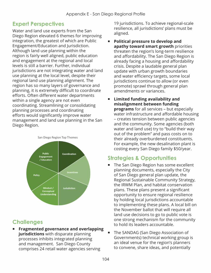
104
Appendix E - San Diego Regional Profile
Expert PerspectivesWater and land use experts from the San Diego Region elevated 6 themes for improving integration, the greatest of which are Public Engagement/Education and Jurisdiction. Although land use planning within the region is fairly well aligned, public education and engagement at the regional and local levels is still a barrier. Further, individual jurisdictions are not integrating water and land use planning at the local level, despite their regional land use planning alignment. The region has so many layers of governance and planning, it is extremely difficult to coordinate efforts. Often different water departments within a single agency are not even coordinating. Streamlining or consolidating planning processes and coordinating efforts would significantly improve water management and land use planning in the San Diego Region.
Challenges ¡ Fragmented governance and overlapping
jurisdictions with disparate planning processes inhibits integrated planning and management. San Diego County comprises 24 retail water agencies serving
19 jurisdictions. To achieve regional-scale resilience, all jurisdictions’ plans must be aligned.
¡ Political pressure to develop and apathy toward smart growth priorities threaten the region’s long-term resilience and affordability. The San Diego Region is already facing a housing and affordability crisis. Despite a laudable general plan update with urban growth boundaries and water efficiency targets, some local jurisdictions continue to allow (or even promote) sprawl through general plan amendments or variances .
¡ Limited funding availability and misalignment between funding programs for all services – but especially water infrastructure and affordable housing – creates tension between public agencies and the community. Some agencies (both water and land use) try to “build their way out of the problem” and pass costs on to their already overburdened constituents . For example, the new desalination plant is costing every San Diego family $50/year.
Strategies & Opportunities ¡ The San Diego Region has some excellent
planning documents, especially the City of San Diego general plan update, the Regional Sustainable Community Strategy, the IRWM Plan, and habitat conservation plans. These plans present a significant opportunity to ensure regional resilience by holding local jurisdictions accountable to implementing these plans. A local bill on the November ballot that will require all land use decisions to go to public vote is one strong mechanism for the community to hold its leaders accountable .
¡ The SANDAG (San Diego Association of Governments) technical working group is an ideal venue for the region’s planners to convene, share ideas, and potentially

105
Appendix E - San Diego Regional Profile
converge around a more resilient shared vision for the region’s water and land use. Similarly, San Diego Coastkeeper is convening the heads of each of the city’s water and planning departments to align decision-making.
¡ Many San Diego residents share an interest in and/or value for open space and natural habitat. Leveraging this shared interest provides an opportunity to engage the community and educate them on the value and importance of integrating water management and land use planning.
RECOMMENDATIONS$ Advocate for strong, local legislation that promotes affordable, efficient, & anti-sprawl development and integrated water management. This includes the November ballot measure that would require all land use decisions go to public vote, and ensuring equitable local implementation of the new Water Use Efficiency Standards (AB 1668). Facilitating equitable local water agency consolidation via SB 778 will also support long-term integration and alignment. The San Diego Region can ensure a sustainable water future through its land use decision-making.
$$ Build local political will and understanding around water and land use integration by convening and educating local leaders. Currently, robust planning documents are easily ignored and policies to ensure resilience are easily bypassed in favor of inequitable sprawl development and big infrastructure projects. Developing a coalition of informed and passionate local decision-makers will combat this short-sightedness. LGC’s Capital Region Dinner Forums, Water Education for Latino Leaders UnTapped Fellowship, and Water Solutions Network are effective leadership development and coalition-building models.
$$$ Invest in existing integrated planning efforts (such as SANDAG’s regional planning technical working group, San Diego County IRWM, and San Diego Climate Action Plan); and ensure plans are implemented . The Sonoran Institute “Growing Water Smart” program is an excellent model for bringing multiple jurisdictions through the integrated planning and implementation process. Additionally, if an unbiased third-party (non-advocacy) organization tracks plan implementation via metrics and communicates key findings to community stakeholders, jurisdictions will be held more accountable for their decisions.
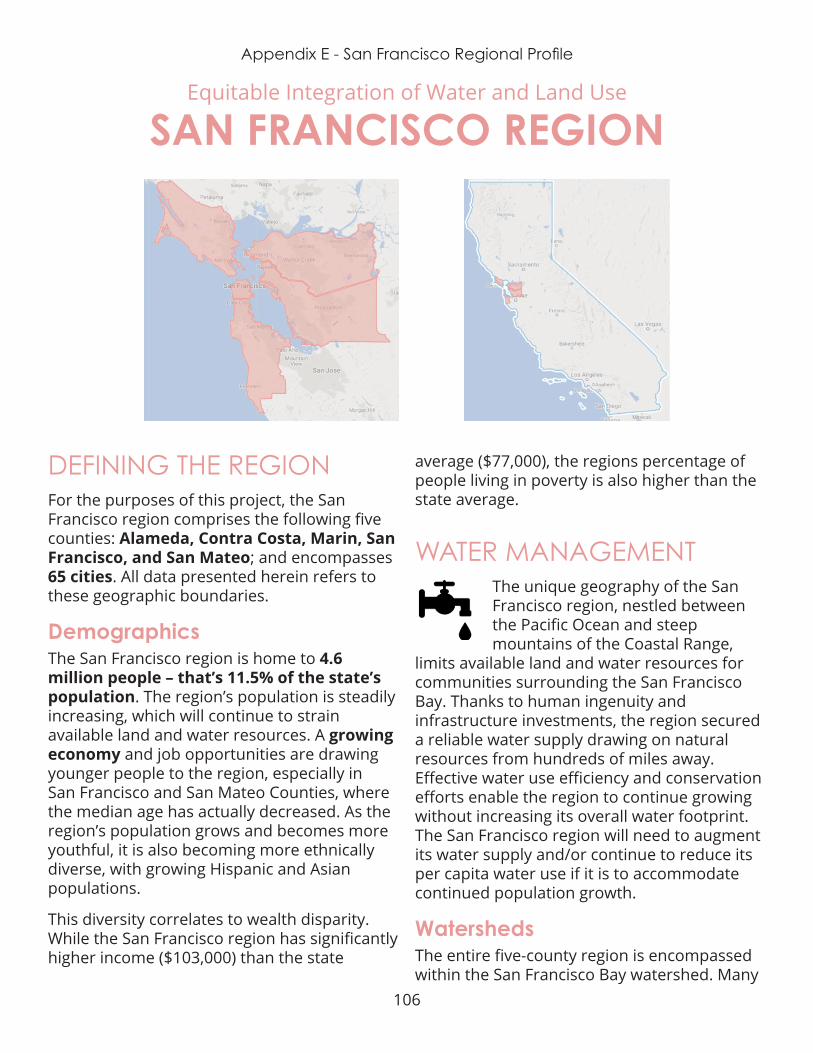
106
Appendix E - San Francisco Regional Profile
DEFINING THE REGIONFor the purposes of this project, the San Francisco region comprises the following five counties: Alameda, Contra Costa, Marin, San Francisco, and San Mateo; and encompasses 65 cities. All data presented herein refers to these geographic boundaries.
DemographicsThe San Francisco region is home to 4.6 million people – that’s 11.5% of the state’s population. The region’s population is steadily increasing, which will continue to strain available land and water resources . A growing economy and job opportunities are drawing younger people to the region, especially in San Francisco and San Mateo Counties, where the median age has actually decreased. As the region’s population grows and becomes more youthful, it is also becoming more ethnically diverse, with growing Hispanic and Asian populations .
This diversity correlates to wealth disparity . While the San Francisco region has significantly higher income ($103,000) than the state
average ($77,000), the regions percentage of people living in poverty is also higher than the state average.
WATER MANAGEMENTThe unique geography of the San Francisco region, nestled between the Pacific Ocean and steep mountains of the Coastal Range,
limits available land and water resources for communities surrounding the San Francisco Bay. Thanks to human ingenuity and infrastructure investments, the region secured a reliable water supply drawing on natural resources from hundreds of miles away. Effective water use efficiency and conservation efforts enable the region to continue growing without increasing its overall water footprint. The San Francisco region will need to augment its water supply and/or continue to reduce its per capita water use if it is to accommodate continued population growth.
WatershedsThe entire five-county region is encompassed within the San Francisco Bay watershed . Many
Equitable Integration of Water and Land Use
SAN FRANCISCO REGION

107
Appendix E - San Francisco Regional Profile
local streams and tributaries, as well as urban and suburban stormwater runoff drain into the Sacramento - San Joaquin Delta, a confluence of two large rivers, which then flow into the Pacific Ocean via the San Francisco Bay. This watershed is part of a vast, complex estuary ecosystem of great importance to the entire state – for both its ecological value and its role in statewide water conveyance .
Integrated Regional Water ManagementThe Bay Area IRWM group – a voluntary planning collaborative – comprises 9 counties, including the 5 counties of the San Francisco region. Nineteen public agencies and NGOs participate in collaborative planning efforts and project identification for competitive funding. The IRWM group updated their plan in September 2014, with an emphasis on regional collaboration and integration of water resource management.
Water SupplyThe San Francisco region has very limited local water supplies (e.g., groundwater and recycled water), and is therefore highly dependent on imported surface water supplies from regional, state, and federal infrastructure projects.
The City of San Francisco, for instance, receives its water from the historically controversial Hetch Hetchy system piped in from 167 miles away in the Sierra Nevada mountains .
Hetch Hetchy Reservoir, USGS
Water ProvidersThe San Francisco Public Utilities Commission is the major water supplier for the region. One-third of their water goes directly to “retail” customers – residents and businesses who pay a water bill to the Utility. The other two thirds of SFPUC water is “wholesale” – sent to 27 municipalities, water suppliers, and private entities in Alameda, Santa Clara, and San Mateo counties, who then distribute the water to their own customers . This is a complex governance and management network to provide water to the Region’s 4.6 million residents .
GroundwaterThe San Francisco Region sits atop four groundwater basins ranked “medium priority” (based on degree to which the groundwater aquifer is overdrafted). The 2014 Sustainable Groundwater Management Act (SGMA) requires all groundwater basins identified as medium priority to form new Groundwater Sustainability Agencies (GSAs) and develop Groundwater Sustainability Plans (GSPs) by 2022, and achieve sustainability by 2024. Nine new GSAs formed to manage the Region’s groundwater – adding additional layers of governance to the region’s already complex water management system.
Water AffordabilityThe San Francisco region is highly reliant on imported water supplies. Water agencies are proactively working to increase local water independence – through efficiency, recycling, and other technologic advances. But these methods are expensive, and require water agencies to increase water rates for their customers. Community members living in poverty are the most impacted by these increased costs, and yet are easily overlooked in discussions around water and equity . This is due in part to the false assumption of
108
Appendix E - San Francisco Regional Profile
ubiquitous wealth in the San Francisco region. Communities already facing disadvantages have less capacity to engage in governance discussions via public meetings or forums, and are also less likely to vote on rate increases . This is especially true of undocumented residents, those for whom English is a second language, and individuals who rent rather than own their homes .
109
Appendix E - San Francisco Regional Profile
CASE STUDY Recharge Net Metering Pilot Program UC Santa Cruz
In October 2016, the University of California at Santa Cruz (UCSC), the Resource Conservation District (RCD) and the Pajaro Valley Water Management Agency (PV Water) started the Recharge Net Metering program. The Pajaro Valley Water Management Agency is a special district created by the State Legislature. This is a unique 5-year pilot program that provides a financial incentive to landowners in the form of a rebate issued by PV Water for building a managed aquifer recharge (MAR) system on their property, where it can seep into the ground and recharge underground water aquifers.
The program will be tested for five years to assess the benefits to the Pajaro Valley Groundwater Basin and its residents . The primary focus of the program is on stormwater collection from hillslopes linked to infiltration, using a variety of techniques, to improve groundwater supplies. We refer to this as “distributed stormwater collection - managed aquifer recharge,” or DSC-MAR. The functional of goal the ReNeM program is to offset some of the on-the-ground costs associated with operation and maintenance of DSC-MAR projects.
This groundbreaking program has occurred through the agency’s partnership with the Resource Conservation District of Santa Cruz County and UC Santa Cruz Professor Andrew Fisher .
Fisher’s team has mapped the lands in the district that have the hydrologic and geologic conditions necessary to absorb stormwater and recharge the aquifer. Some property owners in these areas are being offered a reduction in the Water District’s groundwater pumping fees proportional to the volume of water that they have captures and percolated into the aquifer. This program has been termed “Recharge Net Metering (ReNeM).”
The Resource Conservation District has contracted for the management of the program with the University providing the technical information needed to perform the recharge net metering calculations.
First initiated in 2016, the first year of the recharge net metering program tested on a 5 acre parcel of farmland was highly successful and has since been expanded to other properties .

110
Appendix E - San Francisco Regional Profile
LAND USE PLANNING The San Francisco region is expected to nearly double in the next twenty years . To accommodate that growth, the
Association of Bay Area Governments (ABAG) and Metropolitan Transportation Commission (MTC) created Plan Bay Are 2040. The plan’s land use and transportation strategies address two main goals:
1 . Reduce per-capita carbon dioxide emissions from passenger vehicles
2 . Provide adequate housing for projected population growth.
Landscape FeaturesThe region’s most iconic feature is of course the 550 square mile San Francisco Bay, which each of the five counties border. The San Francisco region’s geography is a mix of rolling foothills and rugged mountains from the ancient volcanic coastal range. Five major rivers feeds into the Bay-Delta which forms the largest estuary ecosystem on the west coast, draining over 60,000 square miles into the Pacific Ocean. Several major fault lines run through the five-county region, making the area highly susceptible to earthquakes. Communities closest to the bay rest on water-saturated soils, which are much more prone to damage from post-earthquake liquefaction.
Flooding Flooding is a serious threat to many areas of the San Francisco region, particularly those in low lying areas. Flooding occurs as a result of poor drainage during heavy storms as well as sea level rise impacting the Bay. Low-income communities tend to be most impacted by flooding, as their neighborhoods are often in greater need of infrastructure improvements, and they are least able to repair damage caused by flooding. Additionally, these
communities often lack the economies of scale to adequately prepare for the risk of sea level rise .
Development PatternsThe San Francisco Region is an extremely densely-developed. The City of San Francisco has been a world-recognized metropolitan center for generations. As San Francisco became built out, the regional areas became increasingly urbanized. This is due in part to sharp rises in population . The primary development challenge in the region is meeting the demand for housing, especially affordable housing for lower income residents.
Densely developed urban communities like the San Francisco region have greater areas of impervious surface – paved or structural areas where water cannot soak into the soil and percolate down into the groundwater aquifer. This ultimately limits the resilience of a region’s local water supply. The San Francisco region can improve its resilience by protecting existing undeveloped areas, focusing future development in already urbanized areas, replace impervious surfaces with permeable paving options where possible, and using green infrastructure to capture and treat stormwater .
TransportationThe San Francisco Region is an extremely densely-developed. The City of San Francisco has been a world-recognized metropolitan center for generations. As San Francisco became built out, the regional areas became increasingly urbanized. This is due in part to sharp rises in population . The primary development challenge in the region is meeting the demand for housing, especially affordable housing for lower income residents.
Densely developed urban communities like the San Francisco region have greater areas of impervious surface – paved or structural

111
Appendix E - San Francisco Regional Profile
areas where water cannot soak into the soil and percolate down into the groundwater aquifer. This ultimately limits the resilience of a region’s local water supply. The San Francisco region can improve its resilience by protecting existing undeveloped areas, focusing future development in already urbanized areas, replace impervious surfaces with permeable paving options where possible, and using green infrastructure to capture and treat stormwater .
EQUITYAccess to affordable housing is the most prominent equity challenge in the San Francisco region. The high demand and limited
availability of housing – especially multi-family unites – results in steep competition and rising costs for both renters and homeowners. Residents facing disadvantages – especially low wage earners – are priced out of the local housing market. Displacement and homelessness are major threats to individuals and families within the San Francisco region. Displaced individuals must then face higher costs for transportation and temporary housing.
Access to safe, reliable, affordable drinking water and wastewater infrastructure is another equity issue in the San Francisco Region. While the overall quality of the water supplied to the region is high, the quality of service infrastructure varies widely from community to community within the region. Lower-income communities are more likely to have aging infrastructure with deferred maintenance. This can degrade water quality and result in higher rates of leaks at the household scale. These community-members are thus paying the same price for lower quality water and wastewater service, and water they are not receiving (due to loss through leaks on the household’s side of the meter).
Additionally, the ability to pay for water service varies widely across the region. A water rate that is affordable for a family near the median income level is unbearable for a family living at or near the poverty line. The San Francisco Public Utilities Commission (SFPUC) instituted a low rate assistance program to support families in this situation. However, the program is not being taken advantage of. This could be a result of ineffective outreach methods, a lack of trust of government, or a combination of factors.
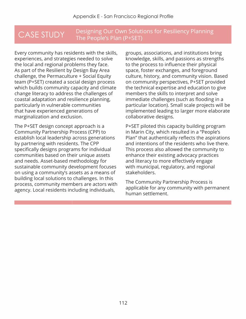
112
Appendix E - San Francisco Regional Profile
CASE STUDY Designing Our Own Solutions for Resiliency Planning The People’s Plan (P+SET)
Every community has residents with the skills, experiences, and strategies needed to solve the local and regional problems they face. As part of the Resilient by Design Bay Area challenge, the Permaculture + Social Equity team (P+SET) created a social design process which builds community capacity and climate change literacy to address the challenges of coastal adaptation and resilience planning, particularly in vulnerable communities that have experienced generations of marginalization and exclusion.
The P+SET design concept approach is a Community Partnership Process (CPP) to establish local leadership across generations by partnering with residents. The CPP specifically designs programs for individual communities based on their unique assets and needs. Asset-based methodology for sustainable community development focuses on using a community’s assets as a means of building local solutions to challenges. In this process, community members are actors with agency. Local residents including individuals,
groups, associations, and institutions bring knowledge, skills, and passions as strengths to the process to influence their physical space, foster exchanges, and foreground culture, history, and community vision. Based on community perspectives, P+SET provided the technical expertise and education to give members the skills to interpret and solve immediate challenges (such as flooding in a particular location). Small scale projects will be implemented leading to larger more elaborate collaborative designs.
P+SET piloted this capacity building program in Marin City, which resulted in a “People’s Plan” that authentically reflects the aspirations and intentions of the residents who live there. This process also allowed the community to enhance their existing advocacy practices and literacy to more effectively engage with municipal, regulatory, and regional stakeholders .
The Community Partnership Process is applicable for any community with permanent human settlement .
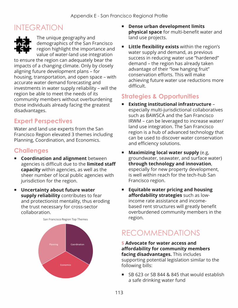
113
Appendix E - San Francisco Regional Profile
INTEGRATIONThe unique geography and demographics of the San Francisco region highlight the importance and value of water-land use integration
to ensure the region can adequately bear the impacts of a changing climate. Only by closely aligning future development plans – for housing, transportation, and open space – with accurate water demand forecasting and investments in water supply reliability – will the region be able to meet the needs of its community members without overburdening those individuals already facing the greatest disadvantages.
Expert PerspectivesWater and land use experts from the San Francisco Region elevated 3 themes including Planning, Coordination, and Economics.
Challenges ¡ Coordination and alignment between
agencies is difficult due to the limited staff capacity within agencies, as well as the sheer number of local public agencies with jurisdiction for the region.
¡ Uncertainty about future water supply reliability contributes to fear and protectionist mentality, thus eroding the trust necessary for cross-sector collaboration .
¡ Dense urban development limits physical space for multi-benefit water and land use projects.
¡ Little flexibility exists within the region’s water supply and demand, as previous success in reducing water use ”hardened” demand – the region has already taken advantage of their “low hanging fruit” conservation efforts. This will make achieving future water use reductions more difficult.
Strategies & Opportunities ¡ Existing institutional infrastructure –
especially multi-jurisdictional collaboratives such as BAWSCA and the San Francisco IRWM – can be leveraged to increase water/land use integration. The San Francisco region is a hub of advanced technology that can be used to discover water conservation and efficiency solutions.
¡ Maximizing local water supply (e.g, groundwater, seawater, and surface water) through technology and innovation, especially for new property development, is well within reach for the tech-hub San Francisco region.
¡ Equitable water pricing and housing affordability strategies such as low-income rate assistance and income-based rent structures will greatly benefit overburdened community members in the region.
RECOMMENDATIONS$ Advocate for water access and affordability for community members facing disadvantages. This includes supporting potential legislation similar to the following bills:
¡ SB 623 or SB 844 & 845 that would establish a safe drinking water fund

114
Appendix E - San Francisco Regional Profile
¡ SB 778 which incentivizes water agency consolidation
¡ SB 1000 which requires all General Plans to include an Environmental Justice element
$$ Provide venues for local leaders in both the water & land use sectors to interact with one another. Effective models include the Sonoran Institute “Growing Water Smart” program and the Local Government Commission’s Alliance of Regional Collaboratives for Climate Adaptation (ARCCA).
$$$ Partner with technology companies, policy hubs, and community-based organizations to establish workforce development opportunities within the housing and water sectors to provide living-wage jobs within the community and increase diversity across the profession. Positive models include the Governor’s Initiative AmeriCorps program CivicSpark; Eastern Municipal Water District’s Youth Ecology Corps, and Local Conservation Corps .

115
Appendix E - Silicon Valley Regional Profile
DEFINING THE REGIONFor the purposes of this project, the Silicon Valley Region is defined as San Mateo and Santa Clara Counties. It includes 35 incorporated cities .
DemographicsThis region is home to nearly 3 million people . The Silicon Valley’s population is projected to grow to 9 million by 2040, but existing housing stock is inadequate to meet demand. Although the counties of San Mateo and Santa Clara have some of the highest median household incomes in the nation, the gap between the
wealthy and the low-income is significant. Due to the disparity of low-wage earners and their increasing costs of living, many current residents are expected to leave the region and move to other parts of California or out of state as housing rates continue to skyrocket.
WATER MANAGEMENTWatersheds
The Silicon Valley region is comprised of watersheds and complex water systems.Both of the region’s counties are encompassed
within the San Francisco Bay watershed . Many local streams and tributaries, as well as urban and suburban stormwater runoff drain into the Sacramento - San Joaquin Delta, a confluence of two large rivers, which then flow into the Pacific Ocean via the San Francisco Bay. This watershed is part of a vast, complex estuary ecosystem of great importance to the entire state – for both its ecological value and its role in statewide water conveyance .
Equitable Integration of Water and Land Use
SILICON VALLEY REGION

116
Appendix E - Silicon Valley Regional Profile
Integrated Regional Water ManagementThe Bay Area IRWM group – a voluntary planning collaborative - overlaps the same geographic boundaries of the Silicon Valley region. Nineteen public agencies and NGOs participate in collaborative planning efforts and project identification for competitive funding. The IRWM group updated their plan in September 2014, with an emphasis on regional collaboration and integration of water resource management.
Water SupplyThe Silicon Valley region relies on both surface water and groundwater. In addition to local supplies, the region receives “south of Delta” deliveries from the State Water Project and Central Valley Project. It is important to note that these surface water supplies originate in Sierra Nevada snowpack . A very small portion of the region’s water is provided by recycling, water transfers, and other supplies. The risk of salt water intrusion due to sea level rise threatens the region’s groundwater supply and overall supply reliability for the region, as well as most Californians reliant on Delta water deliveries .
Water & Wastewater AgenciesTwo collaborative groups represent water supply and wastewater services in the Silicon Valley region. The Bay Area Water Supply and
Conservation Agency (BAWSCA) unites 24 cities, water districts and two private utilities, to collectively purchase water from the regional wholesaler, the San Francisco Regional Water System . Collective membership enables the group to achieve economies of scale otherwise out of reach for each individual water retailer. BACWA, the Bay Area Clean Water Agencies, is a Joint Powers Authority of the five largest wastewater treatment agencies. Together, BACWA members are able to provide better services to their customers and achieve greater goals for the region’s natural ecosystems impacted by wastewater operations .
GroundwaterMuch of the Silicon Valley region relies on groundwater supplies. The region overlies multiple groundwater basins, nine of which are designated by SGMA as medium priority. The 2014 Sustainable Groundwater Management Act (SGMA) requires all groundwater basins identified as medium priority to form new Groundwater Sustainability Agencies (GSAs) and develop Groundwater Sustainability Plans (GSPs) by 2022, and achieve sustainability by 2042. Fourteen new GSAs formed to manage the Region’s groundwater – adding additional layers of governance to the region’s already complex water management system. The groundwater basins in this region are especially at risk for saltwater intrusion due to their proximity to the bay and the threat of sea level rise. Saltwater intrusion into groundwater aquifers diminishes water quality and threatens overall water supply reliability .
Water AffordabilityWater rates across the Silicon Valley are relatively consistent. Yet necessary infrastructure investments to ensure water supply reliability in the future, these costs will go up. Water rates which seem affordable to most community members can be extremely burdensome on low-income families who have to pay more than 2.5% of their income

117
Appendix E - Silicon Valley Regional Profile
on water – a threshold set by the EPA to determine affordability of the resource. These are the same community members who are easily overlooked in discussions around water and equity, due in part to the false assumption of ubiquitous wealth in the Silicon Valley region. Communities already facing disadvantages have less capacity to engage in governance discussions via public meetings or forums, and are also less likely to vote on rate increases . This is especially true of undocumented residents, those for whom English is a second language, and individuals who rent rather than own their homes .
LAND USE PLANNING Landscape Features
The Silicon Valley is known for its unique picturesque locale, bordered by the San Francisco and San Pablo Bays and the California
Coastline. Land use planning decisions must account for the constrains the region faces due to its proximity to the water . Many communities in the region are close in proximity, but disconnected from one another by the water. Several large bridges unite these regions.
Several major fault lines run through the two-county region, making the area highly susceptible to earthquakes . Communities closest to the bay rest on water-saturated soils, which are much more prone to damage from post-earthquake liquefaction.
Flooding Flooding is a serious threat to many areas of the Silicon Valley region, particularly those in low lying areas. Flooding occurs as a result of poor drainage during heavy storms as well as sea level rise impacting the Bays and coastline. During large storm events reservoirs and water smaller waterbody levees are overtopped. Low-income communities tend
to be most impacted by flooding, as their neighborhoods are often in greater need of infrastructure improvements, and they are least able to repair damage caused by flooding. The ratio of costs and benefits for projects that would minimize risk are dependent on property value. Additionally, low-income communities often lack the economies of scale to adequately prepare for the risk of sea level rise. Minimal communication of risk for residents in flood prone areas further threatens the health and safety of residents in these communities .
Development PatternsThe Silicon Valley region is a mix of large urban centers, sprawling suburbs, and rural agricultural areas. Despite this mix in development patterns, the region as a whole does not have adequate housing stock to meet its growing demand. As more people move into the Silicon Valley region for job opportunities, the gap between supply and demand widens and drives up costs . This is especially problematic for lower income residents .
Densely developed urban communities in the Silicon Valley region have greater areas of impervious surface – paved or structural areas where water cannot soak into the soil and percolate down into the groundwater aquifer. This could impact the resilience of their local water supply, but the region has the benefit of its less densely developed suburban and rural agricultural areas. The Silicon Valley region can ensure its resilience by protecting existing undeveloped areas for recharge, focusing future development in already urbanized areas, replacing impervious surfaces with permeable paving options where possible, and using green infrastructure to capture and treat stormwater .
TransportationMobility within and between cities in the Silicon Valley region is limited by its geographic
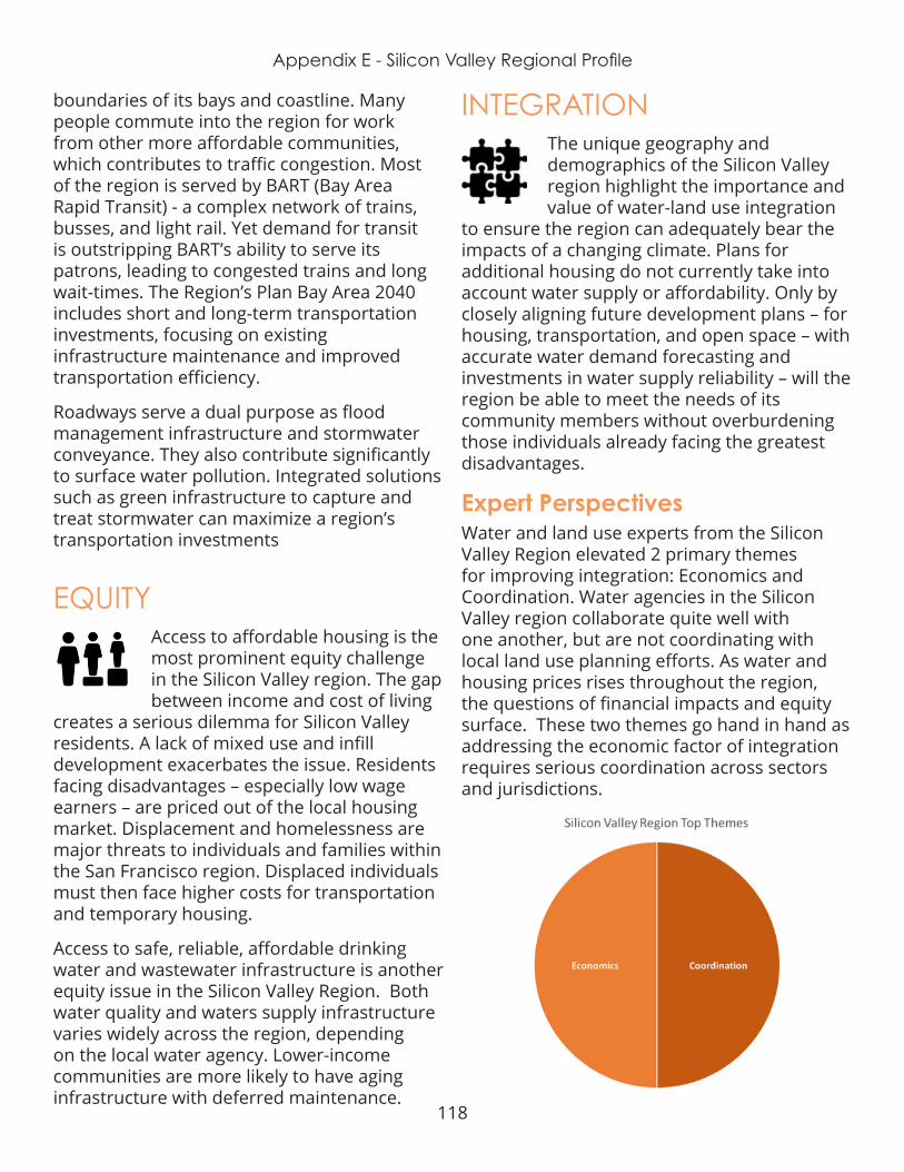
118
Appendix E - Silicon Valley Regional Profile
boundaries of its bays and coastline. Many people commute into the region for work from other more affordable communities, which contributes to traffic congestion. Most of the region is served by BART (Bay Area Rapid Transit) - a complex network of trains, busses, and light rail. Yet demand for transit is outstripping BART’s ability to serve its patrons, leading to congested trains and long wait-times. The Region’s Plan Bay Area 2040 includes short and long-term transportation investments, focusing on existing infrastructure maintenance and improved transportation efficiency.
Roadways serve a dual purpose as flood management infrastructure and stormwater conveyance. They also contribute significantly to surface water pollution. Integrated solutions such as green infrastructure to capture and treat stormwater can maximize a region’s transportation investments
EQUITYAccess to affordable housing is the most prominent equity challenge in the Silicon Valley region. The gap between income and cost of living
creates a serious dilemma for Silicon Valley residents. A lack of mixed use and infill development exacerbates the issue . Residents facing disadvantages – especially low wage earners – are priced out of the local housing market . Displacement and homelessness are major threats to individuals and families within the San Francisco region. Displaced individuals must then face higher costs for transportation and temporary housing.
Access to safe, reliable, affordable drinking water and wastewater infrastructure is another equity issue in the Silicon Valley Region. Both water quality and waters supply infrastructure varies widely across the region, depending on the local water agency. Lower-income communities are more likely to have aging infrastructure with deferred maintenance.
INTEGRATIONThe unique geography and demographics of the Silicon Valley region highlight the importance and value of water-land use integration
to ensure the region can adequately bear the impacts of a changing climate. Plans for additional housing do not currently take into account water supply or affordability. Only by closely aligning future development plans – for housing, transportation, and open space – with accurate water demand forecasting and investments in water supply reliability – will the region be able to meet the needs of its community members without overburdening those individuals already facing the greatest disadvantages.
Expert PerspectivesWater and land use experts from the Silicon Valley Region elevated 2 primary themes for improving integration: Economics and Coordination. Water agencies in the Silicon Valley region collaborate quite well with one another, but are not coordinating with local land use planning efforts. As water and housing prices rises throughout the region, the questions of financial impacts and equity surface. These two themes go hand in hand as addressing the economic factor of integration requires serious coordination across sectors and jurisdictions.
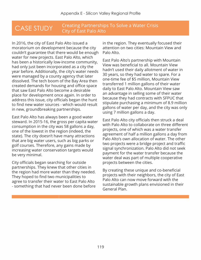
119
Appendix E - Silicon Valley Regional Profile
CASE STUDY Creating Partnerships To Solve a Water Crisis City of East Palo Alto
In 2016, the city of East Palo Alto issued a moratorium on development because the city couldn’t guarantee that there would be enough water for new projects. East Palo Alto, which has been a historically low-income community, had only just been incorporated as a city the year before. Additionally, the city’s water needs were managed by a county agency that later dissolved. The tech boom of the Bay Area then created demands for housing and office space that saw East Palo Alto become a desirable place for development once again. In order to address this issue, city officials began the hunt to find new water sources - which would result in new, groundbreaking partnerships.
East Palo Alto has always been a good water steward. In 2015-16, the gross per capita water consumption in the city was 58 gallons a day, one of the lowest in the region (indeed, the state). The city doesn’t have many attractions that are big water users, such as big parks or golf courses. Therefore, any gains made by increasing water conservation targets would be very minimal .
City officials began searching for outside partnerships . They knew that other cities in the region had more water than they needed. They hoped to find two municipalities to agree to transfer their water to East Palo Alto - something that had never been done before
in the region. They eventually focused their attention on two cities: Mountain View and Palo Alto .
East Palo Alto’s partnership with Mountain View was beneficial to all. Mountain View hadn’t used their daily allotment of water in 30 years, so they had water to spare. For a one-time fee of $5 million, Mountain View transferred 1 million gallons of their water daily to East Palo Alto . Mountain View saw an advantage in selling some of their water because they had contracts with SFPUC that stipulate purchasing a minimum of 8.9 million gallons of water per day, and the city was only using 7 million gallons a day.
East Palo Alto city officials then struck a deal with Palo Alto to collaborate on three different projects, one of which was a water transfer agreement of half a million gallons a day from Palo Alto’s own allocation of water. The other two projects were a bridge project and traffic signal synchronization. Palo Alto did not seek payment for the water transfer because the water deal was part of multiple cooperative projects between the cities.
By creating these unique and co-beneficial projects with their neighbors, the city of East Palo Alto can now move forward with the sustainable growth plans envisioned in their General Plan .
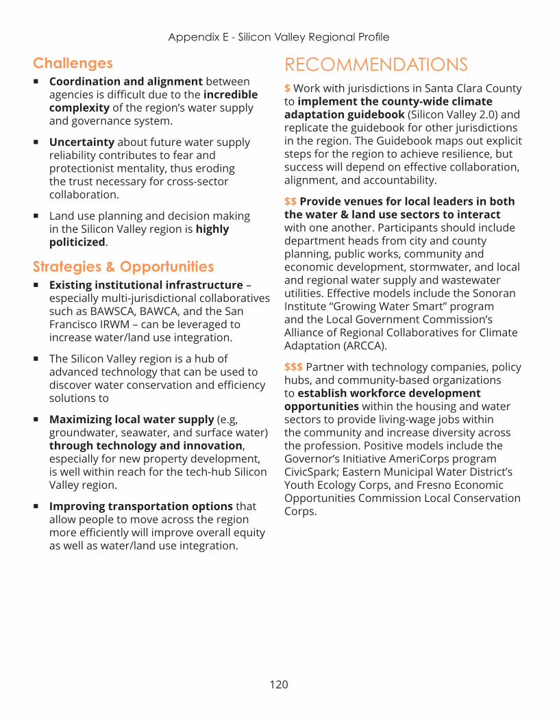
120
Appendix E - Silicon Valley Regional Profile
Challenges ¡ Coordination and alignment between
agencies is difficult due to the incredible complexity of the region’s water supply and governance system.
¡ Uncertainty about future water supply reliability contributes to fear and protectionist mentality, thus eroding the trust necessary for cross-sector collaboration .
¡ Land use planning and decision making in the Silicon Valley region is highly politicized .
Strategies & Opportunities ¡ Existing institutional infrastructure –
especially multi-jurisdictional collaboratives such as BAWSCA, BAWCA, and the San Francisco IRWM – can be leveraged to increase water/land use integration.
¡ The Silicon Valley region is a hub of advanced technology that can be used to discover water conservation and efficiency solutions to
¡ Maximizing local water supply (e.g, groundwater, seawater, and surface water) through technology and innovation, especially for new property development, is well within reach for the tech-hub Silicon Valley region.
¡ Improving transportation options that allow people to move across the region more efficiently will improve overall equity as well as water/land use integration.
RECOMMENDATIONS$ Work with jurisdictions in Santa Clara County to implement the county-wide climate adaptation guidebook (Silicon Valley 2.0) and replicate the guidebook for other jurisdictions in the region. The Guidebook maps out explicit steps for the region to achieve resilience, but success will depend on effective collaboration, alignment, and accountability.
$$ Provide venues for local leaders in both the water & land use sectors to interact with one another . Participants should include department heads from city and county planning, public works, community and economic development, stormwater, and local and regional water supply and wastewater utilities. Effective models include the Sonoran Institute “Growing Water Smart” program and the Local Government Commission’s Alliance of Regional Collaboratives for Climate Adaptation (ARCCA).
$$$ Partner with technology companies, policy hubs, and community-based organizations to establish workforce development opportunities within the housing and water sectors to provide living-wage jobs within the community and increase diversity across the profession. Positive models include the Governor’s Initiative AmeriCorps program CivicSpark; Eastern Municipal Water District’s Youth Ecology Corps, and Fresno Economic Opportunities Commission Local Conservation Corps .
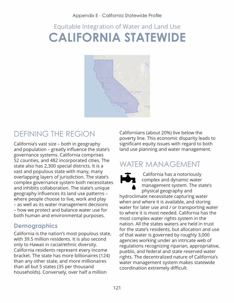
121
Appendix E - California Statewide Profile
DEFINING THE REGIONCalifornia’s vast size – both in geography and population – greatly influence the state’s governance systems. California comprises 52 counties, and 482 incorporated cities. The state also has 2,300 special districts. It is a vast and populous state with many, many overlapping layers of jurisdiction. The state’s complex governance system both necessitates and inhibits collaboration. The state’s unique geography influences its land use patterns – where people choose to live, work and play – as well as its water management decisions – how we protect and balance water use for both human and environmental purposes .
DemographicsCalifornia is the nation’s most populous state, with 39.5 million residents. It is also second only to Hawaii in racial/ethnic diversity. California residents represent every income bracket. The state has more billionaires (124) than any other state, and more millionaires than all but 5 states (35 per thousand households). Conversely, over half a million
Californians (about 20%) live below the poverty line . This economic disparity leads to significant equity issues with regard to both land use planning and water management.
WATER MANAGEMENT California has a notoriously complex and dynamic water management system. The state’s physical geography and
hydroclimate necessitate capturing water when and where it is available, and storing water for later use and / or transporting water to where it is most needed. California has the most complex water rights system in the nation . All the states waters are held in trust for the state’s residents, but allocation and use of that water is governed by roughly 3,000 agencies working under an intricate web of regulations recognizing riparian, appropriative, pueblo, and federal and state reserved water rights. The decentralized nature of California’s water management system makes statewide coordination extremely difficult.
Equitable Integration of Water and Land Use
CALIFORNIA STATEWIDE
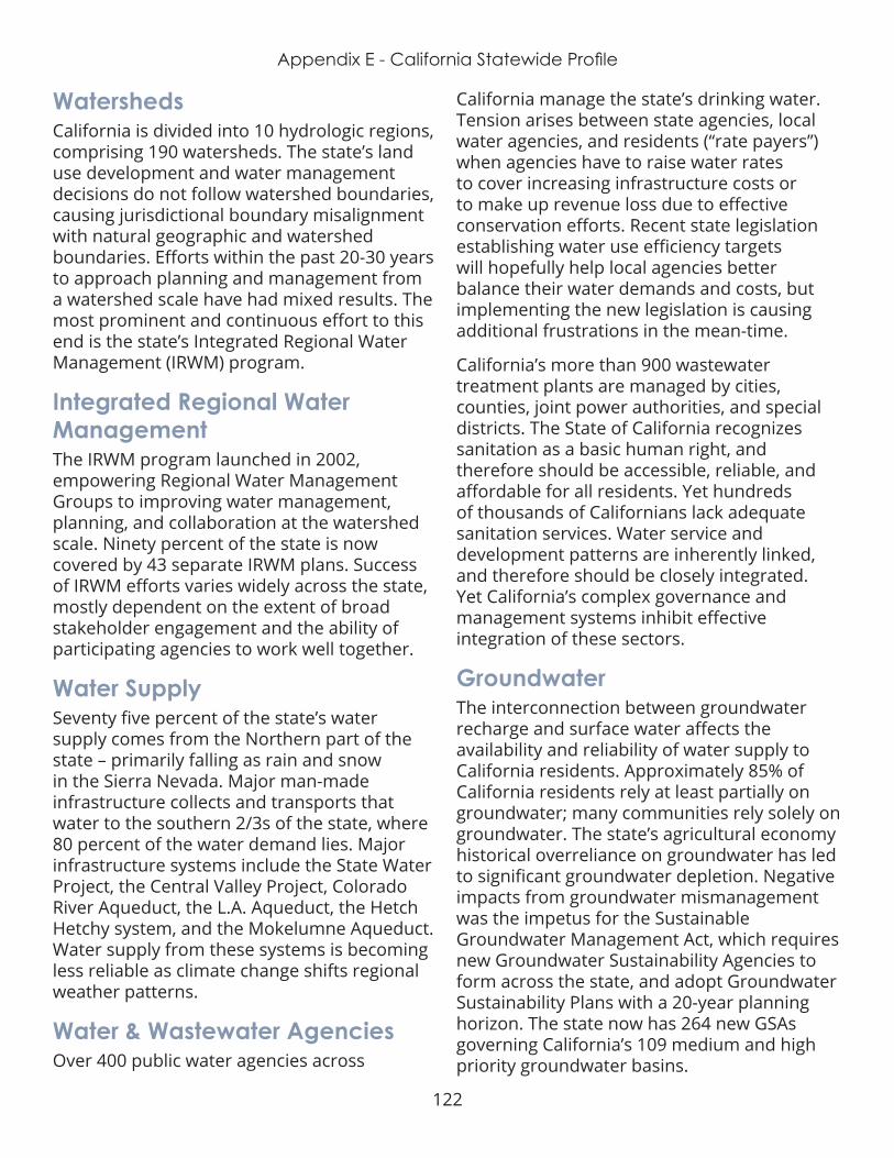
122
Appendix E - California Statewide Profile
WatershedsCalifornia is divided into 10 hydrologic regions, comprising 190 watersheds. The state’s land use development and water management decisions do not follow watershed boundaries, causing jurisdictional boundary misalignment with natural geographic and watershed boundaries. Efforts within the past 20-30 years to approach planning and management from a watershed scale have had mixed results . The most prominent and continuous effort to this end is the state’s Integrated Regional Water Management (IRWM) program.
Integrated Regional Water ManagementThe IRWM program launched in 2002, empowering Regional Water Management Groups to improving water management, planning, and collaboration at the watershed scale. Ninety percent of the state is now covered by 43 separate IRWM plans. Success of IRWM efforts varies widely across the state, mostly dependent on the extent of broad stakeholder engagement and the ability of participating agencies to work well together.
Water SupplySeventy five percent of the state’s water supply comes from the Northern part of the state – primarily falling as rain and snow in the Sierra Nevada. Major man-made infrastructure collects and transports that water to the southern 2/3s of the state, where 80 percent of the water demand lies. Major infrastructure systems include the State Water Project, the Central Valley Project, Colorado River Aqueduct, the L.A. Aqueduct, the Hetch Hetchy system, and the Mokelumne Aqueduct. Water supply from these systems is becoming less reliable as climate change shifts regional weather patterns .
Water & Wastewater AgenciesOver 400 public water agencies across
California manage the state’s drinking water. Tension arises between state agencies, local water agencies, and residents (“rate payers”) when agencies have to raise water rates to cover increasing infrastructure costs or to make up revenue loss due to effective conservation efforts. Recent state legislation establishing water use efficiency targets will hopefully help local agencies better balance their water demands and costs, but implementing the new legislation is causing additional frustrations in the mean-time.
California’s more than 900 wastewater treatment plants are managed by cities, counties, joint power authorities, and special districts. The State of California recognizes sanitation as a basic human right, and therefore should be accessible, reliable, and affordable for all residents. Yet hundreds of thousands of Californians lack adequate sanitation services . Water service and development patterns are inherently linked, and therefore should be closely integrated. Yet California’s complex governance and management systems inhibit effective integration of these sectors.
GroundwaterThe interconnection between groundwater recharge and surface water affects the availability and reliability of water supply to California residents. Approximately 85% of California residents rely at least partially on groundwater; many communities rely solely on groundwater. The state’s agricultural economy historical overreliance on groundwater has led to significant groundwater depletion. Negative impacts from groundwater mismanagement was the impetus for the Sustainable Groundwater Management Act, which requires new Groundwater Sustainability Agencies to form across the state, and adopt Groundwater Sustainability Plans with a 20-year planning horizon. The state now has 264 new GSAs governing California’s 109 medium and high priority groundwater basins.
123
Appendix E - California Statewide Profile
Water AffordabilityLocal water agencies set rates based on the total cost to treat and deliver water to their rate payers. Setting water rates is an incredibly complex process, with many contributing factors including water source location, water quality, service area, and infrastructure. California water rates are increasing at varying rates across the state, but are inequitably impacting communities already facing disadvantages. The California Department of Health measures water affordability threshold of 1.5% of median household income. Recent legislative efforts, such as SB 623, have attempted to address drinking water affordability. Yet to date, no efforts have succeeded. The state’s massive infrastructure improvement deficit is likely to further increase water rates in future years.
LAND USE PLANNING Landscape Features
California’s 155,000 square miles is a place of geographic extremes: from Mount Whitney - the highest mountaintop in the contiguous
united states to Death Valley - the lowest and hottest point in the country. California boasts vast deserts, dense forests, 840 miles of coastline, nearly 190,000 miles of meandering rivers, expansive lakes, and rich agricultural flood plains. The many unique regions of the state have their own landscape features and geographic identifiers.
Flooding California is bordered to the west by the Pacific Ocean. The majority of the state’s population lives along the coast, and is thus highly vulnerable to coastal flooding – especially in the face of sea level rise from climate change. Extreme precipitation events, which are increasing in frequency and severity due to climate change, threaten inland communities.
Pockets of the state recently devastated by wildfires are at heightened risk from flash flood events. Funding for improved flood management is incredibly important, yet currently limited. Improving coordination between regional planning and stormwater management will relieve some pressure from flood risk.
Development PatternsEach city and county in California varies in its population density and development patterns, each unique to its local and regional character. The entire state, however, is currently facing a major housing shortage — especially affordable housing. Population is shifting away from highly expensive coastal regions to more affordable inland regions. This migration adds pressure to less densely populated regions, potentially leading to unsustainable sprawl development . Communities across the state are struggling to meet current and future housing demand in a sustainable and equitable way .
TransportationResidential and commercial development goes hand in hand with transportation. California’s proliferation of freeways in the first half of the 20th century was a major contributor to the era’s resource-intensive sprawl development. In recent decades California communities have shifted toward multimodal transportation infrastructure to support more sustainable development patterns. California’s roadways also serve as both an important stormwater water conveyance system and a major contributor to stormwater pollution . Better integration between transportation planning and stormwater management can reduce costs and improve outcomes for both sectors.

124
Appendix E - California Statewide Profile
EQUITYInequities exist at the intersect of water and land use in regard to affordability and threat of harms. Housing and water rate affordability
are impacted by the state’s overall high cost of living. Communities already facing disadvantages are less able to bear the burden of these compounding costs. Low-wage earners and those on fixed incomes are at constant risk of displacement due to rising housing costs.
Underrepresented communities are also disproportionately impacted by structural and environmental harms – such as poor water quality and sanitation service, flooding, access to adequate outdoor recreation space, urban heat relief, and poor air quality. All of these factors can be improved through better integration of water management and land use planning, especially if equity considerations are explicitly prioritized.
INTEGRATIONCalifornia’s highly complex governance system includes thousands of water and land use agencies, each with overlapping
boundaries and misaligned jurisdiction. The past half-century of segregated planning and management efforts have led to innumerable negative impacts to our natural resources, community health, social equity, and overall resilience in the face of climate change. In recent years, though, we have seen a cultural shift towards the idea of an integrated, collaborative planning approach. In California, these ideas are gaining momentum and recognition - due in part to the heightened urgency and need as a result of climate change and the state’s growing population.
Challenges ¡ California is facing a housing crisis,
requiring more housing stock (particularly affordable housing), to meet current demand and future growth projections.
¡ The number of local and regional agencies makes coordination difficult, especially since they tend to specialize in particular sectors.
¡ Local governments are not incentivized to align with state priorities, preventing integrative efforts.
¡ Collaboration is time and resource intensive, yet many of the entities who need to collaborate are already at limited capacity .
Strategies & Opportunities ¡ Incremental steps towards integration
are being made, causing hope for the future of water and land use planning.
¡ Successful models exist for integration of water and land use planning within and outside California.
¡ Non-governmental entities throughout California are motivated to address these challenges by leveraging their experience building partnerships .
RECOMMENDATIONS$ Use collective momentum of existing projects, programs, and models that exemplify equitable integration of water and land use.
$$ Advocate for state-level policy change in regards to water governance and finance, as well as state mandates and incentives that encourage integration.
$$$ Invest in local integration through leadership development, community education, technical assistance, and project funding.
125
Appendix F - StoryMaps
APPENDIX F: STORYMAPS

126
Appendix F - StoryMaps
Prepared for the Community Foundation Water Initiative (CFWI) and the Funders’ Network for Smart Growth and Livable Communities (TFN) by the Local Government Commission (LGC).
San Francisco Regionhttps://www.arcgis.com/apps/Cascade/index.html?appid=2c33474504b84644866777968c3014c8
Silicon Valley Regionhttps://www.arcgis.com/apps/Cascade/index.html?appid=9b779e20b9ee4d0bb4aa42a015a83b0f
Central Valley Regionhttps://www.arcgis.com/apps/Cascade/index.html?appid=2640c9342ce440158ad7265a355d1b5a
Los Angeles Regionhttps://www.arcgis.com/apps/Cascade/index.html?appid=ab778844d36849689bc4b1a87397c3d9
San Diego Regionhttps://www.arcgis.com/apps/Cascade/index.html?appid=90d2fb0024c14b49aa2e82ee9aa1ed4a
California Statewidehttps://www.arcgis.com/apps/Cascade/index.html?appid=4ee8bee61a954ae78df9d3b4b4ada9b4

127
Appendix H - Resources Database & Literature Cited
APPENDIX H: RESOURCES DATABASE & LITERATURE CITED
128
Appendix H - Resources Database & Literature Cited
1 2 3 4 5 6 7 8 9 10 11
BC
DG
HI
JK
Res
ourc
eFo
lder
/ C
ateg
ory
Aut
hor/P
rodu
cer
Type
Sub
ject
Are
aLi
nk
Des
crip
tion
Abs
tract
/Exp
ande
d D
escr
iptio
n
0201
6 A
nnua
l Pla
nnin
g S
urve
y R
esul
tsP
lann
ing
Gov
erno
r's O
ffice
of P
lann
ing
and
Res
earc
h A
genc
y R
epor
tpl
anni
nght
tp://
ww
w.o
pr.c
a.go
v/do
cs/2
016_
AP
S_f
inal
Ann
ual p
lann
ing
surv
ey
resu
lts
Eac
h ye
ar th
e G
over
nor's
Offi
ce o
f Pla
nnin
g an
d R
esea
rch
dist
ribut
es a
su
rvey
to th
e pl
anni
ng d
epar
tmen
t of e
very
city
and
cou
nty
in th
e st
ate.
The
su
rvey
ask
s fo
r bas
ic in
form
atio
n on
the
stat
us o
f eac
h ju
risdi
ctio
n's
plan
ning
effo
rts, s
uch
as th
e ey
ar o
f the
mos
t rec
ent c
ompr
ehen
sive
upd
ate
to re
quire
d an
d op
tiona
l Gen
eral
Pla
n up
date
s. T
he s
urve
y al
so e
xplo
res
in
grea
ter d
epth
the
polic
ies
and
prog
ram
s th
at ju
risdi
ctio
ns a
re im
plem
entin
g,
incl
udin
g th
e is
sues
prio
ritiz
ed a
nd tr
acke
d, in
cent
ives
dev
elop
ed a
dn ta
ken
adva
ntag
e of
, pla
nnig
n to
ols
depl
oyed
, res
ourc
es a
nd d
ocum
ents
ge
nera
ted,
and
mor
e.
A 1
0- Y
ear S
tory
: The
Wat
er fo
r Life
D
ecad
e 20
05-2
015
and
Bey
ond
Jose
fina
Mae
stu
Unt
urbe
Ram
iro A
urin
Lop
era
Mar
ta L
opez
Rau
rell
Hiro
shi K
itam
ura
Oth
erin
tern
atio
nal w
ater
go
vern
ance
ht
tp://
ww
w.u
n.or
g/w
ater
forli
fede
cade
/Wat
erfo
rLife
EN
G.p
df
UN
repo
rt on
wat
er-re
late
d ac
hiev
emen
ts b
etw
een
2005
and
201
5
See
ing
wha
t the
val
ue a
dded
of t
he D
ecad
e ha
s be
en; H
ow a
nd w
here
the
Wat
er D
ecad
e ha
s pr
ovid
ed a
n ef
ectiv
e fra
mew
ork
for p
rom
otin
g an
d su
ppor
ting
wat
er c
oope
ratio
n an
d IW
RM
efo
rts, b
y pr
ovid
ing
polit
ical
impu
lse
and
help
ing
rais
e aw
aren
ess
and
high
light
ing
actio
n or
ient
ed a
ctiv
ities
(bes
t pr
actic
es a
nd to
ols
for c
oope
ratio
n).
A B
otto
m-U
p A
ppro
ach
to
Gro
undw
ater
Sus
tain
abilit
yG
roun
d W
ater
Lo
ri P
ottin
ger
New
s A
rticl
egr
ound
wat
er
http
://w
ww
.ppi
c.or
g/bl
og/b
otto
m-a
ppro
ach-
grou
ndw
ater
-sus
tain
abilit
y/
Inte
rvie
w a
bout
gr
ound
wat
er m
anag
emen
t in
nova
tions
in K
ern
Cou
nty.
Inte
rvie
wed
Eric
Ave
rett
of th
e R
osed
ale–
Rio
Bra
vo W
ater
Sto
rage
Dis
trict
abo
ut g
roun
dwat
er m
anag
emen
t inn
ovat
ions
bei
ng tr
ied
in h
is K
ern
Cou
nty
dist
rict a
ndle
sson
s le
arne
d th
at m
ight
hav
e w
ider
app
licat
ion
such
as
wat
er b
udge
ts,
wat
er tr
adin
g, a
nd in
divi
dual
gro
undw
ater
ban
k ac
coun
ts.
A G
reat
er L
A
Reg
ion
Spe
cific
s: L
os
Ang
eles
Los
Ang
eles
Reg
iona
l Col
labo
rativ
e fo
r Clia
mte
Act
ion
and
Sus
tain
abilit
y A
genc
y R
epor
teq
uity
, reg
iona
l res
ourc
e m
anag
emen
t ht
tp://
clim
atea
ctio
n.la
/wp-
cont
ent/t
hem
es/la
rc/re
port/
AG
reat
erLA
_Clim
ateA
ctio
nFra
mew
ork_
Dec
-19-
2016
-ene
rgy.
A P
roje
ct o
f the
Los
A
ngel
es R
efio
nal
Col
labo
rativ
e of
Clim
ate
Act
ion
Sus
tani
bilit
y ex
plor
ing
ener
gy, w
ater
, tra
nspo
rtatio
n, p
ublic
he
alth
, and
oce
an a
nd
coas
tal s
ecto
rs.
The
Fram
ewor
k is
offe
red
as a
sta
rt fo
r reg
iona
l dia
logu
e an
d or
gani
zing
to
addr
ess
the
impa
cts
ofcl
imat
e ch
ange
. It i
s no
t mea
nt to
be
com
preh
ensi
ve, a
nd is
sues
suc
h as
la
nd u
se, e
quity
, and
env
ironm
enta
lju
stic
e, a
s w
ell a
s lo
cal r
even
ues
to p
ay fo
r nee
ded
chan
ges,
will
be
impo
rtant
to a
ddre
ss a
s w
ell.
LAR
C a
ims
to d
evel
op fo
rum
s to
add
ress
thes
e an
d ot
her i
ssue
s go
ing
forw
ard.
A T
ool K
it to
Clo
se C
alifo
rnia
's
Hou
sing
Gap
: 3.5
Milli
on H
omes
by
2025
McK
inse
y G
loba
l Ins
titut
e To
olki
tho
usin
g
http
s://w
ww
.mck
inse
y.co
m/~
/med
ia/
McK
inse
y/G
loba
l%20
Them
es/U
rban
iza
tion/
Clo
sing
%20
Cal
iforn
ias%
20ho
usin
g%20
gap/
Clo
sing
-Cal
iforn
ias-
hous
ing-
gap-
Full-
repo
rt.as
hxTo
olki
t to
addr
ess
the
hous
ing
gap
in C
A
Look
s sp
ecifi
cally
at t
he S
tate
of C
alifo
rnia
and
offe
r rem
edie
s fo
r fix
ing
a ch
roni
c ho
usin
g sh
orta
ge. T
he o
bjec
tive
is to
pro
vide
rigo
rous
, fac
t-bas
ed
anal
ysis
on
a ch
arge
d is
sue,
and
to p
rese
nt a
pra
ctic
al b
luep
rint f
or h
ow
citie
s, s
tate
aut
horit
ies,
the
priv
ate
sect
or, a
nd c
itize
ns c
an w
ork
toge
ther
to
unlo
ck h
ousi
ng s
uppl
y an
d en
sure
hou
sing
acc
ess.
AB
52:
A C
EQ
A G
uide
lines
Upd
ate
for T
ribal
Cul
tura
lR
esou
rces
Hol
ly R
ober
son,
JD
Lan
d U
se C
ouns
el G
over
nor’s
Offi
ce o
f Pla
nnin
g an
d R
esea
rch
Oth
ereq
uity
, trib
esht
tp://
ww
w.o
pr.c
a.go
v/do
cs/O
PR
_AB
_52_
Pre
sent
atio
n_D
iscu
ssio
n_D
raft.
Gui
delin
es fo
r AB
52
and
triba
l cul
tura
l res
ourc
es in
C
EQ
ALa
ys o
ut im
plem
enta
tion
proc
ess
for A
B 5
2 an
d de
fines
trib
al c
ultu
ral
reso
urce
s
Allu
vial
Fan
Tas
k Fo
rce
Gro
und
Wat
er
Cal
iforn
ia S
tate
Uni
vers
ity, S
an B
erna
rdin
oO
ther
allu
vial
fans
ht
tps:
//aftf
.csu
sb.e
du/d
ocum
ents
/AFT
F_FA
CTS
_Fin
al_O
ct20
10_w
eb[1
Ove
rvie
w o
f the
allu
vial
fa
n ta
sk fo
rce
in S
outh
ern
Cal
iforn
ia
The
Task
For
ce a
utho
rizin
g le
gisl
atio
n al
so d
irect
ed th
at a
Mod
el O
rdin
ance
(M
O) b
e de
velo
ped
to a
ssis
t city
and
cou
nty
gove
rnm
ents
in p
lann
ing
and
deve
lopm
ent a
ctiv
ities
on
allu
vial
fan
area
s. T
he M
O p
rovi
des
a pr
oces
s an
d gu
idan
ce to
impl
emen
t the
loca
l pla
nnin
g to
ols
pres
ente
d in
the
IA to
pr
ovid
e in
form
ed la
nd u
se d
ecis
ions
for d
evel
opm
ent p
ropo
sals
on
allu
vial
fa
ns a
reas
. The
MO
see
ks to
min
imiz
e flo
odin
g, c
osts
, and
dam
ages
, whi
le
also
max
imiz
ing
flood
pro
tect
ion
and
othe
r allu
vial
fan
bene
fits.
AN
EQ
UIT
AB
LE W
ATE
R F
UTU
RE
A N
atio
nal B
riefin
g P
aper
Equ
ity
Zoë
Rol
ler a
nd D
anie
lle M
ayor
ga.
Brie
fE
quity
ht
tp://
usw
ater
allia
nce.
org/
site
s/us
wat
eral
lianc
e.or
g/fil
es/p
ublic
atio
ns/u
swa_
wat
ereq
uity
_FIN
AL.
US
Wat
er A
llianc
e br
iefin
g pa
per t
oex
pand
nat
iona
l un
ders
tand
ing
of th
e w
ater
-rela
ted
chal
leng
es th
at v
ulne
rabl
e co
mm
uniti
es fa
ce.
The
pape
r des
crib
es th
e cr
itica
l cha
lleng
es fa
cing
the
wat
er s
ecto
ran
d ho
w th
ey im
pact
vul
nera
ble
com
mun
ities
as
wel
l as
the
prom
isin
g pr
actic
es a
nd s
trate
gies
in th
ree
key
aren
assh
owca
sing
the
dive
rse
way
s th
at o
rgan
izat
ions
can
adva
nce
wat
er e
quity
in th
e U
S.
Are
We
Pro
vidi
ng O
ur S
choo
l Kid
s S
afe
Drin
king
Wat
er?
Wat
er Q
ualit
y C
omm
unity
Wat
er C
ente
rO
ther
equi
ty, w
ater
qua
lity
http
s://d
3n8a
8pro
7vhm
x.cl
oudf
ront
.ne
t/com
mun
ityw
ater
cent
er/p
ages
/82
4/at
tach
men
ts/o
rigin
al/1
4626
5675
2/C
WC
_MC
L_05
.07.
16a.
pdf?
1462
6567
52C
WC
and
EJC
W C
alifo
rnia
sa
fe d
rinki
ng w
ater
repo
rt
The
repo
rt as
sess
es th
em
agni
tude
, loc
atio
n, a
nd c
hara
cter
istic
s of
the
impa
cts
of u
nsaf
e w
ater
in
Cal
iforn
ia p
ublic
sch
ools
, and
prov
ides
a b
asis
to g
uide
furth
er re
sear
ch a
nd p
ublic
pol
icy
solu
tions
. N
eith
er th
e st
ate
nor l
ocal
juris
dict
ions
mai
ntai
n a
reco
rd o
f sch
ool w
ater
sys
tem
pro
vide
rs, s
o th
is re
port
mat
ches
6,
974
Cal
iforn
ia s
choo
ls w
ithpu
blic
wat
er s
yste
ms
thro
ugh
both
dire
ct m
atch
ing
and
spat
ial c
orre
latio
n. It
th
en u
ses
spat
ial a
naly
sis
toov
erla
y w
ater
qua
lity
viol
atio
ns to
ass
ess
the
mag
nitu
de o
f wat
er q
ualit
y vi
olat
ions
on
scho
ols.
Ass
essi
ng W
ater
Affo
rdab
ility:
A P
ilot
Stu
dy in
Tw
o R
egio
n of
Cal
iforn
ia
Affo
rdab
ility
Julie
t Chr
istia
n-S
mith
Car
olin
e B
alaz
s M
atth
ew H
eber
ger K
arl L
ongl
eyA
genc
y R
epor
tw
ater
affo
rdab
ility,
equ
ity
http
s://w
ww
.wat
erbo
ards
.ca.
gov/
wat
er_i
ssue
s/pr
ogra
ms/
hr2w
/doc
s/re
fere
nces
/pac
ifici
nst_
asse
ssin
g_w
ater
_affo
rdab
ility.
pilo
t stu
dies
in o
ne u
rban
(S
acra
men
to)
and
one
rura
l are
a (T
ular
e La
ke
Bas
in)
In c
ompa
ring
thes
e tw
o ca
ses
the
stud
y so
ught
toex
plor
e th
e po
tent
ial d
iffer
ence
s th
at u
rban
and
rura
l are
as h
ave
in re
latio
n to
wat
er a
fford
abilit
y
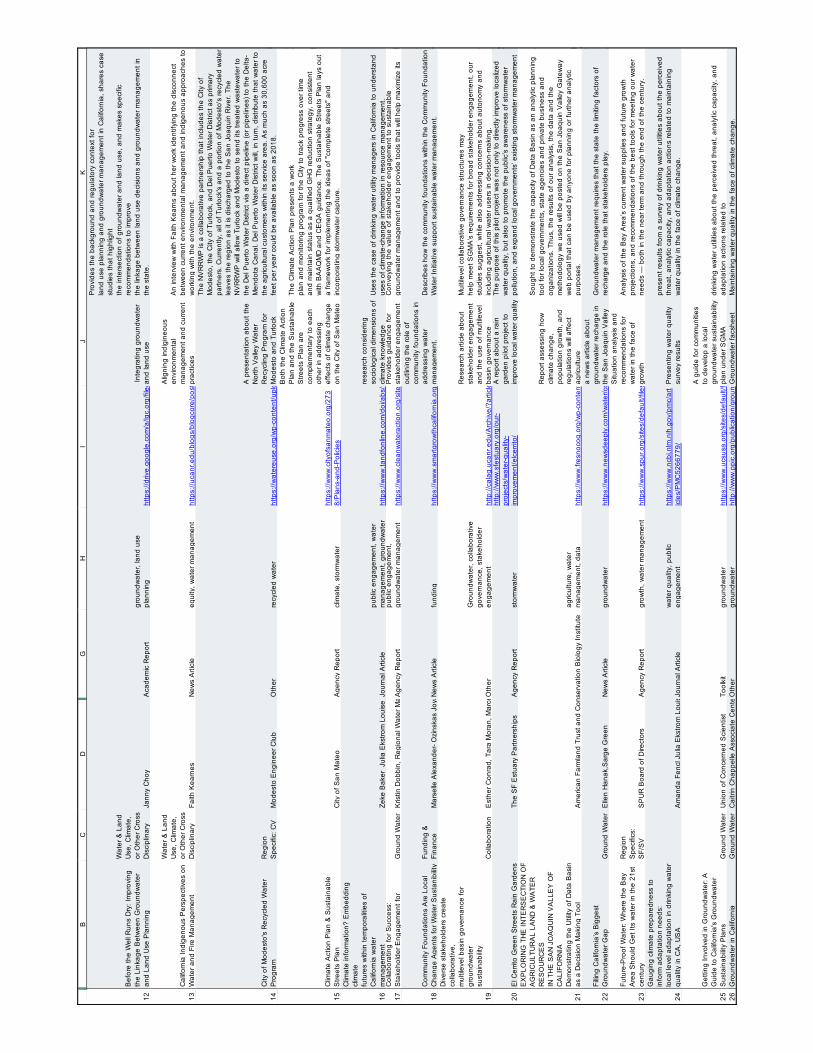
129
Appendix H - Resources Database & Literature Cited
12 13 14 15 16 17 18 19 20 21 22 23 24 25 26
BC
DG
HI
JK
Bef
ore
the
Wel
l Run
s D
ry: I
mpr
ovin
g th
e Li
nkag
e B
etw
een
Gro
undw
ater
an
d La
nd U
se P
lann
ing
Wat
er &
Lan
d U
se, C
limat
e,
or O
ther
Cro
ss
Dis
cipl
inar
y Ja
nny
Cho
y A
cade
mic
Rep
ort
grou
ndw
ater
, lan
d us
e pl
anni
ng
http
s://d
rive.
goog
le.c
om/a
/lgc.
org/
file/
d/1Y
Lcy8
y3U
veP
aduo
lqei
QJy
_FV
yqjP
qZr/v
iew
?usp
=sha
ring
Inte
grat
ing
grou
ndw
ater
an
d la
nd u
se
Pro
vide
s th
e ba
ckgr
ound
and
regu
lato
ry c
onte
xt fo
rla
nd u
se p
lann
ing
and
grou
ndw
ater
man
agem
ent i
n C
alifo
rnia
, sha
res
case
st
udie
s th
at h
ighl
ight
the
inte
rsec
tion
of g
roun
dwat
er a
nd la
nd u
se, a
nd m
akes
spe
cific
re
com
men
datio
ns to
impr
ove
the
linka
ge b
etw
een
land
use
dec
isio
ns a
nd g
roun
dwat
er m
anag
emen
t in
the
stat
e.
Cal
iforn
ia In
dige
nous
Per
spec
tives
on
Wat
er a
nd F
ire M
anag
emen
t
Wat
er &
Lan
d U
se, C
limat
e,
or O
ther
Cro
ss
Dis
cipl
inar
y Fa
ith K
earn
esN
ews
Arti
cle
equi
ty, w
ater
man
agem
ent
http
s://u
canr
.edu
/blo
gs/b
logc
ore/
post
deta
il.cf
m?p
ostn
um=2
6710
Alig
ning
indi
gine
ous
envi
ronm
enta
l m
anag
emen
t and
cur
rent
pr
actic
es
An
inte
rvie
w w
ith F
aith
Kea
rns
abou
t her
wor
k id
entif
ying
the
disc
onne
ct
betw
een
curre
nt e
nviro
nmen
tal m
anag
emen
t and
indi
geno
us a
ppro
ache
s to
w
orki
ng w
ith th
e en
viro
nmen
t.
City
of M
odes
to's
Rec
ycle
d W
ater
P
rogr
amR
egio
n S
peci
fic: C
VM
odes
to E
ngin
eer C
lub
Oth
erre
cycl
ed w
ater
http
s://w
ater
euse
.org
/wp-
cont
ent/u
ploa
ds/2
016/
09/N
VR
RP
-Pre
sent
atio
n.pd
f
A p
rese
ntat
ion
abou
t the
N
orth
Val
ley
Wat
er
Rec
yclin
g P
rogr
am fo
r M
odes
to a
nd T
urlo
ck
The
NV
RR
WP
is a
col
labo
rativ
e pa
rtner
ship
that
incl
udes
the
City
of
Mod
esto
, the
City
of T
urlo
ck, a
nd D
el P
uerto
Wat
er D
istri
ct a
s pr
imar
y pa
rtner
s. C
urre
ntly
, all
of T
urlo
ck's
and
a p
ortio
n of
Mod
esto
's re
cycl
ed w
ater
le
aves
the
regi
on a
s it
is d
isch
arge
d to
the
San
Joa
quin
Riv
er. T
he
NV
RR
WP
will
allo
w T
urlo
ck a
nd M
odes
to to
sen
d its
trea
ted
was
tew
ater
to
the
Del
Pue
rto W
ater
Dis
trict
via
a d
irect
pip
elin
e (o
r pip
elin
es) t
o th
e D
elta
-M
endo
ta C
anal
. Del
Pue
rto W
ater
Dis
trict
will,
in tu
rn, d
istri
bute
that
wat
er to
th
e ag
ricul
tura
l cus
tom
ers
with
in it
s se
rvic
e ar
ea. A
s m
uch
as 3
0,60
0 ac
re
feet
per
yea
r cou
ld b
e av
aila
ble
as s
oon
as 2
018.
Clim
ate
Act
ion
Pla
n &
Sus
tain
able
S
treet
s P
lan
City
of S
an M
ateo
Age
ncy
Rep
ort
clim
ate,
sto
rmw
ater
http
s://w
ww
.city
ofsa
nmat
eo.o
rg/2
738/
Pla
ns-a
nd-P
olic
ies
Bot
h th
e C
limat
e A
ctio
n P
lan
and
the
Sus
tain
able
S
treet
s P
lan
are
com
plem
enta
ry to
eac
h ot
her i
n ad
dres
sing
ef
fect
s of
clim
ate
chan
ge
on th
e C
ity o
f San
Mat
eo
The
Clim
ate
Act
ion
Pla
n pr
esen
ts a
wor
kpl
an a
nd m
onito
ring
prog
ram
for t
he C
ity to
trac
k pr
ogre
ss o
ver t
ime
and
mai
ntai
n st
atus
as
a qu
alifi
ed G
HG
redu
ctio
n st
rate
gy, c
onsi
sten
tw
ith B
AA
QM
D a
nd C
EQ
A g
uida
nce.
The
Sus
tain
able
Stre
ets
Pla
n la
ys o
ut
a fra
mew
ork
for i
mpl
emen
ting
the
idea
s of
"co
mpl
ete
stre
ets"
and
in
corp
orat
ing
stor
mw
ater
cap
ture
. C
limat
e in
form
atio
n? E
mbe
ddin
g cl
imat
efu
ture
s w
ithin
tem
pora
litie
s of
C
alifo
rnia
wat
erm
anag
emen
tZe
ke B
aker
Jul
ia E
kstro
m L
ouis
e B
edsw
orth
Jour
nal A
rticl
epu
blic
eng
agem
ent,
wat
er
man
agem
ent,
grou
ndw
ater
ht
tps:
//ww
w.ta
ndfo
nlin
e.co
m/d
oi/a
bs/1
0.10
80/2
3251
042.
2018
.145
5123
rese
arch
con
side
ring
soci
olog
ical
dim
ensi
ons
of
clim
ate
know
ledg
eU
ses
the
case
of d
rinki
ng w
ater
util
ity m
anag
ers
in C
alifo
rnia
to u
nder
stan
d us
es o
f clim
ate-
chan
ge in
form
atio
n in
reso
urce
man
agem
ent.
Col
labo
ratin
g fo
r Suc
cess
:S
take
hold
er E
ngag
emen
t for
G
roun
d W
ater
K
ristin
Dob
bin,
Reg
iona
l Wat
er M
anag
emen
t Coo
rdin
ator
, Com
mun
ity W
ater
Cen
ter J
enni
fer C
lary
, Wat
er P
rogr
am M
anag
er, C
lean
Wat
er F
und
Laur
el F
irest
one,
Co-
Foun
der a
nd C
o-D
irect
or, C
omm
unity
Wat
er C
ente
r Jul
iet C
hris
tian-
Sm
ith, C
limat
e S
cien
tist,
Uni
on o
f Con
cern
ed S
cien
tists
Age
ncy
Rep
ort
publ
ic e
ngag
emen
t, gr
ound
wat
er m
anag
emen
t ht
tps:
//ww
w.c
lean
wat
erac
tion.
org/
site
s/de
faul
t/file
s/do
cs/p
ublic
atio
ns/S
GM
A_S
take
hold
er_E
ngag
emen
t_W
hite
_Pap
er.p
dfP
rovi
des
guid
ance
for
stak
ehol
der e
ngag
emen
t C
onve
ying
the
valu
e of
sta
keho
lder
eng
agem
ent t
o su
stai
nabl
e gr
ound
wat
er m
anag
emen
t and
to p
rovi
de to
ols
that
will
help
max
imiz
e its
Com
mun
ity F
ound
atio
ns A
re L
ocal
C
hang
e A
gent
s fo
r Wat
er S
usta
nibi
lity
Fund
ing
&
Fina
nce
Mar
selle
Ale
xand
er- O
zins
kas
Joya
Ban
erje
eN
ews
Arti
cle
fund
ing
http
s://w
ww
.sm
artg
row
thca
lifor
nia.
org/
2018
/03/
com
mun
ity-fo
unda
tions
-loca
l-cha
nge-
agen
ts-w
ater
-sus
tain
abilit
y/
outli
ning
the
role
of
com
mun
ity fo
unda
tions
in
addr
essi
ng w
ater
m
anag
emen
t. D
escr
ibes
how
the
com
mun
ity fo
unda
tions
with
in th
e C
omm
unity
Fou
ndat
ion
Wat
er In
itiat
ive
supp
ort s
usta
inab
le w
ater
man
agem
ent.
Div
erse
sta
keho
lder
s cr
eate
co
llabo
rativ
e,m
ultil
evel
bas
in g
over
nanc
e fo
r gr
ound
wat
ersu
stai
nabi
lity
Col
labo
ratio
nE
sthe
r Con
rad,
Tar
a M
oran
, Mar
celle
E. D
uPra
w, D
avid
Cep
pos,
Jan
et M
artin
ez a
nd W
illiam
Blo
mqu
ist
Oth
er
Gro
undw
ater
, col
labo
rativ
e go
vern
ance
, sta
keho
lder
en
gage
men
t ht
tp://
cala
g.uc
anr.e
du/A
rchi
ve/?
artic
le=c
a.20
18a0
002
Res
earc
h ar
ticle
abo
ut
stak
ehol
der e
ngag
emen
t an
d th
e us
e of
mul
tilev
el
basi
n go
vern
ance
Mul
tilev
el c
olla
bora
tive
gove
rnan
ce s
truct
ures
may
help
mee
t SG
MA
’s re
quire
men
ts fo
r bro
ad s
take
hold
er e
ngag
emen
t, ou
rst
udie
s su
gges
t, w
hile
als
o ad
dres
sing
con
cern
s ab
out a
uton
omy
and
incl
udin
g ag
ricul
tura
l wat
er u
sers
in d
ecis
ion-
mak
ing.
El C
errit
o G
reen
Stre
ets
Rai
n G
arde
nsTh
e S
F E
stua
ry P
artn
ersh
ips
Age
ncy
Rep
ort
stor
mw
ater
http
://w
ww
.sfe
stua
ry.o
rg/o
ur-
proj
ects
/wat
er-q
ualit
y-im
prov
emen
t/elc
errit
o/
A re
port
abou
t a ra
in
gard
en p
ilot p
roje
ct to
im
prov
e lo
cal w
ater
qua
lity
The
purp
ose
of th
is p
ilot p
roje
ct w
as n
ot o
nly
to d
irect
ly im
prov
e lo
caliz
ed
wat
er q
ualit
y, b
ut a
lso
to p
rom
ote
the
publ
ic’s
aw
aren
ess
of s
torm
wat
er
pollu
tion,
and
exp
and
loca
l gov
ernm
ents
’ exi
stin
g st
orm
wat
er m
anag
emen
t E
XP
LOR
ING
TH
E IN
TER
SE
CTI
ON
OF
AG
RIC
ULT
UR
AL
LAN
D &
WA
TER
R
ES
OU
RC
ES
IN T
HE
SA
N J
OA
QU
IN V
ALL
EY
OF
CA
LIFO
RN
IAD
emon
stra
ting
the
Util
ity o
f Dat
a B
asin
as
a D
ecis
ion
Mak
ing
Tool
Am
eric
an F
arm
land
Tru
st a
nd C
onse
rvat
ion
Bio
logy
Inst
itute
agric
ultu
re, w
ater
m
anag
emen
t, da
taht
tps:
//ww
w.fr
esno
cog.
org/
wp-
cont
ent/u
ploa
ds/p
ublic
atio
ns/G
reen
prin
t/Aug
ust_
2017
/SJV
_Lan
d-W
ater
_Int
erse
ctio
n_P
relim
inar
y_S
umm
ary_
Rep
ort_
6-14
-17.
Rep
ort a
sses
sing
how
cl
imat
e ch
ange
, po
pula
tion
grow
th, a
nd
regu
latio
ns w
ill af
fect
ag
ricul
ture
Sou
ght t
o de
mon
stra
te th
e ca
paci
ty o
f Dat
a B
asin
as
an a
naly
tic p
lann
ing
tool
for l
ocal
gov
ernm
ents
, sta
te a
genc
ies
and
priv
ate
busi
ness
and
or
gani
zatio
ns. T
hus,
the
resu
lts o
f our
ana
lysi
s, th
e da
ta a
nd th
e m
etho
dolo
gy w
e us
ed w
ill be
pos
ted
on th
e S
an J
oaqu
in V
alle
y G
atew
ay
web
por
tal t
hat c
an b
e us
ed b
y an
yone
for p
lann
ing
or fu
rther
ana
lytic
pu
rpos
es.
Fillin
g C
alifo
rnia
’s B
igge
stG
roun
dwat
er G
apG
roun
d W
ater
E
llen
Han
ak,S
arge
Gre
en
New
s A
rticl
egr
ound
wat
erht
tps:
//ww
w.n
ewsd
eepl
y.co
m/w
ater
/com
mun
ity/2
018/
04/2
6/fil
ling-
calif
orni
as-b
igge
st-g
roun
dwat
er-g
ap
a ne
ws
artic
le a
bout
gr
ound
wat
er re
char
ge in
th
e S
an J
oaqu
in V
alle
y G
roun
dwat
er m
anag
emen
t req
uire
s th
at th
e st
ate
the
limiti
ng fa
ctor
s of
re
char
ge a
nd th
e ro
le th
at s
take
hold
ers
play
.
Futu
re-P
roof
Wat
er: W
here
the
Bay
A
rea
Sho
uld
Get
Its
wat
er in
the
21st
ce
ntur
y
Reg
ion
Spe
cific
s:
SF/
SV
SP
UR
Boa
rd o
f Dire
ctor
sA
genc
y R
epor
tgr
owth
, wat
er m
anag
emen
t ht
tps:
//ww
w.s
pur.o
rg/s
ites/
defa
ult/f
iles/
publ
icat
ions
_pdf
s/S
PU
R_F
utur
e-P
roof
_Wat
er.p
df
Situ
atio
n an
alys
is a
nd
reco
mm
enda
tions
for
wat
er in
the
face
of
grow
th
Ana
lysi
s of
the
Bay
Are
a’s
curre
nt w
ater
sup
plie
s an
d fu
ture
gro
wth
pr
ojec
tions
, and
reco
mm
enda
tions
of t
he b
est t
ools
for m
eetin
g ou
r wat
er
need
s —
bot
h in
the
near
term
and
thro
ugh
the
end
of th
e ce
ntur
y.G
augi
ng c
limat
e pr
epar
edne
ss to
in
form
ada
ptat
ion
need
s:lo
cal l
evel
ada
ptat
ion
in d
rinki
ng w
ater
qu
ality
in C
A, U
SA
Am
anda
Fen
cl J
ulia
Eks
trom
Lou
ise
Bed
swor
thJo
urna
l Arti
cle
wat
er q
ualit
y, p
ublic
en
gage
men
t ht
tps:
//ww
w.n
cbi.n
lm.n
ih.g
ov/p
mc/
art
icle
s/P
MC
5266
779/
Pre
sent
ing
wat
er q
ualit
y su
rvey
resu
lts
pres
ent r
esul
ts fr
om a
sur
vey
of d
rinki
ng w
ater
util
ities
abo
ut th
e pe
rcei
ved
thre
at, a
naly
tic c
apac
ity, a
nd a
dapt
atio
n ac
tions
rela
ted
to m
aint
aini
ng
wat
er q
ualit
y in
the
face
of c
limat
e ch
ange
.
Get
ting
Invo
lved
in G
roun
dwat
er: A
G
uide
to C
alifo
rnia
's G
roun
dwat
er
Sus
tain
abilit
y P
lans
Gro
und
Wat
er
Uni
on o
f Con
cern
ed S
cien
tist
Tool
kit
grou
ndw
ater
http
s://w
ww
.ucs
usa.
org/
site
s/de
faul
t/file
s/at
tach
/201
7/10
/ws-
repo
rt-C
Ato
olki
t-en.
A g
uide
for c
omm
uniti
es
to d
evel
op a
loca
l gr
ound
wat
er s
usta
inab
ility
plan
und
er S
GM
Adr
inki
ng w
ater
util
ities
abo
ut th
e pe
rcei
ved
thre
at, a
naly
tic c
apac
ity, a
nd
adap
tatio
n ac
tions
rela
ted
toG
roun
dwat
er in
Cal
iforn
iaG
roun
d W
ater
C
aitri
n C
happ
elle
Ass
ocia
te C
ente
r Dire
ctor
Elle
n H
anak
Cen
ter D
irect
or a
nd S
enio
r Fel
low
Oth
ergr
ound
wat
erht
tp://
ww
w.p
pic.
org/
publ
icat
ion/
grou
ndw
ater
-in-c
alifo
rnia
/G
roun
dwat
er fa
cshe
etM
aint
aini
ng w
ater
qua
lity
in th
e fa
ce o
f clim
ate
chan
ge.

130
Appendix H - Resources Database & Literature Cited
27 28 29 30 31 32 33 34 35 36 37 38 39 40
BC
DG
HI
JK
Gro
win
g W
ater
Sm
art W
orks
hop
Wat
er &
Lan
d U
se, C
limat
e,
or O
ther
Cro
ss
Dis
cipl
inar
y Li
ncol
n In
stitu
te o
f Lan
d P
olic
y an
d S
onor
an In
stitu
te,
Oth
erw
ater
, lan
d us
e pl
anni
ng
http
s://d
rive.
goog
le.c
om/fi
le/d
/1B
iTa9
zY5t
j9K
nDM
TrW
FwvK
5fS
5nlW
CZN
/vie
w
wat
er a
nd la
nd u
se
wor
ksho
p ev
alua
tion
mem
oE
valu
atio
n of
a w
orks
hop
held
to in
trodu
ce c
omm
uniti
es to
the
conc
ept o
f in
tegr
atin
g w
ater
and
land
use
pla
nnin
g.
Gro
win
g W
ater
Sm
art:
Res
ilient
C
omm
uniti
es a
nd W
ater
shed
s
Wat
er &
Lan
d U
se, C
limat
e,
or O
ther
Cro
ss
Dis
cipl
inar
y Je
rem
y S
tapl
eton
Oth
erw
ater
shed
s, la
nd u
se
plan
ning
ht
tps:
//res
ilient
wes
t.org
/wp-
cont
ent/u
ploa
ds/G
row
ingW
ater
Sm
art_
2018
_RFP
_Fin
al_O
nlin
eVer
sion
wat
er a
nd la
nd u
se
wor
ksho
p fly
er
Pro
mot
ing
a w
orks
hop
held
to in
trodu
ce c
omm
uniti
es to
the
conc
ept o
f in
tegr
atin
g w
ater
and
land
use
pla
nnin
g.
Gui
de to
Com
mun
ity D
rinki
ng W
ater
Adv
ocac
yE
quity
Laur
el F
irest
one
Tool
kit
Drin
king
wat
er, c
omm
unity
en
gage
men
tht
tps:
//d3n
8a8p
ro7v
hmx.
clou
dfro
nt.n
et/c
omm
unity
wat
erce
nter
/pag
es/5
6/at
tach
men
ts/o
rigin
al/1
3943
9897
4/C
WC
_Com
mun
ity-G
uide
_Eng
_Fin
al.p
df?1
3943
9897
4
A le
gal r
efer
ence
s an
d co
mm
unity
hea
lth g
uide
to
addr
ess
a va
riety
of
chal
lleng
es fa
ces
by
com
mun
ities
in re
latio
n to
dr
inki
ng w
ater
The
Gui
de to
Com
mun
ity D
rinki
ng W
ater
Adv
ocac
y br
ings
the
Com
mun
ity
Wat
er C
ente
r’s e
xper
tise,
tool
s, a
nd e
xper
ienc
es to
all
com
mun
ities
st
rugg
ling
for w
ater
just
ice.
Thi
s gu
ide
has
been
car
eful
ly d
esig
ned
with
co
mm
uniti
es a
nd n
on-p
rofit
org
aniz
atio
ns in
min
d so
the
hand
outs
, te
mpl
ates
, or s
ampl
es c
an b
e ea
sily
repr
inte
d an
d di
strib
uted
.H
ow C
alifo
rnia
Wat
er M
anag
ers
Thin
king
Abo
ut C
limat
e C
hang
e ?
It de
pend
Faith
Kea
rns
New
s A
rticl
e
wat
er m
anag
emen
t, m
inds
et/c
once
ptua
l un
ders
tand
ing
http
s://u
canr
.edu
/blo
gs/b
logc
ore/
post
deta
il.cf
m?p
ostn
um=2
6794
Ass
essi
ng p
erce
ptio
ns o
f cl
imat
e ch
ange
am
ong
wat
er m
anag
ers
Look
ing
parti
cula
rly a
t man
ager
s of
rura
l wat
er s
yste
ms
and
thei
r pe
rcep
tions
of c
limat
e sc
ienc
e.
Impl
emen
ting
the
Hum
an R
ight
to
Wat
er in
Cal
iforn
ia's
Cen
tral V
alle
y:
Bui
ldin
g a
Dem
ocra
tic V
oice
Thr
ough
C
omm
iuni
ty E
gage
men
t in
Wat
er
Pol
icy
Dec
isio
n M
akin
g E
quity
R
ose
Fran
cis
& L
aure
l Fire
ston
e O
ther
equi
ty, w
ater
affo
rdab
ility,
co
mm
unity
eng
agem
ent
http
s://d
3n8a
8pro
7vhm
x.cl
oudf
ront
.net
/com
mun
ityw
ater
cent
er/p
ages
/57/
atta
chm
ents
/orig
inal
/139
4394
957/
CW
C-L
aw-R
evie
w-A
rticl
e-on
-Impl
emen
ting-
Hum
an-R
ight
-to-W
ater
-in-C
A.p
df?1
3943
9495
7D
iscu
ssio
n of
the
Hum
an
Rig
ht to
Wat
er B
ill
Dev
elop
ing
an a
ppro
ach
to th
e im
plem
entin
g th
e H
uman
Rig
ht to
Wat
er b
y id
entif
ying
four
key
ingr
edie
nts:
phy
sica
l inf
rast
ruct
ure,
sou
rce
wat
er p
rote
ctio
ns,
inst
itutio
nal c
apac
ity, a
nd c
omm
unity
pow
er.
Impr
ove
Wat
er Q
ualit
y in
Rur
alIm
mig
rant
Com
mun
ities
Wat
er Q
ualit
y C
ente
r for
Pol
icy
Res
earc
hO
ther
equi
ty, w
ater
qua
lity
http
s://p
over
ty.u
cdav
is.e
du/s
ites/
mai
n/fil
es/fi
le-a
ttach
men
ts/c
pr_b
rief-
frenc
h_w
ater
_pol
icy.
A p
olic
y br
ief a
bout
the
lack
of a
dequ
ate
drin
king
w
ater
in ru
ral c
omm
uniti
es
and
its re
latio
nshi
p w
ith
cons
umpt
ion
of s
ugar
y be
vera
ges.
With
obe
sity
affe
ctin
g ov
er a
third
of t
he U
.S. p
opul
atio
n, p
ublic
hea
lth
advo
cate
s—in
clud
ing
first
lady
Mic
helle
Oba
ma—
have
cal
led
to “d
rink
up” o
n w
ater
in
stea
d of
sug
ary
beve
rage
s. N
ew w
ork,
sup
porte
d by
the
Cen
ter f
or P
over
ty R
esea
rch,
find
s th
at lo
w-q
ualit
ydr
inki
ng w
ater
is a
pot
entia
l bar
rier t
o re
duci
ng th
e co
nsum
ptio
n of
sug
ar-
swee
tene
d be
vera
ges
in h
igh-
pove
rty ru
ral i
mm
igra
nt c
omm
uniti
es.
Inte
grat
ed L
and
Use
and
Wat
er
Res
ourc
es: P
lann
ing
to S
uppo
rt W
ater
S
uppl
y D
iver
sific
atio
n
Wat
er &
Lan
d U
se, C
limat
e,
or O
ther
Cro
ss
Dis
cipl
inar
y W
RF
Pro
ject
#46
23 (2
016)
Oth
erw
ater
sup
ply,
pla
nnin
g
http
://w
ww
.wat
errf.
org/
reso
urce
s/Li
sts/
Pub
licP
roje
ctP
aper
s/A
ttach
men
ts/
48/P
roje
ctP
aper
-462
3-1.
Lit r
evie
w s
umm
ary
of
reso
urce
s de
alin
g w
ith
wat
er a
nd la
nd u
se
inte
grat
ion
The
ultim
ate
aim
of t
his
rese
arch
is to
dev
elop
a c
ompr
ehen
sive
sum
mar
y of
th
e re
sear
ch fi
ndin
gs a
s w
ell a
s a
colle
ctio
n of
gui
des
and
reso
urce
s th
at
can
be u
sed
dire
ctly
by
the
wat
er u
tility
, lan
d us
e, a
nd d
evel
opm
ent
com
mun
ities
to p
rom
ote
supp
ly d
iver
sific
atio
n an
d de
man
d m
anag
emen
t, w
ith a
geo
grap
hic
com
pone
nt th
at e
mph
asiz
es k
ey c
onsi
dera
tions
by
regi
on.
Inte
grat
ing
Wat
er M
anag
emen
t and
La
nd U
se P
lann
ing:
U
ncov
erin
g th
e M
issi
ng L
ink
in th
e P
rote
ctio
n of
Flo
rida'
s W
ater
R
esou
rces
Wat
er &
Lan
d U
se, C
limat
e,
or O
ther
Cro
ss
Dis
cipl
inar
y A
ngel
o, M
. J.
Jour
nal A
rticl
ew
ater
sup
ply,
land
use
pl
anni
ng
http
s://s
chol
arsh
ip.la
w.u
fl.ed
u/cg
i/vie
wco
nten
t.cgi
?arti
cle=
1108
&co
ntex
t=fa
culty
pub
Uni
vers
ity o
f Flo
rida
Levi
n C
olle
ge o
f Law
, jou
rnal
ar
ticle
abo
ut in
tegr
atio
n
Exc
ept f
or li
mite
d pr
ovis
ions
, Flo
rida
law
doe
s no
t est
ablis
h a
form
al li
nk
betw
een
land
pla
nnin
g an
d w
ater
pla
nnin
g. In
ligh
t of t
he im
porta
nce
of
wat
er re
sour
ces
for t
he fu
ture
dev
elop
men
t of t
he S
tate
, thi
s is
a s
igni
fican
t "m
issi
ng li
nk."
Lan
d us
e pl
anne
rs a
nd w
ater
man
ager
s liv
e in
ver
y di
ffere
nt
wor
lds
and
spea
k ve
ry d
iffer
ent l
angu
ages
. Wat
er m
anag
ers
poin
t to
poor
pl
anni
ng a
s th
e ca
use
of e
nviro
nmen
tally
inap
prop
riate
dev
elop
men
t, an
d pl
anne
rs p
oint
to th
e sh
ortc
omin
gs o
f wat
er m
anag
emen
t reg
ulat
ory
prog
ram
s as
the
caus
e of
env
ironm
enta
l woe
s.
LA C
limat
e A
ctio
n P
lan
LAR
CA
genc
y R
epor
tcl
imat
e, w
ater
http
://cl
imat
eact
ion.
la/w
ater
/
guid
ance
to c
limat
e-re
silie
nce
in th
e Lo
s A
ngel
es re
gion
LAR
C d
evel
oped
this
doc
umen
t, ca
lled
the
“Fra
mew
ork,
” to
help
regi
onal
le
ader
s id
entif
y th
e m
ost
prom
isin
g su
ite o
f mea
sure
s av
aila
ble
to re
duce
em
issi
ons
and
deve
lop
a m
ore
clim
ate-
resi
lient
regi
on.
Lega
l Ris
k A
naly
sis
for S
ea L
evel
Ris
eA
dapt
atio
n S
trate
gies
in S
an D
iego
: E
xecu
tive
Sum
mar
y
Reg
ion
Spe
cific
s: S
an
Die
go
Env
ironm
enta
l Law
Inst
itute
Age
ncy
Rep
ort
Sea
leve
l ris
e, lo
cal
gove
rnm
ent p
lann
ing
http
s://w
ww
.eli.
org/
site
s/de
faul
t/file
s/el
i-pub
s/ex
ecut
ive-
sum
mar
y-le
gal-
risk-
anal
ysis
-sea
-leve
l-ris
e-ad
apta
tion-
stra
tegi
es-s
an-d
iego
Add
ress
ing
the
risk
of
actio
n vs
inac
tion
in
rega
rds
to s
ea le
vel r
ise
Ana
lyzi
ng th
e le
gal r
isk
of s
ever
al s
ea le
vel r
ise
adap
tatio
n st
rate
gies
in
clud
ing
beac
h no
uris
hmen
t, du
ne re
stor
atio
n &
enh
ance
men
t, of
fsho
re
prot
ectio
ns, h
ard
arm
orin
g, a
nd z
onin
g/la
nd u
se
Link
ing
Wat
er, E
quity
, and
Sm
art
Gro
wth
in L
os A
ngel
es
Reg
ion
Spe
cific
sR
on M
ilam
Jour
nal A
rticl
eW
ater
, equ
ity, s
mar
t gro
wth
http
s://w
ww
.fund
ersn
etw
ork.
org/
linki
ng-w
ater
-equ
ity-a
nd-s
mar
t-gro
wth
-in-lo
s-an
gele
s/
the
inte
rsec
tion
of w
ater
, eq
uity
,an
d sm
art g
row
th-re
late
d is
sues
.in
sigh
ts o
n w
ater
-rela
ted
issu
es in
Los
Ang
eles
Cou
nty
that
affe
ct p
eopl
e,sp
ecifi
cally
in lo
w-in
com
e co
mm
uniti
es o
f col
or.
List
enin
g to
com
mun
ities
: A b
otto
m-u
p ap
proa
ch to
wat
er p
lann
ing
in
Cal
iforn
iaP
lann
ing
Faith
Kea
rns
New
s A
rticl
eeq
uity
, wat
er m
anag
emen
t ht
tps:
//uca
nr.e
du/b
logs
/blo
gcor
e/po
stde
tail.
cfm
?pos
tnum
=271
31
Eth
nogr
aphi
c ap
proa
ch to
w
ater
man
agem
ent i
n th
e S
anta
Ana
wat
ersh
ed
Val
erie
Ols
on, a
ssis
tant
pro
fess
or, a
nd E
mily
Bro
oks,
pos
t-doc
tora
l re
sear
cher
, are
env
ironm
enta
l ant
hrop
olog
ists
at U
C Ir
vine
. The
y ha
ve a
ne
w p
roje
ct a
imed
at g
ettin
g a
bette
r und
erst
andi
ng o
f how
com
mun
ities
, pa
rticu
larly
the
unde
rser
ved,
thin
k ab
out a
nd u
se th
eir w
ater
, and
how
the
agen
cies
that
pro
vide
wat
er c
an b
ette
r ser
ve th
em.
Mak
ing
An
Eco
nom
ic C
ase
for L
ocal
w
ater
in L
A C
ount
y :N
ew re
sear
ch
show
s fin
anci
al b
enef
its o
f usi
ng
sour
ces
such
as
grou
ndw
ater
Reg
ion
Spe
cific
s: L
os
Ang
eles
Chr
is Y
arza
b/ F
lickr
New
s A
rticl
eec
onom
ics,
wat
er
man
agem
ent,
wat
er s
uppl
y ht
tp://
new
sroo
m.u
cla.
edu/
rele
ases
/mak
ing-
an-e
cono
mic
-cas
e-fo
r-loc
al-w
ater
-in-l-
a-co
unty
UC
LA re
sear
ch a
bout
the
econ
omic
s of
loca
l wat
er
supp
lyN
ew re
sear
ch s
how
s fin
anci
al b
enef
its o
f usi
ng lo
cal s
ourc
es s
uch
as
grou
ndw
ater
and
recy
cled
wat
er
Man
agin
g D
roug
hts
PP
IC W
ater
Pol
icy
Cen
ter
Age
ncy
Rep
ort
Dro
ught
, wat
er m
anag
emen
t ht
tp://
ww
w.p
pic.
org/
cont
ent/p
ubs/
repo
rt/R
_101
6JM
2R.p
df
Cal
iforn
ia m
ust k
eep
impr
ovin
g its
abi
lity
to
wea
ther
dro
ught
s
This
brie
f des
crib
es th
e m
ajor
effe
cts
of d
roug
ht, a
nd o
utlin
es a
dapt
atio
n st
rate
gies
to m
anag
e th
em.
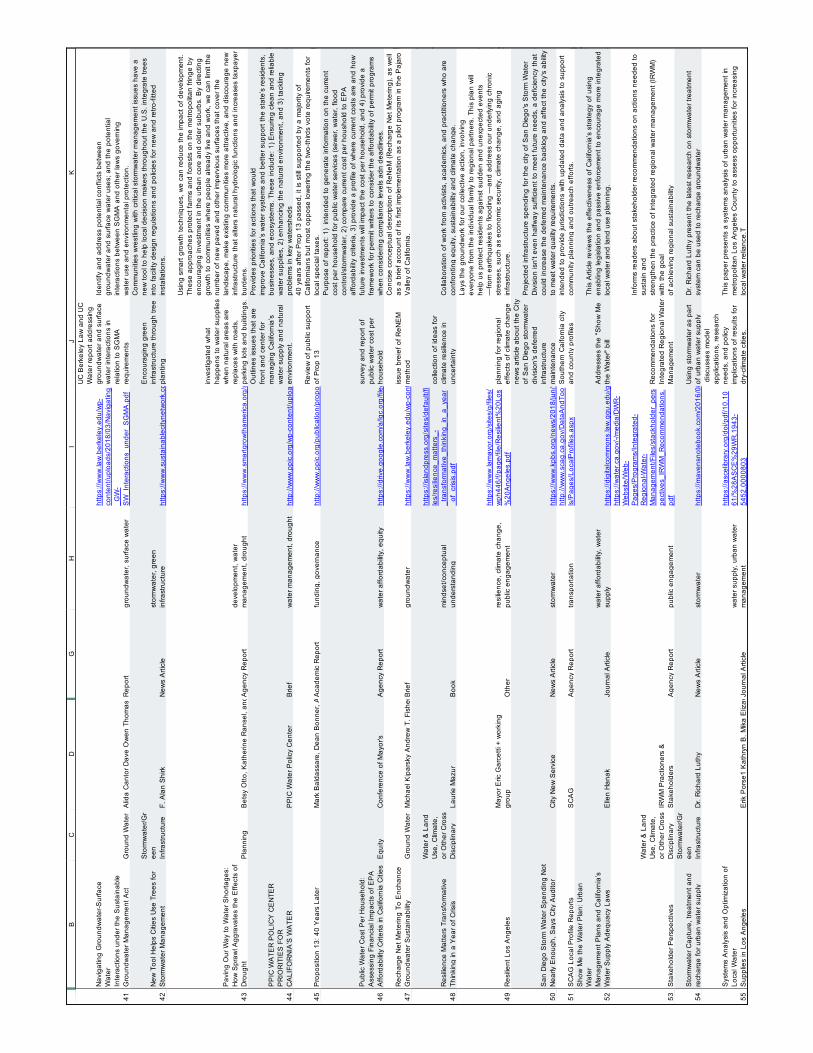
131
Appendix H - Resources Database & Literature Cited
41 42 43 44 45 46 47 48 49 50 51 52 53 54 55
BC
DG
HI
JK
Nav
igat
ing
Gro
undw
ater
-Sur
face
W
ater
Inte
ract
ions
und
er th
e S
usta
inab
leG
roun
dwat
er M
anag
emen
t Act
Gro
und
Wat
er
Alid
a C
anto
r Dav
e O
wen
Tho
mas
Har
ter N
ell G
reen
Nyl
en M
icha
el K
ipar
sky
Rep
ort
grou
ndw
ater
, sur
face
wat
er
http
s://w
ww
.law
.ber
kele
y.ed
u/w
p-co
nten
t/upl
oads
/201
8/03
/Nav
igat
ing
_GW
-S
W_I
nter
actio
ns_u
nder
_SG
MA
UC
Ber
kele
y La
w a
nd U
C
Wat
er re
port
addr
essi
ng
grou
ndw
ater
and
sur
face
w
ater
inte
ract
ions
in
rela
tion
to S
GM
A
requ
irem
ents
Iden
tify
and
addr
ess
pote
ntia
l con
flict
s be
twee
ngr
ound
wat
er a
nd s
urfa
ce w
ater
use
s; a
nd th
e po
tent
ial
inte
ract
ions
bet
wee
n S
GM
A a
nd o
ther
law
s go
vern
ing
wat
er u
se a
nd e
nviro
nmen
tal p
rote
ctio
n.
New
Too
l Hel
ps C
ities
Use
Tre
es fo
r S
torm
wat
er M
anag
emen
t
Sto
rmw
ater
/Gr
een
Infra
stru
ctur
eF.
Ala
n S
hirk
N
ews
Arti
cle
stor
mw
ater
, gre
en
infra
stru
ctur
e ht
tps:
//ww
w.s
usta
inab
leci
tyne
twor
k.co
m/to
pic_
chan
nels
/pub
lic_w
orks
/arti
cle_
0b67
8b32
-11c
5-11
e8-a
e35-
af57
266e
8238
.htm
l
Enc
oura
ging
gre
en
infra
stru
ctur
e th
roug
h tre
e pl
antin
g
Com
mun
ities
wre
stlin
g w
ith c
ritic
al s
torm
wat
er m
anag
emen
t iss
ues
have
a
new
tool
to h
elp
loca
l dec
isio
n m
aker
s th
roug
hout
the
U.S
. int
egra
te tr
ees
into
faci
lity
desi
gn re
gula
tions
and
pol
icie
s fo
r new
and
retro
-fitte
d in
stal
latio
ns.
Pav
ing
Our
Way
to W
ater
Sho
rtage
s:H
ow S
praw
l Agg
rava
tes
the
Effe
cts
of
Dro
ught
Pla
nnin
gB
etsy
Otto
, Kat
herin
e R
anse
l, an
d Ja
son
Todd
, Am
eric
an R
iver
s D
eron
Lov
aas
and
Han
nah
Stu
tzm
an, N
atur
al R
esou
rces
Def
ense
Cou
ncil
Joh
n B
aile
y, S
mar
t Gro
wth
Am
eric
aA
genc
y R
epor
tde
velo
pmen
t, w
ater
m
anag
emen
t, dr
ough
tht
tps:
//ww
w.s
mar
tgro
wth
amer
ica.
org/
app/
lega
cy/d
ocum
ents
/Dro
ught
Spr
awlR
epor
t09.
inve
stig
ated
wha
t ha
ppen
s to
wat
er s
uppl
ies
whe
n na
tura
l are
as a
re
repl
aces
with
road
s,
park
ing
lots
and
bui
ldin
gs.
Usi
ng s
mar
t gro
wth
tech
niqu
es, w
e ca
n re
duce
the
impa
ct o
f dev
elop
men
t.Th
ese
appr
oach
es p
rote
ct fa
rms
and
fore
sts
on th
e m
etro
polit
an fr
inge
by
enco
urag
ing
inve
stm
ent i
n th
e ur
ban
core
and
old
er s
ubur
bs. B
y di
rect
ing
grow
th to
com
mun
ities
whe
re p
eopl
e al
read
y liv
e an
d w
ork,
we
can
limit
the
num
ber o
f new
pav
ed a
nd o
ther
impe
rvio
us s
urfa
ces
that
cov
er th
e la
ndsc
ape,
mak
e ex
istin
g co
mm
uniti
es m
ore
attra
ctiv
e, a
nd d
isco
urag
e ne
w
infra
stru
ctur
e th
at a
lters
nat
ural
hyd
rolo
gic
func
tions
and
incr
ease
s ta
xpay
er
burd
ens.
PP
IC W
ATE
R P
OLI
CY
CE
NTE
RP
RIO
RIT
IES
FO
RC
ALI
FOR
NIA
’S W
ATE
RP
PIC
Wat
er P
olic
y C
ente
r B
rief
wat
er m
anag
emen
t, dr
ough
tht
tp://
ww
w.p
pic.
org/
wp-
cont
ent/u
ploa
ds/r_
1017
ehr.p
df
Out
lines
issu
es th
at a
re
front
and
cen
ter f
or
man
agin
g C
alifo
rnia
’s
wat
er s
uppl
y an
d na
tura
l en
viro
nmen
t.
Pro
vide
s pr
iorit
ies
for a
ctio
ns th
at w
ould
impr
ove
Cal
iforn
ia’s
wat
er s
yste
ms
and
bette
r sup
port
the
stat
e’s
resi
dent
s,
busi
ness
es, a
nd e
cosy
stem
s. T
hese
incl
ude:
1) E
nsur
ing
clea
n an
d re
liabl
e w
ater
sup
plie
s, 2
) enh
anci
ng th
e na
tura
l env
ironm
ent,
and
3) ta
cklin
g pr
oble
ms
in k
ey w
ater
shed
s
Pro
posi
tion
13: 4
0 Y
ears
Lat
erM
ark
Bal
dass
are,
Dea
n B
onne
r, A
lyss
a D
ykm
an, L
unna
Lop
esA
cade
mic
Rep
ort
fund
ing,
gov
erna
nce
http
://w
ww
.ppi
c.or
g/pu
blic
atio
n/pr
opos
ition
-13-
40-y
ears
-late
r/R
evie
w o
f pub
lic s
uppo
rt of
Pro
p 13
40 y
ears
afte
r Pro
p 13
pas
sed,
it is
stil
l sup
porte
d by
a m
ajor
ity o
f C
alifo
rnia
ns b
ut m
ost o
ppos
e lo
wer
ing
the
two-
third
s vo
te re
quire
men
ts fo
r lo
cal s
peci
al ta
xes.
Pub
lic W
ater
Cos
t Per
Hou
seho
ld:
Ass
essi
ng F
inan
cial
Impa
cts
of E
PA
Affo
rdab
ility
Crit
eria
in C
alifo
rnia
Citi
esE
quity
C
onfe
renc
e of
May
or's
Age
ncy
Rep
ort
wat
er a
fford
abilit
y, e
quity
ht
tps:
//driv
e.go
ogle
.com
/a/lg
c.or
g/fil
e/d/
19x7
Ep8
ZdU
wC
tXH
BtiE
3vvw
bAfv
r-lK
mh/
view
?usp
=sha
ring
surv
ey a
nd re
port
of
publ
ic w
ater
cos
t per
ho
useh
old
Pur
pose
of r
epor
t: 1)
int
ende
d to
gen
erat
e in
form
atio
n on
the
curre
ntco
st p
er h
ouse
hold
for p
ublic
wat
er s
ervi
ces
(sew
er, w
ater
, flo
od
cont
rol/s
torm
wat
er, 2
) com
pare
cur
rent
cos
t per
hou
shol
d to
EP
A
affo
rdab
ility
crite
ria, 3
) pro
vide
a p
rofil
e of
whe
re c
urre
nt c
osts
are
and
how
fu
ture
inve
stm
ents
will
impa
ct th
e co
st p
er h
ouse
hold
, and
4) p
rovi
de a
fra
mew
ork
for p
erm
it w
riter
s to
con
side
r the
affo
rdab
ility
of p
erm
it pr
ogra
ms
whe
n co
nsid
erin
g co
mpl
ianc
e le
vels
adn
dea
dlin
es.
Rec
harg
e N
et M
eter
ing
To E
ncha
nce
Gro
undw
ater
Sus
tain
abilit
yG
roun
d W
ater
M
icha
el K
ipar
sky
And
rew
T. F
ishe
r W. M
icha
el H
anem
ann
John
Bow
ie R
ose
Kan
tor C
hris
Cob
urn
Bria
n Lo
ckw
ood
Brie
fgr
ound
wat
er
http
s://w
ww
.law
.ber
kele
y.ed
u/w
p-co
nten
t/upl
oads
/201
8/04
/CLE
E_R
eNeM
_Iss
ueB
rief.p
dfis
sue
brei
ef o
f ReN
EM
m
etho
d
Con
cise
con
cept
ual d
escr
iptio
n of
ReN
eM (R
echa
rge
Net
Met
erin
g), a
s w
ell
as a
brie
f acc
ount
of i
ts fi
rst i
mpl
emen
tatio
n as
a p
ilot p
rogr
am in
the
Paj
aro
Val
ley
of C
alifo
rnia
.
Res
ilienc
e M
atte
rs T
rans
form
ativ
e Th
inki
ng in
a Y
ear o
f Cris
is
Wat
er &
Lan
d U
se, C
limat
e,
or O
ther
Cro
ss
Dis
cipl
inar
y La
urie
Maz
urB
ook
min
dset
/con
cept
ual
unde
rsta
ndin
g
http
s://i
slan
dpre
ss.o
rg/s
ites/
defa
ult/f
ile
s/re
silie
nce_
mat
ters
_-_t
rans
form
ativ
e_th
inki
ng_i
n_a_
year
_of_
cris
is.p
df
colle
ctio
n of
idea
s fo
r cl
imat
e re
silie
nce
in
unce
rtain
tyC
olla
bora
tion
of w
ork
from
act
ivis
ts, a
cade
mic
s, a
nd p
ract
ition
ers
who
are
co
nfro
ntin
g eq
uity
, sus
tain
abilit
y an
d cl
imat
e ch
ange
.
Res
ilient
Los
Ang
eles
May
or E
ric G
arce
tti +
wor
king
gr
oup
Oth
erre
silie
nce,
clim
ate
chan
ge,
publ
ic e
ngag
emen
t
http
s://w
ww
.lam
ayor
.org
/site
s/g/
files
/w
ph44
6/f/p
age/
file/
Res
ilient
%20
Los
%20
Ang
eles
plan
ning
for r
egio
nal
effe
cts
of c
limat
e ch
ange
Lays
the
grou
ndw
ork
for o
ur c
olle
ctiv
e ac
tion,
invo
lvin
gev
eryo
ne fr
om th
e in
divi
dual
fam
ily to
regi
onal
par
tner
s. T
his
plan
will
help
us
prot
ect r
esid
ents
aga
inst
sud
den
and
unex
pect
ed e
vent
s—
from
ear
thqu
akes
to fl
oodi
ng —
and
addr
ess
our u
nder
lyin
g ch
roni
c st
ress
es, s
uch
as e
cono
mic
sec
urity
, clim
ate
chan
ge, a
nd a
ging
in
frast
ruct
ure.
San
Die
go S
torm
Wat
er S
pend
ing
Not
N
early
Eno
ugh,
Say
s C
ity A
udito
rC
ity N
ew S
ervi
ceN
ews
Arti
cle
stor
mw
ater
http
s://w
ww
.kpb
s.or
g/ne
ws/
2018
/jun/
14/s
an-d
iego
-sto
rm-w
ater
-spe
ndin
g-no
t-nea
rly-e
noug
h-s/
new
s ar
ticle
abo
ut th
e C
ity
of S
an D
iego
sto
rmw
ater
di
visi
on's
def
erre
d in
frast
ruct
ure
mai
nten
ance
Pro
ject
ed in
frast
ruct
ure
spen
ding
for t
he c
ity o
f San
Die
go's
Sto
rm W
ater
D
ivis
ion
isn'
t eve
n ha
lfway
suf
ficie
nt to
mee
t fut
ure
need
s, a
def
icie
ncy
that
co
uld
incr
ease
the
defe
rred
mai
nten
ance
bac
klog
and
affe
ct th
e ci
ty's
abi
lity
to m
eet w
ater
qua
lity
requ
irem
ents
.
SC
AG
Loc
al P
rofil
e R
epor
tsS
CA
GA
genc
y R
epor
ttra
nspo
rtatio
nht
tp://
ww
w.s
cag.
ca.g
ov/D
ataA
ndTo
ols
/Pag
es/L
ocal
Pro
files
.asp
xS
outh
ern
Cai
forn
ia c
ity
and
coun
ty p
rofil
es
inte
nded
to p
rovi
de ju
risdi
ctio
ns w
ith u
pdat
ed d
ata
and
anal
ysis
to s
uppo
rt co
mm
unity
pla
nnin
g an
d ou
treac
h ef
forts
. S
how
Me
the
Wat
er P
lan:
Urb
an
Wat
erM
anag
emen
t Pla
ns a
nd C
alifo
rnia
’s
Wat
er S
uppl
y A
dequ
acy
Law
sE
llen
Han
ak
Jour
nal A
rticl
ew
ater
affo
rdab
ility,
wat
er
supp
lyht
tps:
//dig
italc
omm
ons.
law
.ggu
.edu
/ggu
elj/v
ol4/
iss1
/5/
Add
ress
es th
e "S
how
Me
the
Wat
er"
bill
This
Arti
cle
revi
ews
the
effe
ctiv
enes
s of
Cal
iforn
ia’s
stra
tegy
of u
sing
en
ablin
g le
gisl
atio
n an
d pa
ssiv
e en
forc
emen
t to
enco
urag
e m
ore
inte
grat
ed
loca
l wat
er a
nd la
nd u
se p
lann
ing.
Sta
keho
lder
Per
spec
tives
Wat
er &
Lan
d U
se, C
limat
e,
or O
ther
Cro
ss
Dis
cipl
inar
y IR
WM
Pra
ctio
ners
&
Sta
keho
lder
sA
genc
y R
epor
tpu
blic
eng
agem
ent
http
s://w
ater
.ca.
gov/
-/med
ia/D
WR
-W
ebsi
te/W
eb-
Pag
es/P
rogr
ams/
Inte
grat
ed-
Reg
iona
l-Wat
er-
Man
agem
ent/F
iles/
stac
khol
der_
pers
pect
ives
_IR
WM
_Rec
omm
enda
tions
.pd
f
Rec
omm
enda
tions
for
Inte
grat
ed R
egio
nal W
ater
M
anag
emen
t
Info
rms
read
ers
abou
t sta
keho
lder
reco
mm
enda
tions
on
actio
ns n
eede
d to
su
stai
n an
dst
reng
then
the
prac
tice
of in
tegr
ated
regi
onal
wat
er m
anag
emen
t (IR
WM
) w
ith th
e go
alof
ach
ievi
ng re
gion
al s
usta
inab
ility
Sto
rmw
ater
Cap
ture
, tre
atm
ent a
nd
rech
arge
for u
rban
wat
er s
uppl
y
Sto
rmw
ater
/Gr
een
Infra
stru
ctur
eD
r. R
icha
rd L
uthy
New
s A
rticl
est
orm
wat
er
http
s://m
aven
snot
eboo
k.co
m/2
016/
08/1
8/st
orm
wat
er-c
aptu
re-tr
eatm
ent-a
nd-re
char
ge-fo
r-urb
an-w
ater
-sup
ply/
Usi
ng s
torm
wat
er a
s pa
rt of
urb
an w
ater
sup
ply
Dr.
Ric
hard
Lut
hy p
rese
nt th
e la
test
rese
arch
on
stor
mw
ater
trea
tmen
t sy
stem
can
be
used
to re
char
ge g
roun
dwat
er
Sys
tem
s A
naly
sis
and
Opt
imiz
atio
n of
Lo
cal W
ater
Sup
plie
s in
Los
Ang
eles
Erik
Por
se1
Kat
hryn
B. M
ika
Eliz
avet
a Li
tvak
Kim
berly
F. M
anag
o K
artik
i Nai
k M
adel
yn G
lickf
eld
Terri
S. H
ogue
, M.A
SC
E M
ark
Gol
d D
iane
E. P
atak
i and
Ste
phan
ie P
ince
tlJo
urna
l Arti
cle
wat
er s
uppl
y, u
rban
wat
er
man
agem
ent
http
s://a
scel
ibra
ry.o
rg/d
oi/p
df/1
0.10
61/%
28A
SC
E%
29W
R.1
943-
5452
.000
0803
dis
cuss
es m
odel
ap
plic
atio
ns, r
esea
rch
need
s, a
nd p
olic
y im
plic
atio
ns o
f res
ults
for
dry-
clim
ate
citie
s.
This
pap
er p
rese
nts
a sy
stem
s an
alys
is o
f urb
an w
ater
man
agem
ent i
n m
etro
polit
an L
os A
ngel
es C
ount
y to
ass
ess
oppo
rtuni
ties
for i
ncre
asin
g lo
cal w
ater
relia
nce.
T
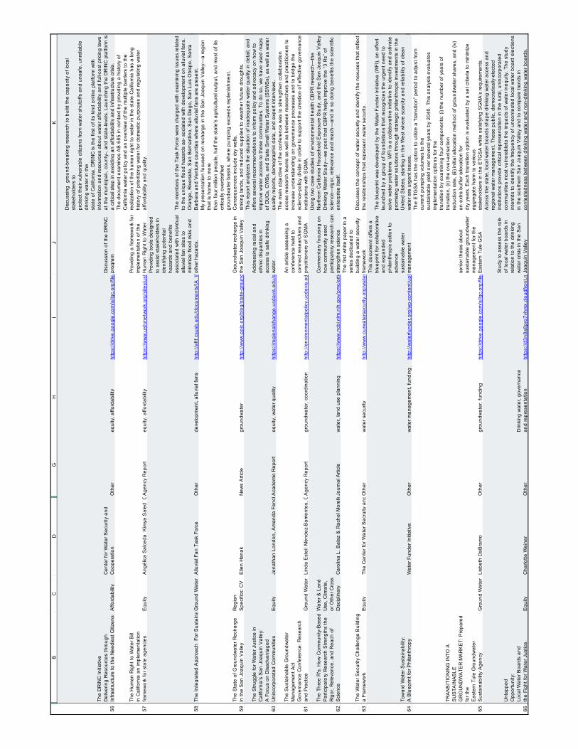
132
Appendix H - Resources Database & Literature Cited
56 57 58 59 60 61 62 63 64 65 66
BC
DG
HI
JK
The
DR
INC
Initi
ativ
eD
eliv
erin
g R
esou
rces
thro
ugh
Infra
stru
ctur
e to
the
Nee
dies
t Citi
zens
Affo
rdab
ility
Cen
ter f
or W
ater
Sec
urity
and
C
oope
ratio
n O
ther
equi
ty, a
fford
abilit
yht
tps:
//driv
e.go
ogle
.com
/a/lg
c.or
g/fil
e/d/
1RxI
WU
ZLrk
HC
3cfW
mY
yFD
fohx
jsiP
6DzP
/vie
w?u
sp=s
harin
gD
iscu
ssio
n of
the
DR
INC
pr
ogra
m
Dis
cuss
ing
gro
und-
brea
king
rese
arch
to b
uild
the
capa
city
of l
ocal
st
akeh
olde
rs to
prot
ect t
heir
vuln
erab
le c
itize
ns fr
om w
ater
shu
toffs
and
uns
afe,
unr
elia
ble
drin
king
wat
er in
the
stat
e of
Cal
iforn
ia. D
RIN
C is
the
first
of i
ts k
ind
onlin
e pl
atfo
rm w
ith
info
rmat
ion
and
reso
urce
s ab
out w
ater
affo
rdab
ility
and
full-
cost
pric
ing
law
s at
the
mun
icip
al-,
coun
ty-,
and
stat
e-le
vels
. Lau
nchi
ng th
e D
RIN
C p
latfo
rm is
a
criti
cal s
tep
in a
void
ing
an a
fford
abilit
y an
d in
frast
ruct
ure
cris
is.
The
Hum
an R
ight
to W
ater
Bill
in C
alifo
rnia
an
impl
emen
tatio
n fra
mew
ork
for s
tate
age
ncie
sE
quity
A
ngél
ica
Sal
ceda
Kim
ya S
aied
Chr
istin
e Zü
low
LLM
A
genc
y R
epor
teq
uity
, affo
rdab
ility
http
s://w
ww
.ush
rnet
wor
k.or
g/si
tes/
ushr
netw
ork.
org/
files
/ihrlc
_wat
er_r
epor
t_20
13_f
inal
Pro
vidi
ng a
fram
ewor
k fo
r im
plem
enta
tion
of th
e H
uman
Rig
ht to
Wat
er
The
docu
men
t exa
min
es A
B 6
85 in
con
text
by
prov
idin
g a
hist
ory
of
Cal
iforn
ia w
ater
pol
icy
and
an o
verv
iew
of t
he m
ultip
le b
arrie
rs to
the
real
izat
ion
of th
e hu
man
righ
t to
wat
er in
the
stat
e.C
alifo
rnia
has
a lo
ng
hist
ory
of p
riorit
izin
g w
ater
for d
omes
tic p
urpo
ses
and
regu
latin
g w
ater
af
ford
abilit
y an
d qu
ality
.
The
Inte
grat
ed A
ppro
ach
For
Sus
tain
able
Dev
elop
men
t On
Allu
vial
Fan
sG
roun
d W
ater
A
lluvi
al F
an T
ask
Forc
eO
ther
deve
lopm
ent,
allu
vial
fans
ht
tp://
aftf.
csus
b.ed
u/do
cum
ents
/IA_W
EB
_Jun
e201
0.pd
f
Pro
vidi
ng to
ols
desi
gned
to
ass
ist s
take
hold
ers
inid
entif
ying
pot
entia
l ha
zard
s an
d be
nefit
s as
soci
ated
with
indi
vidu
al
allu
vial
fan
site
s to
m
inim
ize
flood
risk
s an
d ot
her h
azar
ds.
The
mem
bers
of t
he T
ask
Forc
e w
ere
char
ged
with
exa
min
ing
issu
es re
late
d to
the
uniq
ue fl
ood
haza
rds
as- s
ocia
ted
with
dev
elop
men
t on
allu
vial
fans
. O
rang
e, R
iver
side
, San
Ber
nard
ino,
San
Die
go, S
an L
uis
Obi
spo,
San
ta
Bar
bara
and
Ven
tura
cou
ntie
s w
here
allu
vial
fans
are
pre
sent
.
The
Sta
te o
f Gro
undw
ater
Rec
harg
e in
the
San
Joa
quin
Val
ley
Reg
ion
Spe
cific
s: C
VE
llen
Han
ak
New
s A
rticl
egr
ound
wat
erht
tp://
ww
w.p
pic.
org/
blog
/sta
te-g
roun
dwat
er-re
char
ge-s
an-jo
aqui
n-va
lley/
Gro
undw
ater
rech
arge
in
the
San
Joa
quin
Val
ley
My
pres
enta
tion
focu
sed
on re
char
ge in
the
San
Joa
quin
Val
ley—
a re
gion
th
at is
hom
e to
mor
eth
an fo
ur m
illion
peo
ple,
hal
f the
sta
te’s
agr
icul
tura
l out
put,
and
mos
t of i
ts
criti
cally
ove
rdra
fted
grou
ndw
ater
bas
ins,
whe
re p
umpi
ng e
xcee
ds re
plen
ishm
ent.
Con
sequ
ence
s in
clud
e dr
y w
ells
,si
nkin
g la
nds,
and
redu
ced
supp
lies
to w
eath
er fu
ture
dro
ught
s.
The
Stru
ggle
for W
ater
Jus
tice
in
Cal
iforn
ia’s
San
Joa
quin
Val
ley:
A F
ocus
on
Dis
adva
ntag
ed
Uni
ncor
pora
ted
Com
mun
ities
Equ
ity
Jona
than
Lon
don,
Am
anda
Fen
cl, S
ara
Wat
t ers
on, J
enni
fer J
arin
, Alfo
nso
Ara
nda,
Aar
on K
ing,
Cam
ille P
annu
, Pho
ebe
Sea
ton,
Lau
rel F
irest
one,
Mia
Daw
son,
and
Pet
er N
guye
n.A
cade
mic
Rep
ort
equi
ty, w
ater
qua
lity
http
s://r
egio
nalc
hang
e.uc
davi
s.ed
u/si
tes/
g/fil
es/d
gvns
k986
/file
s/in
line-
files
/The
%20
Stru
ggle
%20
for%
20W
ater
%20
Just
ice%
20FU
LL%
20R
EP
OR
T.pd
f
Add
ress
ing
raci
al a
nd
ethn
ic d
ispa
ritie
s in
ac
cess
to s
afe
drin
king
w
ater
.
This
repo
rt an
alyz
es th
e si
tuat
ion
of in
adeq
uate
wat
er q
ualit
y in
det
ail,
and
offe
rs s
ever
al re
com
men
datio
ns to
info
rm p
olic
y an
d ad
voca
cy o
n ho
w to
im
prov
e w
ater
acc
ess
to th
ese
com
mun
ities
. To
do s
o, w
e ha
ve u
sed
map
s of
DU
Cs,
CW
Ss,
and
Sta
te S
mal
l Wat
er S
yste
ms
(SS
WS
s), a
s w
ell a
s w
ater
qu
ality
repo
rts, d
emog
raph
ic d
ata,
and
exp
ert i
nter
view
s.
The
Sus
tain
able
Gro
undw
ater
M
anag
emen
t Act
Gov
erna
nce
Con
fere
nce:
Res
earc
h an
d P
ract
ice
Gro
und
Wat
er
Lind
a E
stel
í Mén
dez-
Bar
rient
os, C
ory
L. S
truth
ers,
Kris
tin D
obbi
n, M
acke
nzie
Joh
nson
, Jes
sica
Rud
nick
, Mar
k Lu
bell
& L
isa
Beu
tler
Age
ncy
Rep
ort
grou
ndw
ater
, coo
rdin
atio
n ht
tp://
envi
ronm
enta
lpol
icy.
ucda
vis.
edu/
node
/471
An
artic
le a
sses
sing
a
conf
eren
ce h
eld
to
conn
ect r
esea
rche
rs a
nd
prac
titio
ners
of S
GM
A
The
mai
n ob
ject
ive
of th
e co
nfer
ence
was
to s
treng
then
col
labo
ratio
n ac
ross
rese
arch
team
s as
wel
l as
betw
een
rese
arch
ers
and
prac
titio
ners
to
incr
ease
und
erst
andi
ng o
n go
vern
ance
pro
cess
es a
nd to
brid
ge th
e sc
ienc
e-po
licy
divi
de in
ord
er to
sup
port
the
crea
tion
of e
ffect
ive
gove
rnan
ce
inst
itutio
ns w
ith S
GM
A.
The
Thre
e R
's: H
ow C
omm
unity
-Bas
ed
Par
ticip
ator
y R
esea
rch
Stre
ngth
s th
e R
igor
, Rel
evan
ce, a
nd R
each
of
Sci
ence
Wat
er &
Lan
d U
se, C
limat
e,
or O
ther
Cro
ss
Dis
cipl
inar
y C
arol
ina
L. B
alaz
& R
ache
l Mor
ello
-Fro
sch
Jour
nal A
rticl
ew
ater
, lan
d us
e pl
anni
ng
http
s://w
ww
.ncb
i.nlm
.nih
.gov
/pm
c/ar
ticle
s/P
MC
3832
061/
Com
men
tary
focu
sing
on
how
com
mun
ity a
sed
parti
cipa
tory
rese
arch
can
st
reng
then
sci
ence
Usi
ng tw
o ca
se s
tudi
es o
f env
ironm
enta
l hea
lth C
BP
R re
sear
ch—
the
Nor
ther
n C
alifo
rnia
Hou
seho
ld E
xpos
ure
Stu
dy, a
nd th
e S
an J
oaqu
in V
alle
y D
rinki
ng W
ater
Stu
dy—
we
posi
t tha
t CB
PR
hel
ps im
prov
e th
e ‘‘3
Rs’
’ of
scie
nce—
rigor
, rel
evan
ce a
nd re
ach—
and
in s
o do
ing
bene
fits
the
scie
ntifi
c en
terp
rise
itsel
f.
The
Wat
er S
ecur
ity C
halle
nge
Bui
ldin
g a
Fram
ewor
kE
quity
Th
e C
ente
r for
Wat
er S
ecru
ity a
nd C
oope
ratio
nO
ther
wat
er s
ecur
ity
http
://w
ww
.our
wat
erse
curit
y.or
g/w
ater
secu
rityc
halle
nge
The
first
whi
te p
aper
in a
se
ries
dedi
cate
d to
bu
ildin
g a
wat
er s
ecur
ity
fram
ewor
kD
iscu
sses
the
conc
ept o
f wat
er s
ecur
ity a
nd id
entif
y th
e ne
xuse
s th
at re
flect
th
e re
latio
nshi
ps th
at re
pres
ent w
ater
sec
urity
.
Tow
ard
Wat
er S
usta
inab
ility:
A B
luep
rint f
or P
hila
nthr
opy
Wat
er F
unde
r Ini
tiativ
e O
ther
wat
er m
anag
emen
t, fu
ndin
g ht
tp://
wat
erfu
nder
.org
/wp-
cont
ent/u
ploa
ds/2
016/
03/W
ater
-Fun
der-I
nitia
tive-
Blu
eprin
t-Mar
ch-1
5-20
16.p
df
This
doc
umen
t offe
rs a
bl
uepr
int f
or c
olla
bora
tive
and
expa
nded
ph
ilant
hrop
ic a
ctio
n to
ad
vanc
esu
stai
nabl
e w
ater
m
anag
emen
t
The
blue
prin
t was
dev
elop
ed b
y th
e W
ater
Fun
der I
nitia
tive
(WFI
), an
effo
rt la
unch
ed b
y a
grou
p of
foun
datio
ns th
at re
cogn
izes
the
urge
nt n
eed
to
solv
e w
ater
pro
blem
s. W
FI is
a c
olla
bora
tive
initi
ativ
e to
iden
tify
and
activ
ate
prom
isin
g w
ater
sol
utio
ns th
roug
h st
rate
gic
phila
nthr
opic
inve
stm
ents
in th
e U
nite
d S
tate
s, s
tarti
ng in
the
Wes
t whe
re s
carc
ity a
nd re
liabi
lity
of c
lean
w
ater
are
urg
ent i
ssue
s.
TRA
NS
ITIO
NIN
G IN
TO A
S
US
TAIN
AB
LEG
RO
UN
DW
ATE
R M
AR
KE
T: P
repa
red
for t
heE
aste
rn T
ule
Gro
undw
ater
S
usta
inab
ility
Age
ncy
Gro
und
Wat
er
Lisb
eth
DaB
ram
o O
ther
grou
ndw
ater
, fun
ding
ht
tps:
//driv
e.go
ogle
.com
/a/lg
c.or
g/fil
e/d/
0B4Y
hsN
HTl
FNK
bmhu
OG
dvM
0t5V
klM
dHJh
THJH
MV
9rc0
RZb
3hF/
view
?usp
=sha
ring
seni
or th
esis
abo
ut
sust
aina
ble
grou
ndw
ater
m
anag
emen
t for
the
Eas
tern
Tul
e G
SA
The
ETG
SA
has
the
optio
n to
util
ize
a “tr
ansi
tion”
per
iod
to a
djus
t fro
m
curre
nt p
umpi
ng v
olum
es to
the
sust
aina
ble
yiel
d ov
er s
ever
al y
ears
by
2040
. Thi
s an
alys
is e
valu
ates
im
plem
enta
tion
optio
ns fo
r the
trans
ition
by
exam
inin
g fo
ur c
ompo
nent
s: (i
) the
num
ber o
f yea
rs o
f tra
nsiti
on, (
ii) th
e ov
er-e
xtra
ctio
nre
duct
ion
rate
, (iii)
initi
al a
lloca
tion
met
hod
of g
roun
dwat
er s
hare
s, a
nd (i
v)
an e
xtra
buf
fer a
lloca
tion
for
dry
year
s. E
ach
trans
ition
opt
ion
is e
valu
ated
by
a se
t crit
eria
to m
inim
ize
aggr
egat
e ha
rm to
var
ious
stak
ehol
ders
in th
e E
TGS
A w
hile
sat
isfy
ing
SG
MA
’s re
quire
men
ts.
Unt
appe
dO
ppor
tuni
ty:
Loca
l Wat
er B
oard
s an
dth
e Fi
ght f
or W
ater
Jus
tice
Equ
ityC
harlo
tte W
eine
rO
ther
Drin
king
wat
er, g
over
nanc
e an
d re
pres
enta
tion
http
s://d
3n8a
8pro
7vhm
x.cl
oudf
ront
.net
/com
mun
ityw
ater
cent
er/p
ages
/52/
atta
chm
ents
/orig
inal
/152
2100
531/
CW
C_R
ept_
UO
_03.
26.1
8b_w
eb_h
i.pdf
?152
2100
531
Stu
dy to
ass
ess
the
role
of
loca
l wat
er b
oard
s in
re
latio
n to
the
drin
king
w
ater
cris
is in
the
San
Jo
aqui
n V
alle
y
Acr
oss
the
stat
e, lo
cal w
ater
boa
rds
shap
e dr
inki
ng w
ater
acc
ess
and
regi
onal
wat
er m
anag
emen
t. Th
ese
publ
ic, d
emoc
ratic
ally
-ele
cted
in
stitu
tions
pro
vide
crit
ical
repr
esen
tatio
n in
the
rura
l, un
inco
rpor
ated
co
mm
uniti
es m
ost v
ulne
rabl
eto
the
impa
cts
of w
ater
ineq
uity
. The
stu
dy
inte
ntds
to id
entif
y th
e fre
quen
cy o
f unc
onte
sted
loca
l wat
er b
oard
ele
ctio
ns
in th
e so
uthe
rn S
an J
oaqu
in V
alle
y an
d to
com
pare
tren
ds in
co
ntes
tedn
ess
betw
een
drin
king
wat
er a
nd n
on-d
rinki
ng w
ater
boa
rds.
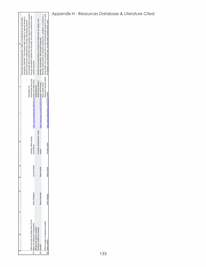
133
Appendix H - Resources Database & Literature Cited
67 68 69
BC
DG
HI
JK
Wha
t the
Par
k an
d W
ater
Bon
d C
oulf
Mea
n fo
r Cal
iforn
ia's
Com
mun
ties
Ker
ry G
alla
gher
Jo
urna
l Arti
cle
fund
ing,
wat
er s
uppl
y,
gove
rnan
ce
http
s://w
ww
.sm
artg
row
thca
lifor
nia.
org/
2018
/02/
park
s-w
ater
-bon
d-m
ean-
calif
orni
as-c
omm
uniti
es/
Info
rmat
ion
for
com
mun
ities
abo
ut th
e pa
rks
and
wat
er b
ond
Pro
posi
tion
68 w
ill ge
nera
te $
4.1
billio
n of
inve
stm
ents
for c
omm
uniti
es
thro
ugho
ut C
alifo
rnia
. Thi
s in
clud
es m
ajor
fund
ing
to: i
mpr
ove
acce
ss to
pa
rks
for l
ow-in
com
e ne
ighb
orho
ods;
pro
vide
saf
e dr
inki
ng w
ater
for
com
mun
ities
with
con
tam
inat
ed w
ater
sup
plie
s; e
xpan
d lo
cal w
ater
sup
plie
s th
roug
h st
orm
wat
er c
aptu
re a
nd re
cycl
ing;
and
pro
tect
coa
stal
and
oth
er
natu
ral r
esou
rces
.W
here
’s th
e w
ater
to s
uppo
rtS
outh
ern
Cal
iforn
ia h
ousi
nggr
owth
?S
teve
Sca
uzillo
New
s A
rticl
eho
usin
g, d
evel
opm
ent,
wat
er
supp
ly
http
s://w
ww
.sbs
un.c
om/2
018/
05/3
1/w
here
s-th
e-w
ater
-to-s
uppo
rt-so
uthe
rn-c
alifo
rnia
-hou
sing
-gro
wth
-her
es-w
hat-1
-sur
vey-
said
/
Add
ress
ing
the
rela
tions
hip
betw
een
wat
er a
nd h
ousi
ng
Gro
wth
and
hou
sing
brin
g up
con
cern
s of
wat
er s
uch
as s
uppl
y, c
ost,
stor
age,
con
serv
atio
n, a
nd d
roug
ht m
easu
res.
Wor
k to
beg
in o
n H
ayw
ard
recy
cled
w
ater
sys
tem
Pet
er H
egar
ty
New
s A
rticl
ere
cycl
ed w
ater
ht
tps:
//ww
w.e
astb
aytim
es.c
om/2
018/
06/1
4/w
ork-
to-b
egin
-on-
recy
cled
-wat
er-s
yste
m-in
-hay
war
d/
New
s ar
ticle
abo
ut
Hay
war
d's
recy
cled
wat
er
syst
em
Rec
ycle
d w
ater
pro
ject
in H
ayw
ard
incl
udin
g th
e in
stal
latio
n of
pip
elin
es, a
pu
mp
stat
ion
and
a st
orag
e ta
nk s
o th
at w
here
drin
kabl
e w
ater
is n
ow u
sed
for i
rriga
tion
and
indu
stria
l use
s, re
cycl
ed w
ater
inst
ead
will
be u
sed.
134
Appendix I - Planning Document Database & Representative Plans
APPENDIX I: PLANNING DOCUMENT DATABASE & REPRESENTATIVE PLANS
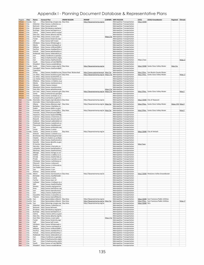
135
Appendix I - Planning Document Database & Representative PlansRegion City/ Name General Plan IRWM REGION IRWMP (UWMP) MPO REGION (SCS) (GSA) Groundwater Regional Climate Silicon County San http://planning.smcgov.org Bay Area http://bayareairwmp.org/w Metropolitan Transportation http://2040Silicon City Atherton http://www.ci.atherton.ca. Metropolitan Transportation Silicon City Belmont http://www.belmont- Metropolitan Transportation Silicon City Brisbane http://brisbaneca.org/gene Metropolitan Transportation Silicon City Burlinga http://www.burlingame.or Metropolitan Transportation Silicon City Colma https://www.colma.ca.gov/ Metropolitan Transportation Silicon City Daly City http://www.dalycity.org/As Metropolitan Transportation Silicon City East Palo http://www.ci.east-palo- https://w Metropolitan Transportation Silicon City Foster http://www.fostercity.org/ Metropolitan Transportation Silicon City Half http://www.half-moon- Metropolitan Transportation Silicon City Hillsboro http://www.hillsborough.n Metropolitan Transportation Silicon City Menlo https://www.menlopark.or Metropolitan Transportation Silicon City Milbrae http://www.millbrae2040.c Metropolitan Transportation Silicon City Pacifica http://www.cityofpacifica.o Metropolitan Transportation Silicon City Portola http://www.portolavalley.n Metropolitan Transportation Silicon City Redwood http://www.redwoodcity.or Metropolitan Transportation Silicon City San https://sanbruno.ca.gov/go Metropolitan Transportation Silicon City San http://cityofsancarlos.org/g Metropolitan Transportation Silicon City San http://www.cityofsanmate Metropolitan Transportation https://ww https://Silicon City South http://www.ssf.net/360/Re Metropolitan Transportation Silicon City Woodsid https://www.woodsidetow Metropolitan Transportation Silicon County Santa https://www.sccgov.org/sit Bay Area http://bayareairwmp.org/w Metropolitan Transportation http://2040 Santa Clara Valley Water http://wSilicon City Campbell http://www.cityofcampbell Metropolitan Transportation Silicon City Cupertino Metropolitan Transportation Silicon City Gilroy http://www.cityofgilroy.org Pajaro River Watershed http://www.pajaroriverwat http://w Metropolitan Transportation http://files. San Benito County Water Silicon City Los Altos http://www.losaltosca.gov/ Bay Area http://bayareairwmp.org/w https://w Metropolitan Transportation http://files. Santa Clara Valley Water https://Silicon City Los Altos http://www.losaltoshills.ca Metropolitan Transportation Silicon City Los Gatos https://www.losgatosca.go Metropolitan Transportation Silicon City Milpitas http://www.ci.milpitas.ca.g Metropolitan Transportation Silicon City Monte http://www.montesereno.o Metropolitan Transportation Silicon City Morgan https://www.morgan- Metropolitan Transportation Silicon City Mountain http://www.mountainview. Metropolitan Transportation Silicon City Palo Alto http://www.paloaltocompp https://w Metropolitan Transportation Silicon City San Jose https://www.sanjoseca.gov Bay Area http://bayareairwmp.org/w https://w Metropolitan Transportation http://files. Santa Clara Valley Water http://Silicon City Santa http://santaclaraca.gov/gov Metropolitan Transportation Silicon City Saratoga http://www.saratoga.ca.us Metropolitan Transportation Silicon City Sunnyval http://sunnyvale.ca.gov/Co Metropolitan Transportation San County Alameda http://acgov.org/cda/planni Bay Area http://bayareairwmp.org/w Metropolitan Transportation http://2040 City of HaywardSan City Alameda https://alamedaca.gov/co Metropolitan Transportation San City Albany http://www.albanyca.org/i Bay Area http://bayareairwmp.org/w http://w Metropolitan Transportation http://files. Santa Clara Valley Water https://35 http://San City Berkeley http://www.ci.berkeley.ca. Metropolitan Transportation San City Dublin http://www.dublin.ca.gov/ Metropolitan Transportation San City Emeryvill http://www.ci.emeryville.c Bay Area http://bayareairwmp.org/w http://w Metropolitan Transportation http://files. Santa Clara Valley Water http://San City Fremont https://fremont.gov/398/G Metropolitan Transportation San City Hayward http://www.hayward2040g Metropolitan Transportation San City Livermor http://www.ci.livermore.ca Metropolitan Transportation San City Newark http://www.newark.org/im Metropolitan Transportation San City Oakland http://www2.oaklandnet.co Metropolitan Transportation San City Piedmont http://www.ci.piedmont.ca Metropolitan Transportation San City Pleasanto http://www.cityofpleasant Metropolitan Transportation San City San http://www.sanleandro.org Metropolitan Transportation San City Union http://www.ci.union- Metropolitan Transportation San County Contra http://www.co.contra- Bay Area http://bayareairwmp.org/w Metropolitan Transportation http://2040 City of Antioch San City Antioch http://www.ci.antioch.ca.u Metropolitan Transportation San City Brentwoo http://brentwood.generalpl Metropolitan Transportation San City Clayton http://ci.clayton.ca.us/depa Metropolitan Transportation San City Concord http://www.cityofconcord.o Metropolitan Transportation San City Danville http://www.danville.ca.gov Metropolitan Transportation San City El Cerrito http://www.el- Metropolitan Transportation http://wwSan City Hercules http://www.ci.hercules.ca. Metropolitan Transportation San City Lafayette http://www.lovelafayette.o Metropolitan Transportation San City Martinez http://www.cityofmartinez. Metropolitan Transportation San City Moraga http://www.moraga.ca.us/ Metropolitan Transportation San City Oakley http://www.ci.oakley.ca.us Metropolitan Transportation San City Orinda http://www.cityoforinda.or Metropolitan Transportation San City Pinole http://www.ci.pinole.ca.us/ Metropolitan Transportation San City Pittsburg http://www.ci.pittsburg.ca. Metropolitan Transportation San City Pleasant http://www.ci.pleasant- Metropolitan Transportation San City Richmon http://www.ci.richmond.ca. Metropolitan Transportation San City San Pablo http://www.ci.san- Metropolitan Transportation San City San http://www.ci.san- Metropolitan Transportation San City Walnut http://www.walnut- Metropolitan Transportation San County Marin http://www.marincounty.or Bay Area http://bayareairwmp.org/w Metropolitan Transportation http://2040 Petaluma Valley Groundwater San City Belveder http://www.cityofbelveder Metropolitan Transportation San City Corte http://www.ci.corte- Metropolitan Transportation San City Fairfax http://www.town-of- Metropolitan Transportation San City Larkspur http://www.ci.larkspur.ca.u Metropolitan Transportation San City Mill http://www.cityofmillvalley Metropolitan Transportation San City Novato http://novato.org/governm Metropolitan Transportation San City Ross http://www.townofross.org Metropolitan Transportation San City San http://www.townofsanans Metropolitan Transportation San City San https://www.cityofsanrafa Metropolitan Transportation San City Sausalito http://www.ci.sausalito.ca. Metropolitan Transportation San City Tiburon http://www.townoftiburon. Metropolitan Transportation San County San http://generalplan.sfplanni Bay Area http://bayareairwmp.org/w Metropolitan Transportation http://2040 San Francisco Public Utilities San City/Co San http://generalplan.sfplanni Bay Area http://bayareairwmp.org/w http://w Metropolitan Transportation http://files. San Francisco Public Utilities https://San County San http://planning.smcgov.org Bay Area http://bayareairwmp.org/w Metropolitan Transportation http://2040 N/a San City Atherton http://www.ci.atherton.ca. Metropolitan Transportation San City Belmont http://www.belmont- Metropolitan Transportation San City Brisbane http://brisbaneca.org/gene Metropolitan Transportation San City Burlinga http://www.burlingame.or Metropolitan Transportation San City Colma https://www.colma.ca.gov/ Metropolitan Transportation San City Daly City http://www.dalycity.org/As Metropolitan Transportation San City East Palo http://www.ci.east-palo- https://w Metropolitan Transportation San City Foster http://www.fostercity.org/ Metropolitan Transportation San City Half http://www.half-moon- Metropolitan Transportation San City Hillsboro http://www.hillsborough.n Metropolitan Transportation San City Menlo https://www.menlopark.or Metropolitan Transportation San City Milbrae http://www.millbrae2040.c Metropolitan Transportation San City Pacifica http://www.cityofpacifica.o Metropolitan Transportation San City Portola http://www.portolavalley.n Metropolitan Transportation San City Redwood http://www.redwoodcity.or Metropolitan Transportation San City San https://sanbruno.ca.gov/go Metropolitan Transportation San City San http://cityofsancarlos.org/g Metropolitan Transportation San City San http://cityofsancarlos.org/g Metropolitan Transportation San City South http://www.ssf.net/360/Re Metropolitan Transportation San City Woodsid https://www.woodsidetow Metropolitan Transportation

136
Appendix I - Planning Document Database & Representative PlansCentral County Fresno http://www.co.fresno.ca.us Westside San Joaquin http://www.sldmwa.org/W Fresno Council of Governments Fresno County - Westside Central City Clovis http://www.ci.clovis.ca.us/ Kings Basin Water http://www.kingsbasinauth http://w Fresno Council of GovernmentsCentral City Coalinga http://www.coalinga.com/ Fresno Council of GovernmentsCentral City Firebaug http://firebaugh.org/2030- Fresno Council of GovernmentsCentral City Fowler http://www.fowlercity.org/ Fresno Council of GovernmentsCentral City Fresno http://www.co.fresno.ca.us Kings Basin Water http://www.kingsbasinauth https://w Fresno Council of Governments https://ww SAN JOAQUIN VALLEY - KINGS https://cli http://tCentral City Huron http://cityofhuron.com/pla Fresno Council of GovernmentsCentral City Kerman http://www.codepublishing Fresno Council of GovernmentsCentral City KingsburgCentral City Mendota http://ci.mendota.ca.us/wp- Fresno Council of GovernmentsCentral City Orange Fresno Council of GovernmentsCentral City Parlier Kings Basin Water http://www.kingsbasinauth n/a Fresno Council of Governments https://ww San Joaquin Valley - Kings noneCentral City Reedley http://www.reedley.com/d Fresno Council of GovernmentsCentral City Sanger https://www.ci.sanger.ca.u Fresno Council of GovernmentsCentral City Selma http://www.cityofselma.co https://w Fresno Council of GovernmentsCentral County Kings http://countyofkings.com/d Kings Basin http://www.kingsbasinauth Kings County Association of http://ww El Rico Groundwater Central City Avenal http://www.avenalgeneral Kings County Association of Central City Corcoran http://www.cityofcorcoran. Kings County Association of Central City Hanford http://www.ci.hanford.ca.u Kings County Association of Central City Lemoore http://www.lemoore.com/ Kings County Association of Central County Madera http://www.madera- Madera http://wdl.water.ca.gov/ir Madera County Transportation http://ww County of MaderaCentral City Chowchill http://www.ci.chowchilla.c Madera County Transportation Central City Madera http://www.cityofmadera.c Madera County Transportation Central County Mariposa http://www.mariposacount Yosemite-Mariopsa http://wdl.water.ca.gov/ir Mariposa Local Transportation N/a Merced Subbasin GSACentral County Merced http://www.co.merced.ca.u Merced http://www.mercedirwmp. Merced County Association of http://ww Merced Subbasin GSACentral City Atwater http://www.atwater.org/d Merced County Association of Central City Dos Palos Merced County Association of Central City Gustine http://www.cityofgustine.c Merced County Association of Central City Livingsto http://www.livingstoncity.c Merced County Association of Central City Los http://losbanos.org/wp- Merced County Association of Central City Merced https://www.cityofmerced. Merced County Association of Central County Tulare http://generalplan.co.tulare Southern Sierra http://www.southernsierra Tulare County Association of http://ww Central Kings Groundwater Central City Dinuba http://www.dinuba.org/im Tulare County Association of Central City Exeter http://cityofexeter.com/doc Tulare County Association of Central City Farmersv Tulare County Association of Central City Lindsay http://www.lindsay.ca.us/d Tulare County Association of Central City Portervill http://www.ci.porterville.c Tulare County Association of Central City Tulare http://www.tulare.ca.gov/d Tulare County Association of Central City Visalia http://www.visalia.city/dep Tulare County Association of Central City Woodlak http://www.cityofwoodlake Tulare County Association of Los County Los http://planning.lacounty.go Upper Santa Clara http://yourscvwater.com/w Southern California Association http://rtpsc Unadjudicated Portion of the LA http://cLos City Agoura http://www.ci.agoura- Southern California Association Los City Alhambra http://www.cityofalhambra Southern California Association Los City Arcadia https://www.arcadiaca.gov Southern California Association Los City Artesia http://www.cityofartesia.u Southern California Association Los City Avalon http://www.cityofavalon.co Southern California Association Los City Azusa http://www.ci.azusa.ca.us/ Southern California Association Los City Baldwin https://www.baldwinpark.c Southern California Association Los City Bell http://www.cityofbell.org/ Southern California Association Los City Bellflowe https://www.bellflower.org Southern California Association Los City Bell Southern California Association Los City Beverly http://www.beverlyhills.org Southern California Association Los City Bradbury http://www.cityofbradbury. Southern California Association Los City Burbank http://www.burbankca.gov Southern California Association Los City Calabasa http://www.cityofcalabasa Southern California Association Los City Carson http://ci.carson.ca.us/com Southern California Association Los City Cerritos http://www.cerritos.us/GO Southern California Association Los City Claremon http://www3.ci.claremont. Southern California Association Los City Commerc http://www.ci.commerce.c Southern California Association Los City Compton http://www.comptoncity.or Southern California Association Los City Covina http://www.covinaca.gov/p Southern California Association Los City Cudahy http://www.cityofcudahy.c Southern California Association Los City Culver http://www.culvercity.org/ Southern California Association Los City Diamond http://www.cityofdiamond Southern California Association Los City Downey http://www.downeyca.org/ Southern California Association Los City Duarte http://www.accessduarte.c Southern California Association Los City El Monte http://www.ci.el- Southern California Association Los City El http://www.elsegundo.org/ Southern California Association Los City Gardena http://www2.cityofgardena Southern California Association Los City Glendale http://www.glendaleca.gov Southern California Association Los City Glendora http://www.ci.glendora.ca. Southern California Association Los City Hawaiian http://hgcity.org/PDFfiles/C Southern California Association Los City Hawthorn http://www.cityofhawthorn Southern California Association Los City Hermosa http://www.hermosabch.or Greater Los Angeles County https://dpw.lacounty.gov/w https://w Southern California Association http://rtpsc COASTAL PLAIN OF LOS http://Los City Hidden https://hiddenhillscity.org/ Southern California Association Los City Huntingto http://www.hpca.gov/Docu Southern California Association Los City Industry http://www.cityofindustry. Southern California Association Los City Inglewoo https://www.cityofinglewo Southern California Association Los City Irwindale http://www.ci.irwindale.ca. Southern California Association Los City La http://www.lcf.ca.gov/plan Southern California Association Los City La Habra Southern California Association Los City Lakewoo Southern California Association Los City La http://www.cityoflamirada. Southern California Association Los City Lancaster http://www.cityoflancaster Southern California Association Los City La Puente http://www.lapuente.org/h Southern California Association Los City La Verne http://www.ci.la- Southern California Association Los City Lawndale http://www.lawndalecity.o Southern California Association Los City Lomita http://www.lomita.com/cit Southern California Association Los City Long http://www.lbds.info/plann Southern California Association Los City Los http://planning.lacounty.go Greater Los Angeles County https://dpw.lacounty.gov/w https://w Southern California Association http://rtpsc COASTAL PLAIN OF LOS http://plaLos City Lynwood http://lynwood.ca.us/wp- Southern California Association Los City Malibu http://qcode.us/codes/mali Southern California Association Los City Manhatta http://www.citymb.info/cit Southern California Association Los City Maywood https://www.cityofmaywoo Southern California Association Los City Monrovia http://www.cityofmonrovia Southern California Association Los City Montebel http://www.cityofmontebel Southern California Association Los City Monterey http://www.montereypark. Southern California Association Los City Norwalk Southern California Association Los City Palmdale https://www.cityofpalmdal Southern California Association Los City Palos http://www.pvestates.org/ Southern California Association Los City Paramou http://stagea4.visionintern Greater Los Angeles County https://dpw.lacounty.gov/w http://w Southern California Association http://rtpsc COASTAL PLAIN OF LOS http://wLos City Pasadena http://www.cityofpasadena Southern California Association Los City Pico http://www.pico- Southern California Association Los City Pomona http://www.ci.pomona.ca.u Southern California Association Los City Rancho Southern California Association Los City Redondo http://www.redondo.org/d Southern California Association Los City Rolling http://www.rolling- Southern California Association Los City Rolling http://ci.rolling-hills- Southern California Association

137
Appendix I - Planning Document Database & Representative PlansLos City Rosemea https://www.google.com/u Southern California Association Los City San http://www.cityofsandimas Southern California Association Los City San http://www.ci.san- Southern California Association Los City San http://www.sangabrielcity. Southern California Association Los City San http://www.cityofsanmarin Southern California Association Los City Santa http://www.codepublishing Southern California Association Los City Santa Fe Southern California Association Los City Santa https://www.smgov.net/De Southern California Association Los City Sierra http://www.cityofsierrama Southern California Association Los City Signal http://www.cityofsignalhill. Southern California Association Los City South El http://www.ci.south-el- Southern California Association Los City South http://www.cityofsouthgat Southern California Association Los City South http://www.ci.south- Southern California Association Los City Temple http://www.ci.temple- Southern California Association Los City Torrance http://www.torranceca.gov Southern California Association Los City Vernon http://www.cityofvernon.or Southern California Association Los City Walnut http://www.cityofwalnut.or Southern California Association Los City West http://www.westcovina.org Southern California Association Los City West http://www.weho.org/city- Southern California Association Los City Westlake Southern California Association Los City Whittier http://www.cityofwhittier. Southern California Association San County San http://www.sandiegocount San Diego, http://www.sdirwmp.org/2 San Diego Association of http://ww Coachella Valley Water DistrictSan City Carlsbad http://www.carlsbadca.gov San Diego Association of San City Chula http://www.chulavistaca.g San Diego Association of San City Coronado https://www.coronado.ca.u San Diego Association of San City Del Mar https://www.delmar.ca.us/ San Diego http://www.sdirwmp.org/2 https://w San Diego Association of http://ww SAN DIEGUITO CREEK http://San City El Cajon http://www.ci.el- https://h San Diego Association of San City Encinitas http://archive.ci.encinitas.c San Diego Association of San City Escondid https://www.escondido.org San Diego Association of San City Imperial http://www.imperialbeach San Diego Association of San City La Mesa http://www.cityoflamesa.c https://h San Diego Association of San City Lemon http://www.lemongrove.ca https://h San Diego Association of San City National http://www.nationalcityca. San Diego http://www.sdirwmp.org/2 https://w San Diego Association of http://ww COASTAL PLAIN OF SAN DIEGO http://San City Oceansid http://www.ci.oceanside.ca San Diego Association of San City Poway http://poway.org/286/Gen San Diego Association of San City San https://www.sandiego.gov/ San Diego http://www.sdirwmp.org/2 https://w San Diego Association of http://ww COASTAL PLAIN OF SAN DIEGO https://San City San http://www.san- San Diego Association of San City Santee San Diego Association of San City Solana http://www.codepublishing San Diego Association of San City Vista http://www.cityofvista.com San Diego Association of