bitton watching brief report
DESCRIPTION
Report of a watching brief at Bitton ChurchTRANSCRIPT
An Archaeological Investigation at
St. Mary’s Parish Church,
Bitton,
South Gloucestershire
BMC 10
Carried out for: St. Mary’s Church PCC and
Benjamin & Beauchamp Ltd.
by
C. & N. Hollinrake Ltd.,
Consultant Archaeologists,
12, Bove Town,
Glastonbury,
Somerset BA6 8JE Telephone: 01458 833332
Report Number 458
An Archaeological Investigation at
St. Mary’s Parish Church, Bitton
Table of Contents
para.......... Contents ..........................................................page Summary ........................................................... 1
1.0............. Introduction....................................................... 1
2.0............. Topography and Geology.................................. 2
3.0............. Archaeological Background.............................. 4
3.1......... Archaeological finds ......................................... 4
3.2......... The Curchyard................................................... 5
3.3......... The Church........................................................ 5
4.0............. The Archaeological Watching Brief ................. 10
4.2......... Trench A ........................................................... 11
4.3......... Trench G ........................................................... 12
4.4......... Bay 2 ................................................................. 14
4.5......... Bay 22 ............................................................... 15
4.6......... Bay 24 ............................................................... 16
5.0............. Discussion ......................................................... 18
Acknowledgements ........................................... 21
Bibliography...................................................... 21
Appendix: Finds List......................................... 22
Figures number .... Description..........................................................................page 1................ The church and historic settlement of Bitton .......................2
2................ Bitton, 1st edition O.S. map, 1886........................................4
3................ St. Mary’s, Bitton, with neighbouring buildings ................6
4................ The eastern end of the church with new features.................10
5................ Trench A looking west .........................................................11
6................ Trench B at junction with Trench A ....................................12
7................ Trench B north end ..............................................................12
8................ The drystone wall in Trench B.............................................13
9................ Trench B in Bay 24 ..............................................................13
10.............. Plan of Bay 2........................................................................14
11.............. Photograph of foundations Bay 2.........................................14
12.............. Plan of Bay 22......................................................................15
13.............. Photograph of Buttress 22/23...............................................15
14.............. Photograph of Buttress 22/23...............................................15
15.............. Plan of Bay 24......................................................................16
16.............. Photograph of Figure 15 ......................................................16
17.............. Photograph of Bay 24 ..........................................................16
18.............. Photograph of Bay 24 and new drain...................................17
An Archaeological Investigation
at
St. Mary’s parish church, Bitton, Gloucestershire and
Summary
A watching brief on new stormwater drains has allowed a glimpse of the
archaeological deposits associated with the foundations of the chancel and a short
drain trench to the north. Despite the limited nature of the ground disturbance,
foundations of several earlier walls were recorded and two features were observed in
the churchyard, demonstrating the survival of finds even in the heavily dug cemetery.
Finds included a Romano-British hypocaust flue tile fragment and glazed medieval
roof tiles.
1.0 Introduction
1.1 In November 2009, benjamin + beauchamp architects commissioned C. and N.
Hollinrake Ltd to prepare an archaeological and historical background study of St.
Mary’s church and its immediate surroundings to better inform the Bath and Wells
Diocesan Advisory Council in dealing with the maintenance of the south boundary
wall of the churchyard (C. and N. Hollinrake, report no. 438). Background
information in this paper is taken from that earlier report.
1.2 In 2010 the chancel required repair and maintenance and C. and N. Hollinrake
were asked to provide archaeological monitoring for the groundworks element of the
project, especially for the storm water drains for the new downpipes that were
installed around the eastern end of the chancel.
1.3 The work to the chancel was undertaken by Ben and Paul Hastings of
Wellington Masonry. The groundworks were monitored and reccorded by Charles
and Nancy Hollinrake on the 4th
and 5th
October and the 4th
November 2010.
1.4 Methods of recording were appropriate for an augmented watching brief.
Archaeological features and deposits, when encountered, were recorded in plan and
by elevation, when accessible, at a scale of 1:20, and by colour digital photography.
Finds were collected and their locations were recorded in a field book. The finds
were cleaned, identified and bagged by context before being listed.
Bitton Church Archaeological Watching Brief
BMC10
2
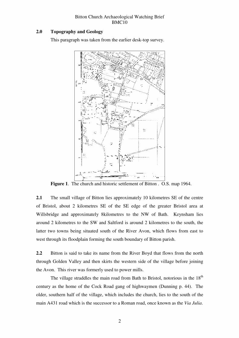
2.0 Topography and Geology
This paragraph was taken from the earlier desk-top survey.
Figure 1. The church and historic settlement of Bitton . O.S. map 1964.
2.1 The small village of Bitton lies approximately 10 kilometres SE of the centre
of Bristol, about 2 kilometres SE of the SE edge of the greater Bristol area at
Willsbridge and approximately 8kilometres to the NW of Bath. Keynsham lies
around 2 kilometres to the SW and Saltford is around 2 kilometres to the south, the
latter two towns being situated south of the River Avon, which flows from east to
west through its floodplain forming the south boundary of Bitton parish.
2.2 Bitton is said to take its name from the River Boyd that flows from the north
through Golden Valley and then skirts the western side of the village before joining
the Avon. This river was formerly used to power mills.
The village straddles the main road from Bath to Bristol, notorious in the 18th
century as the home of the Cock Road gang of highwaymen (Dunning p. 44). The
older, southern half of the village, which includes the church, lies to the south of the
main A431 road which is the successor to a Roman road, once known as the Via Julia.
Bitton Church Archaeological Watching Brief
BMC10
3
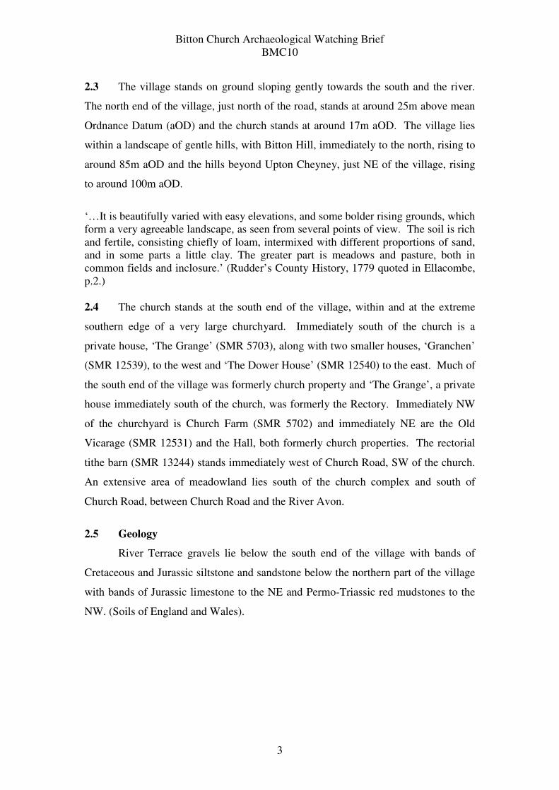
2.3 The village stands on ground sloping gently towards the south and the river.
The north end of the village, just north of the road, stands at around 25m above mean
Ordnance Datum (aOD) and the church stands at around 17m aOD. The village lies
within a landscape of gentle hills, with Bitton Hill, immediately to the north, rising to
around 85m aOD and the hills beyond Upton Cheyney, just NE of the village, rising
to around 100m aOD.
‘…It is beautifully varied with easy elevations, and some bolder rising grounds, which
form a very agreeable landscape, as seen from several points of view. The soil is rich
and fertile, consisting chiefly of loam, intermixed with different proportions of sand,
and in some parts a little clay. The greater part is meadows and pasture, both in
common fields and inclosure.’ (Rudder’s County History, 1779 quoted in Ellacombe,
p.2.)
2.4 The church stands at the south end of the village, within and at the extreme
southern edge of a very large churchyard. Immediately south of the church is a
private house, ‘The Grange’ (SMR 5703), along with two smaller houses, ‘Granchen’
(SMR 12539), to the west and ‘The Dower House’ (SMR 12540) to the east. Much of
the south end of the village was formerly church property and ‘The Grange’, a private
house immediately south of the church, was formerly the Rectory. Immediately NW
of the churchyard is Church Farm (SMR 5702) and immediately NE are the Old
Vicarage (SMR 12531) and the Hall, both formerly church properties. The rectorial
tithe barn (SMR 13244) stands immediately west of Church Road, SW of the church.
An extensive area of meadowland lies south of the church complex and south of
Church Road, between Church Road and the River Avon.
2.5 Geology
River Terrace gravels lie below the south end of the village with bands of
Cretaceous and Jurassic siltstone and sandstone below the northern part of the village
with bands of Jurassic limestone to the NE and Permo-Triassic red mudstones to the
NW. (Soils of England and Wales).
Bitton Church Archaeological Watching Brief
BMC10
4
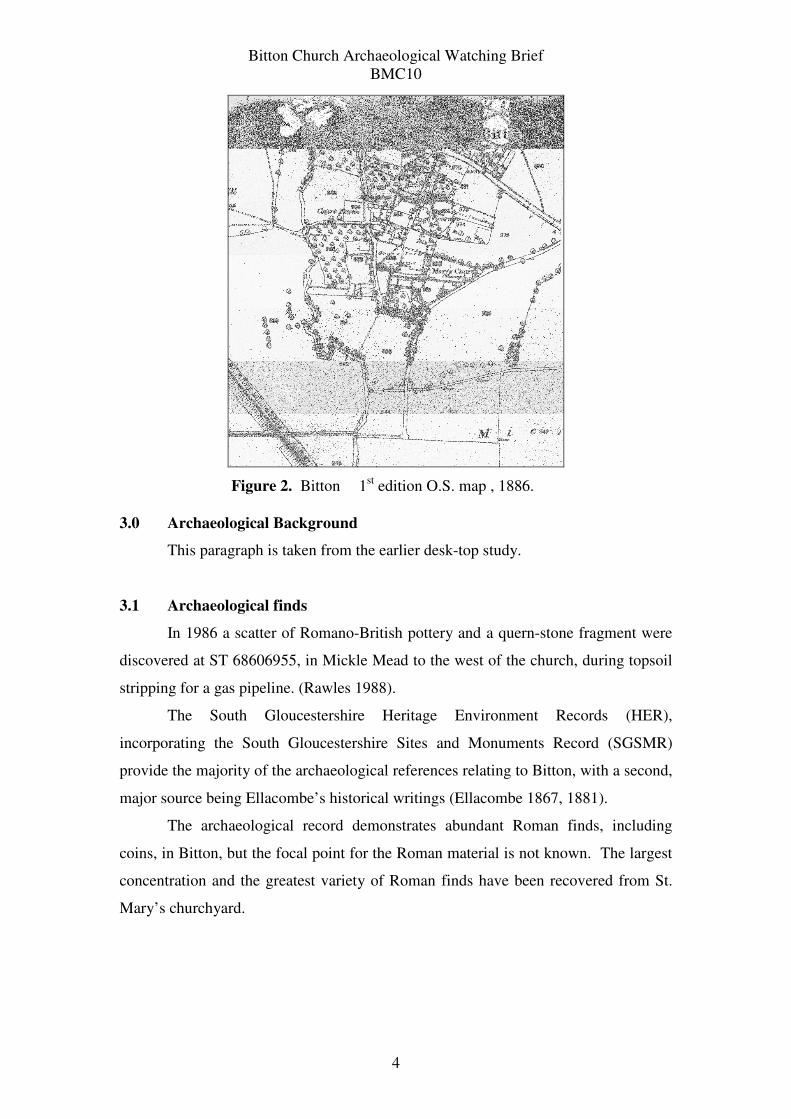
Figure 2. Bitton 1st edition O.S. map , 1886.
3.0 Archaeological Background
This paragraph is taken from the earlier desk-top study.
3.1 Archaeological finds
In 1986 a scatter of Romano-British pottery and a quern-stone fragment were
discovered at ST 68606955, in Mickle Mead to the west of the church, during topsoil
stripping for a gas pipeline. (Rawles 1988).
The South Gloucestershire Heritage Environment Records (HER),
incorporating the South Gloucestershire Sites and Monuments Record (SGSMR)
provide the majority of the archaeological references relating to Bitton, with a second,
major source being Ellacombe’s historical writings (Ellacombe 1867, 1881).
The archaeological record demonstrates abundant Roman finds, including
coins, in Bitton, but the focal point for the Roman material is not known. The largest
concentration and the greatest variety of Roman finds have been recovered from St.
Mary’s churchyard.
Bitton Church Archaeological Watching Brief
BMC10
5
3.2 The Churchyard
Ellacombe reported finding Roman tesserae in the churchyard with ‘an
abundance of cinerary ware and burnt earth’ (p5). He also reported a hoard of Roman
coins in a ‘small earthenware vessel’.
emperor date
bronze coins
Valentinian I 364AD
Gratian (x4) 367
Valentinian II (x2) 383
Eugenius 392
silver coins
Constantius 306
Arcadius 395
Tetricius n.d
In 1850, when a new doorway was pierced into the tower stairwell from the
outside, bricks were found in the masonry of the west wall of the nave; the masonry
was interpreted as Norman and the bricks as Roman (Ellacombe 1881 pp.4-5; SMR
1247; Figure 7).
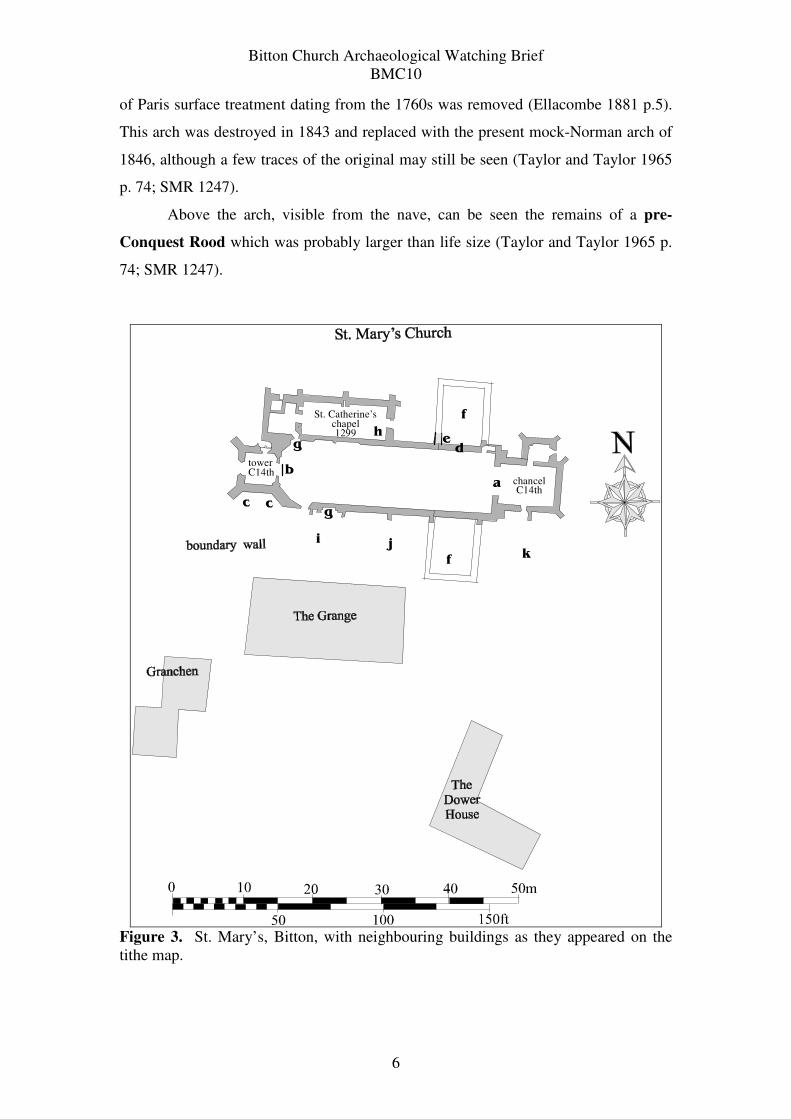
3.3 The Church
St. Mary’s, Bitton, displays several examples of pre-Norman Conquest work,
often referred to as ‘Anglo-Saxon’ (SMR 1247). During his time as the vicar of
Bitton, the Rev. Ellacombe attempted to describe the various building phases of the
church, following the written sources and the evidence he collected from the fabric of
the building. His work has more recently been corroborated by Taylor and Taylor.
The locations of the various features they describe have been added to Figure
4 in an effort to determine the relationship between the standing buildings and the
various descriptions of buried masonry. The observations fall within three main
periods: pre-Norman Conquest/ Anglo-Saxon, Norman/ Romanesque and medieval/
Gothic.
1) pre-Norman Conquest / Anglo-Saxon church
a Chancel Arch
The semi-circular arch constructed of plain voussoires resting on plain jambs
of long-and-short work; was revealed in the 19th
century when an ornamented plaster
Bitton Church Archaeological Watching Brief
BMC10
6
of Paris surface treatment dating from the 1760s was removed (Ellacombe 1881 p.5).
This arch was destroyed in 1843 and replaced with the present mock-Norman arch of
1846, although a few traces of the original may still be seen (Taylor and Taylor 1965
p. 74; SMR 1247).
Above the arch, visible from the nave, can be seen the remains of a pre-
Conquest Rood which was probably larger than life size (Taylor and Taylor 1965 p.
74; SMR 1247).
towerC14th
St. Catherine’s chapel1299
chancelC14th
b
ccg
i jk
gh
f
f
a
de
Figure 3. St. Mary’s, Bitton, with neighbouring buildings as they appeared on the
tithe map.
Bitton Church Archaeological Watching Brief
BMC10
7
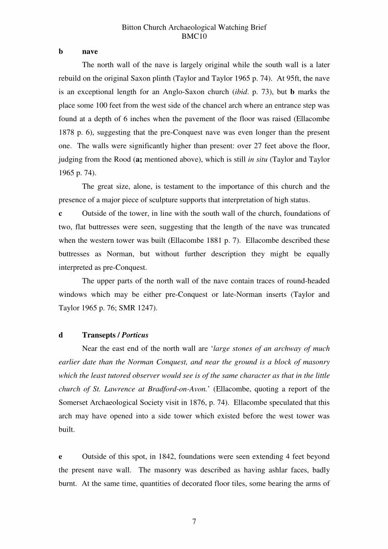
b nave
The north wall of the nave is largely original while the south wall is a later
rebuild on the original Saxon plinth (Taylor and Taylor 1965 p. 74). At 95ft, the nave
is an exceptional length for an Anglo-Saxon church (ibid. p. 73), but b marks the
place some 100 feet from the west side of the chancel arch where an entrance step was
found at a depth of 6 inches when the pavement of the floor was raised (Ellacombe
1878 p. 6), suggesting that the pre-Conquest nave was even longer than the present
one. The walls were significantly higher than present: over 27 feet above the floor,
judging from the Rood (a; mentioned above), which is still in situ (Taylor and Taylor
1965 p. 74).
The great size, alone, is testament to the importance of this church and the
presence of a major piece of sculpture supports that interpretation of high status.
c Outside of the tower, in line with the south wall of the church, foundations of
two, flat buttresses were seen, suggesting that the length of the nave was truncated
when the western tower was built (Ellacombe 1881 p. 7). Ellacombe described these
buttresses as Norman, but without further description they might be equally
interpreted as pre-Conquest.
The upper parts of the north wall of the nave contain traces of round-headed
windows which may be either pre-Conquest or late-Norman inserts (Taylor and
Taylor 1965 p. 76; SMR 1247).
d Transepts / Porticus
Near the east end of the north wall are ‘large stones of an archway of much
earlier date than the Norman Conquest, and near the ground is a block of masonry
which the least tutored observer would see is of the same character as that in the little
church of St. Lawrence at Bradford-on-Avon.’ (Ellacombe, quoting a report of the
Somerset Archaeological Society visit in 1876, p. 74). Ellacombe speculated that this
arch may have opened into a side tower which existed before the west tower was
built.
e Outside of this spot, in 1842, foundations were seen extending 4 feet beyond
the present nave wall. The masonry was described as having ashlar faces, badly
burnt. At the same time, quantities of decorated floor tiles, some bearing the arms of
Bitton Church Archaeological Watching Brief
BMC10
8
De Vivon and Berkley, were recovered, along with Roman flue tiles (Ellacombe 1881
p. 8-9).
f The arch seen by Ellacombe has been re-interpreted as the northern arch of an
Anglo-Saxon porticus (side chapel), illustrating the existence of former porticus on
both sides of the eastern end of the nave (Taylor and Taylor 1965 p. 74; SMR 1247).
The foundations of the south transept, containing the graves of the de Button (or
Bitton) family, formerly extended some 12 feet into the garden of the Parsonage
(Ellacombe 1865 p.8). The location of the southern porticus is marked by masonry
scars on the outer nave wall; the northern porticus has been sketched in on Figure 7 to
match, for illustrative purposes only, although porticus were usually of different
proportions. The footings of the southern porticus are clearly visible extending into
the garden of ‘The Grange’
2) Norman church
The Norman church was comprised of
• a long, single-aisled church of great height; a row of small windows was high
up on the nave walls; the nave walls had been lowered and a Norman corbel
table laid;
• g: northern, southern, and, probably, western, rich doorways, inserted into the
Saxon nave walls (Taylor and Taylor p. 74); they are not placed
symmetrically;
• f: either:
o north and south transepts, or
o a south transept and northern tower in the location of pre-Conquest
porticus.
Nothing remains of the Norman chancel (Ellacombe 1881 p.10).
3) 13th Century church
f The effigy of Robert de Button was discovered in 1826 just outside the south
side of the church, in what was probably the mortuary chapel of the Buttons
(Ellacombe in Nichols p.197).
Bitton Church Archaeological Watching Brief
BMC10
9
h Written sources attest to the dedication in 1299 of the chapel of St. Catherine,
constructed on the north side of the church by Thomas de Button, Bishop of Exeter, to
serve as a chantry chapel for his parents’ graves (Ellacombe p.11; SMR 1247).
4) 14th Century church
Both the chancel and the buttressed western tower have been dated to the 14th
century (Taylor and Taylor p.73; SMR 1247). The floor was raised by 6 inches when
the tower was built (Ellacombe 1881 p.10).
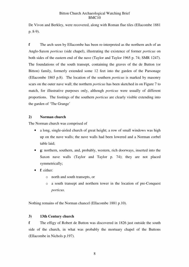
5) The Vestry was built in the 1830s
As part of the recent works to the church, the architect Marcus Chantry has
numbered the bays defined by the external buttresses of the church. These bay
numbers have been applied to this report.
Bitton Church Archaeological Watching Brief
BMC10
10
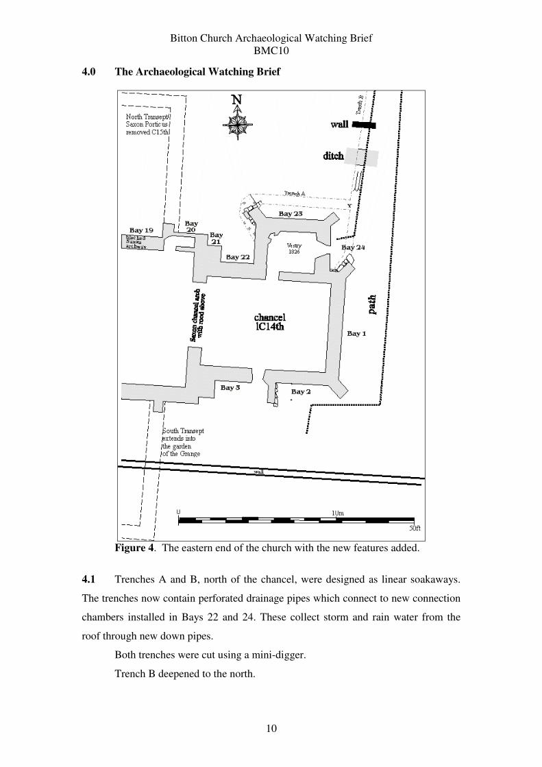
4.0 The Archaeological Watching Brief
Figure 4. The eastern end of the church with the new features added.
4.1 Trenches A and B, north of the chancel, were designed as linear soakaways.
The trenches now contain perforated drainage pipes which connect to new connection
chambers installed in Bays 22 and 24. These collect storm and rain water from the
roof through new down pipes.
Both trenches were cut using a mini-digger.
Trench B deepened to the north.
Bitton Church Archaeological Watching Brief
BMC10
11
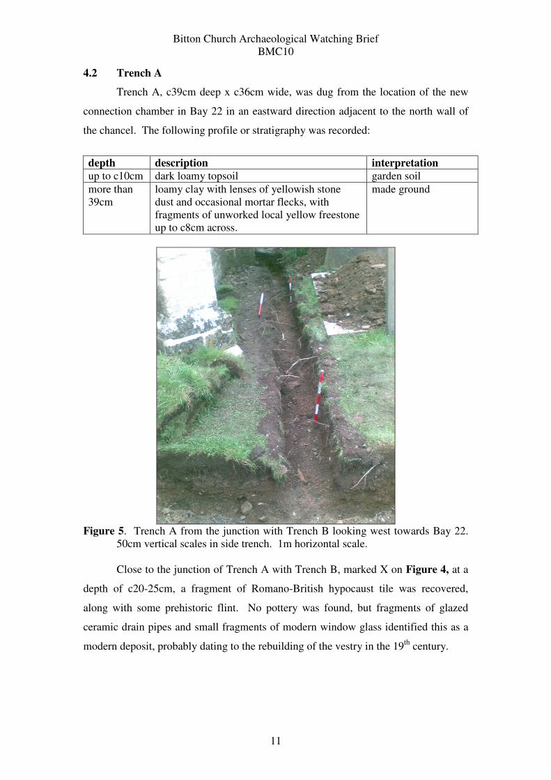
4.2 Trench A
Trench A, c39cm deep x c36cm wide, was dug from the location of the new
connection chamber in Bay 22 in an eastward direction adjacent to the north wall of
the chancel. The following profile or stratigraphy was recorded:
depth description interpretation
up to c10cm dark loamy topsoil garden soil
more than
39cm
loamy clay with lenses of yellowish stone
dust and occasional mortar flecks, with
fragments of unworked local yellow freestone
up to c8cm across.
made ground
Figure 5. Trench A from the junction with Trench B looking west towards Bay 22.
50cm vertical scales in side trench. 1m horizontal scale.
Close to the junction of Trench A with Trench B, marked X on Figure 4, at a
depth of c20-25cm, a fragment of Romano-British hypocaust tile was recovered,
along with some prehistoric flint. No pottery was found, but fragments of glazed
ceramic drain pipes and small fragments of modern window glass identified this as a
modern deposit, probably dating to the rebuilding of the vestry in the 19th
century.
Bitton Church Archaeological Watching Brief
BMC10
12
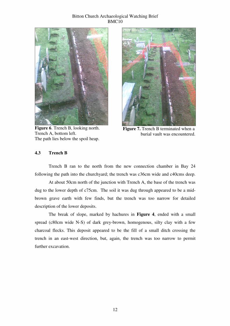
Figure 6. Trench B, looking north.
Trench A, bottom left.
The path lies below the spoil heap.
Figure 7. Trench B terminated when a
burial vault was encountered.
4.3 Trench B
Trench B ran to the north from the new connection chamber in Bay 24
following the path into the churchyard; the trench was c36cm wide and c40cms deep.
At about 50cm north of the junction with Trench A, the base of the trench was
dug to the lower depth of c75cm. The soil it was dug through appeared to be a mid-
brown grave earth with few finds, but the trench was too narrow for detailed
description of the lower deposits.
The break of slope, marked by hachures in Figure 4, ended with a small
spread (c80cm wide N-S) of dark grey-brown, homogenous, silty clay with a few
charcoal flecks. This deposit appeared to be the fill of a small ditch crossing the
trench in an east-west direction, but, again, the trench was too narrow to permit
further excavation.
Bitton Church Archaeological Watching Brief
BMC10
13
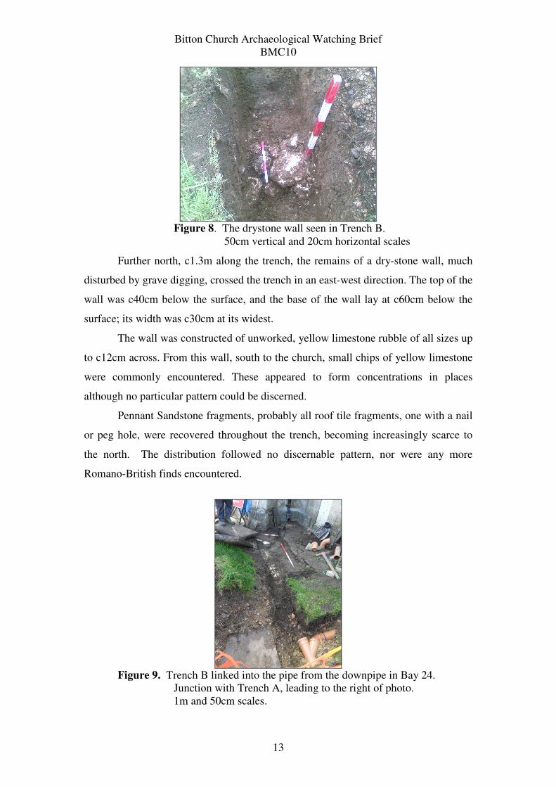
Figure 8. The drystone wall seen in Trench B.
50cm vertical and 20cm horizontal scales
Further north, c1.3m along the trench, the remains of a dry-stone wall, much
disturbed by grave digging, crossed the trench in an east-west direction. The top of the
wall was c40cm below the surface, and the base of the wall lay at c60cm below the
surface; its width was c30cm at its widest.
The wall was constructed of unworked, yellow limestone rubble of all sizes up
to c12cm across. From this wall, south to the church, small chips of yellow limestone
were commonly encountered. These appeared to form concentrations in places
although no particular pattern could be discerned.
Pennant Sandstone fragments, probably all roof tile fragments, one with a nail
or peg hole, were recovered throughout the trench, becoming increasingly scarce to
the north. The distribution followed no discernable pattern, nor were any more
Romano-British finds encountered.
Figure 9. Trench B linked into the pipe from the downpipe in Bay 24.
Junction with Trench A, leading to the right of photo.
1m and 50cm scales.
Bitton Church Archaeological Watching Brief
BMC10
14
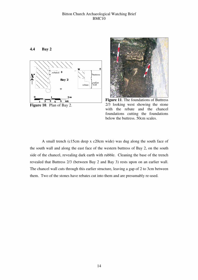
4.4 Bay 2
Bay 2
rebated
0 1
1 2 3 4 5 6ft
2m
N
earlier wall
buttress
rebate
{
{
W E
Figure 10. Plan of Bay 2.
Figure 11. The foundations of Buttress
2/3 looking west showing the stone
with the rebate and the chancel
foundations cutting the foundations
below the buttress. 50cm scales.
A small trench (c15cm deep x c20cm wide) was dug along the south face of
the south wall and along the east face of the western buttress of Bay 2, on the south
side of the chancel, revealing dark earth with rubble. Cleaning the base of the trench
revealed that Buttress 2/3 (between Bay 2 and Bay 3) rests upon on an earlier wall.
The chancel wall cuts through this earlier structure, leaving a gap of 2 to 3cm between
them. Two of the stones have rebates cut into them and are presumably re-used.
Bitton Church Archaeological Watching Brief
BMC10
15
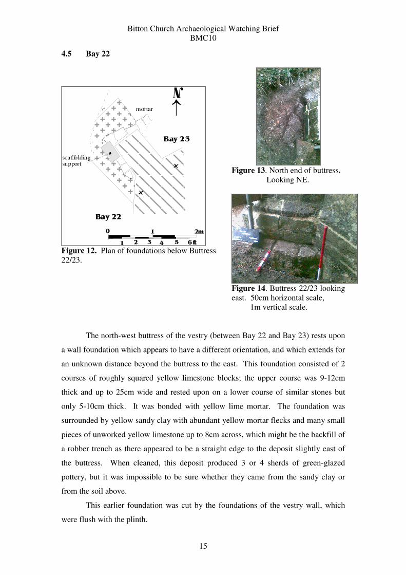
4.5 Bay 22
Bay 22
Bay 23
scaffoldingsupport
mor tar
0 1
1 2 3 4 5 6ft
2m
N
Figure 12. Plan of foundations below Buttress
22/23.
Figure 13. North end of buttress.
Looking NE.
Figure 14. Buttress 22/23 looking
east. 50cm horizontal scale,
1m vertical scale.
The north-west buttress of the vestry (between Bay 22 and Bay 23) rests upon
a wall foundation which appears to have a different orientation, and which extends for
an unknown distance beyond the buttress to the east. This foundation consisted of 2
courses of roughly squared yellow limestone blocks; the upper course was 9-12cm
thick and up to 25cm wide and rested upon on a lower course of similar stones but
only 5-10cm thick. It was bonded with yellow lime mortar. The foundation was
surrounded by yellow sandy clay with abundant yellow mortar flecks and many small
pieces of unworked yellow limestone up to 8cm across, which might be the backfill of
a robber trench as there appeared to be a straight edge to the deposit slightly east of
the buttress. When cleaned, this deposit produced 3 or 4 sherds of green-glazed
pottery, but it was impossible to be sure whether they came from the sandy clay or
from the soil above.
This earlier foundation was cut by the foundations of the vestry wall, which
were flush with the plinth.
Bitton Church Archaeological Watching Brief
BMC10
16
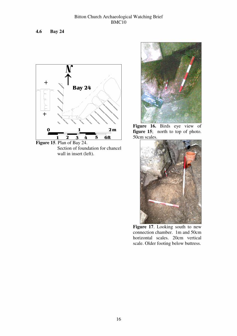
4.6 Bay 24
N
Bay 24
0 1
1 2 3 4 5 6ft
2m
Figure 15. Plan of Bay 24.
Section of foundation for chancel
wall in insert (left).
Figure 16. Birds eye view of
figure 15; north to top of photo.
50cm scales.
Figure 17. Looking south to new
connection chamber. 1m and 50cm
horizontal scales. 20cm vertical
scale. Older footing below buttress.
Bitton Church Archaeological Watching Brief
BMC10
17
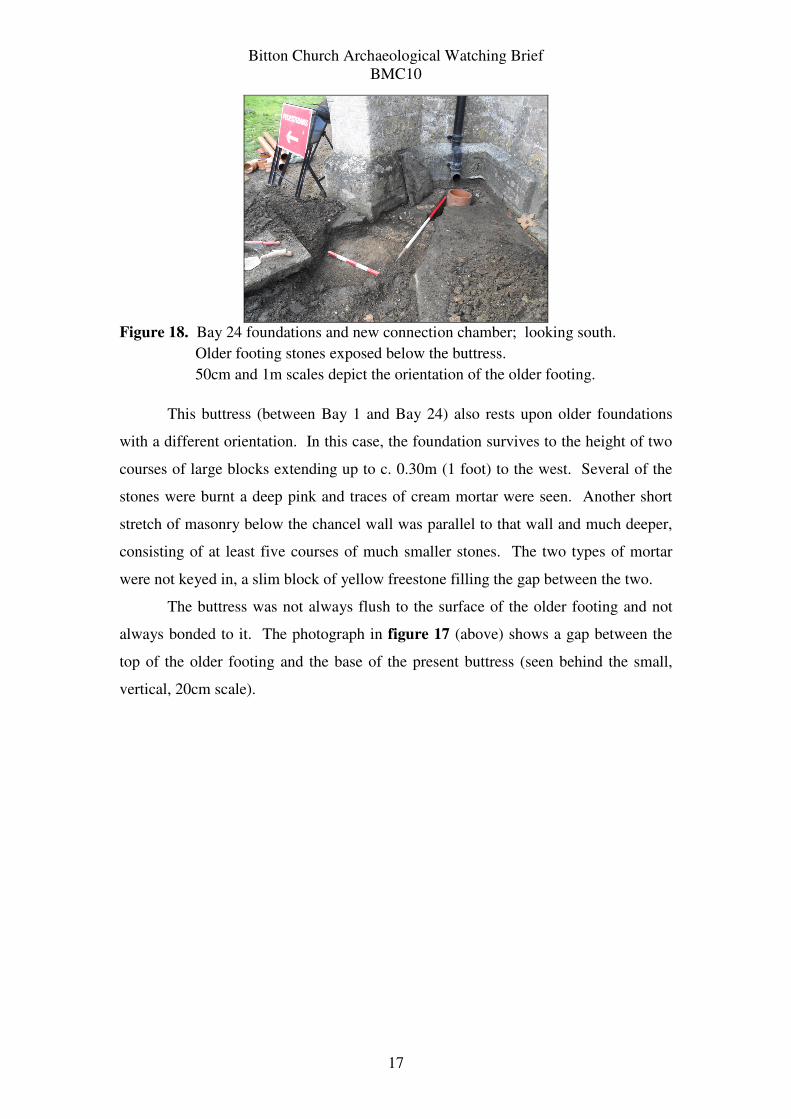
Figure 18. Bay 24 foundations and new connection chamber; looking south.
Older footing stones exposed below the buttress.
50cm and 1m scales depict the orientation of the older footing.
This buttress (between Bay 1 and Bay 24) also rests upon older foundations
with a different orientation. In this case, the foundation survives to the height of two
courses of large blocks extending up to c. 0.30m (1 foot) to the west. Several of the
stones were burnt a deep pink and traces of cream mortar were seen. Another short
stretch of masonry below the chancel wall was parallel to that wall and much deeper,
consisting of at least five courses of much smaller stones. The two types of mortar
were not keyed in, a slim block of yellow freestone filling the gap between the two.
The buttress was not always flush to the surface of the older footing and not
always bonded to it. The photograph in figure 17 (above) shows a gap between the
top of the older footing and the base of the present buttress (seen behind the small,
vertical, 20cm scale).
Bitton Church Archaeological Watching Brief
BMC10
18
5.0 DISCUSSION
5.1 The data presented in this report was been collected under conditions which
were far from ideal for archaeological purposes: the trenches were too narrow to allow
for investigation of the features encountered and finds were not recovered in
association with the features. Allowing for these and similar caveats, a surprising
number of observations were made in these small trenches and it is possible to draw a
few broad conclusions without fear that they are unfounded. The safest policy would
be to begin with the known and to work from that to the unknown.
5.2 The chancel is often the oldest part of the church. The chancel at St. Mary’s
church has been dated to the 14th
century (Taylor and Taylor 1965 p.73)), but the
Anglo-Saxon chancel arch (Taylor and Taylor 1965 p.74) argues that at least some of
the chancel foundations belong to the pre-Conquest period. It is possible that the
chancel was extended during the 14th
century (the slight change of wall thickness
from the western half of the chancel to the eastern might indicate an eastern
extension), so it possible to state with reasonable confidence that the chancel
foundations date to the 14th
century, if not earlier.
5.3 The chancel foundations were seen in both Bay 2 and Bay 24 to be nearly
flush with the wall plinth. In both bays, the foundations for the buttresses were
noticeably different from those of the chancel. In Bay 2 the chancel foundations
appeared to cut through the buttress foundations (Figures 11 and 12), suggesting that
the present buttress is built upon an earlier foundation.
Only a small section of the chancel foundation was visible in Bay 24, but it
was clearly of a different character to the buttress foundation, which extended far
beyond the buttress to the north and to the west and lay on a very different orientation
(Figures 16 – 19). The coursing of the buttress matches that of the chancel, showing
that they are of the same date, suggesting, again, that the buttress foundations are of
an earlier phase.
5.4 Buttress 22/23 was constructed considerably later than the chancel: the date
above the eastern doorway of the vestry is 1826. The foundations of the vestry itself
were not seen and it is entirely possible that this element of the church was built on
Bitton Church Archaeological Watching Brief
BMC10
19
similar foundations to those seen under the buttress (Figures 13 – 15). The mortary
deposit around the foundations do, however, appear to be a robber trench, so it would
appear that the 19th
century buttress laps over an earlier wall foundation.
5.5 It was noted that the NW buttress of Bay 24 stands above a distinctly different
footing and that the buttress was not bonded to that footing; there is a gap between the
two which can be seen on the photographs in figures 18 and 19.
Furthermore, the footing extends far to the west of the present buttress and
also to the north with these extensions at an obviously different orientation.
56 It should come as no surprise to see earlier walls beneath St. Mary’s, since the
small triangle of roads around the churchyard (Figure 2) has been intensively
occupied from at least the Roman period (para. 2.2, 3.1 and 3.2 above). The Romano-
British hypocaust fragment found in Trench A joins the tesserae reported by
Ellacombe and the plentiful coins to paint a picture of high status buildings with
underfloor heating beneath mosaic pavement at the end of the Roman administration
in Britain. Romano-British sites were often re-used for Anglo-Saxon church sites , as
demonstrated at several major early churches in the area, e.g. Wells Cathedral
(Rodwell 2005) and Glastonbury (Hollinrake 2008 p. 70; Morris, 1997 p. 30-45).
As is typical for churches, few datable finds were recovered. Pottery dating
from the 13th
to the 19th
centuries only served to inform us of what we already know:
the presence of a medieval church being maintained into the modern period. The
range of medieval building materials, however, derive from a roof of green-glazed
tiles with brown-yellow glazed accents.
The combed flue tile is diagnostic of the Roman system of interior heating
known as hypocaust. Fireplaces stoked from outside provided heat for the under-floor
cavities, which was drawn through the walls via these flues before emerging through
the roof. The combing is intended to act as a key for a plaster render. The high-status
building for which this flue was intended could well have been roofed with the
Pennant sandstone tiles, although these stone tiles could have also been used in the
church or associated buildings. There is also a great likelihood that the stone roof
tiles could have been taken from the Roman buildings and used on the church.
Finds were marked with the site code BMC10 and context. The
churchwardens will be negotiating with the staff of Bristol City Museum, where other
Bitton Church Archaeological Watching Brief
BMC10
20
finds from the churchyard are deposited, to use these and other finds for a small
museum display in the church.
5.7 Continuity of occupation over this long period may well have fostered the
retention of major boundary and property lines, so it is possible that the principal
building aligments occur and re-occur throughout the Roman, Saxon and medieval
periods. The ditch and wall seen in Trench B could, therefore, be of any date; their
proximity suggests that they could represent a long-standing boundary although their
contemporaneity cannot be demonstrated at present. It should be noted that these
features have survived despite intensive grave digging over many centuries,
suggesting that other important features could survive within the graveyard in this
outstandingly important and interesting site.
Nancy Hollinrake
28th
March 2011
Bitton Church Archaeological Watching Brief
BMC10
21
ACKNOWLEDGEMENTS
The watching brief was commissioned by Marcus Chantry, who generously donated
his photographs of the southern side of the boundary wall. Ann and Bob Willis, the
churchwardens, were very helpful in escorting us around the church and churchyard.
Thanks are due to Ben and Paul Hastings of Wellington Masonry for all their help and
support for our work. Val Stevens washed and marked the finds and Arthur
Hollinrake compiled the finds list. Nancy Hollinrake drew the illustrations.
BIBLIOGRAPHY
Dunning, Robert, 1992, Somerset and Avon, Stroud.
Ellacombe, Rev. H.T., 1867, ‘Some account of the manor of Button or Bitton, Co.
Gloucestershire, in Nichols.
Ellacombe, Rev. H.T., 1881, History of the parish of Bitton, Exeter.
Hollinrake C and Hollinrake N, 2009, An Archaeological and Historical Desk-top
Survey of St. Mar’s Parish Church, Bitton, South Gloucestershire, BMC 09,
unpubl. client report no. 438 for St. Mary’s Church PCC and Bath and Wells
Diocesan Advisory Council.
Hollinrake, N. 2008, Glastonbury from the Romans to the Saxons: a critical review of
the evidence from the Roman period to the tenth century, unpulb MA
dissertation, University of Wales, Cardiff.
Morris, Richard, 1997. Churches in the Landscape, London.
Rawes, B. (ed.) Archaeological Review No 12, 1987, Transactions of the Bristol and
Gloucestershire Archaeological Society 1988, Vol. 106, 219-224
Rodwell, Warwick, 2001, Wells Cathedral: Excavations and Structural Studies, 1978
– 93, English Heritage Archaeological Report 21, London.
Taylor and Taylor Taylor, H.M. and Taylor, J., 1965, Anglo-Saxon Architecture, Vol
1. Cambridge University Press.
Bitton Church Archaeological Watching Brief
BMC10
22
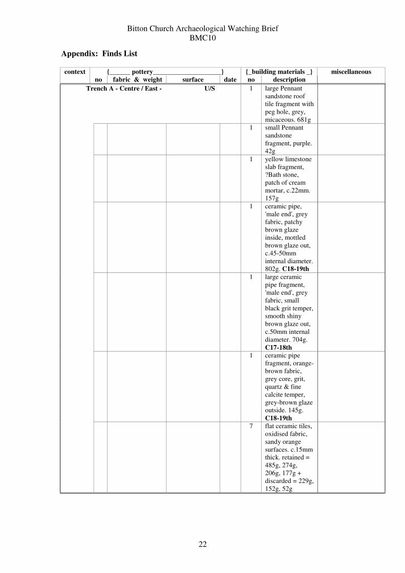
Appendix: Finds List
{______ pottery____________________} {_building materials _} context
no fabric & weight surface date no description
miscellaneous
Trench A - Centre / East - U/S 1 large Pennant
sandstone roof
tile fragment with
peg hole, grey,
micaceous. 681g
1 small Pennant
sandstone
fragment, purple.
42g
1 yellow limestone
slab fragment,
?Bath stone,
patch of cream
mortar, c.22mm.
157g
1 ceramic pipe,
'male end', grey
fabric, patchy
brown glaze
inside, mottled
brown glaze out,
c.45-50mm
internal diameter.
802g. C18-19th
1 large ceramic
pipe fragment,
'male end', grey
fabric, small
black grit temper,
smooth shiny
brown glaze out,
c.50mm internal
diameter. 704g.
C17-18th
1 ceramic pipe
fragment, orange-
brown fabric,
grey core, grit,
quartz & fine
calcite temper,
grey-brown glaze
outside. 145g.
C18-19th
7 flat ceramic tiles,
oxidised fabric,
sandy orange
surfaces. c.15mm
thick. retained =
485g, 274g,
206g, 177g +
discarded = 229g,
152g, 52g
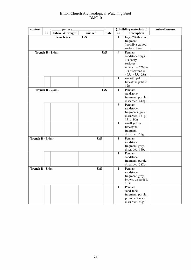
Bitton Church Archaeological Watching Brief
BMC10
23
{______ pottery____________________} {_building materials _} context
no fabric & weight surface date no description
miscellaneous
Trench A - U/S 1 large ?Bath stone
fragment,
?possible carved
surface. 884g
Trench B - 1.4m - U/S 4 Pennant
sandstone frags.
1 x sooty
surfaces -
retained = 626g +
3 x discarded =
495g, 435g, 28g
1 smooth, pale
limestone pebble.
12g
Trench B - 2.3m - U/S 1 Pennant
sandstone
fragment, purple.
discarded. 442g
3 Pennant
sandstone
fragments, grey.
discarded. 171g,
111g, 90g
1 small yellow
limestone
fragment.
discarded. 55g
Trench B - 3.4m - U/S 1 Pennant
sandstone
fragment, grey.
discarded. 140g
1 Pennant
sandstone
fragment, purple.
discarded. 382g
Trench B - 5.4m - U/S 1 Pennant
sandstone
fragment, grey-
brown. discarded.
105g
1 Pennant
sandstone
fragment, purple,
prominent mica.
discarded. 40g
Bitton Church Archaeological Watching Brief
BMC10
24
{______ pottery____________________} {_building materials _} context
n
o
fabric & weight surface date no description
miscellaneous
Trench
B - West
End -
U/S
1 glazed ware, pale
reduced, sandy.
13g
mottled green
glaze outside
with applied
horizontal
thumbed strip
and brown
glaze, pale
creamy sandy
surface inside
13-
15th
1 ceramic tile
fragment, grey
fabric, small
black grit temper,
hard, mottled
green glaze
above, pale
cream surface
below. 17g. C13-
15th
1 glazed ware, grey,
small black grit
temper, white
margin out. 9g
mottled khaki
glaze outside,
orange inner
surface with
deep rilling lines
13-
15th
Trench
B - U/S
1 small sherd,
oxidised sandy,
some grog temper,
abraded. 1g
trace of green
glaze surface
13-
15th
1 ceramic ridge tile
fragment, dark
grey fabric, black
grit temper up to
3mm with rare
grog, pale
oxidised sandy
inner surface,
outer surface
pulled to a rough
point, white strip
below patchy
green & clear
glaze, stabbed.
72g. C13-15th
2 x cortical FLINT
lumps, dark grey to
black. 8g, 7g
1 porcelain sherd.
4g
blue decoration 19-
20th
1 x small tarmac
lump. discarded. 21g
1 large box-flue tile
fragment, 6 x
toothed combed
key-ins, oxidised
fabric with rare
calcite, grit &
grog temper.
416g. C1st-4th
1 ceramic roof tile
fragment.
discarded. 14g.
C19-20th
1 Pennant
sandstone
fragment, grey,
micaceous.
discarded. 112g
2 small roof slate
fragments. grey,
discarded. 15g.
9g
Bitton Church Archaeological Watching Brief
BMC10
25
{______ pottery____________________} {_building materials _} context
n
o
fabric & weight surface date no description
miscellaneous
1 ceramic tile,
oxidised fabric,
patchy clear
glaze on surface.
14g. C17-18th?
1 limestone rubble
fragment coated
with pale cream
lime mortar.
212g
3 Lias stone
fragments,
discarded. 32g,
19g, 8g
2 small white lime
mortar fragments.
3g, 1g
1 window glass
sherd, pale green.
2g. ?medieval
Bay 2 2 joining, base &
body sherds,
oxidised sandy,
partly reduced on
the base. 96g, 32g
abraded inner
surface with
traces of brown
glaze, sooty
patches inside &
out, spots of dull
green glaze on
the base
?14-
16th
1 x long Fe nail,
square with flat
hammered top. 47g.
n.d
Bay 22 1 ceramic ridge tile
fragment, dark
grey fabric, black
grit temper,
rough, buff inner
surface, oxidised
upper surface
with stabbed
decoration,
patchy green
glaze. 228g.
C13-15th
3 x Fe nails.
discarded. 59g, 38g,
31g
1 large Pennant
sandstone roof
tile with peg
hole, purple.
1514g
1 Pennant
sandstone
fragment, purple,
sooty. 505g
1 Pennant
sandstone
fragment, grey,
discarded. 290g
Bitton Church Archaeological Watching Brief
BMC10
26
{______ pottery____________________} {_building materials _} context
no fabric & weight surface date no description
miscellaneous
1 small yellow
limestone
fragment, ?traces
of carving. 140g
1 large yellow
limestone
fragment. 622g
1 dense, smooth
pale limestone.
39g
1 small ceramic
floor tile
fragment, red-
orange fabric,
brown-yellow
glaze above. 21g.
C13-15th
Bay 24 1 rim frag, pale
oxidised, grey
core, frequent
quartz temper.
probably ?North
Devon ware. 33g
inner surface
missing
?16-
18th
1 Pennant roof tile
fragment, grey,
discarded. 270g
1 ceramic tile
fragment, orange
fabric, 1 x
smooth surface.
52g. n.d
U / S Spoil - Pipe Trench 18th Nov 2010 2 joining ceramic
ridge tile
fragments,
oxidised sandy
fabric, patchy
yellow-green
glaze above.
122g.
?C14-16th