better mobility in copenhagen its action plan 2015 … - action... · better mobility in copenhagen...
TRANSCRIPT

1
Better mobility in Copenhagen
ITS Action Plan 2015-2016
November 2014 Technical and Environmental Administration Centre of Traffic and Urban Life

2
Indhold
1 Introduction ..................................................................................................................................................................... 3
1.1 Contents ..................................................................................................................................................................... 3
1.2 Overall objectives .................................................................................................................................................... 3
1.3 Service goals ............................................................................................................................................................. 5
1.4 Themes in the ITS programme ............................................................................................................................ 6
1.5 Interfaces ................................................................................................................................................................... 7
1.5.1 The Danish Road Directorate ...................................................................................................................... 7
1.5.2 Surrounding municipalities .......................................................................................................................... 7
1.5.3 Smart City Initiatives in the City of Copenhagen ................................................................................... 8
1.5.4 Parking ............................................................................................................................................................... 8
2 Themes and initiatives ................................................................................................................................................... 8
2.1 Theme: Mobility and green driving ................................................................................................................... 8
2.1.1 Signal optimisation in relation to The Traffic Management Plan ..................................................... 9
2.1.2 Intelligent bus priority ................................................................................................................................... 9
2.1.3 Green waves for cyclists ............................................................................................................................ 11
2.1.4 ECO-driving .................................................................................................................................................... 12
2.2 Theme: Traffic Safety .......................................................................................................................................... 13
2.3 Theme: The street is adapted to the city’s rhythm of usage .................................................................. 14
2.4 Theme: Data and traffic managmement ....................................................................................................... 15
2.4.1 Establishing sensor networks for collecting traffic data .................................................................. 15
2.4.2 Database for collecting real-time data on traffic ............................................................................... 17
2.4.3 Traffic Management ................................................................................................................................... 18
2.5 Theme: Information and services.................................................................................................................... 19
2.5.1 Traffic information ...................................................................................................................................... 19
2.5.2 Open data....................................................................................................................................................... 20
2.5.3 Dynamic cycle signs with real-time traffic information ................................................................... 21
3 Implementation and the future process ............................................................................................................... 22
3.1 ITS - tender ............................................................................................................................................................. 22
3.2 Economy ................................................................................................................................................................. 23
3.3 Follow up ................................................................................................................................................................ 23

3
1 Introduction
1.1 Contents This ITS Action Plan outlines the themes and focus areas that Copenhagen will be working with within Intelligent Transport Systems (ITS) up to and including 2016. These initiatives aim to ensure that the municipality meets the service goals set out in the Traffic Management Plan, which was approved by the Technical and Environmental Committee on 22 September, 2014. In addition, the initiative will further the municipality's overall objectives as set out in section 1.2. In the period 2013-2014, the administration implemented a number of pilot projects as well as a public private innovation partnership (PPI) for ITS. In these, the administration, in collaboration with universities and private companies, has developed and tested new ITS solutions for the benefit of citizens and users. Lessons learned from these projects, as well as user feedback, have been decisive for the choice of themes and focus areas in this action plan. The ITS Action Plan will form the basis for a larger ITS tender. So, the plan describes themes and focus areas, but not specific solutions or time schedules for the implementation sequence. This approach has been chosen as the Technical and Environmental Administration considers it advantageous to leave this to the bidder. Technological development is proceding very fast, and it is important not to be locked into certain types of solutions when the market will already be able to offer newer and more efficient versions within a short space of time. Even though the specific solutions are not given in advance, the requirements for the solutions naturally appear in the tender documents. Efforts should be focused on those roads where improved mobility has been promised in the Traffic Management Plan. In addition, other stretches of road will be included where optimisation is needed.
1.2 Overall objectives Copenhagen is known abroad as a modern, green and welcoming city and it is a city which has ambitious goals within the areas of the environment, mobility and quality of life amongst others.
Based on digital technology, ITS (Intelligent Transport Systems) is opening up entirely new opportunities to control traffic strategically in a way that supports a number of the overall goals. ITS are also a central element in the concept of the Smart City, where data from a variety of sources can be linked and used for new types of solutions and services. As part of the "CPH 2025 Climate Plan - A green, smart and carbon neutral city", Copenhagen has set an ambitious goal to become carbon neutral by 2025. The ITS programme is one action in the Climate Plan and is

4
expected to contribute to a reduction in CO2 emissions of 25,000 tons per year by 2025. In 2010, transport contributed with 380,000 tonnes CO2. This goal requires investments in ITS continuing until 2025. So, the purpose of the ITS programme is to support the goals within green mobility and improve flow, enabling road users to reach their destination more easily, through smarter and greener traffic management for all modes of traffic. Persuading people to go by bike instead of taking their car is one of the most effective methods for reducing CO2 emissions. So, amongst many other things, the ITS programme deals with how to make cycling and public transport more efficient and attractive. Copenhagen wants to be a city that is good to live in, and a high quality of life requires more than just efficient transport. So, the ITS programme must also support an attractive city life, with more people spending more time outside by, amongst other things, increasing road safety and comfort for pedestrians and cyclists. As stated above, the ITS programme must relate to a variety of different objectives and help to maintain and develop Copenhagen as a modern and healthy capital, which manages in a smart way to combine efficient and environmentally friendly transport solutions with growth, an attractive city life as well as a high quality of life in general. The ITS programme interfaces with the following strategies and objectives set for Copenhagen:
Plan/strategy Objectives
CPH 2025 Climate Plan
2005 – 2015: CO2 emissions from transport to be reduced by 10%
Copenhagen to be CO2-neutral by 2025.
By 2025: 75% of all trips in Copenhagen to be by bike, by public transport or on foot.
Municipal Plan 2011
As 2025 gets closer: the goal is that at least 2/3 of the growth in the total number of personal trips must be made using green transport ie, walking, cycling and public transport.
The long term vision is that at least 1/3 of all personal trips must be by bike in the city, at least 1/3 must be with public transport and a maximum of 1/3 must be by car.
Environment Metropolis 2007
By 2015: Copenhageners must be able to sleep peacefully, undisturbed by noise which is harmful to health coming from street traffic. Furthermore, all schools and institutions should be subject to only a low level of traffic noise.
By 2015: the air must be so clean that Copenhageners’ health is not subject to stress.

5
A Metropolis for People
By 2015: pedestrian traffic will have increased by 20% compared to 2009.
Traffic Safety Plan 2013 - 2020
The number of deaths and serious injuries on our roads to be halved in the period 2013-2020 compared to 2009-2011.
Copenhagen’s Cycle Strategy 2011 - 2025
From 2013 to 2015: percentage of all bike trips to work and places of education in Copenhagen to rise from 41% to 50%.
Compared with 2010, cyclists’ travel time to be reduced by 5% in 2015, 10% in 2020 and 15% by 2025.
1.3 Service goals The traffic management plan lays down a number of service goals for individual forms of transport. The initiatives in this action plan will ensure that service goals are met. Service goals are the administration's performance indicators in traffic management. Each year, the administration follows up on progress towards meeting these service goals. Collection and processing of traffic data is necessary in order to be able to follow to what extent service goals are being met. This applies both when quick action must be taken if a service goal is not being met, as well as when it comes to assessing averages and trends over a longer period of time.

6
Mode of Transport
Service goals – must be achieved by 2018
Cyclists
The average speed on the designated cycle routes will increase from 15.7 kph to 17.3 kph, resulting in the average travel time being reduced by 10%.
The number of stops to be reduced by 10%.
Pedestrians
In the Inner City, pedestrians must have sufficient green time at the signals to cross the road without having to stop in the middle. Care must also be taken to ensure that pedestrians do not wait too long before getting the green light to cross the road.
Outside the inner city, special consideration must be given to pedestrians on the main shopping streets and at busy intersections and particularly in urban spaces where there are many pedestrians.
Buses
The average journey time by bus to be reduced by 5-20% during peak hours, depending on the route.
There must be a 10% increase in the reliability of the travel time.
Cars
The average travel time of the designated road network must not be increased and on specified lines must be reduced by 5%.
There should be a 10% increase in the reliability of travel time prediction during rush hour in the direction with the densest car traffic.
The number of stops on the priority road network must be reduced by 10%.
1.4 Themes in the ITS programme The ITS programme will cover the following five themes. The integration of themes and actions is a key element in the thinking about intelligent solutions and for this reason, "Smart City" and the individual areas of initiatives and actions will often connect several themes.

7
Theme Objective
Mobility and green transport
Improved mobility and traffic flow for all types of road users.
Traffic safety
Use of ITS solutions to improve traffic safety.
The street adapts to the rhythm of usage
Flexible use of street space.
Data and traffic management
Collection and processing of real-time data about traffic.
Overview and strategic traffic management.
Active management of traffic incidents.
Information and services
Better and more updated information through the appropriate channels.
1.5 Interfaces
1.5.1 The Danish Road Directorate The municipality has a cooperative arrangment with the Danish Road Directorate covering traffic management, including the setting up of a joint trafficcontrol center. The traffic management system purchased by the City of Copenhagen will be designed to interact with the existing traffic management system of the Road Directorate, so these complement each other.
1.5.2 Surrounding municipalities Cooperation with surrounding municipalities is important in the deployment of our ITS programme, in particular to ensure good traffic information, the optimisation of signals across municipal borders and the coordination of road works.

8
1.5.3 Smart City Initiatives in the City of Copenhagen A digital infrastructure, as described below, will create a database that will be central to the Smart City initiatives. It is important that the systems interact successfully, which will place demands on open standards and protocols.
1.5.4 Parking Parking in Copenhagen is undergoing a radical development, including digitalisation of payment. The ITS programme will work closely together with the parking system to ensure synergy between the two areas of initiative.
2 Themes and initiatives This section describes the themes and initiatives within ITS and traffic management which will be implemented in Copenhagen in 2015-2016. It is these themes and areas of initiative that will be included in a larger ITS tender. However, signal optimisation will, in part, be delivered through existing framework agreements. Throughout the development and implementation of the specific solutions, the Technical and Environmental Administration will ensure that there is a constant focus on ensuring that the solutions create value for citizens, road users and businesses. For this reason, user tests will be prepared, while road users and citizens will be involved in developing solutions such as those falling under the theme "The street adapted to the city’s rhythm of usage". In addition, the administration will continue to involve stakeholders in the ITS work.
2.1 Theme: Mobility and green driving This theme is about how ITS can help make better use of the existing infrastructure, thus improving the flow of traffic of all kinds. It is also about how to help drivers follow the green wave
Example 1: Traffic simulation of H.C. Andersens Blv
A traffic simulation has shown that optimisation of traffic signals on HC Andersens Boulevard can provide up to 14% reduction in travel time for motorists during rush hour in one direction. The number of stops cyclists made on the same stretch of road was also reduced by up to 16%. Bus travel time was also improved in a similar way, especially in daytime at the Stormgade / HC Andersens Boulevard intersection. Pedestrian traffic safety is also expected to improve following technical adjustment to the signals.

9
through ECO-driving.
2.1.1 Signal optimisation in relation to The Traffic Management Plan The issue The City of Copenhagen is replacing the intersection controllers of traffic signals on all major roads for bicycles, buses and cars (the priority road network). This allows for a much more intelligent traffic management. But many of today’s signals have not been optimised for today’s traffic.
Action
Traffic signals will be optimised on the stretches of road where it is most needed and where it provides the greatest reduction in CO2 emissions. Routes have been identified in the Traffic Management Plan where improvement in travel time for car traffic has been promised. These include Åboulevard-line, Ring 2 and Amager Fælledvej. The action will focus on all types of traffic, and examine where conditions for pedestrians should be improved around stations or other city spaces frequented by pedestrians. The optimisation should focus on creating better traffic flow and shortening travel time, with fewer stops and better conditions for pedestrians.
The prioritisation of traffic is based upon the Traffic Management Plan. The measures implemented will be both simple solutions, such as adjusting the way the signals are coordinated, and advanced solutions, where a variety of sensors control the traffic through their input on the traffic signals. Simulation models will be developed to test the best solution for the given stretch of road before the change is implemented in reality. Anticipated results According to the Road Directorate's report "Better Traffic Signals," we can expect the following improvements from signal optimisation:
Less air pollution and CO2 emissions.
Better service provision for road users.
Fewer accidents due to fewer stops in the traffic.
Greater road capacity and less congestion.
Moreover, simulation studies of signal optimisation on HC Andersens Boulevard show promising results (see Example 1).
2.1.2 Intelligent bus priority The issue
Each year, about 160 million people catch(use/take) one of MOVIA's buses in the metropolitan area. So, the

10
City of Copenhagen has been working for many years to get the buses through the streets faster and more promptly for the benefit of the many millions of passengers. There are already many initiatives in the city to ensure that buses reach their destinations more easily – eg, uniquely dedicated bus lanes which get green lights before the other traffic. We also need to develop new solutions to improve the flow of buses in the future. One of the challenges we must face is to ensure that buses arrive at more regular intervals. This applies especially to the high-frequency bus routes, on which for example, A and S buses run, and where buses sometimes clump together during peak hours. This results in a poorer service for the passangers. Today, buses notify the traffic signal via GPS so that the signal knows the position of the bus. In this way, the signal can prioritise the bus. The traffic signal today however, has no more information on the bus, and the prioritisation relies on the principle of ‘first come, first served.’
Action
This could for example be information, provided by MOVIA, on the relative importance of the bus line, the number of passengers and whether the bus is late. This new data may help to determine the level of priority in signaling, thereby ensuring more regular arrivals of buses.
This initiative is also aimed at improving the progress of buses through the traffic by making traffic signals smarter by, amongst other initiatives, providing them with input about the current traffic by means of cameras.
All the stretches of road where the progress of the buses must be improved can be seen in the Traffic Management Plan. These include Jagtvej, Tagensvej and Bernstorffsgade.
As part of an EU project, Compass4D, a system is being set up to share information between buses and traffic signals. This should improve the passage of buses through the traffic as well as creating safer driving conditions on the route from Copenhagen Central Station to Østerport.
Anticipated results
Including more data on the buses' real-time situation in traffic management can help to ensure that the high frequency buses, which run without a time schedule, do not clump together.
Intelligent bus priority, when the traffic signal gives a green light as needed and helps the buses in through the
Example 2: Intelligent bus priority in Valby
In Valby, 10 traffic signals can now spot buses in the streets and ensure that they get over the lights while they are green. This is done by using 66 cameras that anonymously detect all motor vehicles, plus a GPS system in the buses. The first results have shown that individual bus lines are saving up to two minutes during rush hour over the relatively short distance. Motorists and cyclists are expected to decrease their travel time by 20% in the area.

11
system has been tested in Valby and shows very positive results (see example 2).
2.1.3 Green waves for cyclists
Green waves for cyclists are important if we are to reach the transport policy objectives of getting more people to cycle. Copenhagen has established a few green waves for cyclists. They have all shown positive effects, so there is a great potential to apply this solution to a larger part of the road network.
Action
Green waves for cyclists will be created on those stretches of road indicated in The traffic Management Plan ie, Vesterbrogade, Østerbrogade, Jagtvej and Trianglen, Grønningen / Bredgade, Holmen's Canal to Kongens Nytorv, Queen Louise's Bridge and Gothersgade. In addition, some of the existing green waves for cyclists would benefit from being optimised.
Adaptive systems are being used which prioritise between bikes and buses using data from traffic sensors and GPS in buses dynamically, in such a way that the buses are not delayed. Adaptive systems will adapt to waves dynamically. This means that cyclists get a green light even though they have headwind and are cycling more slowly than normal.
Today, green waves function in isolation without any coordination behind them. For this reason, work is being carried out to link them together.
It must be possible for the green waves to be monitored and adjusted by means of a traffic management system based on measurements of the cyclists real travel time, number of stops etc. Existing green waves are being optimised and updated.
Example 3: ECO-driving along Folehaven
Equipment was set up at twelve intersections on Folehaven to communicate with the trucks on this stretch of the road and to tell the driver when the traffic signal is turning green. The message is shown on a small screen in the truck so that the driver can adjust his speed and thereby avoid stopping and accelerating.
40% of drivers estimated that they had fewer stops along the way after the ECO-driving system was set up, thereby saving fuel. There is a need to develop the system further, so the results become even better.

12
Anticipated results
Green waves reduce cyclists’ travel time and number of stops, resulting in them experiencing a better and more efficient journey. The evaluation report on green waves on Nørrebrogade showed that travel time decreased by 17% for a cyclist who cycled out of town at 20 kph. Moreover, the number of stops fell from six to under one. In the opposite direction, the number of cyclists’ stops decreased by the same percentage, with a slight decrease in travel time.
2.1.4 ECO-driving
The issue
The stopping and acceleration patterns of cars, and especially lorries, have great significance for the emissions discharged, local environmental impact such as noise and air pollution and fuel consumption. By ensuring motorists arrive at the lights when they are green, these negative effects of car traffic are reduced considerably.
Action
Actions within the field of ECO-driving consist of further developing and improving the system which was tested along Folehaven (see Example 3). This system requires equipment both along the road and in the lorries. In order to avoid equipment being erected along the roadside, an experiment was also carried out in which information about traffic signals was shared through a website. Both systems were implemented over two stretches of road. Further work will be done in collaboration with DTL (Danish Transport and Logistics).
Another initiative is about setting up simple units along the roadside which will help guide the stream of traffic to follow the green lights and avoid stops. Not everybody has a cell phone or GPS turned on in the car. The Netherlands has experience with a relatively simple dynamic sign enabling drivers to follow the green wave. Such a sign must be approved by the Danish Road Directorate and the police before it can be set up.
Anticipated results
International projects have shown that ECO-driving can reduce CO2 emissions and NOx emissions by up to 13%. A 40 ton lorry use up to approximately 0.5 liters of diesel per stop (including acceleration). Considerable savings can also be made on fuel consumption.

13
2.2 Theme: Traffic Safety
The issue
A third of all road accidents in Copenhagen occur in the hours of darkness. This happens despite the fact that there is much less traffic in the evening and at night than during the day. Vulnerable road users in particular are hardest hit. Two thirds of of all those who die or suffer serious injuries in traffic are cyclists or pedestrians. In addition, several accidents registered at intersections occur because car drivers run a red light. Here it is important to have data on how drivers run a red light at the intersection and analyse why this happens.
Action
ITS can raise awareness of the presence of cyclists and pedestrians by the use of smart lighting, and by ensuring communication between traffic signals and street lighting (see Example 4). Projects using intelligent street lighting are being carried out at five intersections.
New concepts are also being developed about how to focus greater attention on pedestrians who are crossing the pedestrian crossing with blinking lights.
The latest intiative is about implementing pilot projects at three intersections where sensors detect the number of drivers who run a red light. An ITS solution is being implemented which ensures a reduction in accidents caused by cars running a red light.
Anticipated results
The increased focus on cyclists and pedestrians will improve safety and reduce the risk of accidents. Moreover, the number of accidents due to cars running a red light is expected to be reduced at those intersections where the project is being carried out.
Example 4: Intelligent lighting for increased safety at intersections
In April-June 2014, an experiment was carried out at one of the busiest intersections in Copenhagen - the intersection of HC Andersens Boulevard and Tietgensgade. The brightness of the street lighting was increased every time there was a green light for cyclists in the evening and at night. The cycle track just before the intersection was therefore extra bright when the cyclists were cycling towards the green light. In this way, motorists’ attention to cyclists was heightened, while power could be saved by not having the lights on at full power all night.
The results of the test showed that communication between street lighting and traffic signals is technically possible and that there is potential for synergy between the systems. There was also positive feedback from cyclists who were lit up more brightly on the test cycle track.

14
2.3 Theme: The street is adapted to the city’s rhythm of usage The issue
In this densely populated city where many people live, work, move around and spend time, the street space meets many needs that often change during the course of the day. An increase in the number of inhabitants will contribute to increased pressure on this street space and the need for a more dynamic use of the streets will increase.
In some places in Copenhagen, parking spaces remain empty in the daytime, but this area in the urban space is not used for city life and spending time in.
Elsewhere, the traffic scene changes dramatically throughout the day. Frederiksborggade for example, is one of the streets in the city which has most cyclists in the morning and afternoon rush hours. Outside rush hours however, there is a completely different picture, characterised by many pedestrians, especially around Torvehallerne (the relatively new and popular covered market).
Action
This is an innovation project where technological solutions must clarify and enable a more flexible use of street space around the clock. In residential areas, more work will be done on the concept of using empty parking spaces for other purposes, when there is no need for the parking space (see Example 5). The solutions will not destroy the parking spaces, and the technological solution will ensure that it is made clear when the street is changing character.
Example 5: Flexible use of street space
The concept of a more dynamic use of parking spaces was tested in April 2014 in Saxogade and Estonia Street (Estlandsgade) in Vesterbro. During the daytime, parking spaces were used for outdoor cafés, retail display, seating benches and bicycle parking. The purpose was to get people's feedback on how they experienced the changing character of street space.
Interviews with residents and users of the area showed that flexible solutions can accommodate an area's special needs and circadian rhythm. It also showed that it is important to involve local users in adapting to the changes and that the solution must be logical and easy to read.

15
In addition, the project will show models for a more flexible use of street space, so that it better meets the current traffic needs. It could for instance, be in the form of an area that can be used as a cycle track at some times and pavement at others.
The solutions found under this theme will in general be developed so that it is quite clear which rules apply and when. Since such concepts do not exist today, they must be approved by the Danish Road Directorate and the police before they can be implemented. Anticipated results
A more dynamic use of street space can create value for the citizens of Copenhagen by using the limited space in densely populated urban areas intelligently and creating more space for activities that promote city life. Moreover, it can help to give citizens a sense of ownership of the urban space by including them in the planning and use of the area. It can also help to ensure that people reach their destination more easily and that traffic conditions are good.
2.4 Theme: Data and traffic managmement Central to the ITS programme is the collection of real-time data on traffic and a new traffic management system based on this data to help the administration optimise traffic and deal with traffic situations.
2.4.1 Establishing sensor networks for collecting traffic data The issue
At the moment, the municipality has only limited real-time data ie, data on traffic here and now. The lack of real-time data about traffic makes it difficult for the municipality to get an overview, understand the overall picture and react quickly to unforeseen events.
Real-time data will make it possible to detect and respond to early signs of traffic problems for example, by changing the signal programmes or priorities. Real-time data is also the 'raw data', which many ITS projects related to mobility, safety and service will rely on.
Current data is also needed to follow up on the service goals set out in the Traffic Management Plan.
There are already a number of traffic sensors in the city, including traditional coils in the road and a small number of traffic cameras and GPS from Movia's buses. But data from the sensors is only used locally in traffic signal control devices, and there is no access to real-time data centrally. Currently, traffic counts are carried out primarily manually, and typically only twice a year in selected locations.
There is therefore a need for systems that continuously collect real-time data on the amount of traffic, travel time, number of stops, travel patterns, etc. There is a need for data on pedestrians, bicycles, buses and cars.

16
Action
A network of traffic sensors must be/will be that continuously collects real-time data about traffic. The network is built up in stages, based on The Traffic Management Plan:
1. Stretches of road where service goals are set. 2. Nodal points in designated road networks, including bike PLUS network, bus routes and major roads. 3. Other stretches where traffic signals need to be optimised.
A range of modern technology is available which can collect traffic data including, Bluetooth and WiFi aerials, radar, coils, cameras, RFID, apps for smartphones and so on.
Each techonology has its own strengths and weaknesses, so there is a need for a combination of technologies to get a sufficiently comprehensive data basis, for example:
Bluetooth / WiFi antennas. Through a unique and anonymous ID, smartphones and other devices can be tracked from one antenna to the next. In this way, data can be gathered on volume of traffic, travel times and on the overall level as well as on travel patterns. Provides a large amount of data, but the individual registration is only located within a few hundred meters. To distinguish the different types of traffic, a number of the antennas need to be placed at locations where traffic forms are physically separated for example, on cycle tracks, which are separated from car traffic.
RFID antennas: by means of a unique and anonymous ID, small tags / stickers mounted on eg, cycles can be tracked from antenna to antenna. Each registration is localised within a few meters and in this way different modes of traffic can be separated. This procedure requires that tags be distributed to a sufficient number of cyclists and that they can be installed properly.
Traffic sensors for example, coils, radar and camera, provide highly accurate counts at certain points, but individual road users typically cannot be tracked from sensor to sensor, and so you will not have data on travel times and travel patterns. Traffic sensors are often used simultaneously for local traffic management.
Apps: If the user gives his acceptance, apps for smart phones can, by using GPS, collect very detailed real-time data on travel patterns, number of stops, queues etc. A "tracking" function to go with the existing "I Bike CPH "cycle app has already been planned, where the user can keep track of his own bike habits and share data anonymously with the municipality. The possibility of using this or other
apps to collect data on other types of traffic needs to be looked into.
When possible, existing traffic sensors are to be connected to the administration's core systems, so data from the sensors can be accessed.
Anticipated results
Real-time data will ensure that the administration has an up-to-the-minute picture of the traffic, allowing them to react rapidly when a problem in the traffic occurs as well as to provide more timely traffic information to
17
drivers. In addition, real-time data will ensure a proper follow up on service levels and provide a better basis for planning optimisation measures.
2.4.2 Database for collecting real-time data on traffic
The issue
Collection of real-time data will result in a much larger amount of traffic data than the municipality handles today in existing GIS systems etc. The municipality currently has systems that handle geographic data about the road network, buildings etc, as well as a road administration system containing, amongst other information, data about road surfaces. But the systems are not built to handle real-time data or "Big Data". It will also be necessary to handle new data types which for example, reflect travel time, the number of stops and travel patterns. The existing IT system needs to be upgraded so that it can handle this type of "Big Data" and effectively store, search etc, in real time across data types. Such a database will form the basis for a traffic management system and smart city initiatives as well as new solutions and services. Action An IT system is to be built that can handle "Big Data" covering traffic. The system will connect all relevant data about traffic, roads, incidents, events, travel times etc, so that searches can be carried out across data types, both of current and historical data. It will integrate and interconnect existing and new data sources. For this reason the system must be based on open standards and protocols so that data can be shared with other systems and partners, including the Danish Road Directorate.
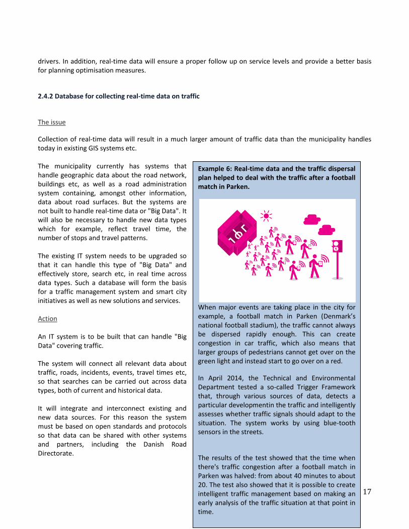
Example 6: Real-time data and the traffic dispersal plan helped to deal with the traffic after a football match in Parken.
When major events are taking place in the city for example, a football match in Parken (Denmark’s national football stadium), the traffic cannot always be dispersed rapidly enough. This can create congestion in car traffic, which also means that larger groups of pedestrians cannot get over on the green light and instead start to go over on a red.
In April 2014, the Technical and Environmental Department tested a so-called Trigger Framework that, through various sources of data, detects a particular developmentin the traffic and intelligently assesses whether traffic signals should adapt to the situation. The system works by using blue-tooth sensors in the streets.
The results of the test showed that the time when there's traffic congestion after a football match in Parken was halved: from about 40 minutes to about 20. The test also showed that it is possible to create intelligent traffic management based on making an early analysis of the traffic situation at that point in time.

18
Anticipated results
An effective system for collecting, handling and retrieval of traffic data enabling effective use of the data collected.
2.4.3 Traffic Management The issue Today, the City of Copenhagen has a number of different systems in the area of traffic that are only loosely connected. We are talking about:
RMS – a system monitoring failure of traffic signals and control mechanisms.
MUSE - control and monitoring of new lighting infrastructure.
Give a Hint – an app and website where citizens can send in reports about failures and problems.
ImFlow – a system for flexible traffic control
GIS - the municipality’s system for handling geographical data.
System for handling digging permits and events.
There are also a number of other systems eg, bus priority, cycle app and traffic sensors that have very limited interaction.
This limited interaction means that it is difficult to provide an overview and use the systems for strategic management of traffic. Furthermore, there is a need for new features that make it easier to make an intervention with active traffic management.
Software and data will form the basis of 'intelligence' in a wide range of ITS and Smart City initiatives and can contribute to smarter and cheaper solutions for the benefit of the city, and its citizens and businesses.
There is therefore a need for a central traffic management system that provides an overview and opportunity for strategic traffic management based on goals in the areas of the environment, mobility and urban life. Existing systems are being digitalised and integrated as far as possible. Such a system must be closely integrated with the Danish Road Directorate’s traffic management system in the new traffic exchange.
Action
A new traffic management system is to be set up. We are talking here of an IT system which is connected to all relevant traffic signals, traffic sensors, monitoring systems, databases and so on. The system should provide a good overview of traffic and signaling equipment, so the administration can identify and address early signs of traffic or technical problems. The system should help us to monitor service levels and ensure that action is taken in places where the goal is not being reached. It should also contribute to handling traffic better during both planned and unforeseen circumstances.

19
A number of scenarios will be prepared for times when swift response is required (for example, closing Lyngbyvejen when flooding occurs, a football match in Parken, the national football arena, or similar), as well as plans as to how to disperse traffic after such events: how the signals should be programmed for each of these scenarios. When a scenario is activated, the signal programs and green waves can for example, be changed automatically (see Example 6), and information can be sent to drivers using the relevant traditional and social media, dynamic signs etc. The system should provide insight into correlations and trends through the use of analyses anddigital interfaces
As part of the upcoming tender, The City of Copenhagen will found out how far we can go by expanding and interlinking existing systems and where there is a need to buy / develop new systems.
Anticipated results
The traffic management system will be the foundation for a number of other initiatives and will result in:
Better overview of traffic, traffic flow and bottle necks.
Faster and more effective response to traffic incidents.
Better prediction and prevention of traffic problems.
Better insight into traffic developments and trends.
Better insight into the impact of transport initiatives.
2.5 Theme: Information and services
2.5.1 Traffic information
The issue
Information about the traffic can provide a better service, get road users through the city more quickly and easily and help them make greener transport choices.
Updated information is also important for business for example, in connection with logistical planning.
In 2013, the Danish Road Directorate completed a study entitled "The value of traffic information", documenting that traffic information has great value for road users. Motorists especially want information on delays, dangerous situations and alternative routes. The more updated the information is, the greater its value.
Today, citizens and businesses expect that information is up to the minute, relevant and personal, and that it is delivered over the channels they already use, which include apps, social media, radio etc.
20
The municipality has a number of data sources, such as traffic signals, road works and snow cleaning operations. Much of this information can be of great value to road users if it is processed and passed on in an efficient manner.
There is therefore a need to automate and digitalise the publication of updated traffic information. Consideration must be given to sensitive personal data, including ensuring that data is kept anonymous.
Action
Based on the new real-time data, current information is published about traffic incidents, road works, events and other things that affect traffic.
The administration is preparing an app for drivers in cooperation with the Danish Road Directorate, which must include information about road works, journey times on the main roads and also, on a longer term basis, parking information.
Information is to be supplied through the relevant channels, including radio / TV, social media and open data platforms. The transmission of information will be automated as far as possible and extracted from, amongst other sources, the traffic management system.
The existing "I Bike CPH" cycle app will be updated so as to take account of road works.
Anticipated results More targeted traffic information will provide better service to road users, offering them a better opportunity to plan their journey. It can also lead to less stress in traffic and to increasing motorists’ attention at specific incidents.
2.5.2 Open data
The issue
Data must be made openly available to the public so that it provides value for citizens, consumers and businesses. This creates demands on the way data is structured and standards.
Action
Data from the traffic management system, traffic sensors etc, should, as far as possible, be made available to others through open data portals so they can be used for new apps, services and products. Data on service levels should also be published.
21
Anticipated results
The publication of real-time data about traffic will make it possible for others to develop new apps or services. Freight and goods carriers for example, will be better able to plan their journeys if an updated picture of the traffic is available.
2.5.3 Dynamic cycle signs with real-time traffic information
The issue
Traditionally, there has been limited focus on providing cyclists with real-time information about traffic. One reason is that cyclists are very flexible, and it is rare that they cannot cycle round roadworks for example. Many cyclists would however, like to avoid roadworks.
So, dynamic information can help to provide a better service and more comfort for cyclists by guiding and informing them. Cyclists have, amongst other things, expressed that it may be difficult to find the right speed to follow the green wave.
Today, more than 12,000 people have downloaded Copenhagen’s "I Bike CPH" app. As mentioned earlier, this could be improved by adding new features such as one that helps cyclists to follow the green wave. Not everyone however, has a cell phone holder on their bike or wants to use headphones, so there is a need to supplement the app with information in the street space by means of dynamic signs at selected locations. Cyclists have had good experiences with the existing bicycle barometers.
Action
A concept is being developed for a new dynamic cycle sign that, amongst other things, can provide information about green waves and alternative routes with less congestion
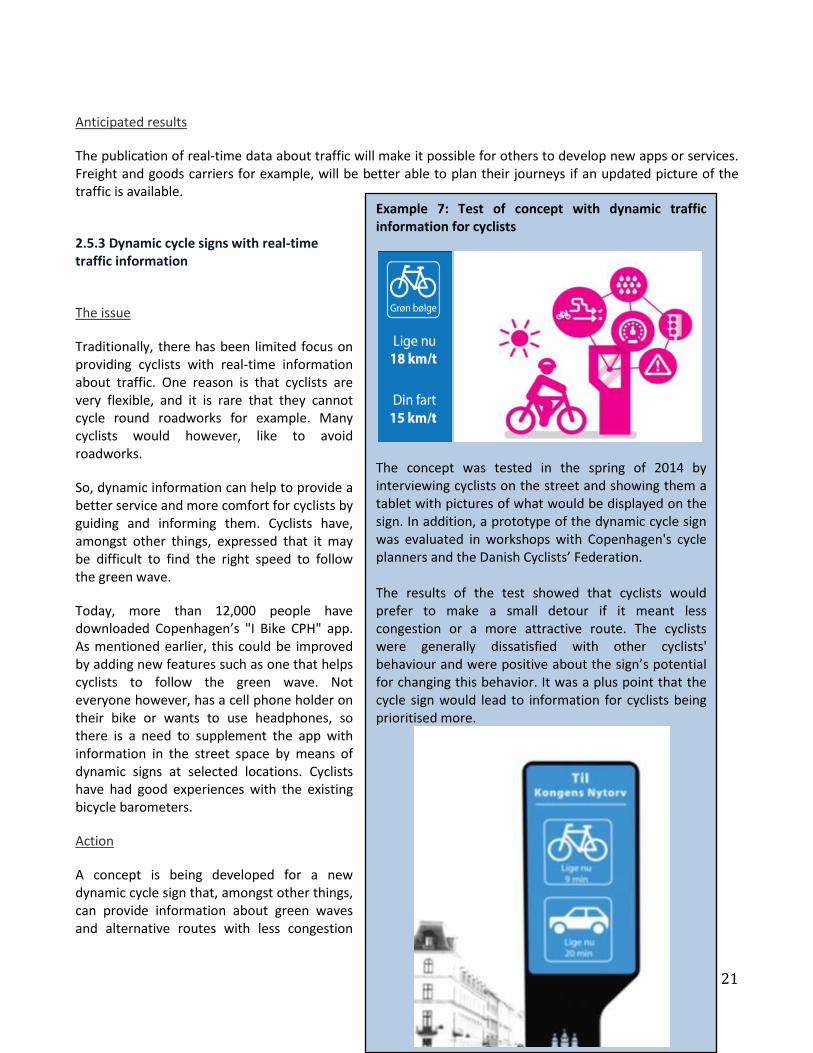
Example 7: Test of concept with dynamic traffic information for cyclists
The concept was tested in the spring of 2014 by interviewing cyclists on the street and showing them a tablet with pictures of what would be displayed on the sign. In addition, a prototype of the dynamic cycle sign was evaluated in workshops with Copenhagen's cycle planners and the Danish Cyclists’ Federation. The results of the test showed that cyclists would prefer to make a small detour if it meant less congestion or a more attractive route. The cyclists were generally dissatisfied with other cyclists' behaviour and were positive about the sign’s potential for changing this behavior. It was a plus point that the cycle sign would lead to information for cyclists being prioritised more.

22
(see Example 7). The sign may also encourage cyclists to be more considerate to each other when the cycle track is crowded, or display the journey time for bikes and cars respectively to make people aware that the bicycle is an efficient means of transport in the city. Such a sign does not exist today and so must be developed and approved by the Danish Road Directorate and police.
Anticipated results
It is expected that cyclists will have a better experience of cycling in Copenhagen. It is also expected that this solution, together with other cycling initiatives, can make it even more attractive to park the car and use the bike in the city.
3 Implementation and the future process
3.1 ITS - tender The initiatives described in this memorandum will be implemented in Copenhagen in the years 2015-2016 and will be part of a larger ITS tender. However, some parts of the process to optimise the signals will be delivered through existing framework agreements, so it will be possible to continue to carry on functioning in this area while the tender is ongoing. A prequalification for the tender will be launched in January 2015 and the bidding process itself will start in February 2015.
The relatively short implementation period requires that it be set in motion rapidly and with a high standard of organisation and mobilisation. The evaluation of the incoming tenders will be based on the principle of "the most advantageous offer". In addition, emphasis will, amongst other things, be placed on innovation and user focus in the incoming tenders and on ensuring that the solutions are operationally reliable. In addition, there will be a requirement that solutions contribute to the municipality meeting its targets as they have been defined.

23
3.2 Economy The table below shows the estimated budget for each theme.
Mobility and green driving 21.0m DKK
Traffic safety 3.0m DKK
Street adapted to circadian rhythm 2.0m DKK
Data and traffic management 23.5m DKK
Information and services 3.55m DKK
Project management (wages paid to individual plants) 1.5m DKK
Total (2015price levels) 54.55m DKK
3.3 Follow up Each year, the Technical and Environmental Department sends a report to the Technical and Environmental Committee, in which a progress review is made on how far the service goals for 2018 are being met. In the report, a review will also be made of the implementation of ITS initiatives.