bee network engagement event - gm moving · •learn more about the bee network and the principles...
TRANSCRIPT

Bee Network Engagement Event
@GmWalks #BeeNetwork


The purpose of todays event
• Learn more about the Bee Network and the principles behind the network across Greater Manchester
• Learn more about walking infrastructure
• Contribute to the discussion and create a louder ‘Walking Voice’ for Greater Manchester
• Widen audience engagement in consultation of the Network
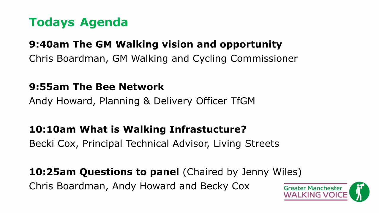
Todays Agenda
9:40am The GM Walking vision and opportunity
Chris Boardman, GM Walking and Cycling Commissioner
9:55am The Bee Network
Andy Howard, Planning & Delivery Officer TfGM
10:10am What is Walking Infrastucture?
Becki Cox, Principal Technical Advisor, Living Streets
10:25am Questions to panel (Chaired by Jenny Wiles)
Chris Boardman, Andy Howard and Becky Cox

Todays Agenda
10:40am Workshops
1) Walking Infrastructure in Action Becki Cox and Jenny Wiles (Living Streets)
2) Walking: Barriers and Accessibility Nick Brelsford (Sustrans)
3) The Bee Network: Connecting to Greenspace Alan Manning (The Ramblers)
4) Walking In Their Shoes - How Can We Create Active Neighbourhoods &
Engage With Everyone? Pauline Johnston (Levenshulme Bee Network)
12:20 Next Steps and Close- Alan Manning

Join the GM Walking Voice www.gmwalking.co.uk
Greater Manchester Walking Ambition:
Progress so far and Evaluation Event Thursday, 26 September 2019
9:30 – 13:00
First Floor Hall, King's House Conference Centre, King's Church,
Sidney Street, Manchester
M1 7HB

Chris Boardman’s slides…

Greater Manchester Bee Network
11th September 2019


• Plan open for public comment for 4
months
• Over 4,000 online geo-referenced
comments received
• Comments used to inform Plan updates
• Many comments not resulting in Plan
changes still be valuable in informing
scheme development/design
• in excess of 1,000 mapping updates and
changes to the Plan across GM
• v2.1 of the plan published June 2019
Bee Network evolution…

Bee
Network
Plan
v2.1
The Updated Bee Network Plan is…
• A combined, joined-up walking and cycling network
• A plan of what is needed, not necessarily what is possible
• The result of many hundreds of hours of officer time;
• Substantially revised with fewer errors;
• Showing a significantly extended network with greater
geographical coverage; and
• The starting point for districts planning MCF-funded
walking and cycling schemes
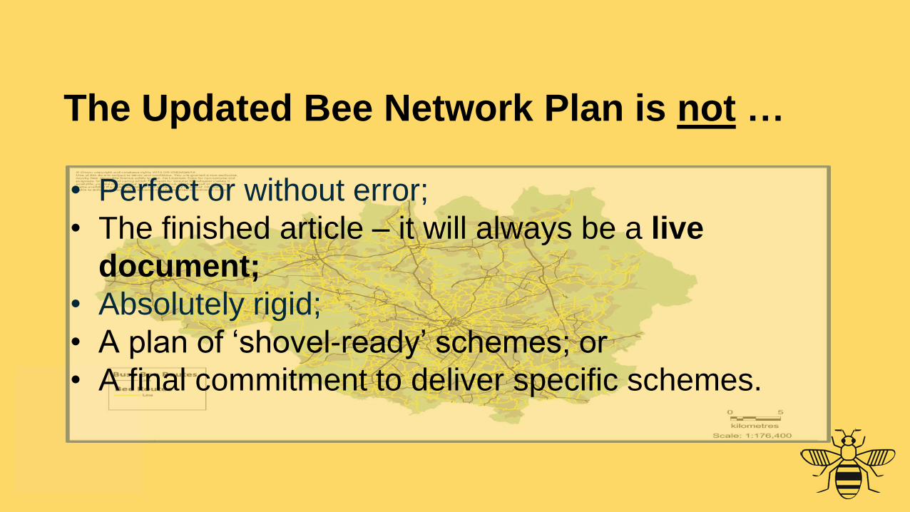
The Updated Bee Network Plan is not …
• Perfect or without error;
• The finished article – it will always be a live
document;
• Absolutely rigid;
• A plan of ‘shovel-ready’ schemes; or
• A final commitment to deliver specific schemes.
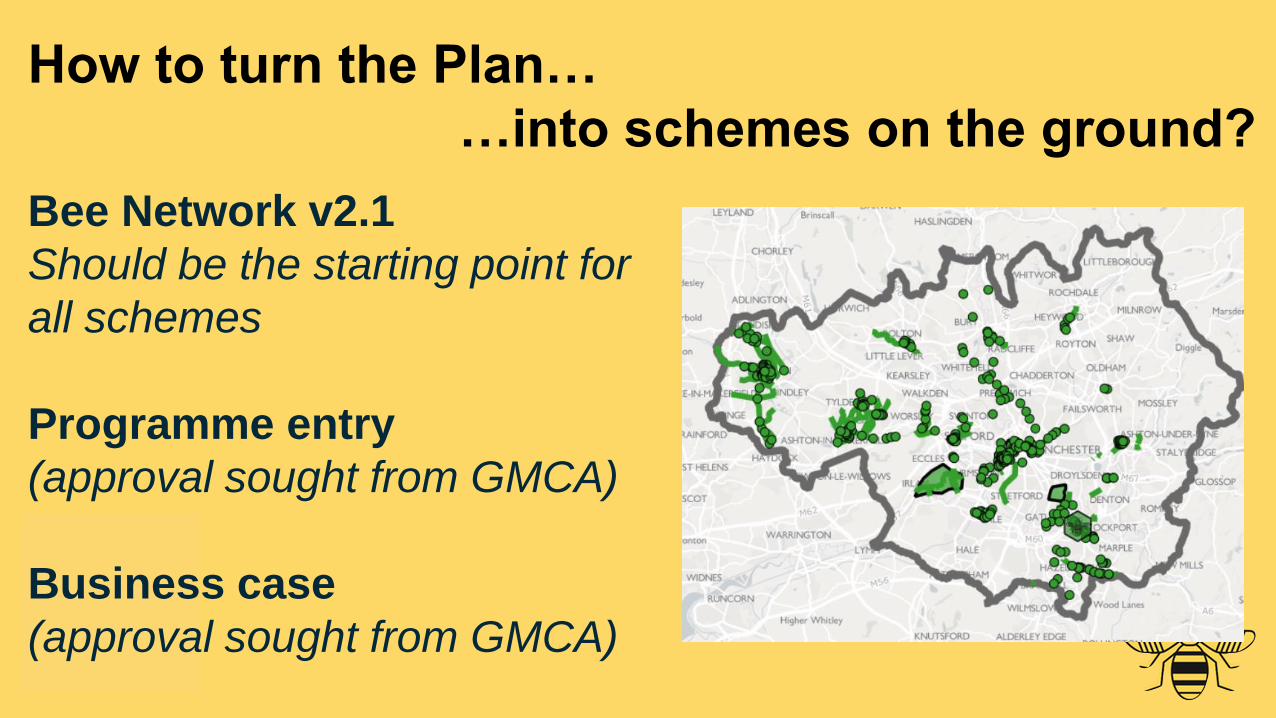
How to turn the Plan…
…into schemes on the ground?
Bee Network v2.1
Should be the starting point for
all schemes
Programme entry
(approval sought from GMCA)
Business case
(approval sought from GMCA)


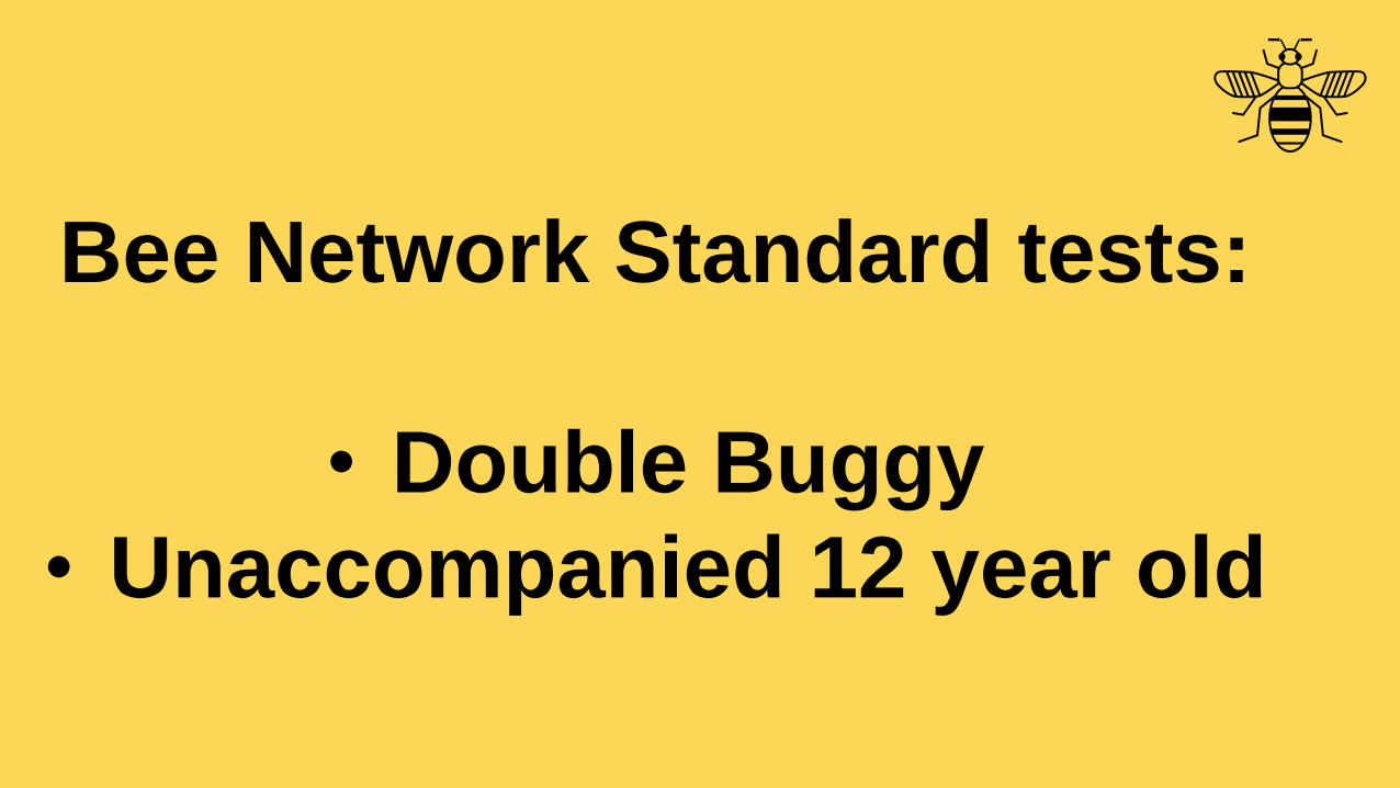
Bee Network Standard tests:
• Double Buggy
• Unaccompanied 12 year old

Design Check for MCF Schemes
Quality Criteria/Level of Service:
• 72-point check
• All MCF schemes must pass
• 12 “criticals”
• Of which, 8 relate directly to
walking
• Of the overall 72 criteria, 57
relate directly or indirectly to
walking

How can I get involved?
Community-led schemes: Schemes generated
by people for the areas they live in
• What are the issues in your neighbourhood that
make cycling and walking difficult? Street audit.
• What are the potential solutions? What
improvements would you like to see?
• Engage with other local people
• Demonstrate support for measures eg filtered
neighbourhoods
• Engage with your local Council
Consultation
• Take part – be heard!
• Be an advocate for schemes you support


WALKING INFRASTRUCTURE:
THINKING BEYOND THE FOOTWAY
Becki Cox
Principal Technical Advisor@becksmoo

WHAT IS CYCLING INFRASTRUCTURE?
A little test…

WHAT IS CYCLING INFRASTRUCTURE?

WHAT IS WALKING INFRASTRUCTURE?

LEEDS CITY CENTRE

LEEDS CITY CENTRE

UNDERSTANDING WALKING AND
CYCLING
2011 report from Lancaster, Leeds and Oxford Brooks Universities
Qualitative research
Main barriers to walking:
• Fears around physical safety (fear of
others and of injury)
• Discomfort – getting wet etc
• Perception of abnormality
• Complex family routines

COMMUNITY STREET AUDITR O YA L B O R O U G H O F K E N S I N G T O N A N D C H E L S E A
Safety and perception of crime
Lack of wayfinding
Lack of places for young people
Fly-tipping, rubbish, maintenance
Attractiveness and green space
Street / footway at railway station

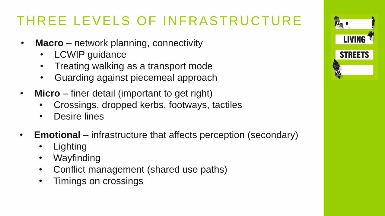
THREE LEVELS OF INFRASTRUCTURE
• Macro – network planning, connectivity
• LCWIP guidance
• Treating walking as a transport mode
• Guarding against piecemeal approach
• Micro – finer detail (important to get right)
• Crossings, dropped kerbs, footways, tactiles
• Desire lines
• Emotional – infrastructure that affects perception (secondary)
• Lighting
• Wayfinding
• Conflict management (shared use paths)
• Timings on crossings

LOW TRAFFIC NEIGHBOURHOODS
Modal Filters
Bollards or similar (trees, seats, playgrounds!) that prevent vehicle access but allow people walking and cycling to pass through.
Prevent rat running and create people friendly streets.

LOW TRAFFIC NEIGHBOURHOODS
Continuous footway
Step change for walking!
Give pedestrians priority over side road crossings; vehicles must wait.
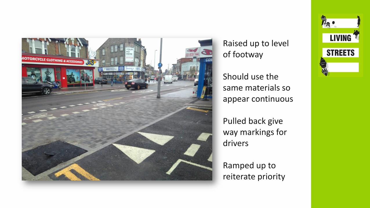
Raised up to level of footway
Should use the same materials so appear continuous
Pulled back give way markings for drivers
Ramped up to reiterate priority

Footway level cycle track
New and improved shared use path!
Visual contrast
Should have a slight step between cycle track and footway
Can have mini zebras

3 TAKE HOME POINTS
• Walking infrastructure is more than footways,
crossings and dropped kerbs
• It is essential to understand perception
(especially of fear) and how infrastructure can
affect it
• Cycling infrastructure won’t automatically cater
for walking but good cycling infrastructure can
and should cater for walking

Becki Cox
Principal Technical Advisor
[email protected] @becksmoo
Thanks for listening
WALKING INFRASTRUCTURE:
THINKING BEYOND THE FOOTWAY

Panel Discussion – Q & A
Chaired by Jenny Wiles, Regional Director (North), Living Streets
Panellists
• Chris Boardman, GM Walking and Cycling Commissioner
• Andy Howard, Planning & Delivery Officer, TfGM
• Becki Cox, Principal Technical Advisor, Living Streets

The Workshops (40 minutes each)
1) Walking Infrastructure in Action (15 max)
Becki Cox and Jenny Wiles (Living Streets)
2) Walking: Barriers and Accessibility
Nick Brelsford (Sustrans)
3) The Bee Network: Connecting to Greenspace
Alan Manning (The Ramblers)
4) Walking In Their Shoes - How Can We Create Active
Neighbourhoods & Engage With Everyone?
Pauline Johnston (Levenshulme Bee Network)

Next Steps & Close
@GmWalks #BeeNetwork