basic principles of ground-water occurance · pdf filebasic principles of ground-water...
TRANSCRIPT
1
BASIC PRINCIPLES OF GROUND-WATEROCCURANCE AND FLOW
GWPC Annual Forum – Sept. 27-30, 2015–Oklahoma City, OK
Mike Wireman
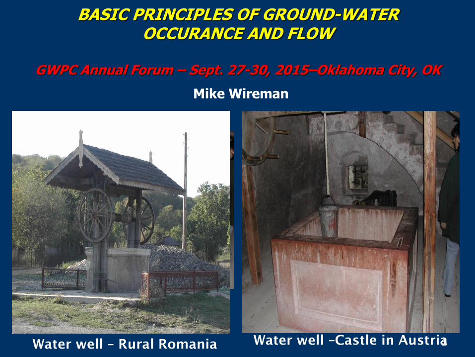
1Water well – Rural RomaniaWater well –Castle in Austria

2
? ?
?
2
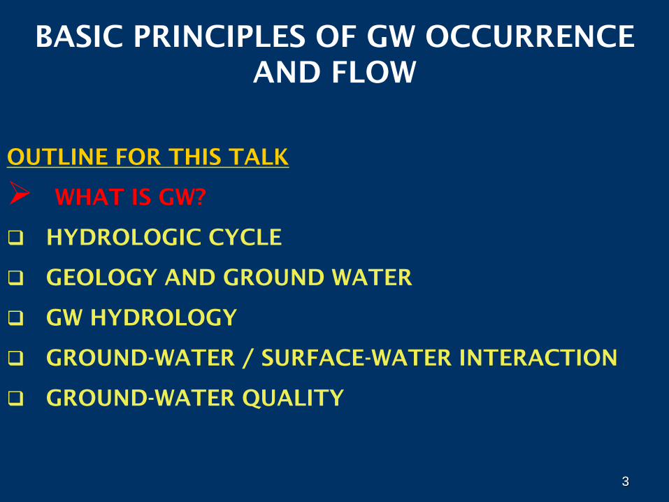
3
BASIC PRINCIPLES OF GW OCCURRENCE
AND FLOW
OUTLINE FOR THIS TALK
WHAT IS GW?
HYDROLOGIC CYCLE
GEOLOGY AND GROUND WATER
GW HYDROLOGY
GROUND-WATER / SURFACE-WATER INTERACTION
GROUND-WATER QUALITY
3
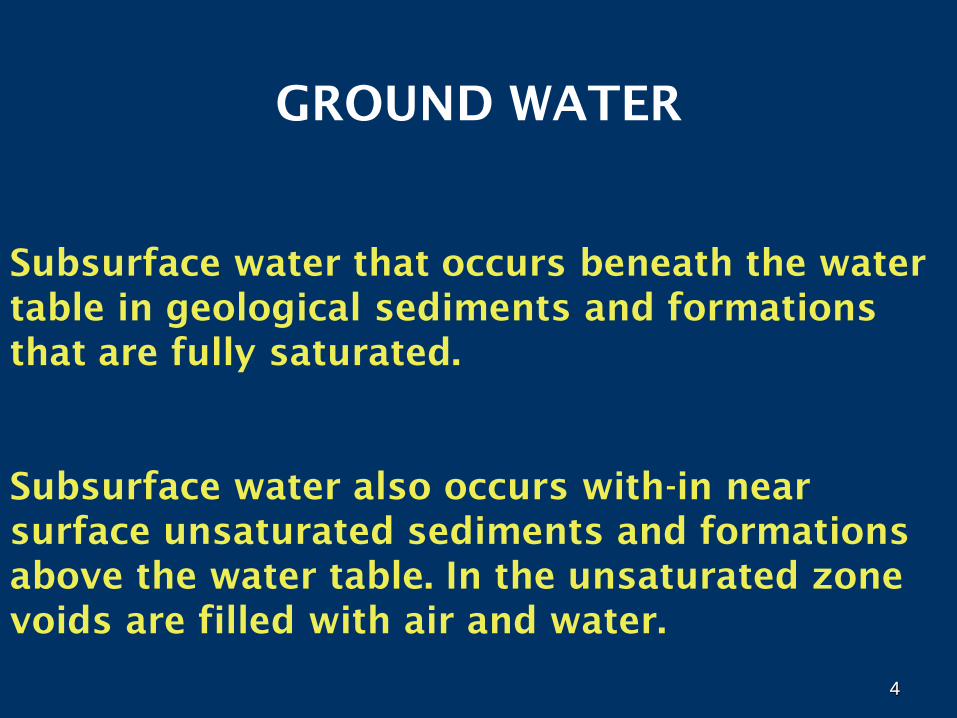
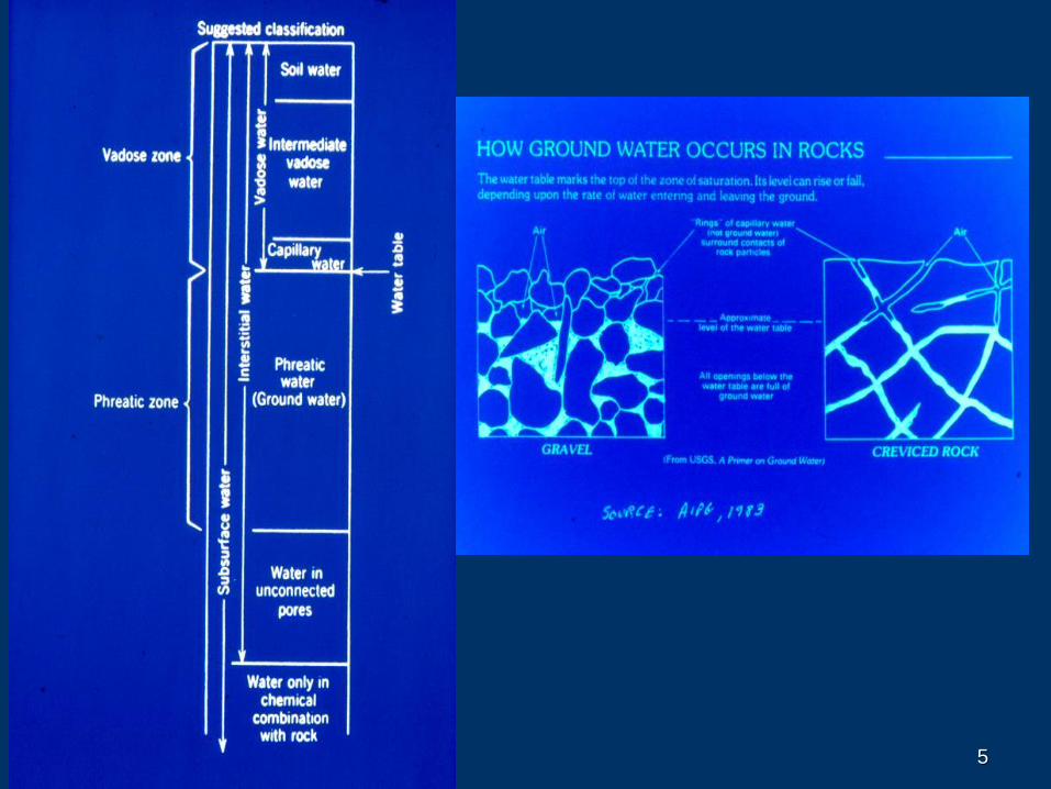
4
GROUND WATER
Subsurface water that occurs beneath the water
table in geological sediments and formations
that are fully saturated.
Subsurface water also occurs with-in near
surface unsaturated sediments and formations
above the water table. In the unsaturated zone
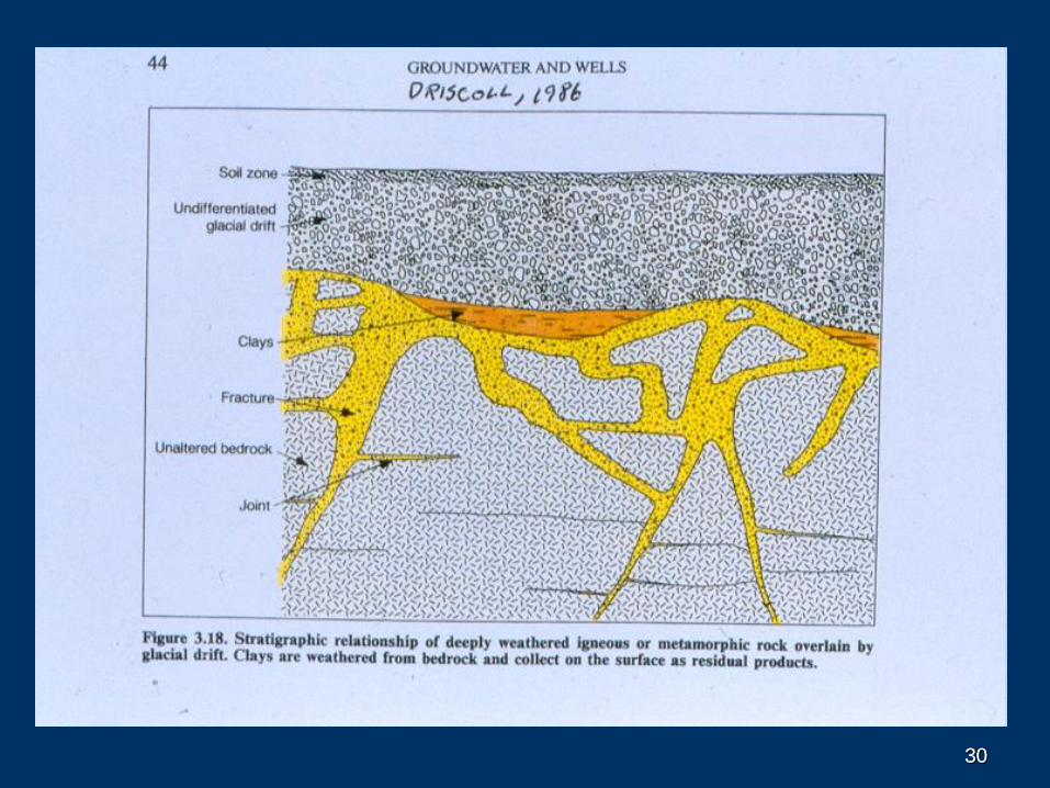
voids are filled with air and water.
4
5
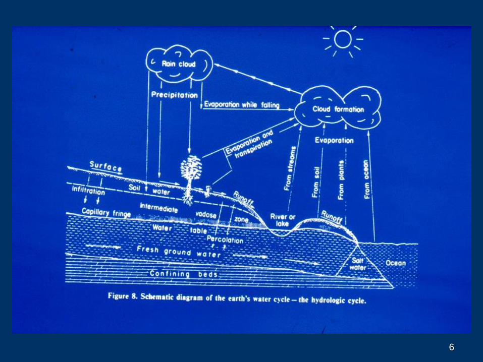
66
7
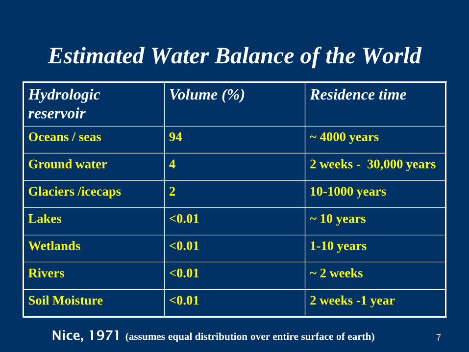
Estimated Water Balance of the World
Hydrologic
reservoir
Volume (%) Residence time
Oceans / seas 94 ~ 4000 years
Ground water 4 2 weeks - 30,000 years
Glaciers /icecaps 2 10-1000 years
Lakes <0.01 ~ 10 years
Wetlands <0.01 1-10 years
Rivers <0.01 ~ 2 weeks
Soil Moisture <0.01 2 weeks -1 year
Nice, 1971 (assumes equal distribution over entire surface of earth)
8
BASIC PRINCIPLES OF GW OCCURRENCE
AND FLOW
OUTLINE FOR THIS TALK
WHAT IS GW?
GEOLOGY AND GROUND WATER
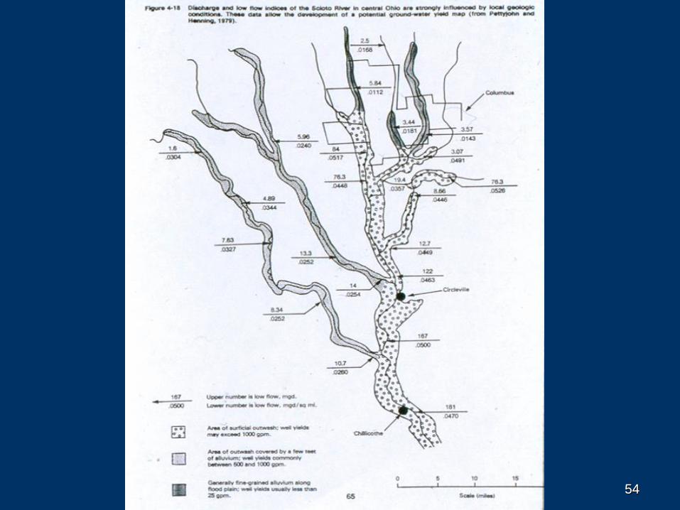
Geology of aquifers
GW regions, hydrogeologic settings, hydrostratigraphic units
GW HYDROLOGY
GROUND-WATER / SURFACE-WATER INTERACTION
GROUND-WATER QUALITY
8
9
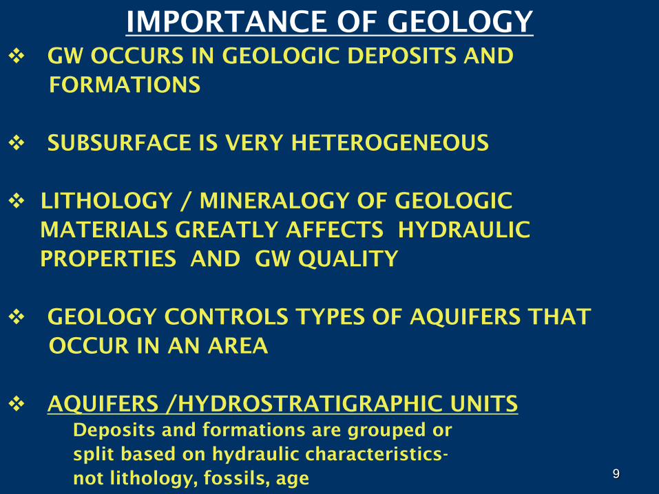
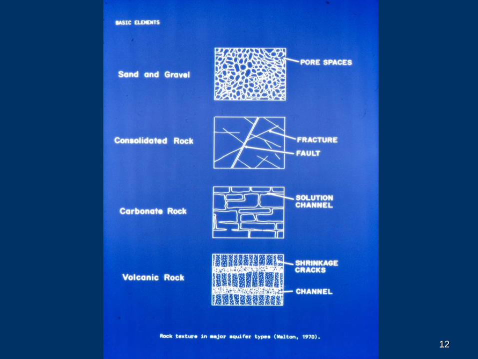
IMPORTANCE OF GEOLOGY
GW OCCURS IN GEOLOGIC DEPOSITS AND
FORMATIONS
SUBSURFACE IS VERY HETEROGENEOUS
LITHOLOGY / MINERALOGY OF GEOLOGIC
MATERIALS GREATLY AFFECTS HYDRAULIC
PROPERTIES AND GW QUALITY
GEOLOGY CONTROLS TYPES OF AQUIFERS THAT
OCCUR IN AN AREA
AQUIFERS /HYDROSTRATIGRAPHIC UNITS
Deposits and formations are grouped or
split based on hydraulic characteristics-
not lithology, fossils, age9
1010
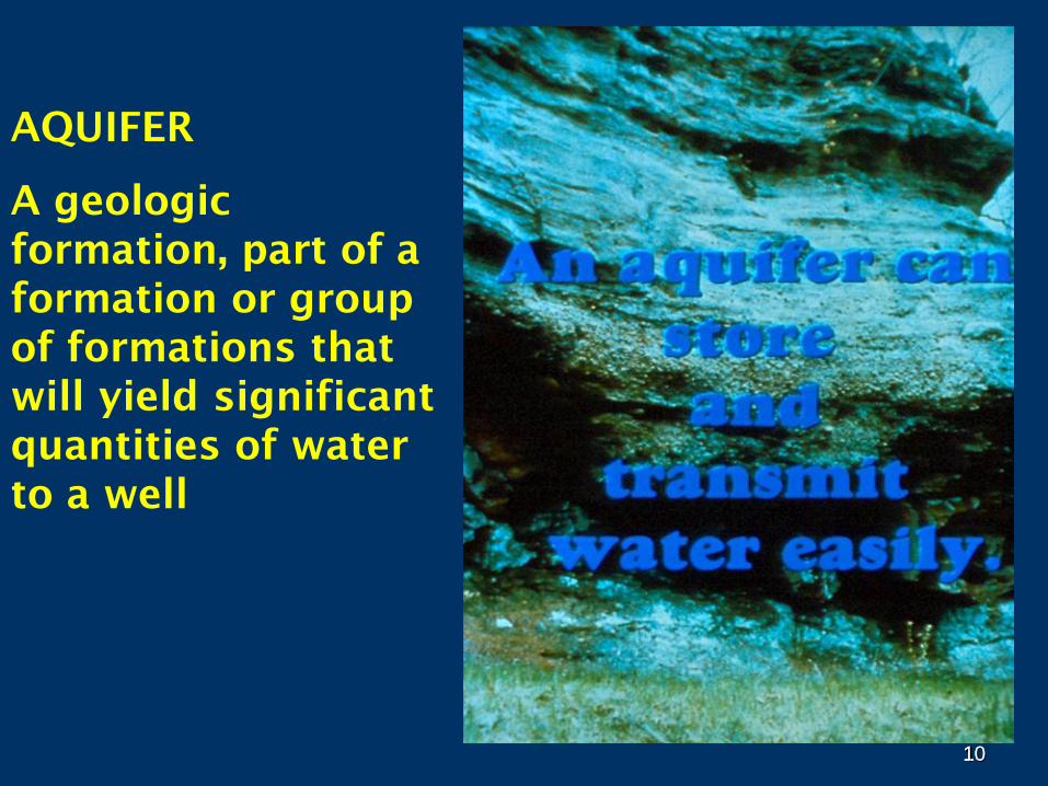
AQUIFER
A geologic
formation, part of a
formation or group
of formations that
will yield significant
quantities of water
to a well
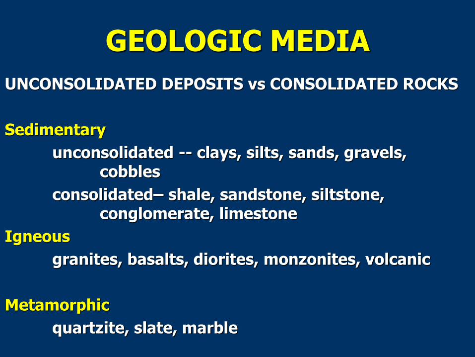
GEOLOGIC MEDIA
UNCONSOLIDATED DEPOSITS vs CONSOLIDATED ROCKS
Sedimentary
unconsolidated -- clays, silts, sands, gravels, cobbles
consolidated– shale, sandstone, siltstone, conglomerate, limestone
Igneous
granites, basalts, diorites, monzonites, volcanic
Metamorphic
quartzite, slate, marble
1212
13
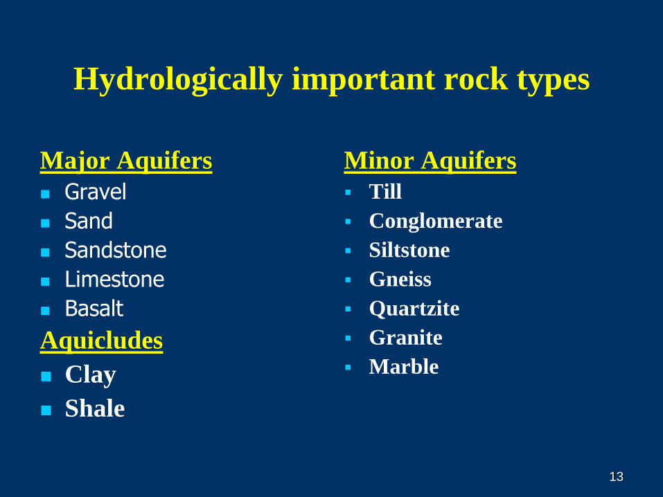
Hydrologically important rock types
Major Aquifers
Gravel
Sand
Sandstone
Limestone
Basalt
Aquicludes
Clay
Shale
Minor Aquifers
Till
Conglomerate
Siltstone
Gneiss
Quartzite
Granite
Marble
14
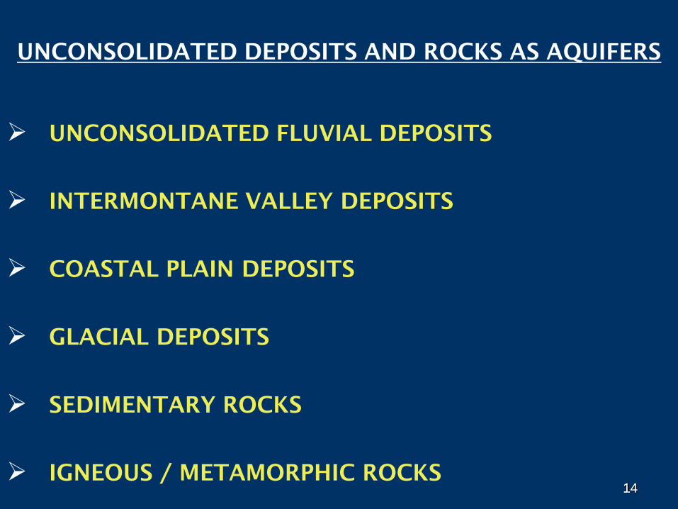
UNCONSOLIDATED DEPOSITS AND ROCKS AS AQUIFERS
UNCONSOLIDATED FLUVIAL DEPOSITS
INTERMONTANE VALLEY DEPOSITS
COASTAL PLAIN DEPOSITS
GLACIAL DEPOSITS
SEDIMENTARY ROCKS
IGNEOUS / METAMORPHIC ROCKS14
1515
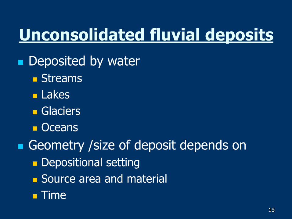
Unconsolidated fluvial deposits
Deposited by water
Streams
Lakes
Glaciers
Oceans
Geometry /size of deposit depends on
Depositional setting
Source area and material
Time
1616
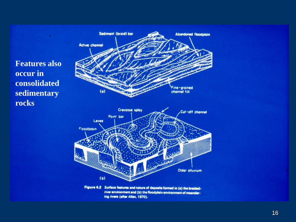
Features also
occur in
consolidated
sedimentary
rocks
1717
18
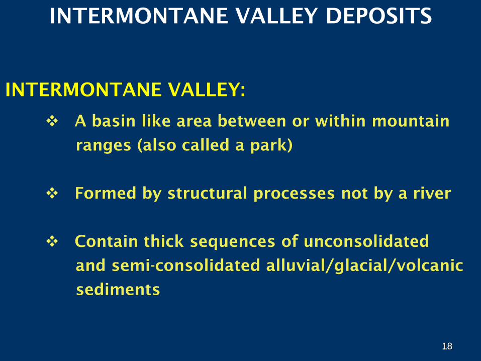
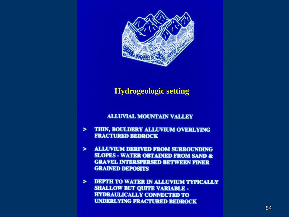
INTERMONTANE VALLEY DEPOSITS
INTERMONTANE VALLEY:
A basin like area between or within mountain
ranges (also called a park)
Formed by structural processes not by a river
Contain thick sequences of unconsolidated
and semi-consolidated alluvial/glacial/volcanic
sediments
18
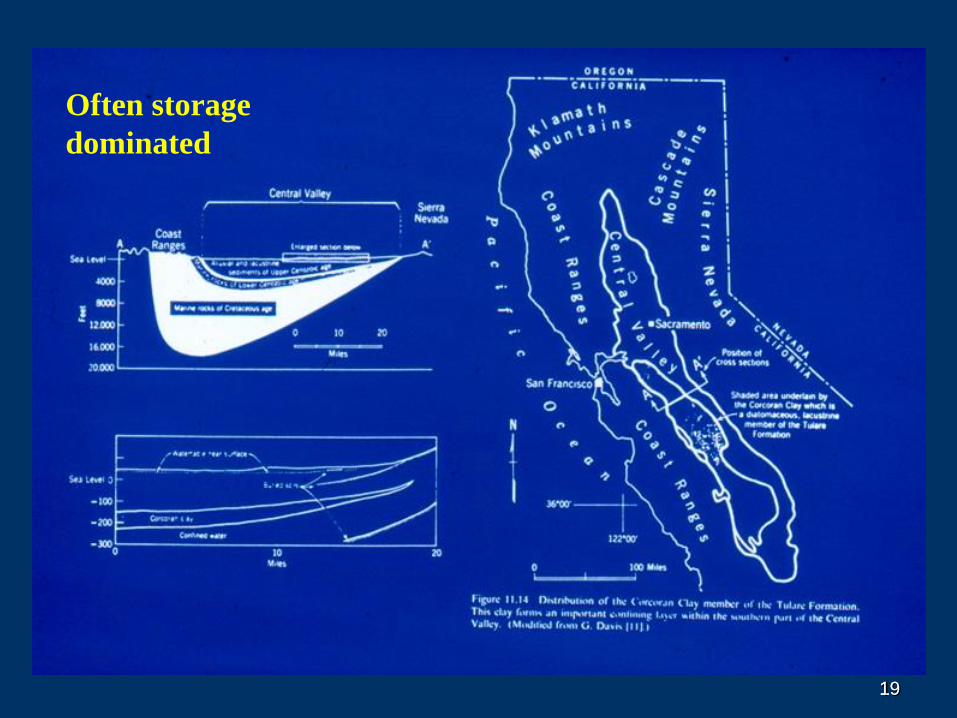
1919
Often storage
dominated
2020
21
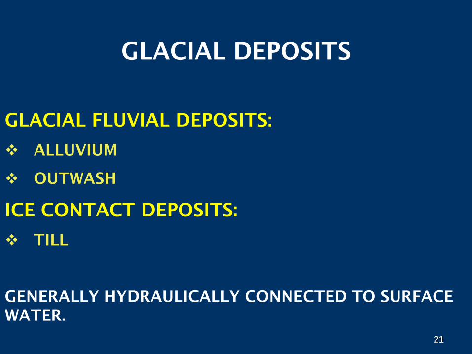
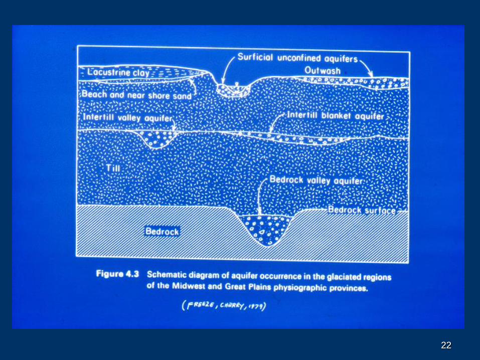
GLACIAL DEPOSITS
GLACIAL FLUVIAL DEPOSITS:
ALLUVIUM
OUTWASH
ICE CONTACT DEPOSITS:
TILL
GENERALLY HYDRAULICALLY CONNECTED TO SURFACE
WATER.
21
2222
23
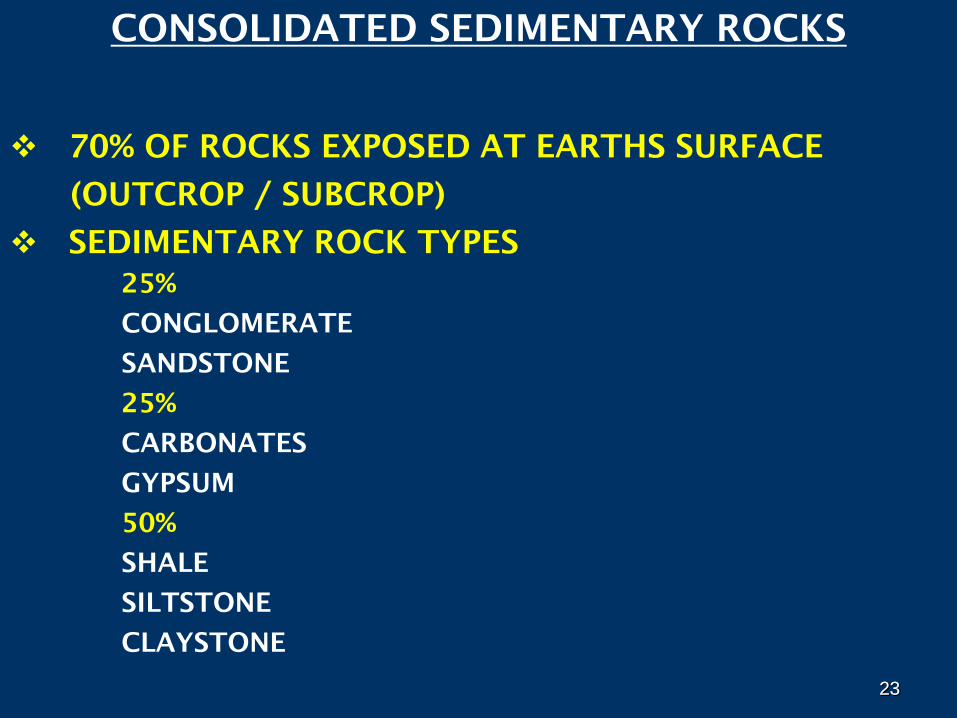
CONSOLIDATED SEDIMENTARY ROCKS
70% OF ROCKS EXPOSED AT EARTHS SURFACE
(OUTCROP / SUBCROP)
SEDIMENTARY ROCK TYPES
25%
CONGLOMERATE
SANDSTONE
25%
CARBONATES
GYPSUM
50%
SHALE
SILTSTONE
CLAYSTONE
23
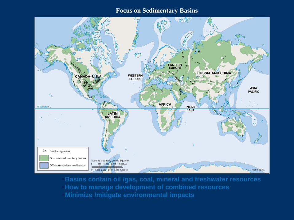
Basins contain oil /gas, coal, mineral and freshwater resources
How to manage development of combined resources
Minimize /mitigate environmental impacts
Focus on Sedimentary Basins
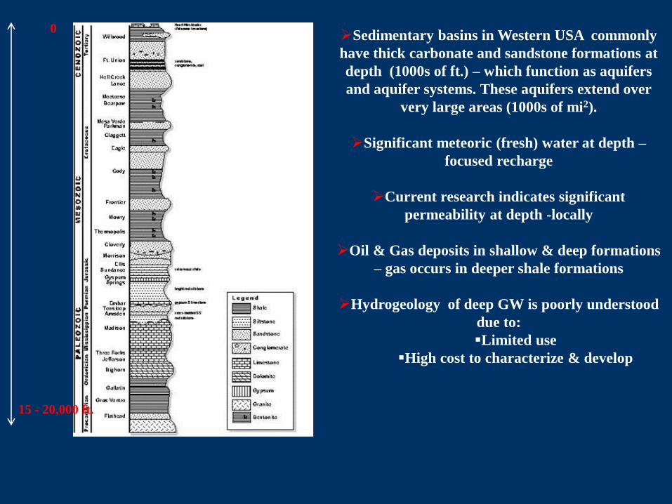
0
15 - 20,000 ft.
Sedimentary basins in Western USA commonly
have thick carbonate and sandstone formations at
depth (1000s of ft.) – which function as aquifers
and aquifer systems. These aquifers extend over
very large areas (1000s of mi2).
Significant meteoric (fresh) water at depth –
focused recharge
Current research indicates significant
permeability at depth -locally
Oil & Gas deposits in shallow & deep formations
– gas occurs in deeper shale formations
Hydrogeology of deep GW is poorly understood
due to:
Limited use
High cost to characterize & develop
26
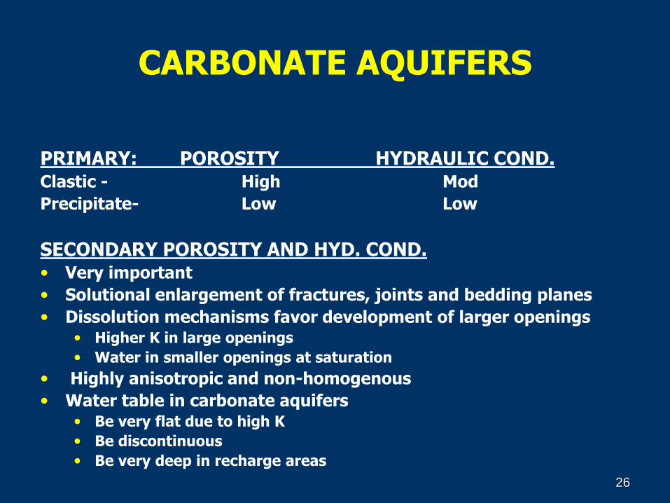
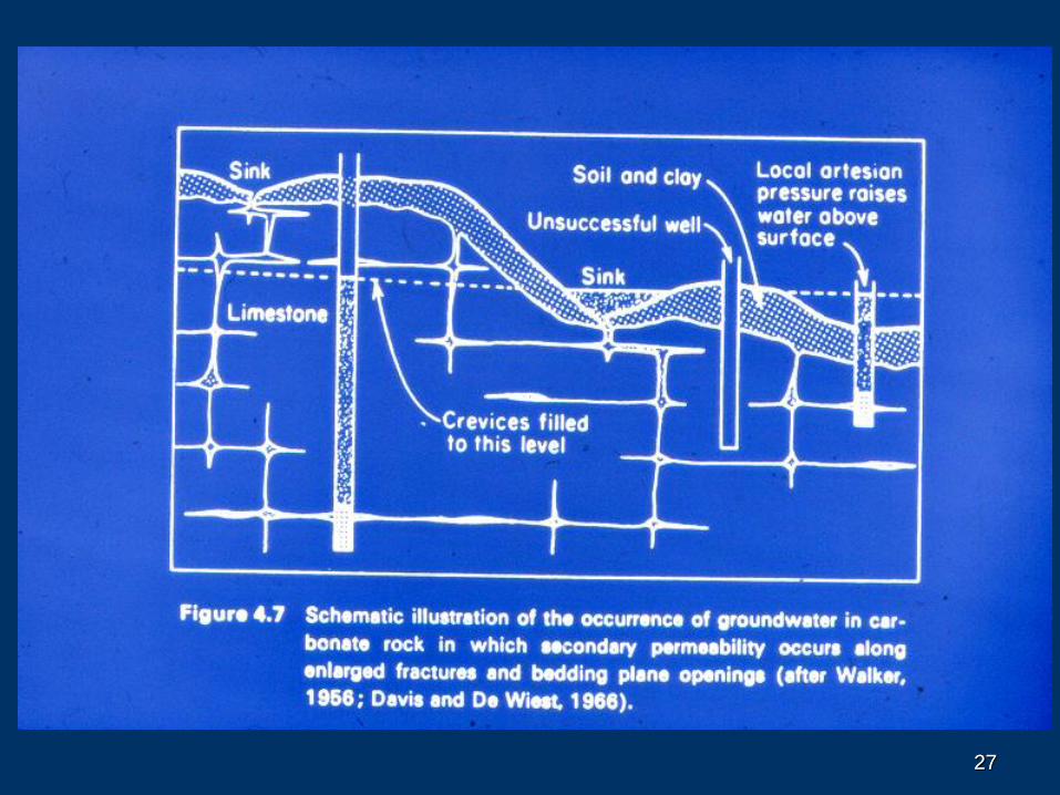
CARBONATE AQUIFERS
PRIMARY: POROSITY HYDRAULIC COND.Clastic - High Mod
Precipitate- Low Low
SECONDARY POROSITY AND HYD. COND.• Very important
• Solutional enlargement of fractures, joints and bedding planes
• Dissolution mechanisms favor development of larger openings• Higher K in large openings
• Water in smaller openings at saturation
• Highly anisotropic and non-homogenous
• Water table in carbonate aquifers• Be very flat due to high K
• Be discontinuous
• Be very deep in recharge areas
2727
28
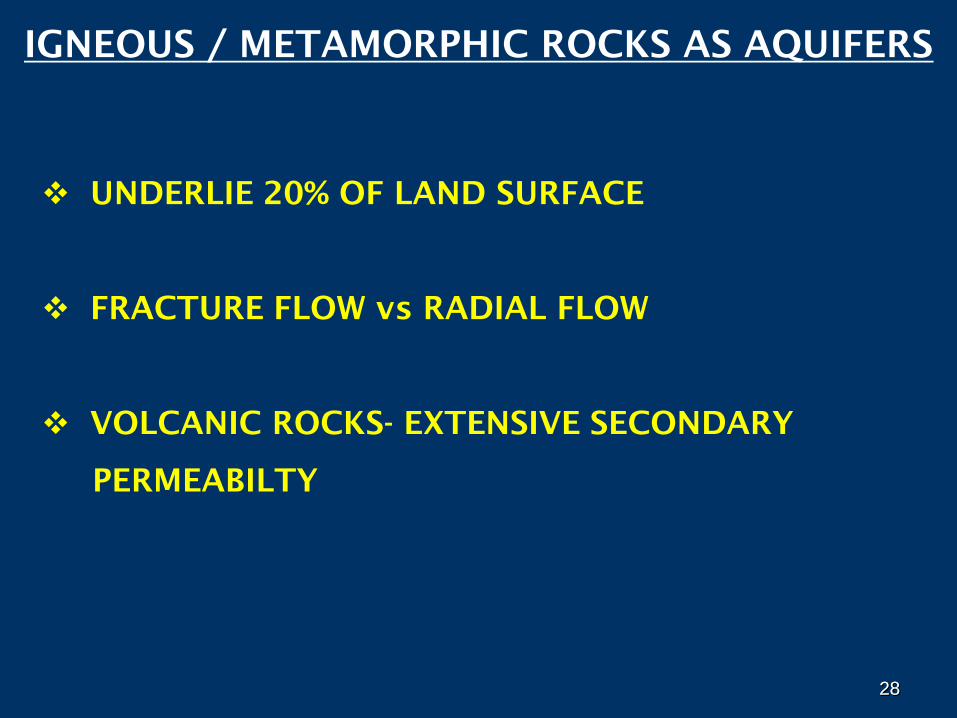
IGNEOUS / METAMORPHIC ROCKS AS AQUIFERS
UNDERLIE 20% OF LAND SURFACE
FRACTURE FLOW vs RADIAL FLOW
VOLCANIC ROCKS- EXTENSIVE SECONDARY
PERMEABILTY
28
29
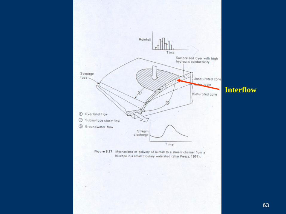
Interflow
3030
31
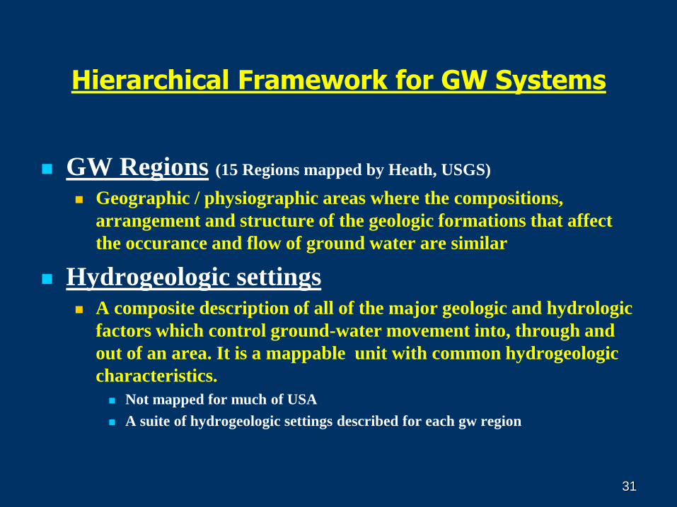
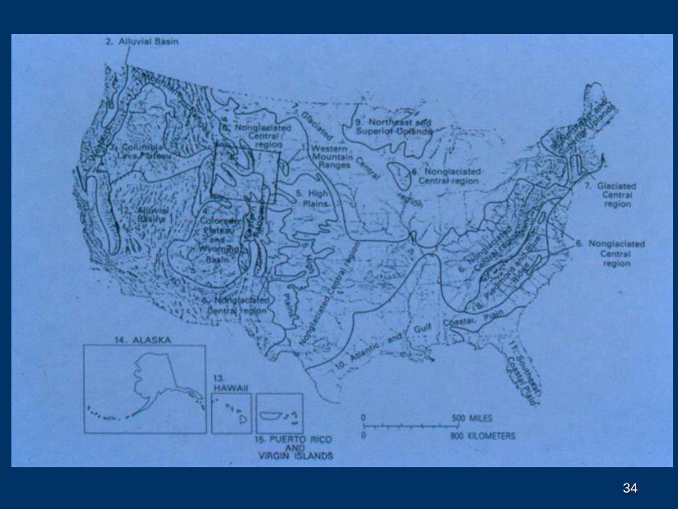
Hierarchical Framework for GW Systems
GW Regions (15 Regions mapped by Heath, USGS)
Geographic / physiographic areas where the compositions,
arrangement and structure of the geologic formations that affect
the occurance and flow of ground water are similar
Hydrogeologic settings A composite description of all of the major geologic and hydrologic
factors which control ground-water movement into, through and
out of an area. It is a mappable unit with common hydrogeologic
characteristics.
Not mapped for much of USA
A suite of hydrogeologic settings described for each gw region
32
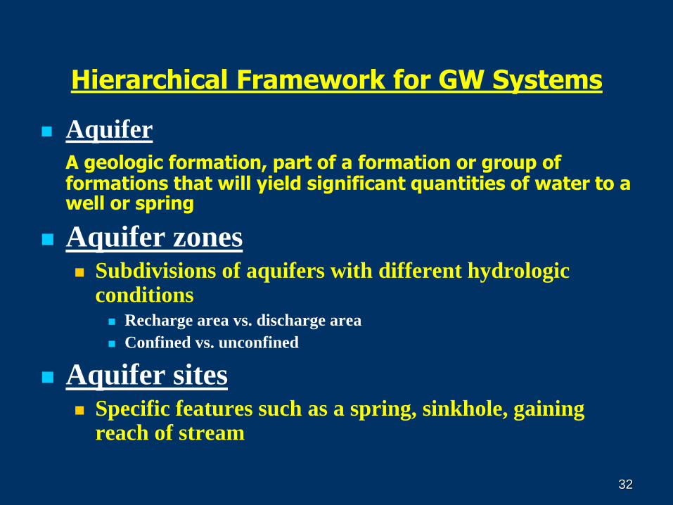
Hierarchical Framework for GW Systems
Aquifer
A geologic formation, part of a formation or group of formations that will yield significant quantities of water to a well or spring
Aquifer zones Subdivisions of aquifers with different hydrologic
conditions Recharge area vs. discharge area
Confined vs. unconfined
Aquifer sites Specific features such as a spring, sinkhole, gaining
reach of stream
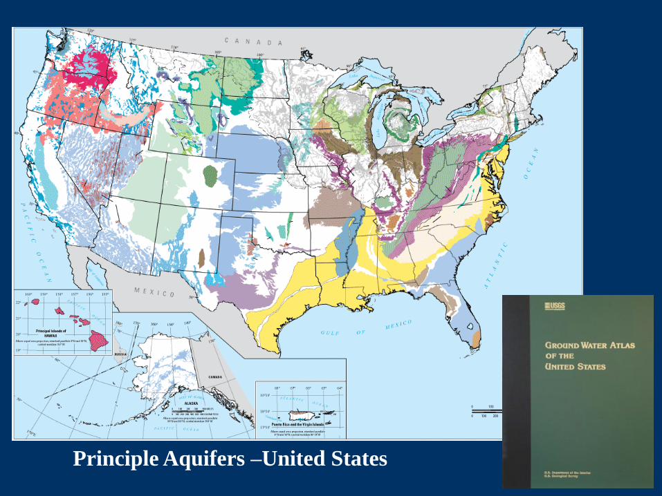
33Principle Aquifers –United States
3434
3535
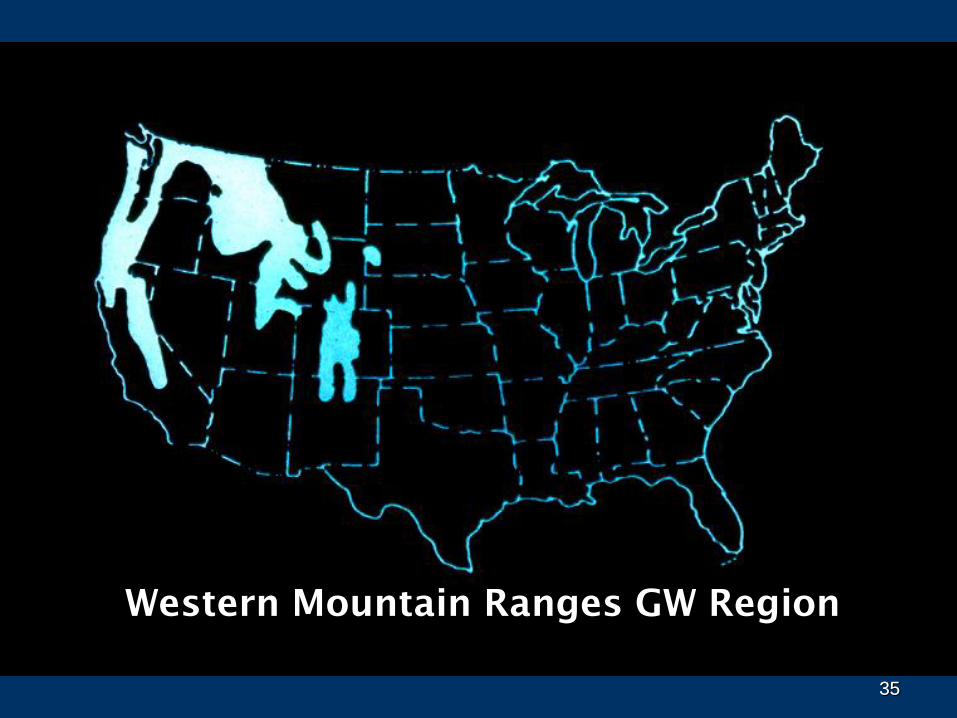
Western Mountain Ranges GW Region
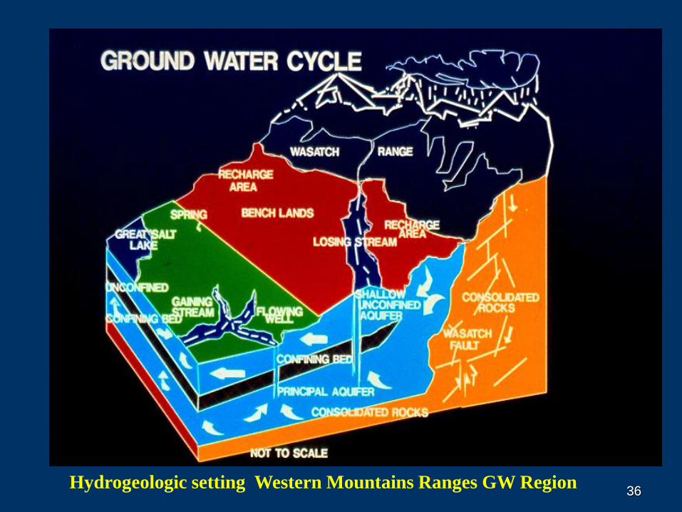
3636Hydrogeologic setting Western Mountains Ranges GW Region
37
BASIC PRINCIPLES OF GW OCCURRENCE
AND FLOW
OUTLINE FOR THIS TALK
WHAT IS GW?
GEOLOGY AND GROUND WATER
GW HYDROLOGY
GROUND-WATER / SURFACE-WATER INTERACTION
GROUND-WATER QUALITY
37
3838
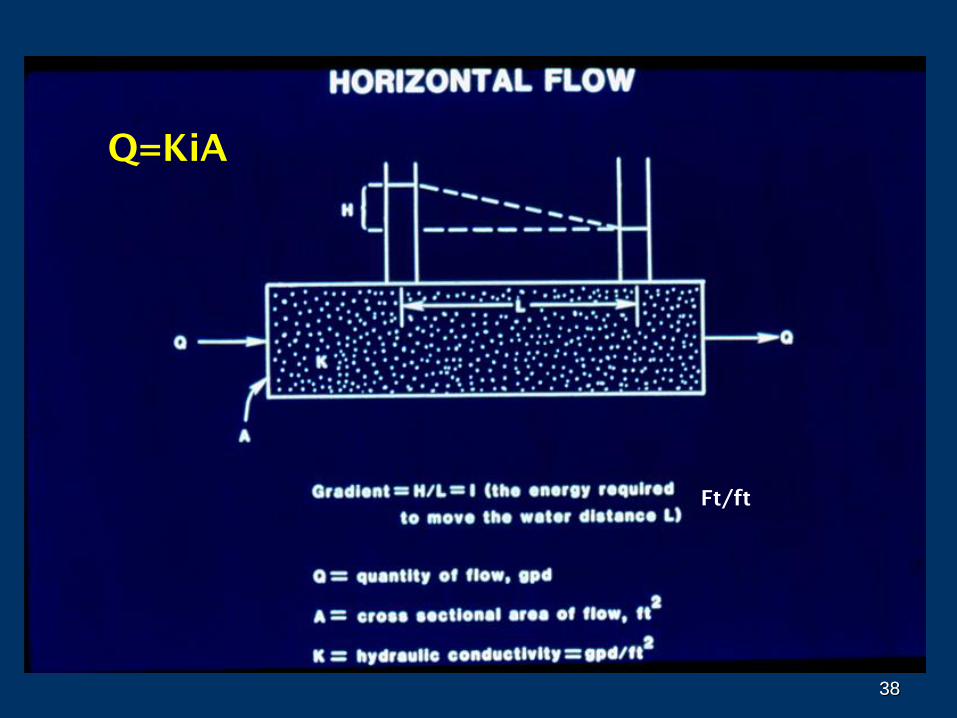
Q=KiA
Ft/ft
3939
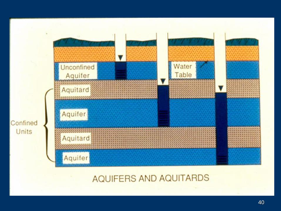
40
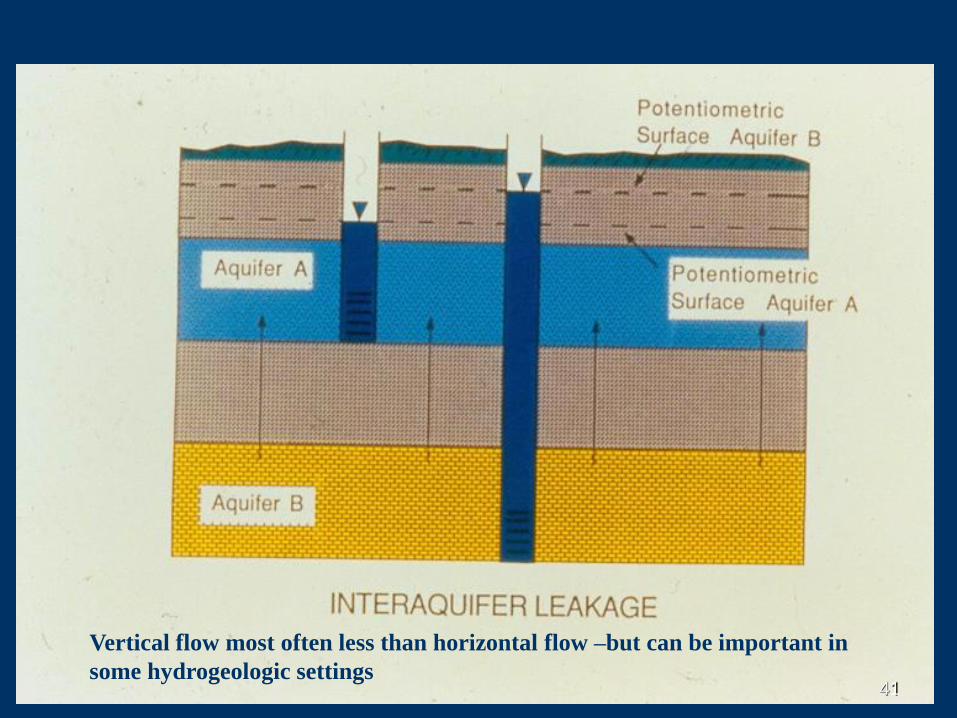
4141
Vertical flow most often less than horizontal flow –but can be important in
some hydrogeologic settings
4242
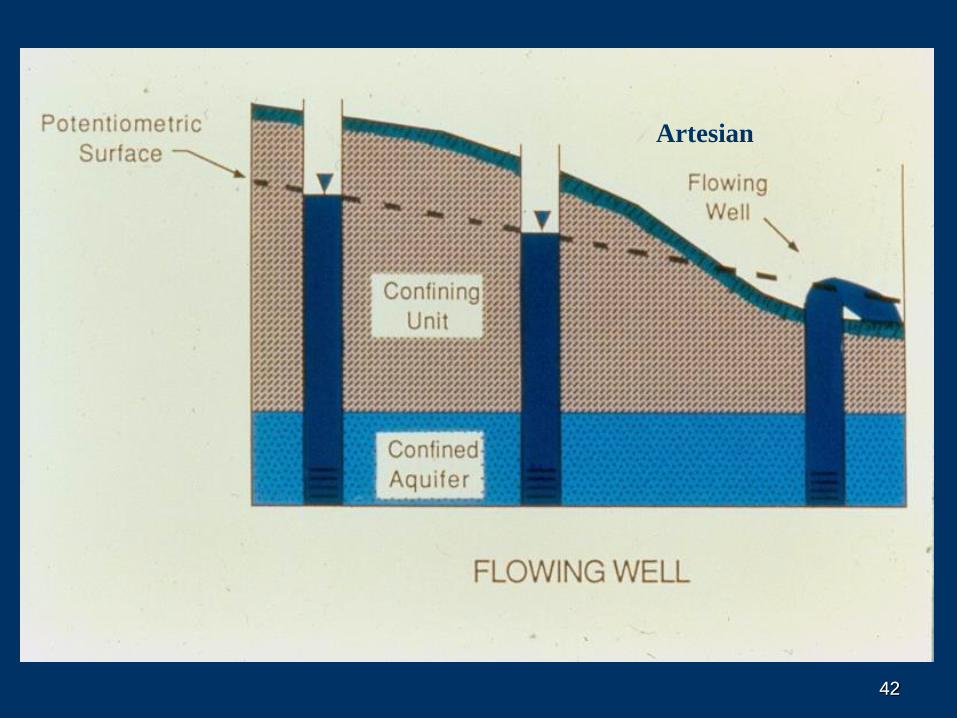
Artesian
4343
4444
4545
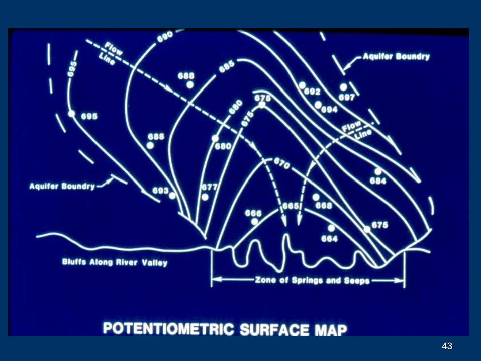
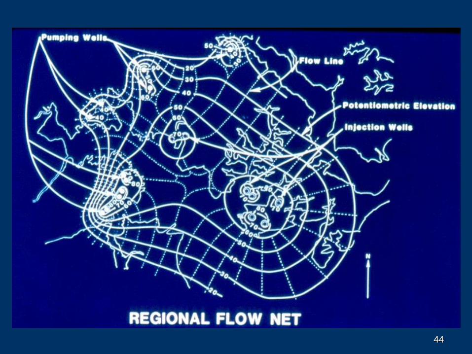
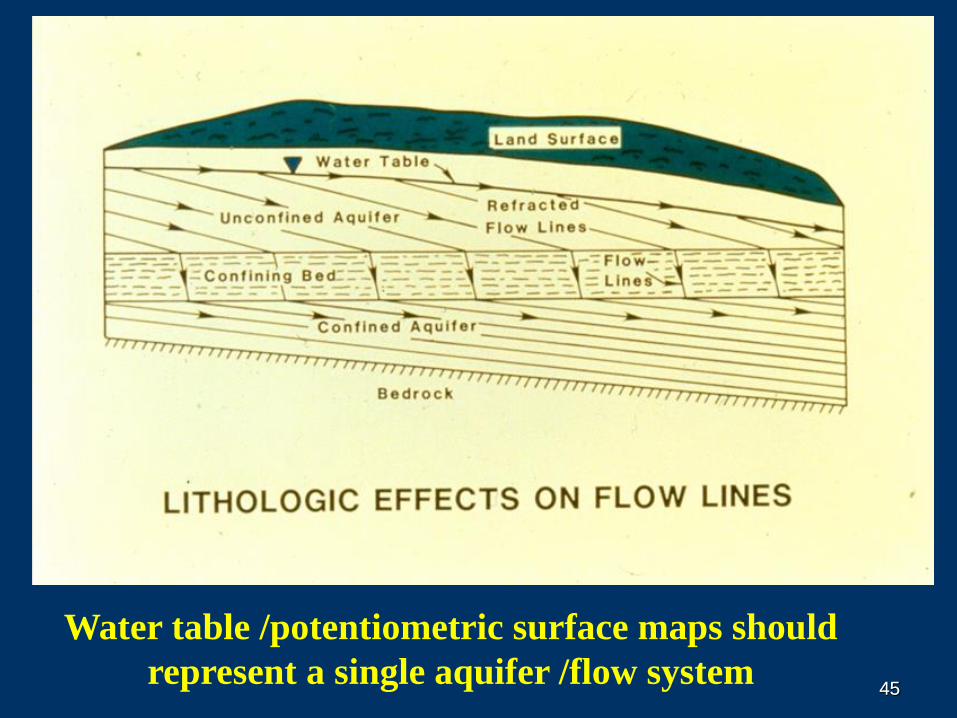
Water table /potentiometric surface maps should
represent a single aquifer /flow system
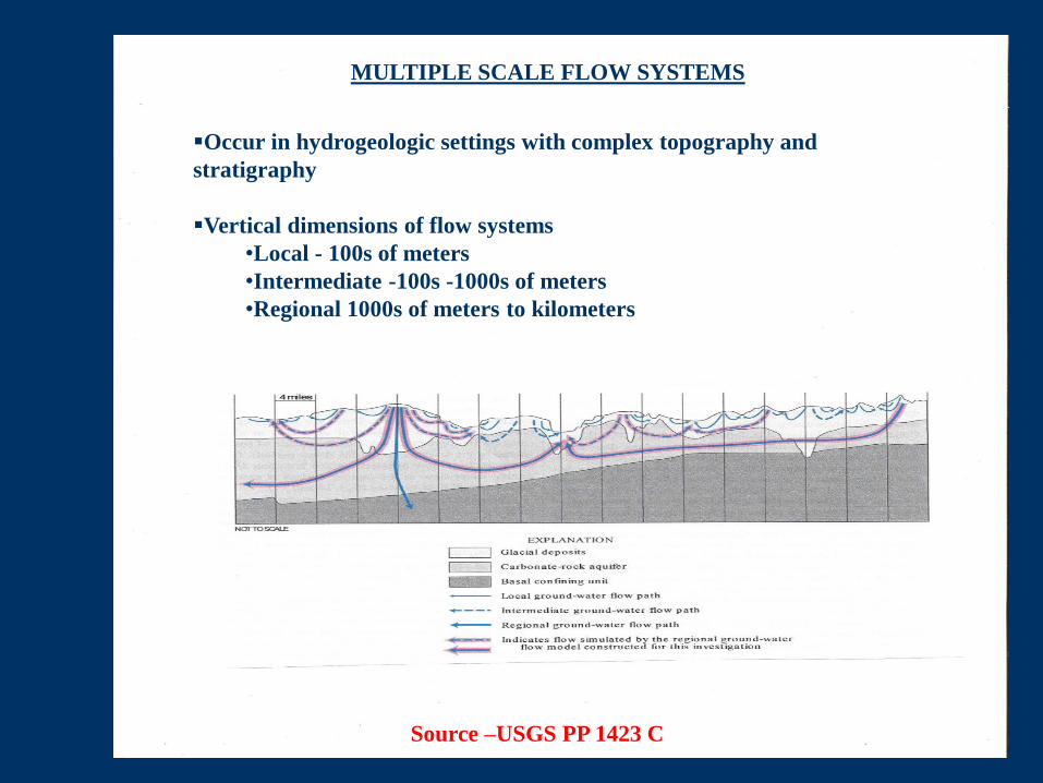
Source –USGS PP 1423 C
Occur in hydrogeologic settings with complex topography and
stratigraphy
Vertical dimensions of flow systems
•Local - 100s of meters
•Intermediate -100s -1000s of meters
•Regional 1000s of meters to kilometers
MULTIPLE SCALE FLOW SYSTEMS
47
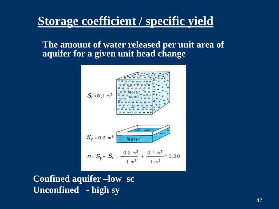
The amount of water released per unit area of aquifer for a given unit head change
Storage coefficient / specific yield
Confined aquifer –low sc
Unconfined - high sy
48
BASIC PRINCIPLES OF GW OCCURRENCE
AND FLOW
OUTLINE FOR THIS TALK
WHAT IS GW?
GEOLOGY AND GROUND WATER
GW HYDROLOGY
GROUND-WATER / SURFACE-WATER INTERACTION
GROUND-WATER QUALITY
48
4949
GROUND-WATER / SURFACE-WATER
INTERACTION
Aquifer –stream interaction
Hyphoreic zone
Wetlands /fens
Hillslope hydrology
Springs
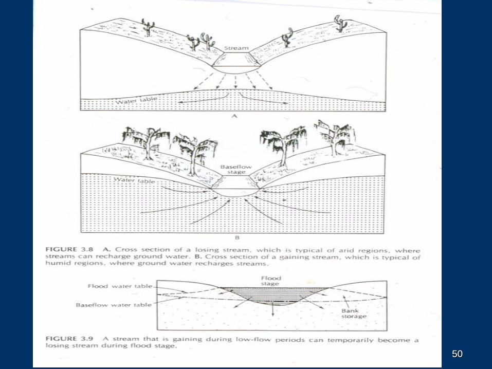
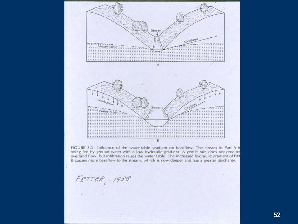
5050
5151
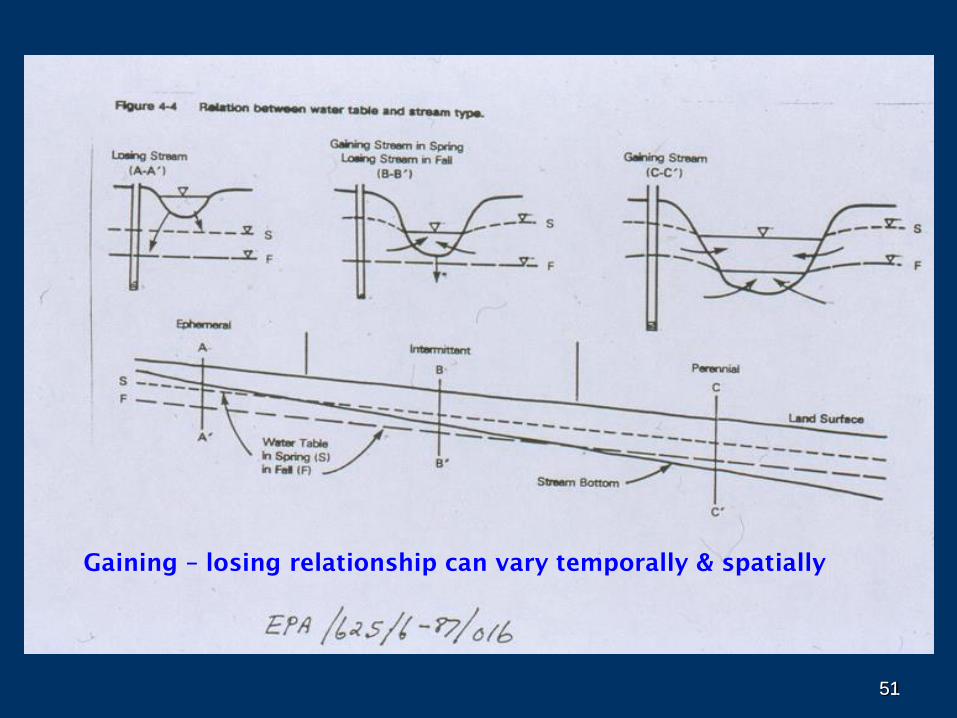
Gaining – losing relationship can vary temporally & spatially
5252
5353
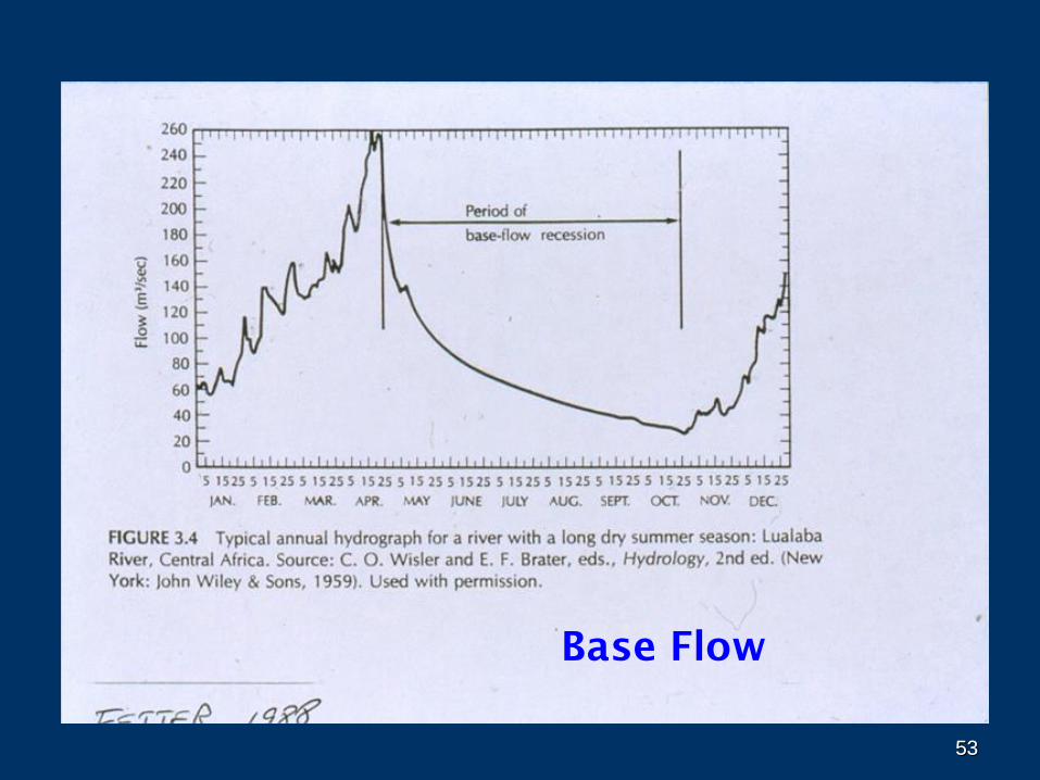
Base Flow
5454
55
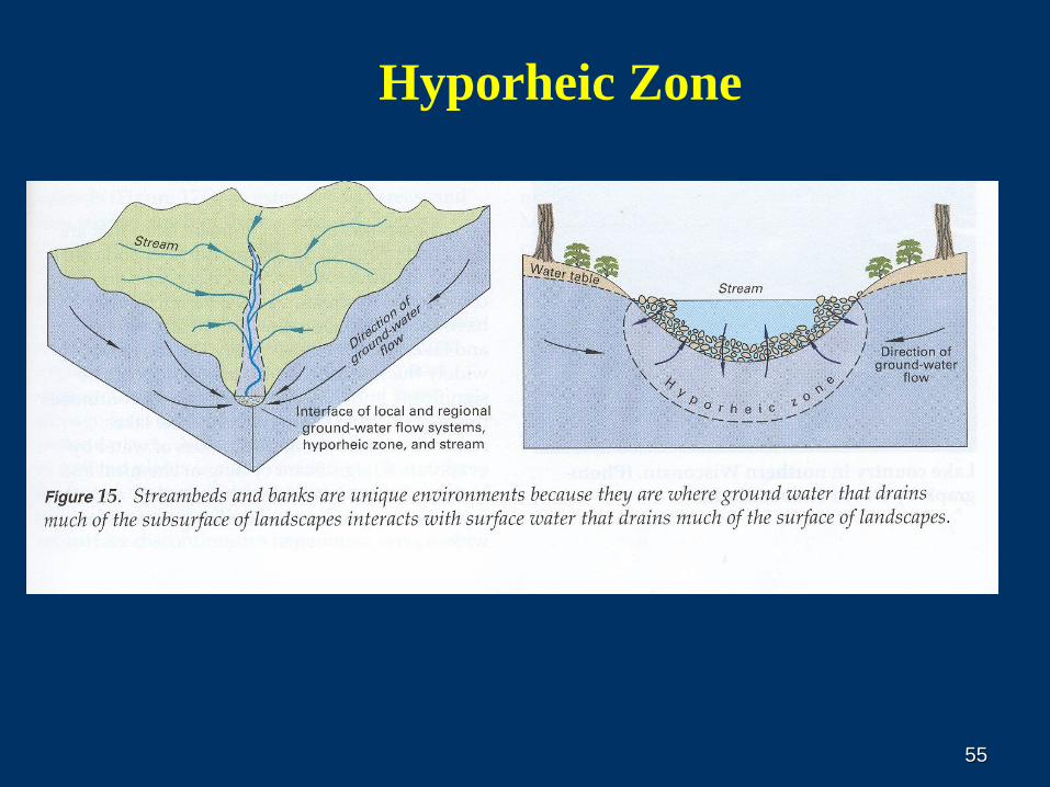
Hyporheic Zone
56
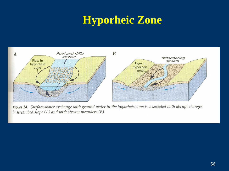
Hyporheic Zone
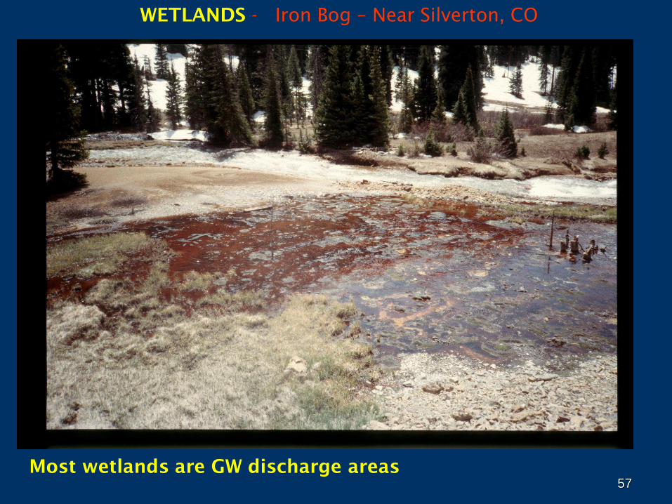
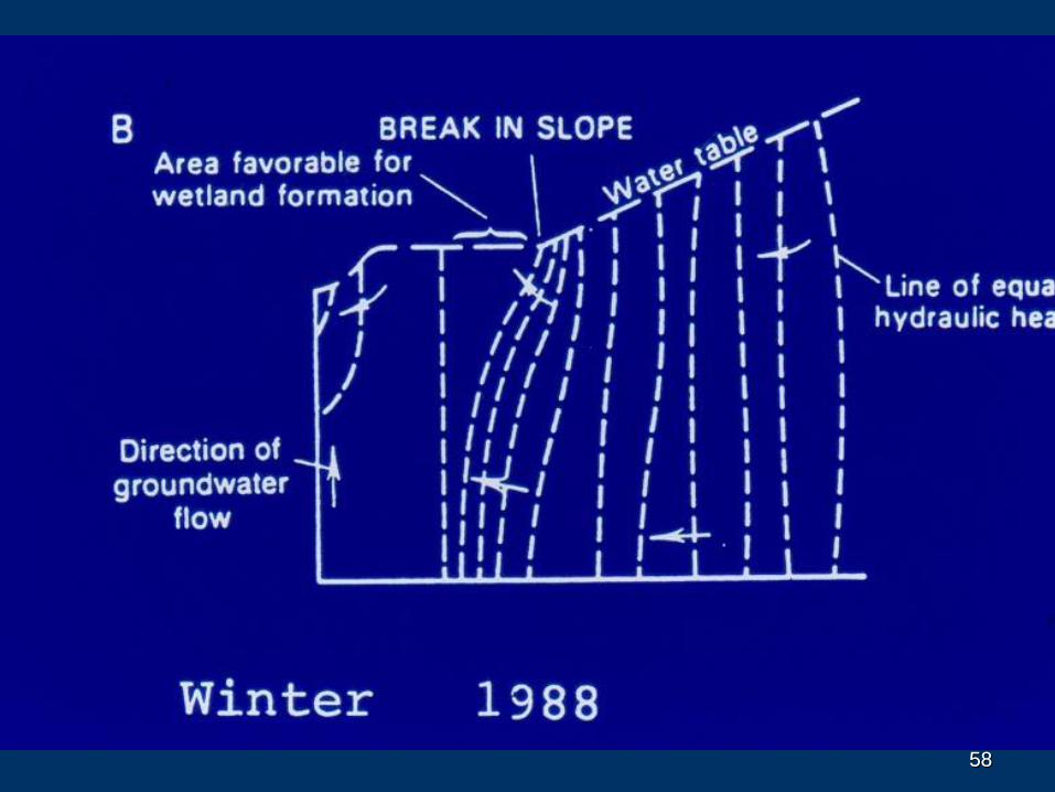
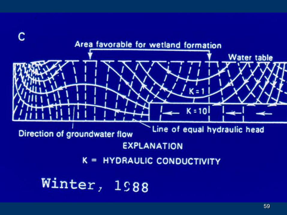
57Most wetlands are GW discharge areas
WETLANDS - Iron Bog – Near Silverton, CO
5858
5959
60
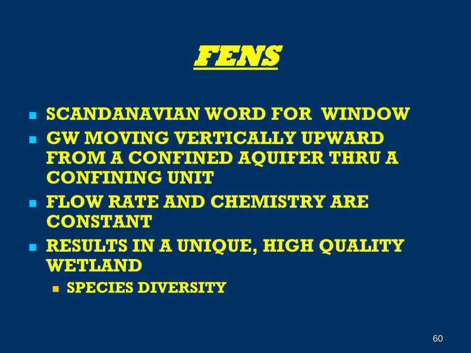
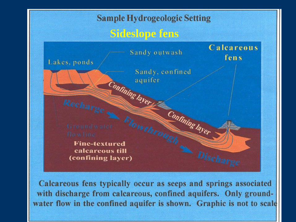
FENS
SCANDANAVIAN WORD FOR WINDOW
GW MOVING VERTICALLY UPWARD FROM A CONFINED AQUIFER THRU A CONFINING UNIT
FLOW RATE AND CHEMISTRY ARE CONSTANT
RESULTS IN A UNIQUE, HIGH QUALITY WETLAND
SPECIES DIVERSITY
61
62
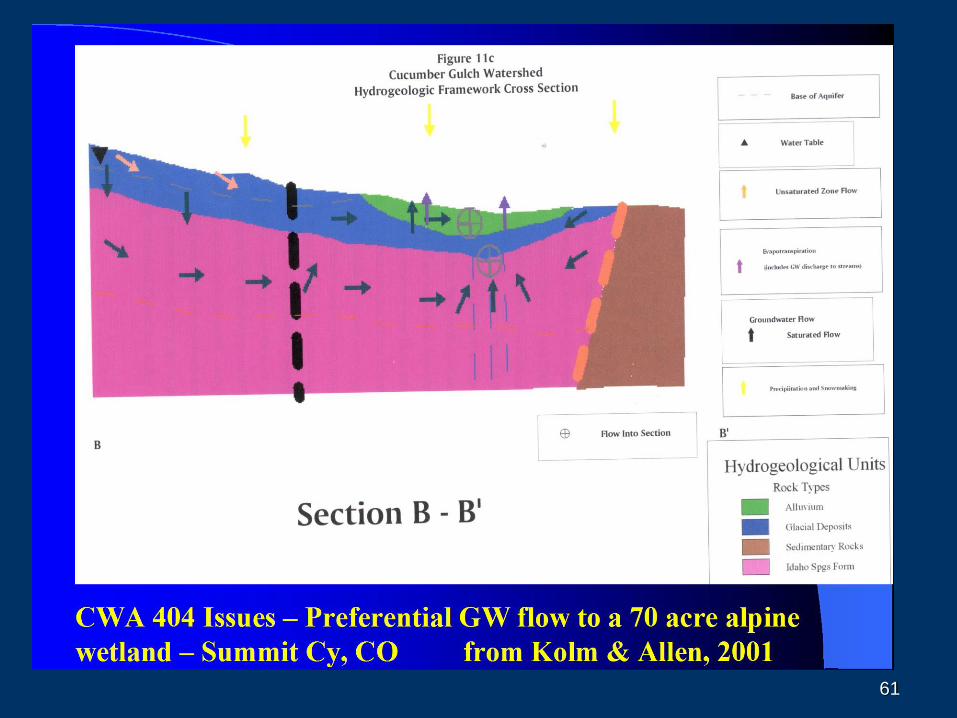
Sideslope fens
6363
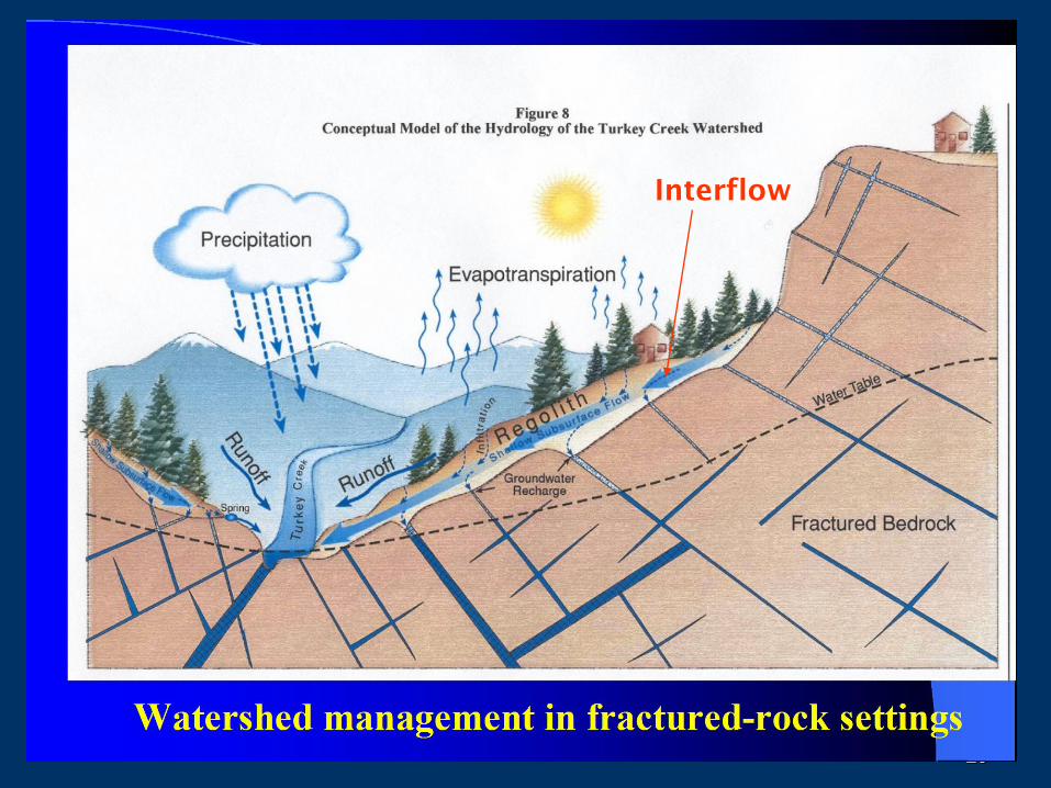
Interflow
6464
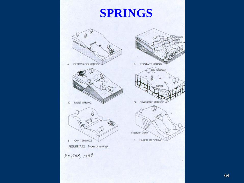
SPRINGS
65
BASIC PRINCIPLES OF GW OCCURRENCE
AND FLOW
OUTLINE FOR THIS TALK
WHAT IS GW?
GEOLOGY AND GROUND WATER
GW HYDROLOGY
GROUND-WATER / SURFACE-WATER INTERACTION
GROUND-WATER QUALITY
65
66
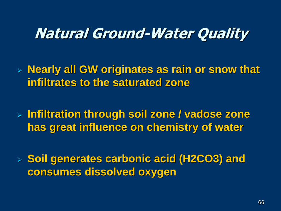
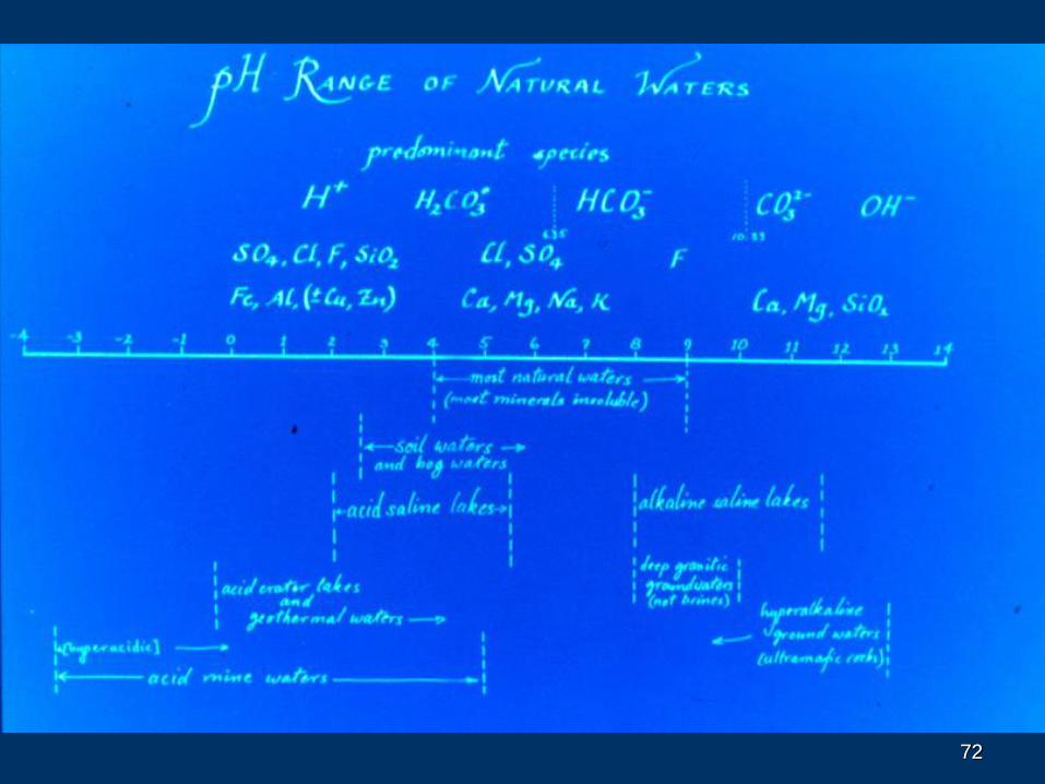
Natural Ground-Water Quality
Nearly all GW originates as rain or snow that
infiltrates to the saturated zone
Infiltration through soil zone / vadose zone
has great influence on chemistry of water
Soil generates carbonic acid (H2CO3) and
consumes dissolved oxygen
66
67
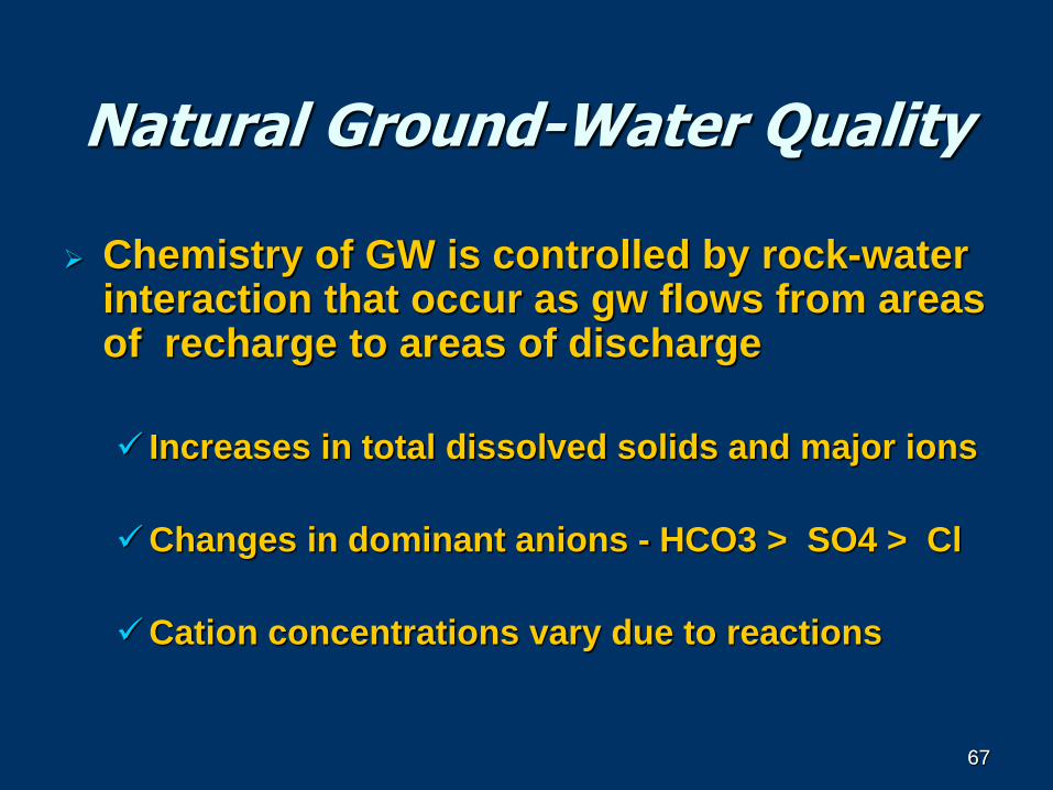
Natural Ground-Water Quality
Chemistry of GW is controlled by rock-water interaction that occur as gw flows from areas of recharge to areas of discharge
Increases in total dissolved solids and major ions
Changes in dominant anions - HCO3 > SO4 > Cl
Cation concentrations vary due to reactions
67
68
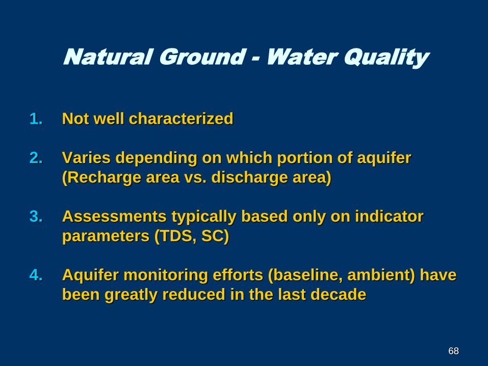
Natural Ground - Water Quality
1. Not well characterized
2. Varies depending on which portion of aquifer
(Recharge area vs. discharge area)
3. Assessments typically based only on indicator
parameters (TDS, SC)
4. Aquifer monitoring efforts (baseline, ambient) have
been greatly reduced in the last decade
68
69
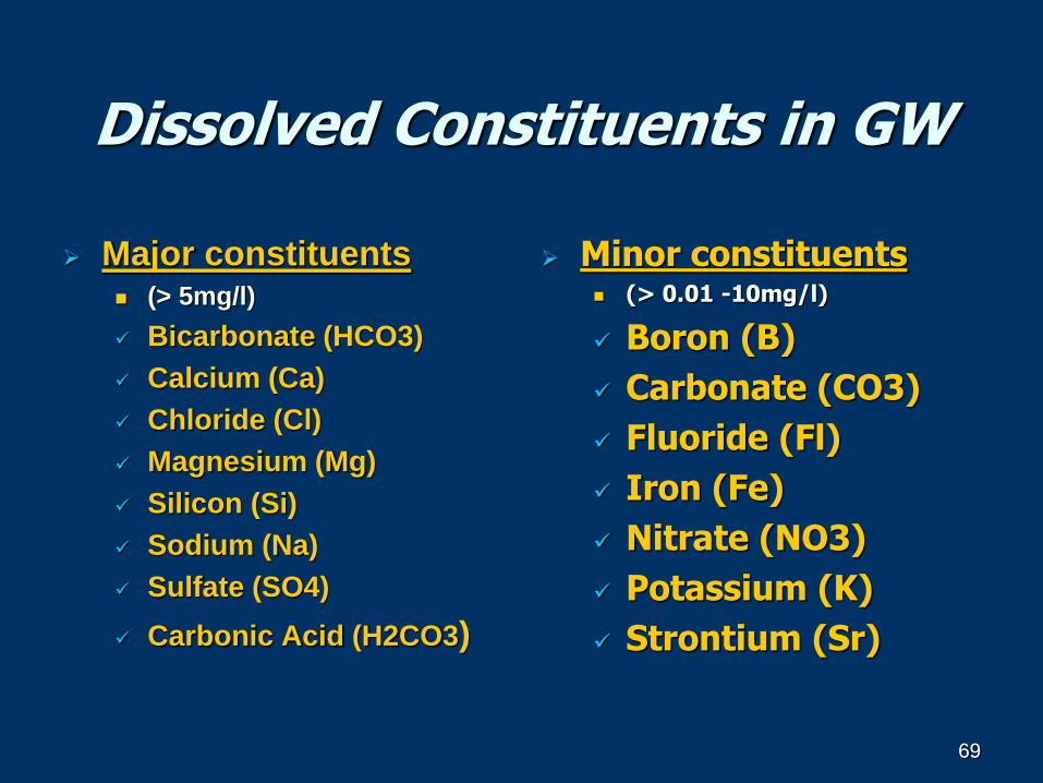
Dissolved Constituents in GW
Major constituents (> 5mg/l)
Bicarbonate (HCO3)
Calcium (Ca)
Chloride (Cl)
Magnesium (Mg)
Silicon (Si)
Sodium (Na)
Sulfate (SO4)
Carbonic Acid (H2CO3)
Minor constituents (> 0.01 -10mg/l)
Boron (B)
Carbonate (CO3)
Fluoride (Fl)
Iron (Fe)
Nitrate (NO3)
Potassium (K)
Strontium (Sr)
69
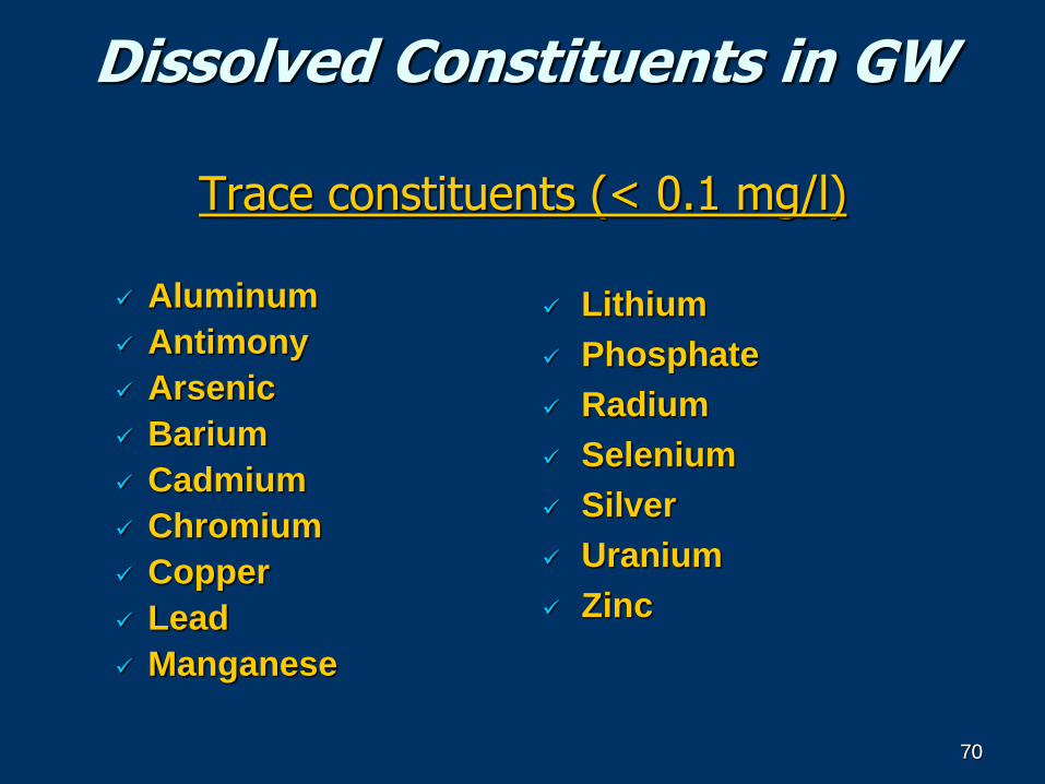
70
Dissolved Constituents in GW
Trace constituents (< 0.1 mg/l)
Aluminum
Antimony
Arsenic
Barium
Cadmium
Chromium
Copper
Lead
Manganese
Lithium
Phosphate
Radium
Selenium
Silver
Uranium
Zinc
70
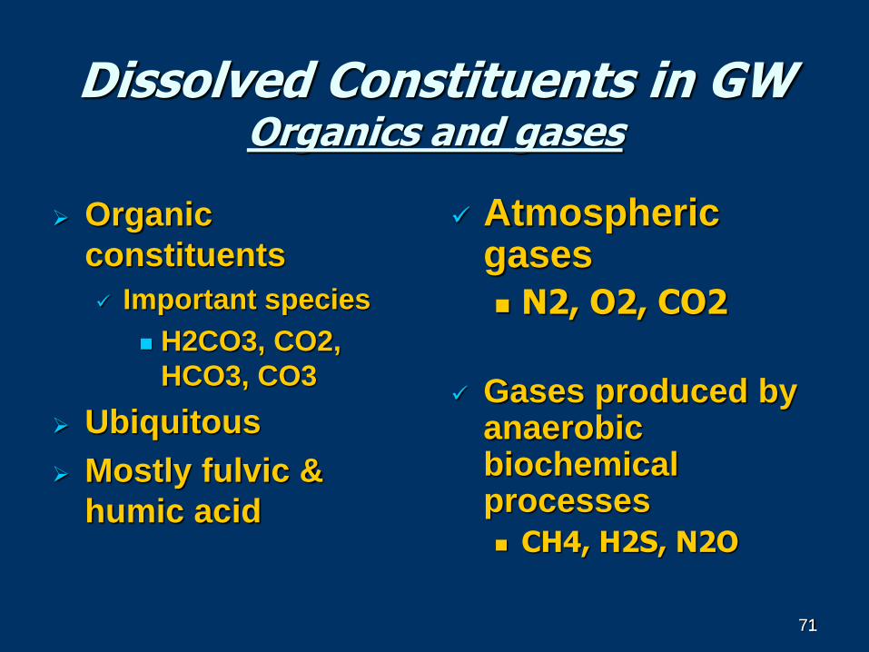
71
Dissolved Constituents in GWOrganics and gases
Organic
constituents
Important species
H2CO3, CO2,
HCO3, CO3
Ubiquitous
Mostly fulvic &
humic acid
Atmospheric gases
N2, O2, CO2
Gases produced by anaerobic biochemical processes
CH4, H2S, N2O
71
7272
73
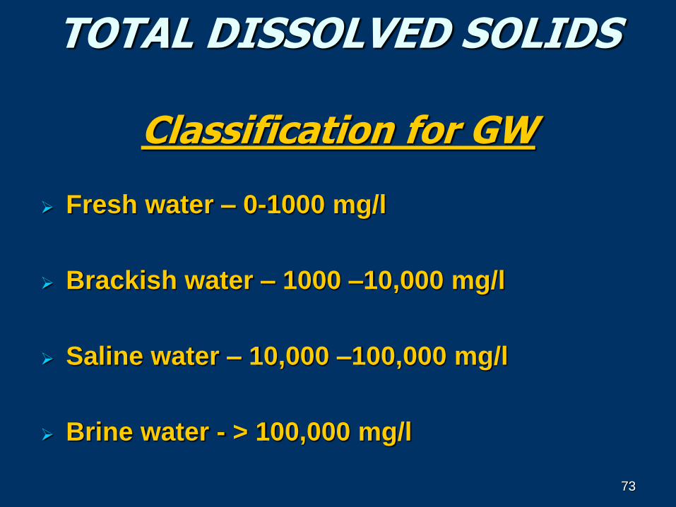
TOTAL DISSOLVED SOLIDS
Classification for GW
Fresh water – 0-1000 mg/l
Brackish water – 1000 –10,000 mg/l
Saline water – 10,000 –100,000 mg/l
Brine water - > 100,000 mg/l
73
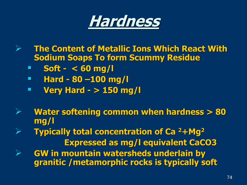
74
Hardness
The Content of Metallic Ions Which React With Sodium Soaps To form Scummy Residue
Soft - < 60 mg/l
Hard - 80 –100 mg/l
Very Hard - > 150 mg/l
Water softening common when hardness > 80 mg/l
Typically total concentration of Ca 2+Mg2
Expressed as mg/l equivalent CaCO3
GW in mountain watersheds underlain by granitic /metamorphic rocks is typically soft
74
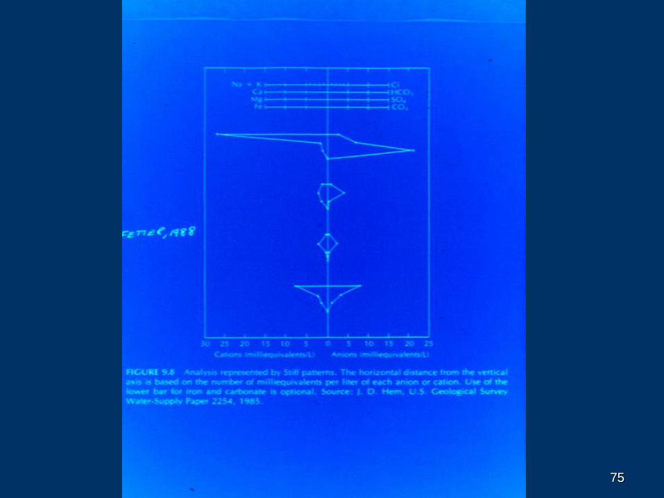
7575
76
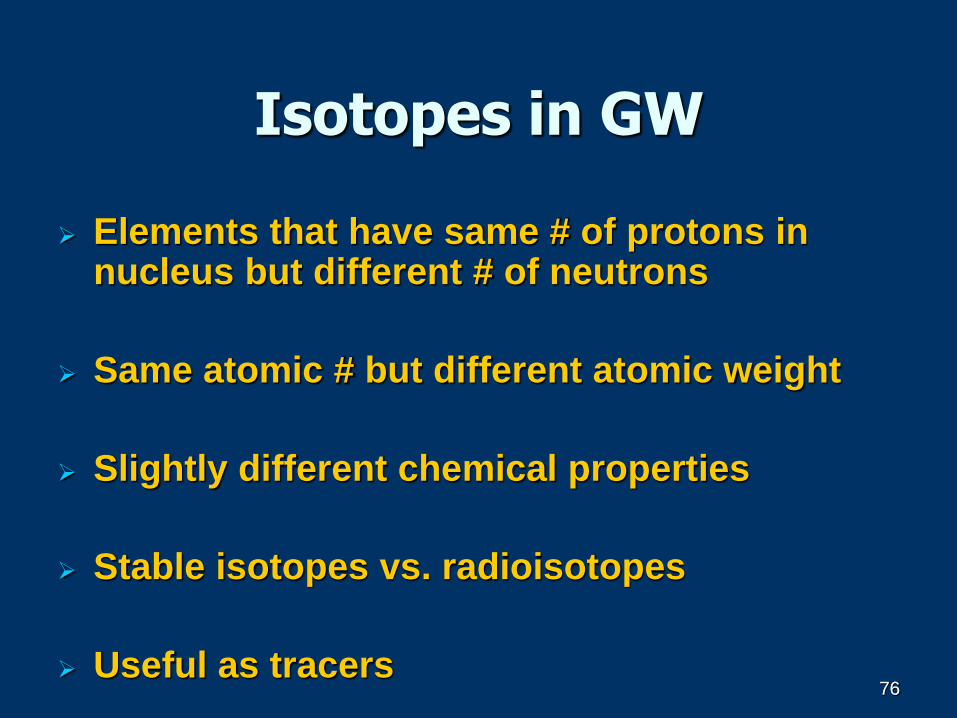
Isotopes in GW
Elements that have same # of protons in nucleus but different # of neutrons
Same atomic # but different atomic weight
Slightly different chemical properties
Stable isotopes vs. radioisotopes
Useful as tracers76
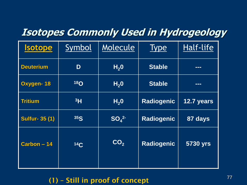
77
Isotopes Commonly Used in Hydrogeology
Isotope Symbol Molecule Type Half-life
Deuterium D H20 Stable ---
Oxygen- 18 18O H20 Stable ---
Tritium 3H H20 Radiogenic 12.7 years
Sulfur- 35 (1) 35S SO42- Radiogenic 87 days
Carbon – 14 14CCO2 Radiogenic 5730 yrs
(1) – Still in proof of concept77
78
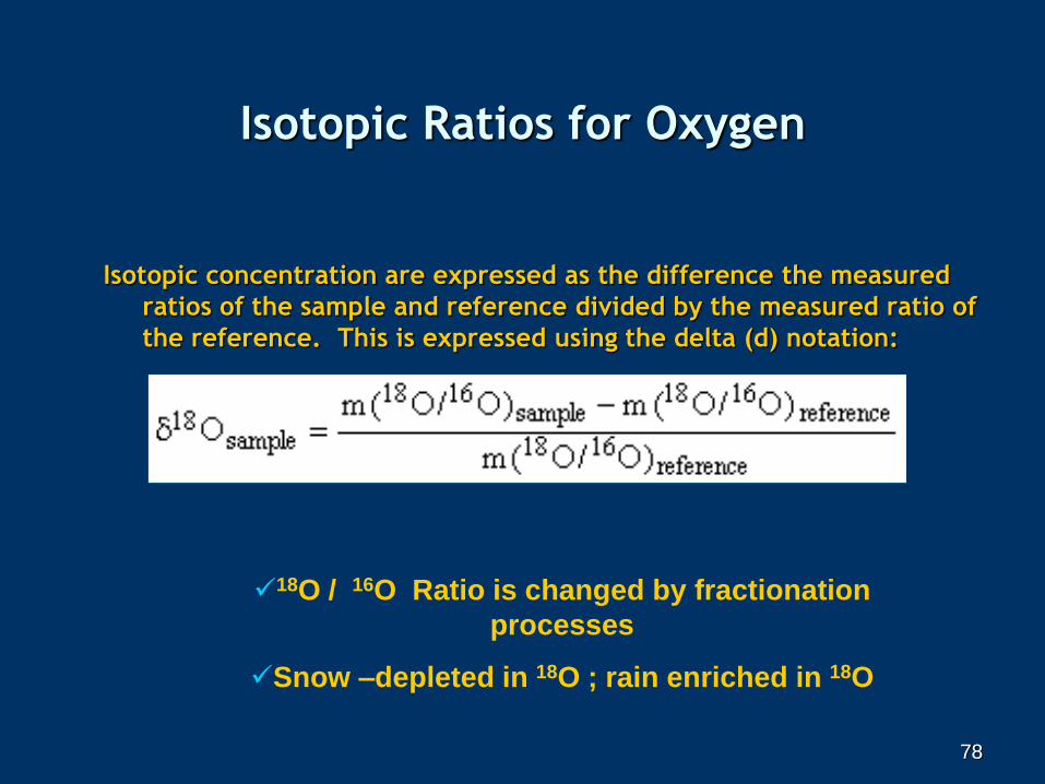
Isotopic Ratios for Oxygen
Isotopic concentration are expressed as the difference the measured
ratios of the sample and reference divided by the measured ratio of
the reference. This is expressed using the delta (d) notation:
18O / 16O Ratio is changed by fractionation
processes
Snow –depleted in 18O ; rain enriched in 18O
78
79
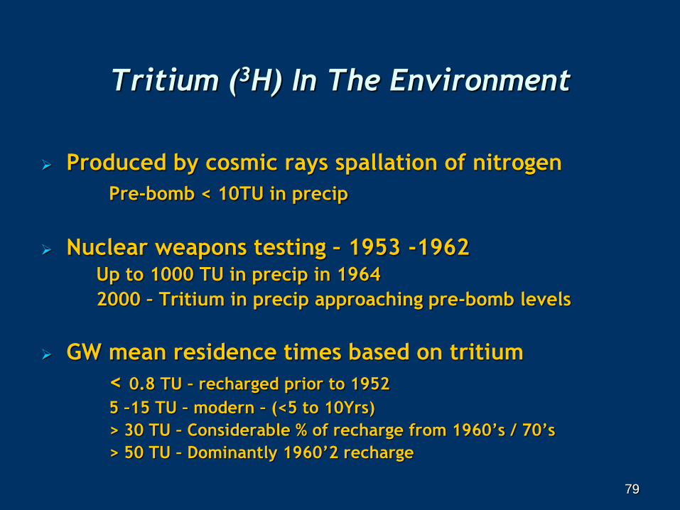
Tritium (3H) In The Environment
Produced by cosmic rays spallation of nitrogen
Pre-bomb < 10TU in precip
Nuclear weapons testing – 1953 -1962 Up to 1000 TU in precip in 1964
2000 – Tritium in precip approaching pre-bomb levels
GW mean residence times based on tritium
< 0.8 TU – recharged prior to 1952
5 –15 TU – modern – (<5 to 10Yrs)
> 30 TU – Considerable % of recharge from 1960’s / 70’s
> 50 TU – Dominantly 1960’2 recharge
79
80
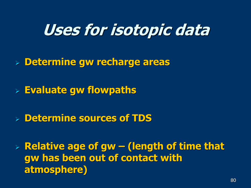
Uses for isotopic data
Determine gw recharge areas
Evaluate gw flowpaths
Determine sources of TDS
Relative age of gw – (length of time that gw has been out of contact with atmosphere)
80
8181
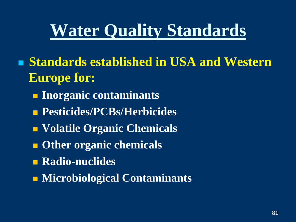
Water Quality Standards
Standards established in USA and Western
Europe for:
Inorganic contaminants
Pesticides/PCBs/Herbicides
Volatile Organic Chemicals
Other organic chemicals
Radio-nuclides
Microbiological Contaminants
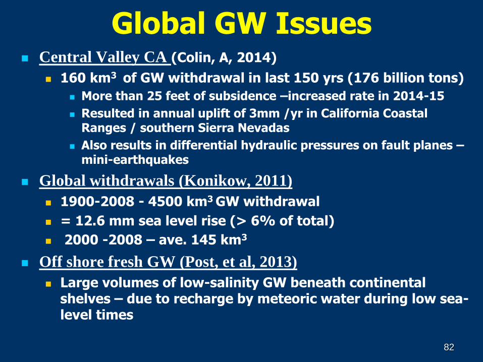
Global GW Issues Central Valley CA (Colin, A, 2014)
160 km3 of GW withdrawal in last 150 yrs (176 billion tons)
More than 25 feet of subsidence –increased rate in 2014-15
Resulted in annual uplift of 3mm /yr in California Coastal Ranges / southern Sierra Nevadas
Also results in differential hydraulic pressures on fault planes –mini-earthquakes
Global withdrawals (Konikow, 2011)
1900-2008 - 4500 km3 GW withdrawal
= 12.6 mm sea level rise (> 6% of total)
2000 -2008 – ave. 145 km3
Off shore fresh GW (Post, et al, 2013)
Large volumes of low-salinity GW beneath continental shelves – due to recharge by meteoric water during low sea-level times
82
THANK YOU !
Mike Wireman
Ama Dablam
Khumbu, Nepal
8484
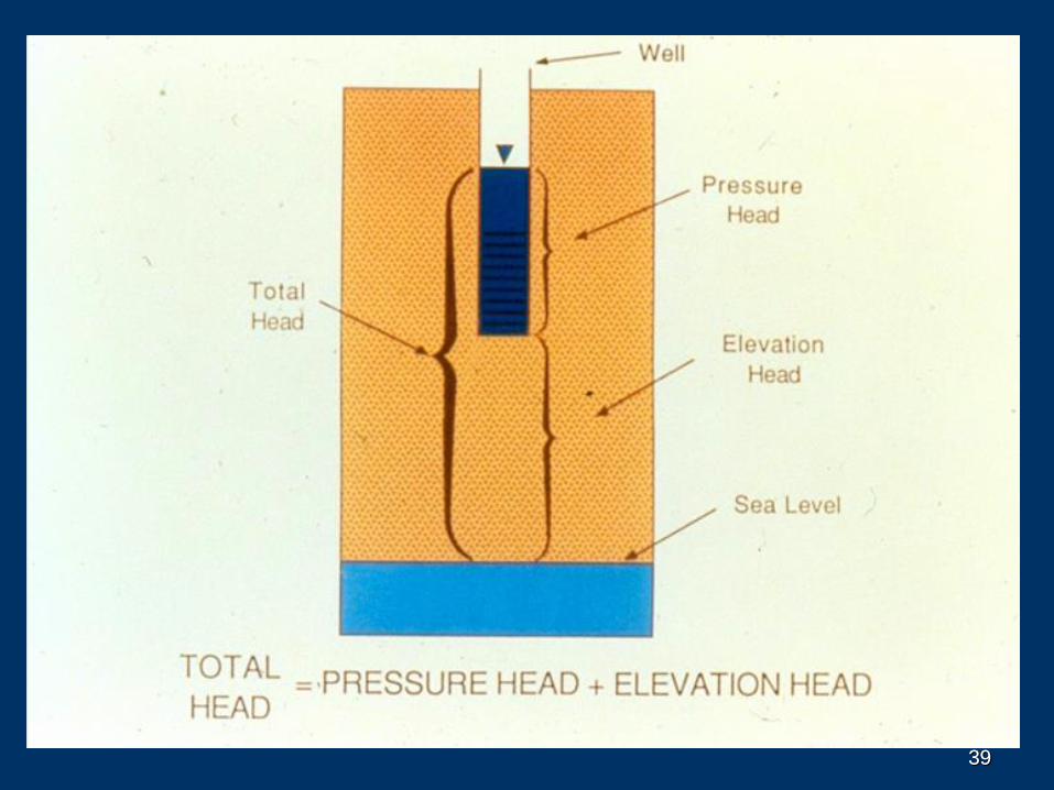
Hydrogeologic setting