basic applied survey math 2019 - cdn.ymaws.com · basic applied survey mathematics joseph v.r....
TRANSCRIPT
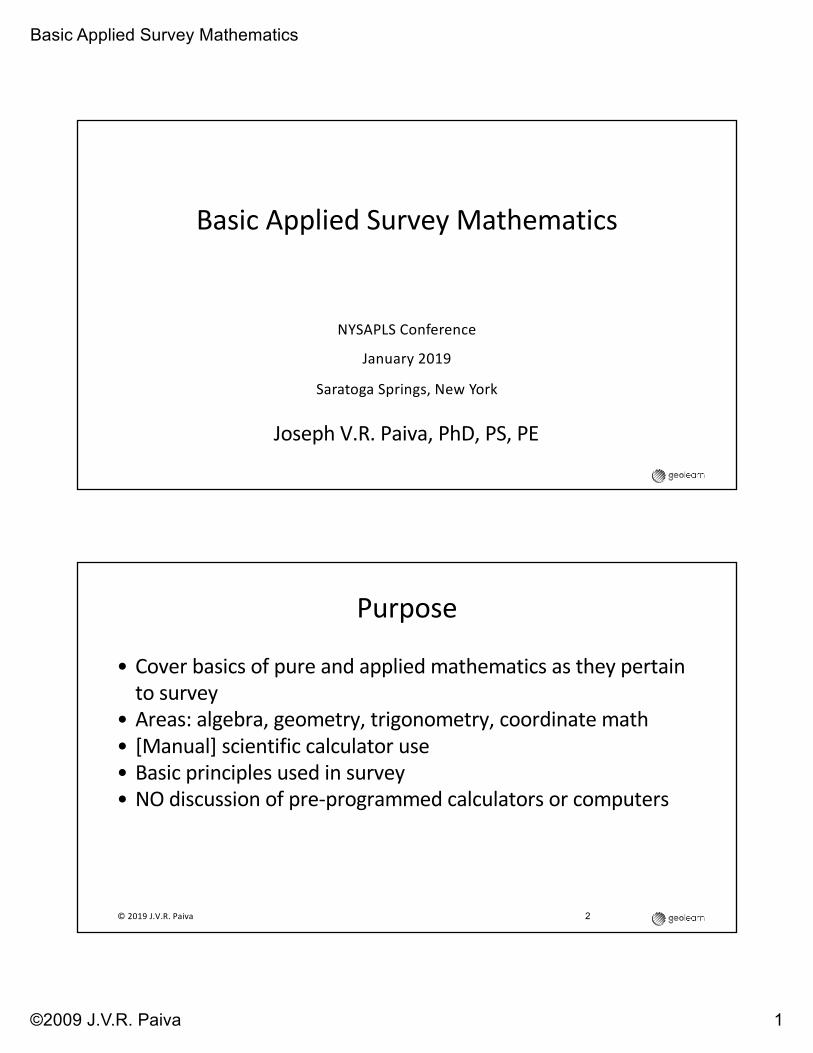
Basic Applied Survey Mathematics
©2009 J.V.R. Paiva 1
Basic Applied Survey Mathematics
Joseph V.R. Paiva, PhD, PS, PE
NYSAPLS Conference
January 2019
Saratoga Springs, New York
Purpose
• Cover basics of pure and applied mathematics as they pertain to survey
• Areas: algebra, geometry, trigonometry, coordinate math• [Manual] scientific calculator use• Basic principles used in survey• NO discussion of pre-programmed calculators or computers
2© 2019 J.V.R. Paiva

Basic Applied Survey Mathematics
©2009 J.V.R. Paiva 2
What YOU Need To Do
• Participate (we are all friends here)
• Speak up
• No such thing as “wrong” answer (in this class)
• OR… the only wrong answer is the one you didn’t ask!
• Learning is the ultimate goal
• Use your calculator in class!
© 2019 J.V.R. Paiva 3
Class Overview
• We will travel fast
• Some basic details may be glossed over (though some will be
pointed out)
• This is only a small part of the body of knowledge you should
know
• Develop skills in researching, reading, trying, applying and
learning while you do
© 2019 J.V.R. Paiva 4
Basic Applied Survey Mathematics
©2009 J.V.R. Paiva 3
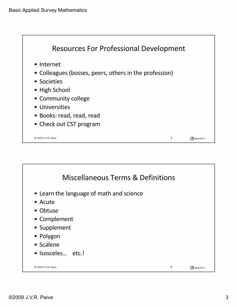
Resources For Professional Development
• Internet• Colleagues (bosses, peers, others in the profession)• Societies• High School• Community college• Universities• Books: read, read, read• Check out CST program
© 2019 J.V.R. Paiva 5
Miscellaneous Terms & Definitions
• Learn the language of math and science• Acute• Obtuse• Complement• Supplement• Polygon• Scalene• Isosceles… etc.!
© 2019 J.V.R. Paiva 6

Basic Applied Survey Mathematics
©2009 J.V.R. Paiva 4
Terms & Definitions
• Acute angle is less than a right
angle (90°)
• Obtuse angle is greater than a
right angle
• The Complement of an angle is
determined by subtracting the
angle from 90°
• The Supplement of an angle is
determined by subtracting it from
180°
• Polygon is an n-sided figure with
straight sides, of two dimensions,
simplest of which is where n = 3 (a
triangle)
• Scalene triangle has no two of its
sides equal
• Isosceles triangle has two sides
equal (and as a corollary) two
angles equal
© 2019 J.V.R. Paiva 7
Terms & Definitions / 2
• Equilateral triangle has three equal length sides (corollary: also three equal angles, all of which are 60°)
• A Right triangle has a right angle• Obtuse triangle has an obtuse
angle• Acute triangle has all three angles
acute
• Trapezium is a quadrilateral which has no sides parallel
• Trapezoid is a quadrilateral with only two sides parallel
• A Parallelogram has both sets of opposite sides parallel
© 2019 J.V.R. Paiva 8
Basic Applied Survey Mathematics
©2009 J.V.R. Paiva 5
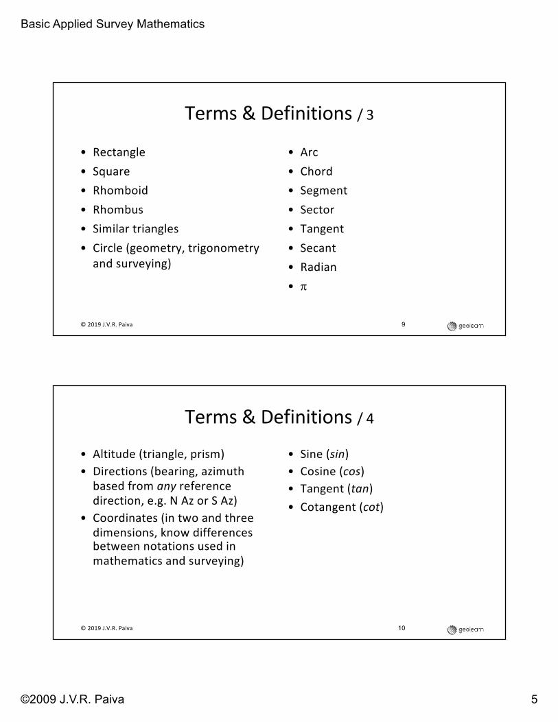
Terms & Definitions / 3
• Rectangle• Square• Rhomboid• Rhombus• Similar triangles• Circle (geometry, trigonometry
and surveying)
• Arc• Chord• Segment• Sector• Tangent• Secant• Radian• p
© 2019 J.V.R. Paiva 9
Terms & Definitions / 4
• Altitude (triangle, prism)• Directions (bearing, azimuth
based from any reference direction, e.g. N Az or S Az)
• Coordinates (in two and three dimensions, know differences between notations used in mathematics and surveying)
• Sine (sin)• Cosine (cos)• Tangent (tan)• Cotangent (cot)
© 2019 J.V.R. Paiva 10

Basic Applied Survey Mathematics
©2009 J.V.R. Paiva 6
• What is x?
Question 1
© 2019 J.V.R. Paiva 11
Question 2
• " = $ tan ∆)• If T is 450 and R is 875 what is ∆?
© 2019 J.V.R. Paiva 12
Basic Applied Survey Mathematics
©2009 J.V.R. Paiva 7
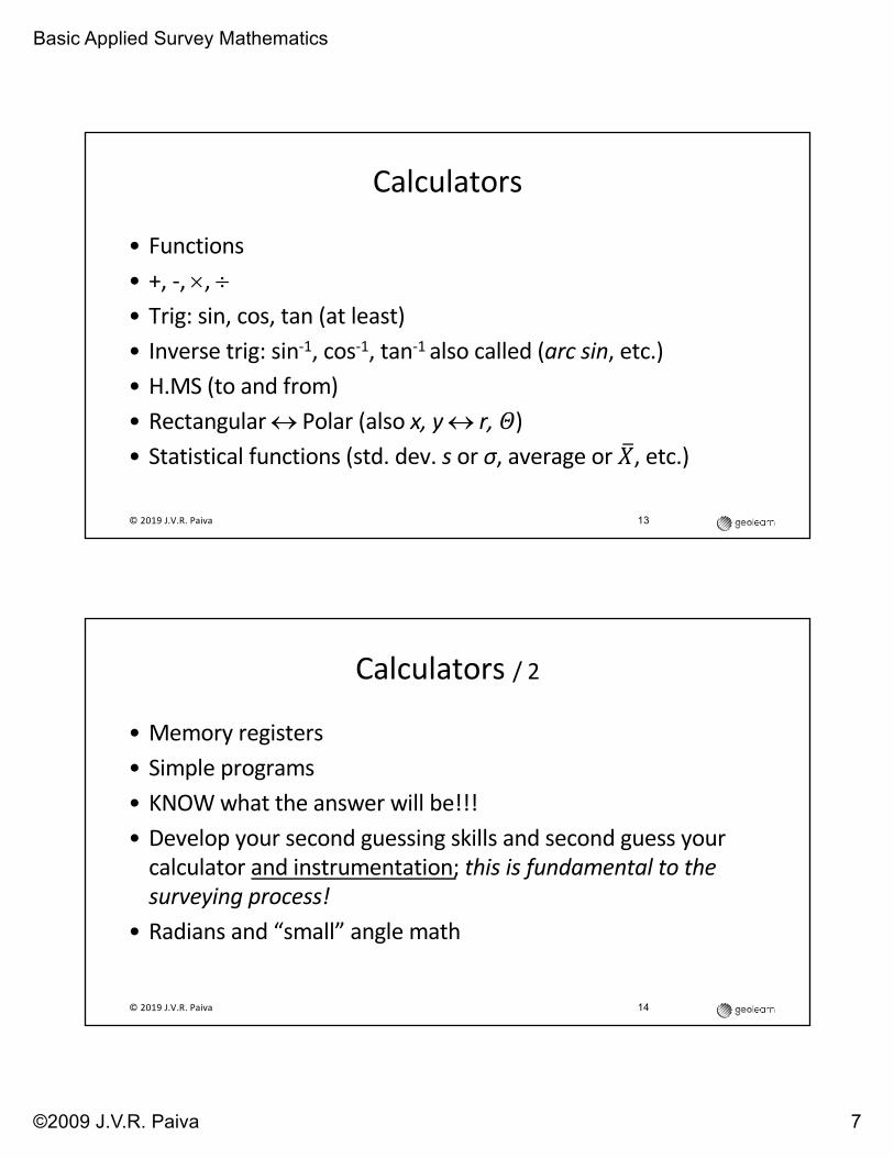
Calculators
• Functions• +, -, ´, ÷• Trig: sin, cos, tan (at least)• Inverse trig: sin-1, cos-1, tan-1 also called (arc sin, etc.)• H.MS (to and from)• Rectangular « Polar (also x, y « r, !)• Statistical functions (std. dev. s or σ, average or "#, etc.)
© 2019 J.V.R. Paiva 13
14
Calculators / 2
• Memory registers• Simple programs• KNOW what the answer will be!!! • Develop your second guessing skills and second guess your
calculator and instrumentation; this is fundamental to the surveying process!
• Radians and “small” angle math
© 2019 J.V.R. Paiva

Basic Applied Survey Mathematics
©2009 J.V.R. Paiva 8
15
Understand Trigonometry
AB
C
b
c
a
SOH-CAH-TOA
© 2019 J.V.R. Paiva
Know the naming convention for vertices (angles) and sides
16
Circle and Central Angle
+
+
-
-
• Counterclockwise angle
• Start at X-axis
• Radius = 1
© 2019 J.V.R. Paiva

Basic Applied Survey Mathematics
©2009 J.V.R. Paiva 9
17
Radians and p
+
+
-
-
Radian = angle subtended by arc of length R
© 2019 J.V.R. Paiva
18
Question 3
What is Q?
© 2019 J.V.R. Paiva
Basic Applied Survey Mathematics
©2009 J.V.R. Paiva 10
19
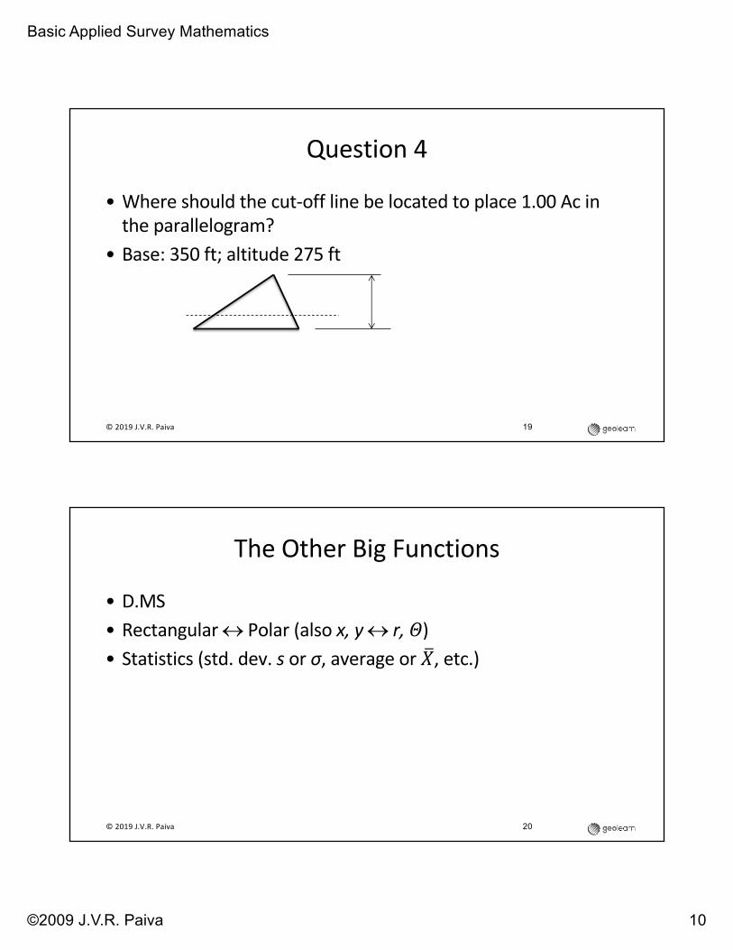
Question 4
© 2019 J.V.R. Paiva
• Where should the cut-off line be located to place 1.00 Ac in the parallelogram?
• Base: 350 ft; altitude 275 ft
The Other Big Functions
• D.MS• Rectangular « Polar (also x, y « r, !) • Statistics (std. dev. s or σ, average or "#, etc.)
© 2019 J.V.R. Paiva 20

Basic Applied Survey Mathematics
©2009 J.V.R. Paiva 11
D.MS
• Understand how it works• Don’t forget it! [one of the biggest source of mistakes]• Some calculators support direct addition and subtraction of
D.MS formatted numbers• Know how to do it manually [factor of 60 and 602]
© 2019 J.V.R. Paiva 21
Questions 5 - 8
• 237°42’13” = ? (in decimal degrees)
• 132.0856° = ? (in D.MS)
• sin128°13*46” =?
• tan 233.567898 =?© 2019 J.V.R. Paiva 22

Basic Applied Survey Mathematics
©2009 J.V.R. Paiva 12
Rectangular « Polar
• Break down a line into its orthogonal components in N-S and E-W directions, i.e. latitudes and departures
• Inverse• Know how to do this without using this function! [i.e. the
theory]• Theory highly underrated
© 2019 J.V.R. Paiva 23
Questions 9-11
• E-W and N-S components of each line in feet (including sign) if clockwise angle from North with meridian is (9) 44°16’; (10) 128°58’; (11) 158°42’. In all cases line is 1.00 ch. in length.
© 2019 J.V.R. Paiva 24
Basic Applied Survey Mathematics
©2009 J.V.R. Paiva 13
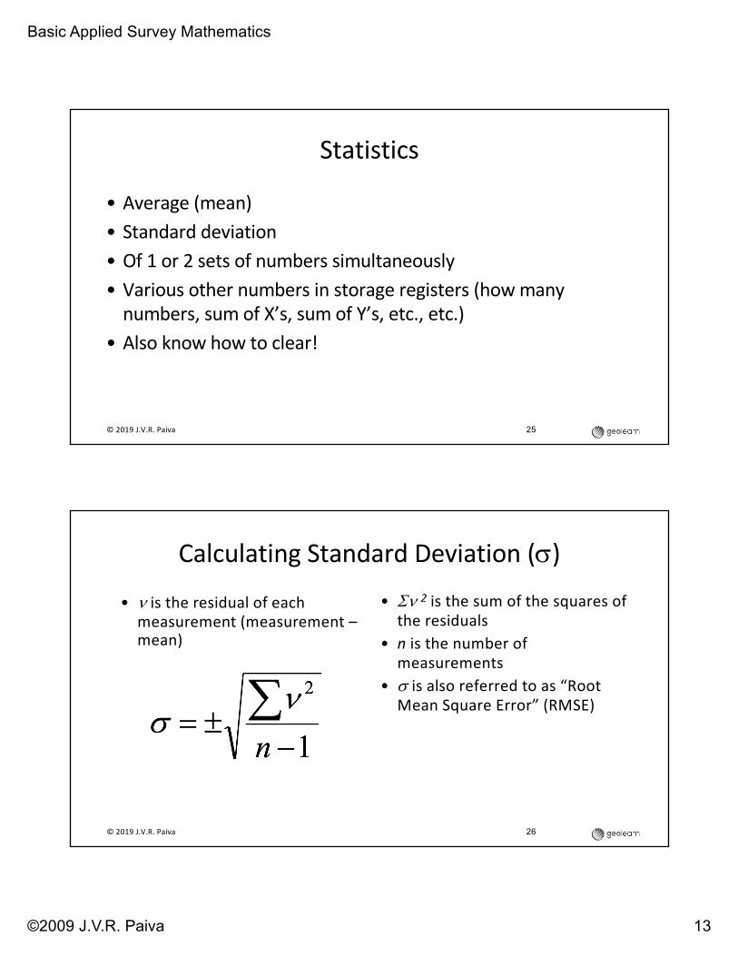
Statistics
• Average (mean)• Standard deviation• Of 1 or 2 sets of numbers simultaneously• Various other numbers in storage registers (how many
numbers, sum of X’s, sum of Y’s, etc., etc.)• Also know how to clear!
© 2019 J.V.R. Paiva 25
Calculating Standard Deviation (s)
• Sn 2 is the sum of the squares of the residuals
• n is the number of measurements
• s is also referred to as “Root Mean Square Error” (RMSE)
© 2019 J.V.R. Paiva 26
• n is the residual of each measurement (measurement –mean)
Basic Applied Survey Mathematics
©2009 J.V.R. Paiva 14
27
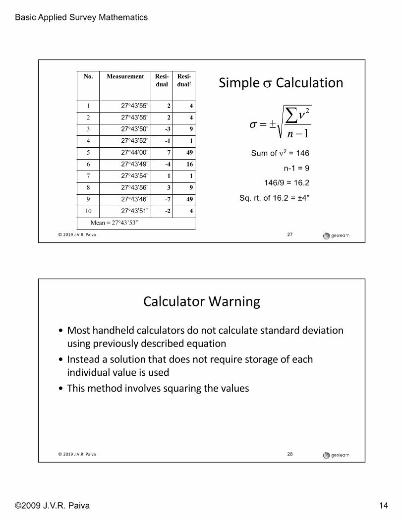
Simple s CalculationNo. Measurement Resi-dual
Resi-dual2
1 27°43’55” 2 4
2 27°43’55” 2 4
3 27°43’50” -3 9
4 27°43’52” -1 1
5 27°44’00” 7 49
6 27°43’49” -4 16
7 27°43’54” 1 1
8 27°43’56” 3 9
9 27°43’46” -7 49
10 27°43’51” -2 4
Mean = 27°43’53”
Sum of n2 = 146
n-1 = 9
146/9 = 16.2
Sq. rt. of 16.2 = ±4”
© 2019 J.V.R. Paiva
Calculator Warning
• Most handheld calculators do not calculate standard deviation using previously described equation
• Instead a solution that does not require storage of each individual value is used
• This method involves squaring the values
© 2019 J.V.R. Paiva 28

Basic Applied Survey Mathematics
©2009 J.V.R. Paiva 15
29
Calculator Warning / 2
• Round-off error, arithmetic overflow and/or arithmetic underflow can occur resulting in erroneous reporting of the standard deviation
• Best handled by only entering the changing parts of the values
© 2019 J.V.R. Paiva
Calculator Warning / 3
• If values range between 227°43’27” and 227°43’53”, only enter arc second values
• If values range between 272°34’42” and 227°35’17” drop 227°34’ from them and convert remaining minutes and seconds values to decimal minutes or seconds first
• Etc.
© 2019 J.V.R. Paiva 30

Basic Applied Survey Mathematics
©2009 J.V.R. Paiva 16
Learn Special Things
• Memory registers• Memory arithmetic• RPN (if applicable)
© 2019 J.V.R. Paiva 31
But Especially…
• Know what the answer should be!
• Order of magnitude calculations
• Mental arithmetic is essential
• Do not ONLY rely on the calculator
© 2019 J.V.R. Paiva 32

Basic Applied Survey Mathematics
©2009 J.V.R. Paiva 17
33
Traverse Calculations
• Balancing angles• Equal or otherwise?• Be reasonable, forget 1.79”, 0.0001 ft or 0.000001 Ac• See example next slide
© 2019 J.V.R. Paiva
34
Angle Balancing Example
Sta Angle ∆’sAdj
Angle
A 100-45-37 2.2” 2” -2 -35”B 231-23-43 4.4 4 -2 -41”C 17-12-59 6.6 7 -3 -56”D 89-03-28 8.8 9 -2 -26”E 101-34-24 11.0 11 -2 -22”S= 540-00-11 -11 00’00”
Cum
ul.
Cor
r.
Rou
nded
C
orr
© 2019 J.V.R. Paiva
Basic Applied Survey Mathematics
©2009 J.V.R. Paiva 18
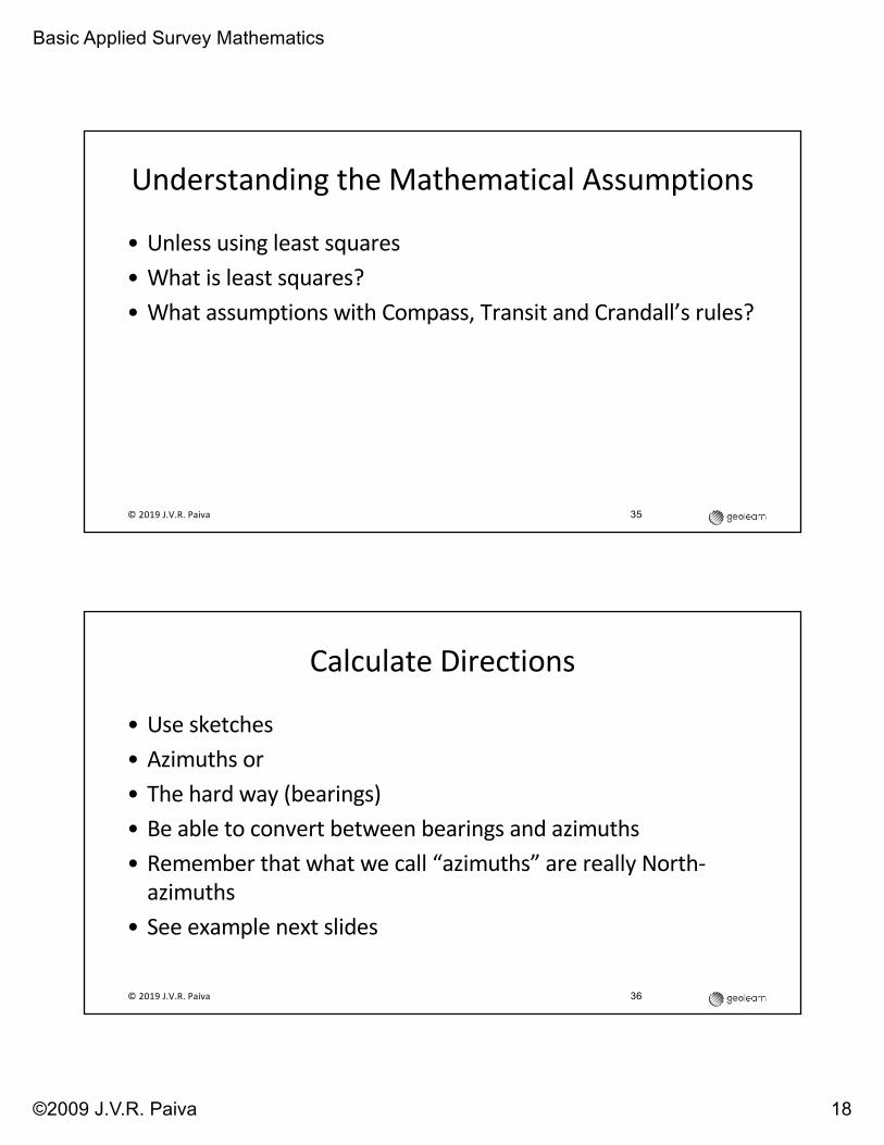
Understanding the Mathematical Assumptions
• Unless using least squares
• What is least squares?
• What assumptions with Compass, Transit and Crandall’s rules?
35© 2019 J.V.R. Paiva
36
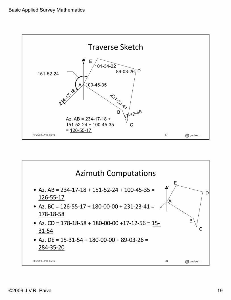
Calculate Directions
• Use sketches• Azimuths or• The hard way (bearings)• Be able to convert between bearings and azimuths• Remember that what we call “azimuths” are really North-
azimuths• See example next slides
© 2019 J.V.R. Paiva
Basic Applied Survey Mathematics
©2009 J.V.R. Paiva 19
37
Traverse Sketch
A
E
D
C
B
N
234-1
7-18
151-52-24
Az. AB = 234-17-18 + 151-52-24 + 100-45-35 = 126-55-17
231-23-41
17-12-56
89-03-26101-34-22
100-45-35
© 2019 J.V.R. Paiva
Azimuth Computations
• Az. AB = 234-17-18 + 151-52-24 + 100-45-35 = 126-55-17
• Az. BC = 126-55-17 + 180-00-00 + 231-23-41 = 178-18-58
• Az. CD = 178-18-58 + 180-00-00 +17-12-56 = 15-31-54
• Az. DE = 15-31-54 + 180-00-00 + 89-03-26 = 284-35-20
© 2019 J.V.R. Paiva 38
A
E
D
C
B
N

Basic Applied Survey Mathematics
©2009 J.V.R. Paiva 20
Azimuth Computations / 2
• Az. EA = 284-35-20 – 180-00-00 + 101-34-22 = 206-09-42
• Using fifth angle to check…
• Az. AB = 206-09-42 – 180-00-00 + 100-45-35 = 126-55-17ü
© 2019 J.V.R. Paiva 39
A
E
D
C
B
N
40
Know How to Describe
• Azimuths• A mathematical manipulation such as balancing angles,
adjusting traverse, etc.
© 2019 J.V.R. Paiva

Basic Applied Survey Mathematics
©2009 J.V.R. Paiva 21
But Don’t Forget…
• Bearings!
• Angle between 0° and 90° (inclusively) that the subject line
makes with the meridian
• Plus quadrant designators (N & S before angle and E & W after
angle)
• Exceptions: due north, due east etc.
41© 2019 J.V.R. Paiva
42
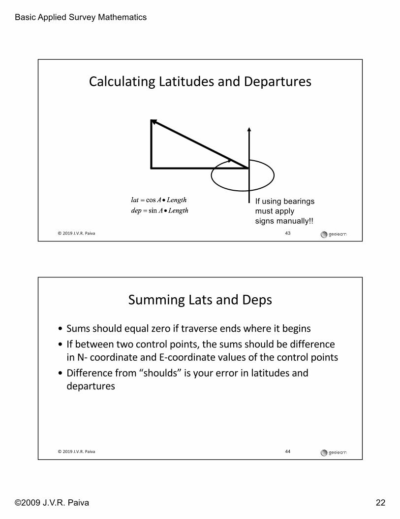
Also Know Terms
• Latitudes• Departures• Which is which?• Latitudes are north-south• Departures are east-west• Don’t forget sign “conventions”
© 2019 J.V.R. Paiva
Basic Applied Survey Mathematics
©2009 J.V.R. Paiva 22
43
Calculating Latitudes and Departures
If using bearings must apply signs manually!!
© 2019 J.V.R. Paiva
44
Summing Lats and Deps
• Sums should equal zero if traverse ends where it begins• If between two control points, the sums should be difference
in N- coordinate and E-coordinate values of the control points• Difference from “shoulds” is your error in latitudes and
departures
© 2019 J.V.R. Paiva

Basic Applied Survey Mathematics
©2009 J.V.R. Paiva 23
45
Error of Closure and Precision
• Errors in lats and deps are the orthogonal components of your total error
• Determine total error• Determine precision [total error divided by perimeter or sum
of the traverse lengths]
© 2019 J.V.R. Paiva
46
Traverse Adjustment
• Systematic method of adjusting individual latitudes and departures so that sum equals the “should” value
• Almost anything rational is justifiable in practice, in the exam…that’s different
• Know the conditions and adjust accordingly
© 2019 J.V.R. Paiva

Basic Applied Survey Mathematics
©2009 J.V.R. Paiva 24
47
Compass Rule
© 2019 J.V.R. Paiva
48
Check Adjusted Lats & Deps
• Sums should now equal “should” value• If traverse closes on itself, the should value is zero
© 2019 J.V.R. Paiva

Basic Applied Survey Mathematics
©2009 J.V.R. Paiva 25
49
Calculate Coordinates
• Use initial value that is given
• Or assume value
• Know how to “translate”
• Understand process of rotation
• Know how to scale [essential for doing state plane
coordinates…but other things too, such as “localization”]
© 2019 J.V.R. Paiva
50
Areas
• Break up into triangles and calculate—NOT!
• Use DMD method or
• Use coordinate method
© 2019 J.V.R. Paiva
Basic Applied Survey Mathematics
©2009 J.V.R. Paiva 26
51
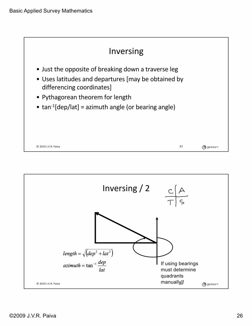
Inversing
• Just the opposite of breaking down a traverse leg• Uses latitudes and departures [may be obtained by
differencing coordinates]• Pythagorean theorem for length• tan-1[dep/lat] = azimuth angle (or bearing angle)
© 2019 J.V.R. Paiva
52
Inversing / 2
If using bearings must determine quadrants manually!!© 2019 J.V.R. Paiva

Basic Applied Survey Mathematics
©2009 J.V.R. Paiva 27
Sideshots
© 2019 J.V.R. Paiva 53
•Simple application of direction calculation
•Then break down into lat and dep
•Add lat to N-coord; dep to E-coord
•No check…unless measured as a sideshot from another traverse point also
Simple Area CalculationPoint Northing EastingA 0 0B 300 50C 450 225D 175 550
54© 2019 J.V.R. Paiva

Basic Applied Survey Mathematics
©2009 J.V.R. Paiva 28
55
Area by Coordinates• List coord in order• Multiply one coordinate along one
axis by next coordinate on other axis• Proceed with this method along one
column of coordinates and sum all products
• Then multiply in opposite direction along other column and sum all products
• Difference of the sums is twice the area
Point Y X
A 150 75
B 225 150
C 300 125
D 185 0
A 150 75
64,500 - 85,000 = -20,500
Area = 10,250
© 2019 J.V.R. Paiva
56
Questions 12 - 19
Point Lat. Dep. Dir. Dist. Northing (Y)
Easting (X)
Q 1200 1100350 -350
M 12 13
550 450N 2100 1200
14 15 83°20’30” 700
O 16 17
P 1650 1600
Q 1200 1100
© 2019 J.V.R. Paiva
Fill in the blanks indicated by superscript numbers.
18.Length NP19.Dir. NP

Basic Applied Survey Mathematics
©2009 J.V.R. Paiva 29
© 2019 J.V.R. Paiva 57
58
Question 20: Find Area Northing (Y) Easting (X)
1200 1100
1550 750
2100 1200
2181.16 1895.28
1650 1600
1200 1100
© 2019 J.V.R. Paiva

Basic Applied Survey Mathematics
©2009 J.V.R. Paiva 30
© 2019 J.V.R. Paiva 59
60
Proportioning w/Coordinates
N1100;
E1400
N1250;
E2000
•If “third” points are desired…
•Determine lat and dep
•[lat: 150; dep: 600]
•Take 1/3 [50 and 200]
•Where are third points located? [Questions 21 – 24]© 2019 J.V.R. Paiva
Basic Applied Survey Mathematics
©2009 J.V.R. Paiva 31
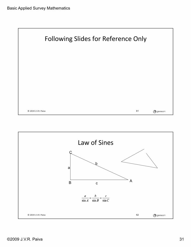
Following Slides for Reference Only
61© 2019 J.V.R. Paiva
62
Law of Sines
AB
C
b
c
a
© 2019 J.V.R. Paiva

Basic Applied Survey Mathematics
©2009 J.V.R. Paiva 32
63
Law of Cosines
AB
C
b
c
a
© 2019 J.V.R. Paiva
64
Triangle Solution When Three Sides Are Known
© 2019 J.V.R. Paiva

Basic Applied Survey Mathematics
©2009 J.V.R. Paiva 33
65
Horizontal Curves
© 2019 J.V.R. Paiva
Equations for Horizontal Curves[R can be in any unit, D is in decimal degrees][L is length of arc, Δ is central angle of circular
curve][T is length from PC or PT to PI, R is curve
radius]
[LC is long chord, i.e. distance from PC to PT][all in stationing][all in stationing][E is external distance, distance from center of
arc to PI][M is middle ordinate, distance from center of
arc to center of long chord]
66© 2019 J.V.R. Paiva
Basic Applied Survey Mathematics
©2009 J.V.R. Paiva 34
67
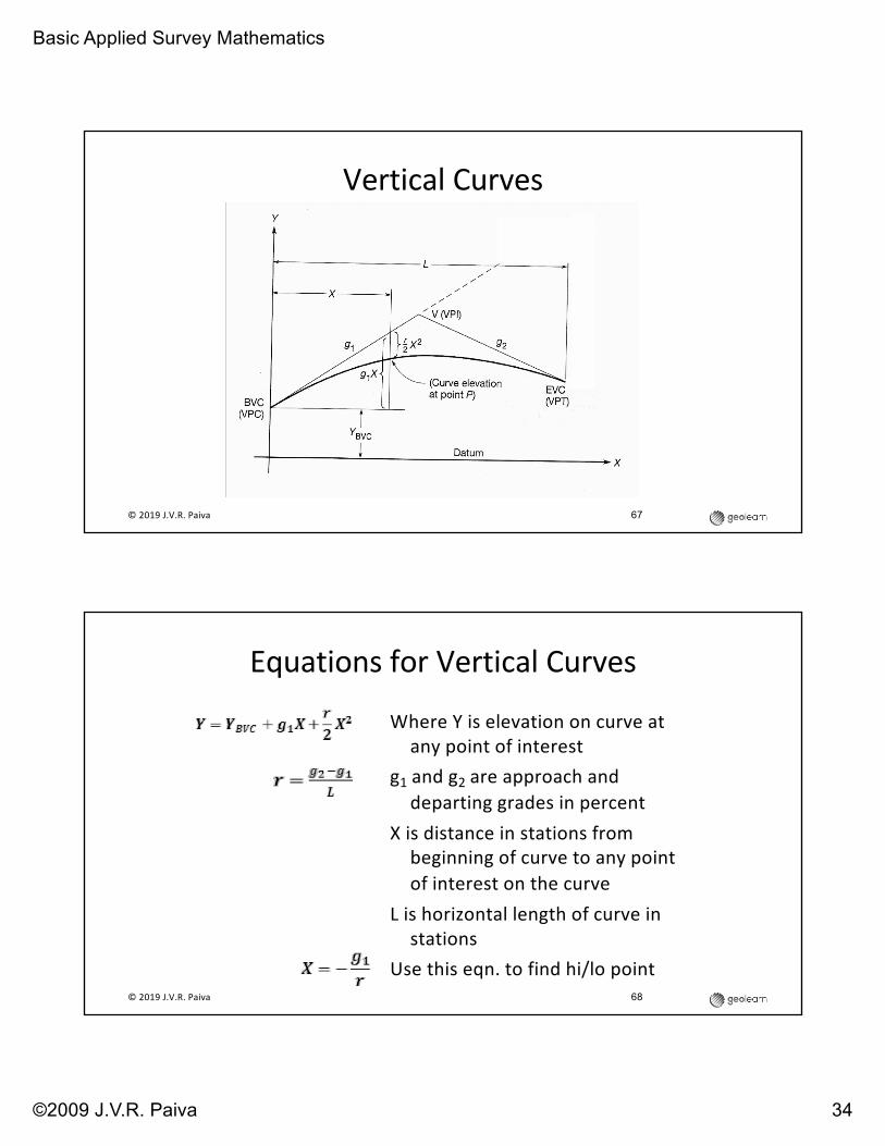
Vertical Curves
© 2019 J.V.R. Paiva
Equations for Vertical Curves
Where Y is elevation on curve at any point of interest
g1 and g2 are approach and departing grades in percent
X is distance in stations from beginning of curve to any point of interest on the curve
L is horizontal length of curve in stations
Use this eqn. to find hi/lo point68© 2019 J.V.R. Paiva

Basic Applied Survey Mathematics
©2009 J.V.R. Paiva 35
Questions?
Good Luck!
© 2019 J.V.R. Paiva 69

www.geo-learn.com
AboutseminarpresenterJosephV.R.Paiva
Dr. Joseph V.R. Paiva, is principal and CEO of GeoLearn, LLC (www.geo-learn.com), an online provider of professional and technician education since February 2014. He also works as a consultant to lawyers, surveyors and engineers, and international developers, manufacturers and distributors of instrumentation and other geomatics tools, as well being a writer and speaker. One of his previous roles was COO at Gatewing NV, a Belgian manufacturer of unmanned aerial systems (UAS) for surveying and mapping during 2010-2012. Trimble acquired Gatewing in 2012. Because of this interest in drones, Joe is an FAA-licensed Remote Pilot.
Selected previous positions Joe has held includes: managing director of Spatial Data Research, Inc., a GIS data collection, compilation and software development company; senior scientist and technical advisor for Land Survey research & development, VP of the Land Survey group, and director of business development for the Engineering and Construction Division of Trimble; vice president and a founder of Sokkia Technology, Inc., guiding development of GPS- and software-based products for surveying, mapping, measurement and positioning. Other positions include senior technical management positions in The Lietz Co. and Sokkia Co. Ltd., assistant professor of civil engineering at the University of Missouri-Columbia, and partner in a surveying/civil engineering consulting firm.
Joe has continued his interest in teaching by serving as an adjunct instructor of online credit and non-credit courses at the State Technical College of Missouri, Texas A&M University-Corpus Christi and the Missouri University of Science and Technology. His key contributions in the development field are: design of software flow for the SDR2 and SDR20 series of Electronic Field Books, project manager and software design of the SDR33, and software interface design for the Trimble TTS500 total station.
He is a Registered Professional Engineer and Professional Land Surveyor, was an NSPS representative to ABET serving as a program evaluator, where he previously served as team chair, and commissioner, and has more than 30 years experience working in civil engineering, surveying and mapping. Joe writes for POB, The Empire State Surveyor and many other publications and has been a past contributor of columns to Civil Engineering News. He has published dozens of articles and papers and has presented over 150 seminars, workshops, papers, and talks in panel discussions, including authoring the positioning component of the Surveying Body of Knowledge published in Surveying and Land Information Science. Joe has B.S., M.S. and PhD degrees in Civil Engineering from the University of Missouri-Columbia. Joe’s current volunteer professional responsibilities include president of the Surveying and Geomatics Educators Society (SaGES) and various ad hoc and organized committees of NSPS, the Missouri Society of Professional Surveyors and other groups.
GeoLearn is the online learning portal provider for the Missouri Society of Professional Surveyors, the Kansas Society of Land Surveyors, the New York State Association of Professional Land Surveyors, The Texas Society of Professional Surveyors, The Pennsylvania Society of Land Surveyors, the Wisconsin Society of Land Surveyors, Arizona Professional Land Surveyors, the Oklahoma Society of Land Surveyors and the Geographic and Land Information Society. More organizations are set to partner with GeoLearn soon. Dr. Paiva can be reached at [email protected] or on Skype at joseph_paiva.
Jan 2019