basaltic volcanism of the central and western snake river ... - my...
TRANSCRIPT

fl d006-02 page 1 of 26
1
Geological Society of America
Field Guide 6
2005
Basaltic volcanism of the central and western Snake River Plain: A
guide to fi eld relations between Twin Falls and Mountain Home, Idaho
John W. ShervaisDepartment of Geology, Utah State University, Logan, Utah 84322-4505, USA
John D. KauffmanIdaho Geological Survey, University of Idaho, Moscow, Idaho 83844-3014, USA
Virginia S. GillermanIdaho Geological Survey, Boise State University, Boise, Idaho 83725-1535, USA
Kurt L. OthbergIdaho Geological Survey, University of Idaho, Moscow, Idaho 83844-3014, USA
Scott K. VetterDepartment of Geology, Centenary College, Shreveport, Louisiana 71134, USA
V. Ruth HobsonMeghan Zarnetske
Department of Geology, Utah State University, Logan, Utah 84322-4505, USA
Matthew F. CookeScott H. Matthews
Department of Geological Sciences, University of South Carolina, Columbia, South Carolina 29208, USA
Barry B. HananDepartment of Geological Sciences, San Diego State University, San Diego, California 92182-1020, USA
ABSTRACT
Basaltic volcanism in the Snake River Plain of southern Idaho has long been associ-ated with the concept of a mantle plume that was overridden by North America during the Neogene and now resides beneath the Yellowstone plateau. This concept is consistent with the time-transgressive nature of rhyolite volcanism in the plain, but the history of basaltic volcanism is more complex. In the eastern Snake River Plain, basalts erupted after the end of major silicic volcanism. The basalts typically erupt from small shield volcanoes that cover up to 680 km2 and may form elongate fl ows that extend 50–60 km from the central vent. The shields coalesce to form extensive plains of basalt that mantle the entire width of the plain, with the thickest accumulations of basalt forming an axial
Shervais, J.W., Kauffman, J.D., Gillerman, V.S., Othberg, K.L., Vetter, S.K., Hobson, V.R., Zarnetske, M., Cooke, M.F., Matthews, S.H., and Hanan, B.B., 2005, Basaltic volcanism of the central and western Snake River Plain: A guide to fi eld relations between Twin Falls and Mountain Home, Idaho, in Pederson, J., and Dehler, C.M., eds., Interior Western United States: Geological Society of America Field Guide 6, p. xxx–xxx, doi: 10.1130/2005.fl d006(02). For permission to copy, contact [email protected]. © 2005 Geological Society of America

2 J.W. Shervais et al.
fl d006-02 page 2 of 26
INTRODUCTION
The Snake River Plain of southern Idaho is one of the most
distinctive physiographic features of North America (Fig. 1). The
topographic low that defi nes the plain cuts across the structural
grain of both the Idaho batholith and the Basin and Range prov-
ince—even though formation of the plain coincided in time with
Basin and Range extension. Evolution of the eastern Snake River
Plain has been associated with the passage of North America over
a mantle hotspot, forming a time-transgressive volcanic province
that youngs from WSW to ENE (e.g., Morgan, 1972; Suppe et
al., 1975; Armstrong et al., 1975). The onset of hotspot-related
volcanism is marked by a series of overlapping caldera com-
plexes, ignimbrites, and caldera-fi lling rhyolite lavas (Bonnich-
sen, 1982a, 1982b; Bonnichsen and Kauffman, 1987; Pierce and
Morgan, 1992; Christiansen et al., 2002). The early rhyolite com-
plexes were followed by extensive eruptions of plains basalts,
which form a carapace on top of the earlier rhyolites (Malde and
Powers, 1962; Greeley, 1982; Leeman, 1982; Kuntz et al., 1982,
1992; Malde, 1991). The hotspot is currently located under the
Yellowstone Plateau, which also forms the locus of a gigantic
geoid anomaly that underlies much of western North America
(Smith and Braile, 1994; Pierce et al., 2002).
The hotspot or plume model for the Snake River Plain is
supported by studies of tectonic uplift and collapse along the
plume track (Pierce and Morgan, 1992; Anders and Sleep, 1992;
Smith and Braile, 1994; Rodgers et al., 2002), the 1000-km-wide
geoid anomaly centered under Yellowstone (Smith and Braile,
1994), seismic tomography of the underlying mantle (Saltzer
and Humphreys, 1997; Jordan et al., 2004), and helium isotopes
(Craig, 1997). Alternate models have been proposed, however,
such as localized asthenospheric upwelling associated with edge
effects of North American plate motion, and counter fl ow created
by the descending Farallon slab (Humphreys et al., 2000; Chris-
tiansen et al., 2002).
There are two aspects of Snake River Plain volcanism that
are not readily explained by the hotspot model. First, the erup-
tion of basaltic lavas generally postdates passage of the hotspot
in time, and may continue 2–3 m.y. after the onset of hotspot
related volcanism farther to the NE. Second, the hotspot model
does not explain the origin of volcanic rocks that do not lie on
the presumed hotspot track; in particular, basalts of the western
Snake River Plain cannot be directly related to the passage of
North America over the Yellowstone hotspot, although models
that link volcanism in the western Snake River Plain indirectly
to the hotspot have been proposed (Geist and Richards, 1993;
Camp, 1995; Shervais et al., 2002; Camp and Ross, 2004).
Basalts of the Columbia Plateau, thought to represent the “head”
of the Yellowstone plume, also lie well north of the presumed
hotspot track. Several models have been proposed to explain
this anomaly, including defl ection of the plume by the Farallon
plate (Geist and Richards, 1993), compression of the plume head
by North American lithospheric mantle (Camp, 1995; Camp
and Ross, 2004), or location of the plume head below northern
Nevada (Pierce and Morgan, 1992; Pierce et al., 2002).
The central Snake River Plain lies at the junction of the
physiographic western and eastern Snake River Plain and rep-
resents a critical link between the two volcanic provinces. The
high along the length of the plain. In contrast, basaltic volcanism in the western Snake River Plain formed in two episodes: the fi rst (ca. 7–9 Ma) immediately following the eruption of rhyolites lavas now exposed along the margins of the plain, and the second forming in the Pleistocene (≤2 Ma), long after active volcanism ceased in the adjacent eastern Snake River Plain. Pleistocene basalts of the western Snake River Plain are intercalated with, or overlie, lacustrine sediments of Pliocene-Pleistocene Lake Idaho, which fi lled the western Snake River Plain graben after the end of the fi rst episode of basaltic volcanism. The contrast in occurrence and chemistry of basalt in the eastern and western plains suggest the interpretation of volcanism in the Snake River Plain is more nuanced than simple models proposed to date.
Keywords: basaltic volcanism, basalt geochemistry, Snake River Plain, Bonneville
fl ood.Easte
rn SRP
Western SRP
TF
MH
1
23
42º 00’41º 59’
117º 02’ 111º 05’
45º 30’
Figure 1. Physiographic map of the northwestern United States show-ing the Snake River Plain (SRP) and related features. Note the strong topographic expression of the plume track and the absence of Basin and Range extension across the axis of the plain. MH—Mountain Home; TF—Twin Falls.

Basaltic volcanism of the central and western Snake River Plain 3
fl d006-02 page 3 of 26
structural, geophysical, sedimentary, and volcanic features of
these provinces are distinct and require different origins. In this
guidebook, we present a brief synopsis of geologic relations
within and between the central and western Snake River Plain
and then examine the stratigraphy and volcanology of each prov-
ince in the fi eld guide section. A compendium of recent papers on
the Snake River Plain has recently been published by the Idaho
Geological Survey (Bonnichsen et al., 2002), and interested read-
ers are referred to that volume for more detailed information.
THE SNAKE RIVER VOLCANIC PROVINCE: GEOLOGIC SETTING
The central and western Snake River Plain comprise two dis-
tinct provinces with different crustal structure, stratigraphy, and
volcanic history. Both provinces are characterized by crust that
is thicker (40–45 km) than crust in the adjacent Basin and Range
province (≈33 km; Mabey, 1978, 1982; Iyer, 1984; Malde, 1991).
The western Snake River Plain is also characterized by a positive
gravity anomaly that trends parallel to the axis of the plain, and
magnetic anomalies that parallel its southern margin (Mabey,
1982). In contrast, gravity and magnetic anomalies in the eastern
Snake River Plain are subdued and defi ne a NW-trending texture
that is normal to the trend of the eastern plain, but parallels struc-
tural trends in the adjacent Basin and Range province (Mabey,
1982; Malde, 1991). These contrasts refl ect fundamental differ-
ences in the underlying structure and stratigraphy of the two ter-
ranes: the western Snake River Plain is a true graben, whereas the
eastern Snake River Plain is structurally downwarped with little
or no faulting along its margins (McQuarrie and Rodgers, 1998;
Wood and Clemens, 2002; Rodgers et al., 2002).
Central and Eastern Snake River Plain
The ENE-trending central and eastern Snake River Plain
begins as a gentle structural depression on the Owyhee Plateau
that deepens to the NE and merges with the physiographic Snake
River Plain near Twin Falls. This structural depression continues
to the NE until it merges with the Yellowstone Plateau (Rodgers
et al., 2002). The central Snake River Plain is defi ned loosely as
that part of the eastern Snake River Plain trend that lies between
the Owyhee Plateau and the Great Rift, or approximately between
116°W and 114°W along the axis of the plain.
The increase in elevation of the eastern Snake River Plain
from SW to NE is thought to result from thermal buoyancy in
the upper mantle under the hotspot (Dueker and Humphreys,
1990; Pierce and Morgan, 1992; Smith and Braile, 1994). The
progressive decay of this thermal anomaly with time has resulted
in tectonic collapse in the wake of the “deformation parabola”
that emanates from the hotspot (Anders and Sleep, 1992; Pierce
and Morgan, 1992; Smith and Braile, 1994). The elevation dif-
ference between the Owyhee Plateau and the eastern Snake River
Plain probably results from differences in the underlying crust:
the Owyhee Plateau is underlain by the southern extension of the
Idaho batholith, whereas the eastern Snake River Plain transects
older crust of the Basin and Range province (Malde, 1991).
The eastern Snake River Plain is characterized by 1–2 km of
basalt that overlies rhyolite and welded tuff (e.g., Leeman, 1982;
Kuntz et al., 1988, 1992; Greeley, 1982). Scientifi c drill holes at
the Idaho National Laboratory (INL) site show that the basaltic
suite ranges from <100 m to over 1500 m thick, with rhyolite
basement extending to depths in excess of 3000 m (Malde, 1991;
Hughes et al., 1999, 2002). Sedimentary intercalations consist-
ing of fl uvial sands, lacustrine muds, windblown sand, and loess
range from 2 m to ≈25 m thick.
The rhyolite eruptive centers consist of overlapping caldera
complexes and ignimbrites that represent the initial volcanic
activity at any given location along the axis of the Snake River
Plain, and are thought to mark the arrival of the hotspot (e.g.,
Bonnichsen, 1982a; Christiansen, 1982; Draper, 1991; Morgan,
1992). Rhyolite eruptive centers become younger from SW to
NE: the Bruneau-Jarbidge eruptive center (12.5–11.3 Ma), the
Twin Falls eruptive center (10.0–8.6 Ma) the Picabo eruptive
center (10.2 Ma), the Heise eruptive center (6.7–4.3 Ma) and the
Island Park–Yellowstone eruptive center (1.8–0.6 Ma). The oldest
basalts in the central and eastern Snake River Plain are slightly
younger than the eruptive centers they mantle; the youngest
basalts erupted from a series of NW-trending volcanic rift zones
during the Holocene (e.g., the Shoshone lava fl ow, Craters of the
Moon, the Great Rift, Hells Half Acre, Wapi lava fl ow), with fl ows
as young as 2000 yr B.P. reported (Kuntz et al., 1986).
Geophysical studies of the eastern Snake River Plain
have documented differences in both the crustal structure and
lithosphere-asthenosphere boundary relative to both the adjacent
Basin and Range province and the Archean Wyoming craton
(Braile et al., 1982; Iyer, 1984; Dueker and Humphreys, 1990,
1993; Humphreys and Dueker, 1994; Peng and Humphreys,
1998; Saltzer and Humphreys, 1997; Humphreys et al., 2000).
The most signifi cant crustal feature observed in seismic profi les
of the eastern Snake River Plain is a midcrustal “sill” ≈10 km
thick and 90 km wide that underlies the entire width of the east-
ern Snake River Plain, with seismic velocities (≈6.5 km/s) inter-
mediate between the mafi c lower crust and the more felsic inter-
mediate crust (Braile et al., 1982; Peng and Humphreys, 1998).
This mafi c “sill” is inferred to represent basaltic melts that were
intruded into the crust and either fractionated to form the high
temperature rhyolites of the eastern Snake River Plain (McCurry
and Hackett, 1999) or induced partial melting of the crust to form
these rhyolites (Leeman, 1982; Bonnichsen, 1982a, 1982b; Doe
et al., 1982). The crust is also underlain by a low velocity layer
that is thought to be partially molten (Peng and Humphreys,
1998). This low-velocity layer apparently thickens to the NE,
toward Yellowstone, where it dominates the lower crustal section
(Priestley and Orcutt, 1982).
Teleseismic tomography across the eastern Snake River
Plain and adjacent domains show that the subcontinental litho-
sphere directly beneath the plain has been eroded to form a deep
channel parallel to North American plate motion (Dueker and

4 J.W. Shervais et al.
fl d006-02 page 4 of 26
Humphreys, 1990; Humphreys and Dueker, 1994; Saltzer and
Humphreys, 1997; Humphreys et al., 2000). The channel con-
sists of low velocity, partially molten asthenosphere buttressed by
levees of high-velocity, melt-depleted mantle. The depth of the
lithosphere-asthenosphere boundary beneath the plain is roughly
constant parallel to its axis (Saltzer and Humphreys, 1997). Since
the subcontinental mantle lithosphere is thicker toward the NE,
the sublithospheric channel must be more deeply eroded into the
lithosphere to the NE.
Tomographic images of the Yellowstone plume show that it
dips steeply to the north from Yellowstone and extends to a depth
of 400–600 km (Montelli et al., 2003; Jordan et al., 2004; Dueker
et al., 2004). This is consistent with recent models of deep-seated
mantle plumes, which show that they may tilt signifi cantly from
vertical and follow complex fl ow lines within the mantle (e.g.,
King, 2004; Farnetani and Samuel, 2004).
Western Snake River Plain
In contrast to the eastern Snake River Plain, the western
Snake River Plain is a NW-trending structural graben, ≈70 km
wide and 300 km long, bounded by en echelon normal faults
and fi lled with up to 2–3 km of late Miocene through Pliocene
sediment (Wood and Clemens, 2002; Shervais et al., 2002).
Structural relief, based on deep drill holes that intercept base-
ment, ranges from 2900 m near Mountain Home to over 3500 m
on the southwest side of the valley (Malde, 1991). Sedimentary
deposits in the western Snake River Plain range in age from
Miocene through Quaternary; these deposits are dominantly
lacustrine, with subordinate fl uviatile and phreatomagmatic
deposits (Wood and Clemens, 2002; Godchaux and Bonnichsen,
2002; Shervais et al., 2002). Miocene sediments were deposited
in small, interconnected lakes, precursors to the large Pliocene
“Lake Idaho” (Kimmel, 1982; Smith et al., 1982; Jenks and Bon-
nichsen, 1989; Malde 1991; Godchaux et al., 1992; Jenks et al.,
1993; Wood and Clemens, 2002). The western Snake River Plain
is topographically lower than the eastern Snake River Plain, with
elevations ranging from 670 m to 1100 m (Malde, 1991), but
recent data suggest that an ancestral Snake River system fl owed
southwards during the Miocene, implying higher elevations to
the NW (Smith and Stearley, 1999; Link and Fanning, 1999).
Paleontological evidence similarly suggests southward drainage
in the late Miocene (Repenning et al., 1995).
Volcanic activity in the western Snake River Plain began
with the eruption of the silicic volcanic rocks along the northern
and southern margins of the basin between ca. 11.8 and 9.2 Ma
(Clemens and Wood, 1993; Wood and Clemens, 2002). Major
basaltic activity in the western Snake River Plain occurred in two
time periods: 9–7 Ma, and <2.2 Ma (White et al., 2002; Bon-
nichsen and Godchaux, 2002). The earlier episode is represented
by basalt fl ows and phreatomagmatic vents intercalated with late
Miocene sediments and by the acoustic basement that underlies
much of the western graben (Malde and Powers, 1962, 1972;
Amini et al., 1984; Malde, 1991; Wood and Clemens, 2002;
White et al., 2002; Shervais et al., 2002). The older (7–9 Ma)
lavas and late Miocene to Pliocene sediments comprise the Idaho
Group of Malde and Powers (1962). Young volcanic activity
(<2.2 Ma) in the western Snake River Plain consists of: (1) pla-
teau forming eruptions of tholeiitic basalt that form the volcanic
uplands north and south of the Snake River, (2) tholeiitic shield
volcanoes that sit on top of these uplands, and (3) young shield
and cinder cone vents of alkaline to transitional alkaline basalt
(Shervais et al., 2002; White et al., 2002). The younger lavas
comprise the Snake River Group of Malde and Powers (1962)
and correlate with the more abundant young volcanic rocks of
the eastern Snake River Plain (Leeman, 1982). Volcanic rocks
of similar age and character are also found in the Boise River
drainage 40 km north of Mountain Home (Howard and Shervais,
1973; Howard et al., 1982; Vetter and Shervais, 1992).
The physiographic junction between the western and eastern
portions of the plain is located west of Twin Falls, Idaho (Fig. 1).
Structurally, boundary faults of the western Snake River Plain
graben extend SE into the eastern Snake River Plain plume track
as far as Hagerman, and linears extend as far as Buhl, near Twin
Falls. The axial Bouguer gravity high of the western Snake River
Plain also extends into the plume track, and is defl ected eastward
south of the Mount Bennett Hills (Mabey, 1976, 1982). The
positive magnetic anomaly along the SW margin of the western
Snake River Plain curves to the NE where it intersects the plume
track (Mabey, 1982), possibly outlining the southern margin of
the Bruneau-Jarbidge eruptive center (Bonnichsen, 1982a). The
NW-trending gravity and magnetic anomalies, which character-
ize the eastern Snake River Plain, are absent in this area.
BASALTIC VOLCANISM: FIELD RELATIONS AND GEOCHEMISTRY
Central Snake River Plain
Late Neogene basalts of the central Snake River Plain north
of Twin Falls form large shield volcanoes (Fig. 2) clustered along
the axis of the plain, which overlie rhyolite of the Twin Falls
eruptive center (Bonnichsen and Godchaux, 2002). This area
has been mapped in detail during the past decade by the Idaho
Geological Survey, by graduate students from the University of
South Carolina and Utah State University, and by undergradu-
ates from Centenary College. The results of this work have been
compiled by the Idaho Geological Survey and are being prepared
for publication as the Twin Falls 30′ × 60′ quadrangle geological
map. Readers are referred to the preliminary copy of that map for
the names, and extent of volcanic units in the central Snake River
Plain and their relation to sedimentary units.
All of the hills seen on this part of the plain are constructive
volcanic vents. The shield volcanoes of the oldest vents have sub-
dued topography and radial drainage and a thick cover of loess
with well-developed soils, and they are typically farmed almost
all of the way to the vent summits (e.g., Flat Top Butte, Johnson
Butte). Many of the older vents appear smaller than the largest

Basaltic volcanism of the central and western Snake River Plain 5
fl d006-02 page 5 of 26
young vents because their fl anks have been partially buried by
younger lava fl ows (e.g., Skeleton Butte, Bacon Butte, Lincoln
Butte). The surfaces of fl ows from younger vents are character-
ized by extremely rugged, chaotic topography, with infl ated fl ow
fronts, collapsed fl ow interiors, ridges, and collapse pits (e.g.,
Owinza Butte, Rocky Butte, Notch Butte, Wilson Butte). These
surfaces lack established drainages but thin loess is present in
local depressions. The surfaces of fl ows from vents of intermedi-
ate age have nearly continuous loess mantles of variable thickness
and well-developed soils, but lack well defi ned surface drainage
and are rarely farmed (e.g., Crater Butte, Dietrich Butte). Where
the Bonneville Flood fl owed overland, loess and soil were com-
monly stripped from basalt surfaces yielding surface morphology
that appears younger then it should, which complicates identifi -
cation of basalt units based on surface characteristics.
Shield sizes vary and are diffi cult to constrain with con-
fi dence because the onlapping of younger lava fl ows often
conceals the true size of the older shields. Even so, the largest
are commonly 15–20 km across the main shield edifi ce—not
counting elongate fl ows that may extend 50–60 km from the
vent. Perhaps the most extensive shield in the region is Black
Ridge Crater, located at the eastern edge of the central plain
(113.96°W), which is ≈32 km across and covers ≈680 km2—all
or parts of eight 7.5′ quadrangles.
Shield volcanoes with extremely long fl ows include Black
Ridge Crater, Notch Butte, Wilson Butte, and Rocky Butte. The
Black Ridge Crater vent has a major sinuous lobe that fl owed
over 40 km from the vent, terminating just south of Notch Butte.
Rocky Butte and Wilson Butte both fed extensive fl ow fi elds.
Flows from Notch Butte extend west as far as Hagerman, a dis-
tance of ~42 km.
A few radiometric dates are available for basalts in the cen-
tral Snake River Plain (Armstrong et al., 1975; Tauxe et al., 2004;
Idaho Geological Survey, 2005, unpublished data). These dates,
along with stratigraphic relations, indicate that most of the shield
volcanoes north of the Snake River are Quaternary, whereas
those south of the river are early Quaternary or Tertiary. Older
volcanoes north of the river, such as Lincoln Butte, Johnson
Butte, and Sonnickson Butte, are surrounded and nearly buried
by younger basalt fl ows, and typically have subdued morphology
and radial drainage patterns. Remanent magnetic polarity of most
of the Quaternary basalts north of the river is normal and within
the Bruhnes polarity chron (<0.78 Ma); an exception is Sid Butte,
which has reverse polarity, but because of its geomorphic charac-
teristics it is thought to be early Quaternary and in the later part
of the Matuyama chron. The older basalt units south of the river
have both normal and reverse polarity and represent Tertiary to
early Quaternary polarity events.
Basalts of the central Snake River Plain have MgO similar to
mid-ocean ridge basalt (MORB; 5%–10%) but with higher FeO*
(12%–15%), TiO2 (1.6%–4.3%), P
2O
5 (0.4%–1.2%), and Al
2O
3
(14%–17%). They are also higher in FeO* than similar basalts of
the eastern Snake River Plain (e.g., Idaho National Engineering
Laboratory or INEL site) but less Fe-rich than typical ferrobasalts
of the western Snake River Plain near Mountain Home (Fig. 3).
The wide range in K, P, and K/P ratios at constant MgO implies a
range of parent magmas derived from a similar source by variable
degrees of partial melting. Fe8 values (≈13) imply deep melting
or a source higher in FeO than MORB asthenosphere, while Na8
values (2.4–3.2) imply moderate but variable degrees of partial
melting. Partial melting models based on 18 incompatible trace
elements indicate 5%–10% melting of a spinel lherzolite source
similar in composition to the E-MORB source. Garnet-bearing
sources are ruled out by the slope of the rare earth element pat-
terns, implying pressures less than 20–25 Kb, i.e., within the
sublithospheric channel that has been imaged seismically.
Most of the chemical variation within fl ows from single
vents can be explained by low-pressure fractionation of the
observed phenocrysts (olivine + plagioclase). Line scans of
olivine phenocrysts show no reversals in composition or other
evidence of magma mixing. Line scans of plagioclase pheno-
crysts show minor reversals that indicate fl uctuations in magma
chamber vapor pressures (Cooke, 1999; Matthews, 2000). The
occurrence of cumulate gabbro xenoliths (ol+cpx+plg+oxide) in
the Sid Butte vent is consistent with high-pressure fractionation
at midcrustal levels, within the “basaltic sill” imaged seismically
beneath the eastern plain (Matthews, 2000). The incompat-
ible element ratios K/P and K/Ti decrease with mg# ( = molar
100*Mg/[Mg+Fe]), ruling out extensive assimilation of older,
A
B
Figure 2. Field photographs contrasting the stratigraphy and topogra-phy of the central and western Snake River Plain. (A) Shield volcanoes of the central Snake River Plain north of Twin Falls. (B) Lacustrine sediments of the Glenns Ferry Formation near Mountain Home, over-lain by plateau-forming Pleistocene basalts.

6 J.W. Shervais et al.
fl d006-02 page 6 of 26
2.02.53.03.54.04.5
121314151617
11 121314151617
89
1011 12
2.5
3.0
3.5
.5
1.0
.5
1.0
1.5
250
300
350
30
40
50
60
5678910
MgO
150200250300350400
ShoshoneMtn Home Tholeiites Mtn Home Alkali
Figure 3. MgO variation diagrams for basalts of the central and western Snake River Plain; data from Cooke (1999), Matthews (2000), and unpublished results (Shervais). The tholeiitic basalts show extensive Fe and Ti enrichment not seen in the alkali series basalts, which are much higher in K. Variations in alumina at low MgO result from plagioclase accumulation or removal.
Basaltic volcanism of the central and western Snake River Plain 7
fl d006-02 page 7 of 26
felsic crust; these trends may be due to assimilation of previously
injected gabbroic dikes at midcrustal depths. We infer that these
basalts represent a mixed asthenospheric-lithospheric source that
formed in response to the Yellowstone melting anomaly; these
melts evolved by a combination of high-pressure and low-pres-
sure crystal fractionation, with possible assimilation of previ-
ously intruded midcrustal ferrogabbros (Shervais et al., 2004).
Western Snake River Plain
The western Snake River Plain graben formed over a short
time period ca. 10–12 Ma, coincident with the eruption of the
extensive rhyolites that now form the fl anks of this structure
(Wood and Clemens, 2002). Late Miocene basalts (9–7 Ma)
underlie the central part of the graben, as shown by geophysical
surveys and deep drilling results (Wood, 1994; Wood and Clem-
ens, 2002; Shervais et al., 2002). Overlying these basalts (and to
some extent interbedded with them) are up to 2–3 km of lacus-
trine and fl uviatile sediments that form the “Idaho Group” of
Malde and Powers (1962): Chalk Hills Formation (oldest), Poi-
son Creek Formation, Glenns Ferry Formation, and the Bruneau
Formation. Phreatomagmatic vents intercalated with sediments
of the Idaho Group are common in the area west of Mountain
Home, between Grand View and Marsing along the Snake River
(Godchaux et al., 1992; Godchaux and Bonnichsen, 2002; Bon-
nichsen and Godchaux, 2002).
Mountain Home occupies an upland plateau above the
Snake River fl oodplain, which is incised into fi ne-grained lacus-
trine sediments deposited by Lake Idaho during the late Mio-
cene–early Pliocene (Fig. 2). Late Pliocene to early Pleistocene
basalts sit conformably on the lacustrine strata, or occur within
the uppermost few hundred feet. Flow of these basalts into the
shallow margin of the lake resulted in deltas of hyaloclastite brec-
cia and pillow lava, which pass upward into subaerial pahoehoe
fl ows. Farther inland, fl ows are separated by deposits of fl uvial
gravel and sand. These plateau-forming basalts are overlain by a
series of younger lavas erupted from 13 central vents that cluster
near the NE margin of the plateau. The shield volcanoes rise
120–210 m above the surrounding plateau; several are capped
by central depressions that probably represent former lava lakes
(pit craters). Pleistocene cinder cones are the youngest volcanic
features, and may cap small shield volcanoes.
Recent tectonic activity is demonstrated by fault scarps with
~2–9 m of throw that crosscut all of the volcanic features. There
are two dominant fault sets: one trends N85W, the other trends
N60W (parallel to the range front faults) and appears to truncate
against the N85W set. All of the faults are vertical or high angle
normal faults that generally dip steeply to the south and are down-
thrown on the south or SW side (a few are downthrown to the N,
forming small grabens with adjacent faults). The young faulting
may be related to Basin and Range extension that has refracted
to more westerly orientation to exploit preexisting fault zones of
the western Snake River Plain. This relationship suggests that
post–Lake Idaho volcanism in the western Snake River Plain
may be related to reactivated partial melting of plume-modifi ed
lithosphere, in response to the onset of Basin and Range exten-
sion (Wood and Clemens, 2002; Shervais et al., 2002).
Basaltic lavas of the western Snake River Plain are generally
distinct from lavas of the eastern Snake River Plain trend, and are
commonly ferrobasalts with up to 17% FeO* (Fig. 3; Shervais et
al., 2002; White et al., 2002). This is clearly seen in the Bruneau-
Jarbidge eruptive center, where basalts of the eastern Snake River
Plain trend are overlain by younger ferrobasalts of Salmon Falls
Butte, which represents the SE extent of western Snake River
Plain magmatism (Vetter and Shervais, 1997). In general, the
oldest (pre–Lake Idaho) basalts are the most Fe-rich; younger
basalts include ca. 2.0–0.7 Ma Fe-Ti basalts (equivalent to the
Boise River Group 1 of Vetter and Shervais, 1992 and group M2
of White et al., 2002) and the <0.7 Ma alkali basalts which are
high in K2O and MgO (equivalent to the Boise River Group 2 of
Vetter and Shervais, 1992 and group M3 of White et al., 2002).
This same sequence of basalts is observed in the Melba area,
100 km west of Mountain Home (White et al., 2002) and along
the Boise River in the Smith Prairie area, 40 km north of Moun-
tain Home (Vetter and Shervais, 1992).
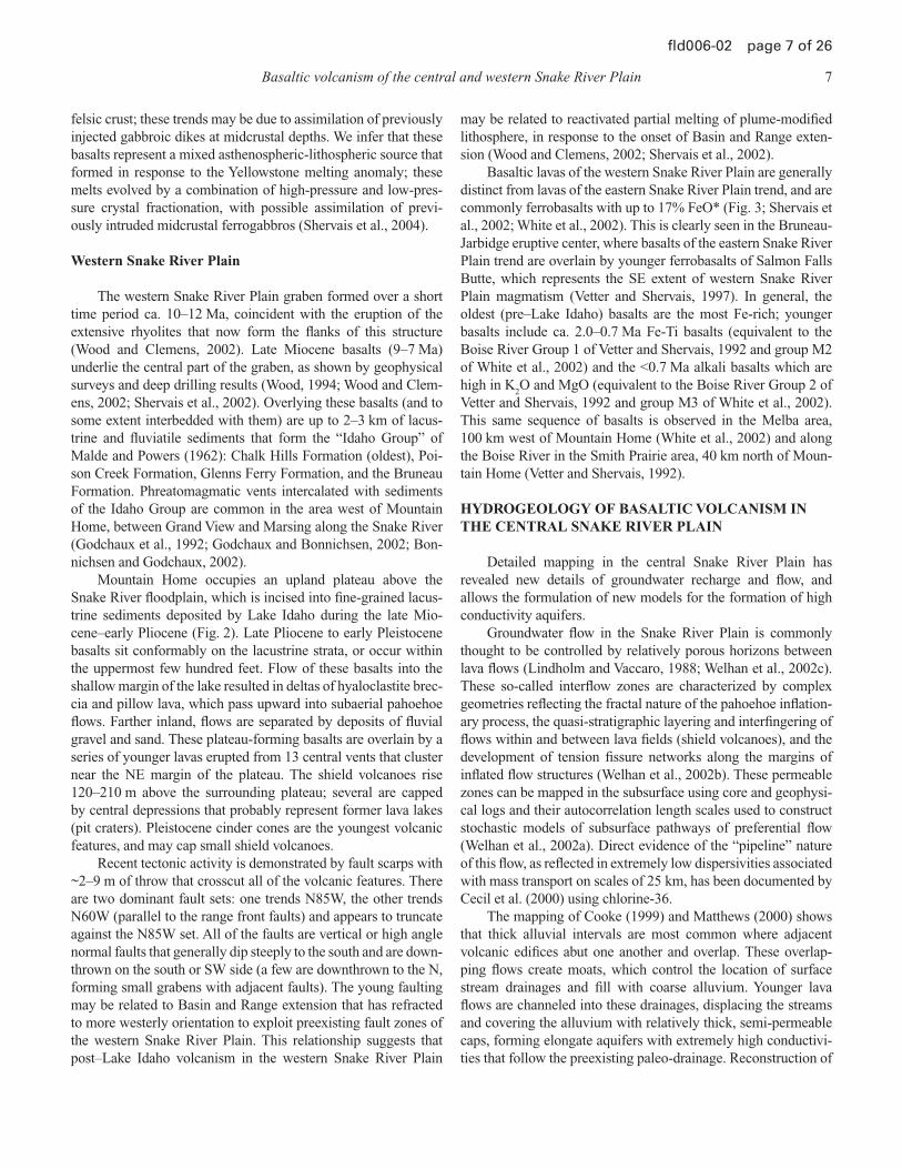
HYDROGEOLOGY OF BASALTIC VOLCANISM IN THE CENTRAL SNAKE RIVER PLAIN
Detailed mapping in the central Snake River Plain has
revealed new details of groundwater recharge and fl ow, and
allows the formulation of new models for the formation of high
conductivity aquifers.
Groundwater fl ow in the Snake River Plain is commonly
thought to be controlled by relatively porous horizons between
lava fl ows (Lindholm and Vaccaro, 1988; Welhan et al., 2002c).
These so-called interfl ow zones are characterized by complex
geometries refl ecting the fractal nature of the pahoehoe infl ation-
ary process, the quasi-stratigraphic layering and interfi ngering of
fl ows within and between lava fi elds (shield volcanoes), and the
development of tension fi ssure networks along the margins of
infl ated fl ow structures (Welhan et al., 2002b). These permeable
zones can be mapped in the subsurface using core and geophysi-
cal logs and their autocorrelation length scales used to construct
stochastic models of subsurface pathways of preferential fl ow
(Welhan et al., 2002a). Direct evidence of the “pipeline” nature
of this fl ow, as refl ected in extremely low dispersivities associated
with mass transport on scales of 25 km, has been documented by
Cecil et al. (2000) using chlorine-36.
The mapping of Cooke (1999) and Matthews (2000) shows
that thick alluvial intervals are most common where adjacent
volcanic edifi ces abut one another and overlap. These overlap-
ping fl ows create moats, which control the location of surface
stream drainages and fi ll with coarse alluvium. Younger lava
fl ows are channeled into these drainages, displacing the streams
and covering the alluvium with relatively thick, semi-permeable
caps, forming elongate aquifers with extremely high conductivi-
ties that follow the preexisting paleo-drainage. Reconstruction of

8 J.W. Shervais et al.
fl d006-02 page 8 of 26
basaltic volcanism through time using detailed geologic maps
allows us to predict the location of paleo-drainage and elongate
alluvial aquifers. This ability to predict aquifer location will
prove to be a valuable tool as increased demands are placed upon
the groundwater supply by agriculture and population growth.
In addition, our mapping reveals that young basalt vents seldom
exhibit channelized drainage systems that connect with major
through-going streams. Instead, the rugged volcanic topogra-
phy of ridges, fl ow fronts, lava channels, and collapse pits trap
precipitation, which must either evaporate or percolate into the
fractured lavas to recharge the local groundwater. These young
volcanic features constitute “negative basins” of interior drain-
age, despite their topographic emergence. We suggest that these
young basalts represent recharge zones that can be easily mapped
and distinguished from older fl ows that display well-developed
external drainage (Cooke and Shervais, 1999).
On a more regional scale, the eastern and central Snake
River Plain basalts and intercalated units form the Snake River
Plain aquifer, which along with the Snake River system sup-
plies water to southern Idaho and are essential to the agricultural
development of the state. Water recharges from snow melt in the
mountains north of the plain and in local basalt recharge areas.
Groundwater fl ow is from the NE to SW and it discharges as
springs in the Thousand Springs and other reaches of the north
and east wall of the Snake River Canyon between Twin Falls
and King Hill. The spring water is used extensively by the aqua-
culture industry, but quantity and quality of the water has been
declining due to increased groundwater pumping upgradient,
drought, and changes in surface irrigation systems. Spring and
groundwater irrigation is supplemented by surface withdrawals
from the Snake River, but acute water shortages are posing a
political dilemma for Idaho politicians and water experts. Map-
ping of springs in the northwall of the Snake River Canyon by
Covington and Weaver (1989), the Idaho Geological Survey, and
others suggests a geologic control. Covington et al. (1985) (and
others before them) recognized that some springs discharge at
rubble zones at the base of where canyon-fi lling late Quaternary
basalts entered a paleodrainage system. It also appears that the
topography developed on the older, slightly altered (Banbury)
basalts may have infl uenced spring discharge, as many springs
seem to emerge through talus but just above the Quaternary-
Tertiary unconformity. The older units may locally form a more
impermeable horizon and basal aquitard.
FIELD TRIP GUIDE
Day 1 (Half Day) Hagerman Valley
Directions to Stop 1.1
From Hagerman, drive south on Idaho Highway 30 ~7 mi
(11 km) across the bridge over the Snake River to ~1 mi south of
Thousand Springs Resort. Pull off to the right on a small dirt road
across from the entrance gate to a big house on the river. Stop 1
lies ~200 ft (60 m) uphill to the right. Bonneville fl ood effects in
the Hagerman Valley are shown on Figure 4; all Day 1 stops are
shown on Figure 5.
On the way to Stop 1, we will drive by scour features and
deposits created by the Bonneville Flood. The following paragraphs
briefl y describe some of the effects of the fl oodwaters (Fig. 4).
About fi fty years ago, geologists fi rst recognized that giant
gravel bars and stark erosional features common along the Snake
River were caused by cataclysmic lowering of Pleistocene Lake
Bonneville. The most complete descriptions and analyses of the
Bonneville Flood were written by Malde (1968) and O’Connor
(1993). O’Connor (1993, p. 1) writes, “Approximately 14,500
years ago, Pleistocene Lake Bonneville discharged 4750 km3 of
water over the divide between the closed Bonneville basin and
the watershed of the Snake River. The resulting fl ood, released
near Red Rock Pass, Idaho, followed the present courses of
March Creek, the Portneuf River, and the Snake and Columbia
River before reaching the Pacifi c Ocean. For 1100 km between
Red Rock Pass and Lewiston, Idaho, the Bonneville Flood left a
spectacular array of fl ood features.” O’Connor (1993) goes on to
describe the hydrology, hydraulics, and geomorphology of the
fl ood and provides a picture of the history and character of the
fl ood and its many landforms and deposits. A major characteristic
of the fl ood is a stepwise drop in the water surface caused by the
diverse geologic and geomorphic environments along the fl ood
route. A repeated phenomenon is a narrow canyon with con-
stricted but high-discharge fl ow that opens up into a wider valley
with less restricted, lower-discharge fl ow. In many locations, a
constriction back-watered the fl ood causing inundation and over-
land fl ow. East of Twin Falls fl ood water diverted north of the
Snake River canyon scoured a long stretch of basalt surfaces and
rejoined fl ood waters in the canyon for ~17 km forming several
systems of cataracts and plunge pools (see Day 3, Stop 3.6).
The areas of Hagerman and Thousand Springs (Day 1) show
the stepwise nature of the fl ood’s energy and the resulting features.
The Thousand Springs reach was a constriction that overfi lled and
the overland fl ow scoured and plucked basalt at the Sand Springs
Nature Preserve, Box Canyon, and Blind Canyon. South of Thou-
sand Springs a dry valley appears to have been the previous loca-
tion of the confl uence of Salmon Falls Creek and the Snake River.
The fl ood may have scoured a new channel for the Snake River and
subsequently the river abandoned the previous valley. Just down-
stream of Thousand Springs, where the Hagerman valley opens up,
energy dropped and the fl oodwaters deposited a large expansion
bar 5 km long with 4 m boulders at its upstream end. At maximum
discharge, the fl oodwaters would have been ~60 m deep at the
location of the Hagerman Inn. In the bottom of the valley, thick
deposits of Yahoo clay that had buried basalt of Notch Butte were
stripped away and the surface of the basalt was scoured.
Stop 1.1—Banbury Basalt and Bacon Butte Basalt: Basalt Water Interaction [N 42°43.804′, W 114°51.079′]
Mapping and reexamination of the “older” volcanic units
exposed south of Hagerman is one phase of the Idaho Geological

Basaltic volcanism of the central and western Snake River Plain 9
fl d006-02 page 9 of 26
Survey’s STATEMAP project in the Twin Falls 30′ × 60′ quad-
rangle. The area includes Banbury Hot Springs, type locality for
the Tertiary Banbury Basalt, which Malde et al. (1963) mapped
over a wide area of southwestern Idaho. Our work and the excel-
lent mapping of Malde and Powers (1972) show much hetero-
geneity within the “type section.” The lower Banbury Basalt
includes a fi eld of hydrovolcanoes, which appear to be localized
along a NW-trending structural zone that also infl uenced later
graben development and formation of Pliocene Lake Idaho, geo-
thermal activity, and canyon development. The inferred structure
is suspiciously close to a projection (S49E) of the northern mar-
gin of the western Snake River Plain.
Figure 4. Topographic map of Thousand Springs and the southern Hagerman Valley showing erosional and depositional features of the Bonnev-ille Flood. Large blue arrows show inferred fl oodwater fl ow directions. The arrow pointing northwest is placed to show the change from scoured rock to the bouldery expansion bar deposited in the broadening valley.

10 J.W. Shervais et al.
fl d006-02 page 10 of 26
Stratigraphically overlying Miocene rhyolite, the Miocene-
Pliocene Banbury Basalt consists of a lower sequence of altered
basalt fl ows and vent deposits, a middle layer of basaltic pyro-
clastic deposits overlain by and/or interbedded with sediments,
which thicken to the south, and an upper sequence of basalt fl ows
(Malde and Powers, 1972). The vent facies of the lower Banbury
Basalt includes at least two exposed volcanic centers (Thousand
Hill and Riverside Ferry vents), which are characterized by
tuff breccias with laterally extensive and locally palagonitized
surge and tephra deposits. At Stop 1.2, spectacular 10-m-high
beds of tuff breccia contain blocks larger than 1 m. At Stop 1.1,
distal phreatomagmatic tuffs containing volcanic bombs, stream
pebbles, and siltstone xenoliths are overlain by a 1-m-thick bed
of black spatter. The spatter is overlain by an oxidized tuff with
small glass bombs, and above that are three upward-coarsening
cycles of air-fall tuff. Unconformably overlying the emergent
hydrovolcano is a baked siltstone and the upper Banbury Basalt,
which here consists of notably fresher, plagioclase-phyric, vesic-
ular basalt fl ows. Elsewhere in the map area, the upper Banbury
consists of altered or water-affected basalt (WAB of Godchaux
and Bonnichsen, 2002) with a different magnetic polarity than
the feldspar-rich fl ows. Pending geochronology and chemistry
may improve age constraints and correlations. Even at its type
locality, the Banbury Basalt is lithologically heterogeneous with
lateral facies changes indicating basaltic volcanism within a
lacustrine and fl uvial setting prior to Lake Idaho and probably
over a considerable time span (Gillerman, 2004). The heteroge-
neity, polarity reversals, and spatial distribution of the fl ows also
indicate a variety of sources for the Banbury units. As noted by
others, it is time to revise the nomenclature. The recent Idaho
Geological Survey mapping, which will be displayed on the fi eld
trip, has renamed and more precisely subdivided many units
based on mapping and paleomagnetism, combined with chemis-
try and a very few radiometric age dates.
Stop 1.1A—Exposure of the Lower Banbury Distal Vent Facies Volcaniclastics
The prominent outcrops to the right of the gully are massive
basaltic tuffs in 3–4 upward-coarsening cycles, 2–3 m thick, with
laminated to cross-bedded tuff above and thin (6–8 cm), locally
cross-bedded, fi ne tuff below (Fig. 6A). This sequence overlies
a juvenile conglomerate of basalt, hyaloclastites, and some
rounded stream cobbles, that transitions up to a bleached/oxi-
dized (?) pumice bed (Fig. 6B). Below these beds are vent-like
spatter and pillowy basalt with abundant fresh glass. Although
the base of the sequence here is unexposed, Malde and Powers
(1972) mapped the lower portion of the slope as lower Banbury
sediments and tuff, most likely from better exposures ~1 mi to
the north, near the Sligar’s Thousand Springs Resort. There, a
42º43’ 48” N, 114º 51’ 05” WStop 1.1
Stop 1.2
Stop 1.3
Stop 1.4
42º43’ 35” N, 114º 51’ 21” W
42º43’ 11” N, 114º 51’ 24” W
42º42’ 24” N, 114º 50’ 23” W
Figure 5. Topographic map of the Snake River canyon between Banbury Springs and Sand Springs showing locations for Stop 1 of the fi eld trip, and ero-sional and depositional features of the Bonneville Flood. Relict fl ood features include scoured and plucked basalt and abandoned valley with no established drainage.

Basaltic volcanism of the central and western Snake River Plain 11
fl d006-02 page 11 of 26
section of mixed tuffs, sandstones, and massive basaltic units
are exposed in a gully and in old road cuts. The massive brown
and black mottled basalts are coarse grained, magnetic, and
look almost gabbroic. An exposure of the mottled rock is just
below the Stop 1.1B outcrop. Godchaux and Bonnichsen (2002)
referred to these massive mottled rocks as “spotted” due to black
augite crystals in a lighter brownish groundmass, which might
include glass and fi brous and hydrous minerals such as zeolites,
chlorite, or amphiboles. They interpret the spotted, massive lavas
as water-affected basalt, which formed in deep water (over a
few tens of feet). If so, then the volcaniclastic sediments should
be indicative of such an environment. It may be that volcanic
eruption of fl ows, tectonic activity, and climatic cycles created
a rapidly changing and laterally heterogeneous distribution of
lakes and sedimentary facies during deposition of the “Banbury
Basalt” and related units.
At this stop, the spatter layers dip into the hill (strike N65E,
dip 11°NW to EW and 14°N) and as seen from a distant photo
(Fig. 6C) the entire lower Banbury Basalt section (renamed Tvd
or vent deposits, distal), including the baked siltstone above,
appears to be tilted 10–15°NNW – possibly faulted along a
WNW normal fault. At this location, the upper Banbury lavas are
clearly unconformable on top of the lower Banbury volcaniclas-
tics. The upper Banbury lavas are fl at lying and mostly subaerial,
but the lower part is glassy, popcorn-like, with quasi-pillows and
glass. The fl ows here are distinguished by abundant feldspar phe-
nocrysts and normal magnetic polarity, and have been renamed
the Basalt of Oster Lakes (Tob) for exposures farther east and
several hundred feet topographically lower. Structural relation-
ships, age, and exact correlations of these various exposures are
problematic.
Stop 1.1B—Quaternary Basalt of Bacon Butte: Water Escape Features
The Basalt of Bacon Butte (formerly included in Sand
Springs basalt by Malde and Powers, 1972) fi lls paleo-drainage
here, with evidence for water interaction at base (pillows and hya-
loclastites) and vertical dewatering conduits that penetrate entire
fl ow (Fig. 7). The water-escape structures in this fl ow constitute a
feature of volcanic rocks that have not been described previously.
They consist of subvertical conduits ≈1 m in diameter (0.5–1.5 m
range) and spaced 5–15 m apart, partly fi lled with spicaceous
basaltic rubble. Columnar jointing in the adjacent basalt wraps
from vertical along the base of the fl ow to horizontal adjacent to
the conduits. Vesicles are more common in the wallrock of the
conduits than in parts of the fl ow farther away, and the basalt is
quenched to a glassy or aphanitic texture in the wallrock adjacent
to the conduit (Fig. 7A). In many of the conduits, basalt from the
adjacent wallrock forms a lattice or trellis arrangement within the
conduit that is contiguous with basalt of the wallrock (Fig. 7B).
The basalt in this trelliswork has glassy margins and spikey
projections along its surface. Spicaceous rubble is common in
all conduits, often forming discrete fragments that resemble
popcorn. This spicaceous rubble of “popcorn” basalt does not
represent later fi ll or pieces broken from the wallrock, but rather
blobs of lava that were isolated within the conduit while steam
was actively rising through the fl ow (Fig. 7C).
The upper surface of the lava fl ow contains depressions as
much as 10 m across and 1.5 m deep centered above the water-
escape structures, which appear to represent areas where the
surface lava collapsed into the conduit during water escape. Such
A
B
C
Figure 6. Banbury Basalt in Hagerman Valley. (A) Lower Banbury Basalt, volcaniclastics and phreatomagmatic vent facies (Stop 1.1). (B) Bleached pumice bed in lower Banbury Basalt. (C) Unconformity of upper Banbury Basalt (Basalt of Oster Lakes) over tilted section of lower Banbury phreatomagmatic volcaniclastics with primary and probable structural dip (Stop 1.1). Fence posts for scale.

12 J.W. Shervais et al.
fl d006-02 page 12 of 26
a feature is well illustrated at another location by the occurrence
of a ropey pahoehoe fl ow surface that is preserved deep inside a
lava fl ow within a steam conduit.
The subaerial lava fl ow with water escape structures is
underlain by pillow lava that fi lls intervening depressions in the
paleosurface. Many of these are mega-pillows as much as 4 m
across, which may contain water-escape structures that continue
up into the subaerial fl ow. In addition, the interface between the
pillow zone and the subaerial fl ow commonly contains small
caves and cavities that represent large steam bubbles (>1 m
across) trapped below the lava fl ow (Fig. 7D).
Directions to Stop 1.2
Continue South 0.3 mi (0.5 km) on Hwy 30 to a prominent
draw on the right with several dirt roads. Turn in to the right, go
through gate and close it, and park near end of drivable jeep trail
to right. Hike northward on cow trail along wire fence ~1/3 mi
(0.5 km) to farthest gully with trees and brush. Hike steeply
uphill 150′–200′ (45–60 m) to large, cliffy exposure of the mega-
breccia at top of ridge on north side of gully.
Stop 1.2—Banbury Basalt: Megabreccias [N 42°43.583′, W 114°51.35′]
As you climb up to the ridgetop, there are poor exposures on
the slope of white breccias and palagonite tuffs, as well as lavas.
The outcrop on the ridge top is an ~10-m-thick “megabreccia”
unit, which can be followed ~600′ to the west, where it termi-
nates, perhaps on the crater rim, or is faulted.
The megabreccia (Tvp) consists of unsorted tuff breccia
with large accidental blocks, many more than 1 m in length
(Fig. 8A). Block compositions include several types of basalt
(lower Banbury Basalt in appearance), tan fi ne-grained lake sedi-
ment, sparse stream pebbles, and some juvenile spattery tephra.
Figure 7. Water-escape structures in basalt of Bacon Butte, Stop 1.1B. (A) Panorama of outcrop showing water-escape conduits, rotated colum-nar jointing, and rubbly fi ll. (B) Close-up of water escape conduit showing trellis structure and spiny rubble with popcorn texture. (C) Popcorn texture basalt in water conduit. (D) Large (1–2 m) scale steam cavities at base of fl ow, just above section of megapillows.

Basaltic volcanism of the central and western Snake River Plain 13
fl d006-02 page 13 of 26
Some clasts show evidence of hot reaction rims on spheroidally
weathered basalt. The matrix is unstratifi ed with ~25% fi ne ash
and many small (<1cm) clasts. The breccia unit appears to grade
upwards into tuff with fewer large clasts. The megabreccia and
associated tuff are interpreted as explosive, subaerial crater-fi ll-
ing deposits of the Thousand Hill vent.
This small drainage basin (~1/2 square mile) is characterized
by outcrops of megabreccia, tuffs, red-orange sediment (which
always overlies the volcaniclastics), and lavas, and by faults. The
area was mapped by Stearns et al. (1938) as “Fault complex of
Hagerman lake beds and interstratifi ed tuff.” Malde and Powers
(1972) mapped it as lower Banbury “vent deposits of basaltic
pyroclastic material,” without showing any internal detail. The
geology is very complex and diverse, and the volcanic and struc-
tural relationships are obscured by a veneer of tan-colored Qua-
ternary Yahoo Clay (Bruneau sediments in earlier work), which
unconformably overlies the Tertiary volcanics.
Directions to Stop 1.3
Return toward vehicles and hike over to small hill nearby,
labeled “Thousand” on topographic map.
Stop 1.3—Banbury Basalt: Tilted Hydromagmatic Vent and Vent Facies Breccias [N 42°43.183′, W 114°51.40′]
The outcrop consists of a 7-m-thick, unsorted and unstrati-
fi ed, matrix-supported volcanic breccia with dull olive-green to
tan color containing accidental blocks of vesicular basalt (as large
as 0.5 m across) and numerous polished stream pebbles. Note the
oblong blocks of undisturbed, fi ne-grained tan water-laid sedi-
ment, which must have been horizontal originally, suggesting that
dip is the result of structural tilting. This is a section of the vent
deposits, dipping 40 degrees north, probably due to faulting.
Hike around to top surface (now dipping) to look at strong
linear features, which are interpreted as elutriation (gas escape)
features.
This outcrop may be the same unit as in Stop 1.2, but on the
opposite side of vent. Note that the Thousand Hill vent and the
Riverside Ferry vent (Stop 1.4) are both along a strong north-
west-trending structural orientation.
Directions to Stop 1.4
Drive south on Hwy 30, ~2 mi (3.2 km), and turn left at
intersection with paved “River Road.” Follow River Road past
houses, ~1 mi (1.6 km) and turn left on paved road near power
line. Drive past sequence of orange-colored palagonitic tuffs on
right roadcut and continue to gravel road at top of hill. Turn right
on gravel road, go ~1/3 mi (0.5 km) and fork left. Drive carefully
northward to edge of vent exposure. Some roads are very sandy
and may need 4WD. There are at least two jeep trails that access
the vent area and overlook the Snake River.
Stop 1.4—Banbury Basalt: Riverside Vent (optional, if time permits) [N 42°42.40′, W 114°50.383′]
This exposure in the north half of the section 29 “island” is a
hydrovolcano bisected by the Snake River and originally named
the Riverside Ferry cone by Stearns et al. (1938). Bonnichsen and
Godchaux (2002) referred to it as the Riverside Ferry cone but
named the phreatomagmatic units “Tuff of Blue Heart Springs”
after a spring located on the north side of the river adjacent to the
volcano. They described the tuff as explosively erupted layers of
cinder to spatter-rich deposits tilted near the vent constructs and
transitioning to subhorizontal, fi ner-grained units more distally.
Chemically they place the basaltic material in the general Snake
River olivine tholeiite compositional range. They also place
some of the Banbury tuff units as intercalating with the Glenns
Ferry Formation sediments, although the mapping of Malde and
Powers (1972) would generally place the Banbury Basalt as
older than the thick pile of lake sediments. Certainly there are
“Banbury-age” lake and fl uvial sediments interstratifi ed with
basaltic units (4–6 Ma) and there are basaltic tuffs and basalt
(3.4–3.8 Ma) interbedded within the Glenns Ferry Formation at
the Hagerman Fossils National Monument (W.K. Hart and M.E.
Brueseke, 1999, personal commun.). Dating the Banbury units is
diffi cult due to the alteration, although a few recent Ar-Ar radio-
metric dates are available, but not defi nitive.
The core of the Riverside Ferry vent is well exposed by
erosion (Fig. 8B). A massive tuff breccia, air-fall tuffs and brec-
cia, cindery beds, surge deposits, and palagonitized tuffs can be
found within a short hike across the 1000 ft of exposed vent.
a b
Figure 8. Vent facies of the Banbury Basalt. (A) Megabreccias that probably represent a vent facies (Stop 1.3). (B) Riverside Ferry vent (Stop 1.4).
14 J.W. Shervais et al.
fl d006-02 page 14 of 26
On the southeast side of the vent, a basaltic lava fl ow appears
to overlie the vent deposits and may be related. Exposures on
the north side of the river contain abundant red cindery mate-
rial, but these deposits have not been studied in detail. A NW-
trending fault may underlie the course of the Snake River, and
it is probable that there is a signifi cant northwest-trending fault
under the “dry” river course south of the “island.” Evidence for
this structure(s) includes small visible offsets of the older rhyo-
lites and lower Banbury lavas, topographic features emphasized
by the Bonneville Flood (Fig. 4), and alignment of geothermal
wells and hot springs.
Return to Hagerman on Hwy 30.
Day 2 (All Day) Mountain Home
Directions to Stop 2.1
Drive north on I-84 to Mountain Home; take Exit 95 on
Idaho Hwy 20 north toward Camas Prairie and Sun Valley. Con-
tinue N for ~7 mi (11 km) where the highway enters Rattlesnake
Creek canyon; park at the turnout on the right side of highway.
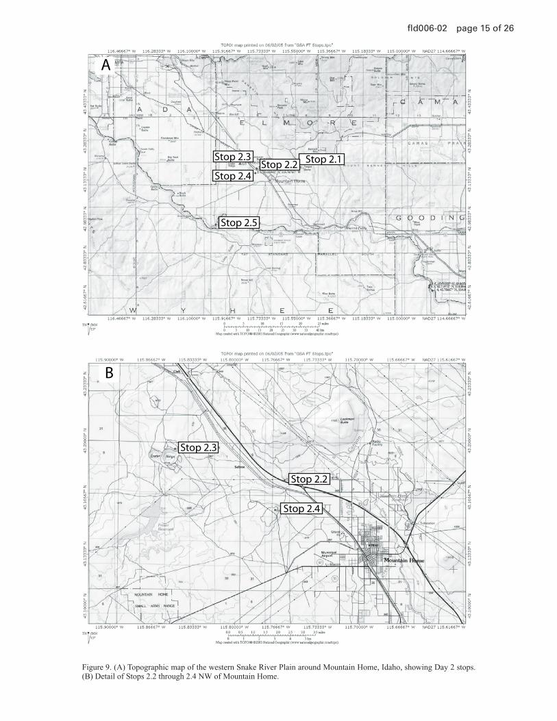
All Day 2 stops are shown on Figure 9A; detailed topography for
stops 2.2 through 2.4 is shown in Figure 9B.
Stop 2.1—Danskin Mountains Rhyolite, Highway 68 North of Mountain Home [N 43°12.052′, W 115°33.2′]
The oldest volcanic rocks exposed in the Mountain Home
area are rhyolite lava fl ows that form the Danskin Mountains
and the Mount Bennett Hills. Clemens and Wood (1993)
mapped the rhyolite here as the Danskin Mountains Rhyo-
lite, and mapped rhyolite which is exposed farther east as the
Mount Bennett Rhyolite. They determined a K-Ar age of 10.0
± 0.3 Ma for sanidine in a vitrophyre from the summit area
on Teapot Dome (Danskin Mountains Rhyolite), and a K-Ar
age of 11.0 ± 0.5 Ma for plagioclase in a rhyolite from near
Mount Bennett. Possible correlative units on the south side of
the western Snake River graben include the Sheep Creek Rhyo-
lite (9.88 ± 0.46 Ma; Hart and Aronson, 1983), the rhyolite of
Tigert Springs, the rhyolite of O X Prong, and the rhyolite of
Rattlesnake Creek (Kauffman and Bonnichsen, 1990; Jenks et
al., 1993). Rhyolite in the eastern Mount Bennett Hills ranges
in age from 9.2 ± 0.13 Ma to 10.1 ± 0.3 Ma (Armstrong et al.,
1980; Honjo et al., 1986, 1992).
The Danskin Mountains Rhyolite is typically a vitrophyre
with abundant phenocrysts of sanidine and quartz set in a red,
gray-brown, or black volcanic glass. Flow banding appears as
laminar variations in the color of the glass, or in its crystallinity.
The fl ow banding is commonly folded ptygmatically, indicat-
ing rheomorphic mobilization of the rhyolite. Flow banding
and axial foliation in the vitrophyre generally trend N50ºW to
N60ºW, and dip 15º–45°NE. There are no indications that these
rhyolites are rheomorphic ignimbrites; they appear to be rhyolite
lavas erupted from fi ssures that were subparallel to the current
range-front faults (Bonnichsen, oral comm., 1996, 1997).
Directions to Stop 2.2
Return to I-84 and proceed west toward Boise; take the next
available exit (exit number 90) then continue across and back on
to I-84 toward Boise (this will slow you down and position you
for the next stop). Pull off to the right immediately after entering
the freeway at the fi rst roadcut encountered.
Stop 2.2—Plagioclase Flotation Cumulates of Lockman Butte, I-84 Roadcut [N 43°10.599′, W 115°45.601′]
This roadcut transects a major fl ow lobe from Lockman
Butte that consists of multiple lava fl ows that are stacked one
on top of (or beneath) another. Many of these fl ow units contain
plagioclase fl otation cumulates that formed within covered lava
channels and aphyric ferrobasalt residues that drained out the
bottom of the cumulates (McGee and Shervais, 1997; Shervais
et al., 2002; Zarnetske and Shervais, 2004). Another interesting
aspect of these fl ows are the gigantic vesicles found in some gas
accumulation horizons; these vesicles are up 2 m long and 0.6 m
high—big enough to lie down in!
Lava fl ows with fl otation cumulates comprise three zones: a
central, plagioclase porphyry with intersertal to intergranular tex-
tures in the groundmass, an upper diktytaxitic zone comprising pla-
gioclase laths with large voids and minor intergranular mafi cs and
glass, and a lower aphyric zone of ferrobasalt, with 16%–17% FeO*
(Fig. 10A). Mass balance calculations show that the diktytaxic
zone contains 30%–50% porosity, represented by the ferrobasalt
base, if the central plagioclase porphyry is assumed to represent
the bulk composition. Detailed outcrop maps show that successive
lava fl ows fl owed beneath previously emplaced fl ows, infl ating and
plastically deforming the aphyric ferrobasalt zone in the overlying
fl ow. Plagioclase fl otation cumulates beneath this ferrobasalt ceil-
ing display a horizontal contact between the diktytaxitic and plagio-
clase porphyry zones; we interpret this horizon to represent the con-
tact between interstitial melt (below) and volcanic gasses (above),
and suggest that interstitial melt was displaced by the rising gasses
(McGee and Shervais, 1997; Zarnetske and Shervais, 2004).
Plagioclase phenocrysts are An65
in both the porphyry
and diktytaxitic zones, suggesting formation of the plagioclase
framework by simultaneous crystallization throughout the fl ow,
followed by sinking of the dense, interstitial ferrobasaltic liquid
to the bottom of the fl ow. This interpretation is supported by
olivine phenocrysts (Fo68
) trapped in the plagioclase framework,
and by partially replaced intergrowths containing Fo80–89
olivine.
The Fo-rich olivine relicts imply a parent magma that was signifi -
cantly more magnesian than observed.
These fl otation cumulates provide an analogue for anor-
thosite formation, both in the lunar magma ocean and in Earth’s
mid-crust. We suggest that planetary anorthosites represent pla-
gioclase saturated melts that crystallize en mass to form buoyant
rafts of plagioclase plus trapped mafi cs; interstitial ferrobasalts
liquids are forced out by rising magmatic gasses, and sink
back into the underlying magma (McGee and Shervais, 1997;
Zarnetske and Shervais, 2004).
Basaltic volcanism of the central and western Snake River Plain 15
fl d006-02 page 15 of 26
Stop 2.1Stop 2.2Stop 2.3
Stop 2.4
Stop 2.5
Stop 2.2
Stop 2.3
Stop 2.4
B
A
Figure 9. (A) Topographic map of the western Snake River Plain around Mountain Home, Idaho, showing Day 2 stops. (B) Detail of Stops 2.2 through 2.4 NW of Mountain Home.

16 J.W. Shervais et al.
fl d006-02 page 16 of 26
Directions to Stop 2.3
Drive NW on I-84 for ≈14 mi (23 km) to the fi rst exit (Simco
Road, Exit 74); cross the freeway and return to I-84 in the SE
direction. Exit at the fi rst Mountain Home exit (exit number 90)
and take the fi rst right turn encountered on Business I-84 (old
Hwy 30). Proceed along the frontage road parallel to the railroad
tracks for ≈6 mi (≈10 km), then turn left and cross the RR tracks
at a clearly marked crossing. Proceed ≈1.8 mi (2.9 km) along this
wide gravel road to a dirt road turn-off on the left near the crest of
the grade. Turn left and follow this dirt road ≈1.3 mi (2.1 km) to
the rim of Crater Rings. You will go past a stock pond (commonly
dry) and through at least one wire fence; be sure to close all gates
behind you. Note: Crater Rings is rattlesnake heaven, so watch
where you step and put your hands!
Stop 2.3—Crater Rings Pit Craters: Lava Lakes and Spatter Ramparts [N 43°11.715′, W 115°50.866′]
The Crater Rings are a spectacular volcanic feature that con-
sists of two large pit craters at the summit of a broad shield volcano
(Fig. 10B). The western crater is ≈800 m across and 75 m deep;
the eastern crater is ≈900 m across and 105 m deep. The inner
walls of the pit craters consist of welded spatter, agglutinate, and
minor intercalated lava fl ows; no fragmental horizons are exposed
in the crater walls, which argues against phreatomagmatic erup-
tion. The welded spatter and agglutinate are easily identifi ed by
their characteristic textures, oxidized coloration, and hollow ring
when struck with a hammer. The eastern crater is surrounded on
three sides by spatter and agglutinate ramparts.
The Crater Rings represent pit craters that were fi lled episodi-
cally with lava lakes (Shervais et al., 2002). They are equivalent
to similar features in Hawaii, such as Halemaumau pit crater on
the summit of Kilauea volcano and the paired lava lakes of the
1972 Mauna Ulu eruption (Decker, 1987; Tilling et al., 1987). Fire
fountain eruptions in the lava lakes fed spatter to the rims, which
were occasionally mantled by lava fl ows when the lava lakes over-
fl owed their ramparts. The fi nal eruptive phase was confi ned to the
eastern vent, where fi re fountains built ramparts on three sides of
the vent that were not covered by subsequent lava fl ows, although
lava from the eastern vent may have fl owed into the western vent
during lava highstands at this time (Shervais et al., 2002).
Directions to Stop 2.4
Return to the frontage road and turn right; proceed SE along
the frontage road (toward Mountain Home) for ≈5 mi (8 km) and
turn right across the railroad tracks (you will be almost due north
of Union Butte cinder cone). Continue south ~1.1 mi (1.8 km) to
the Union Butte cinder cone.
Stop 2.4—Union Buttes: Holocene Cinder Cones, Late Alkaline Basalts Equivalent to Boise River Group 2 of Vetter and Shervais (1992) [N 43°9.565′, W 115°46.06′]
Union Buttes are the two most prominent volcanic vents west
of Mountain Home. Their stratigraphic position (overlying all older
vents) and relative preservation suggest an age of <500,000 yr.
The basalt of Union Buttes erupted from these two vents but was
confi ned between the large Rattlesnake Springs shield volcano to
the south and the smaller Crater Rings and Lockman Buttes vents
to the west and north. The western Union Butte is larger than the
eastern vent, and fed a small fl ow that fl owed west toward Crater
Rings. Both vents consist of cinder cones built on top of small
shield volcanoes of similar composition basalt.
The basalt of Union Buttes is distinct from almost all other
basalts in the Mountain Home area because it contains large,
clear phenocrysts of olivine but lacks plagioclase phenocrysts.
The basalt of Union Buttes, and the similar basalt of Little Joe
Butte (also known as the basalt of Strike Dam Road), are charac-
terized by high K2O compared to other Mountain Home basalts,
A
B
C
Figure 10. Volcanic features near Mountain Home. (A) Plagioclase fl otation cumulates in covered lava channel, Lockman Butte—note diktytaxitic texture near top of cumulate layer where exsolved gas has forced residual ferrobasaltic liquid from the interstices. (B) The Crater Rings, two large pit craters that fed lava lake eruptions and Pelean-style fi re fountains. (C) Pillow and hyaloclastite delta in basalt of Little Joe Butte (Strike Dam Road), which sits on lacustrine sediments of Glenns Ferry Formation (Lake Idaho); note water escape conduits, steam cavities, and southeast dip of foreset beds

Basaltic volcanism of the central and western Snake River Plain 17
fl d006-02 page 17 of 26
along with lower TiO2 and high-fi eld strength trace element
abundances. In terms of their chemical and age relations, they are
similar to the Boise River Group 2 basalts of Vetter and Shervais
(1992) and to the M3 basalts of White et al. (2002). The transi-
tion from high fi eld strength-rich, alkali-poor tholeiites to potas-
sium-rich, high fi eld strength-poor transitional alkaline basalts
around 600,000–700,000 yr ago is one of the most fundamental
time-dependent transitions observed in the western Snake River
Plain province, with the younger lavas characterized by OIB-like
isotopic compositions. See Vetter and Shervais (1992) and White
et al. (2002) for discussions.
Directions to Stop 2.5
Continue south on gravel and paved roads ~2.6 mi (4.2 km)
to intersection with Idaho Hwy 67. Turn right onto Hwy 67 and
proceed SW toward Mountain Home Air Force Base. Bear right
at the turn-off into the air base (away from the base) and continue
SW on Hwy 67 for 6.5 mi (10.8 km) to a poorly marked intersec-
tion with Strike Dam Road. Turn left onto Strike Dam Road and
proceed south for 6.75 mi (10.9 km) to the rim of the plateau;
park at the top and walk down hill to the next stop.
Stop 2.5—Basalt of Little Joe Butte: Subaerial Basalt on a Pillow Lava + Hyaloclastite Delta on Lake Idaho Sediments [N 42°57.648′, W 115°58.526′]
The basalt of Little Joe Butte is olivine-phyric basalt that
crops out along the western edge of the Mountain Home area
(Cinder Cone Butte, Crater Rings SW quadrangles) and con-
tinues into adjacent quadrangles to the west (Little Joe Butte,
Dorsey Butte) and south (Grand View, C.J. Strike Dam; Jenks et
al., 1993). The source of this fl ow is Little Joe Butte, but it has
also been mapped as the basalt of Strike Dam Road (Jenks et al.,
1993). It consists of at least two major fl ow units, with a mappable
fl ow front preserved in the upper unit, and appears to fl ow south
along a former channel of the Canyon Creek drainage. Collapsed
areas of this fl ow are commonly overlain surfi cially by “intermit-
tent lake deposits,” i.e., dry lake beds (Shervais et al., 2002).
This unit is largely subaerial, but its base is commonly pil-
lowed along its southern margin, demonstrating the fl ow of sub-
aerial lava into standing water of Lake Idaho. The subaqueous
portion of the fl ow consists of pillow lava and hyaloclastite breccia
forming foreset delta sequences with individual “rolled” pillows
interspersed (Fig. 10C). The delta foresets dip to the SE, indicating
the direction the lava fl owed when it entered the lake. The subaque-
ous lava delta is ≈10 m thick in the bluffs overlooking C.J. Strike
reservoir, where it fl owed over fl at-lying lake deposits—indicating
the exact water depth in the lake at the time of eruption.
Like the Bacon Butte Basalt at Stop 1.1B, the subaerial lava
that overlies the pillow delta contains water escape conduits
and giant vesicles (steam bubbles). The conduits and vesicles
can be seen from the road but a close-up examination requires
climbing up the pillow delta, which is inherently unstable—be
careful if you go!
Return to Hagerman
Continue south on Strike Dam Road, across Snake River
at Strike Dam Bridge, to Idaho Hwy 78. Drive E on Hwy 78
through Bruneau to Hammett. As time permits, we will make
stops along this route to view the stratigraphy of the former Lake
Idaho and the effects of the Bonneville fl ood. At Hammett, rejoin
I-84 and return to motel.
Day 3 (Partial Day) Twin Falls2
Directions to Stop 3.1
From Hagerman, drive north on Hwy 30 to Bliss, turn E
(right) onto Hwy 26 to Shoshone. At main intersection in Sho-
shone, turn N (left) on Hwy 75. Drive N ~2.3 mi (3.7 km) and
park on right. Hike E into the Shoshone lava fl ow to the lava chan-
nel. All of the stops for Day 3 are shown on Figure 11. Source
vents for the basalt fl ows are indicated on Figure 12, a hillshade
topographic map of the Twin Falls 30′ × 60′ quadrangle.
Stop 3.1—Lava Channel is Shoshone Lava Flow; a‘a Basalt Fills Channel in Pahoehoe Flow [N 42°58.936′, W 114°18.22′]
The Shoshone basalt fl ow (basalt of Black Butte Crater
on the Idaho Geological Survey Twin Falls 30′ × 60′ geologic
map) erupted from Black Butte Crater located in the Black
Butte Crater quadrangle. The basalt is black, fi ne grained,
vesicular to massive, and aphyric to olivine phyric. Olivine
phenocrysts (Fo58–73
) are visible in hand sample and are up to
2.0 mm in size. Most plagioclase (An31–72
) displays a normal
chemical zoning.
Black Butte Crater is a broad shield volcano that rises
135 m above the surrounding topography. The volcano contains
two large craters that are ~300 m across and 100 m in depth.
This young lava fi eld extends south to the Dietrich Butte quad-
rangle and then west into the Shoshone, Tunupa, and Gooding
quadrangles, and terminates just west of the town of Gooding.
Eruption of lava disrupted the confl uence of the Big and Little
Wood rivers, which was probably near Shoshone, and separated
the two rivers to their present confl uence at Gooding. Radio-
carbon dating of underlying sediment baked by the fl ow (Kuntz
et al., 1986) has yielded a date of 10,130 ± 350 yr B.P. for this
basalt. Aside from a few areas covered by thin loess deposits or
alluvium, most of the basalt is completely exposed, and almost
all of the original fl ow morphology can be seen. The fl ow is
dominated by a series of large lava tube and lava channel sys-
tems that can be seen on aerial photographs and topographic
maps. Most of the Shoshone fl ow consists of smooth pavement
outcrops of pahoehoe, overlain by sporadic a‘a fl ows; a‘a fl ows
also fi ll lava channels and collapsed lava tubes.
We plan to visit a large lava channel in the pahoehoe fl ow
that is now fi lled with a‘a lava. This lava channel has levees that
rise 60–70 ft above the surrounding lava, and the channel is as
much as 70 ft deep (Fig. 13A).

18 J.W. Shervais et al.
fl d006-02 page 18 of 26
Day One Stops
Stop 3.1Stop 3.2
Stop 3.3
Stop 3.4
Stop 3.5Stop 3.6
Figure 11. Topographic map of central Snake River Plain showing Day 3 stops.
Figure 12. Hillshade of the Twin Falls area showing the names and locations of volcanic source buttes and the topographic expression of different basalt fl ows revealed through vertical exaggera-tion. The solid lines are main highways. The dashed line is the perimeter of the Twin Falls 30′ × 60′ quadrangle.

Basaltic volcanism of the central and western Snake River Plain 19
fl d006-02 page 19 of 26

20 J.W. Shervais et al.
fl d006-02 page 20 of 26
Directions to Stop 3.2
Return to Shoshone and proceed NE on Hwy 93 toward
Richfi eld. Turn right (S) ≈8.8 mi (14.2 km) from intersection in
Shoshone onto a paved road. Drive south 2.5 mi (4.0 km) to the
second dirt road on the right side of road. Turn right onto this dirt
road and drive to the top of Crater Butte (~0.9 mi/1.5 km). Note:
if we cannot get the vans up Crater Butte, we will drive to the top
of nearby Dietrich Butte instead.
Stop 3.2—Crater Butte [N 42°57.582′, W 114°16.724′]
Crater Butte, located in the northeastern portion of the
Dietrich quadrangle, is a steeply sloping shield volcano that rises
~140 m above the surrounding topography. The most striking
feature of this volcano is the large 80 m deep crater in its center.
This bowling pin-shaped crater is ~1300 m × 1000 m in size
and trends in a NW–SE direction. The inner walls of the crater
show thin layers of spatter interbedded with thicker beds of more
massive basalt (Fig. 13B). The tops of the more massive beds
are highly vesicular which indicates gaseous escape from lava
channels beneath the cooler, more viscous upper crust. When the
volcano was active, the crater probably contained a lava lake that
would periodically spill over the spatter rim to create the inter-
layered spatter and massive fl ows. Most outcrops along the fl anks
of the volcano can be found along terraced ridges concentric to
the main crater. These terraces show the same interlayering of
spatter and massive basalt, indicating that they may mark the
position of older crater rims.
The basalt of Crater Butte is dark gray, vesicular to massive,
and fi ne grained, containing phenocrysts of plagioclase and oliv-
ine. Some of the samples taken from the massive layers display a
slightly diktytaxitic texture but most are intergranular in texture.
Olivine phenocrysts (Fo45–74
) are small (<0.6 mm) and rounded.
Plagioclase phenocrysts (An55–71
) are generally 2.5 mm in size.
Several large plagioclase phenocrysts display an oscillatory zon-
ing, which may be due to pressure fl uctuations during eruption or
to magma mixing. Electron microprobe line scans across plagio-
clase phenocrysts reveal a strong normal chemical zonation.
Directions to Stop 3.3
Return to paved road, turn right (S) and continue 3.3 mi
(5.3 km) to Hwy 24. Turn right (W) onto Hwy 24 and continue
to intersection at south end of Shoshone (≈8.3 mi/13.4 km). Turn
left (S) onto Hwy 93 and drive 2.85 mi (4.6 km) to a gravel road
on the left (east side) of road that leads to Notch Butte.
Stop 3.3—Notch Butte [N 42°53.036′, W 114°24.98′]
Notch Butte is located in the southeastern corner of the
Shoshone quadrangle and rises 110 m above the surrounding
topography. The lava fl ows from this broad shield volcano cover
150 km2, including the southern half of the Shoshone quadrangle,
west into the Tunupa and Gooding SE quadrangles, south into
the Shoshone SW and SE quadrangles, and east into the Dietrich
quadrangle. Several lobes fl owed west to Gooding, continued
south and west around Gooding Butte, and fl owed into the ances-
tral Snake River canyon near Hagerman. The unit is equivalent
to the Wendell Grade basalt of Malde et al. (1963), except for
the canyon fi lling part at Hagerman, which they mapped as Sand
Springs basalt. The unit has been renamed during recent mapping
to follow the convention of naming fl ows after their source vent.
The fl ows display a relatively young volcanic morphology
with many fl ow features such as pressure ridges, collapsed lava
tubes, and fl ow fronts still visible beneath a thin soil and loess
layer. The loess mantle is mostly confi ned to depressions in the
fl ow surfaces. Note the contrast between fl ows from this vent and
those from the older Crater Butte vent and the younger Shoshone
fl ow lavas.
Mapping revealed three to four lobes of varying mineralogy
within the fl ow fi eld. In general, higher lobes closer to the vent
were found to be rich in plagioclase, while those at lower eleva-
tions farther away from the vent contain less plagioclase and are
rich in olivine. The higher lobes are interpreted to be younger,
more fractionated, and therefore more viscous basalt (due to the
plagioclase content), while those found at lower elevations are
older, less fractionated, and less viscous. This difference in vis-
cosity between the older and younger lava accounts for the fact
AA
B
Figure 13. Volcanic features of the central Snake River Plain north of Twin Falls, Idaho. (A) Lava channel in the Sho-shone basalt. (B) Pit crater in Crater Butte.

Basaltic volcanism of the central and western Snake River Plain 21
fl d006-02 page 21 of 26
that the older fl ows spread out over a large area away from the
vent while the younger fl ows did not.
The basalt of Notch Butte is a black, vesicular to massive,
medium- to fi ne-grained, plagioclase- ± olivine-phyric basalt.
Samples taken from some fl ow lobes contain large glomero-
crysts of plagioclase and olivine, which are visible in hand
sample. The basalt is intergranular to intersertal in texture and
contains olivine phenocrysts (Fo35–73
); large glomerocrysts of
plagioclase (An59–71
) and olivine are visible in thin section and
are often up to 5 mm in size. The larger plagioclase phenocrysts
are typically normally zoned.
The view from the top of Notch Butte includes all of the
major volcanoes in this part of the central Snake River plain:
Crater Butte, Dietrich Butte, Owinza Butte, and Black Ridge
Crater to the east; Lincoln Butte to the west; Bacon Butte, and
Flat Top Butte to the south, and Wilson Butte and Rocky Butte to
the southeast. From here, it is easy to contrast the relative ages of
the fl ows, which can be estimated by the amount of cover indi-
cated by farming. We can also see the western fl ow from Notch
Butte, which extends some 40 km to the west where it fl owed
into the ancestral valley of the Snake River. At the time of Notch
Butte eruptions, the ancestral Snake River was already at about
its present position and elevation.
Directions to Stop 3.4
Return to Hwy 93. Turn left (S) onto Hwy 93 and drive south
11.8 mi (19 km) to Hwy 25; turn left (E) onto Hwy 25 and after
≈0.6 mi (1 km) turn left (N) onto paved road; follow for 0.3 mi
(0.5 km), then turn left (N) onto paved/gravel road that goes to
top of Flat Top Butte (~1 mi/1.6 km from highway).
Stop 3.4—Flat Top Butte [N 42°43.722′, W 114°24.75′]
Flat Top Butte is an extremely large (≈450 km2) shield vol-
cano located ~20 km north of Twin Falls in the Falls City 7.5′ topographic map quadrangle. The vent has a large (200 m), shal-
low depression at its summit that represents the former summit
crater; the rim of this crater is now home to a forest of microwave
transceivers. The fl anks of the volcano are covered with a thick
mantle of loess and soil that obscures the underlying basalt. This
butte is farmed almost to its summit, showing that it is one of the
older vents in this part of the plain. Radiometric ages for Flat Top
Butte are in the 0.330–0.395 Ma range (Tauxe et al., 2004; Idaho
Geological Survey, 2005, unpublished data).
The basalt of Flat Top Butte fl owed south and west fi ll-
ing the course of the ancestral Snake River as far as Thousand
Springs, where Malde and Powers (1972) mapped the fl ows as
the Thousand Springs Basalt. Flows from Flat Top Butte defi ned
the present position of the Snake River by forcing the drainage
southward against the regional north slope of the older shield vol-
canoes. Subsequently, the Snake River canyon was cut.
From the summit area of Flat Top Butte we can look east
toward the younger vents Wilson Butte, Rocky Butte, and
Kimama Butte, north toward Bacon Butte and Notch Butte, and
northeast toward Owinza Butte and Black Ridge Crater. Older
buttes to the southeast include Hansen Butte, Skeleton Butte,
Hazelton Butte, Milner Butte, and Burley Butte.
Looking south toward the Snake River canyon and Twin
Falls City, the track of Bonneville Flood overland fl ow was east
to west obliquely across I-84. Along the canyon wall south of
I-84 the overland fl oodwaters rejoined the component follow-
ing the course of the river, forming cataracts in several places.
Although the basalt of Rocky Butte typically has loess fi lling
surface depressions, in the track of the fl oodwaters virtually all
the loess is stripped away and patchy gravel deposits record local
deposition during the fl ood.
Directions to Stop 3.5
Return to Hwy 25; turn left (E) onto Hwy 25 and proceed
4.6 mi (7.4 km) to intersection with paved road. Turn S (right)
and drive 5.4 mi (8.7 km) south—road goes from paved to gravel
after ~2 mi (3.2 km). Continue on dirt road to SE around end of
Wilson Butte fl ow lobe, ≈1 mi (1.6 km). Park anywhere.
Stop 3.5—Wilson Butte Flow Lobe [N 42°37.82′, W 114°21.76′]
Wilson Butte is a large shield volcano (≈10 km across). Its
vent, composed of three small peaks, is rather unimpressive when
compared to the estimated 250 km2 of lava that fl owed down the
slopes of the shield. The fl ows cover the majority of the Shoshone
SE and half of the Star Lake quadrangles. The fl ow continues into
the Shoshone SW and Hunt quadrangles, and it crosses Hwy 25
in the Twin Falls NE quadrangle and continues into the Kimberly
quadrangle, possibly emptying into the Snake River around the
Twin Falls rapids or Devil’s Corral area.
The mode of the basalt is 35%–40% plagioclase, 10%–15%
olivine, 10%–20% pyroxene, 5%–8% oxides, and 15%–20%
glass. Plagioclase shows typical euhedral lath-shaped crystals
with An content ranging from An66
to An36
. Olivine ranges from
Fo71
to Fo33
.
At this stop we will view a major fl ow lobe from Wilson
Butte that stands 10–20 m above the surrounding lava fi elds and
contains a giant complex of lava tubes that fed secondary fl ow
lobes that fl owed primarily west and south. The fl ow lobe is char-
acterized by steep sides and a nearly fl at upper surface that can
be traced for tens of kilometers. This lava tube–channel system
fed fl ows adjacent to the Snake River that have been mapped as
Sand Springs basalt—in addition to fl ows from Rocky Butte (Hill
4526), which may dominate the Sand Springs unit. Wilson Butte
and Rocky Butte have lavas that are nearly identical chemically,
and both appear to have erupted at essentially the same time,
although the Wilson Butte fl ow lobe appears to be younger than
the adjacent fl ows from Rocky Butte. Tauxe et al. (2004) report
radiometric age for “Sand Springs Basalt,” probably from Rocky
Butte, as 0.095 Ma. The lava tube system is exposed in a series of
windows that are open mainly on the eastern margin of the fl ow.
Sitting on the Wilson Butte fl ow lobe here are coarse sedi-
ments deposited by the Bonneville fl ood. These sediments seem

22 J.W. Shervais et al.
fl d006-02 page 22 of 26
to represent a lag deposit from water fl owing over or around the
end of the lobe. At this elevation (~1173 m) the Bonneville Flood
waters were relatively shallow. The relief of this fl ow lobe was
just suffi cient to divert most of the overland fl oodwater around
the feature, but a few low spots allowed water to spill through and
create small plunge pools and gravel deposits. The fl ood waters
lost energy on the lee side of the fl ow lobe and deposited fi ner
sediment that forms fl at surfaces in broad depressions.
Directions to Stop 3.6
Return to Hwy 25, turn W (left) and return to Hwy 93. Turn
left onto Hwy 93 and drive south 8.6 mi (13.8 km) to Perrine
Bridge in Twin Falls (you will cross I-84). Cross the bridge and
enter turnout into viewpoint-tourist information area immedi-
ately on south side of bridge. Park in visitor center parking lot
next to bridge.
Stop 3.6—Perrine Bridge Overlook [N 42°35.8966′, W 114°27.266′]
The Perrine Bridge viewpoint is one of the classic views
of volcanic stratigraphy in the central Snake River Plain. The
Snake River gorge is over 120 m deep here and contains two golf
courses within the gorge just downstream from the bridge. Evil
Kneivel’s famous attempt to jump the gorge on a rocket-powered
motorcycle took place just upstream from here.
Looking north across the river we can see over 4 m.y. of
volcanic history (Fig. 14). At the base of the section is the Twin
Falls rhyolite (ca. 6.25 Ma; Armstrong et al., 1975) that forms the
basement here, and which underlies Shoshone Falls east of Twin
Falls. Sitting on the rhyolite (and on some patchy exposures of
rhyolite breccia) are sediments that may correlate with the Plio-
cene Glenns Ferry Formation (Covington et al., 1985; Covington
and Weaver, 1989). If this correlation holds, these sediments
would represent lake and fl ood-plain sediments that were depos-
ited in an extension of Lake Idaho. Basalts intercalated with these
sediments just upstream from here have been dated at ca. 4 Ma
by Armstrong et al. (1975).
Sitting on the sediment and rhyolite is a thick section of
basalt erupted from large vents to the south (Hub Butte and
other southern buttes). These fl ows are overlain by fl ows from
Hansen Butte and other volcanoes to the southeast, which pushed
the river farther north and built the north slope of a large shield
complex. Evidence downstream shows subsequent fl ows from
Flat Top Butte burying the preexisting northward slope, presum-
ably fi lling any previous east-west drainage, and reestablishing
the course of the ancestral Snake River at the south edge of the
Flat Top shield. By the time of eruptions from Wilson Butte and
Rocky Butte, the Snake River had incised the older basalts along
the margin of the Flat Top Butte shield. Evidence in the canyon
wall shows local fi lling of the canyon by the younger fl ows.
Subsequent fl ows from Flat Top Butte, Wilson Butte, and Rocky
Butte followed the northern margin of these fl ows. The course
of the Snake River then became established along the contact of
the younger and older fl ows. The basalt of Flat Top Butte was
formerly mapped as Thousand Springs Basalt by Malde and
Powers (1972), while the overlying Sand Springs Basalt (Malde
and Powers, 1972) is now known to represent fl ows from at least
two vents in this area, Wilson Butte and Rocky Butte. However,
valley-fi lling Sand Springs Basalt mapped along Cedar Draw
south of the Snake River (Malde and Powers, 1972) is probably
from Flat Top Butte.
At this vantage point near Perrine Bridge, the Bonneville
Flood at maximum discharge would have been mostly confi ned
to the canyon except that overland fl oodwaters from the north-
east were rejoining the canyon along here and the water depth
exceeded the top of the canyon by ~15 m. Areas of cataracts
and plunge pools on the north side of the canyon, such as the
Blue Lake alcove, show the erosive power of the overland fl ow
(Fig. 15). In the canyon bottom, the golf courses have been built
on fl ood-stripped and molded surfaces of older basalt and rhyo-
lite that have thin deposits of fl ood gravel and sand.
The erosional and depositional features of the Bonneville
Flood are time transgressive, albeit a short time period of only
a few months. Unlike Glacial Lake Missoula that is thought to
have emptied and produced a catastrophic fl ood duration of only
several days, the catastrophic fl oodwater from Pleistocene Lake
Bonneville was more complex (O’Connor, 1993). The early
phases were in low discharge as the lake gently overtopped the
divide at Red Rock Pass and it began to erode. As erosion accel-
Twin Falls Rhyolite
Glenns Ferry Fm.
Hub Butte Basalt (?)
Basalt of Flat Top Butte
Sand Springs Basalt (Rocky or Wilson Buttes)
Figure 14. Volcanic stratigraphy at the Perrine Bridge, Twin Falls, Ida-ho. Dark rock at bottom of canyon is the 6.25 Ma Twin Falls rhyolites. The thickest section of basalt erupted from vents south of the river (Hub Butte, Sonnickson Butte), and is overlain by a thinner section of basalt from north of the current river (mostly Flat Top Butte with basalt of Rocky Butte and/or Wilson Butte) on top. Basalt and rhyolite are separated by thin wedges of clastic sediment in middle of section.

Basaltic volcanism of the central and western Snake River Plain 23
fl d006-02 page 23 of 26
erated, the discharge grew to catastrophic proportions and was
sustained for many weeks. However, as the level of Lake Bonn-
eville dropped, gradually the discharge lowered. Ultimately, an
equilibrium was achieved between the lake and the outlet, and the
lake continued to drain into the Snake River drainage for at least
hundreds of years. Given this backdrop, the overland fl oodwaters
entering the canyon from the northeast represent fl ow during the
greatest discharges, and would have ceased when the canyon
could accommodate the fl ood. Features in the canyon, therefore,
range from high-discharge rock scouring and deposition of giant,
bouldery gravel bars, to lower-discharge thin sand and gravel
deposits in the bottom of the canyon.
Return to I-84. Enter freeway in east-bound direction
(right turn). Return to Salt Lake City (approximate driving
time: 4 hours).
REFERENCES CITED
Amini, M.H., Mehnert, H.H., and Obradovich, J.D., 1984, K-Ar ages of late Cenozoic basalts from the western Snake River Plain, Idaho: Isochron/West, v. 41, p. 7–11.
Anders, M.H., and Sleep, N.H., 1992, Magmatism and extension: the thermal and mechanical effects of the Yellowstone plume: Journal of Geophysical Research, v. 97, p. 15,379–15,393.
Armstrong, R.L., Leeman, W.P., and Malde, H.E., 1975, K-Ar dating, Quater-nary and Neogene volcanic rocks of the Snake River Plain, Idaho: Ameri-can Journal of Science, v. 275, p. 225–251.
Armstrong, R.L., Harakal, J.E., and Neill, W.M., 1980, K-Ar dating of Snake River plain (Idaho) volcanic rocks; new results: Isochron/West, v. 27, p. 5–10.
Bonnichsen, B., 1982a, The Bruneau-Jarbidge eruptive center, southwestern Idaho, in Bonnichsen, B., and Breckenridge, R.M., eds., Cenozoic Geology of Idaho: Idaho Bureau of Mines and Geology Bulletin 26, p. 237–254.
Bonnichsen, B., 1982b, Rhyolite fl ows in the Bruneau-Jarbidge eruptive center, in Bonnichsen, B., and Breckenridge, R.M., eds., Cenozoic Geology of Idaho: Idaho Bureau of Mines and Geology Bulletin 26, p. 283–320.
Bonnichsen, B., and Godchaux, M.M., 2002, Late Miocene, Pliocene, and Pleistocene geology of southwestern Idaho with emphasis on basalts in the Bruneau-Jarbidge, Twin Falls, and western Snake River Plain regions, in Bonnichsen, B., White, C.M., and McCurry, M., eds., Tectonic and Magmatic Evolution of the Snake River Plain Volcanic Province: Idaho Geological Survey Bulletin 30, p. 233–312.
Bonnichsen, B., and Kauffman, D.F., 1987, Physical features of rhyolite lava fl ows in the Snake River plain volcanic province, southwestern Idaho, in Fink, J.H., ed., The Emplacement of Silicic Domes and Lava Flows: Geological Society of America Special Paper 212, p. 119–145.
Bonnichsen, B., White, C.M., and McCurry, M., eds., 2002, Tectonic and Magmatic Evolution of the Snake River Plain Volcanic Province: Idaho Geological Survey Bulletin 30, 482 p.
Braile, L.W., Smith, R.B., Ansorge, J., Baker, M.R., Sparlin, M.A., Prodehl, C., Schilly, M.M., Healy, J.H., Meuller, S., and Olsen, K.H., 1982, The Yel-lowstone–Snake River Plain seismic profi ling experiment: Crustal struc-ture of the eastern Snake River Plain: Journal of Geophysical Research, v. 87, p. 2597–2609.
Figure 15. Topographic map of the area near Perrine Bridge showing features formed by the Bonneville Flood, includ-ing cataracts, plunge pools, scoured canyon walls, and giant gravel bars. Large arrows show inferred fl oodwater fl ow directions.

24 J.W. Shervais et al.
fl d006-02 page 24 of 26
Camp, V.E., 1995, Mid-Miocene propagation of the Yellowstone mantle plume head beneath the Columbia River Basalt source region: Geology, v. 23, p. 435–438, doi: 10.1130/0091-7613(1995)023<0435:MMPOTY>2.3.CO;2.
Camp, V.E., and Ross, M.E., 2004, Mantle dynamics and genesis of mafi c mag-matism in the intermontane Pacifi c Northwest: Journal of Geophysical Research, v. 109, B08204, doi: 10.1029/2003JB002838.
Cecil, L.D., Welhan, J.A., Green, J.R., Frape, S.K., and Sudicky, E.R., 2000, Use of chlorine-36 to determine regional-scale aquifer dispersivity, east-ern Snake River Plain aquifer, Idaho: Nuclear instruments & methods in physics research, section B, Beam interactions with materials and atoms, v. 172, p. 679–687, doi: 10.1016/S0168-583X(00)00216-0.
Christiansen, R.L., 1982, Late Cenozoic volcanism of the Island Park area, eastern Idaho, in Bonnichsen, B., and Breckenridge, R.M., eds., Ceno-zoic Geology of Idaho: Idaho Bureau of Mines and Geology Bulletin 26, p. 345–368.
Christiansen, R.L., Foulger, G.R., and Evans, J.R., 2002, Upper-mantle origin of the Yellowstone hotspot: Geological Society of America Bulletin, v. 114, no. 10, p. 1245–1256, doi: 10.1130/0016-7606(2002)114<1245:UMOOTY>2.0.CO;2.
Clemens, D.M., and Wood, S.H., 1993, Late Cenozoic volcanic stratigraphy and geochronology of the Mount Bennett Hills, central Snake River plain, Idaho: Isochron/West, v. 60, p. 3–14.
Cooke, M.F., 1999, Geochemistry, Volcanic stratigraphy, and hydrology of Neogene basalts, central Snake River Plain, Idaho [M.S. thesis]: Colum-bia, South Carolina, University of South Carolina, 125 p.
Cooke, M.F., and Shervais, J.W., 1999, Stratigraphic controls of basaltic volca-nism on groundwater recharge and conductivity in the central Snake River Plain, Idaho: Geological Society of America Abstracts with Programs, v. 31, no. 4, p. A8.
Craig, H., 1997, Helium isotope ratios in Yellowstone Park and along the Snake River plain; backtracking the Yellowstone Hotspot: Eos (Transactions American Geophysical Union), v. 78, p. 801.
Covington, H.R., and Weaver, J.N., 1989, Geologic map of the profi le of the northern wall of Snake River canyon: U.S. Geological Survey Map I-1947, A–E, scale 1:24000.
Covington, H.R., Whitehead, R.L., and Weaver, J.N., 1985, Ancestral canyons of the Snake River: Geology and hydrology of canyon-fi ll deposits in the Thousand Springs area, south-central Snake River Plain, Idaho: Boise, Idaho, Geological Society of America, Rocky Mountain Section, April 1985, Guide Book, 30 p.
Decker, R.W., 1987, Dynamics of Hawaiian volcanoes: An overview; in Decker, R.W., Wright, T.L., and Stauffer, P.H., eds., Volcanism in Hawaii: U.S. Geological Survey Professional Paper 1350, v. 2, p. 997–1018.
Doe, B.R., Leeman, W.P., Christiansen, R.L., and Hedge, C.E., 1982, Lead and strontium isotopes and related trace elements as genetic tracers in the upper Cenozoic rhyolite-basalt association of the Yellowstone Plateau volcanic fi eld: Journal of Geophysical Research, v. 87, p. 4785–4806.
Draper, D.S., 1991, Late Cenozoic bimodal magmatism in the northern Basin and Range province of southeastern Oregon: Journal of Volcanology and Geothermal Research, v. 47, p. 299–328, doi: 10.1016/0377-0273(91)90006-L.
Dueker, K., and Humphreys, E., 1990, Upper mantle velocity structure of the Great Basin: Geophysical Research Letters, v. 17, no. 9, p. 1327–1330.
Dueker, K.G., Schutt, D.L., Yuan, H., and Fee, D., 2004, New seismic con-straints for the Yellowstone hotspot: Eos (Transactions American Geo-physical Union), v. 85/47, Fall Meeting Supplement, Abstract 51B-0554.
Farnetani, C.G., and Samuel, H., 2004, Dynamics of thermochemical plumes: Eos (Transactions American Geophysical Union), v. 85/47, Fall Meeting Supplement, Abstract 44B-03.
Geist, D.J., and Richards, M., 1993, Origin of the Columbia River plateau and Snake River Plain: defl ection of the Yellowstone plume: Geology, v. 21, p. 789–792, doi: 10.1130/0091-7613(1993)021<0789:OOTCPA>2.3.CO;2.
Gillerman, V.S., 2004, Diversity in the Banbury Basalt: hydrovolcanoes, sedi-ments and structures of the Banbury and Thousand Springs area, Snake River canyon, Idaho: Geological Society of America Abstracts with Pro-grams, v. 34, no. 6, p. 86.
Godchaux, M.M., and Bonnichsen, B., 2002, syneruptive magma-water and posteruptive lava-water interactions in the western Snake River Plain, Idaho, during the past 12 million years, in Bonnichsen, B., White, C.M., and McCurry, M., eds., Tectonic and Magmatic Evolution of the Snake River Plain Volcanic Province: Idaho Geological Survey Bulletin 30, p. 387–434.
Godchaux, M.M., Bonnichsen, B., and Jenks, M.D., 1992, Types of phre-atomagmatic volcanoes in the western Snake River Plain, Idaho, USA: Journal of Volcanology and Geothermal Research, v. 52, p. 1–25, doi: 10.1016/0377-0273(92)90130-6.
Greeley, R., 1982, The style of basaltic volcanism in the eastern Snake River Plain, Idaho, in Bonnichsen, B., and Breckenridge, R.M., eds., Cenozoic Geology of Idaho: Idaho Bureau of Mines and Geology Bulletin 26, p. 407–422.
Hart, W.K., and Aronson, J.L., 1983, K-Ar ages of rhyolites from the western Snake River Plain area, Oregon, Idaho, and Nevada: Isochron/West, v. 36, p. 17–19.
Honjo, N., McElwee, K.R., Duncan, R.A., and Leeman, W.P., 1986, K-Ar ages of volcanic rocks from the Magic Reservoir eruptive center, Snake River plain, Idaho: Isochron/West, v. 46, p. 15–17.
Honjo, N., Bonnichsen, B., Leeman, W.P., and Stormer, J.C., Jr., 1992, Mineral-ogy and geothermometry of high-temperature rhyolites from the central and western Snake River plain: Bulletin of Volcanology, v. 54, no. 3, p. 220–237.
Howard, K.A., and Shervais, J.W., 1973, Geologic map of Smith Prairie, Elmore County, Idaho: U.S. Geological Survey Map I-818, scale 1:24,000.
Howard, K.A., Shervais, J.W., and McKee, E.H., 1982, Canyon-fi lling lavas and lava dams on the Boise River, Idaho, and their signifi cance for evalu-ating downcutting during the last two million years, in Bonnichsen, B., and Breckenridge, R.M., eds., Cenozoic Geology of Idaho: Idaho Bureau of Mines and Geology Bulletin 26, p. 629–641.
Humphreys, E.D., and Dueker, K.G., 1994, Western U.S. upper mantle struc-ture: Journal of Geophysical Research, B, Solid Earth and Planets, v. 99, no. 5, p. 9615–9634, doi: 10.1029/93JB01724.
Humphreys, E.D., Dueker, K.G., Schutt, D.L., and Smith, R.B., 2000, Beneath Yellowstone; evaluating plume and nonplume models using teleseismic images of the upper mantle: GSA Today, v. 10, no. 12, p. 1–7.
Hughes, S.S., Smith, R.P., Hackett, W.R., and Anderson, S.R., 1999, Mafi c volcanism and environmental geology of the eastern Snake River plain, Idaho, in Hughes, S.S., and Thackray, G.D., eds., Guidebook to the Geol-ogy of Eastern Idaho: Idaho Museum of Natural History, p. 143–168.
Hughes, S.S., McCurry, M., and Geist, D.J., 2002, Geochemical correlations and implications for the magmatic evolution of basalt fl ow groups at the Idaho National Engineering and Environmental Laboratory, in Link, P.K., and Mink, L.L., eds., Geology, hydrogeology, and environmental remediation; Idaho National Engineering and Environmental Laboratory, eastern Snake River plain, Idaho: Geological Society of America Special Paper 353, p. 151–173.
Iyer, H.M., 1984, A review of crust and upper mantle structure studies of the Snake River Plain-Yellowstone volcanic system: a major lithospheric anomaly in the western USA: Tectonophysics, v. 105, p. 291–308, doi: 10.1016/0040-1951(84)90209-9.
Jenks, M.D., and Bonnichsen, B., 1989, Subaqueous basalt eruptions into Pliocene Lake Idaho, Snake River plain, Idaho, in Chamberlin, V.E., Breckinridge, R.M., and Bonnichsen, B., eds., Guidebook of the Geology of Northern and Western Idaho and Surrounding Areas: Idaho Geological Survey Bulletin 28, p. 17–34.
Jenks, M.D., Bonnichsen, B., and Godchaux, M.M., 1993, Geologic maps of the Grand View-Bruneau area, Owyhee County, Idaho: Idaho Geological Survey Technical Report 93-2, 21 p., scale 1:24,000.
Jordan, M., Smith, R.B., and Waite, G.P., 2004, Tomographic Images of the Yellowstone Hotspot Structure: Eos (Transactions American Geophysical Union), v. 85/47, Fall Meeting Supplement, Abstract 51B-0556.
Kauffman, D.F., and Bonnichsen, B., 1990, Geologic map of the Little Jacks Creek, Big Jacks Creek, and Duncan Creek wilderness study areas, Owyhee County, Idaho: U.S. Geological Survey Miscellaneous Field Studies Map MF-2142, scale 1: 50,000.
Kimmel, P.G., 1982, Stratigraphy, age, and tectonic setting of the Miocene-Pliocene lacustrine sediments of the western Snake River plain, Oregon and Idaho, in Bonnichsen, B., and Breckenridge, R.M., eds., Cenozoic Geology of Idaho: Idaho Bureau of Mines and Geology Bulletin 26, p. 559–558.
King, S.D., 2004, Where plumes live: Eos (Transactions, American Geophysi-cal Union), v. 85/47, Fall Meeting Supplement, Abstract 44B-01.
Kuntz, M.A., Champion, D.E., Lefebvre, R.H., and Covington, H.R., 1988, Geo-logic map of the Craters of the Moon, Kings Bowl, and Wapi lava fi elds and the Great Rift volcanic rift zone, south-central Idaho: U.S. Geological Survey Miscellaneous Investigations Series Map I-1632, scale 1:100,000.

Basaltic volcanism of the central and western Snake River Plain 25
fl d006-02 page 25 of 26
Kuntz, M.A., Champion, D.E., Spiker, E.C., Lefebvre, R.H., and McBroome, L.A., 1982, The Great Rift and the evolution of the Craters of the Moon Lava Field, Idaho, in Bonnichsen, B., and Breckenridge, R.M., eds., Cenozoic Geology of Idaho: Idaho Bureau of Mines and Geology Bulletin 26, p. 423–437.
Kuntz, M.A., Spiker, E.C., Rubin, M., Champion, D.E., and Lefebvre, R.H., 1986, Radiocarbon studies of Holocene-latest Pleistocene lava fl ows of the Snake River Plain, Idaho: data, lessons, interpretations: Quaternary Research, v. 25, p. 163–176, doi: 10.1016/0033-5894(86)90054-2.
Kuntz, M.A., Covington, H.R., and Schorr, L.J., 1992, An overview of basaltic volcanism of the eastern Snake River Plain, Idaho, in Link, P.K., Kuntz, M.A., and Platt, L.B., eds., Regional Geology of Eastern Idaho and West-ern Wyoming: Geological Society of America Memoir 179, p. 227–267.
Leeman, W.P., 1982, Development of the Snake River Plain–Yellowstone Pla-teau province, Idaho and Wyoming: An overview and petrologic model, in Bonnichsen, B., and Breckenridge, R.M., eds., Cenozoic geology of Idaho: Idaho Bureau of Mines and Geology Bulletin 26, p. 155–177.
Lindholm, G.F., and Vaccaro, J.J., 1988, Region 2, Columbia Lava Plateau, in Back, W., Rosenshein, J.S., and Seabar, P.R., eds., Hydrogeology, Geology of North America: Geological Society of North America, v. O-2, p. 37–50.
Link, P.K., and Fanning, C.M., 1999, Late Miocene Snake River fl owed south into the Humboldt drainage: detrital zircon evidence: Geological Society of America Abstracts with Programs, v. 31, no. 4, p. A22.
Mabey, D.R., 1976, Interpretation of a gravity profi le across the western Snake River Plain, Idaho: Geology, v. 4, p. 53–55, doi: 10.1130/0091-7613(1976)4<53:IOAGPA>2.0.CO;2.
Mabey, D.R., 1978, Regional gravity and magnetic anomalies in the eastern Snake River Plain, Idaho: U.S: Geological Survey Journal of Research, v. 6, no. 5, p. 553–562.
Mabey, D.R., 1982, Geophysics and tectonics of the Snake River Plain, Idaho, in Bonnichsen, B., and Breckenridge, R.M., eds., Cenozoic Geology of Idaho: Idaho Bureau of Mines and Geology Bulletin 26, p. 139–153.
Malde, H.E., 1968, The catastrophic late Pleistocene Bonneville Flood in the Snake River Plain, Idaho: U.S. Geological Survey Professional Paper 596, 52 p.
Malde, H.E., 1991, Quaternary geologic and structural history of the Snake River Plain, Idaho and Oregon, in Morrison, R.B., ed., Quaternary Non-glacial Geology: Conterminous United States: Boulder, Colorado, Geological Society of America, The Decade of North American Geology, v. K-2, p. 251–281.
Malde, H.E., and Powers, H.A., 1962, Upper Cenozoic stratigraphy of western Snake River Plain, Idaho: Geological Society of America Bulletin, v. 73, p. 1197–1220.
Malde, H.E., and Powers, H.A., 1972, Geologic map of the Glenns Ferry-Hager-man area, west-central Snake River Plain, Idaho: U.S. Geological Survey Miscellaneous Investigations Map I-696, scale 1:48,000, 2 sheets.
Malde, H.E., Powers, H.A., and Marshall, C.H., 1963, Reconnaissance geologic map of west-central Snake River Plain, Idaho: U.S. Geological Survey Miscellaneous Geological Investigations Map I-373, scale 1:125,000.
Matthews, S.M., 2000, Geology of Owinza Butte, Shoshone SE, and Star Lake quadrangles: Snake River Plain, southern Idaho [M.S. thesis]: Columbia, South Carolina, University of South Carolina, 110 p.
McCurry, M., and Hackett, W.R., 1999, Genesis of Quaternary rhyolites in Southeast Idaho; implications for the Yellowstone–Snake River plain hotspot system: Geological Society of America Abstracts with Programs, v. 31, no. 4, p. 24.
McGee, J., and Shervais, J.W., 1997, Flotation cumulate in a Snake River Plain ferrobasalt: Petrologic study of a possible lunar analogue: Geological Society of America Abstracts with Programs, v. 29, no. 6, p. A136.
McQuarrie, N., and Rodgers, D.W., 1998, Subsidence of a volcanic basin by fl exure and lower crustal fl ow; the eastern Snake River plain, Idaho: Tec-tonics, v. 17, no. 2, p. 203–220, doi: 10.1029/97TC03762.
Montelli, R., Nolet, G., Dahlen, F.A., Masters, G., Engdahl, R., and Hung, S.-H., 2003, Finite-frequency tomography reveals a variety of plumes in the mantle: Science, v. 303, p. 338–343, doi: 10.1126/science.1092485.
Morgan, L.A., 1992, Stratigraphic relations and paleomagnetic and geochemi-cal correlations of ignimbrites of the Heise volcanic fi eld, eastern Snake River Plain, eastern Idaho and western Wyoming, in Link, P.K., Kuntz, M.A., and Platt, L.B., eds., Regional Geology of Eastern Idaho and West-ern Wyoming: Geological Society of America Memoir 179, p. 215–226.
Morgan, W.J., 1972, Plate motions and deep mantle convection, in Shagam, R., et al., eds., Studies in earth and space sciences: Geological Society of America Memoir 132, p. 7–22.
O’Connor, J.E., 1993, Hydrology, hydraulics, and geomorphology of the Bonn-eville Flood: Geological Society of America Special Paper 274, 83 p.
Peng, X., and Humphreys, E.D., 1998, Crustal velocity structure across the east-ern Snake River plain and the Yellowstone Swell: Journal of Geophysical Research, B, Solid Earth and Planets, v. 103, no. 4, p. 7171–7186, doi: 10.1029/97JB03615.
Pierce, K.L., and Morgan, L.A., 1992, The track of the Yellowstone hot spot: volcanism, faulting, and uplift, in Link, P.K., Kuntz, M.A., and Platt, L.B., eds., Regional Geology of Eastern Idaho and Western Wyoming: Geologi-cal Society of America Memoir 179, p. 1–53.
Pierce, K.L., Morgan, L.A., and Saltus, R.W., 2002, Yellowstone plume head: postulated tectonic relations to the Vancouver slab, continental boundar-ies, and climate, in Bonnichsen, B., White, C.M., and McCurry, M., eds., Tectonic and Magmatic Evolution of the Snake River Plain Volcanic Province: Idaho Geological Survey Bulletin 30, p. 5–33.
Priestley, K.F., and Orcutt, J., 1982, Extremal travel time inversion of explosion seismology data from the eastern Snake River plain, Idaho, Yellowstone-Snake River plain symposium: Journal of Geophysical Research, v. B, p. 2634–2642.
Repenning, C.A., Weasma, T.R., and Scott, G.R., 1995, The early Pleistocene (latest Blancan-earliest Irvingtonian) Froman Ferry fauna and history of the Glenns Ferry Formation, southwestern Idaho: U.S. Geological Survey Bulletin 2105, 86 p.
Rodgers, D.W., Ore, H.T., Bobo, R.T., McQuarrie, N., and Zentner, N., 2002, Extension and subsidence of the eastern Snake River Plain, Idaho, in Bon-nichsen, B., White, C.M., and McCurry, M., eds., Tectonic and Magmatic Evolution of the Snake River Plain Volcanic Province: Idaho Geological Survey Bulletin 30, p. 121–155.
Saltzer, R.L., and Humphreys, E.D., 1997, Upper mantle P-wave velocity struc-ture of the eastern Snake River Plain and its relationship to geodynamic models of the region: Journal of Geophysical Research, B, Solid Earth and Planets, v. 102, no. 6, p. 11829–11841, doi: 10.1029/97JB00211.
Shervais, J.W., Shroff, G., Vetter, S.K., Matthews, S., Hanan, B.B., and McGee, J.J., 2002, Origin of the western Snake River Plain: Implications from stratigraphy, faulting, and the geochemistry of basalts near Moun-tain Home, Idaho, in Bonnichsen, B., White, C.M., and McCurry, M., eds., Tectonic and Magmatic Evolution of the Snake River Plain Volcanic Province: Idaho Geological Survey Bulletin 30, p. 343–361.
Shervais, J.W., Vetter, S.K., and Hanan, B.B., 2004, Basaltic Volcanism of the Central Snake River Plain, Idaho: Geological Society of America Abstracts with Programs, v. 36, no. 4, p. 98.
Smith, G.R., and Stearley, R.F., 1999, Fish paleoecology and late Cenozoic his-tory of the Snake River Plain: Geological Society of America Abstracts with Programs, v. 31, no. 4, p. A56.
Smith, G.R., Swirydczuk, K., Kimmel, P.G., and Wilkinson, B.H., 1982, Fish biostratigraphy of late Miocene to Pleistocene sediments of the western Snake River Plain, Idaho, in Bonnichsen, B., and Breckenridge, R.M., eds., Cenozoic Geology of Idaho: Idaho Bureau of Mines and Geology Bulletin 26, p. 519–542.
Smith, R.B., and Braile, L.W., 1994, The Yellowstone hotspot: Journal of Volca-nology and Geothermal Research, v. 61, p. 121–187, doi: 10.1016/0377-0273(94)90002-7.
Stearns, H.T., Crandall, L., and Steward, W.G., 1938, Geology and ground-water resources of the Snake River Plain in southeastern Idaho: U.S. Geological Survey Water-Supply Paper 774, 268 p.
Suppe, J., Powell, C., and Berry, R., 1975, Regional topography, seismic-ity, Quaternary volcanism, and the present day tectonics of the western United States: American Journal of Science, v. 275A, p. 397–436.
Tauxe, L., Luskin, C., Selkin, P., Gans, P., and Calvert, A., 2004, Paleomagnetic results from the Snake River Plain: contribution to the time-averaged fi eld global database: Geochemistry Geophysics Geosystems (G3), v. 5, no. 8, QH13.
Tilling, R.I., Wright, T.L., and Millard, H.T., Jr., 1987, Trace element chemistry of Kilauea and Mauna Loa lava in space and time: a reconnaissance, in Decker, R.W., Wright, T.L., and Stauffer, P.H., eds., Volcanism in Hawaii: U.S. Geological Survey Professional Paper 1350, v. 1, p. 641–690.
Vetter, S.K., and Shervais, J.W., 1992, Continental basalts of the Boise River Group near Smith Prairie, Idaho: Journal of Geophysical Research, B, Solid Earth and Planets, v. 97, no. 6, p. 9043–9061.
Vetter, S.K., and Shervais, J.W., 1997, Basaltic volcanism of the Bruneau-Jar-bidge eruptive center, southwest, Idaho: Geological Society of America Abstracts with Programs, v. 29, no. 6, p. A298.

26 J.W. Shervais et al.
fl d006-02 page 26 of 26
Welhan, J.A., Clemo, T.M., and Gego, E.L., 2002a, Stochastic simulation of aquifer heterogeneity in a layered basalt aquifer system, eastern Snake River Plain, Idaho, in Link, P.K., and Mink, L.L., eds., Geology, Hydroge-ology, and Environmental Remediation: Idaho National Engineering and Environmental Laboratory, Eastern Snake River Plain, Idaho: Geological Society of America Special Paper 353, p. 225–247.
Welhan, J.A., Johannesen, C.M., Davis, L.L., Reeves, K.S., and Glover, J.A., 2002b, Overview and synthesis of lithologic controls on aquifer het-erogeneity in the eastern Snake River Plain, Idaho, in Bonnichsen, B., White, C.M., and McCurry, M., eds., Tectonic and Magmatic Evolution of the Snake River Plain Volcanic Province: Idaho Geological Survey Bul-letin 30, p. 435–460.
Welhan, J.A., Johannesen, C.M., Reeves, K.S., Clemo, T.M., Glover, J.A., and Bosworth, K.W., 2002c, Morphology of infl ated pahoehoe lavas and spa-tial architecture of their porous and permeable zones, eastern Snake River Plain, Idaho, in Link, P.K., and Mink, L.L., eds., Geology, Hydrogeol-ogy, and Environmental Remediation: Idaho National Engineering and Environmental Laboratory, Eastern Snake River Plain, Idaho: Geological Society of America Special Paper 353, p. 135–150.
White, C.M., Hart, W.K., Bonnichsen, B., and Matthews, D., 2002, Geochemi-cal and Sr-isotopic variations in western Snake River Plain basalts, Idaho, in Bonnichsen, B., White, C.M., and McCurry, M., eds., Tectonic and Magmatic Evolution of the Snake River Plain Volcanic Province: Idaho Geological Survey Bulletin 30, p. 329–342.
Wood, S.H., 1994, Seismic expression and geological signifi cance of a lacus-trine delta in Neogene deposits of the western Snake River plain, Idaho: American Association of Petroleum Geologists Bulletin, v. 78, no. 1, p. 102–121.
Wood, S.H., and Clemens, D.M., 2002, Western Snake River Plain—geologic and tectonic history, in Bonnichsen, B., White, C.M., and McCurry, M., eds., Tectonic and Magmatic Evolution of the Snake River Plain Volcanic Province: Idaho Geological Survey Bulletin 30, p. 343–361.
Zarnetske, M.L., and Shervais, J.W., 2004, Plagioclase Flotation Cumulate in Ferrobasalts of The western Snake River Plain: Implications for evolution of planetary magma oceans: Geological Society of America Abstracts with Programs, v. 36, no. 4, p. 95.
Printed in the USA