baltic sea chart datum 2000 a common reference level for ... · and wished the harmonized baltic...
TRANSCRIPT

Baltic Sea Chart Datum 2000 – a common reference level for nautical charts and sea level information in the Baltic Sea
2019-04-11 TWCWG4/GLOSS GE XVI-meeting, Busan, Korea
Thomas Hammarklint [email protected]

http://www.bshc.pro
International Hydrographic Organization
The International Hydrographic Organization is an intergovernmental consultative and technical organization that was established in 1921 to support safety of navigation and the protection of the marine environment.
The object of the Organization is to bring about:- The coordination of the activities of national hydrographic offices- The greatest possible uniformity in nautical charts and documents- The adoption of reliable and efficient methods of carrying out and exploiting hydrographic surveys- The development of the sciences in the field of hydrography and the techniques employed in descriptive oceanography

Members of CDWG:Denmark PhD Joanna Gerlings Denmark Mr Philip Sigaard Christiansen Estonia Mrs Gabriela Kotsulim Finland Mr Jyrki Mononen Germany Dr Patrick Westfeld Latvia Mr Armands MuransLithuania Mr Mindaugas ZakarauskasPoland Cdr Sławomir LipińskiPoland Mr Witold StasiakRussia Capt S. TravinRussia Mr Leonid ShalnovRussia Dr Sergey V. ReshetniakSweden Mr Thomas Hammarklint (Chair)Sweden Mr Lars Jakobsson Sweden Mr Henrik Tengbert
Representative of BOOS: Sweden Mr Thomas Hammarklint
Observers: Finland Mrs Mirjam Bilker-Koivula Finland Katri Leinonen Germany Dr Gunter LiebschNorway Mr Aksel VoldsundSweden Dr Jonas Ågren Sweden Dr Per-Anders Olsson Sweden Mr Mikael Stenström
The BSHC18 (September 2013) decided to continue CDWG work and wished the harmonized Baltic Sea vertical reference to be implemented.
The CDWG will have its next meeting (CDWG12) 3-4 March 2020 in Gdansk, Poland
http://www.bshc.pro/working-groups/cdwg

Baltic Sea Chart Datum 2000 (BSCD2000)
Justification:The Baltic Sea is an international shallow, non-tidal area in the northern part of Europe with dense traffic. IHO BSHC has approved the name and the adoption of the Baltic Sea Chart Datum 2000.
Definition:The datum refers to each Baltic country´s realization of the European Vertical Reference System (EVRS) with land-uplift epoch 2000, which is connected to the Normaal Amsterdams Peil (NAP).
Height systems used as national realization of BSCD2000 (EVRS-based):Sweden RH2000 Denmark DVR90Germany DHHN2016? Poland PL-EVRF2007-NH Lithuania LAS07 Latvia LAS2000,5Estonia EH2000 Finland N2000
Chart datum name to be shown in paper charts:Mean Sea Level (Baltic Sea Chart Datum 2000national realization name)orMean Sea Level (Baltic Sea Chart Datum 2000)
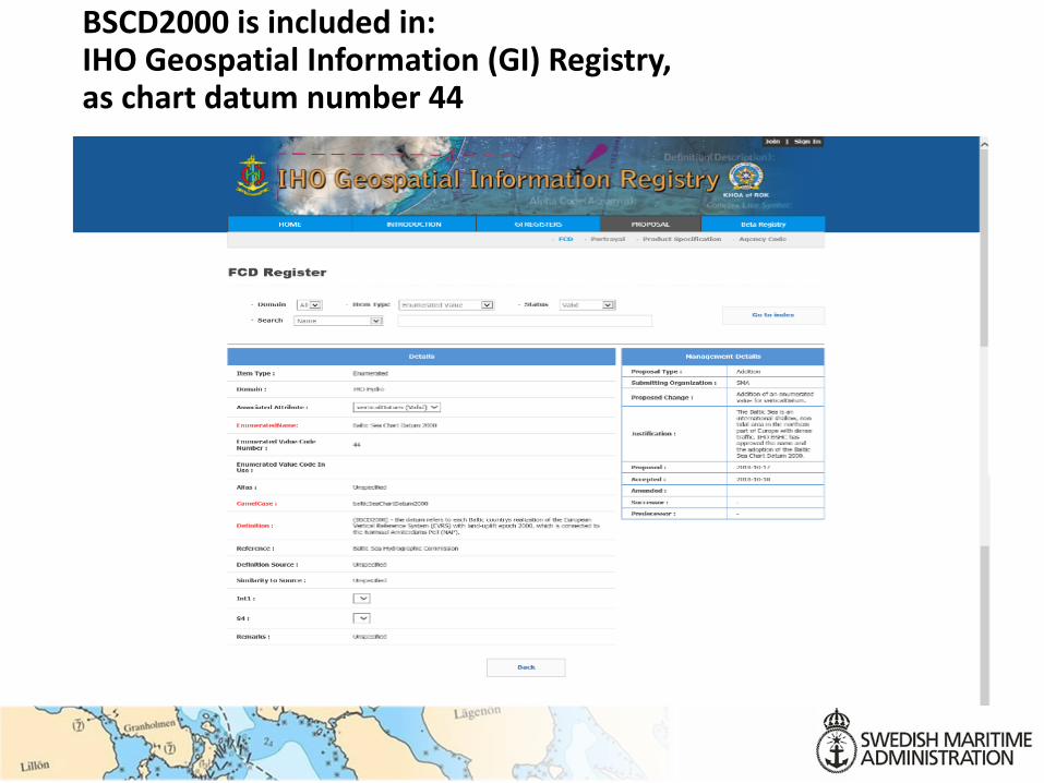
BSCD2000 is included in: IHO Geospatial Information (GI) Registry, as chart datum number 44

BSCD2000 is included as a reference plane in BODC Vocabulary list / SeaDataNet

Swedish Chart Improvement project
Old
New
Mean Sea Level (Baltic Sea Chart Datum 2000RH2000)

Plan for transition from MSL to BSCD2000 in nautical charts
Updated 2019-04-08

Difference between present chart datum and BSCD2000

Swedish Sea Level Network
Real-time data in BSCD2000 from 59 stations 1-minute values with 1 cm accuracy Real-time and delayed mode quality control
Class I Upgrade with battery backup 28 stations (24 SMHI + 3 SMA + 1 CTH)Class II Upgrade without battery backup 26 stations (23 SMA + 3 GBG)Class III Unchanged, temporary 5 stations (5 SMA)

New reference datum for sea level

Glacial Isostatic Adjustment (GIA)
Levelled land-uplift rates
(NKG2016LU_LEV, rates relative to the geoid)
Nr Time serie Start year Rate (cm/year)
1 Furuögrund 1916 0.945
2 Ratan 1891 0.952
3 Draghällan/Spikarna 1897 0.892
4 Björn/Forsmark 1891 0.677
5 Stockholm 1889 0.536
6 Landsort 1886 0.460
7 Visby 1916 0.290
8 Ölands norra udde 1851 0.268
9 Kungsholmsfort 1886 0.133
10 Ystad/Skanör 1886 0.077
11 Malmö/Klagshamn 1924 0.084
12 Varberg/Ringhals 1886 0.252
13 Göteborg 1887 0.289
14 Smögen 1910 0.340

Stockholm”World’s longest sealevel record”

The sea level rise raises the mean sea level
Analysis of 14 Swedish sealevel records since 1886
Sealevels corrected for the levelled land-uplift (glacial isostatic adjustment)
1.7 mm/year

Future sea level rise (SLR)

Changing mean sea level

Difference between old reference system and BSCD2000

Reference datums in Skagerack
Norwegian chart datum (LAT-20) ca 0,5-0,6 m below BSCD2000
Danish LAT ca 0,2 m below BSCD2000
LAT
LAT-20
BSCD2000
BSCD2000
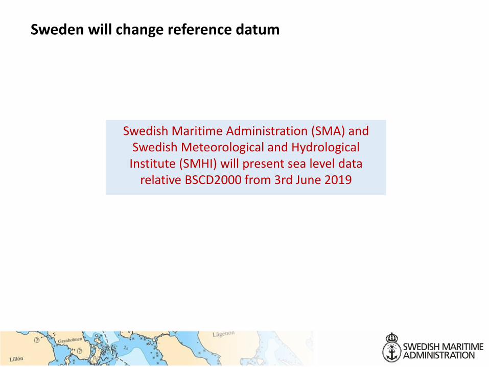
Sweden will change reference datum
Swedish Maritime Administration (SMA) and Swedish Meteorological and HydrologicalInstitute (SMHI) will present sea level data
relative BSCD2000 from 3rd June 2019

SMHI oceanographic warning and forecasting service
An ongoing transition to BSCD2000 (RH 2000) at SMHI -> forecasts, warnings and information about currentsea level will be issued in BSCD2000
Warning levels have been adjusted from MSL to BSCD2000
2019-06-03: Warnings for high and low sea level willbe issued in BSCD2000

New Sealevel service from SMHI

Bottom
Stone
BSCD2000 (m)
Current sea level
3,1m charted depth≈2,7m depth
+ 0,10 Mean sea level 2019
-0,30
Chart datum 1990+ 0,20
- 0,20
Present situation (2019)
0,10 difference
Reduction of depths due to land-uplift
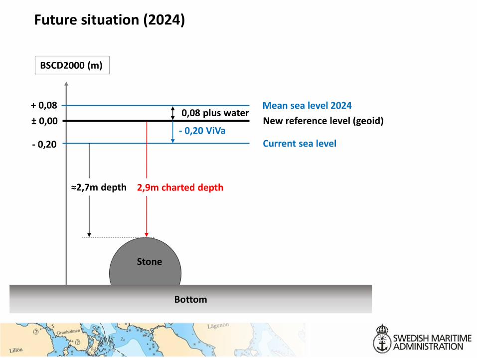
Future situation (2024)
Bottom
Stone
BSCD2000 (m)
New reference level (geoid)± 0,00
Current sea level
2,9m charted depth≈2,7m depth
- 0,20 ViVa
- 0,20
+ 0,08 Mean sea level 20240,08 plus water

New info sheet about the transition to BSCD2000 as the new reference level for sea level, nautical charts and warnings
EnglishSvensk

A uniform reference system from land to sea
Illustration Veronica Wärn SMHI