attempting escape: a network based analysis of north korean refugees capt krysta anthony lt kevin...
TRANSCRIPT

Attempting Escape:A Network Based Analysis of North Korean Refugees
Capt Krysta AnthonyLT Kevin Kerno

Historical Background
• History of North Korea• Human rights issues• What is the rest of the world doing?

North Korean Escapees
• 1,500 North Koreans escaped in 2012– So what’s the big deal?
• Extremely arduous/perilous journey– Difficult to travel within in North Korea– Geography– Government agents– Sex Traffickers– Kidnappers
• China illegally deports North Korean refugees– Classifies North Korean refugees as “economic
immigrants”
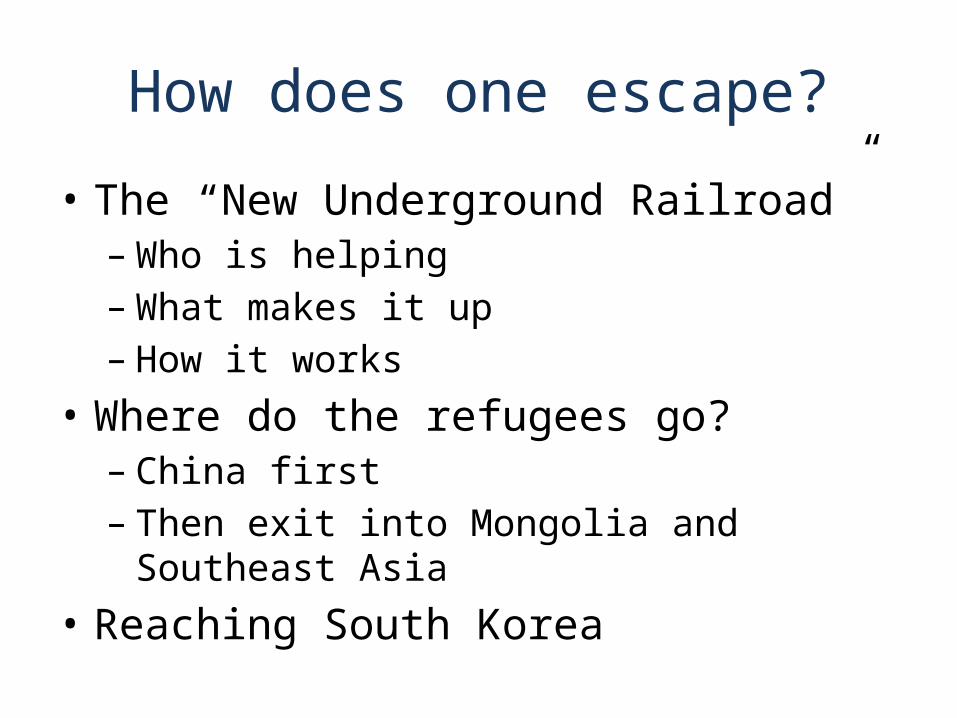
How does one escape?
• The “New Underground Railroad”– Who is helping– What makes it up– How it works
• Where do the refugees go?– China first – Then exit into Mongolia and Southeast Asia
• Reaching South Korea
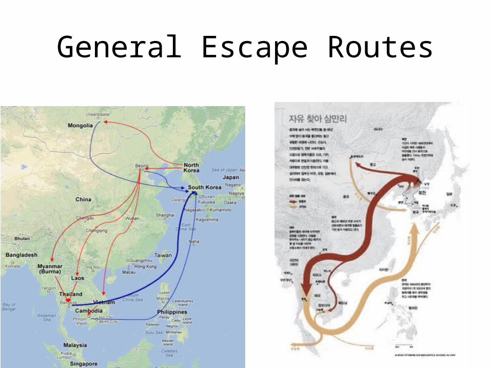
General Escape Routes
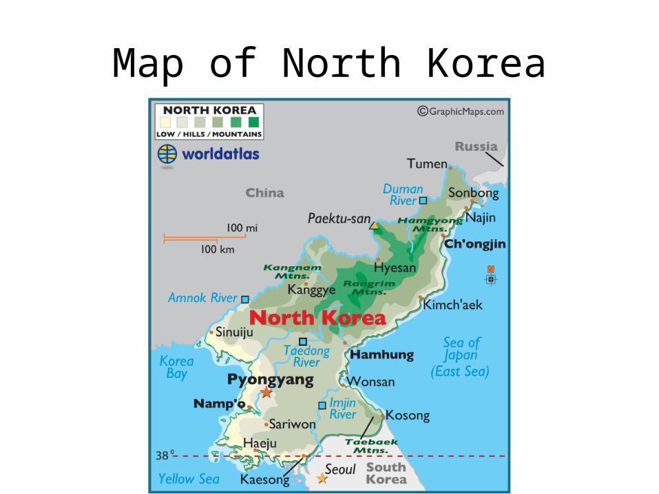
Map of North Korea

Problem Statement
What are the best routes for North Korean escapees to take when fleeing from North Korea?

Research Questions
• What is the shortest route an escapee can take to fully escape?
• What is the safest route an escapee can take?• What general route provides the highest
likelihood of escape?• Where are the most likely points of interdiction
both inside of North Korea and in China?• How can resources be allocated to assist North
Korean refugees escape?

Challenges in Creating Network
• Limited published information and data• Most information is word of mouth and
anecdotal• Pieced multiple accounts and sources together • Utilized Google Earth • Utilized geographical data, topographical
maps, and intuition
Assumptions/Project Limitations
• Three starting points in North Korea that represent southern, central, and northern regions
• Considering a single escapee• All edge probabilities within North Korea are the
same– Similar for border crossings and within China
• Only considered straight line distances• The only escape paths out of NK are into China• If in China, an escapee must escape to Mongolia or
Southeast Asia to be considered safe• Average speed refugees moving is 10 km/hr for 14
hours per day
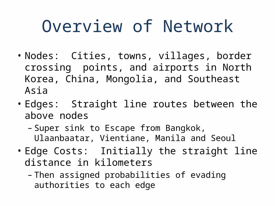
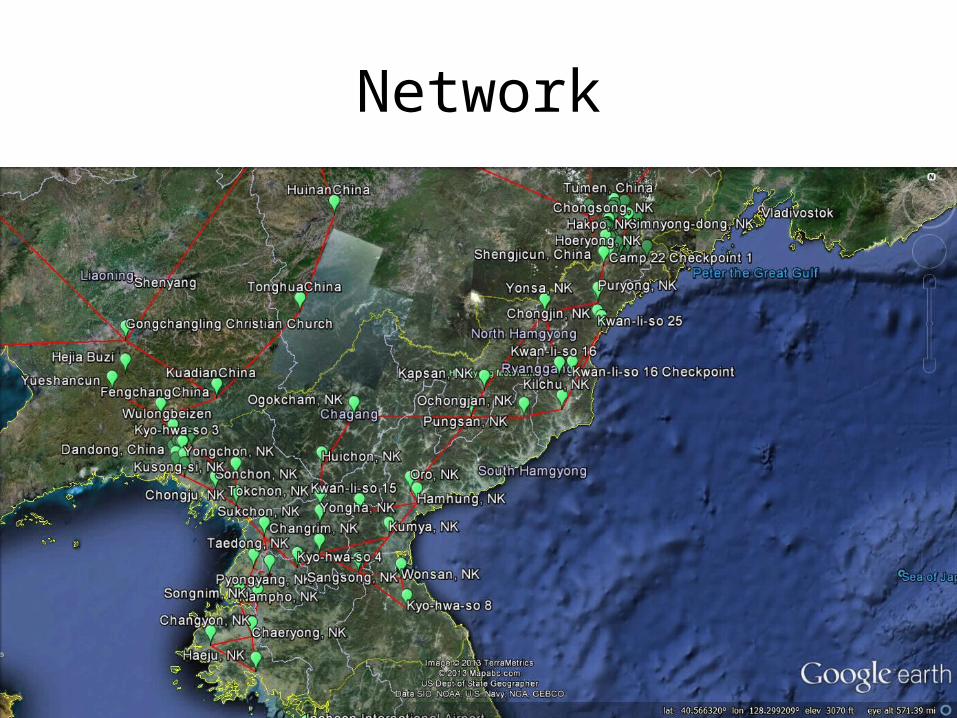
Overview of Network
• Nodes: Cities, towns, villages, border crossing points, and airports in North Korea, China, Mongolia, and Southeast Asia
• Edges: Straight line routes between the above nodes– Super sink to Escape from Bangkok, Ulaanbaatar,
Vientiane, Manila and Seoul• Edge Costs: Initially the straight line distance in
kilometers– Then assigned probabilities of evading authorities to
each edge
Network
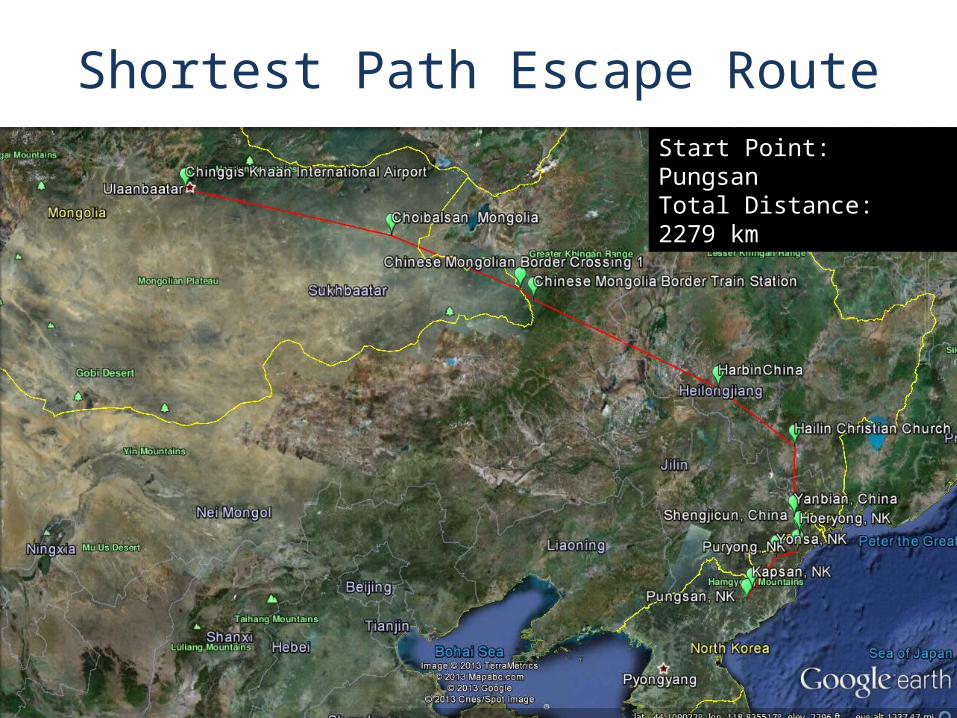
Start Point: HaejuTotal Distance: 2244 kmStart Point: Kyo-Hwa-So 4Total Distance: 2139 kmStart Point: PungsanTotal Distance: 2279 km
Shortest Path Escape Route
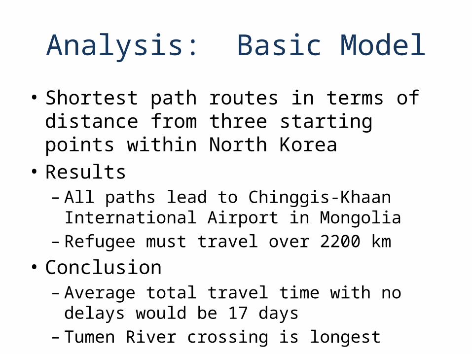
Analysis: Basic Model
• Shortest path routes in terms of distance from three starting points within North Korea
• Results– All paths lead to Chinggis-Khaan International
Airport in Mongolia– Refugee must travel over 2200 km
• Conclusion– Average total travel time with no delays would be
17 days– Tumen River crossing is longest
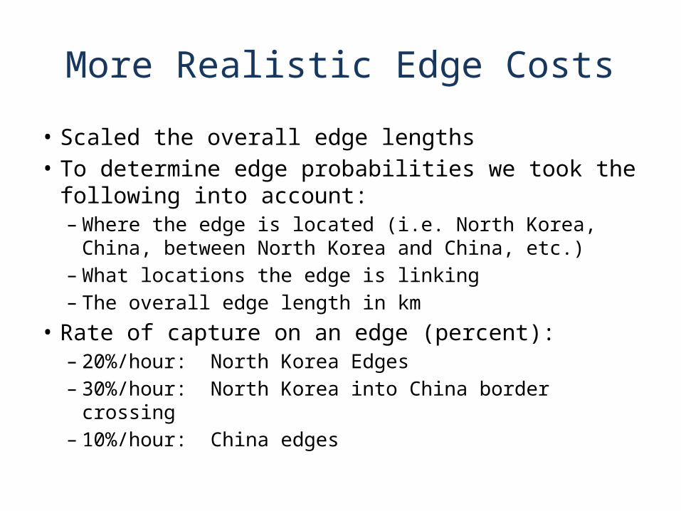
More Realistic Edge Costs
• Scaled the overall edge lengths• To determine edge probabilities we took the following
into account:– Where the edge is located (i.e. North Korea, China, between
North Korea and China, etc.)– What locations the edge is linking– The overall edge length in km
• Rate of capture on an edge (percent):– 20%/hour: North Korea Edges– 30%/hour: North Korea into China border crossing– 10%/hour: China edges

More Realistic Edge Costs
• To generate edge probabilities we applied the following transformation
Probability of Evading =
[% / ]
[ ]
pt
p rate of capture on edge hour
t time an escapee is on an edge hours
e
More Realistic Edge Costs
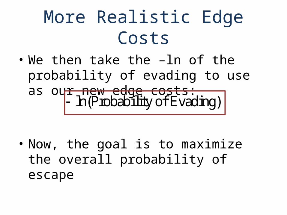
• We then take the –ln of the probability of evading to use as our new edge costs:
• Now, the goal is to maximize the overall probability of escape
ln(Probability of Evading)
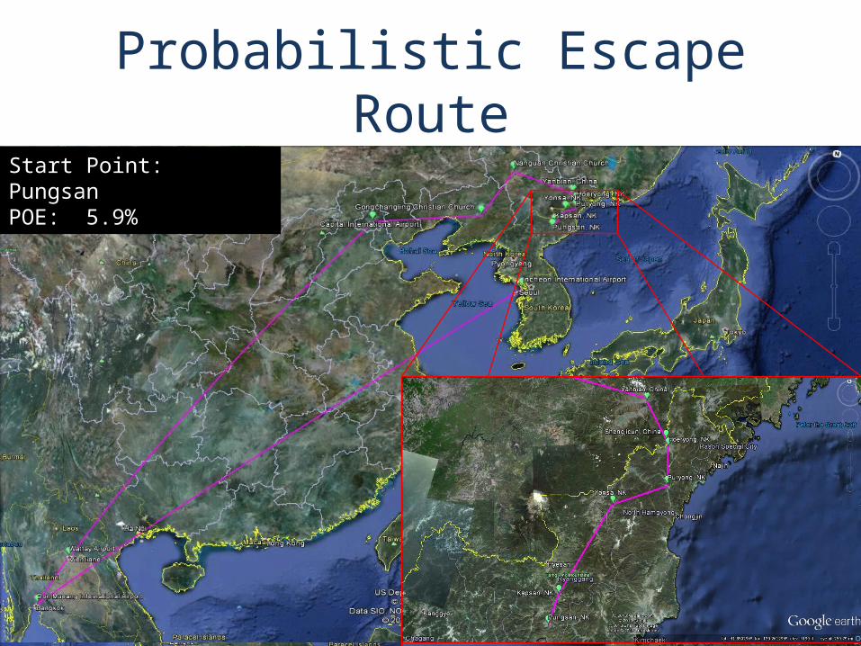
Probabilistic Escape RouteStart Point: HaejuPOE: 11.4%Start Point: Kyo-Hwa-So 4POE: 16.0%Start Point: PungsanPOE: 5.9%
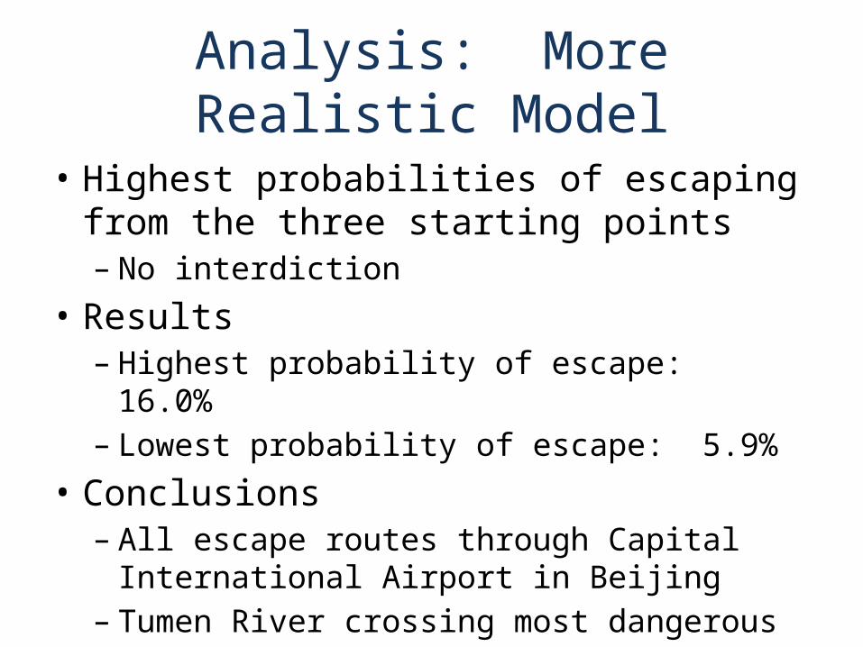
Analysis: More Realistic Model
• Highest probabilities of escaping from the three starting points– No interdiction
• Results– Highest probability of escape: 16.0%– Lowest probability of escape: 5.9%
• Conclusions– All escape routes through Capital International
Airport in Beijing– Tumen River crossing most dangerous
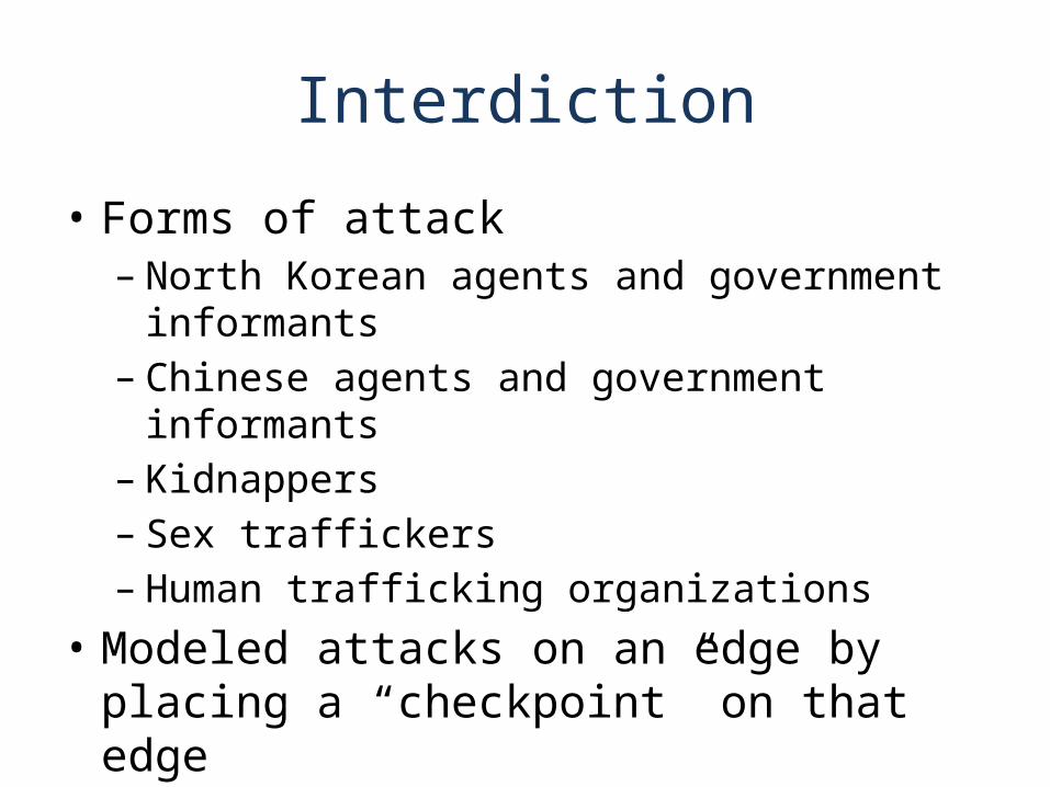
Interdiction
• Forms of attack– North Korean agents and government informants– Chinese agents and government informants– Kidnappers– Sex traffickers– Human trafficking organizations
• Modeled attacks on an edge by placing a “checkpoint” on that edge

Implementing Attacks
• “Checkpoint” encompasses all above forms of attack
• No “checkpoints” outside of China and North Korea
• Checkpoints are not 100% effective– Each “checkpoint” causes a 6-hour delay
• Looked at a varying number of checkpoints to determine effect on safest path

Probabilistic Escape Routes with 5 Checkpoints
Start Point: HaejuPOE: 1.40%Start Point: Kyo-Hwa-So 4POE: 2.07%Start Point: PungsanPOE: 1.10%
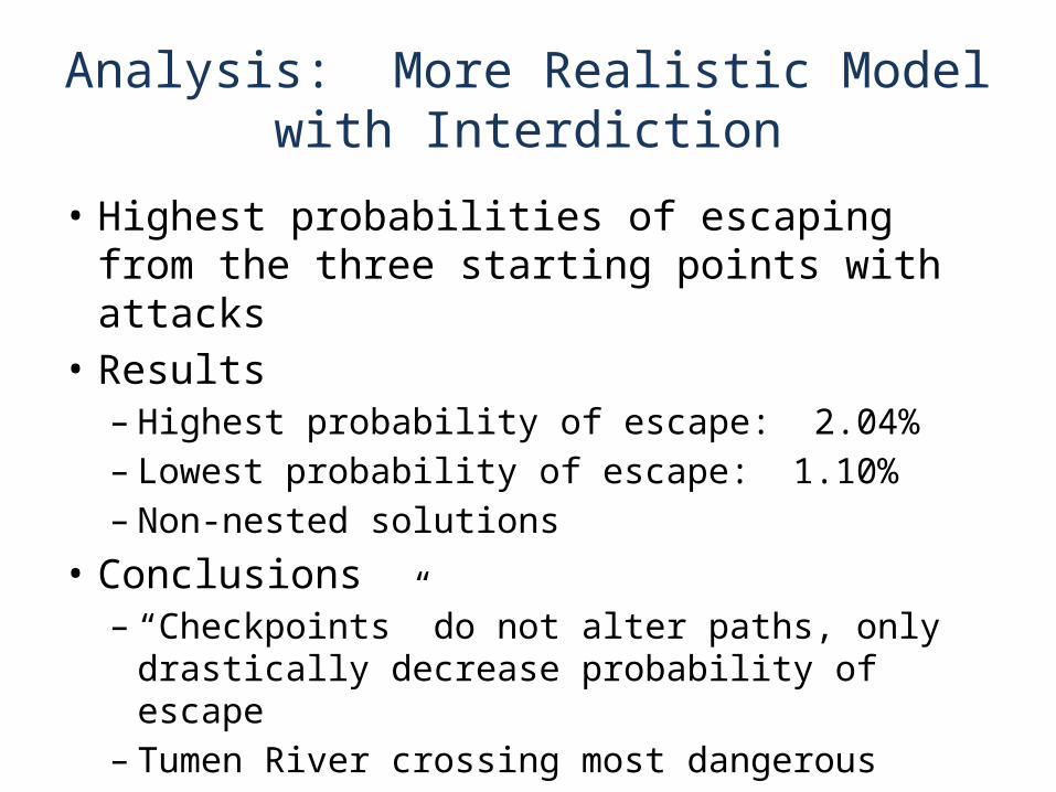
Analysis: More Realistic Model with Interdiction
• Highest probabilities of escaping from the three starting points with attacks
• Results– Highest probability of escape: 2.04%– Lowest probability of escape: 1.10%– Non-nested solutions
• Conclusions– “Checkpoints” do not alter paths, only drastically
decrease probability of escape– Tumen River crossing most dangerous

Operator Resilience Curve

Network Design
• Adding resources to certain routes• Increasing probabilities of successful border
crossing– Increasing the number of border crossings– Increasing the number of guides– Paying off government agents
• With more resources, more escapees could escape through Beijing airport – Enhances their chances of escape– Avoids hundreds of miles of ground travel

Network Design: Additional Resources along Pungsan Route
Conclusions and Insights
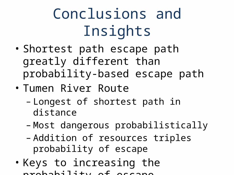
• Shortest path escape path greatly different than probability-based escape path
• Tumen River Route– Longest of shortest path in distance – Most dangerous probabilistically– Addition of resources triples probability of escape
• Keys to increasing the probability of escape – Get escapees to the Beijing airport– Add additional resources in China
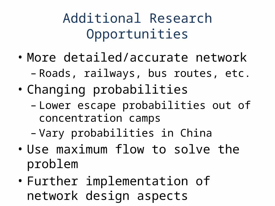
Additional Research Opportunities
• More detailed/accurate network– Roads, railways, bus routes, etc.
• Changing probabilities – Lower escape probabilities out of concentration
camps– Vary probabilities in China
• Use maximum flow to solve the problem• Further implementation of network design
aspects

Questions