atlin/taku land use planning update presentation to multiparty workshop #4 june 19, 2009
TRANSCRIPT

Atlin/Taku Land Use Planning
Update
Presentation to Multiparty Workshop #4June 19, 2009

2
Overview Technical Working Group’s “To Do List” from Workshop #3
Review of principles and goals Complete Interest Summary Document Monarch Mountain (detailed maps)
TWG Activities over last 3 months Where are we in the planning process Plan for Ongoing Community and Stakeholder Engagement

3
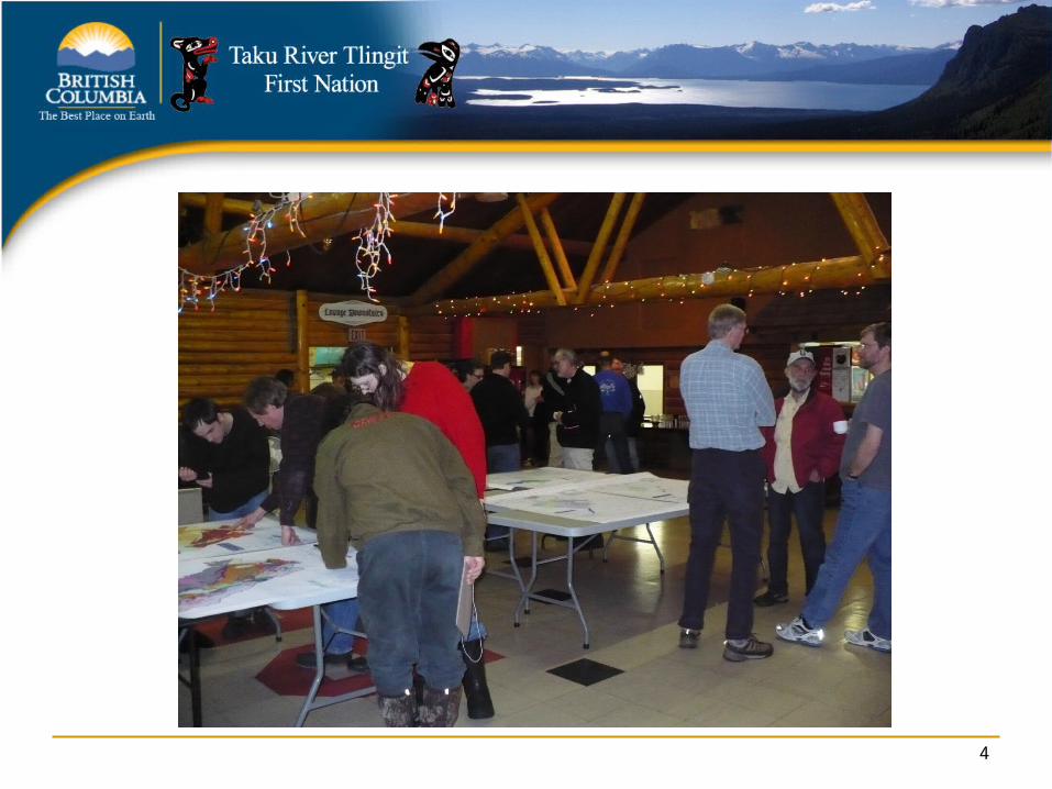
Workshop #3 Continue to be well attended
37 people to the Community Open House Approximately 40 people attended the workshop
Workshops, stakeholder meetings, newsletters, etc. considered effective and sufficient for engaging the community and stakeholders
4

5

To Do List ...
6
Review of Principles and Goals Received comments from a few
individuals/organizations Written comments have been compiled Principles have been completed
7

Interest Summary Summary updated Waiting to post to web
8

Monarch Mountain Detailed maps available since last workshop Values noted in the spatial summaries
9

What has the TWG been up to?
10

11
Stakeholder Meetings Mining and Exploration permitting workshop Atlin end of April
Address questions raised at the April 3rd LUP Subcommittee meeting.
Introduced “High Value TRTFN Cultural and Ecological Landscapes Map”
Answer questions
Workshop #4 Orientation ENGOs and AMEBC by conference call in June Atlin residents prior to the workshop

TRTFN Community Meetings TRTFN Technical team meetings with
individual families and community through May and June
Meetings with Da Kha Nations – Carcross Tagish FN and Teslin Tlingit Council
12

Decision Support Tool Information compiled and available for
analysis Available to be used to develop and assess
land use zone scenarios Used to derive the “High Value Landscapes
for TRTFN Cultural and Ecological Values”
13

High Value TRTFN Cultural and Ecological Landscapes Map
Identifies the areas with the highest concentration cultural and ecological values
Draft map presented at May 1st open house and to Tlingit community
Map revised based on TRTFN community input Map reflects TRTFN priorities and goal setting
14

Subarea Summaries Planning area subdivided into 38 “subareas” Sub-areas:
represent geographic units with distinct biophysical characteristics, resource values, or management issues
follow intermediate watersheds approximately Understanding values and issues by sub-area is a
precursor to zoning
15

Joint Land Forum Meetings One day conference call on June 3rd
16

Chapters Forestry
More detailed work completed Ongoing exchange of perspectives for
remaining chapters Much work remains to be done
17

18
Where are we in the “Process” Pre-planning phase, orientation, visioning,
and information collection is completed Resource Analysis underway
Workshop #4 Draft planning products under development

19
Stages Not Yet Initiated Compilation of plan and public review Revisions to plan and public review Joint approvals Joint implementation
Next Steps Complete remaining sub-area summaries by July 10th
(comments by end of July) Joint Land Forum Field Trip July 13-17th
“Problem Solving” Draft zones developed by Fall 09
JLF Field Trip Workshop #4
20

Next Steps (continued) Community and Stakeholder review of zoning options
through September and October Draft chapters completed by end October Emerging plan products reviewed with community and
stakeholder November and December Draft plan presented to Joint Land Forum in December Timing of next steps of engagement, including
workshop, dependant on progress in g2g discussions Wise use of time!
21