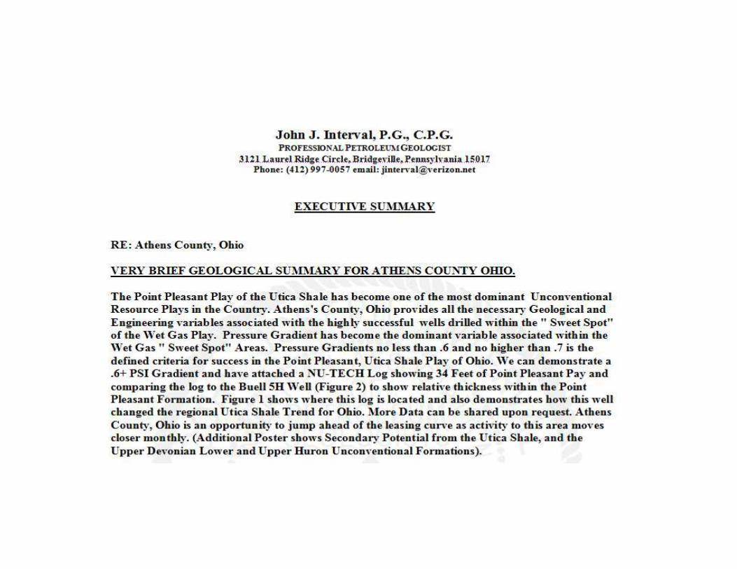
athens county ohio- project stratagy-6-2014 revised
TRANSCRIPT
Athens County, Ohio
Unconventional Resource Development for the Point Pleasant, Utica, Rhinestreet
and Lower Huron Shales.
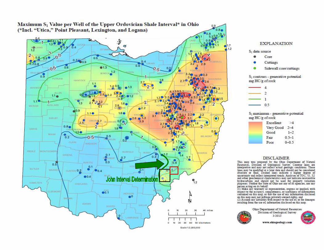
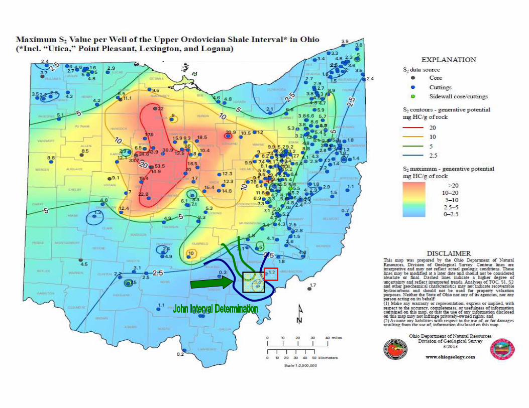
JOHN J. INTERVALPROFESSIONAL PETROLEUM GEOLOGIST
Specializing in Petroleum Geology Prospect Generation, Analysis and Well Site Assessment, Well Completion Design and Production
Analysis.
American Association of Petroleum Geologists: C.P.G. # 5848
Pennsylvania Licensed Professional Geologist: PG-000673
Georgia Licensed Professional Geologist: PG-001762
Email: [email protected]
Phone: 412-997-0057
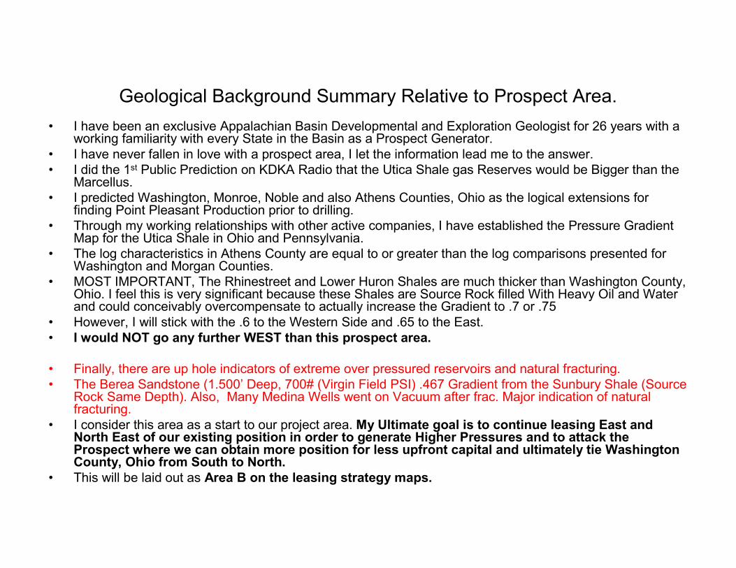
Geological Background Summary Relative to Prospect Area.
• I have been an exclusive Appalachian Basin Developmental and Exploration Geologist for 26 years with a working familiarity with every State in the Basin as a Prospect Generator.
• I have never fallen in love with a prospect area, I let the information lead me to the answer.
• I did the 1st Public Prediction on KDKA Radio that the Utica Shale gas Reserves would be Bigger than the Marcellus.
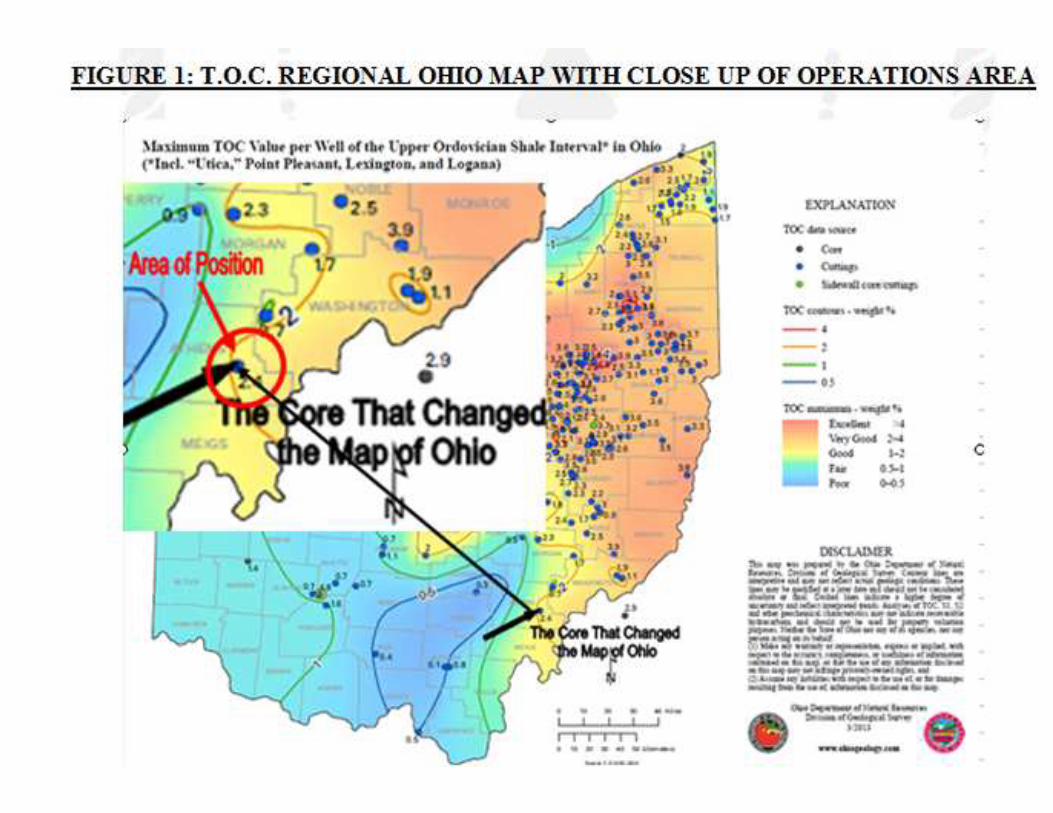
• I predicted Washington, Monroe, Noble and also Athens Counties, Ohio as the logical extensions for finding Point Pleasant Production prior to drilling.
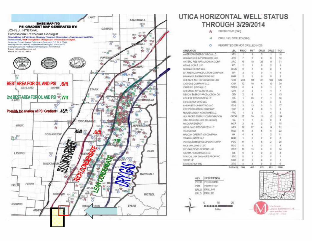
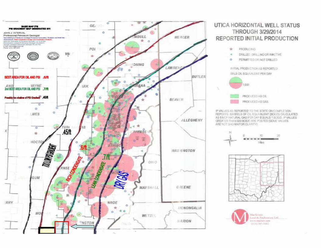
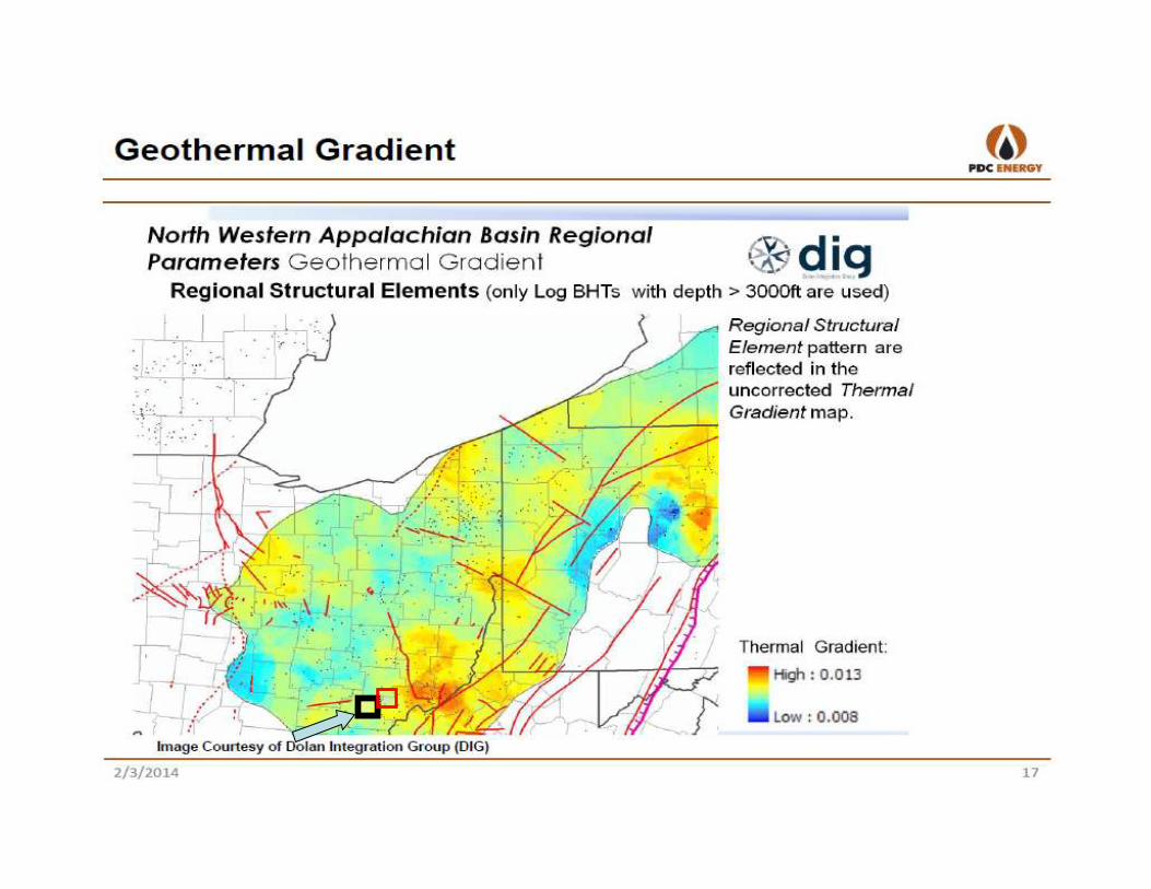
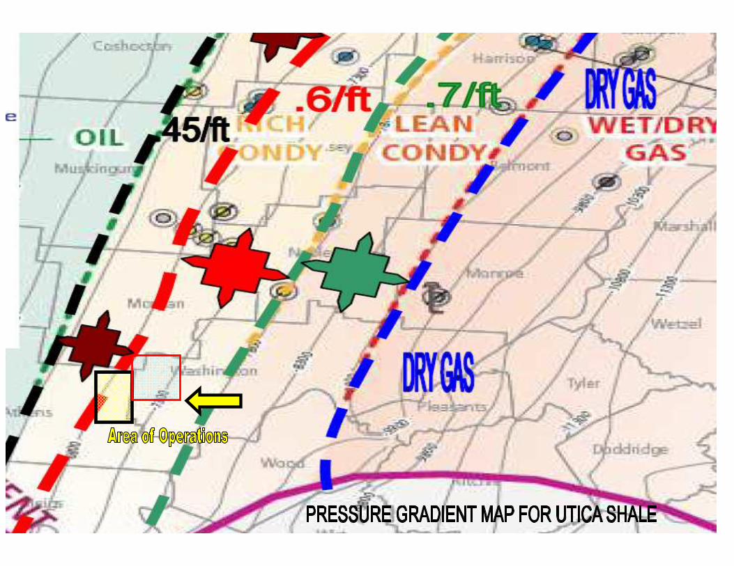
• Through my working relationships with other active companies, I have established the Pressure Gradient Map for the Utica Shale in Ohio and Pennsylvania.
• The log characteristics in Athens County are equal to or greater than the log comparisons presented for Washington and Morgan Counties.
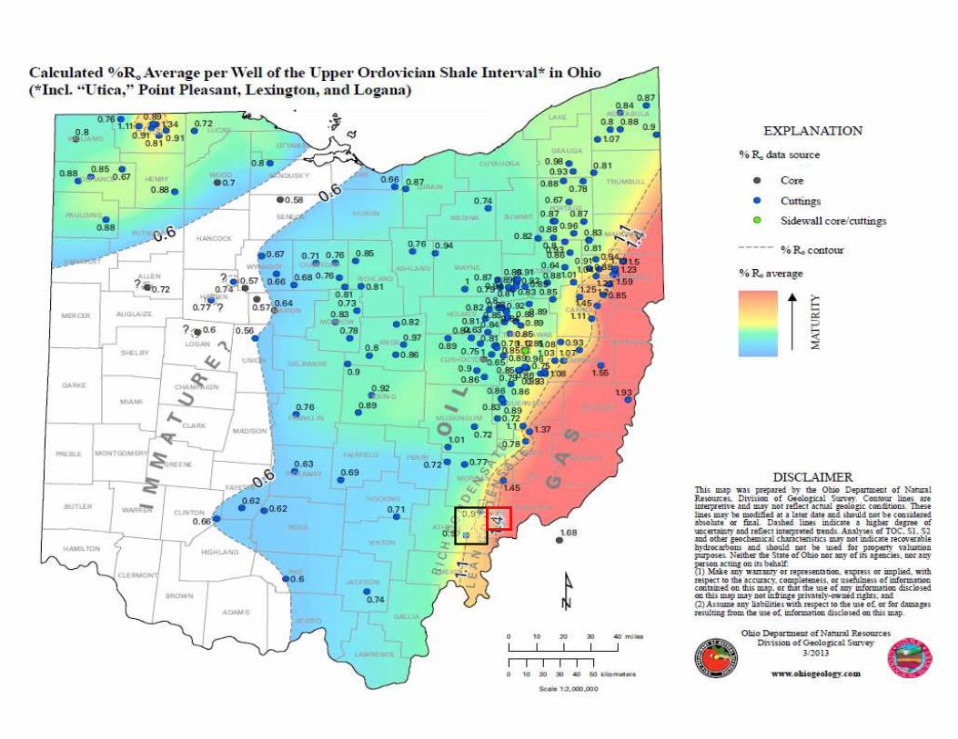
• MOST IMPORTANT, The Rhinestreet and Lower Huron Shales are much thicker than Washington County, Ohio. I feel this is very significant because these Shales are Source Rock filled With Heavy Oil and Water and could conceivably overcompensate to actually increase the Gradient to .7 or .75
• However, I will stick with the .6 to the Western Side and .65 to the East.
• I would NOT go any further WEST than this prospect area.
• Finally, there are up hole indicators of extreme over pressured reservoirs and natural fracturing.
• The Berea Sandstone (1.500’ Deep, 700# (Virgin Field PSI) .467 Gradient from the Sunbury Shale (Source Rock Same Depth). Also, Many Medina Wells went on Vacuum after frac. Major indication of natural fracturing.
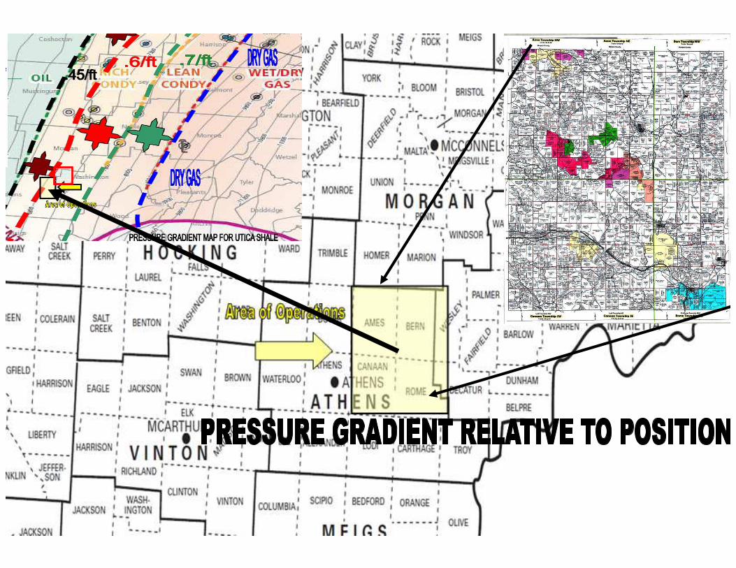
• I consider this area as a start to our project area. My Ultimate goal is to continue leasing East and North East of our existing position in order to generate Higher Pressures and to attack the Prospect where we can obtain more position for less upfront capital and ultimately tie Washington County, Ohio from South to North.
• This will be laid out as Area B on the leasing strategy maps.
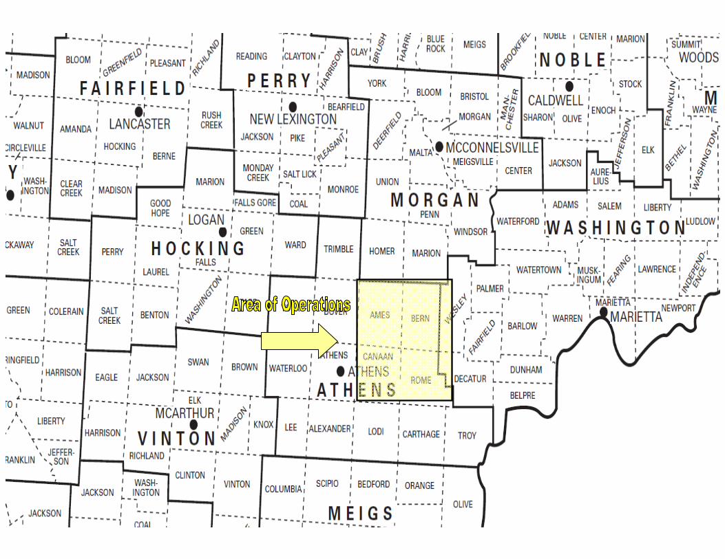
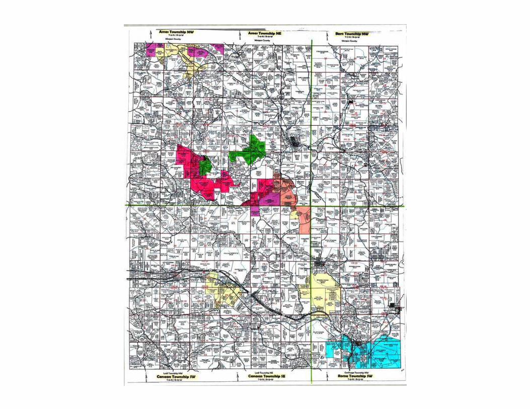
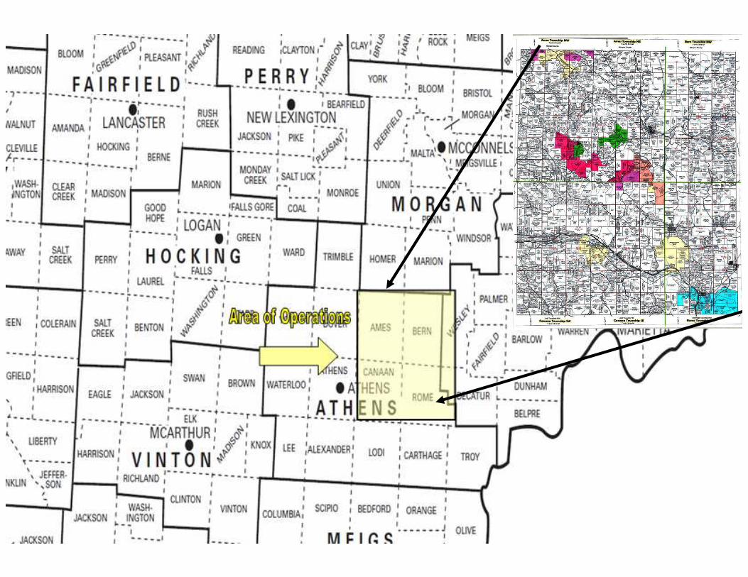
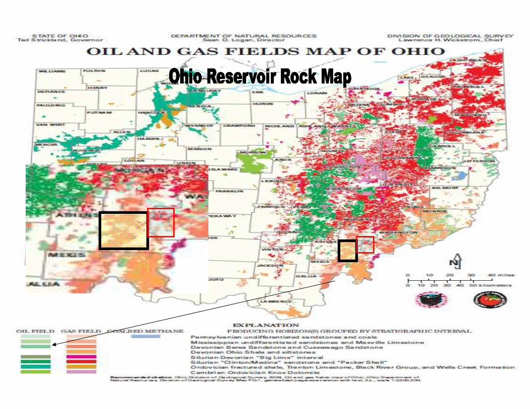
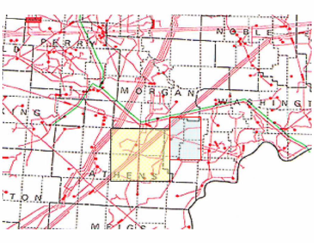
Position Map
Property Location in
Athens County, Ohio
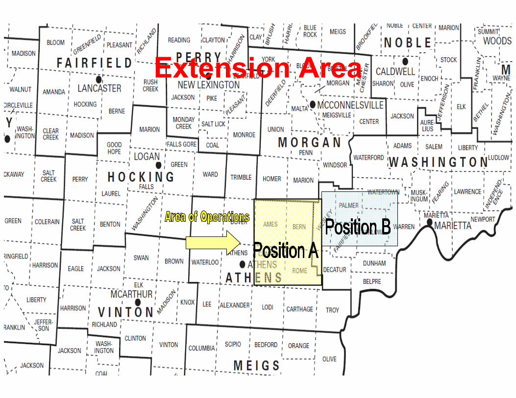
Extension Area

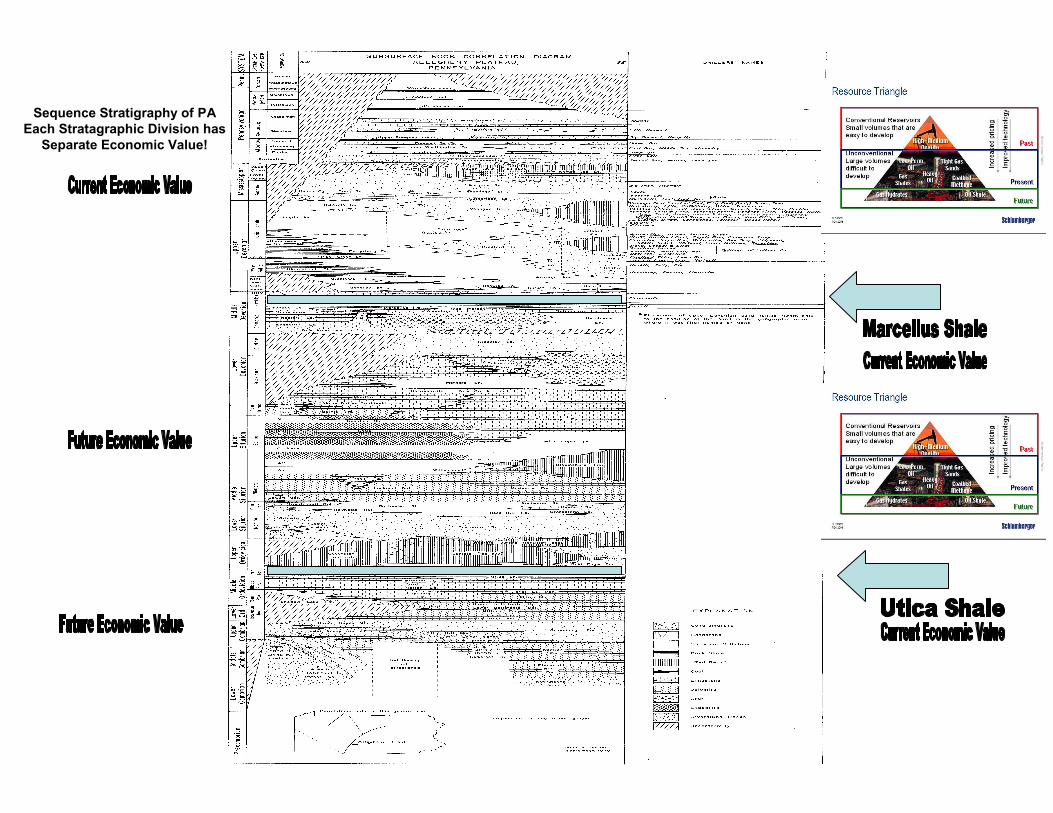
Sequence Stratigraphy of PA
Each Stratagraphic Division has
Separate Economic Value!


Low Risk Drilling.
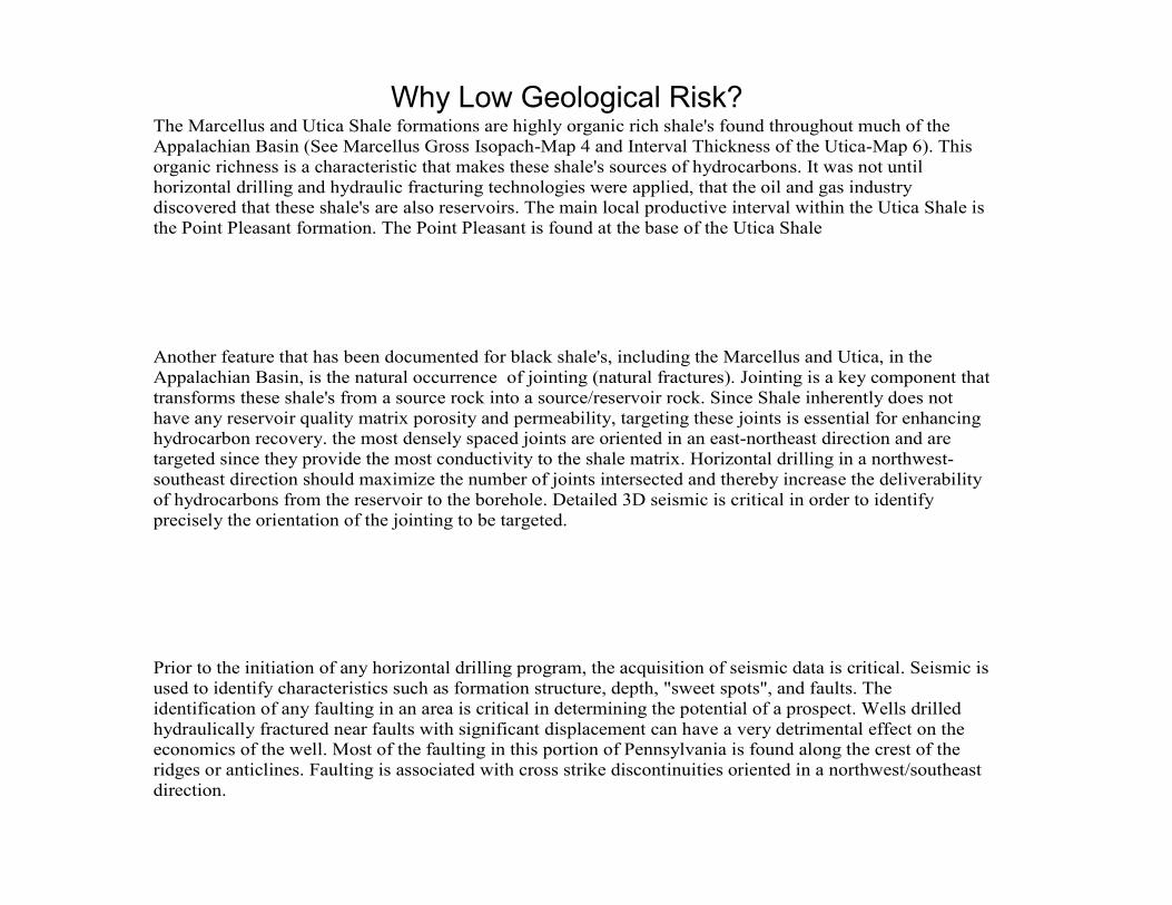
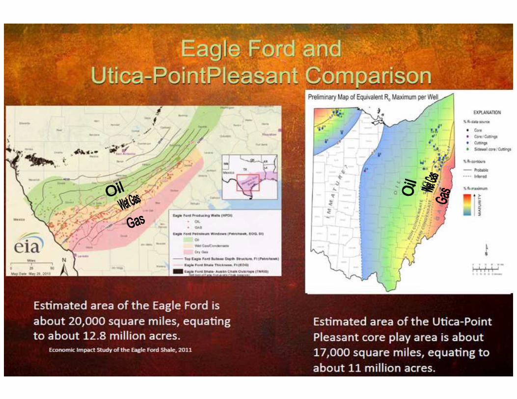
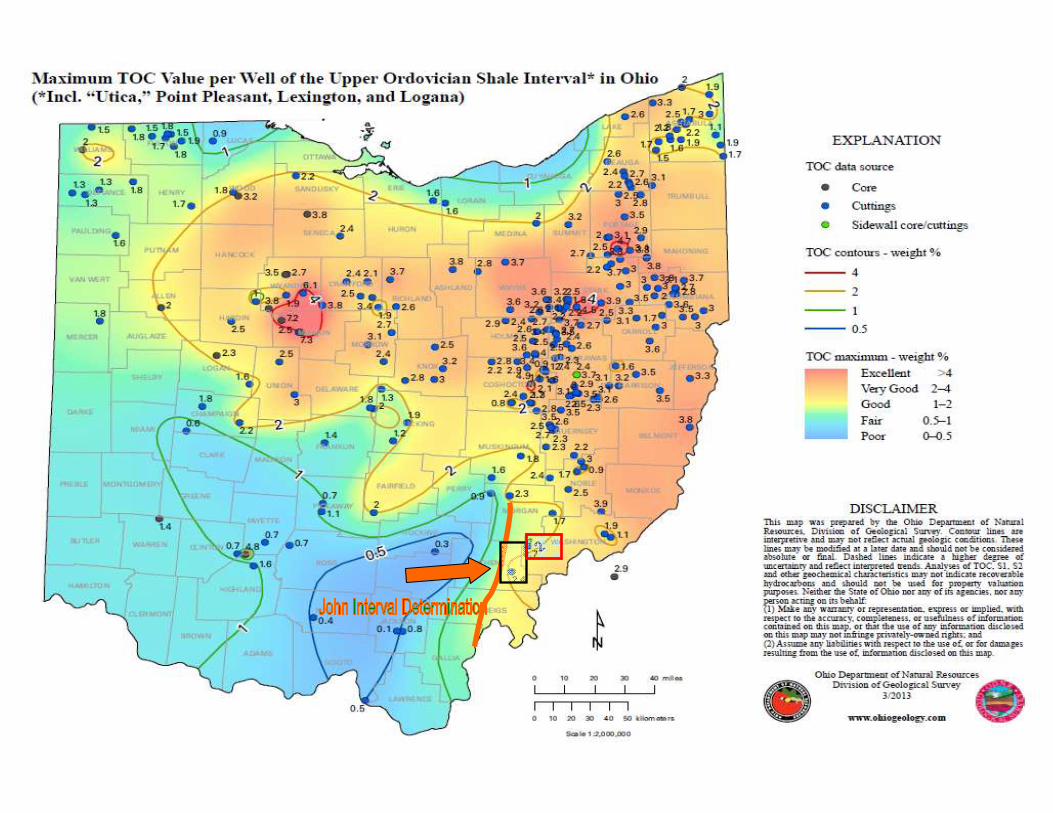
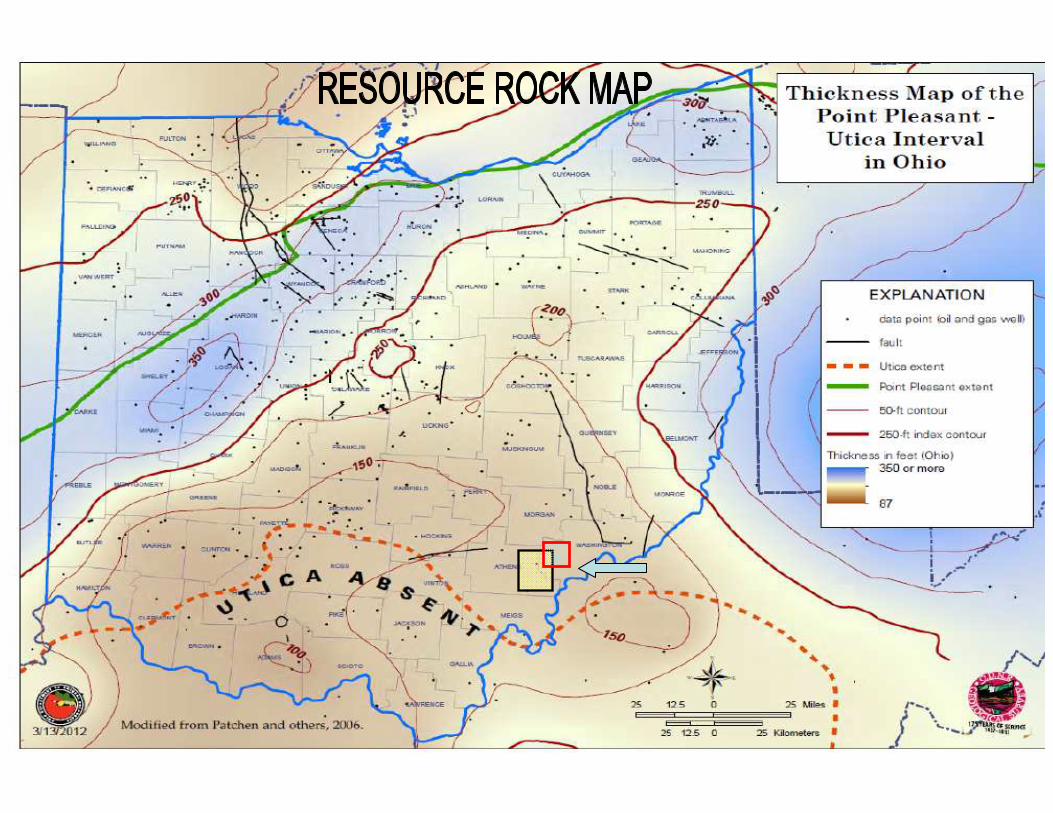
The Marcellus and Utica Shale formations are highly organic rich shale's found throughout much of the
Appalachian Basin (See Marcellus Gross Isopach-Map 4 and Interval Thickness of the Utica-Map 6). This
organic richness is a characteristic that makes these shale's sources of hydrocarbons. It was not until
horizontal drilling and hydraulic fracturing technologies were applied, that the oil and gas industry
discovered that these shale's are also reservoirs. The main local productive interval within the Utica Shale is
the Point Pleasant formation. The Point Pleasant is found at the base of the Utica Shale
Another feature that has been documented for black shale's, including the Marcellus and Utica, in the
Appalachian Basin, is the natural occurrence of jointing (natural fractures). Jointing is a key component that
transforms these shale's from a source rock into a source/reservoir rock. Since Shale inherently does not
have any reservoir quality matrix porosity and permeability, targeting these joints is essential for enhancing
hydrocarbon recovery. the most densely spaced joints are oriented in an east-northeast direction and are
targeted since they provide the most conductivity to the shale matrix. Horizontal drilling in a northwest-
southeast direction should maximize the number of joints intersected and thereby increase the deliverability
of hydrocarbons from the reservoir to the borehole. Detailed 3D seismic is critical in order to identify
precisely the orientation of the jointing to be targeted.
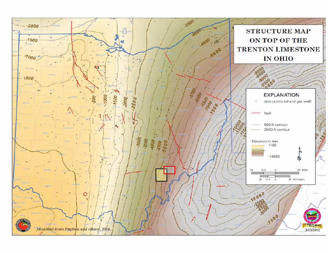
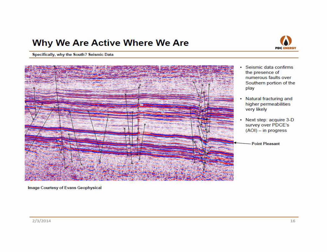
Prior to the initiation of any horizontal drilling program, the acquisition of seismic data is critical. Seismic is
used to identify characteristics such as formation structure, depth, "sweet spots", and faults. The
identification of any faulting in an area is critical in determining the potential of a prospect. Wells drilled
hydraulically fractured near faults with significant displacement can have a very detrimental effect on the
economics of the well. Most of the faulting in this portion of Pennsylvania is found along the crest of the
ridges or anticlines. Faulting is associated with cross strike discontinuities oriented in a northwest/southeast
direction.
Why Low Geological Risk?
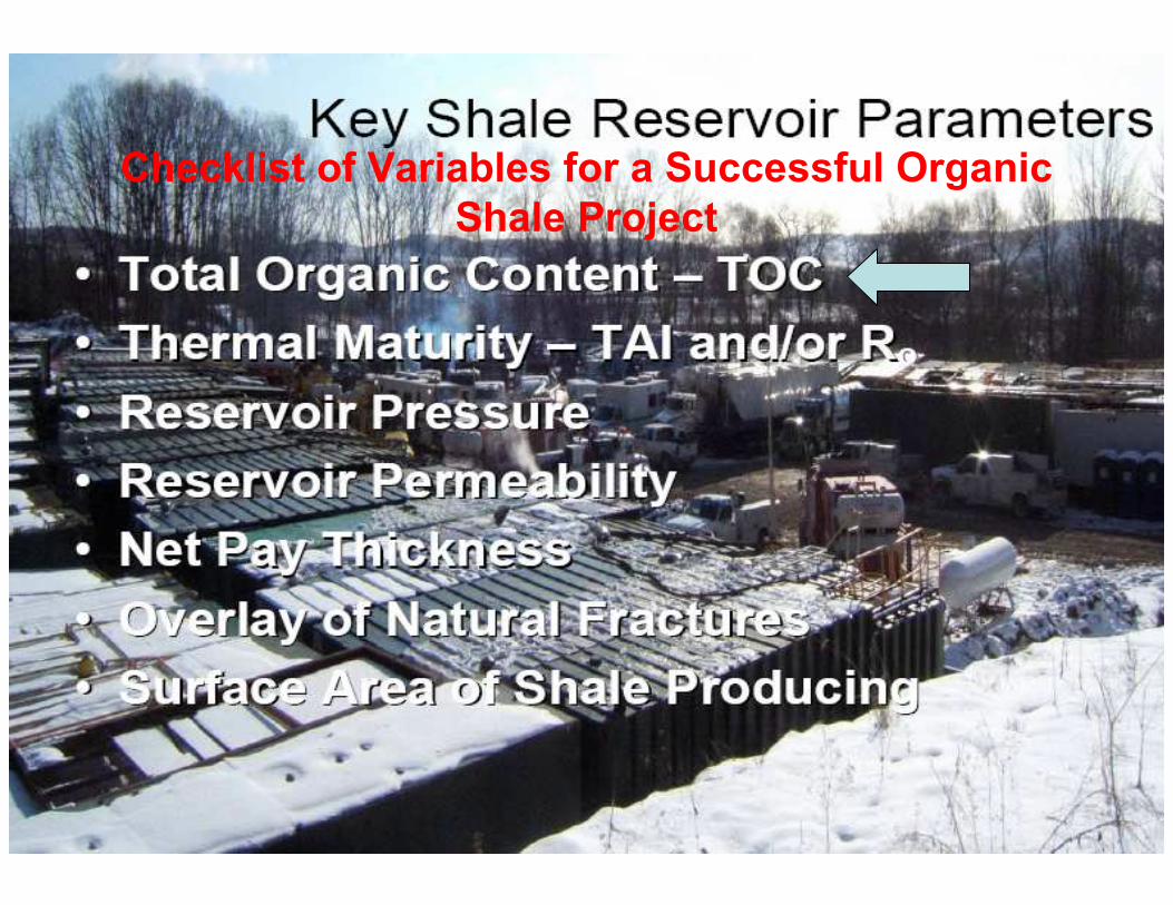
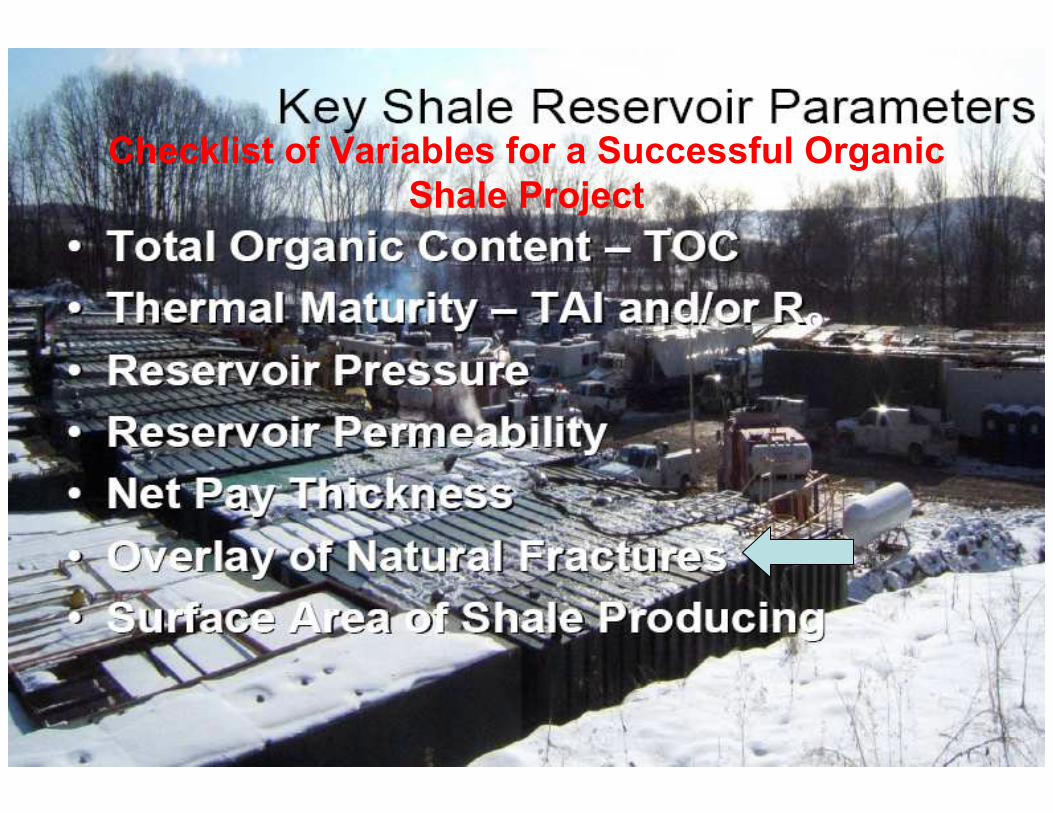
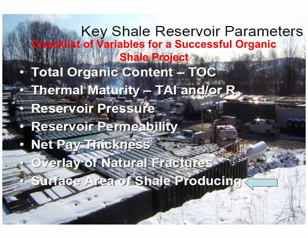
Checklist of Variables for a Successful Organic
Shale Project
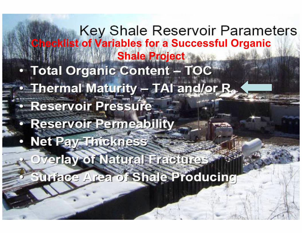
Checklist of Variables for a Successful Organic
Shale Project
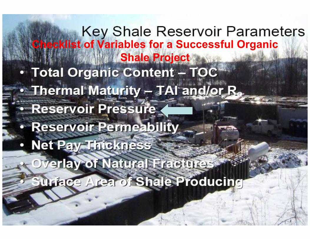
Checklist of Variables for a Successful Organic
Shale Project
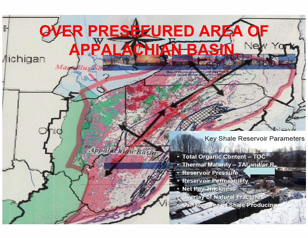
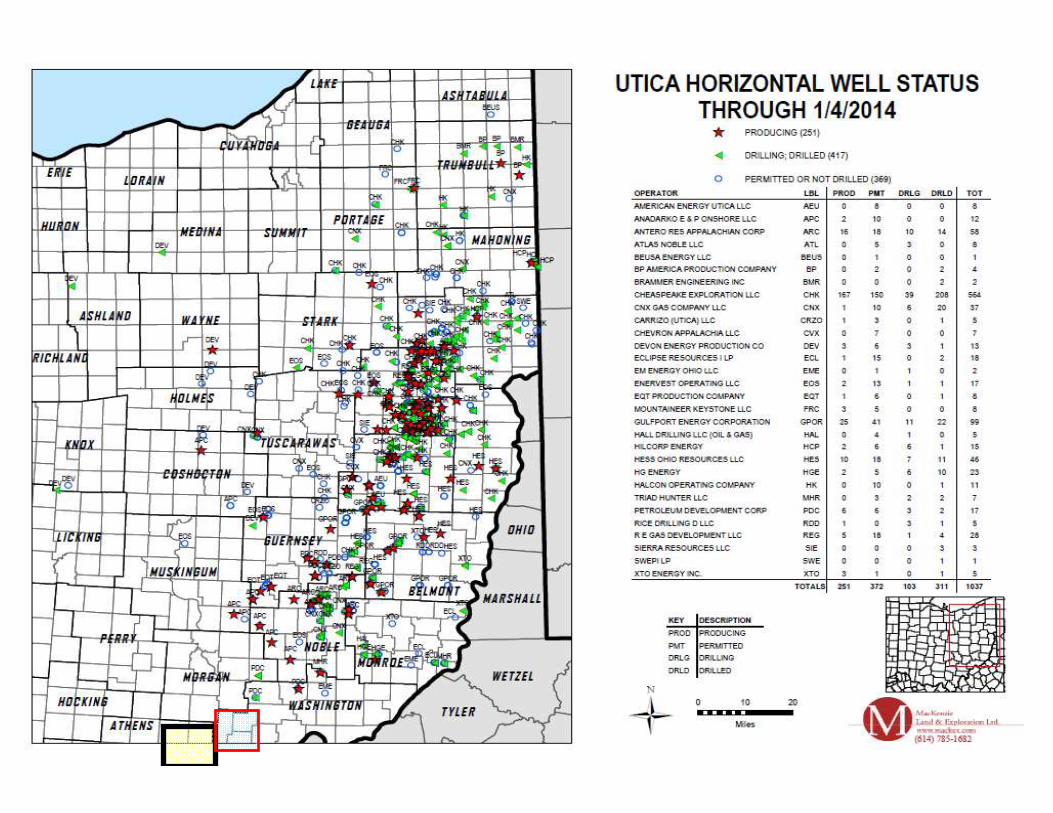
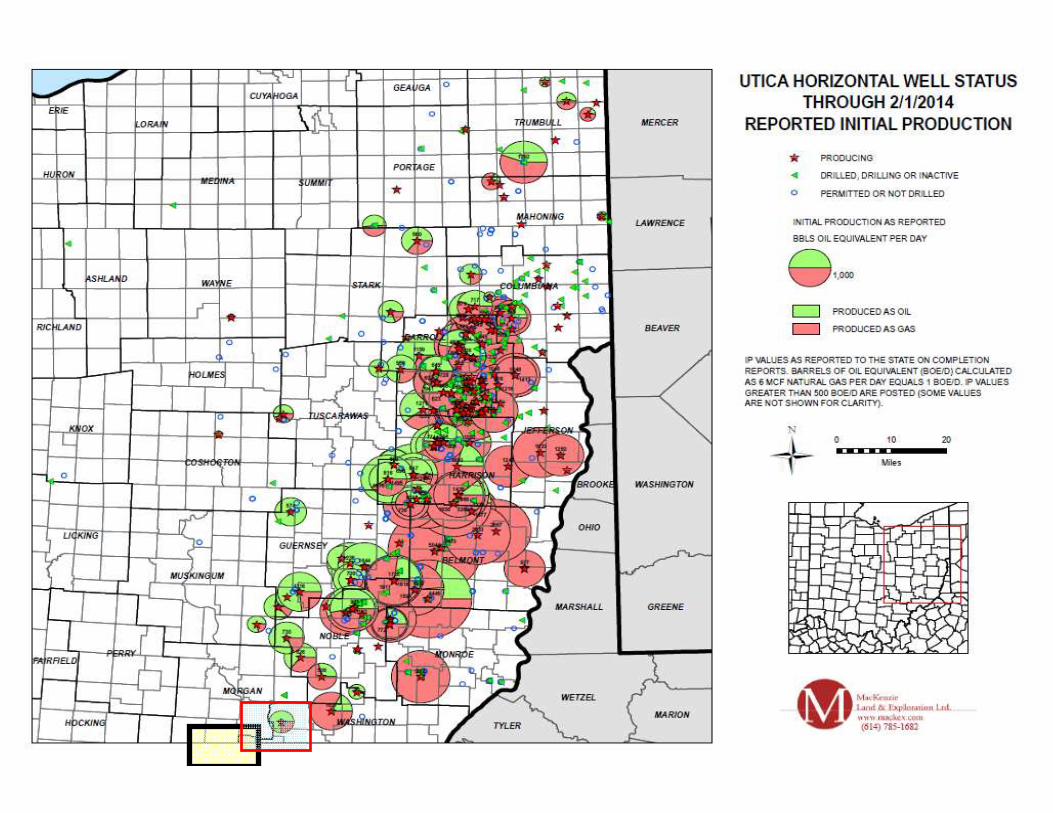
OVER PRESEEURED AREA OF
APPALACHIAN BASIN.

REFINED MAP TO INCLUDE PRESSURE GRADIENT.
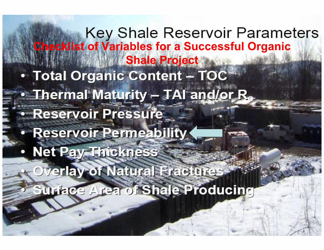
Checklist of Variables for a Successful Organic
Shale Project
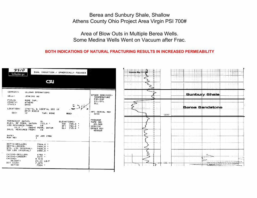
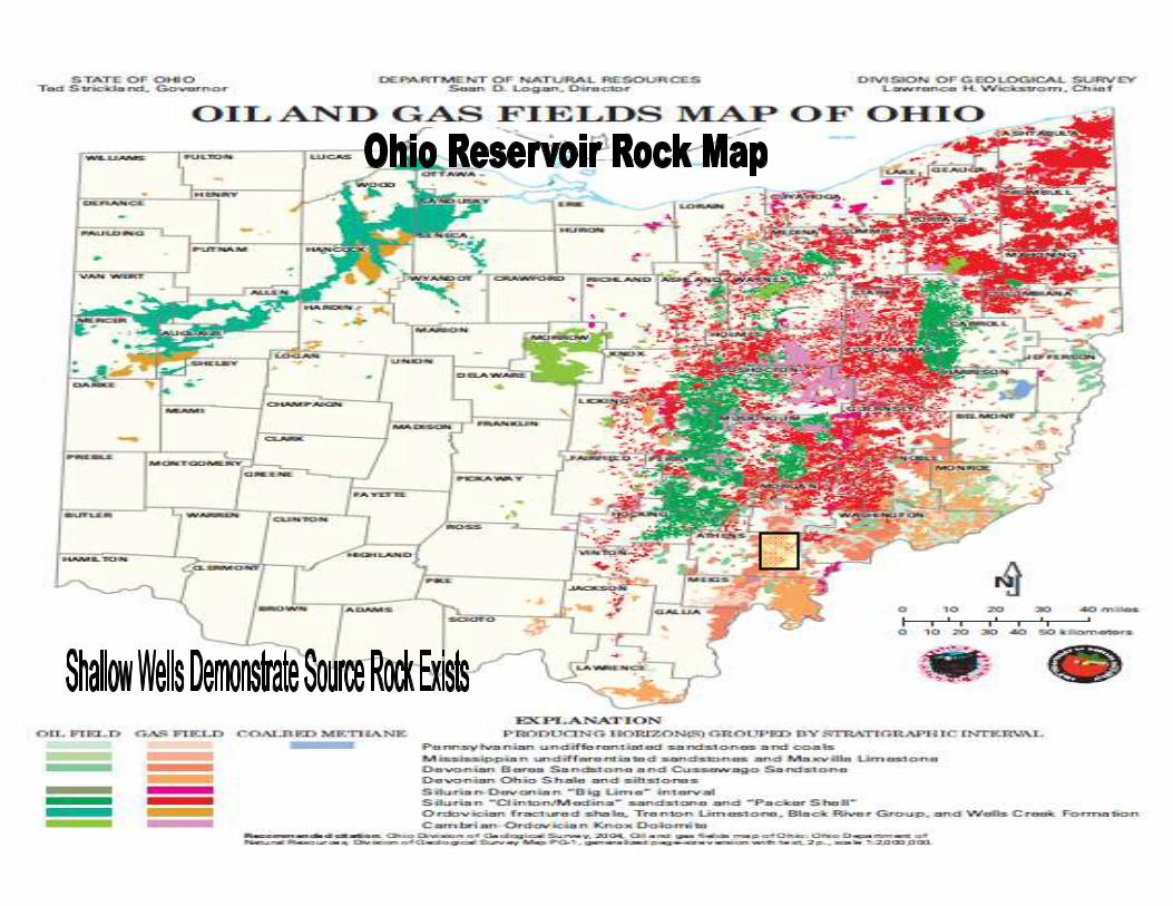
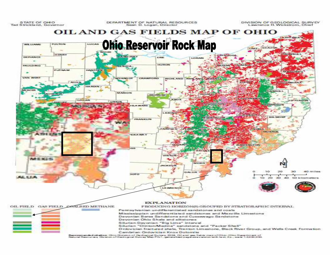
Berea and Sunbury Shale, Shallow
Athens County Ohio Project Area Virgin PSI 700#
Area of Blow Outs in Multiple Berea Wells.
Some Medina Wells Went on Vacuum after Frac.
BOTH INDICATIONS OF NATURAL FRACTURING RESULTS IN INCREASED PERMEABILITY
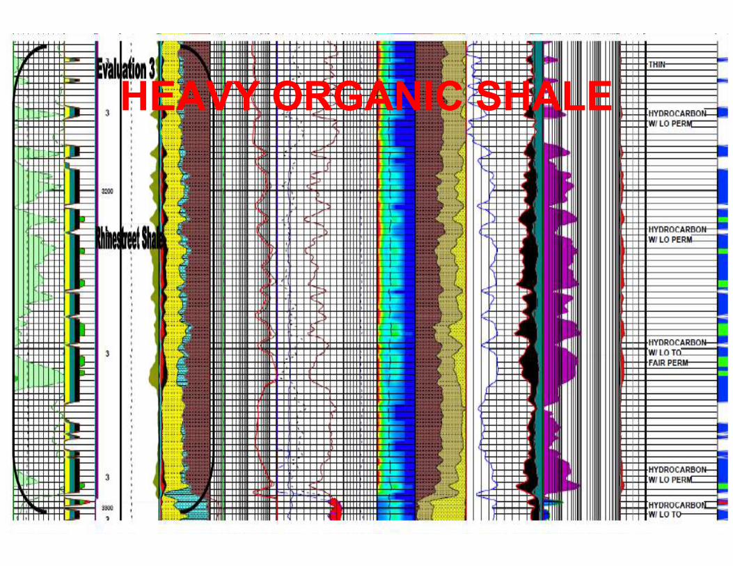
HEAVY ORGANIC SHALE
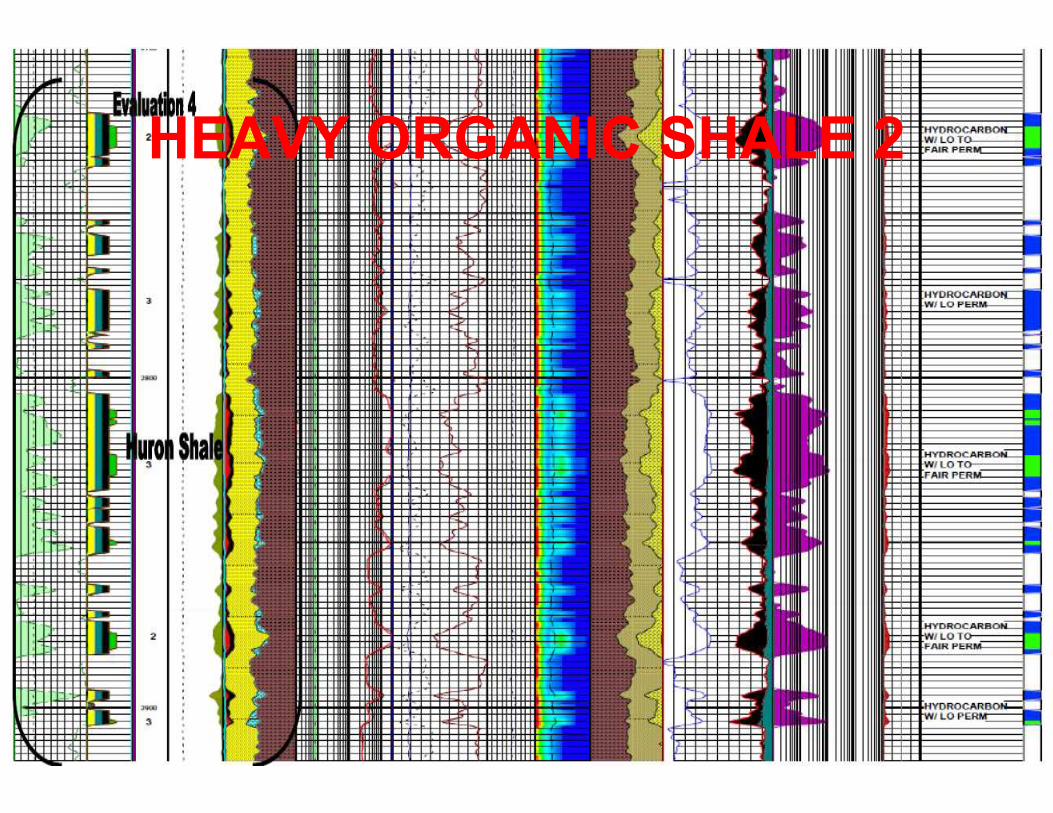
HEAVY ORGANIC SHALE 2
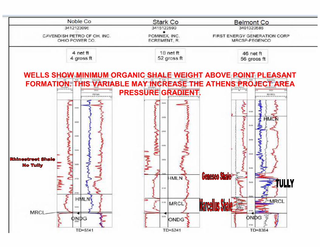
WELLS SHOW MINIMUM ORGANIC SHALE WEIGHT ABOVE POINT PLEASANT
FORMATION. THIS VARIABLE MAY INCREASE THE ATHENS PROJECT AREA
PRESSURE GRADIENT.
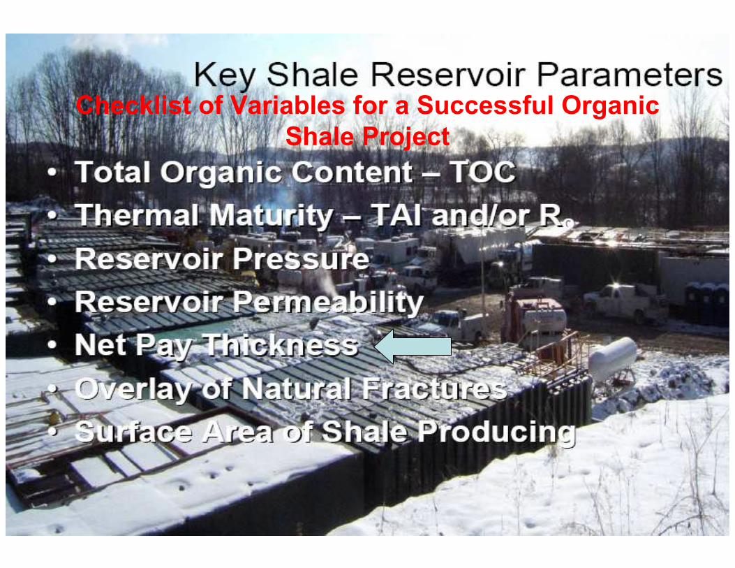
Checklist of Variables for a Successful Organic
Shale Project

Checklist of Variables for a Successful Organic
Shale Project
Checklist of Variables for a Successful Organic
Shale Project

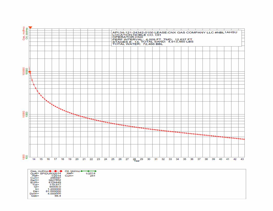
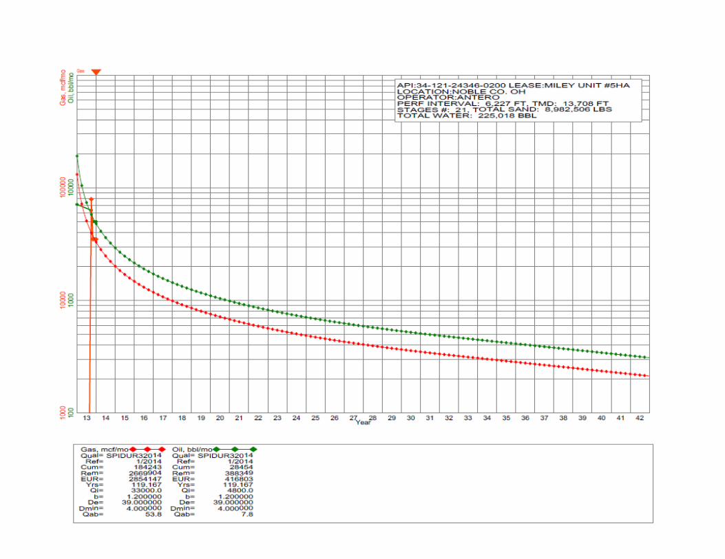
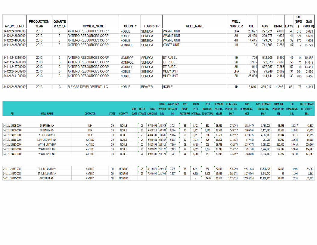
SUMMARY
PREVIOUS SLIDES SHOW PROSPECT AREA HAS ALL VARIABLES OF A SUCESSFUL
UNCONVENTIONAL RESOURCE PROJECT.
LOCAL AND REGIONAL LOG
COMPARISONS AND REGIONAL
CROSS SECTIONS
COMPARING LOGS OF SUCSEFUL
AREAS TO PROJECT AREA
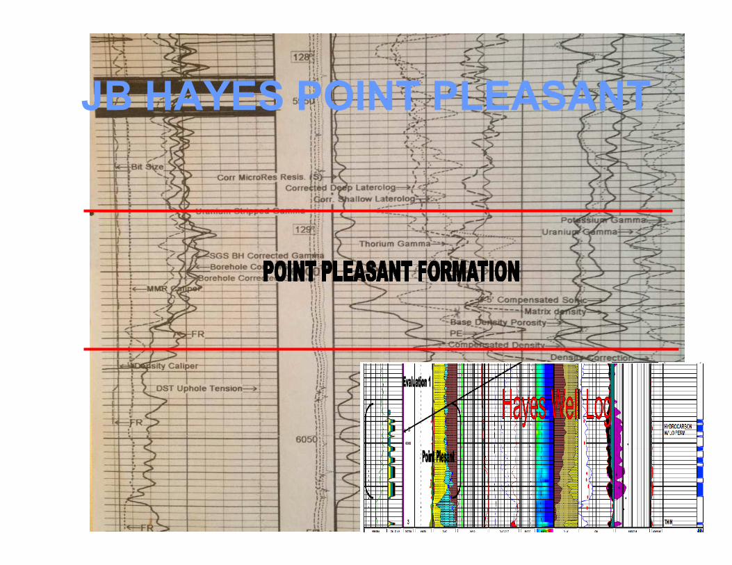
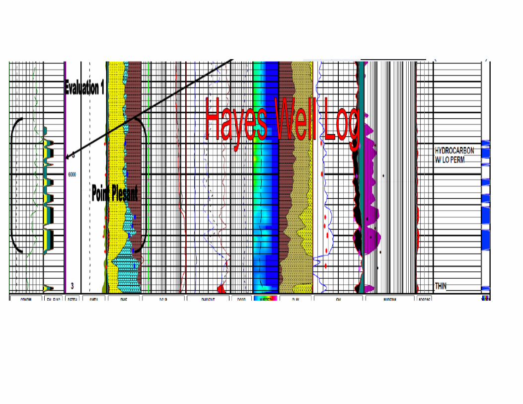
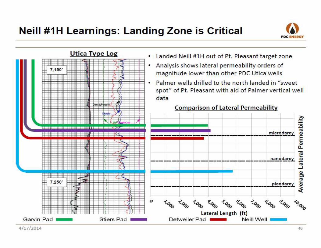
JB HAYES POINT PLEASANT
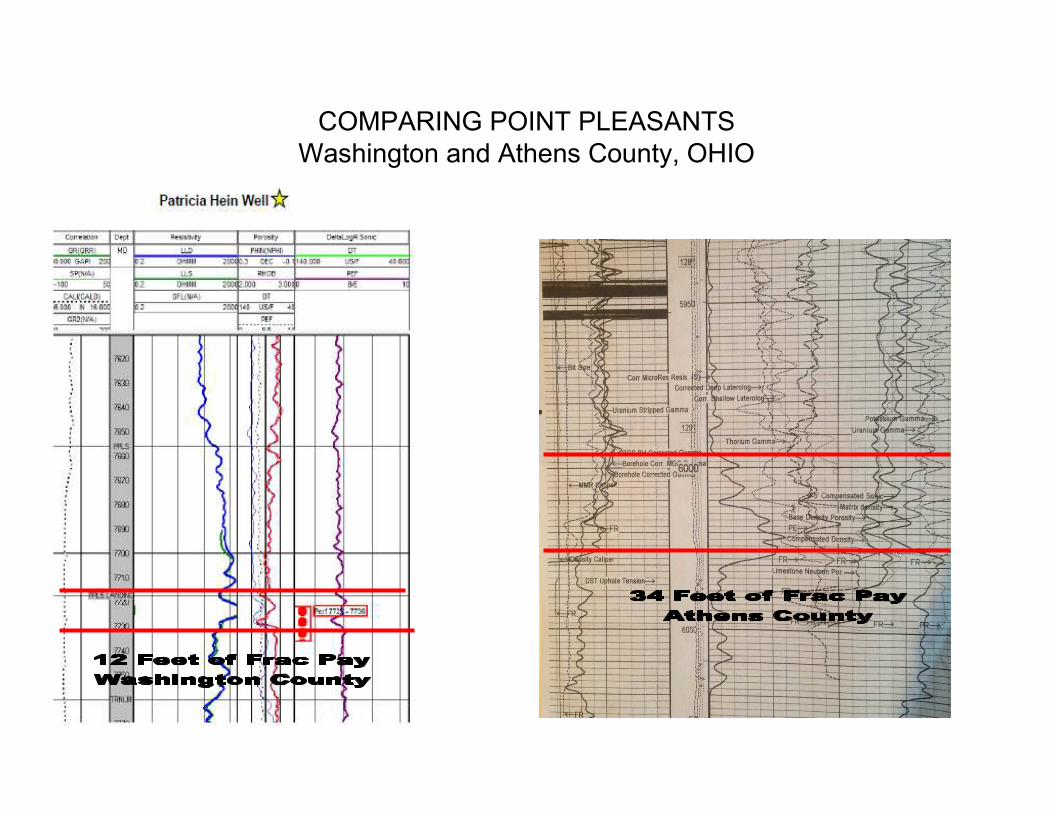
COMPARING POINT PLEASANTS
Washington and Athens County, OHIO
COMPARING POINT PLEASANTS
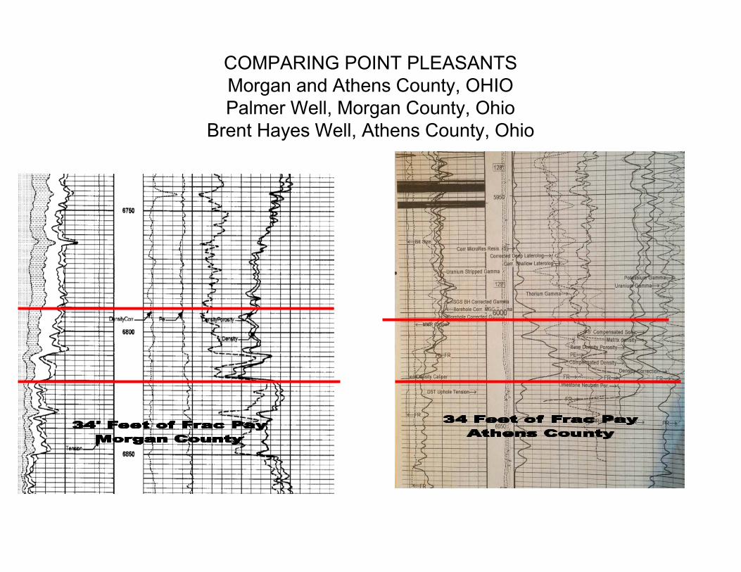
Morgan and Athens County, OHIO
Palmer Well, Morgan County, Ohio
Brent Hayes Well, Athens County, Ohio
COMPARING POINT PLEASANTS
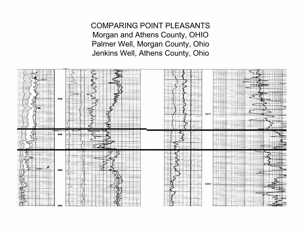
Morgan and Athens County, OHIO
Palmer Well, Morgan County, Ohio
Jenkins Well, Athens County, Ohio

SUMMARY OF LOCAL LOGS
LOG COMPARISONS SHOW POINT PLEASANT THICKNESS EQUAL TO OR
GREATER THAN PROVEN AREAS.
REGIONAL LOG CROSS-
SECTIONS.
REGIONALLY DEFINES EXISTENCE OF
LOG DATA THROUGHOUT PROSPECT
AREA

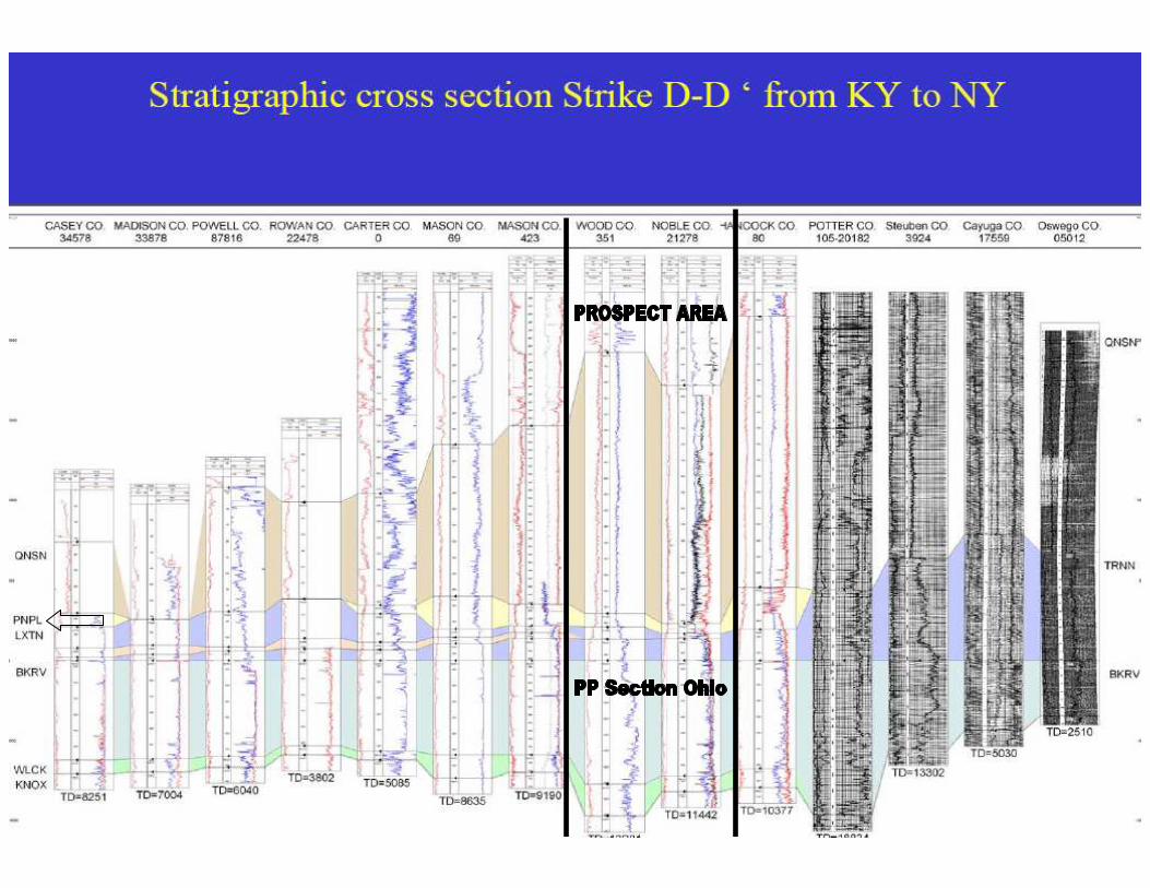
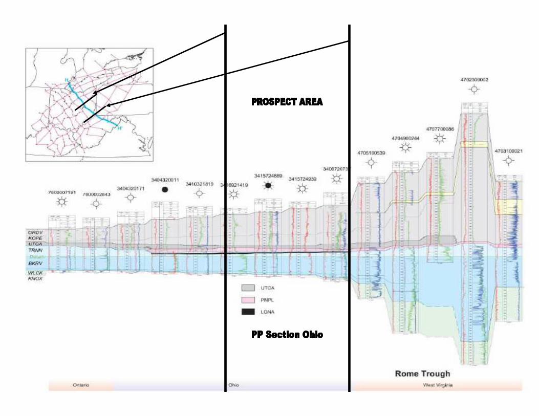

SUMMARY OF REGIONAL LOG
CROSS SECTIONS
LOG CROSS-SECTIONS VERIFY
EXISTENCE OF POINT PLEASANT
THRU PROSPECT AREA.
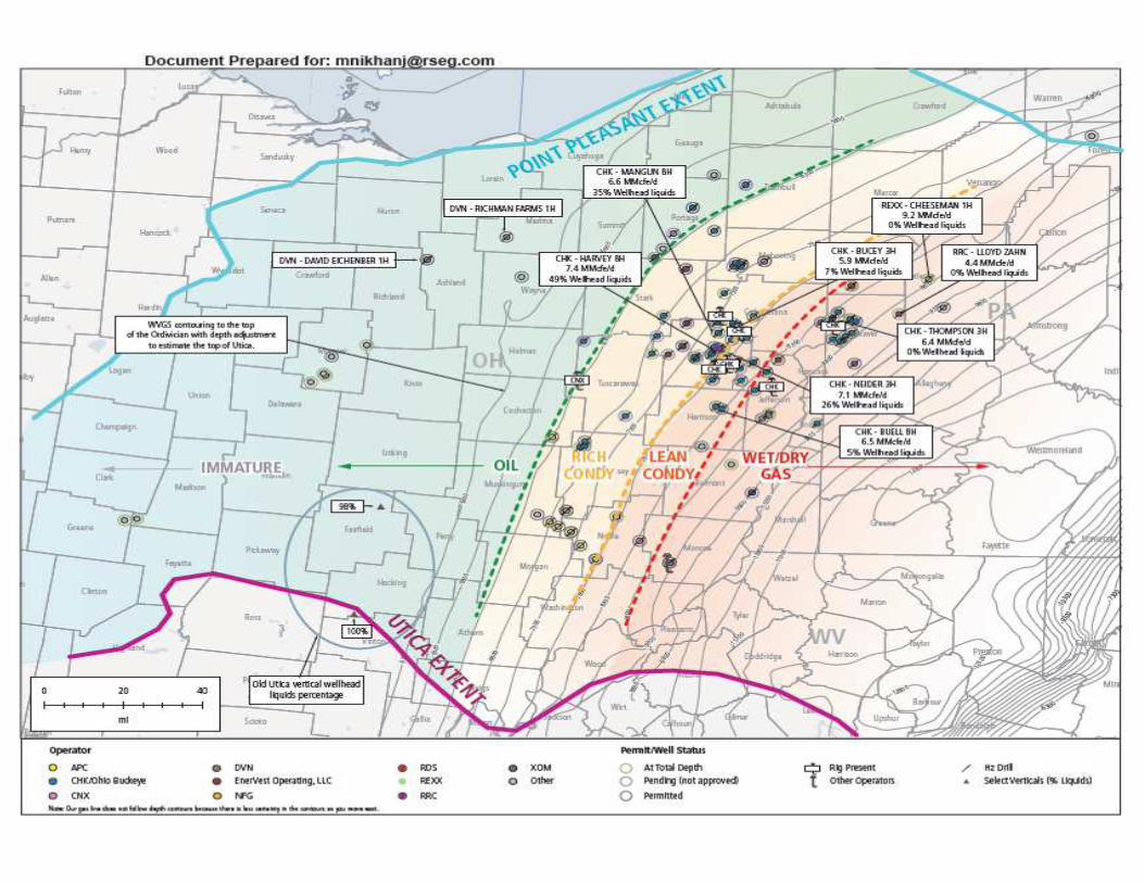
ADDITIONAL INFORMATION
• DETAILED LOG ON THE JB HAYES POINT
PLEASANT FORMATION.
• PRESSURE GRADIENT MAP RELATIVE TO
PROJECT AREA.
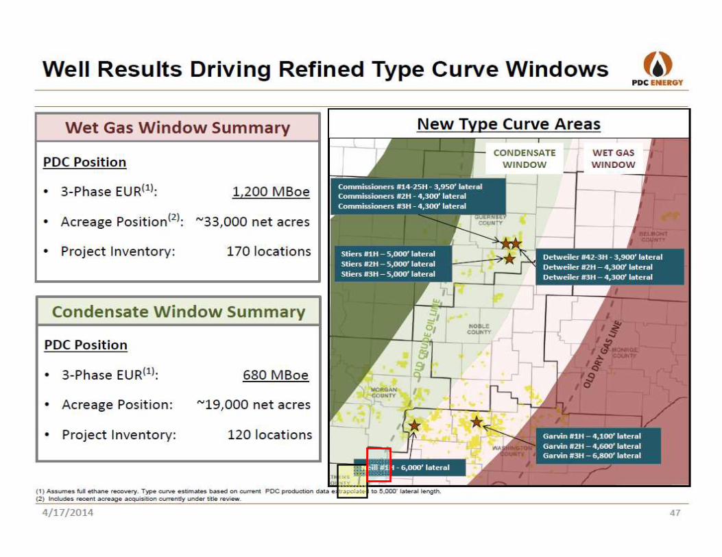
• NEW PDC MAP MOVES OIL LINE 15 MILES
WEST VERIFYING MY PRESSURE
GRADIENT MAP.
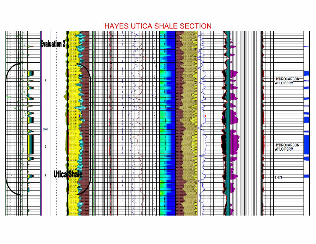
HAYES UTICA SHALE SECTION
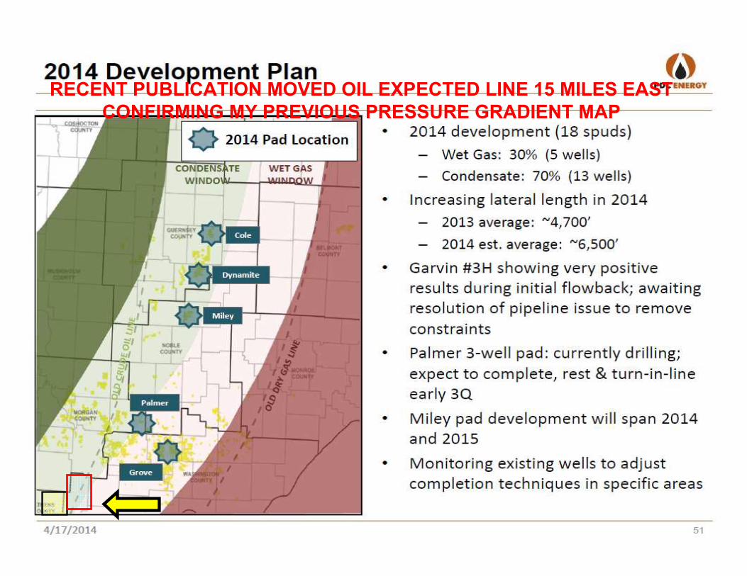
RECENT PUBLICATION MOVED OIL EXPECTED LINE 15 MILES EAST
CONFIRMING MY PREVIOUS PRESSURE GRADIENT MAP
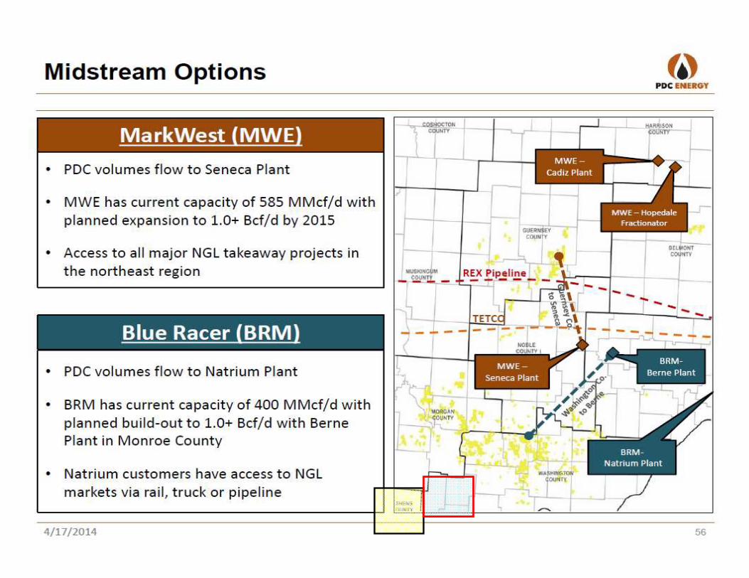

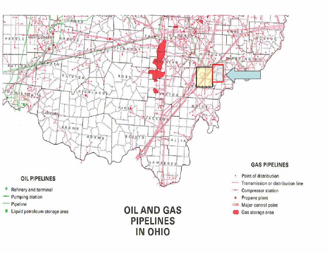
PIPELINES
POTENTIAL MARKETS
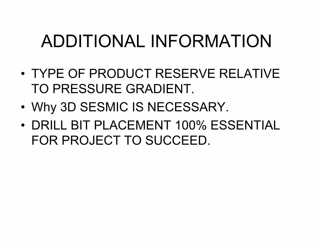
ADDITIONAL INFORMATION
• TYPE OF PRODUCT RESERVE RELATIVE
TO PRESSURE GRADIENT.
• Why 3D SESMIC IS NECESSARY.
• DRILL BIT PLACEMENT 100% ESSENTIAL
FOR PROJECT TO SUCCEED.
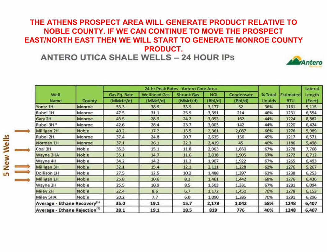
THE ATHENS PROSPECT AREA WILL GENERATE PRODUCT RELATIVE TO
NOBLE COUNTY. IF WE CAN CONTINUE TO MOVE THE PROSPECT
EAST/NORTH EAST THEN WE WILL START TO GENERATE MONROE COUNTY
PRODUCT.
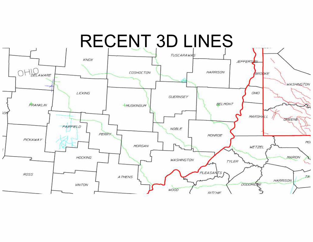
RECENT 3D LINES
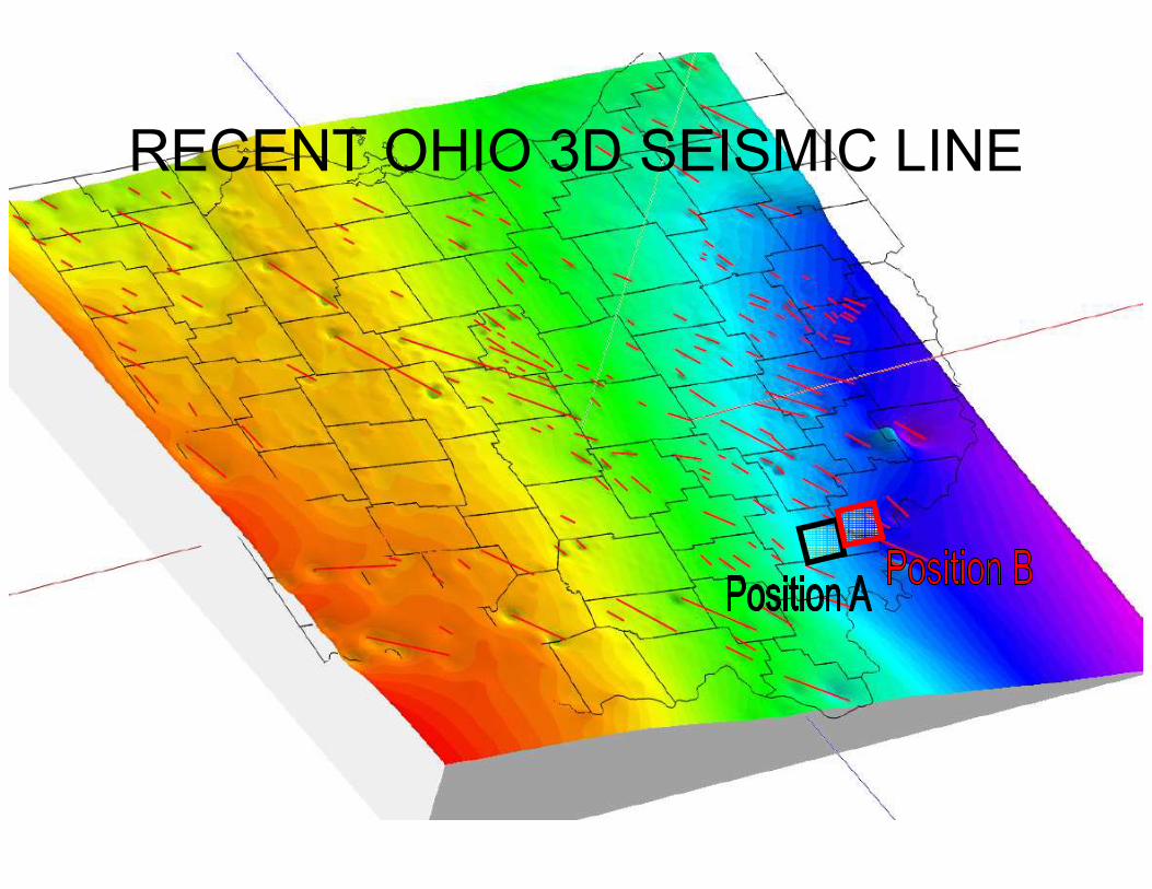
RECENT OHIO 3D SEISMIC LINE
CONCLUSIONS
• EVERY EFFORT HAS BEEN MADE TO VERIFY THE VALIDITY OF THE PROSPECT AREA.
• I HAVE DEMONSTRATED THAT EACH VARIABLE ASSOCIATED WITH A SUCESSFUL UNCONVENTIONAL DRILLING PROJECT EXISTS WITHIN OUR AREA OF OPERATIONS.
• NEW DATA CONFIRMS THESE FINDINGS.
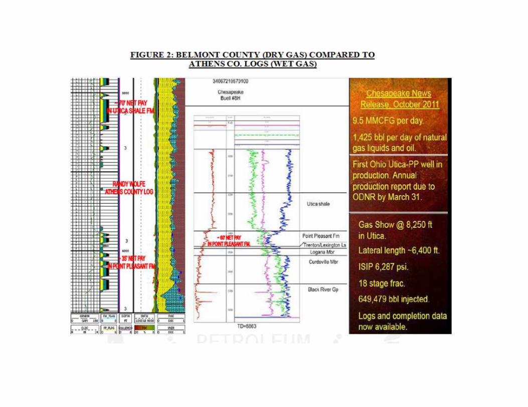
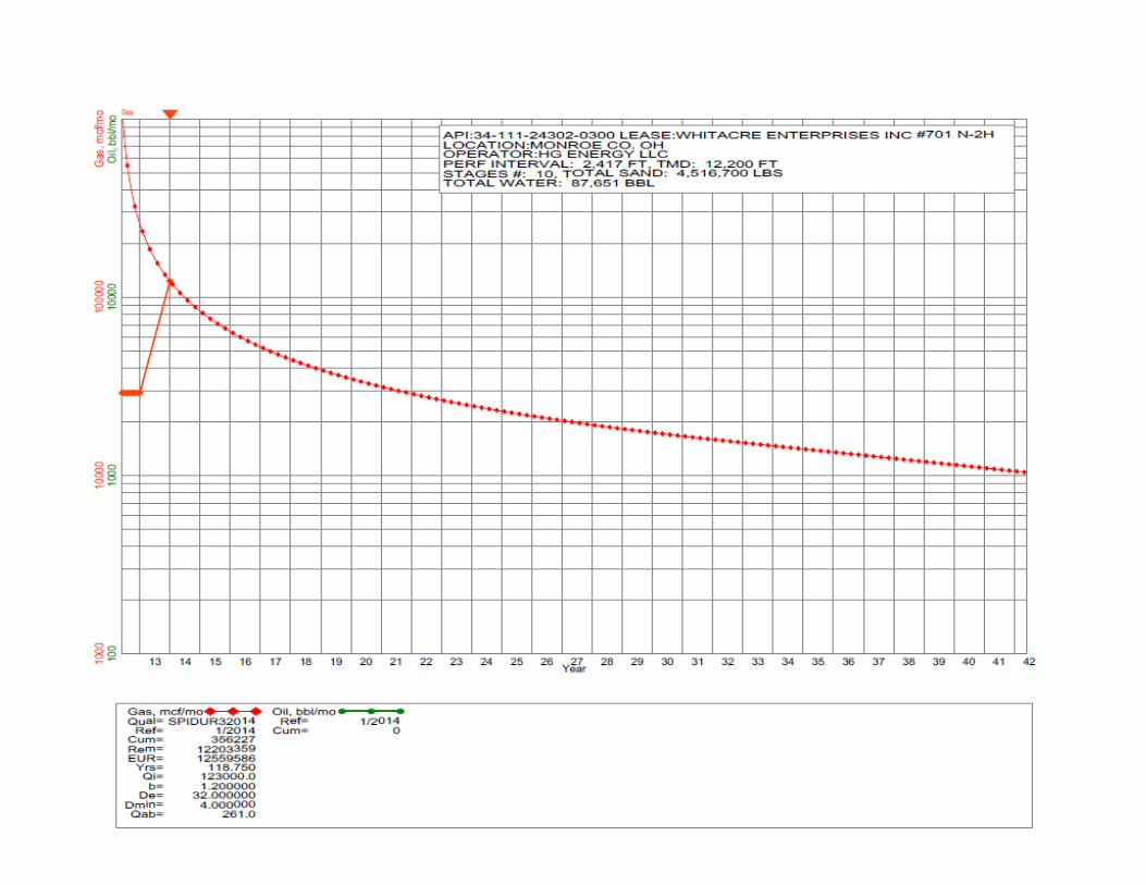
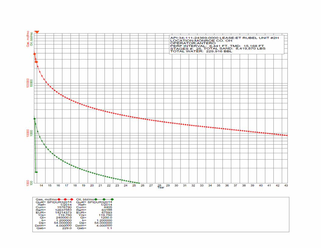
• PRODUCTION DATA PROVIDED SHOWS HIGH NGL EXPECTATION IN ATHENS COUNTY AND INCREASED GAS CONTENT EXISTS EAST OF OUR INITIAL PROSPECT AREA WHICH I WOULD LIKE TO EXPAND.
• THESE ARE THE LIMITS OF MY TALENTS. IF THIS WERE A CONVENTIONAL DRILLING PROJECT I COULD TAKE THIS FROM PERMIT TO PIPELINE.
• ENGINEERING AND GEOLOGY EXPERTS ARE NEEDED TO DETERMINE PROPERLYRUNNING 3D SEISMIC AND VERIFYING ENTRY POINT FOR MAXIMUM RESULTS. ENGINEERING IS RESPONSIBLE FOR GENERATING FINANCIAL SUCCESS RELATIVE TO THE PROPER FRAC DESIGN AND ALL VARIABLES WITH ACCOMPLISHING THAT TASK.
• I WILL DO WHATEVER I CAN TO MAKE THIS A VENTURE WE CAN ALL BE PROUD OF.