assessment of climate trends and projections and their ... · projections and their associated...
TRANSCRIPT

Assessment of climate trends and projections and their associated impacts on the Pacific coast of Canada
James Christian, Robin Brown, Michael Foreman, Karen Hunter, Kim Hyatt
Fisheries and Oceans Canada

ACCASP stands for Aquatic Climate Change Adaptation Services Program
This is the Fisheries and Oceans Canada contribution to a government-wide effort to address climate change adaptation.
This is a Science program developed in close coordination with other 'sectors' (Policy, Fisheries Management, Fisheries Protection Program) of the Department.
Science participants included "Trends and projections" and "Impacts, vulnerabilities and opportunities" teams for each of four Large Aquatic Basins.
What is ACCASP?

ACCASP Large Aquatic Basins

Pacific LAB subdomains
GOA
WCVI
SoGNC

A trend is based on past observations, and the length of the observational records varies.
A projection is estimated from climate model output based on assumptions about future anthropogenic greenhouse gas emissions. We make projections only for the 50 year timescale.
In the North Pacific, climate variability is large relative to anthropogenic trends. Climate model projections have no predictive skill on the 10-year time scale. Trends based on less than 20-30 yearsof data can not be assumed to represent long-term trends.

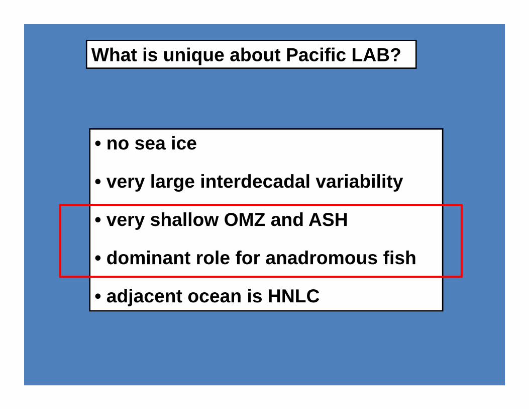
What is unique about Pacific LAB?
• no sea ice
• very large interdecadal variability
• very shallow OMZ and ASH
• dominant role for anadromous fish
• adjacent ocean is HNLC
What is unique about Pacific LAB?
• no sea ice
• very large interdecadal variability
• very shallow OMZ and ASH
• dominant role for anadromous fish
• adjacent ocean is HNLC

CanESM2 ocean grid
Projections require downscaling for all sub‐basins except the open Gulf of Alaska.

Domain of regional downscaling model (Masson, Morrison, Foreman, Callendar, Pena)

CanRCM grid (45 km)

Duration (years) Trend (ºC / 100 y)Amphitrite Point 76 0.77 ± 0.60Kains Island 76 0.57 ± 0.74Entrance Island 74 1.48 ± 0.53Race Rocks 69 1.52 ± 0.57Pine Island 74 0.86 ± 0.80Langara Island 71 0.85 ± 0.75Bonilla Island 51 0.86 ± 1.05Chrome Island 48 3.60 ± 1.86
Coastal temperature time series
Cummins and Masson 2014 Prog Oceanogr 120: 279
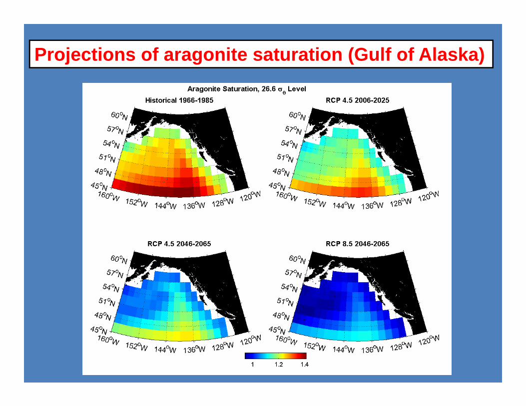
Projections of aragonite saturation (Gulf of Alaska)

OSP (RCP4.5)
Projections of dissolved oxygen (Gulf of Alaska)

Historic temperatures and projected changes over land

Decade
Tahltan Meziadin Docee
Cowichan Somass Okanagan
Frequency of occurrence of temperatures >18˚C in northern and southern salmon-bearing rivers
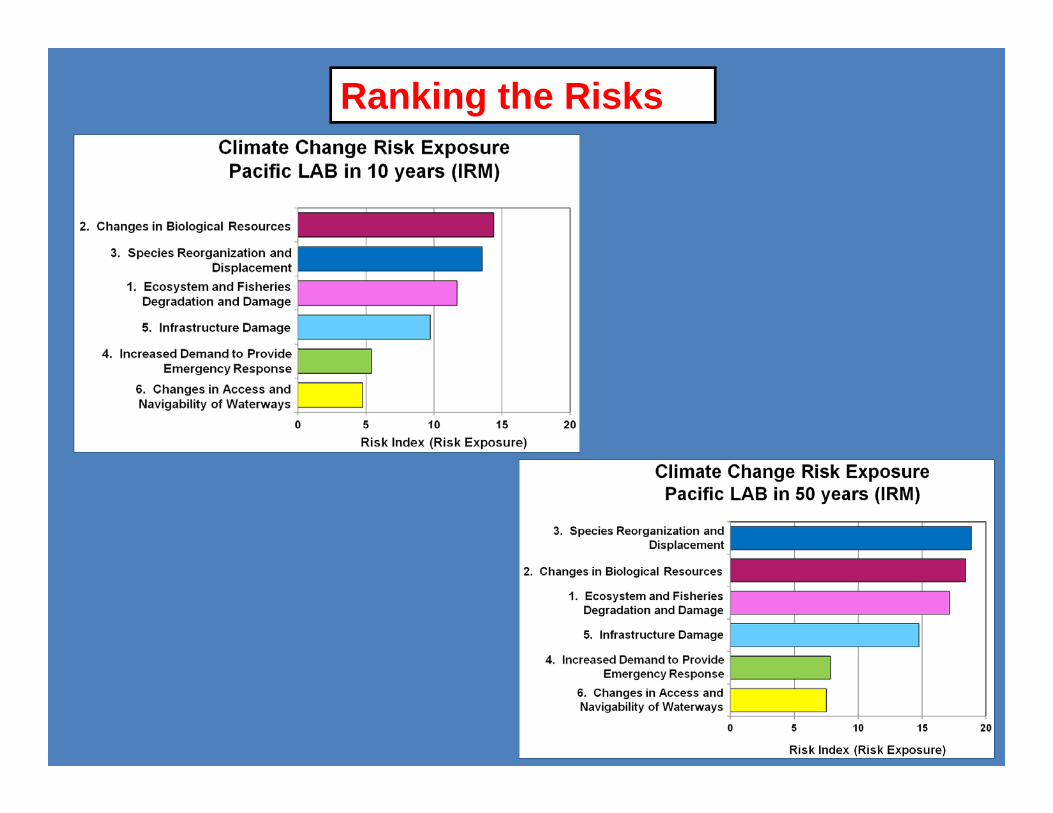
Ranking the Risks

Risk index - all LABs
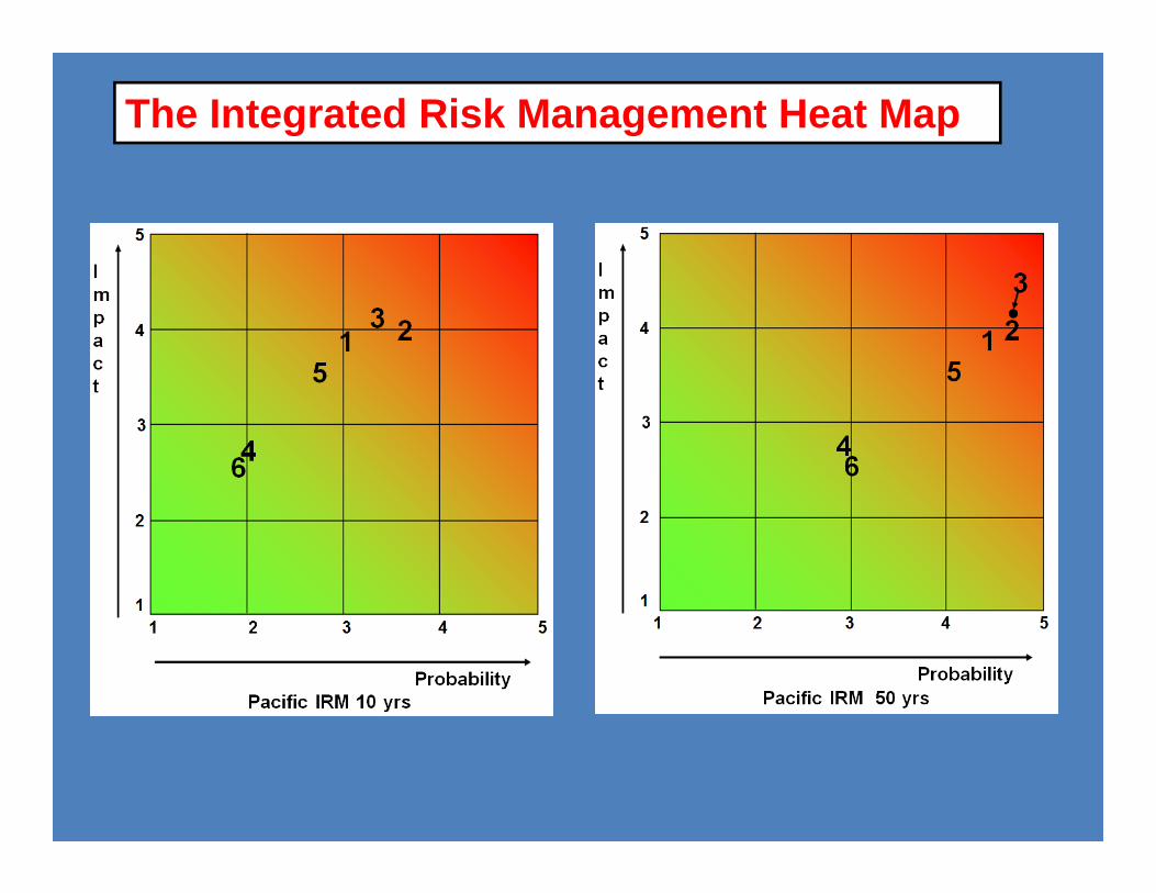
The Integrated Risk Management Heat Map

The Integrated Risk Management Heat Map

The Integrated Risk Management Heat Map
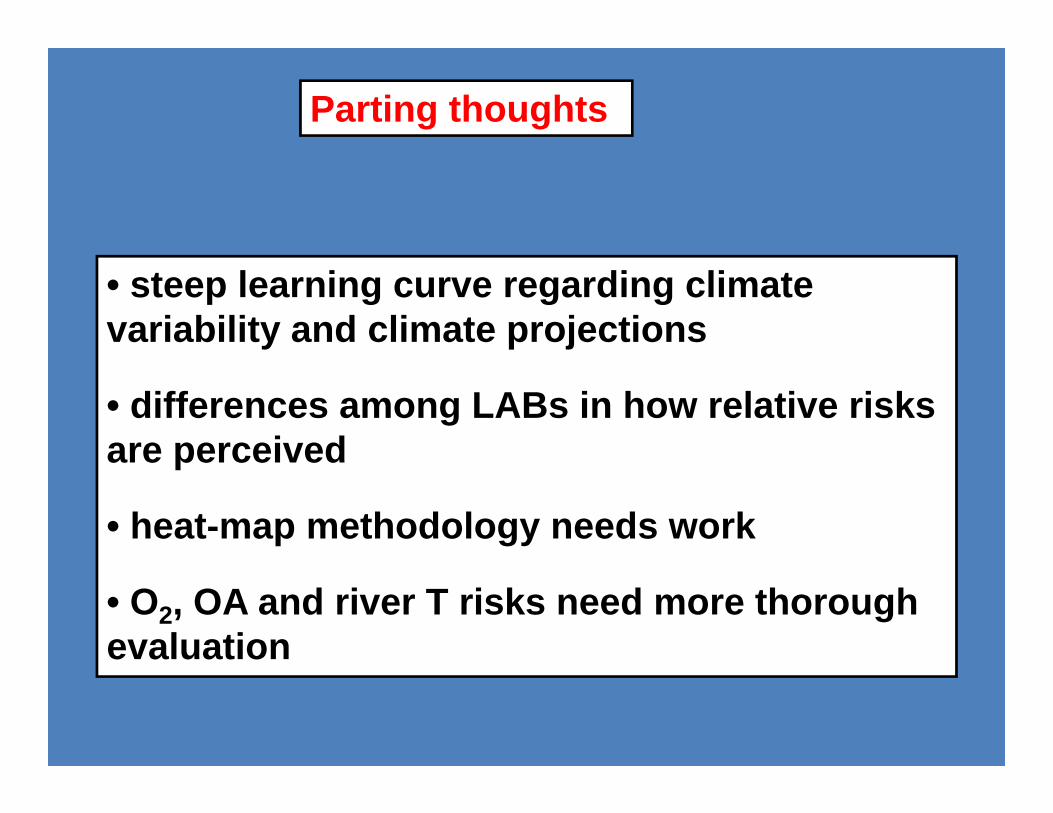
Parting thoughts
• steep learning curve regarding climate variability and climate projections
• differences among LABs in how relative risks are perceived
• heat-map methodology needs work
• O2, OA and river T risks need more thorough evaluation
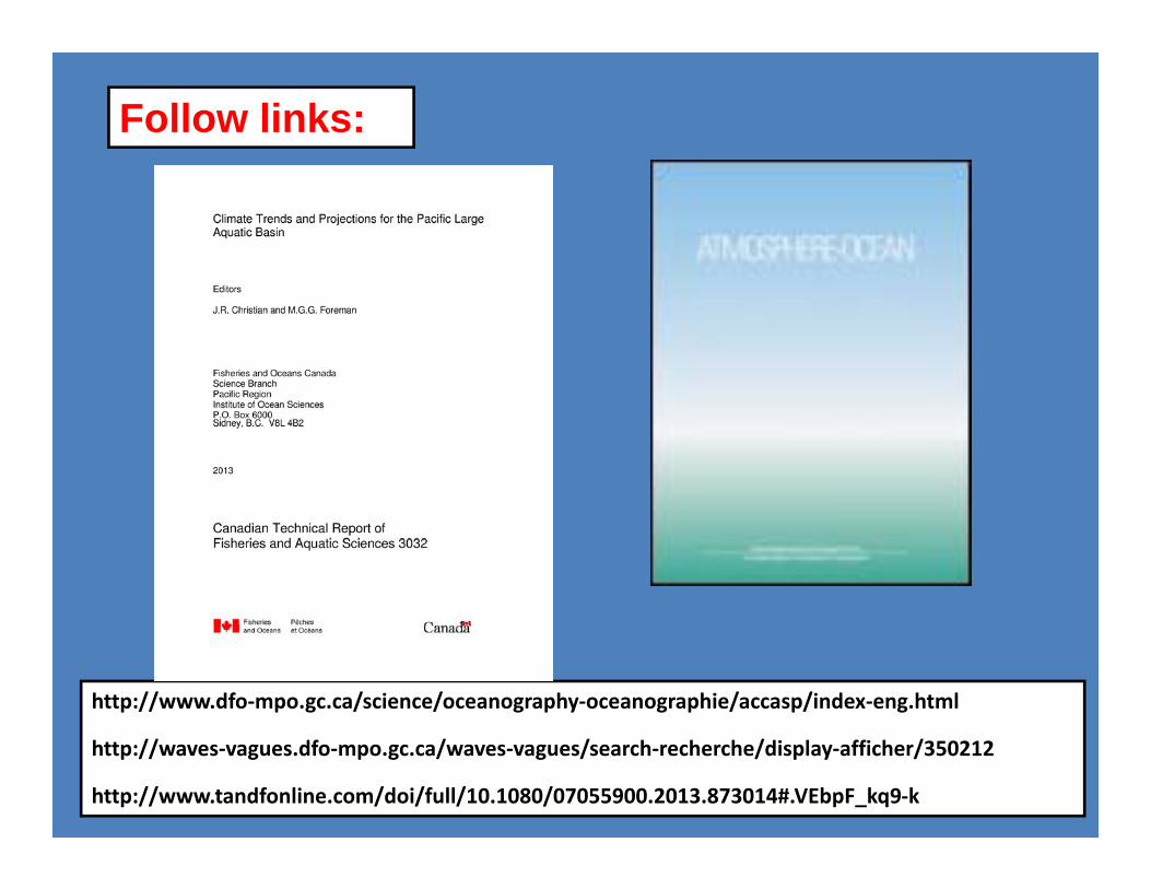
Follow links:
http://www.dfo‐mpo.gc.ca/science/oceanography‐oceanographie/accasp/index‐eng.html
http://waves‐vagues.dfo‐mpo.gc.ca/waves‐vagues/search‐recherche/display‐afficher/350212
http://www.tandfonline.com/doi/full/10.1080/07055900.2013.873014#.VEbpF_kq9‐k