arkansas river decision support system task 1 spatial
TRANSCRIPT

Arkansas River Decision Support System
Task 1 Spatial System Integration
Technical Memorandum for subtask: 1.1.A, Irrigation Canal Mapping
with discussion of subtask 1.1.B, Ditch Service Area Mapping
Prepared for:
Colorado Water Conservation Board
Colorado Division of Water Resources
Prepared by:
September 22, 2020
CWCB Contract No. CT2018-00578

Contents 1.0 Introduction ...................................................................................................................................... 1
2.0 Approach ........................................................................................................................................... 2
2.1 Data Sets used to Assist with Canal Digitizing .............................................................................. 2
2.2 Division 2 Canal Layers and ArkDSS Working GIS Canal Layer ...................................................... 4
2.2.1 Dataset Name: DITCH_D2.shp .............................................................................................. 4
2.2.2 Dataset Name: DITCHTRACE_D2.shp .................................................................................... 5
2.2.3 Dataset Name: DITCHBLWPUEBLO_D2.shp .......................................................................... 6
2.2.4 Dataset Name: NHD_Div2_CanalPipe.shp ............................................................................ 7
2.3 ‘Structure to Parcel’ Canal Digitizing Process ............................................................................... 9
2.4 Revisions to Irrigated Parcel and Diversion Structure Data Sets ................................................ 10
2.5 ‘Parcel to Structure’ Canal Digitization ....................................................................................... 11
3.0 Data Quality and Quantity .............................................................................................................. 13
4.0 Canal Mapping Final Deliverables ................................................................................................... 15
5.0 Discussion of Subtask 1.1.B - Ditch Service Area Mapping ................................................................... 16

1
1.0 Introduction
This memorandum documents the approach and deliverables for subtasks 1.1.A, Irrigation Canal Mapping
and briefly discusses subtask 1.1.B Ditch Service Area Mapping, of the Arkansas River Decision Support
System (ArkDSS). This memorandum and the Task 1.1.A GIS deliverables were prepared by HRS Water
Consultants, Inc. (HRS) and Elephant Fish, LLC. The Colorado Water Conservation Board (CWCB) and the
Colorado Division of Water Resources (CDWR), collectively referred to as the “State”, also assisted in
completing these tasks. Wilson Water Group (WWG) completed extensive interviews of Division 2 Water
Commissioners to improve the assignment of ditches to irrigated parcels and update ditch headgate
locations. HRS, Elephant Fish LLC, WWG, CWCB, and CDWR are referred to herein as the “project team”.
The goals of Subtask 1.1.A and 1.1.B were:
Irrigation Canal Mapping (1.1.A): Improve existing mapping and to create a consistent
Geographic Information System (GIS) layer of irrigation canals to enable estimation of canal
efficiencies and improve understanding of irrigation delivery systems
Ditch Service Area Mapping (1.1.B): Create a ditch service area polygon coverage using canal
mapping, irrigated parcel data, and information from ditch companies and Division 2 staff.
HRS completed the subtask 1.1.A deliverables using ESRI’s ArcGIS™ Desktop software1, unless otherwise
noted. As discussed later in this memorandum, subtask 1.1.B was primarily completed by CDWR staff
(K. Thompson). Because the irrigation canal mapping subtask was complex and largely dictated the
results of the ditch service area subtask (along with the Task 1.3 irrigated parcel mapping), the majority
of this memorandum describes the approach and deliverables for subtask 1.1.A.
The definitions of several key terms used in this memorandum are defined below:
Canal: includes irrigation canals, irrigation ditches, irrigation pipelines, laterals, and drains
Trace: refers to digitized GIS polylines that follow the location and extent of canals, where each
trace represents either a portion of a canal or the entire canal (i.e., one canal may be made up
of 5 traces snapped together at the end vertex of each trace).
Surface water diversion ID (SW-WDID number): refers to the unique identifier that is given to a
diversion structure and its associated canal by the State Engineer’s Office (SEO).
Figure 1 presents a flowchart of the irrigation canal task approach, data sets, interim results, and
deliverables. The following sections of this memorandum are organized according to the boxes shown
on the flowchart.
1 The use of trade names is for purposes of documentation only and does not constituent an endorsement of any product.

2
Figure 1 – Basic irrigation canal digitization workflow
2.0 Approach HRS compiled existing data including aerial imagery, map and filing statements, GIS irrigated parcel
datasets, previously digitized ditch traces, the National Hydrography Dataset (NHD), and diversion
structure locations (e.g., ditch headgates from Hydrobase). These data were used to interpret the
location and extent of unmapped canals or adjust incorrectly mapped irrigation canals throughout
Division 2. Per the subtask 1.1.a scope, laterals and drains were generally not mapped unless they were
already included in a previously completed GIS coverage. HRS assigned the SW-WDID and canal name to
each canal trace. These values were input using the text as contained in the Colorado Decision Support
System’s (CDSS) HydroBase database. The digitization process involved consideration of a wide number
of data sets. In some cases areas of uncertainty were iteratively edited based on meetings with the
State, WWG, and the Division 2 GIS staff. HRS extensively revised canal traces and associated SW-WDIDs
per updates made to irrigated parcel SW-WDIDs and diversion structure locations by Division 2 Water
Commissioners. Additions to the canal GIS dataset were made concurrently with the work performed by
HRS under Task 1.3, Irrigated Parcel Datasets. Digitizing irrigated acreage helped to identify areas were
canal traces were missing or incorrectly attributed or mapped.
2.1 Data Sets used to Assist with Canal Digitizing Performing a holistic evaluation using all the available data was critical to correctly identifying and
attributing canals. Many canals required developing an assessment based on the weight of evidence
from disparate and sometimes conflicting data sets. The primary sources of data included:
Recent Air Photos / Imagery

3
o ESRI’s world imagery basemap.
Provided relatively current conditions (2016-2018) associated with the canals.
Historic Imagery
o Compiled under ArkDSS Subtask 1.2, Historical Aerial Photos; includes black and white
or color infrared images from snapshot years 1999, 1998, 1988, 1975, and/or 1954;
these images provide historic conditions associated with the canals.
Google Earth
o Provided additional, close-up visual insights, including “Street View” ground level
details, to help locate diversion structures that pass under roads or other features that
complicate identification of ditch traces from air photos.
2010 Irrigated parcel dataset
o An important dataset provided by the SEO.
The dataset is a GIS polygon shapefile representing the extent of irrigated
parcels and the associated SW-WDID for 2010.
This dataset provides insight to the general location, extent, and flow direction
of canals.
The dataset was updated with revised SW-WDID assignments to irrigated
parcels based on extensive meetings between WWG, Water Commissioners,
and the SEO.
o Revisions made to this dataset were reflected in the canal digitization process.
Map and Filing Statements
o If a canal trace was difficult to locate in aerial imagery, especially before the irrigated
parcel dataset was revised, map and filing statements provided some insight into the
location and extent of ditches, particularly for older or historic canals.
Diversion Structure Locations/Ditch Headgate GIS dataset
o Provided a starting location and SW-WDID for canal headgates.
o Some diversion structure locations in the initially provided GIS dataset were not
accurate as they are located by Public Land Survey System (PLSS) section
quarter/quarters (i.e., only located to within a 10-acre parcel) rather than with more
accurate global positioning system coordinates. The inaccurate locations are particularly
associated with older diversion structures.
o Diversion structure locations were also updated based on the meetings between WWG,
Water Commissioners, and the SEO.
Water Court Decrees
o Occasionally provided information on the location and extent of canals.
Straightline Diagrams
o Provided by Division 2; the diagrams give general information on the direction a canal
extends from a river and location on the river relative to other structures.
Existing GIS Canal Mapping
o United States Geological Survey (USGS) National Hydrography Dataset (NHD)
Includes GIS polylines of canals, ditches, and pipelines digitized primarily based
on USGS topographic maps.

4
Downloaded from the USGS National Map
(https://viewer.nationalmap.gov/basic/).
o Division 2 previously mapped/digitized canals
Located within the H-I Model Area, the Purgatoire River Water Conservancy
District, and other areas of the Arkansas River Basin.
The Division 2 GIS team provided HRS with three polyline GIS shapefiles
(datasets) as well as support throughout this task.
Division 2’s previously digitized datasets are discussed in the section below.
2.2 Division 2 Canal Layers and ArkDSS Working GIS Canal Layer HRS reviewed four existing GIS canal mapping datasets including three datasets provided by the Division
2 GIS team and one dataset extracted from the USGS Subregion 1102 NHD geodatabase. The three GIS
coverages provided by Division 2 included a significant amount of canal traces that had been digitized
for previous projects. The extracted NHD data included polylines classified as either ‘canal/ditch’ or
‘pipe’ in the attribute table. A brief discussion of each existing GIS dataset and associated figures are
provided below.
2.2.1 Dataset Name: DITCH_D2.shp
Source: Division 2 GIS team
Consists of 61 canal traces with most of the traces within Water Districts 14 and 79.
The attribute table includes the SW-WDID of each canal as well as the canal name and additional
information such as owner, case number, and comments.
The location and extent of canals included in the DITCH_D2 GIS shapefile are shown below in
Figure 2.

5
Figure 2 – Location and extent of the Division 2 GIS dataset – DITCH_D2
2.2.2 Dataset Name: DITCHTRACE_D2.shp
Source: Division 2 GIS team
Consists of 1,102 traces extending throughout all Water Districts in Division 2.
The attribute table includes the SW-WDID of each canal as well as the canal name and additional
information such as owner, case number, date that diversion began, ditch use, and comments.
The location and extent of canals included in the DITCHTRACE_D2 GIS shapefile are shown
below in Figure 3.
6
Figure 3 – Location and extent of Division 2 dataset – DITCHTRACE_D2
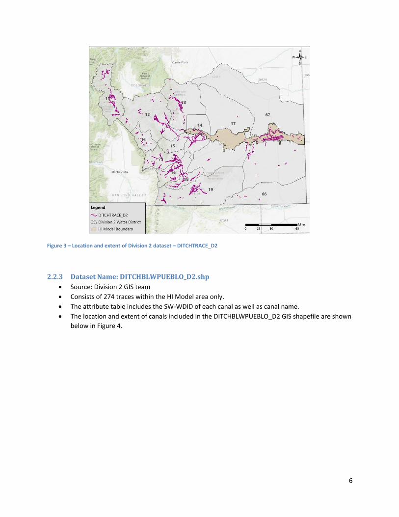
2.2.3 Dataset Name: DITCHBLWPUEBLO_D2.shp
Source: Division 2 GIS team
Consists of 274 traces within the HI Model area only.
The attribute table includes the SW-WDID of each canal as well as canal name.
The location and extent of canals included in the DITCHBLWPUEBLO_D2 GIS shapefile are shown
below in Figure 4.

7
Figure 4 - Location and extent of Division 2 dataset – DITCHBLWPUEBLO_D2
2.2.4 Dataset Name: NHD_Div2_CanalPipe.shp
Source: UGSG NHD
Consists of 3,512 traces extending throughout all districts in Division 2.
Traces in this dataset were extracted from the USGS Subregion 1102 NHD geodatabase based on
the attribute table, where FType = CanalDitch or FType = Pipeline.
In some cases, the canal name is given in the attribute table.
o Canal names in the USGS NHD are primarily based on names provided on topographic
maps. These names do not necessarily match the names of traces in the CDSS
Hydrobase database.
The location and extent of canals included in the NHD_Div2_CanalPipe GIS shapefile are shown
below in Figure 5.

8
Figure 5 - Location and extent of USGS NHD dataset – NHD_Div2_CanalPipe
The existing Division 2 and NHD canal GIS layers were merged into a single, comprehensive GIS dataset.
An attribute field named ‘Data_Source’ was added to the dataset to identify the source of each digitized
trace. This dataset became the starting point of the digitization effort and will be referred to as the
working GIS canal layer.
A consequence of merging the four existing datasets together was that the working GIS canal layer
contained duplicate and/or overlapping or conflicting traces. The duplicate traces were identified using
two methods. The first method utilized a Microsoft Access database query that identified traces sharing
either the same name or same SW-WDID. This query identified 105 duplicate traces. The second method
involved a topologic examination that identified overlapping or crossing traces. This method was done in
ArcMap using ET GeoWizards’ tool, “Clean Polyline Layer”, which identifies overlapping polylines with a
new exported shapefile. The topologic check resulted in 113 overlapping traces.
After duplicate or overlapping traces were identified, HRS provided the Division 2 GIS team with the list
of duplicate traces, grouped either by name or SW-WDID. In response, the Division 2 GIS team provided
their recommendations for which traces to retain and which traces to mark for removal in the working
GIS canal layer. These recommendations were integrated into the working GIS canal layer’s attribute
table under the attribute field ‘COMMENT_HRS’.

9
2.3 ‘Structure to Parcel’ Canal Digitizing Process After the working GIS canal layer was organized, the canal digitization process began. The SEO provided
a list of approximately 1,140 diversion structure SW-WDIDs that they recommended to be included in
the final canal mapping layer, of which only 281 had a corresponding ditch trace in the working GIS canal
layer. The SEO also provided the 2010 irrigated parcel GIS dataset for Division 2 which was to be used as
a guide for the canal trace locations and extent. The initial digitization method is termed the “structure
to parcel” method because the process started with the diversion structure location (headgate), then
the canal was traces to the associated irrigated parcels. The general structure to parcel process is
shown in the flow chart below.
Figure 6 – Structure to Parcel Method Flow Chart of General Steps
The structure to parcel method involved:
Identifying each diversion structure location by merging the SW-WDIDs given in the SEO
diversion structure list with the SW-WDID locations downloaded from the CIM website.
Locating corresponding parcel(s) in the 2010 irrigated parcel dataset (i.e., parcel(s) containing
the same SW-WDID assignment as the diversion structure).
Using aerial imagery to digitize the extent and location of the canal from the diversion structure
to and around the irrigated parcel(s).
If the aerial imagery was not definitive, using other data sources such as straight line drawings,
decrees, topographic maps, or map and filing statements to help determine the location and
extent of the canal trace.

10
Initially HRS was unable to locate many ditches. As this challenging work progressed, it became clear
that: 1) some diversion structures were incorrectly located downstream of their assigned irrigated
parcel(s); 2) some SW-WDIDs assigned to irrigated parcel(s) had been abandoned; and/or, 3) some SW-
WDIDs assigned to parcel(s) were adjacent to previously digitized canals that did not share the same
SW-WDID. Due to this and other discrepancies discovered by the project team, digitization of canal
traces was paused to hold meetings between the SEO, WWG, and Division 2 Water Commissioners to
review and update the irrigated parcel SW-WDID assignments in the 2010 irrigated parcel dataset.
2.4 Revisions to Irrigated Parcel and Diversion Structure Data Sets During the meetings between the SEO, WWG, and Division 2 Water Commissioners, the SW-WDID for
each irrigated parcel was identified on a highly detailed parcel-by-parcel basis. HRS assisted with the
meetings by providing WWG with screenshots and maps of known discrepancies between the SW-WDID
parcel assignments and the adjacent diversion structures and ditch traces. An example of one of these
screenshots is shown below in Figure 6.
Figure 7 – Example screenshot sent to WWG to assist with correcting the irrigated parcel SW-WDID assignments. In this screenshot the SW-WDID assigned to the irrigated parcel does not match the diversion structure and associated canal trace.
Significant revisions to the irrigated parcel SW-WDID assignments for the 2010 irrigated parcel GIS
dataset were identified. Many diversion structure locations were updated and parcel extents and
assigned SW-WDIDs were revised. The SEO revised the 2010 irrigated parcel GIS dataset and HRS revised

11
the working GIS canal layer accordingly. In addition, Water Commissioners often included helpful notes
or sketched canal traces on maps used during the interviews. These notes and sketches were reviewed
by HRS and integrated into the working GIS canal layer.
An example of the usefulness of the revisions is shown in Figure 8, where the generalized flow direction
vectors drawn between the diversion structures and the associated irrigated parcels are shown before
and after the revisions. Following the revisions HRS continued the digitization process, but with an
additional method discussed in the section below.
Figure 8 – Example direction vectors drawn between the diversion structure (headgate) and associated irrigated parcel before and after the revisions to the irrigated parcel and diversion structure datasets (District 12).
2.5 ‘Parcel to Structure’ Canal Digitization After the 2010 irrigated parcel GIS dataset was updated with the Water Commissioners’ revisions and
verified by the SEO, HRS continued the canal digitization task using an additional new method referred
to as the ‘parcel to structure’ method. This method used the irrigated parcel as the starting point, rather
than the diversion structure, and the canal trace was digitized back, or upstream, to the diversion
structure.

12
Figure 9 – Parcel to Structure Method Flow Chart of General Steps
The SW-WDIDs added during the parcel revisions that were not already in the structures list were
exported from the revised 2010 irrigated parcel GIS dataset and were added to the original list of
diversion structure SW-WDIDs initially provided to HRS by the SEO. This step added approximately 200
canals to the original list that needed to be digitized or identified in the working GIS canal layer. The
parcel to structure step was completed to ensure that every parcel in the 2010 irrigated parcel dataset
had a corresponding canal and headgate.
At the end of the parcel to structure and structure to parcel digitization processes, the working GIS canal
layer consisted of over 6,000 traces including the previously digitized Division 2 and NHD traces as well
as the newly digitized HRS traces. Some canals consisted of multiple individual traces snapped together
at end vertices, rather than one continuous trace. At this point, approximately 3,400 of the 6,000 canal
traces did not have a SW-WDID assigned to them.
Assigning SW-WDIDs to canal traces consisted of a visual check to look for either adjacent diversion
structures that had been located by GPS or adjacent irrigated parcels that gave an indication of SW-
WDID assignment. Traces that could not be identified with a SW-WDID during the visual check were
marked for deletion in the working GIS canal layer attribute table. Of the 3,400 traces without an
assigned SW-WDID, approximately 600 were assigned a SW-WDID using the visual check method. The
remaining 2,800 were marked for deletion in the working GIS canal layer.
Canal laterals were included in the working GIS canal layer only if they were digitized based on easily
identifiable traces in aerial imagery, or if previously digitized traces in the working GIS canal layer

13
contained laterals that could be identified with a SW-WDID. Most of the previously digitized laterals
were sourced from the NHD dataset.
3.0 Data Quality and Quantity
The digitized deliverable canal traces closely match the alignment and extent of what would be
reasonably interpreted using aerial imagery and the other supporting data sets. As with all mapped
features, there will invariably be some degree of difference between a given mapped canal trace and
the actual canal channel. Some factors that lead to these differences include:
Small spatial offsets in georeferenced images or changes in the physical ditch location over time
Difficulty seeing canals on images due to snow, vegetation, clouds, or shadowing
Canals that have a complex set of numerous laterals with no discernable main channel
Previously mapped canal traces from Division 2 and the USGS NHD were re-digitized if the trace was
significantly different from what was interpreted using the current aerial imagery and other data sets.
Some examples of when an existing trace was re-digitized include:
Obvious re-alignment of the canal through time as evidenced in historic and more recent aerial
images
The original canal was digitized based on a generalized description in decree rather than an
aerial image
A preliminary draft GIS canal layer was delivered to the SEO in April 2018. The SEO returned the dataset
with several newly digitized traces as well as traces with identified SW-WDID(s) and canal names. Those
revisions were incorporated into the final GIS canal layer.
A list of 1,444 diversion structures with unique SW-WDIDs was compiled by combining the original SW-
WDID list provided by the SEO and the additional SW-WDIDs included in the revised 2010 irrigated
parcel dataset. Of the 1,444 unique SW-WDIDs, 1,136 of the associated canals were successfully located
and either digitized or retained a trace from an existing dataset to generate the final GIS canal layer. The
remaining 308 SW-WDIDs without an associated digitized canal primarily included reservoirs, wells, and
springs.
Some ditches and canals that were part of the USGS NHD dataset, but not included in either the original
SW-WDID SEO list or the 2010 irrigated parcel dataset were retained for the final GIS canal layer. These
included the ditches that could be assigned a SW-WDID either by the name provided in the NHD
attribute table or adjacent irrigated parcel(s). With the addition of these USGS NHD traces, the final GIS
canal layer includes 1,534 unique SW-WDIDs, of which a little over half are newly digitized traces. Figure

14
10 shows the breakdown of sources for the canal traces. The source(s) and extent of the final GIS canal
layer is shown on Figure 11. The final digital datasets were delivered to the SEO on May 10, 2019.
Figure 10 – Breakdown of source(s) for each canal trace in the final canal mapping layer.

15
Figure 11 – Location and extent of canals included in the final GIS canal layer.
4.0 Canal Mapping Final Deliverables As outlined in the Subtask 1.1.A scope of work, HRS provided the following GIS data deliverable:
A GIS layer of irrigation canal and ditch lines for Division 2 that includes SW-WDID, ditch name,
and a column to distinguish between main canal, lateral lines, and drain lines. Flow direction is
also indicated in the data layer.
HRS provided two versions of the deliverable:
Two polyline shapefiles of canal and ditch lines
o Working_Canal_GIS_Layer – This polyline shapefile contains all the traces, undissolved,
including those traces marked for deletion
o Final_Canal_GIS_Layer – This polyline shapefile contains the dissolved traces (i.e., one
line for each canal) with assigned SW-WDID
A data dictionary describing the GIS data sets’ attribute fields is included as Attachment A.
The final digital datasets were delivered to the SEO and Division 2 on May 10, 2019. The State reviewed
and refined the datasets for further use in ArkDSS and will continue to improve the datasets.

16
5.0 Discussion of Subtask 1.1.B - Ditch Service Area Mapping Although task 1.1.B was part of the original scope, HRS and CDWR jointly decided at a meeting in
November 2017 that CDWR would complete this task rather than HRS.
The goal of Subtask 1.1.B was to create a ditch service area GIS polygon coverage containing the
following attributes - WDID, structure name, start year (if required) and end year. CDWR constructed
this GIS coverage using irrigated parcel data with assigned SW-WDIDs (Task 1.3). This coverage was
created by combining all irrigated parcel datasets (i.e. 1954 – current) including parcels that were
determined to not have been irrigated in the snapshot year, then dissolving irrigated parcels by common
SW-WDIDs. A future improvement may be to use canal mapping and any additional information
provided by ditch companies and Division 2 staff to define an outer polygon boundary for each Ditch
Service Area. An example of a small ditch service area is shown below in Figure 12.
Figure 12 – Example of a small ditch service area