argentina - iho€¦ · ar307240 “archipiélago de palmer –de isla trinidad a isla amberes”,...
TRANSCRIPT

Hydrographic Commission on Antarctica
National Report by
ARGENTINA

Survey and charting progress in Antarctica
since last meeting (December 2013)
new charts produced (INT, national, ENC)
AR307240 “Archipiélago de Palmer – De Isla Trinidad a Isla Amberes”, Published in 26-01-2015
AR307240
“Archipiélago de Palmer –
De Isla Trinidad a Isla
Amberes”
Boundaries Scales
North Latitude 63°20.0’S
1:180.000South Latitude 64°18.05’S
West Longitude 63°49.5’W
East Longitude 60°07.0’W

Survey and charting progress in Antarctica
since last meeting (December 2013)
areas surveyed
– Islas Orcadas (INT 9140)
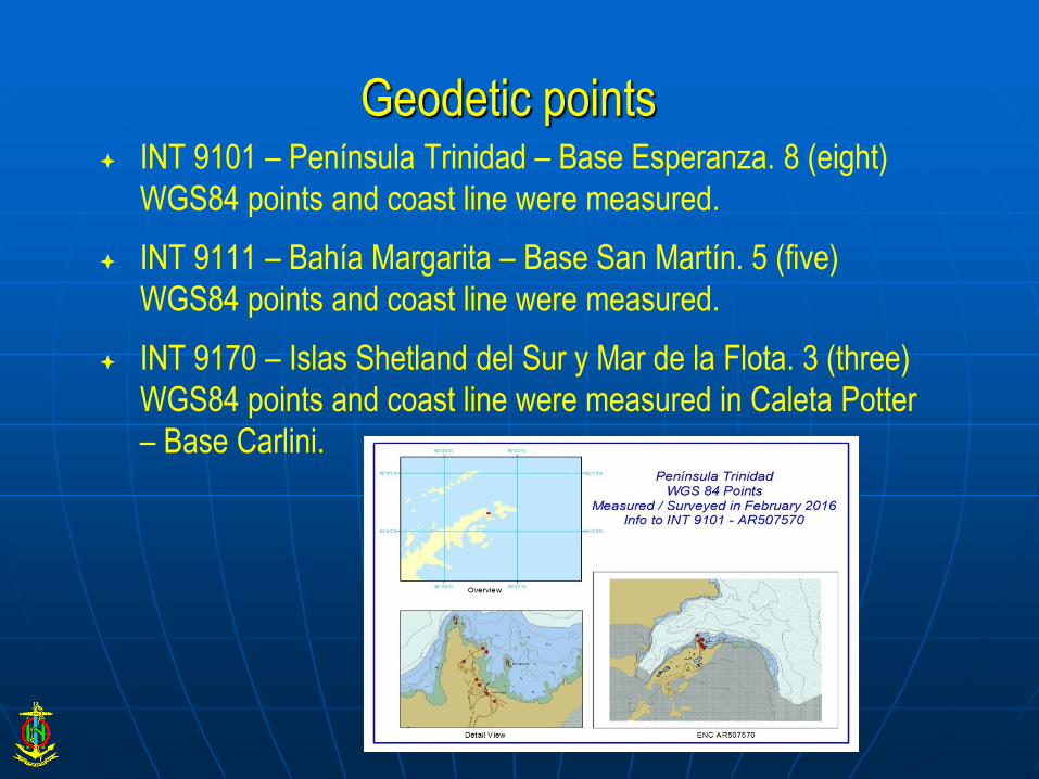
- Geodetic points for:
– INT 9101 – Península Trinidad – Base
Esperanza.
– INT 9111 – Bahía Margarita – Base San Martín.
– INT 9170 – Islas Shetland del Sur y Mar de la
Flota.

2016

2014

Pre 2014
Geodetic points INT 9101 – Península Trinidad – Base Esperanza. 8 (eight)
WGS84 points and coast line were measured.
INT 9111 – Bahía Margarita – Base San Martín. 5 (five)
WGS84 points and coast line were measured.
INT 9170 – Islas Shetland del Sur y Mar de la Flota. 3 (three)
WGS84 points and coast line were measured in Caleta Potter
– Base Carlini.

Status of Relations with Other Organizations
scientific and polar institutes
NGA (US) orthorrectified mosaics for INT charts
– 9101 Peninsula Trinidad
– 9111 Bahia Margarita
– 9115 Active Sound
– 9140 Islas Orcadas
INSTITUTO GEOGRAFICO NACIONAL (IGN)
And INSTITUTO ANTARTICO ARGENTINO
(IAA)

INT 9115 Active Sound
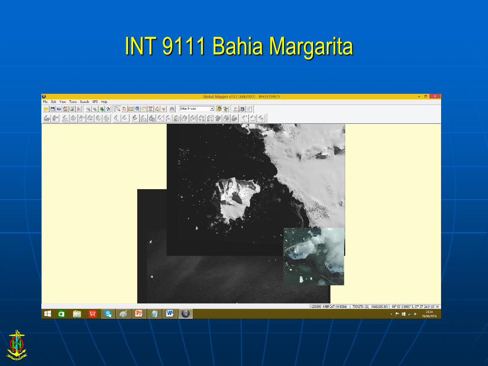
INT 9111 Bahia Margarita

INT 9140 Islas Orcadas
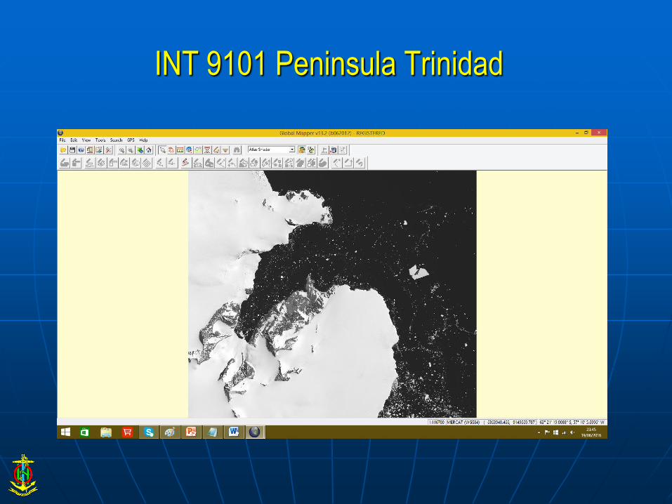
INT 9101 Peninsula Trinidad

Status of Relations with Other Organizations
scientific and polar institutes
INSTITUTO GEOGRAFICO NACIONAL (IGN)
and INSTITUTO ANTARTICO ARGENTINO
(IAA) Geodesy and topography in places of
common interest
E.g. Potter Cove
Coastal DTM

Planned Activities for 2016-17
new charts
– AR506510 “Bahía Scotia”, in production. Expected to be
submitted to IC-ENC during July 2016. (from INT 9142)
AR506510
“Bahía Scotia”
Boundaries Scales
North Latitude 60°43.40’S
1:12.000South Latitude 60°47.10’S
West Longitude 44°45.00’W
East Longitude 44°36.00’W

Planned Activities for 2016-17
new charts
– AR407910 And INT 9111 “Bahía Margarita - Base San
Martín”, in production. For 2017
AR407910
“Bahía Margarita - Base San
Martín”
Boundaries Scales
North Latitude 68°04.00’S
1:22.000South Latitude 68°14.00’S
West Longitude 67°33.00’W
East Longitude 66°55.00’W

Planned Activities for 2016-17
new charts
– AR407570 and INT 9101 “Península Trinidad - Base
Esperanza”, in production. For 2017
AR407570
“Península Trinidad - Base
Esperanza”
Boundaries(*) Scales
North Latitude 63°21.36’S
1:8.000South Latitude 63°25.30’S
West Longitude 57°05.00’W
East Longitude 56°53.00’W

INT 9101 proposal for change of limits
Established limits Proposed limits
Chart title Península Trinidad
Scale 1:10.000
Limit (NE) 63°22.00’S 56°35.00’W 63°21.6’S 56°35.00’W
Limit (SW) 63°26.00’S 57°05.00’W 63°25.3’S 57°05.00’W
Plan title Base Esperanza – Caleta Choza
Scale 1:5.000
Limit (NE) 63°23.50’S 56°58.30’W 63°23.50’S 56°58.45’W
Limit (SW) 63°24.20’S 56°58.30’W 63°24.20’S 57°00.15’W


Planned Activities for 2016-17
new surveys
INT 9140 Islas Orcadas INT 9115. Active Sound
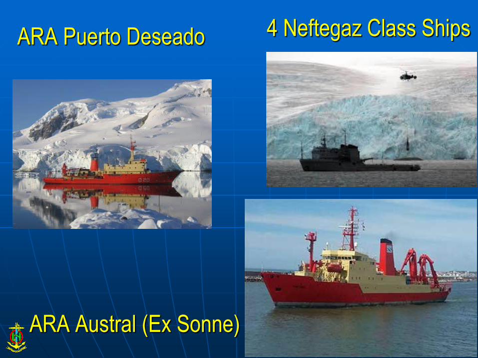
4 Neftegaz Class Ships
ARA Austral (Ex Sonne)
ARA Puerto Deseado

NEW PUBLICATIONS & UPDATES and MSI
Permanent update of publications :
– H – 205 Derrotero Argentino Parte V. “Antártida y Archipiélagos
Subantárticos Argentinos y Suplemento” (Sailing Directions Part V.
Antarctica. H-205).
– H – 213 Faro y Señales Marítimas Parte III. “Tierra del Fuego, canales e
islas adyacentes, Islas Malvinas y Antártida Argentina y Suplemento”
(List of lights and Maritime Signals Part III H-213)
MSI
– Structure in accordance with the area assigned by IMO (NAVAREA VI).
– Transmissions made through Safety NET – INMARSAT – “C” at a pre
established schedule.
– Navigational warnings with ice edges and plotting of drifting icebergs,
broadcasted through Safety NET (INMARSAT).

Capacity building
Course in Antarctic NavigationCourse Date Support Participants / Officers
XXVth Course on Antarctic
Navigation
25th August to 6th September
2014
“Dirección de Educación Naval” of the
Argentine Navy
Argentina Navy (20)
Foreing Navies:
Brasil (1)
Perú (1)
Belgium (1)
Chile (2)
Italy (1)
India (1)
Panamá (1)
Ecuador (1)
Canadá (1)
Merchant Navy (4)
Argentine Coast Guard (4)
listeners / other participants (4)
XXVIth Course on Antarctic
Navigation
24th August to 4th September
2015
“Dirección de Educación Naval” of the
Argentine Navy
Argentina Navy (25)
Foreing Navies:
España (1)
Perú (2)
Chile (2)
Italy (1)
India (1)
Uruguay (1)
Merchant Navy (3)
Argentine Coast Guard (4)
listeners / other participants (1)

Any other matters of relevance to HCA
Ice Charts
from analysis and visual interpretation of satellite images of
high resolution of SENTINEL-1, RADARSAT-2 satellites,
COSMO-SkyMed, AQUA-TERRA-MODIS and MODIS.
The updates of these charts are made according to the
availability of satellite images in the portals Internet providers
such information.
Encoded with WMO standards
SEA ICE COVERAGE MIOS
Encoding and distribution of S-57 Sea Ice Coverage MIO will
be next step an distribution is expected for next southern
summer.

Ice Charts
Sea Ice border
& MIOs
http://www.hidro.gob.ar/Smara/glacio/BH.asp

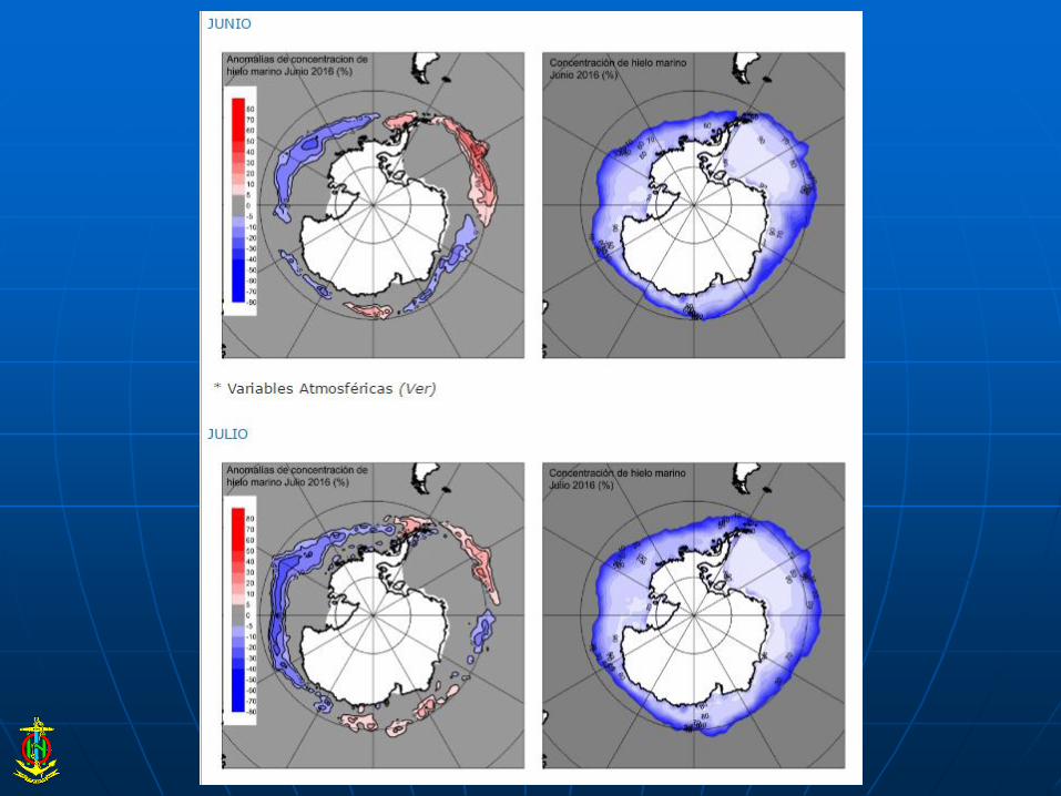
SHN – ARGENTINA’s New product: outcome of the Forecasting Model for Sea Ice
Concentration.
Forecasting model based on the results of Principal Component Analysis applied to the monthly anomalies series of Sea Ice, from which are obtained temporal patterns, valid in some regions of Antarctica, assuming the importance on determining the sea regions around Antarctica that will have Sea Ice Anomalies.
Forecasting model output is improved with Perceptron (an artificial neuronal network dedicated to the images recognition). It is been implemented through the anomalies fields of temperature and pressure associated to the anomalies spatial patterns of SI concentration. The obtained results, so far, are presented as encouraging.
To access the model output: http://www.hidro.gob.ar/smara/sb/sb.asp
A short description of the model: http://www.hidro.gob.ar/smara/sb/sb.asp
POC: [email protected]