(arcgis for autocad, data interoperability & data reviewer ... · pdf file... data...
TRANSCRIPT
Esri Canada User ConferenceToronto, Ontario
Technical Session | October 16, 2012 |
Data Automation (ArcGIS for AutoCAD, Data Interoperability & Data Reviewer)
in ArcGIS 10.1Michael Brown
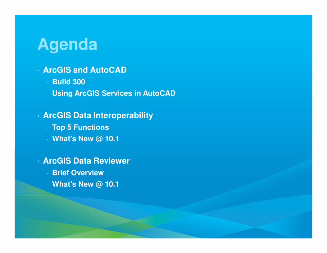
Agenda
• ArcGIS and AutoCAD
- Build 300
- Using ArcGIS Services in AutoCAD
• ArcGIS Data Interoperability
- Top 5 Functions
- What’s New @ 10.1
• ArcGIS Data Reviewer
- Brief Overview
- What’s New @ 10.1
ArcGIS for AutoCAD 300
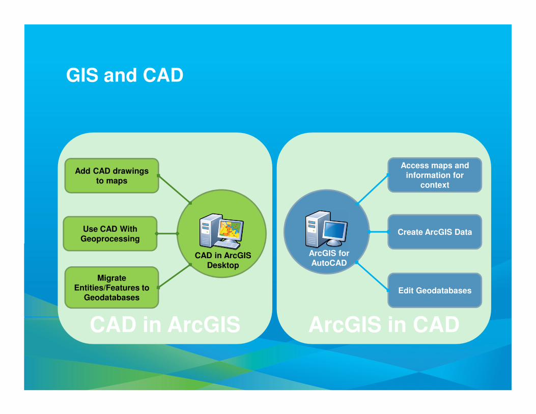
Add CAD drawings to maps
Access maps and information for
context
Create ArcGIS Data
Edit Geodatabases
Use CAD With Geoprocessing
MigrateEntities/Features to
Geodatabases
CAD in ArcGIS Desktop
ArcGIS for AutoCAD
GIS and CAD
CAD in ArcGIS ArcGIS in CAD
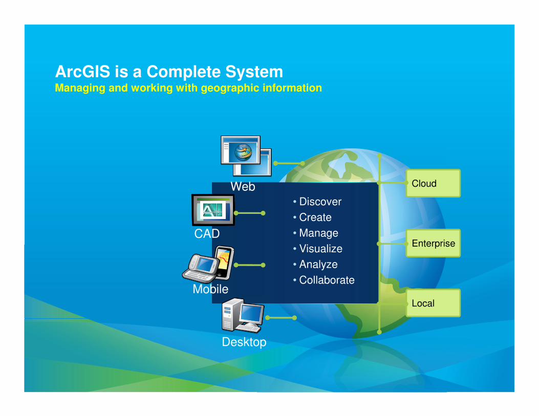
ArcGIS is a Complete SystemManaging and working with geographic information
Cloud
Enterprise
Local
• Discover
• Create
• Manage
• Visualize
• Analyze
• Collaborate
Web
Mobile
Desktop
CAD
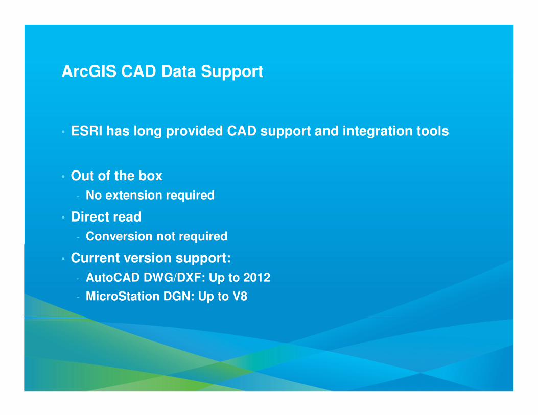
ArcGIS CAD Data Support
• ESRI has long provided CAD support and integration tools
• Out of the box
- No extension required
• Direct read
- Conversion not required
• Current version support:
- AutoCAD DWG/DXF: Up to 2012
- MicroStation DGN: Up to V8
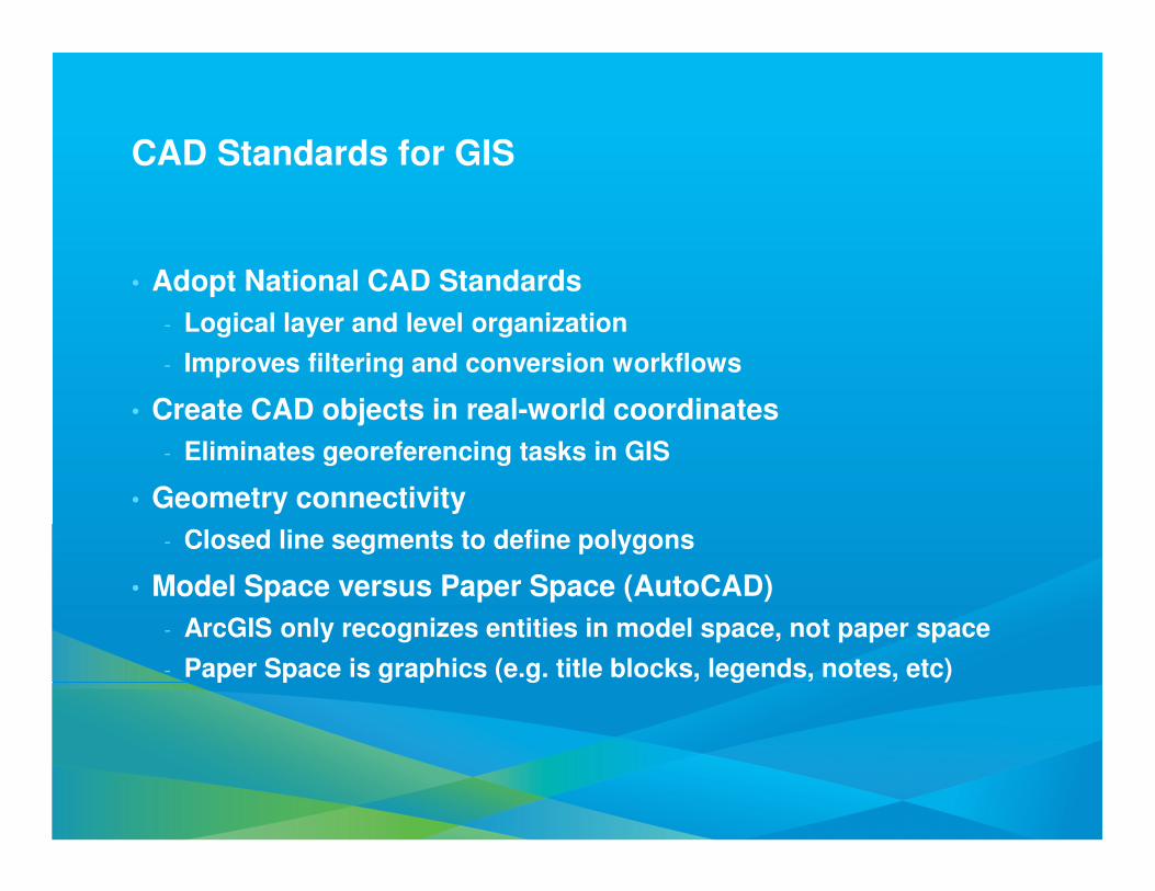
CAD Standards for GIS
• Adopt National CAD Standards
- Logical layer and level organization
- Improves filtering and conversion workflows
• Create CAD objects in real-world coordinates
- Eliminates georeferencing tasks in GIS
• Geometry connectivity
- Closed line segments to define polygons
• Model Space versus Paper Space (AutoCAD)
- ArcGIS only recognizes entities in model space, not paper space
- Paper Space is graphics (e.g. title blocks, legends, notes, etc)
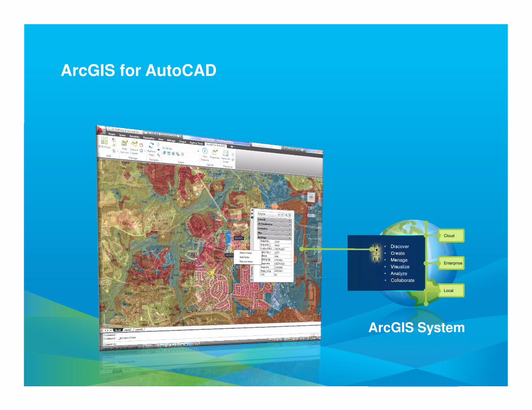
ArcGIS for AutoCAD
Cloud
Enterprise
Local
• Discover
• Create
• Manage
• Visualize
• Analyze
• Collaborate
ArcGIS System
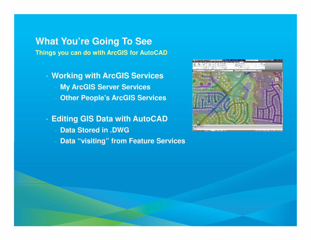
What You’re Going To SeeThings you can do with ArcGIS for AutoCAD
• Working with ArcGIS Services
- My ArcGIS Server Services
- Other People’s ArcGIS Services
• Editing GIS Data with AutoCAD
- Data Stored in .DWG
- Data “visiting” from Feature Services
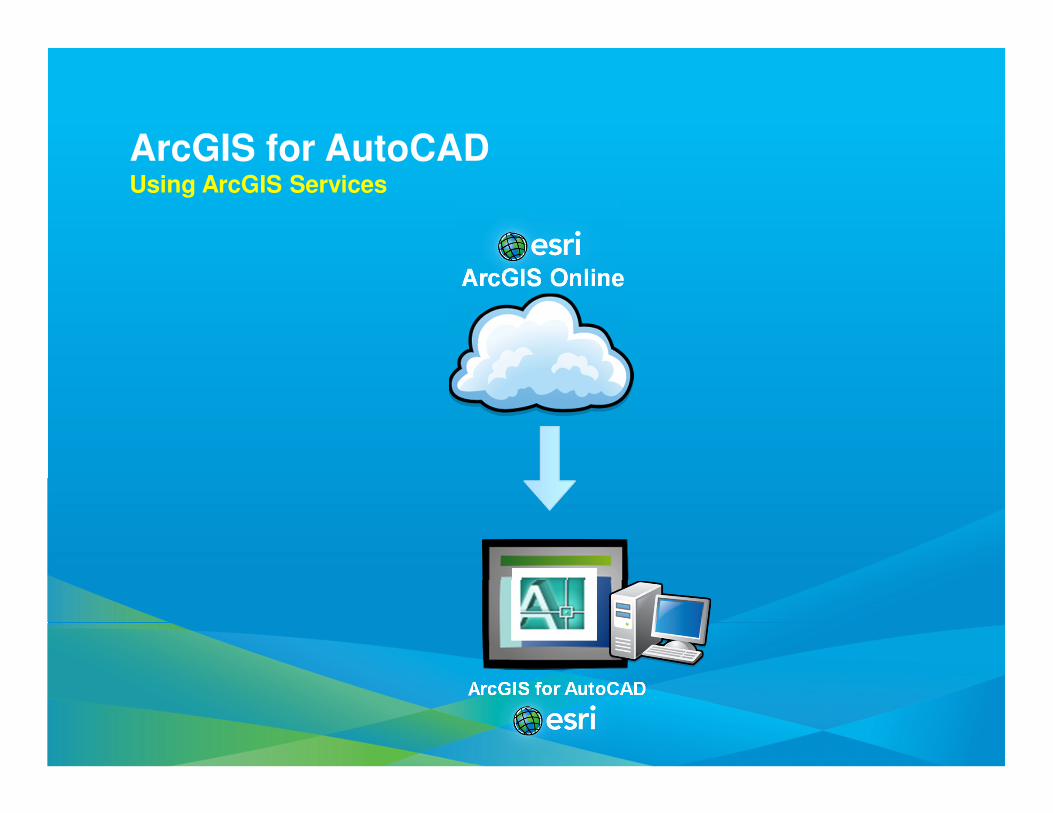
ArcGIS for AutoCADUsing ArcGIS Services
ArcGIS for AutoCAD
ArcGIS Online

DemoAutoCAD using Map Service
ArcGIS for AutoCAD
.DWG Files.DWG Files
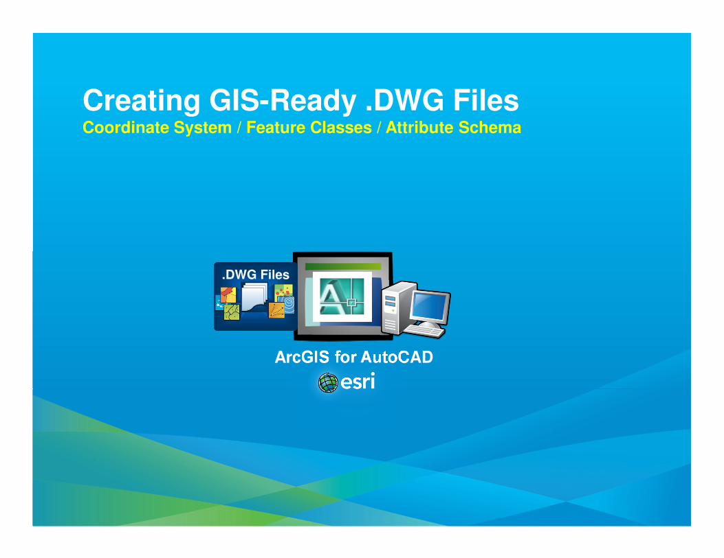
Creating GIS-Ready .DWG FilesCoordinate System / Feature Classes / Attribute Schema
Geodatabase
ArcGIS for AutoCAD
ArcGISDesktop
.DWG with ArcGISFeature Classes
.DWG Files.DWG Files
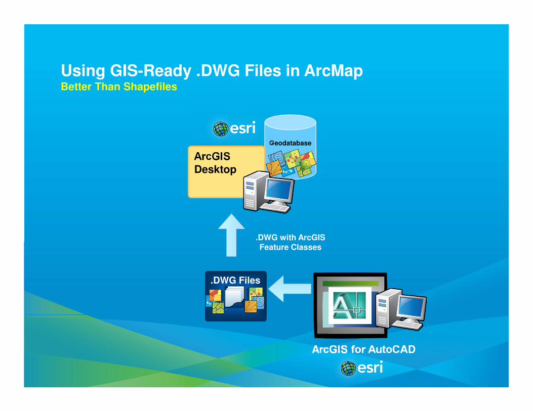
Using GIS-Ready .DWG Files in ArcMapBetter Than Shapefiles
Geodatabase
ArcGIS for AutoCAD
ArcGISDesktop
.DWG Files.DWG Files
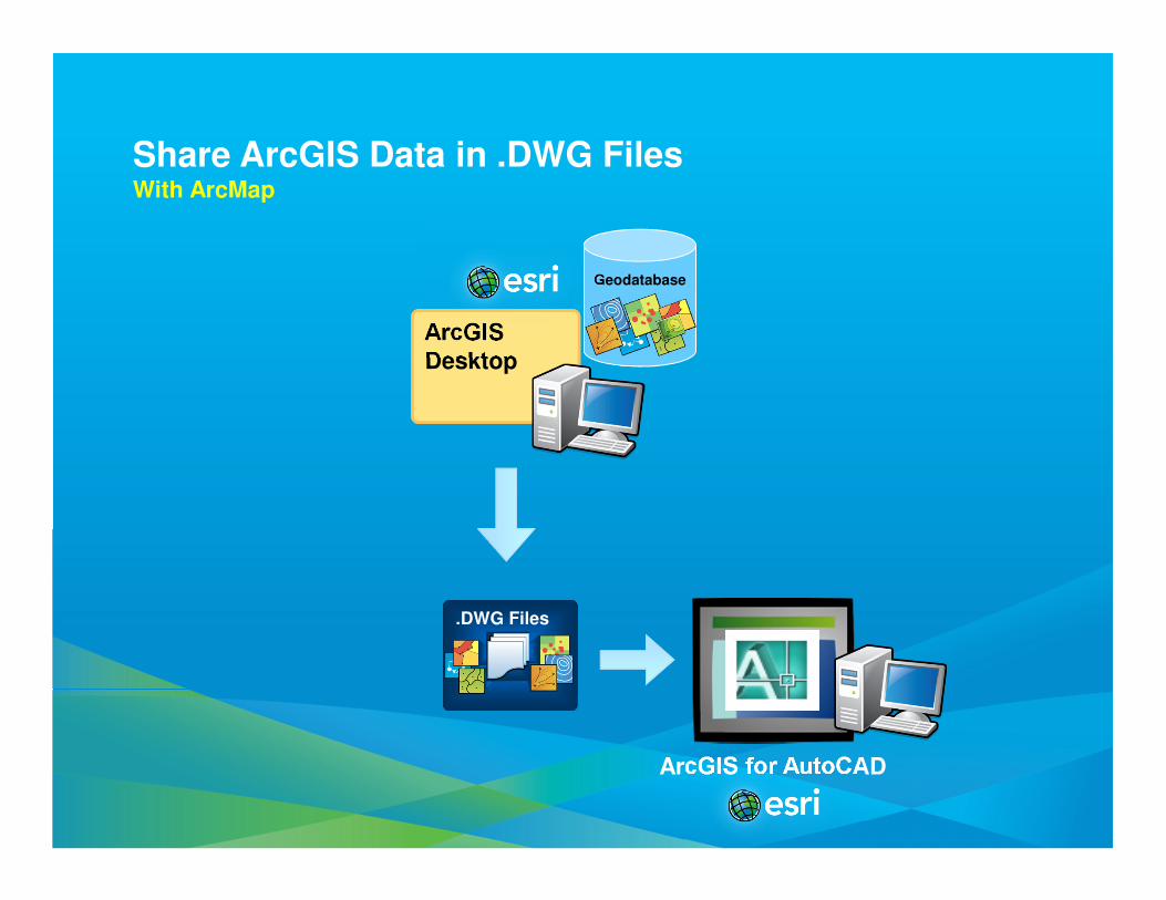
Share ArcGIS Data in .DWG FilesWith ArcMap
Geodatabase
ArcGIS for AutoCAD
ArcGISDesktop
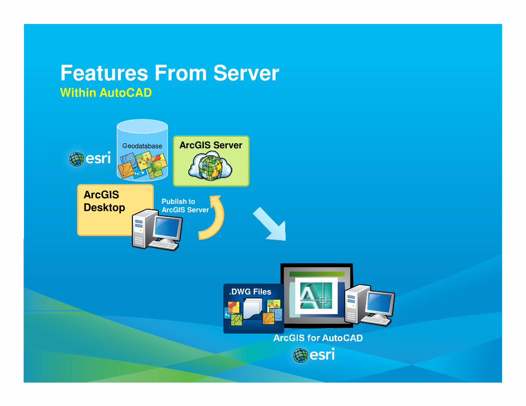
ArcGIS Server
Publish to ArcGIS Server
Features From ServerWithin AutoCAD
.DWG Files.DWG Files
DemoAutoCAD using Feature Service
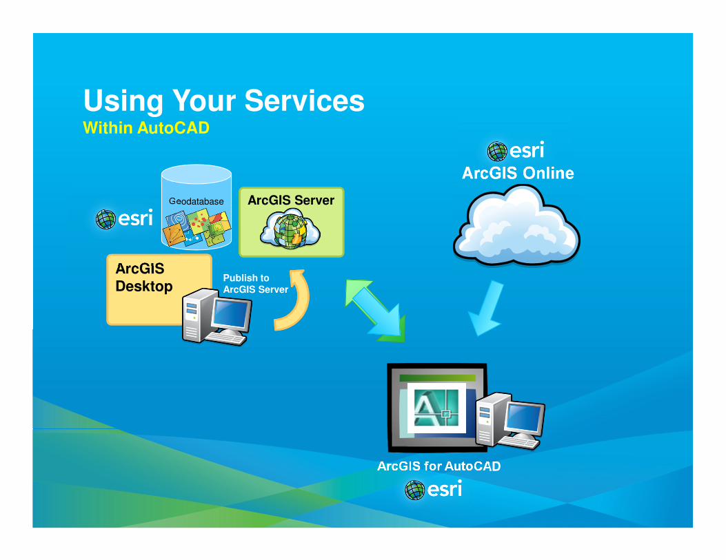
Geodatabase
ArcGIS for AutoCAD
ArcGISDesktop
ArcGIS Server
ArcGIS Online
Publish to ArcGIS Server
Using Your ServicesWithin AutoCAD
ArcGISDesktop
ArcGIS Server
Geodatabase
.DWG Files.DWG Files
ArcGIS for AutoCAD
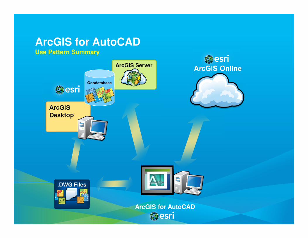
ArcGIS for AutoCADUse Pattern Summary
ArcGIS Online
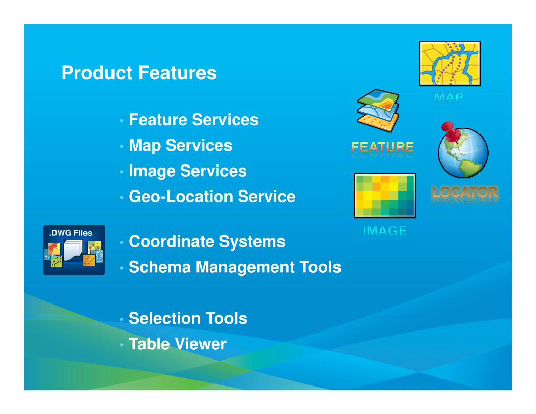
Product Features
• Feature Services
• Map Services
• Image Services
• Geo-Location Service
• Coordinate Systems
• Schema Management Tools
• Selection Tools
• Table Viewer
.DWG Files.DWG Files

Download ArcGIS for AutoCAD 300 Now
• AutoCAD Windows 32/64 bit 2010-12
- Civil 3D/ Map 3D/ ADT
- Not Supported* in AutoCAD LT
• Coming Soon:
- AutoCAD 2013 Support
(ArcGIS 10.1 Service Pack 2)
- More Languages…
ArcGIS Data Interoperability
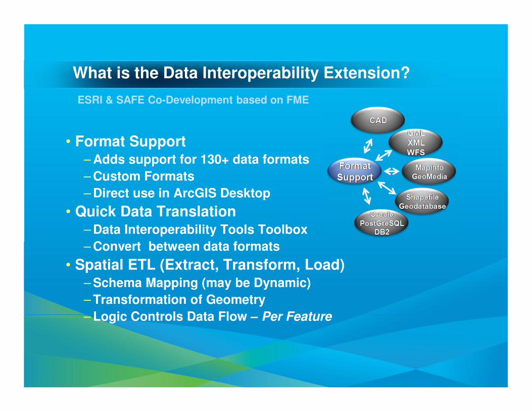
What is the Data Interoperability Extension?
• Format Support – Adds support for 130+ data formats
– Custom Formats
– Direct use in ArcGIS Desktop
• Quick Data Translation – Data Interoperability Tools Toolbox
– Convert between data formats
• Spatial ETL (Extract, Transform, Load)– Schema Mapping (may be Dynamic)
– Transformation of Geometry
– Logic Controls Data Flow – Per Feature
ESRI & SAFE Co-Development based on FME
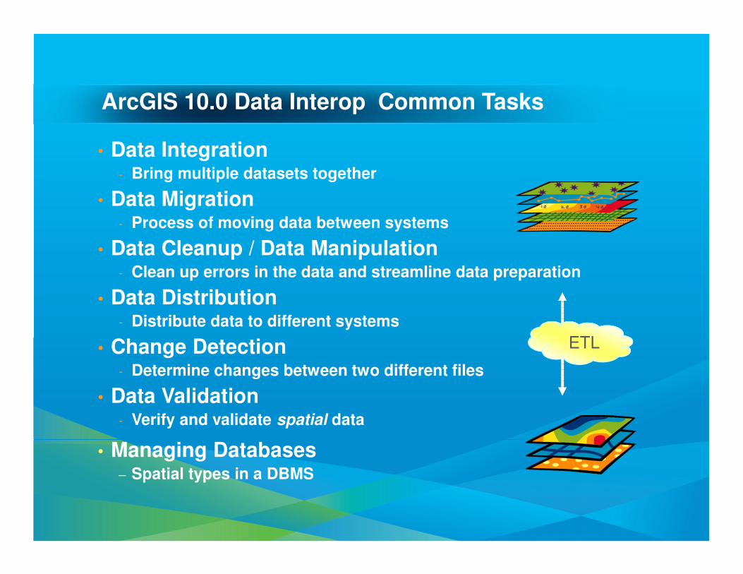
ArcGIS 10.0 Data Interop Common Tasks
• Data Integration- Bring multiple datasets together
• Data Migration- Process of moving data between systems
• Data Cleanup / Data Manipulation- Clean up errors in the data and streamline data preparation
• Data Distribution- Distribute data to different systems
• Change Detection- Determine changes between two different files
• Data Validation- Verify and validate spatial data
• Managing Databases– Spatial types in a DBMS
ETL
Data Interoperability Top 5 Functions
Countdown
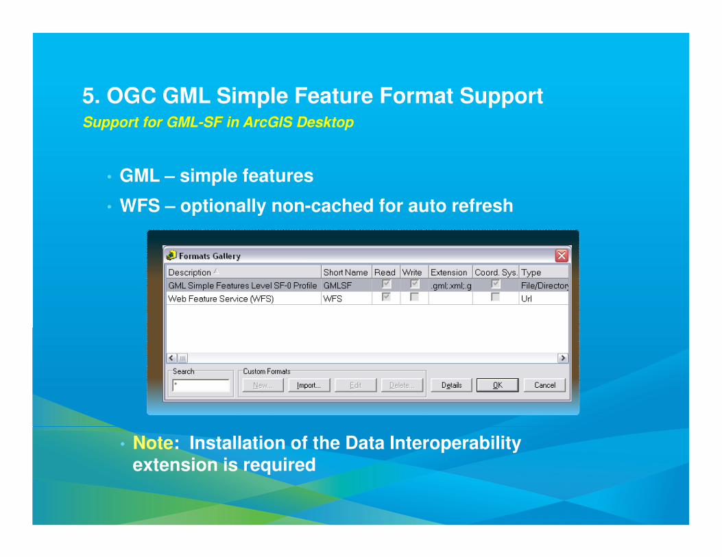
5. OGC GML Simple Feature Format SupportSupport for GML-SF in ArcGIS Desktop
• GML – simple features
• WFS – optionally non-cached for auto refresh
• Note: Installation of the Data Interoperability extension is required
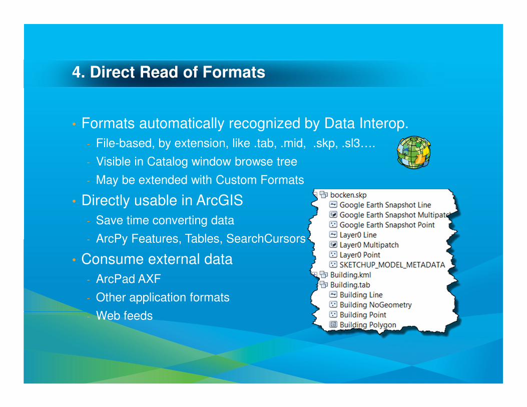
4. Direct Read of Formats
• Formats automatically recognized by Data Interop.
- File-based, by extension, like .tab, .mid, .skp, .sl3….
- Visible in Catalog window browse tree
- May be extended with Custom Formats
• Directly usable in ArcGIS
- Save time converting data
- ArcPy Features, Tables, SearchCursors
• Consume external data
- ArcPad AXF
- Other application formats
- Web feeds
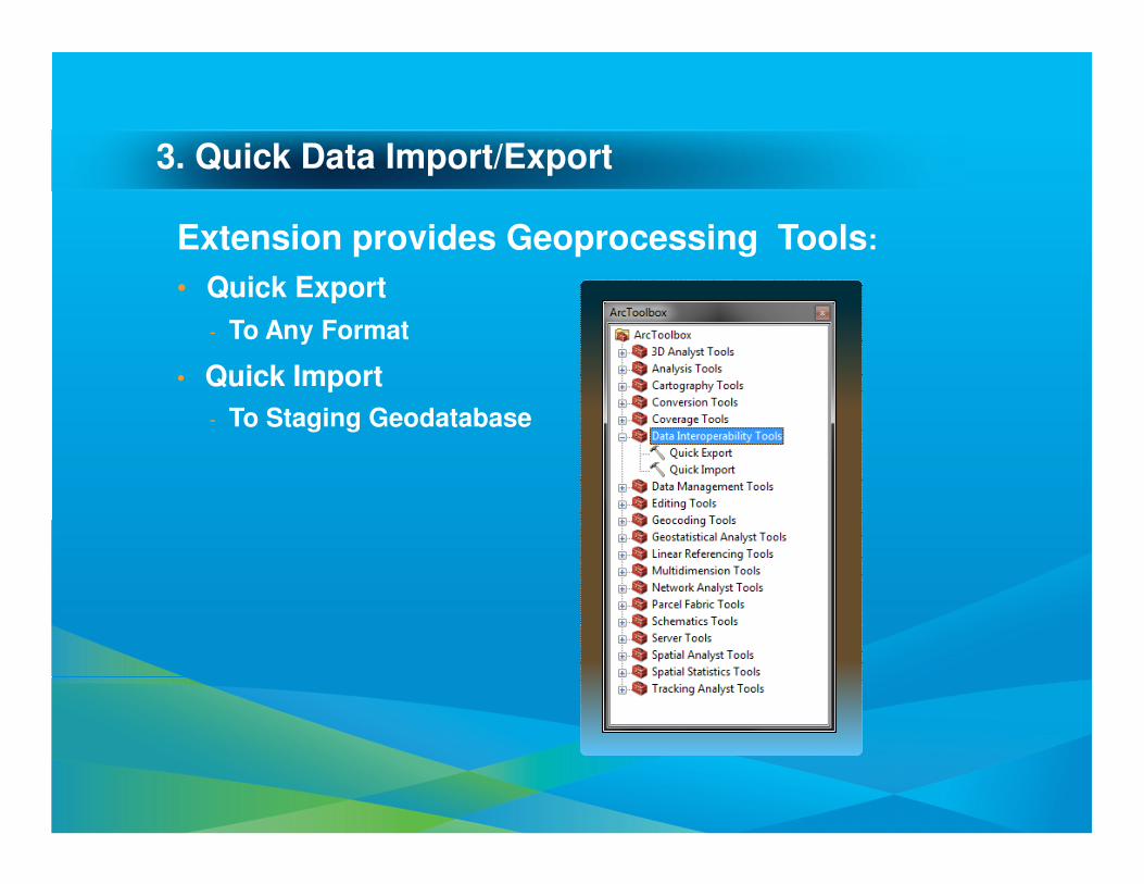
3. Quick Data Import/Export
Extension provides Geoprocessing Tools:
• Quick Export
- To Any Format
• Quick Import
- To Staging Geodatabase
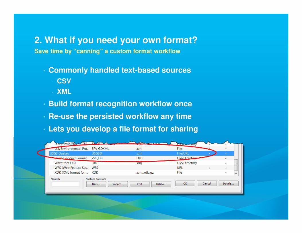
2. What if you need your own format?Save time by “canning” a custom format workflow
• Commonly handled text-based sources
- CSV
- XML
• Build format recognition workflow once
• Re-use the persisted workflow any time
• Lets you develop a file format for sharing
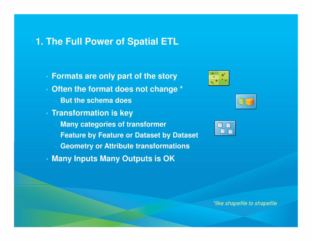
1. The Full Power of Spatial ETL
• Formats are only part of the story
• Often the format does not change *
- But the schema does
• Transformation is key
- Many categories of transformer
- Feature by Feature or Dataset by Dataset
- Geometry or Attribute transformations
• Many Inputs Many Outputs is OK
*like shapefile to shapefile
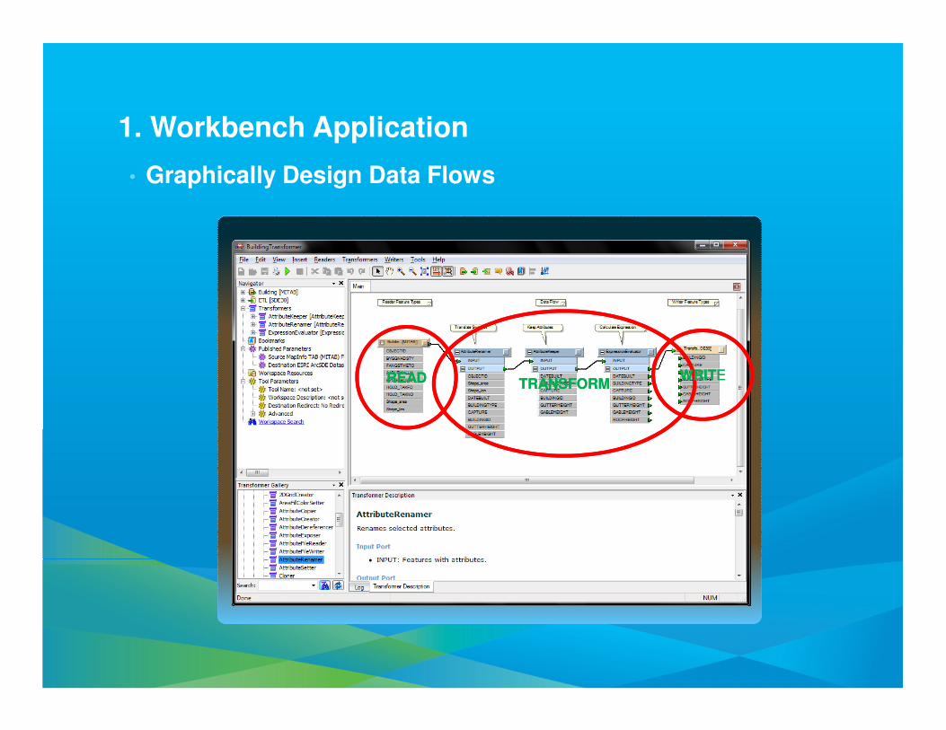
1. Workbench Application
• Graphically Design Data Flows
READREAD TRANSFORMTRANSFORMWRITEWRITE

Data Interoperability DifferentiatorsNot Just About Schema Manipulation
• 3D PDF Writing
- Share “data” with the world
• Vertical Datum Handling
- When working with water, transmission
• XML Documents as Features or Attributes
• JSON Documents as Attributes
• HTTP interaction
• GeoRSS interaction
• Cross-platform SQL support
- SQLite temporary workspace
• Parallel Processing
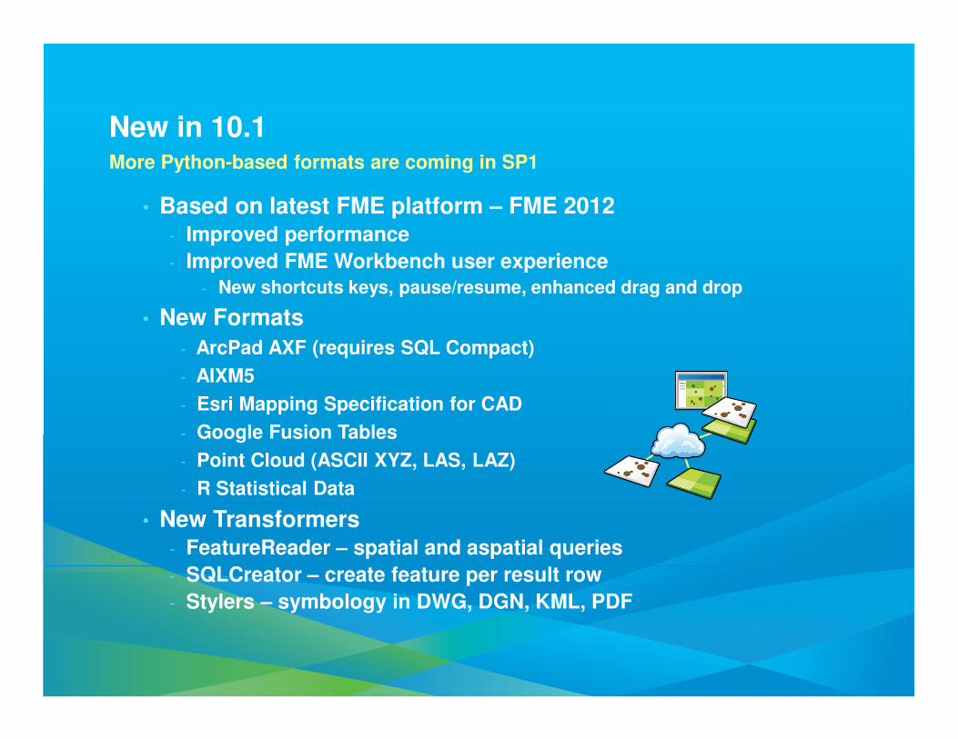
New in 10.1More Python-based formats are coming in SP1
• Based on latest FME platform – FME 2012- Improved performance
- Improved FME Workbench user experience- New shortcuts keys, pause/resume, enhanced drag and drop
• New Formats
- ArcPad AXF (requires SQL Compact)
- AIXM5
- Esri Mapping Specification for CAD
- Google Fusion Tables
- Point Cloud (ASCII XYZ, LAS, LAZ)
- R Statistical Data
• New Transformers- FeatureReader – spatial and aspatial queries
- SQLCreator – create feature per result row
- Stylers – symbology in DWG, DGN, KML, PDF

DemoArcGIS Data Interoperability
ArcGIS Data Reviewer
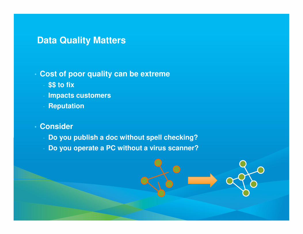
Data Quality Matters
• Cost of poor quality can be extreme
- $$ to fix
- Impacts customers
- Reputation
• Consider
- Do you publish a doc without spell checking?
- Do you operate a PC without a virus scanner?
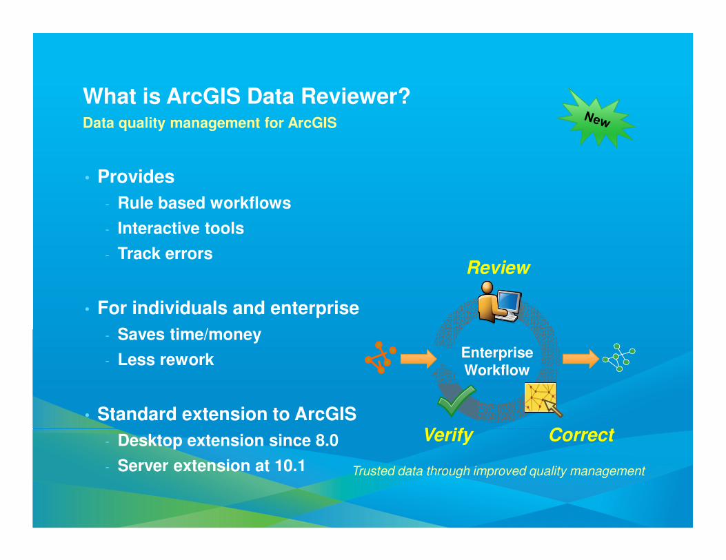
• Provides
- Rule based workflows
- Interactive tools
- Track errors
• For individuals and enterprise
- Saves time/money
- Less rework
• Standard extension to ArcGIS
- Desktop extension since 8.0
- Server extension at 10.1
What is ArcGIS Data Reviewer?Data quality management for ArcGIS
Trusted data through improved quality management
EnterpriseWorkflow
Review
CorrectVerify
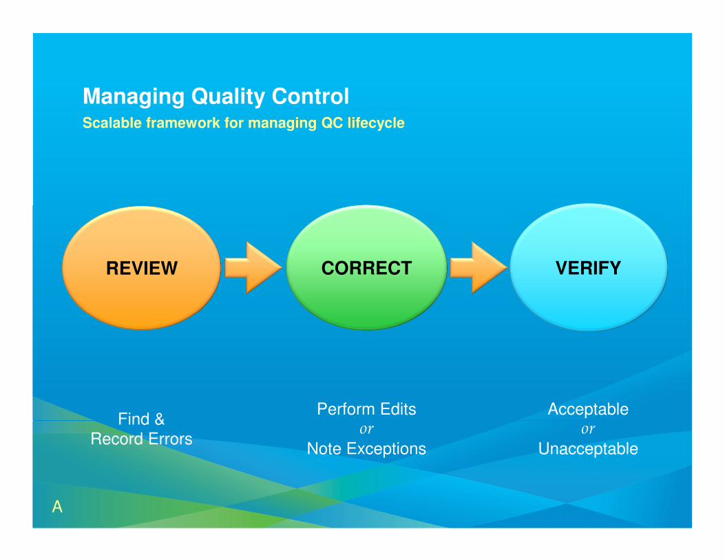
REVIEW
Find &
Record Errors
CORRECT
Perform Editsor
Note Exceptions
VERIFY
Acceptableor
Unacceptable
Managing Quality ControlScalable framework for managing QC lifecycle
A
The Reviewer Table
• Heart of the Data Reviewer
• Tracks all anomalies/errors
from review
• Interactive table
Review Data & Identify Errors
• Automated Checks
• Batch Data Review
• Visual Review
Reviewer Session
• Similar to an edit session
• Allows data interaction for QC
purposes
Reviewer Workspace
• Stores spatial & attribute
information about errors
• Personal, File, or Enterprise
Geodatabase
• Feature class & tables created
automatically
Report Quality Information
• Summarize quality control
results
• Interpret data error
• Report data accuracy
An Introduction to Data Reviewer ComponentsThe Quality Control Process with Data Reviewer
A
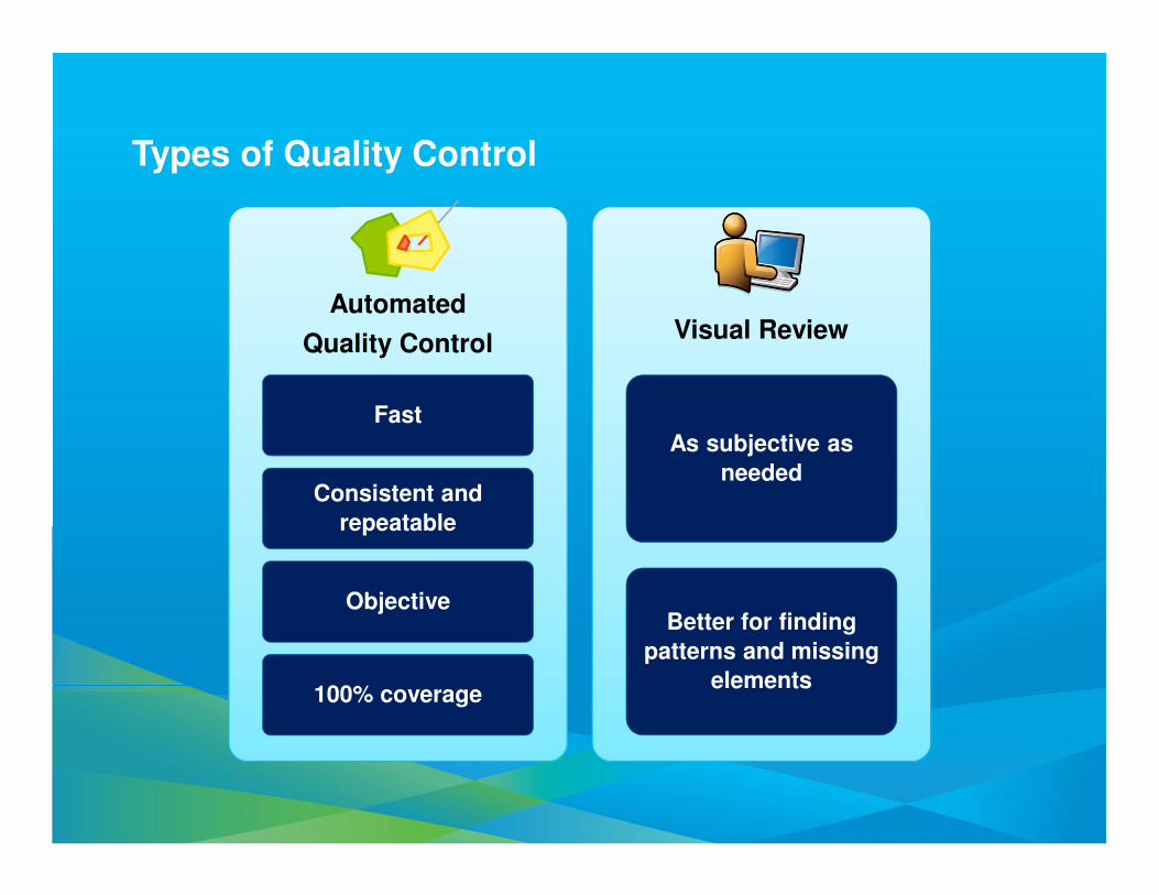
Types of Quality Control
Fast
Consistent and
repeatable
Objective
100% coverage
As subjective as
needed
Better for finding
patterns and missing
elements
Automated
Quality ControlVisual Review
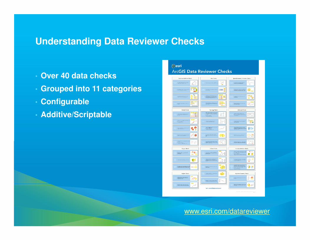
Understanding Data Reviewer Checks
• Over 40 data checks
• Grouped into 11 categories
• Configurable
• Additive/Scriptable
www.esri.com/datareviewer
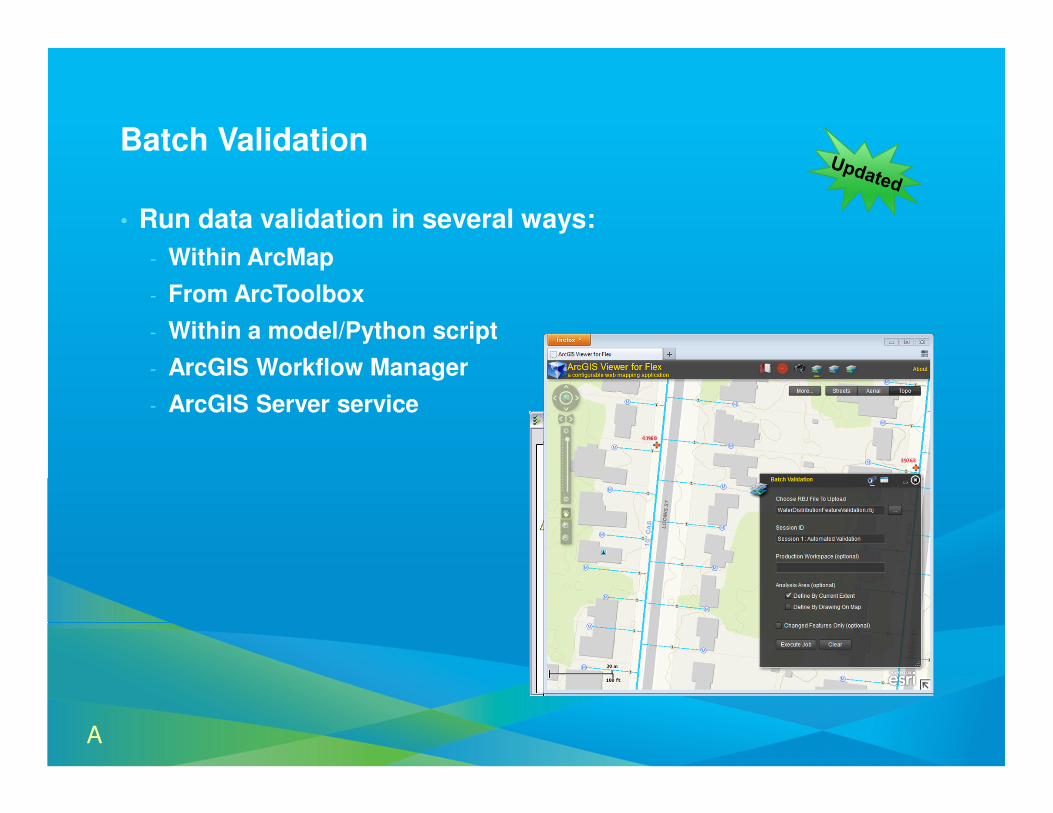
Batch Validation
• Run data validation in several ways:
- Within ArcMap
- From ArcToolbox
- Within a model/Python script
- ArcGIS Workflow Manager
- ArcGIS Server service
A
ArcGIS ServerArcGIS Server
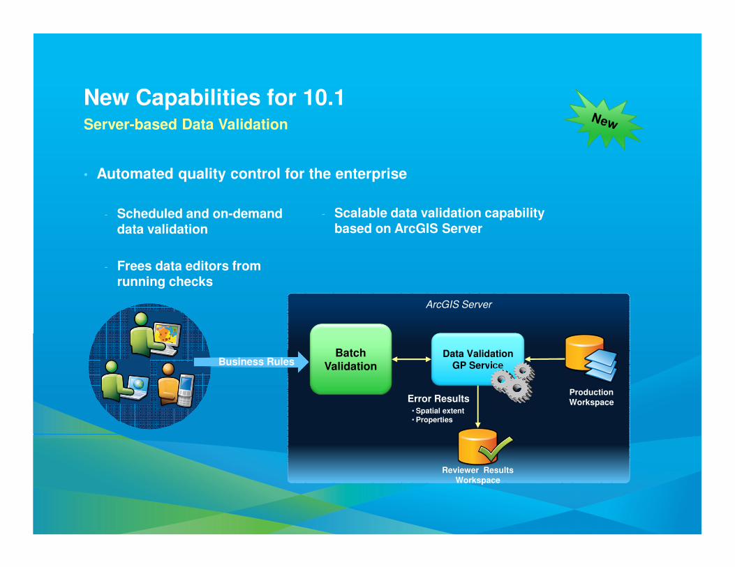
New Capabilities for 10.1Server-based Data Validation
• Automated quality control for the enterprise
- Scheduled and on-demanddata validation
- Frees data editors fromrunning checks
Data ValidationGP Service
Batch Validation
ProductionWorkspace
Reviewer ResultsWorkspace
Business Rules
Error Results• Spatial extent• Properties
- Scalable data validation capability based on ArcGIS Server
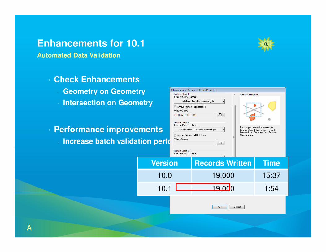
Enhancements for 10.1Automated Data Validation
• Check Enhancements
- Geometry on Geometry
- Intersection on Geometry
• Performance improvements
- Increase batch validation performance
10.110.1
Version Records Written Time
10.0 19,000 15:37
10.1 19,000 1:54
A
DemoArcGIS Data Reviewer
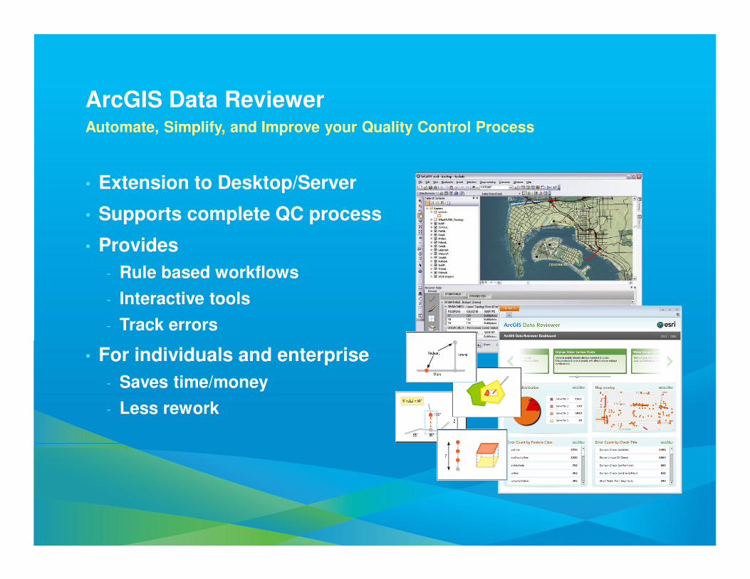
ArcGIS Data ReviewerAutomate, Simplify, and Improve your Quality Control Process
• Extension to Desktop/Server
• Supports complete QC process
• Provides
- Rule based workflows
- Interactive tools
- Track errors
• For individuals and enterprise
- Saves time/money
- Less rework
Summary
ArcGIS and AutoCAD
ArcGIS Data Interoperability
ArcGIS Data Reviewer
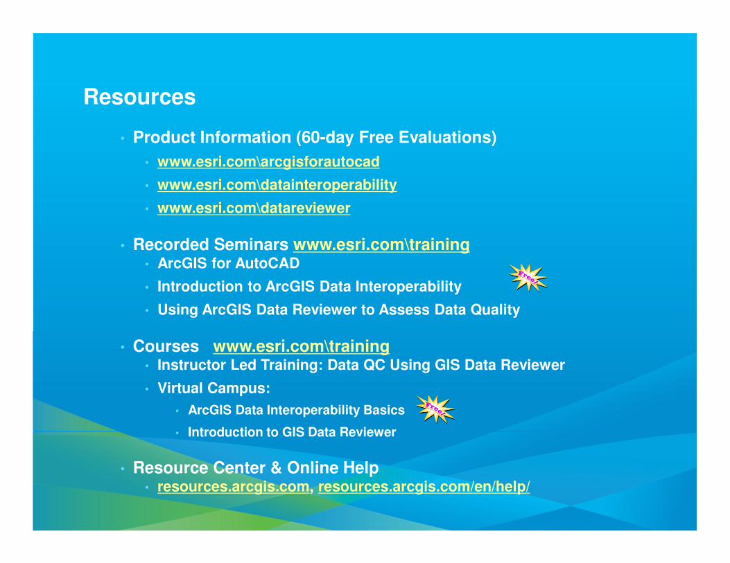
Resources
• Product Information (60-day Free Evaluations)
• www.esri.com\arcgisforautocad
• www.esri.com\datainteroperability
• www.esri.com\datareviewer
• Recorded Seminars www.esri.com\training• ArcGIS for AutoCAD
• Introduction to ArcGIS Data Interoperability
• Using ArcGIS Data Reviewer to Assess Data Quality
• Courses www.esri.com\training• Instructor Led Training: Data QC Using GIS Data Reviewer
• Virtual Campus:
• ArcGIS Data Interoperability Basics
• Introduction to GIS Data Reviewer
• Resource Center & Online Help• resources.arcgis.com, resources.arcgis.com/en/help/