application of laser scanning in mine surveying · 2010-11-10 · application of laser scanning in...
TRANSCRIPT
53
Application of Laser Scanning in Mine Surveying
Anatoli L. OKHOTIN, Russian Federation Key words: laser scanner, 3d model, mobile laser scanning systems, mine surveying, aerial survey, GPS-GLONASS Laser scanners, often referred to as Lidars, are comparatively recently become be to use in mine surveying. Their application is similar to that of for surveying works, but there are also some differences. According to the types, scanners are divided into aerial, terrestrial and underground. Aerial scanners are intended for surveying of extended areal and linear objects. In mining the new areas of designed mining companies, existing open-cast mining sites and collieries, oil and gas pipelines, roads, and power transmission lines are related to such objects. Formerly the similar objects were mapped by aerial surveys and there was no other alternative for a long time. Undoubtedly, laser ranging has a number of advantages over aerial surveys. The technology of field works is simple. After a short processing the coordinates of surveying points are got in a user’s coordinate system. The quality assessment of field works including a completeness of laser reflection point clouds and orthophoto mosiacs is performed at the same aerial survey flight’s day that sufficiently reduces a scrap rate, preliminary ground survey works, and eliminates the necessity for ground control points. Only a limited number of GPS-GLONASS base stations are required for laser scanning. Owing to a lidar’s navigation block, the direct geo-positioning method is used to provide with coordinates of laser ranging. The rate of cartographic works is 5-10 times higher than that of traditional technologies. The accuracy of laser scanning as proved from practice meets the requirements of “Guidelines for Mine Surveying Works”. In this case a survey team should strictly follow the standards for aerial surveys and calibration procedures outlined in corresponding manuals in detail.
The productivity of laser scanning is very high. It is real to survey in a day 500 km for linear object and 1,000 km for areal objects. Of vital difference of laser ranging is a possibility of night work. A key feature of this technology is its feasibility to survey a forested territory and simultaneously to generate a digital elevation model as well as to survey a territory with a slight relief and absence of marking situation.
As an example we may take our project realized in Yakutia. The ore field with the area of 200 sq. km was taken as an object for laser scanning survey. The gold ore deposits have been mined there for a long time. In economic recession the gold was extracted with procedural violations of mining operations. Selective mining was practiced. The mine surveying documentation was unconscientiously maintained and

54
partially lost. At the moment of surveying the terrain had a lunar landscape with not clearly defined contours. Traditional surveying was practically unacceptable. The work was started on August 10, and on November 10 of the same year we handed over a final survey report together with accompanying digital topographical plans at scale 1: 2 000, orthophotos, digital terrain models, and 246 mine survey sheets. Our competitor participating in the same tender was ready to carry out the same volume of works for 18 months using classical aerial survey. Having got cartographic materials of good quality, the enterprise has worked out a project and extracted about 3 tones of gold for the same months.
We have done a similar work at a gold ore deposit in Balei Zabaikalsky Region. The area of 50 sq. km was covered by aerial survey only for three flying hours. The office processing was finished in three weeks.
Figure 1: A survey team on board the aircraft
Figure 2: Orthophoto and map fragments

55
The economic efficiency of laser scanning is very high. The cost price is considerably lower than that of for aerial survey. Why are the budget expenses drawn up according to traditional price lists? There is a simple explanation: they haven’t been drawn up for laser ranging yet. A profit is a good impetus to develop and implement the innovative technologies and to purchase the expensive equipment.
It should be mentioned that laser scanning has also disadvantages as well. The process is strongly depended on weather conditions. It is influenced by precipitation and high humidity, low cloud and fumulus. There are some restrictions on the flight height. The laser radiation is dangerous for human eyes. However, all disadvantages should be related to the technology merits. Thereby, it should be also remembered that many of them are inhered aerial survey.
Land laser scanning has been successfully used on open-cast mining sites and collieries. Scanner positions (scan positions) are defined while the surveying is planning. In this case the scanner is set up either on a tripod or a vehicle (mounted on a mobile platform). There is no need in instrument centering of leveling. Its geo-referencing is carried out on the targets located at a distance of 20-30 m apart of the scanner. The target positions are defined by a total station or GPS-GLONASS receiver. Laser scanner software is used for stitching of point clouds from different scan positions and creation a unified model. Terrestrial photography is performed simultaneously along with laser scanning, which serves as a sketch and allows photographic interpretation in office.
As an example we can demonstrate the scanning of a Buryatiyan opencast colliery occupied an area of 500 hectares. The team consisting of 3 persons (a teacher and 2 students) has finished field works for three working days. Office works have taken 2 weeks during which it was revealed that the team scanned and mapped 700 hectares instead of 500 hectares. In addition to traditional materials, 3D model of coal strip mine was added to DTM, a digital topographic plan and a metal-mounted board. Once we have faced a problem to estimate load-bearing structure’s geometry of a new gold beneficiation plant’s in Bodaibo. The customer apprehensions were based on the fact that at building phases three different organizations were engaged in plant development. Besides, there were processing facilities on all the floors shading the building structure that complicated essentially the execution of work.

56
Figure 3: Organization of field works
Figure 4: A topographic plan of opencast colliery compiled by scan data

57
Figure 5: A view of the gold beneficiation plant
Finally, the problem was solved. The scanning traverse was laid out round a building and continued through all the floors. It allowed the creation of a unified model where the columns, beams and ties were distinguished on. This model was used as a basis to plot the measurement diagrams with design deviations.
Figure 6: A stitched point cloud for the gold beneficiation plant

58
Figure 7: The distinguished load-bearing structures
Figure 8: An approval drawing
59
Fortunately, all the drawings were correct enough and within specific tolerances.
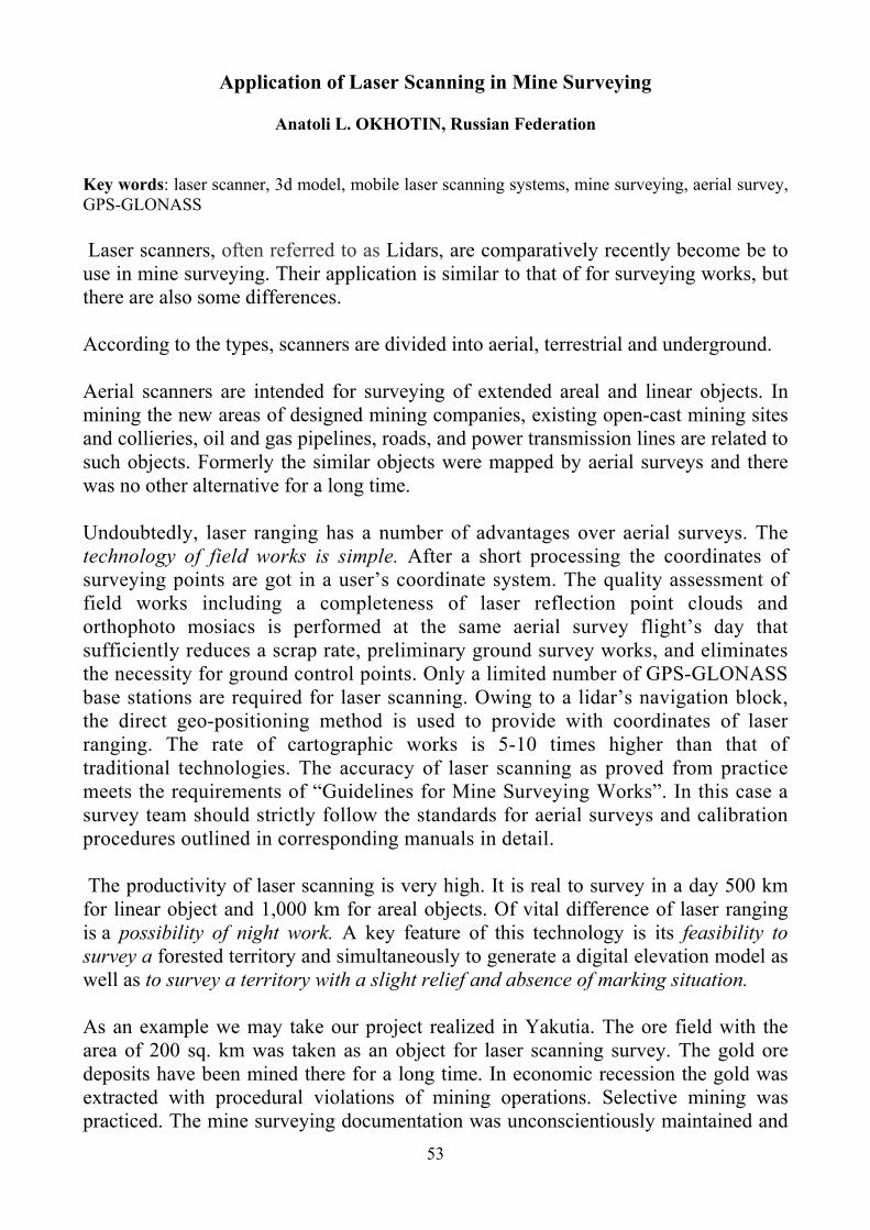
We faced the same problem on the Beryozovsky hydroelectric power plant where it was necessary to estimate the structures geometry state of the highest in Russia industrial building 125 m in height.
Figure 9: A Shop at the Berezovsky hydroelectric power plant
Figure 10: 3D model of load-bearing structures
60
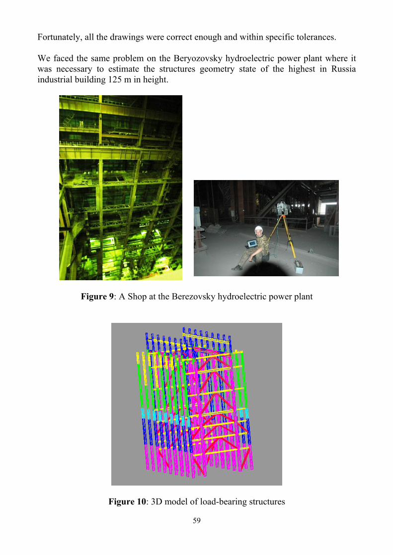
The customer himself tried to solve this problem using reflectionless total stations for surveying purposes, but due to the complicated geometry of structures, their inaccessibility and danger, he has given up this idea. We used RIEGL RIEGL LMS 420i and finished the whole volume of works for 16 days.
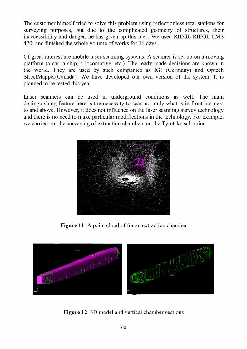
Of great interest are mobile laser scanning systems. A scanner is set up on a moving platform (a car, a ship, a locomotive, etc.). The ready-made decisions are known in the world. They are used by such companies as IGI (Germany) and Optech StreetMapper(Canada). We have developed our own version of the system. It is planned to be tested this year. Laser scanners can be used in underground conditions as well. The main distinguishing feature here is the necessity to scan not only what is in front but next to and above. However, it does not influence on the laser scanning survey technology and there is no need to make particular modifications in the technology. For example, we carried out the surveying of extraction chambers on the Tyretsky salt-mine.
Figure 11: A point cloud of for an extraction chamber
Figure 12: 3D model and vertical chamber sections

61
One of the key complicated problems in mine surveying is a regular vertical shaft alignment. In practice, misalignments of shaft guides are determined. A freely-hanging plumb is used as a vertical. Here should be mentioned that the alignment is complicated by the following factors: a vertical shaft depth, which is sometimes more than 1,000 m, airstream turbulence, atmospheric gas pollution, and high job hazard of working at heights in unconditioned situation. The decision can be simplified if apply an automated station for the vertical shaft alignment, but in this case it provides with strictly limited volume of information that is not sufficient for estimation of shaft conditions. From our point of view, application of laser scanning in a shaft would become the best solution of this problem. In-situ testing will be carried out in the nearest future.
Welfare and safety regulations in mining demand to carry out regular scanning of capital closed work as well as its geometry, railtrack conditions and underground utilities. Due to their long expansion and a large volume of works, the mine surveying service has not enough time for such works. We have developed a mobile scanning complex for automation of these works. We are planning to make its presentation soon.
Among other key complicated problems in mine surveying is a scanning of dangerous and inaccessible cavities. Such cavities are a lot of in chamber mining and rise driving. At present, there are scanners able to scan the cavities at a distance. Among them we should mention Optech’s Cavity Monitoring System (CMS) provides fast, reliable and efficient scanning of underground cavities. By collecting thousands of measurements per minute, the data can be used to determine stope volumes, stope dilution, backfill volumes and create detailed drawings and data formats for use in any software workflow. With the recent introduction of the wireless feature, scanner operation can be controlled from a safe zone outside the cavity to enhance operator safety.
Figure 13: A schematic diagram of the scanner in operation

62
Figure 14: An example of the underground chamber’s horizontal sections on a pit of the “JSC Kola Mining & Metallurgical Company”
Practical applications of laser ranging and laser scanning in mine surveying given in this paper were carried out with the participation of the author.
CONTACTS Prof. Anatoli L. Okhotin President of the Baikal Union of Mining Surveyors Head of the Department of Mine Surveying Irkutsk State Technical University Russian Federation Tel: +7 (3952) 52-68-48 Fax: +7 (3952) 52-68-58 E-mail: [email protected], [email protected]
© A.L. Okhotin, 2009