annual update on usgs coastal zone elevation...
TRANSCRIPT
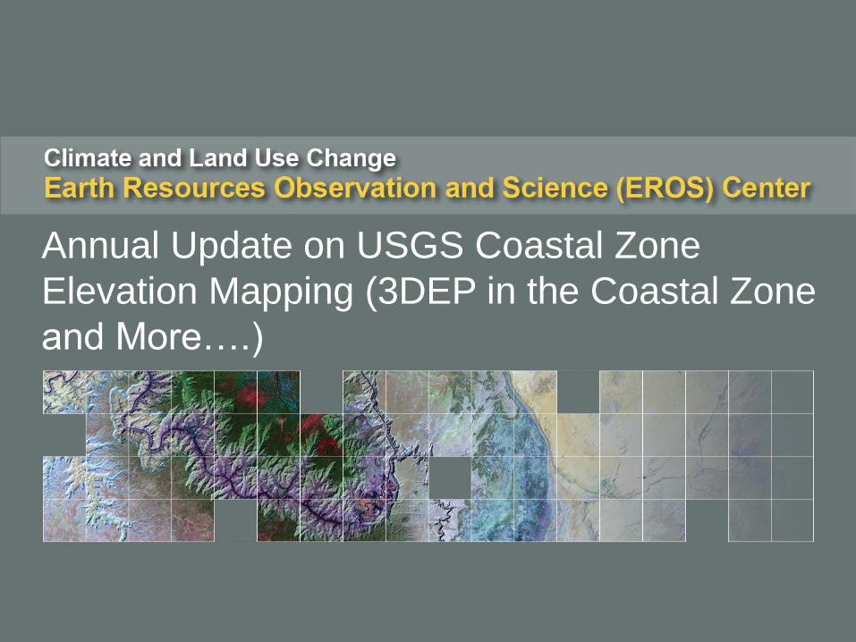
Annual Update on USGS Coastal Zone
Elevation Mapping (3DEP in the Coastal Zone
and More….)
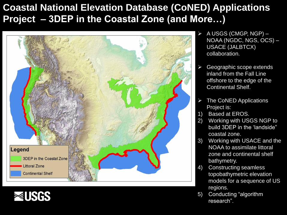
Coastal National Elevation Database (CoNED) Applications
Project – 3DEP in the Coastal Zone (and More…)
A USGS (CMGP, NGP) –
NOAA (NGDC, NGS, OCS) –
USACE (JALBTCX)
collaboration.
Geographic scope extends
inland from the Fall Line
offshore to the edge of the
Continental Shelf.
The CoNED Applications
Project is:
1) Based at EROS.
2) Working with USGS NGP to
build 3DEP in the ‘landside”
coastal zone.
3) Working with USACE and the
NOAA to assimilate littoral
zone and continental shelf
bathymetry.
4) Constructing seamless
topobathymetric elevation
models for a sequence of US
regions.
5) Conducting “algorithm
research”.
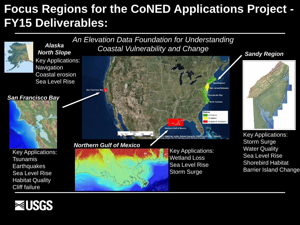
Focus Regions for the CoNED Applications Project -
FY15 Deliverables:
Sandy Region
San Francisco Bay
Northern Gulf of Mexico
An Elevation Data Foundation for Understanding
Coastal Vulnerability and Change Alaska
North Slope
NJ/DE
Key Applications:
Tsunamis
Earthquakes
Sea Level Rise
Habitat Quality
Cliff failure
Key Applications:
Navigation
Coastal erosion
Sea Level Rise
Key Applications:
Storm Surge
Water Quality
Sea Level Rise
Shorebird Habitat
Barrier Island Change
Key Applications:
Wetland Loss
Sea Level Rise
Storm Surge
X
X X
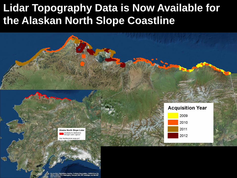
Lidar Topography Data is Now Available for
the Alaskan North Slope Coastline
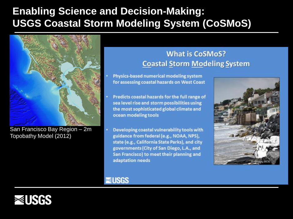
Enabling Science and Decision-Making:
USGS Coastal Storm Modeling System (CoSMoS)
San Francisco Bay Region – 2m
Topobathy Model (2012)
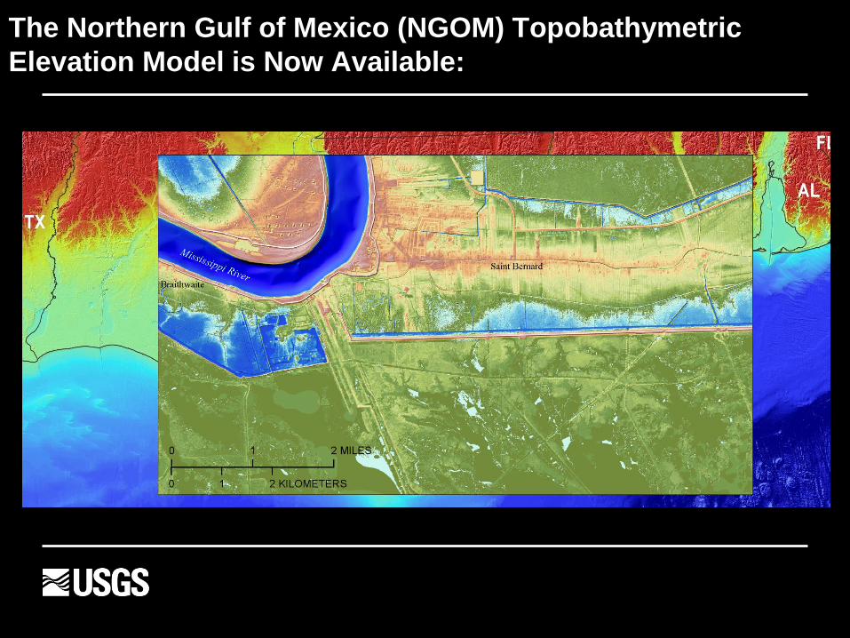
The Northern Gulf of Mexico (NGOM) Topobathymetric
Elevation Model is Now Available:
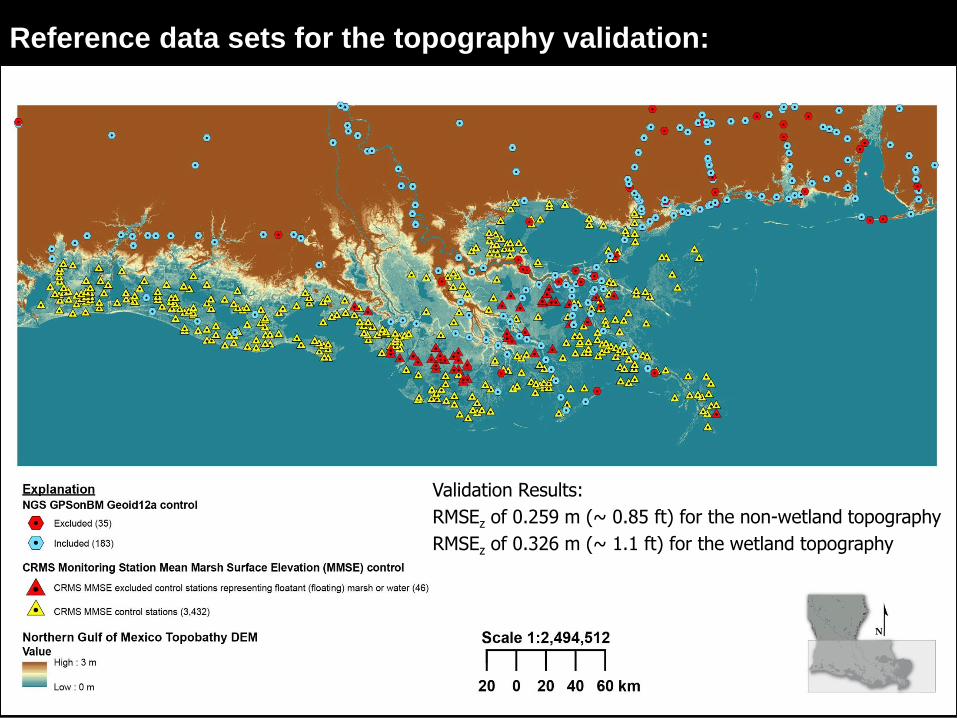
Reference data sets for the topography validation:
Validation Results:
RMSEz of 0.259 m (~ 0.85 ft) for the non-wetland topography
RMSEz of 0.326 m (~ 1.1 ft) for the wetland topography
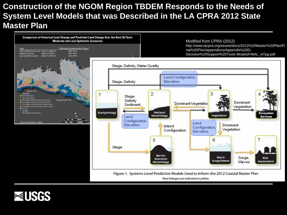
Construction of the NGOM Region TBDEM Responds to the Needs of
System Level Models that was Described in the LA CPRA 2012 State
Master Plan
Modified from CPRA (2012) http://www.lacpra.org/assets/docs/2012%20Master%20Plan/Fi
nal%20Plan/appendices/Appendix%20D-
Decision%20Support%20Tools-ModelsFINAL_wTpg.pdf
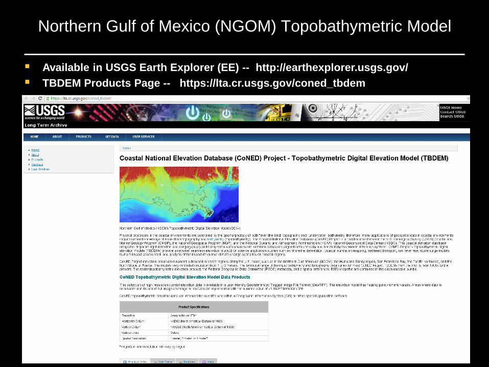
Northern Gulf of Mexico (NGOM) Topobathymetric Model
Available in USGS Earth Explorer (EE) -- http://earthexplorer.usgs.gov/
TBDEM Products Page -- https://lta.cr.usgs.gov/coned_tbdem
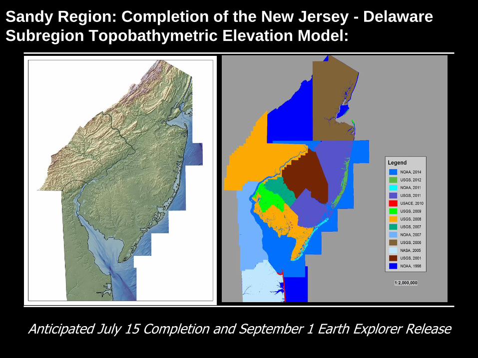
Sandy Region: Completion of the New Jersey - Delaware
Subregion Topobathymetric Elevation Model:
Anticipated July 15 Completion and September 1 Earth Explorer Release
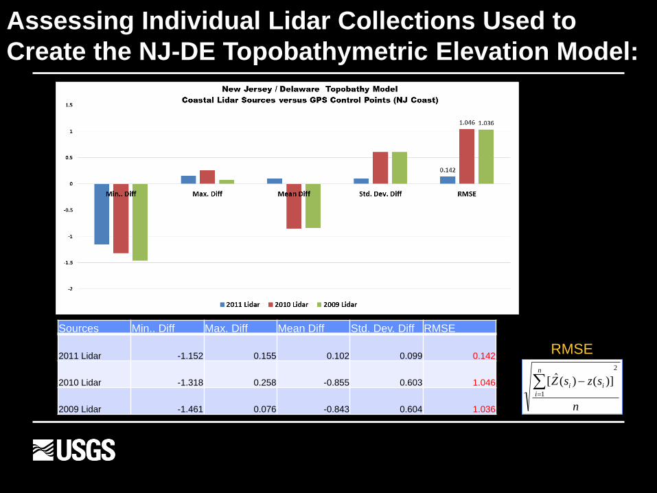
Assessing Individual Lidar Collections Used to
Create the NJ-DE Topobathymetric Elevation Model:
n
szsZn
i
ii
2
1
)]()(ˆ[
Sources Min.. Diff Max. Diff Mean Diff Std. Dev. Diff RMSE
2011 Lidar -1.152 0.155 0.102 0.099 0.142
2010 Lidar -1.318 0.258 -0.855 0.603 1.046
2009 Lidar -1.461 0.076 -0.843 0.604 1.036
RMSE
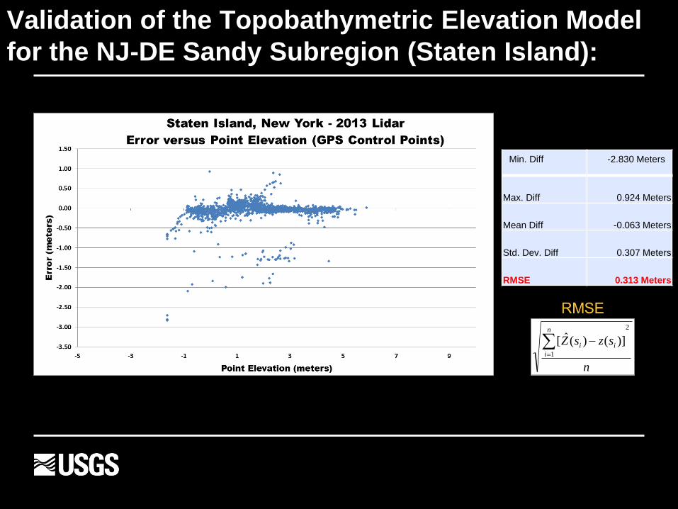
Validation of the Topobathymetric Elevation Model
for the NJ-DE Sandy Subregion (Staten Island):
n
szsZn
i
ii
2
1
)]()(ˆ[
Min. Diff -2.830 Meters
Max. Diff 0.924 Meters
Mean Diff -0.063 Meters
Std. Dev. Diff 0.307 Meters
RMSE 0.313 Meters
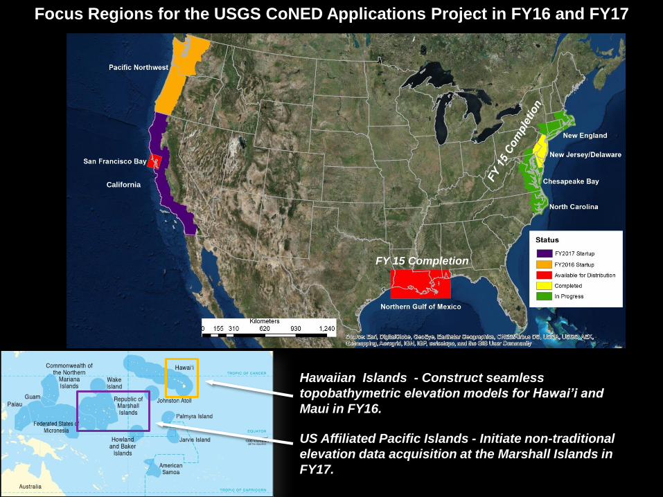
Focus Regions for the USGS CoNED Applications Project in FY16 and FY17
Hawaiian Islands - Construct seamless
topobathymetric elevation models for Hawai’i and
Maui in FY16.
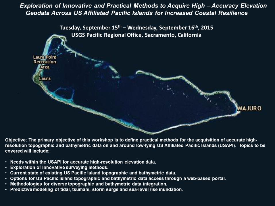
US Affiliated Pacific Islands - Initiate non-traditional
elevation data acquisition at the Marshall Islands in
FY17.
FY 15 Completion
California
?
Seattle
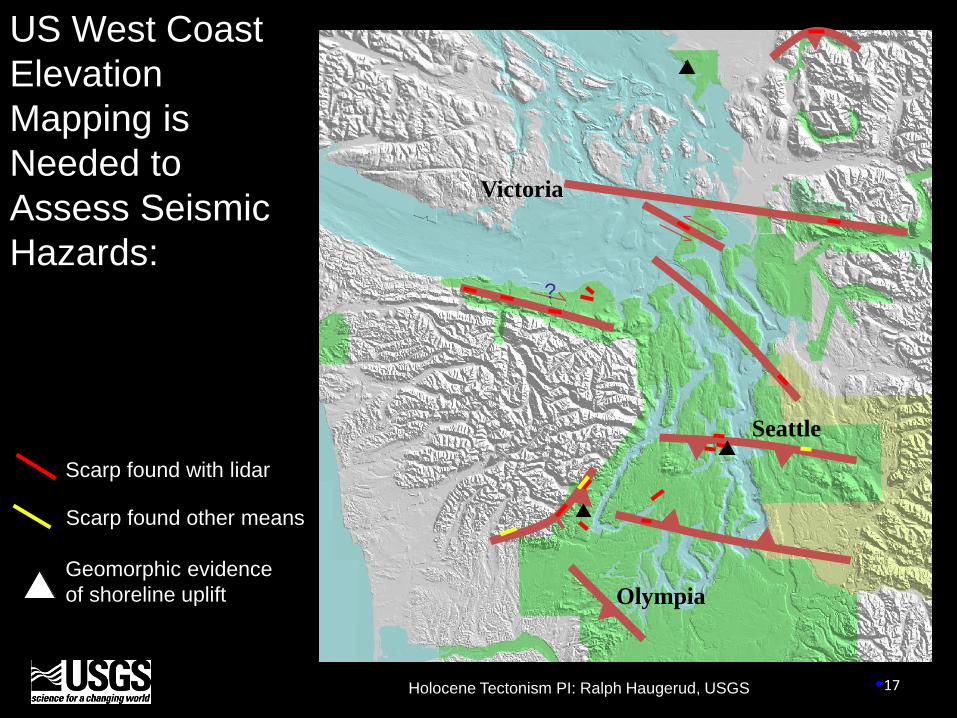
Victoria
Scarp found with lidar
Scarp found other means
`
Geomorphic evidence
of shoreline uplift
Holocene Tectonism PI: Ralph Haugerud, USGS
Olympia
17
US West Coast
Elevation
Mapping is
Needed to
Assess Seismic
Hazards:

18
Oso, WA Landslide March 22, 2014
Post-landslide
High-resolution lidar reveals
historic and potential slides
Pre-landslide
US West Coast Elevation Mapping is Needed to Assess
Sea Cliff Erosion and Landslide Hazards:
Source: D. Eldridge
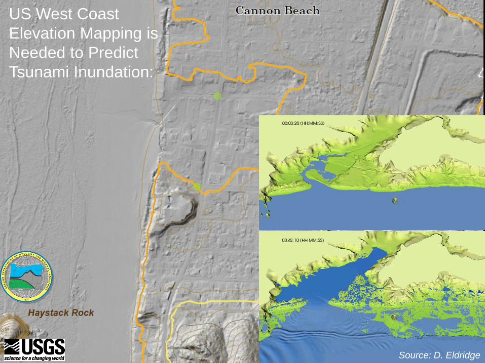
US West Coast
Elevation Mapping is
Needed to Predict
Tsunami Inundation:
Source: D. Eldridge
Core Science Systems 20
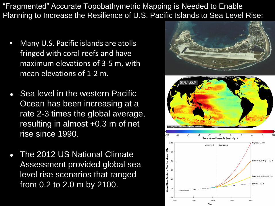
• Many U.S. Pacific islands are atolls fringed with coral reefs and have maximum elevations of 3-5 m, with mean elevations of 1-2 m.
● Sea level in the western Pacific
Ocean has been increasing at a
rate 2-3 times the global average,
resulting in almost +0.3 m of net
rise since 1990.
● The 2012 US National Climate
Assessment provided global sea
level rise scenarios that ranged
from 0.2 to 2.0 m by 2100.
“Fragmented” Accurate Topobathymetric Mapping is Needed to Enable
Planning to Increase the Resilience of U.S. Pacific Islands to Sea Level Rise:
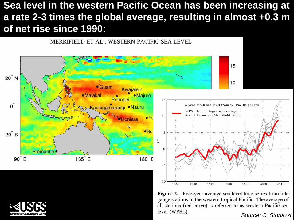
Sea level in the western Pacific Ocean has been increasing at
a rate 2-3 times the global average, resulting in almost +0.3 m
of net rise since 1990:
Source: C. Storlazzi
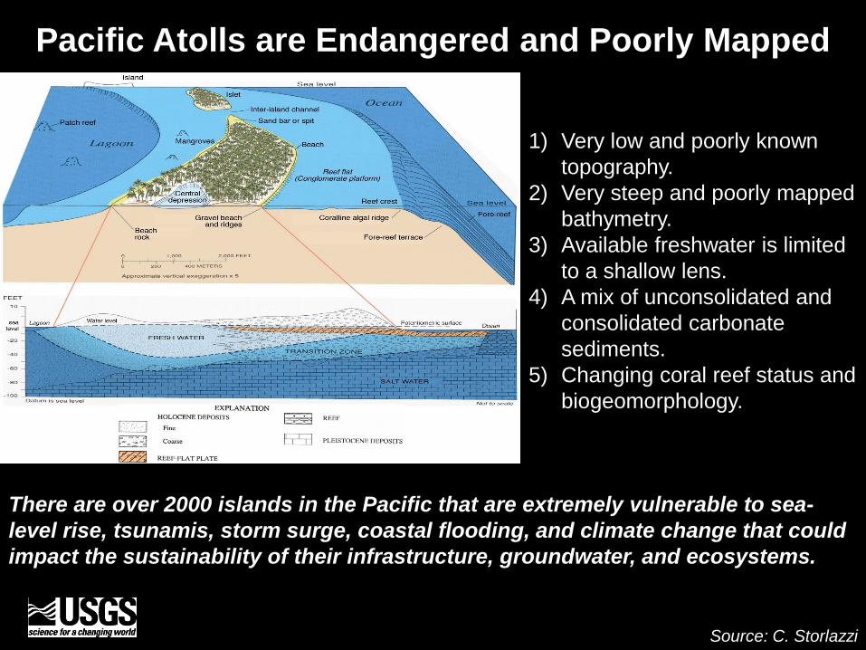
Pacific Atolls are Endangered and Poorly Mapped
1) Very low and poorly known
topography.
2) Very steep and poorly mapped
bathymetry.
3) Available freshwater is limited
to a shallow lens.
4) A mix of unconsolidated and
consolidated carbonate
sediments.
5) Changing coral reef status and
biogeomorphology.
There are over 2000 islands in the Pacific that are extremely vulnerable to sea-
level rise, tsunamis, storm surge, coastal flooding, and climate change that could
impact the sustainability of their infrastructure, groundwater, and ecosystems.
Source: C. Storlazzi
Algorithm Research and Dedicated
Workshops Associated with
FY16+ Focus Regions
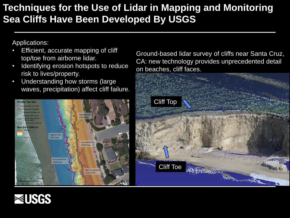
Techniques for the Use of Lidar in Mapping and Monitoring
Sea Cliffs Have Been Developed By USGS
Ground-based lidar survey of cliffs near Santa Cruz,
CA: new technology provides unprecedented detail
on beaches, cliff faces.
Cliff Top
Cliff Toe
Applications:
• Efficient, accurate mapping of cliff
top/toe from airborne lidar.
• Identifying erosion hotspots to reduce
risk to lives/property.
• Understanding how storms (large
waves, precipitation) affect cliff failure.
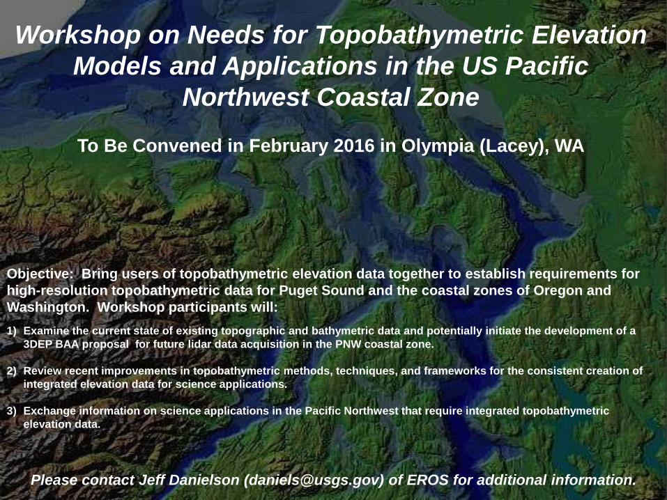
Workshop on Needs for Topobathymetric Elevation
Models and Applications in the US Pacific
Northwest Coastal Zone
To Be Convened in February 2016 in Olympia (Lacey), WA
Objective: Bring users of topobathymetric elevation data together to establish requirements for
high-resolution topobathymetric data for Puget Sound and the coastal zones of Oregon and
Washington. Workshop participants will:
1) Examine the current state of existing topographic and bathymetric data and potentially initiate the development of a
3DEP BAA proposal for future lidar data acquisition in the PNW coastal zone.
2) Review recent improvements in topobathymetric methods, techniques, and frameworks for the consistent creation of
integrated elevation data for science applications.
3) Exchange information on science applications in the Pacific Northwest that require integrated topobathymetric
elevation data.
Please contact Jeff Danielson ([email protected]) of EROS for additional information.
-
Questions or Comments on USGS Coastal Elevation Mapping?