and food agricultural land classificatioa bittaford
TRANSCRIPT

U B 0
l ™ * * - * Agriculture Fisheries and Food
FRCA Agricultural Land Classificatioa
Bittaford
1 Legend |
Gride 1
Grade 2
Grade 3a
Grade 3b
Grade 4
Grade 5
^
^^H H 1 1
• 1
Quality
Excellent
Very Good
Good
Moderate
Poor
Very Poor
.Agricultural not surveyed
Other land
Boundary of survey area
Total agricultural land
Total survey
land
area
area * Not pnatm within surrey area
Area (ha)
0.0
0.0
3g.g
64.9
22.2
1.6
0.0
38.1
127i
185.6
L _L Furihcr deuiU conuiocd to MAFF (1988) AgrKuliural Und Ctassificatioa of EnflaDd anJ Wain - Revised guidelines nod criirru fur ^radini ibc quality of agricultural taad. Maff tpnblicationi), London S£99 7TF. The informaiion it accunic •! base map Kale bai any caJargeaiciit would be misleadiog. Reproduction in whole or in pan by any meaoi ii probibiied wiihoui the prior permissioQ of MAFF.
SurTcyed lad d n v n by the Re&ource Planning Team, FRCA Western Region. Based on the 1982 Ordauce Survey 1:10,00(1 map with the permiuton of the CnniToIler of Her Majesty's Srationery Office. Unaurhoriwd reproduction infringes Crown copyright and mty lead to proiecmioii or civil proceedings. MAl'l- Licence No: 00272361 Source inap(s»: SX65NE^X65NW Reference no; 94/98 © Crow Copyright Reserved 1998
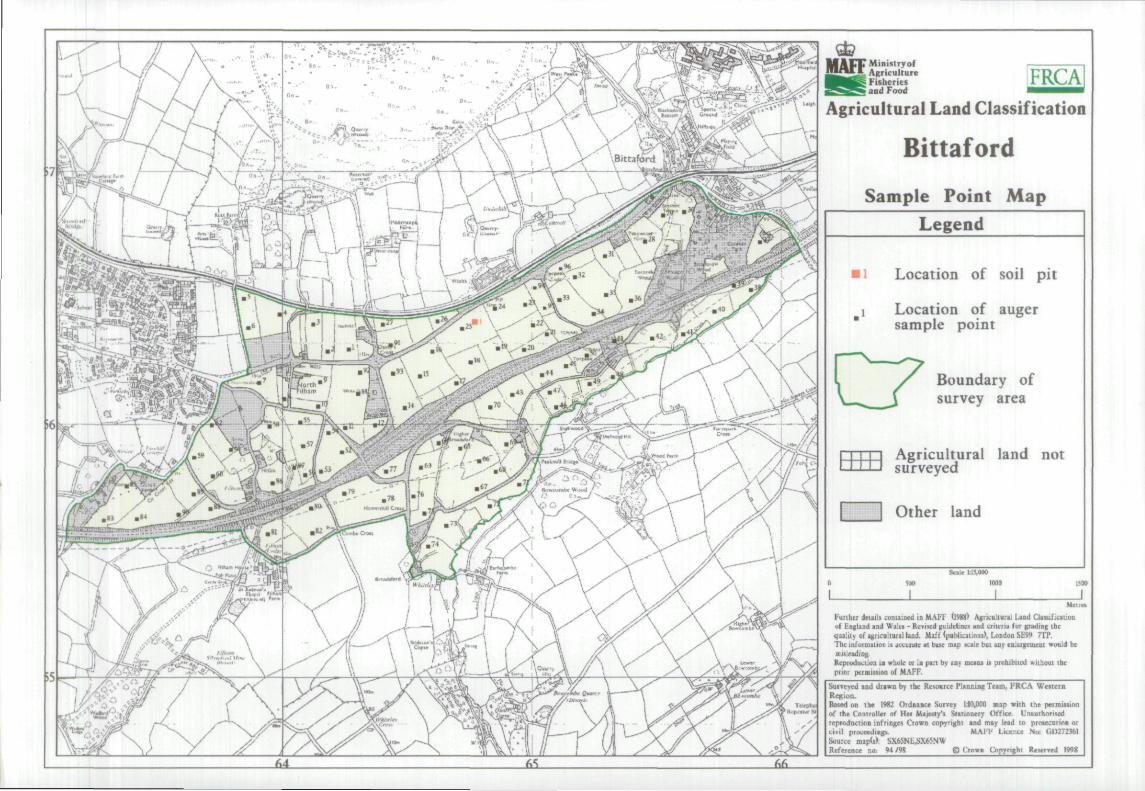
M A F F Ministry of !!•'*•• % Agriculture
" Fisheries and Food
FRCA
Agricultural Land Classificatioa
Bittaford
Sample Po in t M a p
Legend
Location of soil pit
Location of auger sample point
C7 Boundary of survey area
Agricultural land not surveyed
I I Other land
Purihcr deiails contained in MAFI' (1988) Agricniiural Land Clasuficaiioa of England and Wales - Revised guidelines and criurru tor grading the quality of agncultiual land. Maff (puMicalions), Loodon SF99 7TP. The inXormaiion n acckr<Uc at btiK map scale bui any cniiiigcoicst wcmJd be misleading. Reproduction ia whole or In pan bv any mciiu ii prohibiied wiihout ibe piioi permissioQ of MAFF.
SuiTeved and drawn by the Resource Planninf! Team, FRCA Western Region. Bttud on the 1982 Ordoance Survey lJO,CK)fl map with the permiision of the Controller of Hei Majesty's Stirionery Office. UnauThonted reproducTion infringes Crown copyrighl and may lead to protecurion or ciMl proceedia^ M.MI- Lkente No; 00272361 Sourte n)ap(s»; SX65NU>X65NW Reference no; »i/9B © Crown CInpyfighi Reserved 1998