analysis of high risk rural roads through gis based … · analysis of high risk rural roads...
TRANSCRIPT
ANALYSIS OF HIGH RISK RURAL ROADS THROUGH GIS BASED
CRASH MAPPING
2014 Mid-Continent Transportation Research Symposium
Madison, WI - Thursday, August 21, 2014
1
Justin Shell Wisconsin Department of
Transportation
Steven T. Parker, Ph.D. University of Wisconsin-
Madison TOPS Lab
Session 1-C Traffic & Safety: Rural Safety Concerns
Outline
� WISCONSIN HRRR PROGRAM ◦ HISTORY AND OBJECTIVES
� HRRR STATEWIDE LIST IMPLEMENTATION ◦ METHODOLOGY AND RESULTS
� IMPLEMENTATION STATUS AND FUTURE
CONSIDERATIONS
2
Wisconsin HRRR Program
� High Risk Rural Roads (HRRR) � Established in SAFETEA-LU as a
mandatory set-aside in the Highway Safety Improvement Program (HSIP)
� Funding limited to locations with: ◦ Functional classifications of rural major collector,
rural minor collector, or rural local road ◦ Fatal or severe injury crash rate above statewide
average for functional classification � WisDOT focused on the local system
3
Wisconsin HRRR Program
� Applications followed traditional HSIP process ◦ Application submitted by local ◦ Project-specific safety evaluation ◦ 10% local funding match
� Two questions emerged: ◦ The “Reactive” vs. “Proactive” question ◦ The “Hotspot” vs. “Corridor” question
4
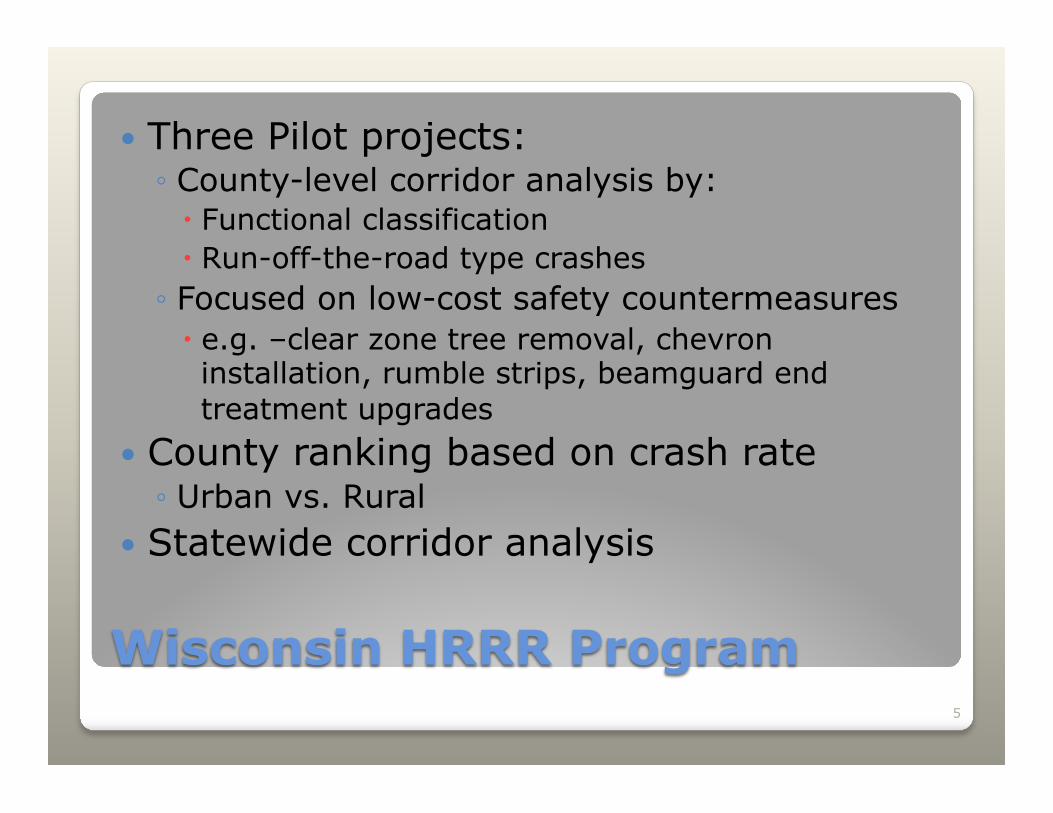
Wisconsin HRRR Program
� Three Pilot projects: ◦ County-level corridor analysis by: � Functional classification � Run-off-the-road type crashes ◦ Focused on low-cost safety countermeasures � e.g. –clear zone tree removal, chevron installation, rumble strips, beamguard end treatment upgrades
� County ranking based on crash rate ◦ Urban vs. Rural
� Statewide corridor analysis
5
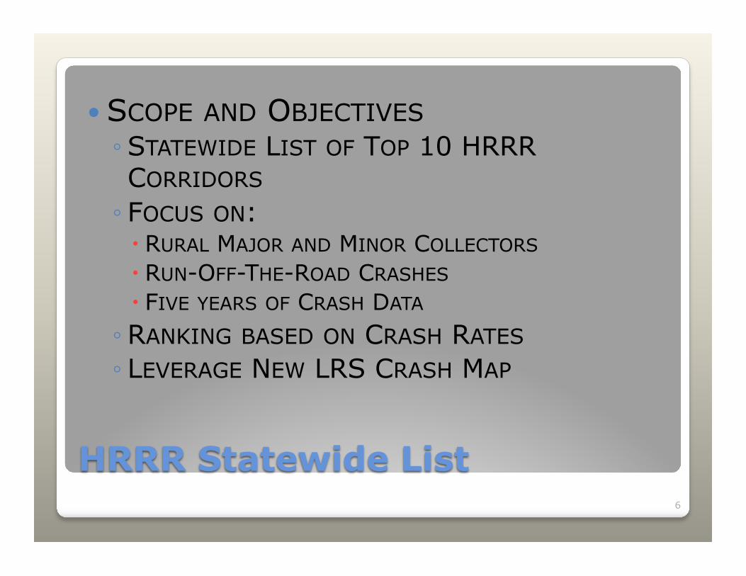
� SCOPE AND OBJECTIVES ◦ STATEWIDE LIST OF TOP 10 HRRR CORRIDORS ◦ FOCUS ON: � RURAL MAJOR AND MINOR COLLECTORS � RUN-OFF-THE-ROAD CRASHES � FIVE YEARS OF CRASH DATA ◦ RANKING BASED ON CRASH RATES ◦ LEVERAGE NEW LRS CRASH MAP
6
HRRR Statewide List
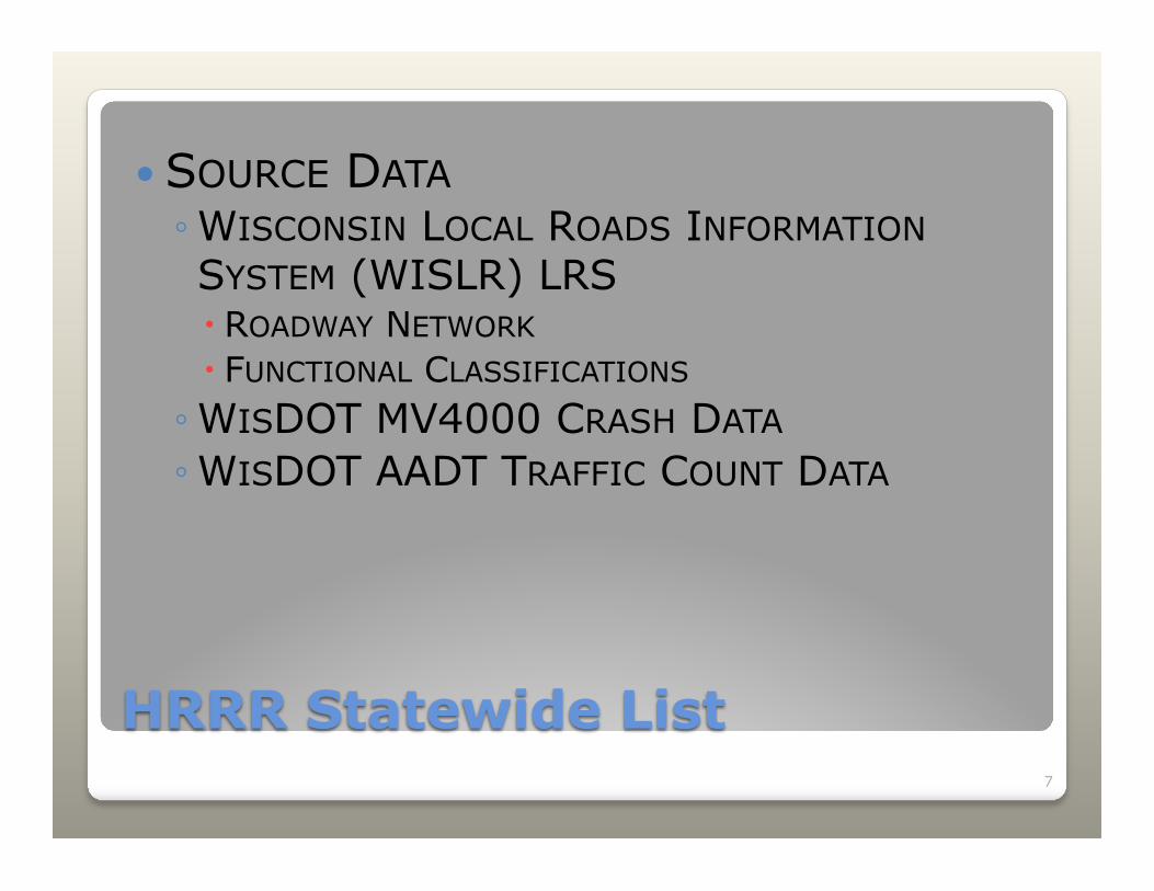
� SOURCE DATA ◦ WISCONSIN LOCAL ROADS INFORMATION SYSTEM (WISLR) LRS � ROADWAY NETWORK � FUNCTIONAL CLASSIFICATIONS ◦ WISDOT MV4000 CRASH DATA ◦ WISDOT AADT TRAFFIC COUNT DATA
7
HRRR Statewide List
8
HRRR Statewide List
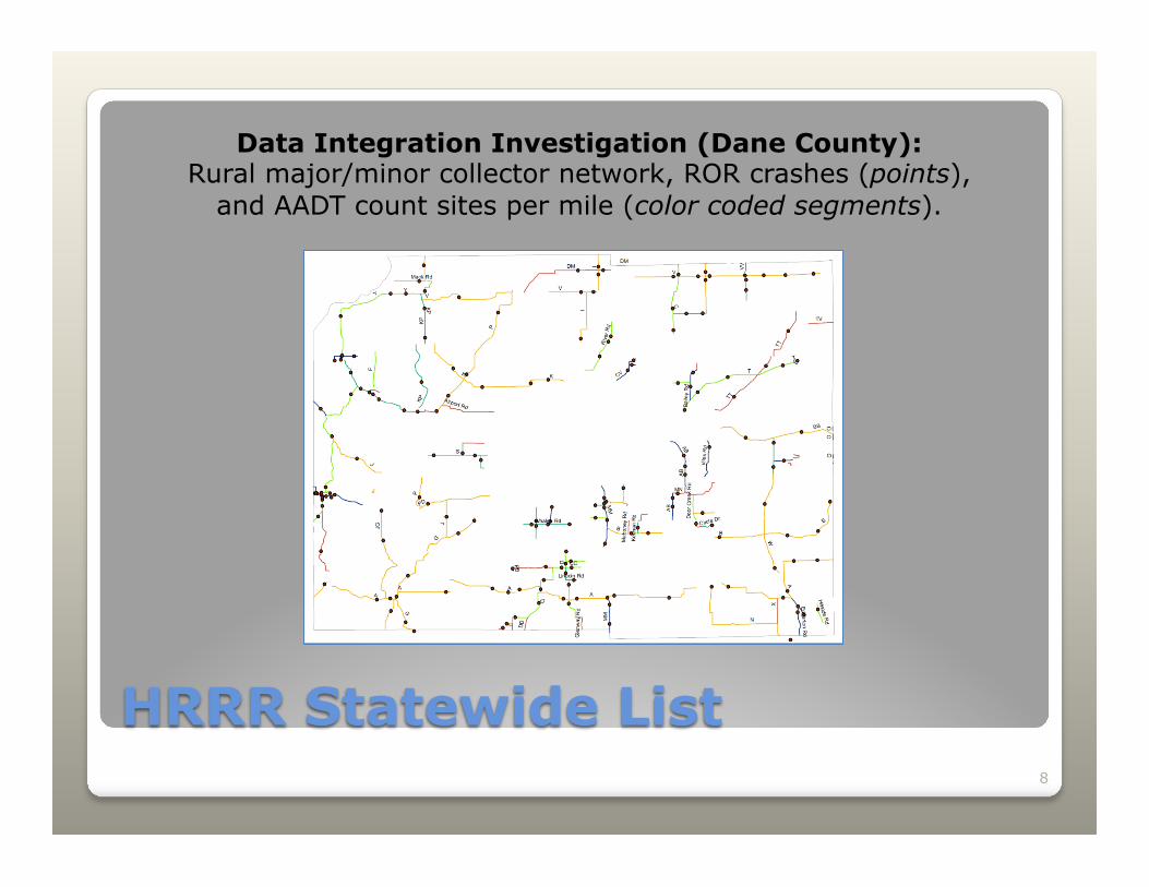
Data Integration Investigation (Dane County): Rural major/minor collector network, ROR crashes (points),
and AADT count sites per mile (color coded segments).
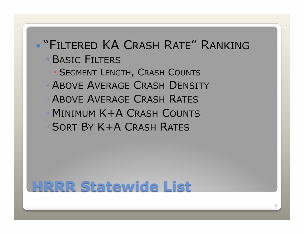
� “FILTERED KA CRASH RATE” RANKING ◦ BASIC FILTERS � SEGMENT LENGTH, CRASH COUNTS ◦ ABOVE AVERAGE CRASH DENSITY ◦ ABOVE AVERAGE CRASH RATES ◦ MINIMUM K+A CRASH COUNTS ◦ SORT BY K+A CRASH RATES
9
HRRR Statewide List

10
HRRR Statewide List
11
HRRR Statewide List
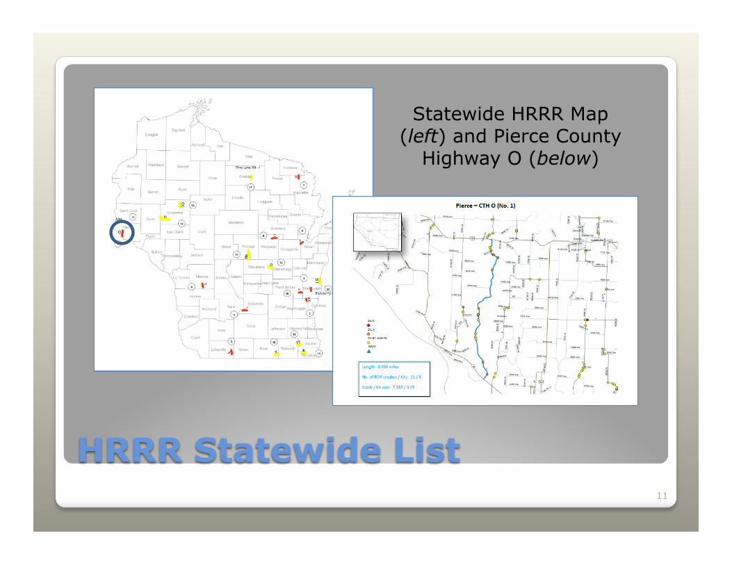
Statewide HRRR Map (left) and Pierce County
Highway O (below)
12
HRRR Statewide List
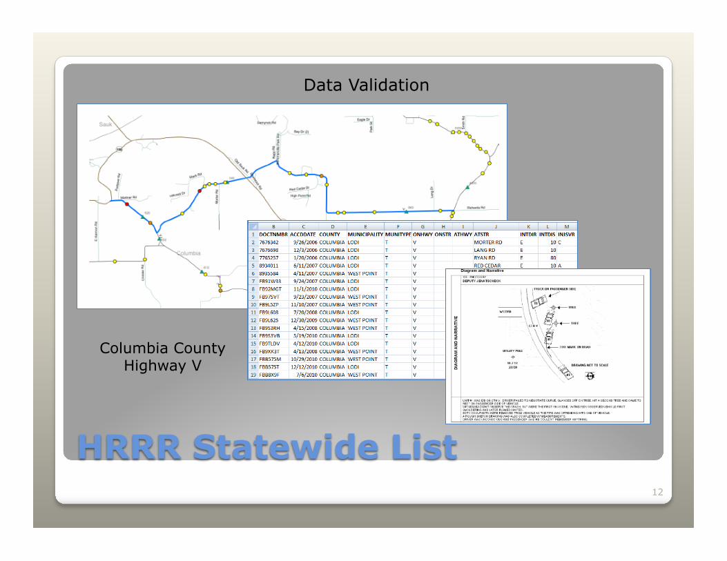
Columbia County Highway V
Data Validation
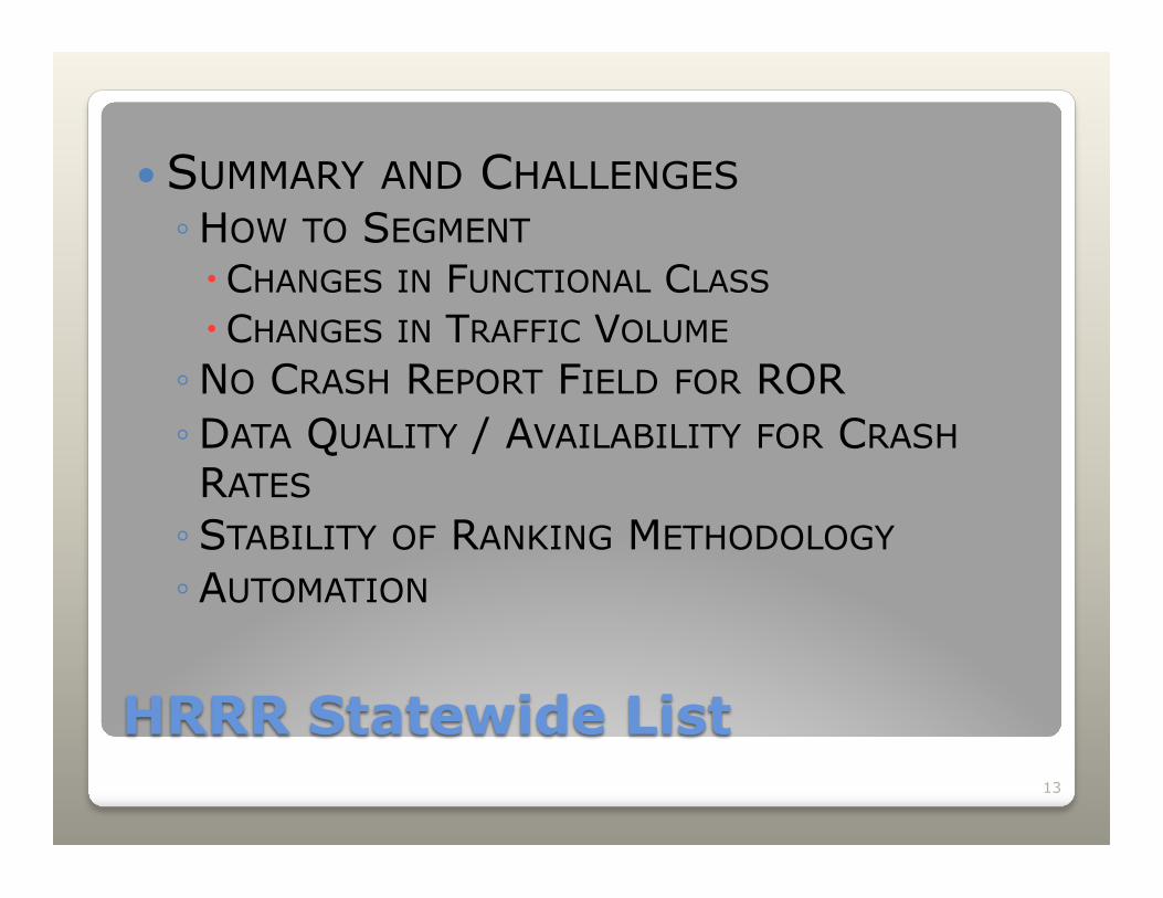
� SUMMARY AND CHALLENGES ◦ HOW TO SEGMENT � CHANGES IN FUNCTIONAL CLASS � CHANGES IN TRAFFIC VOLUME ◦ NO CRASH REPORT FIELD FOR ROR ◦ DATA QUALITY / AVAILABILITY FOR CRASH RATES ◦ STABILITY OF RANKING METHODOLOGY ◦ AUTOMATION
13
HRRR Statewide List
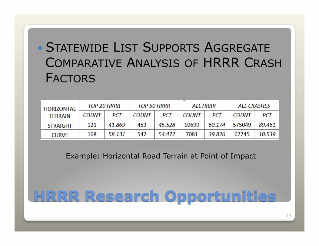
� STATEWIDE LIST SUPPORTS AGGREGATE COMPARATIVE ANALYSIS OF HRRR CRASH FACTORS
14
HRRR Research Opportunities
Example: Horizontal Road Terrain at Point of Impact
15
HRRR Project Implementation
2014
� Initially met skepticism, but this is understandable since historically these datasets were not available
� 7 of 10 corridors applied for funding � WisDOT has simplified and streamlined
the application process, giving locals access to additional safety funds
16
Future: Map 21 Considerations
� MAP-21 eliminated the mandatory set-aside for HRRR.
� But, requires additional funding (200% of FY09 set-aside) should crash rates increase over the most recent two-year period
� Why WisDOT will continue to manage a HRRR program ◦ Supports our local transportation system ◦ No studies under SAFETEA-LU HRRR

Wisconsin HRRR Program
Steven T. Parker UW-Madison TOPS Lab [email protected]
17
Justin Shell Wisconsin DOT
Questions?
Darren Schoer Wisconsin DOT HSIP Coordinator