an early twentieth century general store deposit … · 2015-02-08 · an early twentieth century...
TRANSCRIPT
AN E A R L Y T W E N T I E T H CENTURY
G E N E R A L STORE DEPOSIT
ON CAMP GRAYLING
Kent C. Taylor
ABSTRACT
Archaeological investigations at the early twentieth century lumber camp/village of Hardgrove (20CR89) on Camp Grayling in Crawford County, Michigan, revealed cultural material and structural evidence of a general store. The store, owned and operated by William T. Kirkby, serviced the village from about 1900 to 1914 until it and the town were abandoned. Following the demise of Hardgrove, Kirkby and his brothers moved operations to the larger north woods logging town of Sigma in neighboring Kalkaska County and resumed the general store business. Studies of logging camp sites have been typically limited to a sampling of the lifeways of the Michigan lumbering era. The analysis of the Kirkby store deposit offers an alternative insight into small-scale commercialism on the logging frontier
INTRODUCTION
Phase I and I I archaeological investigations across portions of the Camp Grayling National Guard base in Crawford County were completed by Commonwealth Cultural Resources Group , Inc. (CCRG) in 1994 and 1998 (Demeter and Taylor 1999; Robertson and Taylor 1994). Amongst the numerous sites identified during these surveys was that of Hardgrove, an early twentieth century (c. 1900-1914) lumber camp that evolved into a small but substantial community over the short course of its existence (Figures 1 and 2). Shovel testing and test unit excavations in and around structural depressions at the site revealed discrete activity areas including residences, a cook shack/restaurant, and the general store.
Kent C. Taylor: Commonwealth Cultural Resources Group, 2530 Spring Arbor Road, Jackson, MI 49203
22 T H E M I C H I G A N A R C H A E O L O G I S T V o l . 47 No. 1,2
i
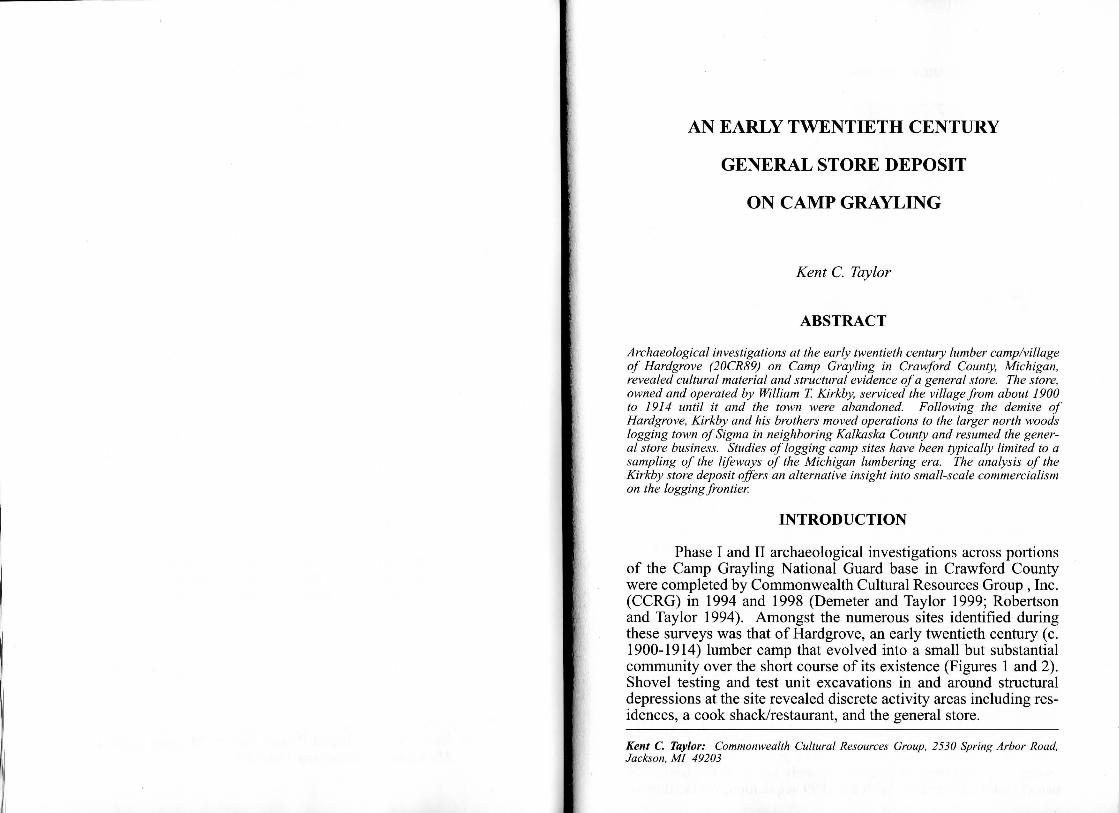
Figure 1.Hardgrove Settlement
HISTORIC BACKGROUND
Expansion to Abandonment
The site of Hardgrove was initially utilized as railroad land, having been included in the 1867 transfer from the State of Michigan to the Jackson, Lansing & Saginaw Railroad. At an unspecified point (between 1873 and 1899), the major logging concern of Sailing Hanson, which was headquartered in Grayling by 1878, acquired the property (Taylor n.d.). The first reference to a transaction involving the land encompassing site 20CR89 is a warranty deed sale made by Sailing Hanson to the Engle & Speer Lumber Company on December 6, 1899 for $1,800 (Crawford County n.d.b:324). Before the year was out, on December 28,1899, George Engle and others sold 45 acres of the original purchase to Frank Hardgrove and Charles W. Forbes (e.g., Hardgrove & Forbes) of Mt. Pleasant, Michigan for $200. According to the deed, Engle reserved the right to use the acreage for the storage of lumber and "Forest Products" and the "right to enter the premises to cut and remove said timber by December 27, 1904" (Crawford County n.d.c:310). Engle remained in the area at least through 1927 as owner of a large tract of land immediately north of the Hardgrove parcel (MDCLES 1927). With the 1899 acquisition, the Hardgrove
A N E A R L Y 2()TI1 C i i N T U R Y D E P O S I T 2.1
name becomes permanently identified with the area. On August H, 1924, Nellie J. Hardgrove, Vera G. Hardgrove Foster, Roy I''. Hardgrove, and Cora Hardgrove Kirkby all of Mt. Pleasant and heirs of Frank Hardgrove transferred the property to William T. Kirkby of Sigma, Michigan for $1.00 and other valuable considerations through a quit claim deed (Crawford County n.d.a: 155). 'I1io property was transferred by Kirkby (then of Kalkaska) to Artluir l i . Woodhams also of Kalkaska on November 4, 1927 via a $1.00 quit claim deed (Crawford County n.d.d:290). The property was transferred back to Kirkby on the same day (Crawford County n.d.d:291). Kirkby retained the land for the next ten years and eventually sold it to the United States on June 30, 1937 for $2.̂ 0 through a warranty deed (Crawford County n.d.e:64). The fetlcnil government held it for another 12 years and subsequently assigned 41.07 acres to the State of Michigan through the Secretary of Agriculture on January 1, 1949 to form part of the Camp Grayling military reservation (Crawford County n.d.f 58).
From volumes of the Michigan Gazetteer and Business Directory for this period a chronicle of events for Hardgrove can be pieced together. The Hardgrove lumber camp, solely operated by Frank Hardgrove, probably started in 1900 or 1901. The 1901 Michigan Gazetteer and Business Directory (Polk 1901:964) states
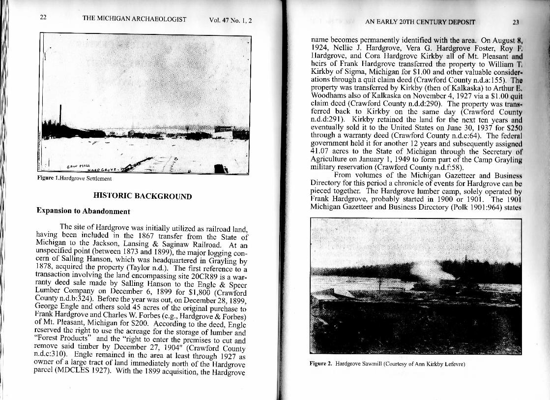
Figure 2. Hardgrove Sawmill (Courtesy of Ann Kirkby Letcvre)
24 T H E M I C H I G A N A R C H A E O L O G I S T V o l 47 No. 1,2
that Hardgrove was "a recently established post office in Crawford." By 1903 (Polk 1903:996), the site consisted of a few businesses including William T. Kirkby's general store (who also served as postmaster) and Frank Hardgrove's sawmill. The Kirkby store is mentioned throughout the next decade and is listed for the years 1903/4 through 1913 (Polk 1903/4:996; 1905:1212; Polk 1907:1146; Polk 1909:1028; Polk 1911:997; Polk 1913:762). An undated photo of the settlement during this period not only depicts the mill but an assortment of buildings as well (Figure 1) (Archives of Michigan n.d.). The conglomeration of structures shown in the photograph makes it virtually impossible to identity the store or any other specific building.
The first postmaster at Hardgrove was Esther Kent, who occupied that position beginning on July 25, 1900 (Romig 1986:251). Though Dodge (1970:79) states that A. A. Geister was the postmaster and the proprietor of the store by 1905, the Michigan State Business Gazetteer and Directory for 1905 lists Kirkby as both postmaster and store owner (Polk 1905:1212), both positions which Kirkby held as early as 1903 (Polk 1903/1904:996). As of 1915, there is no further documentary reference to the store. By this date, William C. Johnson had assumed the role of postmaster and is listed as the manufacturer of Chippewa Canoe Paddles. While the Hardgrove Lumber Company is listed as still doing business as late as 1915 (Polk 1915:860), Hardgrove had died of "sugar" in 1909 (GENDEX 2001; Ann Kirkby Lefevre, personal communication 2001).
Apparently, Hardgrove's death severely impacted the future of the sawmill operation, leaving the camp/town with no one to run it (Ann Kirkby Lefevre, personal communication 2001). This event may explain the acute depopulation that Hardgrove experienced after 1909. As of 1917, Hardgrove is referred to only as a place along the railroad but without a post office or business of any sort (Polk 1917:872), suggesting that the store, privately owned by Kirkby, was in operation from about 1901/1903 to about 1913/1914. Ten years later in 1924, Kirkby, who was related to Hardgrove by marriage, gained ownership of the entire parcel through a quit claim deed (Crawford County n.d.a: 155). The lifespan of the Hardgrove store correlates with the beginning dates of the Kirkby Brothers store at Sigma in neighboring Kalkaska County to the west. Kirkby was made postmaster at Sigma on May 13, 1914; the post office was located in the Kirkby store as it was at Hardgrove. The first reference to the Kirkby Brothers general store in Sigma was in the 1913 gazetteer (Polk 1913). Wakefield (1994)
A N E A R L Y 20TH C E N T U R Y DEPOSIT 25
writes that Sigma was started in about 1910 and that "a year or so later, the Kirkby Brothers, Bil l , Claude, and A l , buih a big general store...".
The history of 20CR89 touches on the following points: 1) a population drop from a high of 200 in 1907 to only 50 by 1910; 2) the Kirkby store at Hardgrove ended in about 1913/1914; 3) the Kirkbys opened another store in Sigma shortly thereafter; 4) the Hardgrove store may have closed as early as 1910/1911; and 5) the Sigma store may have opened as early as 1911/1912. The abandonment of Hardgrove and thus the store may have resulted from a devastating fire, a drastic downturn in the business climate (especially the well-publicized decline in hardwood procurement during this era), the national economic downturn of 1910, or Hardgrove's death in 1909 which may have led to a break up of the lumber company, and therefore the sharp population decline. Destruction by fire was common during the lumbering era. The nearby logging village of Frederic contained three mills each of which were destroyed by fire during the same period. The loss of the mills prompted the mill workers to move away to follow the mills (Lewis 1950:35, 36). The drop in population may have also been precipitated by a labor force that shifted away from the lagging hardwood industry to work on the hydroelectric dams that were being constructed along the Au Sable River beginning in 1909. In all likelihood, it was some combination of these factors, but fire, Hardgrove's death, and a depressed hardwood industry would seem to be the best explanations for the abandonment of Hardgrove and the Kirkby store.
The 1927 Farm and Forest Map of Crawford County shows an abandoned railroad line running south-southwest out of Hardgrove for a distance of about five miles, where it connected with the Lewiston Branch of the Michigan Central Railroad in Grayling Township (MDCLES 1927). Following Hardgrove's death, the settlement continued to be occupied but to a diminished degree. By 1917, the site is characterized as little more than a place along the railroad, lacking a post office and only one or two businesses. The Directory of Michigan Communities (MOCD 1945:36) continues to list "Hard Grove" as an active community, but with less than 100 people and no viable post office. This description probably refers to the town after the population had dispersed away from the original site location. The hilltop inhabitants were probably dispersed to the surrounding lands and/or nearby villages. Dodge (1970:79) places the 1910 population at 50, as compared to the 200 inhabitants listed for 1907 (Polk 1907:1146). It may be that when Hardgrove died it led to a gradual evacuation of the site over
26 T H E M I C H I G A N A R C H A E O L O G I S T V o l . 47 No. 1,2
the next few years until the point was reached when the community could no longer sustain a post office. Of course, the decrease in population and the loss of the post office may also be attributed to fluctuations or regular cycles in the business climate. Perhaps lumber manufacturing at this location had been substantially reduced and operations were either discontinued or relocated elsewhere in the region.
Site Chronology:
1899-1900 1901 1903-1904
1907 1909 1910 1911-1912
1914
1914
1897-1915
1917
Hardgrove & Forbes purchase property Hardgrove, rural post office stop First reference to Kirkby as postmaster and owner of general store Population estimate of 200 Death of Frank Hardgrove Population estimate of 50 Wakefield's estimate of the starting date for the Kirkby Brothers general store at Sigma Last reference to Kirkby general store at Hardgrove Kirkby installed as Sigma postmaster with post office in his general store Diagnostic artifacts from Kirkby store and other Hardgrove deposits Last gazetteer reference to Hardgrove (no post office)
SITE DESCRIPTION AND C U L T U R A L M A T E R I A L
The Phase I survey identified site 20CR89 as the most likely location of the early twentieth century logging camp/community of Hardgrove. A total of six structural depressions were identified during the Phase I and I I reconnaissances; initial inspection of the site area also identified three related surface artifact scatters (designated as A, B, and C). Artifacts recovered during the Phase I investigation combined with those collected from a small potted area north of Feature 1 ascribed a ca. 1900-1915 time frame to the site. Documentary evidence for the community of Hardgrove strongly supports the use-dates achieved through the diagnostic cultural material (Robertson and Taylor 1995:98, 101, 103).
Phase I I investigations involved extensive systematic shovel testing at 10 m intervals, including 289 total shovel test units
A N E A R L Y 20TH CENTURY DEPOSIT 27
(STUs) that resulted in 30 culturally positive STUs. Shovel test units yielded moderate quantities of diagnostic items, including examples of ca. 1900+ decalcomania white paste ware, wire nails, and ca. 1880-1915 solarized amethyst glass fragments. One shovel test produced several refit paneled bottle firagments embossed with KIL.../SWAMP-/ROOT/...NEY/...ADDER/...RE..., which refers to Dr. Kilmer & Co.//The Great/Dr. Kilmer's/Swamp-/Root/Kidney/Liver & Bladder/Cure/Specific//Binghamton, N.Y., datable to at least 1894 (Baldwin 1973:291; Fike 1987:101). A shovel test in close proximity to Feature 6 (the cook shack deposit) yielded refit aquatint panel bottle fragments denoting HOODS/SARSA/PARILLA which Wilson (1981:138) dates to the 1883-1896 period. Other paneled aquatint bottles from this same context were embossed with LOWELL MASS. and likely originated with the Hoods Sarsaparilla, manufactured in Lowell, Massachusetts (Fike 1987:262). STU E-8, also closely associated with Feature 6 and the hillside trash deposit, produced paneled bottle fragments embossed with SPERM/SEWING MACHINE/OIL (ca. 1890-1920). The presence of this product infers that a seamstress or tailor was active at the site.
Feature 4: General Store Deposit
The Kirkby store most closely corresponds with Feature 4 and was revealed through artifact assemblages in both shovel tests and test units. In total. Feature 4 produced 1,203 artifacts attributable to nine individual artifact classes. Household and architectural artifacts dominated the inventory with 357 (29.7%) and 771 (64.1%) artifacts respectively (Table 1).
Artifact Class Shovel Tests Unit 3 Unit? Unit 11 Totals
llousehold 37 302 12 6 357 Architectural 55 552 120 44 7 71 Vlisc. Hardware 3 22 5, - 30 Fools - 2 - 1 3 ;:iothing - 8 1 - 9 Ammunition - 6 1 1 8 Personal 15a _ _ 20 Toys - 1 - - 1 3one 1 2 1 - 4 Totals 96 910 145 52 1203
Tablet. Feature 4: Kirkby Store Deposit Artifact Calsses. a- includes 3 advertisement buttons, 3 mirror fragments, 1 1898 US cent, 1 1908 US dime, 3 keys, 1 heart shaped charm, 1 finger ring, & 2 comb teeth; b- includes 1 1901 US cent, 1 1903 US nickel, 1 1907 US cent, & 2 keys.
28 T H E M I C H I G A N A R C H A E O L O G I S T V o l . 47 No. 1, 2
Test Unit 3 - - r ) - . " , .
Phase I I excavations involved 50 cm x 50 cm test units targeted within structural depressions and concentrations of artifacts. Given the density of material recovered in associated STUs, Test Unit 3 was positioned inside the eastern end of Feature 4, a structural depression located on the west side of the site. Level 1 (0-48 cmbs) consisted of yellowish brown lOYR 5/4 and brown lOYR 4/3 sand with gravel and cobbles while Level 2 (33-83 cmbs) contained a mottled and burned zone of yellowish brown lOYR 5/4, grayish brown lOYR 5/2, and black lOYR 2/1 sand with gravel and cobbles. The underlying sterile subsoil included yellowish brown lOYR 5/6 sand with gravel inclusions.
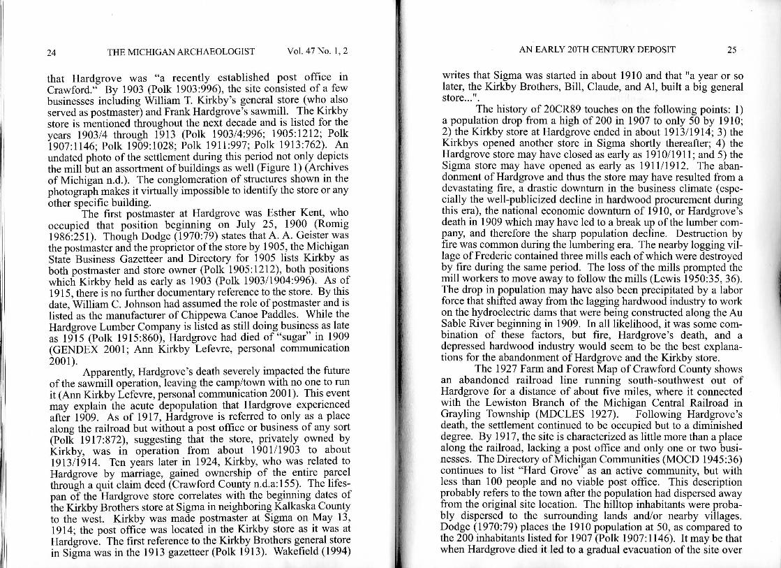
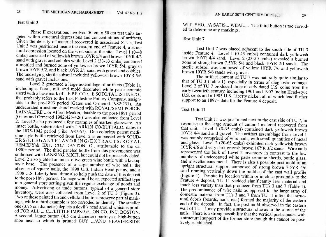
Level 2 generated a large assemblage of artifacts (Table 1), including a floral, gilt, and mold decorated white paste ceramic sherd with a base mark of ...E.PR CO./...E SOTO/PALESTINE./O., that probably refers to the East Palestine Pottery Company, assignable to the pre-1893 period (Gates and Ormerod 1982:231). An undecorated ironstone sherd marked with ROYAL/SEMI-PORCE-LAIN/ALFRE ...or Alfred Meakin, datable to the post-1891 period (Gates and Ormerod 1982:425-426) was also collected from Level 2. Level 2 also produced a few examples of marked glassware. An intact bottle, side-marked with LARKIN CO/BUFFALO, dates to the 1875-1942 period (Fike 1987:67). One colorless patent medicine-style bottle retrieved from Level 2 is embossed with SOUD-E R S / E L E G A N T F L A V O R I N G / E X T R A C T S / R O Y A L REMEDY/& EXT. CO./ DAYTON, O., attributable to the ca. 1890+ period. The third paneled bottle from this provenience was embossed with LANSING, MICH, but could not be precisely dated. Level 2 also yielded an intact olive green wine bottle with a kickup style base. The presence of a large number of wire nails, the absence of square nails, the 1898 U.S. Indian Head penny, and a 1908 U.S. Liberty head dime also help push the date of this deposit to the post-1897 period. Coinage would be an expected artifact type in a general store setting given the regular exchange of goods and money. Advertising or trade buttons, typical of a general store inventory, were also collected from Level 2 of TU 3 (Figure 3). Two of these painted tin and celluloid buttons preserve partial markings, while a third example is too corroded to identify. The smaller one (3.75 cm diameter) depicts a devil's head around which is printed FOR ALL ... C.../LITTLE IMPS/50/...ON CO. INC. BOSTON. A second, larger button (4.5 cm diameter) portrays a high-button shoe next to which is printed BUY .../AND HEAVIER/SIDE
A N E A R L Y 20TH C E N T U R Y DEPOSIT 29
WIT...SHO.../A SATIS... WEAT... . ed to determine any markings.
Test Unit 7
The third button is too corrod-
Test Unit 7 was placed adjacent to the south side of TU 3 inside Feature 4. Level 1 (0-43 cmbs) contained dark yellowish brown lOYR 4/4 sand. Level 2 (23-50 cmbs) revealed a burned zone of strong brown 7.5YR 5/8 and black lOYR 2/1 sands. The sterile subsoil was composed of yellow lOYR 7/6 and yellowish brown lOYR 5/6 sands with gravel.
The artifact content of TU 7 was naturally quite similar to that of TU 3 (Table 1), especially in terms of diagnostic coinage. Level 2 of TU 7 produced three closely dated U.S. coins from the early twentieth century, including 1901 and 1907 Indian Head-style U.S. cents and a 1903 U.S. Liberty nickel, all of which lend fiirther support to an 1897+ date for the Feature 4 deposit.
Test Unit 11
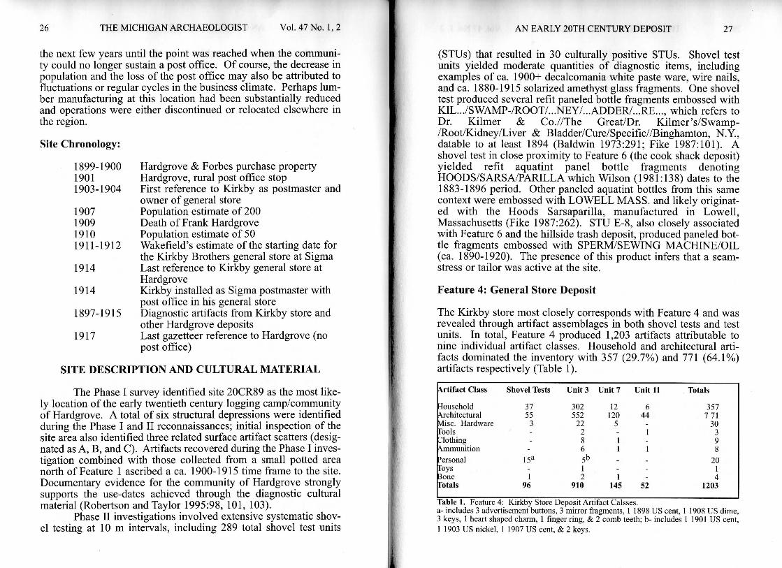
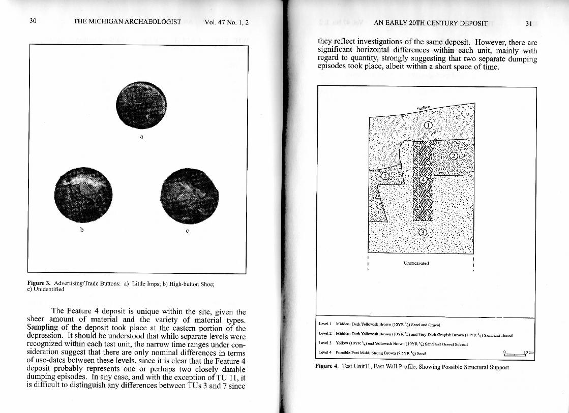
Test Unit 11 was positioned next to the east side of TU 7, in response to the large amount of cultural material recovered from that unit. Level 1 (0-35 cmbs) contained dark yellowish brown lOYR 4/4 sand and gravel. The artifact assemblage from Level 1 was mainly comprised of wire nails, with small quantities of metal and glass. Level 2 (20-65 cmbs) exhibited dark yellowish brown lOYR 4/6 and very dark grayish brown lOYR 3/2 sands. Wire nails represented the bulk of Level 2 inventory in contrast to the low numbers of undecorated white paste ceramic sherds, bottle glass, and miscellaneous metal. There is also a possible post mold of an upright structural support composed of strong brown 7.5YR 4/6 sand running vertically down the middle of the east wall profile (Figure 4). Despite its location within or in close proximity to the Feature 4 deposit, TU 11 yielded significantly less material and much less variety than that produced from TUs 3 and 7 (Table 1). The predominance of wire nails as opposed to the large array of domestic material from TUs 3 and 7 from TU 11 infers that structural debris (boards, nails, etc.) formed the majority of the eastern end of the deposit. In fact, the post mold observed in the eastern wall of TU 11 may provide a structural clue as to the source of the nails. There is a strong possibility that the vertical post equates with a structural support of the former store though this cannot be positively established.
30 T H E M I C H I G A N A R C H A E O L O G I S T V o l . 47 No. 1,2
Figure 3. Advertising/Trade Buttons: a) Little Imps; b) High-button Shoe; c) Unidentified
The Feature 4 deposit is unique within the site, given the sheer amount of material and the variety of material types. Sampling of the deposit took place at the eastern portion of the depression. It should be understood that while separate levels were recognized within each test unit, the narrow time ranges under consideration suggest that there are only nominal differences in terms of use-dates between these levels, since it is clear that the Feature 4 deposit probably represents one or perhaps two closely datable dumping episodes. In any case, and with the exception of TU 11, it is difficult to distinguish any differences between TUs 3 and 7 since
A N EARLY 2()TH CENTURY DEPOSIT 31
they reflect investigations of the same deposit. However, there are significant horizontal differences within each unit, mainly with regard to quantity, strongly suggesting that two separate dumping episodes took place, albeit within a short space of time.
CD
Unexcavated
Level 1 Midden: Dark Yellowish Brown ( l O Y R •*/,) Sand and Gravel
Level 2 Midden: D a * YeUowish Brown ( l O Y R X) and Very Dark Grayish Brown ( l O Y R \ Sand and Jravel
Level 3 Yellow ( l O Y R \ a n d Yellowish Brown ( l O Y R %) Sand and Gravel Subsoil
Level 4 Possible Post Mold; Strong Brown (7 .5YR "4) Sand °
Figure 4. Test Unitl 1, East Wall Profile, Showing Possible Structural Support
32 T H E M I C H I G A N A R C H A E O L O G I S T VoL 47 No. 1,2
Level 2 in both TUs 3 and 7 furnished the most substantial quantity of artifacts. For example, Level 2 within TU 3 produced in excess of three times the material and a much greater variety as that of Level 1. Domestic-type material dominated the assemblage, but there was also a significant quantity of structural items such as nails, screws, washers, etc. The most interesting aspect of the TU 3/Level 2 deposit was the presence of debris not readily associated with the typical residence/homestead of the region, but which would be more representative of a general store inventory, especially the recovery of the advertisement/trade buttons. Level 2 is characterized as a burned zone and indeed several of the artifacts from this provenience were either burned or melted, thus giving rise to the supposition that the deposit originated from a burned structure. Layer 2 in TU 7 is quite similar to that of TU 3 particularly in terms of diversity of recovered material and burned and melted items as well as the presence of structural debris.
Test Unit 11 presents a somewhat different circumstance. It apparently encompasses an area slightly beyond and out of the main deposit as evidenced by its substantially smaller artifact inventory. Very little difference exists in terms of both artifact type and numbers between Levels 1 and 2. In contrast to TUs 3 and 7, TU 11 produced a greater frequency of structural-type items compared to domestic or store-related goods. The post mold recorded on the east wall of TU 11 also implies that the test unit is in fact positioned within an original area of Feature 4, not necessarily associated with the large deposit immediately to the west which obviously occurred later than the structural component represented in the TU 11 profile.
Interpretation of Feature 4
The analysis and interpretation of the Feature 4 deposit is based on the burned condition of the artifacts, the type of artifacts represented, and the frequency of certain types of artifacts. For instance, there is almost a total lack of faunal material in sharp contrast to the typical residential or the restaurant/cook shack structure. It is safe to say that the deposit, particularly Level 2, reflects a singular dumping episode that occurred sometime between 1900 and 1915 and whose origin likely points to a general store context (as mentioned in the historic documentation). This is based mainly on the variety of unusual material recovered, including advertising/trade buttons, jewelry, coins, etc. It is also implied that the one-time disposal could have been occasioned by a devastating fire to the store and perhaps to the entire community which could
A N E A R L Y 20TH C E N T U R Y DEPOSIT 33
have occurred between 1907 and 1910. The fire might explain the reduced level of activity associated with Hardgrove after 1910, as seen in the depleted population numbers. It is unclear as to the original provenience of the store and whether or not Feature 4 is its actual location. The deposit may represent a reuse of an older privy vault or trash dump that was expanded to accommodate the large quantity of trash associated with the fire, although this cannot be substantiated.
SYNTHESIS AND DISCUSSION
A number of factors point to the 20CR89 site location as that of the early twentieth century community of Hardgrove. Both archival documentation and cartographic sources are very specific about the location of the community during the post-1900 period (Dodge 1970:79; MDCLES 1927; Romig 1986:251). Hartwick Pines State Park Interpreter Wendell Hoover also confirmed this location as that of the site of Hardgrove (Wendell Hoover, personal communication 1998). The recovered artifact assemblages, particularly those produced from the Feature 4 deposit and from the hillside dump just west of Feature 6, are both domestic and structural as might be typical of a small settlement from the period. The narrow date range, as achieved through the presence of decalcomania wares, solarized amethyst glass, marked ceramics and bottles, and especially the coins lend indisputable evidence for an early twentieth century occupation that correlates with that known historically for Hardgrove. In this light, the site indeed represents a remaining intact portion of the settlement, although the site has experienced vehicular disturbances since the initial survey, primarily to the southern end of the hill where the old road is located.
The archival photograph of Hardgrove is interesting and can be used to better define the nature and period of utilization of the ridge top features that constitute the site. The photograph could predate the abandonment of the town in the foreground and the relocation to the ridge top, thus structures do not as yet exist on the ridge top. The ridge top occupation may represent a much diminished use-phase of Hardgrove that began sometime between 1907 and 1910 and lasted to about 1913/1914. Perhaps the store (Feature 4) was relocated to the ridge top but continued on a smaller scale. The ridge top community could also represent an expansion of the lakeside community.
The archaeological investigation revealed 3-5 residences, a cook shack or restaurant, and Kirkby's store. It is difficult to deter-
34 T H E M I C H I G A N A R C H A E O L O G I S T VoL 47 No. 1,2
mine whether the store deposit is in-situ or was dumped from elsewhere, but i f it is indeed an in-situ accumulation of material it may represent its secondary location, perhaps because the first store burned down. For example, none of the coins post-date 1908. It is also possible that the ridge top community is the non-industrial portion of the site that only consisted of residences, a cook shack, and the store. These structures would therefore post-date the archives photograph. I f Hardgrove represents an expanded or elaborate lumber camp, there may have been just a few residences as suggested by the small number of features on the ridge. There was also the possibility that since fire was an ever-present problem, so few people actually lived on the immediate property. The population estimates for Hardgrove obviously encompass the greater surrounding rural area, not just the narrow confines of the site.
Based on the Phase I I investigations at the site, some specific interpretations as to feature function, etc. can be made. Feature 4 represented a major investigative focus of the site. The combination of quantity and variety of cultural material recovered at this location made it the logical focal point for further discussion.
The Feature 4 deposit contained strong evidence for a domestic as well as a structural-type artifact component. Interestingly, there was a small incidence of tin cans and faunal waste recovered from the Feature 4 deposit, suggesting that it is specifically made up of non-household refuse. We would expect that any canned goods in the deposit prior to the fire were salvageable and therefore would have not made it into the bum zone. The liberal presence of faunal waste in the other deposits at the site as opposed to the virtual lack of such material in Feature 4 indicates that any fresh meat sold at the store was purchased, consumed, and discarded elsewhere, especially in association with Feature 6 (the probable location of the site's cook shack/restaurant), and to a much lesser extent at the residential units.
Artifact debris collected firom the site's other concentrations conform with typical domestic material of the ca. 1900+ period and are clearly associated with residential-type contexts. As such, it is likely that Features 1, 2, 3, and 5 represent individual housing units. On the other hand, the size of the root cellar (Feature 6) located in the east portion of the site may indicate that it served as a cook shack for the entire hilltop populace. Homesteads and farmsteads that were located away from the hilltop may in fact represent "sub-urban"-type loci that developed around the main ridge top.
Given the early ownership of the property by three lumber companies (Sailing Hanson, Engle & Speer, and Hardgrove &
A N EARLY 2()TH C l i N T U R Y DEPOSIT 35
Forbes) it is obvious that the settlement of Hardgrove evolved out of milling operations that were clearly located to take advantage of the south-southwest running railroad that connected it to the Michigan Central Railroad. In fact, the unnamed railroad line appears to have been extended northward specifically to accommodate the various operations at Hardgrove. There is a strong possibility that most of the early inhabitants of Hardgrove were directly involved in the production of wood products along the lake or at least in some capacity closely associated with lumbering activity. Essentially then, Hardgrove may be typical of frontier settlements that develop around a loose aggregate of related activities or industries (in this case, lumber milling and wood products) and might therefore fit into Lewis' (1984:16-17) concept of the "cosmopolitan" frontier settlement in that it was economically specialized and short-term in duration. It is tempting to propose that Hardgrove was a company town because of its early association with the Hardgrove & Forbes lumbering and milling operations. While Hardgrove owned and operated the sawmill, probably the town's most dominant enterprise, it appears that all of the other businesses were individually owned. This becomes clear through the examination of any of the business gazetteers for the period which list several different firms all with different proprietors. Likewise, Kirkby or at least the Kirkby brothers seem to have owned the general store quite apart from any of Hardgrove's interests.
The Kirkby establishment probably shared a number of attributes in common with any rural northern Michigan general store of that era. Comparable stores were located in Frederic, also an early twentieth century lumbering village located about seven miles west of Hardgrove. In Frederic there were three general stores that supplied the needs of the people of the village, the farmers, and the logging camps with the usual supplies. These old-fashioned general stores were known to carry a broad range of goods that is emphasized by the letterhead on the Lewis general store stationary which read "T. E. Lewis, General Store - Hay - Grain -Groceries - Dry Goods - Lumberman's Supplies - In Fact Anything" (Lewis 1971).
Proprietors of general merchandise stores filled prominent roles on Main Street. Besides selling the widest possible selection of groceries, dry goods, and hardware, they usually operated the local post office (as did Kirkby), served as a font for town gossip, offered a haven for local wags and philosophers, and provided a meeting place for clubs and fraternal groups. It was, in the words of one shopkeeper, "a clustering point for all of village life." The
36 T H E M I C H I G A N A R C H A E O L O G I S T V o l . 47 No. 1,2
man who presided over such an estabUshment naturally had to be something more than a mere merchant. He ranked as a public figure and a celebrity, known and trusted by everyone (Sutherland 1989:186, 187).
The interior of a country store was typically crowded and cluttered with tobacco jars, kitchen wares, crockery, bolts of cloth, bottles of whiskey, medicines, school slates, meal and flour, and scores and scores of other items lined the two side walls. Shopkeepers often tried to keep groceries and canned goods on one side and dry goods on the other. Some wall space accommodated various-sized drawers to hold small items like socks, suspenders, spools of thread, stationary, and fish hooks. Display cases for buttons, needles, ribbons, corset stays, pencils, pipes, rings, dollar watches, scissors, and thimbles occupied space on the counters. At least one case might hold toilet articles, including hair tonic, pomade, shaving soap, razors, talcum powder, camphor, and perfume. Jars of assorted candies also lined the counters, and some portion may have provided customers with an array of cheese, sausage, sardines, crackers, and essential seasonings (Sutherland 1989:187-188).
SUMMARY AND CONCLUSIONS
The Phase I I investigations at the site have identified refuse and evidence of fire from a general store context. The cultural material evidence from Feature 4 can be reliably dated to the ca. 1903-1913/1914 period and provides a unique profile of a frontier commercial establishment that existed contemporaneously with a number of the hardwood logging camps in the region and which is connected with a logging village of the opening years of the twentieth century.
Based on documentation and physical evidence, the following assumptions are made about the depopulation of Hardgrove:
• a fire destroyed Hardgrove and the Kirkby store between 1907 and 1910
• the store was rebuilt after 1907/1910, then removed altogether by about 1914
• store operations were moved to Sigma perhaps as early as 1911/1912. There could have been two Kirkby stores in
A N E A R L Y 20TH C E N T U R Y DEPOSIT 37
operation for a brief time (one in Hardgrove and one in Sigma); there were certainly enough brothers to accomplish this. Or the Hardgrove store was kept going until construe tion of the Sigma store was completed, then operations were moved entirely to Sigma
• population decline may have been the result of fire, depletion of hardwood, Hardgrove's death, or available unskilled construction work on the AuSable hydroelectric dams that were started in 1909
• the Feature 4 deposit could be the location of a second Kirkby store at Hardgrove.
A C K N O W L E D G E M E N T S
This article is based on the discussion of site 20CR89 that formed a portion of the Camp Grayling archaeological studies carried out by Commonwealth Cultural Resources Group, Inc. Funding for this investigation was derived from the Department of Military and Veteran Affairs (DMVA), while permission for the publication of this article was obtained from Carla Elenz, environmental officer at Camp Grayling. In addition, valuable background material and photographs were generously furnished by Ann Kirkby Lefevre, grand niece of William Kirkby and great granddaughter of Frank Hardgrove.
R E F E R E N C E S C I T E D
Archives of Michigan n.d. Sawmill Hardgrove. DeWitt Watson CoUecfion, negative
no. 10808. Photograph on file. Archives of Michigan, Lansing.
Baldwin, J. K. 1973a Collector's Guide to Patent and Proprietary Medicine
Bottles of the Nineteenth Century. Thomas Nelson, Inc., Nashville, Tennessee.
Crawford County n.d.a.Deed Liber 18. Crawford County Register of Deeds,
Grayling, Michigan.
38 T H E M I C H I G A N A R C H A E O L O G I S T V o l . 4 7 No. 1,2
n.d.b.Deed Liber Q. Crawford County Register of Deeds, Grayling, Michigan.
n.d.c.Deed Liber R Crawford County Register of Deeds, Grayling, Michigan.
n.d.d.Deed Liber 21. Crawford County Register of Deeds, Grayling, Michigan.
n.d.e.Deed Liber 26. Crawford County Register of Deeds, Grayling, Michigan.
n.d.f Deed Liber 36. Crawford County Register of Deeds, Grayling, Michigan.
Demeter, C. S. and K. C. Taylor 1999 Phase I I Archaeological Investigations of Camp
Grayling Crawford, Kalkaska, and Otsego Counties, Michigan. Commonwealth Cultural Resources Group, Inc., Jackson, Michigan.
Dodge, R. L. 1970 Michigan Ghost Towns, Volume 1. Amateur Treasure
Hunters Association, Inc., Oscoda, Michigan.
1937 Michigan Today: Its Human and Physical Resources as They Affect Education. Bulletin 307. State of Michigan Department of Public Instruction, Lansing.
Fike, R. E. 1987 The Bottle Book: A Comprehensive Guide to Historic,
Embossed Medicine Bottles. Peregrine Smith Books, Salt Lake City.
Gates, W. C , Jr. and D. E. Ormerod 1982 The East Liverpool Pottery District: Identification of
Manufacturers and Marks. Historical Archaeology 16:1-358.
GENDEX 2001 GENDEX genealogical website, www.gendex.com.
PARTNERS IN PRESERVING T H E PAST 39
Lewis, F. E. ; 1950 Frederic: A Typical Village in the Twilight of the
Lumbering Era, 1912-1918. Michigan History 32(4).
Lewis, K. C. 1984 The American Frontier: An Archaeological Study of
Settlement Pattern and Process. Academic Press, New York.
Michigan Department of Conservation Land Economic Survey [MDCLES]
1927 Ownership Maps - Crawford County. Michigan Department of Conservation Land Economic Survey, Lansing. On file. Archives of Michigan, Lansing.
Michigan Office of Civilian Defense [MOCD] 1945 Directory of Michigan Communities. Compiled by
Michigan Office of Civilian Defense. Captain Donald S. Leonard Director, Lansing.
Polk, R. L. 1901 Michigan State Gazetteer and Business Directory, 1901. R.
L. Polk, Detroit.
1903 Michigan State Gazetteer and Business Directory, 1903. R. L. Polk, Detroit.
1905 Michigan State Gazetteer and Business Directory, 1905. R. L. Polk, Detroit.
1907 Michigan State Gazetteer and Business Directory, 1907. R. L. Polk, Detroit.
1909 Michigan State Gazetteer and Business Directory, 1909-10. R. L. Polk, Detroit.
1911 Michigan State Gazetteer and Business Directory, 1911-1912. R. L. Polk, Detroit.
1913 Michigan State Gazetteer and Business Directory, 1913. R. L. Polk, Detroit.
40 T H E M I C H I G A N A R C H A E O L O G I S T V o l . 4 7 No. 1,2
1915 Michigan State Gazetteer and Business Directory, 1915. R. L . Polk, Detroit.
1917 Michigan State Gazetteer and Business Directory, 1917. R.L. Polk, Detroit.
Robertson, J. A. and K. C. Taylor 1995 Phase I Archaeological Survey Camp Grayling Crawford,
Kalkaska, and Otsego Counties, Michigan. Commonwealth Cultural Resources Group, Inc., Jackson, Michigan.
Romig, W. 1986 Michigan Place Names: The History of the Founding and
Naming of More than Five Thousand Past and Present Michigan Communities. Wayne State University Press, Detroit.
Sutherland, D. E. 1989 The Expansion of Everyday Life. Harper & Row
Publishers, New York.
Taylor, L. H. n.d. Otsego County History Taken from Files of "Herald"
Beginning in 1875 by County's Second Editor - "Mack," Gaylord, Michigan.
Wakefield, L. 1994 Ghost Towns of Michigan. Northmont Publishing, West
Bloomfield, Michigan.
Wilson, R. L. 1981 Bottles on the Western Frontier. The University of
Arizona Press, Tucson, Arizona.