alviso salt works hals ca-92 don edwards san francisco...
TRANSCRIPT
PHOTOGRAPHS
WRITTEN HISTORICAL AND DESCRIPTIVE DATA
FIELD RECORDS
HALS CA-92HALS CA-92
ALVISO SALT WORKSDon Edwards San Francisco Bay National Wildlife Refuge1751 Grand BoulevardAlvisoSanta Clara CountyAlameda County California
HISTORIC AMERICAN LANDSCAPES SURVEYPACIFIC WEST REGIONAL OFFICE
National Park ServiceU.S. Department of the Interior1111 Jackson Street, Suite 700
Oakland, CA 94607
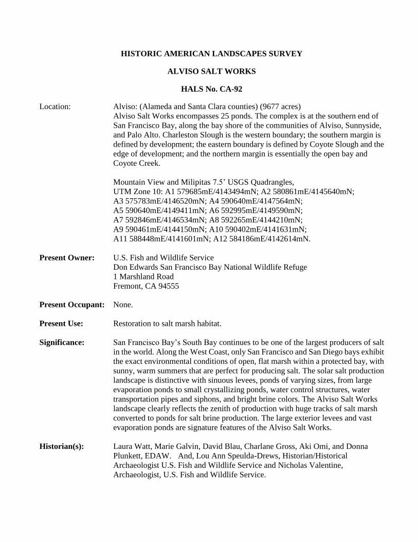
HISTORIC AMERICAN LANDSCAPES SURVEY
ALVISO SALT WORKS
HALS No. CA-92
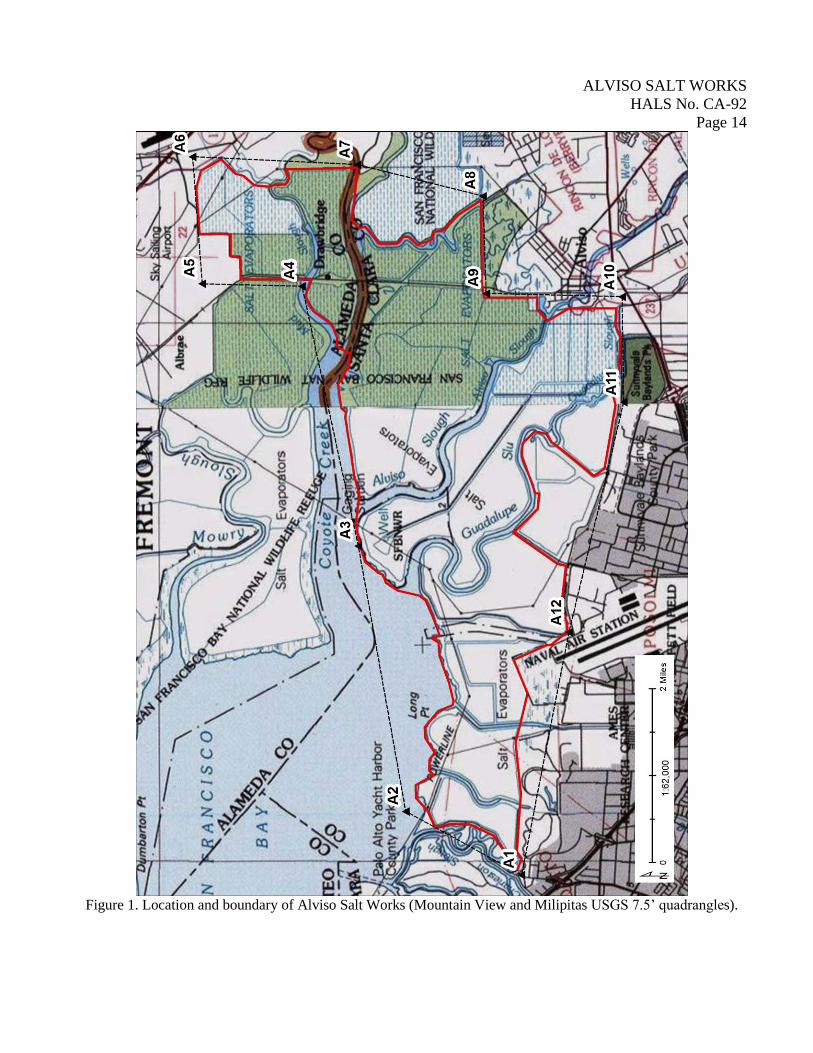
Location: Alviso: (Alameda and Santa Clara counties) (9677 acres)
Alviso Salt Works encompasses 25 ponds. The complex is at the southern end of
San Francisco Bay, along the bay shore of the communities of Alviso, Sunnyside,
and Palo Alto. Charleston Slough is the western boundary; the southern margin is
defined by development; the eastern boundary is defined by Coyote Slough and the
edge of development; and the northern margin is essentially the open bay and
Coyote Creek.
Mountain View and Milipitas 7.5’ USGS Quadrangles,
UTM Zone 10: A1 579685mE/4143494mN; A2 580861mE/4145640mN;
A3 575783mE/4146520mN; A4 590640mE/4147564mN;
A5 590640mE/4149411mN; A6 592995mE/4149590mN;
A7 592846mE/4146534mN; A8 592265mE/4144210mN;
A9 590461mE/4144150mN; A10 590402mE/4141631mN;
A11 588448mE/4141601mN; A12 584186mE/4142614mN.
Present Owner: U.S. Fish and Wildlife Service
Don Edwards San Francisco Bay National Wildlife Refuge
1 Marshland Road
Fremont, CA 94555
Present Occupant: None.
Present Use: Restoration to salt marsh habitat.
Significance: San Francisco Bay’s South Bay continues to be one of the largest producers of salt
in the world. Along the West Coast, only San Francisco and San Diego bays exhibit
the exact environmental conditions of open, flat marsh within a protected bay, with
sunny, warm summers that are perfect for producing salt. The solar salt production
landscape is distinctive with sinuous levees, ponds of varying sizes, from large
evaporation ponds to small crystallizing ponds, water control structures, water
transportation pipes and siphons, and bright brine colors. The Alviso Salt Works
landscape clearly reflects the zenith of production with huge tracks of salt marsh
converted to ponds for salt brine production. The large exterior levees and vast
evaporation ponds are signature features of the Alviso Salt Works.
Historian(s): Laura Watt, Marie Galvin, David Blau, Charlane Gross, Aki Omi, and Donna
Plunkett, EDAW. And, Lou Ann Speulda-Drews, Historian/Historical
Archaeologist U.S. Fish and Wildlife Service and Nicholas Valentine,
Archaeologist, U.S. Fish and Wildlife Service.
ALVISO SALT WORKS
HALS No. CA-92
Page 2
Report Reference: Final Cultural Resources Assessment Strategy Memorandum/Historic Context.
Prepared by EDAW, 2005. And, Identification and Evaluation of the South San
Francisco Bay Solar Salt Industry Landscape (Alameda, Santa Clara, and San
Mateo Counties, California, prepared by USFWS, 2009.
PART I. HISTORICAL INFORMATION
A. Physical History
Date of
Construction: 1920-2000.
Landscape
Architect,
Designer, etc: Various.
Builder, contractor,
Laborers, suppliers: Alviso, Arden, Leslie, and Cargill.
Original and
Subsequent owners,
occupants: Two salt companies initiated development of Alviso’s salt works in the
1920s: the Alviso Salt Company and Arden Salt Company. Arden acquired
Alviso Salt in 1929. Leslie Salt purchased the operation from Arden in
1936. Cargill Incorporated diversified its holdings by acquiring Leslie Salt
in 1978.1 In 2003 Cargill transferred the Alviso ponds along with other
parcels to the U.S. Fish and Wildlife Service for inclusion in the Don
Edwards San Francisco Bay National Wildlife Refuge (NWR).
Periods of
development: a. Original plans and construction: 1920s construction.
b. Changes and additions: 1930-2000.
B. Historical Context:
Salt can be found in a variety of forms and locations around the world and is an important mineral for
human survival that has long been sought for flavoring and storing food. In the San Francisco Bay area,
salt naturally occurs along the bay where salt spray coats rocks. Native Americans collected the naturally
occurring salts by scraping it off the rocks or leaving sticks or twigs in briny pools, on which the salt
would crystallize and could be harvested.2 Little manipulation of the shoreline was required to recover
enough salt to meet the pre-European demand. Inhabitants in the San Francisco Bay area at the time of
European contact were the Ohlone people, also referred to as Costanoan.
1 EDAW, Final Cultural Resources Assessment Strategy Memorandum/Historic Context. (2005), pg 14.
2 Robert F. Heizer, contributor to William E. Ver Planck, Salt in California. California Division of Mines Bulletin 175. (1958),
pgs 103-104.
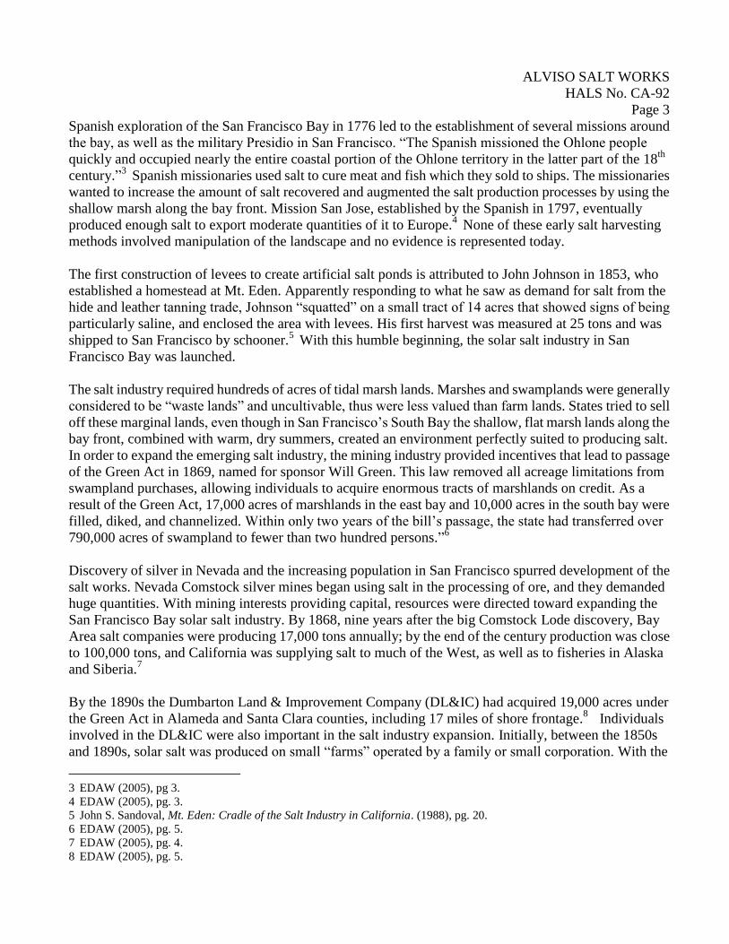
ALVISO SALT WORKS
HALS No. CA-92
Page 3
Spanish exploration of the San Francisco Bay in 1776 led to the establishment of several missions around
the bay, as well as the military Presidio in San Francisco. “The Spanish missioned the Ohlone people
quickly and occupied nearly the entire coastal portion of the Ohlone territory in the latter part of the 18th
century.”3 Spanish missionaries used salt to cure meat and fish which they sold to ships. The missionaries
wanted to increase the amount of salt recovered and augmented the salt production processes by using the
shallow marsh along the bay front. Mission San Jose, established by the Spanish in 1797, eventually
produced enough salt to export moderate quantities of it to Europe.4 None of these early salt harvesting
methods involved manipulation of the landscape and no evidence is represented today.
The first construction of levees to create artificial salt ponds is attributed to John Johnson in 1853, who
established a homestead at Mt. Eden. Apparently responding to what he saw as demand for salt from the
hide and leather tanning trade, Johnson “squatted” on a small tract of 14 acres that showed signs of being
particularly saline, and enclosed the area with levees. His first harvest was measured at 25 tons and was
shipped to San Francisco by schooner.5 With this humble beginning, the solar salt industry in San
Francisco Bay was launched.
The salt industry required hundreds of acres of tidal marsh lands. Marshes and swamplands were generally
considered to be “waste lands” and uncultivable, thus were less valued than farm lands. States tried to sell
off these marginal lands, even though in San Francisco’s South Bay the shallow, flat marsh lands along the
bay front, combined with warm, dry summers, created an environment perfectly suited to producing salt.
In order to expand the emerging salt industry, the mining industry provided incentives that lead to passage
of the Green Act in 1869, named for sponsor Will Green. This law removed all acreage limitations from
swampland purchases, allowing individuals to acquire enormous tracts of marshlands on credit. As a
result of the Green Act, 17,000 acres of marshlands in the east bay and 10,000 acres in the south bay were
filled, diked, and channelized. Within only two years of the bill’s passage, the state had transferred over
790,000 acres of swampland to fewer than two hundred persons.”6
Discovery of silver in Nevada and the increasing population in San Francisco spurred development of the
salt works. Nevada Comstock silver mines began using salt in the processing of ore, and they demanded
huge quantities. With mining interests providing capital, resources were directed toward expanding the
San Francisco Bay solar salt industry. By 1868, nine years after the big Comstock Lode discovery, Bay
Area salt companies were producing 17,000 tons annually; by the end of the century production was close
to 100,000 tons, and California was supplying salt to much of the West, as well as to fisheries in Alaska
and Siberia.7
By the 1890s the Dumbarton Land & Improvement Company (DL&IC) had acquired 19,000 acres under
the Green Act in Alameda and Santa Clara counties, including 17 miles of shore frontage.8 Individuals
involved in the DL&IC were also important in the salt industry expansion. Initially, between the 1850s
and 1890s, solar salt was produced on small “farms” operated by a family or small corporation. With the
3 EDAW (2005), pg 3.
4 EDAW (2005), pg. 3.
5 John S. Sandoval, Mt. Eden: Cradle of the Salt Industry in California. (1988), pg. 20. 6 EDAW (2005), pg. 5.
7 EDAW (2005), pg. 4.
8 EDAW (2005), pg. 5.
ALVISO SALT WORKS
HALS No. CA-92
Page 4
larger tracts of land available and capitalization from the mining companies, consolidation and expansion
of the salt industry was set in motion.
In order to understand the salt production landscape, a review of the methods used to make salt is useful at
this point. Producing solar salt is a simple process. First, ponds are created with earthen dike divisions and
water control gates along the open bay or slough. Then, seawater is directed into the first series of large
ponds where the water begins to evaporate. When the water reaches a specific salinity level, the brine is
moved to condensing ponds, and then to crystallizing ponds, where the salt precipitates out of solution and
forms crystals. The layer of salt crystals is the end product that is harvested.
The Alviso Salt Works is representative of the period from the late-1920s to 1970s, but its history is tied to
the small corporations and families who joined forces in the 1890s. Beginning around 1892, the C.E.
Whitney Company, began working on DL&IC-owned lands, and saw the potential for salt pond
development in the west bay. In 1904, after C.E. Whitney had died, the name was changed to Leslie Salt
Refining Company, run by several of the next generation of Whitney’s. Soon after, in 1907, three of the
largest salt producers Schilling, Stauffer Chemical Company, and A.L. Whitney all formed Leslie Salt
Company, which consolidated Leslie and Stauffer salt holdings in the west bay under one name”9 August
Schilling founded his foodstuffs company in 1881 along with George F. Volkmann, both were from
Bremen, Germany. Schilling-brand is primarily remembered for coffee, tea, baking powder, and spices.10
In 1907, Schilling traveled to Europe to research and purchase machinery to process and refine salt on a
large scale. Schilling’s ambition to establish “what will certainly be the most extensive chemical plant on
the Pacific Coast and eventually, will probably be second to none in the United States, at least” was being
promoted by DL&IC.11
At the same time that they were expanding their production capacity, DL&IC also
appears to have been aggressively looking to buy out other salt companies in the Bay Area. Salt ponds
stretched south along the east side of the bay nearly to Alviso. “Consolidation of the industry was driven
by the few large companies, seeking to buy out smaller companies so as to make the whole market more
efficient, in terms of reduced maintenance costs on fewer salt works, lower freight rates on shipping salt in
bulk, improved packaging methods, and so forth.”12
By 1924, the number of salt operators had dwindled
from roughly 30 separate operators to only a handful.13
The Alviso area was owned by DL&IC but was developed as a separate salt company by Schilling. Even
though Schilling worked for DL&IC, he pursued the development of Arden Salt Company, beginning in
1919. Historical records fail to explain why Schilling developed a salt company separate from the Leslie
corporate structure. Schilling’s operation quickly expanded to become a major salt producer, and in 1929
he acquired Alviso Salt Company.14
It had taken Schilling nearly 20 years to achieve his vision of production on a grand scale. Alviso Salt
Works were developed in 1929 reflecting the expanding industrialization of brine production at a new,
9 EDAW (2005), pg. 7.
10 Wikpedia, 2013, Schilling Company.
11 EDAW (2005), pg. 9.
12 EDAW (2005), pg. 9.
13 EDAW (2005), pg. 9.
14 EDAW (2005), pg. 9-10.
ALVISO SALT WORKS
HALS No. CA-92
Page 5
higher level. The Alviso Salt Works represent a clearly corporate focus characterized by vast evaporation
ponds, large levees, and robust water control devices. Levees were built along sloughs and creek channels
following natural water courses. The pattern of spatial organization has changed only slightly from the
final expansion stage in the 1950s. Alviso Salt Works was developed solely for brine production with no
crystallizing ponds or processing plants.
In 1936, Schilling’s Alviso holdings were merged with Leslie-California Salt, bringing back together the
original interests of the DL&IC into one company. The newly formed Leslie Salt Company was
dominated by the Schilling family who took over from the Whitney family.15
Leslie Salt continued to expand its output through the 1940s and 1950s. Production in 1936 for the
newly-reconstituted company was a little over 300,000 tons annually, with approximately 12,000 acres in
production; within ten years volume had increased to 450,000 tons and over 25,000 acres of ponds.16
The 1930s to the 1950s was the zenith of salt production in San Francisco Bay with salt ponds developed
along the shore line nearly ringing the south end of the bay. Groupings of salt ponds were divided into
production units with each having their own network of evaporation ponds, concentrating, and
crystallizing ponds, harvesting equipment, and processing plants. Alviso Salt Works was the exception,
producing only brine.
In the late 1950s and early 1960s, Leslie Salt Company and the Schilling estate began selling parcels of
land to be used for urban development. Cities along the south bay needed more land to expand and filling
the marshlands appeared to be the best and highest use for the shoreline. Salt production began decreasing
as urban development, environmental concerns, and public access to the bay began to take precedent in
San Francisco Bay. Public pressure to preserve the natural character of the bay influenced Leslie Salt to
sell 20,000 acres to the U.S. Fish and Wildlife Service (USFWS) in 1972 for the creation of the Don
Edwards San Francisco Bay National Wildlife Refuge. A proviso of the deal was that Leslie retained the
mineral rights to continue producing salt from ponds within the refuge. Leslie Salt Company, run by
Schilling’s heirs, decided to get out of the salt business in 1978, selling their interests to Cargill
Incorporated. Cargill continued production utilizing Leslie’s pond system at generally the same
production levels for the next two decades.17
In 2003 Cargill transferred about 14,000 acres to the USFWS and nearly 1,000 acres to the State of
California for ecological restoration of the salt ponds. In 2013, the Alviso Salt Works are being revised to
include salt marsh habitat. Breaches in the levees will allow tidal flows to etch some of the ponds into
irregular shapes. Several ponds will be left intact as habitat for brine shrimp. A few ponds will be modified
with islands for nesting and resting places for migratory birds. A series of levees will be maintained for
pedestrian trails and public access.
15 EDAW (2005), pg. 11.
16 Ver Planck (1958).
17 EDAW (2005), pg. 13.
ALVISO SALT WORKS
HALS No. CA-92
Page 6
PART II. PHYSICAL INFORMATION – Alviso Salt Works
A. Landscape Character and Description Summary:
Alviso Salt Works represents a large-scale solar salt operation with 9677 acres of evaporation ponds. Ponds
are divided by large earthen levees with small scale elements such as siphons, tide gates, and water control
structures used to regulate the flow between ponds. There are no buildings associated with the Alviso Salt
Works.
B. Character Defining Features:
Creation of the solar salt manufacturing landscape required building levees, harnessing the tidal surge, and
transporting water among the ponds. Landscape characteristics are conveyed by levees, water flow
structures, and the sinuous boundaries of salt ponds along creeks, sloughs, and other natural features.
Character defining elements of the Alviso Salt Works historic landscape are the sequence of ponds defined
by perimeter levees, interior pond divisions, and water control structures.
Water control structures and mechanisms are located among the ponds, but are generally replaced every
10-20 years because of the harsh conditions, therefore the water control structures themselves are not
historically important.
a. Topography: Alviso’s large expanses of flat, tidal marsh, at sea level perfectly suited the
needs of the solar salt industry. There is no topographical relief, the only obvious structures
are the levees that define the size and shape of the ponds.
Salt ponds vary in size and shape. The size is based on processing requirements and the
shape depends on the existing land forms, such as slough or creek channels and the edge of
the mud flat. In most instances the ponds have curving edges with few straight lines. Large
scale evaporation ponds of several hundred acres are characteristic of Alviso.
Vegetation: There is no vegetation in the Alviso Salt Works.
b. Water: Seawater is the primary element of the Alviso Salt Works. Seawater is transported
through tide gates into a series of first tier ponds along the bay front where the initial
evaporation process occurs. Once the brine reaches a specific gravity it is moved to smaller
ponds, the second tier ponds, usually located closer to shore. The landscape is defined by
the water-filled ponds and changing color of the water as the salinity level increases.
2. Spatial Organization
a. Land patterns: The Alviso Salt Works is a series of 25 evaporation ponds of various sizes
divided by levees. The outside levees are 40 feet wide at the base, 12 feet wide at the top
and 3½ to 10 feet high. To prevent leakage between the base of the levee and the old
surface, the levee is keyed to solid material by coring. “In coring a trench is dug through
the grass and peat along the center line of the levee and filled with clean mud. Cross levees,
or levees that separate one pond from another, may be slightly lower and usually are not
cored.”18
Other features of the large exterior levee are the borrow pit alongside the exterior
18 Ver Planck (1958), pg. 46.
ALVISO SALT WORKS
HALS No. CA-92
Page 7
of the levee where clean mud is gathered for topping the levee and in some areas sheet
metal pilings may be used to keep the levees from eroding.19
b. Circulation: The system of water circulation is critical for producing solar salt, beginning
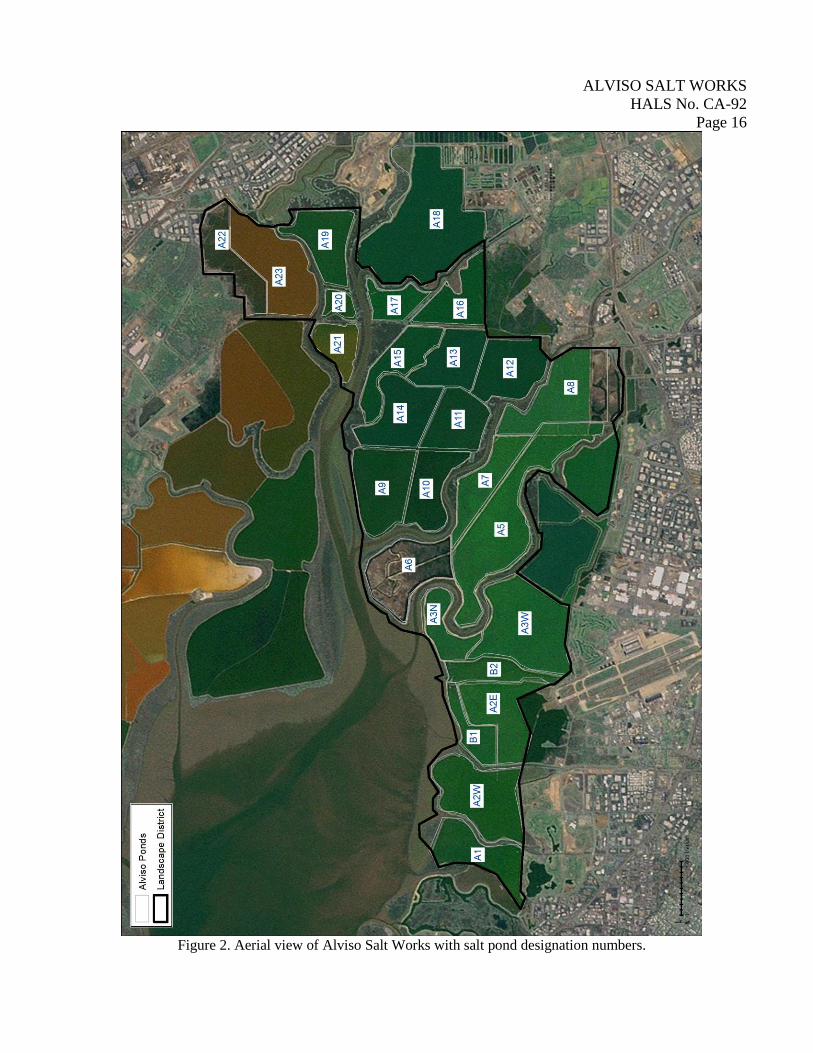
with the intake gate that controls sea water to fill the first tier of ponds. Alviso ponds A1
and A9 have intake gates. Ponds A1-A8 are interconnected, moving bay water and brine
through the ponds as the salinity is gradually increased. Ponds A9-A17 are interconnected.
Ponds A19-A23 are serviced by an intake gate outside of the current Alviso Salt Works
boundary. Water control structures, gates, pumps, pipes, and siphons are all used to move
water between the ponds. Controlling water flow is important so that brine is not
contaminated by “fresh” bay water. Roads are located on top of the levees to provide
access to the water control structures and repair the levees.
The salt production process is described by Ver Planck, the leading authority on the topic
in the 1950s: “Bay water is taken in through automatic gates that open at high tide and
close when the tide drops below the pond level….Concentrating bay water requires passing
the brine slowly through a series of ponds and the salinity level is checked often. The
stages of salt production include: “1) bay water reduced to a salinity level of 12.9 Be and
reduced the volume to nearly half of that taken in, suspended matter settles, carbonates
precipitate begins; 2) evaporation continues until at 25.6 Be, the brine is saturated with
respect to salt; 3) by 25.0 Be the brine is transferred to the pickle pond where it is reduced
to about ten percent of the volume of bay water taken in.”20
c. Views and vistas: The spatial structure of the salt works is difficult to comprehend at
ground level, because they are by definition, flat and at sea level. There are no vistas points
available for viewing the salt pond landscape. But the salt ponds are visually striking from
the air with the ponds clearly divided, and the color of the water reflecting the increasing
salinity from ponds of light green, dark green, brown, magenta, pink and finally, white.
Alviso Salt Works usually present only the greens and brown hues associated with the
initial brine stages.
d. Water: Only naturally occurring seawater is used in the Alviso Salt Works.
e. Buildings and structures: No building or structures are present in the Alviso Salt Works.
f. Small scale elements: Tide gates, siphons, pipes, pumps, and water control structures are
all considered small scale elements within the solar salt pond landscape. Each of these
elements has been replaced over the years. The small scale elements can also be moved to
fit the needs of production.
19 Ver Planck (1958), pg. 47.
20 Ver Planck (1958), pg. 47.
ALVISO SALT WORKS
HALS No. CA-92
Page 8
g. Archaeological sites: Archaeological surveys have identified a variety of pump stations,
flood gates, bridges, wooden pier structures, boat launches, pilings, hunting blinds, and
culverts that are present within the Alviso Salt Works. All of the wooden elements appear
to have severe integrity issues especially for items and objects associated with flood
control, recreation, and salt production.21
Only two cultural resources are within the area
encompassed by the Alviso Salt Works: the town of Drawbridge (P-01-003291); and a
prehistoric shell midden (CA-ALA-338/P-01-002057). Neither of the cultural resources is
related to salt production and they are not included in this report.
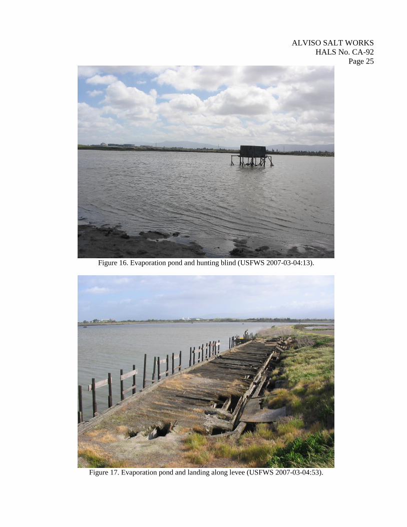
Other: Hunting blinds are common features within the salt ponds. Salt marsh habitat is
attractive to waterfowl. Duck hunting has always been popular along the marsh and
shoreline of San Francisco Bay, beginning in the nineteenth century and continuing to the
present, hunt clubs lease hunting rights from salt companies. Hunting blinds within Alviso
Salt Works are simple plywood boxes set on wood stilts in the large evaporation ponds.
Temporary docks or boat launches are also built seasonally by hunters. None of the
structures are more than 50 years old, and none are included in this report.
PART III. SOURCES OF INFORMATION
A. Drawings, plans: None located.
B. Historic view, photographs: None located.
1953 Ver Planck map, in Salt in California. California Division of Mines Bulletin 175. (1958).
C. Interviews: None recorded.
D. Bibliography:
1. Primary and unpublished:
2. Secondary and published:
Birnbaum, Charles and Christene Capella Peters (editors)
1996The Secretary of the Interior’s Standards for the Treatment of Historic Properties with Guidelines
for the Treatment of Cultural Landscapes. Cultural Resource Stewardship and Partnerships,
Heritage Preservation Services, Historic Landscape Initiative, National Park Service, Washington
D.C.
21 Colin I. Busby, Cultural Resources Assessment: South San Francisco Bay Shoreline Interim Feasibility Study, Task Order
3. Report prepared for U.S. Army Corps of Engineers, San Francisco. Report prepared by Basin Research Associates, Inc., San
Leandro. (2008), pg. 85.

ALVISO SALT WORKS
HALS No. CA-92
Page 9
Busby, Colin I.
2008 Cultural Resources Assessment: South San Francisco Bay Shoreline Interim Feasibility Study,
Task Order 3. Report prepared for U.S. Army Corps of Engineers, San Francisco. Report prepared
by Basin Research Associates, Inc., San Leandro.
Coon, A.T. and F.E. Harris
2009 “Salt, Bromine, Calcium Chloride, and Iodine.” Minerals Yearbook 1938. United States
Government Printing Office, Washington, D.C.
Cronon, William
1994 “Landscapes of Abundance and Scarcity.” Oxford History of the West. Oxford University Press,
Oxford.
Davis, Joseph S.
1973 Importance of Microorganisms in Solar Salt Production. Paper presented at the Fourth Salt
Symposium, Salt Institute (saltinstitute.org).
Dobkin, Marjorie and Robert Bruce Anderson
1994 Historic Resource Evaluation Report for the Oliver Bros. Salt Co., Alameda County, CA.
Prepared for the Environmental Planning Branch, South District 4, California. Department of
Transportation, Oakland.
Donaldson, Milford Wayne
November 19, 2004. Letter to Margaret T. Kolar, Refuge Complex Manager, San Francisco Bay
National Refuge Complex. On-file at USFWS, Cultural Resources Team Office, Sherwood,
Oregon.
EDAW
2005 Final Cultural Resources Assessment Strategy Memorandum/Historic Context. Prepared for
USFWS. Prepared by EDAW, San Francisco.
EDAW, Philip Williams and Associates, Ltd., H.T. Harvey and Associates, Brown and Caldwell, and
Geomatrix (EDAW et. al).
2006 ADMINISTRATION DRAFT. South Bay Salt Pond Restoration Project
Environmental Impact Statement/Report [EIS/EIR] Section 3.8. Prepared for USFWS. Prepared
by EDAW, San Francisco.
2007 South Bay Salt Pond Restoration Project Environmental Impact Statement/Report [EIS/EIR],
Executive Summary and Volume 1. Submitted to U.S. Army Corps of Engineers, U.S. Fish and
Wildlife Service, and California Department of Fish and Game. Prepared by EDAW, San
Francisco.
Galvan, P.M.
1967/68 “People of the West: The Ohlone Story.” Indian Historian 1(2):9-13.
ALVISO SALT WORKS
HALS No. CA-92
Page 10
Garrett, Donald E.
1965 Factors in the Design of Solar Salt Plants Part I. Pond Layout and Construction, pps 168-175.
Paper presented at the Second Salt Symposium, Salt Institute (Saltinstitute.org).
1965 Factors in the Design of Solar Salt Plants Part II. Optimum Operation of Solar Ponds, pps
176-187. Paper presented at the Second Salt Symposium, Salt Institute (Saltinstitute.org).
1969 Factors in the Design of Solar Salt Plants Part IV. By-Product Chemical Recovery. Paper
presented at the Second Salt Symposium, Salt Institute (Saltinstitute.org).
Heizer, Robert F. contributor to William E. Ver Planck
1958 “Salt in California Indian Culture” pps 103-104 in Salt in California, California Division of Mines
Bulletin 175.
Hundley, Jr., Norris
1992 The Great Thirst: Californians and Water 1770s – 1990s. University of California Press,
Berkeley.
Jones & Stokes
2001 Cultural Resources Inventory Report for the Habitat Mitigation Planning Sites, San Francisco
International Airport Proposed Runway Reconfiguration Program. Prepared for San Francisco
International Airport. On-file at the Northwest Information Center, Rohnert Park, California.
Johnek, Ellen Joslin
2008 The South Bay Salt Pond Restoration Project: A Cultural Landscape Approach for the Resource
Management Plan. Master’s Thesis, Sonoma State University, Sonoma.
Krase, Elizabeth and Robert Gross
2009 2001 Historic Architecture Survey Report for the Eden Landing (Baumberg) Ecological
Mitigation Tract, Alameda County, California. Prepared for California Department of
Transportation for the U.S. Army Corps of Engineers. Prepared by California Department of
Transportation, District 4, Office of Environmental Planning, Sacramento.
Kolar, Margaret T.
July 16, 2004. Letter to Dr. Knox Mellon, California State Historic Preservation Officer. On-file at
USFWS, Cultural Resources Team Office, Sherwood, Oregon.
Kurlansky, Mark
2002 Salt: A World History. Penguin Books, New York.
Levy, Richard
1978 “Costanoan,” pps 485-495 in Handbook of North American Indians, Volume 8: California.
Smithsonian Institute, Washington, D.C.
ALVISO SALT WORKS
HALS No. CA-92
Page 11
Lopez, Claire
1971 “Reclamation and Development: the Marsh and Overflowed Lands of the South San Francisco
Bay.” Report to Leslie Salt Company. Unpublished report, on-file in Leslie Salt Company
archives, Newark, California.
Manson, Marsden
1888 The Swamp and Marsh Lands of California, Transactions of the Technical Society of the Pacific
Coast. November 26, 1888. Stoel-Rives case archive, San Francisco; copy of document on-file
with EDAW.
MacGregor, Bruce and Richard Truesdale
1982 South Pacific Coast: A Centennial. Pruett Publishing Company, Boulder, Colorado.
MacMillian, R.T. and James M. Foley
1959 Salt. Minerals Yearbook 1958, Volume 1 of 3 – Metals and Minerals (except fuels). United States
Government Printing Office, Washington, D.C.
Melnick, Robert Z.
1984 Cultural landscapes: Rural Historic Districts in the National Park System. U.S. Department of the
Interior, Washington, D.C.
Moratto, Michael J.
1984 California Archaeology. Academic Press, Orlando, Florida.
Page, Robert R.
2001 Cultural Landscapes Inventory Professional Procedures Guide. Revision by Cari Goetcheus. U.S.
Department of the Interior, Washington, D.C.
Parker, E. W.
1897 Salt. U.S. Geological Survey Annual report, Pt. 5, Vol. 2, Washington, D.C.
Postel, Mitch
1977 More Than A Grain: The History of the Salt Industry in San Mateo County. Star Publishing
Company, Belmont, California.
Salt Institute
n.d. “Facts About Salt,” pamphlet. Salt Institute, Alexandria, Virginia.
Sandoval, John S
1988 Mt. Eden: Cradle of the Salt Industry in California. Mt. Eden Historical Publishers, Hayward,
California.
Santa Clara Valley Water District
2005 Guadalupe Watershed Stewardship Plan. Supported in part by the CALFED Bay-Delta Program,
San Jose, California.
ALVISO SALT WORKS
HALS No. CA-92
Page 12
Speulda-Drews, Lou Ann and Nicholas Valentine
2009 APPENDIX E: Identification and Evaluation of the South San Francisco Bay Solar Salt Industry
Landscape (Alameda, Santa Clara, and San Mateo Counties, California. U.S. Fish and Wildlife
Service, Region 8, Sacramento, California. On-file at U.S. Fish and Wildlife Service, Cultural
Resources Team, Sherwood, Oregon.
U.S. Department of the Interior, NPS
1996 Guidelines for the Treatment of Cultural Landscapes. Government Printing Office, Washington,
D.C.
U.S. Department of the Interior, NPS
1995 National Register Bulletin #15: How to Apply the National Register Criteria for Evaluation.
Government Printing Office, Washington, D.C.
U.S. Department of the Interior, NPS
1998 National Register Bulletin #30: Evaluating and Documenting Rural Historic Landscapes.
Government Printing Office, Washington, D.C.
Ver Planck, William E.
1958 Salt in California. California Division of Mines Bulletin 175.
PART IV. PROJECT INFORMATION
Documentation is required by a Memorandum of Agreement (MOA) for an adverse effect caused by
altering the function and appearance of the Alviso Salt Works. Restoring the salt ponds requires breaching
the exterior levees to allow tidal waters to flow through the ponds along with dredging and filling areas to
create an undulating landscape that is conducive to salt marsh habitat. The Alviso ponds are located in the
southern San Francisco Bay near the town of Alviso and are managed by the U.S. Fish and Wildlife
Service as part of the Don Edwards San Francisco Bay National Wildlife Refuge.
MAPS AND PHOTO-DOCUMENTATION Location Maps: USGS quadrangle location map with Alviso Salt Works boundary;
Aerial view with Alviso Salt Works boundary; South Bay Salt Pond development 1857 to 1960;
South Bay Salt Works in 1953, from Ver Planck 1958;
Photo-documentation: Overview of Drawbridge (foreground) and Alviso Salt Works, view to SW (Coastal
Conservancy);
Evaporation pond;
Evaporation pond with interior pond water control structure;
Evaporation pond with interior berm and power poles;
Evaporation ponds divided by levee with road;
Evaporation pond with levee with water control structure;
Evaporation ponds with pile of salt in background;
Evaporation pond at low tide;

ALVISO SALT WORKS
HALS No. CA-92
Page 13
Evaporation pond at low tide;
Evaporation pond with wood pilings;
Evaporation pond and levee with water control structure;
Evaporation pond with hunting blind; and
Evaporation pond and landing along levee.
HALS CA-92 -1 to CA-92-16
ALVISO SALT WORKS
HALS No. CA-92
Page 14
Figure 1. Location and boundary of Alviso Salt Works (Mountain View and Milipitas USGS 7.5’ quadrangles).
ALVISO SALT WORKS
HALS No. CA-92
Page 15
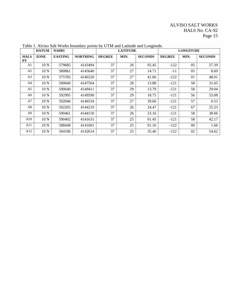
Table 1. Alviso Salt Works boundary points by UTM and Latitude and Longitude.
DATUM NAD83 LATITUDE LONGITUDE
HALS
PT
ZONE EASTING NORTHING DEGREE MIN. SECONDS DEGREE MIN. SECONDS
A1 10 N 579685 4143494 37 26 05.45 -122 05 57.39
A2 10 N 580861 4145640 37 27 14.71 -11 05 8.69
A3 10 N 575783 4146520 37 27 41.66 -122 01 48.01
A4 10 N 590640 4147564 37 28 13.88 -121 58 31.65
A5 10 N 590640 4149411 37 29 13.79 -121 58 29.04
A6 10 N 592995 4149590 37 29 18.75 -121 56 53.08
A7 10 N 592846 4146534 37 27 39.66 -121 57 0.53
A8 10 N 592265 4144210 37 26 24.47 -121 67 25.23
A9 10 N 590461 4144150 37 26 23.16 -121 58 38.66
A10 10 N 590402 4141631 37 25 01.45 -121 58 42.17
A11 10 N 588448 4141601 37 25 01.16 -122 00 1.66
A12 10 N 584186 4142614 37 25 35.46 -122 02 54.62
ALVISO SALT WORKS
HALS No. CA-92
Page 16
Figure 2. Aerial view of Alviso Salt Works with salt pond designation numbers.
ALVISO SALT WORKS
HALS No. CA-92
Page 17
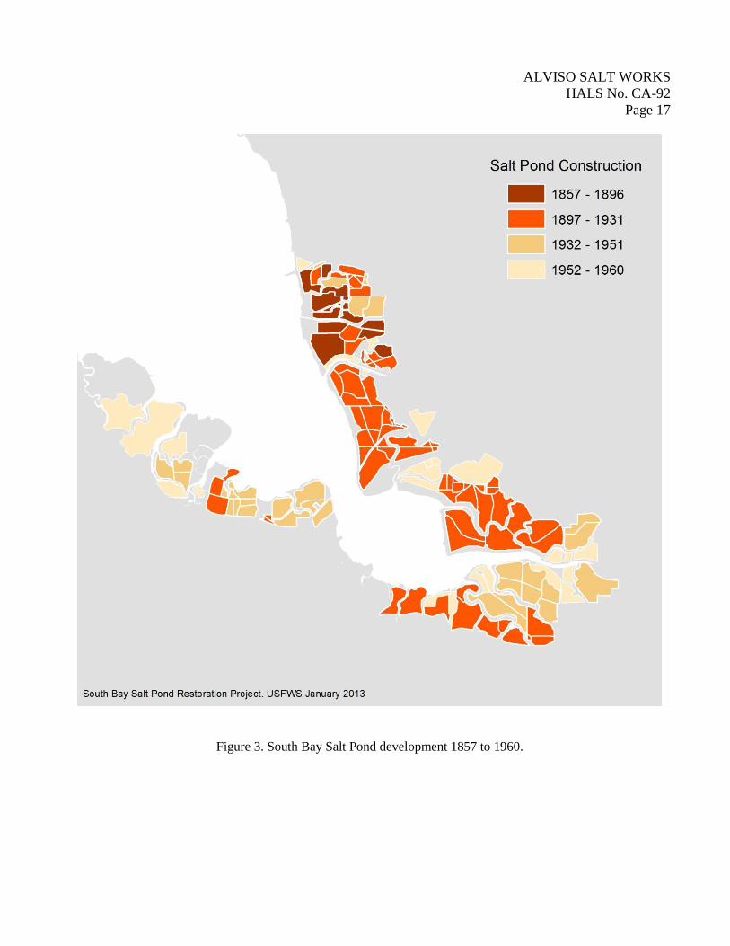
Figure 3. South Bay Salt Pond development 1857 to 1960.
ALVISO SALT WORKS
HALS No. CA-92
Page 18
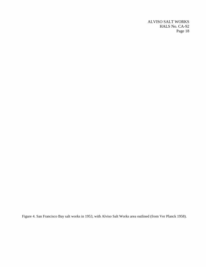
Figure 4. San Francisco Bay salt works in 1953, with Alviso Salt Works area outlined (from Ver Planck 1958).
ALVISO SALT WORKS
HALS No. CA-92
Page 19
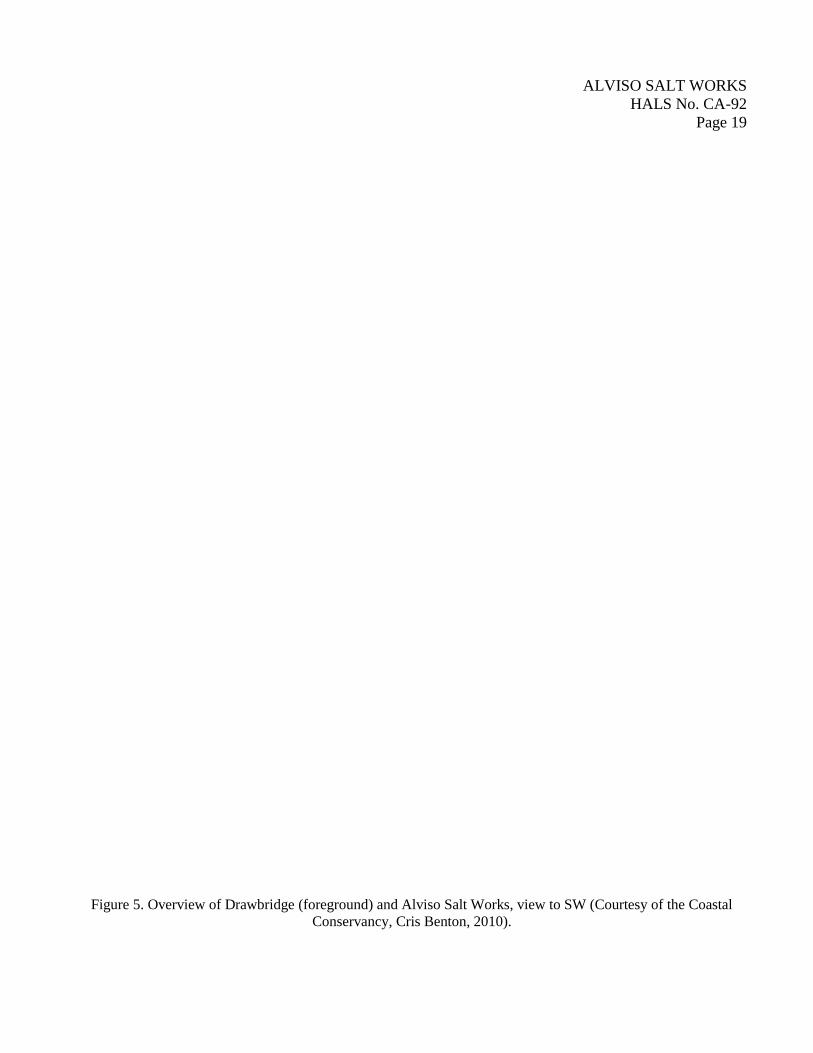
Figure 5. Overview of Drawbridge (foreground) and Alviso Salt Works, view to SW (Courtesy of the Coastal
Conservancy, Cris Benton, 2010).
ALVISO SALT WORKS
HALS No. CA-92
Page 20
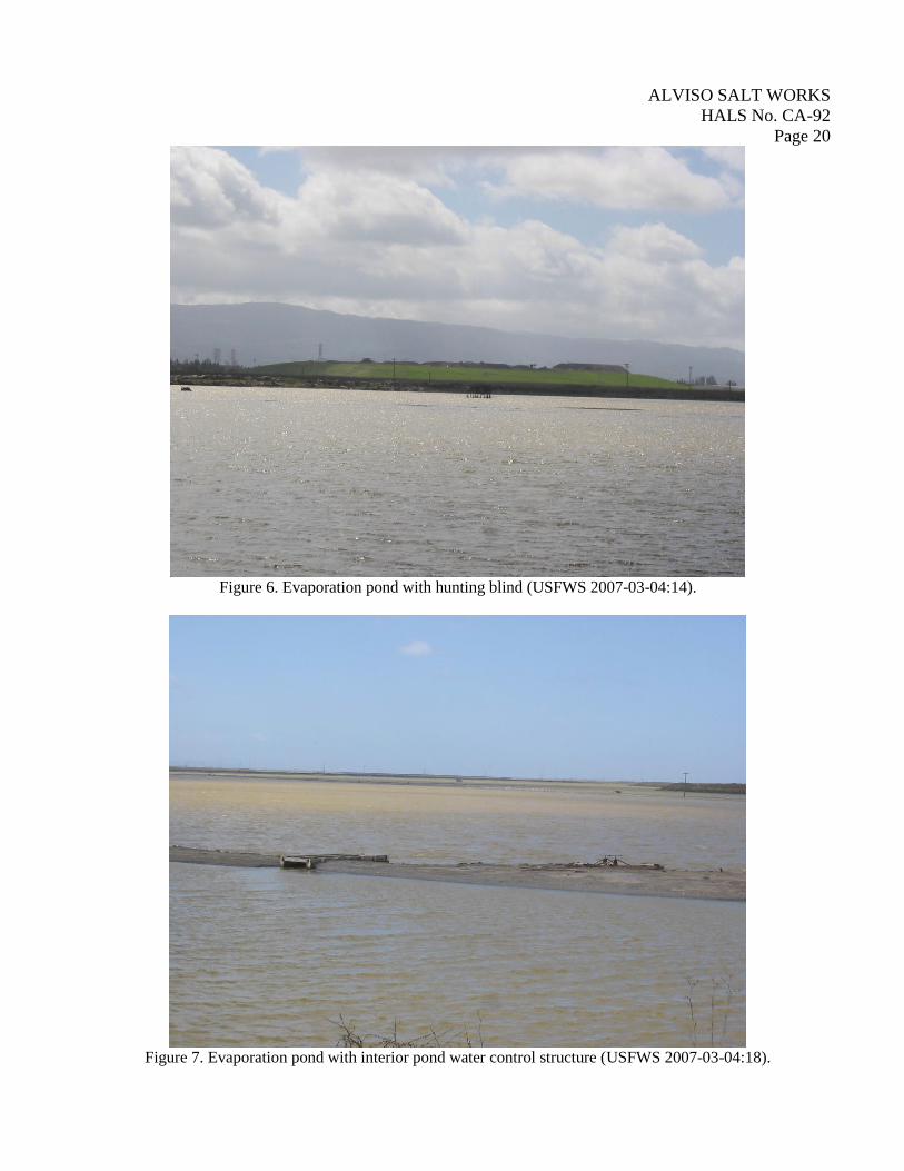
Figure 6. Evaporation pond with hunting blind (USFWS 2007-03-04:14).
Figure 7. Evaporation pond with interior pond water control structure (USFWS 2007-03-04:18).
ALVISO SALT WORKS
HALS No. CA-92
Page 21
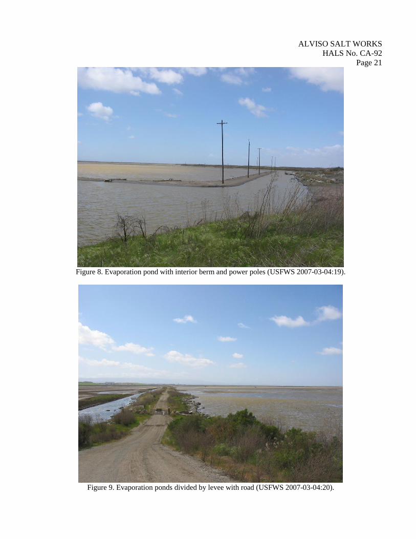
Figure 8. Evaporation pond with interior berm and power poles (USFWS 2007-03-04:19).
Figure 9. Evaporation ponds divided by levee with road (USFWS 2007-03-04:20).
ALVISO SALT WORKS
HALS No. CA-92
Page 22
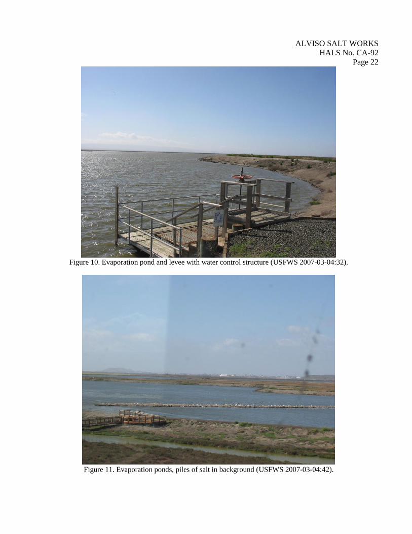
Figure 10. Evaporation pond and levee with water control structure (USFWS 2007-03-04:32).
Figure 11. Evaporation ponds, piles of salt in background (USFWS 2007-03-04:42).
ALVISO SALT WORKS
HALS No. CA-92
Page 23
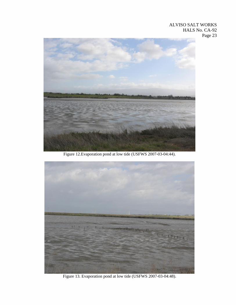
Figure 12.Evaporation pond at low tide (USFWS 2007-03-04:44).
Figure 13. Evaporation pond at low tide (USFWS 2007-03-04:48).
ALVISO SALT WORKS
HALS No. CA-92
Page 24
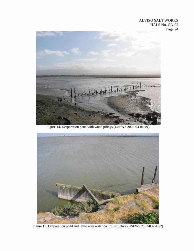
Figure 14. Evaporation pond with wood pilings (USFWS 2007-03-04:49).
Figure 15. Evaporation pond and levee with water control structure (USFWS 2007-03-04:52).
ALVISO SALT WORKS
HALS No. CA-92
Page 25
Figure 16. Evaporation pond and hunting blind (USFWS 2007-03-04:13).
Figure 17. Evaporation pond and landing along levee (USFWS 2007-03-04:53).