all places that the eye of heaven visits are, to a wise man, ports … · · 2012-09-14are, to a...
TRANSCRIPT

F
All places that the eye of heaven visits Are, to a wise man, ports and happy havens.
(William Shakespeare, Richard II)
Fairbanks Estate - A 1921 subdivision of section 394, Hundred of Yatala, by the executors of the estate of George Washington Fairbank who said it was ‘unequalled for gardening purposes, being in the same line of country as the
famous Findon land’; now included in Beverley.
Fairfield - A 1917 subdivision of part section 234, Hundred of Noarlunga; Messrs. Charles J. Hargrave laid it out
into 17 allotments between Brighton Road and Fairfield Avenue; now included in Somerton Park.
It is a common place name in England and, possibly, derives from the Œ forfeld - ‘fore or front field’.
The Fairfield School, near Spalding, opened in 1889 by Fanny Cox, was closed in 1904.
It took its name from a local homestead.
In 1885, the Fairfield Apiary near Mount Barker was mentioned as being the property of Messrs Coleman and
May, ‘who have brought much knowledge and intelligence and no small amount of capital to bear upon the
prosecution of the work…’
Fairford - It was situated on the River Sturt, about 12 km from Adelaide, at the foot of the hill on which stands the Flagstaff Inn:
The only portion of the vineyard which is now in bearing is intersected by the river and was planted in
1861… There are three acres of vines, principally Verdelho, but with about one-sixth Gouais, and Mr
Trimmer mixes the two grapes in this proportion for a white wine… On the brow of the hill, rising from the
eastern bank of the Sturt, five acres were planted in 1859…
To the southward of this piece another five acres were planted in 1861 with Black Portugal and
Grenache… He adopted a wine making system upon the authority of Mr J.S. Kercht, whose very useful
work on the culture of the vine was reprinted and published in Sydney in 1838…
A photograph of a Fairford tennis team is in The Critic, 4 April 1906, page 16.
Fairies Glen - In the Musgrave Ranges, discovered by Ernest Giles on 8 September 1873 and so named because ‘it
was such a beautiful spot with plenty of water.’
The Fairies Glen
Falkland, Mount - East of Parachilna, named by the surveyor Samuel Parry, in 1858, ‘in honour of the great and
good man, Lucius Carey, Viscount Falkland, who fought against the Puritans.’
A scene at the foot of Mount Falkland
Fairview - The name was applied to two schools, viz., near Gladstone (1889-1895) and
near Mannum (1899-1913).
Fairview Park was a descriptive name given
to a subdivision of part section 57, Hundred of
Yatala, by B.E. and E.F.J. Chandler in 1967.
In 1860, there was a report of a property near
Walkerville owned by Lt-Colonel Freeling
and called ‘Fairview’.
Falmouth - It derives from the Danish hval - ‘a whale’, hence a ‘whale’s mouth’ and, in 1914, was applied by
Henry Smerdon when he cut up section 96, Hundred of Pirie; it is now included in Risdon Park and bisected by
Esmond Road and Herbert Street.
False Bay - This place, near Whyalla, appears on Admiralty charts dated 1884 and a pastoral run sketch of 1886; its
nomenclator is unknown. On Freycinet’s charts it is shown as Baie Corneille.
Fanny Lookout - Near Port Lincoln and named, in 1962, after Gladys Fanny P. Tapley. Fanny, Point - Situated on Boston Island, it was named after Mrs Fanny Nicholls (ca.1809-1902) who lived for
many years in Ringmore Road, Marryatville; her husband was John Warner Nicholls (1798-1880), a barrister.
She was most interesting to talk to for she had many… reminiscences of the early days. She was, formerly,
Miss Conway and a great friend of Governor Gawler and his wife. She accompanied them on several trips
to various parts of the colony; Cape Fanny [sic], near Port Lincoln, was named after her, also.
Mrs Watts, widow of the first Postmaster-General of the colony, was a sister of Mrs Nicholls and lived
with her. Next to Mrs Nicholls’ home lived Mrs Gliddon who conducted a school; of part French extraction
she was a clever and excellent teacher. The Hallack’s also lived in this street.
Miss Conway assisted the governor’s daughter to work the flag which Charles Sturt took with him on one
of his expeditions and her name is referred to in his biography. As Mrs Nicholls she lived to a remarkable
old age and had an unusually wide circle of friends.
Faraway Hill - About 100 km east of Burra was named by Hilary Boucaut because it ‘looked a long way off.’ (See Boucaut Folly & Braemar)
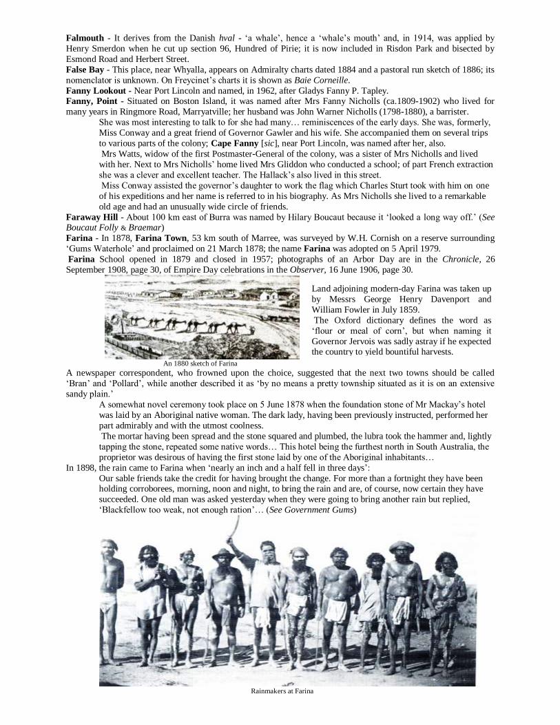
Farina - In 1878, Farina Town, 53 km south of Marree, was surveyed by W.H. Cornish on a reserve surrounding
‘Gums Waterhole’ and proclaimed on 21 March 1878; the name Farina was adopted on 5 April 1979.
Farina School opened in 1879 and closed in 1957; photographs of an Arbor Day are in the Chronicle, 26
September 1908, page 30, of Empire Day celebrations in the Observer, 16 June 1906, page 30.
An 1880 sketch of Farina
A newspaper correspondent, who frowned upon the choice, suggested that the next two towns should be called
‘Bran’ and ‘Pollard’, while another described it as ‘by no means a pretty township situated as it is on an extensive
sandy plain.’
A somewhat novel ceremony took place on 5 June 1878 when the foundation stone of Mr Mackay’s hotel
was laid by an Aboriginal native woman. The dark lady, having been previously instructed, performed her
part admirably and with the utmost coolness.
The mortar having been spread and the stone squared and plumbed, the lubra took the hammer and, lightly
tapping the stone, repeated some native words… This hotel being the furthest north in South Australia, the
proprietor was desirous of having the first stone laid by one of the Aboriginal inhabitants…
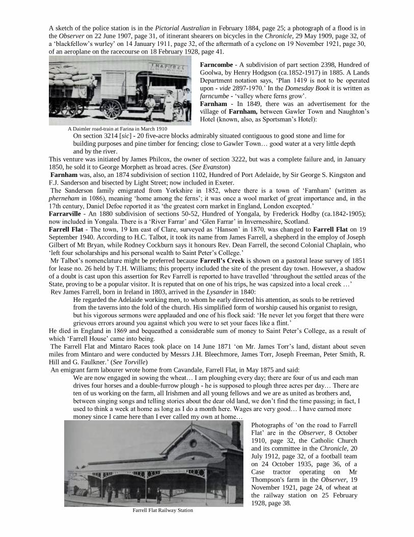
In 1898, the rain came to Farina when ‘nearly an inch and a half fell in three days’:
Our sable friends take the credit for having brought the change. For more than a fortnight they have been holding corroborees, morning, noon and night, to bring the rain and are, of course, now certain they have
succeeded. One old man was asked yesterday when they were going to bring another rain but replied,
‘Blackfellow too weak, not enough ration’… (See Government Gums)
Rainmakers at Farina
Land adjoining modern-day Farina was taken up
by Messrs George Henry Davenport and
William Fowler in July 1859.
The Oxford dictionary defines the word as
‘flour or meal of corn’, but when naming it
Governor Jervois was sadly astray if he expected the country to yield bountiful harvests.
A sketch of the police station is in the Pictorial Australian in February 1884, page 25; a photograph of a flood is in
the Observer on 22 June 1907, page 31, of itinerant shearers on bicycles in the Chronicle, 29 May 1909, page 32, of
a ‘blackfellow’s wurley’ on 14 January 1911, page 32, of the aftermath of a cyclone on 19 November 1921, page 30,
of an aeroplane on the racecourse on 18 February 1928, page 41.
A Daimler road-train at Farina in March 1910
On section 3214 [sic] - 20 five-acre blocks admirably situated contiguous to good stone and lime for
building purposes and pine timber for fencing; close to Gawler Town… good water at a very little depth
and by the river.
This venture was initiated by James Philcox, the owner of section 3222, but was a complete failure and, in January
1850, he sold it to George Morphett as broad acres. (See Evanston)
Farnham was, also, an 1874 subdivision of section 1102, Hundred of Port Adelaide, by Sir George S. Kingston and
F.J. Sanderson and bisected by Light Street; now included in Exeter.
The Sanderson family emigrated from Yorkshire in 1852, where there is a town of ‘Farnham’ (written as
pherneham in 1086), meaning ‘home among the ferns’; it was once a wool market of great importance and, in the
17th century, Daniel Defoe reported it as ‘the greatest corn market in England, London excepted.’ Farrarville - An 1880 subdivision of sections 50-52, Hundred of Yongala, by Frederick Hodby (ca.1842-1905);
now included in Yongala. There is a ‘River Farrar’ and ‘Glen Farrar’ in Invernesshire, Scotland.
Farrell Flat - The town, 19 km east of Clare, surveyed as ‘Hanson’ in 1870, was changed to Farrell Flat on 19
September 1940. According to H.C. Talbot, it took its name from James Farrell, a shepherd in the employ of Joseph
Gilbert of Mt Bryan, while Rodney Cockburn says it honours Rev. Dean Farrell, the second Colonial Chaplain, who
‘left four scholarships and his personal wealth to Saint Peter’s College.’
Mr Talbot’s nomenclature might be preferred because Farrell’s Creek is shown on a pastoral lease survey of 1851
for lease no. 26 held by T.H. Williams; this property included the site of the present day town. However, a shadow
of a doubt is cast upon this assertion for Rev Farrell is reported to have travelled ‘throughout the settled areas of the
State, proving to be a popular visitor. It is reputed that on one of his trips, he was capsized into a local creek …’
Rev James Farrell, born in Ireland in 1803, arrived in the Lysander in 1840:
He regarded the Adelaide working men, to whom he early directed his attention, as souls to be retrieved from the taverns into the fold of the church. His simplified form of worship caused his organist to resign,
but his vigorous sermons were applauded and one of his flock said: ‘He never let you forget that there were
grievous errors around you against which you were to set your faces like a flint.’
He died in England in 1869 and bequeathed a considerable sum of money to Saint Peter’s College, as a result of
which ‘Farrell House’ came into being.
The Farrell Flat and Mintaro Races took place on 14 June 1871 ‘on Mr. James Torr’s land, distant about seven
miles from Mintaro and were conducted by Messrs J.H. Bleechmore, James Torr, Joseph Freeman, Peter Smith, R.
Hill and G. Faulkner.’ (See Torville)
An emigrant farm labourer wrote home from Cavandale, Farrell Flat, in May 1875 and said:
We are now engaged in sowing the wheat… I am ploughing every day; there are four of us and each man
drives four horses and a double-furrow plough - he is supposed to plough three acres per day… There are ten of us working on the farm, all Irishmen and all young fellows and we are as united as brothers and,
between singing songs and telling stories about the dear old land, we don’t find the time passing; in fact, I
used to think a week at home as long as I do a month here. Wages are very good… I have earned more
money since I came here than I ever called my own at home…
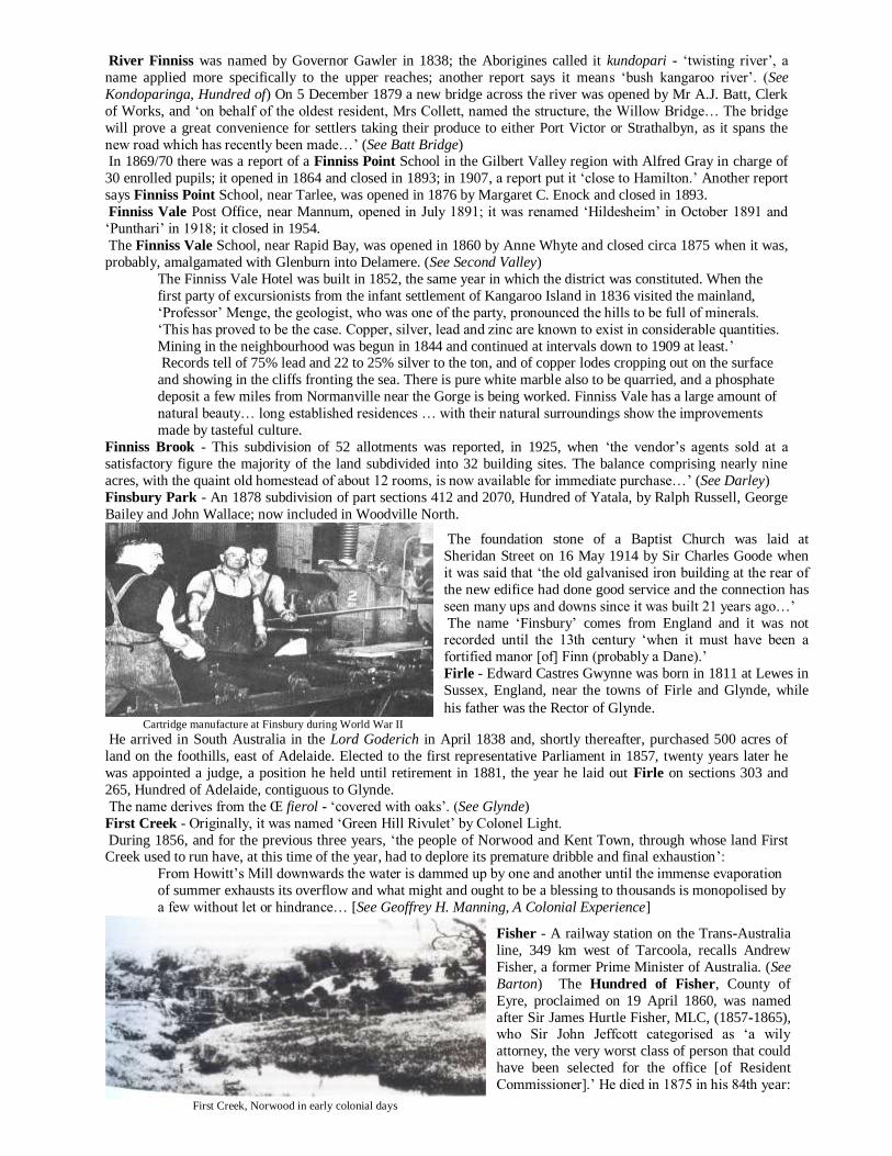
Farrell Flat Railway Station
Farncombe - A subdivision of part section 2398, Hundred of
Goolwa, by Henry Hodgson (ca.1852-1917) in 1885. A Lands
Department notation says, ‘Plan 1419 is not to be operated
upon - vide 2897-1970.’ In the Domesday Book it is written as
farncumbe - ‘valley where ferns grow’.
Farnham - In 1849, there was an advertisement for the village of Farnham, between Gawler Town and Naughton’s
Hotel (known, also, as Sportsman’s Hotel):
Photographs of ‘on the road to Farrell Flat’ are in the Observer, 8 October
1910, page 32, the Catholic Church
and its committee in the Chronicle, 20
July 1912, page 32, of a football team
on 24 October 1935, page 36, of a
Case tractor operating on Mr
Thompson's farm in the Observer, 19
November 1921, page 24, of wheat at
the railway station on 25 February
1928, page 38.

Federal Town - A 1902 subdivision of part sections 102 and 107, Hundred of Colton, by the Federal Salt Co. Ltd.
that followed a visit by two gentlemen representing a large syndicate from Adelaide and Melbourne who, after
examining Lake Newland and testing its value for salt, pegged several large blocks for salt claims and works.
The roads from the salt sites to either Venus or Elliston Bays are good and the shipping facilities at Venus
Bay should be all that are required to ship thousands of tons of salt to any part of the Commonwealth. The
salt contains 99.5% pure sodium. At the height of activity at the salt works thirty men were employed and the town sported two eating houses.
The salt carters transported the produce to Elliston at £1 per ton; after 18 months of production the
company closed down because transport to Adelaide proved too costly. [See Newland, Lake]
Felixstow - The Rev Thomas Quinton Stow arrived in South Australia in the Hartley in 1837 and was the first
nonconformist minister to take up pastoral duties. He bought land east of Adelaide and is believed to have named it
by combining the Latin felix - ‘happy’, with the Anglo-Saxon stow - ‘place’. On a document dealing with the land in
1851 there is the signature ‘Thomas Quinton Stow, Felixstow, May 19th 1851’ and a memorial of a conveyance of
portion of section 306 to Rev. T.Q. Stow in July 1851 refers to ‘Rev. Thomas Quinton Stow of Felixstow.’
Felixstow – Reverend Stow’s residence
There is a ‘Felixstowe’ (sic) in Suffolk, England, the County in which Rev Stow was born on 7 July 1801. An old English chart of circa 1080 shows the ‘Church of Saint Felix of Walton’; Saint Felix was the first Bishop of
East Anglia.
The domain of the Stow’s - a name that has already become a household word in South Australia - is
situated to the left of the road from Adelaide, on the banks of the Torrens, about half a mile beyond the
village and not far from the German hamlet of Klemzig.
The vineyard upon the estate is the property of Augustine Stow… The first planting was done in 1852
when 4½ acres were put in… He also has an orangery…
In 1854, about 200 trees were planted at 15 feet apart, but in the dry summer, that followed, little progress
was made… A creek runs through the western portion of his grounds to the Torrens. This has been diverted
from its original tortuous course and straightened… Adjacent to this property is a ten acre block belonging
to R.I. Stow and Wycliff Stow, on about eight acres of which vines have been planted… The first subdivision to take the name was Felixstow Gardens, laid out by Richard and Clare E. Fricker on part
section 306, in 1923.
Fellmongery, Lake - (See Dunn, Lake)
Felton Court - A 1913 subdivision of part section 278, Hundred of Adelaide, by Thomas Goode; now included in
Maylands. He named it after his birthplace, Felton, in England, derived from the Old Norman fjall - ‘fell’ (open
country); hence, ‘town on the fell’.
Feltus Flat - Near Echunga. Rodney Cockburn says that a man of this name was reported to have sunk the first hole
on the local goldfield in 1852.
Feltwell - The name occurs as a village in Suffolk, England, derived from the Πfelt - a name of a plant and wella -
‘spring’ and was given to a school, in the Hundred of Grace, that operated from 1870 to 1878 when it was
superseded by ‘Mallala School’.
Examinations took place there on 2 October 1871 when the prize winners were listed as: Alex. W. Moody, Frederick Lewis, Henry Jury, John McHugh, Richard Earl, S.A. Tupper, D. Tupper,
Alice J. Moody, Elizabeth Forby, Alfred Hawser, John Snigg, Alice Miller, Francis McHugh, Eliza A. Jury,
Frederick Wilson.
Fendler Hill - In the Hundred of Tungkillo and named after a pioneer family.
Fenner Depression - On Lake Eyre North, is the lowest part of the lake bed located by W.G. Fenner in association
with C.W. Bonython.
Ferdinand Creek - In the Musgrave Ranges, named by Ernest Giles in September 1873 after Ferdinand von
Mueller, the famous botanist. Since 1918 it has been known as ‘Ernaballa Creek’.
Mount Ferdinand has the same derivation and is known now as ‘Mount Warrabillinna’. (See Ernaballa)
Ferguson - Peter Ferguson (ca. 1812-1877), the manager of the Crystal Brook run for W. Younghusband in the late
1840s, is remembered by Mount Ferguson, near Port Pirie; it was known formerly as ‘Benjamin Hill’, ‘Price Nob’ and ‘Port Flinders’. (See Port Flinders & Weeroona)
Various references using this spelling of the name include Bailliere’s South Australian Gazetteer and
Cockburn’s Nomenclature of South Australia
(1908). However, the road and bridge were spelt,
invariably, as Felixstowe.
In H.C. Talbot’s historical notes the following
appears: ‘Felixstow, one of the old preliminary
sections (306) acquired by Rev. T.Q. Stow and
named by him after the village in Suffolk… from a
letter written by J. Stow, SM Port Pirie, Register 25
May 1901.’

During 1873, it was rumoured that the ‘late government, after having sold most of the township of Port Pirie,
contemplated removing the port to a place called Mount Ferguson… It is certainly nearer to the open gulf than the
present port, but it is surrounded by banks and bars that a strong two-mile jetty would be necessary…’
In 1909, William K. Mallyon, of Port Pirie, said that ‘the freehold of that hill at the mouth of “our arm of the sea”,
commonly known as Mount Ferguson, was purchased many years ago by the Mount Remarkable Pastoral and
Mining Company who subdivided the land into building sites and called it the township of Port Flinders.’ Ferguson Hill, south of Lake Eyre South, was named after him, following his occupation of pastoral lease no. 966
in the district in 1861.
In 1877, the town of Ferguson was advertised at the corner of Glen Osmond and Fullarton Roads as being:
One of perfect beauty, reminding visitors to the Colony of some of the most lovely views in Ireland and
Scotland. [It] is quite free from the gully breezes and the land is sufficiently high to have the benefit of the
cool air from both the sea and the hills during the summer months…
Another town of Ferguson was laid out on section 429, Hundred of Dalkey, by Messrs A.Y.H.M. and J.M.
Kingsborough, agents of Adelaide in 1881. (See Nurom & Pinery)
Ferguson railway station, on the Trans-Australia line, was named after Sir Ronald Munro-Ferguson, Governor-
General of Australia, 1914-1920.
Fergusson, County of - Proclaimed on 18 February 1869, it recalls Sir James Fergusson, Governor of South
Australia, 1869-1873 who, during his tenure, possessed considerable ability, was a profound thinker and high minded gentleman, During his term of office, telegraphic communication was established to Europe and, shortly
after its completion, he left the colony to become Governor of New Zealand.
His first wife, the former Lady Edith Ramsay, died in Adelaide in 1871 and, in 1873, he remarried; his new bride
was Olive Richman, the daughter of the pastoralist and barrister, John Henry Richman. She met an untimely end,
dying of cholera in India in January 1882. (See Cunningham, Hundred of)
Fernandez Creek - Near Vivonne Bay on Kangaroo Island, named after a deceased local resident by the District
Council of Kingscote in 1977.
Fern Hill - Captain F. Servante (1798-1872) arrived in the Murray in 1861 and, during 1861-62, built a home in
Dashwood Gully calling it Fern Hill.
The name occurs in Essex, England, and was given to a subdivision of part sections 19 and 2797, Hundred of
Noarlunga, by Hills Land and Investment Company in 1882; now included in Crafers: The great sanatorium and delight of the citizens of Adelaide, where they may enjoy a cool and bracing
temperature, free from dust and mosquitoes in the middle of the hottest summer.
The situation of Fern Hill is denoted by a signboard. Most of Adelaide’s visitors know its locality, but few
of them have been over the two gardens there, namely, of Mr Ernest Grimes and Mr William McGregor.
Ferns - This town in the Hundred of Hawker; proclaimed on 6 February 1879, ceased to exist on 5 September 1901.
Named by Governor Jervois it, no doubt, honoured either a friend or acquaintance.
Alternatively, there is a town in County Wexford, Ireland called ‘Ferns’, derived from the Anglo-Saxon fearna -
‘the alders’ (i.e., ‘trees’); it was devastated by the Danes between 834 and 930 AD.
Ferryden Park - A 1924 subdivision of part section 398, Hundred of Yatala, by William Duthie, dairyman of Tam
O’Shanter Belt. There is a seaport named ‘Ferryden’ in Forfarshire, Scotland, from whence the Duthie family
emigrated in the 1850s. Ferryden Park School opened in 1953.
Ferryville - A subdivision of section 1078, Hundred of Port Adelaide; Joshua Evans (1818-1894) laid it out in 1877 comprising 10 allotments bisected by Mary and Alfred Streets, thereby honouring his wife and son; now included in
Largs Bay. It was described as being ‘within five minutes walk of the Port and Birkenhead ferry… [the] steam ferry
is now open…’ By 1877, it was obvious that some cheap form of transportation was necessary across the river to
Port Adelaide for the convenience of residents of settlements on both banks of the Port River.
Accordingly, on 4 January of that year, a meeting took place at the Ship Inn under the presidency of the Mayor, Mr
David Bower, when thirty interested people attended and Mr Christie explained the origin of the scheme and
referred to recent government promises to erect approaches on both sides of the Port River.
In addition to Mr Christie, other foundation members of the proposed company were Messrs J. Walker, D.
McKendrick, R. Lindsay, W. Harris and J.M. Sinclair.
Within a short time the Port Adelaide Ferry Company was founded and a tender accepted for the construction of a
ferry boat by Messrs McCallum (sic - McAllan?) to Smith and Co. The specifications provided for a vessel 40 feet long, 10 feet abeam in the midships diminishing to six feet. Seats were to be fitted on both sides to accommodate 60
passengers and, to avoid the need for turning the ferry, it was to have a screw propeller and rudder at each end.
To provide access and egress the existing landing steps at the end of Commercial Street were extended and, at
Birkenhead, a 200 feet long pier was constructed. The one-way fare was set at one penny per trip. The trial run of
the ferry, appropriately called Unique, took place on 26 October 1877 and, a few days later, the ferry service was
formally opened by the former Colonial Treasurer, Mr R.D. Ross. From the start it was well patronised and, in June
1878, a dividend of two shillings a share was declared.
Earlier, on New Year’s Day, 1878, the ferry’s resources were ‘severely taxed’ for 4,300 passengers were
accommodated. The man in charge was roughly handled and in the rush he ‘was forced under foot and bruised; his
watch was damaged and the chain lost… [After this unfortunate event] a policeman was stationed on the steps to
prevent overcrowding.’ In later years, the company was plagued with problems until, finally, due to lack of

patronage, it was wound up in 1890 when, in a reflective statement, it said that the service was ‘at first conducted by
steam ferry but latterly by boats.’
Fides Bluff - On 22 May 1860 the barque Fides was wrecked in Snug Cove with the loss of nine seamen and the
captain, Frederick R. Aspland.
The cargo was washed ashore over a wide area, portion of it being found, later, on Yorke Peninsula.
The chief mate and four seamen survived and managed to reach Cape Borda lighthouse with news of the wreck Field - Edgar John Field, a former Director of Lands, is remembered by the Hundred of Field, County of Cardwell,
proclaimed on 10 February 1938.
River Field recalls Henry Field, an early settler in the Happy Valley District. (See Cherry Gardens)
The River Onkaparinga was known as the River Field from October 1836 until 1838 when Governor Gawler
effected the change. The name honoured Lt W.G. Field of the Rapid.
Fifth Creek - Originally, it was called ‘Ormsby Rivulet’ by Colonel Light. In 1875, the Fifth Creek School was
conducted in a chapel by Ann Humphrey with 28 enrolled pupils.
A cottage on Fifth Creek – circa 1895
Probably, the name comes from Middlesex, England, where it was recorded first in the time of King John and
derives from the Œ finc - ‘a small bird’ and leah - ‘woodland’. Finchley Common was long noted for its
highwaymen and there is a tree still standing there known as ‘Turpin’s Oak’. (See Duff, River & Wandsworth Estate)
Findon - The land on which the suburb stands comprised, originally, sections 393 and 410, granted to George Cortis
in 1839, who subdivided it in 1848 when he advertised it as, ‘the Village of Findon - part sections 393 and 410 near
the Port Road having been surveyed and marked off into 10-acre blocks are now ready for sale.’
In 1849, there was an advertisement for the ‘Township of Beverley’ saying, it will ‘adjoin the pretty township of Finden [sic] and before long may be expected to unite with Lockleys.’ The Findon School opened circa 1861. Its
date of closure is unknown. However, in 1899, the residents of Findon said that ‘their children had to walk two,
three and sometimes four miles to school’:
They were not asking for a new school, as the trustees of the Bible Christian Church had a room which they
would enlarge for the purpose of a school room…
Mr Cortis came from Worthing, adjacent to Findon in Surrey, England, recorded as findune in the Domesday Book
meaning the ‘hill of Fin’, while another authority says it comes from the Gaelic fionn-dun - ‘clear, white hill’.
To confuse the issue further, another nomenclator says that in 1073 it was recorded as fintona - ‘hill with a heap of
wood’. A photograph of Vawser’s Boiling Down Works is in the Observer, 24 February 1912, page 32.
The name Findon was applied, also, to a subdivision of section 2312, Hundred of Goolwa, by the land owner, G.L.
Liptrott, circa 1855.
Finger Post - (See Beda Creek) Finke - On 4 April 1860 John McD. Stuart named the River Finke, in the Far North, ‘after my sincere friend
William Finke, one of the liberal promoters of the different expeditions I have had the honour to lead;’ its
Aboriginal name was lirambenda - ‘permanent water’.
Mount Finke in the Gawler Ranges was named by John McD. Stuart on 7 August 1858 after the same gentleman
who died in Adelaide in 1864, aged 48 years; he arrived in the Tam O’Shanter in 1836. (See Todmorden, Mount)
In 1891, it was reported that ‘two blacks were alleged by Mounted Constable Willshire to have been shot by
trackers in self-defence in a native camp… However, it was further alleged that they were shot by instructions of
MC Willshire within 100 yards of the station’s kitchen…’
Photographs of floods are in the Observer, 28 May 1921, page 24, of the first train to cross the river in the
Chronicle, 27 October 1928, page 41, of a flood on 14 December 1933, page 32.
Finlayson, Hundred of - In the County of Robinson, proclaimed on 18 May 1893 and named after John Harvey Finlayson, editor and part proprietor of the Register newspaper.
A school of this name was opened as ‘Petina’ in 1915 and had its name changed in the same year; it closed in 1942.
Finniss - This name appears many times on the map of South Australia and they all honour Boyle Travers Finniss
(1807-1893), who came to South Australia as Assistant Surveyor to Colonel Light. He was Commissioner of Police
from 1843-1847 and held many administrative and parliamentary positions from 1847 to 1862. The first parliament
was noted for its frequent ministerial changes, the first lasting only four months when, on 15 August 1857, Mr
Finniss, the colony’s first Premier, had to admit that ‘the Ministry had ceased to command a majority of the House.’
Fig Tree Gully - Near the Musgrave Ranges, named by W.C. Gosse on 11 November 1873,
‘as there is a very large native fig tree growing
in it.’
Finchley - A subdivision of section 284,
Hundred of Adelaide; now included in Magill.
John Finlay Duff (1799-1868), the former
master of the Africaine gave it the title in 1853
when an invitation was extended to ‘the public
of SA… to take tiffin at Finchley… on the shady
borders of the ever-flowing streamlet…’

Further afield, the novelty of such a young and small community being granted responsible government led the
London Times to write in the following strain:
It must be confessed that it is rather an odd position for a new community of rising tradesmen, farmers,
cattle breeders, builders, mechanics, with a sprinkling of doctors and attorneys, to find that it is suddenly
called upon to find prime ministers, cabinets, a ministerial side, an opposition side and all the apparatus of a
parliamentary government - to awake one fine morning and discover that this is no longer a colony, but a nation saddled with all the rules and traditions of the political life of the Mother Country.
Whilst the debate about public flogging was at its height in 1884, Mr B.T. Finniss wrote a stirring piece of prose
condemning this barbaric practice: ‘I have watched with pain and anxiety the advocacy of a system which I think
deserves reprobation instead of approval’:
The writers of articles [in favour of flogging] describe the sufferings of the men under the hands of the
public executioner as conveying to them a sense of pleasure. They mention the yells of the victims with
apparent satisfaction as though they rejoiced in the torture inflicted. I cannot but hold that such
punishments are brutal and tend to degrade not only the victims, but society.
We once had laws which decreed torture for certain offences, chiefly political and religious. The edicts of
the Star Chamber and of the Holy Inquisition mark the savagedom of the times in which they were
permitted. It has long been the boast of Englishmen that they have abolished the use of torture, and the
humanitarian tendencies of this age extend even to alleviating the sufferings of men undergoing the extreme sentences of law.
Will not men who have suffered the punishment of flogging, the marks of which brand a man for life, be
the enemies of society ever after? Will their nature be softened? Will the nature of the community, which
hears and sees such punishment, be softened?
Are men not ferocious enough by nature, unless restrained and civilised by education in tender years? Do
not ideas and sights of pain and suffering inflicted in the name of the law tend to encourage brutality?
We have long recognised the fact by withdrawing public execution from the public gaze and covering
them in the walls of our prisons. We set the example in this respect to England, which she has followed.
Shall we now reverse the lesson and teach her that we are cruel with all our philanthropy?
The long possession of power makes tyrants of the best of men. Let us beware that the continued exercise
of irresponsible power by our legislators should also tend to lessen their respect for human nature, and for themselves should they in the future lend themselves to the use of torture.
Mr Finniss then went on to recount his experiences as a young soldier in England:
I was summoned to attend a punishment parade. The regiment was formed into a hollow square facing
inwards, the young officers being outside the square… I could witness the operation of flogging a young
soldier who had been sentenced to receive 300 lashes.
The unfortunate culprit was brought into the centre of the square and, after being stripped to his trousers,
was lashed to three halberds and his limbs extended like a spreadeagle.
The regimental surgeon stood by him to watch how much he could bear, whilst the drum-major directed
the services of the drummers who administered the strokes, each drummer in turn administering 25 lashes.
This was my first experience at such a scene and my feelings were those of shame and horror as I gazed on
the unfortunate soldier, who could not even display his sense of suffering by any movement or struggles, as
his limbs were fixed tightly to the triangles. I never got over my disgust of such punishment, although I had to witness many in my military career of
ten years; and on one occasion I saw a man receive 600 lashes with only once a groan, when he was struck
in a fresh place by an inexperienced drummer.
This noble man, for I knew he was one, was a pugilist and of immense strength... When it was all over he
drew his shirt over his bleeding shoulders and marched off to the hospital with his escort with as much
coolness and steadiness as if he had never been tortured.
Happily, flogging in the army has been abolished and it is to be hoped that it will be abolished in our civil
courts for any offence whatever as the last survival of an age of tyranny and oppression.
The Hundred of Finniss, County of Sturt, was proclaimed on 19 April 1860 and the town of Finniss, 13 km west of
Milang, surveyed in 1867 as ‘Queen’s Own Town’ and offered for sale on 28 May 1868 was changed to ‘Finniss’ in
1940. Its school opened in 1869 as ‘Queens Own Town’; name changed in 1922 and closed in 1970. Finniss Flat School opened in 1864. (See Ashbourne & Appendix 53) In 1887, as the contractor proceeded with the
erection of the Bank of New South Wales in Adelaide ‘the passer-by cannot fail to be struck by the massive, yet
light appearance of the building. The stone used in its construction comes from Finniss Flat…’
In 1875, the Lower Finniss School was conducted by Alexander Douglas with 26 enrolled pupils; it opened in
1863 and closed in 1877. A new Wesleyan Chapel was opened on 24 February 1856 when ‘three sermons were
preached to excellent and attentive congregations… It is well built of timber and lime…’ In 1863, Mr John Gilbert,
of the Lower Finniss, stated that he ‘only reared one [cotton] plant from the seeds obtained… He had been more
successful with some seeds he got from Mr Graham, of Goolwa, having raised 22 plants.’
Finniss Springs, west of Lake Eyre South and 216 km west of Marree, were named by P. E. Warburton on 9
November 1858; its school opened in 1940 being sponsored by the United Aborigines Mission; it closed in 1961.
The ‘Finniss Springs Run’ was established by Thomas Elder in 1869 (lease no 1839).
River Finniss was named by Governor Gawler in 1838; the Aborigines called it kundopari - ‘twisting river’, a
name applied more specifically to the upper reaches; another report says it means ‘bush kangaroo river’. (See
Kondoparinga, Hundred of) On 5 December 1879 a new bridge across the river was opened by Mr A.J. Batt, Clerk
of Works, and ‘on behalf of the oldest resident, Mrs Collett, named the structure, the Willow Bridge… The bridge
will prove a great convenience for settlers taking their produce to either Port Victor or Strathalbyn, as it spans the
new road which has recently been made…’ (See Batt Bridge) In 1869/70 there was a report of a Finniss Point School in the Gilbert Valley region with Alfred Gray in charge of
30 enrolled pupils; it opened in 1864 and closed in 1893; in 1907, a report put it ‘close to Hamilton.’ Another report
says Finniss Point School, near Tarlee, was opened in 1876 by Margaret C. Enock and closed in 1893.
Finniss Vale Post Office, near Mannum, opened in July 1891; it was renamed ‘Hildesheim’ in October 1891 and
‘Punthari’ in 1918; it closed in 1954.
The Finniss Vale School, near Rapid Bay, was opened in 1860 by Anne Whyte and closed circa 1875 when it was,
probably, amalgamated with Glenburn into Delamere. (See Second Valley)
The Finniss Vale Hotel was built in 1852, the same year in which the district was constituted. When the
first party of excursionists from the infant settlement of Kangaroo Island in 1836 visited the mainland,
‘Professor’ Menge, the geologist, who was one of the party, pronounced the hills to be full of minerals.
‘This has proved to be the case. Copper, silver, lead and zinc are known to exist in considerable quantities.
Mining in the neighbourhood was begun in 1844 and continued at intervals down to 1909 at least.’ Records tell of 75% lead and 22 to 25% silver to the ton, and of copper lodes cropping out on the surface
and showing in the cliffs fronting the sea. There is pure white marble also to be quarried, and a phosphate
deposit a few miles from Normanville near the Gorge is being worked. Finniss Vale has a large amount of
natural beauty… long established residences … with their natural surroundings show the improvements
made by tasteful culture.
Finniss Brook - This subdivision of 52 allotments was reported, in 1925, when ‘the vendor’s agents sold at a
satisfactory figure the majority of the land subdivided into 32 building sites. The balance comprising nearly nine
acres, with the quaint old homestead of about 12 rooms, is now available for immediate purchase…’ (See Darley)
Finsbury Park - An 1878 subdivision of part sections 412 and 2070, Hundred of Yatala, by Ralph Russell, George
Bailey and John Wallace; now included in Woodville North.
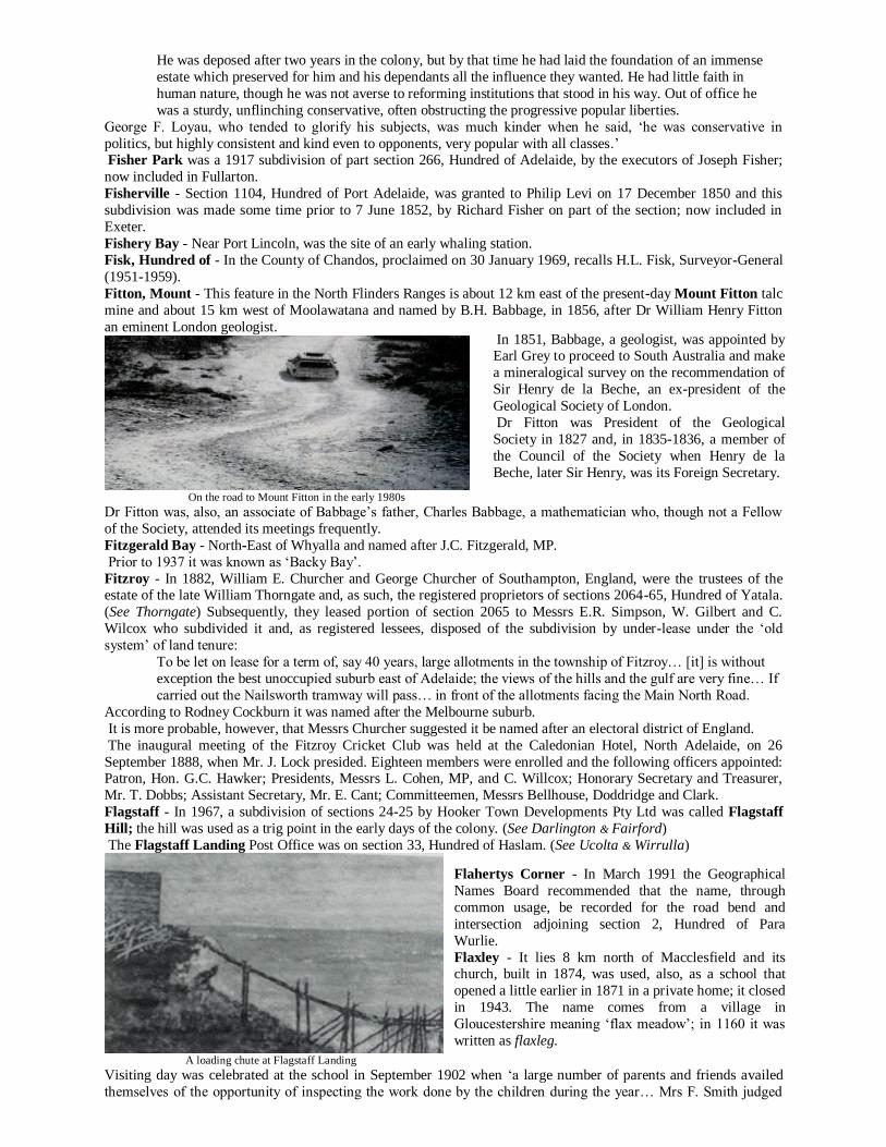
Cartridge manufacture at Finsbury during World War II
He arrived in South Australia in the Lord Goderich in April 1838 and, shortly thereafter, purchased 500 acres of
land on the foothills, east of Adelaide. Elected to the first representative Parliament in 1857, twenty years later he
was appointed a judge, a position he held until retirement in 1881, the year he laid out Firle on sections 303 and
265, Hundred of Adelaide, contiguous to Glynde.
The name derives from the Œ fierol - ‘covered with oaks’. (See Glynde)
First Creek - Originally, it was named ‘Green Hill Rivulet’ by Colonel Light.
During 1856, and for the previous three years, ‘the people of Norwood and Kent Town, through whose land First Creek used to run have, at this time of the year, had to deplore its premature dribble and final exhaustion’:
From Howitt’s Mill downwards the water is dammed up by one and another until the immense evaporation
of summer exhausts its overflow and what might and ought to be a blessing to thousands is monopolised by
a few without let or hindrance… [See Geoffrey H. Manning, A Colonial Experience]
First Creek, Norwood in early colonial days
The foundation stone of a Baptist Church was laid at
Sheridan Street on 16 May 1914 by Sir Charles Goode when
it was said that ‘the old galvanised iron building at the rear of
the new edifice had done good service and the connection has
seen many ups and downs since it was built 21 years ago…’
The name ‘Finsbury’ comes from England and it was not recorded until the 13th century ‘when it must have been a
fortified manor [of] Finn (probably a Dane).’
Firle - Edward Castres Gwynne was born in 1811 at Lewes in
Sussex, England, near the towns of Firle and Glynde, while
his father was the Rector of Glynde.
Fisher - A railway station on the Trans-Australia
line, 349 km west of Tarcoola, recalls Andrew
Fisher, a former Prime Minister of Australia. (See
Barton) The Hundred of Fisher, County of
Eyre, proclaimed on 19 April 1860, was named
after Sir James Hurtle Fisher, MLC, (1857-1865), who Sir John Jeffcott categorised as ‘a wily
attorney, the very worst class of person that could
have been selected for the office [of Resident
Commissioner].’ He died in 1875 in his 84th year:
He was deposed after two years in the colony, but by that time he had laid the foundation of an immense
estate which preserved for him and his dependants all the influence they wanted. He had little faith in
human nature, though he was not averse to reforming institutions that stood in his way. Out of office he
was a sturdy, unflinching conservative, often obstructing the progressive popular liberties.
George F. Loyau, who tended to glorify his subjects, was much kinder when he said, ‘he was conservative in
politics, but highly consistent and kind even to opponents, very popular with all classes.’ Fisher Park was a 1917 subdivision of part section 266, Hundred of Adelaide, by the executors of Joseph Fisher;
now included in Fullarton.
Fisherville - Section 1104, Hundred of Port Adelaide, was granted to Philip Levi on 17 December 1850 and this
subdivision was made some time prior to 7 June 1852, by Richard Fisher on part of the section; now included in
Exeter.
Fishery Bay - Near Port Lincoln, was the site of an early whaling station.
Fisk, Hundred of - In the County of Chandos, proclaimed on 30 January 1969, recalls H.L. Fisk, Surveyor-General
(1951-1959).
Fitton, Mount - This feature in the North Flinders Ranges is about 12 km east of the present-day Mount Fitton talc
mine and about 15 km west of Moolawatana and named by B.H. Babbage, in 1856, after Dr William Henry Fitton
an eminent London geologist.
On the road to Mount Fitton in the early 1980s
Dr Fitton was, also, an associate of Babbage’s father, Charles Babbage, a mathematician who, though not a Fellow
of the Society, attended its meetings frequently.
Fitzgerald Bay - North-East of Whyalla and named after J.C. Fitzgerald, MP.
Prior to 1937 it was known as ‘Backy Bay’.
Fitzroy - In 1882, William E. Churcher and George Churcher of Southampton, England, were the trustees of the estate of the late William Thorngate and, as such, the registered proprietors of sections 2064-65, Hundred of Yatala.
(See Thorngate) Subsequently, they leased portion of section 2065 to Messrs E.R. Simpson, W. Gilbert and C.
Wilcox who subdivided it and, as registered lessees, disposed of the subdivision by under-lease under the ‘old
system’ of land tenure:
To be let on lease for a term of, say 40 years, large allotments in the township of Fitzroy… [it] is without
exception the best unoccupied suburb east of Adelaide; the views of the hills and the gulf are very fine… If
carried out the Nailsworth tramway will pass… in front of the allotments facing the Main North Road.
According to Rodney Cockburn it was named after the Melbourne suburb.
It is more probable, however, that Messrs Churcher suggested it be named after an electoral district of England.
The inaugural meeting of the Fitzroy Cricket Club was held at the Caledonian Hotel, North Adelaide, on 26
September 1888, when Mr. J. Lock presided. Eighteen members were enrolled and the following officers appointed: Patron, Hon. G.C. Hawker; Presidents, Messrs L. Cohen, MP, and C. Willcox; Honorary Secretary and Treasurer,
Mr. T. Dobbs; Assistant Secretary, Mr. E. Cant; Committeemen, Messrs Bellhouse, Doddridge and Clark.
Flagstaff - In 1967, a subdivision of sections 24-25 by Hooker Town Developments Pty Ltd was called Flagstaff
Hill; the hill was used as a trig point in the early days of the colony. (See Darlington & Fairford)
The Flagstaff Landing Post Office was on section 33, Hundred of Haslam. (See Ucolta & Wirrulla)
A loading chute at Flagstaff Landing
Visiting day was celebrated at the school in September 1902 when ‘a large number of parents and friends availed
themselves of the opportunity of inspecting the work done by the children during the year… Mrs F. Smith judged
In 1851, Babbage, a geologist, was appointed by Earl Grey to proceed to South Australia and make
a mineralogical survey on the recommendation of
Sir Henry de la Beche, an ex-president of the
Geological Society of London.
Dr Fitton was President of the Geological
Society in 1827 and, in 1835-1836, a member of
the Council of the Society when Henry de la
Beche, later Sir Henry, was its Foreign Secretary.
Flahertys Corner - In March 1991 the Geographical
Names Board recommended that the name, through
common usage, be recorded for the road bend and
intersection adjoining section 2, Hundred of Para
Wurlie.
Flaxley - It lies 8 km north of Macclesfield and its church, built in 1874, was used, also, as a school that
opened a little earlier in 1871 in a private home; it closed
in 1943. The name comes from a village in
Gloucestershire meaning ‘flax meadow’; in 1160 it was
written as flaxleg.

the needlework and awarded the first prize to Amy Fry. Florrie Sutherland obtained the second and the third was
secured by Doris Mustard…’ Flaxley Post Office closed on 30 August 1974.
Flaxman - Johannes Menge named the River Flaxman circa 1840:
The exploring German emigrants who were said to have named a stream which they found flowing through
‘Light’s Pass’ the ‘Flaxman River’, were but paying graceful recognition to the man who had befriended
them during the course of their long voyage of exile, and again during the early days of their settlement in the province; but unfortunately the river in question was but a section of the North Para, another section of
which had already been called the ‘Gawler River’ by Bewes Strangways on the 23 November 1838; and
since no further references to the ‘Flaxman River’ could be found in official maps or documents, it seemed
right to conclude that the officials who had swallowed two names for one river, had baulked at a third
name, that did not happen to be the name of the Governor.
Nevertheless, the grateful German emigrants were not to be wholly cheated of their wish to do honour to
the name of Flaxman and, accordingly, an adjoining valley to the South-West of Light’s Pass, and
immediately to the north of Tarawatta, was from that time onwards recognised, officially, as ‘Flaxman’s
Valley’. [See under ‘Gawler, River’ for an account of the discovery of that river and naming of same.]
Flaxman Valley is 5 km North-West of Eden Valley and was named after Charles Flaxman, who was in the employ
of George Fife Angas. Born at Portsea, Hampshire, England, on 25 December 1806, he came to South Australia in
the Prince George in 1838 as personal agent for George F. Angas. Historians, such as Edwin Hodder, Douglas Pike and Charles Grenfell Price, in many ways, ostracised Flaxman and dismissed him as a reckless adventurer.
However, in The Confidential Clerk, Charles H. Bright subjected the findings of these learned historians to critical
scrutiny and concluded that much of what they had to say about the dealings between Angas and Flaxman was
lacking in substance and fact:
There has been a tendency for later historians to continue to express the same view as their predecessors
despite the latest evidence. This is perhaps because the later material often consists of scraps of
circumstantial evidence which, considered singly, appear insignificant, but which, taken collectively,
present a picture which is inconsistent with earlier views…
A writer, who at the present time, attempts an assessment of an early colonist must pick his path with care.
He will not readily believe the abuse uttered by other colonists and he will discount the praises of those
whose interests are served by praising… I attempt to show that Edwin Hodder, who in 1881, wrote a history of Angas… misrepresented Flaxman… Only a patient examination of the available records can
disclose that Hodder was often mistaken…
In a comprehensive and analytical review of this book, which appeared in the Advertiser on 18 February 1984, Mr
Stewart Cockburn who, at the time, was in the throes of publishing his late father’s work on South Australian
nomenclature, made the prediction that Mr Bright’s book:
Is going to deliver a large jolt to professional writers of history and biography in Australia who have often
take n in each other’s washing and accepted secondary sources for their information, instead of going back
to primary sources,
while in a foreword Sir Walter Crocker concluded that ‘some errors, some of them enshrined in the Australian
Dictionary of Biography and in our standard histories, are at length, cleared away.’ (See Flaxman River, Angaston,
Tanunda & Appendix 46)
In 1838, Professor J. Menge said that the Flaxman Valley was ‘a beautiful country, splendid timber, plenty of water, abounding in minerals and precious stones and to all appearances there is gold.’
Fleming Bridge - Erected over the River Onkaparinga in the 1970s and named after D.V. Fleming, the first
Commissioner of Highways (1926-1949). In addition to laying the framework of the State’s arterial road system and
introducing a scientific approach to road construction, he was responsible for the first bituminous surfacing in South
Australia and personally designed and supervised construction of the original Torrens Gorge Road.
For his services in highway engineering he was decorated with the Order of the British Empire in 1941.
Fleurieu Peninsula - In Alas, for the Pelicans, Mark Tostevin says:
The name Fleurieu Peninsula is one of several derived from the voyage of the French, though it seems
certain that the name was assigned in Paris rather than by Baudin. Comte de Fleurieu was a career naval
officer. Condemned to death by the Republic and after a year in gaol was released through efforts of his
friends. He wrote the orders for Baudin under the form of contract with the French Ministry of Marine. Contrary to that comment, in a report to the government the Surveyor-General said, in February 1913, that:
The French navigators, principally Baudin, in the first decade of the nineteenth century named a large
number of points and bays along the South Australian coast, and amongst other places the Peninsula at
Cape Jervis was called Fleurieu by Baudin. It is understood that this was called after Count Fleurieu, the
then Minister of Marine in France. It is desirable that some of the unnamed points and small bays should be
named, and I am not aware of any reason why a few of those mentioned by Count Fleurieu, the grand-
nephew of the Minister of Marine referred to, should not be adopted.
Personally, I am in favour of giving some name to the peninsula referred to, and in view of the present
very cordial relations between Great Britain and France it would be a graceful act if the name Fleurieu were
adopted for the peninsula, which is at present unnamed on the charts, and in addition I suggest that the
following French names be adopted for the capes and bays. These are not named so far as I am aware on

any of the charts with the exception of one - Shoal Point - which it is suggested be called Rouge Point, as
the name is very appropriate. The names suggested are Bay D’Anville, Cape Carnot, Cape Tournefort,
Jussieu Bay, Cape Colbert, Massena Bay, Cape Euler, Cape Rouge.
Officially, the name was bestowed, circa 1913, following a visit to South Australia of Count Alphonse de Fleurieu, a
grandnephew of Charles-Pierre Claret, Comte de Fleurieu, a member of the council that prepared instructions for
Baudin’s voyage. He held the post of Minister of Marine in 1790 and was counsellor and friend of Napoleon. Commenting on the detention of Matthew Flinders on the Isle of France he declared, fearlessly, that ‘the indignities
imposed upon [him] were without example in the nautical history of civilised nations.’
Flinders - The explorations of Matthew Flinders are immortalised in history books and need no repetition here.
However, a comment by Captain W. Goalen, RN, as to Matthew Flinders’ competency as a hydrographer was as
follows:
Although Flinders was in the first rank as an astronomical observer and calculator he was far behind Cook
as a hydrographic surveyor - or, in other words, as a maker of charts by the aid of which ships could be
safely navigated.
In South Australia he is remembered by the County of Flinders, proclaimed on 2 June 1842 and the Hundred of
Flinders on 26 November 1903.
Flinders Highway extends from Ceduna to Port Lincoln; Flinders Lake is the former name of Franklin Harbor.
Flinders Park was laid out on part sections 391-92, Hundred of Adelaide, by the South Australian Company in 1924 when many of its street names were names after navigators, including members of Flinders’ expedition.
The feat of building a chapel in one day was completed by a number of Church of Christ adherents on 11
September 1926… The structure of wood and iron was erected in about 12 hours on a site at the corner of
Franklyn [sic] Avenue and Rex Street…
Flinders Reef is near Streaky Bay, Flinders Town, is now known as ‘Streaky Bay’ and Flinders Ranges, was
named by Governor Gawler in July 1839. (See Saint Marys Peak)
A photograph of a donkey team in the Ranges is in the Observer, 10 December 1919; page 8 (supp.), scenic
photographs in the Chronicle, 30 July 1931, page 31.
A Workmen’s shack in the Flinders Ranges
The town Port Flinders was laid out by the Mount Remarkable Mining Co., circa 1853, on section 1, Hundreds of
Telowie and Pirie - it never advanced beyond surveyors’ pegs in the ground, but at the outset it was stated that there
‘is reserved forever the free wharf of this desirable and leading port of Spencer’s Gulf.’ (See Mount Ferguson &
Weeroona) The Flinders Chase National Park on Kangaroo Island, established by the Fauna and Flora Reserve Act, 1919,
was assented to on 16 October. (See Appendix 15)
Flinders Island - Off Elliston, discovered and named by Matthew Flinders, on 13 February 1802, after his brother,
Samuel W. Flinders, Second Lieutenant of the Investigator.
Baudin called it La Basse Terre (The Low Land), while Freycinet’s charts show it as I. Andreossy.
The greater part of the island was leased first to John Sinclair in 1857 and the remainder taken up by Thomas Elder
and Anton Schlink in 1862.
The story of Terence O’Brien, a ship’s deserter who lived there from circa 1830, was reported in 1884:
Some fifty or 60 years ago there lived on Flinders Island and others a number of men, sometimes singly,
and in other cases in pairs, who had deserted from their ships and who sustained themselves by catching
seals and bartering their skins for rations with whaling ships which occasionally visited there.
On Flinders Island at this time lived Terrence [sic] O’Brien, a native of Tipperary. Finding the lonely solitude of the island anything but congenial with his social and amorous nature he resolved to visit the
mainland and endeavour to kidnap a black woman. He made a dart [sic] at a comely-looking lady and
dragging her to his boat pulled away from the shore with all his might and when at a safe distance
examined his prize and found that she had an infant in a net on her back.
In due time the child grew and throve and Terrence, a true son of the Church, endeavoured to instill the
elementary doctrines of the Church of Rome into the child. In course of time Terrence died and a few
weeks later ‘Young O’Brien’ went to barter his seal skins at Port Lincoln. He was invited to a party where
he sang Irish songs and drank spirits until he was in anything but a fit state.
One of the assembled company then proceeded to play a practical joke and, imitating the brogue of the late
lamented Terrence addressed, the inebriate: ‘Tirence, ye blaggard of a spalpeen, is this the way yiz do,
philandering with the haythen… before I am comfortable in my grave? Go home and take care of your old mother, or it will be the worst for yiz.’ The fright he received sobered young O’Brien and the next day he
sailed for the island… [See Bobs Nose]
A statue of Matthew Flinders, sculpted by Frederick
Brook Hitch, was unveiled in Prince Henry Gardens,
North Terrace, Adelaide, on 12 April 1934 and, in
1965, the SA Government decided that the new
‘University of Adelaide at Bedford Park’ would
become fully autonomous and be called the Flinders
University; it was opened officially in 1966.

Flood Creek - It empties into Lake Frome and recalls Robert Flood, a member of Captain Sturt’s 1844 expedition.
Floraville - The name given to an estate comprising sections 12, 13, 16 and 17, Hundred of Nuriootpa, and sections
468, 469 and 3045, Hundred of Barossa. A pastoral station named Floraville was taken up by William
Younghusband (ca.1814-1863). In the mid-1840s Floraville House was destroyed by fire:
Following an inquest the jury returned a verdict to the effect that there was no evidence to show by what
means the fire occurred, but suggested the boys employed on the farm should be admonished for smoking without the consent and sanction of their master.
The name comes from Cumberland, England, from whence Mr Younghusband departed for South Australia.
Florieton - A town in the Hundred of Maude, 24 km North-West of Morgan, proclaimed on 5 October 1882 and
named after Florence A. Price, who married the second son of Governor Jervois. Surveyed and sold by the
government, it was on the main road from Morgan to the Burra and ‘any person looking at the map of the Hundred
of Schomburgk [now Hundred of Maude] would realise that the township was, originally, to be the principal place
of business, as the cattle travelling track passed by it and there were nine government roads leading into it…’
The Florieton School opened in 1890 and closed in 1906.
Florina Springs - North-West of Manna Hill where the ‘Florina Run’ was established by T.R.E. and W.J.
O’Connell in 1888 (lease no. 1058).
Folkestone - An 1878 subdivision of section 216, Hundred of Noarlunga; now included in Marino.
Charles Tompkins laid it out and, no doubt, named it after its counterpart in Kent, England, recorded in the Domesday Book as fulchestan - ‘stone rock of the folk or people’.
Foote - On 2 October 1853, N. Foote took up pastoral lease no. 365 in the Hundreds of Anna, Skurray, Bagot and
Fisher and Foote Creek, on section 12, Hundred of Neales, probably recalls his name; it is known locally as ‘King
John Creek’. Alternatively, it may be corrupted from John Foott who took out an occupation licence over land in
County Eyre on 7 January 1847.
Foote Hill is North-East of Manna Hill on land held by Henry Foote, namely, pastoral lease no. 1540 (Outalpa)
purchased from Walter Duffield and Joseph Harrold on 31 March 1876.
Forbes - An 1882 subdivision of part section 90, Hundred of Adelaide, by William J.H. Farrant, Thomas Bailey and
John C. Bailey between Daly and Thomas Streets and bisected by Laurence Street; now included in South Plympton.
Originally, the section was taken up by Alexander and Maxwell Christie who came to South Australia from Scotland
in the Sir Charles Forbes in June 1839. The ship carried the name of an eminent member of an ancient Scottish family closely associated with Aberdeen and was built in that city in 1824. Today, the Forbes School, opened in
1953, stands on the former Christie’s land. The name derives from the Gaelic forba - ‘field, district’.
Forbin, Cape - On Kangaroo Island. It has been recorded that Baudin named it after Louis N.P. A. Forbin.
However, a Mortlock Library reference says, ‘he was too young to be well-known at the time of the Baudin
expedition. It was named after a French Admiral, Claude de Forbin (1656-1733).’ As a boy he ran away from home
and went to sea and became a brilliant seaman who won several actions against the English.
Fordham - In the 1870s, it was described as ‘a small agricultural, vine growing and wine making settlement about 7
miles from Adelaide on the road to Mount Lofty. There is a well-known hotel (Eagle on the Hill) at Fordham.’ (See
Eagle on the Hill)
Fords - A railway station in the Hundred of Light, 6 km South-West of Kapunda, recalls John Ford (1830-1914)
who, in the 1860s, held section 385, portion of which was transferred to the Railways Commissioner in 1859 by
James Neilson Smith. John Ford was born on the island of Millport at the mouth of the River Clyde in Scotland on 16 May 1830 and, in
1910, recalled that ‘I had a look in the at the 1851 Exhibition at the Crystal Palace and then took a boat for here’;
It was the good ship Catherine Mitchell and we landed in Melbourne after 125 days… Eventually I went to
Fords in 1853 - the crossing and the station were named after me - and took up three 80 acre sections. The
land was valued at £3 per acre and I had the right of purchase. I paid 15 per cent for the money, too. Jimmy
Martin, the founder of the big Gawler firm, was then a blacksmith in that town. I gave him £16 for a
wooden plough and with it and one wheel I used to do my two acres a day… I was in that country for ten
years and had a square mile of country when I left…
Fords Post Office opened circa 1867, the first postmaster being E. Pulford; it closed on 13 March 1969. (For
information on the Fords School see under ‘Bagot’.) In 1870, Ford’s Crossing School was conducted by Sarah Roe
with 38 enrolled pupils; it opened in 1867 and closed in 1870. Photographs of a railway smash are in the Observer, 22 February 1913, page 29.
Fords Lagoon, out of Hundreds on the Eastern Plains (south), 70 km north of Morgan, remembers Joseph Ford,
who took up pastoral leases nod. 2226 and 2228 in 1876.
Forest - A school near Lenswood opened in 1869 as ‘Jerry’s Flat’ by James Clarke and, in 1883, its location was
described as ‘Forest, Lobethal Rd’. The name was adopted in 1884 and, in 1909, Church of England services were
held on the premises. It closed circa 1961. Forest Glen was the site of a gold find near Lobethal:
The diggers seem to a little more sanguine about the prospects of the field than they were on Saturday, the
discovery of some show of gold in two or three claims having raised their hopes. On Monday morning
Bowen, the original prospector, having secured about two pennyweights put more heart into the doubtful
workers… That many men on the field have hopes of the permanency of the diggings is proved by the

systematic way they have gone to work in rigging windlasses and making other appliances for thoroughly
testing their claims… Up to date 254 licences have been issued…
Forest Gardens was a 1917 subdivision of part section 44, Hundred of Adelaide, by a syndicate that included Isabel
Roberts, F.G. White, J.R. Blaikie, A.S. Jackman and C.H. Treloar, ‘just beyond the Keswick tram terminus… close
to the new Showground’; now included in Forestville.
Forest Range is 6 km South-West of Lobethal and the origin of the name is somewhat obscure and, interestingly, appears first in East Torrens District Council records as early as 1870, but it was not in Onkaparinga District
Council records until 1884. In 1870, the East Torrens assessments gave section 80 as Forrest (sic) Range (See
Forrest), whilst nearby sections 104, 250 and 252 were described as ‘Deep Creek’, a name encompassing most of
the Basket Range area. The first use of ‘Forrest Range’ in relation to James Gillett Collins’ property, sections 89 and
90, was in 1884.
It is impossible to ascertain whether Collins coined the name but, as early as July 1853, he had named his section
5153 ‘Mount Farm’, giving the locality as ‘New Forrest (sic)’.
There would seem to be little to support Cockburn’s Nomenclature of South Australia (1908) that Forest
Range was named by Caleb Biggs. From 1857-1870 the location of Biggs’ property was described as ‘The
Tiers’ and in the East Torrens’ records as being on the Forrest Road (opened 1859).
From 1870 until 1885 his property was described by its name ‘The Bluff’, presumably a reference to a
prominence on sections 257 and 84 and over which the bullock track passed before descending to the Stony Creek gully, where his house was located. By 1890, the spelling had been altered to Forest Range and was
rapidly replacing ‘The Tiers’ to describe the locality.
James Collins (1833-1917) arrived with his parents in the Hooghly in 1839
James Gillett Collins’ home in the 1860s Peg Berry
In respect of mail deliveries in the district, it was ‘brought on horseback three times a week, but the distance of
eight miles from Adelaide to Magill there was no mail communication whatever’: The present mail service between Lobethal and Adelaide, via Forest Range, Ashton and Norton Summit is
very inconveniently timed. The time table should be altered so that the mail should leave Lobethal about 7
o’clock in the morning and return from Adelaide about three in the afternoon…
This district produced some of the greatest necessaries of life and supplied a great portion of the colony,
but they were worst treated of the whole lot… The government had done a great injustice by taking away
the daily mail… The mail had been originally arranged to suit the convenience of the Governor at Marble
Hill, but the present Governor had never used that residence…
The Sharpe family off to a picnic – circa 1910
About a half mile further was the mine situated on a section of 260 acres belonging to Mr Peter Prankerd
and three other gentlemen. Auriferous ore had been found there in 1870 and, after the discoverer, Captain
Terrell, had worked it for a short time, it passed into the hands of a company. A crusher, formerly used at
Lobethal, was erected and five head of stamps installed by Mr J.A. Whitfield of Adelaide.
A nugget weighing over three ounces was found at Gory’s (sic) Point, Forest Range, in April 1887, where the field
presented a ‘lively appearance’ with scores of tents, a store, blacksmith’s shop and a cheap Jack:
Gold was first discovered there in 1854 and the
Eclipse mine promoted on the finding of bismuth
ore showing some free gold. In November 1871, a number of its directors took a
pleasant drive through the Magill Gully, past Norton
Summit and over Deep Creek ‘where a detour of a
mile led to Mr Biggs’ wine shop’:

Some of the wiseacres predicted that the field would be worked out in a few months but it is now three
months since the rush started and there is no sign of it being abandoned yet. Messrs Boehm & Love, to
whom the land now belongs, charge the miners two shillings and sixpence a week for an ordinary sized
alluvial claim.
It is apparent that this field was contiguous to Price Maurice’s property which was resumed by the government in
1889. In 1888, a company was formed to work a reef known to exist on Mr James Love’s land at Forest Range
but, although many thousands of pounds worth of alluvial gold had been won there, all attempts at lode
mining ended in failure. Over the years this land was gone over time and again but it was not until 1931
that ‘The Golden Hill’ was discovered by Mr J. McGuire and three brothers, Messrs O., J. and H. Fox.
Gold diggings at Forest Range – 1887
Forest Range - 1983
Formby Bay - Between Daly and Royston Heads, named in 1908 in honour of John Formby an ex-Chairman of the
Marine Board. Its Aboriginal name was wilibadla - ‘pelican creek’.
Forrest - Alexander Forrest arrived in South Australia in the Thomas Maitland in 1848. A blacksmith by trade, he laid out the village of Forrest in 1858 on part sections 6025-26, Hundred of Talunga, 3 km North-East of
Gumeracha. It is known, also, as Forreston. Its school opened as ‘Gumeracha North’ in 1860; name changed in
1890; closed in 1967; photographs are in the Chronicle, 8 July 1911, page 31.
The Robert Burns Hotel operated from 1851 until 1858:
Unusually, it closed when Forreston, sometimes referred to as North Gumeracha, was officially laid out in
1858. This tiny hamlet was subdivided two years before Gumeracha but it is not yet known why it should
have lost its pub.
A photograph of a Baptist Sunday School picnic is in the Chronicle, 7 October 1911, page 33.
The Hundred of Forrest, County of Robinson, proclaimed on 11 June 1885, was named in honour of Lord John
Forrest, Australian statesman.
Forster - Anthony Forster, MLC (1855-1864), born in Northumberland in 1813, came to Adelaide in the Siam in 1841. In the 1850s, he was proprietor of the Register and Observer and entered the Legislative Council as a Member
for West Adelaide, where he was a strong advocate of the Torrens system of land registration.
He died in England in 1897. The Hundred of Forster, County of Albert, was proclaimed on 10 May 1883; the
Hundred of Forster School opened in 1889 and closed in 1941.
The Forster Post Office, 26 km North-East of Mannum; opened in April 1898 and closed in 1971.
Pastor P. Scherer of Cambrai wrote in June 1920:
Our church, in the Hundred of Forster on the Murray, seemed to be an eyesore to some of the enemies of
God. First of all, during the war years all the windows were smashed to the displeasure of the congregation,
but which remained silent. Then the money box with contents was robbed. Finally, on the night on May 29
an attempt was made to burn the church… So I would like to ask the enemies of the Kingdom of God why
they cannot leave the Lutheran Church in peace, now that the war has ceased and peace proclaimed. Have
not the Australian Lutherans proved their loyalty during the war? [See Appendix 43]
Its first hotel, the Splitter’s Arms, dates from
the time of the gold rush when it operated
from 1857 to 1859:
It was another ten years before Caleb Biggs
obtained a wine licence for the Forest
Range Wine Shop. When he obtained a
publican’s licence in 1884, the premises
were renamed the Forest Range Hotel. In 1913, the Biggs family sold the hotel to
H. Pike and Company, brewers of
Oakbank; it was their new hotel at Oakbank
that took the licence from Forest Range.
Mention of Forest Village at Cox’s Creek
was made in 1849, while the laying of the
foundation stone of a Bible Christian Chapel
at ‘Forest Road, near Mount Lofty’ was
reported in 1863.
Rodney Cockburn says that Forestville, near
Black Forest, was known once as ‘Goodwood
West Extension’ but, following the advent of the Glenelg railway, the local station was
named Forestville.
Further, in 1917, Andrew Ferguson applied
the name Forestville to a subdivision of part
section 43, Hundred of Adelaide.

The Reverend John Blacket responded as follows:
I want to assure the minister of the church and his congregation of my deep sympathy with them in the
oppression and persecution to which they have been subjected… and my detestation of a cowardly and
wicked act… [See Devon Downs]
Forster Dam, on section 154, Hundred of Willochra, was probably named after Matthew Forster who, on 11 August
1854, signed an agreement to purchase sections 1, 2 and 3, 13 km South-East of Mount Remarkable and 82 acres, 10 km ‘N-E and by N from the Bluff Trig Station’, from Samuel W. White and Frederick White.
Fortress Hill - In the Far North and on its summit are a number of large stones deposited with the regularity of a
mason’s work, giving it the appearance of a fortress.
Fountain, The - An old accommodation house on section 7, Hundred of Wanilla, 16 km North-West of Port
Lincoln, so named because a permanent spring was nearby:
Driving on a few miles we came to a spring of delicious water bursting out from the side of a hill… Here
the traveller may quench his thirst without the fear of establishing an aquarium in his internals or of making
an acquaintance with hydatids…
It was listed in directories between 1866 and 1877, when the proprietor was H. Bryant.
The ‘Fountain Run’ was established by H.J. Smith in 1851. (See Shields)
The establishment of The Fountain Forest Reserve was reported in 1890.
Fourth Creek - Originally, it was called ‘Anstey’s Rivulet’ by Colonel Light. Riparian rights along the creek were discussed in the Register, 14 May 1923.
Fowler, Lake - Near Edithburgh, recalls William Fowler (ca. 1820 - 1901), who held pastoral lease no. 79
(Moorowie) from July 1851.
He was a conservative old fellow who hated new-fangled ideas. Yet he is reputed to have been the first on
the peninsula to use phosphates. From all accounts, he was a man with many peculiarities, perhaps many
inconsistencies. One of his strange acts was to have his own grave dug before he died. Another was to carry
a tape measure about with him to make sure that his land was being ploughed to the requisite depth.
He was very fond of animals, and on the homestead at Yararoo there was a small cemetery complete with
headstones, recording the demise of the family pets. In business he was exacting to the penny. On the other
hand, he was most generous to those in want.
If you met his employees and asked them what he was like, some would tell you he was an old screw, and others that he was a fine ‘boss’. Both would have been right. Fowler was a good boss - to the man who did
his job. But he had no time for the shirker. He was a mass of contradictions. But the good points far
outweighed the bad. His tenants, whom he treated liberally in hard times, will vouch for that.
Scraping salt on Lake Fowler
Being a layman, of course, I am not supposed to know where people go after death, but this I must say… If
cold-blooded murderers are to be the inmates of heaven and to have the fingering of the olden harps, then I
seriously hope that I may not be there to listen to their music. A photograph of the lake and its salt deposits is in the Chronicle, 26 June 1926, page 39.
Fowlers Bay - Robert M. Fowler, Matthew Flinders’ First Lieutenant, is remembered by this bay, 128 km west of
Ceduna; named on 28 January 1802; On Freycinet’s charts it is shown as Baie Denon. (See Pearson Isles)
The ‘Fowlers Bay Run’ was established by R.B. Smith in 1865 (lease no. 1529A) while the town of ‘Yalata’ was
proclaimed on 10 July 1890 and renamed Fowlers Bay on 19 September 1940.
The Fowlers Bay School opened in 1893 and closed in 1959.
Fowlers Bay – circa 1900 – King Moonlight at left
In 1890, there were, altogether, about ten parties employing natives for the purpose of kangaroo hunting
between Laura Bay and Eucla, a distance of about 350 miles, and it was reported that ‘the blacks are treated
In 1864, William Fowler spoke at length of his
experiences on the Moorowee (sic) run on Yorke Peninsula and in the North and, in 1875, wrote to
the editor of the Register deprecating the public
attitude towards self-confessed murderers:

well by their various employers… I have frequently questioned the natives although no complaints have
been made to me by any native or other person as to the alleged ill-treatment of any women or girls by the
hunters, and not one of them have any complaint to make. I have no doubt whatever that considerable
immorality is carried on amongst the native women, some of the hunters being reputed to keep lubras for
the purpose of cohabiting with them… The lubras… are in every instance consenting parties…’
At the behest of Messrs J.N. Tonkin and J.M Edwards, a jetty was built there and opened in 1896; the last cargo of wheat departed on 9 February 1963, of barley on 27 November 1965 and wool on 27 November 1965, all aboard
MV Yalata.
Fowlers Bay - 1909
Fowlers Bublacowie Well - On section 342, Hundred of Dalrymple; bublacowie is Aboriginal for ‘brackish water’.
(See Fowler, Lake)
Fox - Land Grants Book No. 44 at page 359 places Fox Creek on the Waterloo Plains and Mrs Ruth Fox died there
in 1918, aged 87:
She was born in Devonshire in 1831 and came to South Australia in the David Malcolm in 1846. At the age
of 18 she married Robert Fox, who was a passenger in the Buffalo. She lived all her life at Fox Creek where
she and her husband carried on dairy farming and gardening.
Fox Plains were probably named after a family of early settlers of whom H. Fox was a member. A public meeting
was held in September 1866 at Fox Plains Chapel by a few persons interested in forming a district council in the
Hundred of Light; ‘35 persons were in attendance including Messrs Rankine (promoter), Fox, Gravestock, MacNamara, Barber, Keane and Costello.’
The Hundred of Fox, County of Robe, proclaimed on 12 March 1885, was named after Arthur A. Fox, MP (1884-
1887); born in Adelaide in 1847, ‘he was highly respected by all who knew him and he was held in special esteem
by his co-religionists.’ He died at Athelstone in April 1901.
Lake Fox is on section 393, Hundred of Waterhouse; its nomenclature is unknown but ‘it lies on the opposite side
of the road to Pub Lake. It is brackish and hardly a quarter a mile across’:
It was singled out by the first geological observer, Rev. Julian T. Woods, as worthy of note. In 1960, the
Methodist Youth Hostel was established on its banks - a fitting purpose, when one recalls that across the
land the first road led into Guichen Bay, traversed by so many in quest of adventure, so highly prized by
youth…
Frampton Well - Near Streaky Bay, recalls F.W. Frampton who took up pastoral lease no. 940 on 27 March 1861,
‘East of Point Westall’. Frances - This town, 40 km north of Naracoorte, was named by Governor Fergusson in memory of Frances Jones
(nee Caton), the wife of Henry Jones of Binnum Station, who wrote a book entitled Broad Outlines of Long Years in
Australia. The provision for the town’s establishment was made in 1871 when ‘Agricultural Area no. 12’, containing
the site of the future town and surrounding area, was defined by proclamation.
It was surveyed in 1881 and Frances School, opened in 1888, closed in 1890.
On 1 January 1906, pedestrian and aquatic sports were held ‘when a large group assembled at Lake Cadnite and
everything passed off satisfactorily under the management of Messrs J.C. Brown and A.J. Carracher. In the evening
a ball was held in the Institute Hall. Messrs W. Pettit and D. Smith officiated as masters of ceremonies and Messrs
A. Quinlivan (piano) and A. Oliver (violin) supplied music.’ (See Kybybolite)
Franklin - William Henry Gray died on 6 September 1896 and, in 1898, his executors, who included his son,
Franklin James Gray, subdivided part section 420, Hundred of Yatala; now included in Cheltenham. The name Franklin Harbor honours Sir John Franklin, Governor of Tasmania (1837-1843), who was previously a
midshipman on the Investigator. His wife unveiled a monument to Flinders at Port Lincoln on 12 January 1841. In
his log of 8 March 1802, Matthew Flinders said ‘a lagoon was visible from the masthead over the beach and a small
inlet, apparently connected with it, was perceived soon afterwards.’ In the course of a speech at Port Lincoln on 5
May 1840 Governor Gawler said, ‘the lagoon I have named Lake Flinders and the port connected with it Franklin
Harbor. The latter will receive and hold securely vessels of any burthen.’
A correspondent writing to the Observer in 1884 said that ‘one of the unnoticed and almost unknown districts is
that of Franklin Harbor, to which I have just had the opportunity of paying a visit’:
I took the steamer on Tuesday afternoon, and did not reach Franklin Harbor till Friday morning… The
steamer calls here about once a fortnight with goods and passengers… Much cannot be said of the township
of Cowell, which is usually called after the harbour, the government name not being used. It contains a decent hotel, a store, smith’s shop, wheat store, but not a single chapel. The place, however, is increasing,
A photograph of the town is in the Observer, 28
January 1905, page 25, 4 February 1911, page 29, 29
May 1926, page 31, Chronicle, 5 January 1907, page
29, of rifle club members on 21 January 1911, page 32,
of a bogged motor mail coach on 28 August 1915, page
29, of the post office on 11 July 1929, page 36, of Mr &
Mrs T.S. Price on 8 August 1929, page 38, of a camel
team in the Observer, 15 February 1913, page 31.

and while I was there two donkeys arrived and this enlivened things. The district around is occupied by
wheatgrowers and sheepfarmers…
The scattered settlements of people over these seven or eight Hundreds enjoy but few advantages, and their
wants are no doubt still more pressingly felt on account of the isolated character of the settlement that has
taken place. They have no resident trooper or a medical man in the whole district, and have to send to Port
Lincoln or Port Augusta for either, unless they go to Wallaroo, which they only have the opportunity of doing once a week.
Although a telegraph line traverses the country from Port Lincoln to Port Augusta, passing within four
miles of the harbour, they have not yet the privilege of a telegraph office. A small cutter carries the mails
once a week only from Wallaroo, while many other places with not half the population have a daily mail.
The mails are delivered on Sundays. Here the State, without any tangible reason, not only sanctions but
deliberately arranges for the delivery of the mail on the day of rest, a state of things which could not obtain
in any other centre of population in the colonies.
Until recently there were no stated or regular services for Divine worship, the people depending on
occasional visits from clergymen of different denominations.
The Bible Christians intend to provide for the religious demands of the people, and have recently sent a
deputation to inspect the country with that end in view.
The Franklin Harbor Post Office was opened in May 1867 by P.M.J McKechnie. (See Wangaraleednie) In 1914, it was said that it seemed a pity that ‘the residents of a great district should be fighting one another, instead
of cooperating to ensure the advancement of their district’:
If Nature has decreed that Franklin Harbour can never be a harbour for deeper boats, it would be wise for
the Cowell residents to recognise it at once and, instead of wasting their energies fighting Carpa people,
join them in getting the deep sea harbour, which… can be had 12 miles away…
Jetty at Franklin Harbor - 1911
Franklin Islands, named by Matthew Flinders on 3 February 1802 (Baudin christened them Isles St Pierre - ‘Isles of St Peter’) and Franklin Parade, that strip of the foreshore from the mouth of the River Inman to the Bluff
(Rosetta Head), have the same nomenclature as ‘Franklin Harbor’ The request for the latter name came from the
District Council of Encounter Bay after receiving a petition from 210 school children in 1946.
Franklyn - The town, near Terowie, proclaimed on 23 September 1880 and closed on 9 February 1984, was named
by Governor Jervois. In 1916, the nomenclature committee suggested it be changed to ‘Wonna’ to avoid confusion
with the Adelaide subdivision of ‘Franklin’.
The Franklyn School was opened as ‘Wonna’ in 1883; name changed in 1886 and closed in 1916.
The nomenclature of the town is, no doubt, explained by the fact that near Alphington, in Devonshire, was
‘Franklyn House’ which, in 1983, was reported to be a health centre.
It is an excellent building of the early pre-Palladian years of the 18th century and became the home of the Snow
family who were partners in a city bank and, under the entries of ‘Cleve’ and ‘Snowtown’, is a discussion on the affiliation between the respective families of ‘Jervois’ and ‘Snow’.
Frankton - Heinrich C.F. Diener arrived in 1847 in the Hermann Von Beckerath, married Augustine Mai at
Tanunda in 1853 and, in 1879, obtained the land grant of section 372, Hundred of Dutton, 24 km South-East of
Eudunda, on which the Frankton Post Office was opened in September 1882, the first postmaster being George
Rice: ‘Henry Brook suggested that this new post office be named… after Frank Rice, the postmaster’s son.’
William Diener took it over in April 1883 and held office for 41 years; it closed on 30 November 1930.
The Frankton School was opened in 1884 by Kate Cooper; it closed in 1938.
The name occurs in England and, in 1043, was written as francton - ‘Franca’s town’.
Fraser, Mount - Rodney Cockburn places it in the Musgrave Ranges and attributes its nomenclature to John Alan
Fraser, a member of the Pastoral Board.
Frayville - In 1933, Miss Fray opened this school, 8 km WNW of Mannum; a photograph of students is in the
Chronicle, 24 August 1933, page 31. Freds Flat - A school near Wudinna opened in 1923 by Rex E. Pepper; it closed in 1941.
Freds Knob - Near Wilpena, was named in 1895 by the surveyor W.G. Evans after his brother-in-law, Fred
Orchard.
Freeling - Arthur Henry Freeling, born in 1820, came to South Australia, in 1849, and was appointed Surveyor-
General and Colonial Engineer. In 1861, he returned to England after a distinguished career in the colony and, in
1871, as Fifth Baronet, succeeded to the title and estates of Ford and Hastings in Sussex. The following places
honour his name - Freeling Heights, near Copley, the Hundred of Freeling proclaimed on 1 October 1857; the
A photograph of members of the district council is in the Chronicle, 14 May 1904,
page 43, of local Aborigines on 21 May 1904,
page 43, of scrub rolling on 10 November
1906, page 30, of loading wheat at Warren
Beach on 17 August 1907, page 29.

town of Freeling surveyed in March 1860 and offered for sale on 19 July 1860 - ‘seven years later 100 lots
remained unsold in the town which was… the main outlet for the great cereal district of the north.’ (See Greenock)
In 1869, notwithstanding the depressing effect that the entire failure of last season’s crop had upon the colony:
This place has been going ahead surprisingly, for during the past year we have had four or five substantial
stone-built cottages added to our dwelling houses and, further, we have built a handsome new store - this
building was erected by Mr Elsholz and the business is carried on by Messrs Elsholz and Schuttloffel. Mr Kreusler has added a handsome stone front to his general store… Mr Schuttloffel has also a large wheat
store in course of erection, with a cellar the size of the whole building…
In 1891, the South Australian Company, to encourage their tenants to put the land to uses other than wheat growing:
Offered to provide vine cuttings, pay for the labour of putting them in, etc., and to charge no rent for the
land so used for the first three years. This condition has induced Messrs A. and H. Mattiske to plant ten and
five acres respectively with vines…
Mr. T.H. Litchfield, who lives on the Angaston side of Freeling, has a good garden and growing vineyard.
He put in several thousand vines last year and intends to put in 3,000 more this year.
The Freeling School opened in 1867; Freeling North School opened as the ‘Hundred of Light’ in 1903; name
changed in 1907 and closed in 1947.
A photograph of the first recorded snow fall is in the Chronicle, 7 August 1909, page 31, of a football team on 2
October 1909, page 32, 10 September 1910, page 32, of a cricket team in the Observer, 7 May 1910, page 28, of old residents in the Observer, 10 September 1910, page 31, of a band concert on 19 October 1912, page 29.
Freeling Water Hill was discovered and named by G.W. Goyder on 28 May 1857 and Mount Freeling, near
Marree, discovered and named by John McD. Stuart on 18 April 1860; Mount Freeling Post Office opened in 1868
and closed in 1896; a sketch of the pastoral station is in the Pictorial Australian in February 1884, page 25, of the
police station in the Chronicle, 2 September 1899, page 19 (supp.).
Freeling Range, ‘a remarkable isolated range south of Mount Ive’, was named by Stephen Hack in August 1857 ‘at
Mr Harris’ request.’
Freeman - The South-West promontory of Port Elliot is called Freeman Knob and H.C. Talbot says it takes its
name from Sylvester Freeman, the second officer to Captain J.W.D. Blenkinsopp, of the whaling station at
Encounter Bay in 1837, while Rodney Cockburn suggests that it may have been named by whalers in 1836 after a
Malay sailor who brought in a vessel from Hobart with stores for the fishery at Encounter Bay ‘by recognising the headland.’ The Aborigines called it kainjamin while Freycinet’s charts show it as C. Cretet.
A post office was opened there on 17 July 1851 and renamed ‘Port Elliot’ in 1852. (See Blenkinsopp, Point)
Freeman Peninsula, in the Hundred of Wrenfordsley, was named after the Freeman family, who held land in the
vicinity. It is known, also, as ‘Calca Peninsula’.
Freestone Creek & Freestone Hill - On Kangaroo Island where freestone, suitable for paving, is to be found.
Fremanton - A 1909 subdivision of part section 95, Hundred of Adelaide, by H. Jackson; now included in
Torrensville. The first Methodist Church on Henley Beach Road, between Clifford Street, and West Street, was
known as New Thebarton until 1910, when it became Torrensville.
In 1919, a new church was built in Hayward Avenue and although this locality was Fremanton, officially, the
church retained the name Torrensville Methodist Church. It would seem the latter name was favoured locally,
although Thomas & Co’s Street Directory of 1922 shows Freemanton (sic) encompassing Hardy’s Road, Ashley
Street, almost to West Street (section 95 boundary) and Henley Beach Road. French - The Hundred of French, County of Hanson, proclaimed on 12 December 1895 as the ‘Hundred of
Basedow’ was, in 1918, renamed in honour of Field Marshal French of World War I.
In 1867, French Creek was said to be ‘at the back of Torrens Island.’
Lord and Lady Tennyson at Frenchman’s Rock

Frenchman Rock - It once stood on the present day lot 96 of the town of Penneshaw. In 1802, members of
Baudin’s crew placed an inscription on a rock and, in 1906, it was covered with a shelter built of hard brick,
cemented over with three wrought iron grills, one of which was hinged to allow periodical visits to the stone and to
apply preservatives; it was believed to be the first such action to protect an historical site in situ.
Mrs Stow, the headmistress of the Penneshaw (Hog Bay) School opened a subscription list for the purpose
of securing a shelter for the rock, and her public spirit and energy have had their reward in the collection of about £30, which the government has subsidised pound for pound…
The completion of the arrangements was left to Mr C.E. Owen Smyth, Superintendent of Public Buildings,
and men are now constructing a shelter in the shape of a mosque, with a dome right above the stone… The
shelter will contain a wrought-iron gate, with two grilles, so that the face of the stone will be plainly
perceptible…; later, it was removed to preserve it from the elements and, today, a replica stands at the site.
The rock was removed in 1917-1918 and a cement cast substituted for the original which was taken to the Art
Gallery of SA in Adelaide.
Since 1996 it has been on display in the Penneshaw Information Centre.
A photograph of a shelter is in the Observer, 25 August 1906, page 29, 27 September 1913, page 6 (supp.).
Baudin called the place ‘Cove of Springs’.
Fresh Dip Lake - Near Beachport. Named by Dr. Margaret Brock in 1981 as a parallel to the saline Little Dip Lake.
Freshford - In 1862, it was reported that ‘Freshford, the residence of Mr A.F. Boord, is situated on a section adjoining Mr Coull’s vineyard and orchard, being on the north bank of the Torrens, about half a mile nearer the
gorge’:
There are about six acres planted with vines and fruit trees on a rich alluvial flat where the soil is light and
deep… The wines he makes are a pure Dolcetto, pure Constantia and pure Madeira, mixing all the other red
varieties for a second-class wine. He also makes a white wine from Muscats alone…
In 1869, this place on the River Torrens ‘was chosen by the proprietor of the Hindmarsh Brewery for their annual
picnic…’
Freshwater - A subdivision of section 1110, Hundred of Port Adelaide, by Robert Thornber, circa 1851, who
advised prospective buyers of allotments that fresh water was available at low depth on the section ‘opposite the
Prince’s Wharf and on the road to Semaphore’; now included in Exeter. The name occurs on the Isle of Wight,
England, where in 1194 it was written as freschewatere - ‘river with fresh water’. (See Bridgetown & Sandwell)
James Frew acquired the section in July 1847 and laid it out in 1865.
He arrived in the Lady Bute with his brother, Robert, in 1839. (See Fullarton)
The name Frewville was given, also, to a subdivision of section 369, Hundred of Blanche, by the executors of John
Frew (the son of James Frew) in 1902; now included in Mount Gambier.
Frew Park, a recreational ground within the town of Mount Ganbier, also honours his name. (See Hedley Park)
Fricker, Point - ‘In the centre of Coffin Bay’ and named, in 1910, after a warden of the Marine Board.
Friday, Mount - South-West of Lake Acraman, named by Stephen Hack because he climbed the hill on Friday, 24
July 1857.
Friedrichstadt - The name given to a rural subdivision of section 3913, Hundred of Kuitpo, circa 1852, by Johann Friedrich Paech, who came to South Australia in the Zebra in 1838:
It is indeed a lovely spot and the old residences there occupied by the Paech family are worthy of attention
by rising young artists of the Sinclair and Wadham type. The district - named after the late Friedrich Paech
- spreads considerably and covers the thirteen 80-acre sections he purchased from the SA Company, on
which flocks were herded in the early days after having been brought over from New South Wales. The
original settlement is approached either by the roads running past Mr Gething’s or from the slopes of
Windmill Hill - the latter for preference…
The name means ‘Friedrich’s town or city’.
Since 1918 it has been ‘Tangari’, Aboriginal for ‘edible gum’. (See Paech Town & Tangari)
Friedrichswalde - In the Hundred of Waterloo; it translates as ‘Friedrich’s forest or wood’ and comprised one-acre
lots cut out of section 39 by Friedrich W. Pfitzner in 1867. Born in Germany, in 1814, he arrived in the La Rochelle in 1855, when he established himself as a farmer and miller. He died at Nuriootpa in 1898.
Friedrichswalde Post Office was conducted first by H. Thien (sic) in October 1867.
Friedrichswalde School was opened in 1888 and closed in 1947; it, and the village, became ‘Tarnma’ in 1918.
Freshwater Creek School was opened as ‘Hundred of Neales’; name changed in 1927
and closed in 1940.
Frew Hill & Frew Well - In the Far North-East
are where the ‘Frew Hill Run’ was established
by Robert Frew in 1880.
Frewville - This subdivision was laid out on
part section 265, Hundred of Adelaide, granted
to John Brown on 7 March 1839, who sold it to
William Giles on 25 July 1843.

Frill, Mount - (See Watch, Mount)
Frimley - A 1919 subdivision of part section 234, Hundred of Adelaide; now included in Hawthorn. Lucy G.
Howard laid it out at the corner of Unley and Angas Roads and Durdin Street: ‘The environment [is] rural and
picturesque to a degree seldom found in such close proximity to the city.’ Mrs F.C. Howard’s property was called
‘Frimley’ and there were ‘fewer prettier spots in the suburbs than [that] beautiful property at the corner of Unley and
Angas Roads’: The willow bordered creek and the profusion of stately trees lend a delightfully rural aspect seldom found
so close to the city. Portion of the property, including the orangery, orchard and tennis court are now being
surveyed into 17 residential allotments…
The name comes from Surrey, England, and, possibly, derived from the Œ freme - ‘full of moisture’; in 1195 it was
written as fremi’s leah, leah indicating ‘a meadow’.
Frome - Edward Charles Frome (1802-1890) was Acting Surveyor-General under Governor Gawler, later holding
the substantive position until 1849 when succeeded by Arthur H. Freeling.
He was a Captain in the Royal Engineers and, under his supervision, surveys were completed rapidly, though some
fault was found by settlers on the score of their accuracy. He was a strong critic of the special survey regulations,
described as ‘a vicious system of cutting up the country.’
This system was included in the Colonisation Commission’s Land Board Regulations at the request of George Fife
Angas and any purchaser who paid £4,000 in advance could select 15,000 acres outside defined districts and, when surveyed into sections, 4,000 acres could be chosen by the purchaser with the remainder being available for sale at
the uniform price of £1 per acre.
Captain Sturt also came out against them saying that ‘they have secured all that is valuable in the shape of water to
a few individuals and rendered invaluable more than one third of the provincial lands.’ (See Angaston)
His name is commemorated by County of Frome, proclaimed on 7 August 1851, Lake Frome in the North-East,
discovered by him in July 1843 and named by Governor Grey; Lake Frome in the South-East, discovered and
named by Thomas Burr on 4 May 1844; River Frome, near Copley, discovered and named by E.J. Eyre on 27
August 1840. The Aborigines called it wringen wurnap kroand-umer - ‘by the cormorant the wood was removed’.
Fromm Landing - On the River Murray south of Walker Flat, probably named after Carl C.G. Fromm (1853-1935)
who resided at Milendella. Close by was a rock shelter, near section 301, known as tungawalaka, the main camping
area of the clanspeople of the same name. Fry Flat - South of Balaklava on section 151, Hundred of Dalkey, where Robert Fry took up an occupation licence
on 26 September 1844. Later, after survey, on section 153 he took his wife’s life and then committed suicide ‘in an
open plain near the River Wakefield.’
On 11 January 1850 the local Justice of Peace reported the murder to the Colonial Secretary:
The remains of the unfortunate woman I have interred on the spot, as I found the corpse in such a
dreadfully decomposed state… I have directed one of the police… to watch if he should return to his home,
as it is supposed he is still lurking in the scrubs in the vicinity of the station… I regret to say there are three
unfortunate children… the youngest… is in a weak and sickly state of health.
His remains were found on 28 June 1850 and, following an inquest, interred at Penwortham.
Fulford - The village of Fulford was advertised in 1849 as ‘allotments for sale 4 miles from Mount Barker between
Mount Barker and Macclesfield’ and related to section 2877, Hundred of Macclesfield.
Fulham - When John White (ca.1790-1860) arrived in South Australia in 1836 he purchased land near the Reedbeds naming it ‘Fulham Farm’, after the suburb of Fulham in London, where he was born; it derives from the Anglo-
Saxon fullen-hame - ‘habitat of water fowls’. His home was built of bricks brought out from England, while the roof
was thatched with local reeds. He died in 1860 following a horse accident and was buried in a vault at the rear of a
chapel he had erected in 1855, sited at the South-West corner of modern-day Henley Beach and Tapley Hill Roads.
The chapel was demolished during the widening of Henley Beach Road.
Original John White’s bridge, near intersection of Tapley’s Hill Road – Horse tram bridge at the right
In 1877, his son, William White (1834-ca.1929), established the suburb of Fulham on part section 433, Hundred of
Adelaide, when it was described as being ‘surrounded by the finest gum trees in the colony. It is high and dry and
forms one of the most delightful retreats from the heat and dust of the city…’

The northern boundary of the suburb follows the former outlet of the River Torrens - hence Riverside Drive -
which, in high river, flowed into the Port River.
Fulham School opened in 1861 and, at the annual visiting day celebration at the Fulham State School in 1908, a
mild sensation was caused by the interchange between the Chairman of the Board of Advice, Mr John F. Mellor and
Councillor Stacey, a member of the board:
Mr Mellor stated that he had heard that a large number of children were losing their manners and he had noticed it himself. He did not wish to be looked upon as God Almighty, so to speak, but to be respected as
chairman. Cr. Stacey said that… Mr Mellor had insulted the headmaster by asking the children if they had
tongues in their heads… On the way home Cr. Stacey referred to Mr Mellor as a ‘[expletive deleted] ass’.
On 4 June 1869, the bridge built by the West Torrens District Council on the road leading from the ‘Beehive to
Patawillunga (sic) Creek and Frogmore, the residence of Mr. W.H. Gray’, was opened:
It has a waterway of 40 feet and is built of Oregon pine with a flooring of red gum and does great credit to
the contractor, Mr. W.H. Campbell. Miss Gray opened the bridge and christened it ‘Rosetta Bridge’ which
designation is painted on each side. Vehicles then passed over and two smaller bridges lately built on the
same line were inspected.
A Catholic picnic was reported in 1884 when ‘several troopers and foot constables were in attendance and by their
presence and attention kept the larrikin element, which assembled in force, within bounds. One or two “hoodlums”
of both sexes… were promptly ejected from the ground.’ Photographs of local flooding are in the Chronicle, 28 July 1917, pages 20-25, of the opening of a bridge and
district pioneers in the Observer, 20 May 1911, page 27.
Fullarton - Laid out in 1849 on section 252, Hundred of Adelaide, by James Frew, whose wife was the former Jane
Fullarton, on land purchased from P.V. Agnew. (See Frewville)
It was advertised as ‘the prettiest and most fertile township in the colony’:
Let no dust-choked citizen of Adelaide, let no houseless newcomer forget that on Monday next Nathaniel
Hailes will sell [lots] by auction… The soil is peculiarly rich, the water pure and easily obtained and many
allotments are thickly wooded with… most beautiful trees.
However, by 1880, a discerning citizen described it as follows:
Fullarton is a village between two to three miles South-East of Adelaide and situated upon the delta formed
by creek running from the Glen Osmond Gully and is therefore naturally adapted for gardening purposes. The alluvium is very deep and in winter is wet with a tendency to become sodden, but in summer it is apt to
be very dry when, for surface-rooting plants, the gardener needs to be diligent with the watering pot.
The approach to the village is like the rogue’s road to Heaven - very devious and full of bogs and slippery
places; but the comfortable looking cottages on the roadside and the nice large-sized allotments everywhere
abounding, give the place an English wayside appearance… There is bus accommodation to Fullarton, the
fare being sixpence.
Hamley Gun Club at Fullarton–February 1860–HRH the Duke of Edinburgh with members
Fullerville - A post office of this name, 5 km SW of Booleroo Centre on section 47 was opened in December 1883
by W.L. Gall and closed in 1907. The Fullerville School, opened in 1885, closed in 1944.
The name recalls George Samuel Fuller (1830-1916), who farmed in the district from 1878 and was a member of
the first Land Board and the Board of the State Bank of South Australia.
Furner - A town, 32 km east of Beachport, proclaimed on 11 November 1886 in honour of Luke L. Furner, MP
(1878-1890), who was born in Hampshire, England in 1837, came to Melbourne, in 1858, settling, finally, at Goolwa, where he founded the auctioneering firm of Moody, Furner and Company and became a town councillor
and three times Mayor:
He was not a brilliant speaker, but was a man greatly esteemed by his comrades in the House of Assembly
and by his political opponents. He was an apostle of water conservation and by his advocacy of general
progressive measures abundantly justified the wisdom of his constituents in returning him… to parliament.
Furner West was gazetted on 12 May 1887.The Furner School opened in 1889 and closed in 1962.
In 1391 the name was recorded
in England as foulertoune -
‘hamlet of the fowler’.
A photograph of a fete is in the Observer, 2 December 1905,
page 27, of the laying of the
foundation stone of the
Anglican Church on 18
September 1920, page 23.
Fuller - William Fuller
(ca.1845-1924) obtained the
land grant of section 158,
Hundred of Yackamoorundie
on 5 April 1881 and Fuller Hill
is located thereon.