alberta environmental appeals board report and recommendations 13, 2004.pdf · environmental...
TRANSCRIPT
Appeal No. 03-010-R
ALBERTA ENVIRONMENTAL APPEALS BOARD
Report and Recommendations
Date of Report and Recommendations – October 13, 2004
IN THE MATTER OF sections 91, 92, 94, 95, and 99 of the Environmental Protection and Enhancement Act, R.S.A. 2000, c. E-12, and section 115 of the Water Act, R.S.A. 2000, c. W-3;
-and-
IN THE MATTER OF an appeal filed by Michael Monner with respect to Water Act Approval No. 00136848-00-00 issued to the New Dale Hutterian Brethren by the Director, Southern Region, Regional Services, Alberta Environment.
Cite as: Monner v. Director, Southern Region, Regional Services, Alberta Environment, re: New Dale Hutterian Brethren (13 October 2004), Appeal No. 03-010-R (A.E.A.B.).
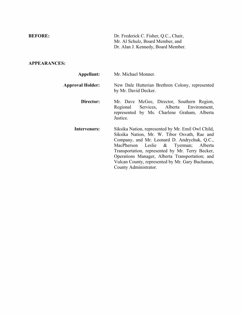
BEFORE: Dr. Frederick C. Fisher, Q.C., Chair, Mr. Al Schulz, Board Member, and Dr. Alan J. Kennedy, Board Member. APPEARANCES:
Appellant: Mr. Michael Monner.
Approval Holder: New Dale Hutterian Brethren Colony, represented by Mr. David Decker.
Director: Mr. Dave McGee, Director, Southern Region,
Regional Services, Alberta Environment, represented by Ms. Charlene Graham, Alberta Justice.
Intervenors: Siksika Nation, represented by Mr. Emil Owl Child,
Siksika Nation, Mr. W. Tibor Osvath, Rae and Company, and Mr. Leonard D. Andrychuk, Q.C., MacPherson Leslie & Tyerman; Alberta Transportation, represented by Mr. Terry Becker, Operations Manager, Alberta Transportation; and Vulcan County, represented by Mr. Gary Buchanan, County Administrator.
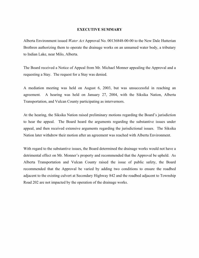
EXECUTIVE SUMMARY
Alberta Environment issued Water Act Approval No. 00136848-00-00 to the New Dale Hutterian
Brethren authorizing them to operate the drainage works on an unnamed water body, a tributary
to Indian Lake, near Milo, Alberta.
The Board received a Notice of Appeal from Mr. Michael Monner appealing the Approval and a
requesting a Stay. The request for a Stay was denied.
A mediation meeting was held on August 6, 2003, but was unsuccessful in reaching an
agreement. A hearing was held on January 27, 2004, with the Siksika Nation, Alberta
Transportation, and Vulcan County participating as intervernors.
At the hearing, the Siksika Nation raised preliminary motions regarding the Board’s jurisdiction
to hear the appeal. The Board heard the arguments regarding the substantive issues under
appeal, and then received extensive arguments regarding the jurisdictional issues. The Siksika
Nation later withdrew their motion after an agreement was reached with Alberta Environment.
With regard to the substantive issues, the Board determined the drainage works would not have a
detrimental effect on Mr. Monner’s property and recommended that the Approval be upheld. As
Alberta Transportation and Vulcan County raised the issue of public safety, the Board
recommended that the Approval be varied by adding two conditions to ensure the roadbed
adjacent to the existing culvert at Secondary Highway 842 and the roadbed adjacent to Township
Road 202 are not impacted by the operation of the drainage works.
TABLE OF CONTENTS
I. BACKGROUND .................................................................................................................. 1
II. SUBMISSIONS ....................................................................................................................5 A. Appellant........................................................................................................................................5
B. Siksika Nation................................................................................................................................6
C. Alberta Transportation ...................................................................................................................9
D. Vulcan County ...............................................................................................................................9
E. Approval Holder ..........................................................................................................................10
F. Director ........................................................................................................................................12
III. ANALYSIS.........................................................................................................................15 A. Will the direction of the water flow change or the water level rise?............................................15
B. Recourse available if conditions of Approval not met .................................................................21
C. Perennial weeds/grasses...............................................................................................................23
D. Should the Approval be revoked? ................................................................................................24
IV. CONCLUSION...................................................................................................................25
V. COSTS ................................................................................................................................26
VI. DRAFT MINISTERIAL ORDER ......................................................................................27
- 1 -
I. BACKGROUND
[1] On July 25, 2003, the Director, Southern Region, Regional Services, Alberta
Environment (the “Director”), issued Approval No. 00136848-00-00 (the “Approval”) to the
New Dale Hutterian Brethren (the “Approval Holder”) under the Water Act, R.S.A. 2000, c. W-
3, authorizing them to operate the drainage works on an unnamed water body, a tributary to
Indian Lake, at NW 15-20-21-W4M, 16-20-21-W4M, and 17-20-21-W4M, near Milo, Alberta.
[2] On June 30, 2003, the Environmental Appeals Board (the “Board”) received a
Notice of Appeal from Mr. Michael Monner (the “Appellant”) appealing the Approval.
[3] On July 2, 2003, the Board wrote to the Appellant, the Approval Holder, and the
Director (collectively the “Parties”) acknowledging receipt of the Notice of Appeal and notifying
the Approval Holder and the Director of the appeal. The Board also requested the Director
provide the Board with a copy of the records (the “Record”) relating to this appeal, and the
Parties provide available dates for a mediation meeting or hearing. The Record was received on
July 24, 2003 and was subsequently provided to the Parties.
[4] According to standard practice, the Board wrote to the Natural Resources
Conservation Board and the Alberta Energy and Utilities Board asking whether this matter had
been the subject of a hearing or review under their respective legislation. Both boards responded
in the negative.
[5] On July 2, 2003, the Board received a letter from the Appellant requesting a Stay.
On July 4, 2003, the Board requested the Appellant respond to a number of questions in relation
to his Stay request,1 and on July 7, 2003, the Board received the Appellant’s response.
1 The Board’s letter stated:
“The Board would like Mr. Monner to answer the following questions… 1. What are the serious concerns of Mr. Monner that should be heard by the Board? 2. Would Mr. Monner suffer irreparable harm if the Stay is refused? 3. Would Mr. Monner suffer greater harm if the Stay was refused pending a decision
of the Board on his appeal, than the New Dale Hutterian Brethren would suffer from the granting of a Stay?
4. Would the overall public interest warrant a Stay?
- 2 -
[6] The Board notified the Parties on July 14, 2003, that, after reviewing the
Appellant’s submissions, a Stay would not be granted.2
[7] On July 15, 2003, the Appellant provided names of other parties who may have an
interest in the appeal, including the Siksika Nation, Ducks Unlimited, the Minister of Indian
Affairs and Northern Development, and Vulcan County. On July 31, 2003, the Appellant
notified the Board that Alberta Transportation also wanted to be informed of the appeal.
[8] A mediation meeting was held on August 6, 2003, with Mr. Ron Hierath, Board
member, acting as mediator. There was no resolution at the mediation meeting, but the Parties
agreed to continue discussions and a further mediation meeting was scheduled for October 7,
2003.
[9] On October 6, 2004, the Approval Holder notified the Board that they would not
be attending the mediation meeting on October 7, 2004. The Board notified the Parties that the
mediation meeting was cancelled.
[10] On October 30, 2003, the Appellant provided a status report to the Board,
indicating that settlement discussions were continuing. The Board notified the Parties on
November 5, 2003, that it intended to proceed with the appeal and schedule a Hearing.
[11] The Board notified the Parties on November 24, 2003, that the issues to be heard
at the Hearing would be:
“1. the changing direction of water flow so that the applicants (sic.) water drains onto Mr. Monner’s property;
2. no recourse if conditions of the Approval are not met; 3. the increased water flow will raise the water level on Mr. Monner’s
property thereby compromising his ability to raise crops. When this happened in 1997 Mr. Monner lost the use of this land for six years;
5. Is Mr. Monner directly affected by Alberta Environment’s decision to issue the Approval
to the New Dale Hutterian Brethren? This question is asked because the Board can only grant a Stay where it is requested by someone who is directly affected.”
2 In its letter, the Board stated: “The Board has determined that Mr. Monner has not presented a sufficient case to warrant a
further consideration of his Stay request at this time. In addition, the Board is not yet in receipt of the record from Alberta Environment, and as such has not been able to review it. Once the record has been received from Alberta Environment, and has been distributed to the parties, Mr. Monner can make a further application for a Stay at that time, if he chooses.”

- 3 -
4. perennial weeds/grasses that have built up since last unauthorized flooding; and
5. Mr. Monner would like the Approval revoked and all licenced drainage canals returned to original topographical state.”
[12] On December 9, 2003, the Board received a letter on behalf of Vulcan County,
stating it wanted to participate in the hearing of the appeal. On December 12, 2003, Alberta
Transportation requested it be allowed to make a representation before the Board on this appeal.
On December 15, 2003, the Siksika Nation requested they be permitted to make a representation
intervening in the appeal. The Board requested the Parties provide comments on the
participation of Vulcan County, Alberta Transportation, and the Siksika Nation.
[13] On December 15, 2003, the Board notified the Parties the Hearing would be held
on January 27, 2004.
[14] In letters received on December 18 and 19, 2003, the Appellant and the Director
stated they did not have any concerns with the Vulcan County, Alberta Transportation, and the
Siksika Nation participating in this appeal. No response was received from the Approval Holder.
[15] On December 22, 2003, the Board notified the Parties that the Siksika Nation,
Alberta Transportation, and the Vulcan County (collectively, the “Intervenors”) would have full
party status, and therefore, they would be allowed to file a submission and present evidence, be
subject to cross-examination, and cross-examine if they wish to do so.
[16] The Hearing was held on January 27, 2004.
[17] At the Hearing, the Siksika Nation raised a number of jurisdictional issues,
challenging the validity of the Approval and the ability of the Board to hear this appeal. The
Board decided to continue with the Hearing and hear the substantive arguments of the Parties.
The Board stated that it would receive submissions regarding the jurisdictional issues. An
extensive submission process ensued addressing complex constitutional and aboriginal law
issues.3
3 The Parties were required to answer the following questions:
“1. Does the Siksika Nation have the right to raise jurisdictional questions in their capacity as an intervenor?

- 4 -
[18] As the Board did not close the Hearing on January 27, 2004, the Appellant and
the Siksika Nation applied for a Stay of the Approval. The Board received submissions from the
Parties between February 2, 2004, and February 25, 2004. On March 11, 2004, the Board
notified the Parties that it would not grant a Stay.
[19] On September 9, 2004, the Director notified the Board that settlement discussions
were continuing between the Siksika Nation, the Approval Holder, and the Director. He
requested that the Board make an application to the Minister for an extension of the time limit
for the Board to provide its Report and Recommendations. The Board made this request and the
Minister granted the request.
[20] On October 13, 2004, the Board was notified that the Director and the Siksika
Nation had reached an agreement that addressed the concerns raised by the Siksika Nation. As a
result, the Siksika Nation withdrew their preliminary motions, and the Board proceeded to
address the substantive issues in this appeal and prepare its Report and Recommendations. The
following is the Report and Recommendations regarding the substantive issues heard at the
January 27, 2004 Hearing.
2. Does the Board have jurisdiction to hear this appeal, or is there no jurisdiction because the
Approval in question may affect the Constitution Act, 1867, section 91(24) Indian reserve lands? …
3. Did the Director lose jurisdiction to issue the Approval because the Approval may affect the Constitution Act, 1867, section 91(24) Indian reserve lands?
4. Did the Director lose jurisdiction to issue the Approval because he had a “duty to consult” and that duty was not satisfied?
5. Did the Siksika Nation have an obligation to comply with section 24 of the Judicature Act, R.S.A. 2000, c. J-2? …
6. What is the effect of the Notice of Constitutional Questions served on the Minister of Justice and Attorney General of Canada and the Minister of Justice and Attorney General of Alberta, both dated March 25, 2004?
7. Has the Government of Alberta participated in a public review under the Canadian Environmental Assessment Act (Canada) in respect of all the matters included in the Notice of Appeal filed by Mr. Monner?”

- 5 -
II. SUBMISSIONS
A. Appellant [21] The Appellant stated there are numerous ditches other than those identified that
negatively impact him and the Intervenors. He explained there are two significant excavations
plus numerous smaller excavations and drainage channels throughout sections 16 and 17-20-21-
W4M. The Appellant explained he was not concerned with the original ditch excavations that
were completed in the 1960s, but the ditches were cleared and deepened in 1996. According to
the Appellant, one ditch is approximately 4300 feet long and the second is approximately 500
feet long, and they vary in depth from 3 to 12 feet.4
[22] The Appellant stated a large amount of water from spring runoff flowed through
the ditch in 1997, causing damage to Secondary Highway 842. The Appellant argued the smaller
unauthorized ditches directed the flow of water towards his property. He stated this water would
have stayed on the Approval Holder’s land, creating many large sloughs, but the Approval
Holder wanted the ditch to drain the sloughs.
[23] The Appellant stated the increased drainage onto his lands has resulted in an
increase in salinity. He stated the salinity rating for the majority of his quarter is 0.4 mS/cm (non
saline), but the lowland area in question is rated 8 mS/cm (severe salinity).5 He further stated
the same land previously produced significant crop yields but now has weedy vegetation and salt
crystals laying on the soil surface. According to the Appellant, the plant species growing on the
site, specifically Kochia, wild oats, dock, and foxtail barley, are moisture and salinity tolerant.
[24] The Appellant explained the land had been farmed successfully except from 1997
to 2000, and he has gradually included the land back into production, except where he has had to
take extra efforts to control the perennial weeds and grasses that became established during those
three years. He stated he has a grain operation, specialty livestock operation, and a cow calf
operation. As a result, he stated that he may want to return the quarter section to pasture in the
future.
4 See: Appellant’s submission, received January 13, 2004. 5 See: Appellant’s submission, received January 13, 2004, at Tab 11.

- 6 -
[25] The Appellant stated that, since 1998, the area he has been able to crop has
decreased by 31 acres, approximately 19 acres due to salinity and approximately 12 acres due to
a high water table. He explained he has not calculated the loss of income and increased costs to
manage the area because of the increased water flows.
[26] The Appellant argued he has not caused his own problems. He explained he has a
very small ditch, approximately 6 feet wide and 1.5 feet deep, which drains water from two small
depressions towards the main channel. He argued water does not flow up the ditch as suggested
by the Approval Holder. The Appellant submitted the runoff water does not flow from the south
to the north through the main channel on his property, but instead flows from the west and is of
sufficient volume that it crosses over the small natural berm on the east side of the main channel.
He stated, a “…combination of water crossing over and being held behind this natural berm and
the increased resulting water table of Indian Lake itself contributed to the saturation of land on
our property.”6
[27] The Appellant explained he did not allow the Approval Holder to enter his land to
do groundwater monitoring, as he was not going to receive remuneration similar to what may be
expected when a utility company or oil or gas company wishes to access the property.7
[28] The Appellant submitted the Approval was based on false representations,
misleading reports, and speculation. He argued the proposed supervision of the drainage works
would not be effective, as the personnel have many duties and responsibilities of greater
importance than to supervise the drainage works.
B. Siksika Nation [29] The Siksika Nation stated they did not receive direct notification of the Approval
application, and publication of the application was in media they do not subscribe to. They
further stated that, “…a concerted effort to establish notification through our sources of media
was required and will continue to be required in the future.”8 The Siksika Nation referred to the
April 19, 2001 letter from Alberta Environment in which it noted the Siksika Nation may be
6 Appellant’s submission, received January 13, 2004, at paragraph 33. 7 See: Appellant’s submission, received January 13, 2004 at paragraph 34.

- 7 -
affected and the Approval Holder has the responsibility of obtaining any other required
approvals. The Siksika Nation stated they were not notified, and they had not “…given its
consent to the receipt of these surface waters that will eventually rest within the Nation’s
boundary.”9
[30] The Siksika Nation explained the purpose of Indian Lake was to capture and
contain spring runoff and rain for livestock. They stated the waters came from uncultivated
lands with additional waters coming as runoff from neighbouring lands to the south. The Siksika
Nation did not consider the additional runoff significant as there was a natural drainage
causeway and it occurred intermittently, but the Approval changes the scenario.
[31] The Siksika Nation argued that the Approval will result in dissolved contaminants
entering and settling on the Nation’s lands, and it had been their experience the quality of the
surface water drainage entering their lands has posed an adverse effect to their lands and
environment. Therefore, according to the Siksika Nation, the approved diversion scheme has a
“…real potential to impact water quality in Indian Lake.”10
[32] The Siksika Nation did not believe the impact on water quality was adequately
assessed or considered before the Approval was issued, and the Approval does not include
adequate conditions to protect the water quality in Indian Lake as there is a lack of specified
monitoring, enforcement, and overall feasibility.11 The Siksika Nation stated the Approval does
not contain any structured water testing process or frequency schedule to determine water
quality. They also stated the environmental impact assessment completed for the Approval
application did not address the potential impact of the drainage scheme on water quality in
Indian Lake. The Siksika Nation further stated that Alberta Environment with Alberta
Agriculture had taken a cursory look at the potential for changes in salinity resulting from the
diversion, but it did not appear they completed a rigorous assessment or reached any clear
conclusions.12
8 Siksika Nation submission, dated January 12, 2004. 9 Siksika Nation submission, dated January 12, 2004. 10 Siksika Nation submission, dated January 12, 2004. 11 See: Siksika Nation submission, dated January 12, 2004. 12 See: Siksika Nation submission, dated January 12, 2004.
- 8 -
[33] The Siksika Nation expressed concern the diversion could result in a degradation
of Indian Lake due to higher salinity levels, nutrient enrichment, and an increase in fecal
coliforms. They believed runoff from saline areas could increase salinity levels in the Lake, and
runoff from lands where the Approval Holder had spread manure from their operations could
result in an increase in water borne pathogens.13
[34] The Siksika Nation stated that, if the diversion could potentially impact water
quality in Indian Lake, the Approval should be revoked or amended to provide the necessary
protection to water quality. They suggested an assessment be completed that would include
water sampling of the proposed area to be drained as well as Indian Lake at various times of the
year, and information regarding such matters as land use, drainage areas, and hydrologic
frequencies.
[35] The Siksika Nation submitted that if the assessment indicates water quality can be
protected, the Approval should be amended to include: (1) monitoring, operating, and reporting
conditions to manage water releases from the diversion to ensure water quality is equal to or
better than the water in Indian Lake, and monitoring be completed by a properly trained third
party; and (2) a condition to ensure the diversion scheme has structures in place that can be
operated to prevent the release of water if the water quality is not as good as or better than the
water in Indian Lake.14
[36] The Siksika Nation stated the Approval allows for a more direct and reduced
transport distance for the surface water to run into Indian Lake, reducing the ability for the water
to be naturally cleaned through evaporation or settling in low areas as now occurs in the natural
drainage causeway.15
[37] The Siksika Nation submitted the drainage works should be revoked or
decommissioned to the extent that the “…drainage of the water bodies be allowed to follow the
pre-existing combined manmade/natural drainage causeway….”16 The Siksika Nation
13 See: Siksika Nation submission, dated January 12, 2004. 14 See: Siksika Nation submission, dated January 12, 2004. 15 See: Siksika Nation submission, dated January 12, 2004. 16 Siksika Nation submission, dated January 12, 2004.
- 9 -
recommended groundwater measuring test holes be placed strategically on the north and south
boundaries with their lands.
C. Alberta Transportation [38] Secondary Highway 842 is a provincial highway and is maintained by Alberta
Transportation. It stated that if the roadway subgrade soils of Secondary Highway 842 are
subjected to additional water the surface stability of the road, which is already unstable, would
degenerate further. According to Alberta Transportation, this would accelerate the need to
rehabilitate the road and add costs to the taxpayers of Alberta. It expressed concerns as to
whether the existing culvert is adequate to handle the combined water flows permitted under the
Approval, and the Approval “…appears to allow a ‘surcharge of 1.0m above the top of the
existing culvert.’”17
D. Vulcan County [39] Vulcan County stated Secondary Highway 842 is a paved road running adjacent
to the lands at issue and is the main north south connector in the area, and Township Road 202,
the main east west road in that portion of the County, is adjacent to the south side of these lands.
[40] The County expressed two concerns regarding the Approval. The first concern
was with respect to the impact the Approval may have on Secondary Highway 842 and,
indirectly, to the County’s road network. Vulcan County stated the Approval allows for the
detention of water adjacent to Secondary Highway 842 and for a “…controlled and perhaps
lengthy, discharge through the existing 600 mm culvert under Highway 842….”18 The County
stated the detention of water could make the highway bed soft, leading to the ban of truck traffic
on Highway 842 and forcing truck traffic onto Township Road 202.
[41] The second concern expressed by Vulcan County was regarding the impact on
Township Road 202. According to the County, the Approval allows for water detention at the
southern end of the properties, adjacent to Township Road 202, and for the controlled release of
17 Alberta Transportation submission, dated January 9, 2004. 18 Vulcan County submission, dated January 12, 2004.

- 10 -
the detained water northward. The County stated the “…detained water could lead to higher
ground moisture, a softening of the Township Road 202 road bed, which could lead to increased
maintenance or repairs or total road failure requiring a complete rebuilding of the road.”19 The
County further stated that damage to Township Road 202 would curtail heavy agriculture and
oilfield truck traffic, thereby severely restricting access to that part of the County.
[42] Vulcan County also stated that additional damage could occur to Township Road
202 if future unauthorized drainage occurs on lands to the south of the lands in question. Vulcan
County summarized its concerns, stating the Approval does not indicate the road base of
Secondary Highway 842 and Township Road 202 are to be protected from the adjacent detention
and controlled release of water.20
E. Approval Holder [43] The Approval Holder’s submission consisted of a series of photographs and maps
and a copy of the environmental impact assessment completed as part of the application process
for the Approval.
[44] The Approval Holder stated the drainage ditch was excavated in 1966 to enhance
the flow of surface water from the lands surrounding the ditch to Indian Lake. The Approval
Holder stated the drainage ditch effectively drained a few wet, marshy, depressions, enabling
them to cultivate the area for crop production.21
[45] The consultants for the Approval Holder explained the surface water from
sections 15, 16, and 17-20-21-W4M flows toward the southern end of Indian Lake located in the
northeast, and the Lake is the main source of water in the southern portion of the Blackfoot
Indian Reserve land. The Approval Holder stated the drainage ditch is approximately 1,440
metres (4800 feet) in length with a depth of 0.9 to 3.6 metres (3 to 12 feet) and a width of 3.6 to
10.8 metres (12 to 36 feet).
19 Vulcan County submission, dated January 12, 2004. 20 See: Vulcan County submission, dated January 12, 2004. 21 See: Approval Holder’s submission, dated June 2000, at page 3.

- 11 -
[46] The Approval Holder stated the drainage ditch drained water from the depressions
on their property toward the natural drainage channel on the north portion of sections 16-20-21-
W4M and NW 15-20-21-W4M and into Indian Lake. The Approval Holder argued that, if the
ditch is made non-operational, water will accumulate in the depressions, saturating the soil and
eventually accumulating on the surface for longer periods of time, especially after spring runoff
and heavy rainfall storms, “…rendering the land to be inaccessible and unsuitable for crop
production.”22 According to the Approval Holder, the drainage system reclaimed the
productivity of approximately 91 acres of land.23
[47] The Approval Holder stated the amount of water the drainage ditch carries into
Indian Lake is not significant, and there has been no change in the lake level since the drainage
ditch was excavated in 1966. The Approval Holder submitted that the amount of water entering
Indian Lake because of the drainage ditch would be slight and would be beneficial to the users of
the lake.24
[48] According to the Approval Holder, the only drainage carried by the drainage ditch
will be spring runoff or major storm events, that is storm events exceeding a 10-year period with
a 2-hour duration. The Approval Holder claimed there would be no direct runoff for a normal
storm event. The Approval Holder stated the drainage ditch has the capacity to convey 0.73
cubic metres per second.
[49] The Approval Holder argued the impact on the Appellant’s land would not be
significant, and the northeast corner of the Appellant’s property seemed to be wet and marshy
even before the drainage ditch was in existence.
[50] The Approval Holder stated the supply ditch constructed on the Appellant’s land a
few years ago has contributed to the Appellant’s problems. The Approval Holder stated the
supply ditch is approximately 750 metres (2,500 feet) in length and runs from the southwest
corner of NE 15-20-21-W4M, alongside the lower south end of the lake, to an area at the north
end of the quarter section, from which the water flows down slope by gravity to fill a man-made
dugout toward the west. According to the Approval Holder, the supply ditch has filled with
22 Approval Holder’s submission, dated June 2000, at page 8. 23 See: Approval Holder’s submission, dated June 2000, at page 10.

- 12 -
“…plant residue and mud, raising the level of the ditch bottom, which resulted in the flooding of approximately 32 acres of land, and seeping into few more acres of land, on both sides of the ditch and extending to the dug-out site in NE 15-20-21 W4. The effect of this flooding and seeping seem to have extended to adjacent land within NE 15-20-21 W4, causing saturation of the soil and creating difficult trafficability conditions….”25
F. Director [51] The Director explained that one of the goals of the terms and conditions of the
Approval is to ensure the flow entering the unnamed tributary does not exceed its natural
capacity, thereby ensuring no flooding or adverse impacts occur on the Appellant’s lands.26
[52] The Director stated there had been extensive consultation with the Appellant
throughout the process in an attempt to address his concerns, but it was not possible to reach a
solution. The Director explained he contacted Alberta Agriculture to comment on the salinity
potential of the project, and the final recommendation was that “…‘flows be maintained at levels
that the water course and small dam [on Indian Lake] can support. This will reduce a water table
build up and salinization of the area.’”27 The Director stated he contacted the hydrology branch
of Alberta Environment and asked them to comment on the project, and “…they indicated that
based upon effective drainage areas, the overall impact of the ditching would be negligible.”28
[53] The Director stated specific clauses of the Approval were designed to ensure the
flow release rate does not exceed the channel capacity. Specifically, the Director referred to
clauses 3, 4, 8, 9, 10, 13, 14, 15, 16, and 17.
[54] According to the Director, clauses 3 and 429 relate to monitoring and
measurement and are meant to accomplish the following goals:
24 See: Approval Holder’s submission, dated June 2000, at page 9. 25 Approval Holder’s submission, dated June 2000, at page 9. 26 See: Director’s submission, dated January 12, 2004, at paragraph 46. 27 Director’s submission, dated January 12, 2004, at paragraph 15. 28 Director’s submission, dated January 12, 2004, at paragraph 16. 29 Conditions 3 and 4 provide: “Condition 3: The approval holder shall establish a flow measurement site downstream of the
Existing Culvert and upstream of the boundary of NE 15-020-21-W4, which is visible and the flow measurement can be read from Highway 842.

- 13 -
“• the location of the flow measurement sites were specified so it would be easy for all parties concerned to read the flow measurement at any given time and access by any party would not be an issue;
• the actual flow rates measured are used in conjunction with the ‘flow restriction’ clause (Clause 8); and
• the location of the flow measurement sites were chosen to ensure measurement of all flow in the New Dale Hutterian Brethren drainage scheme into the unnamed tributary.”30
[55] The Director stated clauses 13, 14, and 15 specify the frequency of monitoring
and the recording of the information,31 thereby ensuring a complete record of all flow
measurements.
[56] The Director emphasized clause 8, which, according to the Director, “…ensures
that the flow entering the unnamed tributary from the New Dale Hutterian Brethren drainage
system does not exceed channel capacity and possibly adversely impact/flood the Appellant’s
land.”32 The Director submitted, “…an increasing cumulative flow of 5 cfs would not be
excessive and would not cause water to back up or flood Mr. Monner’s property.”33 According
to the Director, 5 cfs is close to the estimated natural flow observed on March 19, 2003, and is
only slightly more than the maximum calculated flow the Approval Holder submitted for the
Condition 4: The approval holder shall establish a flow measurement site downstream of the
Main Supply Channel crossing and upstream of the boundary of NE 15-020-21-W4, which is visible and the flow measurement can be read from Township Road 20-2.”
30 Director’s submission, dated January 12, 2004, at paragraph 50. 31 Clauses 13, 14, and 15 state: “Condition 13: The approval holder shall obtain flow measurement readings from the flow
measurement sites daily, beginning one day prior to the release of any water through the Existing Culvert until one day after the release of water is complete.
Condition 14: The approval holder shall record all changes made in the operation of Structure B and Structure C including time and date of change and the amount of increase or decrease of flow rate.
Condition 15: The approval holder shall provide the information collected under Conditions 13 and 14 to the Director within 30 days after the release of water is complete or upon request by the Director or an Inspector.”
32 Director’s submission, dated January 12, 2004, at paragraph 53. Clause 8 states:
“Condition 8: The approval holder shall operate Structure B or Structure C only when the flow at the flow measurement site downstream of the Existing Culvert, when combined with the flow entering the NE 15-020-21-W4 from the Main Supply Channel, does not exceed 0.142 cubic metres per second (5.0 cubic feet per second).
33 Director’s submission, dated January 12, 2004, at paragraph 54.
- 14 -
existing culvert under Highway 842. The Director stated this flow rate is “…substantially less
than the maximum capability of either of the two existing natural channels entering Mr.
Monner’s land individually.”34
[57] The Director stated clause 9 ensures the integrity of the roadway is protected, and
1.0 metre is approximately the maximum level when the culvert capacity is reached.35
According to the Director, clause 10 prevents back flooding onto the Appellant’s land and the
Siksika Nation lands, as it ensures the drainage flows do not overtop the full supply level of
Indian Lake.36
[58] The Director explained clauses 16 and 17 ensure the Director is able to maintain
involvement if the circumstances warrant it,37 and this is in addition to the Director’s powers to
cancel and suspend the Approval (section 43), the Director’s powers to initiate an amendment to
the Approval (section 42), and the enforcement provisions of the Water Act (Parts 7, 10, and 11).
[59] The Director argued the conditions included in the Approval will protect all
interests in the area, as it will ensure all Parties can measure and see the flow rates; flow rates are
controlled to ensure the flow through the unnamed tributary will not exceed its capacity; road
integrity is maintained; and there is no overtopping of Indian Lake.38
[60] The Director explained groundwater monitoring was considered, but neither the
Appellant nor the Approval Holder was agreeable to including such clauses into the Approval.
34 Director’s submission, dated January 12, 2004, at paragraph 55. 35 Clause 9 provides: “Condition 9: The approval holder shall only operate Structure B and Structure C only when
the depth of water upstream of the Existing Culvert is less than the surcharge depth of 1.0m above the top of the Existing Culvert.”
36 Clause 10 states: “Condition 10: The approval holder shall only operate Structure B and Structure C when the
level of Indian Lake is not more than 10 cm above full supply level at any time.” 37 Clauses 16 and 17 provide: “Condition 16: The approval holder shall install any additional water measuring stations as
directed by the Director when the Director is of the opinion that the activity authorized by this approval may be causing unreasonable interference with the use of any other lands.
Condition 17: This approval may be suspended by the Director at any time the Director is of the opinion that the activity authorized by this approval is causing the water table to rise on the NE15-020-21-W4 and unreasonably interfere with the agricultural use of the NE 15-020-21-W4.”
38 See: Director’s submission, dated January 12, 2004, at paragraph 64.

- 15 -
[61] The Director also explained the flooding event in 1997 referred to by the
Appellant occurred when an ice jam caused an irrigation canal to overflow. The Director stated
this should not happen again as the canal has been rehabilitated and illegal ditching on a third
person’s property has been blocked. According to the Director, the structures on the Approval
Holder’s property would prevent excessive flow from reaching the culvert, as the Approval
Holder can only release 5 cfs, regardless if the source is drainage from their own lands or if it is
flow that comes onto their property from other sources.39
III. ANALYSIS
A. Will the direction of the water flow change or the water level rise? [62] The issue of the drainage ditch and the possible effect it might have on the
Appellant’s property has been an ongoing issue.40
[63] The Appellant argued water in the area flows from the west, the Approval
Holder’s lands, onto his property. After viewing the diagrams provided and listening to the
evidence presented, the Board is of the view the water flows from the south, through the
Appellant’s property towards the north, and at the northern end of his property, water from the
Approval Holder’s property flows into the natural drainage system on the Appellant’s property,
joining the flow from the south on its way to Indian Lake.
[64] The Director stated the amount of increased water that may flow through the ditch
might increase negligibly, but it would have no effect on the Appellant’s property. The Board
39 See: Director’s submission, dated January 12, 2004, at paragraphs 72 and 74. 40 In 1999, the Director determined the Approval Holder was contravening the Water Resources Act, R.S.A. 1980, c. W- 5. According to the Director, the drainage ditch was a non-approved drainage works, but the Approval Holder maintained that no approval was required and that it was not logical to require one after 34 years of operation. The Director issued an Enforcement Order in November 1999, which the Approval Holder appealed to this Board. A mediation meeting was held, and the Appellant requested and received permission to attend the mediation meeting. The Enforcement Order was later complied with, and the Approval Holder withdrew their appeal and applied for an approval for the drainage ditch. The Director then issued the Approval, which was appealed by the Appellant. In his Notice of Appeal, the Appellant requested the Approval be overturned on the basis the Approval would result in the water flow changing direction, increased water flow onto his property, and there is no recourse if the conditions of the Approval are not followed.
- 16 -
accepts this analysis of the flow rate. The drainage ditch allows for the water that accumulates
on the Approval Holder’s property to drain off the property faster, but it is retained behind the
control structure and the flow rate will be controlled. This should reduce the amount of erosion
on the Appellant’s land as the flow rate will be controlled to a level that will not cause damage to
the downstream property.
[65] The terms and conditions of the Approval require the Approval Holder to release
water from their canals only at specific times and under specific conditions. For example, water
can only be released only when the depth of water upstream of the Existing Culvert is less than
the surcharge depth of 1.0m above the top of the Existing Culvert, when the level of Indian Lake
is not more than 10 cm above full supply level at any time, and when the water levels are low
enough in the main supply channel so that when combined with the added water, the flow will
not exceed 5.0 cubic feet per second. All of these conditions must be met before the water can
released from the drainage ditch. If any of these conditions are not met, then the Approval
Holder is in non-compliance and the Director can take action against the Approval Holder.
[66] Essentially, the Appellant is arguing the water will be forced, uphill, onto his
property. The Board believes that, providing the Appellant maintains his drainage ditch as it
presently exists, the flow of water through his property from the Approval Holder’s will not be
impeded and will flow through to Indian Lake. Only if the current drainage pathway is blocked,
will there be the potential for the water to backup onto the Appellant’s property. The evidence
presented shows that the flow of the water is from the south to the north, and it would only be in
extreme conditions that water would be forced the opposite direction.
[67] Under Clause 8 of the Approval, the Approval Holder cannot release water until
the water levels are low enough in the main supply channel so that when combined with the
added water, the flow will not exceed 5.0 cubic feet per second.41 This will ensure water levels
will not rise in the natural watercourse to such a level that will cause the water to back up into
the main supply channel.
41 Clause 8 of the Approval states: “The approval holder shall operate Structure B or Structure C only when the flow at the flow
measurement site downstream of the Existing Culvert, when combined with the flow entering the NE 15-020-21-W4 from the Main Supply Channel, does not exceed 0.142 cubic metres per second (5.0 cubic feet per second).”
- 17 -
[68] The natural watercourse through the Appellant’s land allows water to flow from
the south to the north and into Indian Lake. During the time the Appellant has owned the
property, he mentioned only one time that excess water caused the main supply channel to flood
his lands. The natural watercourse is capable of handling over 5 cfs of water, and based on the
evidence presented, often carries more than 5 cfs during spring runoff without causing any effect
on the Appellant’s property. The conditions of the Approval require the Approval Holder to wait
until the water level in the channel is low enough so that when water from the Approval Holder’s
lands are released, the total amount of water in the main supply channel does not exceed 5 cfs.
[69] By having this provision in the Approval, essentially what will happen is the
runoff from the south would be allowed to flow through the channel first, and when it has
subsided, then the flow of water from the west would be allowed to enter the channel. This
reduces the possible cumulative effect that could occur with runoff from the south and the west
flowing into the main supply channel at the same time. In other words, by having the control
structures in place on the Approval Holder’s property, and by limiting the timing of the release
of any water from their property, there is a decreased chance of the Appellant’s property being
flooded. This is not to say the possibility is now impossible since no one can control rainfall
events and runoff levels, and if there is sufficient water available coming from the south,
flooding could still occur. However, the amount of water entering the Appellant’s property
would still be less since water flow from the west would be retained within the Approval
Holder’s property until such time that levels in the main supply channel have decreased to below
5 cfs.
[70] Indian Lake has a spillway that is controlled by the Siksika that limits the level of
water in the lake, and if the water exceeds that level, it spills into the natural channels towards
the Bow River.42 Therefore, it seems reasonable that if the water released by the Approval
Holder causes the lake level to rise above the full supply level, it would flow over the control
structure at the far end of the lake and into the channel towards the Bow River. Based on the
size of Indian Lake and the amount of water permitted to be released by the Approval Holder, the
Board accepts the Director’s description that “…it would be indiscernible from the natural
42 Transcript, January 27, 2004, at page 125, lines 15 to 20.

- 18 -
flow.”43 In addition, the Director included condition 10, which restricts when the Approval
Holder can release the water. It states: “The approval holder shall only operate Structure B and
Structure C when the level of Indian Lake is not more than 10 cm above full supply level at any
time.”
[71] Concerns were also expressed regarding the quality of the water being impacted.
The Director included conditions requiring the Approval Holder to prevent erosion and siltation
and to reclaim the disturbed area to vegetation where possible. A condition was included in the
Approval requiring the Approval Holder to release the water only when the water quality is equal
to or better than the quality of water in the receiving water body.44 The Director also stated in
his testimony that holding the water back before releasing it will allow for natural biological
processes to occur, and the water released will be of better quality. The Director stated that some
of the contained water would seep into the ground and some would evaporate, thereby reducing
the amount of water that would usually flow through the channels towards Indian Lake. The
Board accepts these principles, and although the quality may only be minimally improved, it
should not cause a deterioration in the water quality on the Appellant’s or the Siksika Nation’s
properties.
[72] Under condition 17, the Director can suspend the Approval if he believes the
authorized drainage ditch is causing the water table to rise and interfere with the agricultural use
on the Appellant’s lands. This provides another mechanism to ensure the Appellant’s and the
Siksika Nation’s properties will not be adversely affected.
[73] The Director has required the Approval Holder to install two flow measurement
sites to make certain the water is released only when the water in the main supply channel and
Indian Lake are at the proper levels.
43 Transcript, January 27, 2004, at page 125, lines 26 to 27. 44 Condition 6 states: “The approval holder shall reclaim to vegetation where possible, any disturbed bed and banks of the water body and areas associated with the activity.” Condition 11 provides: “The approval holder shall prevent siltation and erosion of the water body resulting from the activity, including the diversion of water.” Condition 12 states: “Where applicable, the approval holder shall only release water to a water body when the quality of water is equal to or better than the quality of water in the receiving water body.”
- 19 -
[74] With all of these conditions in place, which the Approval Holder must follow, the
Board does not believe the Appellant will see a noticeable change in the water flow across his
property, except for the slightly lengthened time for the runoff. The Director stated the water
“…could move through the natural water course immediately behind the natural flow without
even being discernible….”45 The Director emphasized that “…it would be impossible to even
detect that water as it trailed through behind the … normal spring runoff.”46 The Board accepts
the Director’s evidence regarding the water flow and believes there will not be any perceptible
effect on the flow of water through the Appellant’s lands. Therefore, the Board sees no reason to
cancel the Approval.
[75] The Appellant expressed concern regarding the size of Indian Lake and the
potential of the lake to rise due to the increased runoff from the Approval Holder’s drainage
ditch. It is the Board’s understanding that Indian Lake is not at its full supply level and therefore
does not encroach onto the Appellant’s property. The Board also understands that when the lake
is at its full supply level, it extends onto the Appellant’s lands. However, the lake cannot exceed
its full supply level. There is a control structure at the other end of the lake that limits the fill
level, thereby preventing the lake from exceeding its full supply level and encroaching onto the
Appellant’s lands.
[76] The Appellant stated in his closing remarks that he would like the ditches on the
Approval Holder’s property closed. He offered as an alternative that monitoring wells should be
installed on his property to monitor the water table and that a neutral third party determine
whether the flow is adequate or inadequate.47
[77] The Appellant argued the rising lake level would impact the water table on his
property. The reasonable remedy would be to install monitors, and any change in the water table
would be easily and quickly detected. However, the Appellant is not willing to have the
monitors installed on his property. He will not grant any access without compensation. In his
closing arguments, he stated:
45 Transcript, January 27, 2004, at page 120, lines 6 to 8. 46 Transcript, January 27, 2004, at page 120, lines 21 to 23. 47 Transcript, January 27, 2004, at page 188, lines 1 to 8.
- 20 -
“I think I have to emphasize that in no other situation, whether it be utility company, et cetera, could there be – could they force an interference over our land without consent and without compensation. The drainage is not necessary for the public good if you believe this is a public – or a private matter between two individuals therefore there’s no power of expropriation. It’s a private matter, then you can take the steps that go along with expropriation and I’m not entirely sure which message I’m receiving at various times. Alberta Environment suggested it could be public and maybe it is with all the other interveners involved today. Well, then let’s stop the process.”48
[78] It appears the Appellant’s real concern was he wanted the Approval Holder to
purchase his land or to have his land expropriated. He argued if it was for a private purpose,
then he should be compensated, or if it is a public purpose, then his land should be expropriated
and he should be paid for it. The Board sees the project as benefiting the Approval Holder, but it
also provides some protection to the Appellant. The rate of water flowing through the
Appellant’s land will be controlled, thereby reducing the risk of flooding and erosion.
[79] The Appellant argued he should be compensated for granting access onto this
property to install the monitoring wells. He said other utilities are required to compensate for
access. However, there are utilities that do not pay, or the rate is minimal. For example, water
and gas cooperatives will install lines through property with minimal compensation. This is
based on the premise that the installation of these utilities is for the benefit of many. In this
particular case, the installation of the monitoring wells would be for the benefit of the Appellant
himself.
[80] The Appellant wants to have monitoring wells on his property, be compensated
for allowing the wells onto his land, and have a third party monitor the flow in the wells. The
Board has always held that, pursuant to section 2 of the Water Act,49 Albertans have to bear some
48 Transcript, January 27, 2004, at page 189, lines 8 to 21. 49 Section 2 of the Water Act provides:
“The purpose of this Act is to support and promote the conservation and management of water, including the wise allocation and use of water, while recognizing:
(a) the need to manage and conserve water resources to sustain our environment and to ensure a healthy environment and high quality of life in the present and the future;
(b) the need for Alberta’s economic growth and prosperity; (c) the need for an integrated approach and comprehensive, flexible administration and
management systems based on sound planning, regulatory actions and market forces;
- 21 -
of the costs and responsibilities for protecting the environment. In this case, the Appellant is not
willing to accept any of the costs associated with the monitoring wells, including allowing the
installation of the wells on his property. The Appellant argued he wants to protect his property
from further damage, yet he is unwilling to allow a simple, practical measuring device be
installed that would help alleviate some of his concerns and would provide information on his
groundwater wells that could benefit him.
[81] The issues raised by the Appellant relating to the direction of water flow and
higher water levels cannot be supported by the evidence presented. The Appellant argued the
Approval would result in a change in the direction of the water flow, causing flooding of his
property. When examining the photographs and data provided, the natural water flow on the
Appellant’s land is from the south to the northeast. The drainage ditch from the Approval
Holder’s property allows water to flow east into the natural drainage on the Appellant’s property,
which flows into Indian Lake to the northeast. The water will not flow south onto the
Appellant’s property and cause flooding in that portion of his lands. Therefore, it should not
decrease his ability to use the area for raising crops or for pasture.
B. Recourse available if conditions of Approval not met [82] The Approval places very specific conditions on how the water can be released
and includes monitoring and reporting requirements. The Approval Holder must comply with all
of the conditions in the Approval.
[83] Different mechanisms are in place to deal with any contraventions of the
Approval. Condition 17 of the Approval itself allows the Director to suspend the Approval if he
is of the opinion the water table is rising because of the drainage works.
(d) the shared responsibility of all Alberta citizens for the conservation and wise use of water
and their role in providing advice with respect to water management planning and decision-making;
(e) the importance of working co-operatively with the governments of other jurisdictions with respect to transboundary water management;
(f) the important role of comprehensive and responsive action in administering this Act.”
- 22 -
[84] There are also legislated remedies available to the Director. For example,
sections 42 and 43 of the Water Act allow the Director to amend or cancel an approval.50 If the
Approval Holder is in non-compliance, the Director can issue Environmental Protection Orders
or an Administrative Penalty. If the terms and conditions of the Approval are not being met, the
50 Sections 42 and 43 of the Water Act state: “42(1) The Director may amend an approval (a) on the Director's own initiative without the consent of the approval holder (i) to correct a clerical error in the approval, (ii) to amend a term or condition that relates to a monitoring, reporting or inspection
requirement, (iii) if the Director has received notice of a disposition of the land to which an
approval is appurtenant, to reflect the disposition, (iv) to address matters related to a temporary discontinuance of the activity by the
approval holder, (v) to extend, under section 41, the expiry date of an approval or a term or condition
of an approval, (vi) to amend a term or condition if, in the opinion of the Director, a significant
adverse effect on the aquatic environment, human health or public safety that was not reasonably foreseeable at the time the approval was issued occurred, occurs or may occur,
(vii) to amend a term or condition if, in the opinion of the Director, an adverse effect on a household user, licensee or traditional agriculture user occurred, occurs or may occur, or
(viii) if there is a term or condition of the approval allowing the amendment ….” 43(1) The Director may suspend or cancel an approval
(a) on the Director's own initiative without the consent of the approval holder if (i) the approval was issued in error, (ii) in the opinion of the Director, the activity has been abandoned, (iii) there is an emergency or the Director is of the opinion that the suspension or
cancellation is necessary for public safety, (iv) the approval holder is indebted to the Government, (v) there is non-performance of or in the opinion of the Director there is a serious
breach of any term or condition of the approval, (vi) in the opinion of the Director, the approval holder made a material
misrepresentation in obtaining the approval, (vii) the approval holder is convicted of an offence under this Act, other than an
offence under section 142(1)(j), (o) or (p), (viii) the Director is of the opinion that a significant adverse effect on the aquatic
environment, human health or public safety occurred, occurs or may occur that was not reasonably foreseeable at the time the approval was issued,
(ix) the Director is of the opinion that an adverse effect on a household user, licensee or traditional agriculture user occurred, occurs or may occur, or
(x) an approval has been automatically extended under section 41(2)….”
- 23 - Appellant or the Intervenors can notify the Director, and the Director will investigate all valid
complaints.
[85] There are sufficient mechanisms present, in the Approval and in the Water Act, to
ensure the Approval Holder complies with the terms and conditions of the Approval, and if there
is a contravention, the Director has alternatives available to gain compliance.
C. Perennial weeds/grasses [86] During the Hearing, the Director explained the events that led to the excess water
appearing on the Appellant’s property in 1997. The Director stated the excess water resulted
when an ice jam built up in an existing environmental canal east of the Appellant’s property.
The Board believes the Director has taken steps to prevent this from re-occurring. The Board
does not believe that that the flooding was the result of the Approval Holder’s drainage ditch.
[87] The Appellant had stated that because of the previous flooding event, unwanted
plant species had invaded a portion of his property. However, he did not show how the species
identified were there because of the drainage ditch allowed under the Approval. Most of the
species listed grow in disturbed soils, and there are ways of eliminating the plants as shown in
the Appellant’s evidence that he is returning portions of the affected land back to productive use.
[88] It is the Board’s understanding the area affected by the unwanted vegetation
growth is a natural watercourse, and therefore, it is reasonable to expect the area to be wetter
than other areas on the property and to have vegetation that can tolerate wetter and, in many
instances, more saline conditions.
[89] It was also unclear as to what use the Appellant made of the three acres he
referred to as having the perennial weeds and grass problem. He stated he lost the use of that
land since the flood occurred and he has regained only partial use of the area.
[90] The Appellant explained his farming operations include grain and livestock
components. Although some crops may be less tolerant to saline soils, there are others more
tolerant. There is also the opportunity for the Appellant to use the area for other purposes, such
as pasture land.
- 24 -
[91] Since it is difficult to determine where the seed source is from, the Board cannot
make any recommendations or include any additional clauses into the Approval with respect to
unwanted vegetative growth.
D. Should the Approval be revoked? [92] The Appellant has not provided sufficient evidence to demonstrate there will be a
detrimental effect to his property due to the drainage ditch being constructed and operated as
specified in the Approval. The Director included a numerous conditions in the Approval to
ensure the drainage ditch will have minimal effect on the Appellant’s property.
[93] The Board notes that there were suggestions the report submitted by the Approval
Holder, as part of his application for the Approval, contained inaccurate information. For
example, the Appellant raised concerns regarding the explanation that was included in the report
regarding the water flow from the Approval Holder’s lands. The Appellant argued the report
contradicts the survey completed by Ducks Unlimited.51 The Appellant argued the natural flow
is to the south. When reviewing the survey map, the Appellant’s property does have a higher
elevation in the northwest, but this allows water to drain from these higher areas to the main
channel, and then northeast to Indian Lake. In assessing the survey map provided, the main
channel has a higher elevation at the southwest end, and the elevation decreases as it goes
towards the northeast. This supports the evidence provided by the Approval Holder and the
Director that the natural drainage flow of the water off the Appellant’s land is to the northeast
and not to the south.
[94] As to the matter of the report stating part of the drainage problems on the
Appellant’s property is due to the manner in which he maintains the existing channels on his own
land, the Board cannot agree or disagree. In the Board’s view, the upkeep of the drainage ditches
on the Appellant’s property does not affect the issuance of the Approval.
[95] The Board does not believe any such inaccuracies fundamentally change the
Board’s decision or the appropriateness of the Approval.
51 See: Appellant’s submission, dated January 9, 2004, at Tab 1.
- 25 -
[96] However, Alberta Transportation and Vulcan County raised the issue of
protecting the adjacent roadbeds from any adverse affect resulting from the detention of the
water on the Approval Holder’s property. Alberta Transportation expressed concern the ditch
could affect the road sub-grade along Secondary Highway 842. Vulcan County stated it wanted
to ensure the water is not ponded or contained close to Township Road 202 and Secondary
Highway 842 as it would undermine the roads and cause problems in maintaining the roads.52
[97] The issues presented by Alberta Transportation and the Vulcan County are public
concerns as they affect the public transportation corridors in the area. Although the Director and
Alberta Transportation believed the existing corridor is capable of handling the 5 cfs water flow,
the Board considers it important for the Director take all reasonable steps to minimize effects of
projects on the public. In this case, there is a potential ponded water might undermine the
adjacent roadbeds. Therefore, the Board considers it prudent to recommend additional
conditions be included in the Approval to protect the roadways.
[98] From a public protection perspective, the damage that could occur to the roadbed
is a major concern. The adjacent roads, specifically Secondary Highway 842 and Township
Road 202, are major thoroughfares in the area, and if the roads are made impassable due to
washouts, major delays would result for traffic.
[99] Although the Director did not have any concerns regarding the affect the drainage
works would have on the roadways, the Board believes steps should be taken to minimize the
possibility of damage occurring. In this case, the Approval Holder needs to take the necessary
steps to prevent the roadbeds from being affected because of the drainage works.
[100] Therefore, the Board recommends the Minister include two additional conditions
into the Approval specifically dealing with the roadbeds adjacent to the property to ensure public
safety in the area is protected.
IV. CONCLUSION
[101] Attached for the Minister’s consideration is a draft Ministerial Order
implementing these recommendations.
52 Transcript, January 27, 2004, at page 99, lines 2 to 10.

- 26 - [102] With respect to sections 100(2) and 103 of EPEA, the Board recommends copies
of this Report and Recommendations and of any decision by the Minister be sent to the following
parties:
1. Mr. Michael Monner;
2. Mr. George Decker, New Dale Hutterian Brethren Colony;
3. Ms. Charlene Graham, Alberta Justice, on behalf of Mr. Dave McGee, Director, Southern Region, Regional Services, Alberta Environment;
4. Mr. Terry Becker, Alberta Transportation;
5. Mr. Gary Buchanan, Vulcan County;
6. Mr. Leonard Andrychuk and Mr. Brian Barrington-Foote, MacPherson Leslie & Tyerman; and
7. Mr. Emil Owl Child, Siksika Nation.
V. COSTS
[103] The Board requests that any applications for costs be provided to the Board within
two weeks of the date of the Minister’s Order with respect to this Report and Recommendations.
The Board will then provide the other Parties with an opportunity to respond to any such
applications before making its decision.
Dated on October 13, 2004, at Edmonton, Alberta. “original signed by” __________________________ Dr. Frederick C. Fisher, Q.C. Chair “original signed by” __________________________ Mr. Al Schulz Board Member “original signed by” __________________________ Dr. Alan J. Kennedy Board Member
- 27 -
VI. Draft Ministerial Order
Ministerial Order
/2004
Environmental Protection and Enhancement Act, R.S.A. 2000, c. E-12.
Water Act, R.S.A. 2000, c. W-3.
Order Respecting Environmental Appeals Board
Appeal No. 03-010 I, Dr. Lorne Taylor, Minister of Environment, pursuant to section 100 of the Environmental Protection and Enhancement Act, make the order in the attached Appendix, being an Order Respecting Environmental Appeals Board Appeal No. 03-010. Dated at the City of Edmonton, in the Province of Alberta this _____ day of ______, 2004. __________________________ Honourable Dr. Lorne Taylor Minister of Environment
- 28 -
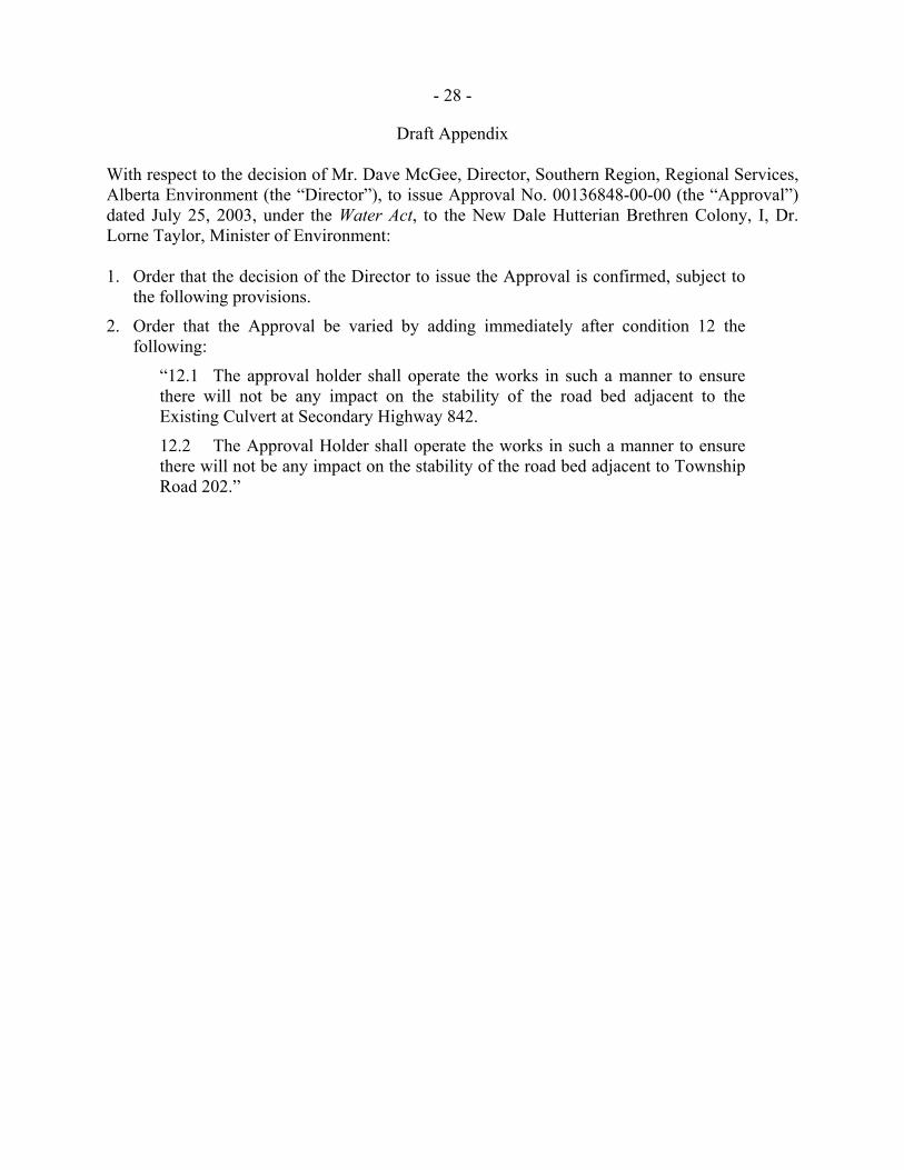
Draft Appendix
With respect to the decision of Mr. Dave McGee, Director, Southern Region, Regional Services, Alberta Environment (the “Director”), to issue Approval No. 00136848-00-00 (the “Approval”) dated July 25, 2003, under the Water Act, to the New Dale Hutterian Brethren Colony, I, Dr. Lorne Taylor, Minister of Environment:
1. Order that the decision of the Director to issue the Approval is confirmed, subject to
the following provisions.
2. Order that the Approval be varied by adding immediately after condition 12 the following:
“12.1 The approval holder shall operate the works in such a manner to ensure there will not be any impact on the stability of the road bed adjacent to the Existing Culvert at Secondary Highway 842.
12.2 The Approval Holder shall operate the works in such a manner to ensure there will not be any impact on the stability of the road bed adjacent to Township Road 202.”
- 29 -
- 30 -