aims and objectives - moor than meets the eye a summary of what will be delivered to achieve our...
TRANSCRIPT
The story of the people and landscape over 4,000 years on Dartmoor
Landscape Conservation Action Plan: 4 – Aims and Objectives
1 SECTION 4
AIMS AND OBJECTIVES Introduction People have left their mark on Dartmoor for many centuries. Mesolithic man was here and has left flint clusters, most notably at Batworthy, Gidleigh, Ringhill, Postbridge and Fernworthy in the Landscape Partnership Scheme area, which have produced large scatters of characteristic Mesolithic flint tools. Neolithic man was also here, in a time that witnessed the transition from hunter-gatherers to farmers but that evidence is more elusive in the Scheme’s area, particularly for the earlier part of the period (6,500 BC). These periods of prehistory should not be ignored, and if Moor than meets the eye sheds further light on them this should be welcomed and celebrated. However, to take up the theme from W G Hoskins, it is the last 4,000 years which have contributed most to leaving the imprint of people on Dartmoor, and so the focus of the Landscape Partnership Scheme is primarily on that period. The risks identified through the development stages of the Landscape Partnership will be addressed by the successful delivery of a wide-ranging suite of 30 projects. To ensure that these projects are focused on the needs of the landscape and to ensure that the Partnership can monitor the impacts of the projects, a vision, objectives and outputs have been developed that will provide the framework within which the Partnership will operate and allow effective monitoring of the scheme. This section of the Plan outlines our vision, aims and objectives for the scheme. It provides a summary of research undertaken during the Development phase which has helped shape the actions, target audiences and priorities for the scheme. It provides a summary of what will be delivered to achieve our aims and objectives and it also considers sustainability, management and maintenance of the projects, the heritage and the partnership.
“…..on the Moor dwelt, in a kinder climate than today, the earliest settlers of whom we have any real knowledge, the farmers of the Early Bronze Age with their little corn-plots and their flocks and herds. Apart from the lone, nomadic figure of Palaeolithic man, in numbers quite unimportant, we may regard Dartmoor as the earliest home of man in Devon, the beginning of forty centuries of continuous human occupation in the south-western peninsula of England”
W G Hoskins (1954)

The story of the people and landscape over 4,000 years on Dartmoor
Landscape Conservation Action Plan: 4 – Aims and Objectives
2 Moor than meets the eye - the vision, objectives and outcomes The Moor than meets the eye Landscape Partnership will help people:
learn about and learn from the past
understand, appreciate and enjoy the cultural and natural environment now
develop projects and skills to sustain the area’s heritage for future generations.
The vision for Moor than meets the eye is:
“Our vision is for the unique historic landscape of south east Dartmoor to be recognised as a truly special place: one where wildlife thrives, heritage is conserved and appreciated, and people draw inspiration and value from the landscape, today and for future generations. It is an area where local residents, businesses, farmers, visitors and agencies work together to share, understand and appreciate the importance of this landscape and together have the skills and opportunities to contribute to its future.”
This is also an opportunity to look at ways of developing innovative projects that can be used elsewhere in Dartmoor National Park. The Landscape Partnership Scheme takes the form of a book with seven chapters. These come together to tell a compelling story of an integrated living landscape - where people understand, enjoy, contribute to and therefore value the rich mosaic of our natural and built heritage.
The book “Moor than meets the eye - the story of people and landscape over 4,000 years on Dartmoor” has the following chapters:
1. Unveiling and conserving the Bronze Age archaeology of the high moor and forests
2. Learning about, conserving and sharing medieval Dartmoor and valuing local heritage
3. Discovering lost industrial landscapes 4. Moving in the footsteps of the Victorians 5. Making important connections - across the landscape and across generations 6. Exploring Dartmoor’s Treasures
7. The Future - sustaining heritage businesses and moor skills.
This vision will be achieved through the Landscape Partnership Scheme’s main objectives of:
To conserve the unique historic landscape and its natural habitats which tell the story of human influence over thousands of years.
To significantly enhance physical and intellectual access to the heritage landscape for everyone to enjoy.
To develop new ways to increase community involvement and understanding of the historic and natural landscape and improve the ability of local people to share, celebrate and enjoy their local landscape.

The story of the people and landscape over 4,000 years on Dartmoor
Landscape Conservation Action Plan: 4 – Aims and Objectives
3 To provide local communities, businesses, land managers, guides and local
property owners with enhanced skills, confidence and enthusiasm to contribute to the conservation of our built and natural heritage.
To sustain a living and working landscape by encouraging and facilitating business opportunities that capture the value of the landscape.
To develop a well trained and co-ordinated volunteer workforce to help conserve and interpret the area's heritage both now and in future years.
The Programme objectives of Moor than meets the eye A. Conserving or restoring the built and natural features that create the
historic landscape character A1. Conserve or restore Moor than meets the eye’s natural heritage,
particularly its moorland, grassland and woodland flora and fauna. A2. Conserve or restore the rich archaeological heritage of the landscape
and other built heritage.
B Increase community participation in local heritage B1 Increase participation in local heritage management, conservation and
learning activities by those that that live in and near, work in and visit the Moor than meets the eye area and Dartmoor to raise awareness of and celebrate its sense of place.
C. Increasing access to and learning about the landscape and its heritage
C1. Increase awareness of Moor than meets the eye’s heritage especially for those that are less familiar with it.
C2. Provide a diverse and wide-ranging suite of formal and informal opportunities for all ages and abilities that will increase understanding and appreciation of Moor than meets the eye’s heritage.
D. Increasing training opportunities in local heritage skills D1. Offer bespoke training opportunities that will ensure the relevant local
heritage skills are sustained and used into the future.
The outcomes that will indicate the success of Moor than meets the eye A. Conserving or restoring the built and natural features that create the
historic landscape character A1 Priority habitats and species surveyed, recorded, conserved or
restored A2 Habitats of wild plants and animals populations are more resilient to
change A3 Significant built features surveyed, recorded, conserved or restored
B. Increase community participation in local heritage
B1 A greater number of people are engaged with landscape heritage B2 People feel a sense of place B3 More people feel a sense of pride and excitement about heritage
C. Increasing access to and learning about the landscape and its heritage
C1 A greater understanding and appreciation of heritage

The story of the people and landscape over 4,000 years on Dartmoor
Landscape Conservation Action Plan: 4 – Aims and Objectives
4 C2 More people and a greater variety of people are able to access and
enjoy heritage C3 A better understanding of barriers to accessing and enjoying heritage C4 Reduce or remove barriers to accessing & enjoying heritage
D. Increasing training opportunities in local heritage skills
D1 More people with knowledge and experience of local traditional skills D2 More people have acquired and are developing skills to benefit
landscape heritage
E. Partnership management E1 A functioning, diverse and established Partnership
Forces for change These outcomes have been developed to take account of the threats to the landscape character identified as part of Section 1. These threats include:
Development pressure such as potential demands for increased water supply; continued popularity of the area as a retirement destination and an increase in home working; ongoing increase in commuting and visitor traffic requiring traffic management and road engineering works out of keeping with the character of the landscape’s narrow rural lanes; the uncertain future for the agricultural economy; the decline in rural skills including hedge laying and traditional woodland management, threatening the age and species diversity of semi-natural woodlands; and further recreational demand from expanding urban centres close to Dartmoor
Potential drying out of wet heath, blanket bog, valley mires, Rhôs pasture and wet woodland due to an increased frequency and intensity of drought conditions in the summer months, and increased autumn and winter precipitation levels; a longer growing season and enhanced growth rates of vegetation with a related increase in the prevalence of pests and diseases, the spread of non-native and alien species and change in woodland / tree species composition
Higher demand for UK food production potentially leading to an increase in stocking levels on the moorland commons, and pressure for agricultural improvement on the moorland fringes
Drive for increased woodland planting and regeneration, including at the heads of stream valleys on the open plateau to enhance flood storage capacity, water filtration and carbon sequestration functions to strengthen the landscape’s resilience to climate change.
Rise in UK-based tourism with an associated increase in recreational demand on the open moorland, demand for car parking on the edge of the moor and at ‘honeypot’ sites, with an increase in traffic levels, car parking, recreational pressures and farm conversions.
Research as part of developing Moor than meets the eye During the development phase of Moor than meets the eye, there have been a number of studies commissioned to further increase knowledge and understanding of the area and the people who the Landscape Partnership Scheme needs to engage with. Key findings or recommendations from these reports are outlined

The story of the people and landscape over 4,000 years on Dartmoor
Landscape Conservation Action Plan: 4 – Aims and Objectives
5 below and have shaped the priorities, target audiences and the final project proposals as detailed in Section 5: Skills Audit (Power Marketing, Exeter)
1. Over 35% of respondents said they would be very interested in learning more about the following subjects:
traditional moorland skills
understanding access
habitats and species
habitat management
agri-environment schemes
recording and interpreting heritage assets
archaeology, historic farmsteads
maintenance of historic buildings
building vernacular
history of farming
Dartmoor breeds
history of the commons 2. There were also a range of other skills which were quite important:
maps/navigation; first aid; survey and monitoring techniques; customer service, marketing, presentations and IT.
3. There was significant trend in the way respondents would like the training delivered, practical demonstrations and walk/talks on site being the most popular by far. However some interest in on line and social networking delivery.
4. 34% were interested in the idea of a Dartmoor Diploma. 5. Interesting comment that Authorities and visitors should take the Dartmoor
Diploma which is also an interesting concept. A scheme currently being delivered by the Dartmoor HFP is providing on farm training for professional staff delivered by farmers, it is proving very successful and is something that might be expanded with relevant resources. The farmers are paid for their time. There was a also a view that young people could benefit from the Diploma
6. Both Duchy College and Plymouth College have expressed an interest in working on the Diploma. Duchy have a programme through EDEXCEL which could be developed as a qualification
LiDAR Survey (Fugro-BKS, Coleraine, Northern Ireland) LiDAR data was collected with flights over the three Forestry Commission areas (Fernworthy, Bellever and Soussons) and the East Dartmoor National Nature Reserve. The results were discussed at a seminar in August 2013, at which the potential for LiDAR data to support further archaeological investigations was highlighted. The seminar was attended by a range of project partners and volunteers, and had significant input from Peter Crow (Forest Research) and Tim Yarnell (Heritage Advisor, Forest Services) of the Forestry Commission. There is some variation in the quality of the data due to the tree cover in the forests, with less clarity in Fernworthy because of the conifer plantation whereas at Yarner Wood the imagery produced was of high quality. However, it needs to be stressed

The story of the people and landscape over 4,000 years on Dartmoor
Landscape Conservation Action Plan: 4 – Aims and Objectives
6 that this is data that is available for interpretation, and it is this that is the important skill to develop.
LiDAR Image for Fernworthy Forest with hillshading to show topography
(Fugro-BKS) Fernworthy Archaeology Survey (South-West Landscape Investigations, Newton Abbot)
1. Research
Expand the archaeological survey to include areas currently managed by SW Lakes and also parts of Metheral.
This would necessarily exclude submerged areas but future droughts may give rise to opportunities to further explore that area, including hut circles, field walls, reaves and a cist/barrow.
Undertake detailed documentary research to establish history and origins of the five farmsteads. To include Duchy of Cornwall Archive (Princetown and London), British Library, The National Archive (London) and any other relevant archive.
Clear vegetation from Higher and Lower and carry out detailed survey of the farmsteads.
Commission excavations at one of the above farmsteads and/or Assacombe/ Silk House to better understand the buildings and to retrieve dateable material that might help establish origins and development of the settlements.

The story of the people and landscape over 4,000 years on Dartmoor
Landscape Conservation Action Plan: 4 – Aims and Objectives
7 2. Management
Specific works
Assacombe settlement: Remove self-seeded conifer saplings from the cleared area and maintain the open aspect through annual cutting and grazing. Following clear felling to the east of this site, whenever this occurs, it would be desirable for re-planting to allow a clear buffer zone around the site of at least 50m.
Froggymead: Extend the cleared areas around the site to enable greater appreciation of all features together. In particular widen the clearing leading up to Barrow D and the corridor between the stone circle and the northern stone row.
Lowton, East: Clear debris from interior of enclosure. Prevent self-seeded saplings taking a hold.
Lowton, West: Improve the cleared status of the southern two huts by preventing sapling growth and improve the small branch trackway up to them, which is currently becoming obscured by debris and saplings.
Expand the annually cleared area to include the space below the track between huts [6577] and [6580] and the area SE of the latter hut.
Hemstone, South: remove debris from the clear area, which is currently hampering walker access, and may be concealing further remains and maintain the open aspect.
Place visual markers around hut circle [104643] and protect the site from damage associated with future felling in this area.
General works
Prevent future forestry activities disturbing any of the archaeological remains described above including field boundaries associated with 2nd
millennium AD farms. Contractors should receive archaeological supervision before undertaking clear-felling and timber removal in sensitive areas. Driving vehicles through field walls should be stopped and the planting of saplings should in future not take place within agreed zones adjacent to all archaeological remains, including those currently without statutory protection (SMs).
Interpretation and Access
Many guided walk descriptions recommend parking at Fernworthy as a means to gain access to the open moors, but very few actually recommend exploring its archaeology, although there is much of interest in a relatively safe environment.
Improve access to the archaeology by the creation of archaeologically themed corridors through the conifers. This could be achieved by expanding and adding to the current cleared areas around some monuments and incorporating existing forest tracks, to create permanent open archaeological zones, connected by open corridors. This would be particularly appropriate for the Lowton and Assacombe areas, where a single corridor could include all the monuments in these groups but a circular route could also be established taking in the majority of Fernworthy’s monuments.

The story of the people and landscape over 4,000 years on Dartmoor
Landscape Conservation Action Plan: 4 – Aims and Objectives
8 Upgrade the level of interpretation and signage. Signposted routes could
be created to allow walkers to explore the archaeology of Fernworthy, either as a themed circular walk or en route to the open moors.
Upgrade and update interpretation leaflets and explore the possibilities of using digital media to disseminate the information.
Audience Development and Interpretation Strategy (Resources for Change, Llanymynech, Powys and Imagemakers, Okehampton) 1. Audience Development
There are four over-arching outcomes that we have defined which will guide both the audience development and the interpretation work:
Improving connectivity
Audience segmentation
An ‘audience first’ approach
Deepening engagement. Within these, we have set out a series of seven specific audience development objectives derived from the findings of the research. They are based on a small number of underlying observations:
There is a lack of connections, in several dimensions. The newly emerging LPS is working to build connections between itself and its project partners and with local communities, and the projects will need time to build connections between themselves. Related to this, interpretation will play a crucial role in making connections between the sites where LPS project activity takes place, through telling ‘The Dartmoor Story’.
MTMTE has value as a coherent partnership, but not as an external brand. Dartmoor is the outward-facing brand for use in interpretation and promotion, whilst MTMTE is the internal organisational structure steering and implementing the work. Whilst stakeholders will hopefully become increasingly familiar with MTMTE, it should be in the context of its existence as a Landscape Partnership Scheme and not an externally promoted brand.
Audience development and interpretation cannot solve user conflicts, but they can include actions to influence perceptions and behaviour.
Honeypot sites are often visitors’ only experience of Dartmoor and therefore could be considered of particular priority for audience development and interpretation. In part, this is because by their nature, they are subject to large numbers of visitors, but also because many of the visitors may have relatively little understanding of the story, the interest and the importance of Dartmoor.
This ADP and its development work are the start of an engagement process, not a one-off exercise. It is clear that there is an appetite amongst local communities for more engagement with the LPS, and the audience development work is one part of that.
Audience development in itself is a new concept to some partners and stakeholders, and also is a cause for concern amongst some who fear inappropriate and excessive use of Dartmoor’s precious heritage
The story of the people and landscape over 4,000 years on Dartmoor
Landscape Conservation Action Plan: 4 – Aims and Objectives
9 resource. There is work to be done to demonstrate how audience development could be part of a solution to these fears.
Supporting audience development It should be noted that there are some groupings which will be key to supporting the LPS’s work to develop the target audiences. Farmers and other land owners and managers, as custodians of Dartmoor’s natural heritage and landscape, have the potential to pass on their appreciation and knowledge. In the same vein, the ‘interested’ residents have a great resource of knowledge that could be shared. The other large grouping that has potential to strengthen audience development activities are local visitor-focussed businesses, such as B&Bs, campsites, shops, cafes and pubs, in that they have frequent and regular exposure to large numbers of visitors, and may be the primary source of information for a visitor. And finally, the students, volunteers and trainees who will be involved in many of the projects will gain knowledge, skills and enthusiasm, all of which there is potential to pass on to others. Audience development and the emerging LPS projects Audience development will take place within the structure of the LPS as a whole, fitting into and enhancing the individual projects that together make up the Landscape Partnership Scheme. A table has been prepared which lists the 56 projects, and for each one, suggests the main audiences who could be involved, and considers what the audience development potential is in terms of the 7 audience development objectives. As this is in the form of an Excel spreadsheet, it is too unwieldy to include within this report, and has been provided separately (in electronic version) to the LPS staff.
2. Interpretation
Messages relating to the National Park Where Dartmoor National Park Authority is the sole or lead partner in a project it may be appropriate to highlight some or all of the following messages. The National Park Authority’s role is clearly defined by Parliament in two statutory purposes and socio-economic duty. Related to the above are some further aspirational ‘public-facing’ messages. The emphasis of these messages may change over time but in essence they reflect the core purposes and duty of the Authority: Enjoying Dartmoor There are many opportunities for you to get out and get active on Dartmoor. Respecting Dartmoor By taking Moor Care when you are out and about you can do your bit to help look after the precious landscapes, historic buildings, archaeology, wildlife and livestock of Dartmoor. Helping Dartmoor There are lots of opportunities to get involved in looking after Dartmoor National Park.

The story of the people and landscape over 4,000 years on Dartmoor
Landscape Conservation Action Plan: 4 – Aims and Objectives
10 Themes relating to Dartmoor ‘the place’ ‘Place’ is a powerful concept and one with which we can all connect, and Dartmoor ‘the place’ means different things to different people.
The following interpretive themes aim to distil the essential ingredients that make up Dartmoor ‘the place’. As such they are not an exhaustive list of absolutely everything that can be said about Dartmoor! Informed by local history and flavoured by the enthusiasm, passion and knowledge of local communities and organisations, these themes will lead people on a journey of discovery; deepening their understanding and appreciation of Dartmoor’s significance and spurring them onto a greater sense of connectedness with the place. The over-arching theme is: Created by nature; fashioned by the hands of time and people. The story of Dartmoor’s cherished and protected landscapes and wildlife is one of powerful geological forces, relentless weather and more than 4000 years of human activity. Primary themes PT1: The essence of Dartmoor’s distinctive tors and moorland landscapes, its pattern of streams and rivers, its traditional field boundaries, buildings and settlements has been created largely by granite. PT2: Dartmoor’s complex and varied landscapes have been shaped by farming, forestry and industry over thousands of years – and people continue to influence them today. PT3: Dartmoor’s landscapes host a fantastic diversity of wildlife and habitats, much of it rare and protected. PT4: Dartmoor’s contrasting remote and intimate landscapes, big skies, mysterious ancient monuments and distinctive wildlife have long inspired legend, folklore, story-telling and art and remain a continuing source of inspiration for many. PT5: We can all be inspired to learn more about Dartmoor and play a part in protecting its natural and cultural heritage through the choices we make as individuals, communities and as a society.
Secondary themes PT1: The essence of Dartmoor’s distinctive tors and moorland landscapes, its pattern of streams and rivers, its traditional field boundaries, buildings and settlements has been created largely by granite.

The story of the people and landscape over 4,000 years on Dartmoor
Landscape Conservation Action Plan: 4 – Aims and Objectives
11 1A: Magnificent magma and mighty natural forces (ORIGINS) The granite which forms the heart of Dartmoor’s prized landscapes was created by volcanic forces and moulded over millennia by the relentless power of the elements and movements in the earth’s crust. 1B: Precious metals and minerals (MINERAL LEGACY) Heat and pressure associated with Dartmoor’s volcanic origins altered surrounding rocks, forming in them precious deposits of mineral ores such as copper, tin, arsenic and lead. 1C: Water, water everywhere (WATER) Dartmoor’s giant, peat-covered granite dome acts as a sponge, absorbing and controlling the release of water into most of Devon’s streams and rivers and providing essential drinking water for local populations. 1D: Rocks and roots (SOILS & VEGETATION) Not all of Dartmoor is made of granite, and changes in the underlying geology give rise to a complex and varied pattern of soils and vegetation. 1E: Precious and protected (PROTECTING OUR GEOLOGY) Dartmoor’s predominantly granite geology is internationally renowned and, in places, specially protected. 1F: Building with bedrock (GRANITE BUILDINGS) Churches, chapels, stone crosses and farm houses are perhaps the most prominent examples of Dartmoor’s many characterful, historic granite-built buildings. PT2: Dartmoor’s complex and varied landscapes have been shaped by farming, forestry and industry over thousands of years – and people continue to influence them today. 2A: Rows, circles, cairns and cists (PRE-HISTORIC AND BRONZE AGE SETTLEMENT) Dartmoor is one of the most important pre-historic and Bronze Age archaeological landscapes in Europe. 2B: People and place (TRADITIONS & PLACE NAMES) The close bond between people and place on Dartmoor is evident in the traditions and place names of its many scattered communities and in the names given to landscape features. 2C: Monks, kings, lords and serfs (MEDIEVAL DARTMOOR) The intricate pattern of fields, farmsteads, drover’s tracks, drift lanes and parish boundaries on Dartmoor is a tangible reminder of the efforts of successive generations to bring order to and to extract wealth from the land during medieval times.
The story of the people and landscape over 4,000 years on Dartmoor
Landscape Conservation Action Plan: 4 – Aims and Objectives
12 2D: Held in common (COMMON LAND) Large parts of Dartmoor are common land where medieval rights to graze ponies and other livestock are continued today. 2E: Rich resources for the taking (USE OF WATER / INDUSTRIAL LEGACY) The Dartmoor landscape is riddled with signs of human ingenuity and exploitation thanks to its natural resources and plentiful supply of water to be tapped and tamed. 2F: Tor-ism and Conservation (VICTORIAN DARTMOOR) Victorians brought train transport, tourism and an increasing awareness of conservation to Dartmoor. You can follow in their footsteps by exploring disused railways on the edges of the moor. 2G: Digging deeper (ARCHAEOLOGY ON THE MOOR) Archaeologists are using the latest remote surveying techniques to discover Dartmoor’s hidden human past, even deep beneath the cover of forestry plantations. 2H: Protecting the past for the future (PROTECTING OUR ARCHAEOLOGY) Dartmoor’s pre-historic and Bronze Age archaeology is vulnerable and finite and needs our collective care to preserve it for future generations. 2I: Bogs and bullets (MILITARY PRESENCE) The vast, remote spaces, tough terrain and sometimes dramatic weather of Dartmoor make it a challenging place suited to military training and exercise. 2J: Changing places (MODERN INFLUENCES) The actions of people continue to shape and change Dartmoor’s landscapes in deliberate and sometimes unintentional ways. PT3: Dartmoor’s landscapes host a fantastic diversity of wildlife and habitats, much of it rare and protected. 3A: Feathery comings and goings (BIRD LIFE) Many rare and protected species of birds depend on Dartmoor’s moorland and woodland to breed, feed and shelter. 3B: Flitting into place (BATS & BUTTERFLIES) Some of the nation’s rarest bats and butterflies have their stronghold on Dartmoor. 3C: Flower power (HAY MEADOWS & TRADITIONAL PASTURES) Traditional hay meadows and pastures are rarer than rainforest and play host to a dazzling and colourful array of flowering plants and insects. 3D: Out of the mire (MOORLAND & MIRES) Dartmoor’s peat moorland and mires are internationally rare habitats which require careful and deliberate management to maintain their landscape character and biodiversity.

The story of the people and landscape over 4,000 years on Dartmoor
Landscape Conservation Action Plan: 4 – Aims and Objectives
13 3E: Clean air cling-ons (LICHENS) Dartmoor’s clean air and Atlantic-influenced climate make it an especially important place for lichens. 3F: Ancient oaks and valley cloaks (WOODLAND) Dartmoor’s steep-sided wooded valleys and isolated copses are important refuges for a great diversity of wildlife. 3G: Protection through partnership (SCIENCE OF CONSERVATION) Dartmoor is a place where scientists, farmers and land managers work closely in partnership to look after vulnerable wildlife habitats and individual species. 3H: Natural networks (HABITAT CONNECTIVITY & CONDITION) Habitat re-creation and positive management is helping Dartmoor’s wildlife to thrive by connecting up and improving the condition of rare and threatened habitats. PT4: Dartmoor’s contrasting remote and intimate landscapes, big skies, mysterious ancient monuments and distinctive wildlife have long inspired legend, folklore, story-telling and art and remain a continuing source of inspiration for many. 4A: Ghostly prisoners, pixies, beasts and bogs (LEGEND & FOLKLORE) Many places and place names on Dartmoor are associated with local legend and folklore. 4B: Dartmoor in print (NOVELISTS AND POETS) Famous (and not-so-famous) writers past and present have been inspired by the mystery, romance, drama and beauty of Dartmoor’s landscapes. 4C: Dartmoor on canvas (ARTISTS) Dartmoor’s ever changing light, sweeping vistas and intimate scenes and landscape details have inspired artists past and present. 4D: Dartmoor on location (FILMS) People have been capturing the essence of Dartmoor on film for almost as long as film has been in existence and it continues to be a popular location for film makers and photographers. 4E: Dark sky Dartmoor (PERSONAL INSPIRATIONAL QUALITIES) Dartmoor is one of the increasingly rare places in Britain where you can find peace and tranquillity or look up into a star-filled night sky. 4F: Challenging conditions (INSPIRATION THROUGH CHALLENGE) For those seeking it, Dartmoor provides many opportunities for physical and mental challenge and personal achievement.

The story of the people and landscape over 4,000 years on Dartmoor
Landscape Conservation Action Plan: 4 – Aims and Objectives
14 PT5: We can all be inspired to learn more about Dartmoor and play a part in protecting its natural and cultural heritage through the choices we make as individuals, communities and as a society 5A: Moor skills past and present (SKILLS PAST AND PRESENT) By perpetuating traditional farming practices and buying local produce we can ensure a brighter future for Dartmoor’s treasured landscapes, vulnerable wildlife habitats and cultural heritage. 5B: Getting involved (VOLUNTEERING) There are plenty of opportunities to get involved practically in protecting Dartmoor’s heritage through volunteering with a range of organisations. 5C: Going deeper (LEARNING) You can discover more about Dartmoor through a fascinating range of events, visitor centre exhibitions and by visiting the Dartmoor National Park Authority website. 5D: Reduce, re-use and recycle (GOING GREENER) There are lots of ways that we can reduce, re-use and recycle – to lessen our impact on the environment and climate.
The Interpretation Strategy also proposes using the concept of gateways, hubs and clusters (although this is for use as an internal planning tool and NOT a public facing promotional concept), which is a strategic approach to the development and delivery of interpretation across a large area, based on readily observed visitor behaviours, audience profiles and the geography of the heritage resource. Hub sites are described as defined physical localities whose cultural or natural heritage assets lend themselves well to conveying strategic themes/messages from The Dartmoor Story, and which include:
Primary hub sites are popular, well-known destinations readily accessible to a broad audience.
Secondary hub sites may be less well known or not as readily accessible as primary hub sites.
Hub sites should have significant extant features of heritage interest, or provide strong heritage connections, contextual views and experiences.
Hub sites should be starting points, end destinations or otherwise be incorporated within connecting experiences.
Bellever and Postbridge Landscape and Access Plan (Wildlife Woodlands, Metherell, Cornwall) The concept of a hub site based on the village and the forest requires local businesses and land managers to work together to deliver a quality experience, with smooth flow of visitors between the various businesses. This includes larger local employers (the Forestry Commission and the National Park are local employers!) as well as small family-based businesses. Local accommodation providers will benefit from the improved visitor facilities, and that will in turn help encourage longer dwell times.

The story of the people and landscape over 4,000 years on Dartmoor
Landscape Conservation Action Plan: 4 – Aims and Objectives
15 Integration needs to be at a number of levels
Linking parking: we have proposed works to better link the Forestry Commission car park to the visitor centre
Incomes: this plan involves a joint approach. We have suggested transferable car park tickets. In the same way, the National Park publications should be made available at wholesale rates to village businesses, so they can help jointly promote the village. A further option is for a small donation from each sale being passed to a community organisation.
Staffing: rangers should not be confined to one site! There is always more scope for the National Park staff and Forestry Commission staff to work closer together. A jointly funded post is one way this partnership could be strengthened. Also, as is already the case, the role of staff in the visitor centre is to promote all of the attractions and all of the businesses relying on the visitor economy.
We would tentatively suggest that the National Park tries to do too much with very tight funding constraints. A particular issue is the mixed range of visitor information spread across a number of sites. The park web-site is hard to navigate for visitor information, which is one reason why the Interpretation Strategy recommended a visitor focussed site, “The Dartmoor Story”. The Dartmoor Partnership also need to be linked into this idea, as they have a very effective site for accommodation, which also includes visitor information. There is some duplication, and it would benefit from a rationalisation.
Links between web-pages provide an easy and early win for all local businesses. There is more technical detail in the Interpretation Strategy, including methods, for example, of linking Facebook pages to a common Postbridge page.
The village shop is open at times when the visitor centre is closed, and thus becomes the first point of contact, and an ambassador for the village, for some visitors.
There are opportunities to use businesses to tell the story - see also the interpretation section. The proposed letterbox trail is one example; another would be for the local inns to have Postbridge themed information as part of the internal decorations.
Working together is easy to say, (or write!) and sometimes harder to achieve. However, tourism is one area where competitors benefit from working together to promote and provide a destination.
The Postbridge destination will help provide a vibrant local economy, help sustain local businesses, and provide the resources to manage and conserve the local area, of which everyone is so proud.
Visitor Counters As part of the work for the development stage of Moor than meets the eye the number of people counters across the project area was expanded to complement some of the existing counters previously installed. The additional counters for the Moor than meets the eye were installed during March 2013 across the project area on a selection of paths to record numbers of walkers. An additional counter was installed on the Wray Valley Trail to monitor cycle use.

The story of the people and landscape over 4,000 years on Dartmoor
Landscape Conservation Action Plan: 4 – Aims and Objectives
16 Vehicle counters were also installed in car parks at Dartmeet and Newbridge and at the Widecombe-in-the Moor pay and display car park. New people counters were installed at Postbridge and Princetown National Park Visitor Centres to replace old counters that were from a different supplier and had become unreliable or stopped working. This means that all three visitor centres are now on the same counters system, which makes direct comparisons of their respective data sets possible. Car parks Vehicle counters are located at seven car parks across the project area. The total number of vehicles recorded at each site during the survey period is shown in the table below.
Site Dartmeet Haytor Lower
Haytor Top
*Newbridge Postbridge Princetown Widecombe
Total Vehicles
50,984
43,303 35,400 34,868 37,694 43,164 17,013
Total number of vehicles using car parks April – October 2013
*Newbridge total is May - October
National Park Visitor Centres People counters installed as a break beam across the entrance doors at each of the three National Park Visitor Centres.
Site Haytor Postbridge Princetown
Total Visitors 37,507 42,956 42,088 Total number of visitors to National Park Visitor Centres April – October 2013
Paths & Trails – Walkers
Site Total
Bellever 12,180
Dunnabridge Pound 4,878
Fernworthy 11,125
Gawler 2,442
Grimspound 4,753
Haytor 18,979
Headland Warren 1,629
Postbridge1 7,889
Postbridge2 596*
Princetown Nuns Cross 18,162
Rippon Tor 2,492
Warrenhouse 1,432
Wray Valley Trail 11,986 *Postbridge2 partial data July-October 2013

The story of the people and landscape over 4,000 years on Dartmoor
Landscape Conservation Action Plan: 4 – Aims and Objectives
17 Paths & Trails - Cycles Three cycle counters are located within the project area – two at Princetown and a third on the end of the short section of Wray Valley Trail at Moretonhampstead.
Site Princetown Nun’s Cross Princetown Railway Wray Valley Trail
Total cycles 6,376 9,210 3,639 Total number of cycles using trails April – October 2013
Comparative Visitor use of facilities by Area of Dartmoor Haytor This graph shows the comparative numbers of visitors’ use of the Lower and upper car parks at Haytor, their use of the Visitor Centre, and the path leading from the lower car park towards Haytor Rocks.
Postbridge This graph shows the comparative numbers of visitors’ use of the car park and Visitor Centre at Postbridge, along with use of the paths in the area. The comparatively high numbers of visitors to the Visitor Centre probably reflects the large numbers of visitors who arrive by coach. The number of visitors recorded by the POSTFP2 is due to partial data available for the survey period. However a direct comparison of the data between the two Postbridge counters for walkers (POSTFP1 3,734 & POSTFP2 575) between July and October, suggests that not many people are straying much beyond the clapper bridge. The higher numbers of visitors recorded by the BELLFP1 counter is most likely due to its location on a path leading directly from one of the Bellever Forest car parks.
0
5000
10000
15000
20000
25000
30000
35000
40000
45000
0
5000
10000
15000
20000
25000
30000
35000
40000
45000
Y2013
HAYTCP1
HAYTFP1
Haytor Top 2013
HAYTVC
Haytor Visitor Use April - October 2013

The story of the people and landscape over 4,000 years on Dartmoor
Landscape Conservation Action Plan: 4 – Aims and Objectives
18
During this period, the National Park Authority has also commissioned two studies relating to projects within Moor than meets the eye: Higher Uppacott Conservation Plan In 2002 Keystone Historic Buildings Consultants undertook an historic and archaeological survey of the longhouse and its setting which placed the origin of longhouse to the mid to late 14th century. As a result of further extensive works more recently undertaken in 2013, particularly with regard to the development of our project bid for Higher Uppacott, it has become clear that the date of origin for this Dartmoor longhouse is closer to the early to mid 14th century period and this also correlates convincingly with another nearby longhouse hamelt group called Tor.
Likewise, the development of the Conservation Plan for Higher Uppacott has clearly articulated and informed our understanding of the designated heritage assets, setting and context as well as the wider historic environment and heritage landscape of the Dartmoor National Park. With this developing understanding and defining of significance during the year also comes the timely publication in 2012 of Harold Fox’s book called Dartmoor’s Alluring Uplands. This brings to the fore how the practice of Transhumance and mass movement of stock from the lowlands for summer grazing on the high moor in the medieval period occurred and possible role and association with longhouses in management of stock movement.
The emerging constraints, challenges, risks and opportunities which Higher Uppacott faces in the future have been examined in detail through specialist conservation practice and advice where the approach for developing the project proposal has emerged through a ‘Vision’ prepared by our appointed Conservation Architect, Van der Steen Hall. Close working with others including English Heritage, Keystone Historic Buildings Consultants, in-house resources like Archaeology and Ecology staff etc. have shaped and informed the Vision which is also expressed through dialogue with local community, amenity societies, individuals and DNPA staff, and expected uses and groups located within the buildings, site and wider landscape.
0
5000
10000
15000
20000
25000
30000
35000
40000
45000
0
5000
10000
15000
20000
25000
30000
35000
40000
45000
Y2013
BELLFP1
POSTCP
POSTFP1
POSTFP2
POSTVC
Postbridge / Bellever Visitor Use April - October 2013

The story of the people and landscape over 4,000 years on Dartmoor
Landscape Conservation Action Plan: 4 – Aims and Objectives
19 The developed proposal presented for consideration is based on the best outcome for Higher Uppacott at this time where the Vision for the building is realised up to a certain stage based on the level of support sought from the HLF project, leaving the full Vision to be secured in the longer term.
Historic Environment Character Assessment This project was commissioned by Dartmoor National Park Authority in September 2013, and was completed between October 2013 and January 2014. It has been prepared by Fiona Fyfe Associates, with Matthew Beamish of University of Leicester Archaeological Services (ULAS), and Jonathan Porter of Countryscape. Dr Mark Gillings of the University of Leicester was academic advisor to the project. The Historic Environment Character Assessment (HECA) has four main purposes:
To unite a range of text and GIS-based data sources to provide a comprehensive strategic picture of Dartmoor’s historic environment. Specifically it should provide a spatial picture of where different elements of the historic environment occur.
To provide more information on the historic environment in order to further inform the existing Dartmoor Landscape Character Assessment (LCA).
To be used as a strategic planning and management tool for Dartmoor’s historic environment.
To contribute to the second stage Heritage Lottery Fund submission for the Moor than meets the eye Landscape Partnership.
The following nine themes cover the historic environment sites within the National Park:
Theme 1: Occupation and settlement Theme 2: Field boundaries Theme 3: Religious, ritual and funerary Theme 4: Common land and woodland/ plantation Theme 5: Industry/ mineral working/ water resources Theme 6: Transport and communication Theme 7: Designed estate landscapes Theme 8: Military and defence Theme 9: Rabbit warrening
Dartmoor’s known archaeology spans over 6000 years, from the Mesolithic period up to the present day. For this project the archaeology has been characterised into the following date bands (consistent with those already used in the Historic Environment Record (HER)):
a: Mesolithic (pre 4000BC) b: Neolithic (4000BC-2200BC) c: Bronze Age (2200BC-700BC) d: Iron Age and Romano-British (700BC-409AD) e: Medieval (409AD-1539AD) f: Post-medieval (1540AD-1750AD) g: Modern (1750AD-Present)

The story of the people and landscape over 4,000 years on Dartmoor
Landscape Conservation Action Plan: 4 – Aims and Objectives
20 PERIOD
TH
EME
a b c d e f g
Mesolithic
Neolithic Bronze Age
Iron Age and Romano British
Medieval Post-medieval
Modern
Approx. date range
pre 4000BC
4000BC-2200BC
2200BC-700BC
700BC-409AD
409AD-1539AD
1540AD-1750AD
1750AD-present
Symbol on HECT maps
●
1 Occupation/ Settlement
2 Field Boundaries
3 Religious/ Ritual/ Funerary
4 Common land and woodland/ plantation
5 Industry/ mineral working/ water resources
6 Transport and communication
7 Designed estate landscapes
8 Military and defence
9 Rabbit warrening
Table 3.1: Matrix of Historic Environment Character Types (HECTs)
As much of Dartmoor contains ‘palimpsest’ historic landscapes, this meant that the historic environment of a particular location contains visible features from different eras, and of different archaeological types. For example, it would be possible to have an early Bronze Age stone row, overlain by a later Bronze Age reave (field) system, overlain by a medieval field system and associated longhouse, overlain by tin workings, all of which is now common land. It was therefore necessary to develop an approach which enabled this complexity to be reflected, whilst also simplifying the mass of archaeology, built heritage and

The story of the people and landscape over 4,000 years on Dartmoor
Landscape Conservation Action Plan: 4 – Aims and Objectives
21 historic environment features present within the National Park. A matrix-based approach was developed, which enables type of archaeology to be set against period of archaeology to create a series of Historic Environment Character Types (HECTs). Each HECT has a profile in this report, and the distribution map for each HECT forms a GIS layer. It is therefore possible to view any combination of HECT distribution maps in the GIS at any one time. The HECT matrix is shown above. Where there is no known archaeology from a particular HECT, the box is shaded grey. It is important to note that HECTs comprise combinations of areas, linear features and/ or individual features. Using the example of the palimpsest landscape described in 3.1.3 above, the distribution maps would show the following HECTs present in that location:
3c (Bronze Age stone row) 2c (Bronze Age field system (reaves)) 2e (Medieval field system) 1e (Medieval longhouse) 5f (Post-medieval tin workings) 4g (Modern common land)
Delivery Conserving or restoring the built and natural features that create the landscape’s heritage There are many distinct features that make up the character of the Moor than meets the eye area. However, not all are in need of conservation, restoration or enhancement. For the natural environment, the majority of significant risks to the heritage and therefore potentially in need of conservation, restoration or enhancement are associated with
deterioration of wet valley systems which support a range of flora and fauna some of national and international significance. At least three Dartmoor BAP species (the narrow-bordered bee hawkmoth, the bog hoverfly [not found anywhere else in the UK] and marsh fritillary) are likely to be lost from Dartmoor without a new landscape-scale approach to management of wet valleys. Existing information shows that these sites are often being managed in isolation or not being managed at all. They have not been eligible for the Higher Level Stewardship scheme because they are small and fragmented. Without a new approach the wet valley systems will revert to wet woodland
a survey of unimproved neutral grassland on Dartmoor in 2003/04 showed that only 5% are in top condition. Deterioration of haymeadows has continued due to lack of management and neglect often because of the small and fragmented nature of sites. Along with the loss of habitat is the loss of the traditional skills and cultural traditions associated with them
a recent specialist survey at the East Dartmoor NNR showed a decline in the lichen community and the need to identify and manage replacement habitat more widely in the Bovey valley to protect their long term presence in the valley
the red backed shrike has been extinct in England since 1992 but it returned to Dartmoor in 2010. It is important that management is in place to help this bird create a stronghold in the area as it declined rapidly in the 1900s due to

The story of the people and landscape over 4,000 years on Dartmoor
Landscape Conservation Action Plan: 4 – Aims and Objectives
22 loss of suitable habitats and a decline in its largest prey, insects (caterpillars and bees)
a number of other moorland birds are also declining in numbers, which includes cuckoos, waders etc.
a survey in 2008 revealed that the nationally scarce Barbastelle bat used the woodlands of the Bovey Valley as a key area for maternity roosting. Thinning work has been undertaken since then to secure ancient woodland remnants. There is a need to undertake further survey to monitor the impact of woodland management and develop management proposals to protect existing and potential maternity roosts
coniferous plantations with hard physical boundaries which intrude on otherwise open vistas
visitor pressure at key honey pot sites is damaging the natural heritage
The key elements that make up the built and cultural heritage of the Moor than meets the eye area that require conservation, restoration and enhancement are:
despite being recognised as an internationally important area for archaeological remains, there is a lack of detailed archaeological information for certain parts of the Landscape Partnership area, so filling these gaps includes work at Fernworthy where there is a risk that archaeological landscapes might be lost due to forestry operations and the high moorland areas around Whitehorse Hill where recent finds would indicate further, currently unknown, archaeological significance
whilst a cherished and much visited landscape, many visitors (locals and tourists), and even local communities, are unaware of the ‘story of this landscape’ – how it has evolved, the interaction of people and place, role of customs and traditions in the management of the landscape, etc. Most visitors are transient – they travel through admiring the scenery but unaware of the story behind it and the opportunities to explore and understand. There is a need to better explain the story of the landscape
there is also a linked opportunity to support existing local community groups to help to manage this landscape by providing training in traditional skills, co-ordinating volunteer opportunities and enabling them to tell the story of the landscape
there is a clear need to provide training in traditional skills and promote awareness of these skills in maintenance of land or property to ensure that our heritage is conserved, including the built environment. Maintenance of the fabric of vernacular buildings is important, but equally important is their longer-term sustainability, and, in the case of Higher Uppacott, this requires a business plan to show commitment to regular management and increased public access
farmers remain crucial to the management of the landscape yet current trends indicate a move down the hill (off the moor) putting moorland management skills at risk of dying out. There is a lack of opportunity for young people to gain vocational training in these skills and a start on the ‘upland farming ladder’
there is also a threat to the landscape and heritage of the area from the decline and loss of traditional ‘customs’ - the custom of pony drifts is an important part of managing the upland moorland landscape but not widely

The story of the people and landscape over 4,000 years on Dartmoor
Landscape Conservation Action Plan: 4 – Aims and Objectives
23 understood. Also, the infrastructure of drifts and pounds that supports this custom, and are an important part of the sense of place, are in need of repair
There is a need to work with local history societies and volunteer groups to share expertise and skills amongst, and across, community groups - to help them learn from each other.
Increase community participation in local heritage The Moor than meets the eye Landscape Partnership want to encourage more people and a wider range of people to get involved in their local landscape heritage and see this as an important measure of the success of the scheme. The Partnership is keen to make new and lasting connections with under-represented groups of people who don’t currently take part in heritage and conservation activities and don’t regularly visit the countryside. This scheme will provide the Partnership with the time and resources needed to make appropriate contacts with new audiences and to use the projects to find and develop common ground, which will be an important legacy. One of the key elements here is that there should be a significant part of Moor than meets the eye where local communities can develop their own ideas and projects. At the same time, the Landscape Partnership needs to make sure that it succeeds in being able to involve local communities in telling the story of people and landscape over 4,000 years (and more) on Dartmoor. Moor than meets the eye has now developed to include both approaches so that there are those projects that have come from communities, projects that are crucial to telling that story, and those in which community involvement is helping to shape the outcomes. Examples of these include:
Parishscapes – this has become one of the ‘flagship’ projects in Moor than meets the eye. This was based on the excellent project delivered in the East Devon AONB, and has now been developed to be less focused on using the tithe map as a starting point to being more of an enabling project to encourage communities to identify and engage with their heritage assets and being able to incorporate them, with the Landscape Partnership, into the tale of the 4,000 years. This will include provision of some resources and a small grant scheme, opportunities to share discoveries and experiences, and a flexibility to meet local need which should reflect the local community characteristics across the area
Moor Medieval – some have described the development of Dartmoor as having three periods – pre-medieval, medieval and post-medieval. This may seem simplistic, but it does stress how important the medieval period is to Dartmoor and its landscape heritage, and as such it has been fundamental to Moor than meets the eye that this project provides the opportunity to learn more about that period
Bellever and Postbridge – it became clear that the concept of interpreting the Bronze Age archaeology in Bellever Forest had support, but the idea of the Bellever Time Trail as outlined in the Round 1 submission for the Landscape Partnership Scheme didn’t. The local community has expressed considerable interest in developing a series of trails and interpretation that help people discover more about the Bellever and Postbridge area (including the discoveries from Whitehorse Hill) which would also help engage with and manage visitors and access in the village together with input into the

The story of the people and landscape over 4,000 years on Dartmoor
Landscape Conservation Action Plan: 4 – Aims and Objectives
24 forthcoming round of Forest Design Plans which will help create a less severe edge to the forestry plantations.
The Audience Development Plan identified a number of objectives, which are related to the key target audiences for Moor than meets the eye. For all of these, the Project Team and Partnership should pay particular attention to the opportunities that these Objectives offer for the identified target audiences, i.e. local residents, families and young people, and honeypot site visitors. The Plan also shows the relationship between the target audiences and their level of engagement with Moor than meets the eye, and the potential to increase that (shown on the next page) The Objectives outlined in the Audience Development Plan are: Objective 1: Staying to Play – provide quick, time-limited and memorable experiences which can enrich the experience of visitors who are passing through. It is common that ‘passing through’ visitors, e.g. those on organised coach trips or those driving themselves, have short stop-offs at particular honey-pot sites or sites that are easy to see and stop at from the road. However, once off the coach or out of the car, visitors may struggle to know what to do other than to wander around the immediate area and take a few photographs. There is therefore considerable potential to enrich their experience by providing them with information and something to do – either or both, depending on the site. The development here is to move these visitors from their current position of ‘awareness’ towards ‘understanding’.
Target Audiences and the Levels of Engagement
Objective 2: Time Travel – create the 4000 Year Walk. Dartmoor is well-known as a venue for walking, as well as challenge events, both of which offer great opportunities to explore the National Park. Most people want to explore Dartmoor on their own. There is potential for creating a series of walking trails of varying distances, and in varying locations and types of places, which enable someone (not necessarily just visitors) to actively experience Dartmoor and to learn

The story of the people and landscape over 4,000 years on Dartmoor
Landscape Conservation Action Plan: 4 – Aims and Objectives
25 more about it. The audiences which could be particularly targeted through this objective are residents (passive and active) and their visiting friends and family, visitors, families and young active people.
Objective 3: Heritage hosting – help more local businesses and residents to inform and engage others about the local heritage. Visitor-focussed businesses have a key role to play, as they are often a visitor’s first or primary personal contact; also, a visitor may have contact with them before they actually go anywhere on Dartmoor. Of course, many of these businesses already fill all or part of this hosting role already; the LPS can build on existing good practice, provide active support to those already doing it, as well as encourage others to get started, e.g. through linking to the Dartmoor Diploma. Interested local residents are also important ‘gatekeepers’, either to their local friends and neighbours who we have categorised as passive (i.e. they just live on Dartmoor but are not actively interested or engaged in its heritage or landscape) or their visiting friends and family. They have the potential to pass on their interest and enthusiasm to others, so the heritage hosting role is designed to equip them with the confidence, skills and information to do so. The role could be quite informal, or it could be developed into a formalised scheme. Objective 4: Your Dartmoor Scrapbook – help people to record and share their experience of Dartmoor at different times in their life. Anecdotal evidence shows that some people return to Dartmoor a number of times, at different stages of their lives. This suggests that there is potential to move these people along the typology of audience development from ‘awareness’ to ‘understanding’ to ‘engagement’ and maybe even ‘participation’. The Dartmoor Scrapbook is intended as a tool to encourage and support this deepening experience, and to share this with others as a way to raise people’s awareness and knowledge of Dartmoor, including taking advantage of modern technology. It could be possible to use the knowledge, experiences and information given by ‘Scrapbookers’ as part of the on-going interpretation development process.
Objective 5: Open your eyes and look beyond – work with specialist interest users to broaden their perspectives on Dartmoor. Users such as anglers, canoeists and wild swimmers use Dartmoor because it offers particularly good facilities for their activity, but their interest beyond their own immediate activity can be limited. There is therefore potential to broaden these people’s outlook, so that they place the facility or feature they are focussed on within a bigger context.
Objective 6: Dartmoor on your doorstep – aim to attract people from the rest of the South West beyond Devon, and to extend the stay of those South West visitors already coming. The Audience Development Plan research showed relatively few respondents from the wider South West region beyond Devon. This may be a seasonal issue, with relatively local visitors choosing to avoid Dartmoor at high season; this needs further investigation as part of the on-going audience development work within Moor than meets the eye. The research shows that the two biggest barriers to visiting Dartmoor are access (getting there and getting around once you are there) and

The story of the people and landscape over 4,000 years on Dartmoor
Landscape Conservation Action Plan: 4 – Aims and Objectives
26 information (knowing what to do and see), so these would be key issues to address when working to attract this new audience.
Objective 7: Guten Morgen, Buenos Dias – extend multi-lingual provision of information for visitors. Overseas visitors to Dartmoor do not necessarily understand English, and in common with English-speaking visitors, will also need materials and activities in order to enrich their Dartmoor experience and increase their levels of awareness and understanding. Whilst some materials in other languages already exist, the Landscape Partnership should consider how some of the actions falling out of the Interpretation Plan could be provided multi-lingually. Increasing access to and learning about the landscape and its heritage As previously outlined in Section 2 of this Landscape Conservation Action Plan, Dartmoor, and therefore much of the Moor than meets the eye area, is well served in terms of access provision. The area is well served with 226 km of Public Rights of Way, which includes 81 km of Public Footpaths, 101 km of Public Bridleways and 9 km of Byways. There are also 12 km of permissive routes and 23 km of promoted routes, the latter including the 3 options for the Two Moors Way between Frenchbeer (near Chagford) and Bel Tor Corner (near Poundsgate), and the Templar Way running 18 miles between Haytor and Teignmouth on the south coast, tracing the route by which granite was exported from Dartmoor. Work is continuing to further develop the Dartmoor Way for both cycling and walking, with the launch of the cycling trail taking place in 2013. Much of the open moor and common land includes access under the Countryside and Rights of Way Act 2000, with 4,271 ha designated by Natural England as ‘open country’ in the Moor than meets the eye area. This gives access on foot to 15.3% of the area, and includes some restriction on access with dogs during the lambing and bird breeding seasons, although the West Dart River Valley has recently had the restriction on dogs in this area renewed for further 5 years. The Forestry Commission has also dedicated its forests for open access under section 61 of the CROW Act. This is in addition to the Dartmoor Commons Act 1985, which gives access for walking and horse-riding on the commons. The Act also allows wild camping on some of the commons. Apart from Spitchwick Common, Haytor and the Birch Tor area where camping is not allowed, most of the rest of the commons in the Moor than meets the eye area can be used for wild camping, although some, such as the area to the east of Fernworthy forest including Teignhead Farm, do require prior permission from the landowner. In this respect, Dartmoor is becoming increasingly unique as wild camping opportunities become more limited elsewhere in the country. Both the annual Ten Tors event, first organised by Colonel Lionel Gregory of the Junior Leaders’ Regiment, Royal Signals, and which has been taking place every year since 1960 (Dell, 2013) and large numbers of Duke of Edinburgh’s Award participants have

The story of the people and landscape over 4,000 years on Dartmoor
Landscape Conservation Action Plan: 4 – Aims and Objectives
27 taken advantage of this to experience the remoter parts of Dartmoor. However, they generally remain as ‘one-off’ events and the aims of Moor than meets the eye also include encouraging people, particularly young people, to discover more about Dartmoor through journeys in that landscape. While other projects look at interpreting the landscape’s heritage, two of them (‘Heritage Trails’ and ‘Moor Boots’) look to support and provide opportunities for such journeys. This has to be the crux of what Moor than meets the eye is aiming to achieve in dealing with access to the area – there is already significant opportunity particularly for the walker, so on the whole it is more about increasing the quality of access rather than the quantity. The scheme includes a number of projects to improve the quality of access and in doing so improve accessibility for more people, particularly those with special needs. These include physical improvements at Fernworthy Reservoir (to be implemented by South West Lakes Trust), Bellever Forest (by the Forestry Commission) and East Dartmoor National nature Reserve (by Natural England and the Woodland Trust). The development of the Wray Valley Trail is a significant improvement to access along the valley, providing a safe, traffic-free route for cyclists, horseriders and walkers. This route will provide sustainable access to the valley, allowing people to access the area without the use of the car from Bovey Tracey, Newton Abbot and Moretonhampstead. Physical access improvements will also be undertaken at Higher Uppacott to facilitate visitor numbers and improve the experience whilst developing an appreciation of the longhouse as a medieval response to settlement of the moor. As well as the range of access provision outlined above, there appears to be a wide range of interpretation, and the National Park Authority provides leaflets and audio trails from its Visitor Centres as part of this. The authority is now theming each centre so that, in the Moor than meets the eye area, Haytor Visitor Centre will have a wildlife theme and Postbridge will focus on cultural heritage. The latter will become more important as interest in the Whitehorse Hill discoveries increases. However, much of what there is may need to be looked at with fresh eyes and there are many opportunities for Moor than meets the eye projects to not only help provide a coherent framework for interpretation but also bring in new discoveries and ideas on how people used the area. With projects looking at the range of periods from the Bronze age to the 20th century there is a real chance that the Landscape Partnership can support interpretation that is not just re-hashing existing knowledge but is also finding new ways in which to tell these stories and in ways that are not likely to impact on the special qualities of the area. The LiDAR data and the archaeological survey of Fernworthy Forest are part of this, as is the development of new facilities such as Wi-Fi provision and the use of near field communications. There is also the potential to use existing facilities and services, eg the Haytor Hoppa, as a further means of telling the story, and some tourist providers at Widecombe are exploring the idea of having guides on the buses taking tourists across the moor to interpret what they can see before reaching the village. There is also the potential to link sites and themes, and the Interpretation Strategy suggests the use of icons, so that, for example, the range of tinworking sites (Brimpts, Great Wheal Eleanor Tin Mine , Birch Tor, Vitifer, Golden Dagger, and just outside the area, the Henroost and Hooten Wheals) could use the same symbol to show their

The story of the people and landscape over 4,000 years on Dartmoor
Landscape Conservation Action Plan: 4 – Aims and Objectives
28 connection. However, this should be used with some caution – while this may work well on a website to show the spread and range of this type of site and its interpretation, it has become clear that introducing icons on the ground would not meet with a great deal of enthusiasm. Away from Dartmoor, there is already involvement with both Plymouth Museum and RAMM in Exeter, and they both provide potential contact with new audiences which should form part of the Communications and Community Engagement work of the Project Team.
All of this should form part of developing ‘The Dartmoor Story’. Moor than meets the eye has some value as a brand in its own right, but this must be for the period of the Landscape Partnership Scheme (including acknowledgement of support from HLF through the National Lottery) and therefore should help promote rather than compete with the Dartmoor Story. Because the Landscape Partnership includes a wide range of partners that work over the rest of Dartmoor, they can help work across the National Park to develop an interpretation plan and coherent means of delivering it which will last beyond Moor than meets the eye. Developing a website that will tell the Dartmoor Story is a first step, to be followed by the way in which this is implemented in the area and across Dartmoor. In discussing interpretation and access, there is one recurring theme that needs developing. Ponies on Dartmoor must be one of the most iconic symbols of the National Park and a pony features on the logo for the National Park and the Authority. The threat to the continued existence of ponies in large numbers has already been highlighted in Section 3, and the need to do something about it is a topic on which most agree. What that ‘something’ is not so clear. Where Moor than meets the eye can play a full part in this is to raise awareness of the importance of ponies as part of the landscape heritage of Dartmoor, on their use in grazing the moor, and in the creation of landscape features to help in their management. Given the proposals for interpretation and trails from Postbridge, and improvements to the Visitor Centre, it is logical to use this to engage people more with ponies, especially as the Dartmoor Heritage Pony Trust lease part of Bellever Forest from the Forestry Commission. However, given that interest in ponies on Dartmoor is considerably wider than the work of DHPT, it is also important that interpretation covers this range to support everyone interested in the future of ponies on Dartmoor. Dartmoor National Park Authority already runs an outreach and education service, and many of the other partners, particularly Natural England at the East Dartmoor National Nature Reserve, also offer facilities and help with schools and educational groups. As highlighted in the previous section, there are also a number of other providers, such as outdoor centres, youth hostels and other businesses which offer educational opportunities. The Moor than meets the eye Project Team, mainly through the Community and Events Officer, will work to complement these and develop resources to help them provide quality delivery to increase understanding of the area.

The story of the people and landscape over 4,000 years on Dartmoor
Landscape Conservation Action Plan: 4 – Aims and Objectives
29 Increasing training opportunities in local heritage skills The needs of the landscape, centred on the physical management of monuments and habitats, are not always being met. There are a number of areas which are managed through Environmental Stewardship Schemes but these do not cover the whole of the Moor than meets the eye area.’, and, in some cases, there is not always agreement on the best prescriptions to achieve management outcomes. The Skills Audit has provided further evidence that land managers, farmers and volunteers would welcome training to improve knowledge and recording of heritage and to learn a range of physical conservation skills. These are listed on page 5 above. The scheme partners will take every opportunity for further developing local heritage skills is in those activities that requires time-demanding and skilled work, such as drystone wall repair. This will include having qualified instructors to pass on these traditional skills such as drystone walling and habitat management; not only to paid workers, but also to volunteers who are essential if the conservation of the area’s valuable heritage assets are to be conserved or protected. Provision of training can be through work placements, apprenticeships, volunteer opportunities and bespoke training. This will not only provide the relevant skills to workers and volunteers, but also ensure that there are suitable qualified instructors to pass on the skills in the future. The need to provide training for a range of people, particularly in the tourism sector, in awareness of Dartmoor’s heritage and in providing help for visitors to engage with this was identified as a high priority. This has supported the view which was first highlighted in the Skills Audit undertaken by Power Marketing that, rather than have a series of small courses aimed at particular niche audiences, there was a greater need for co-ordination of training and the development of a qualification that sat within the National Qualifications Framework. The Dartmoor Diploma will use the Edexcel-accredited Award in Developing Work Related Skills through Vocational Training (Levels 1-4) to do this, which will allow the Landscape Partnership to develop training that is of direct relevance and benefit to those who live and work in the area, and which can be delivered at the point of need rather than in the classroom. This includes having a ‘pick and mix’ approach so that an individual learner can use the modules and elements that best fit their needs.
The initial discussions on the training required providing people with the necessary skills and accreditation and the related organisational support has been with Duchy College, based at Stoke Climsland in Cornwall. They have worked with the Dartmoor Hill Farm Project on the ‘Moorskills’ programme, and they have worked closely with Edexcel in developing this Award. Costs for delivering the Dartmoor Diploma are based on their estimates for training co-ordination, accreditation and verification, and course running costs. The National Park Authority’s Rangers, staff from partners, and the Project Team will be well placed to deliver both training and management of Moor than meets the eye’s valuable heritage. Natural England will be running the EcoSkills project which, while based at the East Dartmoor National Nature Reserve, will help invest in environmental skills training for the future. This will include a training programme for new graduates (or industrial placement students) to obtain qualifications (eg through

The story of the people and landscape over 4,000 years on Dartmoor
Landscape Conservation Action Plan: 4 – Aims and Objectives
30 the Dartmoor Diploma) through work on the reserve and the wider area, and providing the Woodland Centre as a venue for a range of rural skills training for wider sector and community use. Management of Moor than meets the eye’s landscape heritage Area Management The Moor than meets the eye Landscape Partnership Scheme area lies almost wholly within Dartmoor National Park. As such, much of the land is in private ownership as described in the section on ‘Understanding Your Landscape Partnership Area’, with much of the open moorland managed as commons, as well as farming on in-bye land and newtakes near to the area’s villages. However, significant areas are managed by either national non-departmental public bodies such as the Forestry Commission and Natural England, or by Non-Governmental Organisations such as the Woodland Trust, National Trust and Devon Wildlife Trust. Dartmoor National Park Authority owns the area around Haytor and South West Lakes Trust manages the area around Fernworthy Reservoir, and there is also the military presence on the high moor.
With the area being within the National Park, the Management Plan and other DNPA strategies (see ‘Understanding Your Landscape Partnership Area’) and the National Park Authority’s role as the spatial planning authority are important for defining and delivering management of the area. Key to this are the National Park purposes and the duty as defined under the Environment Act 1995. Also important is the provision of access through both the Dartmoor Commons Act 1985 and the Countryside and Rights of Way Act 2000. This management structure is further underpinned through the network of Higher Level Stewardship agreements, Forest Design Plans, and management plans for individual sites (eg South West Lakes Trust’s Fernworthy Reservoir Management Plan 2010 – 2014). The Landscape Partnership Scheme described in this Landscape Conservation Action Plan delivers on 26 of the 162 actions within the Management Plan and clearly supports delivery of National Park policies and the policies of other partners. Management of visitors is an issue that has been raised by local community interests. The proposals in the scheme are in line with the Dartmoor Recreation and Access Strategy, which has been guided by conservation principles. All partners are used to balancing the needs of conservation and access and detailed implementation will continue to be guided by the Sandford Principle that conservation should take precedence over recreation where there is an irreconcilable conflict. Scheme Management (structure) Landscape Partnership Board The Landscape Partnership Scheme will be steered and overseen by its own Landscape Partnership Board to ensure tight geographical focus, representing delivery partners, funders, line managers, specialist advisors and representatives of the farming and wider communities. The Landscape Partnership Board has adopted a Memorandum of Understanding and Constitution, which comprises the following:
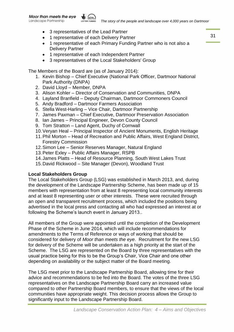
The story of the people and landscape over 4,000 years on Dartmoor
Landscape Conservation Action Plan: 4 – Aims and Objectives
31 3 representatives of the Lead Partner
1 representative of each Delivery Partner
1 representative of each Primary Funding Partner who is not also a Delivery Partner
1 representative of each Independent Partner
3 representatives of the Local Stakeholders' Group The Members of the Board are (as of January 2014):
1. Kevin Bishop – Chief Executive (National Park Officer, Dartmoor National Park Authority (DNPA)
2. David Lloyd – Member, DNPA 3. Alison Kohler – Director of Conservation and Communities, DNPA 4. Layland Branfield – Deputy Chairman, Dartmoor Commoners Council 5. Andy Bradford – Dartmoor Farmers Association 6. Stella West-Harling – Vice Chair, Dartmoor Partnership 7. James Paxman – Chief Executive, Dartmoor Preservation Association 8. Ian James – Principal Engineer, Devon County Council 9. Tom Stratton – Land Agent, Duchy of Cornwall 10. Veryan Heal – Principal Inspector of Ancient Monuments, English Heritage 11. Phil Morton – Head of Recreation and Public Affairs, West England District,
Forestry Commission 12. Simon Lee – Senior Reserves Manager, Natural England 13. Peter Exley – Public Affairs Manager, RSPB 14. James Platts – Head of Resource Planning, South West Lakes Trust 15. David Rickwood – Site Manager (Devon), Woodland Trust
Local Stakeholders Group The Local Stakeholders Group (LSG) was established in March 2013, and, during the development of the Landscape Partnership Scheme, has been made up of 15 members with representation from at least 8 representing local community interests and at least 8 representing user or other interests. These were recruited through an open and transparent recruitment process, which included the positions being advertised in the local press and contacting all who had expressed an interest at or following the Scheme’s launch event in January 2013.. All members of the Group were appointed until the completion of the Development Phase of the Scheme in June 2014, which will include recommendations for amendments to the Terms of Reference or ways of working that should be considered for delivery of Moor than meets the eye. Recruitment for the new LSG for delivery of the Scheme will be undertaken as a high priority at the start of the Scheme. The LSG are represented on the Board by three representatives with the usual practice being for this to be the Group’s Chair, Vice Chair and one other depending on availability or the subject matter of the Board meeting. The LSG meet prior to the Landscape Partnership Board, allowing time for their advice and recommendations to be fed into the Board. The votes of the three LSG representatives on the Landscape Partnership Board carry an increased value compared to other Partnership Board members, to ensure that the views of the local communities have appropriate weight. This decision process allows the Group to significantly input to the Landscape Partnership Board.

The story of the people and landscape over 4,000 years on Dartmoor
Landscape Conservation Action Plan: 4 – Aims and Objectives
32 The role of the LSG will also incorporate liaison and awareness-raising with the communities of interest and of place that they will be representing, and should provide advice and make decisions on the basis of what is best for the local community and stakeholder groups across the project area as a whole and its hinterland, rather than just specific local interests in it. During the development of Moor than meets the eye, the following have contributed as members of the Local Stakeholders Group:
Local Communities User/Interest Groups Geoffrey Fenton Anne Came Hazel Jones George Coles Peter F Mason Sue Eberle Sylvia Phillips Tom Greeves Margaret Rogers Julia Lewis Julian Tope Nigel Rendle John Willis Patrick Simpson Brendan Stone
Landscape Partnership Scheme Team (’the Project Team’) The Landscape Partnership Board will be responsible for scrutinising the progress of delivery and provide a strong steer as to the direction and inputs required to deliver the aims and objectives of the Moor than meets the eye Landscape Partnership. These decisions will be implemented by the Moor than meets the eye Project Manager through the Landscape Partnership’s Project Team, which will include a Community and Events Officer, Community ecologist, Community Heritage Officer and a Finance and Administrative Officer. Line management responsibility for the Project Manager lies with Dartmoor National Park Authority’s Director for Conservation and Communities. After discussions with other organisations, eg Devon Wildlife Trust, it has been agreed that the Project Team would be hosted and employed by the National Park Authority. For the scheme to be effective, the Landscape Partnership will need to identify, develop and share good practice so that the projects operate efficiently and they achieve their outcomes. Areas where this good practice will need to be implemented include equality impact assessment, interpretation, sustainable working, understanding landscape character, audience development, promotion, project planning, evaluation and monitoring. Some of these, such as developing interpretation guidelines will be usefully applied to other areas of Dartmoor National Park and will therefore act as test-bed for wider good practice. Management of Information With so many partners and keen local community interests, it will be important that all existing and ongoing research is available to everybody to ensure that a co-ordinated approach, and crucially to ensure that decisions are based on the best information available. The Landscape Partnership Board, the Local Stakeholders Group and the Project Team will have a key role in ensuring that lines of communication are established and well used. The proposed website for the Scheme will contain all relevant publications/research documents and an ongoing
The story of the people and landscape over 4,000 years on Dartmoor
Landscape Conservation Action Plan: 4 – Aims and Objectives
33 record of issues, projects and successes or learning points fro the Scheme. As an added bonus, the Dartmoor Trust has offered to keep records of the work and outputs from the Scheme on their existing Dartmoor Archive. Sustainability Each project has absolute clarity on future legacy and sustainability as detailed on project pro-formas (see Section 5). Delivery Partners have committed to ongoing maintenance where there is funding to undertake physical improvements to the heritage or to the visitor infrastructure. Likewise, any third party grants will be reliant on the recipient agreeing future maintenance responsibility. There is however a much wider legacy which will contribute significantly to the sustainability of the Scheme and that is people: the Landscape Partnership regard Moor than meets the eye as the start of increasing participation and involvement in managing and maintaining the heritage of the area, with a particular focus on local communities and volunteers as ambassadors. The Development phase has shown that there is a clear interest in this and that existing groups provide a good foundation for the future. The proposed package of support for these groups will ensure they have the skills, contacts and networks to take this forward.